* A Distributed Proofreaders Canada eBook *
This eBook is made available at no cost and with very few restrictions. These restrictions apply only if (1) you make a change in the eBook (other than alteration for different display devices), or (2) you are making commercial use of the eBook. If either of these conditions applies, please check with an FP administrator before proceeding.
This work is in the Canadian public domain, but may be under copyright in some countries. If you live outside Canada, check your country's copyright laws. If the book is under copyright in your country, do not download or redistribute this file.
Title: The Dominion of Canada
Date of first publication: 1868
Author: Henry Youle Hind, 1823-1908
Date first posted: Mar. 24, 2018
Date last updated: Mar. 24, 2018
Faded Page eBook #20180320
This eBook was produced by: Marcia Brooks, David T. Jones, Howard Ross & the online Distributed Proofreaders Canada team at http://www.pgdpcanada.net
THE
DOMINION
OF
CANADA;
CONTAINING
A HISTORICAL SKETCH OF THE PRELIMINARIES AND ORGANIZATION OF CONFEDERATION;
ALSO,
THE VAST IMPROVEMENTS MADE IN AGRICULTURE, COMMERCE AND TRADE, MODES OF TRAVEL AND TRANSPORTATION, MINING, AND EDUCATIONAL INTERESTS, ETC., ETC.
FOR THE PAST EIGHTY YEARS UNDER THE PROVINCIAL NAMES.
WITH A LARGE AMOUNT OF STATISTICAL INFORMATION,
FROM THE BEST AND LATEST AUTHORITIES.
BY
H. Y. HIND, M. A., F. R. G. S.
T. C. KEEFER, CIVIL ENGINEER.
J. G. HODGINS, LL. B., F. R. G. S.
CHARLES ROBB, MINING ENGINEER.
M. H. PERLEY, ESQ.
REV. WM. MURRAY.
FULLY ILLUSTRATED WITH STEEL AND ELECTROTYPE PLATE ENGRAVINGS,
SHOWING THE PROGRESS IN THE VARIOUS BRANCHES TREATED OF.
(FURNISHED TO SUBSCRIBERS ONLY.)
TORONTO:
PUBLISHED BY L. STEBBINS.
1868.
| Transcriber's Notes and Errata are placed at the end of this file. |
| Part I. | Introductory, (2 sections.) |
| Part II. | Period of English and French Discovery and Settlement, (10 sections.) |
| Part III. | Political and Military History—French Period, (26 sections.) |
| Part IV. | Political History of Canada—British Period, (18 sections.) |
| Part V. | The Maritime Provinces, (8 sections.) |
| Part VI. | Confederation of the Provinces—with Statistical Tables, (16 sections.) |
HISTORICAL SKETCH
OF THE NEW
CONFEDERATED DOMINION OF CANADA.
The prosperous provinces of British North America, which now constitute the "Dominion of Canada," were, with the islands of Prince Edward and Newfoundland and the outlying territory of the Hudson Bay company, (and even portions of the United States,)—once known as Nouvelle France. This vast area was two centuries ago held by one people, and ruled by one viceroy—with his subordinates as governors of districts. It will be curious and interesting briefly to trace the successive steps which led not only to the rapid expansion of French power and influence on the continent, but also to note the causes which led to the no less certain decay and extinction of that power as a political entity in America. Equally instructive will it be to take a glance at the successive steps which led to the establishment of that other rival power in the very seat of French dominion on this continent, and caused to be transferred to Great Britain these fine provinces, which afterwards under her beneficial rule grew and prospered as single communities, and at length confederated together as one Dominion—a Dominion with a population and territory equal to that which formed the United States at the close of its successful revolution of 1776.
2. Growth of British North America.—Long after the discovery of America, Great Britain had no permanent foothold in any part of the continent. For many years she maintained but a nominal claim, for fishing purposes, upon the outlying island of Newfoundland—her sovereignty over which was chiefly based upon Cabot's discovery in 1497, and Sir Humphrey Gilbert's act of possession in 1583. Gradually, however, she advanced her power and increased her influence, until she absorbed nearly the whole of the North American continent. But very soon after the absorption of this vast territory, there arose that restless spirit among her own children, which at length issued in rebellion against her authority, and in the end bereft her of more than half of her possessions. Since that event there has again grown up in what was once New France, a prosperous cluster of colonies, which stretch across the continent from the island of Newfoundland to that of Vancouver.
1. Cabot's Discovery of Newfoundland.—Soon after the news of the discovery by Columbus had reached England, John Cabot, a Venetian merchant, resident at Bristol, obtained a commission from Henry VII., in 1496, to make a voyage to the New World. In June 1497, he left Bristol with his son Sebastian. On the 24th of that month, he reached a point on the Trinity Bay coast, Newfoundland, which he named Prima Vista. On St. John's day he came to an island which he named St. Jean, (afterwards Prince Edward.) By virtue of these discoveries, the English first laid claim to sovereignty over these islands.
2. Cortereal's Voyages.—In 1500 Gaspard Cortereal, a Portuguese, made a voyage to Labrador, Newfoundland, and New England. He made a second voyage in 1501, and, having reached Hudson Strait, was never heard of afterwards.
3. Verazzani's Voyage.—In 1524, John Verazzani made a voyage to America, under the patronage of Francis I. In 1525 he made a second voyage, and explored more than 2,000 miles of coast. In consequence of his discoveries the French claimed jurisdiction of all places visited by him.
4. Cartier's Discovery of Canada.—In 1534 Philip Cabot, admiral of France, urged King Francis I. to establish a colony in the new world. He recommended Jacques Cartier, a noted navigator of St. Malo, to command an expedition of discovery to the New World. In April 1534 Cartier left St. Malo, and twenty days after reached a cape on the Newfoundland coast which he named Bona Vista. On the 9th of July he entered a bay (of New Brunswick) in which he experienced such intense heat that he called it the "Baie des Chaleurs." Passing northwards out of this bay he rounded the peninsula, and on the 24th of July landed on the coast since known as "Gaspé,"—an Indian name for Land's end. There he erected a cross, on which he placed a shield bearing the fleur-de-lis, as emblematical of the new sovereignty of France in America. He then returned to France. In July, 1535, after a tempestuous voyage, he again reached Newfoundland. On the 10th of July he anchored in a bay to which he gave the name of St. Lawrence,—having entered it on the festival of that saint. The name thus given to the little bay has since been applied to the vast gulf and noble river which Cartier was the first European to discover and afterwards explore.
5. Name of Canada.—When Cartier reached Stadacona (Quebec) the Algonquin Indians intimated to him that Kanata,—a collection of wigwams at the native Huron village of Hochelaga (Montreal)—was farther up the river. He probably understood them to apply that word to the whole country lying beyond him. In this way, it is supposed the name Kanata, or Canada, was given to the entire country which Cartier was then engaged in exploring.
6. Other Futile Expeditions—Feudal System introduced.—During the next fifty years little more was accomplished. But in 1598 the Marquis de la Roche was constituted lieutenant-general of the king, and was invested by him with power to "grant leases of land in New France, in form of fiefs, to men of gentle blood." Thus was the feudal system introduced into Canada. It was modified by Richelieu into a seigniorial tenure, and was not finally abolished until 1854.
7. Commercial Efforts.—Not only did the French fishermen continue to frequent the coast of Newfoundland, but, under the patronage of Henry IV., Dupont Gravé, a merchant of St Malo, and Chauvin, a master-marine of Rouen, made several voyages up the St Lawrence to Tadoussac, and brought home cargoes of the rich furs which had been collected from the north at that place. De Chattes, the governor of Dieppe, formed a company of Rouen and other merchants, to prosecute the work more vigorously.
8. Champlain's Discoveries.—The first expedition to Canada projected by this Company was placed under the command of Samuel de Champlain. In company with Dupont Gravé, he, in 1603-7, explored the St Lawrence from Tadoussac to Three Rivers. On the 3d of July, 1608, he founded the city of Quebec. In 1609 he ascended the river Richelieu, and discovered the beautiful lake since called Champlain. In 1615 he ascended the Ottawa to Lake Nipissing, descended French River to Georgian Bay, and from Lake Simcoe he passed by a long portage to the head-waters of the river Trent, and thence to Lake Ontario.
9. Reverses—Further Explorations.—The Prince de Condé having been appointed viceroy, a new and enlarged company was incorporated under his auspices, and an effort was made to introduce Christianity among the Indians. For this purpose Champlain brought the first missionaries to Canada. These were four Recollet fathers, who accompanied him in 1615.
10. Montreal Founded.—Huron War.—M. De Montmagny followed Champlain. During his administration in 1642, Montreal was founded with religious ceremonies under the name of Villa Maria, (Town of Mary,) and soon after, the long threatened war of extermination against the Huron Indians was commenced by the Iroquois. It was to this governor that the Indians first applied the term Onontio, the great mountain—a literal translation of M. de Montmagny's name. The term was afterwards applied to each of the French governors of Canada. On-ti-go-a was the Indian name of the king of France.
1. Proposed Union of the English, French, and Dutch Colonies.—The four New England colonies had, in 1643, formed a union or alliance. It was then proposed that this union should include all the European colonies in America—English, French, and Dutch—whose existence should not be imperilled by the politics or wars of Europe. Each colony was to retain its own laws, customs, religion, and language.
2. Projected Alliance with New England.—With a view to carry out this confederation, Governor Winthrop of Massachusetts wrote to the governors of New Netherlands and New France, or Canada, in 1647. The Dutch governor responded favorably at once, but the French governor delayed doing anything until 1650, when he dispatched Père Druilletes to Boston, to propose as an additional article of union, the stipulation that New England should join Canada against the Iroquois—the French having suffered so severely from the Iroquois in their prosecution of the peltry-traffic. This hostile stipulation on the part of the French, although skillfully presented as a righteous league in defense of Christianity against scoffing pagans, broke off the negotiations. When this proposed arrangement became known to the Iroquois, it exasperated them still more, and they redoubled their efforts to destroy the French colonists, so that for several years the French were virtually kept within their inclosures. Trade entirely languished, and the beavers were allowed to build their dams in peace, none of the colonists being able or willing to molest them.
3. Peace and Progress.—At length, however, a treaty was entered into with the five Iroquois tribes in 1654, and for a time war ceased its alarms. Trade revived, and the peltry-traffic was vigorously prosecuted by the French with such of the Iroquois as were near Canada. The others, however, preferred to trade with the English. During the intervals of war, explorations were made among the Sioux Indians beyond Lake Superior, and also among the Esquimaux. The year 1656 was noted for an overland expedition which was sent from Canada to Hudson Bay by way of Labrador, under Louis Jean Bourdon, attorney-general of New France, to take possession of that territory on behalf of the French King.
4. Royal Government Established.—In 1659, a royal edict was issued regulating the civil government of the colony. The resumption of Royal authority in Canada was made the occasion of introducing various reforms. A "Sovereign Council," invested with administrative and judicial functions, somewhat like the "Parlement de Paris," was instituted at Quebec. Legal tribunals were established, and municipal government in a modified form introduced. The right of taxation was, however, reserved to the king. The administration of government devolved upon a viceroy (who, as colonial minister, generally resided in France,) a governor, and an intendant, or chief of justice.
5. Police and Public Works.—West India Company.—With these modifications the king, in 1664, transferred the trading interests of Canada to the West India Company, by whom an ordinance was passed introducing into the colony "the law and customs of Paris," (la coutume de Paris.) With a view to insure harmony in this matter throughout Canada, all other French coutumes were declared illegal in it.
6. Vigorous Administration and Reform.—The new rulers sent out from France in 1665, were men of ability. M. de Tracy was selected by the king as lieutenant-general, M. de Courcelles as governor, and M. Talon as intendant. On their arrival with new emigrants and farming materials, the colony revived. Talon, by authority of the king, carried into effect various useful reforms in the system of government,—especially in regard to the finances, the punishment of peculators, and the reduction of the amount of tithes payable to the clergy. He further sought to encourage both agriculture and manufactures. During his administration the restrictions on trade in Canada, as imposed by the West India Company, were greatly relaxed.
7. Attempted Diversion of the Fur Trade.—The English, having, in 1663, superceded the Dutch in New Amsterdam, (afterwards New York,) pushed their trade northward through the agency of the Iroquois Indians. These allies, anxious to profit by the traffic, sought, in 1670, to obtain furs and skins for the English from the various tribes up the Ottawa, which was then the chief hunting ground of the French Indians.
8. Formation of the Hudson Bay Company.—In the meantime the English obtained a footing in the Hudson Bay territories, under the guidance of des Grosellières, a French pilot, aided by another Franco-Canadian, named Radisson. An English company was formed to trade for furs, under the patronage of Prince Rupert. Charles I., King of England, having claimed the Hudson Bay territories, by virtue of Hudson's discoveries in 1610, granted a charter in 1670 to this company, authorizing it to traffic for furs in that region.
9. Count de Frontenac.—In the year 1672 de Courcelles retired, and Count de Frontenac, a man of great energy and ability arrived. He remained ten years, and was recalled in 1682. In 1672 he built Fort Frontenac (Kingston.) It was rebuilt of stone by La Salle in 1678. Frontenac was re-appointed governor in 1689, and carried on a vigorous war against the English settlements in New York, and against their Indian allies, the Iroquois. The English retaliated, and the Iroquois made various successful inroads into Canada. In 1690 Frontenac defeated Sir William Phipps and the English fleet, before Quebec. He died greatly regretted in 1698, aged 78 years. Though naturally haughty, he was an able and enterprising man.
10. Spirit of Discovery and Adventure.—Nothing was so remarkable, during the early settlement of Canada, as the spirit of adventure and discovery which was then developed. Zeal for the conversion of the Indians seems to have inspired the Jesuit clergy with an unconquerable devotion to the work of exploration and discovery. Nor were they alone in this respect, for laymen exhibited the same adventurous spirit in encountering peril and hardship. From the first settlement of Quebec, in 1608, until its fall in 1759, this spirit of discovery and dominion was actively fostered by each succeeding governor, until there radiated from that city a series of French settlements which stretched from the St. Lawrence to the far West, and from the sources of the Mississippi to the Gulf of Mexico, and even to the shores of South America.
11. Summary of Discoveries.—After Champlain, other explorers extended their researches westward. In 1640 the southern shores of Lake Erie were visited by Pères Chaumonot and Breboeuf. In 1647, Père de Quesne went up the Saguenay and discovered Lake St. John. In 1651, 1661, and 1671, expeditions were sent northwards towards the Hudson Bay, with more or less success. In 1646, Père Druilletes ascended the Chaudière, and descended the Kennebec to the Atlantic. In 1659, the Sioux were visited by adventurous traders, and in 1660 Père Mesnard reached Lake Superior. In 1665, Père Alloüez coasted the same lake, and formed a mission at the Bay of Che-goi-megon. In 1668, Pères Dablon and Marquette formed a settlement of Sault Ste. Marie. In 1670 and 1672 Alloüez penetrated, with Dablon, to the Illinois region, where they first heard of the mysterious Mississippi,—the "great father of waters."
12. La Salle's Expeditions to the Mississippi.—Fired with the news of this notable discovery, Sieur de la Salle, a French knight, then at Quebec, determined to complete the discovery. He sought to reach China by the way of Canada. His design was frustrated by an accident at a place since called Lachine, or China. He explored the Mississippi from its source to its month in 1678-80; spent two years between Frontenac (Kingston) and Lake Erie, and constructed the first vessel on Lake Erie (near Cayuga Creek.) He sought to reach the Mississippi by sea, but, having failed, he sought to reach it overland. In doing so he was murdered by his jealous followers who, afterwards, justly suffered great hardships. Père Hennepin, a Recollet Franciscan friar emigrated to Canada in 1675. He accompanied La Salle in his exploration of the Mississippi in 1678, and visited the Falls of Niagara,—of which he wrote an interesting account.
13. Failure to restrict the Peltry Traffic to the Region of the St. Lawrence.—Great efforts were made by the French to restrict the traffic in beaver-skins and peltry within their own territories. They at one time interdicted trade with the Anglo-Iroquois—then they made them presents;—again they threatened them—made war upon them—invaded and desolated their villages;—they made treaties with them, and urged and entreated the Dutch and English to restrain them, and even sought to make the latter responsible for their acts;—but all in vain. As the tide rolled slowly in upon them, and the English, (who were always heralded by the Iroquois,) advanced northwards and westwards to the St. Lawrence and the great lakes, the French still gallantly holding possession of their old trading-forts, also pressed forward before them and occupied new ground.
14. Armed Trading Posts.—With sagacious foresight, the French, in addition to a regular fort at Quebec, erected, from time to time, palisaded inclosures round their trading posts at Tadoussac, at Sorel, and the Falls of Chambly (on the Iroquois, or Richelieu River) at Three Rivers, Montreal, and Cataraqui (Kingston.) Subsequently, and as a counterpoise to the encroachments of the English, they erected palisaded posts at Niagara, Toronto, Detroit, and at Sault Ste. Marie and Mich-il-i-mack-i-nac. Nor were the English idle. Creeping gradually up the Hudson river, they erected armed trading-posts at Albany, and at various points along the Mohawk valley, until, at length, in 1727, they fearlessly threw up a fort at Oswego, on Lake Ontario, midway between the French trading posts of Frontenac and Niagara.
15. The Cause of the Incessant Disputes and Wars must be looked for in the mutual determination of the French and English colonists to secure an exclusive right to carry on a traffic for furs with the Indian tribes. Territorial extension, no less than national resentment between the French and English colonists, gave intensity of feeling to the contest, and contributed to its duration. In their efforts to force the traffic into unnatural channels, the plans of the French were not only counteracted by the energy of the English traders, but they were even thwarted in them by separate classes among themselves—each having different interests to serve, but all united in their secret opposition to the government.
16. The Three Classes of French Fur Traders were; 1, the Indians; 2, the trading officials; and 3, the coureurs de bois ("runners of the wood," or white trappers.) As to the first class, (the Indians of these vast territories,) they were ever proud of their unfettered forest life, and naturally disdained to be bound by the artificial trammels of the white man. The second class, (the officials of New France,) were secretly in league with the coureurs de bois against the king's revenue agents—their exaction and their exclusive privileges. The third or intermediary class of traders, or factors, (the coureurs de bois,) sought in every way to evade the jurisdiction of the farmers of the revenue at Quebec. Their own reckless and daring mode of life among the Indians in the woods, far from the seat of official influence and power, gave them peculiar facilities for doing so.
17. Various ameliorations.—During a peaceful interval, M. de Vaudreuil, the governor, set himself to develop the resources of the country, and to foster education among the people. He subdivided the three governments of Quebec, Three Rivers, and Montreal, into eighty-two parishes, and took a census of the people.
18. Maritime Defense of New France.—To provide for the maritime defense of Canada, (which, as yet, had no protection to the seaward,) France, in 1713, colonized the island of Cape Breton, and, in 1720, strongly fortified Louisbourg its capital, at great expense.
19. Pepperrell's Expedition from New England.—In 1745 war again broke out. From Crown Point, on Lake Champlain, the French and their Indian allies successfully attacked the English settlements; and from Louisbourg a host of French privateers sallied forth to harrass the commerce of Nova Scotia and New England. Governor Shirley, of Massachusetts, aided by the other colonies, at once sent an expedition under William Pepperrell for the reduction of this stronghold. It was highly successful, and Pepperrell was rewarded with a baronetcy. Nothing daunted, a fleet, under the Duke d' Anville, was dispatched from France to recapture Louisbourg. But having been dispersed by a tempest, it never reached its destination.
20. Proposed Federal Union of the Colonies, 1753-4.—With a view to concerted action against the French, the lords of trade suggested to the colonies the formation of a league with the Indians, which in its structure should be an enlargement of the Iroquois confederacy. Shirley, the indefatigable governor of Massachusetts, conceived the bolder project of an alliance among the colonies themselves, for the purposes of mutual defense. Neither schemes were, however, adopted, but the germ of such a colonial union was subsequently developed at the time of the American revolution.
21. Capture of Quebec.—The incessant trading disputes which had lasted for years between the English and the French ultimately culminated, in 1759, in that decisive contest between them on the Plains of Abraham. And thus, in the memorable fall of Quebec, fell also, in Canada, (although the after-struggle was protracted for a year,) that imperial power which, for more than one hundred and fifty years, had ruled the colonial destinies of New France.
22. Fall of French Power.—Thus, after years of heroic struggle—with scant means of defense against powerful rival colonists and a relentless Indian enemy,—the first promoters of European civilization and enterprise in Canada were compelled to give place to a more aggressive race. But they did so with honor. And little did those think who were then the victors over so brave an enemy in Canada, that, within twenty years from that event their own proud flag would be ignominiously lowered at the seat of their own power at New York, as well as at every other fort and military post within the thirteen American colonies.
23. The Treaty of Paris, 1763.—By this treaty France ceded to England the whole of her possessions in North America, with the exception of Louisiana and the small fishing islands of St. Pierre and Micquelon (off the coast of Newfoundland.)
24. The French and English Colonial Systems Contrasted.—The return to France of the French military officers and troops, as well as of many of the chief inhabitants, was encouraged by the English, who were anxious thus quietly to rid themselves of a powerful antagonistic element in their newly acquired possession. They well knew that the process of assimilation between the two races so long arrayed in hostility to each other, would be very slow indeed.
25. System of Government in the French Colony.—The French colony, in its relations to the Imperial government, was as a child of the State. Every thing in it was subject to political influence or official surveillance, while religious matters were subject to vigorous ecclesiastical control. Two principal objects engrossed the attention of the French colonists,—the extension of the peltry traffic, and the conversion of the Indian tribes. As a means of carrying out these two great projects, exploration and discovery formed a chief feature of French colonial life.
26. System of Government in the English Colony.—In the English colony, the government, on the contrary, partook rather of the nature of a civil and social bond between the governing and the governed. It interfered as little as possible in matters of trade. Hence exploration and discovery within the colony formed but a subordinate part of the objects and pursuits of the English colonist. When, therefore, the rival colonists came into contact, it was rather in a struggle for enlarged boundaries for trade, or for dominion over rival Indian tribes, and for the monopoly of the fur trade. That contest, although it was too often utterly selfish in its objects, nevertheless unconsciously developed in both colonies, in a wonderful degree, a spirit of enterprise and discovery, which has scarcely had a parallel in later times, when steam and electricity have added, as it were, wings to man's locomotive and physical power.
1. British Rule Inaugurated—In 1763 General Murray was appointed the first governor of the new British Province of Quebec,—the boundaries of which were contracted by the separation from it of New Brunswick, Labrador, &c. The old district divisions of Quebec, Montreal, and Three Rivers were, however, retained, and a subordinate governor appointed over the two outlying districts of Montreal and Three Rivers.
2. State of Canada at this Time.—The population of Canada at this time was about 80,000, including nearly 8,000 Indians. The country, however, had been exhausted by desolating wars, and agriculture and other peaceful arts languished. The failure of the French Government to pay its Canadian creditors the sums due to them, (chiefly through the fraud, rapacity, and extravagance of the Intendant Bigot,) involved many of these creditors in misery and ruin.
3. Ameliorations in the System of Government Discussed.—In 1766 Governor Murray was recalled, and General (Sir Guy) Carleton appointed Governor General. Sir Guy Carleton (afterwards Lord Dorchester) had taken a prominent part in the siege and capture of Quebec, under Wolfe, in 1759; and, during Governor Murray's absence in 1767 he administered the government. Being in England in 1770, he aided in the passage of the first Quebec Act. In 1774 he became Governor-General, and successfully resisted the attack of the Americans upon Quebec in 1776. In 1778 he returned to England and was knighted by the king. In 1782 he succeeded Sir Henry Clinton as commander-in chief of the royal forces in America. In 1786 he was created Lord Dorchester for his distinguished services; and from that time (with the exception of two years) he remained in Canada for the long period of thirty-six years. During that time he acquired great distinction as a colonial governor by his prudence, firmness, and sagacity.
4. The Quebec Act.—In 1774 the Quebec Act was passed as a conciliatory measure by the Imperial Parliament. It provided, among other things, for the "free exercise" of the Roman Catholic religion—for the establishment of a Legislative Council, and for the introduction of the criminal law of England into the province; but it declared "that in regard to property and civil rights, resort should be had to the laws of Canada as the rule for the decision of the same." Thus, the enjoyment of their religion, and protection under the civil laws of French Canada were confirmed to the inhabitants by Imperial statute, and a system of local self-government was introduced. The act gave satisfaction to the French Canadians; and, at a time when the old English colonies were wavering in their attachment to the British crown, it confirmed them in their allegiance to the king.
5. Efforts of the Disaffected colonists to Detach the Canadians from England.—In 1774, the assembly, from Massachusetts, requested a meeting of representatives from all the colonies to concert measures of resistance to England. Each of the thirteen old colonies, except Georgia, sent delegates. Canada declined to take any part in the revolt; and although one of the three addresses issued by the insurgent Congress was especially addressed to the Canadians, they declined to repudiate their formal allegiance to the British Crown. Strong efforts were also made by the Americans to detach the Iroquois (under Brant) from the British standard, but without effect.
6. Constitutional Changes—Clergy Reserves.—In 1789, the draft of a new constitution for Canada was prepared. It proposed to divide the province of Quebec into Upper and Lower Canada; to give to each section a Legislative Council and House of Assembly, with a local government of its own. This celebrated constitutional act was passed in 1791. By it representative government, in a modified form, was for the first time introduced into the two Canadas simultaneously, and gave very great satisfaction. In the same year the famous Clergy Reserve Act was passed in England. This act set apart one seventh of the unsurveyed lands of the Province, "for the support of a Protestant Clergy," and authorized the governor of either Province to establish rectories and endow them. This act became afterwards a fruitful source of agitation and discontent in Upper Canada.
7. Parliamentary Government Inaugurated.—In June, 1792, the first parliamentary elections were held in Lower Canada, fifty members were returned. The Legislative Council, appointed by the Crown, consisted of fifteen members. On the 17th of December the new Legislature was opened by General Alured Clarke, the Lieutenant-Governor. Eight acts were passed by both houses. During the second session five bills were passed. The revenue of Lower Canada this year was only $25,000. During the third session, of 1795, accounts of the revenue and expenditure, which had now reached $42,000, were first laid before the Legislature. Of the customs revenue, Upper Canada was only entitled to one eighth.
8. Settlement of Upper Canada.—As Upper Canada was chiefly settled by United Empire Loyalists (to whom the British Government had liberally granted land and subsistence for two years,) it was deemed advisable to confer upon these settlers a form of government, similar to that which they had formerly enjoyed. In 1788 Lord Dorchester divided Upper Canada into four districts, viz.: Lunenburg, Mecklenburg, Nassau, and Hesse. In 1792, the Legislature changed these names into Eastern, Midland, Home and Western. These districts were afterwards divided, and their number increased; but they were abolished in 1849.
9. The First Upper Canada Parliament was opened at Newark (Niagara) on the 17th of September, 1792, by Lieutenant-Governor Simcoe. The House of Assembly consisted of only sixteen members, and the Legislative Council of seven. Eight bills were passed—one of which provided for the introduction of the English Civil Law. Trial by jury was also specially introduced, by statute, in that year. The English Criminal Law was also (as it stood in 1792) made the law of the land in Upper Canada.
10. Slavery Abolished.—In 1793, Slavery was abolished in Upper Canada; and in 1803, Chief Justice Osgoode decided that it was incompatible with the laws of Lower Canada.
11. The Seat of Government in Upper Canada was, in 1796, removed from Newark (Niagara,) to York (Toronto) by Governor Simcoe.
12. Progress of Affairs.—From 1796 to 1810 little of public or historical interest occurred in Canada. The local discussions related chiefly to abuses in land-granting by the government, the application of the forfeited Jesuit estates to the founding of a Royal Institution for the promotion of public education in Lower Canada, and the establishment of Grammar Schools in Upper Canada. Efforts were also made to improve the navigation of the lower St. Lawrence, to regulate the currency, extend the postal communication, ameliorate the prison system, promote shipping and commerce. Soon after, the war of 1812 took place.
13. Conditions of the Provinces at the Close of the War.—Although the war of 1812 lasted only three years, it left Upper and Lower Canada very much exhausted. It, however, developed the patriotism and loyalty of the people in the two provinces in a very high degree.
14. Political Discussions in Upper and Lower Canada.—The distracting influences of the war having gradually ceased, political discussions soon occupied public attention. In Lower Canada, a protracted contest arose between the Legislative assembly and the Executive Government, chiefly on the subject of the finances and political rights. In Upper Canada an almost similar contest arose between the same parties in the state; while the abuses arising out of an irresponsible system of government were warmly discussed and denounced. Nevertheless, progress was made in many important directions. Emigration was encouraged; wild lands surveyed; commercial intercourse with other colonies facilitated; banking privileges extended; the system of public improvements (canals, roads, &c.) inaugurated. Steamboats were employed to navigate the inland waters; primary and higher education encouraged, and religious liberty asserted as the inherent right of all religious persuasions.
15. Political Crisis.—Remedy.—The political discussions culminated, at length, in 1837, into armed resistance. This however was soon put down; and Lord Durham was sent out from England to inquire into the grievances complained of. His mission resulted in their removal, and in 1840 the two provinces were reunited under one government.
16. Political Progress.—Lord Sydenham was sent out as Governor General to inaugurate and carry the union into effect. Under his administration the foundation of many of the most important civil institutions were laid, especially those relating to the municipal system, popular education, the customs, currency, &c.
17. Lord Elgin.—From this period until 1847, when the distinguished Lord Elgin became Governor General, the political and material progress of the Province was marked and steady. In the discharge of the duties of his high office Lord Elgin exhibited a comprehensiveness of mind and a singleness of purpose which gave dignity to his administration, and divested the settlement of the various questions of much party bitterness and strife. Under his auspices, responsible government was fully carried out, and every reasonable cause of complaint removed. The consequence was that contentment, peace and prosperity became almost universal throughout Canada. During his period of office the Grand Trunk and Great Western Railways were projected, a free banking law was passed, a uniform letter postage rate of five cents was adopted, and the number of representatives in Parliament increased. He also procured the passage of the Reciprocity Treaty with the United States, (since abrogated.) He fostered the systems of public instruction in Upper and Lower Canada, and greatly promoted their popularity and success by the aid of his graceful eloquence.
18. Sir Edmund Head succeeded Lord Elgin in 1854. His administration was noted for the final settlement of the Clergy Reserve question in Upper Canada, and of the Seigniorial Tenure question in Lower Canada; also for the completion of the Grand Trunk Railway to Rivière du Loup, and of its splendid Victoria Bridge over the St. Lawrence river at Montreal. In 1851, 1861, and 1863 Canada distinguished herself in the great International Exhibitions held in London, Paris and Dublin. In 1856, the Legislative Council was made elective; and the laws of the province consolidated. In the same year a Canadian line of ocean steamers was established; a decimal system of currency, with appropriate coins, was introduced; the handsome Parliament and Toronto University buildings were commenced; in 1860 the memorable visit of the Prince of Wales to British America took place; and in 1864 the project of Confederation was discussed.
1. Nova Scotia, formerly called Acadie, was settled by the French under De Monts, in 1604; ceded to England in 1713; colonized in 1748-9; a constitution was granted in 1758; in 1784 it was modified. Cape Breton was taken from France by England in 1758; ceded formally to her in 1763; annexed to Nova Scotia in the same year; separated from it in 1784, and re-annexed again in 1819.
2. Political and Commercial Progress.—In 1820 efforts were first formally made to protect the English fisheries on the Nova Scotia coast. In 1823 the Roman Catholics were admitted to the full enjoyment of equal civil privileges with other denominations. In 1824-28 the Shubenacadie canal, designed to connect Halifax with Cobequid Bay, was commenced, and a line of stages between Halifax and Annapolis established.
3. Responsible Government.—In 1838 a deputation from Nova Scotia was sent to confer with Lord Durham, the Governor General at Quebec, on a proposed change in the constitution. In 1848 a system of government, responsible to the Legislature, as in Canada, was introduced. In 1851 further efforts were made to protect the fisheries; and, in 1852, a Provincial force, auxiliary to the Imperial, was placed under the direction of the British Admiral for that purpose. Afterwards a fishing and reciprocity treaty was made with the United States, but it was abrogated by that country in 1866.
4. Confederation in Nova Scotia.—In 1860 His Royal Highness, the Prince of Wales, visited Nova Scotia. In addition to the other valuable minerals, gold was discovered in 1861. In 1864 Nova Scotia united with the other colonies in the consideration of a scheme for the confederation of all the provinces of British North America under one government. With that view a meeting of delegates from each province was held at Charlottetown, Halifax, and Quebec. Resolutions approving of confederation were passed by the Nova Scotia Legislature in 1866, and a feeling in favor of it exists in Nova Scotia, although the scheme is now strongly opposed by many of the people there, headed by the Hon. Joseph Howe, her leading statesman.
5. New Brunswick.—In 1713, this Province, being part of the French colony of Acadie, was, by treaty, ceded to the British Crown. This transfer was finally confirmed by another treaty in 1763. In 1785, New Brunswick, then the county of Sunbury, (Nova Scotia,) was, by an act of the Imperial Parliament, separated from Nova Scotia, and erected into a distinct Province. It was named New Brunswick, after Brunswick in Lower Saxony, in Germany, the place of residence, up to 1714, of the present royal family of England.
6. Ashburton Treaty, &c.—In 1842 a treaty was negotiated between Great Britain and the United States by Lord Ashburton. By it the disputed boundary between Maine and New Brunswick was settled. This territory contained 12,000 square miles, or 7,700,000 acres. Maine received 4,500,000 acres, and New Brunswick 3,200,000.
7. Responsible Government, similar to that in the other provinces, was introduced in 1848. Since then the Province has increased in wealth, population, and importance.
8. Confederation in New Brunswick.—During 1864-6 the project of confederating the Provinces of British America was discussed in New Brunswick, and in each province. The result was that in 1867 a basis of union was formally submitted to the British Parliament and passed into law.
1. History of Confederation.—The germ of confederation, (as we have seen in the rapid glance which we have taken,) may be traced in the efforts which were made from time to time, by the colonies themselves, to overcome the weakness of their isolated position, and to concentrate their energies and resources for the purpose of mutual defense. (1) The first step in this direction was the union of the New England colonies in 1643, and (2) in the projected league between the Dutch, English, and French Colonies in 1647-50. (3) The celebrated confederated league which existed among the Iroquois until 1780 was a remarkable instance of the sagacious instinct of this brave and noble people to maintain their power, and to perpetuate their existence. (4) The project of an extension of this league so as to include in it the English Colonies (with the Iroquois) was urged by the Lords of Trade in 1753; (5) Governor Shirley of Massachusetts, however, conceived the bolder plan of a federal union between all the British Colonists themselves for the purpose of mutual defense. (6) Neither scheme succeeded at that time; but it was afterwards fully developed in the memorable union of the thirteen insurgent colonies in 1776. (7) In 1784 it was mooted, when New Brunswick was separated from Nova Scotia. (8) In 1800, Hon. R. J. Uniacke of Nova Scotia brought the matter under the notice of the Imperial authorities. (9) In 1814, Chief Justice Sewell of Quebec wrote a letter to the Duke of Kent, while in Nova Scotia, advocating a union of the provinces. (10) In 1822, Sir J. B. Robinson, of Toronto, while in England, submitted to the colonial office, by request, a scheme of union. (11) In 1825 the noted Robert Gourley, of Canada, in a letter from London, recommended a scheme of confederation. (12) In 1838 a deputation from Nova Scotia brought the matter before the Earl of Durham, Lord High Commissioner, in a conference with them on the political state of that province. (13) In the same year, Bishop Strachan of Toronto also urged the expediency "of consolidating the provinces into one territory or kingdom," on Lord Durham's attention. (14) Lord Durham himself also favored the plan of a single "ruled government" over that of a "federal union." (15) In 1840 the union of the Canadas too, (16) and in 1843 Elliot Warburton in his "Hochelaga," advocated an extension of the principle to other colonies. (17) In 1849 the British American Conservative League advocated "colonial union." (18) In 1851 Col. Rankin, of the Canadian Parliament, in an address to his constituents, and in 1856 in a speech before the House, urged a "union of colonies." (19) In 1858 the Hon. A. T. Galt, finance minister of Canada, renewed the project; (20) and in the same year the governor-general recommended it in a speech from the throne. (21) In 1864-6 the present confederate scheme was discussed at meetings of delegates from all the provinces, at Charlottetown, Prince Edward's Island, and at Halifax and Quebec, and finally assented to by the British Parliament in 1867.
2. Principle of Confederation.—This act of confederation provides for the union of the four provinces of Ontario, (Upper Canada) Quebec, (Lower Canada) Nova Scotia and New Brunswick, into one Dominion, with the seat of government at Ottawa. The Executive Government consists of a Governor-general, and a Privy Council of 13 members. The Legislature consists of three branches, viz., the Governor-general, 72 senators, and 181 members of the House of Commons. Each Province retains its own Local Government, viz., Lieutenant-governor, Legislative Council, and House of Assembly. (Ontario alone has no legislative council.)
3. To the Central Legislature belongs the right to deal with all matters relating to the Public Debt and Property; the regulation of trade and commerce; the raising of money by any mode or system of taxation; the borrowing of money on public credit; postal service; the census and statistics; militia, military and naval service, and defense; the fixing of and providing for the salaries and allowances of civil and other officers of the Government of Canada; construction of beacons, buoys, lighthouses, navigation and shipping, quarantine, and the establishment and maintenance of marine hospitals; sea-coast and inland fisheries; ferries between a Province and a British or foreign country, or between two provinces; currency and coinage, banking, incorporation of banks, and the issue of paper money, savings banks, bills of exchange and promissory notes, interest, legal tender, bankruptcy and insolvency; weights and measures; patents of invention and discovery; copyrights; Indians, and lands reserved for the Indians; naturalization and aliens; marriage and divorce; the criminal law, except the constitution of courts of criminal jurisdiction, but including the procedure in criminal matters; the establishment, maintenance, and management of penitentiaries; and such classes of subjects as are expressly excepted in the enumeration of the classes of subjects by the act assigned exclusively to the legislatures of the provinces.
4. To the Local Legislatures belong matters relating to the provincial government and revenue; public lands; education; reformatories and prisons; municipal institutions; trading licenses; local public works; agriculture; property and civil rights in the province; marriage; and the administration of justice; and "generally all matters of a merely local or private nature in the province."
5. Financial Arrangements.—The Dominion is made liable for the debts of all the provinces; and these provinces are held liable to the Dominion in the following ratio—interest payable at the rate of five per cent, per annum.
| Ontario and Quebec | for any debt over | $62,500,000 |
| Nova Scotia, | ditto, | 8,000,000 |
| New Brunswick, | ditto, | 7,000,000 |
The payments to these provinces from the Dominion government are as follows:—
| Province of Ontario | $80,000 | per annum. |
| Province of Quebec | 70,000 | do. |
| Province of Nova Scotia | 60,000 | do. |
| Province of New Brunswick | 50,000 | —and $63,000 ... |
... for ten years, (on account of her small debt.) Each province is also entitled to 80 cents per head of the population as per census of 1861.
6. Intercolonial Trade and Customs.—All articles of the growth, produce or manufacture of any one of the provinces are admitted free into each of the other provinces. Only one tariff of customs and excise shall prevail in all the provinces.
7. Intercolonial Railway.—The interest on a loan of £3,000,000 is guaranteed by the British Government. This loan is to be expended in the construction of a railway to connect Nova Scotia and New Brunswick with Quebec and Ontario.
8. Progress of Population in the Dominion.—The following table exhibits the progress of population in the four provinces of the Dominion.
| 1775 | 1800 | 1820 | 1861 | 1861 | 1861 | 1867 | |
| Males. | Females. | Total. | Estimate. | ||||
| Ontario | 8,000 | 50,000 | 158,000 | 725,575 | 670,516 | 1,396,091 | 1,802,000 |
| Quebec | 96,000 | 225,000 | 450,000 | 567,864 | 543,702 | 1,111,566 | 1,300,000 |
| Nova Scotia | {20,000 | 57,000 | 150,000 | 165,584 | 165,273 | 330,857 | 370,000 |
| New Brunswick | 10,000 | 75,000 | 129,948 | 123,099 | 252,017 | 296,000 | |
| Totals | 196,000 | 342,000 | 833,000 | 1,588,97 | 1,502,59 | 3,090,561 | 3,768,000 |
9. The present Political Divisions of the whole of British North America are as follows:—
| Name of Province. | Discoverer and Date. | Mode of Acquisition and Date. | Government Established. |
| Quebec. | Jacques Cartier, 1535 | Capitulation, 1759 | French, 1608; English, 1764; separ. gov'mt, 1792; united, 1840 |
| Ontario | Champlain, 1615 | Cession, 1763 | Separ. gov't, 1748; |
| Nova Scotia | {Sebastian Cabot, 1498 | Cabot's visit and treaty of 1713 | {Sep. gov't, 1784; united, 1819 |
| Cape Breton | Capitulation, 1758 | ||
| New Brunswick. | Jacques Cartier, 1535 | Treaty, 1763 | Separ. governm't, 1784 |
| Name of Province. | Discoverer and Date. | Mode of Acquisition and Date. | Government Established. |
| Prince Edward Island | Sebastian Cabot, 1498 | Treaty, 1763 | Separate gov't, 1771 |
| Newfoundland | Sir John Cabot, 1497 | Sir H. Gilbert, 1583 Utrecht treaty, 1713 | By Charles I., 1663; separate gov't, 1728 |
| Hudson Bay Territory | H. Hudson, 1619 & 1794 | Treaty, 1713 & 1763 | Charter, 1670 and license, 1821 & 1842 |
| Red River | Canada Explorers | Lord Selkirk's settlement, 1811 | Crown Colony, 186- |
| British Columbia | Sir A. Mackenzie, 1793 | Treaty, 1793 | Act of Parliament, |
| Vancouver Island | Sir F. Drake, 1759 | V'couver's visit, 1799 settled, 1848 | Charter to Hudson Bay Co. 1849 |
10. The extent, population, and capitals of these divisions of British North America are as follows:—
| Name of Provinces. | Area in Eng. sq. Miles. | Population. | Capital. | Where Situated. | Population. | |
| Quebec | 210,000 | 1,111,566 | Quebec. | }Ottawa. | St Lawrence | 62,140 |
| Ontario | 150,000 | 1,396,091 | Toronto. | Lake Ontario | 44,425 | |
| Nova Scotia & C. B. | 19,650 | 330,857 | Halifax. | S. E. Coast | 26,000 | |
| New Brunswick | 27,710 | 252,047 | Fredericton. | River St. John | 7,000 | |
| Name of Provinces. | Area in Eng. sq. Miles. | Population. | Capital. | Where Situated. | Population. |
| Prince Edward Island | 2,134 | 80,857 | Charlottetown | Near centre of island | 6,700 |
| Newfoundland | 57,000 | 124,288 | St. Johns | S. E. Peninsula | 25,000 |
| Hudson Bay Territory | 2,200,000 | 175,000 | York Factory | Hayes' River | 500 |
| Red River | ... | 10,000 | Fort Garry | Assiniboine, Red River | ... |
| British Columbia | 210,500 | 8,000 | } Victoria | S. of island | 3,500 |
| Vancouver Island | 18,000 | 11,463 |
11. The general area of these divisions of British North America is as follows:—
key = A Average length in miles; B Average width in miles; C Miles of Sea-coast lines; D Area in Acres E Acres in Cultivation; F Surveyed Acres uncultivated; G Value of Farms.
| Name. | A | B | C | D | E | F | G |
| Quebec. | }1,200 | 300 | 1,000 | 160,500,000{ | 4,804,235 | 5,575,000 | 172,000,000 |
| Ontario. | 6,051,620 | 7,304,000 | 296,000,000 | ||||
| Nova Scotia. | }330 | 100 | 1,150 | 13,534,200 | 1,028,032 | 1,000,000 | 40,000,000 |
| Cape Breton. | |||||||
| New Brunswick. | 190 | 150 | 500 | 17,600,000 | 835,108 | 2,905,000 | 32,000,000 |
key = A Average length in miles; B Average width in miles; C Miles of Sea-coast lines; D Area in Acres E Acres in Cultivation; F Surveyed Acres uncultivated; G Value of Farms.
| Name. | A | B | C | D | E | F | G |
| Prince Edward Island. | 130 | 40 | 350 | 1,370,000 | 268,127 | 260,000 | 8,000,000 |
| Newfoundland. | 320 | 130 | 1,100 | 2,304,000 | 41,108 | 1,000,000 | 1,000,000 |
| Hudson Bay Ter. | } ... | ... | 1,500 | ... | ... | ... | ... |
| Red River. | |||||||
| British Columbia. | 450 | 250 | 900 | 136,640,000 | 26,500 | 73,000 | 500,000 |
| Vancouver Island. | 278 | 55 | 850 | 8,320,000 | 17,000 | 63,000 | 300,000 |
12. Value of Products.—The estimated quantity and value of the products of the four provinces in the Dominion is as follows:—[A]
| Grain, viz. | Wheat, | 30,000,000 | bushels. | ||||
| " | Barley, | 8,000,000 | " | ||||
| " | Oats, | 50,000,000 | " | ||||
| " | Buckwheat, | 4,000,000 | " | ||||
| " | Indian Corn, | 3,000,000 | " | ||||
| " | Rye, | 2,000,000 | " | 97,000,000 | bushels, | valued at | $60,000,000 |
| Peas, &c., | 15,000,000 | ditto | ditto | 12,000,000 | |||
| Roots, viz. | Potatoes, | 50,000,000 | " | ||||
| " | Turnips, &c. | 25,000,000 | " | 75,000,000 | ditto | ditto | 25,000,000 |
| Hay, | 2,500,000 | tons | ditto | 25,000,000 | |||
| Butter and Cheese, | 75,000,000 | lbs | ditto | 10,000,000 | |||
| Meats, viz. | Mutton, | 250,000,000 | lbs. | ||||
| " | Beef, | 200,000,000 | do. | ||||
| " | Pork, | 150,000,000 | do. | 600,000,000 | lbs. | ditto | 35,000,000 |
| Fish, | 80,000,000 | do. | ditto | 3,500,000 | |||
| Lumber, viz. | Oak, | 1,500,000 | cubic feet. | ||||
| " | Elm, | 1,500,000 | " | ||||
| " | White Pine | 25,000,000 | " | ||||
| " | Red Pine, | 4,000,000 | " | ||||
| " | Tamarack & Spruce, | 2,000,000 | " | ||||
| " | Miscellaneous, | 1,000,000 | " | 35,000,000 | cubic feet, | 30,000,000 | |
| Wool, | 10,000,000 | lbs. | 5,000,000 | ||||
| Miscellaneous, | 5,000,000 | ||||||
| Grand Total, | $210,500,000 |
|
Year Book of Canada for 1868, page 40. |
13. The Income, Expenditure &c., of each province in the Dominion, during the last year of their separate existence, was about as follows:—
| Items. | Quebec and Ontario. | Nova Scotia. | New Brunswick. |
| Income | $16,419,000 | 1,800,000 | 1,450,000 |
| Expenditure | 14,727,000 | 1,900,000 | 1,350,000 |
| Debt | 62,734,000 | 5,000,000 | 5,000,000 |
| Assets | 69,500,000 | 5,700,000 | 5,054,000 |
| Imports | 59,100,000 | 14,400,000 | 10,000,000 |
| Exports | 48,500,000 | 8,050,000 | 8,200,000 |
15. Recent Example of Confederation of States.—It is a striking fact that during the last few years a more general and rapid confederation of States has taken place, than had occurred during the whole of the preceding century. Not to mention the absorption of the native states in India under British rule, we have seen how rapid has been the consolidation of Italy into one kingdom. Later, there took place in the United States a memorable contest against a principle of separation of States. Within the last year or two, the fate of one noted battle led to the absorption by Prussia of a number of petty States in Germany; and now guided by an unerring instinct four large provinces of British America have confederated themselves together into one Dominion.
16. The Objects and Advantages of such a confederation may be stated in a few words: It has long been the desire of the sagacious statesmen of the Dominion to concentrate the resources and energies of the isolated provinces into a powerful and prosperous State, and thus to give free scope, on a wider and broader field, for the enterprise and talent of a young and growing people; to enable them to present a bold and united front against aggression or absorption, by an active and powerful rival; to develop internal trade and commerce; to bring into settlement and productive life large tracts of outlying territory, now a vast uninhabited forest, in the various provinces; and, as was fitting, at this period in the history of the provinces, to lay broad and deep the foundation of a new nationality, whose heritage and birthright are the priceless blessings of civil and religious freedom, as long felt and enjoyed in England and in these provinces.—A nationality whose future should witness the consolidation and growth, on this continent, of those principles of British colonial freedom which are so eminently calculated to promote internal peace and prosperity, and, under God's blessing, the enjoyment also of "life and liberty," as well as "the pursuit of happiness," among all classes of people.
PREFACE.
The business of the historian of the earlier ages of the world was to record changes in forms of government, to give accounts of long and bloody wars, and to narrate the rise or fall of dynasties and empires. From the days of Herodotus, to the middle of the last century, the world made little progress. It is true, that great empires rose one after another upon the ruins of their predecessors; but so far from there being any thing like real progress, the reverse seems to have been the case. It has remained for the present age to witness a rapid succession of important inventions and improvements, by means of which the power of man over nature has been incalculably increased, and resulting in an unparalleled progress of the human race.
But great as has been the movement in the world at large, it is on the North American continent that this has been most remarkable. The rise of the United States, from a few feeble colonies to a high rank among nations, has never ceased to attract the attention of the world; and their career has been indeed so wonderful, that the quiet but equally rapid growth and development of the British North American provinces has received comparatively little notice. It will be seen from the following pages that they have at least kept pace with their powerful southern neighbors, and that, though laboring under some disadvantages, they have in eighty years increased tenfold, not only in population but in wealth; they have attained to a point of power that more than equals that of the united colonies when they separated from the mother country. They have, by means of canals, made their great rivers and remote inland seas accessible to the shipping of Europe; they have constructed a system of railroads far surpassing those of some of the European powers; they have established an educational system which is behind none in the old or the new world; they have developed vast agricultural and inexhaustible mineral resources; they have done enough, in short, to indicate a magnificent future—enough to point to a progress which shall place the provinces, within the days of many now living, on a level with Great Britain herself, in population, in wealth, and in power. If in the next eighty years the provinces should prosper as they have in the eighty years that are past, which there seems no reason to doubt, a nation of forty millions will have arisen in the North.
To exhibit this progress is the object of the present volume. It will be seen, from the well-known names of the gentlemen who have contributed to its pages, that a high order of talent has been secured to carry out the design of the work.
CONTENTS.
| Page | |
| Physical Features of Canada | 13 |
| Agricultural History of Canada | 32 |
| Agricultural Societies in Upper Canada | 39 |
| Agricultural Productions of Canada | 52 |
| Forest Industry | 64 |
| The North-west Territory | 74 |
| The New Parliament Buildings at Ottawa | 94 |
By Henry Youle Hind, M. A., F. R. G. S., Professor of Chemistry and Geology in Trinity College, Toronto; Author of Narrative of the Canadian Exploring Expedition in North-west British America; Explorations in Labrador, and in the Country of the Montagnais and Nasquapee Indians; Editor of the British American Magazine, and of the Journal of the Board of Arts for Upper Canada.
| Travel and Transportation | 99 |
| Roads in Lower Canada | 104 |
| Roads in Upper Canada | 109 |
| Bridle and Winter Roads | 116 |
| Corduroy Roads | 119 |
| Common or Graded Roads | 120 |
| Turnpike and Plank Roads | 122 |
| Macadam Roads | 123 |
| Water Communications | 129 |
| Ocean Steamers | 141 |
| Early Navigation of the St. Lawrence | 146 |
| Railways in Canada | 187 |
| Grand Trunk Railway | 197 |
| Causes of Failure of the Grand Trunk Railway | 206 |
| Municipal Railways | 214 |
| Railway Morality | 221 |
| Great Western Railway | 229 |
| Buffalo, Brantford, and Goderich Railway | 234 |
| Grain Portage Railways | 236 |
| Intercolonial Railway | 238 |
| Railway Policy | 247 |
| Express Companies | 250 |
| Canadian Gauge | 253 |
| Horse Railways | 255 |
By Thos. C. Keefer, Civil Engineer, Author of "Philosophy of Railroads," Prize Essay on the Canals of Canada, &c.
| Victoria Bridge | 257 |
| The Electric Telegraph in Canada, Nova Scotia, and New Brunswick | 266 |
| Commerce and Trade | 268 |
| Early Trade of Canada | 268 |
| Fur Trade | 275 |
| Ship-Building and Lumber Trade | 284 |
| Produce Trade | 290 |
| Present Trade of Canada | 292 |
| The Reciprocity Treaty | 296 |
| Channels of Trade | 298 |
| Immigration | 301 |
| Free Grants of Land and Colonization | 303 |
By Henry Youle Hind, M. A., F. R. G. S., &c.
| Mineral Resources of British North America | 308 |
| Geological Structure of Canada | 310 |
| Catalogue of useful Minerals found in Canada | 313 |
| Mineral Resources of Nova Scotia | 350 |
| Mineral Resources of New Brunswick | 360 |
| Mineral Resources of Newfoundland | 363 |
| Mineral Resources of British Columbia and Vancouver Island | 365 |
| Mineral Resources of the North-west Territory | 371 |
By Charles Robb, Mining Engineer, Author of "The Metals in Canada," &c.
| Historical Sketch of Education in Upper Canada | 373 |
| Early Educational Efforts | 374 |
| Educational Legislation, 1806-1816 | 381 |
| First Establishment of Common Schools, 1816-1822 | 384 |
| Fitful Progress from 1822 to 1836 | 390 |
| Parliamentary Inquiry and its Results, 1836-1843 | 395 |
| Improvement, Change, and Progress, from 1844 to 1853 | 399 |
| Higher and Intermediate Education, &c., 1853-1861 | 401 |
| Summary of each Class of Educational Institutions | 407 |
| Public Elementary Schools receiving Legislative Aid | 409 |
| Elementary Schools not receiving Legislative Aid | 430 |
| Superior Schools receiving Legislative Aid | 431 |
| Superior Schools not receiving Public Aid | 433 |
| Professional Schools | 435 |
| Universities—Supplementary Elementary Educational Agencies | 467 |
| Other Supplementary Educational Agencies | 468 |
| Additional Supplementary Aids to Education | 476 |
| Educational Endowments for Upper Canada | 477 |
| Historical Sketch of Education in Lower Canada | 485 |
| Early Educational Efforts in Lower Canada, 1632-1759 | 485 |
| State of Education from the Conquest, 1759, until 1800 | 488 |
| Unfulfilled Promises and Failures, 1801-1818 | 491 |
| Common School Legislation, 1819-1835 | 495 |
| Final Educational Measures of the Lower Canada Legislature | 499 |
| A New Foundation Laid—First Steps onward, 1841-1855 | 503 |
| Normal Schools—Renewed Activity and Progress, 1856-1862 | 506 |
| Universities | 508 |
| Classical and Industrial Colleges | 523 |
| Academies for Boys and Girls | 530 |
| Normal Schools—Professional or Special Schools | 532 |
| Model, Elementary, and Private Schools, &c. | 533 |
| Educational Communities, Societies, and School Organizations | 534 |
| Supplementary Elementary Educational Agencies | 538, 539 |
| Educational Statistics and Parliamentary Grants | 540, 541 |
By J. George Hodgins LL. B., F. R. G. S., Author of the "Geography and History of British North America," "Lovell's General Geography," &c.
| The Progress of New Brunswick, with a Brief View of its Resources, Natural and Industrial | 542 |
| Sketch of the Early History of New Brunswick | 542 |
| Descriptive and Statistical Account | 552 |
| The Forest | 561 |
| The Fisheries | 574 |
| Geology of the Province | 585 |
| Mines, Minerals and Quarries | 590 |
| Ship-Building | 597 |
| Mills and Manufactures | 599 |
| Internal Communication | 600 |
| Railways | 604 |
| Electric Telegraph Lines | 605 |
| Commerce and Navigation | 606 |
| Form of Government | 609 |
| Judicial Institutions | 610 |
| Tenure of Land and Law of Inheritance | 612 |
| Religious Worship and Means of Education | 613 |
| Education | 614 |
| Civil List, Revenue, and Expenditures | 617 |
| Banks for Savings; Value of Coins; Rate of Interest | 618 |
| General Information for Immigrants | 619 |
| Fruits and Vegetables | 623 |
| Wild Beasts and Game—Aborigines | 624 |
| Natural Resources | 626 |
| Progress of Population—Description of Counties | 627 |
By M. H. Perley, Esq., British Commissioner for the North American Fisheries, under the Reciprocity Treaty with the United States.
| The Progress of Nova Scotia, with a Brief View of its Resources, Natural and Industrial | 654 |
| Discovery and Early Fortunes of Nova Scotia | 654 |
| Situation—Extent—Natural Features—Climate, &c. | 660 |
| Natural Resources | 666 |
| Population, Statistics, &c. | 677 |
| Industrial Resources | 684 |
| Commercial Industry | 690 |
| Public Works, Revenue, Crown Lands, &c. | 695 |
| Education and Educational Institutions | 704 |
| Ecclesiastical Condition of the Province | 711 |
| Political State of the Province | 714 |
| General Civilization, Social Progress, Literature, &c. | 719 |
| Sable Island | 726 |
| Prince Edward Island | 728 |
| Situation, Extent, General Features, Early History, &c. | 728 |
| Natural Resources, Climate, &c. | 734 |
| Industrial Resources | 736 |
| Population, Education, Civil Institutions, &c. | 738 |
| Newfoundland | 744 |
| Situation, Discovery, and Early History | 744 |
| Topography, Natural Resources, Climate, &c. | 747 |
| Industrial Resources | 751 |
| Population, Civil and Religious Institutions | 756 |
By Rev. William Murray.
THE PHYSICAL FEATURES OF CANADA.
Montreal, the commercial capital of Canada, is situated at an equal distance from the extreme western and eastern boundaries of the province. The source of Pigeon River, (long. 90° 50′,) one of the foaming tributaries of Lake Superior, forty-six miles in a straight line from its mouth, and 1,653 feet above the sea, is the point where its western limits touch the boundary between the United States and British America. Blanc Sablon harbor, (long. 57° 50′,) in the Gulf of St. Lawrence, and close to the western extremity of the Straits of Belle Isle, marks the eastern limits of Canada, touching Labrador, a dreary waste under the jurisdiction of Newfoundland. Draw a line through the dividing ridge which separates the waters flowing into Hudson's Bay from those tributary to the St. Lawrence, and the ill-defined and almost wholly unknown northern limits of the Province are roughly represented. The boundary line between Canada and the United States follows the course of Pigeon River, runs north of Isle Royale, strikes through the center of Lake Superior, the St. Mary's River, Lake Huron, the St. Clair River, Lake St. Clair, the Detroit River, Lake Erie, the Niagara River, Lake Ontario, and the St. Lawrence as far down as the intersection of the 45th parallel of latitude. It follows this parallel to near the head waters of the Connecticut River, when, striking north-east, it pursues an undulating course roughly parallel to the St. Lawrence, and from thirty to one hundred miles distant from it, until it reaches the north entrance of the Bay of Chaleurs in the Gulf of St. Lawrence. The States of the American Union which abut on this long and sinuous frontier, are Wisconsin, Michigan, Ohio, Pennsylvania, New York, Vermont, New Hampshire, Maine, and the British Province of New Brunswick.
The vast tract of country called the Province of Canada, has an area of about 340,000 square miles, 140,000 belonging to Upper Canada, and 200,000 to the lower division of the province. It lies wholly within the valley of the St. Lawrence, in which are included the most extensive and the grandest system of fresh water lakes in the world.
The bottom of Lake Superior is 600 feet below the level of the ocean, its mean surface is exactly 600 feet above it. With a length of 300 miles and a breadth of 140 miles, it comprises a water area of 32,000 square miles, and supposing its mean depth to be 600 feet, it contains 4,000 cubic miles of water. It is the grand head of the St. Lawrence, receiving the waters of many tributaries, and discharging them into Lake Huron by the St. Mary's River, with a fall of nearly 20 feet in half a mile, to overcome which, the most magnificent locks in the world have been constructed on the United States side, thus forming, with the Welland and the St. Lawrence canals, an uninterrupted communication with the sea, and enabling large vessels from any part of the world to penetrate one-third across the continent of America in its broadest part, or about 2,000 miles from its ocean boundary.
Lake Huron, the next fresh water sea in succession, has an area of 21,000 square miles, and, like its great feeder, Lake Superior, it is very deep, 1,000 feet in some places having been measured. The great Manitoulin Island, (1,500 square miles in area,) with others belonging to the same chain, divide the lake into two portions, the northern part being called Georgian Bay. It receives numerous important tributaries on the north side, among which French River is the most interesting, in consequence of its being on the line of a proposed canal communication between the Ottawa and Lake Huron. The distance between Montreal and the mouth of French River is 430 miles, and of this distance 352 are naturally a good navigation; of the remaining 78 miles it would be necessary to canal 29 miles in order to complete the communication for steam vessels. These data are the result of careful governmental surveys, and are calculated for vessels of one thousand tons burthen. The cost of establishing this important communication is estimated at $12,057,680. The distance between Chicago and Montreal by the St. Lawrence is 1,348 miles, by the Ottawa and Huron Canal route 1,005 miles.
Lake St. Clair forms the connecting link between Lake Huron and Lake Erie, another magnificent sea of fresh water, 265 miles long and 50 broad on the average, with a depth of 120 feet. Its shores, particularly on the United States side, are the seats of numerous populous cities; its waves on the north shore wash the garden of Canada—the fertile western peninsula. The last of this great and magnificent chain is Lake Ontario, separated from Lake Erie by the Niagara River, in whose short and tumultuous course occurs the most stupendous cataract on the face of the globe. Before reaching Niagara Falls the river descends about 50 feet in less than a mile, over limestone rocks, and then plunges 165 feet perpendicularly. For seven miles more the torrent rushes through a narrow gorge, varying from 200 to 400 yards in width and 300 feet deep. It then emerges into a flat, open country, at Queenstown, and after a further flow of about twelve miles, glides peacefully into Lake Ontario.
Lake Ontario is 180 miles long, 50 broad, 600 feet deep, and has an area of 6,300 square miles; it discharges its waters, together with those of the upper lakes, by the River St. Lawrence into the gulf of the same name. A few miles above Montreal, the Ottawa River comes in from the north, draining an area of 80,000 square miles. Below Montreal the St. Maurice debouches into the St. Lawrence at Three Rivers, drawing contributions from 22,000 square miles of timbered country. At Quebec the St. Lawrence is 1,314 yards wide, but the basin below the city is two miles across, and three and three-quarters long. From this point the vast river goes on increasing in size as it swells onward toward the gulf, receiving numerous large tributaries, among which is the famous Saguenay, 250 feet deep where it joins the St. Lawrence, and 1,000 feet deep some distance above the point of junction. Below Quebec the St. Lawrence is not frozen over, but the force of the tides incessantly detaches ice from the shores, and such immense masses are kept in continual agitation by the flux and reflux, that navigation is totally impracticable during part of the winter season. Vessels from Europe pass up the great system of canals which render the St. Lawrence navigable for 2,030 miles, and land their passengers at Chicago without transshipment.
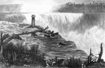
THE HORSE SHOE FALL, NIAGARA.—WITH THE TOWER.
The table on the following page shows a profile of this ship route from Anticosti, in the Estuary of the St. Lawrence, to Superior City:
key = A Distance from Anticosti in miles; B Elevation above the Sea level; C Number of Locks; D Length of Locks in feet; E Breadth of Locks in feet; F Total Lockage in feet.
| Names. | A | B | C | D | E | F |
| Anticosti | ||||||
| Quebec | 410 | |||||
| Montreal | 590 | 14 | ||||
| Lachine Canal | 598½ | 14-58 | 5 | 200 | 45 | 44¾ |
| Beauharnois Canal | 614 | 58.5-141.3 | 9 | 200 | 45 | 82½ |
| Cornwall Canal | 662½ | 142.6-185.6 | 7 | 200 | 45 | 43 |
| Farren's Point Canal. | 673½ | 190.5-195 | 1 | 200 | 45 | 4 |
| Rapid Flat Canal | 688 | 195.3-207 | 2 | ... | ... | 12 |
| Pt. Iroquois Canal | 699½ | 207-213 | 1 | ... | ... | 6 |
| Galops Canal | 714½ | 213-225 | 2 | ... | ... | 8 |
| Lake Ontario | 766 | 234 | ||||
| Welland Canal | 1016 | 234-564 | 27 | 150 | 26½ | 330 |
| Lake Erie | 1041 | 564 | ||||
| Detroit River | 1280 | 564 | ||||
| Lake St. Clair | ||||||
| River St. Clair | ||||||
| Lake Huron | 1355 | 573 | ||||
| River Ste. Marie | 1580 | 573-582.5 | ||||
| Sault Ste. Marie Canal | 1650 | 582.5-600 | 2 | 550 | 75 | 17½ |
| Lake Superior | 1650 | 600 | ||||
| Fort William | 1910 | |||||
| Superior City | 2030 |
The entire area of the great lakes is about 91,000 square miles. They are remarkable for the purity of their waters, which do not contain more than eight grains of solid matter to the gallon of 70,000 grains. The variations to which their level is subjected are common to all, and may be generally stated to be as follows:
1. The mean minimum level is attained in January or February.
2. The mean maximum level is in June.
3. The mean annual variation is twenty-eight inches.
4. The maximum variation in twelve years has been four feet and six inches.
5. There is no periodicity observable in the variations of their levels, and there is no flux and reflux dependent upon lunar influence.
The St. Lawrence carries past the city of Montreal 50,000,000 cubic feet of water in a minute, and in the course of one year bears 143,000,000 tons of solid materials held in solution, to the sea. All the phenomena of a mighty river may here be witnessed on a stupendous scale, its irresistible ice masses, crushing and grinding one another in the depth of winter, its wide-spreading and devastating floods in spring, its swelling volume stealing on with irresistible power in summer, broken here and there by tumultuous and surging rapids or by swift and treacherous currents, or by vast and inexhaustible lakes. As it approaches the ocean it rolls on between iron-bound coasts, bearing the tributary waters of a region equal to half Europe in area, and subject to a climate which vainly endeavors to hold it frost-bound for fully one-third of the year. The whole valley of the St. Lawrence is a magnificent example of the power of water in motion, and the great lakes themselves are splendid illustrations of the "dependence of the geographical features of a country upon its geological structure."
The following table shows the relative magnitude of the great lakes of the St. Lawrence valley:
| Names of Lakes. | Area in Square Miles. | Elevation above the Sea | Mean Depth. |
| Lake Superior | 32,000 | 600 | 1,000 |
| Green Bay | 2,000 | 578 | 500 |
| Lake Michigan | 22,400 | 578 | 1,000 |
| Lake Huron | 19,200 | 578 | 1,000 |
| Lake St. Clair | 360 | 570 | 120 |
| Lake Erie | 9,600 | 565 | 84 |
| Lake Ontario | 6,300 | 232 | 600 |
| Total area, | 91,860 |
The greatest known depth of Lake Ontario is 780 feet; in Lake Superior, however, a line 1,200 feet long has, in some parts, failed in reaching the bottom.
The western peninsula, comprehending the rich tract of country west of an undulating escarpment or ancient sea margin, reaching from Queenstown on the Niagara, round the head of Lake Ontario, and thence north to Georgian Bay, Lake Huron, is a gently sloping plain, deeply covered with drift clays; the highest part of this plain is at the Blue Mountains, abutting on Georgian Bay, where their northwestern escarpment is about 1,000 feet above Lake Huron. From the central townships of Proton and Luther, a low axis or water parting causes the rivers to discharge west into Lake Huron and east into Lake Erie, as far south as the head-waters of the Thames, which flows in a south-westerly direction to Lake St. Clair. Joining the ancient sea margin about half way between Lake Ontario and Nottawasaga Bay, Lake Huron, a ridge of drift, about 700 feet above where the Northern Railway crosses it, pursues a course roughly parallel to Lake Ontario, but with gradually diminishing altitude, and terminates near the Bay of Quinté. This ridge of drift blocks up a communication which once existed between Georgian Bay and Lake Ontario. There is strong evidence to prove that another 'Niagara' formerly existed somewhere between Lake Huron and Ontario, probably in the neighborhood of the line of the Northern Railway. A direct artificial water communication between these lakes is now advocated. In the rear of these subordinate elevations, which only slightly diversify the great plain of western Canada, the Laurentide mountains, stretching from Lake Superior to Labrador, separate the valley of the St. Lawrence from the region tributary to Hudson's Bay. The Laurentides approach or form the north shores of the Gulf and River St. Lawrence from Labrador to near Quebec; they then retire from the river by degrees, and at Montreal are thirty miles from the St. Lawrence. They cross the Ottawa one hundred and fifty miles from Montreal, and, bending round, approach the St. Lawrence again in the direction of Kingston. From this point they run in a north-westerly direction, and form the rough country in the rear of Lakes Huron and Superior, and the water parting between the St. Lawrence valley and Hudson's Bay. The height of land is really a tableland, diversified with innumerable lakes, large and small, but west of the Saguenay River, not distinguished by mountains possessing any considerable altitude. In the rear of the St. Lawrence, below Quebec, detached peaks of the Laurentides attain an elevation of 2,000, and even 3,000 feet. Forty miles from the coast, opposite Anticosti, they have an elevation of 3,200 feet, and on the great table land of the Labrador Peninsula there are isolated peaks at least 5,000 feet above the sea level. On the south of the St. Lawrence, the level valley of the river is from thirty to forty miles broad as far as the base of the prolongation of the Green Mountains of Vermont, in which range detached peaks attain an elevation of about 4,000 feet. The Notre Dame mountains in the District of Gaspé are very imposing; they vary in width from two to six miles, and in height from 2,000 to 3,778 feet. Viewed as a whole, the entire valley of the St. Lawrence from Lake Superior to Quebec, may be regarded as occupying part of the north-eastern rim of the immense basin of sedimentary rocks which form the United States, a portion of Mexico and British America west of Lake Winnipeg. The broad and low Laurentides stretching from Labrador to the Arctic sea separate this basin from the northern one, in part occupied by Hudson's Bay.
The geological structure of different parts of this vast extent of country determines, to a considerable degree, the character of the soils which form the surface. The soils in the western part of the province are derived from the 'drift,' which is made up of the ruins of the crystalline rocks of the Laurentides and of the sedimentary rocks lying to the north of any particular locality or in its immediate neighborhood In the extreme western peninsula the rich clays consist of remodeled 'drift,' and are of lacustrine origin. In the valley of the St. Lawrence below Montreal, the clays are marine, and not unfrequently contain a considerable proportion of calcareous matter. Below Quebec, on the south shores, the soils are derived from the disintegration of the red slates found in that region, while in the eastern townships the drift and debris of the altered rocks, which distinguish that part of the country, form the surface covering. In the region of the Laurentides, the fertile belts or strips consist either of 'drift' or of the ruins of crystalline limestone, and soda and lime feldspars, but the area covered by arable soil in the rocky region of the Laurentides is comparatively very small, and necessarily limits the progress of settlement north of the St. Lawrence and great lakes. The area in Canada occupied by sedimentary rocks, where in general rich and fertile soils abound, is about 80,000 square miles; the region embraced by the crystalline rocks is about 240,000 square miles in extent, five-sixths of which may be said to be wholly incapable of cultivation.
The whole of the peninsula of Western Canada, the valley of the St. Lawrence south of the Laurentides, the valleys and depressions in the peninsula of Gaspé, are more or less deeply covered with clays interstratified with sand and gravel, which belong to quaternary deposits, and in some parts are overlaid by alluvium. The region of the Laurentides alone exposes over the greater part of its vast extent, bare crystalline sedimentary rocks, the oldest, as far as is known, in the world, and named after the great river where they are developed on such a stupendous scale, the 'Laurentian Series.'
Between the Post Tertiary and the base of the Carboniferous, the entire series of sedimentary rocks is wanting in Canada, with the exception of small patches of Tertiary Formations which have escaped denudation.
The stratified clays, sands and gravels contain the remains of many species of marine animals, identical with those now found in the Gulf of St. Lawrence, often at an altitude of 500 feet above the level of the sea. Sixty-three species of marine invertebrates from the Post-Pliocene or Pleistocene clays of the St. Lawrence valley have been disinterred. The quaternary deposits form the soil of a large portion of the country. They contain clays suitable for the fabrication of red, white and yellow bricks; molding sands, tripoli, shell marl, bog iron ore, ochre, and in the eastern part of Canada they are overlaid by peat, which occupies depressions.
If we suppose that the quaternary deposits were swept away, and the whole of the underlying rocks laid bare, the formations of Canada older than the post tertiary would be found to consist of the following series:
1. A small area of the Carboniferous.
2. The Devonian Series.
3. The Silurian Series.
4. The Huronian or Cambrian Series.
5. The Laurentian Series.
These rocks form part of the Great Southern Basin of North America; the geographical limits of Canada, while embracing a large portion of its northern rim, penetrate like a wedge towards its center, by means of the peninsular portion of the western part of the province. An anticlinal axis separates this basin into two subordinate divisions, the line of demarcation running from the valley of the Hudson towards Quebec. The western subordinate basin contains the great coal fields of the United States, the eastern portion embraces those of New Brunswick and Massachusetts. "The rocks of these two basins present remarkable differences in their chemical and physical conditions. The formations of the western basin are nearly horizontal, and offer a perfect conformity, while in those of the east there is discordance between the upper and lower Silurian, and between the Devonian and Carboniferous formations. The strata of the eastern basin are moreover very much folded and contorted, and have in some parts undergone profound chemical and mineralogical changes."[1]
The highest formation in Western Canada is the Portage and Chemung group, or the upper portion of the Devonian Series, which includes the Hamilton group, the Corniferous limestone, the Oriskany sandstone, &c., of the New York geologists. In the extreme west of the province, where patches of the Portage group occur, extraordinary springs of petroleum have been tapped by boring to the depth of from 200 to 300 feet, on the summit of an anticlinal axis. The source of the petroleum is probably the underlying Corniferous limestone. The yield from four springs, which send pure petroleum about thirty feet above the surface of the ground, is estimated at fifteen thousand barrels a day. Lying beneath the Devonian Series are the Onondaga Salt Group, the Niagara limestone and the Medina sandstone of the Upper Silurian Series. Next follow the Middle Silurian rocks, represented by the Hudson River Group and Utica Slate, the Oneida Conglomerates not having been found in Western Canada. The Lower Silurian Series is represented in regular sequence by the Trenton, Black River, Birds-eye and Chazy limestones, succeeded by the Calciferous sand-rock and the Potsdam sandstone which rests upon the ancient crystalline rocks of Huronian or Laurentian age. Tracks of a large crustacean are numerous in the Potsdam sandstone, coprolites occur in abundance at the summit of the Calciferous sand-rock, the succeeding limestones are very rich in fossils, and the Utica slate is distinguished by abundance of bitumen, which has been used as a source of oil derived from its destructive distillation, but not, commercially, with success. The Onondaga salt group furnishes gypsum and brine springs. The marbles of the lower limestones are susceptible of a fine polish, and hydraulic cement of the best quality occurs in many parts of the province.
The highest rock in the eastern basin is a millstone grit, which forms the base of the New Brunswick coal field. It occurs in the Peninsula of Gaspé, and is underlaid by Devonian sandstone of great thickness, (7,000 feet,) which reposes on limestone and shales of the Upper Silurian Series, resting upon rock of Middle Silurian age. Some members of the Lower Silurian Series are highly metamorphosed and developed to an extraordinary extent in the vicinity of Quebec and elsewhere, showing a thickness of 7,000 feet, and distinguished by metaliferous veins; hence, although of the age of the Potsdam sandstone and the Calciferous sand-rock, they have been named the Quebec Group, also the Taconic system, and the Upper Copper-bearing rocks of Lake Superior. They are of vast economic importance, inasmuch as they form the great metaliferous formation of North America, containing gold, lead, copper, zinc, silver, cobalt, nickel, chromium and titanium. They are traceable from Gaspé to Alabama, under various designations, and thence to the west side of the Mississippi, through Kansas to Lake Superior, without suffering any diminution in volume. The copper ores in Eastern Tennessee and those of Acton in Lower Canada, belong to this important group, as well as the lead, copper, zinc, &c., of Missouri, and the copper of Lake Superior.
On the shores of Lakes Huron and Superior, the Quebec group rests unconformably on the Huronian Series, which reposes also unconformably upon the Laurentian Series. The Huronian Series is 18,000 feet thick, and consists of quartzites, thin limestone bands, slate rocks and diorite. It is the lower copper-bearing rock of America. The immense beds of iron ore at Marquette also belong to this series. It is traversed by a vast number of trappean dykes. The Laurentian system is the oldest known system of rocks, and is composed of gneiss, crystalline limestone and Labradorite. This series is of enormous thickness, one band of limestone being 1,000 feet thick, and the entire mass of altered sediments composing the vast Laurentian series probably exceeds 20,000 feet. Traces of fossils have been found in several localities; beds of iron ore hundreds of feet thick, great veins of metallic sulphurets with widely distributed crystalline limestone bands, give great economic importance to the series. The geographical surface of Canada contains about 80,000 square miles of unaltered fossiliferous rocks, and probably 230,000 square miles of the Laurentian Series. Where the Laurentian Series is not covered with quaternary deposits, the belts of crystalline limestones, and soda and lime feldspars, produce upon disintegration a fertile soil, so that the cultivable area in the Laurentian country is much greater than would be inferred from the gneissoid character of the formation in many districts.
The geographical position of Canada has necessarily a remarkable influence upon the climates of different parts of the country. The western peninsula has its climate greatly modified by the vast lakes which almost encircle it. The valley of the St. Lawrence below Kingston, as far as tide water, is removed from this ameliorating influence, and the country below Quebec is subject to many of those vicissitudes which belong to great estuaries and the sea-coast. The north shores of Lake Huron and Superior, and the back country north of a line extending from Lake Huron to Ottawa, and removed from the influence of the great lakes, possess a very rigorous climate, in which intense winter cold, prolonged through many weeks, is followed by a short but hot summer, succeeded by genial autumnal months.
Meteorological observations have been carried on for many years, at three separate points, which may represent the centers of the different climates of Canada in the settled parts of the country. At Toronto, (1862,) the mean annual temperature for a period of 22 years, has been 44°.12, the warmest month, July, has a mean of 66°.85; the coldest month on the average of 22 years is February, which has a mean temperature of 22°.98. The highest temperature recorded was 99°.2, the lowest, -26°.5. The average range of temperature during the same period amounts to 102°.7. The average fall of rain during 21 years was 30.32 inches. The greatest rain-fall in one month was 9.76 inches, the greatest in one day, 3.36 inches; but the average for 21 years of the greatest rain-fall in one day is 2.14 inches. The average fall of snow for 21 years is 61.6 inches, and the number of days on which snow falls is 57. The total average depth of snow and rain during 21 years is 36.49 inches. The average number of days on which rain or snow falls is 163. September is the most humid month. The resultant direction of the wind during a period of 14 years is N. 60 W. The mean velocity per hour being 1.85 miles; but without regard to direction, the mean velocity is 6.78 on an average of 14 years. The mean humidity of May, June and July, deduced from a period of 21 years, is 74.
At Montreal, (1856,) the mean temperature of the air for a period of 7 years, was 41°.56. The absolute mean range for the same period has been from 90°.9 to 27°.4 below zero. The highest temperature in the shade recorded was 100°.1, the lowest 36°.2 below zero, giving a climatic range of 136°.3. The degree of humidity is represented by .84. The average number of days on which rain fell was 73 per annum, and of days on which snow fell 43; or in all, 116 days on which precipitation took place. The rain-fall amounted to 43.004 inches; the depth of snow to 95.76 inches, or 52,380 inches of precipitation reduced to the form of rain. The mean of evaporation from the surface is nearly 21 inches during the spring, summer and autumn. The most prevailing wind is the westerly. The snow storms are from the N. E. by E., on the average.
The following table shows the monthly mean temperature at four different stations between the head of Lake Ontario and Quebec inclusive. From it an idea of the difference in climate between those far separated points may be inferred. The period over which the observations extend is the year 1855, but it is probable that the means of a large number of years would produce slight but comparatively unimportant changes in the observed temperatures. From this table the chief differences in the climates of the districts of which they are centers may be deduced.
Of the Mean Monthly Temperatures at Hamilton and Toronto, (Upper Canada,) and Montreal and Quebec, (Lower Canada,) for the year 1855.
| Hamilton. | Toronto. | Montreal. | Quebec. | |
| (Lat. 43° 16′) | (Lat. 43° 39′) | (Lat 45° 32′) | (Lat 46° 49′) | |
| Head of Lake Ontario. | 341 ft. above the sea. | |||
| 1855. | 1855. | 1855. | 1855. | |
| Months. | Months. | Months. | Months. | Months. |
| January, | 29.37 | 29.95 | 17.88 | 16.70 |
| February, | 19.14 | 15.41 | 11.23 | 10.55 |
| March, | 32.11 | 28.46 | 24.08 | 21.06 |
| April, | 45.48 | 42.43 | 40.15 | 34.14 |
| May, | 56.95 | 53.07 | 56.85 | 49.03 |
| June, | 62.63 | 59.93 | 62.39 | 58.34 |
| July, | 71.65 | 67.95 | 72.73 | 68.86 |
| August, | 68.08 | 64.06 | 64.94 | 61.54 |
| September, | 64.02 | 59.49 | 58.55 | 55.16 |
| October, | 47.89 | 45.39 | 46.35 | 45.43 |
| November, | 41.08 | 38.58 | 31.58 | 28.75 |
| December, | 29.21 | 26.99 | 20.84 | 18.09 |
| Annual Mean, | 10 years, 48.73 | 16 years, 44.27 | 3 years, 42.24 | 1855, 38.09 |
| Min. 1855 | -20.00 | -25.00 | -33.09 | -29.05 |
| Max. " | 96.00 | 92.08 | 97.00 | 90.00 |
The year 1855 was distinguished by the extreme and prolonged cold of February.
Showing the average Temperature, Humidity, Wind, Rain and Snow at Toronto, 108 feet above Lake Ontario, or 341 feet above the sea, for a period of 22 years:
(Observatory, Toronto, PROFESSOR KINGSTON, DIRECTOR.)
| TEMPERATURE. | |||
| Average of 22 years. | Extremes in 22 years. | ||
| Highest. | Lowest. | ||
| Mean temperature of the year | 44°.12 | 46°.36 (in 1846.) | 42°.16 (in 1856.) |
| Warmest month | July. | July, 1854. | Aug. 1860. |
| when the mean temperature of the month was | 66°.85 | 72°.47 | 64°.46 |
| Coldest month | February | Jan. 1857. | Feb. 1848. |
| when the mean temperature of the month was | 22°.98 | 12°.75 | 26°.60 |
| Difference between the warmest and coldest months | 43°.87 | ||
| Highest temperature | 90°.4 | 99°.2 | 82°.4 |
| which occurred on | July 22 | Aug. 24. (1854.) | Aug. 19. (1840.) |
| Lowest temperature | 12°.3 | -26°.5 | +1°.9 |
| which occurred on | Jan. 25. | Jan. 26. (1859.) | Jan. 2. (1842.) |
| Range of the year | 102°.7. | 118°.2 (in 1855.) | 87°.0 (in 1847.) |
| HUMIDITY. | |||
| Average of 20 years. | Extremes in 20 years. | ||
| Mean humidity of the year | 78 | 82, in 1851. | 73, in 1858. |
| Month of greatest humidity | January. | Jan. 1857. | Dec. 1858. |
| when the mean humidity of the month was | 83 | 89 | 81 |
| Month of least humidity | May. | Feb. 1843. | April, 1849. |
| when the mean of the month was | 72 | 58 | 76 |
| CLOUDS. | |||
| Average of 9 years. | Extremes in 9 years. | ||
| Highest. | Lowest. | ||
| Mean cloudiness of the year | 60 | 62, in 1861. | 57, in '53 '56 |
| Most cloudy month | December. { | Dec. '58. | } Dec. 1857. |
| Most cloudy month | Dec. '60. | ||
| Feb. '61. | |||
| when the mean of the month was | 75 | 83 | 73 |
| Least cloudy month | July and Aug. | July, 1853. | June, 1861. |
| when the mean of the month was | 45 | 34 | 45 |
| WIND. | |||
| Result of 14 years. | Extremes in 14 years. | ||
| Resultant direction. | n. 60° w. | ||
| Mean resultant velocity in miles | 1.82 | ||
| Mean velocity, without regard to direction | 6.78 | 8.55 in 1860. | 5.10 in 1853 |
| RAIN. | |||
| Average of 21 years. | Extremes in 21 years. | ||
| Total depth in the year in inches | 30.324 | 43.555 in 1843. | 21.505 in 1856. |
| No. of days on which rain fell | 106 | 136 in 1861. | 80 in 1841. |
| Greatest depth in one month fell in | September. | Sept. 1843. | Sept. 1848. |
| when it amounted to | 3.973 | 9.760 | 3.115 |
| Rainy days were most frequent in | June | June, 1857. | May, 1841. |
| when their number was | 12 | 21 | 11 |
| Greatest depth of rain on one day | 2.138 | 3.360 | .. |
| which fell on | .. | Oct. 6, 1849 | .. |
| Greatest depth in one hour | .. | .. | .. |
| SNOW. | |||
| Average of 19 yrs & 22 yrs. | Extremes in 19 years & 22 years. | ||
| Total depth in the year | 61.6 | 99.0 in 1855. | 38.4 in 1851. |
| No. of days on which snow fell | 57 | 87 in 1859. | 33 in 1848. |
| Greatest depth in one month fell in | February | Feb. 1846. | Dec. 1851. |
| when it amounted to | 18.0 | 46.1 | 10.07 |
| Days of snow were most frequent in | December. { | Dec. 1859. | Feb. 1858. |
| Jan. 1861. | |||
| when their number was | 13.0 | 23.0 | 8 |
| RAIN AND SNOW, (COMBINED.) | |||
| WHERE 10 INCHES OF SNOW ARE CONSIDERED AS EQUIVALENT TO 1 INCH OF RAIN. | |||
| Average of 19 yrs. & 22 yrs. | |||
| Total depth in the year | 36.488 | ||
| Number of days in which rain or snow fell | 160 | ||
| Greatest depth in one month fell in | September. | ||
| when it amounted to | 3.973 | ||
| Days of aqueous precipitation most frequent in | December. | ||
| when their number was | 18 | ||
|
Sketch of the Geology of Canada, by Sir W. E. Logan, F. R. S., and T. Sterry Hunt, F. G. S. |
Eighty years ago Upper Canada was a wilderness from the Ottawa to the St. Clair. The first British settlements were made after the year of peace 1783, but previously to that date only a few insignificant and drooping French colonies lay scattered on the banks of the St. Lawrence, or grouped in remote isolation on the river Detroit. Lower Canada at that time contained 113,000 people, although in 1676, or more than a century before, its population amounted to nearly nine thousand souls. So languid and sluggish was the progress of Canada under French rule, that a century scarcely swelled the number of its inhabitants to that of its commercial capital, Montreal, at the present day.
Eighty years ago the province, which now claims 2,506,755 inhabitants, was just emerging from the gloom of its forests. Over the whole of the most fertile and now most densely peopled western half, forest silence reigned, reigned undisturbed and supreme.
The agricultural history of Lower Canada—where the population is of French origin in the proportion of 76.29 per cent. to the whole number of inhabitants—is essentially distinct from that of Upper Canada, whose people are almost exclusively of British descent. The Lower Canadian French are natives of the country, sons of the soil, honest, light-hearted, and pre-eminently faithful to the religion, traditions and usages of their forefathers. They have grown to be almost a distinct people, under the old feudal system, and have always looked with characteristic reverence on their seigneurs, their pastors and the notary of their village. They have received no fresh blood by immigration for generations, and have clung with remarkable tenacity to the customs of their ancestors, repelling innovation and discarding all change not especially sanctioned by their spiritual advisers. Hence their agriculture is still to a considerable extent in a primitive condition, and requires a brief historical notice separate from that of the people of Upper Canada, who have been continually supplied with an infusion of fresh blood from Europe, are eager to grasp at every improvement which may better their condition, and who live less with a careless indifference to the future, or a happy enjoyment of the present, than with continual efforts to secure independence, often merging into a feverish anxiety to become rich, and surround themselves with the luxuries which the well-to-do in the world are supposed to enjoy.
There can be no doubt that the wretched mode of subdividing land and laying out farms which formerly prevailed in Lower Canada, has been instrumental in retarding the progress of husbandry in that part of the province. Very generally the farms in the old settled parts originally consisted of narrow strips whose lengths and breadths were in the ratio of ten to one; three arpents wide by thirty arpents in depth being the form of the long rectangle exhibited by a French Canadian farm when first surveyed. This is the same as if the farms were 200 yards broad by 2,000 yards long, a form inconvenient for practical agriculture, involving a yearly increasing expenditure of time and labor in its cultivation as the cleared portions become more remote from the homestead, for which no advantages of river or road frontage could compensate as the country became cleared. But when the seigneuries were surveyed, steamboats, railroads, and even macadamized roads were not thought of, and people did not then indulge in the habit of looking far into the future, or those of later date care to contemplate the condition to which they were drifting by continuing the mode of subdividing the soil which their fathers had inaugurated. With the increase of population, and the love for the paternal roof, which distinguishes the habitans of Lower Canada, their farms have been again subdivided longitudinally, sometimes into three parts, or one arpent in breadth by thirty in depth, or in the proportion of 66-2/3 yards broad to 2,000 long; and in the older seigneuries the ratio of breadth to length is not unfrequently as one is to sixty or 33-1/3 yards broad to 2,000 yards long. These are some of the heirlooms of that old feudal system which sat like a huge incubus on Lower Canada, and whose depressing influence will long leave its mark on the energies and character of its people.
We do not require to go far back into the history of that part of the province to find husbandry in all its branches in a very primitive condition. Thirty years ago, rotation of crops was wholly unknown, and no rules of art were practiced by the happy, light-hearted French Canadian, who with rigid steps pursued the systems handed down to him by his ancestors, and strictly adhered to usages which generations had sanctioned. In addition to the entire absence of rotation of crops, the practice of carting manure on to the ice of a neighboring river, in order that it might be washed away in the spring, was generally practiced, and even now prevails to a considerable extent. Barns were removed when the accumulations before the door impeded entrance or exit, and the old primitive forms of plows, harrows and all other farming implements and vehicles, were retained, with a wholesome horror of innovation in form or material. Nor need we travel far to find them still flourishing in all their original imperfections and want of adaptation to the end in view.
MORGAN
The narrowness of the French Canadian farms has led to those seemingly interminable lines of neat whitewashed cottages which border the main roads, or fringe the river St. Lawrence, wearing the aspect of a continuous village. A stranger, steaming down the noble river, sees with admiration and delight an uninterrupted thread of white cottages, fronting the water, with here and there the broad, glittering tinned roof of the parish church, and in the background the primeval forest; he gazes upon a beautiful picture, suggesting pleasing associations, and thoughts of rural contentment and prosperity, susceptible of increase as elsewhere in the world. Such is the outward show, but let him take a nearer view and examine in detail. He will find little or no change save in increase of numbers, between what he now surveys and what he might have seen one generation or even two generations ago. Improvement is progressing, but with snail-like progress, where ancient habits and customs are preserved, and where families cling to the soil on which they were born, and divide and sub-divide their farms until they become narrow strips not much wider than a modern highway, with the house fronting the river, and "the land all longitude."
The following table will show the progress made in Lower Canada between 1827 and 1852, a period of twenty-five years, and it will strikingly illustrate the fact that, ten years since, real improvement was scarcely visible in aggregate results, while in some instances a retrograde movement seems plainly discernible.—
| Population. | Wheat. Bushels. | Oats. Bushels. | Barley. Bushels. | |
| 1827, | 471,876 | 2,931,240 | 2,341,529 | 363,117 |
| 1852, | 890,261 | 3,073,943 | 8,977,380 | 494,766 |
| Peas. Bushels. | Rye. Bushels. | Indian Corn. Bushels. | Potatoes. Bushels. | |
| 1827, | 832,318 | 217,543 | 333,150 | 6,796,310 |
| 1852, | 1,415,806 | 325,422 | 401,284 | 442,016 |
| Hay. Tons. | Flax. Pounds. | Horses. | Oxen. | |
| 1827, | 1,228,067 | 731,696 | 140,432 | 145,012 |
| 1852, | 755,579 | 1,189,018 | 184,620 | 112,128 |
| Cows. | Sheep. | Swine. | Area culti- vated—Acres. | |
| 1827, | 260,015 | 829,122 | 241,735 | 2,946,565 |
| 1852, | 295,552[B] | 647,465 | 257,794 | 3,605,167 |
|
183,972 calves or heifers not included under the head 'cows.' |
The diminution of oxen and sheep is remarkable; the small increase in the production of wheat is probably owing to the "fly." In two articles only do we recognize any advance commensurate with the increase of population in twenty-five years, viz., in oats and flax. The area under crop in 1827 was 1,002,198 acres, in 1852, 2,072,341 acres, or more than double, yet while the area under crop had doubled, the yield appears to have uniformly diminished, a fact strongly shown in the subjoined comparative table of average produce per acre in Upper and Lower Canada in 1852, according to the census of 1851-2:
| Upper Canada. Bushels per acre. | Lower Canada. Bushels per acre. | |
| Wheat, | 16-14/60 | 9-50/60 |
| Indian Corn, | 24-4/60 | 18-14/60 |
| Rye, | 12-17/60 | 10 |
| Peas, | 14-16/60 | 9-56/60 |
| Oats, | 26-19/34 | 20-25/34 |
In 1851-2, each person in Lower Canada cultivated 4 acres, 0 roods, 8 poles; in Upper Canada, 3 acres, 3 roods, 20 poles; and while each family in either section of the province had on an average 2 cows, in Upper Canada 53¾ pounds of butter per cow was produced, and in Lower Canada the quantity was only 33 pounds. With respect to cheese, the proportion was as 7½ is to 1¾, or about 4 to 1 in favor of Upper Canada.
While the stagnation, or rather retrograde movement, in the farming industry of the habitans in Lower Canada was taking place during the twenty-five years under review, the most striking proofs were simultaneously afforded at the different agricultural exhibitions at Quebec and Montreal, of the fitness of the soil and climate of the country for agriculture in its broadest acceptation. Scattered throughout Lower Canada there are numbers of excellent farmers whose practice can not be surpassed. In the results they have produced, and the example they have shown, they have proved beyond doubt what can be accomplished throughout the length and breadth of settled Lower Canada, from the Bay of Chaleurs to Montreal, and redeemed it from those unfavorable impressions which a survey of the cultivated productions of its soil under the hands of the habitans of the old school is adapted to create.
In April, 1862, there were no less than seventy-two of these useful associations in the Lower Division of the province. The progress which might fairly have been anticipated from such a large number of distinct bodies, organized for the purpose of mutual assistance and encouragement, has not been satisfactory. This state of things has arisen in many instances from a most unusual and novel mode of distributing the annual government grant. We can not do better than transcribe the description of this singular disposal of public money, given in a recent number of the Lower Canada Agricultural Review, written by the editor on the occasion of a visit to different parts of Lower Canada to collect the best specimens of agricultural productions for transmission to the International Exhibition at London. "In many counties the societies have only distributed the funds among the local farmers, and this has been the case year after year, and we have often raised our voice against this sort of family compact. We need not here repeat our arguments, for wherever we have suggested the employment of the funds for any other purpose, we have generally met with the entire approbation of the enlightened farmer; and we have often met conscientious and intelligent men whose only aim is the advancement of agriculture. But these men are often bound hand and foot in their actions, being opposed by a majority who have no reason, and are only guided by their own narrow notions and the following of old customs; happily this majority is day by day losing their strength and influence, and we predict a triumph, at no distant day, of progressive and improved agriculture."
The Board of Agriculture for Lower Canada have taken decisive steps during the present year, (1862,) to secure the proper disbursements of the provincial grant, and to devote liberal awards of public money to the promotion of agricultural industry in all its important branches. The Lower Canadian Provincial Shows have partaken more of the character of an agricultural festival, hitherto, than of a meeting for the purpose of securing the progress of the Science and Art of Agriculture by fair and open competition and peaceful rivalry. In this respect they have differed materially from the same annual expositions in Upper Canada, where astonishing advances in the proper direction have been made. The Board has now taken steps to establish an Agricultural Museum, and to give assistance to county societies towards the importation of improved breeds of horses, cattle and sheep. The Board is willing to advance to any society funds for the purchase of stock, retaining one-third of the annual government allowance for three successive years to discharge the debt thus incurred. If this new spirit of enterprise continues, the progress of agriculture in Lower Canada will be much more rapid than it has been of late years, although it must be acknowledged that in the face of many difficulties, national prejudices and peculiarities of character, a very marked improvement has taken place in many departments of husbandry, and in many parts of the Lower Province, but much, very much remains to be done. The influence exercised by the Agricultural School at St. Anne is already favorably felt, and as this establishment appears likely to work a beneficial change in Lower Canadian husbandry, a few details respecting it may be both appropriate and acceptable.
At this establishment there are two departments, one devoted to theoretical training, the other to the cultivation, upon the most approved principles, of a tract of land, to serve as a model farm, and a nursery for stock. The beneficial effect of the model farm is already felt in the neighborhood, farmers having generally adopted the cultivation of root crops, and sought with avidity for the improved breeds of animals which have been reared by the College. During the year 1860 there were eight pupils attending the school. In 1861, there were only four; but as this department is yet in its infancy, there is good ground for the expectation that it will receive increased encouragement, as the influence of the College becomes more widely felt.
The steps taken by the provincial government for the encouragement of agriculture in the Province at large, will be described in the narrative of the progress made in Canadian husbandry in Upper Canada, to which we now turn with more encouraging results before us.
WE have already stated that eighty years ago that part of the province of Canada which is now most densely peopled, was a forest wild. Upper Canada dates its existence as a distinct Province previously to the Union from the year 1791. Before that period it formed part of the Province of Quebec; as soon, however, as it had acquired a separate political status, it was divided into four districts, the Eastern, Midland, Home and Western, each of which, in course of time, established agricultural societies. In 1782, or exactly eighty years ago, Upper Canada had barely 10,000 inhabitants. In 1824, the numbers had increased to 152,000, and in 1829 to 225,000; but it was not until the year 1830 that the government of the province took any decisive step to foster the agriculture of the country by "An Act to encourage the establishment of Agricultural Societies in the several Districts of the Province." As early as the year 1825, agricultural societies, it is believed, existed in two or three districts, but no records have been handed down to show the condition of husbandry at that period.
The indirect assistance given by the Imperial Government to Agriculture in Upper Canada, dates from a much earlier period than the encouragement given to Agricultural Societies by the Provincial Government; for we find among the donations of George III. to the U. E. Loyalists the old English plow. It consisted of a small piece of iron fixed to the colter, having the shape of the letter L, the shank of which went through the wooden beam, the foot forming the point, which was sharpened for use. One handle and a plank split from a curved piece of timber, which did the duty of a mold board, completed the rude implement. At that time the traces and leading lines were made of the bark of the elm or bass-wood, which was manufactured by the early settlers into a strong rope. About the year 1808 the "hog-plow" was imported from the United States; and in 1815 a plow with a cast iron share and mold-board, all in one piece, was one of the first implements requiring more than ordinary degree of mechanical skill, which was manufactured in the province. The seeds of improvement were then sown, and while in the address of the President at the Frontenac Cattle Show in 1833, we observe attention called to the necessity for further improvement in the plows common throughout the country, we witness, in 1855, splendid fruit at the Paris Exhibition. In a notice of the trial of plows at Trappes, the Journal d'Agriculture Practique makes the following reference to a Canadian plow: "The plowing tests were brought to a close by a trial of two plows equally remarkable—to wit, the plow of Ranson & Simms, of Suffolk, England, and that of Bingham, of Norwich, Upper Canada. The first is of wood and iron, like all the English plows, and the results which it produced seemed most satisfactory, but it appeared to require a little more draught than the Howard plow. Bingham's plow very much resembles the English plow; it is very fine and light in its build; the handles are longer than ordinary, which makes the plow much more easy to manage. The opinion of the French laborers and workmen who were there, appeared on the whole very favorable to this plow."
In 1828, when the whole population of Upper Canada amounted to 185,500 inhabitants, the number of acres under agricultural improvement was 570,000, or about 3-3/16 for each individual; in 1851 the average for each inhabitant was very nearly four acres. The comparative progress of Upper and Lower Canada, in bringing the forest-clad wilderness into cultivation, may be inferred from the following table:
| Year. | LOWER CANADA. No. acres cultivated. | UPPER CANADA. No. acres cultivated. |
| 1831, | 2,065,913 | 818,432 |
| 1844, | 2,802,317 | 2,166,101 |
| 1851, | 3,605,076 | 3,702,783 |
| 1861, | 4,678,900 | 6,051,619 |
Hence, in a period of twenty years, Lower Canada increased her cultivated acres by 1.9 and Upper Canada by 4.5.
Before proceeding to describe in detail the progress of Agriculture in Upper Canada, it will be advisable to glance at the efforts made by societies and the Government of the Province to elevate the condition of husbandry in all its departments, and to induce the people at large to join hand in hand in the march of improvement.
The first public Act for the encouragement of Agriculture in Canada, which came into operation in 1830, authorized the governor to pay one hundred pounds to any District Agricultural Society which raised the sum of £50 by subscription, for the purpose of importing valuable live stock, grain, useful implements, &c.
Several acts were passed in subsequent years, being modifications of that of 1830, all of them having for their object the encouragement of Agricultural Societies and Agriculture. In 1847 an additional step was taken, fraught with very important consequences to the interests of husbandry in Canada. An Act for the incorporation of the Provincial Agricultural Associations came into operation; and in 1850, Boards of Agriculture for Upper and Lower Canada were established by law. In 1851, an Act was passed to provide for the better organization of Agricultural Societies, and finally, in 1852, the most important step of all was taken, and "An Act to provide for the establishment of a Bureau of Agriculture, and to amend and consolidate the laws relating to Agriculture," came into operation.
The District Societies, which, in 1830, drew their annual pittance from Government, and represented the agricultural interests of the country, have thus grown, in twenty-two years, to a comprehensive and centralized organization, consisting of, 1st, the Bureau; 2d, the Boards of Agriculture for Upper and Lower Canada; 3d, the Agricultural Associations for Upper and Lower Canada; 4th, County Societies; 5th, Township Societies.
In 1857, another change took place, being also a step in advance; an Act was passed "to make better provision for the encouragement of Agriculture, and also to provide for the promotion of Mechanical Science." The head of the Bureau of Agriculture received the title of 'Minister of Agriculture,' with very extensive powers for obtaining and distributing information respecting the condition of Husbandry and the Progress of Arts and Manufactures in the Province. By this act Boards of Arts and Manufactures were created, and Horticultural Societies incorporated.
The Boards of Agriculture distribute the annual government grant to the County Societies, upon duly certified statements from the Treasurers of the different Societies. The progress of these excellent adjuncts to agricultural improvement is shown in the following table:
| Year. | No. of Societies. | Amount of Subscription. | Amount of Grant. |
| 1852, | 22 | $13,531.00 | $21,557.00 |
| 1853, | 41 | 17,109.00 | 25,930.00 |
| 1854, | 41 | 23,409.00 | 32,792.00 |
| 1855, | 41 | 23,119.00 | 32,574.00 |
| 1856, | 41 | 23,654.00 | 33,614.00 |
| 1857, | 41 | 24,957.00 | 34,075.00 |
| 1858, | 42 | 15,675.96 | 34,275.00 |
| 1859,[C] | 61 | 24,221.00 | 23,836.00 |
|
This year, in consequence of the financial condition of the country, the legislative grant was limited to a certain amount for the entire Province, and a uniform deduction was made from the amount which each society would have been entitled to under the act. The sum due, according to the act, being $47,950, of which only $32,836 was furnished by the Government. |
With the means at the disposal of the County Societies, a valuable impulse has no doubt been given to agriculture in all its branches; chiefly by encouraging the introduction of a superior breed of animals and of improved implements. Several societies have devoted a considerable portion of their funds to the importation of improved breeds of cattle and horses. The awarding of premiums for stock, implements and farm productions generally, has encouraged private enterprise and awakened a spirit of emulation which has been most successful in promoting progress and improvement, and the rank which Upper Canada now occupies as an agricultural country is mainly due to the excellent organization and energetic spirit which has always distinguished the county societies since their first establishment.[2]
As a necessary result of the successful working of the county and township Agricultural Societies, a growing desire began to be felt, now nearly twenty years ago, for the organization of a Provincial Society which would bring the farmers and manufacturers from all parts of the Province together, and, by friendly rivalry and competition at an annual exhibition, present at one view the best results of the agricultural and mechanical industry of the country. After several ineffectual attempts to obtain general and united action, a meeting of delegates from county societies was held at Hamilton in August, 1846, and an Association formed, entitled the "Provincial Agricultural Association and Board of Agriculture for Canada West."
The first Exhibition of the Association was held at Toronto in October, 1846. The amount of prizes offered in money reached $1,112, besides books, making the total prize list to have a money value of about $1,600. The result of the Exhibition surpassed the most sanguine anticipations of its promoters, and excited the astonishment of many who were not familiar with the progress already made by the County Societies, at the display of stock, implements, grain, fruit, and vegetables. Thorough-bred Durham cattle were exhibited, and eagerly bought up at the close of the show. In the address delivered at the first meeting of the Association, we find the following paragraph, which illustrates the condition of husbandry in relation to stock which prevailed throughout the province: "The rough condition of our farmers, with various concurring circumstances, have in times past precluded any due attention to the important department of live stock. We find every where a mongrel mixture of Devons, Herefords, Lancashires, and Normans, frequently, indeed, producing good milkers, and useful cattle for the yoke, but entirely devoid of any established qualities upon which the breeder can rely, or feel any confidence that 'like will beget like.' We must admit, however, that some improvement has taken place, and that the well-defined breeds of England are beginning to be sought after with some care."
The Provincial Association commenced its operations without any well-established means of support, trusting to members' fees and contributions from county societies. Its first exhibition was so far successful that a balance of $408.25 remained in the treasurer's hands after all expenses were paid. In 1847 the association was incorporated by act of Parliament, under the title of "The Agricultural Association of Upper Canada." Since that time it has increased in influence and usefulness year by year, as the following brief synopsis of the results of the different exhibitions held under its auspices amply proves:
Showing the amount of competition at all the Exhibitions held by the Association, between 1846 and 1860, inclusive:
| Exhibitions. | Amount of Prizes offered. | Total No. Entries. | Amount of Prizes Awarded. | ||||
| Toronto, 1846, | £400 | 0 | 0 | 1,150 | £275 | 0 | 0 |
| Hamilton, 1847, | 750 | 0 | 0 | 1,600 | 600 | 0 | 0 |
| Cobourg, 1848, | 775 | 0 | 0 | 1,500 | 575 | 0 | 0 |
| Kingston, 1849, | 1,400 | 0 | 0 | 1,429 | 700 | 0 | 0 |
| Niagara, 1850, | 1,276 | 11 | 9 | 1,638 | 950 | 0 | 0 |
| Brockville, 1851, | 1,254 | 9 | 3 | 1,466 | £805 | 18 | 9 |
| Toronto, 1852, | 1,470 | 9 | 9 | 3,048 | 1,228 | 5 | 0 |
| Hamilton, 1853, | 1,602 | 10 | 9 | 2,820 | 1,323 | 6 | 3 |
| London, 1854, | 1,794 | 0 | 6 | 2,933 | 1,356 | 17 | 6 |
| Cobourg, 1855, | 2,304 | 1 | 6 | 3,077 | 1,735 | 8 | 6 |
| Kingston, 1856, | 2,309 | 12 | 6 | 3,791 | 1,699 | 17 | 6 |
| Brantford, 1857, | 2,517 | 17 | 0 | 4,337 | 2,046 | 10 | 0 |
| Toronto, 1858, | 2,675 | 2 | 6 | 5,572 | 2,303 | 15 | 0 |
| Kingston, 1859, | 2,628 | 5 | 0 | 4,830 | 2,016 | 15 | 0 |
| Hamilton, 1860, | 3,753 | 17 | 6 | 7,532 | 3,235 | 0 | 0 |
The following table exhibits, in a condensed form, the general results of two exhibitions, at an interval of 11 years. The remarkable change, both in number and kind of stock, and implements exhibited, shows how rapid the progress of improvement has been during that period.
| Classes | No. of Entries, 1849. | No. of Entries, 1860. | Amount Awarded. | |
| Blood Horses, | 16 | 26 | $305 | 00 |
| Agricultural Horses, | 97 | 128 | 418 | 00 |
| Road or Carriage Horses, | 188 | 422 | 00 | |
| Heavy Draught Horses, | 49 | 330 | 00 | |
| Horses of all Classes, | 52 | 100 | 00 | |
| Durham Cattle, | 54 | 143 | 632 | 00 |
| Devon Cattle, | 10 | 172 | 603 | 00 |
| Hereford Cattle, | 19 | 329 | 00 | |
| Ayrshire Cattle, | 12 | 63 | 558 | 00 |
| Galloway Cattle, | 56 | 532 | 00 | |
| Bulls of any Breed, | 21 | 80 | 00 | |
| Grade Cattle, | 51 | 73 | 199 | 00 |
| Fat and Working Cattle, | 20 | 38 | 227 | 00 |
| Leicester Sheep, | 79 | 176 | 162 | 00 |
| Cotswold Sheep, | 68 | 178 | 00 | |
| Cheviot Sheep, | 41 | 159 | 00 | |
| Other Long Wooled Sheep, | 121 | 162 | 00 | |
| Southdown Sheep, | 16 | 118 | 162 | 00 |
| Merino and Saxon Sheep, | 11 | 52 | 202 | 00 |
| Rams of all Breeds, | 40 | 20 | 00 | |
| Fat Sheep, | 5 | 23 | 54 | 00 |
| Yorkshire Pigs, | } 59 | 45 | 82 | 00 |
| Large Berkshire Pigs, | 19 | 80 | 00 | |
| Other large Breeds, | 16 | 64 | 00 | |
| Suffolk Pigs, | 28 | 105 | 00 | |
| Improved Berkshire Pigs, | 45 | 95 | 00 | |
| Other Small Breeds, | 23 | 66 | 00 | |
| Pigs all Breeds, | 11 | 20 | 00 | |
| Poultry, | 22 | 297 | 191 | 00 |
| Foreign Stock, | 1 | 15 | 00 | |
| Grains, Seeds, &c., | } 224 | 764 | 822 | 00 |
| Roots, &c., | 546 | 254 | 00 | |
| Fruit, | 690 | 270 | 50 | |
| Garden Vegetables, | 644 | 269 | 50 | |
| Plants and Flowers, | 142 | 228 | 50 | |
| Dairy Products, | 63 | 201 | 210 | 00 |
| Agricultural Implements, (Power,) | } 101 | 226 | 771 | 00 |
| Agricultural Implements, (Hand,) | 153 | 204 | 50 | |
| Artificial Cattle Food, Manures, &c., | 6 | 15 | 00 | |
| Foreign Agricultural Implements, | 39 | 2 | 10 | 00 |
| Arts Department, (in Medals,) | 160 | 00 | ||
| Architectural and Miscellaneous Useful Arts, | 70 | 159 | 00 | |
| Cabinet Ware and other Wood Manufactures, | 18 | 120 | 236 | 00 |
| [D]Carriages, Sleighs, &c., | 40 | 47 | 88 | 00 |
| Furs and Wearing Apparel, | 28 | 25 | 00 | |
| Fine Arts, | 78 | 262 | 291 | 00 |
| Groceries, Provisions, &c., | 194 | 182 | 00 | |
| Indian Work, | 3 | 4 | 6 | 00 |
| Ladies' Department, | 165 | 535 | 227 | 00 |
| Machinery, Castings, &c., | } 29 | 140 | 377 | 00 |
| Metal Work, Plain and Ornamental, | 89 | 87 | 00 | |
| Miscellaneous, | 24 | 54 | 00 | |
| Musical Instruments, | 26 | 95 | 00 | |
| Natural History, | 50 | 274 | 00 | |
| Paper, Printing, Bookbinding, &c., | 7 | 61 | 91 | 00 |
| Pottery, | 3 | 53 | 137 | 00 |
| [D]Saddlery, Harness. Leather, &c., | 72 | 148 | 00 | |
| [D]Shoe and Boot Work and Leather, | 67 | 99 | 00 | |
| Woolen, Flax, and Cotton Goods, | 99 | 159 | 272 | 00 |
| Foreign Manufactures, | 21 | |||
| Amateur Bands, | 3 | 325 | 00 | |
| Totals, | 1,429 | 7,532 | $12,940 | 00 |
|
In 1849 included under the head of Carriages and Sleighs, and Leather manufactures and Furs. |
Note.—The Medals and copies of Transactions of the Board are included in the above statement; the gold Medals being valued at $40 each, the silver Medals at $10 each; and the transactions at $1 per volume. Where the amount of prizes awarded exceeds that offered, the excess is caused by extra prizes, or, in the case of live stock, by the additional amount for imported animals.
Some permanent buildings are now erected at Toronto, Hamilton, London, and Kingston, respectively, for the express purposes of holding annual exhibitions. In 1862, the annual meeting was held at Toronto, and permanent provision made for stabling 198 horses and 435 head of cattle. The amount of prizes offered exceeded 1,600 dollars.
Such is the progress which has been made during fifteen years, in bringing together the different industries of Upper Canada, and teaching her people those lessons which can only be learned by friendly competition in an arena open to all, without distinction, prejudice, or favor. The cause of this rapid improvement is no doubt in great part due to the immigration of scientific agriculturists, as well as practical farmers, who have learned and studied husbandry in all its branches in the best districts of England and Scotland. Any improvement which takes place, either in stock, implements, or farming practice, either in Europe or the United States, is immediately imported, and, if satisfactory, adopted in Upper Canada. By means of the different agricultural societies, all needful information respecting the results attained are speedily made known, and there is now no lack of enterprising and energetic men who gladly embrace every opportunity of improving the farming practice. The financial condition of the Association and the Board of Agriculture, afford incontestible proof of the deep root which these institutions have taken in Canada. It will be remembered that in 1846 they commenced their operations without funds, relying solely on subscriptions. In 1859, the large sum of $110,908.78 passed through the hands of the treasurer. Out of the surplus funds a handsome and commodious brick building has been erected in Toronto for the purposes of the Board, amply provided with space for museum, library, reading-room, large hall for public meetings, and a capacious seed-store.
Intimately connected with agriculture, in the common acceptation of the term, fruit-growing is now an accepted department of husbandry. Canada imports an immense quantity of fruit from the United States. In 1859-1861, inclusive, the value of the importation of green and dried fruit from the United States amounted to the following
| 1859. | 1860. | 1861. | |
| Fruit—Green, | 216,592 | 241,912 | 245,259 |
| Fruit—Dried, | 35,414 | 43,192 | 64,932 |
| Total, | $252,006 | $285,104 | $310,191 |
The fruit crop of the state of New York is estimated as being worth annually $6,000,000; that of Canada may reach $500,000. The objects contemplated by the Fruit-Growers' Association for Upper Canada:
First.—The discussion by members of the society of the relative merits of the different kinds and varieties of fruit, the determination and selection of the best varieties suitable for cultivation in Canada West, and the publication of the list of fruits so selected and recommended.
Second.—The revision from time to time, as occasion may require, of the catalogue of fruits, and the addition thereto of such new varieties as may after a sufficient trial be deemed worthy of general cultivation, and striking out the names of any that may on further trial be found unworthy of cultivation, either from being deficient in flavor or not sufficiently hardy to stand the severity of our climate.
Third.—The promotion by the society of the cultivation and improvement of native and indigenous fruits, the testing of all new varieties of fruit, the discussion of their merits or defects, and making known the result of such trials.
Fourth.—The determination of the names of fruits; and the identification of fruits having different names in different localities, or which, having received new names through the ignorance or fraud of cultivators, have been distributed as new varieties.
Fifth.—The discussion of all questions relative to fruit culture, and disseminating information respecting the same, such as the most proper or most advantageous modes of cultivation; the soils and exposures most suitable for the different kinds of fruit; the manures most beneficial, and the best modes of applying the same; the diseases to which the various fruit-bearing trees, shrubs and plants are liable, with the remedies for such diseases; the insects injurious to the different kinds of fruit, and the best means of preventing or restraining their ravages; the best modes of ripening, gathering, and preserving fruits; and any other subject bearing upon fruit culture.
This association was reorganized in 1861, the Constitution and By-Laws having been framed and adopted in January, 1862. It already numbers most of the fruit-growers in the province among its members, and it will no doubt ere long take an important position.
These are established in most of the chief towns: Toronto, Hamilton, Kingston, Peterborough, St. Catharines, Niagara, Cobourg, and Paris. In the bill now before Parliament it is proposed that "every horticultural society in any city, town or incorporated village, incorporated under this act, or which may have been incorporated under any other act of the Provincial Legislature, shall be entitled to a public grant equal to the amount subscribed by the members of such society, and certified by their treasurer to have been paid into his hands in the manner provided by the sections of the act relating to Agricultural Societies, provided that the whole amount granted to any such society shall not exceed one hundred pounds in any year."

SOUTH DOWNS
BLACK HAWK
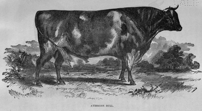
AYRSHIRE BULL.
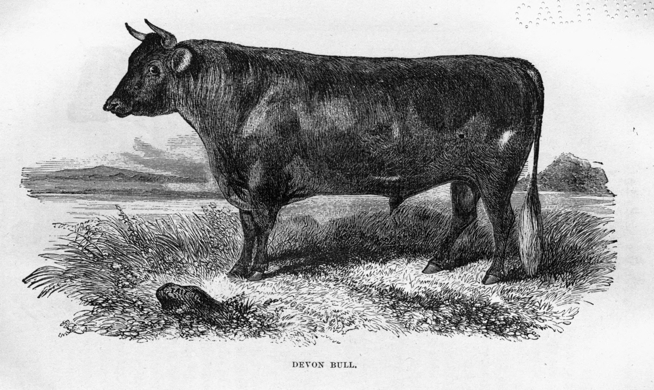
DEVON BULL.
The progress of horticulture in Canada may be inferred from what has taken place at and near Toronto since 1836. In that year, with a population of about 6,000, there were two small green-houses in the town, where common plants only were cultivated. In 1862, there exist many thousand square feet of glass-roofed structures, most of them built upon the most approved modern principles, and adapted to the growth of foreign grapes, green-house and exotic plants. Orchard houses are already numerous, and a taste for the delightful pursuit of horticulture is rapidly spreading. Some of the private green and hothouses are constructed on a very substantial and extensive scale; several thousand feet of pipes for the supply of hot water being used. The grounds of the horticultural society occupy five acres, in a most valuable part of the city, and are the gift of a zealous horticulturist and warm and generous supporter of whatever tends to improve and elevate his fellow-countrymen. Five acres adjoining have been purchased from the corporation, so that there is now in the midst, as it were, of the city of Toronto, a horticultural garden containing ten acres. In Hamilton the number of entries at the annual shows was 393 in 1851; in 1859 it rose to 1,418, or nearly four times as many.
Organized in 1860, and having for its object the introduction and distribution of new plants and seeds adapted to the wants of the country; experiments on the indigenous and domestic plants of Canada; the encouragement of arboriculture, forest-conservation, and the culture of fibre dye, oil, food and medicinal plants, together with the publication of papers embodying the results arrived at, and the information brought together by the above means, with the ultimate establishment of a Botanical and Experimental Garden.
Among other important adjuncts to the progress of agriculture in Upper Canada, there is a Chair of Agriculture in the University of Toronto, and a Veterinary School in connection with Board of Agriculture.
|
For an excellent summary of legislative enactments in favor of agriculture in Canada, see the first volume of the Transactions of the Board of Agriculture for Upper Canada. |
Among farm products, wheat takes the first rank in the husbandry of Upper Canada. Formerly it occupied an equally prominent position in Lower Canada, but for many years this cereal has not been successfully cultivated in the eastern part of the province, in consequence of the Hessian fly, wheat midge, and an exhausting system of culture; it is now, however, slowly regaining its position in Lower Canada.
The following table shows the amount of wheat produced in Lower and Upper Canada in different years:
| Lower Canada. | Upper Canada. | |||
| Year. | Bushels of Wheat. | Year. | Bushels of Wheat. | |
| 1827, | 2,931,240 | 1842, | 3,221,991 | |
| 1831, | 3,404,756 | 1848, | 7,558,773 | |
| 1844, | 942,835 | 1851, | 12,674,503 | |
| 1851, | 3,045,600 | 1861, | 24,620,425 | |
| 1861, | ... | |||
Long before Upper Canada was invaded by the whites, Lower Canada was a wheat exporting country; but the returns show a gradual falling off from about the year 1819. In 1790 the valley of the Richelieu produced 40 bushels to the acre.
| Year. | Wheat. | Flour—(bbls.) |
| 1793, | 487,000 | 10,900 |
| 1794, | 414,000 | 13,700 |
| 1795, | 395,000 | 18,000 |
| 1796, | 3,106 | 4,300 |
| 1797, | 31,000 | 14,000 |
| 1798, | 92,000 | 9,500 |
| 1799, | 129,000 | 14,400 |
| 1800, | 217,000 | 20,000 |
| 1801, | 473,000 | 38,000 |
| 1802, | 1,010,033 | 28,300 |
| * * | * * * | * * * |
| 1816, | ... | 1,137 |
| 1817, 1818, | 546,500 | 69,100 |
| 1819, | 37,800 | 12,100 |
| 1820, | 320,000 | 45,000 |
| 1821, | 318,400 | 22,600 |
| 1822, | 145,000 | 47,700 |
|
It is probable that a considerable portion of the exports from Quebec between 1816 and 1822 came from Upper Canada. |
An inspection of the foregoing table will show that the cultivation of wheat in Lower Canada has long since been of a precarious character; two instances are known, namely, in 1796 and 1819, when the exports became merely nominal, while in 1802, before Upper Canada could contribute any proportion of exports, the amount of wheat and flour sent from Quebec reached 1,010,033 bushels, and 28,300 barrels respectively. Even when Upper and Lower Canada are taken together in relation to the export of wheat, the progress is shown to be far from uniform.
| Year. | Value. | Rate per Bushel. | Quantity Bushels. |
| 1853, | $ 7,322,324 | $1 15 | 6,267,628 |
| 1854, | 6,742,200 | 1 31 | 5,146,795 |
| 1855, | 11,750,020 | 1 85 | 6,351,362 |
| 1856, | 10,476,327 | 1 39 | 7,536,925 |
| 1857, | 3,690,428 | 1 06 | 3,841,536 |
| 1858, | 2,763,509 | 0 97 | 2,848,977 |
| 1859, | 1,097,742 | 1 06 | 1,035,606 |
| 1860, | 6,367,061 | 1 13 | 5,637,222 |
| 1861, | 9,299,351 | 1 08 | 8,613,195 |
Until recently, with few exceptions, wheat has been cultivated without regard to rotation of crops, both in Upper and Lower Canada. Several reasons have led to this very improvident system of farming practice, independently of a general want of knowledge regarding the first principles of husbandry. For a long time wheat was the only product of the farm upon which reliance could be placed as a mean of obtaining ready money. Wheat has always been a cash article; other farm products have often sought a market in vain, and were consequently given by the farmer in barter or exchange for many of the necessaries he required. Since the construction of railways, things have changed; a market has been found for almost every production of the farm, and with a more general spread of agricultural knowledge, a better farming practice has been established, and the value of rotation of crops acknowledged. Both in Upper and Lower Canada, vast areas of most fertile land have been rendered absolutely unproductive by continual wheat cropping. Portions of the valley of the Richelieu in Lower Canada and of the Thames in Upper Canada afford striking proofs of this deterioration in the fruitfulness of the soil. Forty bushels to the acre was by no means an uncommon yield when the land was first cleared of its forest, as it now is in the valley of the Saugeen and Maitland. Rest for a few years, or deep plowing, restores the soil nearly to its original fertility, and where the last artifice is adopted, even on what are called worn-out farms, it is found that fair and sometimes excellent crops can be obtained. This is particularly the case in Lower Canada, where for centuries the soil has been merely skimmed, and the cultivation of wheat abandoned on account of the wretched yield obtained. By deep plowing these "worn-out lands" have been restored, and there is no doubt that the same artifice, if thoroughly carried out, would bring many a wheat field of by-gone celebrity back to its original productiveness, if a judicious rotation of crops were adopted.
Insects here as elsewhere on this continent have been the great enemies of the wheat crops, before which the best practice has failed. The wheat midge, the Hessian fly, and that destructive fungus, "rust," have in many instances ruined the productive capabilities of whole counties, and in one instance the greater part of a province, for a term of years. A glance at the tables of annual exportation, given on a preceding page, will show how terrible has been the effect of insect destroyers. In 1856, the exportation of wheat rose to 9,391,531 bushels; in 1857 it fell to 6,482,199, and 1859 to 4,032,627 bushels, or less than one half the exportation of 1856. This diminution must be attributed in great part to the wheat midge, of which a short account is given in subsequent paragraphs.
The first recorded appearance of the wheat midge in Lower Canada took place in 1829. In 1834 it appeared in vast numbers near Montreal, and in the following year, and in 1836, it destroyed a great quantity of the wheat crops in the valley of the St. Lawrence. In the year 1849 it appeared in the eastern counties of Upper Canada, but previously to this date the production of wheat in Lower Canada had fallen from 3,404,756 bushels in 1831 to 942,835 in 1844. In 1851 the average production of some of the best wheat-growing counties of Upper Canada fell from twenty-two to six bushels to the acre in consequence of this pest. Its progress westward in Upper Canada during the years 1851 and 1852 was very marked. In 1854 this insect caused a loss in the wheat crop of the state of New York exceeding fifteen million dollars, and in some counties in Canada, its destructive influence was felt in the same proportion. In the region of the Lower St. Lawrence it was very destructive in 1855, although not generally prevalent in the United States, although very abundant and destructive in the previous year. In 1856 this insect had progressed as far westward as the Niagara counties, and on the lake shore west of Toronto. Its ravages in Canada during this year were estimated at $2,500,000. It appeared on the Thames in 1856, and throughout a large part of the western peninsula its depredations were felt.
There are several species of the wheat-midge, but the differences are so small as not readily to strike the eye of the unpracticed or unscientific observer. The most common species is a small orange-colored fly with delicate, transparent, viridescent wings, and long, slender legs. The length of this insect is about the tenth of an inch, the breadth of its expanded wings slightly exceeds the tenth of an inch. It appears in Canada during the latter part of June, and remains until the middle of August. The eggs are deposited in the germ of the still undeveloped grain, through its chaff or sheath. The number of eggs rarely exceeds ten, but as several insects lay their eggs in the same floret, from ten to forty larvæ have been counted in one floret. The young maggots feed upon the juices of the grain, and dry it up. It appears to be most destructive during dry summers, like other insect pests.
In 1859 this midge was destructive in the county of Welland, but in other parts of Canada it appears to have exhausted itself. The remedy universally adopted or recommended is to sow early kinds of winter wheat very early in the season, and the Fife spring wheat either very early or not until after the 20th of May.
Between the years 1805 and 1816, the Hessian fly was very destructive in some parts of Lower Canada. In 1819 the importations of wheat fell to 37,800 bushels, having in 1802 exceeded one million bushels. This diminution is in great part attributed to the Hessian fly. In 1830 it began to disappear in Lower Canada, and in 1836 it was no longer to be found. In 1846 it appeared in Upper Canada, having been very destructive during the previous year in western New York, Ohio, Michigan, and the western states generally. In 1847 it was common about Toronto, and strange to say, although great fears were entertained for the safety of the harvest of 1848 in the United States on account of the remarkable prevalence of the insect in the previous year, the crop of 1848 proved to be one of the best ever grown, so remarkable and mysterious are the laws which govern the increase and decrease of insects destructive to vegetation.
Other wheat insect depredators are comparatively harmless with the exception of the wire-worm. Upwards of sixty species of the larvæ of beetles belonging to the genus Elater are known to entomologists. They feed upon the roots and underground stems of wheat, Indian corn, and the grasses generally. Sometimes the wire-worm is found in such destructive abundance that it cuts off the young crops as fast as they appear two or three inches above the surface.
Rust is justly considered one of the greatest enemies to the wheat crops of this continent. Its attacks are often so unexpected and universal that it has been likened to a whirlwind of blight, which sweeps over thousands and tens of thousands of square miles in the short space of a single night. In 1837, 1840 to 1846, 1849, 1850 and 1855, this fungus was very destructive in many states of the Union and in different parts of Canada. Draining, and early sowing with properly prepared seed, are the best preventives of rust. As, in most other cases, good husbandry is the surest mode of withstanding the attacks of this minute vegetable organism, whose seeds or sporules are always floating in the air during the summer season and instantly vegetate when those climatic conditions occur favorable to "rust." The only plan is to have the wheat plant strong enough to bear its attack when it comes, and the soil in such a state that it will not foster its growth by an unhealthy condition of the plant.
Average per Acre.—According to returns to circulars sent by the Bureau of Agriculture in 1860 to the Presidents of the different Agricultural Societies in the Province, the following data with reference to the yield of wheat has been collected:
| Winter wheat. No. of bushels per acre. | Spring Wheat. No. of bushels per acre. | |||
| County | of | Carlton | 28¼ | 22¾ |
| " | " | Northumberland | 27½ | 19 |
| " | " | Simcoe | 26¼ | 23¾ |
| " | " | York | 27 | 20 |
| " | " | Bruce | 25 | 20 |
| " | " | Leeds | 25 | 16½ |
| " | " | Peel | 24-2/3 | 18-2/3 |
| " | " | Ontario | 22½ | 23½ |
The total average for the Province is 21 bushels of winter wheat to the acre, and 18-2/3 bushels of spring wheat. The number of acres of winter wheat now cultivated in Upper Canada is only about one-third of the whole cropped with wheat. Five years ago there was not one acre of spring wheat for every ten of winter wheat. This change has been brought about by the ravages of the wheat midge. No doubt when draining becomes more generally adopted, farmers will return to the cultivation of winter wheat.
In Lower Canada the county of Laval returned 18 bushels to the acre of winter wheat, Ottawa 15, Pontiac 20 and 15 bushels. Of spring wheat in Terrebonne the average is stated to be 20, Megantic 18, Grantham 17, Leeds 16½. The total average of spring wheat for Lower Canada being 13 bushels to the acre. The midge was destructive in several counties in Lower Canada in 1859, destroying from 25 to 50 per cent. of the crop.
The wheat crop of 1858 was very deficient; it averaged for winter wheat not more than 12 bushels to the acre, or about 33-1/3 per cent. less than the general yield of 18 bushels to the acre. The yield of spring wheat in 1858 was 13½ or 15 per cent. below the general annual average. The wheat midge was found to prevail in every county on the lake shores of Upper Canada. Rust was this year about as destructive as the midge, although the Fife wheat was stated not to be injured by rust. Generally the wheat crop of 1858 was about 25 per cent. below the average. The pea crop was beyond the average, the potato crop 25 per cent. below.
In 1857 the wheat crop was 31 per cent. below the general annual average. These deficient crops will explain without further comment the small exportations of wheat from Canada during 1858 and 1859; they will also show that the western peninsula, although nearly surrounded by vast bodies of fresh water which exercise a marked and beneficial influence upon its climate, is scarcely less liable to the terrible visitations of the midge, the Hessian fly and rust, than those parts of the United States, where wheat has been partially abandoned as a farm crop in consequence of these destroyers. In good husbandry only can we hope for a remedy against the attacks of insects and of rust, but there is no doubt that by draining, the selection of early varieties of wheat, and sowing very early or late, the wheat destroyers can be overcome. The lessons taught in 1858 and 1859, have been productive of great good to the country; they have opened the eyes of a great number of farmers to the necessity of due attention to the first and leading principles of good husbandry, namely, draining and rotation of crops.
The total average of oats in Upper Canada was 34½ bushels per acre in 1859; in 1858 the average was only 32 bushels. In Lower Canada the returns show an average of 22½ bushels per acre.
The average return of this grain in Upper Canada is 27½ bushels to the acre; in Lower Canada it is 23 bushels. The growth of barley is very much on the increase in Lower Canada. Winter barley is coming into extensive use; as much as 60 bushels to the acre have been produced in the county of Maitland.
The average return in Upper Canada is 18 bushels to the acre; in Lower Canada 13 bushels.
Thirty bushels to the acre is the average for Upper Canada in 1859. In Lower Canada, Indian corn, peas, and buckwheat seem to be very little cultivated, and with indifferent success.
The average for Upper Canada is 23½ bushels per acre; the curculio, which for many years had been very destructive in the Province previous to 1858, appears to have disappeared in 1859, affording another instance of the vicissitudes of insect life.
In Upper Canada the average was 125 bushels to the acre in 1858; in 1859 it rose to 176 bushels. In Lower Canada the average was 175 bushels in 1859, about 50 per cent. greater than in 1858.
Hay is a better crop in Lower than in Upper Canada, the averages for the eastern half of the Province being about 2 tons to the acre, whereas in the western division it is not more than 1¼ tons.
The cultivation of this valuable vegetable is increasing in Canada, and some magnificent crops are produced in both sections of the Province.
A sketch of the progress of agriculture in Canada would be incomplete if the manner in which the vast wilderness in the rear of the thickly settled parts of the country is yearly invaded by thousands of hardy and industrious settlers. In Upper Canada the country between Lake Huron and the upper waters of the Ottawa River has been penetrated by colonization roads, on the line of which free grants of land are made to actual settlers. In Lower Canada, the valley of Lake St. John and the St. Maurice, the peninsula of Gaspé, and the shores of the estuary of the St. Lawrence below Quebec, are intersected by roads cut by government through the wilderness, and free grants made to actual settlers, as in Upper Canada. In illustration of what has been done on these colonization roads, two examples are selected, one from each division of the Province.
On the Ottawa and the Opeongo colonization road in Upper Canada, 1,090 acres of free grants were allotted in 1859; in 1860 the area amounted to 1,468 acres. The number of acres cleared up to the 31st of December, 1859, was 2,016; in 1860 it reached 2,623, showing that on one road alone 607 acres of forest fell before the settler's ax in one year. Upon 1,468 acres actually cropped in 1860, there were raised:
| 12,723 | bushels | of | wheat, | at | $1.00 | a | bushel, | $12,723.00 |
| 12,711 | " | " | oats, | " | 50 | " | 6,355.50 | |
| 904 | " | " | barley, | " | 60 | " | 542.40 | |
| 268 | " | " | Indian corn, | 1.00 | " | 268.00 | ||
| 580 | " | " | peas, | " | 1.00 | " | 580.00 | |
| 22,620 | " | " | potatoes, | " | 40 | " | 9,048.00 | |
| 11,502 | " | " | turnips, | " | 10 | " | 1,150.20 | |
| 312 | tons | of | hay, | " | 14.00 | per | ton, | 4,368.00 |
| 570 | " | " | straw, | " | 3.00 | " | " | 1,710.00 |
| 5,192 | lbs. | " | sugar, | " | 12 | " | lb. | 614.64 |
| 544 | gals. | " | molasses, | " | 1.00 | " | gal., | 544.00 |
| 209 | bbls. | " | pork, | " | 16.00 | " | bbl., | 3,344.00 |
| 95 | " | " | potash, | " | 20.00 | " | " | 1,900.00 |
| 4,467 | lbs. | " | soap, | " | 10 | " | lb., | 446.70 |
| 1,877 | bu. | " | ashes, | " | 5 | " | bu., | 908.80 |
| Total, | $44,503.24 |
—which sum shows the average value of the produce of each acre to be $30.32.
On the Elgin road in Lower Canada, below Quebec, 23,507 acres have been allotted, of which 1,457½ acres were under improvement; 238 souls were residing on the road, and 54 houses and 41 barns and stables erected. Grain and potatoes to the value of $3,291.30 were raised in 1860, and the actual amount of the settlers' labor on this colonization road was equal to $26,194 in 1860. The total length of colonization roads opened in the province in 1860 amounted to 483½ miles. This invasion of the wilderness by means of free grants of land to actual settlers, on lines of road cut out by the government, is fast peopling that vast region north of the immediate valley of the St. Lawrence and the great lakes, and must soon exercise a very important influence upon the wealth, power, and political influence of the country.
The following comparative tables will show the increase which has taken place in various agricultural productions in Upper Canada since 1851. The census tables for Lower Canada were not published at the time of going to press, and therefore the data for that part of the province is not so complete as for the sister half.
A comparison between the census reports of 1851 and 1861 will show in a very striking manner the progress which has been made in Agricultural Industry during the last ten years in Upper Canada.
Of the Agricultural Products, &c., of Upper Canada in the years 1851 and 1861.
| 1851. | 1861. | ||
| Population of Upper Canada, | 952,004 | 1,396,091 | |
| Occupiers of land, | 90,906 | 131,983 | |
| Wheat, | bushels | 12,682,550 | 24,620,425 |
| Barley, | do. | 625,452 | 2,821,962 |
| Rye, | do. | 318,429 | 974,181 |
| Peas, | bushels | 3,127,681 | 9,601,496 |
| Oats, | do. | 11,391,867 | 21,220,874 |
| Buckwheat, | do. | 579,935 | 1,248,637 |
| Indian Corn, | do. | 1,688,805 | 2,256,290 |
| Potatoes, | do. | 4,982,186 | 15,325,920 |
| Turnips, | do. | 3,110,318 | 18,206,959 |
| Carrots, | do. | 174,686 | 1,905,598 |
| Mangel Wurzel, | do. | 54,206 | 546,971 |
| Hay, | tons | 693,727 | 861,844 |
| Flax or Hemp, | pounds | 59,680 | 1,225,934 |
| Tobacco, | do. | 777,426 | |
| Maple Sugar, | do. | 3,669,874 | 6,970,605 |
| Cider, | gallons | 742,840 | 1,567,831 |
It will be observed upon inspection of the foregoing table that in every item enumerated an increase has taken place, in some instances of a very favorable character, indicating progress in the true principles of farming practice.
The cultivation of root crops is progressing with extraordinary rapidity, as shown by the production of 18,000,000 bushels of turnips in 1861 against a little over 3,000,000 bushels in 1851. The production of mangel wurzel has increased tenfold; wheat has doubled itself; barley shows more than a fourfold increase; peas, threefold; and the production of flax and hemp in 1861 is twenty times greater than in 1851. The cash value of the farms of Upper Canada reaches the enormous sum of $295,000,000.
We now turn to the live stock as shown in the following
Of Live Stock in Upper Canada in the years 1851 and 1861.
| 1851. | 1861. | |
| Bulls, Oxen, and Steers, | 192,140 | 99,605 |
| Milch Cows, | 297,070 | 451,640 |
| Calves and Heifers, | 255,249 | 464,083 |
| Horses,[F] | 201,670 | 377,681 |
| Sheep, | 1,050,168 | 1,170,225 |
| Pigs, | 571,496 | 776,001 |
| Total value of Live Stock, | $43,227,486 |
|
Including colts and fillies. |
The remarkable diminution in the numbers of bulls and oxen arises, probably, from the more general use of horses for farm work. The small increase in the number of sheep is surprising; but from the wool returns the fleece must be much heavier than formerly; for, while the increase of the number of sheep is only 120,057, the excess of the wool crop of 1861 over that of 1851 exceeds 1,000,000 pounds.
The third comparative table to which we now turn relates rather to manufactures than to agriculture: it exhibits the mode in which the raw material was utilized, and the progress made in domestic manufactures:—
Showing the Number of Yards of Fulled Cloth, Flannel, and Linen Manufactured in Upper Canada in 1851 and 1861, respectively.
| 1851. | 1861. | ||
| Fulled Cloth, | yards | 531,560 | 497,520 |
| Linen, | do. | 14,711 | 37,055 |
| Flannel, | do. | 1,157,221 | 1,595,514 |
In the manufacture of fulled cloth a marked diminution is perceptible; but a considerable increase has taken place in the production of linen and flannel,—yet far from being so large as might reasonably have been anticipated from the remarkable progress of the country in Agricultural Industry.
The Canadian forests are great but far from inexhaustible sources of national wealth. The circumstances attending the first settlement of a new country necessarily involved an enormous destruction of valuable trees, which at the time of the invasion of the wilderness by the pioneer of civilization were hewn down, cut into lengths, piled into heaps and consumed by fire as fast as possible, in order to admit the warm sunlight to the earth and fit it for the plow. Millions of magnificent trees which would now command a fabulous price have been destroyed in this way, so that the lumberman is compelled year by year to retreat farther into the wilderness, and this will continue until the inferior quality of the timber arising from a too rigorous climate arrests his operations. The products of the Canadian forest consist chiefly of timber in all its forms, from the massive square timber to the crooked "knees" for ship-building, together with ashes, both pot and pearl.
The following table will show the kinds of Canadian woods now brought into the markets, with the average prices:
| cts. | cts. | ||||
| Oak, | per cubic foot, | according to average | 30 | to | 40 |
| Elm, | do., | do. | 25 | " | 30 |
| White Pine, square, | do. | do. and quality | 10 | " | 18 |
| White Pine, Waney, | do. | according to average. | 18 | " | 25 |
| Red Pine, | do. | do. | 18 | " | 25 |
| Ash, | do. | 14 inches and upwards | 15 | " | 20 |
| Birch, | do. | 16 inches average | 17 | " | 20 |
| Tamarac, | do. | according to average | 17½ | " | 24 |
| Walnut, | do. | " " | 45 | " | 50 |
| Cherry, | do. | " " | 45 | " | 50 |
| Basswood, | per cubic foot, | according to average | 12 | " | 15 |
| Spruce, | do. | do. | 8 | " | 12 |
| Hickory, | do. | do. | 35 | " | 40 |
| White Wood, | do. | do. | 27 | " | 32 |
| Maple, hard, | do. | do. | 22 | " | 25 |
| Maple, bird-eye, | do. | do. | 22 | " | 25 |
| Red Oak, | do. | do. | 30 | " | 35 |
| Iron Wood, | do. | do. | ... | " | ... |
| Hemlock, | do. | do. | 12 | " | 15 |
| Beech, | do. | do. | 17 | " | 20 |
| White Cedar, | do. | do. | 15 | " | 20 |
| Deals, Pine, Bright: | 1 ql. St. Psbg std. | $48 00 | to | $50 00 |
| 2 do. | 34 00 | " | 42 00 | |
| 3 do. | 26 00 | " | 30 00 | |
| Floated | are usually $2 per std. less. | |||
| Spruce: | 1 quality, St. Petersburg std. | $26 | to | $28 |
| 2 do. do. | 20 | " | 24 | |
| 3 do. do. | 16 | " | 20 | |
| Boards, | per 1000 feet, | 12 | " | 16 |
| Staves: | all pipes, per mille, | $200 | to | $220 |
| assorted, standard, per mille, | 190 | " | 210 | |
| West India, | 55 | " | 65 | |
| Railway Sleepers, | 9x8x6, per 100 pieces, | 26 | " | 28 |
| Ash Oars, | manufactured, per pair, according to length | $1 20 | to | $2 40 |
| Ash Oars, | rough, | 55 | " | 1 00 |
| White Pine masts, | $4 per inch, to say 20 inches; $6 to say 30 inches. | |||
| Red Pine spars, | say 15 inches, $14 to $16. | |||
The following table shows the export of timber during the year 1861:
| Quantity. | Value. | ||
| Ash, | 2,422 | tons | $12,708 |
| Birch, | 8,397 | " | 60,585 |
| Elm, | 32,610 | " | 265,562 |
| Maple, | 127 | " | 1,014 |
| Oak, | 55,970 | " | 526,997 |
| White Pine, | 523,112 | " | 2,594,388 |
| Red Pine, | 71,381 | " | 508,609 |
| Tamarac, | 1,802 | " | 11,116 |
| Walnut, | 948 | M. feet | 22,094 |
| Basswood, Butternut, and Hickory, | 1,786 | " | 18,524 |
| Standard Staves, | 1,765 | mille | 248,653 |
| Other Staves, | 4,989 | " | 167,385 |
| Knees, | 5,833 | pieces | 5,294 |
| Scantling and Treenails, | 18,585 | ||
| Deals, | 67,333 | S. han. | 2,189,792 |
| Deal ends, | 1,929 | " | 49,750 |
| Planks and Boards, | 165,583 | M. feet. | 1,570,381 |
| Spars, | 5,511 | pieces | 29,818 |
| Masts, | 774 | " | 38,101 |
| Other woods, railroad ties, &c., | 390,484 | ||
| Total, | $8,693,638 | ||
One hundred years ago (1759) the exports of lumber amounted to $31,250; about half a century since (1808) the value of the exports of lumber did not exceed $400,000, so that within the memory of many who can recollect lumbering operations at the commencement of the present century, the foreign trade has increased twenty-fold, besides the enormous quantities which have been consumed by a population growing from 300,000 to nearly 3,000,000 souls. The value of the imports of lumber in 1860 exceeded $10,000,000.
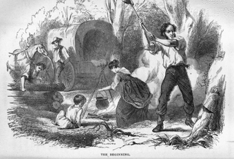
THE BEGINNING.
The most important and extensive timber territories of Canada are subjoined:
1st. The country drained by the Ottawa, containing an area of 75,000 square miles. The white pine, red pine, and ash are chiefly obtained from this region.
2nd. The St. Maurice and its tributaries, draining an area of 22,000 square miles. Contains large quantities of white, yellow and red pine, spruce, birch, maple, and elm.
3rd. The Saguenay country, area 21,000 square miles. Rich in white and red pine, spruce, birch, and tamarac.
4th. The north shore of Lake Huron. White and red pine, spruce, cedar, birch, and maple.
5th. The extensive Gaspé Peninsula. White and red pine, spruce, tamarac, and birch.
6th. The Peninsula of Canada West contains oak, elm, and walnut.
7th. The Ontario territory, north of Lake Ontario, still contains a large amount of white pine, elm, maple, &c.
Not less than twenty-five thousand persons are directly engaged in lumbering operations. Government works, technically called slides, have been constructed on the sides of the falls on the great rivers down which the lumber is floated from the interior. Farmers have followed the lumberers far beyond the frontiers of the settlements, in order to supply them with oats, potatoes, peas and hay; the lumberers are essentially the pioneers of civilization, and although they leave the marks of desolation behind them in their progress through the wilderness, these soon become obliterated, and the snug farm-house in the course of a few years occupies the site of the lumberer's rude log shanty, being the second stage of the transformation of the forest wilds into fruitful farms.
The amount of revenue accruing from timber dues and ground rent in 1861 was $327,503, and from slide dues $55,546, or a total of $383,050.
British American lumber is chiefly exported to the United Kingdom, but there can be no doubt that the trade is diminishing, while there is every prospect of an increased trade taking place between continental European ports and British America. Thirty years ago, one-third of all the British tonnage trading beyond the seas, or about 300,000 tons, navigated by 16,000 seamen, was engaged in the colonial timber trade. During the year 1830 out of 40,000 emigrants which arrived from Europe, more than 30,000 were carried out by the timber ships. During the four years between 1857 and 1860, both inclusive, the proportion of British North American lumber imported into the United Kingdom was in
| 1857 | 50 | per cent. of the whole. |
| 1858 | 48 | " |
| 1859 | 44 | " |
| 1860 | 45 | " |
Hence it appears that the average decrease in the imports of lumber from British North America to the United Kingdom, during the above period, is about 11½ per cent., while the increase on the imports of foreign lumber is nearly 10 per cent. During 1861 about twenty cargoes of Canadian lumber were exported to the continent of Europe, and numerous inquiries continue to be made respecting the timber resources of the country. So rapidly is the price of timber increasing in France that standing timber worth 50 francs per 35 cubic feet in 1852 was worth 100 francs five years later.
The industry to which the manufacture of the different products of the forest gives rise is very extensive. In 1851 there were 1,567 saw-mills in Upper Canada, and 1,065 in Lower Canada. The number of feet manufactured during the year amounted to 391,051,820 and 381,560,950 respectively. Since 1851 the quantity manufactured has no doubt increased enormously, but no data are at present published from which satisfactory conclusions can be drawn, although some conception of the magnitude of the trade may be formed from the fact that planks and boards to the value of $1,507,546 were exported to the United States in 1861, being not far from half the total production of Upper Canada ten years previously, although the trade had suffered to a remarkable extent in consequence of the calamitous civil war which is now wasting the energies of our brethren across the international boundary.
The exportation of planks and boards to the United States is one of the most important Canadian sources of prosperity as may be inferred from the following table.
| 1857. | 1858. | 1859. | 1860. | 1861. |
| $2,558,206 | $2,890,319 | $2,676,447 | $3,027,730 | $1,507,546. |
The sudden diminution from more than 3,000,000 in 1860 to 1,500,000 in 1861 results from a temporary depression occasioned by the civil war in which the United States are unhappily engaged.
The year 1845 was a most prosperous one for the lumber trade. The quantity of square timber brought to market that season amounted to 27,704,344 feet, and the quantity exported was 24,223,000 feet. In 1846 the quantity brought to the Quebec market rose to 37,300,643 feet, but only 24,242,689 feet were exported. Hence prices fell to a ruinous degree and a great blow was given to the trade during that year. In 1847 there was a stock supply of more than 44,000,000 feet to meet a demand for 19,000,000 and in 1848 a total supply of 39,000,000 to meet a demand for 17,000,000. Under such circumstances it is not to be wondered at that the timber trade became exceedingly depressed. The excitement of high prices has fostered over-production, and the diminished consumption of Canadian timber in Great Britain brought prices down to the lowest ebb. When the trade is in a prosperous condition the profits are sometimes excessive, speculation then ensues and ruin frequently follows. The character of the trade is changing as the timber groves become more remote, more capital being required to carry on lumbering operations on a profitable scale. Many lumberers now invest a considerable portion of their capital in clearing and cultivating farms in connection with their timber limits for the purpose of raising provender for their stock and food for their hands.
A glance at forest industry would be incomplete if we were not to note a contingency to which the timber trade is becoming more and more liable each year. One of the most destructive agents in the vast pine forests north of the St. Lawrence, is fire. Thousands of square miles of the forest timber have been ruined by this ruthless destroyer. Fires in the woods do not generally extend so far as one at the first blush supposes; they rarely go beyond thirty miles in length by ten in breadth, but it is the frequent occurrence of these fires which in the long run of years lays waste so much valuable property; and with the progress of the lumberers in the wilderness the chances of fresh conflagrations yearly become more imminent.
The produce of the forest of most importance next to lumber has always been pot and pearl ashes. Potashes are made from the crude ashes by dissolving the soluble salts with water, evaporating to dryness and fusing at a red heat into a compact mass, which although grey on the outside is pink colored within. Pearlash is made by calcining potashes upon a reverberatory hearth until the carbon and much of the sulphur is dissipated. Water is then added, and a lye formed, which, when evaporated to dryness, yields the pearlash of commerce. Canadian potashes contain on an average about 60 per cent. of carbonate of potassa. Pearlash contains generally about 50 per cent. of caustic potassa. The quantity of potashes obtained from the combustion of the trees or vegetables on a given area of ground depends altogether upon the species. Thus, while the pine yields only 0.45 per mille, the oak gives 1.53, the willow 2.85, elm and maple 3.90 per mille, or 39 per cent. The value of ashes, both pot and pearl, exported from Canada during the years 1859 to 1861 inclusive, was as follows—three-fourths going to the United Kingdom:
| 1859. | 1860. | 1861. | |
| Potashes | $769,512 | $741,473 | $705,228 |
| Pearlashes | 337,759 | 219,633 | 173,779 |
| Total, | $1,107,271 | $961,106 | $879,007 |
In addition to these staple productions of our forests, we have a growing trade in Canada balsam, turpentine, pitch, spruce gum, oil of spruce, oil of hemlock, hemlock bark, maple sugar, bark of the basswood, bark of the butternut, and of the hickory, sassafras, sumach, bark of the white oak, and of the slippery elm, besides the medicinal plants common to Canada and the northern States of the American Union.
Comparative Statement of the Produce of the Forest, from 1853 to 1861, inclusive:
| 1853, | $9,421,010 | 1858, | $9,284,514 | |
| 1854, | 9,981,367 | 1859, | 9,663,962 | |
| 1855, | 7,947,923 | 1860, | 11,012,253 | |
| 1856, | 10,019,883 | 1861, | 9,572,645 | |
| 1857, | 11,575,508 |
Very few years have elapsed since the produce of the forest formed the most important of Canadian exports, as the following comparison will show. Of late years, agriculture has asserted a superior claim and will no doubt maintain it:
| 1849. | 1850. | 1851. | |
| Value of the Products of the Forest exported, | $5,310,148 | $5,442,936 | $6,038,180 |
| Value of all other productions, | 4,000,108 | 5,237,056 | 5,260,340 |
| Balance in favor of Forests, | $1,310,040 | $205,880 | $777,840 |
| 1859. | 1860. | 1861. | |
| Value of Agricultural Productions exported, | $7,339,798 | $14,259,225 | $18,244,631 |
| Value of the Products of the Forest exported, | 9,663,962 | 11,012,253 | 9,572,645 |
| Balance in favor of Forests, | $2,324,164 | ||
| Balance in favor of Agriculture, | $3,247,972 | $8,671,986 |
A lumberer's life is full of that half-wild excitement which belongs to the wilderness, and few who have engaged in this apparently laborious and at times dangerous industry are willing to relinquish it for the tamer pursuits of the farm. When anyone intends to "make timber," as it is technically called,—that is, to cut and bring lumber to market,—the first operation is to take a "limit," and having thoroughly explored it and laid out roads to the most convenient water-course or "drivable" creek, he engages his men, either for cutting the timber, or for cutting the timber and the "drive" (or from the time of commencing operations to the period when it is brought to Quebec or any other convenient port.) A "grove of pine" having been found and rough roads cut or laid out if necessary, the operation of making the timber commences. The hands are divided into gangs, which generally consist of four or more cutters who fell the trees and bark them for the liner. The liner marks the tree for the "scorers," who block it off,—that is, cut off branches, knots, &c. The broad-ax man follows, who squares and finishes the "pieces." During the winter, when the snow lies sufficiently deep on the ground, each piece is hauled by a yoke of oxen or a pair of horses to the bank of the drive, where the timber is piled on or near the roll-way until the return of spring melts the frozen creek and the waters rise to a convenient "driving condition." A lumber "shanty" generally contains three or four gangs, headed by a foreman whose duty it is to call the men up in the morning, lay off their work, take their time, and superintend operations generally. The broad-ax man makes each night a return of the quantity of timber made during the day. When the rivers are in suitable driving condition, the most perilous and laborious part of lumbering operations begins. The pieces are pushed into the stream and floated down to its junction with the main river, where they are retained by a temporary boom. When the tributary streams on which the lumber is made are narrow, it is a matter of some difficulty to accomplish the drive, and the men are often exposed for weeks together to all the inconveniences and dangers which attend frequent wading through in cold water. Jams not unfrequently occur at the bends of the stream or above falls, and the utmost caution is necessary in removing the obstruction which retains the confused mass of pieces, apparently involved in inextricable confusion. The cutting away of a single stick or piece is often sufficient to set the accumulated mass in motion, and accidents of a fatal description are not unfrequent in endeavoring to loosen a "jam." The main river once reached, a number of pieces are fastened together by means of withes, and formed into a raft, which slowly floats down the river towards a sea or lake port. The great distance up the tributaries of the large rivers draining a timber territory to which the lumberers have penetrated, often causes the drive to occupy from two to three months. An idea of the immense distance from which lumber is now brought may be obtained when it is known that the lumberers traveling up the tributaries of the Ottawa are now meeting those who have ascended the rivers flowing into Lake Huron; and the broad height of land which sends waters to the St. Lawrence by the tributaries of the Ottawa, to Lake Ontario by the Trent, and to Lake Huron by the Muskoka and other rivers, resounds with the ax and shout of lumbermen who have reached the same spot by traversing the rivers draining three different water-sheds, after clearing the country of all timber groves conveniently situated for driving.
Beyond the dividing ridge which separates the waters flowing into Lake Superior from those which take a north-westerly and then northerly direction towards Hudson's Bay, lies the Great Inland Basin of Lake Winnipeg, occupying a very considerable extent of the North American continent, and forming part of the British possessions known as the North-West Territory, or Rupert's Land.
The Basin of Lake Winnipeg extends from the 90th to the 118th meridian. Its most easterly margin lies on the boundary of Canada, west of Lake Superior, in long. 90° 14′, lat. 48° 53′, being the head waters of Savanne River, a remote tributary of the Winnipeg. The most westerly limit of this vast basin is the Glacier, near Howse' Pass, in long. 117° 35′, lat. 51° 52′, from which a branch of the Saskatchewan takes its rise. The southern extension of its boundary is Lake Traverse, in Dakotah territory, long. 96° 43′, lat. 45° 58′. It stretches north as far as Frog Portage, long. 103° 30′, lat 55° 26′. This Basin consequently extends over 28 degrees of longitude and 10 degrees of latitude. The elevation of its eastern boundary is 1,485 feet above the ocean, and the height of land near the sources of the tributary which rises farthest to the west is 6,347 feet above the same level. Its northern boundary is separated from the valley of the Mississippi by a low portage over which waters flow during floods, while towards the south, Lake Traverse, which also sends water into the Mississippi during spring freshets, is only 820 feet above the sea. The outlet of Lake Winnipeg is through the contracted and rocky channel of Nelson River, which flows into Hudson's Bay. The mean breadth of the Basin of Lake Winnipeg is about 380 English miles, and its mean length 920 miles, hence its area is approximately 360,000 square miles, or about as large as the Province of Canada.
Lake Winnipeg is 628 feet above the sea, and, with Lakes Manitobah, Winnipegosis, and Dauphin, covers an area exceeding 13,000 square miles, or about half as much as Ireland. The country possessing a mean elevation of one hundred feet above Lake Winnipeg is well marked by an ancient lake ridge called Pembina Mountain, and may contain 70,000 square miles, nine-tenths of which are lake, marsh or surface rock of Silurian or Devonian age, and generally so thinly covered with soil, with the exception of that part of the valleys of Red River and the Assiniboine which lie within it, as to be unfit for cultivation, except in small detached areas.
Succeeding the low regions there are the narrow terraces of the Pembina Mountain, which rise in abrupt steps, except where cut by the broad valleys of rivers, to the level of a higher plateau, whose eastern limit is formed by the precipitous escarpments of the Riding, Duck, and Porcupine Mountains, with detached outlines, Turtle, Thunder, and Pasquia Mountains. This is the great Prairie Plateau of Rupert's Land; it is bounded towards the south-west and west by the Grand Coteau du Missouri, which forms the north-eastern limit of the Plains of the north-west. The area of the Prairie Plateau is about 120,000 square miles; it possesses a mean elevation of 1,100 feet above the sea, and consists of cretaceous rocks, overlaid in some parts with tertiary formations. The Riding and Duck Mountains, 1,600 feet above the ocean, no doubt once formed part of an unbroken level to the Grand Coteau, the intervening depression having been the result of denudation. The isolated range of hills, such as the Touchwood Hills, the File Hill, the Pleasant Hill, the Birch Hill, &c., are parts of this former elevated table-land, and would assume the character of islands in a sea washing the base of the Grand Coteau du Missouri. The Great Plains rise gently as the Rocky Mountains are approached, and at their western limit have an altitude of 4,000 feet above the sea level. With only a very narrow belt of intervening country, the mountains rise abruptly from the Plains, and present lofty precipices, frowning like battlements over the level country to the eastward and separating the rich golden treasures of British Columbia from the wide sterile wastes of the South Saskatchewan or the long and narrow fertile belt through which the North Saskatchewan pursues its winding course of nearly one thousand miles. The average altitude of the highest part of the Rocky Mountains is 12,000 feet; in lat. 51°, the forest extends to the altitude of 7,000 feet; or 2,000 feet above the Vermilion Pass. The "Fertile Belt" of the North-West consists of the richest arable soil, partly in the form of open prairie, partly covered with groves of aspen; it stretches from the Lake of the Woods to the foot of the Rocky Mountains, about 800 miles, and averages from 80 to 100 miles in breadth. The North Saskatchewan flows through this Fertile Belt, in a valley varying from one-fourth of a mile to one mile in breadth, and excavated to the depth of 200 to 300 feet below the level of the plains or prairie through which it flows, until it reaches the low country some miles east of Fort à la Corne. The area of this remarkable strip of rich soil and pasturage is about 40,000,000 acres. It was formerly a wooded country, but by successive fires it has been partially cleared of its forest growth, but abounds with the most luxuriant herbage, and generally possesses a deep, rich soil of vegetable mould. The winter of this region is not more severe than that of Lower Canada. The snow is never very deep, and in the wildest tracts the natural pasture is so abundant that horses and cattle may be left to obtain their own food during the greater part of the winter. This perennial supply of food for cattle might have been predicted from the fact that the North Saskatchewan west of Carlton supports vast herds of buffalo during the winter season, and formerly the whole of the fertile belt used to be the favorite winter quarters of countless herds who fattened on the rich abundance of the natural grasses, scraping the snow away with their feet, and never failing to obtain abundance of well preserved hay beneath. The Fertile Belt of the North Saskatchewan valley does not derive its importance from the bare fact that it contains 64,000 square miles of country immediately available for agricultural purposes in one continuous strip, 800 miles long and 80 broad, stretching across the continent; it is rather by contrast with an immense sub-arctic area to the north and a vast desert area to the south that this favored "Edge of the Woods" country acquires political and commercial importance. A broad agricultural region, capable of sustaining many millions of people, and abundantly supplied with iron ore and an inferior variety of coal, and spanning the eight hundred miles which separate Lake Winnipeg from the Rocky Mountains, more than compensates for the rocky character of the timbered desert between the Lake of the Woods and Lake Superior. The South Saskatchewan flows through an arid district which reaches as far north as lat. 52. The stiff clays of the cretaceous and tertiary deposits, often highly impregnated with salts, bakes into a hard and cracked surface during the summer. The characteristic plants of the arid region are the pretty prairie apples (Opuntia) and the shrub sage (Artemisia.) Within the fertile belt the alluvial flats of the river valleys are clothed with the balsam poplar and a dense thicket of willows, dogwood, amelanchier, and red willow, together with Shepherdia argentea. On the prairies of the Belt the aspen occurs in groves, and dense thickets of willows surround marshes and swamps. On the sides of the rising grounds the Elæagnus argentea forms a low silvery copse, affording food to large coveys of prairie grouse. On high ground, with a sandy soil, the bear-berry or kin-i-kinic forms a close matting. Towards the Rocky Mountains large expanses of plain are covered with a low birch or alder six to eight inches high, which in winter gives the appearance of a heather-covered moorland to these prairies. In June and July the prairies are covered with brightly colored flowers, or completely clothed with a dense copse of rose bushes and in many places of snow-berry. As the country towards the south merges into open prairies, the clumps of copse and young poplars are found only on northern exposures. The last outliers of the woods to the south form "Islands;" which make a great show in the distance, but when approached are found to consist of a small species of willow, that will yield neither fire-wood nor shelter.[3] The whole of the Fertile Belt is well fitted for settlement and agricultural colonization. All common cereals and green crops have been grown successfully at the different posts of the Hudson Bay Company within this district.
The recent discoveries of gold in British Columbia have given extraordinary importance to that colony, and to the great Fertile Belt of the Saskatchewan valley in view of a high road across the continent. During the season of navigation the facilities for reaching any part of Lake Superior are such that a vessel from Liverpool, of a capacity fitted to go through the locks of the Welland Canal, may discharge her cargo at Fort William or any port on this vast inland sea without breaking bulk. The next step in an overland communication to British Columbia is from Lake Superior to the settlement on Red River. The water parting is not more than 890 feet above Lake Superior, and the country is thickly wooded with valuable trees as far as the Lake of the Woods. There does not exist any difficulty in the construction of a road between Thunder Bay and the most easterly indent of Rainy Lake, a distance of 200 miles. Between Rainy Lake and the north-west angle of the Lake of the Woods, the country in rear of Rainy river, a distance of 120 miles, is unexplored, and its facilities for a direct land communication unknown. From the north-west angle of the Lake of the Woods to Fort Garry, 90 miles, is a level country, which has already been traveled by horses, although the swamps near Lac Plat are formidable. The third step is the valley of the Saskatchewan, already described, which, even in its present state is constantly traversed with horses and carts from Red River to the Rocky Mountains. The following are the altitudes of the principal passes in the mountains above the sea level:
| Altitude in Feet. | |
| Kicking Horse Pass, lat. 51° 25′, | 5,420 |
| Vermilion Pass, lat. 51° 10′, | 4,944 |
| Kananaski Pass, lat. 50° 40′, | 5,985 |
| Kootanie Pass, lat. 49° 25′, | 6,000 |
The height of land not 5,000 feet above the sea on the line of the Vermilion Pass once crossed, the auriferous terraces of British Columbia come into view. The Cariboo and Kootanie diggings are both on the immediate west flank of the Rocky Mountain range, or between 400 and 500 miles from the Pacific coast. The whole valley of the upper Columbia is auriferous, and gold has been found on the eastern slope, two hundred miles from the mountains, in the bed of the Saskatchewan, but it is not probable that the auriferous region on the east of the mountain is of great extent, as the ancient rocks from which the gold must have been derived have not been observed on that side. A great future lies before the valley of the Saskatchewan; it will become the granary of British Columbia, the vast pasture field by which the mining industry of the Rocky Mountains will be fed. British Columbia is rich in the precious metals, but poor in arable land; the Fertile Belt of the Saskatchewan is marvelously fruitful in forage plants, possesses an admirable soil, and embraces besides an immense supply of coal and iron ore of the best quality. With these conditions, added to a very healthy climate, it is not too much to expect that the Basin of Lake Winnipeg will one day become the seat of an industrious, prosperous, and powerful people, who, in these days of steam, will always be able to communicate with the outer world for two months in the year, at least, by way of Hudson Bay, even if other outlets should be closed against them through unhappy international troubles.[4]
The vast peninsula which commonly bears the name of Labrador, a term more correctly applied to the north-eastern portion, occupies an area between the Atlantic and Hudson's Bay, lying within the forty-ninth and sixty-third parallels, and between the fifty-fifth and seventy-ninth meridians. The Gulf of St. Lawrence, the North Atlantic, Hudson's Straits and Hudson's Bay are its boundaries on three sides; Rupert's River, the Mistassinni and the Bersiamits rivers may be considered as forming the approximate south-western limits of this peninsula. From the mouth of Rupert's River on Hudson's Bay to the mouth of the Bersiamits on the St. Lawrence, the distance is about 470 miles, and from Cape Wolstenholme, the most northern point of the country to the Straits of Belle Isle, it is 1,100 miles. Traveling northward from the Hudson Bay Company's post at Bersiamits, in a direct line to Ungava Bay, the distance would be about 650 miles, while to Cape Wolstenholme to the west, not less than one thousand. The area of the Labrador Peninsula is approximately 42,000 square miles, or equal to the British Isles, France, and Prussia combined, and the greater portion of it lies between the same parallels of latitude as Great Britain.
The whole of this immense country is uninhabited by civilized man, with the exception of a few settlements on the St. Lawrence and the Atlantic coast, and some widely separated posts of the Hudson's Bay Company. It is very thinly peopled by nomadic bands of Montagnais, Nasquapee and Mistassinni Indians, and the northern coast by wandering Esquimaux. Taken as a whole it is a region altogether unfit for the abode of civilized man, and although once rich in fur-bearing animals, and in cariboo or reindeer, it is now almost a desert.
In the absence of any definite boundaries, the entire peninsula is divided into three parts, supposed to be separate water-sheds, to which special names have been given. The area draining into the River and Gulf of St. Lawrence, belongs to Canada, whose eastern boundary is at Blanc Sablon, near the mouth of the North-West River. The country supposed to be drained by rivers which flow into the Atlantic is called Labrador, and is under the jurisdiction of Newfoundland. The remaining part of the peninsula, which is drained by rivers flowing into Hudson's Bay, has received the designation of the East Main. The names and position of the mouths only of the numerous rivers which flow into the Gulf of St. Lawrence, from the Bay of Seven Islands to the Straits of Belle Isle, are correctly given in published maps of the country, and nearly the whole of our present knowledge of the east side of the Labrador Peninsula is derived from Capt. Bayfield's surveys, which are limited to the coast, and no map yet published exhibits a correct geographical picture of the interior of the country.
The Moisic or Miste-shipu River, the "Great River" of the Montagnais Indians, enters the Gulf of St. Lawrence in longitude 66° 10′, and has its sources in some of the lakes and swamps of the high table-lands of Eastern Canada. For centuries it has been one of the leading lines of communication from the interior to the coast, traveled by the Montagnais during the time when they were a numerous and powerful people, capable of congregating upwards of a thousand warriors to repel the invasion of the Esquimaux, who were accustomed to hunt for a few weeks during the summer months a short distance up the rivers east of the Moisic, as they do now on the Coppermine, Anderson's and Mackenzie's rivers in the country of the Hare Indians, and the Loucheux. The old and well-worn portage paths round falls and rapids and over precipitous mountains on the upper Moisic, testify to the antiquity of the route, independently of the traditions of the Indians who now hunt on the river and on the table-land to which it is the highway.
The Montagnais Indians have for centuries had a water communication between Seven Islands on the Gulf and Hamilton Inlet on the Atlantic Ocean, viâ the Moisic, the Ash-wa-nipi to a great lake on the table-land in the interior called Petshikupan, thence by the Hamilton River to the Inlet of the same name. The whole river may be known by the name of the Ashwanipi, which takes its rise near the head waters of the Moisic, and from which it is separated by a low and narrow water parting. The Ashwanipi flows through five degrees of longitude, and little more than two degrees of latitude, traversing the elevated table-land of the Peninsula in a direction roughly parallel to the Gulf coast. The table-land is 2,240 feet above the ocean at the sources of the east branch of the Moisic. It is pre-eminently sterile, and where the country is not burned, cariboo moss covers the rocks, with stunted spruce, birch and aspen in the hollows and deep ravines. The whole of the table-land is strewed with an infinite number of boulders, sometimes three and four deep; these singular erratics are perched on the summit of every mountain and hill, often on the edges of cliffs, and they vary in size from one foot to twenty feet in diameter. Language fails to paint the awful desolation of the table-land of the Labrador Peninsula.[5]
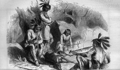
THE ABORIGINES
All tribes of Indians from the Red River of the North to the Atlantic coast of Labrador, draw a considerable share of their support from the lakes and rivers, by means of the fish-spear or "negog" of the Montagnais of the Gulf of St. Lawrence. But spearing any kind of fish during the daytime is a tame and monotonous occupation compared with the irrepressible excitement which attends spearing salmon by torch-light, with Indians who understand their work. It unfolds the real character of the Indian race in its most striking peculiarities; it displays untutored man in the full strength of his natural gifts, expresses his capabilities for intense enjoyment, and shows how he may be roused to exert for hours together the utmost activity of body and the greatest presence of mind.
See how gently they step into their canoe in the gloom of the evening just passing into night. They whisper to one another, although there is no fear of the sound of their voices disturbing the prey of which they are in search. Watch the one in the bow trying the flexible clasping tines of his "negog" or salmon-spear, springing them backward to see if they have lost their elasticity, or if they can be trusted to hold a powerful fish in their grasp; how he straightens the long and slender shaft and lays it tenderly under the bars of the canoe within reach of his hand. He next examines the rolls of birch-bark which he will use for torches, and fastens a cleft stick to the bow of his canoe, in which he will insert one extremity of the flaming roll. Turning round to ask his companion if he has "fire," he receives a low grunt in reply, which is followed by a subdued howh! howh! and both grasping their paddles, away the canoe glides towards the foot of the rapids, to a well known shallow, or close to the tumbling waters of a cataract where the fish are known to lie.
The torch is lit, and the spearman relinquishing his paddle stands in the bow of the canoe, glancing eagerly from side to side. Suddenly he pushes his spear in a slanting direction, and quickly draws it back, lifting a salmon into the canoe; a second push and another victim; now he attaches a thin line of sinew to his spear and twines it round his arm. Like an arrow he darts his spear; it is whirled away with a sudden jerk, and trembles in the stream; he gently but steadily draws it towards him with the line of sinew, and grasping it when within reach, lifts his quarry into the canoe. Look over the side of the little craft, the salmon are seen coming to the light, they gaze for a moment and glide away like spectres into the black waters; some of them swim round the canoe, and come to look again and again, pausing but for a moment to speculate upon its brightness, and the next lie quivering at the bottom of the canoe.
Both Indians at the same moment see a fish of unusual size approach the light, gaze without stopping and quickly move off, hover about at some little distance, suspicious and distrustful, but still attracted by the light. Gently and noiselessly the canoe is urged toward him by the Indian in the stern, no words pass between him and his companion, both saw the fish at the same moment and both know that they will take him. But look at the Indian with the spear, look at his face illumined by the red flare of the burning torch; his mouth is half open with suspense, but he does not breathe through it, his dilated eyes are flashing intent, he stands so motionless, with uplifted spear ready to strike, that he looks like a statue of bronze. But there is life in that expanding and contracting nostril, life in the two thin streams of vapor which puff from his nostrils into the keen night air; and is there not sudden and vigorous life in that swift dart of the spear, those parting lips closing together in unison with the fling of his arm? is there not intelligent life in that momentary light which flashes from his eyes, red like the gleams which they reflect, and in that smile, triumphant and assured, which he throws at his companion, as, without uttering a word or sound, he lifts with both hands the heavy fish straight from the water, holds it struggling over the canoe, and shakes it from his spear? Is this the languid, drowsy savage which you have often seen slouching through the day, indolent and listless, a sluggard and a drone?
They go to the foot of the cataract; the largest fish lie there in little eddies close to the rocks, waiting for an opportunity to take their leap up the tumbling waters, to sheltered parts above, where they may rest in their difficult ascent. Now is the full measure of the Indian's skill required; the broken water at the edge of the main rapid at the foot of the cataract rocks the canoe, and would seem to destroy the spearer's aim; the water is deep, and he must throw his weapon, he cannot push it as in the shallows or a quiet stream. The Indian who is steering and paddling must beware of strong eddies, of whirlpools, of getting under the cataract, or of sidling into the rapid below. He must have his eye on the canoe, the water, and the salmon, and his hand ready at any moment to edge off from danger and never give way to momentary excitement, even when the spear is thrown, and a heavy fish struck,—the rocks, the impetuous torrent, the tumbling waters at his bow, the flickering light not always to be relied on, must be watched, for a slight change in an eddy may swamp the fragile craft, or break it on a rock.
There is indescribable excitement in the dancing motion at the foot of a cataract, in a tiny birch-bark canoe, by the red light of a torch during a night without a moon. You see before you a wall of water, red, green and white tumbling incessantly at your feet, on either hand you gaze on a wall of rock, rising so high as to be lost in the gloom and apparently blending with the sky. You look behind and there is a foaming torrent rushing into the blackness of night, sweeping past the eddy in which your birch craft is lightly dancing to the loud music of a water-fall. No sound but its never-ceasing din can reach you; no near object meets your eye which does not reflect a red glare and assume an unaccustomed character which the warm and cheery color imparts. Suddenly the torch falls and is instantly extinguished in the rushing waters; absolute darkness envelopes you, the white foam, the changing green of the falling water, the red reflected light of the broken waves, all become uniformly and absolutely black. Nothing whatever is discernible to the eye, but perhaps another sense tells of swift undulating motion, a rolling ride over stormy waves, with lessening roar. Your eyes gradually recover their power of vision, and you find yourself either swaying up and down in the same eddy or far away from the fall on the main channel of the river, secure against whirlpools and rocks, with the Indians quietly paddling the canoe and about to turn again to resume their savage sport. The moment the light fell into the water, an event which often occurs with birch-bark torches, the Indian at the stern decided whether to remain in the eddy, or to enter the rapid and descend it until his power of vision was restored. This is a contingency for which all salmon-spearers in such situations must be prepared. Indecision might prove fatal; for if the eddy were safe in absolute darkness for a quarter of a minute, it would be wise to remain; if there is danger of being sucked under the fall, it would be well to seek refuge from a sudden deluge, or from rocks and whirlpools in the swift but tumultuous rapid. This can only occur on a large river, and at the foot of a fall. Water in rapid motion is a terrible power, and none know how to take advantage of its humors better than the wild Indian salmon-spearer, who avoids its dangers with matchless skill and self-possession, and who seeks the excitement it offers as if it were the mainspring of his life, or the aim of his existence.
From the earliest period when the fur trade was prosecuted with vigor in British America, those wanderers through the woods, the Coureurs du Bois, with their descendants, the Bois brules, or Half-breeds, have always occupied a prominent position on the frontiers of civilization, and latterly among many of the nomadic Indian tribes which peopled and still occupy the vast north-west territory. Life in the wilderness has not only peculiar charms to these children of the forest and the prairies, but it annually wins for months or for years many who have been brought up and educated in all the refinements of civilized society. It is difficult to say wherein lies the greatest charm of the wilderness of British America, within the limits of the valley of the St. Lawrence, or the valley of the Saskatchewan. Rocks, mountains, foaming torrents, magnificent cataracts, and endless forests distinguish the St. Lawrence. Boundless prairies, sweet-scented breezes, and gorgeous sunsets are the characteristics of the Saskatchewan. In summer the prairies are perhaps to be preferred, in winter the woods. The falls and rapids of the rivers flowing into the St. Lawrence to the east, or ultimately into Lake Winnipeg on the west, often present the wildest and most picturesque scenery, displaying every variety of tumultuous cascade, precipitous cliffs, deep gorges, treacherous and sullen eddies, huge swelling waves, rising massive and green over hidden rocks, or quiet and tranquil rivers gliding into lakes. Viewed under different aspects they convey all variety of impressions to the mind, cold and cheerless in the gray dawn of morning, pleasing and encouraging as they flash in the brightness of noonday, or melancholy and depressing as they silently glitter in the silver light of the moon. Few enjoyments can equal a bright camp-fire after a hard day's work in canoes, and no sleep is like the sleep of the toil-worn voyager, on the pine or spruce branches he spreads for his couch, beneath the cold, clear sky of autumn in the gloom of Lawrentian forests.
The dawn of morning when journeying through the wide and wild rocky ridge which separates the valley of the St. Lawrence from that of the Winnipeg, possesses scenes and associations which belong to itself. Rising from a bed on the hard rock, softened by a few spruce boughs and a north blanket, the paling stars and the cold, yellow light in the east first tell that the night is passed. On the lake a river by which the camp is made a dense screen of fog rests like a pall. A sudden rush through the underbrush tells of a poor mink or martin prowling close by, probably attracted by the fragments of last night's meal. From the dying camp-fires a thin column of smoke rises high above the trees or spreads lakewards to join the damp, misty veil which hides the waters from view. Around the fires are silent forms, stretched like shrouded corpses at full length on the bare earth, or on spruce branches neatly laid. These are Indians; they lie motionless on their backs completely enveloped in their blankets. Beneath upturned canoes, or lying like the Indians with their feet to the fire, the half-breeds, or the French Canadian voyageurs, lay in wild disarray. All is repose; the silence is almost oppressive, broken at intervals only by the dull noise of a waterfall borne on the gentle breath which springs up imperceptibly with the rising sun. As the morning advances an Indian awakes, uncovers his face, sits on his haunches, and looks around from beneath the folds of his blanket which he has drawn over his head. After a few minutes have thus passed, not observing his companions show any signs of waking or any disposition to rise, he utters a low "waugh;" slowly other forms unroll themselves, sit on their haunches and look around in silence. Soon the half-breeds or voyageurs are aroused, the dying embers of the fire blown into a flame, a few sticks of fresh wood added, pipes lit, and the day's work begins. The canoes are soon launched and the baggage stowed away; the party embark and plunge into the mist, while no sound but the measured stroke of the paddle meets the ear. The sun begins to glimmer above the horizon, the fog clears slowly away, a loon or a flock of ducks fly wildly across the bow of the canoe, the Indians shout at the frightened birds, or imitate their cry with wonderful accuracy, the guide calls a halt, pipes are replenished, and the cheerful sunlight gilding the top of distant trees brightens, warms, and enlivens all animate and inanimate things. The day wears on and the breakfast hour arrives, a short hunt in the woods for rabbits, or in a neighboring lake or marsh for ducks, rapidly passes the time. As soon as the meal is finished, all embark again. The voyageurs and half-breeds sing their merry French songs, or the Indians chant the war-songs of their forefathers, keeping time to the regular stroke of the paddles. The banks of the river are closely scanned in search of game, and the fresh track of a bear, a moose, a cariboo, or a deer a wakens all the hunter's sympathies, as with suppressed voices they discuss the number of hours which have elapsed since the track was made. Supper is the time for enjoyment, as lazily lolling round the camp-fires the men, pipe in mouth, listen to tales of forest life, incident of the chase, hair-breadth escapes, and distant Indian wars.
Dogs, carioles, sledges and snow-shoes, are required for a winter journey in the prairies as well as in the woods, but in consequence of the greater degree of cold in an open expanse of country, the difficulty of procuring fire-wood and the scarcity of game, winter traveling in the prairies is far from being so pleasant as in thick woods where a good track can be made. Each dog requires daily about two pounds of pemmican or three pounds of white-fish, so that the provisions for a train of carioles employing thirty dogs would involve the carriage of 600 pounds of pemmican or 900 pounds of white-fish for a ten days' journey. A train of three dogs will draw 300 pounds forty miles a day for ten or twelve days in succession, if well fed, and the road is tolerably good over a level country. A winter road, it may be here remarked, is nothing more than a cariole or sledge track caused by the passage of this primitive kind of vehicle over the snow, and is liable to be obliterated by every fresh fall. A cariole is constructed of a very thin board ten feet long and twelve or fourteen inches broad, turned up at one end in the form of half a circle, like the bow of an Ojibway canoe. To this board a high cradle, like the body of a small carriage, is attached, about eighteen inches from the end of the board or floor. The framework is covered with buffalo skin parchment, and painted or decorated according to taste. The inside is lined with a blanket or buffalo robe, and when the traveler is seated in his cariole, with outstretched legs, he is only separated from the snow by the thin plank which forms the floor. A sledge is nothing more than a thin board ten or twelve feet long, twelve inches broad, and turned up at one end. The baggage is attached to it by means of buffalo thongs, and two or three dogs are harnessed to this simple vehicle with the same materials. The dogs attached to a cariole are generally decorated with collars, from which beadwork and tassels are suspended together with a string of small bells. When a train is in motion the driver runs behind the cariole or sledge, guiding it by means of a loop fastened to each corner of the floor; when tired or anxious to ride he sits on the small box containing the traveler's baggage, which is fastened to the projecting board.
A camp is always made in "woods," if possible, for the sake of fuel and shelter. The first operation is to sweep the snow from the ground, and prepare a place for the fire and blankets. This is easily accomplished with snow-shoes, and as soon as an area proportioned to the size of the party is prepared, a fire is made sufficiently long to admit of each man lying for the night with his feet towards it. No tent or covering of any description beyond a blanket stretched on poles is admissible, as it would scarcely be possible to fold canvas in the morning, and time does not generally allow of the erection of a hut, nor are the materials always at hand. When pine or spruce is accessible, a very comfortable floor can be made from the boughs, but in the prairie country or on its borders these useful trees are rarely to be seen.
The appearance of the camp during the night, when all are buried in profound slumber, is very wild and savage. Throwing a few dry sticks into the fire to light up the scene, the silent, slumbering forms of the travelers are seen stretched in two parallel rows with their feet to the fire; between the men, one, two, and sometimes three huge dogs have crept; some are lying on the legs of the half-breeds for the sake of warmth, others have found a snug berth close to the fire but in imminent danger of burning their fur, a few lie coiled outside of the circle half-buried in the snow. The cold is so intense that their faces are white with frozen breath, and scarcely distinguishable. The fire, even when in full glow, has not power to melt the snow more than a few inches from it, without it is exposed to direct and prolonged radiation. Now and then a watchful dog raises his head, probably disturbed by some slight movement of the sleepers; he looks once round and buries his face again. Sometimes a dog will utter a low warning growl, when three or four other dogs, probably old stagers, will rouse themselves for an instant, listen and growl, generally all looking in one direction and snuffing the air. A half-breed sits up, looks at the dogs, observes their mien and actions, and after a moment's pause, uttering the word "wolves," he quickly coils himself under his blanket again.
The most disagreeable part of the daily routine of a long winter's journey is the catching and harnessing of the dogs. Some of these animals at the beginning of winter, when fresh at their work for the season, are exceedingly restive under coercion of any description, and not unfrequently snap at their masters, who invariably arm themselves with very strong mittens of buffalo or deer hide when harnessing a savage and powerful animal. They require long-continued and most severe punishment to make them obedient to the word of command. An Esquimaux whip is the instrument which every driver should be compelled to use, but the half-breeds trust to sticks and stones, or any object within reach on the road, which is picked up as they pass and thrown at the dogs. It is painful to witness the sudden start of terror with which each animal, looking over his shoulder as he trots along, watches the mien and motions of the driver as he poises the stick, which he knows how to throw with certain dexterity at the terrified animals. All the dogs give a simultaneous jump on one side as the missile flies past them, when directed to the leader of the train; and not unfrequently would the cariole be overturned if it were not for the strength and the skill of the driver in holding the loop with which he steers it. When this occurrence takes place and the dogs are at full speed, the only plan left for the helpless traveler is to draw his arms close to his sides, and wait until the cariole is righted by the driver; but any attempt to right the cariole by putting out an arm is a dangerous operation, which might occasion a broken limb. In descending steep hills, it is always advisable to walk or run, which all would prefer for the sake of exercise, except when the road is very good, and the trains can proceed for many miles at a gallop without fatigue.
A heavy snow-storm is a serious matter in the prairie. It is then absolutely necessary for all the trains to keep close together; the drifting snow soon obliterates the tracks; and, although the dogs with their exquisite noses will follow the tracks of the leading cariole even when completely hidden from view by a light fall, yet when drifts accumulate they are at fault.
Preparing to camp in a snow-storm is not an agreeable operation, or suggestive of that comfort and safety which a camp almost always presents. When the fire is well lighted, supper cooked and eaten, and the party "turned in," then it does not matter much how heavily it snows, the trouble being reserved for the following day. After a heavy fall during the night, men, dogs, carioles, and sledges are all covered with a thick mantle of pure white; a sudden shout from the guide enlivens many of the apparently lifeless forms, recognized only by their outline; but some of the sagacious dogs take advantage of the concealment afforded by the snow, and, quite neglectful of the whistles and shouts of their masters, "lie close."
|
See Dr. James Hector on the Physical Features of the central part of British North America. |
|
See "Narrative of the Canadian Expeditions in Rupert's Land," by the author of this article. |
|
See "Explorations in the Interior of the Labrador Peninsula" by the author of this article. |
Canada has hitherto been signally unfortunate in her different seats of government, in the buildings appropriated to public departments, and in the residences of her governors. Quebec, Montreal, Kingston, and Toronto have each in turn been the capital of the province. Ottawa has not yet been tried; but there is good ground for the expectation and hope that the selection of Her Majesty the Queen will be found conducive to the best interests of the province, whatever may be the disappointment felt by cities which had a history before Ottawa was in existence or even the great river from which it derives its name thoroughly explored.
The Ottawa rises near the forty-ninth parallel of latitude in longitude 76° W. It is about 780 miles long, and 300 miles from its source it passes through Lake Temiscaming, 67 miles long. Above this lake the country drained by the Ottawa is little known; but below it, for a distance of 430 miles, the river has been surveyed. Montreal River, the canoe route to Hudson Bay, comes in from the north-west, 34 miles down Lake Temiscaming, and, six miles lower down, the great and almost unknown river Keepawa plunges into the lake in a magnificent cascade 120 feet in height. From the long sault at the foot of Lake Temiscaming, 233 miles above the city of Ottawa, the river is not navigable for a distance of 89 miles, except for canoes. Between the last-named point and Ottawa, a distance of 197 miles, numerous tributaries swell its waters, and one of these, the Matawan, coming from the west, is of especial interest at the present time, in consequence of its being on the line of the proposed ship-canal route between the Ottawa River and Lake Huron. Above the Upper Allumette Lake there is a navigable reach of water 43 miles in length. The mountains above Allumette Lake are upward of 1,000 feet in height, and the scenery is magnificent. The mountains on the north side of Colongue Lake are 1,500 feet high, and the scenery grand and beautiful. The Petewawa, one of the largest tributaries, 140 miles long, drains an area of 2,200 square miles; the Black River drains 1,120 square miles; and, 39 miles above Ottawa City, the Madawaska, one of its greatest feeders, and 210 miles long, drains 4,100 square miles. Six miles above Ottawa the rapids begin which terminate in the celebrated Chaudière Falls, whose tumultuous waters plunge 40 feet and partly disappear in the "Lost Chaudière" by an underground passage whose subsequent outlet is unknown. At Ottawa the great river receives the Rideau, distinguished on account of its canal which connects the city of Ottawa with Lake Ontario at Kingston. Its largest tributary, the Gatineau, with a coarse of 420 miles, comes in from the north, and drains 12,000 square miles of territory. Eighteen miles below Ottawa is the Rivière du Lièvre, draining an area of 4,100 square miles; below this river there are numerous tributaries varying from 90 to 160 miles in length. The rapids below Ottawa are avoided by a succession of canals. One hundred and thirty miles below the future capital of the province the Ottawa's waters mingle with those of the St. Lawrence, and for many miles their yellow, turbid stream can be seen quietly gliding by the side of the blue waters of the St. Lawrence, soon to become blended in their onward course to the sea.
The valley drained by the Ottawa is 80,000 square miles in area, for the most part covered with valuable woods, particularly red and white pine; it is abundantly intersected with large rivers, and contains a very considerable area of the best soil. The country is generally beautiful and undulating behind what has been called the red-pine region, and sustains a growth of maple, beech, birch, and elm. No region of equal extent enjoys so much excellent water-power with such ample supplies of timber and minerals to work up, or to apply to any kind of manufacture to which water-power is applicable. It is a region rich in iron, lead, plumbago, marbles, ochres, and copper. The valley of the beautiful and bountiful river is capable of maintaining without difficulty twice the entire present population of Canada, or more than 6,000,000 souls. Such is the region in which the future capital of this vast province is situated, and where its government will be established. The city of Ottawa was founded by Colonel By, in 1827, at the time of the construction of the Rideau Canal. It is situated a little below the beautiful and curious falls of the Chaudière, and stands upon a high and bold eminence surrounding a deep bay. Lord Sydenham recommended Bytown (now Ottawa) as a very favorable situation for the seat of Government of Canada. In 1850 the population was 6,016; but, in consequence of its being the seat of the lumber trade, its inhabitants have always been of a very transient description, spending the summer in the town and in fall hastening far away to the great lumber districts, north, west, and east, to spend the winter in the glorious forests which still cover the Upper Country. The present population of Ottawa is 15,000.
These are three in number,—the parliament-house and two departmental buildings. They occupy an elevated piece of ground, about 25 acres in extent and 150 feet above the river, known by the name of "Barrack Hill." The view from this natural terrace is superb. The great river, with its moving rafts, steamers, barges, and canoes rolls swiftly on through splendid hill ranges towards the south. In the distance the succession of bridges which span the majestic river just above the Chaudière Falls, attracts the eye, even though it be tempted to rest upon the wild beauty of the cascade sweeping by craggy rocks, between abrupt islands, and plunging into the basin below, where part of its waters disappear in the Lost Chaudière. Far beyond the beautiful cascade, glitters the broad river, swiftly rushing down the rapid Des Chenes; and in the remote background rise towering hills and mountains, often brilliant with purple and gold when the sun dips from view and gilds their lonely summits with his parting beams.
The buildings are constructed of a light-colored sandstone found in the township of Nepean in the valley of the Ottawa. This material is geologically interesting, as it comes from the most ancient fossiliferous unaltered rock in the world,—the Potsdam sandstone. At Lyn, where some of the stone is obtained, the massive sandstone beds are seen resting on Laurentian gneiss. The walls are relieved with cut-stone dressings of Devonian sandstone from Ohio, and by red sandstone relieving arches from Potsdam in the state of New York. The roofs are slated with purple and green, and the pinnacles ornamented with wrought-iron cresting. The style of architecture is the Italian-Gothic, and the south front of the quadrangle is formed by the parliament building, 500 feet in length. The two departmental structures are 375 feet long. The rear is open and will be railed off with a suitable ornamental screen. The committee rooms occupy the front of the building. The library, a beautiful detached circular building, with a dome 90 feet high, is in the rear of the central tower, 250 high. The two legislative halls are on each side of the library, but in the main building. The dimensions of these halls are the same of those of the House of Lords,—namely, 80 feet by 45; they are situated on the ground floor and lighted from above. The library is constructed after the plan of the new library of the British Museum, and will hold 300,000 volumes. The speaker's rooms, and all other offices and conveniences required, are judiciously arranged within easy reach of the legislative halls. The speaker's and librarian's residences are detached buildings and do not necessarily form part of the main structure.
The two departmental buildings contain in the aggregate 300 rooms, and are intended to accommodate all the departments of the government of the province; and are so constructed as to be capable of extension at any future time without injuring the general architectural effect. The buildings cover nearly four acres, and some idea of their magnitude may be inferred from the following brief statistics. The plastering when completed will exceed ten acres in extent. The number of windows and doors is about 1,200; the length of the cornices, 12 miles; the number of bricks used, 12,000,000; together with many thousand yards of masonry, cut-stone work, and much carving and decorations of a similar character.
The architects for the parliament buildings are Messrs. Fuller and Jones, of Toronto; Mr. Thomas McGreevy, of Quebec, is the contractor. The architects for the departmental buildings are Messrs. Stent and Laver; the contractors, Messrs. Haycock and Jones. It is quite impossible to state the cost of these buildings when finished: it is sufficient to say that up to the present moment, upward of a million dollars has been expended on them, and they are still far from being completed.
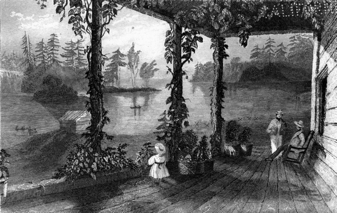
VIEW OF THE OTTAWA From the Shirreff House
TRAVEL AND TRANSPORTATION.
The true appreciation of the progress of any country in any branch of its industry depends upon the conditions under which that progress has been made: a glance, therefore, at physical, social, and political elements becomes a necessary introduction even to the limited field of its Travel and Transportation. The progress of Canada during the century which has elapsed since it became a British colony practically commenced about eighty years ago, or after the close of the contest between Great Britain and her revolting North-American colonies. Out of these eighty years, fifty at least, embrace the history of two provinces of unequal age, and two races, under different laws, language, religion, and (to a great degree) climates. These provinces have been hampered by a vacillating Imperial policy, while struggling for a commercial independence involving competition along a thousand miles of frontier with one of the foremost nations of the earth;—with a people tenfold their superiors in numbers and wealth, in quantity and variety of productions, and in the possession of their "treaty-making power" on their own continent—whereby they have derived manifest advantages in the settlement of every boundary question.
The province of Canada, or of Quebec, by which names the whole of Canada was called after its seizure by the English, contained a French population between 60,000 and 70,000 in number, which, with two exceptions and the few settlements along the Detroit River, was confined within the bounds of Eastern or Lower Canada. At Frontenac (Kingston,) and at the outlet of Lake Erie, the old French forts were garrisoned within the boundaries of Upper Canada; but those which commanded the Niagara and Detroit Rivers were upon the southern shore. As a colony of France, Canada was a semi-military organization, without any other exports than peltries. By becoming English, a privileged market for lumber and breadstuffs was opened to her in the British West-India Islands,—particularly valuable during and after the war of the Revolution, when the Atlantic colonies were excluded. In 1777 a British officer wrote that "there are saw-mills and grist-mills all over the province, and the Canadians are enriching themselves by exporting lumber and grain to the West Indies."[6] This referred, of course, to Lower Canada; for, though Montreal fell, and a daring attempt was made at the outset of the Revolution to seize upon Quebec, the posts upon the lakes, although then one hundred years old, were surrounded by savages hostile to the cause of the insurgents. Upper Canada was at that period in the possession of the Northern Iroquois, a confederation of the most warlike of the native tribes; and there are those yet living who remember when,—save the few families around the precincts of the old French forts,—not a white man could be found over all the vast area of Canada West. Toronto was then an Indian village whose warriors speared the salt-water salmon in her harbor, or chased the deer through the county of York, and their squaws then paddled among the rice-beds of the smaller lakes, and threshed out the wild grain over the gunwales of their canoes.[7] In the Western Peninsula the noble elk herded upon the prairies of St. Clair, or roamed over the oak forests, untroubled by the sound of the settler's axe, and swam the waters where paddle and screw barque and brig now plow their busy way. Myriads of wild pigeons from the South annually invaded the beech woods and bore down the branches by their weight; thousands of black squirrels from the East swam the broad Niagara, and marched westward in extended line; while flocks of gorgeously clad turkeys and plump-breasted quails stalked solemnly along the wild pathways of the forest, undisturbed by the hoarse roar of the locomotive or the rush of the railway train. In every narrow valley and upon every living streamlet, the laborious beaver arrested the rich alluvion and prepared broad meadows for the flocks and herds of the red man's successors. The hunter and the hunted have exterminated each other.
The achievement of their independence by the revolted colonies expatriated all those whom loyalty to their king had placed upon the losing side; and fortunate it was for these vilified and plundered fugitives that there yet remained for them upon this continent an asylum to which they could retire from the fierce persecution of the successful democrats. The impregnable fortress of Quebec on the east maintained communication with the mother country, while the forts of Oswego and Niagara—separated from the Atlantic settlements by vast forests—were cities of refuge to which the adherents of the king might flee under the guidance and protection of the friendly Mohawk. This northward emigration penetrated Canada by Lake Champlain on the east, by Oswego and Frontenac (Kingston) in the center, and by Niagara on the west. They came from as far south as the Carolinas, and their wagon-boxes, made water-tight, floated the wheels across rivers where no ferries were yet established. Many of those who entered by the eastern route moved westward to a milder climate, and to join those of their own language, faith, and municipal customs. This sudden influx of a British population into the province of Quebec—French in all but its allegiance,—brought about the division into Upper and Lower Canada, in each of which the laws were to be made by the inhabitants thereof. The separation took place in 1791, at which time the population of Upper Canada was about 20,000 souls; that of Lower Canada a little over 100,000. The province of Quebec had been governed by the ordinances of a governor and council; but, from 1791, both provinces were equally endowed with a local legislature, although in both, the governors selected and maintained their councils without the acknowledgment that the confidence of the house of assembly was a constitutional necessity, until their reunion in 1841.
The development of the Transportation service in any new country is not more dependent upon the advance in civilization of its colonists than upon its physical geography and climate. The possession of capital and a knowledge of the arts, are, for a time at least, often valueless in the face of obstacles presented by rapid rivers, mountain ranges, trackless forests, or quantities of snow. Time is as necessary as money to prepare the way for the superior vessel or vehicle; and thus, to the European in America, the simple expedients of the savage indigène are as applicable as the camel to the desert, the dog-sledge for the Esquimaux, or the ironless carts of the "Bois Brulés" in Rupert's Land.
Although the existence of roads for the passage of wheeled vehicles dates from the most remote history, it would seem that their early construction was for warlike or for state rather than for commercial purposes—for chariots and trophies and engines of war; perhaps, also, for the transport of materials for monuments, temples, &c. The Assyrian sculptures show that wagons and carts, drawn by mules and oxen, were used; but their land trade, we know, was principally carried on by caravans of loaded camels, horses, mules, and asses. Wagons were used to bring down the aged patriarch, "the wives, and the little ones" into the land of Goshen, but their supplies were borne upon the backs of animals. Egypt and Assyria were rainless countries, traversed by great rivers, watered by irrigation, and supplied with numerous canals giving water transportation for internal traffic. Separated by the mountainous regions of the Holy Land, their interchange of commerce was best conducted by the "ships of the desert;" for movable sand has ever been one of the greatest impediments to road-making.
The wonderful roads of the Romans, carried straight over hill and dale in such a manner as to be of little service for wheels, were more military than commercial. Inasmuch as the Roman knowledge of road-making was derived from the Carthaginians, ancient colonists from Tyre, it is probable that, notwithstanding the obstacles which the rugged landscape of Canaan opposed to commercial highways, we may trace the origin of paved roads to the land where Pharaoh's wagons were sent when Israel went down into Egypt. Indeed, it is difficult to conceive how the cedars of Lebanon could be transported from Joppa to Jerusalem without a graded road. Two thousand years have not effaced those adamantine lines which the Romans engraved and inlaid upon the face of three continents, for some of them are in use to this day; and, until the discovery of America, it was supposed that as road-makers they had no superiors. A Roman road was often three feet thick, consisting of three courses, of about one foot in thickness each, of coarse concrete masonry, gravel, and cut-stone paving:—sometimes their roads were wholly formed by a species of "macadamizing" with the addition of a cement forming a very hard concrete. Of such roads there were about fifty distinct ones with an aggregate length of 14,000 miles in Italy alone, besides those in the provinces.
In point of magnificence, however, the Incas of Peru surpassed even the Emperors of Rome. That narrow fringe of sea-coast was traversed from north to south by two great roads,—one in the interior, the other along the Pacific sea-board. The first extended 1,500 to 2,000 miles, having stone pillars set up at intervals of little more than a league, and hostelries or caravansaries at suitable distances—in which respect it was similar to the Babylonian royal road from Sardis to Susa, as described by Herodotus, which it exceeded in length. This road, says Prescott, was carried over pathless sierras covered with snow; through galleries cut for leagues in the living rock; upon suspension bridges, swayed to and fro over raging torrents, by cables of native osier thick as the body of a man; and was conducted across ravines of hideous depth filled up with solid masonry. The coast road, about 300 leagues in length, was carried on an embankment twenty-five yards wide, with a parapet of clay. Trees and odoriferous shrubs were planted along the margin, and streams of water were conducted through aqueducts along its side, to slake the traveler's thirst. Both roads were paved with heavy flags of freestone, some ten feet square, and in some places with pebbles imbedded in a bituminous cement which made a road-bed hard and smooth. It was an evidence of their advanced civilization that persons were stationed at the Incas' "swing" bridges to collect toll from all passers-by, for the maintenance of these the only perishable portions of the work.
The roads of the province of Quebec and of Lower Canada, until 1832, were placed under an officer appointed by the crown called a grand voyer, a sort of surveyor-general, who had deputies (sousvoyers) and surveyors under him.[8] The roads were divided into three classes.
1. Chemins royaux—Post roads or "front" roads, the soil of which belonged to the crown; these generally traversed the "front" of the seigneuries.
2. Chemins de ceinture et de traverse—or back roads, the soil of which belonged to the seigneurs; these ran in the rear and parallel with the royal roads.
3. Chemins de sortie et de communications—called, also, "routes" and by-roads. These were cross-roads, connecting those in front and rear. Also, banal roads, which were those leading to the seigneury mill.
All proprietors and holders (seigneurs and censitaires) were obliged to open, make, maintain, and repair, as well in winter as in summer, their "front" roads, across the land held by them. All bridges under four (or six) feet span were to be made by the occupant; but larger ones by the joint labor of the parties interested,—the timber being demanded from the nearest property. By joint labor, also, the cross or by-roads and mill-roads were made. In the case of the front roads, ownership or occupancy was considered a sufficient reason for making the unlucky holder construct and maintain the road; but in the case of side roads and others made by joint labor, this proprietorship exempted him from all other contribution, because he furnished the right of way. The grand voyer made semi-annual inspections, and by procès verbal, if confirmed by the quarter sessions, determined the dimensions, ditches, &c., and the "repartition" or apportionment of labor on bridges and routes. He seems to have been a magnificent personage, with the powers almost of a provost-marshal, who literally drove the habitants to the improvement of their ways.
Winter roads in the climate of Lower Canada require special provisions, some of which are demanded by the absurd tenacity with which the habitant clings to a vicious system. Instead of profiting by the example of the township people beside him, he attaches the shafts of his cariole, berline, or traineau, the running gear of which is a low sledge, by a chain in such a manner that when the draught slackens the shafts fall on the snow. The runner likewise does not follow the horses' feet, so that the road is not beaten for two horses abreast,—and thus must forever remain an inferior or "one-horse" affair. The action of the loose shaft is similar to a horse-rake, and the snow is rolled into "winrows," giving the road a corrugated profile, forming what are called cahots by the French, and "cowholes" by the English; the crater between the opposite peaks being large enough to contain one of those animals. As a penance for thus destroying the road, the law required the habitant to carry shovel, pick, and hoe, and to level the track behind him. It is also obligatory to have the track over ice or open country marked out by evergreen bushes called balises, so that the traveler may not lose his way. Besides the ordinary provisions for "breaking" the winter roads, it is required that on the 1st of December all fences along and abutting the roadside within twenty-five feet, be taken down within two feet of the ground, and kept down until the 1st of April, the posts only left standing; and, when required, balises are to be planted every thirty-six feet.
The road question appears to have early engaged the attention of the Governor and Council of the province of Quebec, and an attempt was made to establish the statute labor system of the English colonies by Governor-General Murray in 1766. His ordinance authorized the surveyor of highways to summon the parishoners with their carts, horses, &c., to work collectively on the roads, which were then specified to be at least fourteen feet wide. In 1777 Guy Carleton passed an ordinance establishing the French system of individual responsibility on the part of each owner and occupier to keep in repair the king's road, then specified at thirty feet wide. By-roads twenty feet wide were to be made by joint labor, and banal or mill roads "according to ancient usage." In that early day, hogs, less favored than they since have been, were not allowed to run in any highway. In the ordinance of 1777 the value of our white cedar was recognized by enacting that all bridge sleepers should be made of it; and grand voyers and sousvoyers were appointed for each district, the latter to be the captains and senior officers of militia. In these particulars the old French system was followed. In 1788, Lord Dorchester made a bold attempt to abolish cahots by an ordinance "to alter the method of drawing sleighs," &c.; but this led to rioting, and the habitants, by stopping the supplies from country to town, forced the repeal of the obnoxious ordinance the following year. No further attempt was made to interfere with the cahots, and the habitants were left in undisturbed possession of an institution, guaranteed to them by the articles of capitulation, until 1840, when Lord Sydenham took advantage of the suspension of the constitution of Lower Canada, caused by the rebellion of 1837, to pass two sleigh ordinances; but immediately after the union, the right of self-government was asserted, and one was repealed; but the other was confined to the district of Montreal, where the turnpike trust commissioners have hitherto successfully resisted the traineau.
In 1832, the despotic powers of the grand voyer were transferred to road commissioners; and in 1841 the roads came under the control of the municipalities, by whom the labor has been more equalized, and who have the power of apportioning it upon all roads. In the absence of any by-law of the municipality or unrepealed procès verbal, "front" roads are still to be made and maintained by the occupant; but a special superintendent, appointed by the Council, may, by proper procès verbal, relieve any owner or occupant from any excessive portion of work required under that provision. All the main roads, made by the government and transferred to the municipalities, are to be maintained by the latter. Front roads must (since 1855) be at least thirty-six feet French (nearly thirty-eight and a half feet English), and routes twenty-six feet French (about twenty-seven feet nine inches English,) between the fences. This is an increase of fifty per cent. over the width established before the conquest.
The old French laws governing the roads were practicable in the level seigneuries, with their peculiar subdivisions caused by the laws of descent, as well as from their quondam semi-military organization. The holdings are narrow strips of one or two hundred yards, or less, fronting on the St. Lawrence, and extending back a mile or more. The front road is near the river, and on it are the houses, giving the river bank the appearance of a continuous street. These laws were, however, wholly inapplicable to the townships with their hills, and lakes, and heavy timber, where the "front" road would run a mile or more along one property, and where the cost of making the road would be far greater than the value of the land; where, also, there were crown reserves and long distances without an occupant. The seigneuries having their roads formed, for perhaps a century, and conducting their light traffic on the snow in winter and on the river in summer, were not urgent for road grants; and the townships thus had no opportunity for "log-rolling," and were too weak politically to extort relief. It was therefore not until 1815-17 that any effort was made to apply a portion of their abundant revenue to the roads and bridges of the lower province. The sum of £63,600 (or $254,400) was voted in these two years, which was expended chiefly in the seigneuries. In 1829, however, the legislature seems to have commenced in earnest, about £120,000 (or $480,000) having been voted in that and the two succeeding years; and then the townships, after forty years of suffering, obtained some assistance.
In the first parliament of Upper Canada, held at Newark in 1793, an act was passed by which the roads were placed under overseers to be appointed by the rate-paying inhabitant householders at their annual town meetings. Every person was required to bring tools and work three to twelve days; and owners of carts and teams at least six days. At first rich and poor were treated alike (for all were alike poor,) and the number of days' work exacted from each, which was in the discretion of the overseer and depended on his energy and the wants of the road, was fixed at ten; but when large blocks of land, granted to favorites or held by speculators, stood in the way of improvement, dissatisfaction was created at the unequal road law which exacted no more from the great land-owner than from the tenant or laborer, and it was altered; the number of days' labor being determined according to the assessment roll.
The power of altering or opening new roads was vested in the quarter sessions by whom a surveyor was appointed to report upon any application for such alteration or new road if signed by twelve freeholders.
In its infancy this province had neither revenue nor taxes, the civil list being at first wholly and afterwards partially sustained by the military chest of the Imperial government. In 1795, the revenue was £900 sterling, and the only tax 4d. per gallon on wine; and it was not till 1804 that there appeared any surplus for roads. In that year an appropriation of £1,000 (or $4,000) was made for this purpose, which proved premature and was repealed in 1806, when £1,600 (or $6,400) was granted; and this road grant, increased to £2,000 (or $8,000) and £3,000 (or $12,000,) was annually maintained till 1812, when it rose to £6,000 (or $24,000.) Interrupted two years by the war, it increased in 1815 to £20,000 (or $80,000,) and in 1816 to £21,000 (or $84,000,) after which little was done until 1830, when, between that date and 1833, £128,000 (or $512,000) were granted. Between 1836 and 1840 over £100,000 (or $400,000) more was granted, the whole of which was not expended until after the union.
The roads of Upper Canada, by the municipal act, are wholly under local control; and the assessment act provides that every male between sixteen and sixty years is liable to statute labor to the extent of two days as a minimum. If assessed at a total valuation of £50 (or $200,) two days are required, and more in proportion up to £1,000 (or $4,000,) which gives twelve days; and one day for every £200 (or $800) over that sum, subject to a pro ratâ reduction by the council. Where there is no by-law, 2s. 6d. (or 50 cents) per day is the rate of commutation. When there is no property delinquents may be imprisoned six days if they do not work their two days or pay their two dollars. The roads must not be less than thirty feet or more than ninety feet wide; and local rates may be levied for local roads, on a petition of two-thirds of the resident rate-payers representing one-half the assessed value. Councils can not close a road to the prejudice of any person, nor encroach on gardens, orchards, pleasure-grounds, or buildings; but they may order the removal of trees, not being ornamental or plantations, within twenty-five feet of the highway, and must compensate for all real damage.
In the province of Quebec, the European system of traveling by post was in force and regulated by law. The distance between Quebec and Montreal, commonly called sixty leagues was divided into twenty-four stages. The maitres de poste were obliged to keep four caleches and four carioles, and to be ready at a quarter of an hour's notice to forward the traveler, who was usually received with much ceremony, on alighting after each stage, by the lady of the house.[9] They had the exclusive right of passenger transport by land, the charge being fixed at twenty to twenty-five cents per league,—twelve to fifteen dollars for the journey between Quebec and Montreal, which occupied three days. The caleche is a gig upon grasshopper springs with a seat for two passengers; the driver occupies the site of the dashboard, with his feet on the shafts and in close proximity to the horse with which he maintains a confidential conversation throughout the journey, alternately complimenting and upbraiding him, and not failing to impress him with the many virtues of his master.
A public mail-stage was established between St. John's and Quebec before the expiration of the last century; but although facilities existed for land travel before the era of steamboats, the water route, where it was down stream or slack water, was generally preferred. Water carriage along the whole frontier from Quebec to Lake Huron, and abundance of snow (east of Kingston) while the navigation was closed, checked the early establishment of a good road throughout. Before the war of 1812, the land route from Montreal westward was broken, not only by the necessary ferries across the Ottawa at Isle Perrôt, but by the long ferry in Lake St. Francis, where a horse-boat traversed the slack water, because of the wet land route along the front of Glengary. In 1796, with the exception of about fifty miles, a road had been opened from Montreal to Kingston, and the journey could be made by land from Montreal to Lake St. Francis, and from Cornwall to Prescott, along which latter route the United Empire loyalists, who came in in 1784, had established themselves. The intermediate portions, having slack water or nearly so opposite them, were not completed until the necessity for them was demonstrated by the war of 1812-15.
During the infancy of Upper Canada the road extension from Prescott to Burlington,—with the exception of those portions where the loyalists were settled, which extended as high as the Bay of Quinte,—was retarded by the slack-water navigation between these points; but to avoid the detour by Queenston, Fort Erie, and Lake St. Clair, a road was opened as early as 1794 from Ancaster (the point to which the loyalists had extended their settlements from Niagara, and made their road by private subscription) to the Mohawk village on the Grand River, to which place Brant had removed his Six Nations. From Brantford it was carried through to a point (London) on the river La Trenche (now called the Thames,) from whence a boat navigation existed to Lake St. Clair. Thus, from the French seigneuries on her eastern boundary to the American border on the west, Upper Canada sought first to connect the natural navigation by what may be called portage roads of greater or less length; and so to diminish the time, cost, and fatigue of land transport.
Governor Simcoe, who seems to have been fully impressed with the importance of his mission as the founder of a nation, also opened out, in 1794, by the labor of the Queen's Rangers, the portage of thirty-three miles from Toronto to Lake Simcoe, called Yonge Street, which shortened and cheapened the route to Mackinaw, then the great dépôt of the fur-trade. On the opening of this route the North-West Fur Company, which was established by Frobisher and McTavish, of Montreal, in 1782, and which in 1796 employed 2,000 men, instead of sending their supplies up the Ottawa by canoes, sent batteaux up the St. Lawrence, which were carted across the portages at the Carrying Place and Yonge Street, and delivered their cargoes in Mackinaw at a saving of £10 (or $40) to £15 (or $60) per ton. Even the Spanish settlements down the Mississippi were supplied by British goods thus taken to the great peltry fair at Mackinaw. Dundas Street, as the main post-road traversing the province was called, was also established by Governor Simcoe, lots being granted along it on condition of building and improving in one year; and so provision was made for a continuous land communication throughout the province: but it was not until after the war of 1812 that any portion of it was so far improved and bridged as to become a stage route.
The first stage in Upper Canada was established by Mr. Macklem, of Chippewa, in 1798, between Queenstown and Fort Erie, running every other day at the moderate fare of one dollar; distance about twenty-five miles. On the 1st of January, 1816, the first stage between Montreal and Kingston was established by Barnabas Dickinson. Covered sleighs left Samuel Hedge's, in St. Paul Street, Montreal, and Robert Walker's Hotel, Kingston, every Monday and Thursday, and arrived every Wednesday and Saturday. In January, 1817, Samuel Purdy established the first stage between Kingston and York. It left Daniel Brown's inn, Kingston, every Monday morning, and York every Thursday morning, stopping at Spaulding's inn, Grafton, as a half-way house. The fare was eighteen dollars with twenty-eight pounds of baggage allowed. The next winter Purdy reduced the fare to ten dollars, three dollars to Belleville, and six dollars to Spaulding's inn. On the opening of navigation the stages between Prescott and York were discontinued, as a steamboat was then on this route. The mail, which as late as 1807 was so light as to be carried by pedestrian white men between Montreal and Toronto, and by an Indian between Toronto and Niagara, all of whom carried axes to aid them in crossing streams, went by the king's vessels in summer, and after 1817 by the steamers, which also took the local traffic between the frontier towns; so that there was no travel to maintain a summer stage except on the portages below Prescott. The first steamers were placed on Lake St. Francis and Lake St. Louis, in 1826, when four-horse covered coaches were put on the road between Montreal and Lachine, and stages were run from the Cascades to Coteau Landing, and from Cornwall to Prescott, no steamboat having yet ventured below the latter point. In 1832, a stern-wheel steamer, the Iroquois, was built to overcome the rapids between the Longue Sault and Prescott. At first she required the aid of horses and oxen at Rapide Plâtte; but further experience in pilots and an improvement in the boilers enabled her to ascend by steam power alone; and thereafter the stages retired to the twelve miles of portage passing the Longue Sault between Dickinson's Landing and Cornwall.
Between Kingston and Cobourg, and other points where the steamers did not call, at first a horse, and then the one-horse wagon delivered the local mail; and, as local travel increased, two and four horses were put on, the vehicles generally being open stage-wagons, the covered coaches being kept in the vicinity of the larger towns where the roads were better and where it was worth an effort to "take in" the unwary. As late as 1834, passengers in stages from the west could avoid "sea" sickness on Lake Ontario by connecting with steamers at the "Carrying Place," at the head of the Bay of Quinte, from whence there is river navigation to Montreal.
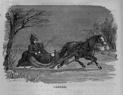
CARIOLE.
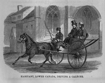
HABITANT, LOWER CANADA, DRIVING A CALÈCHE.
In 1826, the first stage was established between Niagara and York,—time, seventeen hours; fare, five dollars. In 1827, the exclusive right to run a stage for twenty-one years from Ancaster, through Brantford, Burford, "the Long Woods," and Delaware, to Detroit River, was obtained, after two years' effort, by a public-spirited physician of St. Catharines, for the purpose of inducing other parties to provide this much-needed accommodation. Under this stimulus, a line of four-horse coaches was started in 1828, which not paying it was reduced to an uncovered wagon, and after a time even that was abandoned. It was some years after this before a stage was established between Lake Ontario and the Detroit River, and not until 1842 that a daily line was established throughout the province, which was done in consequence of Deputy Postmaster-General Stayner's requirements with regard to the mails.
Benjamin Franklin, Deputy Postmaster-General of North America in 1766, stated before a committee of the House of Commons that the only post-road then in Canada was between Montreal and Quebec. In 1791 the post-road extended eastward to New Brunswick, and westward as far as Kingston. As late as 1807, the mail to Amherstburgh was only quarterly, a Canadian once in three months appearing with a mail-bag on his shoulder.
Our progress, as gathered from the number of miles of established post-roads, is as follows:—
| Dates. | Number of Post-Offices. | Miles of Established Post-Roads. | Miles of Annual Mail Travel. |
| 1766, | 3 | 170 | ... |
| 1791, | 10 | 600 | ... |
| 1817, | 25 | 1,200 | ... |
| 1824, | 69 | 1,992 | 369,616 |
| 1828, | 101 | 2,368 | 455,936 |
| 1831, | 151 | 2,896 | 713,076 |
| 1832, | 227 | 3,460 | 787,472 |
| 1836, | 289 | 4,377 | 1,005,524 |
| 1837, | 375 | 5,370 | 1,176,708 |
| 1840, | 405 | 5,736 | 1,473,264 |
| 1851, | 601 | 7,595 | 2,487,000 |
| 1852, | 840 | 8,618 | 2,930,000 |
| 1854, | 1,166 | 10,027 | 4,000,000 |
| 1857, | 1,506 | 13,253 | 5,383,000 |
| 1860, | 1,698 | 14,202 | 5,712,000 |
In 1852, the number of letters per annum was 3,700,000; the revenue, $230,629; expenditure, $276,191. In 1860, the number of letters per annum was 9,000,000; the revenue, $658,451; expenditure, $534,681. This expenditure is exclusive of railway and steamship subsidies. The former costs $110,000 and the latter $416,000 per annum.
The land communications of the copper-colored nomads, eastward of the prairies, were natural routes subordinate to their water ones, being mere portages from one stream or lake to another; and in this respect they differed essentially from those of a fixed population. But, as with the savage, the track of the wild animals,—the deer, moose, elk, or cariboo,—indicated the hardest ground or lowest pass for the war-path, so with the colonist the same guides—or the instincts of domestic animals turned loose in the forest,—often marked out the "bridle-road," the pioneer route of land transport from point to point. In later times, since the surveyor has preceded the settler, the roads have been either arbitrarily determined for a country presenting no special obstacles, or carefully explored as a basis of settlement. But as, until a comparatively recent period, the squatter preceded the surveyor, the original roads have been established either by the accidental conditions noted above, or by the more extensive and careful explorations of the lumberman, who has been the pioneer of the agriculturist over the greater portion of cultivated America.
The progressive stages of improvement, from the track of the wild animal to the metalled road, are,—
1. The Bridle Road;
2. The Winter Road;
3. The Corduroy Road;
4. The Common or Graded Road;
5. The Turnpike; Macadam, Gravel, and Plank Roads.
Before the era of wheeled vehicles, communication between back settlements, save in winter, is restricted to "bridle roads," by which men and women on horseback may assemble for worship, visit their neighbors, and attend upon all those occasions of births, marriages, and deaths so much noticed in the forest and so little in town. On packhorses, also, grain is taken to and from the mill, and other movables transported. These roads are formed simply by clearing away the branches and logs, so that a man on horseback may ride, and are most frequently old lumbermen's roads, which have become impassable from fallen timber, and the growth of underbrush. In winter, however, the snow and ice, the great democratic elements in the physical constitution of Canada, make all roads alike, and the humblest settler in the most remote back-township has not only an excellent road, but can make himself a vehicle capable of transporting the largest loads; and, sheltered by the forest, the once broken track is protected from those drifts which are the only drawbacks to the snow-roads in the clearings.
It is impossible to over-estimate the importance of the frost and snow to the people of Canada, or to place any money value upon them. That which most Europeans have deplored as the only drawback to this country is in truth the source of its rapid prosperity. The operations of agriculture and commerce do not necessarily require perennial communication with a market. As there is but one crop of grain and lumber in the year, it is sufficient if once in the year an opportunity is afforded to transport it, and this Canada possesses in a higher degree than any other "more favored clime." In the dead of winter, when all agricultural out-door operations have ceased, the farmer, after having threshed his grain, can sally forth to any market he may select, even if distant one hundred miles or more, and combine other business or pleasure in the town with that of the sale of his products. He can go any where while the snow lasts, for all roads are alike; and he can take as large a load as can be transported by the same power on the best wheel roads in Europe. For domestic purposes the ice and snow are equally valuable to him; for, while unable to cultivate the fields, he can make the forest resound with his axe, and every swamp is accessible to his horses and his sledges; thus securing his annual supply of fuel without the necessity of money or barter. If he has a family of grown-up sons, he may cut the timber and fuel and transport it to the market, because there is not a week in the whole winter in which out-door work is unpleasant; and there is, therefore, less loss of time than in milder and more rainy climates. The presence of the ice and snow at the season when horses and cattle and their owners can not be employed in field operations, and its certain continuance over the greater part of the country for several months, define the mode of conducting the business without inconvenience and to the best advantage. Whatever is intended for export is, where good summer roads are wanting, hauled down to the shipping ports while the snow lasts; and if a house is to be built, the stone is quarried and hauled When little else can be done, and all preparations are made before the season for building commences. The statistics of shipments show that only about one-third of the crop is sent forward in the year in which it is grown; and although in many instances the produce can not be brought out until the snow falls, it is evident that from choice the greater part will be held back until that season. The autumnal plowing and sowing after harvest, ditching, fencing, and other duties, often make it inconvenient to commence threshing before the winter: moreover, there is also the hope that better prices, when western exports are suspended, and cheaper transportation on the snow, will more than compensate for any loss of interest.
The frost which bridges every river and makes a hard and level causeway of every swamp, with the snow, which fills every rut and cavity and buries boulders, logs, and stumps, enable the lumberman to send supplies for a whole year to his shanties; and, in like manner, the pioneer settler takes advantage of this season, to prepare for his summer's work of establishing a home in the heart of the forest. It is only by contrasting this state of things with India, the Turkish Empire, or other snowless and roadless countries of the world, that we can determine what it is worth to have, as Canada has for months in every year, the best possible road, not only on all main lines, but to every man's door and to every corner of his property.
The winter road is too narrow for wheeled vehicles; in summer it is but a bridle road on the hard ground, and impassable through the swamps.
In forming a road for wheeled vehicles or in converting a winter road into a summer one, there are necessarily as many degrees of excellence (or rather badness) as are afforded by the character of the route,—the number, wealth, and intelligence of the settlers. But, whatever the means at their disposal, there seems to be a universal resort to the axe and log-chain, where the pick and shovel should be used. This wide-spread error is the result of habit: axes are in the hands of all, and familiar to all; the pick and shovel are regarded as only fit for "canallers" and railway "navvies." Not only in the case of swamps (in many of which the corduroy system is indispensable), but wherever water at stated seasons collects on the surface, so as to soften the soil and cause the wheels to sink, whole hecatombs of trees are sacrificed to form a corrugated causeway of their round trunks, laid side by side, over which wagons can be slowly dragged or bumped, any attempt at speed being checked by immediate symptoms of approaching dissolution in the vehicle. When the country becomes cleared most of these vegetable causeways remain high and dry throughout the year, from the mere admission of sun and wind; but though no longer of any service, the logs are too often permitted to remain, because, half-buried as they are, the laborious and plebeian occupation of digging is required to extract them. It must, however, in justice, be admitted that in many cases where simple ditching would be better and cheaper than the corduroy, the latter can be done while the former can not, for want of tools or of time, at the proper season of the year. Where the foundation is a morass the corduroy is a ready and efficient mode of constructing a road; and, though most disagreeable to the traveler, and perhaps destructive to his vehicle, it is often impossible for the scattered settlers to do more. The captious visitor from older districts may grumble at the roads over which he is obliged to travel, but a liberal mind will acknowledge the formidable obstacles which the early settler must contend with, and not expect that, in addition to the war waged on the wilderness to obtain bread for his family, he can devote much of his labor to the common benefit. If, therefore, perhaps after years without any summer road at all, he can procure a passable one only, it is natural he should wait for assistance before attempting more. The great objection to the indiscriminate resort to corduroy is that many roads are kept in the worst state many years longer than they would be had they been left without this questionable improvement. As the settlement increases in numbers and wealth, and the evils of corduroy are appreciated, an attempt is made to cover the logs with earth, by ditching from the sides when practicable, or by the more expensive process of hauling the material from the extreme ends. But where there is not a morass beneath the logs, the frost penetrates and throws them up through their scanty covering, and there can be no rest for these ghosts of the murdered trees until they are wholly removed or buried the "full fathom" deep.
This is that stage which has emerged from the bridle, winter, or corduroy to the condition of a highway marked out by fences in the clearings or by wide openings through the woodland,—formed, drained, and bridged, with logs extracted or effectually buried, and hills graded down within reasonable limits; but without any other road-bed than that afforded by the underlying or adjacent soil. These roads are excellent in midsummer and midwinter, and (except when broken up by frost in spring and autumn) are seldom surpassed, even by the turnpike, except for the heaviest traffic. The common road as it becomes consolidated is better for the horse and more agreeable to the traveler than any other, and, except where in loose sand, affords facilities for travel and transport during the summer months only inferior to those of the winter ones. Their chief defect is in their Roman straightness, following the concessions or side-lines of the original survey arbitrarily, and encountering obstacles which might easily be avoided. Land-owners attach importance to straight and rectangular boundaries as more easily ascertained and maintained, and therefore oppose propositions to have their fields encroached upon to improve the road. Although the bail of the pot is no longer when on the fire than when off—when upright than when horizontal,—it does not seem to be conceded that it may often be as short to go around the hill, upon the level, as to climb over it. The value of level roads is demonstrated in the highest degree by the locomotive, which, upon an ascent of only one in one hundred, can not draw more than one fourth the load which can be taken on the level. The act of parliament only requires hills to be reduced to one in twenty on toll roads and railway crossings, and we often see them one in ten or less on other roads. If the principles of transportation were more thoroughly appreciated, all our main routes would be improved by abandoning locations which can never give a good road, and by avoiding, as far as possible, all hills, particularly those which are to be ascended in the direction of the heaviest traffic, thus making the road towards the market as far as possible, down hill. The reflection that millions in number and in value must, until the end of time, travel over the roads, perhaps as we lay them out, should secure the utmost carefulness and conscientiousness in the location of all our highways, railways included, so as to avoid the unnecessary loss of time and waste of horse-power and steam-power now going on daily over all this continent.
Gravel Roads.—The existence of large deposits of gravel at many points, and the fact that the natural roads upon a gravel formation were the best, led to its being used extensively for metalling graded roads. For light traffic it makes a smooth and hard road; but it is not, as usually applied, capable of resisting the heaviest traffic. If sufficiently clean, and laid on to a proper depth, it will form a road fit for any purpose; but so formed, it, in the majority of cases, will be more expensive than broken stone.
Plank Roads.—These were introduced after the union, and were extensively used at first; but as a class they may be said to have proved failures, except as a temporary expedient. In many districts where there is neither stone nor gravel, and where plank abounds, they have been the only means of accommodating a heavy traffic, and are particularly valuable where the natural road-bed is sand. Sand, except when frozen or covered with snow, is almost as great an obstacle to traffic as swamps; and plank, although a perishable, is an expeditious and generally economical mode of overcoming it. In many cases it will pay to lay down plank in order to cheapen the cost of putting metal on the same road; and, as the plank will last several years, the tolls collected in that time may reimburse the cost. Where lumber is cheap and where stone can not be obtained near the road, it will be policy to make the first covering of the graded turnpike with planks. Many plans have been devised for laying the planks, but it is unnecessary to notice these, as their duration does not depend on this. If there is little traffic they warp and rot without reference to their form; and if there is much traffic the horses' feet wear them down: and when thus weakened they are broken through and soon become a nuisance. When stone or gravel is within reach, plank should never be laid the second time, unless the tolls replace them as fast as worn out, and unless there be a lack of means to make the more durable road.
Macadam Roads.—This system, after about forty years' experience in Europe and America, has proved its superiority over any other; but its value in this country has been very much impaired by inattention to details in construction and repairs, and by the want of a sufficiently heavy traffic rapidly to consolidate the new road. The metal, often of improper size and inferior quality, unless "blinded" with sand (and thereby deteriorated) or covered with snow, is avoided except for a short time in spring and autumn; and thus two or more seasons are passed before it becomes "bound." The repairs are then postponed until the road is worn out, when it is again renewed en masse; and thus years are consumed in the infancy and old age of this system, with scarcely an intermediate period of efficiency. The only properly constructed and managed macadamized roads in the province, with perhaps one or two exceptions, are the turnpike trusts outside of Montreal and Quebec. These roads are in the hands of commissioners, and as the tolls are freely expended on them, they are never allowed to wear out, but by constant repairs with clean metal are kept in good order. In Upper Canada, on the other hand, the roads are generally in the hands of lessees or stock companies whose practice it is to lay out nothing upon them which can be avoided. There is no stronger instance of the patience and law-abiding disposition of the people than in their toleration of so great an imposition as most of the toll-roads of Upper Canada. It matters not whether a company has purchased the right of way, cleared the forest, fenced, "graveled," and bridged a road, or whether it has thrown down stones or plank upon an old highway made ready for them at the cost of the public,—the traveler (who has perhaps exerted all his skill in driving between the loose stones and broken planks and the ditches, or in "straddling" the ruts) is arrested every four or five miles by a toll-gate. In winter toll is exacted even if sleighs are used, which can only be defended on the ground that some revenue must be had; but in summer there is not this relief, although it would be safe to say that, for the greater part of that season at least, the roads would be much more efficient in their natural state than they are as "improved." Such roads have no resemblance to the turnpike trusts of Lower Canada, except at the toll-gates; and the continuance of so great a nuisance as barriers on even the best of roads must be regarded as evidences of a preference on the part of the most intelligent population of Upper Canada for direct taxation. It may be argued that those who wear out the road should pay for keeping it in order; but this might be met by an annual assessment on hoofs and wheels without the intervention of toll-gates. If the cities and market-towns assumed the tolled roads, they have it in their power, by fees, market-rates, &c., to levy the amount required; and there would thus be bodies interested by their mutual competition in keeping the roads permanently in good order. This, however, is one of those reforms which we can not hope to attain until we are far enough advanced to think of fencing our animals in instead of fencing them out.
The provision for roads in many of the townships of Upper Canada is excessive. The usual dimensions of the lots are a quarter of a mile in width and a mile and a quarter in length, containing two hundred acres; and in some townships, in order to give every lot frontage on a highway, road allowances sixty-six feet wide, running from front to rear, have been reserved every half-mile. The concessions (which are reserves of a similar width) divide each tier of lots so that they occur at intervals of every mile and a quarter; thus the lots may be halved, and each hundred acres, front and rear, will have a road allowance upon two sides of the property. In townships of unbroken, and dry land the roads become established upon those allowances; but in many cases, intervening obstacles force the road through private property, where it remains on sufferance until (from the permanent character of the obstacle) it is duly established by authority, when it is enlarged to the regulated width and the "statute labor" expended on it.
Before the union of the provinces, and the establishment of municipal institutions in 1841, considerable amounts were annually granted by the Legislature for roads and bridges. These were in fact almost the only public works prior to the era of canals and railways and public debt, and absorbed the greater part of the net revenues. This system still obtains in the lower colonies, and their main roads are unsurpassed, as a class, by those of any other government on this continent. Aid from the public chest was generally restricted to trunk lines and bridges beyond the means of local taxation or "statute labor;" but, by judicious "log-rolling," as the barter of vote for vote between members is called, this aid became so widely distributed and the number of claimants so increased as to force the leaving of road-making wholly in the hands of the localities, except in the case of new roads for settlement, or where large areas of public land remained unsold. The dissatisfaction created by the apportionment of the road moneys was one of the arguments in favor of municipal institutions which have since relieved parliament of applications on account of what may be called local roads. While there is little doubt that it was high time the old, rich, and populous districts should no longer abuse their greater political strength to secure for their own doors the lion's share of the road moneys, it is equally clear that, in being thrown upon their own resources, a load has been imposed upon many of the back counties which they are unable to bear. It may cost one county, by reason of numerous large rivers, deep ravines, swamps, &c., ten times as much to make its roads as it costs another more favorably situated; and the more broken the country the less good land and the fewer the inhabitants, so that the tenfold expenditure falls upon a population only one-tenth of that in the older front counties. Again, the back counties contribute so much to the wealth of the front ones, that the latter may with justice be asked to share a burden from which, by the natural formation of the district, the labors of their fathers, or from past government aid, they are comparatively exempt. Honestly administered, the system which prevails in the lower colonies, and which once existed here, is at least the most equitable; and it can only be decried by the confession that there is not public virtue enough to sustain it.
The proceeds from sales of the crown lands and the revenues derived from the valuable timber thereon, do not accrue to the municipalities in which these may be situated, and as there seems to be a natural claim upon this fund for roads in the same district, the provincial treasury which receives may with reasonableness be asked to give. This principle has been recognized by the government of the United States, which, in organizing new states, made provision for roads out of the proceeds of the public lands sold in each state; and is acknowledged by us as respects what are called Colonization Roads.
Showing the amount expended by the Legislature of Upper and Lower Canada, respectively, from 1791 to 1861, for Roads and Bridges; also, the amount expended since the Union by Municipalities and Road Companies, in the construction of Turnpike Roads:
Expended by Upper Canada:
| Common Roads. Miles. | Macadam Roads. Miles. | Plank Roads. Miles. | Cost Before Union. | Cost Since Union. | Total Cost. | |
| General grants for roads and bridges, | ... | ... | ... | $762,200.00 | ... | $762,200.00 |
| Special appropriations for roads, | 714 | 137 | 125 | 753,466.65 | $1,392,707.00 | 2,146,173.65 |
| Special appropriations for bridges, (50) | ... | ... | ... | 13,456.00 | 91,537.75 | 104,993.75 |
| Grants for colonization roads, | 938 | ... | ... | ... | 528,739.21 | 528,739.21 |
| Roads built by municipalities and joint stock companies. | [G]1,302 | 283 | 194 | ... | 4,366,522.00 | 4,366,522.00 |
| Total, Upper Canada | 1,529,122.65 | 6,379,505.96 | 7,908,628.61 | |||
| Expended by Lower Canada: | ||||||
| General grant for roads and bridges, | ... | ... | ... | 782,240.00 | ... | 782,240.00 |
| Special appropriations for roads, | 893 | 22 | 37 | 230,380.00 | 780,711.19 | 1,011,091.19 |
| Special appropriations for bridges, (32) | ... | ... | ... | 21,500.00 | 218,909.00 | 240,409.00 |
| Grants for colonization roads, | 1,537 | ... | ... | ... | 446,786.32 | 446,786.32 |
| Turnpike trusts, | ... | 93¼ | 19½ | ... | 425,265.72 | 425,265.72 |
| Roads built by municipalities and joint stock companies, (no return) | ... | 8 | ... | ... | 20,000.00 | 20,000.00 |
| Total, Lower Canada | 1,034,120.00 | 1,891,672.23 | 2,925,792.23 | |||
| Grand Total, Upper and Lower Canada, | 2,563,242.65 | 8,271,178.19 | 10,834,420.84 | |||
|
Graveled roads only, on nearly all of which tolls are collected. |
The Plank, Gravel, and Macadam roads of Lower Canada were nearly an constructed by Parliamentary grants.
This road expenditure of $10,834,420.84 excludes those made by statute labor or commutation money; and all municipal outlay on common roads.
The colonization road expenditure in Upper Canada includes that from the Improvement Fund,—applicable to new townships.
Of Plank, Gravel, and Macadam Roads constructed by municipalities and Joint Stock Companies in Upper Canada, since the Union.
| Counties. | Plank Road. No. Miles. | Gravel Road. No. Miles. | Macadam Road. No. Miles. | Total No. Miles. | Total Cost. |
| Brant, (no return,) | ... | 37 | ... | 37 | $37,000.00 |
| Carleton, (no return,) | ... | ... | 6 | 6 | 12,000.00 |
| Elgin, | ... | 42 | ... | 42 | 84,000.00 |
| Essex, (no return,) | ... | ... | ... | ... | ... |
| Frontenac, Lennox, and Addington, | ... | ... | 166 | 166 | 318,000.00 |
| Grey, | ... | 177 | ... | 177 | 200,000.00 |
| Haldimand, | ... | ... | ... | none | ... |
| Halton, | ... | 60 | ... | 60 | 100,000.00 |
| Hastings, (no return,) | 9 | 94 | ... | 103 | 191,300.00 |
| Huron and Bruce, | ... | 177 | ... | 177 | 462,400.00 |
| Kent, | 14 | 19 | ... | 33 | 66,000.00 |
| Lambton, | 18 | 3 | ... | 21 | 42,000.00 |
| Lanark and Renfrew, (no return,) | ... | ... | ... | ... | ... |
| Leeds and Grenville, | ... | ... | ... | 148½ | 227,848.00 |
| Lincoln, | ... | ... | 20 | 52 | 127,500.00 |
| Middlesex, | 11 | 142 | ... | 153 | 600,000.00 |
| Norfolk, (Plank and Gravel,) | ... | ... | ... | 88 | 140,000.00 |
| Northumberland and Durham, | ... | ... | ... | 229 | 492,000.00 |
| Ontario, | ... | 8 | ... | 8 | 12,000.00 |
| Oxford, | 11 | 112 | 13½ | 136½ | 255,500.00 |
| Perth, | ... | 101 | ... | 101 | 209,457.00 |
| Peterboro' and Victoria, | ... | 6 | ... | 6 | 12,000.00 |
| Prescott and Russell, | ... | ... | ... | none | ... |
| Prince Edward, | ... | 200 | ... | 200 | Statute labor. |
| Simcoe, (no return,) | 6 | 5 | ... | 11 | 22,000.00 |
| Stormont, Dundas, and Glengary, | ... | 24 | 4 | 28 | 60,000.00 |
| Waterloo, | 1 | ... | ... | 1 | 2,000.00 |
| Welland, | ... | ... | 28 | 28 | 114,877.00 |
| Wellington | ... | 82½ | ... | 82½ | 162,640.00 |
| Wentworth, | 13 | 12½ | 46 | 71½ | 194,000.00 |
| York and Peel, (no return,) | 111 | ... | ... | 111 | 222,000.00 |
| Totals, | 194 | 1,302 | 283½ | 2,277 | 4,366,522.00 |
Note.—Cost is estimated where not given, and known roads are inserted in cases where no return was made.
The physical geography of Canada, presents a marked contrast with respect to rivers and water communications, to that of the States of the Union. The Mississippi and its numerous tributaries are navigable, at some seasons of the year, from their mouths almost to their sources; but the St. Lawrence and its branches are beset, a little beyond tide-water, with rocky barriers to navigation which are repeated at varying distances—generally with lakes or long deep reaches intervening. The proportion of water navigable in both directions to that of rapids, chutes, and cataracts is, however, so great, that for purposes of transportation the St. Lawrence presented to the early explorer less obstacles than the Mississippi,—the upper waters of which were first reached through the great lakes, by Jolliette and Marquette in 1673, and by Hennepin in 1680. Between Quebec and Chicago—a fresh-water navigation of 1,450 miles,—the total length of canal is only sixty-eight and a half miles: and in the proposed improvement of the Ottawa navigation, out of a total of four hundred miles between Montreal and Lake Huron the length of canal is only thirty miles, about one-third of which is upon the Island of Montreal itself. On this latter route,—by which the Algonquins avoided the Iroquois, and which afterward became the highway of the voyageurs of the fur companies,—a few miles of portages constituted all the land carriage required between Montreal and the centre of the continent. In the later operations of the lumberman the long reaches of level road upon the ice of the Ottawa, and of its lakes and tributaries, have carried the supplies into the inmost recesses of the forest.
This terracelike profile of the northern rivers is not without its ameliorating influence upon the temperature during the two or three short periods of intense cold which occur in a Canadian winter. While a thick covering of snow retains heat in the earth for the protection of vegetation, and when the fish retire to the shelter of the deep water in the ice-covered lakes, the open area at the rapids affords the principal outlet for radiation,—which increases with the intensity of the frost—and at these points an almost constant congelation in the form of "anchor ice" upon the bed of the stream, sets free an additional supply of latent heat.
Another peculiarity of the Canadian navigation is its great directness. From the Straits of Belle Isle to the head of Lake Erie, the St. Lawrence affords a navigation almost upon an air-line; and from Montreal to the western extremity of Lake Superior, the Ottawa gives a route nearly direct. The Mississippi and many of its tributaries, on the other hand, double the air-line distance between their cities, and oppose an almost uniform current to ascending craft. While batteaux could be dragged up the rapids and sail up the St. Lawrence in ten or twelve days from Montreal to Lake Ontario, and there transfer their cargoes to schooners, it required four months to pole a keel-boat up the Mississippi from New Orleans to St. Louis; and it was not until the successful invention of the steamboat that the western rivers could be commercially navigated, and thus have their fertile valleys opened to the immigrant.
The river St. Lawrence—that great aorta of the province of Canada, which drains an area of half a million of square miles, and opens a highway for ocean borne vessels from the Atlantic fully two thousand miles into the interior, or more than half-way across the continent,—has ever been a base-line of operations in those struggles, both military and commercial, which have taken place between the rival races and rival offshoots from the same race in the New World. Its two most important branches, the Ottawa and the Richelieu, were, on account of their great directness towards the West and South, their slack-water, and the greater depression in their valleys, favorite thoroughfares of the Algonquin and the Iroquois, and these characteristics are none the less important to the commercial requirements of our own time. The Appalachian chain of mountains, sweeping the curve of a great circle of the earth from the Gulf of Mexico to the St. Lawrence, is cleft to the ocean level at the Hudson River, and only there. Almost in a direct line north of this river, and apparently a continuation of the same fissure in the chain, Lake Champlain discharges in an opposite direction, into the St. Lawrence, by means of the river Richelieu. This lake is only eighty feet above tide water, and the summit level of the canal connecting it with the Hudson is only fifty-five feet higher. A subsidence, therefore, of only one hundred and fifty feet, along the line of this valley, would open salt-water navigation between Montreal and New York, and make an island of New England and the Lower Colonies.
The progressive stages in the navigation of the northern rivers are—
The Bark Canoe;
The Batteau;
The Barge or Durham Boat;
The Horse-boat;
The Steamboat;
To which—for the lakes—may be added every description sail-craft required in ocean navigation.
The Bark Canoe.—This primitive vessel of the northern aborigines is one of the most useful and economical vehicles for travel and light traffic upon a broken and sheltered navigation which can possibly be devised. Every attempt to improve upon it, by substitution of tin or otherwise, has failed, and it is to this day the favorite craft of the lumberman for ascending or descending the tributaries of the Ottawa, where no summer roads are found. In size they range between nine and thirty feet—one and a half to five fathoms, as the measurement is usually given. The smaller size will only carry one person, with a small stock of food or necessaries to trim the ship; and as one person can easily carry it, a considerable journey with numerous portages may be made solus wherever there is a foot of water in the stream. The larger canoes will carry twenty-five to thirty men, or a cargo of three tons, and when loaded draw two feet of water. The frame-work consists of numerous single ribs or laths, bent like an ox-bow, and terminating in the gunwales; all which, with the bow and stern-post; are made of white cedar (Thuya occidentalis,) the lightest and most durable wood our forest affords. The few bars which maintain the opposite gunwales in situ are of maple, elm, or ash—cedar not being strong enough—but they are attached, through holes bored in their ends, by a seizing of young roots, (instead of being framed in,) so that they can readily be replaced. The sheathing is the bark of the white birch (Betulu papyracea,) more durable than the cedar itself, (although that lasts as long as the owner,) sewed together and lashed to the gunwale with the fine, tough, and durable filaments which form the young roots of the spruce, and which are prepared by boiling. The seams are payed with a pitch composed of resin and tallow, which makes them water-tight; but often the raw gum of the forest tree is used. Thus it will be seen that with the exception of the cross-bars, so easily replaced, there is no perishable wood in the bark canoe; and they are lighter for their tonnage than any other craft of equal strength. Being very elastic they will stand a good deal of rubbing on boulders or water-worn rocks not sharp enough to cut them through; and if damaged the adjoining forest affords the means of repair. The largest canoe requires a crew of six to eight men, but can be carried by one-half this number; and it is only with the larger sizes that more than one of the crew is needed to carry the vessel over the portages. At night the canoe inverted affords shelter from rain and dew.
The bark of the birch-tree forms the covering for the wigwam or hunters' camp—gives utensils in which flour is kneaded and water boiled—is the papyrus on which the Indian pioneer sketches with native plumbago hieroglyphics (which are left in cleft sticks at the portage landing) for the guidance of his following tribe—and makes the resinous torch for lighting the portage, the camp, or the night-fisher's spear; while the green wood from which it is stripped burns as readily on the camp-fire as the dry of any other tree.
The Batteau.—When the extent and regularity of the traffic called for some more improved means of transport, the batteau—a large, flat-bottomed skiff, sharp at both ends, about forty feet long and six to eight feet wide in the middle, and capable of carrying about five tons—was substituted. Sometimes they were confined to a particular reach of water; in other places they were, with the aid of ropes and windlasses, men and oxen, dragged up the shallow rapids; or were unloaded and carted across the portages. They were provided with masts and lug-sails with about fifteen feet hoist, an anchor, four oars, and six setting-poles shod with iron, and a crew of four men and a pilot. With forty barrels of flour on board they drew only twenty inches of water. Their great merit was in their entire adaptation to the work and to all conditions of the route. They could not be capsized in the excitement of a rapid, while their light draft enabled them to creep up along shore; nor could the flat bottoms be easily damaged on the water-worn rocks. When coasting along the shore of the great lakes, if the sea became too rough they could be hauled up and inverted to afford shelter like a canoe. Though by no means models their light draft and displacement and their sharp bows made them tolerable sailers and not difficult to row.
In the last century the batteau was used, almost exclusively, on the inland waters. Although ships of four hundred tons then came up once a year to Montreal, and although there were, as early as 1795, three merchant vessels on Lake Ontario of from sixty to one hundred tons, which made eleven voyages in the year, (besides the six king's vessels which carried the mails, troops, and passengers,) the batteau was still used for purposes of travel and light transport from Quebec to York. Passengers from Montreal went down with the current to Quebec in a batteau having a section covered with cloth stretched over hoops, forming a sort of cabin; but came up by land to save time. From Montreal westward there was no choice; the passengers were obliged to camp on shore at night, and shot over the adjoining woods while the crew were toiling up the rapids. This state of things continued until the introduction of the steamboat and the completion of the land road.
The Durham Boat was introduced after the war of 1812 by the Americans, and adopted to a considerable extent by the Canadians, the object being to combine the light draft of the batteau with better sailing qualities and greater tonnage capacity. They were flat-bottomed barges with keel and center-board, and with rounded bows; eighty to ninety feet long and nine to ten feet beam, with a capacity about ten times that of a batteau, or about 350 barrels of flour, down; but, in consequence of the rapids and want of back freight, they brought only about eight tons up, on the average. The commencement of agricultural exports and consequent increase in the downward tonnage, after the war, called these boats into existence; for, though unable to carry a full load up the stream, they could bring up enough to meet the demands of the route,—the proportions between the down and up freights having materially changed from those in 1795-1800, when the batteaux bringing up provisions from below for the new settlers and taking down peltries as the only export, were equally loaded both ways.
Sail Vessels.—The French traversed Lake Ontario in sail vessels two hundred years ago, and in 1679 La Salle launched the Griffin, above Niagara Falls, in which he sailed to Lake Michigan; but nothing more pretentious than a batteau or open boat was constructed, for commercial purposes only, previous to 1790. It was not until 1796 that any vessel bearing the American flag was afloat above Niagara Falls. She was a British built, 75-ton sloop, purchased from the North-West Fur Company. The Simcoe was the first commercial schooner on Lake Ontario. She was built at Simcoe Island about 1793, by the North West Fur Company, and was commanded by Henry Murney, who built the second vessel, the Prince Edward, in 1798, at the Stone Mills on the Bay of Quinte. In 1795, three merchant vessels were engaged between Kingston and Queenston. Merchandise was taken up and furs and skins brought down, and this trade then employed as many as fifty to sixty wagons daily on the portage around Niagara Falls. Still, however, the batteau coasted along the north shore, and it was not till after the war of 1812 that the Carrying Place was abandoned—because communication was maintained by the Bay of Quinte while Lake Ontario was in possession of the enemy. Government schooners first commenced carrying passengers through Lake Ontario in 1791: the fare was only two guineas, wines included, which, as the voyage might last a week, was very moderate.
The Cherokee, a Canadian vessel, built and sailed by Captain Gaskin, was the first lake craft which crossed the Atlantic; and the Dean Richmond, from Chicago, in 1855, was the first American vessel which entered into the direct trade with Europe. A Lake Erie vessel, from Cleveland, in 1849, went out of the St. Lawrence and around Cape Horn, with passengers, &c., for California. The first English vessel which reached Chicago from Liverpool was the Madeira Pet, in 1856.
The following table shows the fluctuations in the Canadian lake marine in the last ten years. The decrease since 1857 is owing to the insane efforts of the Grand Trunk Railway to rival the water route, the only result of which has been to ruin the boat owners and exhaust the road. The vessels are, however, in existence, and their highway needs no repairs or renewals. They are, therefore, re-appearing on the scene, no longer in danger from their worn-out and exhausted antagonist.
Of the Number and Tonnage of Vessels built in Canada from 1850 to 1861; distinguishing those at Quebec and Gaspé, which are chiefly sea-going, from those at inland ports.
| Sailing Vessels | Steamers | ||||||||
| Year. | Quebec and Gaspe. | Inland Ports. | Quebec. | Inland Ports. | |||||
| No. | Tonnage. | No. | Tonnage. | No. | Tonnage. | No. | Tonnage. | ||
| 1850, | 65 | 31,204 | 11 | 876 | 8 | 839 | 3 | ... | |
| 1851, | 65 | 41,505 | 12 | 1,144 | 3 | 150 | 1 | 300 | |
| 1852, | 48 | 28,003 | 14 | 1,403 | 4 | 572 | 5 | 1,139½ | |
| 1853, | 80 | 51,124 | 56 | 7,272 | ... | ... | 2 | 674 | |
| 1854, | 72 | 46,993 | 32 | 4,829 | 8 | 518 | 8 | 1,715 | |
| 1855, | 73 | 32,001 | 40 | 7,702 | 6 | 933 | 18 | 2,335 | |
| 1856, | 80 | 36,765 | 46 | 4,819 | 8 | 485 | 14 | 3,270 | |
| 1857, | 65 | 38,592 | 45 | 5,788 | 3 | 173 | 13 | 2,383 | |
| 1858, | 50 | 20,326 | 35 | 4,234 | 8 | 697 | 9 | 1,980 | |
| 1859, | 43 | 14,997 | 20 | 1,579 | 3 | 285 | 3 | 175 | |
| 1860, | 55 | 22,426 | 14 | 1,102 | 3 | 354 | 2 | 111 | |
| 1861, | 53 | 26,737 | 32 | 5,295 | 2 | 223 | 9 | 932 | |
The Horse-Boat.—This vessel, adapted only to short and sheltered ferries, may be considered the true forerunner of the steamboat—which latter is an extension of the system on a larger scale and with a vastly superior power, but involving a different mechanical arrangement between the engine and the paddle-wheels both of which were comparatively old—the engine having been in use efficiently for over thirty years on land, and the wheels on the horse-boat, before they were brought together in the steamboat.
Boats of this description, worked by four horses, were established on the Niagara River in 1793, at Fort Erie, Queenston, and Niagara; and, even as late as 1834, one was put on the ferry across Toronto Harbor. But now steam has almost every where relieved the noblest of animals from the worst of the many forms in which he has been doomed to suffer in the service of man.
The Steamboat.—It is generally conceded that the steam-engine was first invented by the Marquis of Worcester, in 1663; but it was an atmospheric engine, usually more costly than horse-power, until taken in hand by Watt in 1765. William Symington succeeded in applying an engine to a boat, so as to obtain a speed of five miles per hour, in 1788, and seven miles per hour, in 1789; but, neither of these proving serviceable, he built the first practicable steamer, the Charlotte Dundas, in 1801, and set her at work on the Forth and Clyde Canal; but the swell caused by her paddles proving injurious to the canal banks, she was laid up. Fulton visited Symington, who "fired up" the Charlotte Dundas and gave him a trip at the rate of six miles per hour. He requested and obtained permission to take notes—Symington, who was protected in Great Britain, appearing indifferent to any use which might be made in America of his labors. Fulton thereafter proceeded to the United States, and, securing a patent, launched the Clermont in 1807, having wisely taken the precaution to import the engine from Boulton and Watt in England. The Clermont commenced her trips regularly in 1808, and was the first steamer applied to any regular purposes of transport.
As soon as this demonstration was made on the Hudson, the first Hon. John Molson, of Montreal, determined to introduce steam upon the route between Quebec and that city. A small experimental boat was built at Montreal called the Accommodation, said to have been only about forty tons, with seventy-five feet keel and eighty-five feet length on deck, the engine of which was made at the ancient works at Three Rivers. After various alterations in the boilers, she set out, on Wednesday, the 1st day of November, 1809, at 2 P. M., for Quebec, which she reached on Saturday morning, the 4th, at 8 A. M.,—having been thirty hours at anchor. Her running time, with the current, therefore, was thirty-six hours, and her average speed under five miles per hour; but it is stated that her time to Three Rivers was twenty-four hours. She had berths for twenty passengers, at that time, but brought only ten to Quebec; the passage-money down was eight dollars, and up, nine dollars. She was propelled by "open double-spoked perpendicular wheels, without any circular band or rim." Her return to Montreal occupied a week or more; and, although she was kept on the route in 1810, the adventure was a serious loss to Mr. Molson, who determined nevertheless to persevere. In 1811, he proceeded to England and ordered an engine from Messrs. Boulton and Watt, and commenced the hull of the Swiftsure for its reception. This boat was completed, late in the season of 1812, in time to be of much service during the war which commenced in that year. The first passenger steamer in Britain was only established in that year, so that, in employing steam navigation, the colony was not behind the mother country.
Immediately after the peace of 1815, several gentlemen of Kingston determined to introduce steam navigation upon Lake Ontario; and on the 7th of September, 1816, the steamer Frontenac was launched at the village of Ernesttown. She was one hundred and fifty feet keel, one hundred and seventy feet over all, thirty feet beam, and twelve feet depth of hold; her wheels were thirteen feet in diameter, her draft of water when loaded eight feet, and she was rated at 742 tons. The machinery was imported from England, and the contract price for the hull was £7,000 (or $28,000.) The Frontenac was pronounced "the best specimen of naval architecture yet produced in America," and was owned by respectable merchants and other inhabitants of the County. She was commanded by Captain Mackenzie, and, after making her trial trip, on the 30th of May, 1817, went on her route in June from Prescott to Burlington, for which distance the fare was eighteen dollars; but from Kingston to York it was only twelve dollars. Her route was advertised from Prescott, touching at the river ports, to Kingston, Ernesttown, Newcastle, and York; thence, viâ Burlington Beach, to Niagara, returning over the same route,—the round trip requiring about nine days. Steerage passengers paid three dollars and "found" themselves. Cabin passengers paid extra baggage over sixty pounds. Having touched, it is said not unwillingly, a rock in the river on her first attempt to go to Prescott, her owners, who were interested in maintaining transhipment at Kingston, withdrew from the river navigation and kept her on the lake.
In August, 1816, a small steamer of two hundred tons, called the Ontario, owned by Mr. Charles Smith and associates, of Albany, was launched at Sackett's Harbor. Her trial trip is said to have been made in April, 1817; but whether she traversed the lake before the Frontenac or not has not been established. These were the first steamboats which were tried, out of river navigation, and the attempt to navigate the lakes by them was then looked upon as an interesting experiment.
The New York Legislature refused, in March, 1816, to incorporate a steamboat company for Lake Ontario, by a vote of 75 to 49, on the ground, as was stated at the time, that it would facilitate trade down the St. Lawrence; but, if Fulton's right extended to the lakes, that fact may have had something to do with the defeat of the measure.
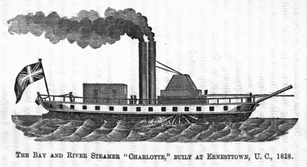
The Bay and River Steamer "Charlotte," built at Ernesttown, U. C., 1818.
In 1818, the Charlotte, a river steamer, was launched from the same yard where the Frontenac was built, to ply between Prescott and Carrying Place. She was the first river boat in Upper Canada, and was built by Henry Gildersleeve (who was also the assistant builder of the Frontenac) for a committee consisting of Smith Bartlett, Solomon Johns, Daniel Washburn, and Peter Hetsel. Although these two boats held almost a monopoly of lake and river transportation, the future was so doubtful to the editor of the Kingston Gazette, that he consoled himself with the reflection that "whether they prove profitable or not, they are calculated to promote the public good." It was said that the proprietors not only sought government aid, but the exclusive right of steam navigation,—a right which the legislature of Lower Canada had more than once declined to grant to Mr. Molson. The fate of the Frontenac in a measure warranted these fears; for, although she cost about £17,000, she was sold in 1825, at auction, for £1,550, to the Hon. Jno. Hamilton, of Kingston, whose whole life has been spent in developing steamboat transportation on the lake and river.
The celebrated Swedish engineer, Ericsson, while in England in 1837, successfully applied the screw to the propulsion of vessels. In 1841, the Vandalia, the first of a class now numbering over one hundred and twenty on the lakes, was built at Oswego, and afterwards sold to Canadians.
The whole number of steamers, propellers, and tugs now upon the lakes is 363, with an aggregate tonnage of 132,327 tons, and a valuation of $5,576,000. Of these, 100 are Canadian, having a tonnage of 30,511 tons, and a valuation of $1,397,000.
The magnificent subsidy awarded by the British government to the Cunard line had the effect of diverting Canadian traffic with Europe from the St. Lawrence river through the ports of Boston and New York. The policy of the Imperial government, which tended to build up American seaports at the expense of Canadian, left the colony no other resource than competition. On the 13th of August, 1852, a contract was entered into between the commissioner of public works of Canada, and Messrs. McKean, McLarty & Co., a Liverpool firm, for the term of seven years, by which a line of screw steamers of not less than 1,200 tons carpenters' measurement, 300 horse-power, and capable of carrying 1,000 tons of cargo besides coal for twenty-four days, were to commence running between Liverpool, Quebec, and Montreal, in the spring of 1853, once every fortnight during the season of navigation, and to Portland once a month; the outward passage not to exceed fourteen days, and the homeward passage thirteen days. The maximum rate of freight to be charged was 60s. per ton. Fourteen trips were to be made from Liverpool to the St. Lawrence and back, for which at least five steamers were to be provided; and five trips to Portland and back, for which three steamers were required. The vessels were all to be ready and to commence their fortnightly service on or before the 1st of May, 1854; and a sufficient number to be ready and to commence the monthly trips in the spring of 1853. The price to be paid by the province was, for fourteen fortnightly trips to the St. Lawrence, £1,238 1s. 11d. sterling per trip. The Grand Trunk Railway was to pay £336 6s. 8d. sterling for each monthly trip to Portland.
In October, 1852, Messrs. McKean, McLarty & Co. formed a provisional company under the title of the "Liverpool and North American Screw Steam-Ship Company," and petitioned the board of trade for a royal charter, with limited liability. In this they were vigorously and successfully opposed by the Cunard company, and generally by British ship-owners not protected by limited liability, and were compelled to attempt the formation of their company under a Canadian charter.
Under this contract, the Genova, a small steamer of 700 tons and 160 horse-power, was sent out in 1853,—the first transatlantic screw steamer which entered the St. Lawrence. The Lady Eglinton, 600 tons and 160 horse-power, and the Sarah Sands, 1,200 tons and 150 horse-power, followed; these boats made five trips only in 1853. The average voyage out was fourteen to twenty-two days, and home twelve to eighteen days; and 80s. freight, instead of 60s., was charged. In consequence of this total failure on the part of the contractors, the government of Canada annulled the contract, and on the 28th of September, 1855, a new one was entered into with Hugh Allan, of Montreal, to commence in April, 1856, and give the same time and number of trips as before, but with vessels not less than 1,750 tons builders' measurement, and not less than 350 horse-power. The subsidy was £24,000 sterling per annum, and a penalty of £1,000 for every trip lost was provided for, besides the deduction of a pro-ratâ amount of the subsidy. The contract was terminable by the contractor, at the end of any year, by giving six months' previous notice. Although the line was not remunerative in its first season, 1856, the contract was fulfilled in the most satisfactory manner, the outward passage being under thirteen days, and the homeward a little over eleven days.
The inefficiency of a semi-monthly line, especially for postal purposes, in competition with the subsidized line to Boston and New York, led to a revision of the contract in 1857, by which a weekly service to the St. Lawrence commenced in May, 1859, at a subsidy of $220,000 per annum. In April, 1860, a new contract was entered into with Mr. Allan, to continue in force until the 1st of January, 1867, for a weekly line between Liverpool and the St. Lawrence, and in winter Portland. All the vessels, except the Anglo-Saxon, Canadian, and North American, to be not less than 2,300 tons builders' measurement, with not less than 500 horse-power. Under this arrangement the ships must call at any port in Ireland which may be selected. The average passages in 1860 were twelve and eleven days, instead of fourteen and thirteen, the contract time. The subsidy is $416,000 per annum; the penalty for every trip not performed is $5,000, besides the contract value thereof; and the contract is terminable by the contractor on giving six months' notice, but by the government only in case of default. The doubling of the subsidy was in consequence of the losses of the company in the first year of the weekly line, in which two of their steamers, the Indian and the Hungarian, were lost in the Atlantic, en route for Portland, while off the coast of Nova Scotia.
In the winter of 1859, the Canadian steamships for Portland commenced to call at Cork, receiving supplementary mails, with letters written in London after the steamer had left Liverpool; but as Cork was not suited to the St. Lawrence route, Londonderry was selected for the Irish port of call, and the first voyage, stopping there, was made from Liverpool on the 30th of May, 1860. The day of departure from Liverpool was also changed, in July, 1860, from Wednesday to Thursday, taking an extra day from the Cunard line, which leaves on Saturday.
The Canadian line, in 1860, carried 620,000 letters between the United States and Europe, and received $104,641.68, from the United States' post-office, for this service. Previous to the arrangement of 1859 and 1860 the claims of the British and American post-offices, for packet and transit charges on Canadian correspondence with Europe, averaged $165,000 per annum; but, after 1860, they were reduced to $50,000—the difference of $115,000 per annum being the amount accruing to Canada from the transport of her own European correspondence.
This line has been unfortunate, in the loss of not less than five of its steamers in four years,—the Canadian in 1857, Indian in 1859, Hungarian in 1860, and Canadian and North Briton in 1861. Of these losses, two were in the St. Lawrence and three in the Atlantic, and of the former only one can be laid to the dangers of the navigation, as the first steamer lost was run ashore almost under the lamps of a lighthouse in full view, and on a bright, calm evening, by an incompetent pilot, who had assumed the control on her arrival.
The following table shows the principal dimensions, capacity, &c., of the Canadian ocean steamers:—
key = A Length of Keel; B Breadth of Beam; C Draft of Water; D Light; E Loaded; F Tonnage Measure't.; G Gross; H Net; I Freight Capacity, Tons.; J Nominal Horse-power.; K Consumption of Coal, per diam. Tons.; L Speed per hour—geographical miles.; M Number of Officers and Crew.; N Carries Cabin passengers.; O Carries Steerage passengers.
| LIVERPOOL AND LONDONDERRY LINE. | C | F | |||||||||||
| A | B | D | E | G | H | I | J | K | L | M | N | O | |
| North American, | 276 | 35 | 11 | 19½ | 1,784 | 1,137 | 1,000 | 250 | 45 | 11 | 75 | 100 | 250 |
| Anglo Saxon, | 276 | 35 | 11 | 19½ | 1,784 | 1,165 | 1,000 | 250 | 45 | 11 | 75 | 100 | 250 |
| Nova Scotian, | 292 | 38¾ | 13 | 21½ | 2,250 | 1,487 | 1,250 | 300 | 50 | 10 | 90 | 120 | 350 |
| Bohemian, | 292 | 38¾ | 13 | 21½ | 2,250 | 1,488 | 1,250 | 300 | 50 | 10 | 90 | 120 | 350 |
| Hibernian, | 296 | 38 | 13 | 21½ | 2,334 | 1,888 | 1,150 | 300 | 48 | 11 | 90 | 120 | 350 |
| Norwegian, | 296 | 38 | 13 | 21½ | 2,334 | 1,888 | 1,150 | 300 | 48 | 11 | 90 | 120 | 350 |
| Jura, | 305 | 37¾ | 13½ | 22 | 2,246 | 1,067 | 1,200 | 400 | 60 | 12 | 90 | 60 | 350 |
| New ship, building, | 300 | 38 | 13 | 22 | 2,350 | ... | 1,250 | 500 | 50 | 15 | 110 | 120 | 350 |
The nominal horse-power, speed and ship's company are approximate; the actual horse-power exerted is nearly four times the nominal. The Hibernian and Norwegian show a marked advantage in the net tonnage as compared with the gross.
There are two regular Lines of Screw Steamers sailing to Glasgow, and the pioneer vessel of one to London has visited Montreal.
The St. Lawrence route to Liverpool as a steam one has the very great advantage of sheltered and therefore comparatively smooth water from Cape Race to Quebec. The Canadian steamers have 1,000 miles less of open ocean to contend with than those plying to New York. Our mail steamers should therefore regularly make shorter time than the Cunard line, but for want of sufficient power they do not do so: and from over loading since the grain trade at Montreal has increased, their average voyages are longer now than they were before 1860. The contract for fixing a maximum for the outward and homeward passage necessarily allows a margin for bad weather, and thus this provision fails to secure that speed which alone can establish the route. The subsidy should not be renewed unless the utmost efficiency of which a screw line is capable of, is secured; for this is precisely one of those things which should be thoroughly done or not attempted at all. It is the height of folly to continue to pay a large subsidy to a line just fast enough to be beaten. The fastest line will take the mails,—the most profitable traffic; and a larger subsidy even than that now paid might prove remunerative if these can be secured. A subsidy is no longer needed to open the route,—it should now only be employed to demonstrate its superiority to all others.
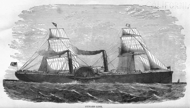
CUNARD LINE.
During the first quarter of the present century,—before the state of New York had availed herself of that remarkable pass through the Alleghany range, which is afforded by the Hudson River, and had tapped Lakes Champlain, Ontario, and Erie by means of her grand canals,—exports from Northern Vermont and New York, viâ Lake Champlain (or Corlaer's Lake, as the Dutch had named it,) as well as from those tributaries of the St. Lawrence which take their rise in the "Empire State," sought an outlet at Quebec and Montreal. Previous to the year 1822, American lumber, grain, &c., were admitted into Canada, duty free, and exported, with all the privileges afforded to Canadian products, to the British West-Indian colonies. While New York was pressing forward her canals (commenced in 1817 and completed in 1824,) the Imperial authorities, in 1822, prepared the way for the complete diversion of American exports from the St. Lawrence to those canals, by imposing a duty upon such exports to Canada. Sir J. B. Robinson, in 1822, as the agent of Upper Canada in London, very properly suggested that the propriety, or otherwise, of such a duty might safely be left to the Canadians; but the defense to the measure was that, as Canadian products were admitted into the British West-India colonies free of duty, while American were taxed, the free admission of the latter into Canada would be a discrimination in favor of British bottoms, viâ the St. Lawrence, against American bottoms, viâ the Mississippi, of which the Americans would complain as an evasion "of the relaxation professed to be made in the navigation laws for the benefit of a reciprocal commerce." This blunder was, however, acknowledged, in 1831, by the re-admission of American exports, as before, free of duty.
Long before the commencement of any regular system of improvement, by means of continuous canals overcoming the whole of any rapid, small locks for batteaux had been constructed by the French at the Cascades, the Coteau, and the Longue Sault rapids. In 1804, these were reconstructed of larger size and in improved positions, by the royal engineers, as military works. While furs were the only exports the batteau was suited to the trade in both directions; but when agricultural export commenced, grain was first sent down (before 1800) on the rafts, and in scows or "arks" which were broken up and sold as lumber in Montreal. Some slight improvements were made by Lower Canada in 1805 and 1806 in the boat channel of the rapids. Merchandise was at that time carted to Lachine, from whence the batteaux and Durham boats took their departure (in "brigades" of five or more boats, that their united crews might aid each other at the rapids,) and sailed through Lake St. Louis. At the Cascades, three-fourths of the cargo was discharged and carted to the head of the Cedars—the boat, with the remaining fourth, being locked past the Cascades, dragged up the "Split Rock" and Cedars, and re-loaded—passing the Coteau by a lock into Lake St. Francis. Above Cornwall, there were two locks in Longue Sault, one of which was a private speculation; and between Mille Roches and the head of the Longue Sault, as between the Cascades and the Cedars, lighterage was necessary, three-fourths of the cargo being discharged and hauled over land. From Prescott the boats sailed up to Kingston, or (after 1818) were towed by steamer. The average time required for the voyage was twelve days, and the actual expenses of a Durham boat with an average cargo of eight tons, from Lachine to Kingston, were as follows:—
| Tolls at the Cascades and Coteau, | £2 | 10 | ... |
| Towing at different Rapids, | 5 | 10 | ... |
| Land carriage of 6 tons from Cascades to the Cedars, | 3 | ... | ... |
| Land carriage of 6 tons from Mille Roches, | 3 | ... | ... |
| Towing by steamboat from Prescott to Kingston, | 3 | 15 | ... |
| Wages, &c., 6 men, 12 days, at 3s. 6d. per day, | 12 | 12 | ... |
| £30 | 7 | 0 | |
| $121 40 cents. | |||
Salt, which was taken at the lowest rates, was charged 3s. 9d. per cwt., in 1825, from Lachine to Kingston; the average rate on merchandise being 4s. 6d. per cwt., or eighteen dollars per ton. The number of boats which paid toll at the Coteau locks were—
| Year. | Durham boats. | Batteaux. |
| 1818, | 315 | 679 |
| 1819, | 339 | 573 |
| 1820, | 561 | 430 |
| 1821, | 342 | 634 |
| 1824, | 268 | 596 |
An addition of about twelve per cent. should be made, to the above because one boat out of eight or nine sailed up the rapids, and did not pay toll. Of the Durham boats about one-half were American.
For downward cargo a Durham boat had a capacity of three hundred and fifty barrels of flour, and a batteau thirty to forty; but in their latter days these were made nearly as large as the former. Upward, the former averaged eight tons, and the latter four to five. The transportation of 1824 was diminished by a failure of the harvest in 1823, as well as by the operations of the Imperial trade act of 1822.
The average passage of a boat from Kingston to Lachine was four days, and the expense as follows:—
| Six men, four days, at 3s. 6d., | £4 | 4 | ... |
| Pilotage at the rapids, | 1 | 17 | 6 |
| £6 | 1 | 6 | |
| $24 30 | |||
The downward trade in 1818 to 1825 averaged about 150,000 to 175,000 barrels per annum, say 15,000 tons; and the upward trade about 5,000 tons, or about one to three. In 1832, the trade had increased so as to give six to eight hundred Durham boats and twelve to fifteen hundred batteaux, passing the locks, the down trade being 66,000 tons and the up trade 21,000 tons—the proportions of about three to one still holding good.
As the trade increased, passenger steamboats were placed on Lakes St. Francis and St. Louis, and four-horse coaches upon the portage roads. Improvements in the steamboats, in 1833, enabled them to overcome the smaller rapids between the Longue Sault and Prescott; and from that date they descended as far as Dickinson's Landing.
The agitation of the Erie and Champlain canals early drew the attention of the Canadians to the competition with which they were threatened. It was a renewal of that strife, for the commerce of civilization, which had existed for the fur-trade, between the English colonies on the Atlantic and the French at Montreal and Quebec, before the conquest. A short portage divided Fort Stanwix, on the Mohawk (a principal branch of the Hudson,) from Wood Creek, which flowed into Oneida Lake, and thence, by the Onondaga River, into Lake Ontario, at Oswego, which latter place was the scene of more than one conflict between French and English and their savage allies, over one hundred years ago.
In 1817, the same year in which the canal bill passed at Albany, and a month earlier, the government of Upper Canada advertised for tenders for the improvement of the navigation between Lachine and Kingston, by the course of the river Rideau. The project of connecting Lakes Erie and Ontario, by the Welland Canal, first appears in print, November 29th, 1817, in a paper prepared by William Hamilton Merritt for Robert Gourlay. In 1818, a company was incorporated to construct the Lachine Canal, a project which had been mooted as early as 1795; and another, in 1819, for the construction of the canal at Chambly.
Thus, movements were on foot, in the center and at the two extremes,—to compass the objects aimed at by the state of New York,—before the completion of her canals had demonstrated their success; but, from various causes, at the head of which, no doubt, the separation of the provinces stood first, no actual commencement was made except with the Lachine Canal upon the Island of Montreal, and the Grenville Canal (by the Imperial government) on the Ottawa, until long after the completion of the Erie and Champlain canals.
The military canals, having been conceded to the province in 1853, and happily never having been required for other than commercial purposes, will be noticed under the head of the Ottawa River improvements.
Taking the three great routes of Canadian navigation in the order of their extent, we begin with the shortest.
The Richelieu or Iroquois River has a length of eighty miles between Sorel, on the St. Lawrence, and Rouse's Point, on Lake Champlain, with two obstructions to navigation in this distance. The first is overcome at St. Ours, about fourteen miles from Sorel, by a dam which deepens the water between this point and Chambly, and a lock—two hundred feet in length between the gates, and forty-five feet wide between the walls, with six feet depth of water—begun in 1844, and completed in 1849, at an outlay of $153,117.65. The second is the rapids above Chambly, which are passed by a canal eleven and a half miles in length, with nine stone locks, each one hundred and twenty-four by twenty-four feet, and six feet of water; commenced in 1831, suspended in 1835, resumed in 1840, and completed in 1843, at a cost of $480,000. By means of these improvements, boats can pass from any part of the St. Lawrence into Lake Champlain, and thence, by the Northern Canal and the Hudson River, to the city of New York. Large quantities of lumber are transported by this route from the city of Ottawa to the Hudson River without transhipment.
Lake Champlain navigation extends into Canada as far as St. John's, at which point the river Richelieu is 29 feet higher than the St. Lawrence at Lachine, or 74 feet higher than the river at Montreal. The distance between Caughnawaga (opposite Lachine) and St. John's is about 25 miles in a direct line; but if Lake Champlain be made the feeder, a canal must make a detour to avoid high ground, which will give a length of 32½ miles, and a cost of about two millions of dollars. Another plan is, to carry a feeder, 16 miles in length, from the Beauharnois Canal, on a level 37½ feet higher than Lake Champlain, down to a point opposite Caughnawaga, and feed a direct line of canal between this point and St. John's, which would be about eight miles shorter than the canal fed from the Champlain level; but as it would have 87 feet more lockage, this would nearly equalize the two routes, in point of time. This scheme, with the feeder made navigable, would cost about double the other, say four millions of dollars; and, with a feeder only, about three millions of dollars. The first scheme gives the minimum amount of lockage to the Ottawa lumber trade; the second, to the through trade from the West, unless the rapids are navigated by the freight boats, in which case these will not leave the St. Lawrence until they reach Caughnawaga; but the question of cost is conclusive between these two plans. Montreal claims that the terminus of the canal should be opposite that city: this has been objected to as causing the Ottawa and western trade to descend 45 feet, only to ascend the same again—besides adding to the length of the route.
The Ottawa River, where it joins the St. Lawrence, divides so as to form the Island of Montreal, and about one-third of its volume, flowing by St. Anne's and Vaudreuil, (where it forms a large island called Isle Perrôt;) enters Lake St. Louis, and passes over the Lachine Rapids—its dark waters taking the Montreal side and forcing the blue St. Lawrence into mid-channel. The other two-thirds flows to the rear of Montreal Island, forming Little River, in which is another large island, Isle Jesus, and discharges into the St. Lawrence about fifteen miles below Montreal.
In connecting tide-water with the interior, the Lachine Canal is common to both the St. Lawrence and the Ottawa routes. Lachine, at the head of the first rapids on the St. Lawrence, may, therefore, be considered the starting point of this route; and the first place where the navigation has been improved, is at St. Anne's, near the entrance to the Lake of Two Mountains. The rapid here is navigable at high water only; the opposite one of Vaudreuil, though affording a more circuitous route, was passable at all stages, and was, moreover, after 1832, aided by a lock for batteaux, built by a private company. In this way navigation was maintained until 1843, when the provincial government completed the lock at St. Anne's, which was commenced in 1839,—is two hundred feet long by forty-five feet wide, and, with the wing dam, cost $111,796. By means of this lock, a large passenger steamer is enabled to run from Lachine to Carillon at the foot of the Longue Sault of the Ottawa, a distance of forty-five miles. The Longue Sault and other rapids between Grenville and Carillon, a distance of twelve miles, are passed by three detached canals with locks, the upper and older of which was commenced, in 1819, by the Imperial government upon the same dimensions as the old Lachine Canal, and remains unaltered to this day. The others were not so far advanced in 1828, when the enlargement of the Rideau Canal was decided on, and therefore have locks one hundred and twenty-eight to one hundred and thirty-four feet long, and thirty-three feet wide; and also extra lockage, because the lowest one is fed from the North River, a branch of the Ottawa. From Grenville to Ottawa the river is navigable, and a passenger steamer, (confined to the reach by being too large for the locks of the Grenville or Rideau canals,) runs in connection with portage railway between Grenville and Carillon, the steamer between Carillon and Lachine, and the railway thence to Montreal; thus making two railways and two steamers necessary to convey a passenger from Montreal to the city of Ottawa.
Above this city, the Chaudière Falls and the rapids near them obstruct the navigation for several miles; but a Macadam road connects with an iron steamer on the Chaudière Lake. No attempt, beyond surveys, has been made to overcome the obstructions to ascending navigation immediately above Ottawa; but at the next point higher up (the Chats,) an abortive attempt to connect the Chaudière and Chats Lakes, which are three miles apart and have fifty feet difference of level, has been made. The obstructions at the Chats are at present surmounted by a horse railway, three miles in length, which conveys passengers and freight between the iron steamers which are running upon the two lakes. Two other steamers are plying still higher up, on reaches divided by rapids but connected by good portage roads; and by this means transportation is effected as far as the head of the Deep River, or to the foot of the rapids of the Deux Joachims, a point nearly three hundred miles from the mouth of the Ottawa. From this point upward the swift current and numerous rapids force a transfer from the steamboat to the bark canoe—from the highest to the lowest order of vessels for water transport.
The agitation of the canal question so soon after the peace of 1815, naturally gave military considerations a prominence in the discussion of the route; and thus we have seen that, in 1817, the first action taken by Upper Canada was with reference to this route. In 1824, the Imperial government offered to aid the upper province by a grant of £70,000 sterling, towards the construction of this canal; but the joint committee on internal navigation, in 1825, while admitting that this offer "ought to determine us to apply our first exertions to the communication between Kingston and Ottawa," was of opinion that, "regarding only the commercial interests of the province, in time of peace with the United States, the improvement of the river St. Lawrence would naturally first engage attention, because a much less expenditure would render this direct and natural channel more convenient for all purposes of trade." The estimate by the St. Lawrence route, for locks one hundred and thirty-two feet by forty feet, with eight feet of water, was only £176,378 (or $705,512;) while that for the Rideau, with locks only one hundred by twenty-two feet, and seven feet of water, was £230,785 (or $923,140.)
The Imperial government had turned their attention to this route immediately after the war; and, early in 1815, Colonel Nicolls, commanding royal engineer, sent Lieutenant Jebb to explore the direct route by Irish Creek. In 1825, a committee of royal engineers, sent out to Canada, were instructed to bring home an estimate for the cost of a canal by this route, based upon the dimensions of the Lachine Canal, then completed. This was found to be £169,000 (or $676,000)—whereupon the Imperial government, desirous of retaining the complete control of the canal in case of another war, determined on its construction; and, in May, 1826, sent out Lieutenant-Colonel John By, R. E., who commenced it on the 21st of September, 1826, and passed the first steamer through on the 29th of May, 1832; but the works were not completed until 1834. This route is one hundred and twenty-six and one-quarter miles long, of which only sixteen and a half are canal. From Ottawa, it ascends two hundred and ninety-two feet by thirty-four locks, in a distance of eighty-seven and a half miles, to the summit level of the Rideau Lakes; and then descends one hundred and sixty-five feet by thirteen locks, in a distance of thirty-eight and three-quarters miles; giving a total of forty-seven locks with four hundred and fifty-seven feet lockage. The navigation is formed by twenty-four dams, six of which range from twenty-five to sixty feet in height. Most of these dams are of stone,—a questionable policy, as timber ones are as reliable and very much cheaper. The original canal was intended to have a towing path; but, in 1828, another committee of royal engineers, with Sir James Kempt at their head, authorized its enlargement for steam navigation, the locks to be one hundred and thirty-four by thirty-three feet; the towing-path was, therefore, unfortunately omitted.
The canal drops into the Ottawa by a flight of eight combined locks, having a lift of eighty-two feet; and as it was necessary, on leaving the Ottawa, at once to rise above the level of the Chaudière Lake, the navigation would have been extended without additional lockage, nearly forty miles higher up the river, had the canal been kept in it until that lake was reached.
The Ottawa, above the point where the Imperial canal joined it, has been, with several of its large tributaries, the subject of improvement, for downward transportation only—for the purpose of bringing out timber and lumber with greater expedition, greater safety, and greater economy. These works are peculiar to Canada and deserve more than a passing notice.
The heavy timber, hauled out by the aid of the snow which gives access to every tree, is deposited on the ice in the several streams and lakes, and is there left to be borne down by the spring freshets, either in single sticks or in rafts manned by men, according to the size of the stream. If not rafted, it goes off with the water, followed by the men in canoes, whose duty it is to look after the stragglers grounded on a shoal or detained in an eddy, and shove them out into the main stream. This mode of bringing out the timber, which is called "driving," is practicable upon almost all streams when in freshet; but, on many, there are a few places where the obstructions are so great as to call for artificial aid, to prevent detention of the timber until too late for that tide which, if not taken at the flood, too often leads to misfortune. In some rivers, precipitous cataracts and jagged rocks are so destructive to timber that the virgin groves have remained almost untouched, until, by means of slides and dams, it could be profitably brought down. In others, the delays in passing certain points were so great that the freshet passed off before the timber could be got into the main river, and it was left behind for the next year.
The slides are artificial "chutes" formed by inclined troughs of timber and plank, open at both ends, through which a portion of the stream is diverted, and the timber thereby carried past chutes and places where it would either stick fast or be torn to splinters. For "driving," the slides are narrow, and similar to the flumes or raceways supplying a water-wheel; but when designed for the passage of rafted timber they are twenty-five feet wide; and down one of them a crib, containing fifteen hundred cubic feet or nearly forty tons of timber, will be carried, with the men aboard and the cookhouse undisturbed, and in a few moments be fifty feet below its former level.
Dams are resorted to to flood back the water on shoals and rocks which retain and damage the timber; to stop up high water channels—so as to keep it from straying or to strengthen the main current; and also at the head of chutes, to govern and regulate the mouth of slides.
The Ottawa and the Bay of Quinte, the latter as being the outlet of the inland waters, are the chief sources from whence Quebec is supplied with timber; to these may now be added the St. Maurice or Three Rivers. Recently, rafts have been towed through some of the great lakes, but at much risk and some loss. The first raft from the Bay of Quinte was got out by Samuel Sherwood, in 1790. It was composed of masts cut upon the north shore of the bay, three miles east of Trenton; and there being then no cattle in the country, Sherwood used tackle to haul the timber to the water. In 1806, Philemon Wright took the first raft down the Ottawa. It was obtained from the Gatineau, a large tributary entering near Ottawa City.
In 1853, an appropriation of $200,000 was obtained, without previous surveyor estimate, for the purpose of connecting the Chats and Chaudière Lakes by means of a canal with fifty feet lockage. The idea of the projectors was to commence on a magnificent scale at a point where the very uselessness of the expenditure would be an argument in favor of its extension, east and west, to Montreal and Lake Huron. They did not, therefore, court any analyzation of the scheme. The government of that day, on the other hand, obtained the support of the Ottawa constituencies for their railway policy along the St. Lawrence, and were thus induced to grant the sum required to commence operations. The simultaneous failure of the contractor and the appropriation afforded a decent pretext for suspension in 1856, which ended in abandonment: in the meantime the projectors were amused with a series of extensive surveys of the whole route, between Montreal and Lake Huron,—of over four hundred miles, and with estimates for canals for Atlantic vessels.
The result of these surveys shows that the abandoned canal on which $373,191 has been expended was in the wrong place; that to have completed it on the scale proposed would have cost $1,465,439, whereas the same result can be produced in the right place for $681,932—in other words, that the opportune abandonment of the work will effect a saving of $410,316. It is gratifying to know that if the commencement has involved a loss of $373,191, the abandonment has saved a greater sum, and that there is still a handsome balance to the credit of the latter. The summit level of the proposed Ottawa route at Lake Nipissing would be six hundred and fifty-one feet above tide-water; and the total rise and fall from tide-water to Lake Huron, by this route, is seven hundred and twenty-eight feet, the fall from Lake Nipissing to Lake Huron being seventy-seven feet.
The general results of the Ottawa survey, as made by Mr. T. C. Clark, C. E., are embraced in the following table extracted from his report:—
| Distances, miles | Levels | ||||
| Sections. | Rivers and Lakes. | Canals. | No. of Locks. | Lockage, feet. | Cost. |
| Lachine Canal, | 8.50 | 5 | 43.75 | not estimated. | |
| Lake St. Louis, | 13.31 | do. | |||
| Saint Anne's, | 1.19 | 1 | 1.00 | $469,672 | |
| Lake of Two Mts., | 24.70 | ||||
| Carillon to Gr'nv'le, | 7.73 | 5.00 | 7 | 58.50 | 1,649,909 |
| Green Shoals, | .10 | ||||
| Ottawa River, | 55.97 | ||||
| Chaudière and Des Chènes, | 3.75 | 2.61 | 6 | 63.00 | 816,733 |
| Des Chènes Lake, | 26.69 | ||||
| Chats, | 1.70 | .60 | 5 | 50.00 | 681,932 |
| Chats Lake, | 19.28 | ||||
| Snows to Black falls, | 18.32 | 1.05 | 11 | 104.00 | 1,256,840 |
| River and Lake Coulonge, | 24.93 | 262,514 | |||
| Chapeau and L'Islet, | 4.85 | .14 | 2 | 18.00 | 243,507 |
| Deep River, | 33.58 | ||||
| Joachim's to Mattawan, | 51.74 | 2.26 | 14 | 148.20 | 1,757,653 |
| River Mattawan, | 16.22 | 1.08 | 11 | 144.00 | 1,162,154 |
| Summit level and cut, | 51.15 | 5.97 | 2,160,369 | ||
| French River, | 47.52 | .82 | 7 | 77.00 | 886,117 |
| Add Engineering & Superintendence, | 574,175 | ||||
| Totals, | 401.44 | 29.32 | 64 | 665.70 | $12,057,680 |
The scale of navigation proposed is for vessels of one thousand tons. Locks two hundred and fifty feet long by forty-five feet wide, with twelve feet depth of water on the mitre sills.
These figures are conclusive;—a canal scheme, undertaken on such a scale, and upon such a route, with all the changes and additions which would follow, would result in an expenditure of at least twenty millions of dollars; but if it could be done for ten, it would be equally impracticable as a provincial undertaking. The region traversed does not possess sufficient political influence to carry the appropriations for a tithe of the sum required; and as a commercial speculation no case could be made out for it. Although it would shorten the distance between Montreal and Lake Huron by three hundred miles over the present route, viâ the lakes and the Welland Canal, there would be no saving of time on the round trip, on account of the extra lockage and river navigation; and it would be exclusively a route for steamers, whereas the greater part of the present route is available for sail craft. On the St. Lawrence route the extra three hundred miles would be overcome by a propeller in the open lakes with an unvarying speed, night and day, of ten miles per hour; while the ten extra locks of the Ottawa route, and the more intricate river navigation worked at half-speed, would demand at least an equal loss of time. For the downward commerce only, which gives at least three tons to one of the upward, the difference is vastly in favor of the St. Lawrence, in those boats which descend the rapids, as there is in this case only the Welland Canal with twenty-seven locks against the Ottawa canals with fifty-nine. On the St. Lawrence route there is a local as well as a through business, and a choice of markets while in transitu, as well as the proximity of railways in case of interruption to the navigation. On the Ottawa there is at present only sawn lumber to fill out a cargo. But while so great an undertaking is, on the part of Canada, financially impracticable and commercially unwarrantable, the opening of this route is, as an imperial and military work, most desirable. From the remote position of the greater part, the expense of cut-stone locks of the size proposed, would make it advisable to reduce the scale and also the character of the work. Cedar cribwork is nearly as durable as ordinary masonry in this climate; and by substituting it, filled with stones and planked water-tight, for stone-work, the Ottawa route would supply the materials and the kind of labor required. The laying of masonry can only be advantageously done for a few months in the year, and a portion of this time would be lost by high water. In some sections it would probably be found cheaper to build timber locks, if only for the purpose of reducing the cost of the future stone ones. Any increased cost of maintenance would be far less than the interest saved, and the amount so saved in interest would be an ample renewal fund. The fact that scarcely one of the hundreds of stone locks in America have proved after ten years' experience, to be properly proportioned, for the wants of commerce, would suggest the propriety of substituting timber for stone for the peculiar conditions of the Ottawa route—especially as there seems no hope for the work being carried out upon any more expensive basis.
The early and efficient commencement of this work was very much retarded by the fact that the obstructions were under separate jurisdictions, and nearly equally divided between the two provinces; and that the action of one would be of little value unless imitated by the other. Lower Canada, having control of the seaports, helped herself to the lion's share of the import duties, the only fund upon which either province could rely for internal improvements. The division of these duties was a constant source of contention between them. From 1792 to 1813, Lower Canada collected a net revenue of £642,000 sterling, of which she kept £600,000 and gave the odd numbers to her younger sister. From 1813 to 1818, Upper Canada received less than twenty-five per cent. of the net revenue collected by Lower Canada,—and in 1820 and 1821, nothing at all; whereupon she carried her complaints to the foot of the throne, and thereafter the Imperial government assumed the collection and distribution of these revenues. The net amount received by the two provinces, in the half-century between their separation in 1791 and their re-union in 1841, was, Lower Canada, £3,445,140 sterling (or $17,225,700;) and Upper Canada, £731,834 sterling (or $3,659,173,) which may be considered the measure of the ability of the two, respectively, in carrying on their public works. Both provinces had a gradually increasing but comparatively unimportant revenue collected at their inland ports; and Lower Canada, under cover of inspection, levied a toll on scows and rafts passing Chateauguay, which, between 1808 and 1831, yielded about £6,500 (or $31,633.33.) She also claimed the excess, not only by virtue of her superior population, but on the ground that rum, the article on which the bulk of the duty was collected, was almost exclusively consumed by her; and Upper Canada was charged with having descended to whisky. Per contra, it may be stated that the quantity of rum which passed above Coteau du Lac in 1799 was about sixty thousand gallons, (which probably went to the United States as well as to Upper Canada;) and the still harder fact that a barrel of rum, the freight on which was three to three and a half dollars from Lachine to Kingston, was the well-known standard of up freight for merchandise by batteaux and Durham boats.
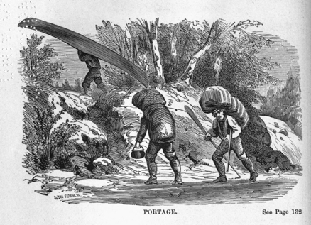
PORTAGE. See Page 132
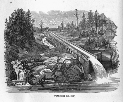
TIMBER SLIDE.
The action taken by the two provinces, respectively, before the Union with reference to the improvement of the St. Lawrence was as follows. As early as the session of 1795-96, a bill was introduced for the construction of both a canal and a turnpike to Lachine, by the late Hon. John Richardson, who lived to carry out those schemes at a later day. In 1805, the Legislature of Lower Canada appropriated £1,000 (or $4,000) to clear the channel of the Lachine Rapids. Batteaux, which ran down loaded, were dragged up light and took in their up cargo at Lachine, to which point it was carted from Montreal. The result of this first expenditure proving satisfactory, a similar sum was given the following year for the rapids between Montreal and Lake St. Francis. Nothing further was done until 1818, when commissioners were appointed to meet those from Upper Canada about the improvement of the water communication between the provinces, both by the St. Lawrence and Ottawa routes. In that year, also, a company was incorporated to construct the Lachine Canal within three years, and another for the Chambly Canal, to be completed in seven years. In 1821, the Lachine Canal was assumed by the province, the company having failed to act; and in 1823 a similar course was taken, for the same reason, with the Chambly Canal, coupled with the proviso that it should not be commenced until the Lachine was completed. In 1831 an appropriation was made for ascertaining if loaded batteaux could be taken up the rapids between Lakes St. Francis and St. Louis, and whether steamers, about the ultimate power of which great expectations had been formed, could not ascend the cascades to Prescott. This was a scheme for "reducing the grade" of the river at the rapids, by which it was hoped currents of twelve or fourteen miles per hour could be reduced one-half. Cuts forming inclined planes were made at Mill Point below the Cedars, at Point au Diable, the Rigolet, and French's Run; but nothing beyond the expenditure of the money resulted from this movement,—with which the action of Lower Canada in respect to the improvement of the St. Lawrence terminated.
The first movement of Upper Canada was an advertisement dated 19th February, 1817, in which the lieutenant-governor invited tenders for the work of rendering the whole or any portion of the water communication between Lachine and Kingston, by the course of the river Rideau, navigable for boats drawing two feet of water and ten feet in width, and also for boats drawing three feet of water and twelve feet in width. The route defined was by Irish Creek and Rideau and Mud Lakes; the number and position of the locks were to be specified, and "the number of flood-gates in each lock." The next year £2,000 (or $8,000) was granted for a survey of the St. Lawrence, and in 1821 commissioners were appointed. In 1823 and 1824, £2,000 (or $8,000) more were granted to this commission of which Robert Nichol was vice-president, and James Gordon and Charles Jones, members. On the death of Colonel Nichol, his place was filled by John Macaulay. As the views of the country with respect to the scale of the proposed navigation became enlarged each successive year, the magnitude of the undertaking evidently alarmed the Legislature. Even the offer of £70,000 stg. ($350,000) by the Imperial government towards opening the Rideau route, failed to elicit more than an expression of gratitude and a promise of early consideration. The Legislature leaned to the St. Lawrence as the natural commercial route, having only about one-half of the lockage of the Rideau route; and were, moreover, convinced that it would be the cheaper of the two. The Imperial government, desiring the control of the work for military purposes, set about the Rideau Canal themselves, in 1826, on an estimate of £169,000 stg. ($845,000,) and completed it in 1832 at a cost of £900,000 stg. ($4,500,000)—a result which may fully account for the hesitation of the Legislature, in 1825, in accepting the £70,000 ($350,000) and undertaking the work.
The opening of the Rideau route failed to satisfy the wants of the trade. The lock at Vaudreuil was in the hands of a private company; those at Grenville were much less in size than the ones above and below them; fixed bridges prevented masted vessels from going through; and the absence of a towing-path made forwarding a monopoly, and caused the delay and expense of locking a steam-tug through with every freight. Moreover, the canal was managed as a military rather than commercial undertaking—the parties in charge being beyond the reach of authority or opinion in the colony. No sooner had it been tried, therefore, than the improvement of the St. Lawrence was set about; a grant being made for the Cornwall Canal in 1833, and this work was commenced in 1834.
In describing the several works embraced in the improvement of the St. Lawrence, we commence at tide-water with
About fifty miles below Montreal, at the lowest point uninfluenced by tide, the St. Lawrence spreads out into a broad and shallow expanse called Lake St. Peter. The depth at low-water upon these flats was only eleven feet, and sea-going vessels were consequently obliged to lighten in entering and leaving Montreal, which city, notwithstanding this disadvantage, maintained her position as the emporium for the import trade, and of all exports except timber, in which latter trade the tidal harbor and roomy coves of Quebec defy competition. As there were only two or three comparatively insignificant bars above Lake St. Peter, and none below, and as the bed of the lake was soft, it was proposed to deepen the channel by dredging, so that sixteen feet draft of water might be carried up to Montreal. This was first attempted by the government in 1844, when the engineers endeavored to induce old Father St. Lawrence to leave the bed in which he had lain since first he emerged from the ocean, and follow a "straight cut," to be dredged to the required depth. The work was so managed that, after expending $295,619, it was suspended in 1847, and the Legislature, after investigation, abandoned it in disgust; whereupon the Hon. John Young, on behalf of the harbor commissioners of Montreal, after four years had elapsed, obtained permission to try again, and the work was recommenced in 1851. By following the natural channel, complete success has been obtained, with much less time and money, and a vessel drawing not sixteen but eighteen feet of water can now come up. It is intended to continue operations until twenty feet at low-water is obtained; and as the government, having had its practicability demonstrated, has assumed the expense, it is to be hoped this work will be carried out.
The original canal between Montreal and Lachine, commenced in 1821 and completed in 1825 at a cost of £110,000 (or $440,000,) was an admirably constructed work, with cut-stone locks, one hundred and eight feet long between the gates, and twenty feet wide, with fixed bridges of the same class of masonry. In these, as in the locks of the Rideau and St. Lawrence canals, the upper gates were placed upon breast walls, which reduced the effective length of the lock. On the Welland Canal, the upper gates being carried down to the level of the lower ones, the whole length between the gates is available.
The enlargement of the old Lachine boat canal, in connection with the construction and completion of the remainder of the St. Lawrence ship canals, was one of the immediate consequences of the reunion in 1841, thus confirming the views of Mr. Macaulay, in 1825, as to the impolicy of its substantial stone locks of boat size only. The enlargement, begun in 1843, was sufficiently advanced in 1848 for the passage of large vessels, and was completed in 1849, except the widening of a portion of the rock-cut near Lachine which is now in progress. This canal, eight and a half miles long with forty-four feet lockage, surmounts the obstacles presented by the Lachine Rapids, and connects Lake St. Louis, an enlargement of the St. Lawrence, with the harbor of Montreal.
The next in order is the Beauharnois Canal on the opposite or south bank of the St. Lawrence, and the only one upon that side, eleven miles long with eighty feet lockage, commenced in 1842 and completed in 1849. It connects Lake St. Louis with Lake St. Francis, overcoming three considerable rapids, united together by a swift current, and known as the Coteau, the Cedars, and the Cascades.
At the upper end of Lake St. Francis, the Cornwall Canal, twelve miles long with fifty feet lockage, reaches the head of the Longue Sault Rapids. This work was undertaken by Upper Canada alone in 1834, and carried on until 1838, by which time £440,000 (or $1,760,000) had been expended. It was completed after the union, at an additional cost of £75,000 (or $300,000,) and opened for traffic in 1843.
From the Cornwall Canal to Prescott, a distance of thirty-eight miles, there are four minor rapids,—Farrans Point, Rapid Plât, Point Iroquois, and Les Gallopes,—with a united lockage of twenty-two and a half feet, at which four separate canals were first constructed, the two upper of which have since been united by the Junction Canal. These canals were commenced in 1843; the upper one was opened to the trade in 1846 and the remainder in 1847.
The notable feature of the St. Lawrence navigation is, that although between Prescott and Montreal, a distance of one hundred and fifteen miles, there are forty and one-half miles of canal, and twenty-seven locks with two hundred and four and three-quarters feet lockage, steamers of five hundred tons burthen daily descend from the level at Prescott to that at Montreal (the fall being two hundred and twenty-five feet) without using a lock or canal. The rapids of the St. Lawrence, though some have a fall of over forty feet in a mile, are navigable for descending boats with a draught of six to eight feet according to the extremes of low and high water. Freight boats drawing more than this descend the canals; but the mixed freight and passenger steamers, which the rapidity, comfort, and excitement of the trip sustain in spite of the railway, all run the rapids, making the passage between Prescott and Montreal in nine to ten hours. The improvement of the rapids so as to turn the whole descending trade down the river, thereby shortening the time of transit and practically doubling the capacity of the canals, has been mooted for the last ten years. Two modes have been proposed; one to raise the water surface by dams and piers, the other to lower the bottom by submarine blasting,—both having the same object in view, viz., the increase of depth at two or three points, where alone there is any deficiency. The former plan has been successfully adopted for the purposes of the timber navigation on the Ottawa; the latter, which has been also tried there, has not only done no good but positive harm, because it has substituted a torn and jagged bed of rock for one worn smooth by the flow of ages. Moreover, a rapid being an inclined trough, if the bottom is lowered the water surface descends with it more or less, and any attempt to increase the depth, beyond the removal of an isolated boulder, &c., by submarine blasting, except in slack water, seems hopeless. Lastly, the effect of submarine blasting against Potsdam sandstone in shoal water would scarcely be perceptible, while the cost, if persisted in, would be overwhelming. An appropriation of £25,000 (or $100,000) as an experiment would settle the question of the practicability of flooding the shoals by dams, &c., and would be a mere trifle, even to throw away in pursuit of an object of so much importance. The indifference displayed towards this subject, as well as toward the equally important one of an enlarged direct canal between the St. Lawrence (near Montreal) and Lake Champlain is due to the demands created by our railway policy, and the mistaken assumption that railways would in a great measure supersede the canals. Improvements in the navigation do not now come home to any particular locality; or enlist the active co-operation of any party. Moreover, they offer no inducement to speculators to undertake them by corporate companies; for, the expenditure being necessarily made under public competition, in which the work goes to the lowest bidder, such works do not afford any of those incidental advantages by which fortunes are made and party support obtained, and which are so conspicuous in a subsidized railway. When the public funds can be dispensed through the medium of an irresponsible corporation, the left hand is not ignorant of what the right is doing; it is not surprising, therefore, that the indirect system of aiding railways and municipalities has been more popular for the time than the direct application of the money, under proper safeguards, to works of general utility only.
From Prescott upward, navigation is unrestricted for craft of any dimensions to the head of Lake Ontario, a distance of two hundred and fifty miles. Here a canal, or rather a passage without locks, is opened across a sand bar, called the Beach, into Burlington Bay, by which means Hamilton is made a lake port. The Desjardins Canal, also without locks, extends lake navigation to Dundas, five miles above Hamilton; these canals are, however, local works, off the line of the St. Lawrence and Lake routes, and more properly come under the head of Harbor Works.
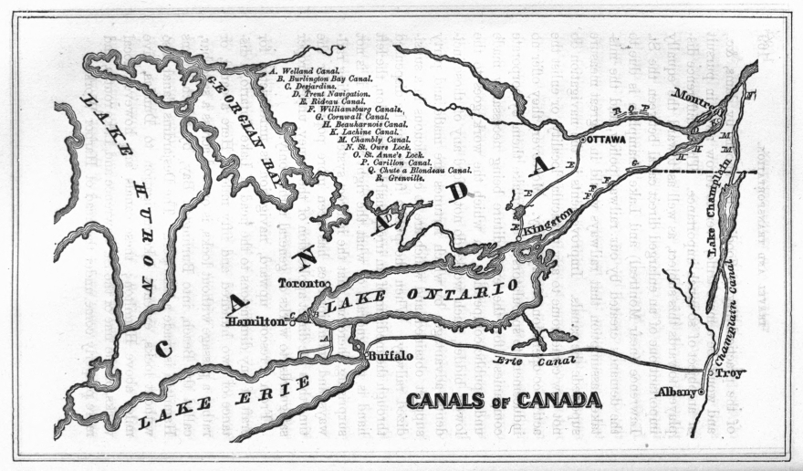
The Falls of Niagara, with the rapids above and below them, offer by far the most formidable obstruction to navigation of any upon the line of the St. Lawrence. The lockage required to connect that short distance of twenty-eight miles, between Lake Erie and Lake Ontario, is greater than the aggregate of all other obstructions in the thousand miles between Lake Superior and tide water.
Although a canal to unite the two lakes was projected at Niagara as early as 1798, and an exploration of the ridge which bounds the Welland River, on the north, was made twenty years later, (in 1818, the year after the scheme was proposed by Mr. Merritt to Gourlay,) the first active movement was made in 1823, by obtaining a line of levels between this river, called also the Chippewa, and Lake Ontario,—which were run by Hiram Tibbets, engineer. On the 19th May, 1824, the legislature incorporated George Keefer, Thomas Merritt, George Adams, William Chisholm, Joseph Smith, Paul Shipman, John Decou, and William Hamilton Merritt, as the "Welland Canal Company," with a capital of £37,500, ($150,000,) divided into 3,000 shares of £12,10s., ($50.00,) each. Over one-fourth of the stock was subscribed, and the work was commenced on the 30th November, 1824, and it is worthy of remark; that "its prosecution was not discontinued a single day until two vessels passed from lake to lake, five years later;" although in the meantime the expenditure was more than six times the original capital. The first project contemplated a boat canal only, up the valley of the Twelve Mile Creek to the foot of the mountain ridge, ascending from thence by a railway to the Beaver dams, and thence to the Welland River by a boat canal tunneled through the Ridge: but power was obtained also to connect the Welland River with Lake Erie at the mouth of the Grand River. In 1825, a ship canal was determined on, and the capital stock was increased to £200,000, ($800,000.) In 1826, the legislature loaned the company £25,000, ($100,000,) and the Imperial government, the same year, gave £16,300, sterling, ($81,500,) one-ninth of the estimated cost, in consideration of the free passage of government stores, troops, and vessels. In 1827, the legislature took £50,000, ($200,000) stock, the company to pay interest until one year after completion; and also granted 13,400 acres of marsh land. The legislature of Lower Canada also took £25,000 stg., (or $100,000) stock. In 1828 the whole amount of stock was paid up, and the company succeeded in borrowing £50,000 (or $250,000) from the Imperial government on condition of surrendering the grant of one-ninth the cost. The work had so progressed that it was fully anticipated the water would have been let in early in November, 1828; but, when within ten days of this estimated result, slips of so formidable a character took place in the "Deep Cut," which was seventy feet in depth, that it became indispensable to abandon the original plan of making a feeder of the Welland River, the level of which is ten feet lower than Lake Erie, and to bring a supply of water on a higher level from the Grand River, in order to pass over the quicksands which caused the slides.
Up to this period the whole pressure had been borne by the shareholders; no aid had been granted by the government except that for which the interest had been punctually paid by the company; but now the funds were almost exhausted, and they dared not appeal to the legislature while prophecies of the inevitable failure of all attempts to get a navigation through the Deep Cut met them at every point. It was now necessary to throw a dam across the Grand River by which its waters were raised about seven feet above, the level of Lake Erie, and to cut a feeder, twenty-seven miles in length, to be carried by an aqueduct over the Welland River; by which means, after allowing for the fall in the feeder, a level sixteen feet higher than the Welland River was obtained, and thus the necessity of carrying the Deep Cut down into those treacherous quicksands was avoided. It was necessary to do all this chiefly on credit, and a covenant was inserted in each contract that a percentage only was to be paid in cash, the balance "after the company obtained the means from the legislature;" so confident were the directors that parliament, like Jupiter, would help those who help themselves.
Although the frost did not leave the ground until the 15th of April, 1829, the dam across the Grand River, the aqueduct over the Welland, four locks at the Deep Cut, the cut at the mouth of the Welland, and twenty-seven miles of canal, were so far completed on the 9th day of October as to admit the passing of a vessel down the feeder; and on the 30th of November (the anniversary of its commencement five years before,) two schooners, one British and the other American, the "Ann and Jane" of York (Toronto,) and the "R. H. Boughton" of Youngstown, N. Y., passed up from Lake Ontario into Lake Erie.
The confidence displayed by the contractors, without which the works must have been suspended altogether, was a natural result of the vigor, ability, and integrity displayed by the projector of the work,—the Hon. William Hamilton Merritt,[10]—by whose extraordinary energy, perseverance and discretion all difficulties were surmounted. Of those out of the province, John B. Yates of New York, the largest private shareholder, who in 1827 became liable for a large amount in aid of the company, was its greatest benefactor. To show upon how few the labor fell, only eight Upper Canadians, viz., William Hamilton Merritt of St. Catherines, George Keefer of Thorold (who was the first president of the company,) John Henry Dunn, John Beverly Robinson, William Allan, Henry John Boulton, D'Arcy Boulton, and Colonel Joseph Wells, of Toronto,—held sufficient stock to qualify them to become directors; and for these services they never received, or looked for, any compensation.
Parliament in 1830, by a majority of two, granted a loan of £25,000 (or $100,000,) which enabled the company to pay the debts incurred during the previous year. The whole expenditure to this period had been £272,795 (or $1,091,180.) To avoid the circuitous route by the Welland and Niagara Rivers, and the strong current in the latter, it was proposed to enlarge the feeder, as far as its course was directed toward Lake Erie, and cut a new channel, only seven miles long, to join that lake at Gravelly Bay; and for this purpose the aqueduct over the Welland had been made twenty-four feet wide. In 1831, £50,000 (or $200,000) was loaned by the legislature on condition that this amount would complete the canal and harbors, and that the company should pay the interest of the loan and one-half the principal; and John B. Yates, William H. Merritt, and Alexander Yates McDonell became sureties for these conditions. The work was retarded by fearful ravages of the cholera in 1832, but in 1833 the new outlet at Gravelly Bay (Port Colborne,) was brought into use. After this date the control of the work was in a great measure assumed by commissioners appointed by government to look after the large interest the province now had in the undertaking. In 1834, the capital was increased to £250,000 (or $1,000,000,)—the government subscribing for £50,000 (or $200,000,) stock by the casting vote of Mr. Speaker McLean, ever a friend to the work. In 1836, a committee of the house recommended the assumption of the work by the province, and ultimate indemnification of the shareholders, as an act of justice to the latter, who had been the means of conferring so great a boon upon the province; and in 1837 all government loans were converted into stock, and a further appropriation of £245,000 (or $980,000,) to complete the canal in a durable manner, with stone locks, was authorized. In 1839, the purchase of the private stock was authorized by an act to which the royal assent was withheld; but, on the unanimous petition of the legislature, this was given in 1840; and the legislature authorized a grant of £500,000 (or $2,000,000,) to complete the work,—only two members out of eighty opposing the grant,—a striking contrast to the state of feeling in 1834, when the company were saved from ruin only by the casting vote of Speaker McLean. Doctor Strachan, archdeacon of York, and member of the legislative council, the present bishop of Toronto, was always a firm supporter of the work, and by his vigorous pen contributed in no small degree, as early as 1825, in putting the true scope and bearing of this important enterprise before the country. Hon. W. B. Robinson, now a commissioner of the Canada Company, as government commissioner and superintendent of the canal, and subsequently as chief commissioner of public works for the province, was ever a fast friend to this great work.
The old Welland Canal had forty wooden locks, one hundred feet in length between the gates, and twenty-two feet wide between the walls, with seven feet water on the sills; and these endured from 1829 until 1845, by which time they were fully worn out. The section of the canal was twenty-six feet wide at bottom, fifty-six feet on water-line, and eight feet depth of water. The cost of stone locks would alone have consumed all the company's resources, leaving nothing for excavations, dams, harbors, aqueducts, and bridges; and any attempt on that basis would have ruined the enterprise. By taking a vessel, of over one hundred tons, from lake to lake, in 1829, at an outlay of a little over one million of dollars, the company were sustained by the legislature—which up to that period had never given them more than £50,000 (or $200,000,) at a time, but which, ten years later, voted ten times as much for stone locks.
It is impossible, at this day, fully to appreciate the vicissitudes of such an undertaking by corporate enterprise in Upper Canada more than thirty years ago. We have only the successes before us;—the refusals, disappointments, sneers, and raillery suffered by the directors and their supporters are forgotten; but, so long as the St. Lawrence flows to the sea, Upper Canada will remember with pride and affection the men who could, at so early a day, carry such a vast enterprise to successful completion. Projects for organizing joint-stock companies in Montreal, the commercial metropolis of British North America, before 1820, for the comparatively insignificant Lachine and Chambly Canals, fell stillborn; and when the latter work was commenced by Lower Canada in 1831, with three-fourths of the import duties levied on the consumption of the two provinces in her treasury, it was suspended in 1835, and only completed in 1843,—requiring more than twice the time taken to open the Welland Canal. The Cornwall Canal, commenced by Upper Canada in 1834, was suspended in 1838 and not completed till 1843. If the provincial governments, with all the increase in wealth and population, of 1835 over 1825, found such difficulties, we may infer what the Welland Canal Company encountered and surmounted, and thus more truly appreciate the result.
The enlargement and reconstruction commenced immediately after the union, and the new stone locks were ready for passing vessels of the larger size, by way of the feeder, in 1845, and the main route was opened through in 1850. Doubts respecting the capacity of the Grand River as a reservoir have led to the lowering of the section between the Deep Cut and Port Colborne, so as to make Lake Erie (which is ten feet higher than the Welland River) the feeder. This lowering of the bottom, which is still in progress, is effected by dredges, the water not being removed; and, therefore, no further slides are anticipated.
key = A Length in Miles.; B Width of Canal.; C At Bottom.; D: At Surface.; E Lockage in Feet.; F Number of Locks.; G Size of Locks.; H: Length between Gates.; I Width in Clear.; J Depth of water on Mitre sills.; K Cost Before Union.; L Cost Since Union.; M Total Cost.
| B | |||||||
| DESCRIPTION. | A | C | D | E | F | ||
| WELLAND CANAL. | |||||||
| The Feeder branch from Grand River to junction, | 21.00 | 35 | 71 | ... | ... | ||
| The Broad Creek branch,—Lake Erie to the Feeder, | 1.50 | 45 | 85 | 8 | 1 | ||
| The Main Trunk, Lake Erie to Lake Ontario, | 28.00 | ... | ... | 346{ | 24 | ||
| 3 | |||||||
| RIVER ST. LAWRENCE. | |||||||
| Williamsburg Canals | 9.75 | 50 | 90 | 29½ | 6 | ||
| Cornwall Canals, | 11.50 | 100 | 150 | 48 | 7 | ||
| Beauharnois Canals, | 11.25 | 80 | 120 | 82½ | 9 | ||
| Lachine Canals, | 8.00 | 80 | 120 | 44¾ { | 3 | ||
| 2 | |||||||
| Lock Gates, | ... | ... | ... | ... | ... | ||
| General Expenditure, | ... | ... | ... | ... | ... | ||
| Improvement of Rapids, | ... | ... | ... | ... | ... | ||
| Lake St Peter,—expended by Government, | ... | ... | ... | ... | ... | ||
| Lake St Peter,—expended by Harbor Commissioners, | ... | ... | ... | ... | ... | ||
| RICHELIEU RIVER. | |||||||
| St. Ours Lock and Dam, | ... | ... | ... | 5 | 1 | ||
| Chamblay Canal, | 11.50 | 36 | 60 | 74 | 9 | ||
| OTTAWA RIVER. | |||||||
| St. Ann's Lock and Dam, | ... | ... | ... | 3½ | 1 | ||
| [H]Chats Canal, | ... | ... | ... | ... | ... | ||
| Total Colonial Expenditure, | |||||||
| [H]Carillon Canal, | } | Passing the Longue | 2.90 | 18 to 40 | 36 | 3 | ... |
| [H]Chute à Blondeau Canal, | Sault of the | 0.16 | 37 | 3-3/8 | 1 | ... | |
| [H]Grenville Canal, | Ottawa River, | 5.78 | 15 to 30 | 46 | 7 | ... | |
| [H]Rideau Canal, (connects Ottawa with Kingston,) | 126.25 | ... | ... | 446 | 47 | ||
Table continued ...
| G | ||||||||
| DESCRIPTION. | H | I | J | K | L | M | ||
| WELLAND CANAL. | ||||||||
| The Feeder branch from Grand River to junction, | ... | ... | ... | |||||
| The Broad Creek branch,—Lake Erie to the Feeder, | 185 | 45 | 9 | } $1,692,895.63 | $4,576,105.89 | $6,269,001.52 | ||
| 150 | 26½ | 10 | ||||||
| The Main Trunk, Lake Erie to Lake Ontario, | 200 | 45 | 10 | |||||
| RIVER ST. LAWRENCE. | ||||||||
| Williamsburg Canals | 200 | 45 | 9 | ... | 1,320,506.04 | 1,320,506.04 | ||
| Cornwall Canals, | 200 | 55 | 9 | 1,448,538.47 | 466,045.74 | 1,914,584.21 | ||
| Beauharnois Canals, | 200 | 45 | 9 | ... | 1,589,170.38 | 1,589,170.38 | ||
| Lachine Canals, | 200 | 45 | 9 | } 398,404.15 | 2,000,455.70 | 2,398,859.85 | ||
| 200 | 45 | 16 | ||||||
| Lock Gates, | ... | ... | ... | ... | 6,244.60 | 6,244.60 | ||
| General Expenditure, | ... | ... | ... | ... | 74,272.88 | 74,272.88 | ||
| Improvement of Rapids, | ... | ... | ... | 40,405.00 | 28,659.00 | 69,064.00 | ||
| Lake St Peter,—expended by Government, | ... | ... | ... | ... | 295,619.00 | 295,619.00 | ||
| Lake St Peter,—expended by Harbor Commissioners, | ... | ... | ... | ... | ... | [I]882,197.39 | ||
| 1,887,347.62 | 5,780,973.34 | $8,550,518.35 | ||||||
| RICHELIEU RIVER. | ||||||||
| St. Ours Lock and Dam, | 200 | 45 | 7 | ... | 153,117.65 | 153,117.65 | ||
| Chamblay Canal, | 120 | 24 | 7 | 322,441.79 | 67,653.25 | 390,095.04 | ||
| 322,441.79 | 220,770.90 | $543,212.69 | ||||||
| OTTAWA RIVER. | ||||||||
| St. Ann's Lock and Dam, | 190 | 45 | 6 | ... | 111,796.57 | 111,796.57 | ||
| [H]Chats Canal, | ... | ... | ... | ... | 373,191.98 | 373,191.98 | ||
| Total Colonial Expenditure, | ... | 484,988.55 | 484,988.55 | |||||
| 15,847,721.11 | ||||||||
| [H]Carillon Canal, | } | Passing the Longue | 128 | 32 | ... | } ... | 1,011,904.00 | 1,011,904.00 |
| [H]Chute à Blondeau Canal, | Sault of the | 128 | 32 | ... | ||||
| [H]Grenville Canal, | Ottawa River, | 106.6 | 19.25 | ... | ||||
| [H]Rideau Canal, (connects Ottawa with Kingston,) | 134 | 33 | 5 | ... | ... | 4,380,000.00 | ||
|
Includes cost of Dredging plant. |
|
Constructed by the Imperial Government. |
The magnitude of the work undertaken in Lake St. Peter, by the Harbor Commissioners of Montreal, may be estimated from the fact that 3,000,000 cubic yards have already been removed by dredging, and that another million yards must yet be dredged to give the intended depth of twenty feet at low water, and a width of channel of 300 feet.
It is an incident not generally known, and worthy of record, that the foundation stone of the Locks at Ottawa, for the Rideau Canal, was laid by the celebrated, but unfortunate arctic voyager, Sir John Franklin.
Showing the amounts expended from 1791 to 1861, in other public works connected with the Navigation.
| DESCRIPTION. | Cost Before Union. | Cost Since Union. | Total Cost. |
| Lighthouses,—Upper and Lower Canada, | $10,000.00 | $788,223.11 | $798,223.11 |
| Ottawa slides, etc., | ... | $697,877.61 | $697,877.61 |
| St. Maurice slides, etc., | ... | 242,584.51 | 242,584.51 |
| Saguenay, | ... | 40,865.07 | 40,865.07 |
| Trent and Newcastle slides, | ... | 352,113.80 | 352,113.80 |
| $1,333,440.99 | $1,333,440.99 | ||
| Local Works—Upper Canada: | |||
| Harbors, | $42,000.00 | $641,360.76 | $683,360.76 |
| Burlington Bay Canal, | 124,356.00 | 158,326.00 | 282,682.00 |
| Desjardins Canal, (estimated,) | 100,000.00 | ... | 100,000.00 |
| Trent Inland Navigation, | 165,180.05 | 103,809.61 | 268,989.66 |
| $431,536.05 | $903,496.37 | $1,335,032.42 | |
| Local Works—Lower Canada: | |||
| Harbors and Piers, | $315,900.00 | $1,388,460.85 | $1,704,368.85 |
| Grand Total, | $5,171,065.37 |
Summing up the provincial, municipal, and corporate expenditure of Canada, under the three heads of Roads, Navigation, and Railway; we find that in round numbers the first have cost $11,000,000; the second, $21,000,000; and the Canadian interest in the last, is at least $30,000,000; or a total of over $60,000,000. This sum also, is about the measure of the public debt of the Province,—so that, setting off what has been expended on public works, out of revenue, against what has been borrowed for other purposes,—we can not lay claim to the possession of any which have yet been paid for.
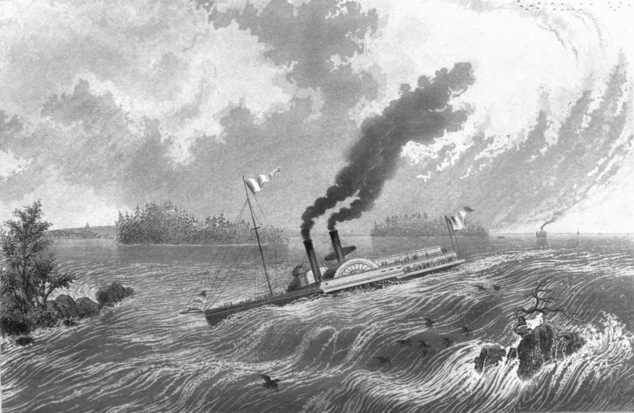
LA CHINE RAPIDS
In commencing the Lachine Canal, in 1821, on a larger scale than those in progress by New York, Lower Canada no doubt supposed she was undertaking all which the circumstances of the case required. In fact, both Upper and Lower Canada were under the delusion that equal facilities in the shape of artificial navigation would give the St. Lawrence with its short canals the advantage over the Hudson with its long ones. They afterwards discovered that it was to be a competition between the attractions offered by rival seaports and their ocean aspect, rather than between the inland routes by which these were reached; that when the Canada route would have the patronage of one hundred thousand, the American would have that of one million; in short, that it would require the development of all the superiority of which the St. Lawrence route was capable, to counterbalance its political and geographical disadvantages.
In comparing Montreal with New York, the great superiority of the latter in shipping accommodation, in cheap export rates, ready sale of large quantities, and especially in the supply of back freights to the inland craft, as well as in the control which the capital of the Atlantic States exercises over the exports of the Western ones—are reasons sufficient to account for the preference which has been given to the latter. But another reason for the slight effect hitherto produced by our canal expenditure, is that all the great American public works were prospectively constructed in advance of the demands of the country; that they have hitherto been more useful for the purpose of expediting the settlement of the interior than as affording an outlet for an existing commerce; and that, until 1860, the carrying capacity of the canals and railways has generally exceeded the wants of the country. With this condition of affairs, railways, supported by a passenger traffic, and desirous of raising their stock quotations by swelling their gross receipts at any cost, have worn out their iron in carrying freights at non-paying rates. While the stream of commerce is weak it can easily be diverted; but when it overflows, capacity must exert its influence so long as there is intelligence and ability to make the proper use of it. If the competition had been confined to the water routes, that by the St. Lawrence would ere this, from sheer necessity, have been better patronized; but the premature birth of a railway system before the existence of a legitimate railway business—a system which was hungering for the coarse staples of export—dissipated the traffic, before even the Erie Canal was overtaxed, by offering facilities which could not be equaled on the water, and rates which could not be afforded on the land. Moreover, a legitimate winter traffic—in exports to which an extra price obtained, or interest saved, counterbalanced extra freight—has enabled the railways to remove, during that season, much of the produce on which the canals relied.
The further enlargement of the Welland Canal has been agitated for several years, but as the question has presented itself as one of convenience and economy of transport, rather than of insufficiency for tonnage,—it has made little progress. Larger locks would admit the larger class of vessels now excluded, and thereby somewhat cheapen freights; but until the capacity of the present canal is exhausted, and a better return on the investment guaranteed, it is not probable that any determined action will be taken. This question must be, moreover, mainly influenced by international relations; and by the probability of the St. Lawrence becoming a route for western imports as well as exports. If Chicago outgrows her commercial vassalage to New York, so that the West is permitted to buy as well as sell in Montreal, Canada can afford to enlarge her avenues to the seaboard. Hitherto we have reaped little but a barren reputation for all our cosmopolitan exertions in delivering the West from the monopoly of the New York canals. Up to 1845, and before our St. Lawrence canals were opened, foreign salt was excluded from western packing-houses, by a toll, on the Erie Canal, of nearly three dollars per barrel, and Nova Scotia plaster from Western canals by a toll of over three dollars per ton. Even now, New York, in order to protect her own products, charges foreign salt five times, and foreign gypsum three times as much as the domestic article. Millions of dollars have been saved to the Western country by the reduction of tolls on the Erie Canal since 1845, and though some of this is due to railway competition,—yet, on the quantity of wheat alone, which was shipped by canal from Buffalo in 1861, the reduction in tolls over those of 1845, amounts to nearly a million of dollars. The down toll upon a barrel of flour, is now 15 cents, and the up toll on 100 lbs. maide, 26 cents,—less than in 1845.
The St. Lawrence canals were designed for side-wheel steamers; the Welland Canal for sail-vessels and screw steamers. The number of sail-craft employed on the lakes, American and Canadian, is one thousand two hundred, and the whole number of steamers is three hundred and seventy, of which about one hundred are tugs, and which may, therefore, properly be assigned to the sail fleet. Of the remaining two hundred and seventy, one hundred and fifty only are side-wheel boats, including ferry boats, and river and lake steamers which do not navigate canals. This proves that in a short canal connecting long lines of deep water and sail navigation, and with the great amount of lockage of the Welland Canal, provision for side-wheel steamers is as unnecessary as it would be inconvenient. The mammoth side-wheel steamers can not pay; they were the creation of rival railway routes as an attraction for passengers,—were sustained as long as possible by railway capital or railway receipts; but now they are, with two exceptions, either rotting at the railway docks or have gone to sea. Any attempt to accommodate such experimental or exceptional craft, either in the St. Lawrence or Welland canals, would be as impracticable as absurd. They can not carry freight profitably; and, while railways are in existence, they could not retain their passengers in a canal. If our canals were enlarged for such boats they would not use them, except to shift their routes, or in case of a sale. It is desirable for the strength, safety, and facility of handling the gates, that the width of the locks should not be unnecessarily increased; and there is a great waste of time, as well as of water, in filling a large lock in order to pass a small vessel. Moreover, if the width of the lock is increased, the whole trunk of the canal should be widened proportionally.
Whatever may prove to be the ultimate demands of the trade, the dimensions of the locks will be governed by sail and screw vessels, and the preposterous dimensions required to enable one of the obsolete railway steamers to surmount the three hundred and thirty feet lockage of the Welland Canal must be abandoned.
The St. Lawrence, from its strong current, is a steam navigation, and the peculiar facilities afforded for passengers and freight going down by the rapids, require that its locks should pass side-wheel steamers of moderate dimensions. Any future enlargement here will be to provide for increase in the length, and draft of water of the boats. A diminution of ten feet in the width from that of the Cornwall Canal has already been made, and the locks are now wide enough for such side-wheel steamers as the route requires, and wider than is needed for screws; but if increased depth be afforded, an increase in the length for screw steamers or sailing craft may be in the future. There remains, however, to be first determined the important question whether the inland business is to be done by through-boats, or by transhipment at Kingston. It is probable that river craft may, with less time and outlay of capital, receive the grain from the sail-vessel whose proper sphere is the lakes.
Ten years ago the tonnage of flour going to the seaboard was three times as great as that of wheat—now the proportions are reversed—and in addition to this, the largely increasing quantities of corn gives such a preponderance to the grain trade that elevators and portage railways are called into play and transhipment is no longer the unmixed evil it was considered to be.
The Civil War has turned Western Canadian exports down the St. Lawrence—more grain having reached Montreal in 1861 and 1862, than in all the previous years since the opening of the canals—but these have not benefited by this diversion in consequence of the abolition of the tolls, in May, 1860, whereby about $645,000 has been transferred from the Provincial treasury to the forwarders—doubtless to compensate them for the injury which the Grand Trunk railway inflicted on them when carrying produce with the aid of provincial funds.
The Welland Canal locks pass a sail-vessel registered as high as four hundred tons, with a carrying capacity of 17,500 bushels of wheat. The St. Lawrence locks pass a side-wheel steamer about seven hundred tons register, with a carrying capacity of about four thousand barrels of flour.
The canal system of Canada may be said to embrace four distinct routes; but, as all are connected, any number of them may be combined. They are,—
1. The St. Lawrence route;
2. The Ottawa route;
3. The Champlain route;
4. The Lake route, or Welland Canal.
The first three terminate at tide-water; the last may be said to terminate in Lake Ontario, or its extension to Prescott, because the great majority of the vessels which pass the Welland Canal do not also pass the St. Lawrence. A vessel with twenty-six feet beam may proceed to sea, from any of the upper lakes, by the route of the Welland and St. Lawrence canals; but she can not enter Lake Champlain with more than twenty-three feet, or pass down the Ottawa route with more than eighteen feet beam. She may carry ten feet draft into Lake Ontario, but must lighten to nine in descending the St. Lawrence; and, if her other dimensions were reduced, she could carry five feet down the Ottawa, and six feet into Lake Champlain. From Lake Ontario, a vessel of forty-four feet beam may proceed to sea. The Chambly Canal will not admit deep vessels from the lakes, but it is more than sufficient for boats from the Ottawa, and larger than the canal which connects Lake Champlain with the Hudson. The St. Ours lock has been constructed on the scale of the St. Lawrence canals; but the enlargement of the Chambly Canal has not been undertaken,—partly because it has been proposed to supersede it, for western trade, by a canal from some point near Montreal to St. Johns, on the Richelieu, in order to save the detour of one hundred miles via Sorel; and partly because any enlargement would not produce its full effect until it was carried through to the Hudson, which can only be done by the state of New York. A canal which would admit the craft of the upper lakes into Champlain by the shortest and cheapest route, would place Boston (via Burlington) and New York (via Whitehall) in the same relation to the West which they now enjoy through the more distant ports of Ogdensburg and Oswego, respectively, and thus add to the St. Lawrence canals that portion of American traffic now given only to the Welland. Whether it forced or invited a passage through to the Hudson or not, it could not fail to aid the canals above it, and is a necessary corollary to the system—unless it be determined to exclude the St. Lawrence canals from the benefit of that American transit trade which is the chief support of the Welland. So long and as often as New York and New England are better markets for western exports than other countries, these exports will go there; and, of course, by American if they can not by Canadian routes.
For transatlantic trade, our canals offer a communication with the lakes, the inland portion of which is superior to that via New York; but the sea portion, inferior in rates of freight and insurance. Increased capital, by increasing trade, alone will equalize the routes. Political considerations may, however, exert an influence which can not be foreseen; but the route exists, and, if required, can be made use of to any extent by the application of that capital which now sustains its rivals.
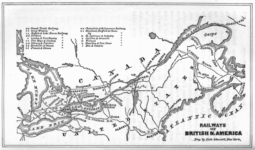
More than two hundred years ago, or about a.d. 1630, one Master Beaumont ruined himself in coal mining, but has been immortalized by the biographer of George Stephenson as the first man that formed a railway; for although his rails were of wood, and the wheeled vehicles were drawn by horses, yet the principle of the railway was there. These tramways were in use a century before iron was employed in them, which event is supposed to have taken place about 1738.
The birth of the Steam Engine was naturally followed by propositions to convert it into a locomotive for common roads; and between 1763 and 1800, Cugnot in France, Evans in the United States, Symington in Scotland, and Murdoch and Trevethick in England, experimented with steam carriages. The latter, in 1804, was the first to put the locomotive where it properly belongs, on the railway, but the wheels being "roughed" in order to "bite" the rail, they fairly devoured it; and though possessing some speed and a power to draw, this arrangement was almost immediately abandoned. Blenkinsop, in 1812, successfully introduced a locomotive with pinion wheels working into a racked rail, which drew thirty coal wagons at three and a quarter miles per hour. In 1813, Blackett, a colliery owner, discovered (by simply trying the experiment) that the adhesion of a smooth wheel on the plain rail was sufficient for traction, and thus the first great step toward efficiency was gained. The locomotive, notwithstanding these strides, was still a crude and almost useless machine until George Stephenson, at this stage, applied his eminently practical mind to the subject. His first engine, however, though the most successful that had yet been constructed, showed at the end of a year's work an economy only equal to that of horse-power, and then it was, in 1815, that Stephenson applied the exhaust steam to the chimney, and by one stroke more than doubled the power of the engine. The discovery of the steam-blast was the second and most important stride in the railway system. The waste steam instead of, as before, puffing into the air, after having done its work, was turned up the smoke-stack, immensely increasing the draught, and therefore the production of steam in proportion to the speed, so that—
The faster she goes
The harder she blows—
and vice versa. Persevering in his determination to overcome all obstacles, Stephenson got rid of the superfluous machinery of his predecessors, and made his engines direct acting, while he increased the adhesion by connecting the other wheels with the driving ones;—and thus, as early as 1816, constructed engines which, strange as it may appear, were "in regular and useful work, in 1858, conveying heavy coal trains at the speed of five or six miles the hour, probably as economically as any of the more perfect locomotives now in use." Notwithstanding this early demonstration of its practicability, it was not until the opening of the Liverpool and Manchester Railway, in 1830, that the success of the locomotive was admitted. So long as railways were restricted to short lines in the colliery districts, power was more important than speed; but when for the first time about to be applied on an extensive scale to general traffic, so little impression had fifteen years of constant use at the Killingworth colliery made upon the public mind, that the Directors of the Liverpool and Manchester Railway were unable to decide whether their line should be worked by fixed or locomotive power. They had indeed allowed Stephenson to place one of his engines on the line, in 1829, to assist in its construction; but though this was working under their eyes, and though more than one deputation had visited the colliery railways, on which locomotives had been successfully at work for years, it was evident that the machine of that day was more valuable for what it promised to those who could see, than for what it was. Tredgold declared in favor of fixed engines. Telford could not say whether even these would succeed, or that horses should not be used. In this dilemma the directors commissioned Messrs. Walker and Rastrick to visit the collieries and report on the question. They recommended the stationary reciprocating system as the best! Against all this array of talent George Stephenson, the fireman, at a shilling a day—the mender of clocks and of his sweetheart's shoes, the embroiderer of pitmen's button-holes—alone stood firm. He knew he was right, and would not be silenced; for though officially worsted, he, aided by his illustrious son Robert, successfully exposed the fallacy of the arguments used against the locomotive, and induced the directors to take the sensible course of offering a premium of £500 for a machine which should travel ten miles the hour, be safe, and unobjectionable as to weight, cost, &c.
The locomotive had been condemned on the assumption that the speed could not be increased without a loss of power—Stephenson asserted that by the action of the steam-blast the power increased with the speed; that in fact all that was necessary to make the slow colliery engines fast ones, was to have a boiler capable of generating steam as rapidly as the increase of speed required.
On the day appointed, the 6th October, 1830, four engines entered the list, two only of which, Ericsson's "Novelty," and Stephenson's "Rocket," distinguished themselves. The former ran at the rate of twenty-four miles an hour, but depending on a blower to keep up the draught, this gave out and she failed. The Rocket, which was the first ready, ran at the then astonishing rate of thirty and thirty-five miles the hour,—had no breakdown, and carried off the prize, as well as effectually disposed of the twenty-one fixed engines, with the engine-houses, ropes, &c., which the eminent engineers had declared indispensable to the working of the line. This result was accomplished by adopting the multitubular boiler for the locomotive, which is the third and last great principle in the progress of the railway.
Since that memorable day when the father of railways "delivered himself" (as one of his opponents on the board exclaimed, with hands upraised in astonishment), the present generation has seen over 50,000 miles of railway constructed, at a cost of about four thousand millions of dollars, the greater portion of this mileage being upon this continent.
Canada owes her first railway as well as her first steamboat to Montreal. In 1831, when the news of the success of the Liverpool and Manchester road came across the water, measures were taken to obtain a charter, which was granted on 25th February, 1832, for the construction of a railway from Laprairie on the St. Lawrence to St. John's, a village above the rapids of the Richelieu River, the outlet for the waters of Lake Champlain. The length was sixteen miles, and the capital £50,000, in 1,000 shares of £50 each, or a little over £3,000 per mile. The work was commenced in 1835, opened with horses in July, 1836, and first worked with locomotives in 1837. It was a "strap-rail" road until 1847, when the heavy T iron was laid.
The next movement was a premature one, in Upper Canada. A charter was obtained, 6th March, 1834, for a Railway from Cobourg to any point on Rice Lake; and though the distance is no greater than that between Laprairie and St. John's, no less than £400,000 capital was provided. In the same year a charter was granted to the London and Gore Railway Company, for a road from London to Burlington Bay, to be extended to the navigable waters of the Thames and Lake Huron. This was the legislative beginning of that important line the Great Western Railway.
The first railway actually constructed in Upper Canada was by the old "Erie and Ontario Company," and was designed to restore the ancient portage route around the Falls of Niagara, between Queenstown and Chippewa, which had been superseded by the Welland Canal. This line was chartered in 1835, and was opened in 1839, as a horse railway, the steepness of the grades near Queenstown being beyond the capacity of locomotive power of that day; and as it stopped at the bank of the Niagara, over one hundred feet above the water level, it fell into disuse. In 1852 the charter was amended, and the line altered so as to run from Lake Ontario at Niagara, to Suspension Bridge and the Falls of Niagara.
Between 1832 and 1845 over a dozen charters were granted in the two provinces, none of which, except the horse railway just mentioned, were followed up; and the Laprairie road continued the sole representative of the system, using locomotives for ten years, or until 1847. In 1845 the St. Lawrence and Atlantic Railway Company was chartered, to connect with the "Atlantic and St. Lawrence," an American company from Portland. This road, though an international rather than a Canadian one, became, by subsequent amalgamation, part of the Grand Trunk; and is, therefore, the beginning of that extensive line. It is worthy of remark, that up to this time the railway efforts of Montreal had been directed to divert the trade of Canada to American cities, her rivals as seaports. In 1846 the first look westward was made in the commencement of the Lachine Railway, but this was undertaken rather as a suburban portage road than as part of the main western line. Although some thirty charters had been granted up to 1850, the only roads on which any work had been done were the Laprairie, St. Lawrence and Atlantic, Lachine, St. Lawrence and Industry, in Lower Canada; and the Erie and Ontario in Upper Canada. Many of these charters have been allowed to drop; and, with the exception of the corporations named, nearly all those relating to roads since built, were extended and amended before any work was commenced. In 1850 the Ottawa and Prescott Railway was authorized, and the line was opened in December, 1854.
The first railway in Upper Canada on which locomotives were used was the Northern, from Toronto to Bradford, opened in June, 1853; yet in 1860, only seven years from that date, about three hundred locomotives were thundering and bellowing over the upper province, between the Ottawa and Lake Huron.
Of the fifty-six charters granted up to June, 1853, only twenty-seven were acted upon, and in twenty-five cases the roads have been completed; the other two (the Woodstock and Lake Erie and the Hamilton and Port Dover) are yet unfinished. By amalgamation or leasing, the Grand Trunk and Great Western have swallowed up nine out of these twenty-five chartered and completed roads, there being now only sixteen distinct railways in the whole province. Since 1853 only three new charters have been acted upon, viz., Preston and Berlin, Three Rivers and Arthabaska, and Peterboro' and Chemung Lake. The last is completed; the first was completed and opened for a time, but is not now in use, and the second is nearly completed.
The province has now 1,906 miles of railway, 1,800 of which have been opened within the last ten years, under the impetus given by the railway legislation of 1849-1852. Of these 1,906 miles, the Grand Trunk Company alone have 872 miles within the province, leaving 1,034 miles in all the other companies. Of these last, however, sixty miles, owned by four companies, are not now in operation. Canada has more miles of railway than Scotland or Ireland, or any of the New England States, and is only exceeded in this respect by five States in America, viz., New York, Pennsylvania, Ohio, Indiana, and Illinois. Of her total railway expenditure, which exceeds one hundred millions of dollars, about thirty millions have been supplied by the government and municipalities. The following tables will show the leading statistics of Canadian railways, from official sources, as far as returns have been made.
STATEMENT SHOWING THE DATES OF OPENING AND LENGTH OF EACH SECTION,
AND THE TOTAL LENGTH OF ALL RAILWAYS IN OPERATION,
JAN. 1ST, 1861. FROM REPORT OF INSPECTOR OF RAILWAYS.
| Corporate name of Railway. | Name of Section. | Date of Opening. | ||
| 1 | Great Western | Main Line— | Suspension Bridge to Hamilton | Nov. 10, 1853, |
| 2 | " | " | Hamilton to London | Dec. 31, 1853, |
| 3 | " | " | London to Windsor | Jan. 27, 1854, |
| 4 | " | Branches— | Harrisburg to Galt | Aug. 21, 1854, |
| 5 | " | " | Galt to Guelph | Sept. 28, 1857, |
| 6 | " | " | Hamilton to Toronto | Dec. 3, 1855, |
| 7 | " | " | Komoka to Sarnia | Dec. 27, 1858, |
| 8 | Grand Trunk | Main Line— | Toronto to Guelph | July, 1856, |
| 9 | " | " | Guelph to Stratford | Nov. 17, 1856, |
| 10 | " | " | Stratford to London | Sept. 27, 1858, |
| 11 | " | " | St. Mary's to Sarnia | Nov. 21, 1859, |
| 12 | " | " | Toronto to Oshawa | August, 1856, |
| 13 | " | " | Oshawa to Brockville | Oct. 27, 1856, |
| 14 | " | " | Brockville to Montreal | Nov. 19, 1855, |
| 15 | " | " | Victoria Bridge and approaches | Dec. 16, 1859, |
| 16 | " | " | Montreal to St. Hyacinthe | Spring, 1847, |
| 17 | " | " | St. Hyacinthe to Sherbrooke | August, 1852, |
| 18 | " | " | Sherbrooke to Province Line | July, 1853, |
| 19 | " | " | Richmond to Quebec | Nov. 27, 1854, |
| 20 | " | " | Chaudière Junction to St. Thomas | Dec. 23, 1855, |
| 21 | " | " | St. Thomas to St. Paschal | Dec. 31, 1859, |
| 22 | " | " | St. Paschal to Rivière du Loup | July 2, 1860, |
| 23 | Branch— | Kingston | Nov. 10, 1860, | |
| 24 | Northern | Main Line— | Toronto to Bradford | June 13, 1853, |
| 25 | " | " | Bradford to Barrie | Oct. 11, 1853, |
| 26 | " | " | Barrie to Collingwood | Jan. 2, 1855, |
| 27 | Buffalo and Lake Huron | Fort Erie to Paris | Nov. 1, 1856, | |
| 28 | " | Paris to Stratford | Dec. 22, 1856, | |
| 29 | " | Stratford to Goderich | June 28, 1858, | |
| 30 | " | From temporary terminus to Station in East st | May 16, 1860, | |
| 31 | London and Port Stanley | Oct. 1, 1856. | ||
| 32 | Cobourg and Peterborough | May, 1854. | ||
| 33 | Erie and Ontario | July 3, 1854. | ||
| 34 | Ottawa and Prescott | Dec., 1854. | ||
| 35 | Montreal and Champlain | Montreal to Lachine | Nov., 1847. | |
| 36 | " | Caughnawaga to Moers' Junction | Aug., 1852. | |
| 37 | " | St. Lambert to St. John (old portion, July, 1836) | Jan., 1852. | |
| 38 | " | St. John's to Rouse's Point | Aug., 1851. | |
| 39 | Carillon and Grenville | Oct., 1854. | ||
| 40 | St. Lawrence and Industry | May, 1850. | ||
| 41 | Port Hope, Lindsay, and Beaverton | Main Line— | Port Hope to Lindsay | Dec. 30, 1857. |
| 42 | " | Branch— | Millbrook to Peterborough | Aug. 18, 1858. |
| 43 | Welland | June 27, 1859. | ||
| 44 | Brockville and Ottawa | Main Line— | Brockville to Almonte | Feb. 17 & Aug. 22, 1859. |
| 45 | " | Branch— | Smith's Falls to Perth | Feb. 17, 1859. |
| 46 | " | Tunnel from temporary station to Harbor | Dec. 31, 1860. | |
| 47 | Stanstead, Shefford, & Chambly | St. John's to West Farnham | Jan 1, 1859. | |
| 48 | " | West Farnham to Granby | Dec. 31, 1859. | |
| 49 | Peterborough and Chemung Lake | Peterborough to Snow Falls | July 6, 1859. | |
| 50 | Preston and Berlin | From Galt branch of Great Western to Grand Trunk | Nov. 2, 1857. | |
| 51 | Stanstead, Shefford, & Chambly | From Granby to Waterloo | ||
Table continued ...
| Railway. | Length of Section. Miles. | Total Length. Miles. | Remarks. | |
| 1 | 43 | ⎫ | Under one management | |
| 2 | 76 | ⎪ | ||
| 3 | 110 | ⎪ | ||
| 4 | 12 | ⎬ | ||
| 5 | 15 | ⎪ | ||
| 6 | 38 | ⎪ | ||
| 7 | 51 | 345 | ⎭ | |
| 8 | 50 | ⎫ | In Canada, and under one management | |
| 9 | 39 | ⎪ | ||
| 10 | 31 | ⎪ | ||
| 11 | 70 | ⎪ | ||
| 12 | 33 | ⎪ | ||
| 13 | 175 | ⎪ | ||
| 14 | 125 | ⎪ | ||
| 15 | 6 | ⎬ | ||
| 16 | 30 | ⎪ | ||
| 17 | 66 | ⎪ | ||
| 18 | 30 | ⎪ | ||
| 19 | 96 | ⎪ | ||
| 20 | 41 | ⎪ | ||
| 21 | 53 | ⎪ | ||
| 22 | 25 | ⎪ | ||
| 23 | 2 | 872 | ⎭ | |
| 24 | 42 | } | From Toronto to Lake Huron. | |
| 25 | 21 | |||
| 26 | 32.14 | 95.14 | ||
| 27 | 83 | |||
| 28 | 33 | |||
| 29 | 45 | |||
| 30 | 1.27 | 162.27 | ||
| 31 | 24 | Lake Erie to London. | ||
| 32 | 28 | Lake Ontario to Peterborough. | ||
| 33 | 17 | Lake Ontario to Chippewa. | ||
| 34 | 54 | From the St. Lawrence to Ottawa City. | ||
| 35 | 8 | |||
| 36 | 32 | |||
| 37 | 20 | |||
| 38 | 21.76 | 81.76 | ||
| 39 | 12.75 | |||
| 40 | 12 | Lanoraie to St. Industrie. | ||
| 41 | 43 | |||
| 42 | 13.50 | 56.50 | From Lake Ontario northward. | |
| 43 | 25 | From Lake Ontario to Lake Erie. | ||
| 44 | 51.25 | |||
| 45 | 11.54 | |||
| 46 | .75 | 63.54 | ||
| 47 | 13 | |||
| 48 | 15 | 28 | From Montreal and Champlain Railway to Co. of Shefford. | |
| 49 | 4 | |||
| Total miles in operation in 1860 | 1,880.96 | |||
| 50 | 11 | Omitted from the above table because not in use. | ||
| 51 | 15 | Opened since 1860. | ||
| Total miles completed | 1,906.96 |
Of these 1,906.96 miles, sixty are not now (1862) in operation, viz. the Cobourg and Peterborough, Peterborough and Chemung, Erie and Ontario, and Preston and Berlin; of the remainder, the St. Lawrence and Industry, and Carillon and Grenville, are worked only in summer.
RAILWAYS OF CANADA.—STATEMENT SHOWING THE COST, STOCK, BONDS, LOANS, FLOATING DEBT, AND DIVIDEND ACCOUNTS, OF CANADIAN RAILWAYS IN 1860. (COMPILED FROM THE REPORT OF THE INSPECTOR OF RAILWAYS.)
| Corporate name of Railway. | Cost of Road and Equipments. | Capital Stock paid in. |
| $ c. | $ c. | |
| a Great Western and its Branches | 23,000,104.00 | 16,158,641.00 |
| b Grand Trunk and its Branches | 55,690,039.92 | 13,524,803.48 |
| c Northern (Toronto to L. Huron) | 3,890,778.68 | 823,818.50 |
| d Buffalo and Lake Huron | 6,403,045.86 | 4,345,701.26 |
| e London and Port Stanley | 1,017,220.00 | 939,542.00 |
| f Welland | 1,309,209.92 | 710,299.60 |
| g Erie and Ontario | ... | ... |
| h Port Hope, Lindsay and Beaverton, and Branch | ... | ... |
| i Cobourg and Peterborough | ... | ... |
| j Brockville and Ottawa, and Branch | 1,901,000.00 | 207,000.00 |
| k Ottawa and Prescott | 1,432,647.21 | 300,630.35 |
| l Montreal and Champlain, and Branch | 2,485,425.16 | 1,226,250.00 |
| m Carillon and Grenville | ... | ... |
| n St. Lawrence and Industry | 50,171.00 | 42,300.00 |
| o Stanstead, Shefford, & Chambly | ... | ... |
| p Peterboro' & Chemung Lake | ... | ... |
| 97,179,641.75 | 38,278,986.19 |
Table continued ...
| Funded Debt. | ||
| Railway | 1st preference Bonds. | 2d preference Bonds. |
| $ c. | $ c. | |
| a | 6,827,640.00 | Included in |
| b | 9,783,888.88 | 4,066,262.23 |
| c | 491,046.67 | 1,092,566.68 |
| d | 2,433,333.33 | 811,111.11 |
| e | 399,400.00 | 120,000.00 |
| f | 486,666.67 | 243,333.33 |
| g | ... | ... |
| h | ... | ... |
| i | ... | ... |
| j | ... | 648,000.00 |
| k | 486,666.67 | 300,000.00 |
| l | 777,186.66 | 192,200.00 |
| m | ... | ... |
| n | ... | ... |
| o | ... | ... |
| p | ... | ... |
| 21,743,605.66 | 7,473,473.35 | |
Table continued ...
| Railway | Government Loan. | Floating Debt. | Interest paid on debt in 1860. | Dividends paid in 1860. |
| $ c. | $ c. | $ c. | ||
| a | 2,791,947.00[J] | ... | 528,254.00 | 3 per ct. for six months. |
| b | 15,142,633.33 | 12,163,213.07 | 1,089,685.72 (Exclusive of rents & mortgs.) | |
| c | 2,311,666.67 | ... | 55,545.21 | |
| d | ... | 145,999.99 | ... | |
| e | ... | 77,770.00 | ... | |
| f | ... | 211,851.93 | ... | |
| g | ... | ... | ... | |
| h | ... | ... | ... | |
| i | ... | ... | ... | |
| j | ... | 280,000.00 | 4,968.00 | |
| k | ... | 179,332.37 | 2,321.90 | |
| l | ... | 285,525.51 | 92,451.69 | |
| m | ... | ... | ... | |
| n | ... | 909.00 | 48.00 | 2 per cent. |
| o | ... | ... | ... | |
| p | ... | ... | ... | |
| 20,246,247.00 | 13,344,600.87 | 1,869,224.52 |
|
The total amount borrowed from the Province by the Great Western Railway, on account of the Guarantee Law was, $3,755,555.18. In July 1858, this company repaid $957,114.45 of this amount. |
Note.—The length of roads for which there are no returns of cost in the above table is 172¼ miles, including eleven miles of Preston and Berlin, not running. The cost of these roads cannot be far from $5,000,000, and the total cost of Canadian Railways is over $100,000,000. The expenditure "on capital account," is much greater than the "cost of road and equipments." In the case of the Grand Trunk Railway, the total expenditure is about $70,000,000—the difference representing interest and discount accounts, loss in working, &c. Of the Grand Trunk cost, $1,621,231.69 was on the Portland Division, and therefore not in Canada.
STATEMENT SHOWING THE EARNINGS, EXPENSES, INCOME, MILEAGE, NO. OF EMPLOYEES, AND NO. OF LOCOMOTIVES AND CARS ON CANADIAN RAILWAYS IN 1860. (COMPILED FROM REPORT OF INSPECTOR OF RAILWAYS.)
| Corporate name of Railway. | Total earnings in 1860. | Total expenses in 1860. | Net income for 1860. |
| a Great Western & Branches | $2,197,943.34 | $1,993,806.00 | $204,043.00 |
| b Grand Trunk & Branches | 3,349,658.18 | 2,806,583.17 | 533,075.01 |
| c Northern | 332,967.01 | 260,466.56 | 72,500.45 |
| d Buffalo and Lake Huron | 315,763.99 | 264,191.29 | 51,572.70 |
| e London and Port Stanley | 29,385.57 | 23,256.02 | 6,129.75 |
| f Welland | 64,554.40 | 51,274.35 | 13,280.06 |
| g Erie and Ontario | ... | ... | ... |
| h Port Hope, Lindsay and Beaverton, and Branch | 53,694.04 | 40,111.01 | 13,583.03 |
| i Cobourg and Peterborough | ... | ... | ... |
| j Brockville and Ottawa, and Branch | 53,801.10 | 34,427.25 | 19,373.85 |
| k Ottawa and Prescott | 75,362.16 | 51,465.11 | 23,897.05 |
| l Montreal and Champlain | 232,803.44 | 136,349.62 | 105,708.82 |
| m Carillon and Grenville | 7,937.25 | 5,762.18 | 2,175.06 |
| n St. Lawrence and Industry | 8,796.00 | 7,819.00 | 978.00 |
| o Stanstead, Shefford, & Chambly | ... | ... | ... |
| p Peterboro' and Chemung Lake | ... | ... | ... |
| $6,722,666.48 | $5,675,511.56 | $1,046,316.78 |
Table continued ...
| Deductions from Returns. | ||||
| Railway | Earnings per mile per week. | Expenses per mile per week. | Pr centage of expens's to earn's. | Total miles run exclusive of piloting, shunting, &c. |
| a | $122.51 | $111.13 | 91 | 1,261,604 |
| b | 58.72 | 49.20 | 84 | 3,195,064 |
| c | 67.40 | 52.72 | 78 | 280,035 |
| d | 37.48 | 31.86 | 88 | 384,457 |
| e | 23.55 | 18.62 | 78 | 41,800 |
| f | 49.64 | 39.44 | 79 | 47,810 |
| g | ... | ... | ... | 11,220 |
| h | 18.28 | 13.64 | 75 | 78,806 |
| i | ... | ... | ... | ... |
| j | 16.80 | 10.42 | 64 | 58,715 |
| k | 26.83 | 18.33 | 68 | 67,911 |
| l | 53.45 | 81.31 | 59 | 185,633 |
| m | 11.77 | 8.54 | 72 | 6,000 |
| n | 14.08 | 12.50 | 88 | 12,440 |
| o | ... | ... | ... | 43,720 |
| p | ... | ... | ... | ... |
| 63.65 | 53.73 | 84 | 5,614,715 | |
Table continued ...
| No. of carriages. | ||||
| Railway | Total persons employed on Line. | No. of locomotives. | Passenger. | Freight. |
| a | 2,049 | 89 | 127 | 1,269 |
| b | 3,118 | 217 | 135 | 2,538 |
| c | 370 | 17 | 20 | 301 |
| d | 458 | 28 | 24 | 255 |
| e | 38 | 2 | 2 | 50 |
| f | 104 | 4 | 4 | 87 |
| g | ... | 1 | 4 | 10 |
| h | 66 | 5 | 8 | 65 |
| i | ... | 4 | 2 | 66 |
| j | 74 | 3 | 8 | 79 |
| k | 92 | 5 | 8 | 79 |
| l | 202 | 16 | 15 | 173 |
| m | 11 | 2 | 5 | 5 |
| n | 24 | 2 | 5 | 5 |
| o | Leased by the Montreal & Champ. | |||
| p | Work'd by Cobourg & Peterboro'. | |||
| 6,606 | 395 | 362 | 4,982 | |
The improvement in the gross receipts of the first three roads since 1860, is as follows:
| 1861. | 1862. | |||
| Gross earnings. | Earnings per mile. | Gross earnings. | Earnings per mile. | |
| Great Western | $2,266,684 | $6,570 | $2,686,060 | $7,786 |
| Grand Trunk | 3,517,829 | 3,226 | 3,975,071 | 3,647 |
| Northern | 414,100 | 4,359 | 409,399 | 4,309 |
Canada had scarcely completed her magnificent system of canals when the rapid extension of the American railways, projected in all directions over the great grain region lying between the Mississippi, the Ohio, and the lakes, warned her that a new and formidable rival had appeared; and that further and greater exertions would be required—not merely to enable her to continue a competitor for western trade with the whole Union, but to maintain her own proper status in comparison with the individual commonwealths of the North. Stretching for nearly one thousand miles along the frontier of a nation ten times more numerous—herself the chief representative on this continent of the first empire in the world—this province has had imposed upon her duties and temptations, far greater in proportion than those of the most important of the associated States commercially opposed to her. Without a perennial seaport, and with her early trade restricted by imperial navigation-laws and custom regulations, she had no foreign commerce accumulating capital; and wanting this commerce and this capital, and confined to her own market, as well as discouraged by the traditionary colonial policy of the mother country, besides being always overstocked with the products of cheaper labor and capital, she could have no manufactures, and consequently no capital for investment in railways. Moreover, she did not possess that trade and travel which could make railways profitable, and thus invite external aid. But, noblesse oblige—the force of position made railways a necessity, if their construction could in any legitimate way be brought about; the more so, because it would have been impossible without them to have kept at home her most valuable population—the young, vigorous, and ambitious natives, "to the manner born," while in sight of a people speaking the same language, and having abundant facilities for developing an almost unbounded fertility, open to all comers.
When Montreal, therefore, was arrested half-way in her single-handed attempt to push a railway to Portland, and even the Great Western, which had been years under contract, could not move, the legislature, on the 30th of May, 1849, passed an act by which the province guaranteed (as a loan) the interest only, on the sum required to complete any railroad of seventy-five miles or more in length, of which one-half had been already made by the proprietors.[11] This act, which was of material service to the Portland and Great Western railways in their preliminary stages, was insufficient, and did not produce any commencement of the intermediate sections of the Trunk line between Montreal and Hamilton. In 1851 a bill was passed, providing for the construction of a main trunk line, and restricting provincial aid to the same. This act of 1851 looked to possible aid from the imperial government, in the form of a guaranteed loan—an offer having previously been made by Earl Grey to assist the colonies in that manner, to the extent required to construct a military line between Halifax and Quebec. A proposition was to be made to extend this boon to the continuation between Quebec and Hamilton, in order that Canada as well as the lower colonies might be traversed by the road built with Imperial aid; and in this event the trunk line was to be undertaken by the province as a public work—or so much of it as the Imperial guarantee might be obtained for. The bill provided, in the second place, that if this guarantee were not obtained, the province would undertake the work on her own credit, provided the municipalities would bear half the expense; and as a last resource, if both these plans failed, the local companies, which had been formed on the strength of the guarantee to attempt the different sections, were to be allowed to try their hand. This bill also extended the provincial guarantee to the principal as well as the interest on one-half the cost, and to this extent substituted provincial debentures for railway bonds, while it allowed the aid to be issued when companies had expended half of the cost, including land, instead of completing half the length of their lines.
The imperial government having declined to aid the particular route demanded by the colonists, no attempt was made by the Canadian envoy to carry out the second plan of the bill of 1850—that is, to construct the Grand Trunk as a public work, in connection with the municipalities.
This change of programme was in consequence of propositions made to him while in London by English contractors of great wealth and influence.[12] It may be said in defence of this step, that the municipalities were not, like the province, irrevocably committed; that uncertainty existed as to the co-operation of some of them, and that, in any event, time would be required fully to embark them in the scheme. On the other hand, it was charged that the Canadian envoy broke off negotiations with the imperial government at the instigation of the contractors—who had already been at the colonial office in the position of competitors with the colonies for the privilege of controlling an expenditure of such magnitude, to be guaranteed by the British treasury. It was also believed that a powerful though indirect influence, wielded by these contractors, materially contributed to the adverse position assumed by the new colonial minister on a question to which the imperial government had, by his predecessor, been so far committed. The course of the Canadian envoy can only be defended on the assumption that a refusal was inevitable, and that a proper appreciation of his position led him to anticipate it. No more unfavorable impression would probably have remained, had not his name subsequently appeared as the proposed recipient of a douceur from the contractors, in the shape of £50,000 of paid-up stock in the capital of the company, which, however, he repudiated when it was announced.
Previous to 1851, Canadian securities had no status of their own in England, the canal loans having been negotiated under an imperial guarantee. When provincial bonds had no regular quotations, it is not surprising (however much so it may now appear), that as late as 1851, the bonds of the city of Montreal were sold in London at thirty per cent. discount. At the great exhibition of 1851, Canada made her début so favorably, that the keen frequenters of 'Change Alley consented to chaperon the interesting stranger—confident that a good thing could be made out of so virgin a reputation—especially after the imperial government had a second time proposed to indorse for her.
No machinery could be better devised for launching a doubtful project, such as was the Grand Trunk Railway of Canada, viewed as a commercial undertaking, than that possessed by the colossal railway contractors, the modern and unique results of the railway era. Extensive operations, involving purchases of land from the nobility and gentry, and weekly payments of wages to the middle and lower classes, over hundreds of miles of country; large orders to iron masters, wood merchants, and engine and carriage builders, in all parts of the kingdom; with banking transactions, and sales of securities of the heaviest description in the capital itself, gather round the eminent contractors a host of dependents and expectants, in and out of Parliament, by a skilful, and, it is to be feared, sometimes unscrupulous use of whom, fortunes are made, and appointments, and titles even conferred. It does not follow that all, or even the majority of those who are thus made use of, are in any degree culpable. Setting aside the effect of pressure from constituents, many an honest man is moved by an unseen lever; and none know better than railway practitioners the value of a man qui facit per alium where he cannot per se.
Although some opposition was experienced from the promoters of the local Canadian companies—who had borne the burden of the project hitherto, and now saw another about to reap its benefits; and from the few who clearly foresaw the cruel injury which would be inflicted on the innocent, and the consequent responsibility of Canada, there was little difficulty in reconciling the provincial legislature and the municipalities to the abandonment of the joint provincial and municipal plan of constructing the road. The latter were shown that they could now devote their means to local improvements; and to those required members of the legislature who failed at once to perceive the great advantages to the country at large attendant upon the importation of so much English capital, the question was brought home individually in such a way that all scruples were removed. To prepare the scheme for the larger appetite of the London market, its proportions were extended from the 500 miles between Quebec and Hamilton, to upwards of 1000 miles, extending from Lake Huron to the Atlantic; although provision had already been made for the former by the Great Western, and for the latter by the New York and Boston lines approaching Montreal. Amalgamations with existing lines in Canada, and the lease of a foreign one, were made upon the most reckless and extravagant terms; and lastly, having whipped in the requisite financial indorsation in London, the scheme was successfully launched by the contractors most opportunely, just before the Crimean war. As the prospectus showed a probable dividend of eleven and a half per cent., the stock rose to a premium! For this premium a discount was substituted, as soon as exertion was slackened by success, which rapidly increased on the breaking out of the war, and became hopelessly confirmed as soon as the London, Liverpool, Manchester, and Glasgow merchants read the postscripts of their Canadian mercantile correspondents; nor could any subsequent effort of the company, with the aid of all the great names now fairly harnessed in, drag the unwieldy vehicle out of the slough into which, apparently by its own dead weight, it so rapidly sank. This sudden depression, before any trial of the scheme had been made, was the natural result of that reflection which ought to have preceded its reception; and is important in itself, as proving that the English shareholders were either self-deceived or deceived by their own countrymen, the promoters in London, rather than by any importance which they attached to the action of Canada; because no practical demonstration was waited for to prove the real value of the stock. The fact that they did not wait for this, proves by their own act that they were not warranted in believing the prospectus, although they have since founded a claim against Canada upon the faith they put in it.[13] A little reflection was all that was required to make that preposterous document harmless; and we can hardly be held responsible for their exercise of that reflection a few weeks after, instead of at the time of its publication.
Notwithstanding this early disrepute of the stock, the character of the subscription list and wealth of the contractors carried on the work until 1855, when the company came before the Canadian Parliament "in formâ pauperis." This was repeated in 1856, when for the first time their contracts were submitted to public inspection. A grant of £900,000 sterling was voted in 1855, to enable them to go on; and in 1856 the province, which had hitherto stood in the position of a first mortgagee, to the extent of its advances to the company, gave up this position and went behind the shareholders, in order that the latter might issue preference bonds to fill the vacated space; and because they complained that Canada ought not to exact her rights to their prejudice. The ordinary bondholders,—who, though they ranked after the provincial mortgage, no doubt counted upon similar forbearance when the proper time arrived, and therefore felt themselves virtually first mortgagees,—were effectually floored by this preference coup d'état; nor can one fail to admire that lucky accident, or judicious foresight, which made one dollar of the original provincial aid, practically count as two to the future wants of the company: for the provincial lien could only have been considered as of prospective value by all parties, especially after the company, which had paid the interest upon it out of capital until 1857, formally declared their inability to continue to do so. This was caused not only by want of receipts, but by their having bound themselves to pay greater rents for leased lines than they could earn from them, so that the productive sections could not certainly do more than pay this deficiency, and complete, equip, and maintain the road. When thus virtually making the company a present of over £3,000,000 sterling, the legislature required them to expend £225,000 (or seven and a half per cent. of this amount) upon branch lines connecting with the main Trunk, a stipulation which the company have described as one of the injuries inflicted upon them by the Canadians.
As section after section was opened, and no indications of the eleven and a half per cent. presented themselves, the difficulty was accounted for, first, by the want of western connections, then by the non-completion of the Victoria Bridge, and lastly, the want of rolling stock. The western connections were obtained by promoting a company to construct a line in Michigan, at a cost at least one-third more than was necessary, and then leasing it at eight per cent. upon this extravagant cost, after it had been demonstrated that it could not earn its own working expenses. The only possible explanation of such an extraordinary proceeding, at so late a date in the history of the company, is, that the parties who furnished the money did so in good faith, for the benefit of the whole enterprise, and that the work being situated in a foreign country, and constructed wholly on Grand Trunk account, they were entitled to protection. Also, that as this last and indispensable link was the golden gate through which the treasures of the boundless west were to pour over the Grand Trunk, and produce eleven and a half per cent. dividends, eight per cent. on their outlay was but moderate compensation to the corporate benefactors. The Victoria Bridge was completed, and then the want of rolling stock was the only reason assigned for the want of success; but when it was remembered that, by the Act of 1857, the conditions on which the province surrendered her lien only remain in force while the company "supply the said railway with sufficient plant, rolling stock, and appliances to work the same efficiently," and "so long as they maintain and work the same regularly," it was discovered that no more rolling stock was necessary at present; and at the same time the rumored threats of stopping the road, unless the postal subsidy were increased and capitalized, suddenly ceased altogether. When at last all efforts failed, the conviction forced itself on the hitherto infatuated proprietors, that the anticipated traffic was not to be had upon any Canadian route, except as a water-borne one which this rail way was unable to divert.
A failure so magnificent, complete, and disastrous has naturally led to recriminations; and forgetting the part played by Englishmen in the inception, and their almost exclusive execution and management of the undertaking, its British victims have attempted reclamations on the province, on the ground of the "moral responsibility" incurred in accepting the tempting offers made her. A very large proportion of such claimants are effectually disposed of by the fact that, having acquired their stock at something like one-fifth its cost to the real victims, and other securities at proportionate discounts, long after the fallacy of the prospectus was admitted, they can have had no implied contract with Canada, "moral" or otherwise. If we are bound to compensate, it can only be those who really put faith in us, and gave the first impulse to our railway, and not the bulls and bears of the stock exchange,—perhaps the men who, having deceived and plundered their own countrymen, have bought back the depreciated securities, and now stand in dead men's shoes to intimidate and revile Canadians—every one of whom bears by taxation something more than a moral responsibility on account of the Grand Trunk. Canadians did not originate this scheme, and, left alone, they would have closed the gap in their Trunk line between Montreal and Hamilton without greater cost than they have contributed to the Grand Trunk, and without loss to any but themselves. This section was all that was necessary, in a national point of view, as it would have secured the connection of our chief seaports with the remote west. But a member of the British Parliament, representing the wealthiest firm of contractors in the world, crossed the Atlantic, applied to the Canadian legislature for the necessary powers to bring out the gigantic scheme on the London market, and taught the inexperienced colonists how to take advantage of their position. The governor-general, either to immortalize his administration, or acted upon, however innocently, by those influences in London which control appointments and peerages, publicly implored the legislature not to shut the door in the face of such proffered relief; and prepared an elaborate statistical report, to accompany the prospectus, showing the progress and resources of the colony. It was not possible that a people ignorant of railways could resist such arguments or such temptations; nor is it remarkable that, knowing the marvellous effects of railways elsewhere, they should be unable to discriminate between the profitable and the unprofitable routes, especially when they were assured of success from such experienced and influential sources. Though they had just incurred a debt of millions for canals, which were not directly remunerative, they embarked in railways to a much greater extent, assuming obligations which, could they have foreseen the results, they would not have done, even though English capitalists had offered to invest two dollars to their one.
The Grand Trunk scheme embraces so large a proportion of the railway system of Canada, that its failure deserves investigation, and may be found in the following considerations:
1. We have seen that while private enterprise had taken up as intrinsically valuable, or supposed to be so, the railways leading from Montreal to Portland, Boston, and New York, and from Toronto and Niagara westward—the sections between Quebec and Toronto—the most prominent portions of the Grand Trunk, as prepared for the English market, were, though backed by a provincial guarantee, left by the Canadians until the last, because it was felt that no railway could successfully compete with such a navigation. The English projectors thought otherwise, because their railways had beaten their canals; but no analogy exists in the case of either system in the two countries. Their railways have a different traffic and climate, are better made and cheaper worked, while their canals are but enlarged ditches compared with ours. The original Canadian railway companies were organized on the basis of portage roads working in connection with the navigation, besides forming a through line for general purposes; but the Grand Trunk vainly essayed competition with the water, and disdained all connection with it between Montreal and Lake Huron.
2. While the Canadian envoy in May, 1852, looked only to a line between Montreal and Hamilton, the English scheme provided for an extension of both ends of a central line, itself never regarded as a promising one—the extensions, as a whole, being still more unpromising intrinsically than the centre; evidently counting upon a through traffic which should be more valuable than the local one. The weak point in the scheme was, that these extensions connected points already connected by better routes, and between which no regular traffic existed, or was likely to arise. The Canadian railway route between Detroit and Boston, as compared with that via Albany, was an attempt to travel the arc of a circle (and a more arctic one at that) in competition with its chord. The scheme did not possess the elements of success, either as a whole or in its parts; the failure was, therefore, inevitable, and in proportion to the extension. The following statements which show the receipts and exports by sea, via the St. Lawrence, and the Grand Trunk Railway respectively, prove the hopelessness of the contest between the rail and the river; and the insignificance of the winter operations of the former, via Portland and Boston, in diverting exports from the latter:
| By water. | By G. T. Railway. | Total. | Pr cent. by G.T.R. | |
| Grain, bus. | 11,367,710 | 802,128 | 12,169,838 | 6.59 |
| Flour, blls. | 772,381 | 402,221 | 1,174,602 | 34.25 |
| By River St. Lawrence | By G. T. R'lw'y via Portland & Boston. | Total. | Percent. by G.T. Railway. | |
| Grain, bus. | 9,015,374 | 478,595 | 9,493,969 | 5.3 |
| Flour, blls. | 597,477 | 66,123 | 663,600 | 9.96 |
3. The enterprise, unpromising as it always was to competent and disinterested observers, was loaded down with improvident leases of foreign lines. The Portland railway was leased at six per cent. upon its cost, and required the expenditure of over a million and a half of dollars to make it workable; yet with all the advantages of the Victoria Bridge and western connections, the company have not been able to earn more than two-thirds of the rent they agreed to pay. Nothing but the greatest infatuation could have led to the belief that such a road, with its heavy grades and curves, and a scanty local traffic, could, amid winter snows, do a through business, to warrant the price paid for it. The lease of the Michigan line we have already noticed: this was so much the worse, in that the company have not only been unable to earn any portion of the eight per cent. rent, but have lost money in working it.
4. The purchase of the St. Lawrence and Atlantic line at cost, though the stock had been sold at fifty per cent. discount, was made on the assumption that it was complete as far as it went; but, like the Portland end of the same line, another million of dollars or more was required to put it in efficient order. Besides this unexpected outlay on the existing road between Montreal and Portland, about six millions of dollars were subsequently required, to make up deficiencies in the contract provision for those portions of the line constructed under the company's own auspices. Whatever allowance may be made for heated imaginations, when estimating the prospective business of the road, and deluding themselves with the notion that it would, as a whole, earn dividends of eleven and a half per cent., when none of its parts had previously been considered as practicable without subsidies, the railway men of the prospectus must have known that this could not be done with three-per-cent. of sidings, and the limited number of locomotives and carriages provided by the contracts; and that the working expenses could not be kept down to forty per cent. of all the receipts which could be earned by such an equipment. The prospectus assured subscribers that the cost of the railway was defined by contracts, whereby "any apprehension of the capital being found insufficient is removed," and which "secured a first-class railway, including sidings, ample rolling stock, and every requisite essential to its perfect completion;" and that, "for the capital stated, the proprietors are assured of a railway fully equipped and complete in every respect, and free from any further charges whatever!" The capital estimated by the prospectus was $47,500,000; the company, in 1860, showed a balance sheet of $70,000,000; of this amount, about $56,000,000 is charged to capital account as the "cost of construction," the remainder is interest, rent, loss in working, &c., although eighty-five miles of the original road have not been constructed: and after expending millions in supplying omissions in the contracts and estimates, the working expenses instead of forty, have exceeded eighty per cent. of the gross receipts.
5. Not only did the contracts fail to provide "every essential to the perfect completion of the road," but the provisions they did contain were either not enforced or so loosely complied with, that the efficiency of the road has been impaired, its working expenses increased, and all the available resources of the company have been required to supply deficiencies, and to repair damages consequent upon this state of things. The bad quality of rails east of Toronto, with the deficiency of ballast and sleepers under them, have led to a destruction of rolling stock and property (fortunately hitherto unaccompanied by loss of life) which is unprecedented in the history of railways. No doubt the force of circumstances, in a great measure, compelled the company to accept a road very much inferior to that originally intended. The English contractors had agreed to take two-thirds of their pay in stock and bonds, and when these became depreciated by the discredit of the company, they were in for a loss in discounts, which was largely increased by the inexperience of some of their agents, who, conducting large expenditures in a country new to them, and having it in their power to place the company in default and suspend the work, were masters of the situation, and naturally desirous, while carrying through their enterprise, to diminish their loss as much as possible.
The system under which the road was constructed was a vicious and illegitimate one, the order of things being reversed from that in well-regulated corporate enterprises. The only way in which an honest and efficient construction of any railway can be guaranteed, is that where bona-fide shareholders elect their directors, who appoint the engineer and solicitors, and invite competition before the contract is given out. Thus those who expect to become the owners of the property have some control over its formation. But in the case of the Grand Trunk, the contractors assumed the risk of floating off the shares and bonds in consideration of getting a contract upon their own terms, with a board of directors, and an engineer and solicitor, of their own selection (and deriving their fees and salaries through them), to carry them through those all-important preliminary stages when the future shareholders are irrevocably bound, and in too many cases have their interests sacrificed, to those of the contractor. And here there was the additional evil of a political element. The contractors wielding a gigantic scheme which traversed almost every county in the province, virtually controlled the government and the legislature while the expenditure continued. The only supervision under the contract which would have affected their interests, was that which the government and their majority in the legislature could have insisted on. It was the interest of the company that in level country the road should be raised so as to keep it out of water and snow; that in hilly country it should be carried as high over the valleys and as deep into the hills as was prudent, in order to diminish the gradients and therefore the cost of working; and that the stations should be as near the business centre of the towns as possible, particularly in places on or near the competing navigation. But it was the interest of the contractors to keep the road as near the surface everywhere as the contract permitted, no matter how much it might be smothered in winter and flooded in spring,—how undulating it was, or how frequent and severe the gradients became; and to place the stations where land was cheapest, or, so as to purchase political support thereby, or obtain a speculation in building lots. It is in vain that magnificent tubular bridges and way-stations of stone are pointed to as evidences of superiority, when the very backbone of the railway, the track on which its receipts are to be earned, is defective in location and construction. Better that the stations had been but temporary sheds, and that their cost had been put into the road-bed, for these can be rebuilt at any time; but the latter must lie as it is, with all its imperfections on its head.
It does not rest with the English public to charge upon Canada all the disastrous results of the Grand Trunk. The prospectus was not prepared in the province, nor did any member of her government see it until it was issued. Canada was not a stockholder in the company; but as the indorser for it, not of it, put four of her ministers on a board, composed of eighteen directors, of whom six were in London and twelve in Canada, eight of the latter being really nominees of the English contractors. The Canadians, as novices in railway matters, could not be censured if they even believed all they were told by the promoters of the railway; nor could they be worse than other people if they gave it a trial without believing in it; but there must have been many men, and many editors in London well versed in railways, not only English but American, who thoroughly appreciated the scheme, as one originated and promoted for the money which could be made out of it by men whose mission it is to prey upon their fellows. If these were silent, Englishmen must blame their own watchmen for not warning them; besides, had they sought the real merits of the scheme, they would have found them in the discussions of the Canadian press and Parliament. These were of such a character as to relieve Canada of any "moral responsibility," and contrast favorably with the intelligence or candor of the English press on the same subject. A proposition to attach the contracts to the prospectus was made, but voted down by the contractors' majority in the Canadian legislature. Why, when this was seen, did not the English press call for the contracts when the prospectus appeared, and tell their readers whether the capital would be sufficient, and analyze the scheme from American data? and why did they not show that the contractors could, through their appointment of the company's engineers, solicitors, and directors, give the subscribers any road they pleased, instead of the one described in the prospectus?
Among the minor causes which heightened the failure of the Grand Trunk, and deprived it of much of that sympathy of which it stands so much in need, have been the general extravagance and blundering in its management, and the ridiculous presumption of some of the officials, in a community in which there is so little of a real aristocratic element and so little room for a sham one. In an enterprise of such magnitude, the salaries of its higher officials, no matter how liberal they were, would seem to have little influence on results; and if these results were confined to the mere question of the difference in salaries they would be unimportant, particularly where the incumbents are worth what they cost. But, in the case under notice, the effect of princely salaries to chief officers was to establish a general scale of extravagance, and a delegation of duties and responsibilities, so as to turn the head of the recipients, and involve the company in needless outlays, and losses greater than all the salaries paid upon the line. The railway satrap sent out by the London Board, whose salary is only exceeded by that of the governor-general, naturally considers himself the second person in the province; and, as a consequence, the special commissioner sent out from the same source, with the salary of the President of the United States, to obtain more money from the province under the veil of a postal subsidy, would deem himself the second person on the continent, and therefore assume a position commensurate with his importance, and indulge in threats of destroying the credit of the province. The salary of this commissioner is reported at $25,000, his charge for expenses $12,000, and the cost of his special trains at $6,000, making a total of $43,000 on account of one year. If only half of this be true, it is sufficient to prevent Canadians increasing their own taxes in order to afford the company the means of continuing such extravagance. Men so much better paid than their confrères naturally value themselves much higher; can only be approached through successive doors, or be communicated with through successive deputies, in a diminishing scale, until the man who does the work is reached; and can only travel by special trains or in exclusive carriages, provided with every luxury on an imperial scale, and with equal indifference to detail. Perhaps no circumstance has tended more to make the management unpopular, and the liberality sought for on account of postal subsidy impossible, than this abuse of special trains and carriages by officials of the company intoxicated with the novelty of their position. The bishops, and the judges of assize; the most venerable and respectable inhabitants of the country, as well as tourists of the highest,rank, are content to travel by ordinary trains and in the usual carriages; but the upper servants of the railway company have burned the fuel, worn the rails and rolling-stock, deprived their fellow employés of the needed Sunday's rest, and thrown the whole freight traffic of a single line out of time (thus jeopardizing life and property), in order that they may show their little brief authority. Passengers have been turned out of a sleeping-car in the dead of the night by the breaking of a wheel, and crowded into the only remaining carriage of the train except one, which, though large enough for fifty, was sacred to a few railway magnates whose duty it was—and pleasure it should have been—to treat the ejected passengers as their guests, but who resolutely kept out the vulgar herd. It seems absurd in such nabobs to plead poverty before our legislature, or expect the men whose wives and daughters have been so treated to support their petitions.
The municipalities, relieved from contributing to the Trunk Railway, were thus at liberty to embark in branch lines, and some rushed headlong in, seduced by men who saw how the thing was done in the Grand Trunk. Contractors controlled the board of directors and appointed the engineer; a scamped road, barely practicable for traffic, was made, on which the whole receipts for the present generation must be applied before it can be considered completed. To enable the municipalities to carry out their local improvements, the province virtually indorsed their bonds by exchanging them for others, in which it acted as a broker, undertaking to collect from the borrower and pay over to the lender. The by-laws by which counties, cities, and townships voted their loans or subscriptions to public works, required the approval of the governor in council before they could take the benefit of the Municipal Loan Fund Act. This provision was intended as a check upon extravagance, but the practical effect of it was to place the members from every county and city, seeking to avail themselves of the provisions of the act, at the mercy of the ministry of the day. Those who were most subservient obtained most money, and one village was allowed to borrow three hundred dollars per head for every soul of the population. Of course default was made in the interest on such loans, and one delinquent produced others; the province as indorser in the mean time paying for them, and in the end accepting, in lieu of the dues, an annual assessment of five per cent. Although loans of this doubtful character have been thus compromised, a rigid neutrality has been maintained toward those municipalities which, like Hamilton, embarked in good faith in similarly unfortunate enterprises upon their own unaided credit.
The following tables show that about six and a half millions of dollars have been contributed to railways by the municipalities in Upper and Lower Canada, out of the loan fund. Some three millions or more have been contributed by municipalities which did not borrow from the fund, so that the total investment by these bodies in railways cannot be far from ten millions of dollars.[14]
| Municipalities. | Population in 1851. | Population in 1861. | Amount of loan. | Arrears of interest due Dec. 31, 1861. |
| Town of Port Hope | 2,476 | 4,161 | $740,000.00 | $312,303.31 |
| Township of Hope | 5,299 | 5,883 | 60,000.00 | 25,862.56 |
| Town of Niagara | 3,340 | 2,070 | 280,000.00 | 148,974.02 |
| Town of Cobourg | 3,871 | 4,975 | 500,000.00 | 313,426.61 |
| Village of Chippewa | 1,193 | 1,095 | 20,000.00 | 7,109.71 |
| Township of Bertie | 2,737 | 3,379 | 40,000.00 | 8,873.36 |
| Township of Brantford | 6,410 | 6,904 | 50,000.00 | 2,428.11 |
| Town of Brantford | 3,877 | 6,251 | 500,000.00 | 186,754.87 |
| Township of Wainfleet | 1,841 | 2,316 | 20,000.00 | 1,446.37 |
| Township of Canboro | 1,151 | 1,252 | 8,000.00 | 330.80 |
| Counties of Huron and Bruce | 20,706 | 76,226 | 125,000.00 | ... |
| Townships of Moulton and Sherbrooke | 2,318 | 3,059 | 20,000.00 | ... |
| Village of Paris | 1,890 | 2,373 | 40,000.00 | 172.23 |
| City of Ottawa | 7,760 | 14,669 | 200,000.00 | 113,411.37 |
| Town of Prescott | 2,156 | 2,591 | 100,000.00 | 62,625.53 |
| Town of Woodstock | 2,112 | 3,353 | 100,000.00 | 47,324.29 |
| Town of St Catharine's | 4,368 | 6,284 | 100,000.00 | 47,748.27 |
| Township of Woodhouse | 2,894 | 3,703 | 10,000.00 | 31.04 |
| Township of Norwich | 5,239 | 6,383 | 200,000.00 | 101,508.96 |
| Township of Ops | 2,512 | 2,872 | 80,000.00 | 39,897.36 |
| County of Elgin | 25,418 | 32,050 | 80,000.00 | 35.95 |
| City of London | 7,035 | 11,555 | 375,400.00 | 155,412.56 |
| Township of Windham | 2,900 | 4,095 | 100,000.00 | 50,251.66 |
| Town of Simcoe | 1,452 | 1,858 | 100,000.00 | 52,276.99 |
| Counties of Lanark and Renfrew | 36,732 | 51,964 | 800,000.00 | 306,189.16 |
| Town of Brockville | 3,246 | 4,112 | 400,000.00 | 187,432.01 |
| Township of Elizabethtown | 5,208 | 6,101 | 154,000.00 | 51,794.00 |
| Village of Stratford | ... | 2,809 | 100,000.00 | 56,871.79 |
| Town of Goderich | 1,329 | 3,227 | 100,000.00 | 35,174.92 |
| Town of Barrie | 1,007 | 2,134 | 12,000.00 | 2,564.69 |
| Town of Guelph | 1,860 | 5,076 | 80,000.00 | 13,400.12 |
| Town of Peterboro | 2,191 | 3,979 | 100,000.00 | 27,274.12 |
| Total, | $5,594,400.00 | $2,359,406.74 |
| Municipalities. | Population in 1851. | Population in 1861. | Amount of loan. | Arrears of interest due Dec. 31, 1861. |
| County of Ottawa | 22,903 | 27,757 | $131,600.00 | $84,740.19 |
| County of Terrebonne | 26,791 | 19,460[K] | 94,000.00 | 60,498.17 |
| County of Shefford | 16,482 | 17,779 | 215,000.00 | 63,340.53 |
| County of Stanstead | 13,898 | 12,258 | 71,000.00 | 17,581.02 |
| County of Megantic | 13,835 | 17,889 | 5,840.00 | 3,580.57 |
| St. Romuald de Farnham[L] | ... | ... | 30,000.00 | 11,423.68 |
| Township of Shefford[L] | 2,512 | 3,712 | 57,500.00 | 21,895.59 |
| Town of Three Rivers[L] | 4,835 | 6,058 | 220,000.00 | 53,855.61 |
| Township of Granby[L] | 2,392 | 3,271 | 30,000.00 | 10,938.37 |
| Township of Bolton[L] | 1,936 | 2,526 | 13,000.00 | 2,834.39 |
| Township of of Stukely Nth[L] | } 2,194 | 2,820 { | 16,000.00 | 3,763.29 |
| Township of of Stukely Sth[L] | 10,000.00 | 2,364.00 | ||
| Village of Fermont[L] | ... | ... | 32,000.00 | 6,393.00 |
| Total, | $925,940.00 | $343,208.41 |
|
Boundaries changed since 1851. |
|
Object of loan not stated; supposed to be for railways. |
This flagrant disregard of obligations, by so many municipalities, is not to be ascribed wholly to the inability of some, and the example of such upon others; nor to any proneness to repudiation; for these bodies have made great and successful efforts to keep faith with other creditors, and have only failed in cases where the debt was overwhelming. Little effort was made to pay the loan fund, even during the most prosperous days of the corporations, chiefly because no attempt was made to collect:—the example of the government in conniving at the default being the prime cause of its present magnitude. To press a municipality was to drive it into opposition; and railway corruption had so thoroughly emasculated the leaders of the people, that they had not virtue enough left to do their duty. Moreover, at the time the money was borrowed supporters of the government had industriously sowed the impression that repayment would not be exacted, and this view gained ground after the lien on the Grand Trunk was abandoned. They could not see why the law of 1849, which treated all districts alike, should have been repealed for the benefit of the wealthier localities; and looked upon this move as an abuse of their political power by the majority. To these considerations, as well as to the feeling that the debt is due, in a great measure, by the people in one capacity to themselves in another, and not to individuals or a foreign government—and has moreover been pretty generally distributed over the province—may be traced this otherwise disgraceful exhibit. The dimensions of many of the loans, as compared with the borrowers, go to show that the latter did not expect and were not expected to repay;—nor could many of them have been sanctioned by the popular approval, had they been considered as bonâ fide debts. The manner in which the guarantee has been distributed, as shown in the following table, has likewise tended to foster this feeling.
| Great Western. | Grand Trunk. | Northern. | |
| Total cost of the road to 31st December, 1860 | $23,000,104.00 | $55,690,039.92 | $3,890,778.68 |
| Total amount received from the province in debentures | $3,755,555.18 | $15,142,633.33 | $2,311,666.67 |
| Total miles built | 345 | 872 | 95 |
| Mileage entitled to guarantee | 267 | 680 | 95 |
| Amount received per mile of whole road in debentures | $10,800.00 | $17,365.00 | $24,333.00 |
| Amount received per mile entitled to guarantee in debentures | $14,000.00 | $22,200.00 | $24,333.00 |
| Per cent. of cost supplied by the province | 16.32 | 27.18 | 59.41 |
The debentures were sold at about twelve and a half per cent. premium, which would increase these amounts one-eighth. The province has abandoned its claim on the last two roads; the Great Western has ceased paying principal or interest,—the former from inability; the latter on the ground that its mail service has not been settled.
The Northern was not a part of the main trunk, but obtained provincial aid because it had been put under contract in view of the guarantee, before the repeal of the law of 1849;—a privilege which the Prescott and Ottawa as well as other companies might have obtained, had they added twenty-five miles or more in any direction to the length of their line (so as to make up the seventy-five miles required to secure them the guarantee), and contracted for the whole.
When the advance to the Grand Trunk was fixed at £3,000 sterling per mile, the railway commissioners established a similar limit for the Northern, or a total of £275,000 sterling, which was more than that company then hoped for from the province. On the twenty-first of June, 1854, after two-thirds of the line had been in operation eight months, the engineer of the company reported that the remaining third was rapidly approaching completion, grading and bridging finished,—ties distributed and iron delivered, and one-half of the track laid;—that he expected to open the whole length in August, when the harbor at Collingwood would be sufficiently advanced to be used; and showed the expenditure, including road, harbor, station and depot services and equipments, to be £698,810 5s. 0d. sterling. He also rendered an account as follows:
| Provincial guarantee, £275,000 stg. = currency at 9½ per cent. | £334,583 | 6 | 8 |
| Received by company, to date | 284,166 | 13 | 4 |
| Balance currency | £50,416 | 13 | 4 |
In the same month, the railway commissioners reported that the total amount to complete the works, including the rolling stock, was £716,530, of which the sum of £682,961 5s. 0d. had been expended, and recommended the advance of this balance, subject to the report of one of their own body, who was an engineer. This report was made on the twenty-seventh of September following, and it not only confirmed the advance, but declared that the road—which was so nearly completed, and which had been estimated by the board of which he was a member, three months before, at £716,530—would now cost £1,156,592 7s. 7d. (or $4,626,369.52), the moiety of which, or full amount of guarantee by the provisions of the act, will be £578,296 3s. 9d., of which the company has received (including the sum above recommended) £334,583 4s. 3d. leaving to be ultimately provided by the province the sum of £243,712, 17s. 1d. The company was paid the whole of this extra amount, £200,000 sterling, in debentures (over $1,000,000), within four months after this report was made. It is not often that a railway, or any public work, proves to have cost less than was estimated for it, seven years before, but the Northern is an honorable exception to the rule. The fiscal returns published by the inspector of railways, which are the company's own statements, show that the cost of this road and its equipments, up to the thirty-first of December, 1860, instead of $4,626,369.52, was $3,890,778.68, or $735,590.84 less.
| The company has received | $2,311,666.67 |
| One-half the cost as returned by them is | 1,945,389.34 |
| So it would appear they were overpaid | $366,277.33 |
Ottawa, Prescott, Brockville, Cobourg, Peterboro', Port Hope, Niagara, Brantford, St. Catharines, Paris, London, Barrie, Guelph, Stratford, Goderich, and the counties and townships adjoining them, which have not displayed much alacrity in repaying the municipal loan fund, will doubtless claim that the railways which they have interested themselves in should receive some of that consideration which has been so liberally bestowed on the Northern.
The guarantee law of 1849 was very unguarded; so much so that contractors, by tendering at double the value, could make the half contributed by the province pay the whole cash outlay, and could thus afford to take payment in stock and bonds: this has been the result in the case of the Northern Railway. It became necessary, therefore, as we have seen, to restrict it to the main trunk line, and to provide not only for the approval of all contracts by the government, but that the estimates of work done and to be done should be submitted to it—well-meant but ineffectual provisos, as we have also seen. So, also, the manner in which the municipalities voted away their bonds, forced, after some three years' experience, a limitation of the amount for which the province would act as a broker. Some of the wealthier counties, careful of their credit, declined to pay eight per cent. for money, and thus derived no benefit from the municipal loan fund (if benefit it can be considered), while they contribute through the consolidated fund to pay its losses.
During the Grand Trunk era of construction, from 1853 to 1859, the first Canadian age of iron, and of brass—the utmost activity was displayed in running into debt. The great success which attended the early years of the Great Western assisted every other Canadian road, and was doubtless the main instrument in preventing the Grand Trunk from being prematurely abandoned. Whatever loss of prestige or character the province may suffer from the almost universal failure of her railways, as investments, it is clear that in a material sense she has been benefited immensely by the early luck of the Great Western, and by the English infatuation about Grand Trunk; for without these the means for the construction of many miles now in use would not have been raised. The construction of the other lines simultaneously with Grand Trunk was equally opportune, because there would have been little prospect of getting them done after the bankruptcy of that road.
So much recklessness was displayed, in sanctioning by-laws, and in exchanging what were really provincial for municipal debentures, as to give color to the charge that contractors were not the only ones personally interested in these issues. The years 1852 to 1857 will ever be remembered as those of financial plenty, and the saturnalia of nearly all classes connected with railways. Before the invasion of the province at the east by a deputation from the most experienced railway men of England, bringing with them all the knowledge and appliances of that conservative country, it had been penetrated on the west by some contractors from the United States, bred in that school of politics and public works which brought New York to a dead stand and Pennsylvania to the goal of repudiation. These "practical men" had built State canals with senators and even governors as silent partners, and were versed in all the resources peculiar to a democratic community. The convergence of these two systems on the poor but virgin soil of Canada, brought about an education of the people and their representatives more rapid than the most sanguine among them could have hoped for. One bold operator organized a system which virtually made him ruler of the province for several years. In person or by agents he kept "open house," where the choicest brands of champagne and cigars were free to all the peoples' representatives, from the town councillor to the cabinet minister; and it was the boast of one of these agents that when the speaker's bell rang for a division, more M. P. P.s were to be found in his apartments than in the library or any other single resort! By extensive operations he held the prosperity of so many places, as well as the success of so many schemes and individuals in his grasp, that he exercised a quasi legitimate influence over many who could not be directly seduced; or made friends of those he could not otherwise approach, by liberal purchases of their property, and thus, insensibly to them, involved their interests with his own. So be ruled boards of directors—suggesting, as the officers who should supervise his work, creatures of his own—and thus the companies found themselves, on settlement-day, committed by the acts of their own servants. Companies about to build a railway, and depending on the municipal loan fund, were led to believe that, if he were the contractor, there would be no difficulty in obtaining the government sanction of the by-laws to any extent, and therefore the exchange of bonds; or, if their charter were opposed, the great contractor only could set it all right. A few anecdotes will illustrate the impartiality of his levies.
An English contractor was, without competition, about to pounce quietly upon the contract for the Toronto and Hamilton Railway, when his American "brother" demanded and received a royalty of £10,000 sterling, before he would allow a corporation to be so imposed upon: he was, however, subsequently obliged to disgorge this black mail, when seeking the co-operation of the same contractor in England for the celebrated but abortive Southern Railway scheme. The English contractors for Grand Trunk also were compelled, before they could risk the ordeal of the legislature, to promise the ever-present and never-to-be-avoided American one-third interest in their contract. This, considering the kind of payments and their prospective losses, the latter took the earliest opportunity to compromise for the consideration of £12,000 sterling.
The Toronto Northern road was let to a company of American contractors at a price per mile, payment being made chiefly in the company's stock and bonds, and the government guarantee debentures. It was necessary, in order to secure any portion of this latter item, that one-half of the work upon seventy-five miles should first be completed by the contractors. Having exhausted their means in reaching, as they hoped, this position, the contractors, through the company, called on the government for the advance; but, upon an inspection by the government engineer, the road was found to have been so "scamped," under the American engineer (who subsequently openly became a partner with the contractors), that the commissioner of public works refused to recommend the issue of the provincial bonds. Here was a fix! But the contractors sent for their American brother, who, for a brokerage of $100,000 of the first mortgage bonds of the company, undertook to obtain the guarantee. He went to his colleague in the government; the commissioner of public works was shunted out of office on a suddenly raised issue (which immediately thereafter was dropped), and just one week afterward the guarantee bonds were forthcoming. In connection with this incident, it is worthy of remark, that a member of the government shortly afterward paid away nearly £10,000 of the first mortgage bonds of the same company in the purchase of real estate.
The Great Western Railway, finding their traffic on the first opening of the road to exceed their expectations, sought, among other legislation, the power to lay a double track from Hamilton to London, and on applying to the government to promote their bill—instead of meeting with that encouragement which the proposal to expend so much additional English capital led them to expect—they were gravely assured that the government was powerless to give them their bill, in consequence of the influence of the enterprising Pennsylvanian in the house. The contractor's price for permitting the bill to pass was—the contract for the work to be done; and to this the company, seeing no escape, consented conditionally; that is, if the work were undertaken during the ensuing five years. Fortunately for them, before a commencement could be made, the double track was found to be unnecessary. Among other favors obtained by the legislation thus bartered for, was the power to disregard that provision of the railway act which requires trains to stop before crossing the drawbridge over the Desjardin's Canal. In less than two years thereafter, a train which did not stop plunged through this very bridge, and among the first recovered of the sixty victims to that "accident," was the dead body of the great contractor himself.
Lest it should be considered that there is any thing peculiar to Canada in these transactions, it may be mentioned that about the same period a Congressman was convicted at Washington of voting for a "consideration," and was expelled from the House of Representatives. This man was declared to be the spokesman of a band, irreverently styled "the forty thieves," by whom he was authorized to negotiate for their votes with the highest bidder. The canal frauds of New York and Pennsylvania are matters of history. Venality and corruption in high places, mainly engendered in the contracts and expenditure for public works, have done, perhaps, as much as slavery, and that territorial covetousness which amounted to idolatry in the Union, to bring down the vengeance of Heaven upon our unhappy neighbors. Nor is this, what may be called, railway morality peculiar to this side of the Atlantic. The following extracts from Smiles' Life of George Stephenson reveal a similar history in English railways:—
"Folly and knavery were, for a time, completely in the ascendant. The sharpers of society were let loose, and jobbers and schemers became more and more plentiful. They threw out railway schemes as mere lures to catch the unwary. They fed the mania with a constant succession of new projects. The railway papers became loaded with their advertisements. The post-office was scarcely able to distribute the multitude of prospectuses and circulars which they issued. For a time their popularity was immense. They rose like froth into the upper height of society, and the flunky Fitz Plushe, by virtue of his supposed wealth, sat among peers and was idolized. Then was the harvest-time for scheming lawyers, parliamentary agents, engineers, surveyors, and traffic-takers, who were alike ready to take up any railway scheme, however desperate, and to prove any amount of traffic even where none existed. The traffic in the credulity of their dupes was, however, the great fact that mainly concerned them, and of the profitable character of which there could be no doubt. Many of them saw well enough the crash that was coming, and diligently made use of the madness while it served their turn.
"The projectors of new lines even came to boast of their parliamentary strength, and of the number of votes which they could command in the 'House.'
"Amongst the many ill effects of the mania, one of the worst was that it introduced a low tone of morality into railway transactions. Those who had suddenly gained large sums of money without labor, and also without honor, were too ready to enter upon courses of the wildest extravagance; and a false style of living shortly arose, the poisonous influence of which extended through all classes. Men began to look upon railways as instruments to job with; and they soon became as overrun with jobbers as London charities. Persons, sometimes possessing information respecting railways, but more frequently possessing none, got upon boards for the purpose of promoting their individual objects, often in a very unscrupulous manner; landowners, to promote branch lines through their property; speculators in shares, to trade upon the exclusive information which they obtained; whilst some directors were appointed through the influence mainly of solicitors, contractors, or engineers, who used them as tools to serve their own ends. In this way the unfortunate proprietors were, in many cases, betrayed, and their property was shamefully squandered, to the further discredit of the railway system.
"Among the characters brought prominently into notice by the mania was the railway navvy. The navvy was now a great man. He had grown rich, was a landowner, a railway shareholder, sometimes even a member of Parliament; but he was a navvy still. The navvy contractor was greatly given to 'scamping.' He was up to all sorts of disreputable tricks of the trade; but he was greatest of all, perhaps, in the 'scamping' of ballast. The consequences were such as might have been anticipated. More bad and dishonest work was executed on the railways constructed in any single year subsequent to the mania, than was found on all the Stephenson lines during the preceding twenty years.
"The navvy's great object was to execute the work so that it should pass muster and be well paid for. The contractor in such cases was generally a large capitalist; a man looked up to even by the chief engineer himself. But the worst feature of this system was, that the principal engineer himself was occasionally interested as a partner, and shared in the profits of the contract. In passing the contractor's work he was virtually passing his own; and in certifying the monthly pay-bills, he was a party to paying himself. What security was there, under such a system, for either honest work or honest accounts? The consequence was, that a great deal of slop-work was thus executed, the results of which, to some extent, have already appeared in the falling in of tunnels, and the premature decay and failure of viaducts and bridges."
Canadians, indeed, have had cause to blush at the spectacle of men filling the highest offices in their province, with a seat at the council-board of their sovereign, accepting fees and favors from contractors and officials of a railway company (between whom and them there should have been a gulf as wide as that which separates the judges of assize from the suitors before them), and laying the honor of their country in the dust, often at the feet of boorish and uneducated men, whose only recommendations were—the material one of ill-gotten wealth, and the immoral one of unscrupulousness in the use of it. May they never again see a member of their government wending his way to the wharf, after a matinée of champagne, supported by contractors and their suite, and departing amid the tipsy cheers of his associates;—or have to complain that ministers of the crown again have made men seeking favors from it their most intimate companions, their hosts and guests, their patrons and their protégés.
The evil effects of the past ascendancy of railway influence is visible in the disregard paid by many of the companies to the law of the land. Every company chartered after the passing of the Railway Act of 30th August, 1851, is required to show a printed tariff in every passenger-car, and to submit all by-laws changing this tariff for the approval of the governor in council, and to publish the by-law and the order in council approving the same at least twice in the Canada Gazette before putting the same into operation; also to file in the registry office of each county traversed by the railway, a map and profile of the portion within that county; and one of the whole railway, in the office of the commissioner of public works; and to submit annually to the legislature classified statements of the passengers and goods transported by them. These provisions should either be enforced, or expunged from the Statute-Book; for nothing can be more demoralizing in its example than long-continued disobedience by such conspicuous law-breakers. An unnecessary tenderness has also been displayed toward companies which are exempt by the date of their charter from the wholesome provisions of the Railway Act. Almost all the early charters contain a clause declaring that subsequent enactments by the legislature in the public interest shall not be considered a breach of the privileges granted; and therefore those railways which, like the Great Western, do not exhibit notice-boards at level crossings, and do not remove timber which may fall across the track, should be required to do so as much as those chartered a few years later. The number of level crossings (at every one of which, sooner or later, loss of life may be counted on) has been reduced on the Great Western by the fact, that the contractors were paid in proportion to the work done, and not by the mile, and because frequent crossings of this description would increase the danger to the trains, with the high speed aimed at in the location of that work. On other roads, where the contractor's interest was supreme, or where the companies were very poor, these crossings are more numerous, as being the least expensive.
This important road, second to the Grand Trunk only in its length, was first chartered sixteen years before it was commenced. The fine agricultural district between London and Woodstock is nearly equidistant from the three lakes, Huron, Erie, and Ontario; and as produce afloat on the latter is most valuable, being nearer its market, the original road of 1834 was one commencing at London and terminating on Burlington Bay; though power was also obtained to extend westward to the navigable waters of the Thames and to Lake Huron. Before the work was commenced, however, in 1850, the New York railways had reached the Niagara frontier, and the Michigan Central road connected Detroit with Chicago. The Great Western thereupon changed its character from that of a Canadian local and portage railway only, debouching on Lake Ontario (which was but a reproduction in iron of Governor Simcoe's road of the last century), to that also of an important section of the main line leading from Boston and Albany to Chicago, the shortest route for which is through the peninsula of Western Canada. The eastern terminus was therefore extended to Niagara, where a magnificent suspension bridge, worthy of the site, united it to the New York roads; and the western one was diverted from Lake Huron to Detroit, where a short ferry maintains uninterrupted communication throughout the year.
The estimate was made in 1847, by an American engineer, and was (exclusive of the Galt branch) only $4,954,080, which, however, did not include the important items of right of way and land damages or rolling stock. The following exhibit shows the expenditure of the company, and how it is made up, with the excess in the cost of the main line over the original estimate of 1847:
| Cost of main line and Galt Branch (with sidings fifty miles) sterling | £3,651,524 | 19 | 7 | |||
| Cost of Sarnia Branch | 467,636 | 2 | 2 | |||
| Cost of Galt and Guelph line | 76,183 | 7 | 5 | |||
| Cost of Hamilton and Toronto line | 394,456 | 10 | 3 | |||
| Cost of Steamboats Detroit Ferry | 39,332 | 12 | 10 | |||
| Cost of Steamboats Canada and America | 48,820 | 5 | 6 | |||
| Detroit and Milwaukee Loan | 250,000 | 0 | 0 | |||
| Total Expenditure in sterling | £4,927,953 | 17 | 10 | |||
| Cost of main line and Galt Branch (not separated) | £3,651,524 | 19 | 7 | |||
| Stuart's estimate, 1847 | £990,816 | 0 | 0 | |||
| Cost of Galt Branch (estimated) | 60,000 | 0 | 0 | |||
| Cost of Galt Right of way (estimated) | 188,371 | 0 | 0 | |||
| Cost of Galt Rolling stock (estimated) | 645,774 | 0 | 0 | 1,884,961 | 0 | 0 |
| Excess of exp. on main line over original estimate | £1,766,563 | 19 | 7 | |||
This increased cost of track and buildings only, on the main line amounting to nearly $9,000,000, makes this part of the work cost nearly three times the original estimate, and is due to several causes:
1st. It appears that millions of dollars were expended on these items after the line was opened for traffic. Until February, 1852, the expenditure was confined to the Central Division, between London and Hamilton (the original Great Western of 1834), and it was only then the company felt itself in a position to strike out for the larger scheme of the through line. Notwithstanding this tardy action, it was expected that the whole line would be opened in August, 1853. In November, 1852, there was a change of engineers, when it was found that the estimates of the previous June would be exceeded by £621,295 currency, and the new engineer protested against any attempt to open, in 1853, a line on which not a mile of track had been laid before the month of May in that year. Notwithstanding this opinion, so great was the pressure to bring about an opening at the earliest moment, that large sums were offered the contractors if they succeeded in passing a train by November 1st, 1853. One of the contractors, by laying the track in unfinished cuttings, at elevations varying from five to twelve feet above the permanent grade, succeeded in passing a train on the 10th of November, for which performance he received a bonus of $50,000. The whole line was opened in January, 1854, but on the 1st of August of that year the engineer showed work yet to be done to the amount of $1,436,435. Of course the unfinished cuttings had to be lowered between the transits of trains; the ballasting was chiefly done under a similar disadvantage, and thus much of the work cost many times more than it could have been done for in the ordinary way. In this course the company exceeded the usual practice of American roads, where, for want of capital, the object is to expend only so much as is necessary to open a line, in order that the company may cease paying interest out of capital—have the means of paying the interest on further loans, and get these loans on better terms. It does not appear that the pressure for such premature opening arose from great difficulty in raising the amount required to cover the deficiency of original estimates, or that the earnings of the road were needed to meet the interest account. The company, which had then only received £200,000 sterling from the province, could have claimed millions of dollars as a six per cent. loan on account of the guarantee.
2d. The traveller, in riding over a perishable wooden bridge, nearly a quarter of a mile long and fifty feet high, which traverses an inlet near the shore of Ontario, sees the termination of it only a few rods from the line, where a better and cheaper crossing could have been obtained, and naturally wonders why the road was not placed there. At the western end he remarks that the track for miles runs in the water, with dry land everywhere parallel to the line and but a few yards from it, and is again nonplussed. The engineer who located the road had a weakness for straight lines; and from the manner in which the work was driven, it is probable that sufficient time was not given to amend the location of these long straight lines. Rather than sacrifice them, therefore, if a wide gulf or miles of water intervened, it was plunged into; or if a house stood in the line it must be removed, and the owner indemnified, coûte que coûte. Of course, the preliminary surveys in 1847 did not provide for such freaks of the location one, which was made some years afterward, and thus increased cost rolled up. An enormous amount has been expended in the location through Hamilton, and the 500 feet ascent westward from Lake Ontario (which is continuous for eleven miles), where the road first worked itself, in the course of years, into a quiet bed through many fathoms of mud and ooze; then clings to the face of cliffs, or the rapid slopes formed by the shedding of their exposed faces; and, lastly, at the summit encounters a quicksand, at the bottom of deep and extensive cuttings. This location, which must have greatly increased the cost, was rather in the interest of the contractors than of the shareholders, and does not appear to have been contemplated in the original estimate of 1847. The contracts, some of which had been entered into four years before work was commenced, were item ones, and if at all profitable, this would be in proportion to the amount of work done. There is much reason to believe that alterations and additions to the plans, and also extra works, were ordered without the sanction or knowledge of the directors, more for the chief contractor's benefit than for that of the work; and to such an extent was this carried, that this road was styled his "milch cow," to be drawn upon at will.
In England capitalists object to item contracts because, under these, the final cost is not fixed; and, therefore, in preparing the Grand Trunk for that market, a price per mile was agreed upon; which, as we have seen, did not save that company from the necessity of adding many millions of dollars to its capital. The difference between an item contract and a per mile one, as usually carried out on this side of the water, is this. In the former there is always the temptation, by increasing the quantity and altering the quality of the work, to make a first-class road: in the latter it is just the reverse; every thing which is not in the bond (and sometimes much that is) is omitted. As to the two systems, it is but Scylla or Charybdis to a railway company, in the hands of dishonest men; and, like forms of government,
"Whate'er is best administered is best."
The original estimate was, no doubt, most insufficient in many respects—but there is very little reason to doubt that the greater part of the excess of £1,766,564 sterling, is due to the causes we have mentioned.
This company was induced, by the example of American lines terminating on Lake Erie, to embark in the steamboat business; a disastrous experiment, as it has proved even on Lake Erie, where its chances were always best. Before so many through railway lines were established between the East and the West, passenger-steamers could be patronized; but the division of the business, and the dread of sea-sickness, no longer make it practicable to sustain such expensive boats as those floating-palaces, once the pride of the lakes. A much more serious undertaking into which the company has been led, was the subsidizing of the Detroit and Milwaukee railway. Whether this was a legitimate attempt to protect itself from the encroachments of the Grand Trunk, and to be able to avoid its proffered embraces, or whether (as is too often the case) the company was forced into it by controlling spirits, who had speculated in the securities of the subsidized road, and used their temporary power to give value to their major interest at the expense of a minor one, cannot yet be determined. Railway companies will always be exposed to such hazards, so long as their directors are permitted to hold a greater interest in any other company.
The Great Western is one of the best equipped and best managed railways on this continent, and traversing a rich and populous district, to which it offers a choice of market, will always have the best local as well as the best through business of any Canadian railway.
While the Great Western was busily engaged in watching the proposed invasion of their territory on the north, by the Toronto and Guelph road and its extensions, they were assailed in the rear, and startled by the announcement that a company was formed, and had secured "vested rights," for a railway between Buffalo and Brantford. The general act, authorizing the formation of road Companies, had been amended in 1850, so as to extend to railways—a provision which, it appears, had escaped the notice of many railway companies. This virtually gave us the New York system of a General Railroad Law, under which any company may make a railway anywhere, by complying with certain conditions. This democratic measure is the horror of all orthodox existing companies; but while, in New York, the impossibility of getting capitalists to invest in competing lines has been ample protection, conservative legislation in Canada has entirely failed to produce the same result. The people of New York passed their General Railroad Law not only as a measure of justice to all districts, and a protection against monopolies, but chiefly in order to extinguish that corrupt trading in charters which has obtained in Canada, and which induced the legislature to repeal our General Railroad Law, immediately after the Buffalo and Brantford Company had been organized under it—saving those rights, of course. The mischief having been done in 1851, the Brantford Company, in 1852, was allowed to produce its line to Goderich, on Lake Huron.
This road originated in a desire, on the part of the populous city of Buffalo, to render tributary to herself the rich peninsula of Canada West; and also to divert the stream of eastern and western travel and freight away from the suspension-bridge route to her own hotels and stations. If the Great Western had not committed the mistake of giving Brantford the go-by, it is extremely doubtful whether Buffalo could have organized a Canadian interest strong enough to have carried out this measure. This road, which has an admirable track, and is splendidly equipped in stations and rolling stock, deserves a better traffic. Virtually connecting Lake Huron with Lake Erie, it can have, on this route, no through traffic—because this could only be supplied during the season of navigation, when there is slack water of unlimited capacity between its termini, with which it is impossible it can compete. Its local traffic, also, may be limited to that between way stations, since its principal terminus is in a foreign country, and liable to exclusion from Canadian traffic by international trade regulations and currency distinctions. The great want of this road is a terminus on Lake Ontario, in which case it would become available for the grain traffic from Chicago and Milwaukee, or Cleveland and Toledo, to Oswego, Ogdensburgh, New York, or Montreal. Now that the Grand Trunk is hors du combat, and better counsels prevail, the railways of the western peninsula will see that their great aim should be to build up the shipping interest on Lake Ontario. This lake is open by water communication both to New York and Montreal, and by the aid of water communication alone can our railways hope to deliver that back freight at their termini on Lakes Erie and Huron, which will induce vessels to bring grain to them instead of taking it on to Buffalo, where return cargoes always await them.
This railway has a value in its power of mischief, for it furnishes, in connection with the Grand Trunk, via Stratford and Sarnia, an opposition to the Great Western; and as it has at present no legitimate orbit, it may become merged in one of these larger bodies. The Grand Trunk, which has so long unsuccessfully wooed the Great Western, might hope to have in this an engine of coercion; while the latter may take it up as a means of self-defence, or to prevent the Trunk from establishing one leg on the Niagara frontier. It is, perhaps, superfluous to say, the Brantford road could be happy with either; but the legislature has fortunately been aroused to the danger of these amalgamations, and it is to be hoped we have seen the end of them. From Hamilton to Quebec, railway monopoly is shorn of its power by the water route, but a general amalgamation on the western peninsula would place the people there under a tyranny which could not and would not be endured.
The Niagara peninsula separates the open stretch of inland navigation afforded by Lakes Erie, Huron, and Michigan, from Lake Ontario (which is 330 feet lower), by a distance of only thirty to forty miles. Although the Welland canal connects these waters by a fixed scale of navigation, it is found that the longer voyage on the upper lakes is most profitable when with a size of vessel too large for this canal; and that the saving in freight on grain from Chicago to this peninsula, in the larger vessel, is more than sufficient to cover the cost of elevating it by steam power and machinery, transporting it across by rail, and discharging it into the vessel on Lake Ontario. Time is saved, so that the wheat reaches the seaboard before the drafts by which it was purchased mature; the grain is improved and prevented from heating by the aeration it receives in passing through the elevators; and, most important of all, every craft afloat on and above Lake Erie is available to carry grain destined for Lake Ontario, instead of the limited number adapted to the locks of the Welland Canal.
The Welland Railway, which runs parallel with the Welland Canal, and thus takes advantage of its harbors, has demonstrated the importance of this traffic, having transferred upwards of eleven millions of bushels of grain from the upper to the lower lake since its opening in June, 1859. Instead of being a competitor with the canal, it has proved an auxiliary to it, as a lighter to grain vessels too deeply laden to pass the canal. Over half a million of bushels were thus "lightered" from one end of the canal to the other in 1862; the total quantity transferred from Lake Erie to Ontario in this year, was 4,111,640 bushels.
This work, originally projected to connect a steamboat route between Port Dalhousie and Toronto with Thorold and the Great Western Railway, unites the two railways which skirt the opposite shores of the peninsula, and the numerous villages created by the water power of the canal, and thus has a self-sustaining local traffic as well as its through business. It has been successfully carried to completion by the same mind and will which produced the Welland Canal, and amid the same general predictions of failure. Following this lead, the Erie and Ontario road, which is now valueless, is to be extended to Lake Erie, and become a grain portage railway, besides forming part of the line between Buffalo and Toronto.
The Buffalo and Lake Huron Company also propose to acquire the half-completed Hamilton and Port Dover Railway, between their line and Burlington Bay. If a connection is made with Lake Erie at Dunville or Port Maitland, another grain portage railway is established for Lake Erie, in addition to their route from Lake Huron. All three of these roads will avoid the expense of harbor protection works, as all have the advantage of terminating in the best natural or artificial harbors to be found on these lakes. The difficulty which all, however, have to contend against, is the securing of a regular supply of tonnage working in connection with them, without which they are helpless, especially while the supply of routes to the seaboard exceeds the demand for them. Iron, from its cleanliness and greater carrying capacity in proportion to beam and draught, would make the best grain craft, but there is not capital here to supply them.
These, together with the larger portage roads, offer an opportunity for a legitimate and extensive increase of British commercial tonnage on the lakes, an object of vital importance in the defence of the province on its weakest side; and in this view, instead of mere private speculations, they become works of national importance.
The proposal to unite the British North American Colonies by a railway was the suggestion of Lord Durham, the imperial commissioner sent out in 1838, to inquire into the Canadian Rebellion.[15] The initiative was taken by a proposition from Nova Scotia to have a survey made, at the joint expense of the three provinces; and this was undertaken under imperial direction, by Major Robinson and Captain Henderson, of the Royal Engineers, in 1846, and completed in 1848. In 1849, the colonies passed acts, guaranteeing to acquire the right of way through private property for this railway, and granting ten miles in width on either side of the road, wherever it traversed the public domain. They also pledged themselves to contribute £20,000 sterling each, per annum, toward making up any deficiencies of revenue. It was proposed to raise the capital on the security of a duty of seven shillings and six-pence per load (fifty cubic feet) to be levied on timber, the produce of the British North American colonies, then enjoying a protection in Great Britain. In May, 1850, Sir John Harvey, Lieutenant-Governor of Nova Scotia, made this proposition to Earl Grey, the colonial secretary, who promptly replied that her majesty's government were "not prepared to submit to Parliament any measure for raising the funds necessary for the construction" of this railway. In July, 1850, a convention was held at Portland, Maine, for the purpose of pushing the American railway system eastward, through Maine, to Halifax, as the ultimate port of debarcation of mails and passengers for Europe. Nova Scotia, desirous of making her portion of this railway, like her electric telegraph—a public work—once more appealed (in August, 1850) to Earl Grey, to aid her with the imperial guarantee or indorsation, and offered to assume the whole burden of its cost. This application, with reference to a section of only provincial and not imperial importance, received no encouragement; whereupon the persevering little province, determining to make a final effort, dispatched a delegate, who arrived in England in November, 1850, and immediately opened his batteries on the colonial office, with such effect, that on the 10th of March, 1851, Earl Grey surrendered; agreeing to guarantee the interest on the cost of the Nova Scotia Trunk line; but only on condition that the other colonies, Canada and New Brunswick, should place themselves in the same position. Of course the line was to go to Quebec or Montreal, instead of Portland. It was stipulated that the line should pass wholly through British territory, and should be approved of by the imperial government; but it was not required that it should necessarily be the one recommended by Major Robinson and Captain Henderson.
In announcing this decision to the delegate, the under secretary wrote, that "Her Majesty's Government would by no means object to its forming part of the plan which may be determined on, that it should include a provision for establishing a communication between the projected railway and the railways of the United States." The delegate read this to mean, that the guarantee would be extended to two lines through New Brunswick, the one to Quebec, and the other to Portland; thus connecting the maritime colonies both with Canada and the United States. On March 14th, 1851, dispatches were sent to all the governments, suggesting a conference at Toronto. New Brunswick, which had, in mean time, become excited on the question of the railway to Portland, passed resolutions, before her legislature adjourned, rejecting any proposition based on the conditions laid down by Earl Grey; evidently not feeling certain that the interpretation of the Nova Scotian delegate was to be relied upon. Delegates, however, from Nova Scotia and New Brunswick came to Toronto, in June, 1851, according to the suggestion of Earl Grey, when it was agreed that a line from Halifax to Quebec should be undertaken on joint-account. Crown lands on each side of it were to be conceded for the benefit of the road; the receipts to be common property until payment of cost and interest; after which each province should own the portion within her own territory. The legislature of Canada, then in session, at once adopted this agreement. The government of New Brunswick favorably received it, but in consequence of a change of ministry, no legislative action was then had. At the very time, however, when Nova Scotia was rejoicing over the acceptance, by her legislature, of the imperial offer, a dispatch was on its way out, which upset all that had been done. On the 27th of November, Earl Grey called the attention of the lieutenant-governor of Nova Scotia to an error into which he had fallen, in his speech when opening the extra session, by assuming that the imperial government intended to guarantee the amount necessary to construct the Portland line through New Brunswick, as well as that leading to Quebec. Earl Grey explained, that the passage which had led Nova Scotia's delegate astray, only meant that the imperial government would sanction, but not aid, the Southern, or European and North American lines, through New Brunswick—which, he was quite aware, was preferred by that province to the Northern, or Quebec and Halifax line.
The great preponderance of population, wealth, and political influence in New Brunswick, lies upon the Bay of Fundy and the river St. John, while Major Robinson's line ran along the Gulf of St. Lawrence. For this reason, New Brunswick would not contribute to the Halifax and Quebec line, unless she in turn was aided to make the line she preferred; and she saw clearly that the military considerations, set forth in Mr. Hawe's letter of the 10th of March, 1851, would keep the line either on the eastern coast or in the wilderness between it and St. John.
Canada, on receiving the interpretation of the original dispatch, and knowing that New Brunswick would now abandon the Quebec line, sent off three of her ministers to Fredericton to console her distressed sister, and at the same time to feel her pulse. As Earl Grey had not insisted on Major Robinson's eastern-shore line, although reserving the right of approval of the route, New Brunswick assented to "try on" a Halifax and Quebec line which should follow the Southern or European and North American one as far as the city of St. John, and then ascend the valley of that river to Lake Temiscouata. Re-enforced by a delegate from the New Brunswick cabinet, the Canadians journeyed on to Halifax, where they found a new difficulty. Nova Scotia had no idea of standing a third of the cost, if the road should first debouche on the Atlantic Ocean at St. John, instead of at its rival, Halifax. Canada, acting as mediator and umpire, finally proposed that as New Brunswick would decidedly gain by the adoption of the southern instead of the northern route,—getting her connection with Quebec and Portland where she wanted it, and with 100 miles less of her chosen railway to make at her own cost,—she should assume five-twelfths and Nova Scotia one-fourth, Canada taking her old proportion of one third. At this stage the New Brunswick delegate put the question to his Canadian fellow-travellers, whether a proposal from English contractors to construct both roads, on receiving £90,000 to £100,000 per annum for twenty years from the colonies, besides a grant of 3,000,000 to 5,000,000 acres of land, would be entertained? The answer was, "not for a moment;" whereupon New Brunswick, with dignified resignation, agreed to the new subdivision on Jan. 31, 1852. On Feb. 5, one of the Canadian delegates wrote from Halifax to Earl Grey, detailing the scheme as amended, and announcing that delegates from the three provinces would wait on him in London. To this, on Feb. 20, Earl Grey replied, declining to commit himself to the new route without more specific information, but expressing solicitude for a successful issue, and approving of the intended delegation to London. The Canadian delegate proceeded to London in advance of his colleagues, where he found Earl Grey out of office, and Sir John Packington as his successor. Sir John, on May 20, 1852, notified him that as all previous negotiations had been based on Major Robinson's line, or something near it, the route by the valley of the St. John was out of the question; and as the delegates were authorized to treat only for the latter, he must terminate the question by declining, &c. The provinces were thus left to carry out their own railways in their own way; they had, however, gained by the discussion. The mere proposal on the part of the British government to indorse their bonds, raised these in a market where they were not known; and before the adverse decision had been announced it had been anticipated, and Canada had thrown herself into the open arms of Messrs. Jackson, Peto, Brassey, and Betts, the great railway contractors.
Viewing the question as an imperial as well as an inter-colonial one, it is evident that the first blunder committed by the colonies was in agreeing to pay the whole expenses of a railway survey which was to be made solely under imperial and military control. They thereby, at the outset, assented to the position that the imperial government had no substantial interest in the question, and at the same time they failed to ascertain the facilities for other routes, if such exist, than those recommended. Without impugning the ability of the royal engineers who conducted the exploration, there is little doubt that a more satisfactory survey could have been made by civil engineers, accustomed to similar surveys in the forests of this continent; and the want of some reliable knowledge of the practicability of other lines besides that recommended by Major Robinson, has been a stumbling-block in the way of every subsequent movement down to the present hour. It must also be admitted that the mother country drove a hard bargain with her offspring. Her own colonial secretary, Lord Glenelg, suggested the communication to her own high commissioner, Lord Durham, not as a military road solely, but as a political measure. When the colonies took up the idea, the mother country steadily refused all aid except that which, as had been proved to her in the case of Canada, was but nominal; while she exacted for this nominal aid sacrifices from the colonies which were real and important. She would not build the road, nor aid in building it, because it would not pay; and she would not permit the colonies to build it where they believed it would pay, at least, its working expenses. She had already guaranteed a loan for the cost of the canals of Canada, which were constructed wholly on commercial principles, and with the route of which she did not interfere, though military considerations were wholly disregarded in the case of the Beauharnois Canal. She acknowledged an imperial interest to which she attached but a nominal value; she felt for the colonies, but would not feel in her pockets for them.
Ten years have elapsed, and in the interim sections of the proposed Halifax and Quebec, and European and North American Roads have been constructed, the former by Canada and Nova Scotia, the latter by New Brunswick—and again the project is revived, by the renewed assent of the imperial government, to guarantee the funds for the construction of the diminished distance (reduced from 635 to 370 or 470 miles, according to the route to be selected); and as military considerations are now predominant, it is understood the selection of the route will be left to the imperial government.
For the revival of this project we are no doubt indebted to the exigencies of the Grand Trunk Company, aided by the re-establishment of the entente cordiale between the Colonies and the Colonial Office, consequent upon the visit of H. R. H. the Prince of Wales; by the subsequent civil war in the United States, and especially by the Trent affair. The Grand Trunk, at its wit's end to raise more money, and seeing the capitalization of a postal subsidy yet remote, sought to revive the intercolonial project in order to transfer to it as much of the unproductive sections east of Montreal as possible—no doubt at a bargain—and therefore the influential owners of this road brought about another Colonial conference. Some years back the Company, during one of its numerous and successful applications for relief, generously proffered their 118 miles east of Quebec as a gift to the Province (in consideration of the relief granted), to enable her, hereafter, to turn it in as a part of her contribution towards the future Intercolonial Railway. As the Company were then subsidizing contractors to work this section, by paying them a handsome bonus in addition to all the receipts, the gift was not accepted. What it would now be valued at, it is difficult to imagine; but it is evident that the first preliminary toward the intercolonial project should be to establish its future relations with the Grand Trunk, and thus confine the expenditure of the capital to be raised wholly to the new road to be built, eastward of Rivière du Loup.
The provinces will, doubtless, build the road, at their own expense, on whatever route the mother country wishes it built, if solicited to do so by her—the loans being guaranteed, so that the money can be raised on terms not oppressive—because there will then be an implied pledge on the part of the empire, that if built as a military work, it will be used as such whenever occasion may require. In other respects its value to Canada will be more political and commercial than military, because, unless extended, with the same avoidance of the frontier, far beyond Quebec, it will be of little value in the defence of the province at large. Though it might bring men and munitions of war without interruption (except from snow) to Quebec, a fortress which does not require this protection, these could not reach Montreal or Western Canada by rail, unless the Grand Trunk Railway were maintained for a distance of nearly 400 miles between St. Hyacinthe and Toronto, every portion of which, except, perhaps, a few miles on the Island of Montreal, would be exposed to a sudden raid or a superior force.
In order to preserve the granaries of the province in case of threatened invasion, and supply the comparatively dense population of Western Canada with arms and munitions of war, as well as to enable us to contend for the superiority of the lakes, a railway from Quebec to Lake Huron, by way of Montreal and Ottawa, is required. If the latter city were made (as is practicable) a second Quebec, the water communication could always be kept open between them, thus reducing the imperative railway distance, in mean time, to less than half. Such a road would be a base line of operations for the defence of Western Canada; and by means of the present railways debouching at Prescott, Brockville, Cobourg, Port Hope, and Toronto, would serve to communicate with the frontier, while it would be, in its entire length, beyond the reach of an enemy. If now laid out as a railway, it could be used as a highway, on which the snow would seldom be wanting in winter, until time and money could be had for the better road. As it would pass almost wholly through the public domain and the best timber districts of Canada, it would pay indirectly, as a colonization road, creating wealth by rendering valuable timber which is now beyond reach, and is being annually diminished by fire; and giving increased value to the lands on both sides of it. In timber and lumber it would have a profitable local traffic in both directions, to the markets of Chicago and the Hudson river; and in spring and autumn, if extended to Montreal, a through grain traffic would arise, in which, the St. Clair flats being avoided, the largest class of vessels which can enter Chicago would be employed, and grain could be delivered at tide-water from Lake Huron, with one hundred miles less of railway carriage than by any other mixed route having but one transshipment.
Large sums of money have been annually expended without much system, and with comparatively partial results, on what are called colonization roads, which it would be wiser to concentrate on such a truly national object as the above,—one which would promote immigration, develop the resources, and provide for the defence of the country. That such a road would yield the country a return commensurate with its cost there can be no doubt, and that it would be at least self-sustaining there is a certainty. The only thing therefore which should prevent its execution, is the burden of its cost until it has produced its fruit. To this it may be said, that more money would be spent and lost for the want of it, in one year of war, than would construct it; and that there is no way in which the colony could so powerfully contribute to her own defence, and to the integrity of the empire, without ultimate loss, and while pursuing the legitimate mission of peace. As a necessary extension and corollary to the intercolonial railway, the mother country might fairly be requested to promote such a work by similar assistance; and the province could have in her unsold provincial domain, thus rendered valuable, a reliable basis for a sinking fund to meet the interest, and to provide for the extinction of the principal, of the loan.
The importance of opening up this domain has been recognized in the charter of a company for the construction of a railway from Quebec to Lake Huron, and the endowment of the same by a grant of 4,000,000 acres of the public lands. The demonstration of the failure of Canadian railways as investments, and the extent to which the provincial revenue is burdened by guarantees, left no other means of raising or attempting to raise the capital required, but that of a corporation based upon land grants; and if, as appears to be the case, large endowments of land will not secure the construction of the road, the project must either be abandoned or be taken up as a public work. However unpropitious the time may be considered for such a suggestion, it may be asserted that no public work already executed, or proposed, can surpass in importance that of a railway from Quebec to Lake Huron, as a national road. With such a base, and with our back to the unopened north, our flank could not be turned, nor our communication with the sea be cut off. Without it, the attempt to hold Western Canada against an invading force five times our superiors in numbers, and commanding, as they then could, the lakes, would be almost hopeless. If 4,000,000 acres is not sufficient appropriation for such a work, we can increase the quantity. The principle that the public lands are of little value until salable is self-evident; and it is equally true, as admitted by our free grant system, that a settler as a consumer, and subject of taxation, is more remunerative to the province than the unoccupied acres he would require. The interest question and municipal taxation will force the earliest practicable settlement of the lands, no matter into what hands they may fall. The United States Congress has granted no less than 25,000,000 acres to railways, besides 10,000,000 acres for other public improvements.
If the Intercolonial Railway be entered upon as a political and social measure only, it may terminate at Quebec; but if designed as a military one, it should be pushed to its legitimate conclusion, and that will not be found short of Lake Huron.
The great want of the Canadian railways is a paying traffic. The Grand Trunk, in tapping the Western reservoirs, may feed itself under an almost constant head, and maintain an almost continuous descending stream, though this may not often be a paying one; but as the Western States do not import through Canada, there is no return traffic. The procession of empties, from the Atlantic to the St. Clair, is "a drawback" which will always be difficult to get round, and must have suggested melancholy trains of reflection in the mind of each successive manager. No price obtainable in competition with the water, or with the shorter lines and better gradients and lighter frosts and snows of the American routes, can compete with the latter, while these monopolize the carriage of the up freight, the merchandise and manufactures, on which the most profitable rates are collected. The through downward freight to the Atlantic, consisting chiefly of the cheap cereals, the flour and the lumber of the north, does not average more than about one-tenth of the value per pound of the cotton, tobacco, and sugar, the agricultural products of the south; and it is questionable whether on the whole of a year's business it has ever paid the railways more than the cost of carrying it. The downward or export tonnage, is usually three to one, as compared with the up or import freight; and to that extent the local business also involves a return of empties which has heretofore, to a considerable extent, been avoided on the American lines by the westward excess of the immigrant travel. The dream of a great railway traffic through Canada, between the Atlantic and the west, except on the portage lines terminating on Lake Ontario and the Niagara frontier, must therefore be abandoned; and we must turn our attention to the development of the local traffic of the country, and bring down our establishments from those of a foreign war of aggression on the more favored routes, with all its consequent extravagances and losses, to that of a peace and home establishment.
With regard to the passenger traffic, there yet remains the experiment of cheaper rates of fare, to test whether any increase of travel will produce a greater aggregate from this source, at the same cost to the companies. The rates charged are, when and where practicable, the maximum which the law allows, and are about fifty per cent. higher than those on leading United States' lines. No doubt they are at this excess much less profitable, in consequence of the paucity of travel; but it is equally certain that the lower rates of the American routes have developed a much greater tendency to travel there than here. The manufactures of New England are the main source of the profitable local traffic of her railways, and this resource our roads do not possess. Besides the immigration and great business travel between the east and the west, one of their profitable items is in the large amount of female travel between New England and her western colonies. The young adventurer returns from the prairies to take back a wife from his native hills; perhaps a sister accompanies them "on speculation." In the course of events the wife returns to her mother, or the mother goes to her daughter, and a third passenger appears on the stage.
On the one hand it is argued by the companies, that fifty passengers at ten dollars each, are more profitable than sixty at eight dollars; but if the number increase to seventy-five the reduction would pay. The increase would be the work of a little time, and might then possibly be attributed to the progress of the country, and not to the policy of lower fares. Such a bold experiment probably requires more faith and patience than our railways, in their present distressed state, can be expected to exercise. On the other hand it may be said that the trains must and do go, whether full or not; that even if no more money were received, they cost the company scarcely any more when full than empty; and that increased facilities beget both trade and travel, to the ultimate gain of the railway. The position assumed by the companies is, that there exists a certain amount of travel which must go, and that any reduction to this would be so much loss. Perhaps a compromise might be arrived at, and the experiment tried by a wise and gallant discrimination in favor of women and children. At present, a respectable woman in Montreal cannot pass her Christmas with relatives or friends in Toronto short of an outlay of twenty dollars. The fatigue of a sixteen hours' journey, and the risk of a broken rail (and neck), are such as to require decided temptations to travel; and it would be sound policy in railway companies to encourage a spirit of locomotion in that sex which is supposed to be attracted by every reduction in price, and which has both the leisure to travel, and the power of obtaining the ways and means from those who must remain at home. In their freight traffic the companies discriminate in favor of the long haul, and it is only in their passenger rates that the pro ratâ system is maintained. The principle that a half fare is better than none, is also admitted, where competition exists, in their through rates, between Chicago and Boston. It might be found equally wise to establish special through rates between distant cities in Canada, instead of treating them wholly as local points, and thus create a travel which does not now exist.
As to freight traffic, the rates must vary with the existence or otherwise of water competition, which is the only protection to the producer against excessive charges, there being no limitation by law to the freight tariff except the neglected sanction of the government. The greatest development of a legitimate and profitable freight traffic will be that which will arise from an abandonment of the attempt to compete with the water route, and the adoption of this as an auxiliary, particularly in the carriage of grain in bulk; which, from its mobility, can be shipped and transshipped by machinery, and with benefit instead of deterioration.
The public does not derive the full benefit from the railways which these great improvements on all previous means of communication are capable of giving, and the railways do not earn all they are capable of earning, in consequence of the monopoly accorded to a peculiarly American institution—the Express Company; a sort of imperium in imperio, enjoying the benefit of the franchise of the corporation, without assuming its liabilities toward the public. The necessity for the rapid conveyance of very valuable small or perishable articles, a business of great importance and profit, which is conducted by the parcels delivery department of the English railways, was soon perceived; but in America, instead of this being done by the railways, independent companies were formed in which railway directors, superintendents, &c., became interested, contracting with themselves for the transport of the most paying freight, and flourishing as an Express Company while languishing as a Railway. The importance of the institution was greatly enhanced by the necessity which existed for some wealthy and responsible association, to whom could be committed the transport of specie, bills, and negotiable security, which either could not be intrusted to, or could not be transported by, the United States post-office. The railway companies confined themselves to the transport of passengers, and of freight by freight trains only; and in some cases they have entered into covenants with the express companies, that no passenger should be allowed to carry any thing but personal luggage with him, even by paying the extra baggage rate for the same. Under this system passengers on the Grand Trunk Railway have unexpectedly had small articles taken forcible possession of and handed over to the express; the owner going home without them, and receiving them some time next day, with charges several times greater than the extra baggage rate, and in some cases more than the value of the article. Fruit, which the passenger hoped to enjoy with his family while it was fresh, was depreciated one-half and charged more than its worth.
The impolicy of this system, besides the ill-feeling it engenders, is, that it discourages the passenger traffic, the most profitable of all. A country resident goes into the city expressly to make purchases, and naturally wishes, if their bulk permits, to take them with him in order to save time and cartage. The company's regulations would allow eighty or one hundred pounds of shirts &c., in a trunk, but not one-half that weight or bulk of any thing else; and when the purchaser once experiences the annoyance and the extortion, he will not a second time submit himself to it. But there is a still greater evil in the system. The company runs with the passenger train one car, about equally divided among the post-office, baggage, and express. The latter, with a limited space, and dealing only in the more valuable articles, keeps up its charges so as to exclude a large amount of articles requiring either quick transport or prompt delivery, and yet not possessing sufficient value to afford express rates; while, where it has the power by the bond, it plays the part of the dog in the manger, and will not let the railway company carry these in the half-empty compartment accorded to baggage. The express charges are arbitrary, irregular, and often prohibitory. The public have no remedy, because the railway company says: "We are not compelled to carry by passenger trains any thing but passengers and their luggage. If you do not like express charges you must wait for the freight trains." These are irregular, and no facilities are offered for, or proper care taken of, light articles, so that the freight trains are not available for these, even if time be unimportant. But perishable articles, such as fruit, fish, vegetables, require quick transport, and space and rates which the express cannot afford or will not accept; and the railway is thus confined to the limited amount of these, with many other articles of traffic, which the rich only can afford to consume.
It is a question whether the railway and post-office departments should not do the whole of the business now done by the express. It is certain that the revenue of both the former are materially reduced by the existence of the latter. But if the express be an institution as indispensable as either of the others, then it should be treated as such, and be put under similar regulations and restrictions. Above all, some provision should be made for a parcel and fast freight traffic, especially for articles which will not go either by express or upon freight trains, and at rates sufficient to pay one profit direct to the railway, instead of two to the express. As to the value of the express traffic to the railway, it appears that the whole amount received by the Grand Trunk Company from express companies in 1860, over 970 miles of road, was $27,600, or less than twenty-nine dollars per mile per annum. This company complains that seventy dollars per mile is wholly insufficient remuneration for the carriage of the mails, which do not equal the express goods in weight, travel at the same speed, occupy the same car, and have, like the express, only one conductor; they must, therefore, be greater losers proportionally by the rates they have fixed for themselves, than by those which the post-office has fixed for them. Assuming that the way mail on accommodation trains together with extra mails per ocean steamers, make the total mail service double in value that of the express, it would seem that the company, by their own showing, either get too much for the mails or too little for the express.
The gauge of the Canadian railways is five feet six inches, although this is not the exclusive one in use. The St. Lawrence and Champlain; Stanstead, Shefford, and Chambly; the Prescott and Ottawa; and the St. Lawrence and Industry roads, in all 147 miles, are of the American gauge of four feet eight and one-half inches.
Some energetic gentlemen in the city of Portland, ambitious of obtaining something of that railway aid which had contributed so much to the success of Boston, conceived the bold idea of tapping the St. Lawrence at Montreal by a railway over the route of the White Mountains, through the vast forests of Maine, New Hampshire, Vermont, and Canada. The distance is nearly three hundred miles, with an intervening summit of about one-third of a mile in height above the termini, the line having besides the frequent and severe curves and gradients usual to such a route. Having enlisted Montreal in the project, they took the precaution to bind the Canadians, under seals and penalties, to adopt the peculiar and exceptional gauge of five feet six inches; and an elaborate and sententious report was prepared, which proved to the unsophisticated Canadians, that by the simple adoption of this great improvement in gauge, Boston and New York would be distanced. When the Grand Trunk bill was passed, Lower Canada being in the ascendant, the Portland gauge was forced upon the province, the Lower Canadians being unanimous in its favor, because they had been led to believe that it would divert western trade from the New York route and send it down to Montreal.
The Great Western Railway, which was not restricted to a particular gauge by its charter, had decided on the American one, but was compelled to change it by threats from the government, both to withhold the guarantee, and also to charter a continuation of the Grand Trunk, on the Canadian gauge, from Toronto to Sarnia. To the latter intimation the company yielded, vainly supposing that they thereby acquired a right of protection from a competing line, especially as they formed a portion of the Trunk railway. But as soon as Grand Trunk became supreme in the provincial cabinet, the unfortunate Great Western had the disagreeable alternative of amalgamation or competition presented to them, and of the two evils they naturally chose the least. The Grand Trunk went to Sarnia, the guarantee following it, to the great benefit of the intervening counties, and of the contractors; and as it went to Sarnia, so it must also go to Rivière du Loup, in order that there might not be an undue preponderance of mileage in Upper Canada; and this is where the contractors and the counties got the better of the shareholders. The latter have, however, no cause of complaint against the province on this score, for, by their prospectus, they undertook to go to Sarnia, and not only to Rivière du Loup, but thirty-five miles beyond, besides constructing the Grand Junction, a work which has not been, and is not likely to be, commenced.
It has long since been demonstrated, that what is called the narrow or Stephenson gauge, of four feet eight and one-half inches, is wide enough for all practical purposes; and that any increased width is an unnecessary expense in first cost, and an increase of dead weight, and of resistance at curves in working.
In case of invasion, however, there would be this advantage in the Canadian gauge, that on all approaches—excepting that from Portland—the enemy must relay to his own gauge nearly the whole of our railways, before his own rolling stock could be used—unless indeed we should so blunder as to let ours fall into his hands.
The first street railway company in Canada was organized the 29th of May, 1861, for the city of Toronto; and the materials being prepared, the Yonge street line was commenced on the 26th of August, and opened to the public on the 11th of September in the same year. The Queen street line was also commenced on the 16th of October, and opened the 2d of December. This company claim six miles of single track, eleven cars, and seventy horses;—which, with stables, car-houses, &c., are put down at a cost of $175,000 in stock and bonds. The cash outlay has probably been something under half of these figures.
The Montreal street railway was likewise commenced in September, 1861, and opened in the following November. The total length of track is six miles and a quarter; the cost of which, including eight cars, brick stable, forty stalls, and car-house, was $89,263.13; of which $42,500 was paid the contractor in stock. The company have besides, four one-horse cars convertible into close sleighs, three covered sleighs, five open sleighs, and sixty-three horses, with harness and other equipments, costing, together er, $10,164.52:—making the total cost almost $100,000.
The street railway is an institution for the benefit of those who ride at the expense of those who drive; and is a flagrant violation of the rights of the minority, if not of the majority. The rights of a single owner are considered sufficient to prevent the closing or alienation of a highway; gas and water companies are only permitted temporarily to obstruct a street; but the horse railway is a permanent obstruction—practically dividing a wide street into two narrow ones, and a narrow one into two lanes.
These railways are a great relief to commercial cities, where the business centre is ever extending, and pushing the population into the suburbs;—and they therefore much increase the value of suburban property;—but it is questionable whether they will be found profitable as investments in Canada. It will be only occasionally that they can be worked in winter—and then only in Western Canada, so that during this period their permanent way is of no value; and the traffic by sleighs, always open to competition, will be barely sufficient to cover expenses. Where, however, they do not pay as investments they are often warranted, provided the traffic is sufficient to cover the working expenses, if laid down in connection with, and by the owners of real estate, in the suburbs. Still there should be some limit to the extent to which the streets of a town may be cut up for such partial and selfish purposes; as there is a tendency to obstruct streets with them where there is no plea of necessity, but chiefly to secure the franchise for the future. If proper discrimination were used, a few leading arteries could be laid down, in streets which are not thoroughfares, without much inconvenience to the public, and with nearly equal advantage to those who use them—a precaution which has not been taken either in Toronto or Montreal.
This structure, the design of which originated with a Canadian engineer, Mr. Thomas Keefer, is beyond dispute, the most costly and magnificent bridge ever erected.[16] The following extract is from a report of proceedings in the Parliament of Canada:
"Hon. Mr. Allan said that before the orders of the day were called, there was a subject to which he desired to call the attention of the House, and which he desired the Government to hear. It was true that one of England's greatest engineers had given the sanction of his name to the Victoria Bridge. But it was also true that that great work was indebted in the first place for its conception to Canadian skill. To a Canadian engineer was due the first enunciation of the scheme of laying down the present bridge in the place where it now stands. In 1847, Hon. Mr. Young, of Montreal, and the finance minister, obtained a survey of the St. Lawrence, in order to see if it were possible to erect the bridge. The survey was carried on by an engineer of experience, but this gentleman reported that the scheme of bridging at Point St. Charles was impracticable. At the same time he reported the feasibility of building a bridge over Nun's Island. In 1851, Hon. Mr. Young obtained another survey of the St. Lawrence, for the same purpose, conducted by Mr. Thos. C. Keefer, an engineer whose talents were well known in the province. The result of this survey was given in a report published immediately afterwards. In this report Mr. Keefer demonstrated the practicability of erecting the bridge in the place where it now stands. The plans on which the bridge should be constructed were also laid down. It was recommended that it should be a solid railroad bridge, that it should be erected high over navigation, instead of having drawbridges in it. A certain distance was to intervene between the piers. It was to be for railroad traffic alone; and lastly, and what was of greatest importance, solid approaches should be constructed to diminish the waterway, instead of enlarging it as might have been proposed, and to guard against the crush of ice. It was worthy of remark, that the present bridge was constructed precisely as this report recommended. (Hear.) In consequence of the changes which afterwards took place in the management of the Grand Trunk Railway, the undertaking was transferred to English hands, and the work in question was constructed by other persons. The bridge, however, was built in accordance with Mr. Keefer's report. (Hear.) All the leading principles set forth in his report were adopted by the English engineers. This being the case, he (Mr. Allan) claimed that Mr. Keefer should not be overlooked; that the English engineer should not receive the whole of that credit, an equal portion of which was due to the Canadian. He claimed for Mr. Keefer that his name should be engraved on the Victoria Bridge beside the names of Stephenson, Ross, and the other engineers connected with that work, whose names were already cut upon it. He made this proposition with the greater confidence, because on many occasions the celebrated Stephenson had acknowledged Mr. Keefer's claims with regard to the originating of the work. (Hear.) The Grand Trunk Railway Company had also acknowledged Mr. Keefer's claims, for they had been compelled to pay him a certain sum for his report, and also for his services; and not only had justice been done to Mr. Keefer by Stephenson and the Grand Trunk Company, but even in the American railroad journals credit was given to him—not once but on several occasions."
The following description of the Bridge is extracted from "A Glance at Victoria Bridge, and the Men who built it," by Mr. Charles Legge, C. E., Montreal.
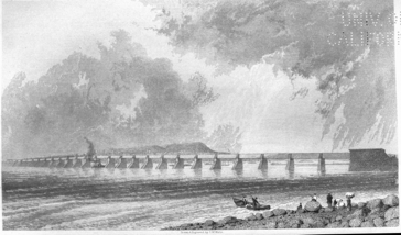
VICTORIA BRIDGE
"The superstructure, as designed by Mr. Stephenson, consists of twenty-five tubes, or rather, as one continuous tube extends over two spans, of twelve double tubes, and the large central one over the channel. They are of the uniform width of sixteen feet throughout, for the accommodation of a single line of railway, but differing in height as they approach the centre. Thus, the depth of the tubes over the first two spans is eighteen feet six, the next two nineteen feet, and so on, every coupled pair gaining an additional six inches, to the centre one, which is established at twenty-two feet in depth, as the proper proportion obtaining for a beam 330 feet long. These side-spans being all the same length, the increase in height does not arise from any requirement of additional strength, but simply to prevent the appearance of too great a break being visible in the top line of the tubes, and, by graduating the difference in height between the ends and centre, to give greater facilities for the roof required in the protection of the tubes from moisture and consequent oxidation, and presenting at the same time a straight and continuous outline on the top.
"The tubes, being detached, are not designed upon the principle of continuous beams, for practical reasons, including the circumstance of the steep gradient on each side of the central span, and the great disturbance which would be caused by the accumulated expansion and contraction of such a continuous system of iron work, in a climate where the extremes of temperature are so widely apart. The arrangement introduced of coupling but two together, with an intermediate space of eight inches between them and the neighboring tubes, divides this movement and retains it within certain specified limits.
"A double tube, covering two openings, is securely bolted to the masonry of the pier in the centre, on which it has a solid bearing of sixteen feet by nineteen feet, and provided with a free bearing on each of the two contiguous piers of seven and a half feet, resting at each end on fourteen expansion rollers six inches in diameter and three feet in length, seven on each side of the tube, retained in place by a wrought-iron frame, allowing the rollers to traverse on a planed cast-iron bed-plate seven and a half feet long, three and a half feet wide, and three inches thick, bolted to the masonry. A similar plate covers the rollers, and is secured to the bottom of the tube. The tube is thus free to expand or contract each way from the bearing-pier in the centre.
"Creosoted tamarack timber, covered with felt, is introduced between the iron and the stone, in every case, to give the junction of these hard materials a certain amount of elasticity.
"The tube proper is composed entirely of wrought-iron, in the form of boiler-plate, ranging from four-sixteenths to twelve-sixteenths of an inch in thickness, with the joints and angles stiffened and strengthened by the addition of Tee and Angle irons. The secret of success in this mode of construction, lies in arranging those different thicknesses where the strains or weights call for additional strength or otherwise.
"The following table will show the general distribution of material in the different parts of the tube, as arranged by Mr. Stephenson, starting in all cases from the centre of the spans:—"
| Top Plates. | ||||||
| Sectional Area. | ||||||
| From Centre. | Length of Division. | Plates. | Strips, Tee and Angle Irons. | Total Area. | Thickness of Plate. | |
| ′ ″ | ||||||
| 1 | 11.00 | 125 | 92-1/16 | 217-1/16 | 5/8″ | |
| 2 | 11.00 | 125 | 86-7/16 | 211-7/16 | 5/8″ | |
| 3 | 11.00 | 114-3/8 | 86-7/16 | 200-10/16 | 9/16 | |
| 4 | 11.00 | 107-1/16 | 84-11/16 | 191-12/16 | ½ | |
| 5 | 11.00 | 87½ | 84-11/16 | 172-3/16 | 7/16 | |
| 6 | 11.00 | 75 | 77-5/16 | 152-5/16 | 6/16 | |
| 7 | 11.00 | 56-11/16 | 77-5/16 | 134 | 5/16 | |
| 8 | 11.00 | 53¼ | 55¼ | 108½ | 4/16 | |
| 9 | 11.00 | 50 | 55¼ | 105¼ | 4/16 | |
| 10 | 11.00 | 50 | 48 | 98 | 4/16 | |
| 11 | 11.00 | 1 | 48 | 98 | 4/16 | |
| Bearing. | 8.00 | |||||
| 129.00 | ||||||
| Bottom Plates. | ||||||
| Sectional Area. | ||||||
| From Centre. | Length of Division. | Plates. | Strips, Tee and Angle Irons. | Total Area. | Thickness of Plate. | |
| 1 | 19.6 | 137.50 | 63.75 | 201.25 | 3/8—5/16 | } Double. |
| 2 | 14.0 | 137.50 | 57.75 | 195.25 | 3/8—5/16 | |
| 3 | 14.0 | 125.00 | 57.75 | 182.75 | 3/8—5/16 | |
| 4 | 14.0 | 112.50 | 54.25 | 166.75 | 5/16—4/16 | |
| 5 | 14.0 | 87.50 | 57.50 | 145 | 4/16—3/16 | |
| 6 | 14.0 | 85.00 | 33.00 | 118 | 5/16 | |
| 7 | 14.0 | 50.00 | 42.00 | 92 | 4/16 | |
| 8 | 17.6 | 50.00 | 42.00 | 92 | 4/16 | |
| Bearing. | 8 | 50.00 | 42.00 | 92 | 4/16 | |
| 129.0 | ||||||
Beginning at the centre, and strengthened by Tee bars inside and out, placed at distances of 3′, 6″,—
| The first space of | 35 feet | from the centre is formed of | ¼ | inch plate. |
| The second space of | 45½ feet | " | 5/16 | inch plate. |
| The third space of | 35 feet | " | 6/16 | inch plate. |
| The remaining space | " | 8/16 | inch plate. |
The following analysis is made of the arrangement proposed for distribution:
| Top of tube | 76 Tons. | ||
| Bottom of do | 82 Tons. | 158 | |
| Sides | 84 | ||
| Total | 242 | Tons. |
Keelsons, 10 inches in depth, are placed transversely at distances of 7 feet, and secured to the side Tee bars by gussets, for the support of the longitudinal timbers carrying the rail.
The top of the tube is also supported by keelsons at the same distances apart, and the whole tube rendered rigid, by stiffening gussets and double covers over every joint.
The wrought iron in a single tube 258 feet in length, including its bearings over the piers, weighs about a ton to the running foot, or 258 tons in all.
The central tube, in consequence of its increased length, is somewhat different in its arrangement; the bottom and top being proportionally stronger,—the first with an additional thickness of plates, and the last, with longitudinal keelsons 10″ high, taking the place of the ordinary longitudinal Tee bars, as existing on the side tubes; the side plates are 2½ feet, instead of 3½ feet wide, with a proportionately larger number of side Tee bars. The whole tube is disconnected from the others, being bolted to pier No. 12, and resting on rollers on No. 13 pier.
Windows are introduced into the sides of the tubes near the line of neutral axis, and serve to light up the inside. Iron brackets are placed on the piers where not occupied by the tubes, and slope back to the top of the tubes, but are entirely disconnected from it. They serve to give a finished appearance, and likewise prevent the snow and rain blowing in through the openings left for expansion and contraction.
It was originally intended to cover the top of the tubes with a curved corrugated iron roof, to protect them from the weather. This design was subsequently abandoned and the present sloping angular one substituted, composed of grooved and tongued boards, covered with the best quality of tin. This tin is not put on in the usual manner, but, by an ingenious arrangement, each sheet is allowed to expand and contract at pleasure, without the danger of destroying the fastenings which attach it to the timber underneath, as in the ordinary method made use of, and thus insures its continual efficiency.
A foot-walk 26 inches in width extends along the top of the roof, the whole length of the tubes, for the convenience of the employés connected with the work; a track is also provided for the painting-travellers.
The contract price may be put down under the heads of,
| First.—The approaches and abutments, which together extend to 3,000 feet in length, amount in the estimate to | $1,000,000 |
| Second.—The masonry forming the piers, which occupy the intervening space of 7,000 feet between the abutments, including all dams and appliances for their erection | 4,000,000 |
| Third.—The wrought-iron tubular superstructure, 7,000 feet in length, which amounts to | 2,000,000 |
| (About $285.70 per lineal foot), making a total of | $7,000,000 |
The following interesting details are annexed by Mr. Legge:
| First stone, No. 1 Pier, laid 20th July, 1854. | |||
| First passenger train passed 17th December, 1859. | |||
| Total length of Bridge, 9,184 feet lineal. | |||
| Number of spans, 25; 24 of 242 feet; one of 330 feet. | |||
| Height from surface of water to under side of centre tube, 60 feet. | |||
| Height from bed of river to top of centre tube, 108 feet. | |||
| Greatest depth of water, 22 feet. | |||
| General rapidity of current, 7 miles an hour. | |||
| Cubic feet of masonry, 3,000,000. | |||
| Cubic feet or timber, in temporary work, 2,250,000. | |||
| Cubic yards of clay used in puddling dams, 146,000. | |||
| Tons of iron in tubes, say, 8,250. | |||
| Number or rivets, 2,500,000. | |||
| Acres of painting on tubes, one coat, 30; or for the four coats, 120 acres. | |||
| Length of abutments, 242 feet each. | |||
| Length of north approach, 1,344 feet. | |||
| Length of south approach, 1,033. | |||
| Force employed in construction during summer or 1858, the working season extending from the middle of May to the middle of November: | |||
| Steamboats, 6; horse-power, 450 | } 12,000 | tons. | |
| Barges, 72 | |||
| Manned by | 500 | sailors. | |
| In stone quarries | 450 | men. | |
| On works, artisans, &c. | 2,090 | men. | |
| Total | 3,040 | men. | |
| Horses, 142. Locomotives, 4. | |||
key = A Date.; B Names of Engineers.; C Description of Structure.; D Total length.; E Greatest headway above water.; F Least headway above water.; G No. of spans.; H Length of span over channel.; I Length of remaining spans.; J Length of solid approach.; K Length of superstructure.; L Estimated cost of Bridge.; M REMARKS.
| A | B | C | D | E | F | G | H | I | J | K | L | M |
| 1846 | Mr. Morton[M] | Stone and wood | 11,540 | ... | ... | ... | ... | ... | ... | ... | ... | ¼ of a mile above foot of Nun's island. |
| 1846 | Mr. Gay, "Upper," | Stone and wood | 14,960 | ... | ... | ... | ... | ... | ... | ... | $613,321 | Head of Nun's island. |
| 1846 | Mr. Gay, "Lower," | Stone and wood | 12,540 | 25 | 22 | 56 | draw 60 | 200 | ... | 11,200 | 525,698 | Foot of Nun's island. |
| 1852 | Mr. T. C. Keefer | Stone, iron, & wood | 10,000 | 100 | 45 | 23 | 400 | 250 | 3,060 | 6,940 | 1,600,000 | Point St. Charles to St. Lambert. |
| 1852 | Mr. T. C. Keefer | Stone and iron | 10,000 | 100 | 45 | 23 | 400 | 250 | 3,060 | 6,940 | 3,600,000 | Do. Do. Do. |
| 1853 | Stephenson & Ross | Stone and iron | 9,184 | 60 | 36 | 25 | 330 | 242 | abuts 2,600 | 6,594 | 6,300,000 | Do. ½ a mile above. |
|
No plan or estimate—line of soundings taken only. |
|
In 1787, over 200,000 bushels of wheat were exported from Quebec. |
|
In 1795, 400 to 500 pounds of wild rice were sold by the Indians in Kingston market. |
|
This office was filled as early as 1689 by the Sieur De Beccancourt, as successor to his father who was probably the first grand voyer of New France. |
|
The maitres de poste were first recognized by law in 1780, and some half a dozen ordinances and acts were passed in their favor or to control them between that date and 1819, when their privileges ceased. |
|
Since these lines were written, death has removed a man, who, with unflagging energy, ever pursued his object in the spirit of peace;—a politician who was not an office-seeker, and who loved his country more than self or party,—a statesman often in advance of his countrymen—but not of his country—and a loyalist who so valued truth that he sought it even from the enemy—preferring to be misunderstood rather than to remain unarmed. |
|
This step was a repetition of the legislation of Upper Canada in 1837, before the Union—that province having voted the Great Western Railway £3 for every £1 of private stock subscribed, to the extent of £200,000. In default of repayment, the receiver-general could levy on the Gore and Western Districts. |
|
It is important to note, that if Canada did not construct her Trunk Railway without involving Englishmen (and women) in ruin, it was because Englishmen would have it so. Moreover, the demand came from such a quarter, that to those familiar with the resources of these "operators," it might have been extremely difficult for her to have gone into the money market on her own account, against their opposition. |
|
They really believed in men of their own country who did not believe in the prospectus, but who had other reasons for indorsing it; and this explains why their faith was of such short duration. |
|
Unfortunately, the municipalities do not make any return to Parliament of their investments in public works. This is the case also with road companies and several other joint-stock corporations. No good reasons are advanced why these bodies should be more favored than banks and railways. |
|
In a dispatch which arrived after the High Comr. had left the province, Lord Glenelg had suggested an inter-colonial road, and Lord Durham, instead of this, proposed the railway. |
|
Mr. Keefer having from a natural delicacy declined to write an account of a work with which his name is so intimately associated, the following extracts must suffice.—Ed. |
The whole of the telegraphic system of Canada (except the private lines belonging to railway companies) is in the hands of one company.
The Montreal Telegraph Company was organized in 1847, and first opened between Quebec and Toronto. The following figures show the progress of this company:
| In 1847. | In 1861. | |
| The capital stock | £15,000 | £100,000 |
| Length of line | 540 miles. | 3,422 miles. |
| Number of stations | 9 | 150 |
| Persons employed | 35 | 400 |
| Number of messages transmitted | 33,000 | 300,000 |
| Miles. | |
| The main line extends from Woodstock in New Brunswick | |
| to Detroit in Michigan | 1,050 |
| And from Quebec C. E. to Buffalo, N. Y. | 650 |
| With the following branches: | |
| River du Loup to Father Point | 70 |
| Quebec to Richmond, on Grand Trunk R. R. | 96 |
| Montreal to Portland, Maine, on do. | 292 |
| Montreal to Troy, New York | 250 |
| Montreal to Waterloo, C. E. | 60 |
| Prescott to Ottawa City | 54 |
| Prescott to Oswego, New York | 120 |
| Belleville to Stirling | 15 |
| Trenton to Pictou | 30 |
| Port Hope to Peterboro' and Lindsay | 55 |
| Toronto to Collingwood, on Northern Railway | 97 |
| Toronto to Sarnia, on Grand Trunk R. R. | 170 |
| Goderich to Buffalo | 160 |
| St. Mary's to Port Stanley | 50 |
| Brantford to Port Dover | 32 |
| Windsor to Amherstburg | 18 |
| Various branches to small towns and villages | 153 |
| 3,422 |
The lines enumerated above embrace all the important towns and villages in both provinces.
There are thirty-two poles to the mile, and the wire is number eight and nine, galvanized. The line is worked on the Morse principle, and nearly every thing is taken by sound. The business, after the crisis of 1857, fell off to a considerable extent, but during the last two years it has gradually increased, and the number of messages passing over the line in 1861, amounted to 300,000.
| Miles. | Built. | |
| Halifax to New Brunswick line | 130 | 1849 |
| Truro to Pictou | 40 | 1850 |
| Halifax to Liverpool | 102 | 1851 |
| Halifax to Yarmouth (via Windsor) | 224 | 1852 |
| Pictou to Sydney, C. B. | 195 | 1852 |
| Pictou to Amherst, (via Pugwash) | 80 | 1853 |
| Liverpool to Barrington | 62 | 1853 |
| Halifax to Truro (second wire) | 64 | 1853 |
| Barrington to Yarmouth | 45 | 1854 |
| Antigonishe to Cape Canso | 67 | 1854 |
| St. Peters, C. B., to Arichbat, C. B. (about) | 20 | 1854 |
| Plaister Cove to Port Hood | 28 | 1855 |
| Wolfville to Canning | 9 | 1858 |
| Total miles, | 1,066 |
All except the second wire between Halifax and Truro, are of number nine ungalvanized wire; the poles are spruce and tamarack, from thirty-five to forty to the mile. The second wire, from Truro to Halifax, is number nine galvanized wire.
The telegraph in Nova Scotia was constructed by the provincial government.
| Miles. | Built. | |
| Calais to St. John | 90 | 1848 |
| St. John to Nova Scotia boundary | 140 | 1849 |
| St. John to Fredericton | 64 | 1850 |
| Fredericton to Woodstock | 64 | 1851 |
| Monckton to Chatham | 100 | 1851 |
| Newcastle to Bathurst | 55 | 1858 |
| Bathurst to Campbelltown | 68 | 1860 |
| Salesbury to Hillsboro' | 22 | 1856 |
| Total miles, | 603 |
COMMERCE AND TRADE
Three hundred and twenty-seven years ago, Jacques Cartier, of St. Malo, discovered the St. Lawrence,[17] sailed up its mighty stream for several hundred miles, formed alliances with the Indians, built a fort, and wintered in the country. In 1549, the colonization of the newly discovered "Canada" was commenced, under the auspices of Roberval, the first viceroy, and an attempt made to establish a traffic in furs with the natives; but, in consequence of the loss of Roberval and some of his companions, at sea, in 1549, and European distractions arising from the wars between France, Spain, and Austria, no further effort was made for nearly half a century to colonize the valley of the St. Lawrence. In 1581, a trade with Canada began to spring into activity, and in 1591 a fleet of ships was fitted out by the adventurous inhabitants of St. Malo, to engage in the Canada trade, and, chiefly, to procure the teeth of the walrus, which at that time was common in the gulf and estuary of the St. Lawrence.
In 1603, a company of adventurers, headed by M. de Chauvin, lieutenant-general of Canada and Acadia, received a royal charter from Henry IV., of France, and established a regular system of trade in the colony. Ten years later, Champlain obtained a commission authorizing him to seize every vessel, not holding a license, he should find trafficking in furs between Quebec and the upper part of the St. Lawrence. In 1628, the celebrated but unscrupulous Cardinal de Richelieu organized the "Company of One Hundred Partners," and conceded to its members in perpetuity the viceroyalty of New France and Florida, thus establishing a commercial régime in Canada, whose influence soon extended far and wide among the Indian races of the valley of the St. Lawrence.
The "Company of One Hundred Partners" was dissolved by Louis XIV., in 1663, who resumed the jurisdiction over the country, which for thirty-five years had been under the rule of a trading association.
Scarcely, however, had a year elapsed, when, by a royal edict dated 1664, Canada was once more handed over to the short-lived commercial bondage of the "West India Company," but, in 1666, free trade with the aborigines was again declared, subject to certain restrictions and reservations. The company was permitted to retain the right to one-fourth of all the beaver-skins, and one-tenth of all the elk-hides exported, besides the traffic which belonged to Tadoussac at the mouth of the Saguenay. For these privileges, the company paid 48,950 livres, or about $10,000, a livre being worth, at that period, about one English shilling.
Thus far, the efforts made by the French to colonize Canada, and open a trade with the different nations inhabiting the vast extent of country drained by the St. Lawrence, had not been productive of much public and private good, and was marked by a succession of individual disasters which damped the ardor even of the most courageous and enterprising merchants of that day.
Lake Superior was visited, in 1659, by two traders, who joined some roving bands of Algonquins, and passed the winter in that region. In 1660, they returned to Quebec, escorted by sixty Algonquin canoes laden with furs.
In the autumn of 1678, La Salle, armed with a royal commission, commenced the construction of a fort at Niagara; and during the winter he laid the keel of a vessel intended for the navigation of the upper lakes, about six miles above the stupendous cataract. The first Upper Canadian ship (for in those days it was worthy of that designation) was launched in the summer of the following year, and, to the unbounded astonishment and alarm of the savage Iroquois and Eries who peopled either shore, it sailed through Lake Erie, Lake Huron, and finally reached Lake Michigan. The "Griffon," as the vessel was called, met with an untimely fate on her return; she was wrecked before she reached the Niagara river, and, with her rich cargo of furs, sank beneath the waves of the inland sea whose solitudes she was the first to invade. Not two centuries (183 years) after the lonely "Griffon" had penetrated through the Upper Canadian lakes, the commerce of the region tributary to them was more than sufficient to employ nearly two thousand steamers and sailing vessels, exceeding half a million tons burden, and costing fifteen millions of dollars.[18]
Subsequently to the extinction of the West India Company, the trade in peltries was free for a time, with the exception of beaver and elk skins, for which monopoly 70,000 francs a year was paid by the lessees, until it became the property of a French society, called the "Company of Canada." After an unprosperous existence for a few years, this trading association, like its predecessors, expired deeply in debt, in 1706. In a report on the condition of Canada in 1715, contained in the "Documents de Paris," there is an interesting account of colonial affairs, which throws some light on the state of Canada at that period. The report is by M. d'Auteuil, who remarks that trade with the savages, once considerable, had even at that early date greatly fallen off. Ship-building was brisk even 150 years ago; hemp for cordage and flax for linen were advantageously grown; but France did not import Canadian timber, or continue to work the copper mines on Lake Huron. The French, at the close of the 17th century, must have been familiar with the copper treasures of the shores of Lake Huron, and perhaps even of Superior, or M. d'Auteuil would not have regretted their neglect of them. In 1687, M. de Denonville writes to the French ministry:[19] "The copper, of which I sent a sample to M. Arnon, is found at the head of Lake Superior. The body of the mine is not yet discovered. I have seen one of our voyageurs, who assures me that he saw, fifteen months ago, a lump of 200 lbs. weight, as yellow as gold, in a river which falls into Lake Superior. When heated, it is cut with an axe; but the superstitious Indians, regarding this piece as a good spirit, would never permit him to take any of it." The estimate formed by M. d'Auteuil of the annual value of the peltries exported from Canada in 1677, was 550,000 francs, and in 1715, two million francs. Thomas Dongan, governor of the province of New York, in 1687, complains bitterly of the difficulties he had to encounter in finding, on his arrival in the colony, "such a contest between the government of Canada and this (New York) about the beaver trade, the inland country, and the Indians." The English found their way to Lakes Ontario and Erie with merchandise, for barter with the Ottawa Indians, as early as 1686, much to the disgust of M. de Denonville, who writes to his government that he is going to intercept ten English canoes, laden with merchandise, that have appeared on Lakes Ontario and Erie.
"I regard, my lord," he says, "as of primary importance the prohibition of the trade to the English, who, without doubt, would entirely ruin ours, both by the cheaper bargains they could give the Indians, and by attracting to them the Frenchmen of our colony, who are accustomed to go to the woods."[20] The "merchandise" largely employed in those days, and continued up to the present time, both by British and French, has proved the ruin of the Indian race of this continent. M. de Denonville writes to Governor Denon: "Think you, sir, that religion will progress whilst your merchants supply, as they do, eau de vie in abundance, which converts the savages, as you ought to know, into demons, and their cabins into counterparts and theatres of hell?" But what was the religion spoken of by Denonville? Here is a description of it: "The present is to inform Y. R. of our return from the Iroquois mission, loaded with some spoils rescued from hell. We bear in our hands more than five hundred children, and a number of adults, the most part of whom died in baptism. We have re-established faith and piety in the heart of a poor captive church, the first foundations of which we laid in the Huron country. We have proclaimed the gospel unto all the Iroquois nations, so that they are henceforth without excuse, and God will be fully justified against them at the great day of judgment."[21]
In a memoir addressed to the Marquis of Seignelay, dated 1687 (Paris Doc.), the trade of Canada is described as being very precarious. "Canada is encompassed by many powerful English colonies, who labor incessantly to ruin it by exciting all our savages and drawing them away with their peltries, for which the English give them a great deal more merchandise than the French, because they pay no duty to the king of England."[22]
In 1754, only ten vessels, of forty to one hundred tons, were built in Canada. The trade with France employed about thirty ships, belonging to merchants of La Rochelle. During the administration of French rule, previously to the year of peace 1760, when Montreal and all the French fortresses in Canada were surrendered to Great Britain, the balance of trade was always against the colony.
The exports, previous to 1759, are stated in a prosperous year to have been as follows:
| Furs to the value of | £88,333 | sterling. |
| Seal Oil | 10,416 | " |
| Flour and Peas | 10,416 | " |
| Timber | 6,250 | " |
| Total | £115,415 | " |
In 1729, the annual expenditure of the government of Canada was £16,166 13s. 4d.; in 1759, the disastrous year which witnessed the fall of Quebec, the expenditure rose to £1,083,330 6s. 8d. sterling; but this vast outlay did not increase the trade of the country. Military operations, glory, and extravagance consuming it all. In 1754, the number of vessels engaged in foreign trade with the colony only amounted to fifty-three, leaving a total importation valued at £216,769, and an exportation valued at £75,560, leaving a balance against the colony of £141,209 sterling.
After the fall of Quebec, trade increased and assumed a healthy tone; the imports no longer exceeded the exports; another race, less addicted to military glory, acquired a standing in Canada, and began to develop its long neglected resources. But the country people, of French origin, had received an indelible impress of character and disposition, which they have retained in many particulars up to the present day.
The following table shows the number of vessels and their aggregate tonnage which have arrived at Quebec from sea, at decennial periods between 1764 and 1861:[N]
| No. of vessels. | Tons. | Men. | |
| 1764 | 67 | 5,496 | 568 |
| 1769 | 82 | 7,411 | 587 |
| 1771 | 77 | 6,584 | 597 |
| 1780[N] | 69 | 8,792 | 724 |
| 1791 | 81 | 14,760 | 826 |
| 1801 | 175 | 20,517 | 1,564 |
| 1811 | 582 | 116,687 | 5,553 |
| 1821 | 434 | 102,786 | 4,645 |
| No. of sailing vessels. | Tons. | Men. | |
| 1831 | 1,026 | 263,160 | 13,329 |
| 1841 | 1,221 | 425,118 | 16,443 |
| 1851 | 1,300 | 533,427 | 17,753 |
| 1861 | 1,277 | 703,908 | 19,339 |
| No. of steamers. | Tons. | Men. | |
| 1831 | 1 | 363 | 21 |
| 1841 | 13 | 5,057 | 221 |
| 1851 | ... | ... | ... |
| 1861 | 67 | 71,894 | 4,335 |
|
No returns for 1781. |
The following table represents the coasting trade, below Quebec, for the last five years:
| Year. | Vessels. | Tons. | Men. |
| 1857 | 130 | 6,265 | 495 |
| 1858 | 146 | 9,372 | 866 |
| 1859 | 160 | 11,454 | 1,070 |
| 1860 | 177 | 12,934 | 1,160 |
| 1861 | 277 | 15,910 | 1,536 |
This table shows how rapidly the country below Quebec is settling, and what an impulse has been given, during the short period of five years, to the commerce of that region.
The earliest period recorded, of the dates of the opening of navigation at Quebec, is the 12th April, in 1828; the latest period was the 11th May, 1847; a difference of one month.
The latest date of the closing of navigation occurred on the 21st December, 1826; the earliest date was the 25th November, 1833; also a period of about one month.
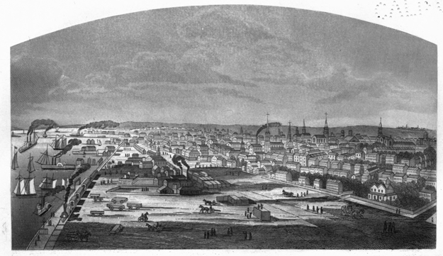
CITY OF TORONTO FROM A CLEARED SPACE ON THE ESPLANADE, NEAR THE DON RIVER.
With respect to the period of navigation between Montreal and Quebec, the longest duration was in 1830, when the number of days between the first arrival and the last sailing was 223 days, or from April 26th to December 4th. The shortest period occurred in 1836, from May 11th to November 25th; 199 days. The average period of navigation is about seven months.
Whosoever chooses to wade through the voluminous documentary history of the early British colonies in America, will find that the fur trade was the all-absorbing interest, for more than one hundred and fifty years, in the valley of the St. Lawrence and the vast region tributary to Hudson's Bay, previous to the second conquest, in 1759.[23]
The beaver, the present symbol of Canada, was early a source of considerable revenue to the colonies, and has far surpassed in importance all other fur-bearing animals; although now it is comparatively valueless, the tax on beaver-skins alone, in early times, being more than the present worth of the pelt, when the difference in the value of money is taken into consideration. In 1678, Sir E. Andros, governor of New York, reports, that "the rates or duties upon goods exported are, 2s. for each hogshead of tobacco, and 1s. 3d. on a beaver skin, and other peltry proportionally."
Governor Dongan, under date 1687, in a report on the Province of New York, writes: "It will be very necessary for us to encourage our young men to goe a beaver hunting as the French doe." "I send a map by Mr. Spragg, whereby your Lops may see the several govermts, &c., how they lye where the beaver hunting is, & where it will bee necessary to erect our Country Forts for the securing of the beaver trade, & keeping the indians in community with us."[24] In the same report, Governor Dongan notices "the custom or duty upon every beaver skin commonly called a whole beaver, ninepence." "And that all other fur and peltry be valued accordingly, that is, for two half beavers ninepence; for four lapps ninepence; three drillings one shilling and sixpence; ten ratoons ninepence; four foxes ninepence; four and twenty meescats ninepence; ten mallar ninepence; twenty-four pounds of moose and deer skin ninepence. And all other peltry to be valued equivalent to the whole beaver exported out of the province (bull and cow hides excepted)." Father de Lamberville, a cunning, zealous, but not overscrupulous missionary, wrote to M. de Denonville, governor of Canada, in 1684, that "the envoy of the governor of New York, who is here, promises the Iroquois goods at a considerable reduction; 7 & 8 lbs. of powder for a beaver; as much lead as a man can carry for a beaver, and so with the rest." It must not be supposed that this was the actual price paid for a beaver-skin at that time. Father de Lamberville merely mentions these items to show that the English were bribing the Iroquois to adopt their side, in the event of war with the French, or in future extension of trade. It was a system of presents which gave rise to the Indian expression, "underground" or secret presents, in order to avoid the appearance of bribery. The word "underground" has recently acquired a different application, familiar to every ear. The fugitives from the slaveholder reach Canada by the "underground railway." The Confederates obtain information of the movements of the Federalists by the "underground telegraph," and the late rush across the Canadian frontier, from the drafting in the United States, was chiefly by the "underground line."
Father de Lamberville defeated Colonel Dongan's attempts to draw the Hurons and Ottawas to his side, by "underground presents," although Dongan offered seven pounds of powder for a beaver, or as much lead as a man could carry.
The mission and the beaver were too frequently associated by the early French missionaries. They made the fur-trader and the proselytizer one. There is no doubt that wherever the fur trade extended, there was but too much need of the humanizing influence of Christianity, but as long as the missionaries traded in furs, the gentle influences of religion were not felt. The condition of the colony in Denonville's time was deplorable. He himself writes, "I receive letters from the most distant quarters, from the head of River Mississippi, from the head of Lake Superior, from Lake des Lenemyngon (Lake St. Anne, north of Lake Superior), where they propose wonders to me by establishing posts for the missions, and for the beavers which abound there. But in truth, so long as the interior of the colony is not consolidated and secured, nothing certain can be expected from all those distant posts, where hitherto people have lived in great disorder, and in a manner to convert our best Canadians into banditti."[25]
The failure on the part of the different French companies to establish successful monopolies, arose in great part, from a spirit of personal aggrandizement, which influenced men in power, and the excellent opportunities which the form of government then prevailing in the colony secured to them. In 1731 the administration of M. de Beauharnois was marked by continued erection of new forts, and displays of military force, for the purpose of keeping the English traders within proper limits. Soon after the whole valley of the St. Lawrence came under British sway, the merchants of Montreal, among whom were many Scotchmen, seeing the advantage of united action, formed themselves into a company in 1784, and assumed the title of the North-West Company of Montreal. The stock of this company was at first divided into sixteen shares without any capital being deposited, each shareholder furnishing a proportion of such articles as were necessary to carry on the fur trade. It was soon found, however, that some of the traders in the Indian country were adverse to this union of interests, and a few of them joined together and established a rival company. As might have been expected, a collision between the two companies soon took place, murder was committed,[26] and many of the injuries which rivalry and jealousy could engender, were inflicted by both sides, far beyond the reach of retributive justice.
At length, in 1787, the discontented traders and the North-West Company came to an understanding, united their interests, and founded a commercial establishment on a sound basis, divided into twenty shares, a certain portion being held by the merchants in Montreal, the remainder by the traders in the Indian country. The adventure for the year amounted to £40,000, but in eleven years from that date, or in 1789, it reached treble that sum, yielding large profits to the company. In 1798 the number of shares was increased to forty-six, and so rapid was the increase in power and wealth of the corporation, that the army of employés enlisted in its service rose to upwards of four thousand.
The agents of the North-West Company came into frequent collision with the servants of the Hudson's Bay Company, which not only led to a spirit of rivalry in trade, baffling description, but also to numerous encounters, in which much blood was shed and many lives lost. Wearied of this ruinous competition, and harassed by the threatened difficulties, which the continuance of so much crime and bloodshed amongst their half-wild subordinates were drawing upon them, the two companies agreed to unite, and in 1821 an end was put to contention and rivalry, by the amalgamation of the two bodies, under the title of the Hudson's Bay Company. From the date of the union a new era in the fur trade began, which will be better described after a brief history has been given of one of the most successful and flourishing monopolies the world has ever seen.
The Hudson's Bay Company was incorporated in the year 1670, under a royal charter of Charles the Second, which granted them certain territories in North America, together with exclusive privileges of trade and other rights and advantages. During the first twenty years of their existence the profits of the company were so great[27] that, notwithstanding considerable losses sustained by the capture of their establishments by the French, amounting,in value to £118,014, they were enabled to make a payment to the proprietors, in 1684, of fifty per cent., and a further payment in 1689 of twenty-five per cent.
In 1690 the stock was trebled without any call being made, besides affording a payment to the proprietors of twenty-five per cent. on the increased or newly created stock. From 1692 to 1697 the company incurred loss and damage to the amount of £97,500 sterling, from the French. In 1720 their circumstances were so far improved that they again trebled their capital stock, with only a call of ten per cent. from the proprietors, on which they paid dividends averaging nine per cent. for many years, showing profits on the originally subscribed capital stock actually paid up, of between sixty and seventy per cent. per annum, from the year 1690 to 1800, or during a period of 110 years.
Up to this time the Hudson's Bay Company enjoyed a monopoly of the fur trade, and reaped a rich harvest of wealth and influence.
In 1783 the North-West Company was formed, having its head-quarters at Montreal. The North-West Company soon rose to the position of a formidable rival to the Hudson's Bay Company, and the territory the two companies traded in became the scene of animosities, feuds, and bloodshed, involving the destruction of property, the demoralization of the Indians, and the ruin of the fur trade. Owing to this opposition, the interests of the Hudson's Bay Company suffered to such an extent, that between 1800 and 1821, a period of twenty-two years, their dividends were, for the first eight years reduced to four per cent. During the next six years they could pay no dividend at all, and for the remaining eight they could pay only four per cent.
In the year 1821 a union between the North-West and Hudson's Bay Companies took place, under the title of the last named. The proprietary were called upon to pay £100 per cent. upon their capital, which, with the stock in trade of both parties in the country, formed a capital stock of £400,000, on which four per cent. was paid in the years 1821 to 1824, and from that time half-yearly dividends of five per cent. to 1828; from 1828 to 1832 a dividend of five per cent., with a bonus of ten per cent., was paid, and from 1832 to 1837 a dividend of five per cent., with an average bonus of six per cent. The distribution of profits to the shareholders for the years 1847 to 1856 both inclusive, was as follows:
1847 to 1849, ten per cent. per annum; 1850, twenty per cent. per annum, of which ten per cent. was added to stock; 1851, ten per cent.; 1852, fifteen per cent., of which five per cent. was added to stock; 1853, £18 4s. 6d., of which £8 4s. 6d. was added to stock; 1854 to 1856, ten per cent. per annum dividend.[28] Of 268 proprietors in July 1856, 196 have purchased their stock at from 220 to 240 per cent.[29]
The affairs of the Hudson's Bay Company are managed by a governor-in-chief, sixteen chief-factors, twenty-nine chief-traders, five surgeons, eighty-seven clerks, sixty-seven post-masters, twelve hundred permanent servants, and five hundred voyageurs, besides temporary employés of different ranks, chiefly consisting of voyageurs and servants. The total number of persons in the employ of the Hudson's Bay Company is about 3,000.
The late Sir George Simpson was governor of the Hudson's Bay Company for forty years. He exercised a general supervision over the company's affairs, presided at their councils in the country, and had the principal direction of the whole interior management in North America. The governor is assisted by a council for each of the two departments into which the territory is divided.
The seat of council for the northern department is at Norway House, on Lake Winnipeg; for the southern department at Michipicoten, Lake Superior, or Moose Factory, on James's Bay. The council consists of the chief officers of the company, the chief factors being ex-officio members of council. Their deliberations are conducted in private. The sixteen chief factors are in charge of different districts in the territory, and a certain number of them assemble every year at Norway House, for the northern department, generally about the middle of June, to meet the governor and transact business. Seven chief factors, with the governor, form a quorum, but if a sufficient number of the higher rank of officers are not present, a quorum is established by the admission of chief traders.
The Hudson's Bay Company's operations extend not only over that part of North America called Rupert's Land and the Indian territory, but also over part of Canada, Newfoundland, Oregon, Russian America, and the Sandwich Isles.
The operations of the Hudson's Bay Company extend over territories whose inhabitants owe allegiance to three different and independent governments, British, Russian, and the United States. These immense territories, exceeding 4,500,000 square miles in area, are divided, for the exclusive purposes of the fur trade, into four departments and thirty-three districts, in which are included one hundred and fifty-two posts, commanding the services of three thousand agents, traders, voyageurs, and servants, besides giving occasional or constant employment to about one hundred thousand savage Indian hunters. Armed vessels, both sailing and steam, are employed on the north-west coast to carry on the fur trade with the warlike natives of that distant region. More than twenty years ago the trade of the north-west coast gave employment to about one thousand men, occupying twenty-one permanent establishments, or engaged in navigating five armed sailing vessels, and one armed steamer, varying from one hundred to three hundred tons in burden. History does not furnish another example of an association of private individuals exerting so powerful an influence over so large an extent of the earth's surface, and administering their affairs with such consummate skill, and unwavering devotion to the original objects of their incorporation.
The Hudson's Bay Company, even when they relinquish the valley of the Saskatchewan, and confine their operations to the region north of the 56th parallel of latitude, will still hold much of the fur trade in their grasp. But they will do so as an independent company, engaged in open competitive rivalry with all who choose to engage in that difficult and precarious traffic. The organization existing among the officers and servants of this company; their acquaintance with the habits, language, and hunting-grounds of the Indians of the North American continent; and, more especially, the fact that they are not only personally acquainted with almost every Indian in North America, but have the means, if it suit the purposes of trade, of communicating with them and supplying their wants, will secure to this admirably organized association the command of the most lucrative branches of the fur trade, for many years to come. If the history of any fur-trading company in America were faithfully written, it would exhibit to the world a systematic course of action as surely destructive to the Indian race of this continent, within the limits of the law, as if it had been a predetermined object from the beginning of their operations to the close. The history, indeed, of almost any one abandoned fort or post, during the prosperous existence of a company, would be a type of the history of the entire trade, and its prejudicial influences on the Indian races. An abandoned post implies, in general, the utter destruction of the fur-bearing animals, or of the sources of food upon which the Indian hunters formerly subsisted. It is an acknowledgment that the country which once served the post has been converted into an inhospitable desert, wholly incapable, in its wild and uncultivated state, of supplying the small demands of the former inhabitants of the district it served.
| 1853, | $127,694 | 1858, | $163,213 |
| 1854, | 69,357 | 1859, | 229,147 |
| 1855, | 115,260 | 1860, | 227,115 |
| 1856, | 207,753 | 1861, | 230,596 |
| 1857, | 154,879 |
All of the furs collected by the Hudson's Bay Company go to England. The Canadian fur trade is very limited in comparison with that of the giant monopolist. The total value of the export of furs amounted, in 1861, to $228,918; $84,661 worth going to the United States, the remainder to Great Britain. The monopoly enjoyed by the Hudson's Bay Company is now extinguished by the expiration of their charter, and, as soon as ready communication between Canada and the valley of the Saskatchewan is established, the Canadian fur trade will revive again, although it will never attain a tithe of the importance it possessed during the palmy days of the North-West Company.
Ship-building was one of the earliest branches of industry cultivated in Canada. The memorials contained in the "Documents de Paris" inform us, that as early as 1715, ship-building at Quebec was pretty brisk, although there was great reason for complaint that the French would not import the fine timber of the country. The fur trade appeared to monopolize all the attention of the French rulers; and although the British drew large supplies of lumber from the Atlantic provinces, New France contributed no part of her immense forest treasures to increase the naval resources of the great rival of England on the seas. M. de Maurepas, the French minister of marine in 1731, was fully alive to the importance of ship-building, for he wrote some strong dispatches to the governor, urging the stimulation of this branch of industry, and promised that ships of war should be constructed in Canada, if some good merchant vessels were turned out. He offered a premium of 500 francs for every vessel gauging 200 tons or over of colonial build, and sold in France or the Antilles, and 150 francs premium for each barge of thirty or forty tons, if similarly disposed of.
In 1752, ten vessels, of forty to one hundred tons, were built in Canada, but the materials were badly chosen, and the price high. It is remarkable, that even at that early period of the history of French Canadian industry, a number of vessels, used in the trade of Canada, were purchased from the enterprising New Englanders. With the finest forests in the world for ship-building, unequalled facilities for bringing lumber to the seaboard, and the encouragement of a liberal bounty, French enterprise in Canada, toward the middle of the last century, was not equal to the task of seizing upon the only industry which would tend to secure to them the peaceable possession of the colony in the event of a war with their great and industrious rival, Britain, besides encouraging immigration, amassing wealth, and establishing a political importance.
In 1734 there were fifty-two saw-mills in that part of this province which lies east of the Ottawa; the population of the country being 37,252 souls. In 1827, or nearly one hundred years later, the number of saw-mills had increased to 565, with a population of 471,876.
The following table shows the number and tonnage of the sea-going vessels built at Quebec during decennial periods, between 1791 and 1861:
| Year. | No. of ships. | Tons. |
| 1791 | 12 | 574 |
| 1801 | 24 | 3,404 |
| 1811 | 54 | 13,691 |
| 1821 | 22 | 2,254 |
| 1831 | 38 | 6,170 |
| 1841 | 64 | 23,122 |
| 1851 | 66 | 41,605 |
| 1861 | 51 | 25,546[O] |
|
The average value of ships built at Quebec is taken at $40 a ton; the tonnage can be obtained at once by dividing the value by 40. |
Since 1787, there have been 2,939 ships built at Quebec, being in the aggregate 890,201 tons burden. The largest ship ever constructed on this continent was built in Quebec, in 1825. It was called the Baron of Renfrew, and measured 5,294 tons. Another large wooden ship was built in 1824, measuring 3,690 tons: but these huge wooden vessels were not successful.
This enumeration does not include other vessels which were constructed at the different ports of the valley of the St. Lawrence, and sometimes sent across the Atlantic for sale. Such vessels have been recently built on Lake Huron, at Toronto, &c., &c., but in consequence of the general depression in trade, since the year 1857, little has been done in ship-building in the lake districts, although there is every prospect that it will become an important industry now that ship communication with Europe and Lake Superior, by means of the Canadian canals, without breaking bulk, is easily and profitably accomplished.
The lumber trade was long in growing to importance during the early history of Canada. In 1723 nineteen vessels cleared from Quebec, containing cargoes of peltries, lumber, and provisions; but there does not appear to have been any considerable trade in lumber between Europe and Canada until the close of the eighteenth century.
In 1786, the exports of fish, lumber, &c., from Labrador and Gaspé were returned at £45,000 sterling, and furs and other colonial produce from Quebec at £445,116 sterling; but lumber is not specially included as an article of commerce. In 1808, the products of the forest became a separate item, and we find oak and pine timber, staves, masts, &c., exported, to the value of £157,360 sterling; but from the United States the imports of lumber were to the amount of £70,000 sterling, the greater part of which would be included in the amount specified above. The different articles which make up Canadian lumber exports have been enumerated in the chapter on "Forest Industry." It will suffice for present purposes to state the condition of the export trade during the years 1824 to 1829 inclusive, with the statistical data of the trade from 1853 to 1861 inclusive.
Exports of lumber from Quebec during the years 1824, 1825, 1826, 1827, and 1829:
| 1824. | 1825. | 1826. | 1827. | 1829. | |
| Masts | 1,132 | 988 | 751 | 983 | 973 |
| Spars | 1,289 | 1,799 | 2,892 | 1,999 | 1,679 |
| Oak timber, planks | 19,994 | 33,152 | ... | ... | ... |
| Oak timber, tons | ... | ... | 23,822 | 21,763 | 24,411 |
| Pine timber, planks | 96,026 | 128,078 | ... | ... | ... |
| Pine timber, tons | ... | ... | 129,151 | 86,090 | 123,510 |
| Staves | 3,657,188 | 3,934,410 | 4,164,688 | 5,476,548 | } 4,537,732 |
| Stave ends | 30,416 | 19,295 | 61,191 | 68,612 | |
| Deals and boards | 1,052,147 | 1,479,565 | 823,922 | 1,621,658 | 9,543,645 |
| Hoops | 147,800 | 125,536 | 98,888 | 34 | ... |
| Ashes, barrels | 55,108 | 65,502 | 39,589 | 27,303 | 30,425 |
Comparative statement of the value of the products of the forest, during the years 1853 to 1861 inclusive:[P]
| 1853, | $9,293,338 | 1858, | 9,284,514 |
| 1854, | 9,912,008 | 1859, | 9,663,962 |
| 1855, | 7,832,660 | 1860, | 11,012,253 |
| 1856, | 9,802,130 | 1861, | 9,572,645 |
| 1857, | 11,575,508 |
|
Furs are not included in this estimate. |
The annual exportation may be stated at 30,000,000 cubic feet of timber in the rough state, and about 400,000,000 feet, board measure, of sawed lumber. The revenue derived from timber cut in the public forests was $383,150, in 1861. There is very good ground for the expectation that new markets in continental Europe will soon be opened for Canadian timber. Already the beginning of this trade has been made, by the dispatch of twenty cargoes to France, Spain, and Germany, in 1861. The products of the forest hitherto exported have been confined to a few species of timber trees, not exceeding a dozen at the most. When it is known that there are upwards of thirty kinds of forest trees, out of some sixty or seventy species with which our forests are filled, well adapted to the wants of European manufactures, it is confidently anticipated that a new impulse will soon be given to the lumber trade of the Province, in a different direction to that which it has hitherto taken.
Prior to 1858, England imported more timber from the British American Provinces than from all other countries. This predominance ceased in the next succeeding year, when the British importations stood thus:
| 1859. | ||
| From British America | 1,301,248 | loads. |
| From Foreign countries | 1,655,232 | " |
| 1860. | ||
| From British America | 1,264,360 | loads. |
| From Foreign countries | 1,537,920 | " |
In the present year (1862), eight vessels have already sailed for German ports, their destination and cargoes being as follows:
| Name of Port. | No. of Vessels. | Cargo. |
| Stettin | 1 | Oak. |
| Hamburg | 3 | Oak and pine. |
| Bremen | 4 | Red and white pine, walnut, &c. |
This trade promises to be of the greatest value to Canada, and if the government adopt wise and liberal measures to secure a foreign European market, the gain which will result to Canada, in many ways, is incalculable. Immigration from those countries can be fostered in no better way than by a growing trade in the forest productions of the British Provinces.
The shipments of timber from Quebec, for the year ending December 1st, 1862, as compared with those of 1860 and 1861, were as follows:
| 1860. | 1861. | 1862. | ||||
| Oak | 1,485,400 | ft. | 1,725,160 | ft. | 1,463,680 | ft. |
| Elm | 1,021,560 | " | 1,269,329 | " | 1,099,200 | " |
| Ash | 88,440 | " | 96,560 | " | 99,840 | " |
| Birch | 462,160 | " | 255,320 | " | 165,480 | " |
| Tamarac | 58,240 | " | 50,240 | " | 57,120 | " |
| White pine, square and wany | 18,252 600 | " | 19,447,920 | " | 15,493,080 | " |
| Red pine | 2,502,880 | " | 2,855,240 | " | 2,491,120 | " |
The export of the leading items for 1862, falls slightly below the average shipments of the five years, from 1853 to 1857; but the stock at Quebec considerably exceeds that of any previous season, being 19,000,000 feet of pine against 10,000,000, the average stock between 1853 and 1857.
The prices current for the leading descriptions of timber in the raft, in Quebec, on the 1st December, compare as follows during the years 1858, 1859, 1860, and 1861.
| White pine. | Red pine. | Oak. | Elm. |
| 1862. | |||
| 3½d. to 6d. | 7½d. to 10d. | 1s. 2d. to 0s. 0d. | 9½d. to 1s. 1d. |
| 1861. | |||
| 5½d. to 6½d. | 8¼d. to 11d. | 1s. 3d. to 1s. 5d. | 9d. to 1s. 1d. |
| 1860. | |||
| 5½d. to 6¼d. | 8d. to 11d. | 1s. 2d. to 1s. 3d. | 7½d. to 1s. 2d. |
| 1859. | |||
| 4¾d. to 6d. | 8d. to 1s. | 1s. to 1s. 3d. | 7½d. to 1s. 2d. |
| 1858. | |||
| 4d. to 5½d. | 9d. to 1s. | 1s. 4d. to 1s. 5d. | 10d. to 1s. 0d. |
The remarkable increase in the grain trade of Montreal, is seriously affecting the shipments of lumber at Quebec. Fully one-half of the vessels which formerly took in cargoes of lumber at Quebec, now go to Montreal for grain. This withdrawal of 400 or 500 large sea-going vessels, is diminishing the industry of the port of Quebec, while Montreal is becoming the great seat of foreign commerce.
In 1734, when Lower Canada had a population of 37,252, the lands occupied and in tillage amounted to 163,111 arpents, and there were produced 737,892 minots of wheat, 163,988 minots of oats, 166,054 lbs. of tobacco, and 92,246 lbs. of flax. The following table shows the export of wheat which took place from the port of Quebec, from 1793 to 1802, inclusive. Nearly the whole of this exportation must have been the growth of Lower Canada, for the upper division of the province did not contain more than 50,000 inhabitants, at the beginning of the 19th century.
| Years. | Wheat (bush.) | Flour (bbls.) | Biscuit (cwt.) |
| 1793, | 487,000 | 10,900 | 9,800 |
| 1794, | 414,000 | 13,700 | 15,000 |
| 1795, | 395,000 | 18,000 | 20,000 |
| 1796,[Q] | 3,106 | 4,300 | 3,800 |
| 1797, | 31,000 | 14,000 | 8,000 |
| 1798, | 92,000 | 9,500 | 12,000 |
| 1799, | 129,000 | 14,400 | 21,500 |
| 1800, | 217,000 | 20,000 | 25,000 |
| 1801, | 473,000 | 38,000 | 32,300 |
| 1802, | 1,010,033 | 28,300 | 22,051 |
| Total, | 3,251,139 | 171,100 | 169,451 |
| Annual average, | 325,114 | 17,100 | 16,945 |
|
In consequence of the failure of the crops in 1795, the governor in council proclaimed an embargo, prohibiting the exportation of wheat. |
During the years 1816 to 1822, inclusive, the exports of wheat averaged 195,386 bushels; of barrels of flour, 28,323; and of hundred weights of biscuit, 9,694, annually. In 1824, 25, 26, 27, 29, and 30, the export of wheat and flour amounted to:
| Wheat. | Flour. | |||
| 1824, | 5,396 | minots. | 41,001 | barrels. |
| 1825, | 718,019 | " | 40,003 | " |
| 1826, | 228,635 | " | 33,671 | " |
| 1827, | 391,420 | " | 53,839 | " |
| 1829, | 40,462 | " | 2,859 | " |
| 1830, | 590,081 | " | 35,836 | " |
These fluctuating exports show the precariousness of the wheat crop in Lower Canada—which is still further exemplified by the following table.
Produce of wheat in Lower Canada, during the years 1831, 1844, and 1851:
| Year. | Bushels. |
| 1831 | 3,404,756 |
| 1844 | 942,835 |
| 1851 | 3,045,600 |
There can be no doubt, however, that importations from the United States, especially of flour, enabled larger exports to be made from Quebec than would otherwise have taken place, for in 1830 we find 10,633 barrels of flour imported into Montreal, and 103 barrels of wheat.
The rise and progress of the grain trade of Canada are well shown by the following table of exports:[R]
| Year. | Bushels of wheat.[R] | Year. | Bushels of wheat. |
| 1838, | 296,020 | 1850, | 4,547,224 |
| 1839, | 249,471 | 1851, | 4,275,896 |
| 1840, | 1,739,119 | 1852, | 5,496,718 |
| 1841, | 2,313,836 | 1853, | 6,597,193 |
| 1842, | 1,678,102 | 1854, | 3,781,534 |
| 1843, | 1,193,918 | 1855, | 6,413,428 |
| 1844, | 2,350,018 | 1856, | 9,391,531 |
| 1845, | 2,507,392 | 1857, | 6,482,199 |
| 1846, | 3,312,757 | 1858, | 5,610,559 |
| 1847, | 3,883,156 | 1859, | 4,032,627 |
| 1848, | 2,248,016 | 1860, | 8,431,253 |
| 1849, | 3,645,320 | 1861, | 13,369,727 |
|
One barrel of flour is estimated equal to five bushels of wheat. |
The total amount of spring and fall wheat grown in Upper Canada, in 1861, exceeded 24,500,000 bushels.
The absolute value of all agricultural products exported, of home and foreign production, for the years 1853 to 1861, inclusive, is given in the following table of home and foreign production:
| Year. | Amount. | Year. | Amount. |
| 1853, | $8,032,535 | 1858, | 7,904,400 |
| 1854, | 7,316,160 | 1859, | 7,339,798 |
| 1855, | 13,130,399 | 1860, | 14,259,225 |
| 1856, | 14,972,276 | 1861, | 18,244,631 |
| 1857, | 8,882,825 |
In the year 1808, the trade of the Province of Canada assumed proportions which entitled it to the serious attention of the mother country; for although the population of Upper and Lower Canada did not exceed 300,000 in that year, the entire trade of the colony, including exports and imports, amounted to £1,776,060 sterling, or about $8,400,000. This trade was made up of the following items:—
| 1808. | |
| No. of vessels engaged in the trade | 334 |
| Exports From Quebec. | |
| Furs and other colonial produce | £350,000 |
| Wheat, biscuit, flour | 171,200 |
| Oak and pine timber, staves, masts, &c. | 157,360 |
| Pot and pearl ashes | 290,000 |
| New ships—3,750 tons, at £10 sterling per ton | 37,500 |
| Fish, lumber, oil, &c., from Labrador and Gaspé | 120,000 |
| Exports to the United States, sundries, about | 30,000 |
| Total exports | £1,156,060 |
| Imports from England:— | |
| Manufactured goods | £200,000 |
| West India produce | 130,000 |
| Imports from United States:— | |
| Merchandise, tea, provisions, tobacco | 100,000 |
| Oats, pine, masts, &c. | 70,000 |
| Pot and pearl ashes | 110,000 |
| Total imports | £610,000 |
| Balance in favor of the colony | £546,060 |
The exports of 1830 show a remarkable increase in the trade of the colony, as will be seen by the following table:
| 1830. | ||||
| Vessels. | Tons. | |||
| To Great Britain from | Quebec | 571 | 169,046 | |
| " | Ireland | 214 | 57,233 | |
| " | Jersey | 1 | 113 | |
| To Great Britain from | Gibraltar | 2 | 226 | |
| " | Spain | 1 | 105 | |
| " | Portugal | 1 | 146 | |
| " | British North America | 130 | 9,153 | |
| " | British West Indies | 57 | 8,113 | |
| " | United States | 4 | 432 | |
| " | Gaspé | 43 | 6,711 | |
| Total Vessels | 1,024 | Tons, | 251,278 | |
Comparative statement of imports, exhibiting the value of goods entered for consumption in Canada during the years 1852 to 1861, inclusive:
| Year. | Great Britain. | North American Colonies. | West Indies. | United States. | Other Foreign Countries. | |
| 1852, | $9,671,132 | $480,954 | $5,115 | $8,477,693 | $651,598 | |
| 1853, | 18,489,120 | 632,660 | 3,479 | 11,782,147 | 1,074,030 | |
| 1854, | 22,963,331 | 675,115 | 2,673 | 15,533,098 | 1,355,110 | |
| 1855, | 13,303,460 | 865,988 | 14,135 | 20,828,676 | 1,073,909 | |
| 1856, | 18,212,934 | 1,032,595 | 17,613 | 22,704,509 | 1,616,736 | |
| 1857, | 17,559,025 | 751,888 | 26,823 | 20,224,651 | 868,211 | |
| 1858, | 12,287,053 | 423,826 | ... | 15,635,565 | 732,083 | |
| 1859, | 14,786,084 | 381,755 | 533 | 17,592,916 | 793,873 | |
| 1860, | 15,859,980 | 393,864 | 15,802 | 17,273,029 | 905,260 | |
| 1861, | 20,386,937 | 499,177 | 371 | 21,069,388 | 1,098,963 |
From the foregoing tables it will be seen that the imports from Great Britain have more than doubled in ten years. The trade with the sister colonies is about the same in value as it was ten years ago. The West India import trade has almost ceased to exist. The imports from the United States have increased from eight millions to twenty-one millions, and the trade with all other foreign countries is now about the same in value as it was in 1853.
The value of the total imports of goods entered for consumption in Canada during the same years is as follows:
| 1852, | $20,286,493 | 1857, | 39,430,598 |
| 1853, | 31,981,436 | 1858, | 29,078,527 |
| 1854, | 40,529,325 | 1859, | 33,555,161 |
| 1855, | 36,086,169 | 1860, | 34,447,935 |
| 1856, | 43,584,387 | 1861, | 43,054,836 |
The years 1854, '5, and '6, were distinguished by unusual commercial excitement, followed by a corresponding depression—the imports in 1861 not equalling those of 1856, while those of 1858 fell short to the extent of nearly $3,000,000 of the value of imports in 1853.
Table showing the total value of exports and imports, and the aggregate value of the foreign trade of the province, from 1852 to 1861:
| Year. | Exports. | Imports. | Total value of Trade. |
| 1852, | $14,055,973 | $20,286,493 | $34,342,466 |
| 1853, | 22,012,230 | 31,981,436 | 53,993,666 |
| 1854, | 21,249,319 | 40,529,325 | 61,778,644 |
| 1855, | 28,188,461 | 36,086,169 | 64,274,630 |
| 1856, | 32,047,017 | 43,584,387 | 75,631,404 |
| 1857, | 27,006,624 | 39,430,598 | 66,437,222 |
| 1858, | 23,472,609 | 29,078,527 | 52,551,136 |
| 1859, | 24,766,981 | 33,555,161 | 58,322,142 |
| 1860, | 34,631,890 | 34,441,621 | 69,073,511 |
| 1861, | 36,614,195 | 43,046,823 | 79,661,018 |
The total value of Canadian foreign trade has more than doubled within ten years, and last year it reached the imposing value of nearly $80,000,000.
It now remains to exhibit the manner in which this enormous trade is carried on, by a statement showing—
First: the number of vessels entered inward and outward, from and for sea, during the years 1853 to 1861, inclusive:
| Vessels Inward from Sea. | Vessels Outward for Sea. | |||
| Year. | Total Number. | Tonnage. | Total Number. | Tonnage. |
| 1853, | 1,798 | 622,579 | 1,821 | 658,853 |
| 1854, | 1,890 | 705,342 | 2,018 | 781,755 |
| 1855, | 1,168 | 419,552 | 1,219 | 451,241 |
| 1856, | 1,494 | 550,573 | 1,532 | 573,648 |
| 1857, | 2,047 | 748,425 | 1,848 | 731,367 |
| 1858, | 1,657 | 613,813 | 1,662 | 623,046 |
| 1859, | 1,715 | 641,662 | 1,618 | 640,571 |
| 1860, | 1,992 | 831,434 | 1,923 | 821,791 |
| 1861, | 2,442 | 1,077,128 | 2,389 | 1,057,667 |
Second: the amount of Canadian and American tonnage, inward and outward, with the intercourse by inland navigation between Canada and the United States:
| 1858. | |||
| Tons. | Tons. | ||
| Canadian | steam | 3,014,123 | } 3,744,297 |
| Canadian | sail | 730,174 | |
| American | steam | 3,038,672 | } 3,516,400 |
| American | sail | 477,728 | |
| Total inwards and outwards | 7,260,697 | ||
| Add sea-going vessels, as above | 1,236,859 | ||
| Total tonnage engaged in Canadian trade | 8,497,556 | ||
| 1859. | |||
| Tons. | Tons. | ||
| Canadian | steam | 1,552,711 | } 2,353,936 |
| Canadian | sail | 801,225 | |
| American | steam | 4,096,690 | } 4,682,394 |
| American | sail | 585,704 | |
| Total inwards and outwards | 7,036,330 | ||
| Add sea-going vessels, as above | 1,282,233 | ||
| Total tonnage engaged in Canadian trade | 8,318,563 | ||
| 1861. | |||
| Tons. | Tons. | ||
| Canadian | steam | 1,841,640 | } 2,755,338 |
| Canadian | sail | 913,398 | |
| American | steam | 2,422,514 | } 3,097,187 |
| American | sail | 674,673 | |
| Total inwards and outwards | 5,852,525 | ||
| Add sea-going vessels, as above | 2,149,360 | ||
| Total tonnage engaged in Canadian trade | 8,001,885 | ||
The year 1859 was one of great depression in Canada; the decrease in 1861 was probably due to the railways, which now afford an excellent means of communication between the two countries, to the detriment of lake and river navigation.
| Vessels Built. | Tonnage. | |
| Steam | 11 | 1,155 |
| Sailing | 85 | 32,032 |
| Total | 96 | 33,187 |
| No. | Tonnage. | |
| Steam | 23 | 9,616 |
| Sail | 150 | 34,749 |
| 173 | 44,365 |
The reciprocity treaty between the United States and Great Britain, has been the subject of prolonged discussion on the part of a few interests among those mercantile communities of the United States and Canada, which are not advantageously affected by the conditions of the treaty. The weight of evidence, as deduced from statistical returns, goes to establish the fact that the advantages derived by both countries are very considerable, and will far outweigh the complaints of sectional interests which have attempted its destruction.
The following are the leading points of the treaty:
I. The inhabitants of the United States possess, under the reciprocity treaty, the right to take fish of any kind, except shell-fish, on the sea-coasts and shores, in the bays, harbors, and creeks, of any of the British provinces, without being restricted to any distance from the shore; with permission to land upon the coasts and shores of those provinces, for the purpose of drying their nets and curing fish.
II. British subjects possess, in common with the citizens of the United States, the liberty to take fish of any kind, except shell-fish, on the eastern sea-coasts and shores of the United States, north of the thirty-sixth parallel of north latitude; with the same privileges as to landing on the sea-coast as are enjoyed by American citizens in the British Provinces.
III. Certain articles, being the growth and produce of the British colonies, or of the United States, are admitted into each country free of duty, respectively. (The most important of these articles are grain, flour, breadstuffs, animals, fresh, smoked, and salted meats, fish, lumber of all kinds, poultry, cotton wool, hides, ores of metals, pitch tar, ashes, flax, hemp, unmanufactured tobacco, rice, &c.)
IV. The right to navigate the River St. Lawrence, and the canals of Canada, is equally enjoyed by the citizens of the United States and of the British Provinces. This right extends also to Lake Michigan; and no export duty on lumber cut in Maine, and passing through New Brunswick to the sea, can be levied.
The treaty was signed June 5th, 1854, and may terminate after the expiration of ten years.
| Years. | Imports from United States into Canada. | Exports from Canada to United States. | Amount of the whole trade. |
| 1851, | $8,365,764 | $4,071,544 | $12,437,308 |
| 1852, | 8,477,693 | 6,284,520 | 14,762,213 |
| 1853, | 11,782,144 | 8,936,380 | 20,718,524 |
| 1854,[S] | 15,533,096 | 8,649,000 | 24,182,096 |
| 1855, | 20,828,676 | 16,737,276 | 37,565,952 |
| 1856, | 22,704,508 | 17,979,752 | 40,684,260 |
| 1857, | 20,224,648 | 13,206,436 | 33,431,084 |
| 1858, | 15,635,565 | 11,930,094 | 27,565,659 |
| 1859, | 17,592,916 | 13,922,314 | 31,515,230 |
| 1860, | 17,273,029 | 18,427,968 | 35,700,997 |
| 1861, | 21,069,388 | 14,386,427 | 35,455,815 |
|
Epoch of the Reciprocity Treaty. |
In ten years the amount of the trade between the United States and Canada has nearly trebled itself, and risen from twelve millions to thirty-five millions of dollars, without including those articles which are free under the treaty.
| Year. | Imports into the United States from Canada. | Imports into Canada from the United States. | Excess of Imports free under the treaty in favor of Canada. |
| 1855, | $16,476,093 | $7,725,561 | $8,750,532 |
| 1856, | 17,810,684 | 7,909,554 | 9,901,130 |
| 1857, | 17,812,308 | 8,642,030 | 9,170,278 |
| 1858, | 11,514,364 | 5,564,615 | 5,949,749 |
| 1859, | 15,289,070 | 7,106,116 | 8,182,954 |
| 1860, | 20,365,829 | 7,069,689 | 13,296,140 |
| Totals, | $99,268,348 | $44,017,565 | $50,250,783 |
The successive governments of Canada have always kept in view the importance of attracting the trade of the country, and of the Western States of the American Union, to the St. Lawrence. This route is beginning to engage increased attention from both importers and exporters. The following tables show the value of the St. Lawrence traffic, for 1857 to 1861, inclusive:
| Tonnage of vessels. | Total trade via | ||||
| Year. | Value of exports. | Value of imports. | Inwards. | Outwards. | St. Lawrence. |
| 1857, | $13,756,787 | $14,561,884 | 748,425 | 731,367 | $28,318,671[T] |
| 1858, | 9,727,413 | 10,795,077 | 613,813 | 632,046 | 20,522,490 |
| 1859, | 8,821,662 | 11,549,068 | 641,662 | 640,571 | 20,370,730 |
| 1860, | 14,037,403 | 13,548,665 | 831,434 | 821,791 | 27,586,068 |
| 1861, | 22,524,735 | 17,249,055 | 1,087,128 | 1,059,667 | 39,773,790 |
|
Value of ships built at Quebec included. |
Hence it appears that the St. Lawrence trade has risen in value, during a period of five years, from twenty-eight millions to thirty-nine millions of dollars. But the grand system of internal navigation which this river affords, with its magnificent canals, will eventually become of great importance to the "Far West." The prospective value of the St. Lawrence route to Canada may be best shown by the following table:
| Year. | Imports. | Exports. | Total. |
| 1857 | $183,790 | ... | $183,790 |
| 1858 | 26,916 | ... | 26,916 |
| 1859 | 76,314 | ... | 76,314 |
| 1860 | 21,505 | ... | 21,505 |
| 1861 | 522,514 | $3,505,511 | 4,028,025 |
The increase in the trade via the St. Lawrence in 1861, as compared with the previous year, exceeds twelve millions of dollars.
The reciprocity treaty, to which reference has already been made, resulted beneficially to both countries, although there is no doubt that much local ill-feeling has been engendered in particular States, and at those lake ports which have not been benefited by the treaty to the extent anticipated, when the subject was under discussion, and whose local trades have been materially influenced by the high tariffs on certain articles recently imposed by the government of Canada.
The following presents a comparative view of all the imports and exports, to and from the United States and Canada, from December 31, 1849, to January 1, 1861:
| Year. | Imports into Canada. | Imports into the United States. | Excess of Imports into Canada. | Other Imports into United States.[U] | Estimated excess of Imports into Canada from the United States above Canadian Imports into the U. States. |
| 1850, | $6,594,860 | $4,951,159 | $1,643,701 | $982,083 | $661,618 |
| 1851, | 8,365,765 | 4,071,544 | 4,294,221 | 845,833 | 3,448,388 |
| 1852, | 8,477,693 | 6,284,521 | 2,193,172 | 1,251,632 | 941,540 |
| 1853, | 11,782,147 | 8,936,382 | 2,845,765 | 1,789,073 | 1,056,692 |
| 1854, | 15,533,097 | 8,649,002 | 6,884,095 | 1,769,880 | 5,114,215 |
| 1855, | 20,828,676 | 16,737,277 | 4,091,399 | 3,265,013 | 826,385 |
| 1856, | 22,704,509 | 17,979,753 | 4,724,756 | 2,238,900 | 2,485,856 |
| 1857, | 20,224,650 | 13,206,436 | 7,018,214 | 1,556,205 | 5,462,009 |
| 1858, | 15,635,565 | 11,930,094 | 3,705,471 | 1,443,044 | 2,262,427 |
| 1859, | 17,592,916 | 13,922,314 | 8,670,602 | 1,664,603 | 2,005,999 |
| 1860, | 17,273,029 | 18,427,968 | ... | 2,270,480 | 1,115,491 |
|
These amounts are named, in the statistics published under the sanction of the Canadian government, as returned not reported at inland ports in Canada, and it may be inferred were chiefly sent to the United States. |
In November, 1860, the harbor of Gaspé Basin, in the Gulf of St. Lawrence, was constituted a free port, where goods, wares, and merchandise of every description may be imported, either for consumption or exportation, without customs duty. The harbor of Sault Ste. Marie, between Lakes Superior and Huron, was also made a free port at the same period, the chief objects being to encourage the fisheries in the one case, and immigration in the other.
The imports at Gaspé, and the out-ports within the limits of the "free port," were, in value, $286,558 in 1860, and $392,068 in 1861. The imports at Sault Ste. Marie were valued at $54,421 in 1860, and at $92,704 in 1861, showing an increase over the imports of 1860, amounting to $38,283.
The expenses of the government of the country are provided for chiefly by the tariff on imported articles. The principal articles contributing to the revenue are enumerated in the following table, with the different tariffs in the years 1855 to 1859, inclusive:
| Articles. | 1855. | 1856. | 1857. | 1858. | 1859. | |
| Molasses, | per cent. | 16 | 11 | 11 | 18 | 30 |
| Sugar, refined, | " | 32 | 28 | 25 | 26½ | 40 |
| Sugar, other, | " | 27½ | 20 | 17½ | 21 | 30 |
| Boots and shoes, | " | 12½ | 14½ | 20 | 21 | 25 |
| Harness, | " | 12½ | 17 | 20 | 21 | 25 |
| Cotton goods, | " | 12½ | 13½ | 15 | 15 | 20 |
| Iron goods, | " | 12½ | 18½ | 15 | 16 | 20 |
| Silk goods, | " | 12½ | 13½ | 15 | 17 | 20 |
| Wool goods, | " | 12½ | 14 | 15 | 18 | 20 |
The net revenue from customs during the past ten years has been as follows:—
| Year. | Net rev. from Customs. | Year. | Net rev. from Customs. |
| 1851, | $2,808,831 | 1857, | 3,595,754 |
| 1852, | 2,822,491 | 1858, | 3,026,294 |
| 1853, | 3,946,391 | 1859, | 4,123,511 |
| 1854, | 4,672,074 | 1860, | 4,405,104 |
| 1855, | 3,255,278 | 1861, | 4,411,160 |
| 1856, | 4,115,621 |
The amount paid yearly, by each individual of the population of Canada, is one dollar and sixty cents,—assuming the population to be 2,506,755, and the calculation to be made for the years 1857 to 1861, inclusive, on the gross revenue from customs.
| Ordinary | $9,318,180 |
| Seignorial indemnity | 224,000 |
| Public works | 906,000 |
| Advances | 218,000 |
| Repayment sums due on open account | 520,000 |
| Special funds | 751,000 |
| Redemption of the public debt | 2,738,000 |
| Redemption Lake St. Peter bonds | 65,000 |
| Total | $14,740,180 |
| Ordinary, including municipal loan fund and railway interest | $7,841,311 |
| Investment realized and advances repaid | 1,116,000 |
| Special funds | 934,000 |
| Debentures issued | 2,764,000 |
| $12,655,511 | |
| Deficiency | 2,085,869 |
The largest number of immigrants arrived at the port of Quebec since 1829 has been 53,180. The following table shows the annual immigration since 1850 to 1861, a period of twelve years:
| Year. | England. | Ireland. | Scotland. | Continent of Europe. | Lower ports. |
| 1850, | 9,887 | 17,976 | 2,879 | 849 | 701 |
| 1851, | 9,677 | 22,381 | 7,042 | 870 | 1,106 |
| 1852, | 9,276 | 15,983 | 5,477 | 7,256 | 1,184 |
| 1853, | 9,585 | 14,417 | 4,745 | 7,456 | 496 |
| 1854, | 18,175 | 16,165 | 6,446 | 11,537 | 857 |
| 1855, | 6,754 | 4,106 | 4,859 | 4,864 | 691 |
| 1856, | 10,353 | 1,688 | 2,794 | 7,343 | 261 |
| 1857, | 15,471 | 2,016 | 3,218 | 11,368 | 24 |
| 1858, | 6,441 | 1,153 | 1,424 | 3,578 | 214 |
| 1859, | 4,846 | 417 | 793 | 2,722 | ... |
| 1860, | 6,481 | 376 | 979 | 2,314 | ... |
| 1861, | 7,780 | 413 | 1,112 | 10,618 | .. |
| Total arrivals, between 1850 and 1861 | 319,993 | ||||
| Total arrivals, between 1829 and 1849 | 632,675 | ||||
| 952,668 | |||||
The dispersion of these immigrants through the country is a matter of great moment, as vast numbers find their way eventually to the Western States who come with the intention of settling in Canada, yet, on account of neglect, or the misrepresentations of agents, are led to seek a home on the south side of the international boundary.
The following is an approximate statement of the arrival and distribution of immigrants during 1861:—
| Landed at Quebec | 19,923 | |
| Arrived in Canada via the route of the United States: | ||
| By steamer to Portland, from January to April | 330 | |
| By steamer to Portland, from November to 31st December | 242 | |
| By route of Suspension Bridge, to Hamilton, 11,132; of whom there remained in Canada | 3,263 | |
| By steamer on Lake Ontario, from Rochester and Oswego, | 353 | |
| By steamer from Oswego and Cape St. Vincent to Kingston, | 350 | |
| By route of Lake Champlain, to Montreal | 126 | |
| 4,664 | ||
| Total arrivals in Canada, | 24,587 | |
| Of the arrivals at Quebec, there proceeded to the United States | 10,700 | |
| Remaining in Canada, | 13,887 | |
| Of this number there appear to have settled: | ||
| In Western Canada | 9,500 | |
| In Ottawa District | 1,544 | |
| In Eastern Canada | 1,500 | |
| In Gaspé | 400 | |
| Unknown, but presumed to have remained in Canada | 943 | — 13,887 |
Each immigrant on his arrival in the country is taxed one dollar, which forms part of the funds under which the immigration department is sustained.
The expenditure in 1861 amounted to $28,773; the items were as follows:—
| For the Quarantine establishment at Grosse Isle | $4,700 25 |
| For immigration, in the direct relief and assistance to destitute immigrants | 8,920 19 |
| Agency charges, salaries, rents, office and travelling expenses | 15,152 58 |
| $28,773 02 |
Being an increase of $2,259 19 compared with that of 1860.
The total amount of tax realized during this season was $19,112, making the surplus of expenditure over receipts $9,661—a paltry sum, when the amazing advantage to the province of a continuous stream of immigration from continental Europe is taken into consideration, and the settlement of the vast wilderness in the rear of the St. Lawrence by industrious laborers and mechanics.
There are six government immigrant agencies in Canada, located respectively at Quebec, Montreal, Ottawa City, Kingston, Toronto, and Hamilton. The Imperial and Provincial Passengers' Acts provide as far as possible against frauds and impositions being practised on the immigrant.
The Provincial Passengers' Act provides that immigrants may remain on board forty-eight hours after the vessel's arrival (except in cases when the vessel has a mail contract), and that they shall be landed free of expense, at proper hours; that no person, without a license, shall influence passengers in favor of any particular steamboat, railroad, or tavern; that tavern-keepers shall have posted, in some conspicuous place, a list of prices to be charged for board, lodging, &c.; and they will not be allowed to have any lien upon the effects of a passenger, for board and lodging, beyond five dollars. The total immigration from Great Britain, from 1815 to 1858, has been as follows:—
| Proportion. | ||
| To British American colonies | 1,180,049 | 24.60 |
| To United States | 2,890,403 | 60.25 |
| To Australian colonies | 652,353 | 13.60 |
| To other places | 74,361 | 1.55 |
| 4,797,166 | 100.00 |
There are now seven million acres of crown lands surveyed and open for sale, at prices varying from thirty cents to one dollar per acre. Every purchaser must become an actual settler. This enormous area of surveyed public lands is distributed in the following manner:
| Lower Canada | 4,540,000 |
| Upper Canada | 2,460,000 |
Or, exhibiting more particularly the localities of these public lands, there are in
| Acres. | ||
| The Three Rivers district | about | 349,000 |
| East of the Chaudière to Gaspé | " | 1,310,000 |
| Gaspé and Bonaventure | " | 348,000 |
| Saguenay district | " | 295,000 |
| Eastern townships | " | 1,030,000 |
| Ottawa region north of the river | " | 1,206,000 |
| Between Ottawa River and Georgian Bay | " | 1,740,000 |
| West of French River and Lake Nipissing | " | 160,000 |
The capital required to enable an immigrant family to settle upon a free-grant lot, or enter upon the occupation of wild land, should be such as would be sufficient for the support of the family for eighteen months, until a return from the land can be obtained.
The following is a careful estimate of the quantity and cost of provisions required for twelve months, for a man and his wife and three young children, and also a list of articles required by settlers going into the bush. The prices are attached at which they can be purchased at the villages near the settlements:[V]
| 8 barrels of flour, at £1 15s. per barrel | £14 | 0 | 0 | |||
| 2 barrels of pork, at £3 15. per barrel | 7 | 10 | 0 | |||
| 80 bushels of potatoes, at 2s. per bushel | 8 | 0 | 0 | |||
| 30 lbs. of tea, at 2s. 6d. per lb | 3 | 15 | 0 | |||
| 1 barrel of herring | 2 | 0 | 0 | |||
| ½ barrel of salt | 7 | 6 | ||||
| Cost of Provisions | £35 | 12 | 6 | |||
| SEED. | ||||||
| 20 bushels of potatoes, at 2s per bushel | £2 | 0 | 0 | |||
| 3 bushels of wheat, at 7s. 6d. per bushel | 1 | 2 | 6 | |||
| 10 bushels of oats, at 2s. per bushel | 1 | 0 | 0 | |||
| Cost of seed. | £4 | 2 | 6 | |||
| OTHER NECESSARIES. | ||||||
| 1 Axe. | £0 | 8 | 9 | |||
| 1 Grindstone. | 0 | 7 | 6 | |||
| 1 Shovel. | 0 | 1 | 10 | |||
| 2 Hoes, at 3s. 6s. each. | 0 | 7 | 0 | |||
| 3 Reaping-hooks, at 1s. 6d. each. | 0 | 4 | 6 | |||
| 1 Scythe. | 0 | 5 | 0 | |||
| 1 Inch auger. | 0 | 5 | 0 | |||
| 1 Inch-and-a-half auger. | 0 | 7 | 6 | |||
| 1 Hand-saw. | 0 | 7 | 6 | |||
| 2 Water pails, at 1s. 6d. each. | 0 | 3 | 0 | |||
| 1 Window-sash, and glazing. | 0 | 5 | 0 | |||
| 1 Bake-oven. | 0 | 5 | 0 | |||
| 2 Pots, at 5s. each. | 0 | 10 | 0 | |||
| 1 Kettle. | 0 | 5 | 0 | |||
| 1 Fryingpan. | 0 | 3 | 0 | |||
| 1 Teapot. | 0 | 2 | 6 | |||
| 6 Small tin vessels, at 4d each | 0 | 2 | 0 | |||
| 3 Large tin dishes, at 2s. 6d. each. | 0 | 7 | 6 | |||
| 6 Spoons, at 2d. each. | 0 | 1 | 0 | |||
| 6 Knives and forks. | 0 | 5 | 0 | |||
| 3 Pairs of blankets, at £1 5s. per pair. | 3 | 15 | 0 | |||
| 2 Rugs or quilts, at 2s. 6d. each. | 0 | 5 | 0 | |||
| 2 Pairs of sheets, at 3s. per pair. | 0 | 6 | 0 | |||
| 1 Smoothing iron. | 0 | 2 | 6 | |||
| 1 Pig. | 0 | 15 | 0 | |||
| £10 | 7 | 1 | ||||
| Total. | £50 | 2 | 1 | |||
| Add one Cow. | 5 | 0 | 0 | |||
| Hay for do., 1st year. | 3 | 0 | 0 | |||
| Currency. | £58 | 2 | 1 | |||
| Or, Sterling. | £47 | 0 | 0 | |||
|
From Government Immigration Reports. |
The provincial government has recently opened seven great lines of road in Upper Canada and five in Lower Canada, and laid out for settlement the lands through which these roads pass.
The roads in Upper Canada are styled;—
1st. The Ottawa and Opeongo Road.—This road runs east and west, and will eventually be 171 miles in length, and connect the Ottawa River with Lake Huron; about 62 miles are now finished, and 235 settlers already located thereon. Resident agent, T. P. French, Clontarf, township of Sebastopol.
2d. Addington Road, running north and south, 61 miles long, and starting from the settlements in the county of Addington, until it intersects the Opeongo Road; the number of settlers on this road is 178. Resident agent, E. Perry, Tamworth.
3d. The Hastings Road, running nearly parallel to the Addington Road, 68 miles long, and connecting the county of Hastings with the Ottawa and Opeongo Road: there are 306 settlers on this road. Resident agent, M. P. Hayes, village of Madoc.
4th. The Bobcaygeon Road, running from Bobcaygeon, between the counties of Peterborough and Victoria, north, and intended to be continued to Lake Nipissing; 36 miles are already completed, and there are 168 settlers on the line; the number in the family of each settler, on the above roads, averages about four. Resident agent, R. Hughes, Bobcaygeon, and G. G. Boswell, Bobcaygeon North.
5th. The Frontenac and Madawaska Road, of which 33 miles are completed. Resident agent, J. Spike, Harrowsmith.
6th. The Muskoka Road, of which 21 miles are completed. This road runs from the head of the navigation of Lake Couchiching to the Grand Falls of Muskoka, where it will intersect the road called Peterson's Line, which will eventually meet the Ottawa and Opeongo Road, now gradually opening westwardly; and by it the intending settler, arriving at Toronto, can, in one day's journey from that city, reach the very centre of the country. Resident agent, R. J. Oliver, Orillia.
7th. The Sault Ste. Marie Road, intended to run from Sault Ste. Marie to Goulais Bay, and of which 5 miles are already completed.
The five roads in Lower Canada are:—
The Elgin Road, in the county of L'Islet, about 35 miles long, from St. Jean, Port Joli, to the provincial line. Resident agent, S. Drapeau, St. Jean, Port Joli.
The Matane and Cape Chat.
The Tache Road, from, Buckland, in the county of Bellechasse, to Metapedia Road, in Rimouski—about 200 miles.
The Temiscouata Road, from River du Loup to Lake Temiscouata; and The Metapedia Road, from Cabot to Restigouche.
In order to facilitate the settlement of these parts of Canada, the government has authorized FREE GRANTS of land along these roads, not exceeding in each case 100 acres, and obtainable upon the following conditions:
1st. That the settler be eighteen years of age; 2d. That he take possession of the land allotted to him within one month; 3d. That he put into a state of cultivation twelve acres of land in the course of four years; 4th. That he build a log-house, twenty by fourteen feet, and reside on the lot until the foregoing conditions are fulfilled.
Families may reside on a single lot, and the several members having land allotted to them, will be exempt from building and residence upon each individual lot. The non-fulfilment of these conditions will cause the immediate loss of the land, which will be sold or given to another. The lands thus opened up, and gratuitously offered by the government for settlement, are chiefly of excellent quality, and well adapted in respect to soil and climate, to all the purposes of husbandry.
|
In 1508, one Thomas Aubert made a voyage from Dieppe to Newfoundland, and sailed up the estuary of the St. Lawrence. |
|
The Marquis de Denonville, in a proclamation respecting the taking of the post Niagara, in 1687, states that the stocks on which La Salle built his "bark" were still seen above the great lake, and that his "quarters" were burned in 1675 by the Senecas. He also states that the Sieur de la Salle navigated Lakes Erie, Huron, and Illinois (Michigan), for several years. |
|
Paris Doc., 1686. |
|
Paris Doc., 1687. |
|
Father Paul Ragueneau. |
|
Governor Dongan's reply to M. de Denonville is characteristic of that officer. "The missionary fathers, if they please but do me justice, can give you an account how careful I have been to preserve them; I have ordered our Indians strictly not to exercise any cruelty or insolence against them, and have written to the king, my master, who has as much zeal as any prince living, to propagate the Christian faith, and assured him how necessary it is to send to them some fathers to preach the gospel to the natives allied to us, and care would then be taken to dissuade them from their drunken debauches; though certainly our rum doth as little hurt as your brandy, and in the opinion of Christians is much more wholesome. However, to keep the Indians temperate and sober, is a very good and Christian performance, but to prohibit them all strong liquors, seems a little hard, and very Turkish."—Paris Doc., III. |
|
Quebec was taken by the British in 1629. Champlain and most of the Jesuits returned under free passes to France. In 1632, Charles I., by the treaty of St. Germain, resigned to Louis XIII., of France, all his title to Canada and Nova Scotia, and Champlain returned to Quebec, as viceroy of Canada. |
|
Documentary History of New York. |
|
Denonville's Expedition, Paris, Doc. III. |
|
Sir Alexander Mackenzie—A General History of the Fur Trade. |
|
See letter from the Governor of the Hudson's Bay Company to the Lords of the Committee of Privy Council for Trade, February 7th, 1838. |
|
Letter from R. G. Smith, Esq., Secretary to the Hudson's Bay Company, to H. Merivale, Esq.—Appendix to Report from the Select Committee on the Hudson's Bay Company. |
|
The capital employed by the Hudson's Bay Company was as follows:—June 1st, 1856:—
|
MINERAL RESOURCES
OF
BRITISH NORTH AMERICA.
A SKETCH OF THE NATURE, EXTENT AND VALUE OF THE METALS AND OTHER USEFUL MINERALS FOUND IN CANADA, NOVA SCOTIA, NEW BRUNSWICK, AND BRITISH COLUMBIA, WITH AN ACCOUNT OF THE PROGRESS OF MINING INDUSTRY IN THESE PROVINCES.
BY CHARLES ROBB, MINING ENGINEER, MONTREAL.
Canada is emphatically an agricultural country, and is pre-eminently favored by nature in the excellence of its soil, and the adaptation of its climate to the growth of wheat and the other cereals, which must long continue as heretofore to constitute its staple productions. Its natural resources, however, are by no means limited to the vegetable kingdom; and although, in the earlier stages of its history, the products of its fields and forests naturally occupy the greatest attention, and have received the fullest development, the extent and importance of the mineral treasures with which it abounds are now beginning to be duly recognized.
With the exception of coal, and a few of the less important metals, Canada has been found to produce almost all the known useful minerals; while, with regard to most of them, it may be safely asserted that she contains within herself a supply not only amply sufficient for her domestic consumption, but for permanent, profitable and extensive foreign commerce. These boundless sources of wealth have as yet been rendered available only to a very limited extent, owing partly to the fact of their existence having been so recently brought to light, and partly to the want of the capital and skill requisite to develop them. As the resources of Canada are now rapidly becoming known to the rest of the world, and as it is gradually learning greater self-reliance, it may be reasonably expected that its mineral productions are destined to assume their due rank in contributing to the national wealth and prosperity. In relation to this department of the contribution made by Canada to the Great Exhibition of 1851 at London, the following judgment was pronounced by the jury: "Of all the British colonies, Canada is that whose exhibition is the most interesting and complete, and one may even say that it is superior, as far as the mineral kingdom is concerned, to all countries that have forwarded their productions to the Exhibition." This judgment will doubtless be more than confirmed by the results of the Great International Exhibition of 1862, to which Canada has contributed a collection of minerals far in advance of that of 1851.
We have stated that coal does not occur in Canada, and we fear it must be regarded as a fully established fact, at least in regard to those parts of the country which have as yet been settled and explored. The rocks are throughout of a lower geological horizon than the carboniferous; and although bituminous schists and shales abound, and thin veins of a substance closely resembling coal occur in certain parts of the country, these can not be regarded as of much economic importance. Canada is, however, very favorably situated in its proximity, at all points, to the carboniferous regions of the United States and Nova Scotia, and in the facility of conveyance afforded by its vast lakes, rivers and canals; and moreover, it contains within itself such ample supplies of wood, peat and mineral oil as will go far to compensate for the want of coal.
Many useful minerals yielded in abundance by Canada, and which require peculiar chemical treatment to render them available in the arts, such as chromic iron, phosphate of lime, petroleum, &c., are rendered comparatively valueless from the fact, that in present circumstances, the crude material has to be transported at great expense to distant manufacturing centres. Such materials are peculiarly deserving of the attention of enterprising capitalists, as their manufacture in the province would be attended with the double advantage of rendering them available as a source of national wealth as well as individual profit, and of giving employment to an industrious and intelligent class of population.
The knowledge we possess of the mineral wealth of Canada, imperfect as it necessarily is, from the vast extent of unexplored and partially explored territory, as well as from the recent date at which public attention began to be directed to the subject, is nevertheless sufficiently accurate to admit of a certain classification and arrangement, and the geographical distribution of the various useful minerals has been ascertained with considerable accuracy. For much or nearly all of this knowledge we are indebted to Sir William Logan, the Provincial Geologist, and his coadjutors, who have devoted themselves assiduously, (under the liberal patronage of the Provincial Government,) during nearly twenty years to the investigation of the Geology of Canada; and whose labors have not only conferred incalculable benefit on the country, but procured for themselves a worldwide reputation. In order to illustrate our remarks upon the mineral productions of Canada, we shall give a slight sketch of the geological structure of the country as ascertained by the provincial geologists.
The oldest geological formation in Canada, styled by Sir William Logan the Laurentian system, occupies all the northern and portions of the central divisions of the province, extending over an area of about 150,000 square miles, and composed of various hard rocks, such as gneiss and white crystalline limestone; the total thickness of this formation in Canada is probably not less than 20,000 feet. These rocks consist of highly altered strata, in which no positive and unequivocal traces of organic life have been as yet detected; and which have been bent, twisted and tilted up at all angles, and in some places invaded by masses of intrusive rock. Among the useful minerals peculiarly characteristic of this formation, the ores of iron are the most important, being found in interstratified layers or beds in quantities which may be regarded as inexhaustible and of exceedingly rich quality. Veins of lead and copper also, cutting the stratification, occur in the formation, especially at or near its junction with the next succeeding system of rocks; plumbago and mica abound, and phosphate of lime and sulphate of barytes are of frequent occurrence. The Laurentian limestones furnish marbles of very excellent quality, together with a great variety of materials applicable to ornamental purposes.
The Huronian system, the next in ascending order, is wanting in the eastern and central parts of Canada, but attains a great development on the northern shores of Lake Huron and parts of Lake Superior; occupying a linear extent of about 400 miles, and consisting of slates, altered sandstones, limestones and conglomerates, associated with heavy masses and dykes of trap; the total thickness is estimated at about 18,000 feet. This system constitutes what has been called the lower copper-bearing rocks of the lake region; the ore occurring sometimes disseminated among the slates, but more frequently in quartz veins intersecting them. These deposits of copper ore have formed, for many years back, the object of mining operations; and there can be no doubt that this region contains metallic treasures which will one day become the source of great wealth to Canada. In addition to copper, silver and nickel occur in this formation in quantities which promise to be of economic importance. Agates, jasper and other varieties of precious stones are of frequent occurrence, and the jasper conglomerate, which abounds in this region, affords a beautiful material, which will be found applicable to many purposes of decorative construction.
The upper copper-bearing rocks, including the well-known rich deposits on the south shore of Lake Superior, have recently been discovered to have their equivalents in what has been denominated the Quebec Group, in the eastern part of the province; consisting of altered and highly dislocated and disturbed limestone and sandstone strata, belonging to the inferior part of the Lower Silurian system, and extending in a belt varying from twenty to sixty miles wide, from the borders of Lake Champlain eastward to nearly the extreme point of Gaspé. This important region, which occupies an area of over 15,000 square miles, is a portion of the great metalliferous formation of North America, which includes the well-known mining regions of the Appalachian chain from Canada to Tennessee, as well as those of Missouri and the Lake Superior region. Although this fact has but recently been recognized, many valuable discoveries of copper and other metals have already been made in the eastern townships of Canada, and at other points comprised within the region specified. In addition to the metals, it abounds in roofing slates of excellent quality, besides many beautiful varieties of serpentine, marble, soapstone, whetstones, ochres, &c.
The central portion of the province, comprising the region bordering on the north shore of Lake Ontario, and extending over an area of about 7,000 square miles, is under laid by rocks of the Lower Silurian age, which are comparatively unaltered, both as regards position and chemical composition. They are for the most part hidden under thick deposits of drift clay, and have hitherto produced no important discoveries of the metals; but it is worthy of remark that it is in limestone rocks of corresponding age and condition that the extensive deposits of lead in Wisconsin and Iowa occur. The limestones of this region, besides contributing materially to its agricultural value, furnish excellent building and paving materials; and in many places beds of hydraulic limestone are found, and a superior description of lithographic stone may be obtained in unlimited quantity.
The rocks of the western peninsula are of Upper Silurian and Devonian age; and furnish, by their decomposition, the materials for the rich and fertile soils by which this part of the province is distinguished, and rendered so invaluable for agricultural purposes. The most important mineral products of the rocks of this region are gypsum, hydraulic lime and petroleum.
The superficial deposits, all over the country, furnish abundant materials for the manufacture of bricks, tiles and every description of coarse pottery. Shellmarls occur in many places, and constitute a valuable manure. Bog iron ore is also found in great quantities, and at several points has been made available in the manufacture of iron of an excellent quality. Beds of ochre exist in many localities, and considerable areas in the eastern part of the province are covered by marshes yielding abundance of peat, which must in time become most valuable for fuel.
It will be impossible, within the limits prescribed to us, to give more than a general and cursory account of the useful minerals of Canada; and with respect to many of them we must confine ourselves to a bare enumeration. As the basis of our remarks, we shall adopt the classification given by Sir William Logan; reproducing, in an abridged form, the index to the elaborate and valuable "Descriptive Catalogues of the Economic Minerals of Canada," prepared by him for the Great Exhibitions of 1851 and 1862; and omitting such as are either common to most other countries, or of limited application in the arts, together with such as appear to be of rare occurrence in Canada. We shall then enter upon a more particular account of such as are of special interest or importance, giving such details as may serve to elucidate their nature, mode of occurrence and value, and the extent to which they have been developed.
Iron. Magnetic, specular, bog and titaniferous.
Zinc and Lead. Sulphurets, (blende and galena.)
Copper. Native, pyritous, variegated and vitreous sulphurets.
Nickel and Cobalt. Sulphurets.
Silver. Native, and associated with galena and copper ore.
Gold. Native; in superficial deposits and in veins.
Chromium. In chromic iron ore, for forming chromate of potash, &c.
Manganese. In iron ore, and as earthy peroxide, for bleaching and decolorizing agents.
Iron Pyrites. For manufacture of copperas and sulphur.
Iron Ochres. All varieties of color; very abundant.
Sulphate of Baryta. For manufacture of permanent white, &c.
Steatite. Soapstone, used both as a paint and a refractory stone.
Lithographic Stone, Mica, Moulding Sand, Fuller's Earth
Agates, Jasper, Labradorite, Sunstone, Hyacinth, Oriental Rubies, Sapphires, Amethysts, Ribboned Chert, (for cameos,) Jet.
White Quartzose Sandstone, Pitchstone, Basalt, &c.
Soapstone, Pipestone, Asbestos, Sandstone, Plumbago, Fire-clay.
Phosphate of Lime, Gypsum, Shellmarl.
Millstones, Grindstones, Whetstones.
Granite, Sandstone, Limestone, Hydraulic Limestone, Roofing Slates, Flagstones, Marbles, (in great variety of colors,) Serpentines, Clays for brick and tile making and coarse pottery.
Peat, Petroleum, and Asphalt.
In the notices which we shall proceed to give of the progress of development of the various minerals under their respective heads, it is to be understood that the date to which this account is brought up is the early part of the year 1862.
The iron ores of Canada, with the exception of the bog ores, which are distributed over many parts of the province, are chiefly found associated, as we before remarked, with the Laurentian rocks, in which they occur in prodigious quantities, and generally in beds lying conformably with the stratification. Most of these beds are of very great extent and thickness, and of excellent quality, yielding sixty to seventy per cent. of pure iron; and although the want of mineral fuel operates as a very serious obstacle to the development of this branch of industry, they have been partially worked in a few places.
At the Hull mine, situated about five miles above Ottawa City, the bed is about 90 feet in thickness, containing between 60 and 70 per cent. of metallic iron, and is of vast though unknown extent. At the lowest estimate this deposit is calculated to contain not less than 250,000,000 tons of iron.
The Crosby mine, situated on the Rideau canal, is on a bed 200 feet thick, and its yield over the same extent of ground would amount to double that above-mentioned; a quantity which, at the present rate of production, would afford employment for the whole mining force of Great Britain and the United States for a century.
In the township of Marmora, where iron works have been established and smelting done to a limited extent, the beds are in the aggregate about 150 feet in thickness, and by the same method of computation may be estimated to contain 100,000,000 tons; and at two other known locations which have been partially opened up, the probable contents may amount to 150,000,000 tons; thus making, for the five localities specified, an aggregate of 1,000,000,000 tons. Vast quantities of iron ore have recently been discovered in the neighborhood of Lake Nipissing, and it is certain that as the whole region overlaid by the Laurentian rocks becomes settled, many additional localities of the material will be discovered. It is thus evident that the supply of iron ore in Canada may be regarded as practically inexhaustible.
As regards the quality of the ore, and natural facilities for working and transportation, these are unsurpassed by any country in the world. The ore consists chiefly, in the localities referred to, of the magnetic oxide of iron, which is the same species, and occurring in the same geological formation, with those of Sweden and Norway, from which the celebrated Swedish Iron is made. There is therefore every reason to believe that if treated in a similar way, it will produce an equally good material for the manufacture of steel and the finer descriptions of iron work. The ore-beds occurring immediately at the surface can be wrought with comparatively little labor, and many of the most promising are situated near the banks of navigable rivers and canals.
The extensive scale on which iron smelting works must necessarily be conducted, and the large capital involved, together with the want of mineral fuel and expense of labor, have hitherto operated as obstructions to the development of this branch of industry in Canada; while the low price of iron imported from the mother country renders it doubtful whether, in present circumstances, it would repay the cost of manufacturing. It is, however, in the highest degree satisfactory to know that this country possesses within itself such vast stores of a material indispensable to the comfort and progress of mankind, and which can be made available when circumstances render its application expedient or necessary.
It is a remarkable and somewhat anomalous fact, however, that in the British provinces in North America, iron smelting and some other branches of industry, received a larger share of attention half a century ago than they do at the present day. This is probably to be accounted for from the application of the modern system of division of labor, which tends to restrict the industry of countries, as well as individuals, to those branches only which are supposed to form their staple productions, or to which nature and custom are conceived to have best adapted them.
Several years ago iron works were established and smelting carried on for some time, on the rich magnetic oxides in the townships of Marmora and Madoc in the county of Hastings; the produce was a very superior quality of manufactured iron; but owing chiefly to the want of roads, distance from markets, &c., they have been found unprofitable, and abandoned in the meantime. We have no statistics of the production of these works. Of late years a trade has sprung up, to a limited extent, in the exportation of the iron ores of Hull and Crosby to the smelting establishments of Pittsburgh, Penn.; which can be done with profit when taken as return freight by the vessels carrying the agricultural products of the West down the St. Lawrence. The ore is worth from $5 to $6 per ton at the furnaces, and can be put on board at Kingston for $2.25. From the Hull mine about 8,000 tons have been thus forwarded since 1855, and from that of South Crosby, which is more conveniently situated as regards proximity to the shipping port, the exports up to the year 1860 are stated at 6,000 tons.
Besides the magnetic oxides, specular iron ore abounds in many localities in Canada, both in the Laurentian and Lower Silurian groups of rocks, and red hematite or carbonate of iron is also of not unfrequent occurrence. About fifty years ago, these descriptions of ores were mined for smelting purposes in the neighborhood of Furnace Falls in Landsdowne, but the works being found unprofitable at the time, were abandoned. Red hematite was formerly quarried in the township of Brome, Canada East, of such superior quality as to be found worthy of transportation a distance of about 180 miles to be smelted. A great extent of rich hematite has recently been discovered upon one of the islands in Lake Nipissing.
Titaniferous iron ore is very abundant in Lower Canada, chiefly in the Eastern townships and at Bay St. Paul, but it is doubtful whether it can be rendered available for the manufacture of iron, owing to the presence of the titanium which is difficult to separate, but which probably may in the progress of the arts become itself a valuable product. The deposit at Bay St. Paul, which is ninety feet thick, and is traceable for about a mile, contains 48.60 of oxide of titanium.
The bog iron ores, which are found so extensively diffused throughout Canada, have been in a few instances the object of manufacturing industry. These ores occur in patches from three to twenty-four inches thick, on the surface, generally in the neighborhood of swampy lands, and consist of hydrated oxide of iron combined with an acid derived from vegetable decomposition; their yield of metallic iron is usually from forty to fifty per cent. The St. Maurice forges at Three Rivers, in Lower Canada, which have been in operation for upwards of a century, employ exclusively this description of ore, which is found in great abundance in the immediate neighborhood; and have produced largely both of cast and wrought iron of a very superior quality. This establishment, which at one time employed from 250 to 300 hands, is now discontinued; but the business is carried on vigorously at the Radnor forges in Batiscan, where the ore and fuel are abundant. The chief manufacture here consists of cast-iron car wheels; and recently a rolling mill has been erected, which produces railroad and other descriptions of fine iron. The quantity of ore annually used at these works is between 4,000 and 5,000 tons, producing about 2,000 tons of pig iron; and the number of workmen varies from 200 to 400.
In Upper Canada an iron smelting work, in which the bog ores were employed, was erected and carried on for some time in the county of Norfolk, on the shore of Lake Erie, but is now abandoned, and no statistics of the production of this work have, so far as we are aware, been preserved. The excellent quality of the iron produced from the bog ores of Canada is remarkable, inasmuch as these invariably contain a notable quantity of phosphorus, which is generally, although, as it appears, erroneously, supposed to be highly prejudicial to the iron.
Hitherto no available deposits of zinc ore have been discovered in Canada, although this metal is known to exist at many places, and may yet become of economic importance. Blende, or the sulphuret of zinc, is found associated with copper in considerable proportion at Pointe aux Mines, on Lake Superior, and it is also found with galena at several points in the eastern townships. Deposits of zinc ores must be large and favorably situated in order to be worked with profit, and the sulphuret is not the most valuable ore; its occurrence in Canada, therefore, can only be regarded as important in so far as it may lead, as in other countries, to the discovery of the more useful ore, calamine.
The officers of the geological survey have reported the occurrence of galena, in many localities in Canada. The most important is that now known as the Ramsay lead mine, in the county of Lanark, C. W. Here the rock intersected by the vein, which is of calc-spar, is an arenaceous limestone, or dolomite, belonging to that division of the lower Silurian series known in New York State and in Canada as the calciferous sand-rock. Mining operations have been prosecuted with some success, and have established beyond a doubt the important facts, that the ore exists in true veins, which may be depended upon for persistence in depth, and that its quality is most excellent, producing eighty per cent. of metallic lead. Upwards of thirty tons of ore of this produce have been obtained, and smelting works have been erected to reduce the ore; but the enterprise has languished from want of sufficient capital to carry on the work efficiently. It is expected that in the course of the present season (1862), these mines will be worked by a powerful company, and with good prospects of success. At other locations in the same district of country, as in the townships of Bedford and Lansdowne, other veins have been discovered, holding a nearly uniform course, and which appear to be connected with the well-known lead lodes of Rossie, in St. Lawrence county, New York. Trial shafts have been sunk on many of these veins, and with good prospects of a successful result.
Galena is known to exist at several points in the Quebec group of rocks, stretching from Lake Champlain to Gaspé; but it is as yet uncertain whether it occurs at any place in sufficient quantity to be remunerative. At Indian Cove, in Gaspé, a lead vein has been partially explored, and has yielded about six tons of sixty per cent. ore.
Galena has also been found in occasional bunches in the Niagara limestone rocks, skirting the head of Lake Ontario, and various attempts have been made to explore and work them; but no vein of any considerable importance has yet been discovered here.
This valuable metal undoubtedly constitutes the most important of the mineral treasures of Canada, and is destined to occupy a prominent rank among the resources of the country. The ores of copper are found to be distributed abundantly over large tracts of country in the western and eastern extremities of the province, their existence having been known in the former case for nearly two centuries, while in the latter, notwithstanding its being a much more populous and accessible region, it has only been brought to light within the last few years. The Laurentian rocks have not hitherto been found to yield any great deposits of copper ore, although veins of the sulphurets have been traced in this formation which may lead to more important discoveries.
Copper mining in the lake region. In the western part of the province, the Huronian rocks, occupying the whole northern flank of Lake Huron, and parts of Lake Superior, are traversed by numerous and powerful cupriferous veins, which have formed the object of mining enterprise for many years. The attention of travellers was attracted to the rich copper ores of this region as far back as the middle of the seventeenth century; and in 1770 a company was actually formed by some enterprising Englishmen to work copper mines on the north shores of Lake Superior; but owing to the remoteness and inaccessible nature of the country, it was found impracticable to continue operations for any lengthened period. In 1845, when the excitement consequent upon the great discoveries of copper on the south shore of Lake Superior was at its height, similar mining schemes were instituted on the Canadian side, and companies were formed in Montreal, Quebec, and various other Canadian cities, who with praiseworthy zeal, though questionable discretion, sent armies of explorers and miners into the field, equipped in the most extravagant style, and who certainly obtained abundance of ore, but at a cost greatly above its value. The consequence of these rash and imprudent proceedings was that most of the companies speedily abandoned their operations, after the irretrievable loss of large sums of money; and with those who have continued in the business till the present time, the debts thus incurred have proved a severe drag upon their subsequent more cautious proceedings. The Montreal Mining Company have prosecuted their works till this time, and with tolerable success, at the Bruce Mine, located on the shores of Lake Huron, where a group of copper-bearing quartz lodes are found intersecting greenstone rocks. On a careful examination instituted by Sir Wm. Logan, in 1848, it was found that about 3,000 square fathoms of the lodes would contain six and a half per cent. of copper. The average annual produce of this mine during the fourteen years of its existence has been about 700 tons, of 18 to 20 per cent. The deepest working is 50 fathoms from the surface; the mine employs about 34 hands.
About four years ago the Montreal Mining Company leased one of their locations, the "Wellington Mine," to a private English company, who have worked it with great vigor and success. The lodes here are apparently continuations of those found on the Bruce location, and are extremely powerful and productive. The quantity of ore obtained at this mine since 1857 is about 6,000 tons of twenty per cent., and it is said to yield twenty-five per cent. on the capital invested. The same company have also recently opened on an adjoining location, which is owned by the Huron Copper Bay Company, and have discovered very valuable deposits; this mine being reported to have yielded during 1861 not less than 1,300 tons of twenty per cent. ore. The number of men on the Wellington and Copper Bay Mines is supposed to be about 265. All the ore raised by this company is sent to Britain.
Smelting works have been established in connection with the Bruce Mines, the coal being supplied at a nominal rate of freight by the vessels which are sent to carry the produce of the south shore mines. These works have not hitherto been brought into successful operation, but if skilfully and economically conducted, they cannot fail to be of great advantage to the mining interests of this region. The aggregate produce of the three Lake Huron copper mines for 1861 is about 3,000 tons, worth about $250,000, a considerable addition to the exports of the country from one small port, but a mere fraction of what might be done, should the government provide efficient steam communication with the upper lakes.
The ores of the Lake Huron copper region are entirely sulphurets, yellow, variegated, and vitreous—no native copper being found. This form of the metal is, however, found in considerable quantity at Maimanse, Michipicoten island, and various other points on the north shore of Lake Superior; and it is quite possible that these regions may ultimately prove as favorable for the production of copper as the far-famed "south shore."
Copper mining in Canada East. We have already remarked that the rocks of the Lake Superior mining region have their geological equivalents in the Quebec group in Lower Canada, and accordingly we find them characterized by similar features as regards their metallic contents. It is only within the last ten years that the existence of copper ores has been recognized in the eastern part of the province, and the discovery of their economic importance is of still more recent date. So far as hitherto observed, the deposits occur most abundantly, and in greatest richness, in the highly altered and disturbed strata constituting the mountainous and picturesque region of the eastern townships, extending from the province line, near the head of Lake Champlain, in a north-easterly direction as far as Quebec, and occupying a breadth of forty-five or fifty miles. They occur chiefly in beds subordinate to the stratification of the chloritic and micaceous slates, and associated dolomitic limestones of the metamorphic lower Silurian age, which are tilted to a high angle; and the most valuable deposits are found where these strata appear to have been fissured or otherwise disturbed, and the openings subsequently filled with ore. In some cases, also, veins occur cutting the stratification at small angles, and these give promise of being permanently reliable mines. The ores are generally of an unusually rich character, and are found in such variety as, by their mixture, to give great facilities for smelting.
During the last two years (1860 and 1861), much activity has prevailed in prosecuting the search for valuable minerals in the region in question, chiefly by individual enterprise or by small companies. Surface explorations have been made over a very large tract of country, and in several instances actual mining operations have been commenced, and the results so far have proved highly encouraging. Deposits of the sulphurets of copper, more or less promising, have been found to exist on upwards of 150 distinct lots, in various townships. On nine or ten locations, at great distances apart, trial shafts have been sunk to a considerable depth, and in as many instances large sums have been expended in costeening and trenching; and in almost all cases the deposits, when traced in depth, have been found to improve in all the qualities requisite for permanent and profitable mining. All that seems wanting in order to establish the character of this promising mining region is the expenditure, at various well selected points, of a moderate capital judiciously and economically applied. These mines are very well situated as regards transportation of the ores to market, the whole district being traversed by railways, and at no point very distant from water conveyance.
The only copper mines in Lower Canada which have as yet produced much ore for the market are the Acton and Harvey Hill mines. At Acton, in Bagot county, the ore, which is associated with a dolomitic limestone, in consequence apparently of complicated dislocations of the strata, occurs at the surface, in a series of bunches of exceeding richness, which have now for the most part been extracted by open quarrying; but on tracing this ore in depth, the bunches appear to be connected with regular veins which afford promise of being permanently productive, although by a different and more satisfactory mode of working. In the absence of full official returns, it may be safely estimated that the Acton mine has, up to the close of the year 1861, produced not less than 6,000 tons of ore, averaging seventeen per cent. produce, and worth about $400,000, at a cost probably about one-sixth of that sum.[30] This mine gave employment in 1861 to between 500 and 600 hands; and although its character as a good mine for permanent and profitable working has been seriously injured by an injudicious system of development, it is certain that the ore is still very far from being exhausted.
At the Harvey Hill mine in Leeds (the property of the English and Canadian Mining Co.), the works have been prosecuted during the past three years with much skill and vigor, in opposition to many and formidable difficulties, which seem at length likely to be crowned with merited success. The ore, which consists of the pyritous, variegated, and vitreous varieties, here occurs both in rich bunches in a series of quartz courses of considerable though limited extent, cutting the stratification at small angles, and in a more diffused state in beds or bands coinciding therewith; and is attacked and extracted by regular and systematic underground operations. The principal adit, when complete, will cut all the courses at a depth of thirty-seven fathoms from the summit of the hill, and will be 250 fathoms in length. In order to save expense in transportation to market, the ore is concentrated by dressing to thirty-five per cent. or upwards. In opening up this mine, from $80,000 to $100,000 have already been expended, and during the past year it has produced about 130 tons of thirty-five per cent. ore, worth about $18,000, and the total produce from the commencement may be estimated at about $60,000.[31] The number of men employed is about sixty; the produce of this mine is all sent to England. An experiment is now in process of trial at the Harvey Hill mine for concentrating the poorer ores from the beds, &c., by Henderson's patent process, which, if successful, as there is every probability it will be, will add greatly to the value of this, as well as all other copper mining property in Canada.
The Ascot Mine, near Sherbrooke, opened in the fall of 1861, has in five months produced about 100 tons of eight or nine per cent. ore, with very little cost for working. This mine has been opened on a twist in the stratification of the chloritic and slaty limestone of the country, which appears to have folded the copper-bearing bed upon itself, giving three courses of ore in the breadth of eighty feet. The ore-bearing bed, which is at one place about eight feet thick, carries the yellow sulphuret of copper disseminated throughout the mass, and is simply broken up and barrelled for market without any special dressing. The total depth reached is about seven fathoms, and the beds seem to increase in richness as they are traced in depth. The rock is mined with unusual facility; the ore has hitherto been sent chiefly to the Boston smelting works, where it is much prized for its valuable fluxing qualities.
At other mining locations in the townships of Sutton, Melbourne, Durham, Wickham, and Upton, and in the Seignory of Lotbiniere, some progress has been made in the extraction of ore, the total value of which may be estimated at $8,000; but these operations must be regarded as only preliminary, this branch of industry being as yet quite in its infancy; and it is a highly gratifying feature in these mines, that the ore incidentally obtained in testing them frequently suffices to defray the expense.
As regards the comparative advantages of mining in Canada and in England, we have to remark, that although at present the expenses both of labor and transportation are considerably greater in Canada, these evils may be expected to cure themselves as soon as mining becomes an "institution" among us—the first by the immigration of Cornish hands, and the latter by the erection of smelting furnaces, or other means of concentrating the ores, at or near the mines, or at the nearest coal country in British North America,—Nova Scotia,—which must in time occupy the same position with regard to the mining region of Lower Canada that South Wales holds with respect to Cornwall. As an ample set-off to these present disadvantages, we may mention the greatly superior richness of the ores in Canada, their greater proximity to the surface, dispensing with much costly machinery for pumping, &c., and abundance of wood for timbering and for fuel.
The mining adventurers in some instances purchase the land with the minerals, but in general the mode of tenure is by lease of the minerals only for a considerable term of years, with payment of a royalty. The extraordinary success of the Acton Mines, and the excitement consequent upon the novelty of the discoveries, at first rendered the proprietors exorbitant in their demands—a per-centage of one-tenth of the gross proceeds, and in some instances a bonus besides, being required before granting a lease. As, however, it became apparent that the Acton deposits were altogether of an exceptional character, and that the risk and expense of proving locations and of underground working will not admit of any such terms, there is a general disposition on the part of the proprietors to encourage mining adventurers as well as benefit themselves by exacting only moderate royalties.
It is the duty of government also, and of all public companies interested in these lands, to foster and encourage this new branch of industry by assisting in the construction of roads, by low tariffs on railways, and by all other means in their power.
Nickel has been found in several localities in Canada, in rocks of the Laurentian, Huronian, and Lower Silurian ages, but it is as yet doubtful if it exist at any one place in quantities which would be remunerative in working. The most remarkable instance of its occurrence is in the island of Michipicoten in Lake Superior, where it exists in the forms of the arseniurets and silicates of nickel, associated with copper, silver, and traces of cobalt, and yielding from seventeen to thirty-seven per cent. of nickel. It is reported that considerable quantities of this ore were thrown into the lake after being stamped and washed for the native silver, the workmen being ignorant of its value. This metal has also been found in considerable abundance at the Wallace Mine, on Lake Huron, as an arsenical sulphuret, associated with iron pyrites; the ore here yields thirteen per cent. of nickel, with a little cobalt.
At Brompton Lake, in the Eastern township, nickel has been found in the form of Millerite, or needle-nickel, exhibiting beautiful slender elongated prisms, associated with calc-spar and chrome garnets—specimens of the rock yielding to analysis as much as one per cent. of nickel, which, according to the modern systems of separating, might pay for working. Traces of cobalt are found in many places in Canada, but not in sufficient quantity to be of much economic importance; at one locality, however, in Elizabethtown, near Brockville, a great bed of cobaltiferous pyrites occurs; the ore yielding to assays one-half per cent. of cobalt, which, according to the modern systems of working, would yield a profitable result. The presence of nickel and cobalt has been recognized in rocks in Canada, which in the neighboring State of New York, and in similar conditions, have yielded these valuable metals in considerable abundance.
Native silver is found with the native copper in Michipicoten, St. Ignace, and Spar Islands, in Lake Superior; also at the latter location it is found as a sulphuret, associated with sulphurets of iron, copper, lead, and zinc, in a thick vein of calc-spar, barytes, and quartz. An assay of a sample of several hundred pounds of the vein yielded about four per cent. of silver, with traces of gold.
Most of the galena found in Canada is exceedingly poor in silver, but specimens from Maimanse, and other points on Lake Superior, have yielded thirty ounces to the ton of metallic lead, and other ores from the Chaudière, and from a vein near Sherbrooke, in Lower Canada, contain respectively twenty-five ounces and sixty ounces of silver per ton of lead. In all these cases, however, so far as yet ascertained, the galena is diffused through such masses of rock as to make it questionable if it would pay to separate the silver.
Discoveries of gold have been made at several localities, and in fair quantity in Eastern Canada; chiefly in the valleys of the rivers Chaudière and Du Loup, and their tributaries, and on the St. Francis, all in the eastern townships. In all cases it has been obtained by a laborious process of washing or stream-work, the material subjected to this process consisting of drift clay and gravel, the debris of the rocks on which they repose. These rocks consist of clay, slates, and interstratified gray sandstones, associated with conglomerates, serpentine, and various ores of iron; and it seems probable that the gold-producing regions will have the same geographical limits as those we have assigned to the Quebec group of rocks. The precious metal has not hitherto been found in any considerable quantity in the quartz veins which traverse these regions, but it has been proved that these veins do produce it, and there can be little doubt that the gold found in the drift has been derived from quartz veins, probably situated not far distant. The largest nuggets found vary from one-half to six ounces.
The work of gold-washing in the drift has been prosecuted to a limited extent, during the last twelve years, by various companies and individuals, and with fair success. In 1851, the Canada Gold Mining Company commenced a trial of the drift along the Rivière du Loup, near its junction with the Chaudière; their operations extended over three years, the greatest part of the gold being obtained in the bed of the river, and, allowing for the large amount of unprofitable preliminary labor, the results are sufficiently encouraging.
The following are the returns for the years 1851 and 1852, as given by Sir William Logan:
| Year. | Area washed. | Gold collected. | Value. | Wages. | Profit. | ||||
| 1851 | 3/8 | acre. | 2,107 | dwts., | 11 | grs. | $1,826.46 | $1,644.33 | $182.13 |
| 1852 | 5/8 | " | 2,880 | " | 19 | " | 2,496.69 | 1,888.35 | 508.34 |
| Total, | 1 | acre. | 4,987 | dwts., | 30 | grs. | $4,323.15 | $3,532.68 | $690.47 |
Sir William states that during the time of his observations the deposit yielded about double wages. Since this company discontinued their operations, no regular attempts have been made to turn the auriferous drift to profitable account, excepting on a very small scale by the French Canadian habitants, who occasionally bring to Quebec nuggets of considerable size as the fruits of their labors. There seems little doubt, however, that, were the field laid open to foreign enterprise, and the improved modern systems of separating the precious metal systematically prosecuted, the gold-fields of Canada would attract much attention. Probably the government does not deem it politic to encourage a description of industry which has, if unduly excited, somewhat of a demoralizing effect upon the population.
This mineral, which is highly prized for the manufacture of the chromates of potash and lead, and for the production of many beautiful red, yellow, and green colors, is found in considerable quantities in the eastern townships of Canada, chiefly in Bolton, Melbourne, and Ham, and in the Shickshock Mountains in Gaspé. It is usually found associated with beds of serpentine, in which the ore occurs in masses or nodules, sometimes about 1,000 pounds weight, but usually of much smaller dimensions. In the township of Ham the bed has been partially worked, and has produced about ten tons of the ore, containing forty-five per cent. of oxide of chromium, from seven square fathoms of the bed. Besides the localities specified, chromic iron is found in many other places in Canada, but generally not in sufficient aggregation to be profitably workable. The value of this mineral in England is stated to be about one dollar per unit per ton, which would afford an ample profit upon its exportation, and a very handsome return to parties who would undertake to invest capital in the preparation of the oxide from the raw material, in the province itself.
The following remarks on the method of manufacturing bichromate of potash in Norway, by Mr. Thomas Macfarlane, of Acton, will be found interesting:
"The ore, in fine powder, is ignited in a reverberatory furnace, with about thirty per cent. of calcined potash and little or no saltpetre. The resulting mixture yields, on lixiviation with water, a solution of neutral chromate of potash, which separates as a granular salt on evaporation. It is redissolved, and the solution treated with a certain quantity of sulphuric acid, when crystallized bichromate of potash is obtained; one hundred parts of ore yield about thirty-seven of bichromate, equal to twenty per cent. of chromic oxide.
"The manufacture suffers from expensive cartage of fuel, and high prices of potash, which is chiefly imported from Russia. In Canada, at South Ham, Bolton, and Melbourne, the ores are much richer and more extensive; in the first named place, containing forty-three per cent. of chromic oxide. In Canada, around the mines of the eastern townships, the settler destroys acres of timber, the softer parts of which he might burn into charcoal, and manufacture tons of potash, which the chrome miner might buy, and use to manufacture his ore into chromate of potash, at a highly profitable rate. I am not aware of any district where greater advantages exist. May they soon be appreciated and taken advantage of as they deserve."
Very extensive beds of hydrated peroxide of iron, constituting the ochres of commerce, are distributed in many parts of Canada, and chiefly in association with the bog iron ores, which are, in point of fact, nearly of the same origin and composition, only differing in the condition in which their elements are combined. In many places these substances are actually found in process of formation, the iron being visibly precipitated from springs holding it in solution.
Some of the ochre beds of Canada have been partially worked, and supply an excellent material, of a great variety of shades of color. The principal locality where the manufacture of this description of paints has been carried on is at Pointe du Lac, on the north shore of the St. Lawrence, near Three Rivers, in Lower Canada, where the deposit occupies an area of about 400 acres, with an average thickness of eighteen inches; but the enterprise appears for the present to be abandoned. It was prepared for the market at very little cost, and the works were capable of producing twelve barrels per day, worth five dollars per barrel. Sir Wm. Logan remarks in his Report, in regard to the exhibition of Canadian minerals at London, in 1851: "I was informed by one of the principal manufacturers of paints in London, that the iron ochres from Canada were of the best usual description, and equal to those now imported from France. The French ochres imported into London in the crude state, and prepared there on a large scale, can be sold to a profit at £3 ($15) per ton; and the superiority of the English manufacturers over the French is such, that the latter, preparing the material at home and exporting it to London, cannot obtain a profit unless they can sell the commodity at £6 per ton. The charges of freight may render it difficult to transport the Canadian ochre across the Atlantic at a profit, but the abundance of the material in the country should surely render it unnecessary that any should be imported into this or the neighboring colonies."
This mineral, otherwise called heavy-spar, and which is much used in the manufacture of a white paint, and for adulterating white lead, occurs abundantly at Baryta Island, in Lake Superior; and also in the townships of Bedford, Bastard, Lansdowne, and McNab; it forms, in conjunction with calc-spar, the gangue of many of the metallic veins, chiefly those of galena. At one place in the township of Bastard, as described by Mr. Murray, assistant provincial geologist, these minerals constitute a vein traceable for a quarter of a mile in length, with a breadth of twenty-eight inches, consisting in some places almost entirely of pure crystallized sulphate of barytes, yielding about ten tons per fathom. The value of the crude material is said to be $8 to $10 per ton to the manufacturer, while the manufactured article is worth $30 per ton.
This mineral, which is composed of silica and magnesia, possesses many valuable and useful properties. It is soft and unctuous to the touch, capable of being worked into any required shape by common carpenters' tools, and is little affected by exposure to intense heat or strong acids. In Canada it is used occasionally as a refractory stone, and is found in beds of twenty and thirty feet thick respectively, in the townships of Sutton and Bolton, associated with serpentine and dolomite. It also exists in the townships of Leeds and Stanstead, where it is ground and employed as a paint.
A species of limestone belonging to the period of the lower Silurian formation, and occurring in the township of Marmora, in the vicinity of the iron-works already mentioned, is found to be exceedingly well adapted to the purposes of lithography, and attracted much attention and commendation at the Great Exhibition in London in 1851, although hitherto no attempt has been made to quarry it for use. The bed from which this valuable material is derived is of great lineal extent and about two feet in thickness, and is distinguished for its perfect homogeneity, closeness and compactness of texture, and other excellent qualities for the purpose referred to. Another locality of this material, in the upper Silurian rocks, has recently been discovered in Canada West, near Walkerton, Brant county, where not less than fifteen beds of limestone, admirably adapted for this purpose, occur in a thickness of nine feet. Good lithographic stone is said to be worth about seven cents per pound.
This remarkable mineral is found in great abundance and of extreme purity in some parts of Canada, and has been to a limited extent applied to economic purposes. "The cleavable character of mica," says Sir William Logan, "its transparency, its elasticity and refractory nature, render it valuable for several purposes, the more important of which relate to it as a substitute for glass for ships' windows, and in some countries for house windows, for stove fronts, and such like applications. For the latter purpose it is greatly used in North America. The price at which plates of five by seven inches sell in Montreal is about a dollar the pound." Sir William further states that the Canadian mica attracted so much notice at the French Exposition in 1855, as to induce inquiries by an artist in Paris, who stated that he could use about 12,000 lbs. annually. He could afford to pay the following prices for square plates of it, according to size:
| From | 3-7/8 | inches to | 5-7/8 | inches | $34.00 | per 100 lbs. |
| " | 5-7/8 | " | 7-7/8 | " | 40.00 | " |
| " | 7-7/8 | " | " | " | 46.75 | " |
| " | 9-7/8 | " | " | " | 53.57 | " |
In Grenville, on the Ottawa River, where the mineral is found in great quantity, but in patches imbedded in massive pyroxenic rock in contact with a bed of crystalline limestone, crystals of mica have been obtained giving sheets measuring twenty-four by fourteen inches. At another locality in the township of North Burgess, near the Rideau Canal, the mineral is found in regular veins, or rather bands, running parallel with each other at no great distance apart, some of which are as much as four feet in width, and can be traced for seventy-five yards in length. These deposits have yielded good plates, which when dressed measure twenty by thirty inches; the average size, however, varies from three to ten inches square, of which great quantities can be obtained in this locality.
At present the demand for mica is rather limited, but there can be no doubt that a material possessing such remarkable and valuable properties must, in the progress of the arts, and when its abundant supply is established, find many economic applications.
In addition to the uses mentioned above, it has recently been much employed in photographic manipulations, and for the manufacture of stable and other lanterns; and large flakes are eagerly sought after by optical instrument makers, for dials for ships' compasses. A flake one inch thick can be divided into the astonishing number of 2,000 sheets.
Recently a new field has been opened up, by a patent process for the application of mica, previously colored or metallized, to the decorating of churches, rooms, shops, and other ornamental and useful purposes. The mica from its unalterable nature, preserves the gilding, silvering, or coloring from deterioration, and from its transparency the articles so treated will preserve all their brilliancy. The value of mica depends upon the size of the sheets and their transparency. In the London market, to which Canada has supplied about two tons, of the total net value of £450 sterling, the Canadian mica is not so much esteemed as that from Calcutta, which commands from two shillings sixpence to four shillings per lb., while the Canadian will rarely exceed two shillings. The location in North Burgess, mentioned above, has supplied the only mica hitherto exported from Canada, so far as we are aware.
The crystalline limestones of the Laurentian system, and some of the lower members of the Silurian system, are marked by the occurrence of this mineral in many cases, diffused in small scales and flakes; but sometimes in sufficient aggregation to be economically available. The chief locality where it seems to occur in workable quantities, is in the townships bordering the north bank of the Ottawa river, below Ottawa City. A bed of tolerably pure graphite has been partially worked in the township of Grenville; it has been traced at intervals for a distance of about three miles, and shows on the surface a thickness of ten inches; but the purer portions of the band appear to form lenticular masses, which cannot be depended upon for continuous working, and, consequently, may not be found profitable in mining. This, so far as hitherto ascertained, seems to be the character of the deposits of graphite generally throughout Canada. At the present time it is essential to the commercial value of this material, that it should be almost free from gritty or stony particles; but economical methods of purifying it will doubtless be applied at an early day, and will secure a regular market for the Canadian plumbago, some of which is found in a state of great purity, and is worth from eighty to one hundred dollars per ton. The chief applications of this material are for the manufacture of crucibles for brass-founders, for glazing gunpowder, blacking stoves, &c., and for diminishing friction in heavy machinery. Processes have recently been patented in England, by Messrs. Brockedon and Brodie, for the purification of ordinary plumbago, so as to render it fit for the manufacture of black-lead pencils. These have been ascertained to be successfully applicable to the Canadian article, and will thus render the mining of this valuable mineral, on an extensive scale, well worthy of attention. We are not aware that any considerable quantity of plumbago has yet been produced in Canada.
Apatite or Phosphate of Lime.—This mineral, the constituent elements of which form the base of animal bones, is found in great abundance in the Laurentian rocks of Canada; and although not hitherto brought into very general use as an artificial manure, is plentifully distributed by the hand of nature from the débris of the rocks among the soils, contributing no doubt very materially to their fertility and value. Its occurrence in rocks of such primitive geological age, points to the existence of animal life at a period vastly earlier than the received geological theories admit.
The mineral phosphate of lime has for some years back attracted considerable attention, both in England and the United States, as a substitute for guano and bone-dust. So important is the substance deemed, that the British government sent commissioners to Estremadura in Spain, where the mineral is found, for the purpose of arranging for its importation into England; but the result was that it did not appear to exist in sufficient quantity; so that the only mineral phosphate now used by the agriculturists in England is obtained from the crag on the coast of Suffolk. This, however, is very impure, containing much carbonate of lime and other earthy matters; while the mineral phosphate found in Canada is nearly in a pure, and much of it in a crystallized state. Although it has not yet been mined to any considerable extent, sufficient has been ascertained with regard to its mode of occurrence to render it certain that it can be obtained in very great quantities, and it may be hoped that it will supersede the use of bones, of which probably not less than £400,000 or £500,000 worth are annually imported into England. Beside the use of bone-dust for agricultural purposes, several thousand tons of it are annually used in England for the manufacture of china ware, at a cost of from seven pounds to ten pounds per ton. Probably the mineral phosphate might be successfully applied as a substitute for this purpose also. As a manure it has been actually applied to the land with great success; but a good and cheap method of decomposing it, previous to applying it to the soil, is still a desideratum. The usual mode of applying it as a manure, is to grind the mineral to powder, and treat with coarse sulphuric acid; about two-thirds of the phosphate is thus at once liberated, and enters into combination with the soil, while the remaining third will act upon the ground the ensuing year, by becoming soluble by natural agencies.
This mineral is found very extensively distributed among the Laurentian rocks, both in detached nodules and in crystals; but the most important locality of its occurrence hitherto discovered is in the township of South Burgess, where it forms a massive bed of unknown though evidently very great dimensions, which has been quarried to a small extent. Another deposit in the adjoining township of Elmsley, but which, from the direction of the beds, seems to be in the same band, has also been worked a little, and apparently forms an irregular bed in the Laurentian limestone. This bed has been traced upwards of a mile, and seems to be about ten feet wide, of which three feet are nearly pure crystalline apatite, containing about ninety per cent. of phosphate of lime, the remainder being mixed with the limestone rock, in which, however, the phosphate greatly predominates. The deposit in South Burgess has the great advantage of being very easily quarried, and of being situated immediately upon one of the reaches of the Rideau canal. The mineral is stated to be worth from twenty to thirty dollars per ton in England, the value of course varying according to the percentage of phosphoric acid. When we consider the bearing of the phosphate of lime upon the animal and vegetable economy, we must regard the discovery of this substance in such abundance, and so easily accessible, as one of the most valuable of the sources of wealth which has been added to the country during the last few years.
Gypsum.—In regard to this valuable material, the following extracts from a lecture delivered by Professor Hind of Toronto, in 1857, are pertinent and exhaustive: "The vast areas occupied by the rocks yielding gypsum in Western Canada have for many years been regarded as sources of great national wealth. Our gypsiferous rocks extend from the Niagara to the Saugeen, a distance of 150 miles, and have a breadth varying from five to fifteen and even twenty miles. Gypsum has been quarried in the townships of Dumfries, Brantford, Oneida, Cayuga, and others in the valley of the Grand River; it will probably be found in great abundance in the valley of the Saugeen when that fertile tract of country becomes better known.
"Gypsum, or sulphate of lime, is used in the arts for numerous purposes. It is employed by potters for procuring moulds with its calcined powder, moistened with a proper quantity of water. The finer kinds are selected for the manufacture of the alabaster ornaments so much admired. When properly calcined, and ground to a fine powder, it is largely employed for stucco-work, statues, and statuettes; when mixed with glue or gelatine, colored stuccoes of great hardness and beauty are made from it. It is admirably adapted for taking casts of objects, and is frequently employed for that purpose. When mixed with alum, borax, or potash, a variety of materials greatly prized in the plastic arts are produced. The subject is one of general interest, and the vast deposits of gypsum in Canada will no doubt become considerable sources of wealth when the proper time arrives.
"For agricultural purposes the value of gypsum is too well known to require much notice here; a growing appreciation of its worth is shown in the yearly increasing demand, and it is now found for sale in large quantities in most Canadian towns. It is a fact ascertained by the experience of very many years in France and Germany, and more recently in America, that gypsum, when judiciously applied, sometimes doubles and even trebles the quantity of certain plants usually grown on a given area. A study of the mode and time of applying it, and of the plants most benefited by it, ought not to be lost sight of in Canada, where it so largely abounds. The value of the exports from Canada of ground plaster and hydraulic lime shows a steady and important increase. In 1853 it was £1,340; in 1854, £2,017; and in 1855, £19,112."
Sir William Logan remarks: "All the gypsum mines at present worked in Canada occur on the Grand River, in a distance of thirty-five miles, extending from Cayuga to Paris. All the mines appear to be confined to one stratigraphical position in the formation, which is probably about the middle. The mineral occurs in lenticular masses, varying in horizontal diameter from a few yards to a quarter of a mile, with a thickness of from three to seven feet. The layer of gypsum appears to be in general both overlaid and underlaid by beds of dolomite, much of which is fit for the purpose of hydraulic cement, and the gypsum itself is sometimes interstratified with thin beds of dolomite. In some parts there appear to be two workable ranges of gypsum, one a few feet above the other. But this probably is only to be considered as a thickening of the gypsiferous band with an interstratification of a larger mass of dolomite."
The business of mining gypsum in Canada, and of preparing it for the market, has been in existence for the last fourteen or fifteen years. The following is the amount raised annually from the quarries on the Grand River, according to Sir Wm. Logan's returns:
| Tons. | |
| T. Martindale, Oneida, | 3,500 |
| J. Donaldson, Oneida, | 1,500 |
| A. Taylor, York | 3,000 |
| Thompson & Wright, Paris | 4,000 |
| J. Brown, Cayuga, | 2,000 |
| 14,000 |
The greater part of this gypsum is employed for agricultural purposes, and the prices at which it is sold are as follows:—
| Per Ton. | |
| Plaster, unground | $2.00 |
| Plaster, ground for agricultural purposes | 3.50-4.00 |
| Plaster, ground for stucco, raw | 5.50-7.00 |
| Plaster, ground for stucco, calcined | 16.00 |
Much of the produce of these mines is sent to be ground and prepared for market by Mr. Brown of Thorold, on the Welland Canal, who has for the last fifteen years manufactured on an average 1,000 tons annually.
Shell Marl. Vast deposits of recent shell marl and calcareous tufa are found in various localities, and in all parts of Canada, too numerous to be here specified. Wherever they occur the land is characterized by a luxuriant vegetation, and dense growth of hard-wood timber, indicating their extraordinary fertilizing properties on the soil. The deposits of shell marl extend in some instances, as in the township of Sheffield, county of Addington, C. W., about 400 acres, with a thickness over the greater portion of at least ten feet. One of the deposits of calcareous tufa is supposed to extend over more than 1,000 acres, with an average thickness of five feet.
At several points, and in various geological formations in Canada, silicious dolomites occur, which, when carefully calcined and ground, are found to furnish a very superior description of water-lime or cement, which rapidly hardens under, and permanently resists the action of water; this invaluable property being due to their containing a definite proportion of silicious and magnesian salts associated with the lime. The principal localities where limestones holding the proper admixture of the materials named have been discovered are at Paris, Cayuga, Thorold, Kingston, and Loughborough in Canada West, and at Nepean or Hull, Quebec, and the Magdalen River in Gaspé, Canada East. In some of these localities the beds have been worked; those of Hull and Thorold are of excellent quality and are highly esteemed. During the construction of various railway and other public works within the last ten years, the quantity of cement manufactured by Mr. Brown of Thorold averaged 80,000 bushels annually, but at present the quantity does not exceed one-tenth of that amount. The present price of the cement is from twenty to twenty-five cents per bushel of sixty pounds. The average annual value of cement ground at the Thorold mills, for the last eighteen years, varies from $3,000 to $6,000.
Roofing Slates.—"Slate is a material daily becoming more valuable, on account of the vast variety of useful purposes to which it is applied. One of its most important characteristics is its strength; it is computed to be about four times as strong as ordinary stone, and slabs eight feet long and upwards can be safely used of a thickness not exceeding half an inch. It is a non-absorbent of moisture, and is thus adapted as an admirable lining for wells and for roofing houses. The economical importance of slates has attracted attention to their distribution in Lower Canada, and already large quarries are worked which furnish slate of a superior quality."—Professor Hind's Lecture.
Sir William Logan makes the following valuable remarks on the numerous useful applications of slate: "Not only is it applied as a covering for houses, but it is employed as walls for cisterns to hold water, slabs of fifteen feet by eight being sometimes used for this purpose; in smaller dimensions it is used for wine-coolers, dairy dressers, kitchen and hall flooring, tables, chimney mantels, and a multitude of other purposes where surface is required. In its application as tables and chimney-pieces, it is capable of receiving a high degree of decoration: the tables, after being dressed to the smoothest possible surface, are embellished with gilding, or with paintings in colors resisting fire, showing landscapes or imitations of stone; and a silicious varnish being applied, the stone is subjected to a heat which melts the varnish into an enamel, and produces a brilliant result. Chimney-pieces in the same way are enamelled over the natural color of the stone, or over a fancy color given to it. When the color is black, it is difficult to distinguish the slate from a brilliantly polished and valuable black marble, while the cost is comparatively small. The great number of purposes to which good slate is applicable render the rock of great economic importance and well worthy of research." To the many advantages above enumerated, attending the use of this material, may be added the extraordinary facility with which it can be worked into any required shape.
The best slate quarry hitherto found in Canada is Mr. Benjamin Walton's, in the township of Melbourne, C. E.; the band of slate is one-third of a mile wide, and overlies serpentine rock; thus marking its geological position to be in the Quebec group of the lower Silurian system, and probably equivalent to that of the far-famed Welsh slate rocks. Mr. Walton commenced preliminary operations in 1860, and has produced slates for the market since the spring of 1861. In opening up the quarry an expenditure of about $30,000 is said to have been incurred, and during last year the value of slate sold has been about $8,000.
These slates are held in high repute for their excellent quality; and it is confidently anticipated that, when in full operation, this quarry will find an abundant market for its produce, not only in Canada, but in the western cities of the Union. The following table, given by Sir Wm. Logan in his Catalogue of Economic Materials for 1862, exhibits, first, the sizes of the slates in inches; second, the number of such slates in a square (of one hundred square feet); and, third, the price per square at which Mr. Walton supplies his slates, placed on the railroad cars on the Quebec and Richmond branch of the Grand Trunk Railway, which is within one and a half mile of the quarry.
| Sizes. | Number. | Price. | Sizes. | Number. | Price. |
| 24 x 16 | 86 | $4.00 | 16 x 10 | 222 | $3.75 |
| 24 x 14 | 98 | 4.00 | 16 x 9 | 246 | 3.75 |
| 24 x 12 | 114 | 4.00 | 16 x 8 | 277 | 3.70 |
| 22 x 12 | 126 | 4.00 | 14 x 10 | 262 | 3.00 |
| 22 x 11 | 138 | 4.00 | 14 x 9 | 291 | 3.00 |
| 20 x 12 | 141 | 4.00 | 14 x 8 | 327 | 3.00 |
| 20 x 11 | 154 | 4.00 | 14 x 7 | 374 | 2.75 |
| 20 x 10 | 169 | 4.00 | 12 x 8 | 400 | 2.75 |
| 18 x 11 | 175 | 4.00 | 12 x 7 | 457 | 2.50 |
| 18 x 10 | 192 | 4.00 | 12 x 6 | 533 | 2.25 |
| 18 x 9 | 213 | 4.00 |
Canada abounds in materials of the best quality applicable to common and decorative construction, such as clay for bricks, etc., building stones of every description, flags, marbles, porphyry, and many stones applicable to jewelry—also grindstones, and whetstones of a very superior description; but want of space compels us to omit all special notice of these products.
We must not omit mention, however, of a substance which is found here, perhaps more largely distributed and of a better quality than in any other country in the world; and which is probably destined at no distant date to become of great economic importance. We refer to peat.
This description of fuel is found to form an excellent substitute for coal in many countries where the latter invaluable substance does not occur; and for the manufacture of the best kinds of iron, for which the Canadian ores are especially adapted, peat would be found peculiarly applicable. Various contrivances for compressing peat have recently been patented, and introduced into England and France; and if this can be economically effected in Canada, there will be a very large field open for the employment of this department of national industry. As the country becomes more thickly settled, wood will rapidly disappear, and in this exigency the peat bogs of Canada will afford an inexhaustible supply of fuel, second in value only to beds of mineral coal.
Peat occurs in great abundance in many parts of the province; in the Island of Anticosti, in the Gulf of St. Lawrence, there is an area of not less than 160 square miles, occupied by a peat bog; the thickness of peat varying from three to ten feet where observed. This is the largest peat field in Canada, and the general quality of the material is excellent. Including this deposit, Lower Canada contains probably not less than 1,000 square miles of this valuable material, and in many places the thickness is much greater than that mentioned above. Canadian peat is found, on a careful comparison, to contain less mineral matter than that usually found in Europe. An attempt was made, some eight or ten years ago, to introduce this material into Montreal as a fuel, but not being prosecuted with sufficient energy and perseverance, it fell to the ground. There can be no doubt, however, that at no distant date, and especially in that large and flourishing city, where the material is very abundant in the immediate neighborhood, sufficient inducements will be offered for the prosecution of this branch of industry.
This very remarkable mineral product has for the last two or three years attracted a large share of public attention in Canada, where its existence in such abundance as to afford promise of a great and permanent traffic has been fully recognized. Never, perhaps, has there been an instance of an extensive trade so rapidly developed as in the case of the rock oil business in Canada.
The locality in which the oil springs have for the most part been discovered and worked in Canada is the township of Enniskillen, county of Plympton, in the western peninsula; and the geological position is the summit of the upper Silurian, or base of the Devonian systems of limestone rocks, being a lower horizon than that of the oil wells of Pennsylvania and Ohio. The petroleum owes its origin, in all probability, to the slow subterranean decomposition and bituminization of organic matter, both animal and vegetable, but chiefly the latter, which have been deposited with the other materials of which the rocks are composed. The resulting fluid and gaseous matters, floating on the surface of the water which permeates the strata, accumulate chiefly along the summit of a flat anticlinal axis, which traverses the western peninsula of Canada, penetrating the fissures or cracks in the rocks. The oil reveals itself at the surface, either by hydrostatic pressure or by the elastic force of the vapor, where the superficial clays are penetrated, either by natural or artificial means.
The fact of the existence of petroleum springs in Western Canada is by no means a new discovery, although it is only very recently that they have been ascertained to be of much economic importance. At several points along the banks of the river Thames and Bear Creek in the western peninsula, the oil has been long known to exude at the surface, and float along the water; and was used in the neighborhood as a remedy for cuts and cutaneous diseases in horses. In the south part of the township of Enniskillen two patches on the surface of the ground, of an acre or more in extent, are found to be covered to a considerable depth with a viscid mineral tar or asphaltum, which has resulted from the oxidation and drying up of springs beneath. It is the existence of these superficial deposits that first attracted attention to the substance as a source of illuminating oil; and it was speedily discovered that, on penetrating below the asphalt into the underlying clay, great quantities of the oil could be obtained in the fluid state, and consequently much nearer the condition required in the manufacture. The first adventurer in this field was Mr. W. M. Williams, of Hamilton, who commenced operations in 1857, and to whom alone is due the merit of developing this branch of industry in Canada, as well as of pointing out the road to success in the same direction in the United States. The capital which Mr. Williams and his associates have embarked in the works is about $50,000; the oil obtained at their wells is conveyed in barrels to Hamilton, a distance of upwards of 100 miles, and there refined for the market. Refineries are now, however, in operation to a considerable extent in the oil region itself, there being not less than six establishments of the kind in Enniskillen, and about an equal number in other parts of the province. The refining process consists in rectifying by repeated distillations, deodorizing by treating with acids, and subsequent washing in alkalies.
Sir William Logan estimates that "within an area of about four square miles, in the first three ranges of the township of Enniskillen, there were supposed to be in August, 1861, about seventy wells yielding more or less oil. Of these forty were surface wells, that is, wells sunk from forty to sixty feet through the drift clay and gravel to the rock beneath. Some of these latter, which had yielded but little oil, gave abundant supplies by boring into the rock. The oil-bearing fissures or veins in adjacent wells were met with at depths varying from 36 to 100 and even 150 feet from the surface of the rock." Since the date to which Sir William refers many other wells have been sunk, and there are now several hundreds in the township, many of which, however, do not yield oil. In some cases, by penetrating to depths exceeding 200 feet from the surface, what are called "flowing wells" have been obtained, and these, from their extraordinary yield of oil, and from the circumstance that it is procured without pumping, for the present eclipse in importance all the rest; but experience in other regions has proved that these valuable qualities do not continue to exist for any very lengthened period at any one well. Some of the flowing wells, of which there are altogether twelve up to the present time, are said to have yielded at the rate of about 2,000 forty-gallon barrels in twenty-four hours. The petroleum from these deep wells is lighter, more fluid, and better adapted for the manufacture of illuminating oil than that from the surface wells.
The total yield of the Enniskillen oil region, till the commencement of 1862, is probably about 500,000 gallons, but this quantity by no means represents the capacity of the wells; as, from the difficulty of communication during a great part of the year, the scarcity of barrels, or other vessels to receive the oil, and, above all, the want of a regular market for the produce, they have never been worked to their full capacity. At present much activity prevails among speculators in this interesting commodity, and there is a prospect of very large exports being made of the crude oil to England, and even to the United States, as the Canadian petroleum is reputed to possess superior qualities for refining purposes to that found in Pennsylvania and Ohio, which is said to be too light, and to contain too much volatile and explosive naphtha. So long as the flowing wells continue their extraordinary yield, the price of the oil at the wells is almost nominal; yet such is the cost of handling and transportation, that it is worth one shilling per gallon, or from £15 to £18 sterling per ton, in England, including packages.
The loss in refining, where illuminating oil only is produced, is considerable, and in these circumstances it will obviously be of advantage, so long as fuel can be obtained at a sufficiently cheap rate, to refine the oil in Canada and export it in that state. The refuse or heavier products of the distillation, however, contain highly useful ingredients, such as benzine, and many valuable coloring matters, which in present circumstances can be turned to much better account in England; and thus it will probably be found that the exportation of the crude oil will ultimately form the staple business in this commodity. At present rates, the cost of delivering one ton of crude oil in London or Liverpool will not exceed £9 or £10 sterling, which will leave a considerable margin for profit. There seems little reason to doubt that an immense traffic in this article will spring up between the two countries; already about 6,000 barrels have been exported from Enniskillen to England during the present season; and from 40 to 50 teams are daily employed in hauling from the wells to the railway station. Although it is impossible to predict with any degree of certainty how long the supply may continue at any one point, yet, from the facts that wells sunk quite near to each other have evidently an independent source, and that there is a very large area of country underlaid by the oil-bearing veins, it is probable that the resources of the country in this respect will not speedily be exhausted.
In Nova Scotia the most important minerals of economic importance hitherto discovered and wrought, are coal, gypsum, iron, and gold. We must be content with a very slight sketch of the history and statistics of these products. For the facts adduced we are indebted mainly to Dr. Dawson's valuable work on "Acadian Geology."
The coal-fields of Nova Scotia have been long known to be of vast extent and value, and have been worked more or less since the first settlement of the colony by the British; when the imperial government, in making their grants of land, reserved for the crown all mineral rights, and subsequently leased them to a company of capitalists styled the General Mining Association, by whom the coal has been for the most part mined and exported. The most important are the Albion mines in the county of Pictou, in the northern part of the province, where two seams of excellent coal occur, of the enormous aggregate thickness of thirty-seven and twenty-two feet respectively; although of this total thickness only about twenty-four and twelve feet can be said to be good coal. The main seam has been very extensively worked, and its outcrop has been traced for several miles; but it is remarkable that it preserves its character as a seam of good coal only for a very limited distance on either side of the main shaft. The coal hitherto exported has been obtained almost exclusively from the upper part of this seam, the workings being from twelve to nine feet deep, and the lowest shaft sunk to a depth of about 400 feet. Although the coal rapidly deteriorates in quality in all directions from the main shaft, its thickness, together with that of the underlying deep seam, is so great that there is no prospect of their being speedily exhausted; and long ere this occurs, there is little room to doubt that other good seams will be discovered in the same district.
The quantity of coal raised at these mines in 1851 was about sixty thousand chaldrons, and subsequently this yield has been still further increased. It is chiefly exported to the United States, and is admirably adapted and extensively used in making gas, as well as for general purposes. These mines afford employment to a population of 2,000, and their produce is conveyed by a railway worked by locomotives to the harbor of South Pictou, a distance of six miles.
The following is an abstract of returns of coal raised, sold, and exported at Pictou in the year ending 31st December, 1858:
| Large Coal. | Slack Coal. | |
| Total quantity raised and sold in tons | 100,607½ | 14,344½ |
Of this there was—
| Sold for home consumption | 9,212½ | 4,519½ |
| Exported to the United States | 89,217 | 6,396 |
| Exported to the neighboring Colonies | 2,178 | 3,419 |
Next in importance to the Pictou coal mines are those of Sydney, at the north-eastern extremity of Cape Breton. Here the productive coal measures cover an area of 250 square miles, and the aggregate thickness of the coal seams amounts to thirty-seven feet, of which, however, only twenty feet are of good quality, or workable thickness. The mines are worked here, as in the preceding instance, by the General Mining Association, who raise annually from the Sydney main seam 80,000 tons of coal, which is conveyed by railway to the bar at North Sydney for shipment. About 30,000 tons are annually consumed in Nova Scotia, the remainder being exported to the United States. The quantity of coal annually raised in the county of Cape Breton, and almost entirely at Sydney, is stated in the census of 1851 at 53,000 chaldrons.
In Cumberland county, on the confines of New Brunswick, occurs the celebrated "South Joggins Section" of the carboniferous system of rocks, which forms such an attractive object to geologists, and has thrown so much light on the theory of the coal formation, and all matters relating thereto. Here, from the relative conditions of dip and coast line, we find extending over a distance of about ten miles, an exposure of not less than 14,000 feet in vertical thickness, of successive rock formations, comprising the whole of the carboniferous series, and including more than seventy distinct seams of coal. Of these, however, only one seam is of sufficient thickness to work, consisting of two beds, three feet six inches and one foot six inches thick, respectively, with a clay parting between, varying from one foot to a few inches. It is a free-burning bituminous coal of fair quality. The quantity of coal shipped in 1851, was only 2,400 chaldrons; it was exported principally to St. John's, New Brunswick. Other seams of good coal, of much greater thickness, have been discovered in this carboniferous district, but at too great distance from navigable waters to be profitably mined, until the general progress of the country admits of the construction of railways or other sources of demand for the material.
The total quantity of coals raised in Nova Scotia in 1851, according to the census returns, was 115,600 chaldrons; in 1856, 120,668 chaldrons, valued at £86,027, were exported, while in the first nine months of 1857, the shipments were valued at £90,315, which are the latest official returns we possess. These figures show a rapid and extensively increasing trade.
There can be little doubt that the coal of Nova Scotia is sufficient to supply the whole steam navy of Britain for many centuries to come, and also to meet amply the demands of the other North American colonies bordering on the Atlantic, which possess within themselves no coal-fields of any importance.
This useful mineral occurs in very great abundance, associated with the carboniferous rocks of Nova Scotia, and is mined to a considerable extent at several points, but chiefly in the districts of Hants and Colchester. The gypsum of Nova Scotia occurs in various forms and conditions; sometimes as an hydrite, or hard plaster, which is not at present applied to any useful purpose, being too hard to be profitably ground for agricultural purposes, though very well adapted as a substitute for marble. Sometimes the common gypsum is found in beds and masses, and sometimes in veins cutting the soft marly sandstones of the carboniferous series; in the latter case the gypsum is generally of a fibrous structure. The principal point where this mineral is quarried for economic purposes, is on the banks of the river Shubenacadie, in Hants, where immense masses of pure gypsum rise boldly from the banks, occasionally to the height of one hundred feet, presenting an inexhaustible supply of the mineral. It is also largely quarried at Windsor, Newport, Walton, and several other places. In 1851, the quantity exported amounted to about 80,000 tons, the value of which at the port of shipment would be about $40,000, the greater part being exported to the United States for agricultural purposes. It is at present only quarried in places accessible to shipping, and its small value per ton indicates the facility with which it can be obtained, in a country where wages are high.
At other parts of the province, as in Cape Breton, very large deposits of the mineral are found, but not at present worked.
A very extensive and remarkable deposit of iron ore, which promises to be of much economic value, occurs, associated with the metamorphic upper Silurian rocks of the Cobequid hills, in the county of Londonderry. This deposit attracted attention as early as the time when the land on which it occurs was granted by the crown, and it had been brought into notice at various times subsequently. Since 1845 the extent and economical capabilities of this deposit have been discussed by several writers, and it has been opened, and smelting furnaces put in operation by an association of capitalists, under the title of the "Acadia Mine." This enterprise has recently been taken up by a powerful English company.
This vein occurs near the junction of the carboniferous and metamorphic series, and runs nearly, although not altogether, with the stratification of the rocks, which are tilted into a vertical position. It contains a great variety of different ores of iron, as magnetic, specular, hematite, &c., as well as other minerals; it is in one place not less than 120 feet in thickness, and has been traced for a distance of seven miles. "The deposit," says Dr. Dawson, "is evidently wedge-shaped, being largest and richest on the surface of the highest ridges. It contains, however, an immense quantity of valuable ores of iron, though its irregular character opposes many difficulties to the miner. Difficulties have also been found in smelting the ore to advantage; but these are often incident to the first trials of new deposits, to which the methods applicable to others, of which the workmen have had previous experience, do not apply. It is to be hoped, however, that these preliminary hindrances have been overcome, and that the mine will soon become highly profitable to the proprietors." The following general estimate of the value of the deposit is quoted from an elaborate report made in 1849, by Dr. J. L. Hayes, of Massachusetts, which is further interesting, as furnishing a statement of the comparative value of iron ores at different places:
"From the descriptions above given, it is evident that although the unlimited extent of the ore at a particular point can only be determined by working the deposits, yet an immense field is open for exploration and working. Although it is probable that an abundant supply of ore will be found upon the mountain last described, at a price not exceeding $2 per ton of iron; if this should not be the case, an ample supply can be furnished from the other localities at an expense which, including raising and hauling, could not exceed $4 to the ton of iron. I would advise the opening of the veins at different points upon the line, to determine the cheapest point for mining, and the ores which can be used most advantageously. If this is done, the price of the ore cannot be fairly set down at the sum for which it can be obtained at the nearest locality, but at an average of the prices of the ores from different localities, delivered at the point selected for the furnace. This may be estimated at $3 to the ton of iron.
"The value of this locality with respect to ore may be judged of by comparing it with establishments in the United States. In Berkshire Co., Mass., at some establishments which have been successfully conducted, the price of the ore is between five and six dollars to the ton of iron. In Orange Co., N.Y., ore yielding between forty and fifty per cent. costs between four and five dollars to the ton of iron. At one locality in New York State the ore costs ten dollars to the ton of iron; at some establishments on Lake Champlain, ore costing one dollar per ton at the mine is carried twelve miles to the furnace. The ore at the Baltimore furnaces costs over seven dollars to the ton of iron; this is also about the average cost of the ore at the furnaces in Pennsylvania. Estimating the cost of the ore even at four dollars to the ton of iron, there will be an advantage over the average American localities.
"The cost of ores at some of the Swedish and Russian furnaces is still greater. In certain parts of the Ural Mountains the minerals are carried by land to the forests, a distance of from forty to eighty miles. Some of the forges of Sweden are supplied with minerals from Presburgh and Dannemora, which are transported by land carriage, the lakes, and the sea, to distances exceeding 370 miles.
"I have no doubt that iron of the first quality for purity and strength, and which will command the highest prices in the market, can be made from these ores. If Mr. Mushet's opinion, based on his own experiments, that these ores will furnish steel-iron equal to the best Swedish brands, should prove correct, these ores possess a rare value; for of the many charcoal iron establishments in the United States, I know but one which furnishes iron suitable for making the first quality of steel."
In the district of Pictou and the neighborhood of the Albion Mines, already described, there occurs an immense bed of iron ore, which, from its situation and concomitant advantages, must eventually become of great economical importance.
Since the excitement with regard to the wonderful gold discoveries in California and Australia arose, reports have from time to time obtained circulation of similar discoveries in Nova Scotia, where the rock formations of the southeast Atlantic coast bear a remarkable resemblance to those of the auriferous regions in the countries named. Until a very recent period, however, these rumors have invariably been found to be devoid of adequate foundation in fact. In 1855, Dr. Dawson, in his "Acadian Geology," expressed the opinion, founded on geological considerations, that gold would probably be found in that region, but his remarks would lead to the inference that it might not prove to be of much economic importance. In 1857, Mr. John Campbell, a gentleman of considerable scientific attainments, obtained gold by washing the sand of the beach near Halifax harbor. This was the first actual discovery on record of gold being found in Nova Scotia, and since that time Mr. Campbell has devoted himself assiduously to the development of this branch of her natural resources.
In the year 1860, some important discoveries of the precious metal were made in the valley and toward the headwaters of the Tangier River, about forty miles north-east of Halifax, which created an immense excitement for a time, and tempted many to leave their ordinary avocations to search for gold, which, however, was not found in sufficient quantities to reward the labor, and consequently the excitement speedily subsided.
In the month of March, 1861, fresh discoveries of considerably larger quantities were made near the mouth of the same river; and since that time there has been a steady increase in the number, and also in the confidence, of the adventurers engaged in this pursuit, as well as in the ascertained extent of the gold-producing country, which may now be regarded as comprising an area of 6,000 or 7,000 square miles, being the entire region occupied by the metamorphic lower Silurian rocks of the Atlantic coast, the corresponding geological position to that in which it is found in most other countries. The description we have already given of these rocks as they occur in Canada, will apply to the same formations in Nova Scotia.
The most recent and authentic information hitherto obtained in regard to the Nova Scotia gold fields, is contained in an article contributed by Dr. Dawson to the "Canadian Naturalist," for December, 1861; and in an elaborate report by Messrs. Poole and Campbell (1862), who were specially appointed by the provincial government to investigate the matter. From these documents we shall condense the most important particulars relative to this interesting subject. In this province, although the general conditions in which the gold occurs are doubtless the same as in other auriferous regions, it is remarkable that it is found chiefly in the quartz veins traversing the rocks, rather than in the superficial clays constituting the debris of these rocks. With the exception of one locality, "The Ovens," near Lunenburg, seventy miles west from Halifax, where a considerable quantity has been obtained in the sand of the beach, formed by the action of the waves upon the rocky cliffs, placer washings and surface diggings have not proved remunerative in Nova Scotia. On the other-hand, the quartz veins, on which the Californian and Australian digger is accustomed to look with suspicion, are here remarkably productive; an instance is upon record where one and a half ton of quartz has produced seventy-two ounces of gold, valued at $1,296. The veins have been traced continuously for a distance, in one case, of two and a half miles, and found to pay well throughout this whole extent. In many instances the veins are exposed at the surface, and, where concealed by drift clay, its thickness is very inconsiderable, rarely exceeding six or eight feet. In mining in the veins themselves, their richness appears to increase with the depth; and there is much to encourage the hope that deep mining will prove the most successful to the adventurer, as well as the most permanent and reliable source of wealth to the province.
The most important gold fields in Nova Scotia hitherto discovered occur in the district of country eastwards from Halifax to Cape Canso, a distance of 130 miles, with an average breadth of about twenty miles. Within this area, Mr. Campbell has recognized the existence of five bands or lines of elevation, running nearly parallel with each other and with the general coast line, and exhibiting at some places arched or folded strata of dark-colored clay-slate, traversed by quartz veins, of thickness varying from one to nine or ten inches, following the planes of bedding in the strike, but frequently cutting the strata in the direction of the dip, sometimes in wavy or zigzag lines. There are also larger veins, from one to three feet in thickness, but the thin veins first referred to are invariably the richest in gold. The metal occurs, for the most part, disseminated in irregular grains and masses in the quartz: it is found most abundantly at and near the walls of the veins, and is usually associated with iron pyrites and mispickel, or arsenical pyrites. The largest nugget yet found is said to be valued at $300.
It is impossible to state, with any degree of accuracy, what amount of gold has been hitherto obtained in Nova Scotia, as, in almost every instance, the claims have been worked by private individuals, who are generally unable or disinclined to give the requisite information. Even if ascertained, this would afford no criterion of the value of the gold fields, as the search has hitherto been prosecuted only in the rudest manner. At one claim at Tangier $2,400 are said to have been realized in a very short time; $1,300 from another, and $480 from a third, while many have yielded little or nothing. A statement we have recently seen gives the daily yield as 100 ounces, valued at $18 per ounce. The Nova Scotia gold is of remarkable purity. The principal localities where mining has hitherto been carried on are Tangier, Wine Cove, Laurencetown, Sherbrooke, Isaac Harbor, and Lunenburg. With the exception of Lunenburg, the district of country westward of Halifax has not as yet produced much gold.
The provincial government have surveyed and divided the principal gold fields into claims of twenty feet by fifty feet, and exact an annual license fee, or rent, of $20 for each claim. It is to be hoped that a more liberal policy will prevail, and greater encouragement be extended to the adventurers, as the claims are much too small, and the rent too high, where the risks of mining are so great.
"In one important respect," says Dr. Gesner, "the Nova Scotian gold fields possess a very great advantage over those of Australia, California, or British Columbia: namely, that the rocks containing the gold in the greatest abundance are near the Atlantic coast, and intersect a number of the smaller rivers and harbors, whereby facilities are afforded to supply the requirements of mining. It is not at all probable that the richest gold deposits in Nova Scotia have yet been discovered; but there is enough known to satisfy the most sceptical that the province contains an ample amount of the precious metal to warrant the most extensive operations, and the employment of machinery for its mining and purification."
The province of New Brunswick has not hitherto attained much consequence as a mining region, although a very great part of its area is underlaid by the coal-measures; and many of the metals and other useful minerals are known to exist within its bounds.
The coal formation of New Brunswick occupies an area which is somewhat triangular in outline. Its base rests on the Gulf of St. Lawrence, and extends from Bathurst on the north to the Nova Scotia frontier on the east. Its apex is at the Oromocto Lake; and its north-western margin runs from thence to Bathurst, while on the south-east it approaches the Bay of Fundy.
It is worthy of remark, that only the south and south-east sides of the great New Brunswick carboniferous basin have yet been explored.
Within this area the only point at which coal mining operations on an extensive scale have been carried on, is at the Grand Lake in Queens County, between Little River and Coal Creek, at the head of the lake. Here mining leases, covering a space of about forty-five square miles, were granted by the crown in 1849; this area being supposed to cover all the available coal ground in this locality.
The number of distinct beds of coal is uncertain; the average thickness of those which are worked, is about twenty inches; the depth of the coal below the surface seldom exceeds forty feet. The quality is excellent, being hard, rather lustrous, giving out much heat in burning, and lasting longer than most other coal. The amount brought to market in 1854, was about 3,000 chaldrons, but the mines are capable, with proper management, of producing at least double this amount. We are not aware whether these mines are now in operation.
We have now to refer to a very remarkable mineral deposit, allied to coal, which has been discovered in this province, and somewhat extensively developed, and has assumed much economic importance as a source of illuminating oils and gas.
We refer to the Albert coal. This remarkable mineral, which appears to partake of the distinctive characteristics of coal, asphalt, and jet, without belonging to either class, occurs in the county of Hillsborough, near the southeastern boundary of the province, in an irregular vein, varying from one to thirteen feet in thickness, sometimes cutting and sometimes coinciding with the strata through which it passes, and which has been mined to an extent of several hundred feet on the length of the vein.[32] We are not aware of the amount or value of the material extracted; it has been used chiefly in the manufacture of illuminating oil, of which it yields, by distillation, a very high percentage, and of the very best quality; but since the discovery of the extraordinary petroleum wells of Pennsylvania and Western Canada, no other source (so long as it lasts) can at all compete with this for the purpose named.
The metalliferous rocks of the Appalachian chain traverse the northern part of the province, and may be expected, when the country becomes settled and explored, to yield the same results as in Canada, Nova Scotia, and the Eastern States of the Union. Already gold, lead, and copper have been found in these rocks in New Brunswick, and the deposits of iron ore are rich and extensive. The principal locality of copper is at and near the village of Bathurst, on the Bay Chaleur. Here rocks of the carboniferous system, or perhaps even higher in the geological horizon, and occupying the region bordering on the coast for a distance of five or six miles back, are found resting on the "primitive slate formation," probably of lower Silurian age. About seventeen years ago, a deposit of very rich copper ore was discovered in the bank of the river Nepisiguit, about one and a half miles from Bathurst, where mining operations were commenced, and about twenty-four tons of very rich vitreous copper ore, said to contain a considerable proportion of silver, were taken out; but the deposits not being sufficiently regular to pay mining expenses, the enterprise was abandoned.
Subsequent observations on the nature of these deposits, and of the enclosing rocks, leading to the belief that they were secondary products, derived from the debris of the older rocks lying farther inland, search was instituted in these rocks, which resulted in the discovery of some important copper lodes on the Tattagouche river, seven miles from Bathurst, which are now being developed by an American company. The lodes are said to be highly promising, being of great thickness, and having all the usual accompaniments of good copper veins; but the works having been temporarily suspended, we are unable to learn the results. Very considerable sums of money have already been expended in mining in this locality. One remarkable peculiarity in the mineralogical character of this region is the occurrence of great veins of manganese ore in the neighborhood of the copper lodes, though in a rock of a different color.
A considerable deposit of copper pyrites has been discovered near Woodstock, Carleton county, about sixty miles north-west from Fredericton, in a true vein which has been traced for upwards of 2,000 feet on the strike, and traversing talcose and felspathic slates of the same geological age with those of the Tattagouche river. Mining operations were instituted here in 1858, to the extent of sinking trial shafts and costeenings, which have proved the deposit to be of considerable importance and value. We are not aware whether this mine is still worked, or to what extent it has proved commercially profitable. The Tattagouche and Woodstock mines are situated at a distance of about 130 miles apart, on a broad band of the formation; and the fact of such apparently valuable deposits being found at the extreme points of such an extensive area, the intermediate parts of which are as yet entirely unexplored, points to this as a highly promising field for mining enterprise.
Besides the metals above named in New Brunswick, deposits of plumbago and gypsum, and salt springs of a high degree of saturation, are found in many parts of the province.
The geological structure and mineral resources of the island of Newfoundland were examined and reported on in 1849, by Mr. Jukes, who gave it as the general result of his investigations, that the island is not favorably situated for useful minerals.
The coal formation occurs on a small portion of the west side of the island, but the beds of coal do not appear to be of any considerable thickness; although it is quite possible that more important seams may be found, should the district ever be thought worthy of a thorough examination. Gypsum is very plentiful on the island. Copper was worked in Newfoundland upwards of a century ago, to a slight extent, and in 1845 attempts were made to revive the work. The copper veins were found in the "lower slate formation" (probably the equivalents of the Quebec group in Canada), in Shoal Bay, south of Peck Harbor, at the eastern extremity of the island. Owing to the unproductive character of the work, however, it was speedily abandoned.
A very remarkable lode of iron pyrites, containing also much copper ore, was discovered during the year 1861, about one mile inland from Little Bay, on the north-east coast of Newfoundland, and a company has been formed for working this and another similar deposit on Trump Island. A grant of these claims has been obtained from the colonial government, free from royalty during the first five years. Vigorous operations were commenced, during August of that year, by Mr. F. A. Gisborne, mining engineer, who turned the course of two rivers, at the junction of which the lode came to the surface. The lode was thus uncovered for a length of 200 feet, showing a thickness varying from twenty to forty feet of solid ore. The true course of the lode appears to be six or eight degrees north of east, and south of west; the northern country being a soft serpentine, and the southern killas, or slate; the north wall, so far as proved, goes down vertically. After various trial pits had been sunk (all of which proved a rapid increase in the richness of the vein for copper, within a short distance from the surface), a stope was commenced, forty-two feet in length and eight feet wide, along the north wall; from this stope a cargo of 150 tons was obtained, and shipped to Swansea. The ore is found in compact horizontal beds, or floors, averaging twenty inches in thickness; and at ten feet from the surface, would average eight per cent. for copper, and forty per cent. for sulphur: the surface ore yielding only from one to two per cent. of copper, this rapid increase in richness is truly remarkable. A shaft is now being sunk in the lode, and will yield about twenty-five tons of ore per cubic fathom, a result rarely surpassed in any mine.
The present has been, perhaps, more prolific than any preceding generation in wonderful discoveries in the arts and sciences, and especially in those means and appliances which tend to promote intercourse between distant parts of the world. A striking illustration of this remark is afforded by the late extraordinary and unprecedented discoveries of gold in California and Australia, which have done more in a few years for the settlement and civilization of these remote regions, than might otherwise have been effected in as many centuries. Still more recently another region, yet more remote from the beaten paths of nations, has been discovered to abound in the precious metal; by whose potent influence British Columbia is rapidly becoming linked to the brotherhood of civilized nations.
Vancouver Island, on the western shores of the Pacific ocean, has been long regarded in England, notwithstanding its great distance, as a promising field for settlement and colonization, on account of the fertility of its soil, the security of its harbors, the excellence of its climate, and the reported abundance of coal on the island. These circumstances, together with its admirable adaptation generally, as a depot for the naval forces on the Pacific, early attracted the attention of the British government, and disposed them to afford every encouragement to emigration; but it was not till the year 1856,[33] when the governor of the island reported to the imperial government the fact, that gold had been found in considerable quantities within the British territory on the Upper Columbia, that any considerable emigration took place. From that date to the present, the ascertained area and reputed richness of the British Columbian gold fields have steadily and rapidly increased; and the influx of adventurers into Victoria, the capital of Vancouver Island, and the nearest port for the gold fields, has augmented in proportion.
The auriferous region of British Columbia comprises a vast, though unknown, area on the western slopes of the Rocky Mountains. Hitherto the discoveries have been chiefly confined to the left bank of the Frazer river, and its numerous affluents from the east, and to the head waters of the Columbia river; the aggregate linear extent of which may be computed at 1,000 miles. The country is broken up into mountains and ravines; there is really no level ground, except the tops of the mountains, which, curiously enough, are all flat and level. The ravines are characterized universally by what the miners call "benches," or terraces running along their sides. These benches are all auriferous as far as they have been tested. The geological formations and conditions are precisely similar to the gold-bearing region of California, of which in fact this forms only the northern extension; and it is worthy of note, that gold mining has proved more successful in California the further north it has been prosecuted. The rocks consist of what (for want of a more precise designation) is now called the primary slate formation—probably, as in other auriferous regions, the metamorphic lower Silurian—thrown up and pierced by masses, veins, and dikes of quartz, granite, porphyry, and other so-called igneous rocks; the débris from which, together with their precious metalliferous contents, form vast accumulations of sand, gravel and clay, extending from the base of the mountains to the banks of the rivers, which, as we have before stated, constitute for the present the field of labor for the miners. There is, however, reason to believe that ample scope will be found for their exertions at a distance from the principal rivers.
As a general rule, the gold is found in smaller particles and less in quantity nearer the mouths of the rivers, and both size and quantity increase as we ascend them. At the celebrated Cariboo district of the Frazer river, a lump of pure gold, weighing seven pounds, is said to have been obtained, and all the gold there is coarse. It will be readily inferred from what we have said, that the adventurers confine their attention entirely to placer digging and washing, and this method of working will doubtless, for many years, be that universally adopted; but there can be little doubt that the auriferous veins which have supplied these washings will ultimately be discovered,[34] and will afford inexhaustible supplies of the precious metal for generations to come. The principal difficulties to be contended with at present are, the want of roads or means of conveyance into the interior of the country; the difficulty of obtaining provisions, tools, and other materials; the freshets on the rivers, &c.; to which may be added, the hostility of the native tribes of Indians, who, though at present apparently friendly, are treacherous and capricious.
In Vancouver Island, although gold has been found and actually worked in a few places, it has not hitherto been obtained in paying quantities. There is every reason to believe, however, that important gold fields may yet be discovered on the island. Rich copper ore has also been found, but hitherto it is undeveloped.
Although here, as in all other gold-producing regions, wonderful instances of good fortune occur, and are noised abroad, there are equally lamentable, and, we fear, much more numerous cases of failure, or at least of very moderate success. We do not therefore think it necessary to chronicle, as is the fashion with newspaper paragraphists, any great strikes, but shall confine ourselves to a statement, from authentic sources, of the quantity of gold actually obtained, and the number of hands employed, during the years 1858 and 1859, from which we shall be enabled to deduce their average earnings.
"In 1858," says Mr. Despard Pemberton, the surveyor general of Vancouver Island, in a recent work containing much valuable information on this subject,[35] "the greatest monthly shipment of gold from British Columbia was $235,000, and the least was about $6,000; and the total product of the gold mines for that year was estimated at $1,494,211 (Vide Gazette, April 19th, 1859). From data before me, I believe the amount mined in 1859 to have been about $2,000,000; but, to be moderate, assume the product of the two years at $3,000,000; the number of miners actually at work at any time in the country cannot have exceeded 3,000, as the mining licenses show (Gazette, June 9th, 1859, estimates them at 2,000), which gives the miners' average earnings at £100 sterling." Mr. Pemberton probably somewhat underrates the prospects of success, but his "facts and figures" render it sufficiently obvious that, taking into account the aggregate results, adventurers will not be justified in forming very sanguine expectations.[36] Mr. Pemberton adds: "In California the average earnings are about half as much, but the country is open and accessible; and therefore the means of living and creature comforts much more plentiful, which leads the miner to prefer it far to British Columbia, notwithstanding the higher pay in the latter."
Assuming, as we have every reason to believe, that Mr. Pemberton's statistics are correct up to the time he wrote, the last two years seem to have greatly improved the prospects of the gold miner in British Columbia, for we find a statement, apparently upon reliable authority, of the yield of 1861, and number of men employed, which gives a much higher average:—
| 79 | miners took out an aggregate of | $926,680 | |
| 400 | ditto, claim owners, took out | 600,000 | |
| 1,021 | ditto, at $7 a-day, in 107 days | 764,729 | |
| Total yield, nearly all from Cariboo | $2,291,409 | ||
| 1,500 | miners who worked in other places for 180 days at $10 per diem | $2,700,000 | |
| 2,000 | ditto, at $5 | 1,800,000 | |
| 4,500,000 | |||
| 5,000 | miners—gross yield for 1861 | $6,791,409 |
Giving an average of $1,358 or about £272 sterling a year.
The consumption of coals by steamboats on the Pacific is enormous, perhaps not less than 200,000 tons a year. It is, therefore, an object of much importance to secure a supply at the nearest point. The coal formations come to the surface towards the coast of British Columbia, and have attracted some attention; but the principal source of mineral fuel on the Pacific coast is undoubtedly Vancouver Island. Outcrops of coal occur at several points along the eastern coast of the island, and attempts have been made at various times, by the Hudson's Bay Company, who have, until very recently, held possession of it, to turn these discoveries to profitable account. The earliest record we can find of such works is in 1849, at Beaver Harbor, at the north-east extremity of the island; but this locality was soon abandoned as hopeless. Further search has, however, been rewarded by the discovery of extensive seams of workable coal at Nanaimo, about sixty miles north of Victoria, in latitude 49° 15′, longitude 123° 45′. We subjoin the following detailed account of mining operations here, abridged from a paper by Col. Grant, read before the Geographical Society of London, in 1857.
"The coal at Nanaimo was first discovered by Mr. Joseph McKay, in 1850, who was directed to it by the Indians of the neighborhood. The same seam was discovered on Newcastle Island, and several other small islands in the channel, and the Indians soon got out two hundred tons. A pit was commenced by ten regular miners, on the 17th of September, and a shaft sunk to a depth of fifty feet, being through twelve feet of alluvium, eight feet of sandstone, and thirty feet of shale; the situation of the pit is at the north-west extremity of Nanaimo harbor. Here they struck another seam of from six to seven feet in thickness, lying on conglomerate; they are now regularly working this seam in several parallel galleries, extending to a considerable distance already underground. The seam here runs nearly level, although with sufficient dip to insure good drainage. The greatest quantity of coal that has been raised from it was at the rate of 120 tons per week, with eight regular miners. The other seam has been discovered outcropping at another place, at a considerable distance from the working already described, and an adit level is being driven upon it. Work has been done at four different places, three on the upper seam, which is of an average thickness of six feet, and one as above described, on the lower seam, about the same thickness and of precisely similar quality, situated fifty feet lower than the first. The pit is situated within a few yards of the water side, and vessels drawing sixteen feet can anchor close to it; notwithstanding its proximity to the water, very little pumping is required. It is the opinion of the head miner that coal may be found anywhere within a circumference of two miles from Nanaimo, at a depth of fifty or sixty feet below the surface. Altogether, there are few places where coal can be worked so easily, and exported so conveniently as from Nanaimo."
As the Hudson's Bay Company have recently surrendered their territorial rights, it has been decided to sell the coal mines, which have accordingly been acquired by a powerful English company, who will doubtless work them to their full capacity. Altogether about 6,000 tons of coal have been exported from Nanaimo up to the present date, of which one-half may be said to have been worked and loaded by Indians, and the rest by regular miners. It is chiefly used by the British steamers, those of the Hudson Bay Company, and by the steamers plying between Victoria and Frazer river; and is worth from four to six dollars per ton at the pit mouth. The coal is of excellent quality, very like that from the West Riding of Yorkshire; the chief objection to it is that it burns too quickly, and leaves behind a good deal of slag, which makes it difficult to keep the furnaces clear; it is, however, very strong, rich coal, and of high heating power.
Mr. William Downie, who was sent by the governor of Vancouver Island to explore the region in the north of British Columbia, along the coast to Fort Simpson, and back into the interior, as far as Stuart Lake, reports, under date October, 1859, that he considers this the best looking mineral country in British Columbia; in some places gold was discovered; rich veins of excellent plumbago were found, and an extensive coal country occurs, where seams, varying in thickness from three to thirty-five feet, were exposed in the banks of the rivers. Notwithstanding its excellent soil and climate, however, and its mineral riches, it is to be feared that unless the government assists in its development, this region must long remain in its primitive condition.
Quite recently gold has been discovered on British territory on the eastern slope of the Rocky Mountains, toward the head-waters of the Saskatchewan and Peace rivers, and expeditions have been fitted out and are now engaged in proving the productiveness of this vast and unknown region. Should the gold be found in any considerable quantity, this will be a great stride toward the attainment of an object which has long been deemed of vast importance for the intercourse and civilization of the world; namely, the opening up, on the northern hemisphere, of a practicable route between the Atlantic and Pacific oceans. The magnificent lake and river system of Canada affords uninterrupted water communication for nearly half the distance, and Lake Winnipeg and the river Saskatchewan, together with the rivers flowing into the Pacific, form a great part of the rest; leaving only the district lying between Lake Superior and Red River, and the pass of the Rocky Mountains, to be overcome by land transport. The country traversed by the Saskatchewan is said to be remarkably fertile and to enjoy an excellent climate, while coal and other useful minerals abound.
Were it for no other object, the opening up of this region would be of inestimable importance, as the most direct route from England and Canada to British Columbia and Vancouver Island, in preference to a long, dangerous, and expensive voyage by sea. There can be no doubt that the existence of a supply of coal in British territory on the shores of the Pacific, and in the valley of the Saskatchewan, will exercise a powerful influence, in combination with the gold discoveries in British Columbia, in furthering communication between the Atlantic and Pacific coasts along the route we have designated.
|
Since writing the above, it has been ascertained that the total value of ore obtained at the Acton Mine, within three years after it was opened, was $490,000. "It is believed that the history of mining in America affords no parallel to this. In the majority of cases where copper mines have proved ultimately profitable, it is only after the consumption of much time and the investment of a large amount of capital that any returns have been realized." —Dr. Jackson's Report on the Acton Mine, 1862. |
|
From a return made by Mr. Williams, at the close of the year 1862, we find that the total quantity of ore shipped to England was 322 tons of 35 per cent., besides about 2000 tons of poorer ore averaging 3½ per cent., then on the ground. |
|
The material is one of the most beautiful of all carboniferous products; it is jet black, brilliant, and lustrous, with a conchoidal fracture, and is extremely brittle. Its composition is: carbon (fixed at redness), 36.04; volatile, 61.74; ash, 2.22; equal to 100. Coke, 38.26. Specific gravity, 1.13. |
|
The earliest reported discovery of gold in British Columbia, however, was in 1850, and again in 1853. |
|
A rich auriferous vein was discovered in 1852, in Mitchell Harbor, Queen Charlotte's Island. |
|
"Facts and Figures relating to British Columbia and Vancouver Island." London, 1860. |
|
It should be remarked that the miners can only work four months in the year. |
HISTORICAL SKETCH OF EDUCATION
IN
UPPER AND LOWER CANADA.[37]
BY J. GEORGE HODGINS, LL. B., F. R. G. S.
By very many writers in Europe and America it has been asserted, and the assertion has been received without question, that in the United States of America, before the recent civil war, education was more generally diffused, and was in a more flourishing condition than in any other part of the world. It has also been stated that the institutions of most of the United States and their systems of government were and are more favorable, if not more peculiarly adapted to this educational success, than in any other part of America; but of late years a change has taken place in public opinion in this respect,—an efficient system of popular education having in the meantime been established in Canada. If this system continues to be properly directed and vigorously maintained, as it has been hitherto, the result will strengthen the conviction in the public mind that an entire compatibility exists between the working of free colonial institutions, founded upon a monarchical basis, and the development and growth of a highly popularized, yet efficient system of public instruction—such as has hitherto been said to flourish only in a democratic country.[38]
The necessity for a national system of education in Canada, had long been admitted by all parties, but the final establishment of such a system did not take place until within a comparatively recent period. For, when public attention was first practically directed to the accomplishment of that object in 1836-7, the seething turmoil of political strife prevented the immediate realization of those hopes of the friends of popular education, which had only then been reawakened.
The political union of the Canadas in 1840 did not long include an educational union of Upper and Lower Canada, for since 1843, they have each had their own separate educational systems.
The references to the state of education in Upper Canada, in books of travel and in other publications of 1783-1805, are very meagre. All the writers, who do allude to the subject, describe the education provided in the few schools then in existence as very inferior in its character, and the facilities for acquiring it but scantily diffused throughout the country. This was chiefly owing to the sparseness of the population and the remoteness of the new settlements.
One reason assigned by a highly intelligent American traveller for the fewness of the schools in Upper Canada, in 1794-9, throws so much light upon the political policy and social state of the province at that time, that we quote the passage entire. This traveller, on visiting Kingston, (then the most important town in Upper Canada,) makes the following observations: "The object of the British nation is to people and cultivate this country, and to make it as perfect a part of the empire as possible. Dreading revolutions, they are cautious in receiving republicans from the States, and wish to encourage husbandmen and laborers only. Clergymen, lawyers, physicians, and schoolmasters from the States, are not the first characters who would be fostered. Many congregations would have been formed, and schools opened, if the policy in this particular had been different. * * *
"An extensive field is opened for men of letters in every profession. Destitute of colleges, academies and schools, and confiding in the qualifications of the clergy ordained by the bishops in the States, Governor Simcoe[39] wished to have introduced such, but an act of the British parliament disconcerted his design.
"When the Bishops of England were permitted to consecrate bishops for the States, a clause was inserted in the act passed by parliament for the purpose, that nothing therein contained should 'enable such bishops or clergymen ordained by them, to exercise their functions within the limits of the nation.' This act of course applies to Canada." The writer further remarks, that, under this law, "the clergy born and ordained in the States are excluded from the parishes in the provinces;" and that its operation "has certainly defeated the extending of religion and learning in the provinces."[40]
So far as we have been able to ascertain, the first school opened in Upper Canada, was in 1785. In that year a classical school was opened at Cataraqui, (Kingston,) by the Rev. Dr. Stuart; another by Deacon Trayer at Port Rowan, (Lake Erie,) in 1789.
The Duke de la Rochefoucault, who visited Kingston in July, 1795, thus refers to the state of education in that part of the country at that early date. He says: "In this district are some schools, but they are few in number. The children are instructed in reading and writing, and pay each a dollar a month. One of the masters, superior to the rest in point of knowledge, taught Latin; but he has left the school without being succeeded by another instructor of the same learning." He also states that "No newspaper is published in Kingston; that of Newark [Niagara] is the only one published in Upper Canada, which being a mere imperfect extract from the Quebec Gazette, is here taken in by no one. I know but of two persons who receive even the Quebec paper. As to the interior of the country, no news penetrates into that quarter, a circumstance that excites there very little regret."
From the Upper Canada papers it appears that private schools were established shortly after this time in several parts of Upper Canada. Among the rest a school was established for the Six Nation Indians, and the teachers paid by the king, at Mohawk, (Grand River,)—"the principal village of the Six Nations, in a tract purchased from the Missassaga Nation for them by his present Majesty, (George III.) on account of their loyalty and attachment during the late rebellion, in which they lost their possessions on the Mohawk River, New York."[41]
The military chaplains at the different stations also did what they could to promote education, but their efforts were chiefly confined to their own immediate circle. The New Testament, with Webster, Lindley Murray, or Dilworth's Spelling-book, were the principal text-books, in general use.
At a very early period in the history of the province, and but six years after the first settlement of Upper Canada, (1789,) a memorial was presented to Lord Dorchester, (Sir Guy Carleton,) the then Governor General of British North America, representing the great deficiency in all means of instruction, and requesting his lordship to establish a public school at a central place, such as Kingston, or Frontenac, (the old French post,) which was then the principal town in Upper Canada. In compliance with this request, Lord Dorchester gave directions to the surveyors-general to set apart eligible portions of land for the endowment of schools in an the new townships. These lands, however, long remained unproductive; and before any benefit could be derived from this solicitude on the part of the Governor General, Canada was divided, by the constitutional act of 1791, into two distinct provinces; and, in 1792, John Graves Simcoe, Esq. was appointed the first Lieutenant Governor of Upper Canada. In that year Rev. Mr. Addison established a classical school at Newark, the seat of government, (now Niagara.) In 1794, the Rev. Mr. Burns, (father of the late Hon. Judge Burns,) opened a school at the same place.
In 1795, Governor Simcoe addressed a letter to the Bishop of Quebec, in which the following passages occur. "The people of this province * * * have the means of governing themselves. * * * To this end a liberal education seems indispensably necessary; and the completion of such education requires the establishment of a university to inculcate sound religious principles, pure morals and refined manners."
In November, 1796, an evening school was opened at Newark, by Mr. Richard Cockrel,[42] who shortly afterwards transferred his school to the Reverend Mr. Arthur,[43] and removed to Ancaster, where he opened another school. In 1796, notice was given in the York Gazette, that "as schools were now opened, ignorance would be no longer tolerated." In 1798, a school was opened in Duke street, York, by Mr. William Cooper.
In 1796, the Imperial Government, in a letter dated 22d of June, and addressed by the Duke of Portland to Lieutenant Governor Simcoe, acknowledged the receipt of a letter from the Bishop of Quebec upon the subject of a school of a higher class, to which Gov. Simcoe had called the Bishop's attention, but which his Grace then did not think necessary in Upper Canada. The Legislature of Upper Canada thought differently, and, in the Spring of 1797, agreed upon a memorial to His Majesty, George III., soliciting a grant of land for the endowment of a grammar school in each district, and a university for the whole province. To the address a favorable answer was returned, embracing a scheme of education more comprehensive in its character, so far at least, as higher education was concerned, than that which was proposed by the Legislature.
This response to the memorial of the Legislature was contained in a dispatch addressed by the Duke of Portland to Peter Russell, Esq., President and acting Governor of Upper Canada, and was dated the 4th of November, 1797, as follows: "His Majesty * * * being always ready to show his parental regard for the welfare of his subjects in the furtherance of so important an object as the instruction of youth, and to assist and encourage the exertions of his province in laying the foundation for promoting sound learning and a religious education, has expressed his gracious intention to comply with the wishes of the legislature of his province of Upper Canada, in such manner as shall be judged to be most effectual. First, by the establishment of free grammar schools in those districts which they are called for; and, secondly, in due process of time, by establishing other seminaries of a larger and more comprehensive nature, for the promotion of religious and moral learning, and the study of the arts and sciences."
Peter Russell, Esq., the President, requested the chief civil officers[44] to draw up a report on the subject. They did so in 1798, and recommended a grant of half a million of acres of land for the establishment of a grammar school in each of the four districts into which Upper Canada was then divided, and a central university at some future time. They recommended, also, that a grant of £3,000 be made to each of the districts in Upper Canada for the erection of "a plain but solid and substantial building containing a school-room sufficient to hold one hundred boys without danger to their health from too many being crowded together; and also a set of apartments for the master, large enough not only for the accommodation of his family, but also for the very desirable purpose of enabling him to take a few (from ten to twenty) of his pupils as boarders." The salaries proposed were £100 for the head master, £50 for the assistant master, and £30 for repairs, &c. Kingston and Newark (Niagara) were recommended as eligible sites for schools; after which, when the funds were sufficient, schools were to be established at Cornwall and Sandwich. York (Toronto) was recommended as entitled to the university; and for the establishment and support of which a sum at least equal to that granted to the four schools was named. Governor Simcoe authorized the Hon. Messrs. Cartwright and Hamilton, to select a person to take charge of the proposed college. The Rev. Dr. Chalmers, having declined the appointment, it was accepted by Mr. (now the Right Reverend Doctor) Strachan (Bishop of Toronto.[45]) On his arrival at Kingston, on the 31st of December, 1799, he found that the project of a college had been abandoned, Governor Simcoe, in the meantime, having gone to England.
In 1799, an act was passed by the Upper Canada Legislature "to provide for the education and support of orphan children." It authorized the township wardens, with the consent of two magistrates, to bind and apprentice, until they became of age, children deserted by their parents. In 1799, a school was opened near St. Catharines.
In August, 1801, a meeting of the proprietors of the Niagara Library was held at Newark, when it was resolved that a call of $2 per share be made for the purchase of new books. It was also resolved that new members pay $4 per annum as subscriptions to the library, and old members $2 per annum.
It was soon discovered that half a million of acres of land would endow but few grammar schools, land being then only worth a shilling per acre; the scheme had, therefore, to be abandoned. Meanwhile the Hon. Mr. Cartwright made an arrangement with Mr. Strachan to instruct his sons and a select number of pupils for three years. In 1803, Mr. Strachan was ordained by the Bishop of Quebec, and in 1804, he removed to the mission of Cornwall, where, at the request of the parents of his former pupils, he opened a private school. For several years this school was the only one of any note in Upper Canada; and in it were educated some of those gentlemen who have filled some of the most important positions in the province. In 1802, Dr. Baldwin opened a classical school at York; and, in 1805, Mr. Strachan held the first public examination of his school, in Cornwall, at which all the principal persons in the neighborhood attended. Subsequently Mr. Strachan's school was constituted the Grammar School of the district.
The first legislative enactment relating to general education was not passed, until March, 1807. This act provided for the establishment of grammar or high schools, but made no provision whatever for the common schools; still, it did good service, and was only finally superseded by a more comprehensive measure in 1853. In the former year (1806) a temporary act was passed by the provincial legislature, and made permanent in 1808, establishing a classical and mathematical or "Public School" in each of the eight districts into which Upper Canada was then divided; and granting £800 per annum, or £100 per school as the annual salary of the teacher in each district—the teacher to be nominated by the trustees, but appointed by the governor.[46]
In February, 1806, at the suggestion of Dr. Strachan, an Act was passed granting £400 for the purchase of instruments for illustrating the principles of Natural Philosophy, which were to be deposited in the hands of a person employed in the education of youth. In January, 1808, M. de Diemar opened a French school from 5 to 9 P. M., at York, (Toronto,) and in August, Rev. Mr. Stuart, held a highly satisfactory examination of his school at the same place.
In describing the state of education in Upper Canada about this period, we quote the following observations from a work published at Baltimore, Maryland, in 1814. by M. Smith, of Richmond, Virginia, author of "A View of Upper Canada," who resided in the province from 1808 until the breaking out of the war of 1812. Mr. Smith says: "The greater part of the inhabitants of Canada are not well educated; for as they were poor when they came to the province, and the country being but thinly settled for a number of years, they had but little chance for the benefit of schools. But since the country has become more settled, and the inhabitants rich, or in a good way of living, which is almost universally the case, they pay considerable attention to learning. Ten dollars a year is the common price given for the tuition of each scholar by good teachers.
"Until lately, there was no Latin or Greek school kept in the province. Now there are three—one in York, taught by the Rev. John Strachan, Episcopal minister of that place; one on the Bay Quantie, by a Mr. Bidwell,[47] from the United States; and the other in Niagara village, by the Rev. Mr. Burns. Good encouragement would be given in many other parts to teachers of such schools, particularly in the Niagara and London districts.
"Notwithstanding that I said that the main body of the inhabitants were not well educated, yet there are a number of gentlemen in the province who have the best of learning.
"There is a public free school kept in every district, by order of the king, the teachers of which receive annually one hundred pounds sterling from the crown."[48]
In 1812, Rev. Mr. Langhorn, a missionary for twenty years, and a school-master, made a present of his library to the inhabitants of the Bay of Quinté. In 1814, Rev. Robert Baldwin was appointed Grammar School master at Cornwall, vice the Rev. Mr. Bethune, resigned. In 1815, an act was passed by the Legislature to incorporate the Midland District School Society. In 1816, an act was passed granting £800 for the purchase of a library for the use of the Legislative Council and House of Assembly.
In 1816, (nine years after the grammar schools were established,) legislative provision was first made for the establishment and maintenance of common schools in Upper Canada. The large sum, in that day, of £6,000 was annually granted for this purpose[49] and the people were authorized "to meet together" in any town, village or township, "to make arrangements for establishing common schools in such town, village or township," at each of which the attendance of pupils should not be less than twenty. It also authorized that three "fit and discreet persons" should be chosen Trustees, who were to "examine into the moral character and capacity of any person willing to become a teacher" and appoint him. The trustees were also authorized to make rules and regulations for their own schools; and to select text-books from a list prescribed by a district Board of Education, to which they were required to report. The provincial allowance to each school was in no case to exceed £25—the balance of salary and contingent expenses to be made up by subscriptions. No rate-bills or assessments were authorized. This law was considered only as an experiment, and its operation was limited to four years.
Thus, in hesitation and doubt, were sown the seeds of intellectual life and vigor in Upper Canada, which, though unproductive for a time, and even nearly uprooted for a time by chilling frosts and wild popular commotions, have, by renewed care and culture, been developed into more than 4,000 schools with almost $1,000,000 of self-imposed taxation for their maintenance.
At the expiration of the four years, it was obvious that either the law of 1816 did not produce satisfactory fruit, or men of narrower minds controlled our public affairs; for, in 1820, another act was passed, reducing the legislative grant from $24,000 to $10,000 per annum, making a uniform grant of $1,000 to each district, and reducing the teachers' allowance from $100 to $50 per annum.
In regard to the state of education in Upper Canada in 1817, and the fluctuating character of its progress since the settlement of the province, in 1784, up to that time, Mr. Robert Gourlay, a well-known Canadian politician and author, writes as follows:
"There is no college in Upper Canada; but there are said to be several townships of land set apart for the purpose of endowing such an institution, when the population and circumstances of the province shall require it.
"No provision is made by law for free schools. The inhabitants of the several townships are left to a voluntary support of schools, according to their own discretion.
"An Act of the provincial legislature, in 1807, granted a hundred pounds a year to the teacher of one school, in each of the eight districts under the direction of trustees. In some districts the school thus provided for is made a free school; but in other districts the salary is considered as a public encouragement to a teacher of literary eminence, in addition to the compensation received for the tuition of each scholar. The act was limited to four years within which period the limitation was repealed, so that it is now a perpetual law. From the extent of the districts, the location of the schools, and other considerations, the school act has proved not very satisfactory, and a repeal of it has been repeatedly attempted. Such dissatisfaction and attempts to procure a repeal, may have lessened the ability of these schools. Several of them, however, are flourishing and highly respectable.
"Other seminaries for the education of youth are supported by individual exertions, without public aid.
"The first inhabitants, as was stated in the historical sketch, were generally poor, in consequence of the revolution. They had also to struggle with the labors and privations incident to new settlements. As their habitations were sparse, it was difficult for them to unite in sufficient numbers to form good schools; and they could neither afford much expense for instructors, nor allow their children much time for receiving instruction. From such inevitable causes, education was neglected among them until the neglect almost became habitual. The want of books, at the same time, relaxed their taste for reading.
"A sense of these disadvantages excited desires for surmounting them, which have at length produced some corresponding exertion. Books are procured in considerable numbers. In addition to those with which particular persons and families are supplied, social libraries are introduced in various places; and subscribers at a small expense thus enjoy the benefit of many more volumes than they could individually afford to purchase.
"A spirit of improvement is evidently spreading. The value of education, as well as the want of it, is felt. The practicability of obtaining it is considered. Gentlemen of competent means appear to be sensible of the importance of giving their children academical learning, and ambitious to do it without sending them abroad for the purpose.
"Among other indications of the progress of literary ambition, I can not forbear referring to the academy lately erected in Ernest Town, by the subscriptions of public-spirited inhabitants of that and the neighboring townships, who appear to be convinced that the cultivation of liberal arts and sciences is naturally connected with an improvement of manners and morals, and a general melioration of the state of society."[50]
As to the state of feeling in the rural parts of the oldest settled portions of Upper Canada, we make the following extracts from a letter written to Mr. Gourlay from the township of Grimsby, in 1818, by a highly respected resident, William Crooks, Esq. Mr. Crooks remarks:
"The state of education is at a very low ebb, not only in the township, but generally throughout the [Niagara] district; although the liberality of the legislature has been great in support of the district schools, (giving to the teachers of each £100 per annum,) yet they have been productive of little or no good hitherto, for this obvious cause, they are looked upon as seminaries exclusively instituted for the education of the children of the more wealthy classes of society, and to which the poor man's child is considered as unfit to be admitted. From such causes, instead of their being a benefit to the province, they are sunk into obscurity and the heads of most of them are at this moment enjoying their situations as comfortable sinecures. Another class of schools has, within a short time, been likewise founded upon the liberality of the legislative purse, denominated common or parish schools, but like the preceding, the anxiety of the teacher employed, seems more alive to his stipend than the advancement of the education of those placed under his care: from the pecuniary advantages thus held out, we have been inundated with the worthless scum, under the character of schoolmasters, not only of this, but of every other country where the knowledge has been promulgated, of the easy means our laws afford of getting a living here, by obtaining a parish school, which is done upon the recommendation of some few freeholders, getting his salary from the public, and making his employers contribute handsomely beside.
"It is true, rules are laid down for their government, and the proper books prescribed for their use; but scarcely in one case in ten are they adhered to, for in the same class you will frequently see one child with Noah Webster's spelling-book in his hand, and the next with Lindley Murray's. However prone the teachers are to variety in their schools, much blame is to be attributed to the trustees, who are in many instances too careless, and I might almost add too ignorant to discriminate right from wrong, in the trust they have undertaken for the public benefit. It is therefore not to be wondered at why the parish school system should meet with almost universal reprobation from most discerning men.
"Of these parish schools, we are burdened with a liberal share, having no less than three of them. If the establishment of this system was meant by the legislature to abbreviate the present enormous price of education, they have been miserably deceived; for I can see no alteration or reduction from the charge made before the passing of the act. The price then was 12s. 6d. [i. e. $2,50,] and is now the same, per quarter."[51]
In 1819, the Executive Council, on considering the Duke of Portland's dispatch of 1797, recommended that 500,000 acres of land be disposed of for the purpose of establishing a University in Upper Canada. The members of the Council thought that £10,000 would be required for the erection of "a suitable building and provide a library, philosophical apparatus and a botanic garden," with £4,060 per annum for "salaries, scholarships and contingencies."
In July, 1819, provision was made for an additional grammar school; for holding annual public examinations; for reporting the condition of the school to the governor, and for educating ten common school pupils, free of charge, at each of the nine public grammar schools already established; but the provincial allowance to teachers of grammar schools was reduced to £50 in all cases where the numbers of pupils did not exceed ten.
Thus ebbed and flowed, without a master hand to stay the current, that tide which in other lands is regarded as the nation's life's blood; and thus was permitted to ensue that state of living death by which Upper Canada, in the significant and popular metaphor of the day, was likened to a 'girdled tree,' destitute alike of life, of beauty, or of stately growth.
In 1822, Sir Peregrine Maitland, the lieutenant-governor of Upper Canada, submitted to the Imperial government a plan for organizing a general system of education for the province, including elementary schools; and, in 1823, he obtained permission from England to establish a Board of Education for the general superintendence of this system of education, and for the management of the university and school lands throughout the province. This Board prepared some general regulations in regard to the schools, and proposed a plan by which to exchange 225,944 acres of the less valuable of the school lands for the more productive Clergy Reserve lands. The plan having been approved of by the home Government, was carried into effect by the Governor soon after. In 1824, the first attempts towards providing the public with general reading books, in connection with the common and Sunday schools, were made. The sum of £150 was annually appropriated for this object, and authorized to be expended by the Provincial Board of Education in the purchase of "books and tracts designed to afford moral and religious instruction." These books and tracts were intended for equal distribution throughout all the districts of Upper Canada.
Thus were presented the dim outlines of a system of public instruction, which it was clear the necessities of the country required, but which for want of a vigorous and systematic departmental supervision was gradually permitted to languish. The educational legislative enactments themselves were suffered to become almost obsolete on the statute book.
In these fitful efforts may be traced the noble instincts of the province to possess herself of an invaluable palladium of civil and religious freedom, but which the apathy or selfishness of her sons alone presented her from acquiring.
We honour her even in her failures, while we learn a valuable lesson from her history: that to entrust the cause of education to the chances of political strife or to the guidance of self-interest or aimless counsels is to doom it to shipwreck and destruction.
In January, 1824, the Common School Act was made to apply "to all schools that are now or may hereafter be established and kept among the Indians who shall be resident within the limits of any organized county or township within this province, excepting such schools as shall or may be otherwise provided for."[52] Provision was also made this year for the examination of common school teachers by county Boards of Education.
In March, 1827, Sir Peregrine Maitland obtained a charter for King's College, Toronto. In transmitting the charter, Lord Bathurst proposed to endow the University, as follows: "I am further to acquaint you that His Majesty has been pleased to grant £1,000 per annum as a fund for erecting the buildings necessary for the college, to be paid out of the moneys furnished by the Canada company and to continue during the term of that agreement.
"I have to authorize you, on receipt of this dispatch, to exchange such Crown Reserves as have not been made over to the Canada Company for an equal portion of the lands set apart for the purpose of education and foundation of a University, as suggested in your dispatch of the 19th December, 1825, and more fully detailed in Dr. Strachan's Report of the 10th March, 1826; and you will proceed to endow King's College with the said Crown Reserves with as little delay as possible."
Objections having been made in Upper Canada to the charter of King's College as too exclusive, a committee of the House of Commons, in 1828, recommended the appointment in it of a theological professor each for the established churches of England and Scotland. This recommendation was, however, not acted upon.
In 1829, Sir John Colborne, (now Lord Seaton,) superseded the Royal Grammar, or District School, at York, now Toronto, by an institution which he named Upper Canada College. He obtained for it, from His Majesty's Government, an endowment of 66,000 acres of school land, besides some town lots. On the 4th January, 1830, this college was formally opened. See Part Second, chapter iii.
In 1828-9, the Wesleyan Methodists took active steps to establish an Academy for the superior education of pupils of both sexes; and in June, 1830, the Wesleyan Conference appointed a committee to collect subscriptions and to select a site for the proposed academy.
In 1831, a committee of the House of Assembly recommended that £4,400 per annum be granted for the support of the eleven free grammar schools, or respectable seminaries [to be "incorporated with the present district schools,"] where the youth of the province generally might receive a liberal education, without being removed many hundred miles from the tender care and watchful authority of their parents. The committee was also opposed to the endowment of "King's College, or any other extensive university which can only be viewed as of benefit to those whose wealth enables them to bear the great expense of sending their children to the capital of the province;" but it recommended that £2,000 be set apart for the annual support of a provincial seminary at York, "whether called Upper Canada College, or by any other name." They further recommended that £50 be annually granted to establish a school in each of the 132 townships of Upper Canada, (being 12 schools in a district,) and thus give to Upper Canada a system of education that might well be envied by any other colony in His Majesty's dominions. The report was partially acted upon in 1839. See page 394.
In November, 1831, Lord Goderich, in a dispatch, proposed that the King's College charter be surrendered, with a view to its modification.
In 1832, the functions of the Upper Canada Board of Education ceased; and the school lands under its management were reinvested in the Crown, with a view to having the proceeds of their sale annually applied as might be directed by the legislature. In the same year, £7,000 having been collected by authority of the Wesleyan Conference, the site was selected for the proposed Upper Canada Academy at Cobourg, and the building commenced. On the 18th of June, 1836, the Academy was opened; and in October of that year a Royal Charter was obtained for it, through the exertions of the Rev. Dr. Ryerson.[53]
Dr. Thomas Rolph, who travelled in Upper Canada in 1832-3, thus refers to the state of the schools at that time. He says: "It is really melancholy to traverse the province, and go into many of the common schools; you find a herd of children, instructed by some anti-British adventurer, instilling into the young and tender mind sentiments hostile to the parent state;[54] false accounts of the late war in which Great Britain was engaged with the United States, geography setting forth New York, Philadelphia, Boston, &c., as the largest and finest cities in the world; historical reading books, describing the American population as the most free and enlightened under heaven; insisting on the superiority of their laws and institutions, to those of all the world, in defiance of the agrarian outrages and mob supremacy daily witnessed and lamented; and American spelling-books, dictionaries, and grammar, teaching them an anti-British dialect, and idiom; although living in a province, and being subjects, of the British crown."[55] Pp. 262, Appendix.[56]
In 1835, the Hon. and Right Reverend Bishop McDonell gave as a legacy by will, four acres of land to a projected Roman Catholic College, to be named St. Raphaels, and to be established in the County of Glengarry. The site of the College was afterwards removed to Kingston. In 1837, the institution was incorporated as Regiopolis College; but it was not until 1845 that an act was passed authorizing the Trustees under the will to convey the Bishop's legacy to the College corporation. In the following year the college was formally opened.
In the public accounts of Upper Canada, the expenditure for public schools from 1832 to 1836, is given as follows:
| Year. | Common Schools. | District Schools. | Total. |
| 1832, | $ 9,600 | $4,000 | $13,600 |
| 1833, | 35,200 | 3,861 | 39,061 |
| 1834, | 31,400 | 3,981 | 35,381 |
| 1835, | 33,800 | 4,545 | 38,345 |
| 1836, | 35,800 | 4,559 | 40,359 |
In 1836, another spasmodic effort was made to revive the dying spirit of education in the province, and a commission was appointed by the legislature to examine the systems of public instruction in operation in the United States, and to report the result. Dr. Charles Duncombe, (a member of the provincial parliament,) the gentleman deputed on behalf of the three commissioners (Drs. Duncombe, T. D. Morrison and T. Bruce,) to perform this labor, visited various States of the Union, and embodied the result of his investigations in the form of an elaborate Report, accompanied by an ample corroborative appendix, and a voluminous bill, which he drafted with great care, and in which he proposed to grant $60,000 per annum in aid of common schools.
As a matter of curiosity and history, it may be interesting to give one or two extracts from Dr. Duncombe's Report, in which he expresses his opinion of the American systems of public instruction in 1836. Dr. Duncombe was an active, intelligent man, and from his strong liberal views and personal history, must be regarded as an impartial witness in regard to American institutions. He says (page 11): "In the United States, where they devote much time and expense towards the promotion of literature, they are equally destitute of a system of national education, with ourselves; and, although, by their greater exertion to import the improvements made in Great Britain, and on the continent, and their numerous attempts at systematizing these modern modes of education so as to lay the foundation for a future perfect system of education adapted to the institutions of the country, they have placed themselves in advance of us in their common school system, yet, after all, their schools seemed to me to be good schools upon bad or imperfect systems. They seem groping in the dark; no instruction in the past to guide the future, no beacon light, no counsel of wise men to guide them, more than we have, upon the subject of common schools." Page 11.
"In the United States, so far as I have witnessed and am capable of judging, their common school systems are as defective as our own. They have, according to their public documents, about 80,000 common school teachers, but very few of whom have made any preparation for their duties; the most of them assume their office as a temporary employment." Page 63.
That the Canadian system of popular instruction was equally inefficient, was fully admitted; and Dr. Duncombe has recorded the historical fact in the preamble to the bill which he proposed for the adoption of the legislature. The labors, however, of Dr. Duncombe were productive of no immediate results.
The charter of King's College University having been deemed too exclusive in its character to be generally acceptable, the legislature petitioned the king to amend it. In reply, His Majesty's Government authorized the provincial legislature to do so. After much discussion a bill amending the charter and incorporating Upper Canada College with the University was passed on the 4th of March, 1837, and soon afterwards received Her Majesty's assent.
In May, 1839, the legislature passed an Act converting the district schools into grammar schools; providing for the appointment by the Government of five trustees for each; applying a portion of the university endowment to their support; and setting apart 250,000 acres of crown lands as a permanent endowment of these schools. The Act also appropriated not less than one half the revenues of the proposed King's College to the support of Upper Canada College until the University would be established. £200 were also applied to the erection of a grammar school in each district, provided an equal sum was raised by subscription among the inhabitants, and provided the buildings thus erected were permanently insured. The Act further provided for the payment of £100 to each of four other grammar schools which might be established in towns or villages not nearer than six miles from the county town, and at which not less than sixty scholars were educated.
In 1840, the Presbyterians, in connection with the Church of Scotland, wishing to establish a theological and literary college at Kingston, obtained an Act of incorporation for it from the provincial legislature. The Governor General reserved the Act for the signification of Her Majesty's pleasure thereon; but in the following year, (1841,) the Queen granted a Royal Charter erecting the institution into the "University of Queen's College, at Kingston." Two faculties were immediately afterwards organized, viz. Theology and Arts. The faculty of Medicine was added in 1854, and that of Law in 1861. See Part Second, chapter v., vi.
In 1840, the Congregationalists established a Theological Institute at Toronto. In 1843, a similar institution was established at Montreal; but in 1846 it was removed to Toronto and amalgamated with the institution there. In 1860, the Congregational College of Nova Scotia was also absorbed in the Toronto Institution, and the name of the new establishment changed to that of the Congregational College of British North America. In the same year (1840,) the United Presbyterians opened a Divinity Hall at London, U. C. In 1841 it was formally recognized by the synod; in 1849 it was removed to Toronto, and in 1861 it was merged in Knox College, Toronto. (See next page.)
The eventful crisis of 1837, by which the political horizon was overcast, and Canada was plunged into civil war, prevented the consummation of the hopes which had been anxiously entertained for the resuscitation of the common school system. In 1839, the clouds of war and tumult had passed away, and in 1840, the provinces of Upper and Lower Canada were united under one Legislature. In 1841, the first Parliament of United Canada passed an Act definitely establishing a system of popular education in Upper and Lower Canada, and endowed it with an annual Parliamentary grant of $200,000.
Thus was reached a great turning point in the somewhat checkered educational history of Canada; and, although the effort was long and painful, the point once gained has never been abandoned.
In 1841, Upper Canada Academy was converted into the University of Victoria College, under the Presidency of the Rev. Dr. Ryerson, and received from the legislature an annual grant of £500. The college was opened with one faculty, that of Arts; the faculty of Medicine was added in 1854, and that of Law in 1862. See Part Second, chap. v., vi.
In the same year, (1841,) the Society of Friends established a seminary for both sexes on a farm of one hundred acres near Picton, in Prince Edward county.
In 1841-2, a Diocesan Theological School for the Church of England was established at Cobourg by the Lord Bishop of Toronto. In 1852 it was merged into Trinity College, Toronto. See Part Second, chapters v., vi.
In April, 1842, the foundation stone of King's College was laid, with appropriate ceremonies, by His Excellency Sir Charles Bagot, Chancellor of the University. In June, 1843, the University was formally opened under the Presidency of the Right Reverend Bishop Strachan. In 1842, the library of the University was first formed. In 1854, the number of volumes in the library had increased to 5,000; in 1861 to 15,000.
In 1843, an effort was made to unite or affiliate King's College, Toronto, with Queen's College, Kingston, but the project failed; and with its failure commenced a systematic agitation of the claims of all denominations to participate equally in the benefits of King's College.
In 1843, another school law, applicable to Upper Canada alone, was passed; and the Act of 1841, so far as it related to Upper Canada, repealed.
In 1844, Knox' Theological College was established, by the (Free) Presbyterian Church of Canada, but its charter was not obtained until 1858. See Part Second, chapter v.
In 1844, His Excellency the Governor General appointed the Reverend Dr. Ryerson (the present head of the department) to be Superintendent of Schools for Upper Canada. Dr. Ryerson specially set himself to reconstruct, upon a broader and more enduring foundation, the entire system of public elementary instruction in Upper Canada. As a preliminary step, he devoted a year to the examination and comparison of the systems of education in Europe and America, and embodied the results in an elaborate "Report on a System of Public Instruction for Upper Canada."
In 1847, a bill providing for the establishment of common schools in the cities and towns of Upper Canada, was prepared by the Superintendent of Education, and received the sanction of the legislature.
Shortly after the organization of the common school system, and as a necessary part of it, a normal school for Upper Canada, was established at Toronto in November, 1847.
In 1848, St. Joseph's College was established at Bytown, now the city of Ottawa, by the Right Rev. Dr. Guigues, first Roman Catholic Bishop of Ottawa. See pages 435-6.
The agitation against the constitution of King's College having continued unabated, the Hon. Robert Baldwin (then Attorney-General for Upper Canada) introduced into the legislature, in 1849, an elaborate bill, designed to place the institution on a more satisfactory footing,—to abolish the remaining provisions of the Royal Charter, and to change the name of King's College to that of the University of Toronto. The bill soon afterwards became a law.
During the three years which followed the passing of the Common School Act of 1846, it was subjected to a good deal of unfriendly criticism, which resulted, in 1849, in the hasty passage of a new Act, entirely repealing the former one. This new Act was, however, upon examination pronounced to be ill adapted to promote the educational interests of the country, and, upon the recommendation of the Chief Superintendent of Education, its operation was virtually suspended.
In 1850, the whole system of popular education underwent a thorough revision, and a comprehensive draft of bill on the subject was submitted to the Government by the Chief Superintendent. This bill was concurred in by the legislature, and became law in June of that year. It still forms the basis of the present common school system of Upper Canada. See Part Second, chapter i.
The Chair of Divinity having been abolished, and other changes having been made in the University of Toronto unacceptable to the Bishop and other members of the Church of England, the venerable prelate (although in his 72d year,) vigorously set about the establishment of an exclusively Church of England University. In this he was eminently successful; and having, in 1850, secured an act of incorporation for it from the Canadian legislature, he obtained, in 1851, a Royal Charter from the Queen for the University of Trinity College, at Toronto. The institution was formally opened in 1852, and the Diocesan Theological School at Cobourg merged in it. See Part Second, chapters v., vi.
In the same year, (1852,) St. Michael's College was established at Toronto, by some clergymen of the order of St. Basil, under the patronage of the Right Reverend Doctor de Charbonell, Second Roman Catholic Bishop of the diocese. See Part Second, chapter v.
In 1853, some valuable improvements were made in the details of the Common school system. After having been discussed at various county school conventions, which were held by the Chief Superintendent of Education, these improvements were embodied in a supplementary school bill, and in that form received the sanction of the legislature.
IN the year 1853, an important change was made by the legislature in the constitution of the University of Toronto. In 1849, the faculty of Divinity was abolished—in 1853 the faculties of Law and Medicine were also abolished, and the lectures discontinued. By the Hon. Mr. Hincks' bill, which became law this year, the functions of the University were separated from those of the College, and two separate and distinct institutions were established. University College became a teaching institution for the remaining faculty of Arts; while the University of Toronto became solely an examining body in each of the faculties of Arts, Law and Medicine. The Senate prescribed the University course and appointed the University examiners. The intention was to model the institution after the design of the London University, and to constitute it a sole University for Upper Canada, having the various colleges in the country affiliated with it as teaching institutions. There having been no permanent endowment provided for these various colleges, and they have continued up to the present day, separate and independent universities, with power to grant degrees in the several faculties, without reference to a common university standard. See Part Second, chap. v., vi.
The Grammar schools, which were first established in Upper Canada in 1807, were suffered to remain in a very unsatisfactory state until 1853. In that year an improvement in their condition was effected by the Chief Superintendent of Education, who prepared a draft of Bill for their entire reorganization and management. Owing, however, to a repugnance on the part of some members of the Legislature to assimilate the financial principles of the Grammar and Common School Acts, and thus to impose upon the municipalities the duty of imposing a tax at least equal in amount to that of the legislative grant to Grammar schools, the objects of the bill were partially defeated; and the anticipated improvement in the condition of these schools did not reach the point aimed at by the Chief Superintendent in the bill. Further legislation is, therefore, rendered necessary in order to make the Grammar schools more efficient as superior commercial or classical schools. See Part Second, chapter iii.
In 1855-6, L'Assomption College was established at Sandwich, by the Jesuit fathers, but was afterwards transferred to members of the Benedictine Order, who conducted it under the auspices of the Right Reverend Doctor Pinsoncault, first Roman Catholic Bishop of the diocese.
In 1857, the Methodist Episcopal Church in Upper Canada succeeded, mainly through the exertions of the Rev. J. H. Johnson, in establishing a seminary at Belleville for the education of males and females. Extensive buildings were erected, and the seminary soon went into active operation.
The same year witnessed the establishment, at Woodstock, (in the county of Oxford,) by the Baptists of Upper Canada, of the Canadian Literary Institute, for the superior education of males and females. See also Part Second, chap. v.
In 1858, chiefly through the aid of private benevolence, a school for the education of the Deaf and Dumb was commenced in Toronto by Mr. J. B. McGann. It has accomplished much good, and has received the countenance and support of the public. See Part Second, chapter vii.
In 1858, the Model Grammar School for Upper Canada was opened at Toronto. This institution is designed as a model for the other Grammar Schools of Upper Canada, and also as a Training School for Masters of Grammar Schools.
In 1858, the Senate of the University of Toronto, with the sanction of His Excellency the Governor-General, Sir Edmund Head, authorized the erection of the handsome buildings in University Park for the purposes of the University, and of University College.
Although ample public provision had been made for the superior education of males in the Grammar schools and the Universities, no corresponding legislative provision has yet been made for the superior education of females. Their separate elementary education is amply provided for under the Common School Act, (although this provision of the law is acted upon to a very limited extent,)[57] and they may, and do, receive instruction with boys in many of the Grammar schools; but up to this time private enterprise alone has provided for the superior education of females. The Methodists, Roman Catholics and Baptists, as separate communities, have sought to supply this defect in our higher educational system. Under the auspices of the Methodists, facilities for higher female education existed at Cobourg from 1833 until 1844. The Methodists now enjoy the same advantages at Belleville and at Hamilton, the Roman Catholics at Kingston, Belleville, Toronto, Guelph, London, &c., and the Baptists at Woodstock. A Wesleyan Female College was established at Dundas, but in 1861 it was merged in a more extensive establishment at Hamilton, which is now in successful operation. There are also some very superior ladies' private schools in the cities, and in several of the towns of Upper Canada.
In October, 1859, the ceremony of placing the cope-stone on the new buildings of the University of Toronto and University College was performed by His Excellency, Sir Edmund Head, visitor of the University. Early in 1860, the institution was formally opened.
In compliance with the prayer of numerous petitions, asking for an inquiry into the expenditures and educational standard of the University of Toronto and University College, a committee of the legislature was appointed in 1860 to take evidence on the subject; and in 1861 a commission was issued by His Excellency the Governor-General, to inquire further into the matter. This commission consisted of the vice-chancellor of the Toronto University, and a representative from each of the Universities of Victoria and Queen's Colleges, with the bursar of the Toronto University and Colleges as their secretary. The commissioners have made a comprehensive Report on the subject. The Senate has also unanimously agreed upon a scheme of affiliation, which is embodied in the Report. The Commissioners recommend:
"Senate.—That the Senate be reconstituted, and consist for the future of a fixed number; viz., first, The heads of affiliated colleges; second, One member from each affiliated college, elected by the corporation thereof; and, third, The remaining one-third appointed by government.
"2. That the elected members continue in office five years, and be eligible for re-election.
"3. That an annual meeting be held in rotation at the seats of the various colleges, and that the other meetings be held at any place deemed most convenient by the Senate.
"4. That the Senate have control of the bursar's office.
"5. That the offices of chancellor and vice-chancellor be continued,—the former to be appointed by government; the vice-chancellor, as at present, to be elected by the Senate.
"6. That no scholarships be founded by the Senate; but that a sum not exceeding $1,000 be annually appropriated for competition at a general examination of all affiliated college students, the successful competitors being distinguished as "honor men."
"7. That the name be changed to the University of Upper Canada and University College to King's College, Toronto.
"8. That the library and museums be regarded as belonging to King's College, Toronto.
"9. The Senate make annual returns to the government.
"10. The Senate shall have power to establish a common curriculum of study for all affiliated colleges.
"11. That the Senate shall appoint examiners, and provide for payment of same.
"12. That the Senate have power to provide for the actual expenses of its members while attending its sessions.
"Affiliated Colleges.—1. That the affiliated colleges be the chartered colleges which come within the requirements of the act, provided each of them accepts the conditions which may be hereafter imposed.
"2. That the affiliated colleges with university powers confer no degrees in arts, except on such students as have passed an examination by examiners appointed by the Senate of the University of Upper Canada, and that the claim to all public aid be forfeited if this condition is violated.
"3. That all students who have passed the examination of the Senate and graduated in their respective colleges, shall be entitled to rank as graduates of the University of Upper Canada.
"4. That the university examinations of candidates shall be held in the respective colleges, where also the degrees shall be conferred.
"5. That in the case of King's College, the bill shall provide that corporate powers be conferred upon this institution with provision for the appointment of professors, regulation of salaries, expenditure, &c.; and for conferring degrees in all the faculties, subject to the same conditions as in the case of the other incorporated affiliated colleges. Also, that the necessary powers for conferring degrees be provided in the case of Regiopolis College, Kingston.
"6. That no degree shall be conferred on any candidate who has not passed through a course of study and attendance in some affiliated college, prescribed by the Senate of the University of Upper Canada.
"7. That the apportionment of public funds to the affiliated colleges be fixed and equal, except in the case of King's College, and that King's College have an annual appropriation from the general income fund not exceeding $28,000.
"8. That $500 be allowed to each college for scholarships, or prizes, to be awarded by competitive college examination, as in the case of the Queen's Colleges, Ireland.
"9. That each college shall annually furnish to government a detailed statement of its income and expenditure.
"10. That the University of Upper Canada shall confer no degrees excepting through the affiliated colleges.
"11. That the Senate shall have a right to accommodation at each affiliated college.
"12. That religious denominations and private individuals shall have power to found scholarships at each of the affiliated colleges, with such regulations as may receive the sanction of the governing body in each.
"13. That the library and museums of the Toronto University be transferred to and become the property of King's College, Toronto; and, in consideration of the very great advantages thereby conferred, each of the other affiliated colleges should receive a liberal grant for founding or enlarging a library and museum, irrespective of any annual appropriation."
His Royal Highness the Prince of Wales, when on his tour in Canada, in the autumn of 1860, visited all the principal educational institutions of the province. On leaving the country he made a donation of $800 to each of them. This money has in all cases, we believe, been invested, and the proceeds applied to the establishment of an annual gold medal, or other prize, in the several institutions which were honored by the royal gift.
In the second part of this article, we propose to give a separate sketch of the actual state and condition of the following classes of educational institutions, &c., in Upper Canada, beginning, as we should naturally do, with the elementary school:—
Chapter I.—Public Elementary Schools Receiving Legislative Aid.
1. Common Schools;
2. Roman Catholic Separate Schools;
3. Protestant Separate Schools;
4. Coloured Separate Schools.
Chapter II.—Public Elementary Schools not Receiving Legislative Aid.
1. Church of England Parochial Schools;
2. Private Schools for boys and girls;
3. Sunday Schools.
Chapter III.—Superior Schools Receiving Legislative Aid.
1. Upper Canada College and Model Grammar School;
2. The County Grammar Schools.
Chapter IV.—Superior Schools not Receiving Legislative Aid.
1. College Preparatory Schools;
2. Seminaries and Academies.
Chapter V.—Professional Schools.
1. Of Theology;
2. Of Law;
3. Of Medicine;
4. Of Teaching.
Chapter VI.—Universities.
Chapter VII.—Supplementary Elementary Educational Agencies.
1. Schools for Orphans;
2. Schools for the Deaf and Dumb;
3. Schools for Juvenile Criminals.
Chapter VIII.—Other Supplementary Educational Agencies.
1. Mechanics' Institutes;
2. Literary Societies;
3. Libraries.
1. The Common Schools.
The chief features of the common school system of Upper Canada are identical with those of other countries; but in its adaptation to the wants of the country and the genius of the people, it is essentially Canadian.
Upper Canada is indebted, in a great degree, to the State of New York for the machinery of her common schools; to Massachusetts for the principle upon which they are supported; to Ireland for the best complete series of common-school books which have been published; and to Germany for her system of normal-school training. All, however, are so blended and modified to suit the circumstances of the country, that they are no longer exotic, but "racy of the soil."
Each city, town, township, and village has its own municipal council, and each city, town, village, and school section has its own independent board of school trustees, which is invested with extensive corporate powers. One is supreme in civic affairs, while the other is not less so in all matters pertaining to the schools. The one accepts, on behalf of the rate-payers, the Legislative School Grant, and imposes an assessment equivalent to the amount granted; while the other imposes any additional assessment required, and controls the entire expenditure of the school moneys, establishes school libraries, and promotes the general interests of the schools. In Upper Canada there are
| 42 | Counties; |
| 5 | Cities; |
| 84 | Towns and Incorporated Villages; and |
| 379 | Townships,—or about |
| 510 | Municipalities in all. |
There are also the same number of city, town, and village school corporations, together with upwards of 4,000 school corporations in the rural school sections. The schools are inspected at least twice a year by local superintendents appointed by the county council. In cities, towns, and villages these officers are appointed, and their duties prescribed, by the boards of trustees. Each local superintendent is required to deliver a school lecture in each section at least once a year, in addition to his other duties. The judges, magistrates, and other official persons specially named, together with the clergy of the different religious persuasions in the country, are ex-officio "school visitors," and are authorized to visit the schools and aid with their counsel and advice in promoting the great objects of popular education. In each county there is also one or more boards of public instruction for the examination and licensing of teachers, composed of local superintendents and of the trustees of county grammar schools.
As a central authority, and at the head of the whole system, is a Council of Public Instruction and a Chief Superintendent of Education, both appointed by the Crown. The council has the entire control of the normal and model schools, prescribes the text-books for the public schools, the reading books for the public school libraries, and the rules and regulations for the government of both grammar and common schools, for the examination of common-school teachers, and the management of the public school libraries.
The Chief Superintendent of Education, as his name implies, is the chief executive officer, and is appointed to administer the laws relating to the public school system. He is, ex-officio, a member of the Council of Public Instruction, has the general superintendence of the normal and model schools, and prepares all the general regulations and reports relating to the public schools, &c.
Such are the distinctive features of the system of common school instruction in Upper Canada. In a few particulars it differs essentially from any of the school systems in operation in Europe or the United States. It may, therefore, be interesting to refer to these peculiarities in detail, as they will thus throw light upon both the Canadian and American systems as compared with the English and Irish systems.
1. The chief executive of the Canadian system is a non-political and permanent officer. The success and efficiency of the system is never, as in the United States, subjected, year after year, to incessant change; nor is the executive control of the system systematically risked at the polls or ballot-box, where sound judgment and wise counsels do not always prevail; although the greatest care is taken to administer the system "in accordance with the well understood wishes of the people." In fact, with the truest appreciation of the great and fundamental objects of a system of Christian and national education, designed to affect every grade of society alike, the Canadian Legislature has never yet permitted it to degenerate into a symbol of strife, nor to be the subject of a partisan warfare. So noble an instinct is worthy of a truly great people, and should be recorded to their honor.
The Legislature of Canada has held that after certain great principles have been once settled, it is but sound national policy to entrust to some enlightened and responsible person, within certain restrictions, the important duty of perfecting and keeping in continuous and active operation the system of public instruction. These systems are not built up in a day, any more than was the "Eternal City on the seven hills." And the history of the present educational structure of Upper Canada confirms this truth; for, with all the continuous aid which the Legislature has been able to give, and the public to receive and appropriate, it has taken at least ten years, under one guiding hand alone, to bring the system of public instruction through the first stage of its existence. The system is now young and vigorous, endowed with capabilities and resources which are rarely combined in other state systems of education; but had Upper Canada adopted the course pursued elsewhere, we feel persuaded that she would have been dooming herself to a continued educational infancy, and the schools would have been the subject of endless experiment and theory,—without the guidance of that settled and permanent policy which alone can develop and mature a great and comprehensive system.
2. The next essential difference arises from the entirely voluntary or co-operative character of the municipal support of the Canadian system of public instruction. Not a penny of tax is imposed by the Legislature for the support of the schools; nor is the law compulsory upon a single municipality of the province. It simply offers public aid on condition that an equal amount be raised from local sources, and that the statutory obligations annexed to the grant be complied with. Thus, every county of the province is left to exercise its own discretion as to whether it will or will not accept the terms offered by the Legislature. With a singular unanimity, every county of the province has accepted those terms, although now and then an individual township has declined them; still, no penalty attaches to such a step, except the loss of the grant which it would otherwise receive. The question, then, of free schools or of no schools, is left, where it properly belongs, to the patriotism and good sense of the people themselves. They thus feel that the entire responsibility of the question rests with themselves, and that they have the sole authority to decide it. Thus their self-respect and dignity are preserved; while the result has been most gratifying to every true friend of local self-government and popular advancement.
3. The third essential difference will be found in the following extract from the Upper Canada school law:—"And be it enacted, that no foreign books in the English branches of education shall be used in any model or common school without the express permission of the council of public instruction." This effectually relieves the educational system of that greatest of all hindrances to its efficiency which arises, as in the United States and in some respects in England, from an endless variety of text-books in the schools, and which renders any uniform standard of classification impossible. It is certain that on no light grounds should such power be reserved to the state; but like some of these invaluable safeguards which must be thrown around even the most equitable and evenly balanced systems of human government, it was found to be absolutely necessary to impose this salutary restriction on the eccentric tastes or mere caprice which often governs parties in the selection of text-books. Besides, although it was admitted that isolated text-books might be found possessed of many superior excellencies in themselves, still, such books being written or compiled without any connection with others of a series, or uniformity of design, were felt to be serious hindrances rather than helps in the process of instruction, as the intermediate steps or links of a complete series were entirely wanting, or but imperfectly supplied. The question was, therefore, reduced to the simple one of whether an uniform series of books, constructed with a view to the progressive improvement of the scholar, and leading in complete and easy steps from the mere elements of knowledge to the higher branches of learning, should be prescribed; or whether the schoolmaster should be compelled to gather a confused variety of instruction from disconnected books, in each of which the same ground might have to be gone over again. The wisest course was therefore adopted; and an uniform series of text-books, based upon an intelligent system of classification, was adopted and recommended for general use in the schools. Not a single book in use was proscribed; but by providing a better and cheaper description of text-books, the old ones gradually disappeared from the schools and were replaced by those recommended. The result has justified what was at first felt to be a delicate experiment, though an imperative necessity; and the Irish National series of text-books are now in universal use throughout the province, at a cost far below what had hitherto been paid for a heterogeneous variety of inferior books, incapable alike of classification or of limitation in number and variety even in the same school.[58]
4. Intimately connected with the foregoing is the manner in which library books have been selected for the public schools. To the same central authority is entrusted the difficult and delicate duty of recommending suitable reading books for the public school libraries. The reasons for this course, although identical in some respects with those which apply to the selection of text-books, are yet in some important particulars essentially different in their character. They were chiefly to prevent the introduction by skillful vendors or from other sources, of unsuitable, immoral, irreligious, or disloyal books.[59] The selection made by provincial authority amounts to about 8,000 volumes, and embraces works in every department of human knowledge and learning, including works on Christian Evidence and Natural Theology. From this extensive list, the local authorities are at liberty to make a selection, while new works of value or interest are constantly being added to the list.
5. The fifth peculiarity relates to the facilities provided by the educational department for supplying the public schools with library and prize (but not text) books, and with maps, charts, diagrams, and apparatus. Not content with merely authorizing the use of certain books and apparatus, the Upper Canada educational department has undertaken to supply the schools of the province, directly from its own depositories, with all these valuable requisites. To aid in the performance of this duty more effectively and advantageously, the Legislature, with a most enlightened liberality, granted $30,000 a year, to be expended in supplying the schools with library and prize books, maps, charts, and apparatus, and other adjuncts to their efficiency and success. The principle upon which this fund is distributed is a just and liberal one. It is as follows:—Whenever a school or municipal corporation contributes a sum of money for the purchase of library or prize books, maps, or apparatus, &c., at the educational depository, the department contributes an equal amount, and supplies the parties applying with articles at a reduced rate of from 20 to 25 per cent. to the value of the sum thus augmented. A premium is thus held out for local exertion and liberality, and each locality is aided according to its works, and not arbitrarily, whether such aid is required or not, as is done in some of the American States; while all are encouraged to contribute to the utmost of their ability to promote the efficiency of the schools. Thus in a deep and expanding volume is permitted to flow freely and continuously into every part of the province streams of knowledge and of intellectual life, purified alike from every poisonous principle and noxious element.
6. The principle involved in the sixth and last peculiarity is a new one in its application to the Canadian school system. It is that of pensioning the worn-out teachers of the province.
It has long been maintained, and with justice, that the profession of teaching has been a most laborious and ill-requited profession in the world; that, while to it we owe our very superiority as an intelligent people, with a heartless indifference and ingratitude, we neglect, in old age, the hand that early supplied us with intellectual food, and leave its possessor to pine and die in solitude and want. Canada has nobly removed this stigma from her character. She has extended her generous sympathy and aid to a most deserving class of men; men, too, who, amid privations and discouragements doubly endured in a new country, devoted themselves to the public service, when even the very existence of a public system of education itself was imperiled, or languished for want of legislative aid and recognition.
7. We can scarcely leave this part of our sketch without quoting one paragraph illustrative of the religious character of the Canadian school system, from the speech of the Earl of Elgin (at present Governor-General of India,) in 1851, on the occasion of his laying of the corner-stone of the spacious and commodious buildings devoted to the purposes of the normal school and the department of public instruction for Upper Canada,—"the seed plot of the system," as he has graphically styled it. At the same time, it is but just to refer to the enlightened policy of Lord Elgin in regard to popular education in Canada during the seven years in which he so ably administered the Government of British North America. As an eloquent and accomplished statesman, he stood out prominently among the many distinguished men who have occupied the high position of Her Majesty's representative in Canada; and it must ever be a source of pride and pleasure to the Canadians, and of satisfaction to himself, that while Governor-General, he identified himself, personally as well as officially, throughout his whole administration, with the general education of the people of Canada. Speaking, on the occasion referred to, in reply to the Chief Superintendent of Education, who had presented to him an address on behalf of the council of public instruction, Lord Elgin impressively remarked:—"Sir, I understand from your statements,—and I come to the same conclusion from my own investigation and observation,—that it is the principle of our common-school educational system, that its foundation is laid deep in the firm rock of our common Christianity. I understand, Sir, that while the varying views and opinions of a mixed religious society are scrupulously respected—while every semblance of dictation is carefully avoided,—it is desired, it is earnestly recommended, it is confidently expected and hoped, that every child who attends our common schools, shall learn there that he is a being who has an interest in eternity as well as in time; that he has a Father towards whom he stands in a closer, and more affecting, and more endearing relationship than to any earthly father, and that Father is in heaven; that he has a hope far transcending every earthly hope; that he has a duty, the duty of striving to prove by his life and conversation, the sincerity of his prayer, that that Father's will may be done upon earth as it is done in heaven. I understand, Sir, that upon the broad and solid platform which is raised upon that good foundation, we invite the ministers of religion of all denominations, the de-facto spiritual guides of the people of the country, to take their stand along with us; that, so far from hampering or impeding them in the exercise of their sacred functions, we ask and we beg them to take the children—the lambs of the flock which are committed to their care—aside, and to lead them to those pastures and streams where they will find, as they believe it, the food of life and the waters of consolation."
The opinion of Lord Elgin, as to the religious character of the common-school system of Upper Canada (which he has here so beautifully and clearly expressed,) is fully borne out, as will be seen from the following official regulations on the subject:—
1. The Act itself provides (section 129) that "No person shall require any profit in any such school to read or study in or from any religious book or join in any exercise of devotion or religion objected to by his or her parents or guardians; but within this limitation pupils shall be allowed to receive such religious instruction as their parents or guardians desire, according to any general regulations provided for the government of common schools."
2. These general regulations are as follows:—
(1) "With a view to secure the Divine blessing, and to impress upon the pupils the importance of religious duties, and their entire dependence on their Maker, the council of public instruction for Upper Canada recommends that the daily exercises of each common school be opened and closed by reading a portion of Scripture and prayer.[60] The Lord's Prayer alone, or the forms of prayer provided, may be used, or any other prayer preferred by the trustees and master of each school. But the Lord's Prayer should form part of the opening exercises, and the Ten Commandments be taught to all the pupils, and be repeated at least once a week. But no pupil should be compelled to be present at these exercises against the wish of his parent or guardian, expressed in writing to the master of the school.
(2) "The clergy of any persuasion or their authorized representatives, shall have the right to give religious instruction to the pupils of their own church in each common school house, at least once a week, after the hour of four o'clock in the afternoon; and if the clergy of more than one persuasion apply to give religious instruction in the same school-house the trustees shall decide on what day of the week the school-house shall be at the disposal of the clergymen of each persuasion at the time above stated. But it shall be lawful for the trustees and clergymen of any denomination to agree upon any hour of the day at which such clergymen or his authorized representative may give religious instruction to the pupils of his own church, provided it be not during the regular hours of the school."
Of the 4,500 teachers employed in the common schools in 1861, 1,250 were Presbyterians, 1,250 were Methodists, 800 were Episcopalians, 322 were Roman Catholics, 230 were Baptists, and 85 were Congregationalists. Before being admitted to examination for certificates of qualification to teach, these teachers had to present to the examiners a certificate of good moral character signed by the clergymen of their own religious persuasion, thus giving a guarantee for their moral if not religious character.
As has already been intimated, the sum first granted by the legislature for common school education in Upper Canada amounted to $24,000. This sum was afterwards reduced to $10,000 per annum. In 1841, however, when the foundations of the present system were laid, the noble sum of $200,000 was granted to carry it into effect in the entire province,—$80,000 to Upper Canada and $120,000 to Lower Canada. They were afterwards equalized to $100,000 each. By the census taken in 1851-2, it was found that Upper Canada so far exceeded Lower Canada in population (on which the division of the grant was based) that $103,000 were appropriated to Upper Canada, and $97,000 to Lower Canada. The grant to the entire province in 1862 was $384,000; of this sum the share coming to Upper Canada was about $213,000 and $171,000 to Lower Canada. About $150,000 are annually appropriated to the common schools;[61] $10,000 for libraries, maps, and apparatus; $14,200 to the normal and model schools; $6,000 to the model grammar school; $4,000 for the support of common-school superannuated teachers; $1,800 for a monthly journal of education; $2,800 for an educational library and museum; $1,000 for the inspection of grammar schools; and $2,000 for a school of art and design. Thus has the liberality of the legislature kept pace with the growth and prosperity of the province, and thus has provision been made for the promotion of every branch of the great work of popular education in Upper Canada.
As we have hitherto referred only to what has been done by the government and legislature for the promotion of popular education, we now turn to consider the corresponding exertions of the people themselves.
In 1842, after the passage of the act of 1841, we find that 1,271 common schools had been established. The number has now increased to upwards of 4,000. The school population between the ages of five and sixteen years has increased from 141,000 in 1842 to 385,000 in 1861, or 173 per cent. The attendance of pupils at the common schools has increased from 66,000 in 1842 to 330,000 in 1861, or 400 per cent.; and at the grammar schools from about 1,000 in 1847 to 4,766 in 1861, or nearly 380 per cent.,—a most gratifying increase, certainly, in each branch of the system, and one that strongly indicates the increased anxiety of the Canadian public to avail themselves of the largely increased facilities of instruction afforded by these "colleges of the people." The greatest test, however, of the love of the Upper Canadians for their common schools is indicated by the amount which they contribute for their support. In 1842, the total sum raised by assessment, rate-bills, and subscriptions, independent of the legislative school grant, amounted to $100,000; in 1850, to $334,400; and in 1861, to $1,215,000. The total expenditure for the salaries of common school teachers amounted in 1842 to $166,000; in 1850, to $329,000; and in 1861, to $918,113,—or nearly 300 per cent. in ten years.
The library system of Upper Canada having been only put into operation in 1853-4, we can only report the result of about eight years' efforts of the department to supply the public with suitable reading books for the winter evenings. During that time, however, including books for school prizes, there have been dispatched from the depository at Toronto about 260,000 volumes, and these have gone into almost every part of Upper Canada, conveying light and intelligence into many a settler's dwelling.
In order to carry out efficiently a system of public instruction so comprehensive in its details, suitable officers and appliances were found to be necessary, and have, therefore, been provided. We will state what has been done in that direction, and give a short sketch of
Cotemporaneous with and indicative of the growth and development of the educational system of Upper Canada, has been the history of the department itself. Originally a branch of the provincial secretary's department, (who was, ex officio, chief superintendent of education,) with an assistant superintendent and a clerk, it has gradually expanded into a distinct and important branch of the public service. It now occupies, with its four excellent accessory schools, a handsome structure which was specially erected by authority of the legislature for that purpose.
The Education Office was first opened in 1841 at Kingston, the then seat of government. In 1844, it was, for convenience, removed to Cobourg, (one hundred miles further west,) and, in 1846, to a building adjoining the old government house, at Toronto. In 1852, it was removed to the new buildings which were erected on a square facing on Gould, Church, Gerrard, and Victoria Streets, which is now nearly in the heart of the city.
The duties devolving upon the educational department include those relating to the general administration of the common and grammar school laws; the giving of explanations to municipal councils, local superintendents, school trustees, teachers, and others on doubtful points of law and modes of proceeding; decisions on appeals and complaints; auditing municipal school accounts; the oversight of the normal and model grammar and common schools, and the granting of provincial certificates to teachers; paying and accounting for all the legislative grants for grammar and common schools; providing teachers' registers, blank reports and returns for trustees, local superintendents, clerks, and treasurers of municipalities, and the Journal of Education (besides editing it) to each local superintendent and school corporation in Upper Canada; general correspondence relating to the promotion of education, &c.
Some idea may be formed of the gradual progress of work in the department from the following statement of the correspondence of it since 1850:—
| During the years | 1850. | 1851. | 1852. | 1853. | 1854. | 1855. | |
| Letters received, | 1,180 | 2,026 | 2,996 | 4,015 | 4,920 | 5,338 | |
| Do. sent out, | 760 | 1,136 | 1,430 | 1,936 | 2,581 | 3,764 | |
| During the years | 1856. | 1857. | 1858. | 1859. | 1860. | 1861. | 1862. |
| Letters received | 5,739 | 6,294 | 6,431 | 6,468 | 7,121 | 7,215 | 6,495 |
| Do. sent out, | 3,966 | 3,542 | 4,627 | 5,823 | 6,015 | 5,656 | 4,955 |
No power has been employed by the department but that of persuasion; and no attempt has been made to advance faster than the felt necessities and convictions of the country would justify. To educate the people through themselves is the fundamental principle of the Upper Canada school system; and to assist them to advance their own best interests and manage their own school affairs has been the spirit and sole object of its administration.
2. Roman Catholic Separate Schools.
The privilege of establishing dissentient or separate denominational schools in the rural parts of Canada was first conceded by the legislature in the common school act of 1841.[62] This act was made to apply to the whole province, and was designed to affect Roman Catholics and Protestants alike. In this act, separate schools were not permitted in cities and towns; but, to obviate their necessity, it was provided that a joint board of Roman Catholics and Protestants should have the control of all the schools in these municipalities.[63]
In 1843, the act of 1841 was repealed so far as Upper Canada was concerned, and a common school act was passed applying to Upper Canada alone, in which provision was made for the establishment of Roman Catholic and Protestant separate schools, both in the rural school sections and in cities and towns.[64] In 1846 this act was also repealed; but in the new and more comprehensive common school act of that year, the provisions embodied in it in regard to Roman Catholic and Protestant separate schools were identical with those contained in the act of 1843.
In 1847, with a view to extinguish separate schools as a distinct organization in cities and towns, and to bring all the schools of the municipality, whether common or separate, under one united management, an additional school act was passed giving the boards of school trustees in cities and towns power to establish "denominational or mixed" schools.[65]
This provision, however, was not satisfactory to the supporters of separate schools. In 1849, a school act was passed which contained no provision for separate schools; but the act being cumbrous and unacceptable never came into operation. In 1850, the whole school system underwent a thorough revision and consolidation, and the facilities heretofore enjoyed by Roman Catholics for the establishment and maintenance of separate schools were restored to them.
In 1853, the provisions of the separate school law were extended, and were made to apply to Roman Catholic, Protestant, and coloured separate schools alike. In 1855, this law, so far as it related to Roman Catholic separate schools, was repealed, and an act prepared under the auspices of the Roman Catholic clergy, with some modifications, was passed. This act is still the law of the land; but as it does not yet give satisfaction to the parties concerned, it is proposed to amend it as to remove any just cause of complaint on the part of Roman Catholics.
It is true that the establishment of these separate Roman Catholic schools was first permitted by the legislature, not as a right, but as an experimental concession to the conscientious convictions of the Roman Catholics, and with the hope that by multiplying educational facilities for the poorer classes in cities and towns, one source of vagrancy and crime would be dried up. The Roman Catholics contended that as their standards of religious belief differed entirely from those of the different Protestant denominations, (who had all a common standard,) they could not allow their children to attend Protestant schools. The fear was, either that, being young and inexperienced, the religious faith of the children would be interfered with, or that they would be allowed to grow up without any religious influences about them whatever. Rather than thus, in effect, to interpose any obstacles to the promotion of education among the children of Roman Catholics, especially in cities and towns where it is so much needed for all classes of children, the concession was made by the legislature. It was, of course, understood that one of the more important objects of the Roman Catholic separate school law would thus be accomplished; and that, with the combined influence of the public common schools, crime and vagrancy would sensibly diminish in cities and towns. Should this desirable object not be accomplished, it would be competent for the legislature to modify or take away the powers now conferred by the separate school act.
In 1841, there was only one Roman Catholic separate school in Upper Canada; in 1851 they had only increased to sixteen; but in 1862 they had increased to one hundred and nine. The legislative apportionment to these schools in 1861 was $7,550; the local contributions made by their supporters in the same year was $23,262; total expenditure on behalf of these schools in 1861, $30,941. The number of pupils attending the forty-one separate schools in operation in 1855 was 4,885, while the number attending the one hundred and nine schools in 1861 was 13,631.
3. Protestant Separate Schools.
The law which at present authorizes the establishment of Protestant separate schools in Upper Canada was passed in 1850,[66] but advantage is rarely taken of its provisions. This law permits the establishment of a Protestant separate school in any locality in which a Roman Catholic teacher is employed in the common school; but although there were three hundred and twenty-two Roman Catholic teachers employed in the common schools of Upper Canada in 1861, only four Protestant separate schools were in existence in that year. These schools were attended by 120 pupils, and were supported at an expense of $475—$415 of which were contributed by their supporters, and $60 were apportioned from the legislative school grant.
4. Coloured Separate Schools.
The law regulating coloured separate schools is the same as that which applies to Protestant separate schools. The coloured people can not be compelled to establish separate schools, but may do so at their option. They enjoy the right of sending their children to the ordinary common schools, if they prefer it; but in some neighborhoods where their numbers warrant it, they are authorized by law to unite and establish schools of their own. The number of these schools in existence in 1861 was only two. They were attended by 118 children, and were supported at an expense of $203; of which $127 were contributed from local sources, and $76 from the legislative school grant. The additional number of coloured children attending the common schools has not been reported separately.
5. Indian Schools.
According to the Census of 1861, there were about 8,500 Indians in Upper Canada. Up to the same period, there were only about thirty schools established among them. These schools were taught by about thirty-five teachers, and attended by about eight hundred pupils. Of these schools, three were of a superior class, viz.: the New England Society's (Church of England) school at Mohawk, Grand River, and the Industrial (Wesleyan Methodist) schools at Mount Elgin, (County of Middlesex,) and Alnwick (County of Northumberland.)
The New England Society in behalf of the Indians, was established in England in Queen Anne's time, (about 1700.) In 1830, it succeeded to the management of the school established for the remnant of the Six Nation Indians at Mohawk, Grand River, (see page 374.) In this school provision is made for boarding the Indian boys and girls attending it, and for giving them instruction in the usual branches of a common English education accompanied with religious teaching. A part of the boys are also taught some mechanical arts and instruction is given to some of the girls in domestic affairs. The schools at Mount Elgin and Alnwick, are purely industrial or agricultural in their character. The pupils receive a good plain education accompanied by religious instruction; the girls are also instructed in household affairs, and the boys are employed a portion of each day in working the farm.
1. Church of England Parochial Schools.
In most of the cities of Upper Canada, parochial schools have, for some years, been established in connection with the principal Church of England congregations, but no authentic information relating to their condition has been published. They are supported by fees and private subscriptions and are chiefly attended by poor children.
2. Private Schools for Boys and Girls.
In all the cities and towns of Upper Canada, there are private schools of various descriptions for boys and girls. Those for girls are more numerous than for boys, owing to the greater number of public schools which have been established for boys. There were in 1861 upwards of three hundred private schools in Upper Canada, attended by nearly 7,400 pupils. In the cities and more important towns, several excellent Roman Catholic convents for the education of girls have been established, viz.:
The Ladies of Loretto have established convents for the superior education of young ladies at Toronto in 1847, with branches at Niagara Falls, Guelph, and Belleville.
The Sisters of St. Joseph have also similar convents at Toronto, Barrie, Niagara, and St. Catharines, besides schools at Oakville, Brantford, and Paris.
The Sisters of the Presentation have an old established convent at Kingston.
An Ursuline convent exists at Chatham, and a convent under a French order of the Sisters of Charity at Ottawa. The Sisters of Notre Dame have a school at Alexandria.
3. Sunday Schools.
From the returns received at the educational department it appears that there were about two thousand Sunday schools in Upper Canada in 1861, attended by about one hundred thousand children. About eighteen hundred Sunday school libraries have been established, containing nearly three hundred thousand volumes of books.
1. Upper Canada College.
Upper Canada College, or Royal Grammar School, at Toronto, was established in 1829-30, by Sir John Colborne (now Lord Seaton,) and endowed with a grant of sixty-six thousand acres of the crown lands. This college is under the control of the senate of the University of Toronto, and was designed to occupy the same position in Upper Canada as the best public grammar schools do in England. It has done good service in its day; and, since its establishment, has educated about twenty-five hundred pupils, some of whom now occupy high positions among the public men of Upper Canada. From two hundred to two hundred and fifty pupils annually attend the school. In addition to the principal, there are ten masters in the college. At the July examinations several exhibitions, varying in value from forty to one hundred and twenty dollars are open to competition among the grammar schools of Upper Canada. Annual prizes and certificates of honor are annually distributed among the pupils.
2. Model Grammar School for Upper Canada.
The Model Grammar School for Upper Canada is somewhat similar in its character to Upper Canada College. It was established by the council of public instruction, at Toronto, in 1858, and was "mainly intended to exemplify the best methods of teaching the branches required by law to be taught in the grammar schools, especially classics and mathematics, and as a model for the grammar schools of the country." It also provides facilities for a training class of ten grammar school masters. The number of pupils is limited to one hundred, or three from each county or union of counties in Upper Canada. Prizes and certificates are annually distributed among the pupils. In addition to the rector there are eight masters.
3. The County Grammar Schools.
Grammar schools were first established in Upper Canada in 1807, under the name of "district schools." The number established in that year was eight,—or one each for the eight districts into which the province was then divided.
In 1853, the present county grammar school system was established. It was designed to form a link between the common school and the university, and was intended to provide facilities for giving "instruction in the higher branches of a practical English and commercial education, including the elements of mechanics and natural philosophy, and also in the Greek and Latin languages and in mathematics, so far as to prepare students for University College or any college affiliated to the University of Toronto."[67]
The course of study in these schools and the general regulations for their management are prescribed by the council of public instruction for Upper Canada. Masters must either be graduates of some university, or possess a certificate of qualification from a committee of examiners appointed by the council of public instruction. Pupils, on entering a grammar school, are required to pass a preliminary examination in "reading, writing, spelling; simple and compound rules of arithmetic, reduction and simple proportion; elements of English grammar and parsing; definitions and outlines of geography." There are four grammar school terms in each year, and the fees are determined by the local boards of trustees. The members of these boards are appointed by the county councils. In 1861 there were eighty-six grammar schools in Upper Canada, attended by 4,766 pupils and supported at a cost of $85,164, including a legislative grant of $36,693.
1. College Preparatory Schools.
Until lately a preparatory school was attached to Trinity and Queen's Colleges. That connected with Trinity College has ceased to exist; while that attached to Queen's College has been merged into the Frontenac County Grammar School. The preparatory school connected with Victoria College is still in successful operation.
2. Seminaries and Academies.
The Friends' Seminary was established near Picton, in the county of Prince Edward, in 1841, under the direction and control of the Society of Friends. The seminary is situated on a farm of one hundred acres, and will accommodate about sixty male and female pupils. At present, instruction is given in the English branches only; but exertions are shortly expected to be made to introduce the study of the classics into the seminary. It is intended, also, to erect more suitable buildings, capable of holding eighty pupils. The officers of the institution are a superintendent, a matron, and other teachers—all of whom are members of the Society of Friends. There are two terms,—a winter and a summer term.
The Belleville Seminary was established at Belleville, county of Hastings, in 1854, chiefly by the liberality of members of the Methodist-Episcopal Church in Canada. It was opened in 1857, and is under the control of that body. Its design is to afford instruction in the higher branches of education to young ladies and young gentlemen. The building will accommodate three hundred pupils—one hundred of whom can reside in the building. The officers of the institution are, a principal, a preceptress, a professor of mathematics, of Greek and Latin, and of the natural sciences, besides a lady teacher of music. The sessions begin in May and September.
The Canadian Literary Institute was established at Woodstock, county of Oxford, in 1857-8, by the regular Baptists of Upper Canada. It is under the control of that body, and is chiefly designed to afford instruction in the primary and higher English branches of education to young ladies and young gentlemen. (The theological department is referred to on pages 433 and 439.) The course of study, in the higher departments, is so arranged as to suit male students both in classics and natural sciences. It is also designed to prepare male students for admission to the Law Society, or for matriculation in the faculties of arts, law, or medicine in the University of Toronto. In the course for young ladies, classics and the higher mathematics are omitted. In the primary department, no pupil under eleven years of age is admissible. The number of pupils in attendance in these branches in 1861, was one hundred and thirty-four; in the theological class, twenty-seven; total, one hundred and sixty-one. The officers of the institution are six; viz.: a principal, two other male teachers, and three female teachers. The terms begin in January, April, and September.
The Wesleyan Female College, a proprietary institution in connection with the conference of the Wesleyan Methodist Church in Canada, was established at the city of Hamilton in 1861. It is designed to furnish a superior education in the English branches to young ladies exclusively. The proprietors of the college are an incorporated body, possessed of one or more shares of the value of one hundred dollars each. The officers of the college are eight; viz.: a principal, five female and two male teachers, besides a domestic or house governor, and a chaplain.
The Convents. In nearly every important town of Upper Canada, convents have within the last few years been established for the instruction of young ladies in the superior branches of an English education. The following are the principal ones, viz.:
1. The Ladies of Loretto. They have a superior convent in Toronto, with excellent branches at the Niagara Falls, Guelph, and Belleville. A pupil at one institution can be removed to the other without any inconvenience.
2. The Sisters of St. Joseph have also similar convents at Toronto, Barrie, Niagara, and St. Catharines. They also teach the Roman Catholic Separate Schools at Oakville, Brantford, and Paris.
3. The Sister's of the Presentation have an old established convent at Kingston.
4. An Ursuline convent has been established at Chatham, and a convent under a French order of the Sisters of Charity has been established at Ottawa. The Sisters of Notre Dame have a School at Alexandria.
1. Schools of Theology.
Although a Royal Charter was obtained in March, 1827, authorizing the institution of a Faculty of Divinity in the proposed University of King's College, at Toronto, it was not until 1843 that a professorship in that faculty was actually established. Pending the protracted public discussions on the subject, the Right Reverend Doctor Strachan, Protestant-Episcopal Bishop of the diocese, upon the report and recommendation of his three chaplains, founded a diocesan theological college at Cobourg, in December, 1841. This diocesan college was continued, notwithstanding the existence of the Church of England professorship of divinity in the University of King's College, from 1843 until 1850, (when an alteration was made in that institution, and the divinity professorship abolished,) in consequence of the precarious tenure by which the divinity professorship in King's College was held during those years. In 1851, after the professorship of divinity was finally abolished, the bishop undertook the laborious and difficult task of founding a purely Church of England university and obtaining a Royal Charter for it. This he successfully accomplished; and in January, 1853, he had the satisfaction to preside at the inauguration of Trinity College University, in which there was established a faculty of divinity. The diocesan college at Cobourg was merged into the new university, and in 1853 the students transferred from Cobourg to Toronto.
The regulations of the Theological Faculty in Trinity College University are as follows:—
"The theological course of Trinity College extends over two years. Any person is eligible for admission to it who has taken the degree of B.A., or who, having attained the age of twenty-one, has passed one year in the Arts Course.
"Bachelor of Divinity. Candidates for this degree must be Masters of Arts of at least seven years' standing. The requisite exercises are,—A Latin and an English thesis,—one on some point of doctrine connected with the Thirty-nine Articles, and the other on some scriptural subject to be appointed by the examiners; An examination must also be passed in some Latin or Greek treatise or treatises chosen by the examiners; An English sermon must be preached before the university.
"Doctor of Divinity. Candidates for this degree must be Bachelors of Divinity of five years' standing. They will be required to write an English and a Latin thesis, as in the case of B.D., and to preach an English sermon before the university.
"The examiners in divinity shall be the professors of divinity, and two graduates in that faculty, to be appointed by the council."
Objections having been made to the character and tendency of the theological teachings in Trinity College, Toronto, the Right Reverend Doctor Cronyn, Bishop of Huron, proposes to establish a theological college in that diocese. A grant of five hundred pounds sterling has been made for this object by the society in England for promoting Christian knowledge. An English gentleman has also given five thousand pounds sterling towards the same object.
Upper Canada is divided into five Roman Catholic dioceses, viz.: Ottawa, Kingston, Toronto, Hamilton, and Sandwich, in each of which, there is a college for the instruction of youth. In these colleges, there is also provision made for the training of candidates for the priesthood. Regiopolis College, at Kingston, is the oldest of these diocesan colleges, and, for a number of years, was the only Roman Catholic college in Upper Canada.
Regiopolis College was founded by the late Hon. and Right Rev. Bishop McDonell, who left a legacy by will for this object in 1835. It was opened in 1846 by the Very Reverend Angus Macdonell, Vicar-General, who is its present president. The general course of study in the college embraces classics, mathematics, philosophy, and theology. The theological course extends over three years.
St. Joseph's College, at Ottawa, was founded in 1848, by the Right Reverend Doctor Joseph E. Guigues, first Roman Catholic bishop of the diocese. It is under the direction of the "Society of the Oblates of Mary Immaculate." Its general course is classical and commercial.
Its theological course comprises moral and dogmatical theology, and is usually attended by about fifteen students. Already forty priests have been educated at the college, and are now performing their functions in various parts of the country.
St. Michael's College was established at Toronto in 1852 by some clergymen of the order of St. Basil, under the patronage of the Right Reverend Doctor De Charbonell, 2nd Roman Catholic bishop of Toronto. It is chiefly designed for the instruction of youth in the higher branches of education, but among its professors is one of divinity. The superior is professor of logic. The course of study in logic and theology extends from four to five years.
The Presbyterian Church of Canada, in connection with the Church of Scotland, have a university at Kingston, called Queen's College. In its theological faculty there are two professors, viz.: the Principal and primarius professor, and the professor of oriental languages, biblical criticism, and church history. The theological course extends over three sessions; the study of Chaldee is only required during one session, while attendance on the Syriac and Arabic classes is optional.
The Canada Presbyterian Church now includes the United Presbyterian Church, and the Free Presbyterian Church in Canada. Both bodies had their separate divinity halls, or colleges, until the period of the union in 1861, when they were merged into Knox's (theological) College, Toronto, which had been established by the Free Church in 1844. This college has three professors, viz.: the Principal and primarius professor of divinity, the professor of church history and the evidences of Christianity, and the professor of exegetical theology and philosophy. The course of study extends over six years, including three years in general studies, and three years in theology. The admission to the college is through the various presbyteries, which have the right of examination in order to entrance. A boarding house is attached to the college; but residence is optional. The institution is supported by funds contributed annually by the congregations of the church. The liberality of several individuals and congregations has secured to it a few permanent bursaries or scholarships. His Royal Highness the Prince of Wales, on the invitation of Principal Willis, visited the college in 1860, and afterwards made a donation to it of eight hundred dollars to form a fund for the establishment of annual prizes. The college possesses a museum and also a library of about five thousand volumes, which was established chiefly through the exertions of the Rev. Principal Willis, Rev. Professor Burns, and other friends.
Although two Methodist bodies in Canada have institutions of learning at which many of their ministers attend as secular students, in neither of them is there any provision made for theological training. The different Methodist bodies have, however, a prescribed course of theological study which all candidates for the ministry must complete before ordination and during their four years' probation. The Wesleyan Methodist course of study will be found on page 440.
The only Baptist institution in Upper Canada in which provision is made for theological training is the Canadian Literary Institute at Woodstock. The regulations require candidates to pass an entrance examination. They must also bring letters from their respective churches, either licensing them to preach or approving of their studying for the ministry. Prior, also, to their full admission, they are required to submit to a committee, chosen by the trustees, a statement of their Christian experience and call to the ministry. The course of study extends over three years. See page 440.
The Congregationalists of the various provinces have, within the last few years, united their various institutions into one theological college at Toronto, under the name of the "Congregational College of British North America." This college is not endowed, but is supported by annual contributions from the colonial churches, assisted by a grant from the Colonial Missionary Society of England. It is under the control of subscribers, by whom a board of directors is chosen to manage the college. The course of study extends over five sessions of six months each. Upwards of fifty ministers have already been sent out from the institute. The present course includes "the usual branches of a liberal education, embracing the original language of the Scriptures, biblical literature, theology, church history, homiletics and pastoral duty. Every candidate for admission into the college is required to present to the directors,—1. The testimony of the church of which he is a member, and apparent suitableness for the ministry; 2. A written statement of the grounds of his conviction that he is called to the work, and his views of Christian doctrine; 3. Evidence of sufficient literary acquirements—the minimum of which shall be a fair English education." Students are first admitted for one session on probation. No fees are charged for tuition, and assistance is given, when required, towards defraying the expenses of board in private families. Examinations are held at the close of each session. The college has a valuable library of over two thousand volumes.
1. Church of England.
Portions of the Septuagint;
New Testament in Greek, (chiefly the Epistles;)
Hebrew: Bernard's Guide to the Hebrew Student;
One or more historical or prophetical books of the Old Testament, &c., Ecclesiastical History: In this department have been used: Robertson for the first six centuries; Hardwick for the middle ages and Reformation; and Massing Cerd, for the English Reformation;
Articles of the Church of England: Professor Harold Browne's Lectures;
Liturgy: Proctor on the Book of Common Prayer;
Pearson on the Creed;
Hooker's Ecclesiastical Polity, Book V.;
A treatise or treatises of the Fathers of the first three centuries;
Moral Science: Bishop Sanderson's Lectures; De Oblagatione Conscientiæ; Bishop Butler's Sermons, by Whewell;
Aristotle, Ethic. Nicom., ii., iii., iv.;
Plato, Resp., ii., iii., iv.;
History of Greek Philosophy;
History of Moral Philosophy in England.
2. Church of Rome.
Bouvier's Institutiones Theologicæ;
Gury, Compendium Theologicæ Morralis;
St. Liguoris Theologia Moralis;
Billuart on St. Thomas;
Cardinel Gousset, Theologie morale et dogmatique;
Bishop Kenrick, Theologia moralis et dogmatica;
Joannes Devoti on Canon Law;
Summa Theologiæ, Sancti Thomæ;
Baldeschi's Ceremonial;
Ceremoniale Episcoporum;
Reeve's Church History;
Rohrbacher's Church History;
Cardinal Wiseman's Lectures on Science and Revealed Religion;
L'Abbé Migne's Cursus Completus Sacræ Scripturæ;
Cursus Completus Sanctorum Patrum;
Commentaries of Maldonatus;
Catechismus Concilii Tridentini;
Rodriguez's Christian Perfection;
Calmet;
Dixon's Introduction to Sacred Scripture;
Bouvier and Rothenflue's Course of Philosophy; including Logic, Metaphysics, and Ethics.
3. Church of Scotland.
Theology:
Hill's Lectures; Paley's Evidences;
Butler's Analogy; Greek Testament.
Biblical Criticism:
Greek Testament; Eadie on Colossians;
Ellicott on Ephesians; Bush's Notes on Genesis;
Horne's Introduction;
Wolfe's Hebrew Grammar;
Arnold's First Hebrew Book; Bible.
Chaldee:
Riggs's Manual; The Bible.
Syriac:
Uhlemann's Grammar; The Bible.
Arabic:
Stewart's Grammar; The Bible.
Church History:
Kurty's Text-book.
4. Canada Presbyterian Church.
Systematic Theology—Oells' Institutes of Theology, with extracts from Calvin;
Dr. Willis' Latin Collectanea;
Biblical Criticism—Horne's Introduction;
Class of Evidences of Christianity—Butler, Paley.
Class of Exegetical Theology—Ellicot;
Eadie on the Epistles;
Alford's Greek Testament;
Moore on the Minor Prophets;
Mortal and Moral Philosophy, Reid, with notes by Sir W. Hamilton—Wayland.
5. Wesleyan Methodist Church.
First year:
The Bible; Horner's Introduction;
Wesley's Sermons, (first series;)
Wesley's Christian Perfection;
Wesley's Notes on the New Testament;
Watson's Theological Institut., (part i.)
(Additional for honors:
Wesley on Original Sin;
Fletcher's Appeal;
Fletcher's Checks to Antinomianism.)
Second year:
Watson's Theological Institut., (part ii.)
Murdoch's Mosheim's Ecclesiastical
History by Reid;
Dr. G. Smith's History of Methodism;
Bangs's History of the Methodist-Episcopal Church.
(Additional for honors:
Smith's Sacred Annals—1. Patriarchal Age: 2. Hebrew People.)
Third year:
Watson's Theological Institutes, (part iii. and iv.;)
Pearson on the Creed;
Taylor's Ancient and Modern History.
(Additional for honors:
Smith's Sacred Annals—3. Gentile Nations.)
Fourth year:
Butler's Analogy, with Teft's Analysis;
Upham's Mental Philosophy;
Whately's Logic and Rhetoric;
(Additional for honors:
Examination by miscellaneous questions on the foregoing.)
6. Baptist Church.
Paley's Natural Theology;
Wayland's Moral Science;
Paley and Wilson's Evidences of Christianity;
Ernesti's Principles of Interpretation;
Hebrew Bible;
Malcolm's Butler's Analogy;
Jahn's Biblical Archeology;
Biblical Geography;
Giesler's Ecclesiastical History;
The New Testament and Septuagint in Greek; also translations;
Analysis and Exegesis in Greek;
Besides lectures on the genuineness of Scripture, History of Sacred Criticism, Ecclesiastical History, Christian Theology, Pastoral Theology Pastoral Duties, &c., &c.
7. Congregational Church.
Books of Reference:
1. In Systematic Theology:
Calvin's Institutes;
The works of Howe, Edwards, and Dwight;
Knapp, Dick, and Wardlaw's Theology;
Dr. Pye Smith's First Lines;
Payne's Lectures;
Watson's Institutes.
2. In Biblical Criticism, and Interpretation:
Home's Introduction;
Davidson's Introduction to the New Testament;
Westcott on the Gospels;
Alexander's Christ and Christianity;
Ellicott's Life of Christ;
Ernesti's Institutes;
Plank's Sacred Philology;
Davidson's Biblical Criticism and Hermeneutics;
Fairbain's Hermeneutical Manual;
Kitto, Herzog, and Smith's Cyclopedias;
On the Evidences: Butler, Campbell, Paley, Watson, Chalmers, &c.;
On the Greek Testament: Alford, Ellicott, Winer, Benzu, and Oerhausen.
3. In Church History:
Reid's Murdoch's Mosheim, Neander, Giesler, Hase, Kurty, Schaff, Bower's Lives of the Popes;
Milman's Latin Christianity;
(Bohn's) Greek Ecclesiast. Historians;
Hagenback's History of Doctrine;
Neander's Christian Dogmas;
Bingham's and Coleman's Antiquities;
Chase's Apostolical Constitutions.
4. In Church Government:
John Owen, David Clarkson;
Wardlaw's Congregational Independency;
Davidson's Church Polity of the New Testament.
5. On Baptism: Wardlaw, Ewing, L. Woods, Beecher, Wilson, and Halley.
2. Schools of Law.
"In Upper Canada, the profession of the law is divided into two branches, each subject to its own peculiar regulations, and, to a certain extent, independent of the other, though generally the one person practices in both. They are, barristers, or persons authorized to "plead at the bar" of the courts of law or equity, and to take upon them the advising and defense of clients, and from whom all judges, Queen's counsel, and attorneys and solicitors general are selected; and attorneys and solicitors, or persons authorized to "appear in the courts" in the place and on behalf of others, to prosecute and defend actions on the retainer of clients. The only distinction between these two latter is, that "attorney" is the title adopted in the courts of common law, and "solicitor" the title adopted in the courts of equity."—[Canada Educational Directory, p. 94.
In the study of law, the course prescribed by the Law Society for Upper Canada takes precedence.[68]
Students who have already passed through a three or four years' university course of law studies are still required, if they wish to become barristers at law, to begin de novo, and continue as students of the Law Society for three years longer. While those who are not university graduates are only required to remain on the books of the Law Society as students for five years. All students must be at least sixteen years of age; they must attend term lectures, and must receive their professional education under the superintendence of some barrister.
In order to facilitate the education of the students, the Law Society has arranged that the tuition of the pupils attending the law school shall be by means of lectures, readings, and mootings; that there shall be four readers, viz.: the reader on common law, the reader on equity, the reader on commercial law, and the reader on the law of real property; that in addition to the lectures in term, there shall be lectures during the three educational terms of each year, which shall continue for six consecutive weeks each. The attendance on the lectures of the educational term is, however, voluntary. In order to give an additional stimulus to the study of law in Upper Canada, the society has established four scholarships (one for each year's course) which are open to any student on the society's books, whether pupils of the law school or not. These scholarships are of the respective values of one hundred and twenty, one hundred and sixty, two hundred, and two hundred and forty dollars per annum, and are payable quarterly. The readers deliver the lectures, hold readings, and preside at mootings or the moot courts. The charge for attendance at the law school is one dollar per term. Students of the Law Society are admitted upon examination in one of the three following classes, viz.: the university class, the senior class, and the junior class. The examination in the university and the senior classes is the same, and includes Greek, Latin, mathematics or metaphysics, astronomy, ancient and modern geography and history; the examination in the junior class is in Latin, mathematics, English history, and modern geography.
Every candidate for admission to the bar must be of the full age of twenty-one years. He must pass an examination in writing and also ore tenus. These examinations are divided into two classes, viz.: for "call" simply, or for "call, with honors." Every student on being called to the bar must appear before the convocation in a barrister's gown for the purpose of being presented to the superior courts by a bencher of the society. Candidates for admission as attorneys and solicitors must pass a similar examination, and receive a "certificate of fitness," but are not required to pass an entrance or matriculation examination as students of the Law Society. They must, however, have completed the whole term of their articles under the instruction of some attorney or attorneys previous to their examination for a "certificate of fitness."[69]
No lectures are delivered in the faculty of law in this university; but the following are the requisites for obtaining the degree of LL.B. in the ordinary course:—
Having matriculated in the faculty of law;
Being of the standing of four years from matriculation;
Having passed in each of those years the examinations prescribed in the statute respecting "subjects of examination in the faculty of law;"
Being of the full age of twenty-one years.
The following are the requisites for obtaining the degree of LL.D.:—
Having been admitted to the degree of LL.B.;
Being of ten years' standing from admission to the degree of LL.B. or of M.A.;
Having composed an approved thesis upon some subject in law.
Four scholarships of the value of one hundred and twenty dollars each are distributed annually to students in this faculty; each successful candidate must sign a declaration of his intention to proceed to a degree in the University of Toronto.
A gold and a silver medal, certificates of honor, and prizes in books, are also distributed annually among the successful students.
The law course in Queen's College extends over three years. Candidates must pass a matriculation examination, unless they have already passed a similar examination in any college, or have been admitted as students of the Law Society for Upper Canada. Lectures are delivered by three professors.
The law course in Victoria College extends over four years. Candidates must pass a matriculation examination, unless they have been admitted as barristers by the Law Society of Upper Canada. A student of three years' standing in arts may enter at the examination for the second year; and a graduate in the same faculty may enter at the third year examination. No lectures are given, but annual examinations in the subjects prescribed are held.
No lectures in law have been given since the law course was opened at Osgoode Hall by the Law Society.
1. Law Society for Upper Canada.
Law Scholarships—First Year:
1. Stephen's Blackstone, Vol. i.
2. Stephen on Pleading.
3. Williams on Personal Property.
4. Story's Equity Jurisprudence, from § 440.
Second Year:
1. Williams on Real Property.
2. Best on Evidence.
3. Smith on Contracts.
4. Story's Equity Jurisprudence.
Third Year:
1. Real Property: Statutes of U. C.
2. Stephen's Blackstone, Book V.
3. Byles on Bills.
4. Haynes's Outlines of Equity.
5. Coote on Mortgages.
Fourth Year:
1. Burton on Real Property.
2. Russell on Crimes.
3. Common Law: Pleading and Practice.
4. Smith's Mercantile Law.
5. Dart on Vendors and Purchasers.
6. Mitford on Pleading.
7. Equity Pleading and Practice.
Examination of Barristers for Call:
1. Blackstone's Commentaries, Vol. i.
2. Addison on Contracts.
3. Smith's Mercantile Law.
4. Williams on Real Property.
5. Story's Equity Jurisprudence.
6. Stephen on Pleading.
7. Taylor on Evidence.
8. Byles on Bills.
9. Public Statutes of Upper Canada.
10. Pleadings and Practice of the Superior Courts of Upper Canada.
Additional for Call with Honors:
11. Russell on Crimes.
12. Story on Partnership.
13. Walkins's Principles of Conveyancing.
14. Coote on Mortgages.
15. Dart on Vendors and Purchasers.
16. Jarman on Wills.
17. Story's Conflict of Laws.
18. Justinian's Institutes.
Certificate of Fitness for Attorneys:
1. Blackstone's Commentaries, Vol. i.
2. Smith's Mercantile Law.
3. Williams on Real Property.
4. Story's Equity Jurisprudence.
5. Statute Laws of Upper Canada.
6. Pleading and Practice of the Courts.
2. University of Toronto.
1. Demosthenes, Olynthiacs.
2. Cicero, Orationes in Catilinum, pro Archia et pro Marcello.
3. Logical and Rhetorical Forms in Fowler's English Language.
4. History of English Literature, from Elizabeth to Anne, in Spaulding's English Literature.
5. Macaulay's History; from Charles i. to William iii., inclusive.
6. Hallam's Middle Ages, chapters i. and ii., with Appendix.
7. Murray's Logic.
8. Wayland's Moral Philosophy.
9. Whately's Political Economy.
Additional for Honors:
1. Demosthenes' Philippics.
2. Cicero, pro Milone.
3. Translation from Latin into English Prose.
4. Analysis of one of Shakespeare's plays.
5. Whately's Synonyms.
6. Trench's English, Past and Present.
7. Trench's Study of Words.
8. Moliere, Le Misanthrope.
9. Translation from English into French.
10. Hallam's Middle Ages, chapter viii.; parts i., ii., iii.
11. Smith's Wealth of Nations, books i., ii., iii., iv.
Second Year:
1. Hallam's Constitutional History.
2. Austin's Province of Jurisprudence.
3. Smith's Equity Jurisprudence.
4. Williams on Real Property.
5. Smith's Mercantile Law.
6. Bowyer's Civil Law.
Third Year:
1. Cox's British Commonwealth.
2. Mitford's Pleading in Equity.
3. Burton's Compendium of the Law of Real Property.
4. Archbold's, Landlord and Tenant.
5. Addison on Contracts.
6. Westlake's Conflict of Laws.
Candidates for LL.B.:
1. Taylor on Evidence.
2. Sugden on Vendors and Purchasers.
3. Jarman on Wills.
4. Blackstone, Vol. iv.
5. Justinian's Institutes.
6. Gibbon's Roman Empire, chap. xliv.
7. Arnold's Rome, chapters xiii., xiv., xvi., xxvi.
Additional for Honors:
8. Sugden on Powers.
9. Wheaton's International Law.
10. Mackeldey, Systema Juris Romani.
3. University of Queen's College.
First Year:
1. Stephens on Pleading.
2. Stephens's Blackstone's Commentaries, Vol. i.
3. Burton on Real Property.
Second Year:
1. Addison on Contracts.
2. Smith's Mercantile Law.
3. Taylor on Evidence.
4. Chitty on Bills.
5. Statutes of Upper Canada.
Third Year:
1. Williams on Real Property.
2. Story's Equity Jurisprudence.
3. Pleadings and Practice of the Courts of Law and Equity.
4. Archbold's Landlord and Tenant.
5. Jarman on Wills.
6. Sugden on Vendors and Purchasers.
4. University of Victoria College.
First Year:
1. Cicero, Pro Archia.
2. Demosthenes, De Corona.
3. Montesquieu, Esprit des Lois, Book ii., chapter 6.
4. Whately's Political Economy.
5. Brougham's British Constitution.
6. Blackstone's Commentaries, Vols. i. and ii.
7. Whately and Hamilton's Logic.
8. Statutes relating to the Constitution of Canada.
9. Wayland's Moral Science.
Second Year:
1. Hallam's Constitutional History.
2. Smith's Wealth of Nations.
3. Powell on Evidence.
4. Drewry's Equity Pleading.
5. Stephen on Pleading.
6. Blackstone, Vol. iii.
7. Smith on Contracts.
Third Year:
1. Smith's Mercantile Law.
2. Byles on Bills.
3. Walkins on Conveyancing.
4. Williams on Real Property.
5. Story's Equity Jurisprudence, Vol. i.
6. Justinian's Institutes.
7. Upper Canada Statutes relating to
Real Property and Commercial Law.
Fourth Year:
1. Bentham's Theory of Legislation.
2. Story's Equity, Vol. ii.
3. Taylor on Evidence.
4. Addison on Contracts.
5. Russell on Crimes.
6. Blackstone, Vol. iv.
7. Upper Canada Statutes relating to
the Administration of Justice and
Criminal Law.
3. Schools of Medicine.
In addition to the ordinary schools of medicine connected with the universities, there are three medical boards in Upper Canada for the examination and licensing of candidates desiring to practice physic, surgery, and midwifery. These three are (1.) The "Medical Board of Upper Canada," which meets quarterly in the Toronto General Hospital; (2.) The "Homeopathic Medical Board of Canada," which meets in Toronto half-yearly; and (3.) The "Eclectic Medical Board," which annually meets in Toronto.
No lectures are given in the medical faculty of this university; but the following are the requisites for admission to the degree of Bachelor of Medicine in the ordinary course:
1. Having matriculated in the faculty of medicine, or having matriculated and passed one other examination in either of the faculties of law or arts;
2. Being of the full age of twenty-one years;
3. Having pursued medical studies for the period of at least four years, and having regularly attended lectures thereon;
4. Having passed in this university an examination in all the medical subjects specified;
5. Producing satisfactory certificates of good conduct.
The following are the requisites for admission to the degree of M. D.:—
Having been admitted to the degree of M. B.; being of one year's standing from admission to the degree of M. B.; and having composed an approved thesis upon some medical subject.
Four scholarships of the value of one hundred and twenty dollars each are distributed annually to students in this faculty; each successful candidate must sign a declaration of his intention to proceed to a degree in the University of Toronto.
The faculty of medicine in this university was established in 1854. It includes seven professors and the president. The period of instruction extends over four years. Attendance on full course of daily lectures in at least two classes is required. One year's instruction under a qualified medical practitioner is received as equivalent to a year's attendance at college.
Each candidate for a degree must be twenty-one years of age, and must present a certificate of good moral character, with a statement of his literary, scientific, and medical studies. He must also submit an original thesis for the approval of the faculty. At the end of the third year a primary examination takes place, and a final examination at the end of the fourth year. These examinations are held both in writing and viva voce.
The faculty of medicine in this university was established at Toronto, in 1854, by the merging of what was then called the Toronto, or Rolph's, School of Medicine, (founded by the Hon. Dr. Rolph in 1843,) into the university. It now embraces eight professors, (including an assistant,) and the dean of the faculty. The period of instruction extends over four years; but, if found duly qualified, a student may graduate in three years.
Each candidate for a degree must be twenty-one years of age, and must compose, for the approval of the faculty, a thesis upon some medical subject.
As this institution, although incorporated in 1851, can not confer degrees of itself, it is affiliated with the University of Toronto for that purpose; its examinations are conducted in that university, and upon the result of those examinations the medical degrees are conferred upon its students. There are eight lecturers in the school, including its president. In addition to its own museum, the medical museum of the Toronto university has been placed in its charge, and forms a valuable collection for the use of students.
1. University of Toronto.
Matriculation:
Sallust, Catilina;
Arithmetic and Algebra, in part;
English Grammar and Composition;
English History;
Ancient and Modern Geography;
Elements of Chemistry;
Elements of Physiology;
Elements of Botany.
For Degree of M.B.:
Examination in the following subjects:
Having attended two courses of lectures of six months each[W] on
Anatomy,
Physiology,
Practical Anatomy,
Theory and Practice of Medicine,
Principles and Practice of Surgery,
Chemistry,
Midwifery and Diseases of Women and Children;
Having attended one course of lectures for six months on
Therapeutics and Pharmacology;
Having attended one course of three months on
Practical Chemistry,
Medical Jurisprudence;
Having attended twelve months' practice at some general hospital, and six months' clinical lectures on Medicine and Surgery.
2. Queen's College, Kingston.
Matriculation:
Cæsar's Commentaries;
London Pharmacopœia, or Gregory's Conspectus.
For Degree of M.D.:
Examination on the following subjects:
Having attended two courses of six months each on
Anatomy,
Practical Anatomy,
Principles and Practice of Surgery,
Theory and Practice of Medicine,
Materia Medica and Pharmacy,
Chemistry,
Obstetrics and Diseases of Women and Children,
Institutes of Medicine;
Having attended two courses of three months each, or one of six months, on Clinical Medicine, Clinical Surgery;
Hospital, twelve months.
3. Victoria College, Cobourg.
Matriculation:
Sallust, Catilina;
London Pharmacopœia,
Gregory's Conspectus, or any other Latin author.
For Degree of M.D.:
Examination in the following subjects:
Having attended two courses of six months each on
Descriptive and Surgical Anatomy,
Physiology,
Principles and Practice of Surgery,
Principles and Practice of Medicine
Materia Medica and Therapeutics,
Chemistry,
Midwifery and the Diseases of Women and Children,
Clinical Medicine and Surgery;
Having attended one course of six months on
Medical Jurisprudence and Pathology.
4. Toronto School of Medicine.
The same as that of the University of Toronto.
|
Or having attended one course of six months with certificate of having assisted at twelve cases of labour. |
4. Schools of Teaching.
The establishment of a normal school for the training of teachers, as a necessary part of a national system of education, engaged attention in Upper Canada in 1836. But no detailed plan by which that object could be accomplished was recommended to the legislature until the presentation, in 1846, of a "Report on a System of Public Elementary Instruction for Upper Canada," by the Rev. Dr. Ryerson, Chief Superintendent of Education. Practical effect was immediately given to these recommendations, by the passing of a school law embodying the general features of the system sketched out in that report,—appropriating $6,000 for furnishing suitable buildings, and an annual grant of an equal amount for the support of the school. After the necessary arrangements had been completed, the Normal School for Upper Canada was opened on the 1st of November, 1847, in the old Government House, Toronto, in the presence of a large number of gentlemen from different parts of the province.
The institution having proved entirely successful, and new and enlarged premises having become necessary, the legislature, at its session in 1850, appropriated $60,000 for the purchase of a site and erection of buildings, and an additional $40,000 in 1852, making in all, $100,000. The corner-stone of the new buildings was laid on the 2nd of July, 1851, by His Excellency the Earl of Elgin and Kincardine, in the presence of the members of both branches of the legislature, the judges, clergy, and the citizens of Toronto. The premises were formally opened by a public meeting in the theatre of the institution, on the 24th of November, 1852.
The institution consists of a normal school and two model schools (one each for boys and girls;) the normal school is the school of instruction by lecture,—the model school the school of instruction by practice. The one hundred and fifty students in the former are teachers-in-training, whose ages vary from sixteen or eighteen to thirty, while the hundred and fifty pupils in each of the latter are children between the ages of five and sixteen years. In the normal school, the teachers-in-training are instructed in the principles of education and the best methods of communicating knowledge to the youth placed under their care—are "taught how to teach;" in the model schools they are taught to give practical effect to those instructions by teachers previously trained in the normal school, and under the direction of the head master. The model schools are designed, both by the system of instruction pursued and general arrangement, to be the model for all the public schools in Upper Canada.
The principal general regulations for admission of the students to the normal school are as follows:—
I. No male student shall be admitted under eighteen years of age, or a female student under the age of sixteen years. 1. Those admitted must produce a certificate of good moral character, dated within at least three months of its presentation, and signed by the clergyman or minister of the religious persuasion with which they are connected. 2. They must be able, for entrance into the junior division, to read with ease and fluency; parse a common prose sentence according to any recognized authority; write legibly, readily, and correctly; give the definitions of geography; have a general knowledge of the relative position of the principal countries with their capitals, the oceans, seas, rivers, and islands of the world; be acquainted with the fundamental rules of arithmetic, common or vulgar fractions, and simple proportion. They must sign a declaration of their intention to devote themselves to the profession of school-teaching, and state that their object in coming to the normal school is to qualify themselves better for the important duties of that profession.
II. Upon these conditions, candidates for school-teaching will be admitted to the advantages of the institution without any charge, either for tuition, the use of the library, or for the books which they may be required to use in the school.
III. Teachers-in-training must board and lodge in the city, in such houses and under such regulations as are approved of by the council of public instruction.
IV. A sum at the rate of one dollar per week (payable at the end of the session,) will be allowed to each teacher-in-training who, at the end of the first or second session, shall be entitled to either a first or second class provincial certificate; but no teacher-in-training shall be entitled to receive aid for a period exceeding one session, and no resident of the city of Toronto shall be entitled to receive aid.
V. The continuance in the school of the teachers-in-training is conditional upon their diligence, progress, and observance of the general regulations prescribed. Each session to be concluded by an examination conducted by means of written questions and answers.
On the establishment, in 1857; of an educational museum and a model grammar school, it was found necessary to provide further accommodation, and to remove the normal school to another part of the premises. With this view, a large additional building was erected, at a cost, including fittings, of about $35,000, in rear of the main structure, having a handsome front facing on Gerrard Street. To this building was transferred, in 1858, the normal school—the model grammar school being then but newly opened.
The Model Grammar School was designed not only to exhibit the best system of grammar school organization, discipline, and teaching, but it was also intended as a training school for masters and assistant masters of grammar schools in Upper Canada.
The regulations of the training department of this school are as follows:—
1. No fees will be charged to students admitted in this department; and each student, if approved at the end of each term, may be assisted during one year to the amount of a dollar per week, towards the payment of his board.
2. Each student must sign a declaration to become a grammar school teacher in Upper Canada.
3. Graduates of universities in Her Majesty's dominions will be admitted without examination, and be aided by such instruction and practice as may qualify them for the special duties of organizing, teaching, and managing a grammar school, and will receive a certificate accordingly.
4. A student who is not a graduate of some university in Her Majesty's dominions must be at least twenty years of age, and pass an entrance examination in the subjects for matriculation in arts in the Provincial University.
5. He will receive instruction in all the subjects required by law, to qualify for the mastership of grammar schools, as also in the best methods of teaching and managing schools. Each student on leaving the school will receive, if approved, a certificate from the rector, in addition to his legal certificate of qualifications from the committee of examiners, according to his attainments and merits.
The general management of both institutions is intrusted to the council of public instruction appointed by the Crown; and their governmental superintendence, together with the executive management of the grammar and common schools of Upper Canada, to the chief superintendent of education.
Having already alluded in this paper to the faculties of law, medicine, &c., in the four universities of Upper Canada, it may be considered sufficient in this place briefly to refer to each university separately, and to give, in a schedule, the course of study in the remaining faculty of arts.
1. The University of Toronto. This institution is simply an examining body, and confers degrees in the faculties of arts, law, and medicine. Its history has been very varied since its first establishment in 1842, when, as King's College, it united the functions of a college with those of a university. Since 1853, these functions have been separate; and the two institutions are now designated respectively the University of Toronto and University College, Toronto.
This latter institution is designed for teaching only. It has nine professors, including a president and a lecturer and tutor. Its lecture courses are delivered in the handsome University Buildings, University Park. Its annual income, including that of the University of Toronto, is nearly $55,000. The value of that part of the original grant of lands, already sold, is about $1,500,000.
The regulations of the University of Toronto and of University College in regard to the faculty of arts are as follows:
Degree of B. A.—Candidates, on entering, must produce satisfactory certificates of age and of good conduct. The regular mode of proceeding to the degree of B. A. is by passing the five annual examinations prescribed; but students may enter at any of the annual examinations on certain conditions. Candidates for the degree of B. A. who are not students in any affiliated college must, in each of the years succeeding that in which they matriculated, pass an examination in the subjects appointed for such year.
Degree of M. A.—Candidates for the degree of M. A. must have been admitted to the degree of B. A.; must be of the standing of one year from admission to the degree of B. A.; and must have composed an approved thesis upon some subject in one of the departments in the faculty of arts.
Eight scholarships are annually offered for competition—at the matriculation examination, and at the end of the first, second, and third years' examinations, and five at the final examination. Each scholarship is of the value of one hundred and twenty dollars a year. Each scholarship is tenable for one year only; but the scholars of one year are eligible for the scholarships of the succeeding years. No student can hold two scholarships at the same time; but if two or more scholarships have been awarded to him, he will be entitled to the sum of forty dollars for each additional scholarship, his scholarship being called a double, triple, &c., scholarship, as the case may be, and the senate may award the remainder of the value of each additional scholarship to the student who would next have been entitled to it. All scholars will be required to sign a declaration that it is their intention to proceed to a degree in the University of Toronto.
Gold and silver medals, prizes in books, and certificates of honour are also given to the most successful students.
2. The University of Victoria College, Cobourg.
This institution originated with the Wesleyan Methodist Church in 1828, and is still under its control. It was erected through the efforts of members of that church, aided by a provincial grant of $16,400. It was first opened as "Upper Canada Academy," under a royal charter, in 1832, and for eight years was attended by male and female pupils. In 1840, it was by the legislature erected into a college and university; and in October, 1841, it was formally opened, as such, under the principalship of the Rev. Dr. Ryerson. It now contains three faculties,—those of arts, law, and medicine. It has no permanent endowment; but it is supported by voluntary contributions and fees, supplemented by an annual parliamentary grant of $5,000, and also $1,000 to the faculty of medicine. Its annual income from these sources (not including the medical faculty) amounts to about $9,500. The number of professors and tutors in the faculties of arts and medicine, including the president, is fourteen. The number of students is about two hundred, not including preparatory students.
The regulations of the university, in regard to the faculty of arts, are as follows:—
Degree of B. A.—After matriculation the course of study embraces four years; on the satisfactory completion of which, students are admitted to the degree of Bachelor of Arts.
Attendance on lectures during the entire four years is requisite to graduation. Any student not intending to graduate may pursue a special or elective course, selecting such studies as his circumstances may require.
For the accommodation of such students, special classes are formed in natural philosophy, logic, rhetoric, metaphysics, and other subjects.
Degree of M. A.—This degree is conferred, in course, on all Bachelors in Arts of three years' standing, whose mental improvement and moral character have appeared satisfactory to the authorities of the university.
Medals, Prizes in Books, &c.—The Prince of Wales gold and a silver medal, with various prizes in books, are given to the most successful students.
3. The University of Queen's College, Kingston.
Queen's College University received a royal charter in 1841. It is under the control of the Presbyterian Church of Canada in connection with the Church of Scotland; and is mainly supported by the voluntary contributions of members and societies of that church, both in Canada and Scotland. It is the only university in Upper Canada which contains the four faculties of arts, theology, law, and medicine. Its endowment fund amounts to $101,738, and its annual income to about $13,300, including a parliamentary grant of $5,000 to the faculty of arts, and $1,000 to the faculty of medicine; besides $1,703 from the colonial committee of the Church of Scotland to the faculty of theology. The number of professors in four faculties is eighteen, including the principal. The number of students in these several faculties is about one hundred and eighty.
The regulations of the university, in regard to the faculty of arts, are as follows:—
Degree of B. A.—The degree of B. A. is obtained by attending the courses of lectures in arts extending over three years, and by passing the prescribed examination.
Degree of M. A.—The degree of M. A. can be taken only after an interval of two years from the date of graduation as B. A. The candidate must compose a satisfactory thesis on a professional or other subject selected by himself and approved by the faculty.
Graduates will be ranked in three classes: 1. Those who simply pass; 2. Those who pass with honors; 3. Those who pass with highest honors. A student is not entitled to highest honors unless he has gained honors in each of the departments of classics, mathematics, natural history, moral philosophy, and English literature.
Scholarships and Prizes.—Twenty scholarships of the annual value of from twenty to eighty dollars, and tenable from one to three years, are at the disposal of the college. Prizes, including the Prince of Wales prize, are also given to the most successful students.
4. The University of Trinity College, Toronto.
On the passage of the law in 1849, changing King's College into the University of Toronto, the venerable bishop of Toronto (the Right Reverend Doctor Strachan,) undertook the establishment of Trinity College as a Church of England university. The buildings for the university were erected at a cost of nearly $55,000. About $200,000 were collected to form its endowment. The annual income of the college is about $17,000. The number of professors is seven, including the provost, or head of the college.
The regulations of this university in regard to the faculty of arts are as follows:—
Degree of B. A.—All candidates for the degree of B. A. must be matriculated students of Trinity College, and have kept nine complete terms. They will be required by the university to pass two examinations.
1st. The previous examination, which will take place at the end of the Lent term in the second year.
The names of those who pass this examination will be arranged in two classes, in alphabetical order,—the first class consisting of those who shall pass with credit; the second, of those to whom the examiners shall only not refuse their certificate of approval.
Anyone who shall absent himself from the proper examinations of his year without the written approval of the vice-chancellor, will not be allowed the Lent term of that year.
Those who fail to satisfy the examiners must present themselves at the examination in the following year.
2nd. The examination for the degree of B. A. which will take place at the beginning of the tenth term from matriculation.
Those who shall have been approved at this examination may present themselves for further examination for honours in classics or mathematics.
The honour examination will take place shortly after the examination for the ordinary degree of B. A. The result of each honour examination will be published in three classes, in order of merit.
Provision for admitting candidates to Degrees in Arts, by examination, without residence.—In consideration of the small opportunity which the inhabitants of the province have hitherto possessed of availing themselves of a university education, the corporation have resolved to admit candidates to degrees in arts, by examination, without residence or attendance at lectures, for the space of five years, beginning from October, 1860, under the following regulations:—
1. All candidates shall be members of the United Church of England and Ireland;
2. They shall produce testimonials of good conduct and attainment, signed by at least one parochial clergyman and two laymen of respectability;
3. They shall also satisfy the corporation that professional duties preclude the possibility of their passing through a regular college course;
4. No candidate shall be less than twenty-five years of age;
5. These regulations shall in no way affect the regulations already made respecting students in divinity;
6. Candidates shall pass the several university examinations—that is to say, the examination for matriculation, the previous examination, and the examination for the degree of B. A., at the usual intervals.
N. B.—Under this statute, candidates may be admitted to the matriculation examination for the first time in October, 1860, and for the last time in October, 1864.
Scholarships.—Twenty scholarships and exhibitions, tenable from one to three years, and of the annual value of from eighty to two hundred dollars, are at the disposal of the college.
Any person offering himself as a candidate for admission is required to produce testimonials of good conduct, and to pass a matriculation examination.
Every candidate for admission must have entered on his sixteenth year; for a scholarship, on his seventeenth year.
Medal and Prizes in Books.—A medal and various prizes in books are also given to the most successful students.
1. University of Toronto.
Matriculation:
Xenophon's Anabasis, book i.;
Sallust's Catilina;
Virgil's Æneid, book ii.;
Latin Prose Composition;
Arithmetic, to end of square root;
Algebra, first four rules;
Euclid, book i.;
English Grammar;
Outlines of English History;
Outlines of Roman History, to death of Nero;
Grecian History, to death of Alexander;
Ancient and Modern Geography.
First year:
Homer's Iliad, book vi.;
Lucian's Vita and Charon;
Virgil's Æneid, book vi.;
Cicero, de Amicitia;
Latin Prose Composition;
Arithmetic;
Algebra;
Euclid, books i.-vi.;
Plane Trigonometry;
English Composition;
English Language and Literature;
French Grammar;
Montesquieu's Grandeur et Decadence des Romaines;
Ancient History;
British History;
Elements of Chemistry;
Elements of Physiology;
Elements of Botany;
Paley's Natural Theology;
Paley's Evidences.
Second year:
Homer's Odyssey, book xi.;
Demosthenes' Olynthiacs;
Horace, Odes;
Cicero, two orations;
Latin Prose Composition;
Statics, Dynamics;
English Composition;
English Literature;
French Composition;
La Bruyère Caractères;
French Literature;
German Grammar;
Adler's German Reader;
German Literature;
Medieval History;
British History;
Chemistry and Chemical Physics;
Mineralogy and Geology;
Murray's Logic;
Wayland's Moral Philosophy;
Locke, books ii., iii., and iv.
Third year:
Sophocles, Œdipus Rex;
Herodotus, book ii.;
Horace, Satires and Epistles;
Livy, book v.;
Latin Prose Composition;
Hydrostatics, Optics;
French Composition;
Racine's Phédre and Athalie;
Bossuet's Oraisons Funèbres;
French Literature;
German Grammar, &c.;
German Composition;
Lessing's Minna von Barnhelm;
German Literature;
Modern History;
British History;
Chemistry;
Comparative Physiology;
Vegetable Physiology, &c.;
Reid's Intellectual Powers;
Stewart's Moral and Active Powers;
Whately's Political Economy.
Final examination:
Euripides, Medea;
Thucydides, book vii.;
Juvenal, sat. iii., vii., viii., and x.;
Tacitus, Germania and Agricola;
Latin Prose Composition;
Acoustics; Astronomy;
English Composition;
English Language and Literature;
French Composition;
Corneille's Le Cid;
De Staël's De l'Allemagne;
French Literature;
German Composition;
Schiller's William Tell, &c.;
German Literature;
Chemistry, Mineralogy, Geology, Physical Geography, and Meteorology;
Smith's Wealth of Nations.
2. University of Victoria College.
Matriculation:
Greek Grammar;
Greek Reader;
Latin Grammar;
Latin Reader;
Arnold's First Book, Latin;
Cornelius Nepos;
Sallust's Jugurthine War;
English Grammar;
English Composition;
Outlines of English History;
Scripture History: the Pentateuch;
Arithmetic;
Algebra;
Geography, Ancient and Modern.
Freshman year:
Xenophon's Anabasis, books i. and iii.;
Herodotus, book i.;
Greek Prose Composition;
Greek Lexicon;
Greek and Roman Antiquities;
Virgil's Æneid, books i., ii., iii., and vi.;
Livy, book i.;
Latin Lexicon;
Latin Prose Composition;
Geometry, nine books;
English Elocution;
English Composition;
French Grammar;
French Reader;
Fenelon's Télémaque;
Scripture History: Old Testament;
Chemistry, Electricity, Magnetism, and Electro-Chemistry.
Sophomore Class:
Homer's Iliad, four books;
Xenophon's Memorabilia, books i. and iv.;
Greek Prose Composition;
Horace, Odes, books i. and ii.;
Horace, Satires and Epistles;
Latin Prose Composition;
Loomis's Trigonometry, plane and spherical;
Mensuration, Surveying, and Leveling;
Analytical Geometry and Conic Sections;
English Elocution;
English Composition;
French: Racine;
Animal Physiology;
Botany, Mineralogy, Geology;
Natural History.
Junior year:
Thucydides, book i.;
Greek Testament;
Tacitus, Germania and Agricola;
Cicero, De Officiis;
English Elocution;
English Composition;
German Grammar;
Mechanics;
Acoustics and Optics;
Logic;
Mental Philosophy;
Stewart's Active and Moral Powers.
Senior year:
Demosthenes, De Corona;
Aristotle's Ethics;
Horace, Ars Poetica;
Cicero, De Oratore;
Juvenal, satires iii., x., xiii., and xiv.;
Hebrew;
English Elocution;
English Composition;
German Reader;
Evidences of Christianity;
Differential and Integral Calculus;
Astronomy;
Political Economy.
3. University of Queen's College.
Matriculation:
Greek Grammar;
Xenophon's Anabasis, book i.;
Sallust's Catiline;
Virgil's Æneid, books i. and ii.;
Cæsar, book i.;
Arithmetic, to end of roots;
Algebra, to end of simple equations;
Euclid, books i. and ii.
First year:
Homer, Iliad, book vi.;
Lucian, Vita et Charon;
Greek Prose Composition;
Cicero, De Amicitia;
Virgil's Æneid, book vi.;
Horace, Odes, book i.;
Latin Prosody;
Roman Antiquities;
Latin Prose Composition;
Euclid, first six books;
Algebra;
Plane Trigonometry;
Logarithms.
Second year:
Demosthenes, Philippics;
Euripides, Alcestis;
Greek Prosody;
Greek Prose Composition;
Greek Antiquities;
Cicero, Pro Milone;
Horace, Epodes;
Virgil, Georgics, book iv.;
Latin Prose Composition;
Euclid, parts of books xi. and xii.;
Trigonometry, plane and spherical;
Whewell's Conic Sections;
Hall's Different. and Integ. Calculus;
Potter's Mechanics;
Natural Philosophy;
Balfour's Outlines of Botany;
Natural History, Animal Kingdom;
Page's Geology;
Gray's Manual of Botany.
Third year:
Plato, Apology and Crito;
Sophocles, Œdipus Coloneus;
Greek Composition;
Greek Antiquities;
Roman Antiquities;
Tacitus, Annals, book i.;
Livy, book xxi.;
Latin Composition;
Terence, Phormio;
Newton's Principia, first three sections;
Hydrostatics, Optics, Astronomy;
Whately's Logic: Fallacies, Rhetoric, part iv.;
Hamilton's Metaphysics;
Wayland's Moral Science, book i.
4. University of Trinity College.
Matriculation:
Xenophon's Anabasis, book i.;
Sallust's Catiline;
Latin Prose Composition;
Grecian History: from Persian invasion to the end of the Peloponnesian war;
Roman History: from the expulsion of the kings to the death of Cæsar;
Arithmetic;
Algebra, to end of simple equations;
Euclid, books i. and ii.
Freshman year:
Two Greek and two Latin authors;[Y]
General and Organic Chemistry;
Experimental Philosophy.
Second year:
An historical book of the New Testament;
Paley's Evidences;
Church Catechism;
One Greek and one Latin author;
Cicero, Tusc. Disputations, books i., ii.;
Latin Prose Composition;
Isocratis Panegyricus;
An historical book of the New Testament;
Church Catechism;
Gospel of St. Luke;
Paley's Evidences;
Euclid, books i.-iv. and vi.;
Algebra, to end of binomial theorem;
Trigonometry, to end of solution of triangles;
Optics;
Astronomy;
Sound and the Theory of Light;
Surveying;
Practical Chemistry;
Geology.
Third year:
Two Greek and two Latin authors;
Greek and Roman History;
Latin Prose Composition;
Old and New Testament History;
An historical book of the New Testament;
Articles of the Church of England;
Euclid;
Algebra, to end of binomial theorem;
Trigonometry, to end of solution of triangles;
Mechanics;
Hydrostatics, Optics;
Astronomy;
Sound and the Theory of Light;
Fortification;
Applied Chemistry;
Geology;
Physiology;
Moral Science;
History of Philosophy.
|
Not including the honour course, which includes options, &c. |
|
The particular Greek and Latin authors for examination are fixed at the beginning of the preceding Lent term of each year. |
1. Schools for Orphans.
Schools or asylums for orphans exist in various parts of Upper Canada; but they are chiefly under the control of some particular religious denomination. The principal ones are the Protestant Orphans' Home, Toronto, and the Roman Catholic Orphans' Homes, in Toronto, Hamilton, Kingston, &c. Two very useful institutions, called respectively, the Boys' Home, and the Girls' Home, exist in Toronto, and are supported by private subscriptions.
2. Deaf and Dumb School.
Although the legislature authorized the expenditure of $40,000, in 1854, for the erection of suitable buildings for a deaf and dumb asylum, yet up to the present time, no public moneys have been applied to these objects. In 1858, however, a private school was opened in Toronto; and soon a society was formed to provide a permanent school for these unfortunates. The school is now in active operation, and is supported by public aid and private contributions, and educates about twenty out of the three hundred deaf mutes who are at present in Upper Canada.
3. Schools for Juvenile Criminals.
Until very recently, the only place for the confinement of convicted juvenile criminals was in the provincial penitentiary at Kingston. As their numbers increased, this place was deemed unsuitable for them, and a reformatory school was opened in the old government barrack at Penetanguishene. The institution is wholly supported by the government, and is well managed. The number of inmates at the end of 1861 was about one hundred.
In a paper of this character it would be scarcely proper to pass over, without some notice, those numerous supplementary agencies which, although not professedly educational in themselves, do, nevertheless, perform an important part in the education of the people. We therefore select the more prominent of these agencies, and briefly refer to them in the following order:—
1. Mechanics' Institutes.
There are about ninety cities, towns and incorporated villages in Upper Canada. In nearly every one of these municipalities there is a mechanics' institute, in a more or less flourishing condition. The primary object of these institutes is to afford to the industrial classes of the community permanent sources of intellectual instruction, relaxation, and amusement, by means of classes, popular lectures, and libraries. In some places these objects have been fully realized, and many young men have by their influence been attracted from the saloons and the theatre; but in a great many instances no such influence has been exerted, and the institutes exist only in name.
Foremost among these institutes is the central and controlling institution, called the Board of Arts and Manufactures. This board was established in 1857 by an act of the provincial legislature, for the purpose of affording "encouragement to arts and manufactures, and stimulating the ingenuity of the mechanic and artisan by means of prizes and distinctions," &c. The board consists of the minister of agriculture; the chief superintendent of education for Upper Canada; the professors and lecturers on physical science in the various chartered colleges; the presidents of boards of trade, mechanics' institutes, and arts associations; and one delegate for every twenty members of a mechanics' institute who are working mechanics or manufacturers. In order to give a practical character to its operations, the board has issued a programme establishing a system of annual examinations of the members of the mechanics' institutes, and awarding three grades of certificates in about twenty-six departments of study. The object of the board is to induce the formation of permanent educational classes in the various mechanics' institutes, and the sending up of members to compete by examination for the prizes and medals offered by the board. The board publishes a monthly Journal of Arts and Manufactures, and has in connection with its rooms a museum containing models of patented Canadian inventions and some specimens of Canadian and foreign manufactures. It has also an appropriate and valuable library of books of reference.
2. Various Literary Associations, etc.
In most of the cities and towns, and in the colleges of Upper Canada, a literary association of some kind exists, either as a debating club, or as a literary society, or both combined. The members are chiefly composed of young men seeking to cultivate their literary tastes, to add to their stock of knowledge, and to acquire a ready and effective style of public speaking. As a specimen of these societies, we may refer to the Ontario Literary Society of Toronto. This society was established in 1856, and incorporated in 1860. The ordinary weekly routine of its operations is thus classified: Essay writing; reading from English authors; public and private debates; public addresses by distinguished lecturers. In the various colleges, these societies take their tone and colour more or less from the ordinary pursuits of student life.
With a view to popularize the study of law, the Osgoode Club was organized by law students in Toronto in 1848. The object of the club is to cultivate the habit of essay writing and especially of public speaking in the discussion of legal subjects and constitutional questions. A literary association with a similar object in view, but on a wider basis, was established in Belleville, in 1855.
3. Young Men's Christian Associations.
These associations are of recent growth in Upper Canada, and are confined to cities. Their objects are similar to those of kindred associations in Europe, &c., viz.: the mental and moral improvement of young men (especially of those residing away from home,) and the development of Christian activity in various ways, such as tract distribution, &c. Associations of this kind exist at London, Toronto, and Kingston.
4. Scientific Institutes.
Of the higher class of scientific associations, only two exist in Upper Canada; viz.: the Canadian Institute at Toronto and the Canadian Institute at Ottawa.[70]
The Canadian Institute, at Toronto, was established in 1849. At first its members consisted almost entirely of land surveyors, civil engineers, and architects; but in 1851 its constitution was changed and a royal charter obtained, so as to enlarge its sphere of operations and to remove the restriction of membership to the classes named above. In the charter, the objects of the institute were briefly described to be "for the encouragement and general advancement of the physical sciences, the arts, and the manufactures," "in our province of Canada." These objects have been steadily kept in view; and for the last twelve years from twenty to thirty original papers on various literary and scientific subjects have been annually read at the weekly meetings and afterwards published (with other information) in the Canadian Journal, the organ of the institute. The number of enrolled members is now about five hundred, and the annual income is upwards of twenty-five hundred dollars, including a parliamentary grant of one thousand dollars.
The Institut Canadien Français, at Ottawa, was established some years ago, and still receives an annual grant from the legislature. It possesses an excellent library. Its objects are chiefly historical. It has recently erected a spacious building for the meetings of its members, lectures, &c. The Emperor Napoleon recently made a donation to the library valued at twenty-five thousand francs.
An effort was also made in December, 1861, to establish an historical society for Upper Canada, at Toronto, but it was not successful. A subsequent effort was also made in the following year to establish one at St. Catherines.
5. The Botanical Society of Canada.
The Botanical Society, at Kingston, was established in 1861, chiefly to aid in the advancement of botanical science in Canada, in all its departments,—viz., structural, physiological, systematic, and geographical,—and the application of botany to the useful and ornamental arts. Sir William Hooker, the eminent English botanist, at Kew, who has already written on Canadian botany, has given his valuable aid in the prosecution of the objects of the society.
6. Scientific Observatories.[71]
There are two observatories in Upper Canada, viz., the Magnetical and Meteorological Observatory, at Toronto, and the Astronomical Observatory, at Kingston. The observatory at Toronto was established as one of the British colonial observatories, in 1839, at the instance of the British Association for the Advancement of Science and the Royal Society. It was placed, by the British government, in charge of one officer and three sergeants of the Royal Artillery, and so continued for the specified period of fourteen years. At the expiration of that time, Captain (now Lieutenant-Colonel) Lefroy, the officer then in charge, returned to England, and the observatory was assumed by the provincial government, and placed in charge of a professor of University College, Toronto. With him were associated the three former assistants, who were allowed to remain in Canada for that purpose. The observatory contains the usual scientific instruments, and is devoted to the investigation of both magnetical and meteorological phenomena; the reports of which are of a highly valuable character.
Previous to his return to England, Colonel Lefroy suggested the establishment of meteorological stations in connection with the grammar schools of Upper Canada. In 1853, an act was passed authorizing their establishment; and in 1855 the Rev. Dr. Ryerson, chief superintendent of education, selected the instruments and completed the arrangements for giving effect to the act in this particular. Up to the end of 1862, eighteen stations were established in connection with senior county grammar schools. The result thus far, however, has not been satisfactory, owing to a defect in the law in not directly providing a specific remuneration for taking and recording the observations.
The Astronomical Observatory, at Kingston, was established in 1855, by means of private subscriptions and a grant from the city corporation. It now receives an annual grant from the legislature. In 1861, it was transferred by deed from the Corporation to the University of Queen's College. It contains an equatorial, a reflecting telescope, and a transit and clock.
7. Museums.
A museum of a greater or less extent exists in connection with all the colleges in Upper Canada, and with some of the other institutions.
The museum connected with the University of Toronto and University College is the most valuable and extensive. It contains nearly one hundred specimens mammalia, affording examples of most of the orders, and including some rare and highly interesting species, besides skulls, horns. Of birds, there are nearly one thousand species, including a very large proportion of the native birds, and illustrations of most of the recognized tribes, besides many eggs and nests. Of reptiles, there are about seventy species, and of fishes there are about one hundred and fifty, with skeletons. There are some good crustacea, a few arachnida, and an extensive and valuable series of insects, illustrative of the received divisions, and including many rare and beautiful species. There is an extensive series, including several thousand specimens, of the shells of molluscous animals,—land, fresh-water, and marine,—amongst which will be found nearly all the North American land shells, and there are some good echinodermata and zoöphyta. In botany, there is a collection including about six thousand species, among which will be found most of our native plants. Some progress has been made in mounting and arranging them. The University Museum of Mineralogy and Geology has been but recently established. Already, however, upwards of six thousand specimens, with various instruments, casts, and models, have been received from Europe, and a special Canadian collection, increased by valuable additions from the collection of the provincial geologists, is now under arrangement.
The museums in Victoria College, Cobourg, and in Queen's College, Kingston, embrace a collection of Canadian and other minerals and fossils; that in Trinity College; Toronto, contains various natural history, mineralogical, and geological specimens. The museum in the Canadian Institute, Toronto, is more varied, and includes numerous specimens of natural history and geology, with Indian and other relics. The museum connected with the educational department for Upper Canada contains some specimens of Canadian natural history and of Nova Scotian geology. It also contains an extensive collection of copies of Italian, Dutch, and Flemish paintings, and of statuary casts. Various smaller museums exist in different parts of the country.
8. Libraries.
Not only do our collegiate and most of our other public institutions possess a library, but many of the public schools have also within the last few years established them for the benefit of the pupils and rate-payers. As an approximation to the number of volumes in the libraries named, we insert the following table compiled from the best sources at our command:—
| University of Toronto and University College, | 1 | 15,500 |
| University of Victoria College, Cobourg, | 1 | 1,000 |
| University of Queen's College, Kingston, | 1 | 3,000 |
| University of Trinity College, Toronto, | 1 | 3,500 |
| Regiopolis College, Kingston, | 1 | 2,500 |
| Knox's College, Toronto, | 1 | 4,000 |
| St. Joseph's College, Ottawa, | 1 | 2,000 |
| St. Michael's College, Toronto, | 1 | 1,500 |
| Upper Canada College, Toronto, | 1 | 500 |
| Congregational College, Toronto, | 1 | 2,260 |
| Belleville Seminary, | 1 | ... |
| Literary Institute, Woodstock, | 1 | ... |
| Osgoode Hall, Toronto, | 1 | 8,000 |
| Canadian Institute, Toronto, | 1 | 2,600 |
| French Canadian Institute, Ottawa, | 1 | ... |
| Educational Department, U. C., | 1 | 2,000 |
| Board of Arts and Manufactures, | 1 | 1,050 |
| Mechanics' Institute, Toronto, | 1 | 5,400 |
| Mechanics' Institute, Kingston, | 1 | 2,300 |
| Hamilton and Gore Mechanics' Institute, | 1 | 2,740 |
| Mechanics' Institute, Ottawa, | 1 | ... |
| Mechanics' Institute, London, | 1 | ... |
| Mercantile Library Association, | 1 | ... |
| Public School Libraries, | 481 | 193,258 |
| Sunday School Libraries, | 1,875 | 288,664 |
| Jail and Asylum Libraries, | 22 | 3,218 |
| Miscellaneous Libraries, | ... | ... |
| Grand total, | 2,401 | 544,990 |
In connection with the foregoing, it may be interesting to show what has been the extent of the demand for books in Canada during the last twelve years. The facts are highly encouraging, and speak well for the prevalence of an enlightened literary taste and growing intelligence among the various classes of the people.
The following statistical table, which has been compiled from the trade and navigation returns for the province, shows the gross value of printed books (not maps or school apparatus) imported into Canada during the twelve years specified, as follow,—
| Year. | Value of Books entered at ports in Lower Canada. | Value of Books entered at ports in Upper Canada. | Total Value of Books imported into the Province. |
| 1850, | $101,880 | $141,700 | $243,580 |
| 1851, | 120,700 | 171,732 | 292,432 |
| 1852, | 141,176 | 159,268 | 300,444 |
| 1853, | 158,700 | 254,280 | 412,980 |
| 1854, | 171,452 | 307,808 | 479,260 |
| 1855, | 194,356 | 338,792 | 533,148 |
| 1856, | 208,636 | 427,992 | 636,628 |
| 1857, | 224,400 | 309,172 | 533,572 |
| 1858, | 171,255 | 191,942 | 363,197 |
| 1859, | 139,057 | 184,304 | 323,261 |
| 1860, | 155,604 | 252,504 | 408,108 |
| 1861, | 185,612 | 344,621 | 530,233 |
| $1,972,828 | $3,084,115 | $5,056,943 |
Up to 1854, the trade and navigation returns give the value on books entered at every port of Canada separately; after that year, the reports give the names of the principal ports only, and enumerating the rest as other ports. In 1854, (a fair average year,) the proportion entered in Lower Canada was within a fraction of a third part of the whole; and, accordingly, in compiling this table for the years 1855-61, the value entered in other ports is divided between Upper and Lower Canada, in the proportion of two-thirds to the former and one-third to the latter.
It is not easy to form an estimate of the number or extent of these additional supplementary aids to education in Upper Canada. They are very numerous and diversified, and are difficult to classify. In a summary sketch like this, no aid to education however humble, should be overlooked; for each in its place performs an important function, and contributes materially to the progress of knowledge and intelligence among the people.
Among these additional supplementary aids we may enumerate the following, although we can, in many cases, scarcely classify them, or estimate their number:—
1. The religious, educational, literary, scientific, and secular press; 2. Bible and tract societies; 3. Religious meetings, sermons, and lectures; 4. Mercantile library associations and reading rooms; 5. Agricultural and horticultural associations, and their exhibitions; 6. Youthful asylums and similar benevolent institutions.
These all perform their duty silently and effectively. Separately they are diverse, both in their character and operations; but, combined, they form an active supplementary agency in the after-training of an individual. They cultivate his intellect, call forth his benevolence, promote his taste, extend the range of his sympathies, and give an additional interest to his daily life. Each one, also, having a definite object of pursuit, or taste, or benevolence, give a concentration of purpose or effort, and thus supply a want which mere educational training could not furnish.
Upper Canada is yet in comparative infancy, but she may well be proud of her educational resources. They are princely in their character and priceless in their worth. They demonstrate that her inner life is vigorous and active; and that if she fails in her high destiny, as the brightest colonial jewel in the crown of Her Most Gracious Majesty the Queen, the fault rests with herself.
As these resources have accumulated and have come down to us in such rich abundance, let us sacredly guard them and seek to extend their value and usefulness. Taking warning by other nations, let us neither dwarf their growth nor extinguish their light; but, through God's blessing, let us transmit them undiminished and unimpaired to our sons who must soon come after us.
Through the munificence of the King and others, the following lands were set apart for the objects named:—
| Acres. | |
| 1. County Grammar Schools, | 258,330 |
| 2. University Institutions, | 226,200 |
| 3. Upper Canada College, | 66,000 |
| 4. Trinity College (from private sources,) | 23,590 |
| 5. Half of the Parliamentary Appropriation of one million acres of Land for Common Schools in each part of the province, | 500,000 |
| Grand total number of acres, | 1,074,120 |
| 1. | Parliamentary Grant to Superior Education (i. e., Colleges and Universities,) | $20,000 | ||
| Less applied to Grammar Schools, as below, | 3,200 | |||
| $16,800 | ||||
| 2. | Income of University College, Toronto, and Upper Canada College (from Lands,) etc., about | 75,000 | ||
| 3. | Parliamentary Grant to Grammar Schools, from Lands, &c., | 22,619 | ||
| Parliamentary Grant to Grammar Schools, $10,000, and $3,200, (as above,) | 13,200 | |||
| 35,819 | ||||
| Parliamentary Grant to three Medical Schools, | 3,000 | |||
| Parliamentary Grant to three Literary Institutions, &c., | 1,800 | |||
| Parliamentary Grant to two Observatories, | 5,300 | |||
| 10,100 | ||||
| $137,719 | ||||
| 4. | Parliamentary Grant to Common Schools, from Lands, &c., | 186,032 | ||
| Grand total Annual Endowment, | $323,751 |
| 1. | Colleges, &c., (1860,) | $33,750 |
| 2. | Grammar Schools (1861,) | 48,470 |
| 3. | (a.) Common Schools (1861,) by trustees, | 937,014 |
| (b.) Common Schools (1861,) by municipal tax, | 278,085 | |
| 4. | Private Schools (1861,) | 45,393 |
| Grand total Annual Income from Taxes, Fees, &c., | $1,342,712 |
In Upper Canada there are the following educational institutions, viz.:—
key = A Name, or Description of Institution. B No. Professors or Teachers. C No. of Students or Pupils. D Estimated Value of Land and Buildings. E Estim. Value of Sch'l Furniture, Maps, Apparatus, Museums, and Libraries. F Estimated Annual Income. G Religious Denomination, or otherwise.
| A | B | C | D | E | F | G | |
| 1. | Toronto University, including University College, | 12 | 250 | $610,000 | $85,000 | $55,000 | (Public.) |
| 2. | Victoria College University, Cobourg, | 20 | 200 | 50,000 | 2,000 | 12,000 | Wesley. Methd'st. |
| 3. | Queen's College University, Kingston, | 18 | 160 | 75,000 | 5,000 | 13,300 | Ch. of Scotland. |
| 4. | Trinity College University, Toronto, | 7 | 40 | 100,000 | 10,000 | 17,000 | Ch. of England. |
| Four Roman Catholic Colleges, viz.: | |||||||
| 1. | St. Joseph's College, Ottawa | 12 | 50 | 30,000 | 2,000 | 6,000 | Rom. Catholic. |
| 2. | Regiopolis College, K'gston | 12 | 100 | 50,000 | 4,000 | 12,000 | Rom. Catholic. |
| 3. | St. Michael's College, T'nto | 11 | 100 | 40,000 | 2,000 | 8,000 | Rom. Catholic. |
| 4. | L'Assomption College, Sandwich, | 5 | 50 | 10,000 | 600 | 5,000 | Rom. Catholic. |
| Two Theological Colleges,[Z] exclusively, viz.: | |||||||
| 1. | Knox College, Toronto, | 3 | 50 | 20,000 | 4,000 | 5,000 | Canada Presbyt'n. |
| 2. | Congregational College of B. No. America, Toronto | 2 | 10 | 1,000 | 800 | 3,000 | Congregational. |
| Three Collegiate Seminaries, viz.: | |||||||
| 1. | Belleville Seminary, | 12 | 150 | 12,500 | 600 | 10,000 | Meth. Episcopal. |
| 2. | Canadian Literary Institute, Woodstock, | 6 | 160 | 10,000 | 800 | 8,000 | Baptist. |
| 3. | Wesleyan Female College, Hamilton, | 10 | 136 | 20,000 | 500 | 10,000 | Wesley. Methd'st. |
| Two Royal Grammar Schools, &c., viz.: | |||||||
| 1. | Upper Canada College, T'no | 10 | 130 | 10,000 | 1,000 | 20,000 | (Public.) |
| 2. | Model Grammar School, T'no | 8 | 90 | } 150,000 | 800 | 10,000 | (Public.) |
| Three Normal and Model Schools, viz.: | |||||||
| 1. | Normal School, Toronto, | 5 | 150 | 1200 | }20,000 | (Public.) | |
| 2. | Boys' Model School, Toronto, | 3 | 150 | 400 | (Public.) | ||
| 3. | Girls' Model School, Toronto, | 3 | 180 | 400 | (Public.) | ||
| County Grammar Schools. | |||||||
| 86 Grammar Schools. | 127 | 4,766 | 40,000 | 8,000 | 83,000 | (Public.) | |
| Three Industrial Schools,viz.: | |||||||
| 1. | Friends' Seminary, near Picton, | 5 | 60 | 8,500 | 500 | 4,000 | Quaker. |
| 2. | Indian Industrial School, Alnwick, | 2 | 30 | 5,000 | 250 | 850 | Wesley. Methd'st. |
| 3. | Indian Industrial School, Mount Elgin, | 2 | 30 | 5,000 | 250 | 850 | Wesley. Methd'st. |
| 4019 Elementary Schools,viz.: | |||||||
| (1.) | 3,910 Common Schools, | 4,180 | 316,287 | 2,100,000 | 60,000 | 1,350,400 | (Public.) |
| (2.) | 109 Roman Catholic Separate Schools, | 160 | 13,631 | 27,000 | 1,000 | 30,000 | Roman Catholic. |
| 351 Miscellaneous, viz.: | |||||||
| (1.) | 30 Indian Schools, | 35 | 800 | 3,000 | 200 | 5,000 | Various. |
| (2.) | 320 Private Schools, | 400 | 7,354 | 60,000 | 2,000 | 44,400 | Various. |
| (3.) | 1 Deaf and Dumb School, Toronto, | 2 | 20 | 500 | 100 | 4,000 | (Public.) |
| or 4,477 Educational Institutions, in all, in U. Canada. | |||||||
| Grand Total for U. Canada, | 5,072 | 345,134 | $3,437,500 | $193,400 | $1,736,800 | ||
|
In addition to these purely theological colleges, there are theological faculties in the Universities of Trinity College, Toronto, and Queen's College, Kingston as well as the Roman Catholic colleges at Ottawa, Kingston, and Toronto, and in the Baptist Literary Institute, at Woodstock. |
key = NR No Reports.
| No. | SUBJECTS COMPARED. | 1842. | 1843.[AA] |
| 1 | Population of Upper Canada, | 486,055 | |
| 2 | Population between the ages of five and sixteen years, | 141,143 | |
| 3 | Colleges in operation, | 5 | |
| 4 | County Grammar Schools,[HH] | [BB]25 | |
| 5 | Academies and Private Schools reported,[II] | [BB]44 | |
| 6 | Normal and Model Schools for Upper Canada, | ... | |
| 7 | Total Common Schools in operation as reported, | 1,271 | |
| 8 | Total Roman Catholic Separate Schools, | ... | |
| 9 | Free Schools reported in operation (included in No. 7 above,) | NR | |
| 10 | Grand Total Educational Establishments in operation in Upper Canada, | 1,795 | |
| 11 | Total Students attending College and Universities, | NR | |
| 12 | Total Pupils attending Country Grammar Schools,[HH] | NR | |
| 13 | Total Pupils attending Academies and Private Schools,[II] | NR | |
| 14 | Total Pupils attending Normal and Model Schools for Upper Canada, | NR | |
| 15 | Total Pupils attending the Common Schools of Upper Canada, | 65,978 | |
| 16 | Total Pupils attending the Roman Catholic Separate Schools, | ... | |
| 17 | Grand Total, Students and Pupils attending Universities, Colleges, Academies, Grammar, Private, Normal, Model, and Common Schools, | 65,978 | |
| 18 | Total amount paid for the Salaries of Common and Separate School Teachers in Upper Canada,[GG] | $166,000 | |
| 19 | Total amount paid for the erection or repairs of Common and Separate School Houses, and for Libraries and Apparatus, Books, Fuel, Stationery, &c.,[GG] | NR | |
| 20 | Grand Total paid for Common and Separate School Teachers' Salaries, the erection and repairs of School Houses, and for Libraries and Apparatus,[GG] | NR | |
| 21 | Total amount paid for Grammar School Masters' Salaries,[GG] | NR | |
| 22 | Total amount paid for the erection or repairs of Grammar School Houses,[GG] | NR | |
| 23 | Amount received by other Educational Institutions, &c.,[DD] | NR | |
| 24 | Grand Total paid for Educational purposes in Upper Canada,[GG] | NR | |
| 25 | Total Common School Teachers In Upper Canada, | ... | |
| 26 | Total Male School Teachers In Upper Canada, | ... | |
| 27 | Total Female School Teachers In Upper Canada, | ... | |
| 28 | Average number of months each Common School has been kept open by a qualified Teacher,[EE] | ... |
Table continued ...
| No. | 1844. | 1845. | 1846. | 1847. | 1848. | 1849. |
| 1 | ... | [BB]622,570 | ... | ... | 725,879 | ... |
| 2 | 183,539 | 202,913 | 204,580 | 230,975 | 241,102 | 253,364 |
| 3 | 6 | 5 | 5 | 6 | 6 | 7 |
| 4 | [BB]25 | [BB]31 | [BB]32 | 32 | 33 | 39 |
| 5 | [BB]60 | [BB]65 | [BB]80 | 96 | 117 | 157 |
| 6 | ... | ... | ... | 2 | 2 | 2 |
| 7 | 2,610 | 2,736 | 2,589 | 2,727 | 2,800 | 2,871 |
| 8 | ... | ... | ... | ... | ... | ... |
| 9 | NR | NR | NR | NR | NR | NR |
| 10 | 2,700 | 2,837 | 2,706 | 2,863 | 2,958 | 3,076 |
| 11 | NR | NR | NR | 700 | 740 | 773 |
| 12 | NR | NR | NR | 1,000 | 1,115 | 1,120 |
| 13 | NR | NR | NR | 1,831 | 2,345 | 3,648 |
| 14 | NR | NR | NR | ... | 256 | 400 |
| 15 | 96,576 | 110,002 | 101,912 | 124,829 | 130,739 | 138,465 |
| 16 | ... | ... | ... | ... | ... | ... |
| 17 | 96,756 | 110,002 | 101,912 | 128,360 | 135,195 | 144,406 |
| 18 | $206,856 | $286,056 | $271,624 | $310,396 | $344,276 | $353,912 |
| 19 | NR | NR | NR | NR | NR | NR |
| 20 | NR | NR | NR | NR | NR | NR |
| 21 | NR | NR | NR | NR | NR | NR |
| 22 | NR | NR | NR | NR | NR | NR |
| 23 | NR | NR | NR | NR | NR | NR |
| 24 | NR | NR | NR | NR | NR | NR |
| 25 | ... | 2,860 | 2,925 | 3,028 | 3,177 | 3,209 |
| 26 | ... | ... | ... | 2,365 | 2,507 | 2,505 |
| 27 | ... | ... | ... | 663 | 670 | 704 |
| 28 | 7¾ | 8 | 8½ | 8½ | 9 | 9-1/20 |
Table continued ...
| No. | 1850. | 1851. | 1852. | 1853. | 1854. | 1855. |
| 1 | 803,493 | 950,551 | 953,239 | ... | ... | ... |
| 2 | 259,258 | 258,607 | 262,755 | 268,957 | 277,912 | 297,623 |
| 3 | 7 | 7 | 8 | 8 | 9 | 10 |
| 4 | 57 | 54 | 60 | 64 | 64 | 65 |
| 5 | 224 | 175 | 181 | 186 | 206 | 307 |
| 6 | 2 | 2 | 3 | 3 | 3 | 3 |
| 7 | 3,059 | 2,985 | 2,992 | 3,095 | 3,200 | 3,284 |
| 8 | ... | 16 | 18 | 32 | 44 | 41 |
| 9 | 252 | 855 | 901 | 1,052 | 1,177 | 1,211 |
| 10 | 3,349 | 3,239 | 3,262 | 3,386 | 3,526 | 3,710 |
| 11 | 684 | 632 | 751 | 756 | 806 | 1,100 |
| 12 | 2,070 | 2,191 | 2,643 | 3,221 | 4,287 | [CC]3,726 |
| 13 | 4,663 | 4,557 | 5,684 | 4,440 | 5,473 | 7,584 |
| 14 | 370 | 356 | 645 | 735 | 622 | 643 |
| 15 | 151,891 | 168,159 | 179,587 | 194,736 | 204,168 | 222,979 |
| 16 | ... | ... | ... | ... | ... | 4,885 |
| 17 | 159,678 | 175,895 | 189,310 | 203,888 | 215,356 | 240,917 |
| 18 | $353,716 | $391,308 | $428,948 | $489,764 | $578,868 | $680,108 |
| 19 | $56,756 | $77,336 | $100,366 | $128,072 | $175,472 | $219,164 |
| 20 | $410,472 | $468,644 | $529,314 | $617,836 | $754,340 | $899,272 |
| 21 | NR | Included in other Educational Institutions. | $46,255 | |||
| 22 | NR | Included in other Educational Institutions. | $5,711 | |||
| 23 | NR | $131,336 | $147,956 | $150,104 | $174,016 | $204,754 |
| 24 | NR | $599,980 | $677,270 | $767,940 | $928,356 | $1,155,992 |
| 25 | 3,476 | 3,277 | 3,388 | 3,539 | 3,539 | 3,565 |
| 26 | 2,697 | 2,551 | 2,541 | 2,601 | 2,508 | 2,568 |
| 27 | 779 | 726 | 847 | 938 | 1,031 | 997 |
| 28 | 9-1/17 | 9-1/3 | 9-1/5 | 9-2/3 | 9-2/3 | 9-2/3 |
Table continued ...
| No. | 1856. | 1857. | 1858. | 1859. | 1860. | 1861. |
| 1 | ... | ... | ... | ... | ... | 1,396,091 |
| 2 | ... | 324,888 | 360,578 | 362,085 | 373,589 | 384,980 |
| 3 | 12 | 12 | 12 | 13 | 13 | 13 |
| 4 | 61 | 72 | 75 | 81 | 88 | 86 |
| 5 | 267 | 276 | 301 | 321 | 305 | 337 |
| 6 | 3 | 3 | 4 | 4 | 4 | 4 |
| 7 | 3,391 | 3,631 | 3,772 | 3,848 | 3,854 | 3,910 |
| 8 | 81 | 100 | 94 | 405 | 115 | 109 |
| 9 | 1,263 | 1,707 | 1,936 | 2,315 | 2,602 | 2,903 |
| 10 | 3,815 | 4,094 | 4,258 | 4,372 | 4,379 | 4,446 |
| 11 | 1,335 | [FF]1,335 | [FF]1,335 | [FF]1,373 | [FF]2,373 | [FF]1,373 |
| 12 | [CC]3,386 | 4,073 | 4,459 | 4,381 | 4,546 | 4,766 |
| 13 | 6,220 | 6,523 | 6,372 | 6,182 | 6,408 | 7,361 |
| 14 | 772 | 746 | 777 | 718 | 700 | 700 |
| 15 | 243,935 | 262,673 | 283,692 | 288,598 | 301,104 | 316,287 |
| 16 | 7,210 | 9,964 | 9,991 | 12,994 | 14,708 | 13,631 |
| 17 | 262,858 | 285,314 | 306,626 | 314,246 | 328,839 | 342,745 |
| 18 | $779,680 | $860,232 | $777,616 | $859,325 | $895,591 | $918,113 |
| 19 | $298,428 | $351,926 | $265,519 | $250,721 | $264,183 | $273,305 |
| 20 | $1,078,108 | $1,212,158 | $1,043,135 | $1,110,046 | $1,159,774 | $1,191,418 |
| 21 | $47,659 | $57,552 | $52,940 | $61,564 | $64,005 | $71,034 |
| 22 | $8,311 | $10,708 | $2,868 | $7,930 | $6,037 | $4,234 |
| 23 | $192,014 | $214,849 | $219,979 | $210,042 | $218,632 | $209,421 |
| 24 | $1,326,992 | $1,405,267 | $1,318,922 | $1,389,582 | $1,448,448 | $1,476,107 |
| 25 | 3,689 | 4,083 | 4,202 | 4,235 | 4,281 | 4,336 |
| 26 | 2,622 | 2,787 | 2,965 | 3,115 | 3,100 | 3,031 |
| 27 | 1,067 | 1,296 | 1,237 | 1,120 | 1,181 | 1,305 |
| 28 | 10 | 10 | 10-1/3 | 10½ | 10½ | 10¾ |
|
No reports for this year in consequence of a change in the School Law. |
|
An approximation only—no specific information having been received by the Department. |
|
A decrease—caused by the institution of an Entrance Examination for the Grammar Schools. |
|
Including Normal and Model Schools, &c., from 1855. |
|
Including holidays and vacations. |
|
Principally taken from 1860—no report being received since. |
|
Balances due but not collected were included until 1858, but from that date Nos. 18, 19, 20, 21, 22, and 24, represent actual payments only. If we add to the Grand Total (24,) the unexpended balances, we should have an available sum of $1,670,024 for Educational purposes during 1861; and for 1860, $1,615,670—the increase in 1861 being $54,354. |
|
Academies included until 1851. |
|
Academies not included until 1851. |
Note.—The Returns in the foregoing Table, up to the year 1847, are not very complete; but since that period they have been sufficiently so as to establish data by which to compare our yearly progress in Educational matters. The Returns are now pretty extensive, and embrace all Institutions of Learning, from the Common School up to the University.
|
This paper is divided into two sections and each section into three parts. The first part of each section contains a brief historical sketch, in chronological order, of the progress of education, including the universities, colleges, grammar, common and other schools. The second part contains an account in detail of universities, colleges, professional and other schools, together with a list of various other educational appliances in operation in each portion of the province. The third part contains various statistical information. |
|
The editor of the Massachusetts Teacher, in giving an account of his visit to Upper Canada, thus refers to the educational system in the Teacher of November, 1855: He says, "So much has been written and said about the Prussian system of schools, that well-informed teachers have become familiar with most of its prominent features; but a system of education in some respects more complete and more imposing than that of Prussia has sprung up on our own borders, which appears to have attracted less general attention among us." |
|
Colonel John Graves Simcoe was born in England in 1752. He entered the army at nineteen, and commanded the Queen's Rangers (Hussars) during the American revolutionary war, 1775-83. In 1792 he was appointed Lieutenant Governor of Upper Canada; and in September of that year he opened the first Parliament of the province, at the town of Niagara, then called Newark. In 1796, he removed the seat of government to Toronto, then called York. He induced many of the American United Empire Loyalists to settle in Upper Canada, and sought in every way to promote the prosperity of the province. He constructed Yonge street, thirty-six miles, as a military road to the lake which now bears his name. He was appointed Governor of St. Domingo in 1796, and was made a Lieutenant General in 1798. He died on his return to England, in 1806, aged fifty-four years. |
|
A Tour through Upper and Lower Canada. By a citizen of the United States. Printed at Litchfield, (according to Act of Congress,) 1799. Pp.55-57. |
|
Topographical description of His Majesty's Province of Upper Canada. By David Wm. Smith, Esq., Surveyor General of Upper Canada. London, October, 1799. |
|
Mr. Cockrel's charges were 4s. per week, for teaching Writing, Arithmetic, and Book-keeping. Time of teaching, from 6 to 8 o'clock, P. M. |
|
In his advertisement Mr. Arthur intimates that "if any number of boys offer, and books can be procured a Latin class will commence immediately." He also states that "besides the attention which he ever wishes to pay to the behavior, religious instruction and literary improvement of all his pupils, his boarders will have the benefit of private tuition in geography and other parts of a useful and ornamental education." |
|
These officers were the members of the Executive Council, the judges and law officers of the Crown in Upper Canada. |
|
The Honorable and Right Reverend John Strachan, D. D., LL. D., first Protestant Episcopal Bishop of Toronto, was born in Aberdeen, Scotland, on the 12th April, 1778. He commenced life as a teacher; and in 1800 opened a private school at Kingston, and subsequently one at Cornwall. Among his pupils (in Scotland,) were Sir David Wilkie and (in Upper Canada) the late Chief Justices, Sir J. B. Robinson, and Sir J. B. Macaulay, Commodore Barclay, &c. He was ordained a clergyman of the Church of England on the 2d May, 1803, was minister of Cornwall in 1804, and Rector of Toronto in 1812; was appointed a legislative counsellor in 1818; archdeacon of York in 1825, and Bishop of Toronto in 1839. He founded the University of Trinity College, Toronto, in 1851-2. |
|
In order to give effect to this Act, Lieut.-Governor Gore, on the 13th March, 1807, appointed "the undermentioned gentlemen to be Trustees of the Public Schools in the several districts of Upper Canada:
| ||||||||||||||||||||||||||||||||||||||||||||||||||||||||||||||||||||||||||||||||||||||||||||||||||||||||||||
|
Father of the Hon. Marshall S. Bidwell, now of the city of New York, but formerly Speaker of the Upper Canada Commons House of Assembly. |
|
Geographical view of the British Possessions in North America, by M. Smith, page 52—Baltimore, Maryland, 1814. |
|
The appropriations under this first Common School Act of Upper Canada were as follows: To the schools in the Midland District £1,000; in the Eastern District £800; in the Home, Johnstown, London, Gore, Niagara and Western Districts, £600 for each district; in the Newcastle District £400, and in the Ottawa District £200. Total, £6,000, or $24,000. |
|
"Such was the prospect when the war commenced, but it is changed. The academy was converted into a barrack; and the academical institution has not been revived. The students resorted to other places of education, many of them out of the province. The building is now occupied as a house of public worship, and a common school. It is to be hoped, however, that the taste for literary improvement may be revived, and this seminary be re-established." Statistical Account of Upper Canada, &c. By Robert Gourlay. 2vols. London, 1822. |
|
In 1818, Mr. Gourley reports the names of the grammar school masters in Upper Canada as follows: Johnstown District, Rev. John Bethune, (now dean and rector of Christ Church Cathedral, Montreal;) Midland District, Rev. John Wilson; Home District, Rev. Dr. Strachan, (now Bishop of Toronto;) Niagara District, Rev. John Burns, (father of the late Hon. Judge Burns;) London District, Mr. James Mitchell, (subsequently Judge of the District Court;) Western District, Mr. Merrill; Eastern and Newcastle Districts, vacant.—Statistical Account of Upper Canada, &c., Vol. II., Appendix xciv. |
|
All the Indian schools of the province, which are sustained by various religious bodies, are chiefly under the control of the Indian Department. The management of the Indian lands is vested in the Crown Lands Department. |
|
The Rev. Egerton Ryerson, D. D., LL. D., is a younger son of the late Colonel Joseph Ryerson, (a United Empire Loyalist, of New Jersey, who came from New Brunswick in 1793.) He was born in Charlotteville, county of Norfolk, Upper Canada, in 1803; entered the Wesleyan ministry in 1825; was editor of the Christian Guardian (which he established) in 1829; Principal of Victoria College (Cobourg) in 1841; appointed Chief Superintendent of Education for Upper Canada in 1844; made a tour of inquiry in Europe in 1844-5; and founded the present system of public instruction in Upper Canada in 1846-53. |
|
It may be proper to remark here that it was not until 1846 that a check was put upon this abuse of public confidence on the part of American or Americanized teachers. In the Upper Canada common school law of 1850 it is provided that "no foreign book in the English branches can be used in any model or common schools without the express permission of Council of Public Instruction." Foreign teachers were also required by the school Acts of 1843 and 1850 to take the oath of allegiance to Her Majesty before they could receive a certificate of qualification from the County Board of Public Instruction. These restrictive provisions of the school law are thus justified by the Rev. Dr. Ryerson in his special Report to the Legislature in 1847: "I think that less evil arises from the employment of American teachers than from the use of American text-books. * * * Whatever may be thought of the wisdom or expediency of restricting legal certificates of qualification to natural born or naturalized British subjects, I believe public sentiment is against its repeal, and in favor of having the youth of the country taught by our own fellow-subjects, as well as out of our own books. * * * In regard to the exclusion of American books from the schools, I have explained that it is not because they are foreign books simply that they are excluded, but because they are, with very few exceptions, anti-British, in every sense of the word. They are unlike the school books of any other enlightened nation, so far as I have the means of knowing. The school books of Germany, France and Great Britain contain nothing hostile to the institutions or derogatory to the character of any other nation. * * * American school books, with very few exceptions, abound in statements and allusions prejudicial to the institutions of the British nation," &c. |
|
Observations made during a Visit, &c., together with a Statistical Account of Upper Canada—By Dr. Thomas Rolph, Ancaster, Gore District, Upper Canada. Dundas, 1836. |
|
Dr. Rolph, in his observations, states that there was in Prescott, at the time of his visit, 1832-3, "a very elegant stone building erected by the Catholic clergyman, the Rev. J. W. Champion, and denominated the Grenville College, [Prescott being in the county of Grenville] 84 feet in length, with two wings, one at either end 40 feet each in length. * * * When Grenville College comes into active operation it will afford a finished education. In connection with this college or establishment there will be a library for general circulation, which will be bought at the public expense, the proprietor supplying a number of miscellaneous works: the proceeds of the library will be appropriated to the clothing of poor children who will be instructed gratuitously in the college." [We believe these expectations were never realized—the college not having gone into operation.]—Rolph's Observations, &c., pp. 148, 149. |
|
Rural school trustees are authorized to establish, with the concurrence of the local superintendent, a second or female school in each section; and in cities, towns and villages the Board of School Trustees is authorized "to determine the number, sites, kind and description or schools [i. e. for boys, girls, colored children; high schools, &c.] to be established and maintained in each city, town or village." |
|
A progressive series of text-books (especially Readers), prepared in and for Canada, would be preferable as a whole; but, until they are available, the use of the Irish National text-books, being a symmetrical series, should be continued. |
|
The example of the state of New York (among other states) furnishes most valuable and instructive warning for Upper Canada in library matters. |
|
It may be interesting and gratifying to state, in connection with the foregoing, that of the 4,019 common schools in Upper Canada, 2,381 of them are reported in 1861 as being regularly opened and closed with prayer, and 2,879 of them in which the Holy Scriptures are read daily. |
|
The amount set down for libraries is less than that granted by the act, but it represents the average sum. The amount set down for common schools is more than the net sum available; but it is augmented by old balances. |
|
The following is the section of the act which first authorized rural separate schools in the townships of Upper Canada and in the parishes of Lower Canada:— "XI. Provided always, and be it enacted, That whenever any number of the inhabitants of any township or parish, professing a religious faith different from that of the majority of the inhabitants of such township or parish, shall dissent from the regulations, arrangements, or proceedings of the common school commissioners, with reference to any common school in such township or parish, it shall be lawful for the inhabitants so dissenting collectively to signify such dissent in writing to the clerk of the district council, with the name or names of one or more persons elected by them as their trustee or trustees, for the purposes of this act; and the said district clerk shall forthwith furnish a certified copy thereof to the district treasurer; and it shall be lawful for such dissenting inhabitants, by and through such trustee or trustees, who for that purpose shall hold and exercise all the rights, powers, and authorities, and be subject to the obligations and liabilities herein before assigned to and imposed upon the common school commissioners, to establish and maintain one or more common schools in the manner and subject to the visitation, conditions, rules, and obligations in this act provided, with reference to other common schools, and to receive from the district treasurer their due proportion, according to their number, of the moneys appropriated by law and raised by assessment for the support of common schools in the school district or districts in which the said inhabitants reside, in the same manner as if the common schools so to be established and maintained under such trustee or trustees, where established and maintained under the said common school commissioners, such moneys to be paid by the district treasurer upon the warrant of the said trustee or trustees." |
|
The following was the provision in the law designed to meet the case of cities and towns:— "XVI. And be it enacted, That it shall be lawful for the Governor of this province to appoint from time to time in each of the cities and towns corporate therein, not less than six nor more than fourteen persons, (one-half of whom shall in all cases be Roman Catholics and the other half Protestants,) to be a board of examiners for each city or town corporate; of which said board the mayor shall be chairman, but shall have no vote other than a casting vote; and the said board shall be divided into two departments, one of which shall consist of Roman Catholics, and shall exercise the duties herein after assigned to the board of examiners in and over the common schools attended by the Roman Catholic children only, and shall in such cases appoint their chairman; and the other department shall consist of Protestants, and shall exercise their said duties in and over the common schools attended by the Protestant children only, and shall in such case appoint their chairman; and in all cases in which the said common schools are attended by Roman Catholic children and Protestant children together, the said duties shall be exercised in and over the same by the whole board of examiners; and the duties of the said board, and of the said departments hereof, in the several cases above mentioned, in and for the said cities and towns corporate, respectively, shall be to examine the persons recommended as teachers by the corporation, and reject them if unqualified on the ground of character or ability; and to regulate for each school separately the course of study to be followed in such school, and the books to be used therein; and to establish general rules for the conduct of the schools, and communicate them in writing to the respective teachers; in addition to which duties, the board of examiners in any city or town corporate shall be visitors of the common schools in such city or town corporate; and, as such visitors, it shall be the duty of the board to appoint two or more of their number to visit each of the common schools in such city or town corporate, at least once in every three months, and to report to the corporations upon an matters connected with each of the said common schools in detail, as fully as common school commissioners; and the visitors by them appointed are bound to report to the district councils under the provisions herein before contained." |
|
The sections of the act of 1843, authorizing the establishment of separate schools, are as follows:— "LV. And be it enacted, That in all cases wherein the teacher of any such school shall happen to be a Roman Catholic, the Protestant inhabitants shall be entitled to have a teacher of their own religious persuasion, upon the application of ten or more resident freeholders or householders of any school district, or within the limits assigned to any town or city school; and, in like manner, when the teacher of any such school shall happen to be a Protestant, the Roman Catholic inhabitants shall have a separate school, with a teacher of their own religious persuasion, upon a like application. "LVI. And be it enacted, That such applications shall be made in writing, signed with the names of each resident freeholder or householder, and addressed and delivered to the township, town, or city superintendent; and such application shall contain the names of three trustees who shall be the trustees of such separate school; and upon the compliance of such trustees and of the township, town, or city superintendent with the requirements of this act, such school shall be entitled to receive its share of the public appropriation, according to the number of children of the religious persuasion who shall attend such separate school, which share shall be settled and adjudged by the township, town, or city superintendent, subject to an appeal to the county superintendent; and all such separate schools shall be subject to the visitations, conditions, rules, and obligations provided in this act with reference to other common schools, or to other town or city schools established under this act." |
|
The section of the act of 1847 reads as follows:— "V. It shall be the duty of the board of trustees of each city and town, * * * Thirdly, to determine the number, sites, and description of schools which shall be established and maintained in such city or town, and whether such school or schools shall be denominational or mixed." |
|
The most important parts of this law, authorizing Protestant and coloured separate schools, are as follows:— "1. Upon the application in writing of twelve or more heads of families resident in any township, city, town, or incorporated village, being Protestants, the municipal council of the said township or the board of school trustees of any such city, town, or incorporated village, shall authorize the establishment therein of one or more separate schools for Protestants; and upon the application in writing of twelve or more heads of families resident in any city, town, or incorporated village, being coloured people, the council of such township, or the board of school trustees of any such city, town, or incorporated village, shall authorize the establishment therein of one or more separate for coloured people; and in every such case such council or board (as the case may be) shall prescribe the limits of the section or sections of such schools." "6. No Protestant separate school shall be allowed in any school section, except when the teacher of the common school in such section is a Roman Catholic." "7. In all cities, towns, incorporated villages, and township common school sections in which such separate schools exist, each Protestant or coloured person (as the case may be) sending children to any such school or supporting the same by subscribing thereto annually an amount equal to the sum at which such person, if such separate school did not exist, must have been rated in order to the obtaining the annual legislative common school grant, shall be exempt from the payment of all rates imposed for the support of the common schools of such city, town, incorporated village, and school section, respectively, and of all rates imposed for the purpose of obtaining such common school grant." "9. Such separate schools shall not share in any school money raised by local municipal assessment." "10. Each such separate school shall share in such legislative common school grant, according to the yearly average number of pupils attending such separate school, as compared with the average number of pupils attending the common schools in each such city, town, incorporated village, or township; the mean attendance of pupils for winter and summer being taken." "17. The trustees of each such separate school shall be a body corporate under the name of the trustees of the separate school of ——, (as the case may be,) in the township, city, or town (as the case may be) of ——; and shall have the same power to impose, levy, and collect school rates or subscriptions upon and from persons sending children to or subscribing towards the support of the separate school, as the trustees of a common school section have to impose, levy, and collect school rates or subscriptions from persons having property in the section or sending children to or subscribing towards the support of the common school of such section."—[Consolidated Statutes; cap. 65.] |
|
16 Vict., chap. 186. |
|
The Law Society of Upper Canada was established in 1797, by the Act 37 George III, cap. 13, which enabled the then practitioners of the law to form themselves into a society, "for the purpose of securing to the country and the profession a learned and honorable body, to assist their fellow-subjects as occasion may require, and to support and maintain the constitution of the province." By the same act, the judges of the superior courts were constituted visitors, with authority to sanction such rules as they considered necessary for the good government of the society. In 1822, the society was incorporated by the Act, 2 George IV., cap. 5, and its functions vested in the treasurer and benchers for the time being, elected according to the by-laws of the society, much in the same manner as in the law societies of Great Britain and Ireland. The benchers sit in convocation every law term, for the admission of students and barristers, and for other business.—[Canada Educational Directory, p. 95] |
|
In an address by the late Sir John B. Robinson, Bart., to the students of the Law Society, on the occasion of his retirement from the office of Chief-Justice of Upper Canada, (after thirty-two years' service,) he thus sums up the "changes which have taken place in the condition of law students" since he first studied law in 1807: 1. The period of study has been reduced two years in favor of graduates in arts or law; 2. Term lectures are delivered on the different branches of law; 3. The whole of the statutes have been simplified and consolidated; 4. Much that was formerly difficult and embarrassing in the mere technicality of law has by late changes been swept away. He strongly advises students "to make some one branch of the law an especial object of study—resolving to know, so far as it may be possible for you, every thing that can be known in it, meaning and hoping to become in time an admitted authority in that particular department of the law, whether your inclination and judgment shall lead you to select the criminal law, the law of real property, commercial law, or pleading generally, or practice generally. Such a course would, I believe, insure to the person who pursues it the advantage of soon being generally and favorably known. He would acquire a reputation which must advance him in his profession, secure for him the confidence and respect of his legal brethren, and make his services sought after by those who have valuable interests to protect." |
|
It may be interesting and proper here to state that in February, 1862, a scientific "Institute of Rupert's Land" was established at Assiniboia under the presidency of the Right Reverend M. Anderson, D. D., Protestant Episcopal bishop of Rupert's Land. From the number and character of the papers read at the subsequent meetings of the institute we anticipate a useful career for this valuable auxiliary to the cause of science and literature in the north-western territories. |
|
It is proper, in this connection, to refer to the geological survey under Sir William Logan, F.R.S., so far as it relates to Upper Canada. The researches of Sir William and his associates have been of the greatest value in developing the mineral resources of the country. The display of these resources, which he was enabled to make at the Great Exhibitions of 1851 and 1862, attracted the attention of the scientific men of Europe to the nominal wealth of Canada, and has reflected the highest credit upon himself. |
|
In many instances the information contained under this head is necessarily defective. Circulars were sent to the various institutions named, but replies to several questions were not received. And in some instances no reply whatever was received. |
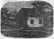
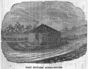
FIRST SETTLERS' SCHOOL-HOUSES.
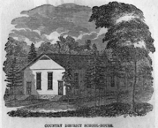
COUNTRY DISTRICT SCHOOL-HOUSE.
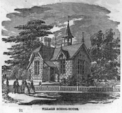
VILLAGE SCHOOL-HOUSE.
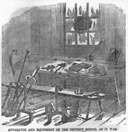
APPARATUS AND EQUIPMENT OF THE DISTRICT SCHOOL AS IT WAS.
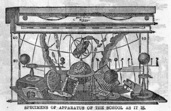
SPECIMENS OF APPARATUS OF THE SCHOOL AS IT IS.
BRIEF HISTORICAL SKETCH OF EDUCATION
IN
LOWER CANADA.
Although upwards of two centuries and a quarter have now passed away since the first school was opened in Lower Canada, yet it was not until nearly a full century had elapsed after Jacques Cartier discovered the country, that that event took place. In 1535, Jacques Cartier first entered the St. Lawrence; and, in 1632, Rev. Father Le Jeune opened the first Canadian school at Quebec. He commenced with only two pupils,—one a negro and the other an Indian boy,—to whom he taught reading and writing. Next year his school was attended by twenty boys, chiefly Indian lads collected by missionaries from wigwams in the neighborhood. Father Le Jeune was greatly elated, and, in view of the noble prospect before him, of christianizing the Indian tribes, he wrote to his superior in France, to say that he would not exchange his little school of savages for the best university of Europe! The Indians permitted these youth to attend the school, chiefly because they were the less hardy and promising of their race, either mentally or physically, and, therefore, were unequal either to the vicissitudes of the chase or to the endurance or strategy of war. The restraints, however, of so monotonous a life proved too much for their untutored natures, and they gladly made their escape. Although these early efforts of Father Le Jeune were thus unsuccessful in inducing the Indians to benefit by his instructions, he did not despair; and, in 1635, under the patronage of the Marquis de Gamache, he founded the "Seminary of the Hurons," or of "Notre Dame des Anges," afterwards known as the Jesuit College of Quebec. He was greatly consoled at this event, which, he said, had been consummated "despite the powers of hell, banded in full force against it!"
Soon afterwards, and in 1639, a young widow lady of high rank, Madame Le Lapeltrie, laid the foundation of the convent of the Ursulines at Quebec, which was designed for the education of young Huron Indian girls. The plan, however, did not succeed.
Exactly two hundred years ago, and thirty-one years after Father Le Jeune had opened his first school in Canada, the distinguished Monseigneur de Laval, the first Roman Catholic bishop of Quebec, projected the Grand Seminary of Quebec. Subsequently, having acquired land for a site, he with great solemnity, on the 14th of April, 1678, laid the foundation of a new building, which he intended should be occupied by his favourite "Seminary of Quebec."
The primary object of this institution was the education of boys who felt an inclination for the priesthood; and such it continued to be until the conquest in 1759. In 1668, at the suggestion of Colbert, the celebrated finance minister of Louis XIV., Bishop de Laval founded the Petit Seminary; and an attempt was made in it to civilize, or, as it was said, francizise, a certain number of young Indians, who were destined to become afterwards, among their own tribes, the nucleus of a more extended civilization. Eight French and six Indian boys were, with this object, taken as boarders into the Petit Seminary and subjected to the same rules and course of instruction. But the attempt utterly failed as it had done before in the Jesuit College and Ursuline Convent owing to the ungovernable conduct of the young Hurons.
In 1680, the bishop endowed the seminary with his own patrimony; and in October, 1688, he had the satisfaction of seeing sixty boys in attendance at its classes.[73] The bishop had previously established an industrial school near Quebec, from which the more promising young habitants were transferred to the Petit Seminary with a view to complete their classical studies. Those who were intended for the priesthood first pursued their ordinary studies at the Jesuit College, and finished their theological course at the Grand Seminary.
In 1647, the Theological Seminary of St. Sulpice was founded at Montreal by the clergy of St. Sulpice, in Paris. In 1677, the King of France granted to the compagnie de Montreal, Letters Patent confirming the Seminary.
Up to this time, few elementary schools existed in any part of the country. Bishop Laval, however, with patriotic solicitude, seconded the pious efforts of Sister Margaret Bourgeoist to establish schools in connection with the order of the Congregation de Notre Dame, which she founded at Montreal in 1653. The Recollets or Franciscans, too, kept a good many schools in operation; and the Jesuit College, Quebec, maintained out of its own revenues several primary schools under the management of ex-students of the college.
In 1680-1, His Majesty the King of France founded the Recollet Convent, in the upper town, Quebec; and, in 1697, the Monseigneur de St. Valier, second bishop of Quebec, established the convent of the Ursulines at Three Rivers.
In 1714, there were seventy-five pupils attending the Quebec Seminary. In 1728, the Jesuits asked permission to found a college at Montreal, and the Frères Charron of Montreal proposed to employ schoolmasters in all the parishes of the country as in France. In 1737, the brotherhood of the Church Schools (Ecoles Chrétiennes,) who undertook the task of popular instruction along with the Charron Frères, and a few scattered rural teachers, formed themselves into an educational corps, the members of which followed one system and wore the same distinctive garb.[74] These praiseworthy efforts were not, however, successful; and the schools languished, owing, chiefly, to the apathy of the government and the want of interest in the education of their children by the settlers. In fact, from the beginning the government of the colony, unless prompted by the French monarch or his ministers, seemed to be utterly unconcerned as to the condition of education in the country. "To the Catholic Church," nevertheless, says Arthur Buller, Esq., the commissioner appointed by Lord Durham to inquire into the state of education in Lower Canada, "To the Catholic Church, [Lower] Canada is indebted for all its early scholastic endowments; indeed, with the exception of McGill College, for all that at present [in 1838] exists. The ample estates and active benevolence of the Jesuits of the seminaries of Quebec and Montreal, and of various nunneries and their missions, were devoted to the education of the people."[75]
Very little change took place in the state of education in Lower Canada until after the conquest in 1759. The stirring events which then transpired interfered to some extent with the operations of the various colleges and other educational institutions; but, as the crisis passed away, things resumed their usual state. In 1773, however, the Petite Seminaire, or College of Montreal was founded by the Sulpicians. In the year following an important event occurred. The suppression of the religious order of the Jesuits, which took place in France in 1762, and in Italy in 1773, was, by royal instruction, carried into effect in Canada in 1774. The estates were, however, permitted to remain in the possession of the surviving members of the order until March, 1800, when they became vested in the Crown. Previous to that time, and down to 1831, various petitions were presented both to the governor-general and to the Imperial government, praying that the estates might be appropriated to the purposes of education, which was their original design. At length, in that year (1831,) they were, with the exception of the Jesuit College buildings at Quebec, surrendered to the provincial parliament for the support of education. Efforts have since been repeatedly made to obtain possession of the college buildings for the same educational purposes, but hitherto without effect. In 1776, these buildings were appropriated by the Imperial government to the purposes of a barrack. The Crown has repeatedly offered to surrender them, provided a suitable barracks be given in exchange for them by the province. This, however, has not been found practicable, and they are still used for military purposes under the singularly incongruous name of the "Jesuit Barracks."
In the year 1787, the legislative council of the province, at the suggestion of the governor-general (Sir Guy Carleton, then Lord Dorchester,) appointed a committee to inquire into the best means of promoting education. In 1789, the committee presented their report, recommending, among other things, that an elementary school be established in each parish, a model school in each county, and a "colonial college" for the entire province, at Quebec, endowed out of the Jesuit estates, open to Protestants and Roman Catholics alike, and controlled by an equal number of each; religious instruction for the students to be provided by each church, and the visitation of the college to be vested in the Crown. The Roman Catholic coadjutor, Bishop Bailly, approved of this scheme, while his superior, Monseigneur Hubert, ninth bishop of Quebec, sought to have it modified. He suggested that the Jesuit College of Quebec should be revived and re-endowed; that it should be first placed under the control of the surviving members of the order for their lives, and that afterwards it should be vested in the Roman Catholic bishop of Quebec, as head of that church in Canada. The titular superior of the dissolved order, Father de Glapion, favored Bishop Hubert's plan, and, to facilitate it, offered, on condition of receiving a fixed stipend for the surviving members of his order, to make over the estates to the province, to be forever applied to educational purposes, under the direction of the Roman Catholic bishop and his successors.
As it would be interesting to learn from a cotemporaneous and independent source something of the state of education in Lower Canada in those days, we make the following extract from an account of the travels of the Duke de Rochefoucault who visited the country in 1795-9. He says, "The Seminary of Quebec is kept by a sort of congregation or fraternity known by the name of the Priests of St. Sulpice. * * * The estates which it possesses are considerable, at least in point of extent, and contain from fifty to sixty thousand acres. * * * This seminary forms the only resource for Canadian families who wish to give their children any degree of education, and who may certainly obtain it there for ready money. * * * Upon the whole, the work of education in Lower Canada is greatly neglected. At Sorel and Trois Rivières are a few schools kept by nuns; and in other places men and women instruct children; but the number of schools is, upon the whole, so very small, and the mode of instruction so defective, that a Canadian who can read is a sort of phenomenon. * * * The English government is charged with designedly keeping the people of Canada in ignorance; but were it sincerely desirous of producing an advantageous change in this respect, it would have as great obstacles to surmount on this head as in regard to agricultural improvements."
In 1793, in response to a petition on the subject, the first house of assembly which was ever convened in Lower Canada presented an address to the governor, urging upon the Crown the propriety of giving up the forfeited estates of the Jesuits to the control of the legislature for the support of education in the province—a destination, it was argued, which would, more than any other, be in accordance with the design of those who had endowed the order with these lands, and with the spirit of the letters-patent of the French monarch which confirmed them to the order for educational purposes only. No answer having been given to this address, another on the same subject was presented to the governor in 1800.
In reply to this address, the governor, in a speech to the legislature in 1801, thus intimated the intentions of the Imperial government to give practical effect to the wishes of the legislature, though in another form, and to set apart a portion of the Crown domain—as had been intimated four years before in Upper Canada—for the permanent establishment of public schools. "With great satisfaction," he said, "I have to inform you that His Majesty [George III.] from his paternal regard for the welfare and prosperity of his subjects in this colony, has been graciously pleased to give directions for the establishing of a competent number of free schools, for the instruction of their children in the first rudiments of useful learning and in the English tongue and also as occasion may require, for foundations of a more enlarged and comprehensive nature; and His Majesty has been further pleased to signify his royal intention that a suitable proportion of the lands of the Crown should be set apart and the revenue thereof applied to such purposes."[76]
In the same year, an act was passed to give effect to these promises. It provided for the establishment of free schools and of a "Royal Institution for the Advancement of Learning." To this corporation was entrusted the entire management of all schools and institutions of royal foundation in the province, as well as the administration of all estates and property appropriated to these schools. The governor was authorized to establish one or more free schools in each parish or township, as he might see fit, upon the application of the inhabitants. He was also authorized to appoint the masters, and to fix their salaries.
The grants of land from the public domain for the endowment of these schools not having been made, as promised, the executive council recommended to the governor that sixteen townships of the waste lands of the Crown be appropriated for this purpose. In concurring in this recommendation, a further promise was made that each of the cities of Quebec and Montreal should receive an additional grant of twenty thousand acres of land for the support of a seminary therein. Notwithstanding these distinct promises, none of these grants were ever made; and, consequently, the act of 1801 practically remained a dead letter. Other causes contributed to render the scheme a failure. Of the eighteen trustees of the Royal Institution (who were not appointed by the government to direct the system of education in Lower Canada until 1818,) four only were Roman Catholics; and of the fourteen Protestants, three were prominent officials in Upper Canada. The teachers, too, were principally from Britain, unacquainted with the French language, and generally ignorant of the habits of the people.
In 1804, the Seminary of Nicolet was founded by the Rev. M. Brassard, curé, and in 1811, the College of St. Hyacinthe was founded by the Rev. M. Girouard, curé.
In 1812, the legislative council voted an address to the Prince Regent, in regard to the land endowments, similar to those passed by the house of assembly in 1793 and 1800. It was sent down to that house for its concurrence; but, owing to the more pressing importance of matters arising out of the war with the United States in that year, it was suffered to remain in abeyance.
In 1814, however, a bill was passed by the house of assembly, amending the "royal institutions" act of 1801. As a matter of curiosity, we give the following abstract of some of its clauses. It provided, among other things, that if a majority or fifty landholders in a parish or township wished to establish a school, they should serve a "notorial acte" upon a resident militia officer highest in rank[77], who shall then call a meeting for the election of five trustees, one of which to retire annually. These trustees, with the senior magistrate, curé, or minister, were to be a corporation, and to replace the school commissioners appointed by the governor, under the previous act. The teacher to be employed by this corporation was required to produce a certificate of loyalty and good character from two magistrates, to take the oath of allegiance, and to receive not more than two hundred and forty dollars per annum out of the provincial revenue. Two magistrates, appointed by the Crown, to act as school visitors. This bill was lost in the legislative council, and failed to become law.
In 1818, a much simpler act was passed by both houses of the legislature. Instead of elective trustees, it provided that the rector, priest, or curate, with four Roman Catholic or Church of England church-wardens, the seigneur primitif, and senior magistrate, should be, ex officio, a corporation for the management of the elementary school of the parish. This act was reserved for the royal assent, which it never received; and, consequently, it never took effect.
In this year, however (1818,) practical effect was, after a long delay, given to the act of 1801, authorizing the establishment of a "Royal Institution for the Advancement of Learning." All the schools then receiving government aid were placed under the control of this corporation. In order to conciliate those more immediately concerned, and to demonstrate the liberality of the principles upon which it intended to act, the following rules were promulgated: "That every school should be placed under the immediate inspection of the clergy of the religion professed by the inhabitants of the spot; and that where they might be of different persuasions, the clergy of each church should have the superintendence of the children of their respective communities." "That a regular superintendence of the schools was assigned to visitors named by the corporation (one or more to be the minister or ministers of the parish or township,) who were to report to them, every six months, the number and progress of the scholars, the conduct of the masters, and, generally, on the state of the schools."
Notwithstanding the official prestige which it possessed, and the influence which it undoubtedly exerted, the "Royal Institution" signally failed to accomplish the objects for which it was established. Even the number of schools under its management soon began to diminish; and, at the end of ten years from the date of its organization, all applications for schools to be placed under its control entirely ceased. Various causes contributed to render the scheme abortive; but the most striking one was the general absence of sympathy between the board itself and the people whose educational interests it sought to promote. The board has long ceased to control the public elementary schools, and its functions are now chiefly confined to the oversight or trusteeship of the University of McGill College, Montreal. This institution, founded, in 1811, by the will of the Hon. Peter McGill, did not receive its royal charter until 1821, owing to a protracted lawsuit to test the validity of the will.
For several years after the Royal Institution came into existence, various efforts were made by either or both branches of the legislature, to introduce a more popular system of management into the public schools. Thus, in 1819 and 1820, two bills were passed by the house of assembly and legislative council with this view; but they were not concurred in by the home government; while two others, passed by the house of assembly, in 1821 and 1823, were rejected by the legislative council, and, consequently, lost.
At length, in 1824, a special committee, appointed by the house of assembly, prepared an elaborate report upon the state of education in the province. Its revelations were startling indeed. It represented that in many parishes not more than five or six of the inhabitants could write; that, generally, not above one-fourth of the entire population could read; and that not above one-tenth of them could write, even imperfectly.
To remedy this state of things, and to meet the wishes of the Roman Catholic clergy in some degree, as a counterpoise to the more Protestant Royal Institution act, a measure was passed this year (1824) known as the Fabrique act. It provided for the establishment of one school in each Roman Catholic parish, for every one hundred families, by the Fabriques, or corporate body, (established by the old laws of France,) consisting of the curé and church-wardens. The corporation was authorized to acquire land, for the support of the school, to the annual value of two hundred dollars, and to retain an acre for a school site.
In 1825, the College of Ste. Thérèse was founded in the county of Terrebonne, by the Rev. M. Ducharme, curé; in 1826, the College of Chambly was founded in the county of that name by the Rev. M. Mignault, curé; and, in 1827, the College of Ste. Anne la Pocatiére was founded in the county of Kamouraska by the Rev. M. Painchaud. In 1827-8, the University of McGill College, after a protracted delay, at length went into operation. In 1828, the convent of La Providence was founded by Madame Gamelin, of Montreal.
In 1829, another effort was made to meet the wishes of the Roman Catholic clergy, and to modify the provisions of the Royal Institutions act of 1801. After some difficulty in bringing both parties to an agreement on the subject, a bill was passed in the legislative council, and received two readings in the house of assembly, providing for the appointment of two committees of the Royal Institution,—one exclusively Roman Catholic and the other Protestant. Thus was introduced the germ of the present separate school system in Upper and Lower Canada; but, owing to some legal impediments in the way of carrying it into effect, the bill was dropped.
In the same year (1829,) an important step was taken in the direction of popularizing the system of public schools then in existence. A measure was passed in that year, providing for the establishment of schools by trustees elected for that purpose by the landholders of each parish. The act contained no provision for the visitation or inspection of the schools; and was otherwise defective; but it is, nevertheless, considered as the first general elementary school act of Lower Canada.
This act was amended in 1830, so as to authorize the election, as trustees, of the Protestant or Roman Catholic clergy who were not freeholders. It further required the teacher to hold a half-yearly examination, of which he should give one week's public notice; twelve hundred dollars were also appropriated by it for sending a person abroad to learn how to conduct a deaf and dumb school.
This act was again amended in 1831, so as to provide for the appointment of nineteen visitors, or local county school inspectors, who, in company with the county member, or a magistrate, commanding officer of militia, rector, or curé should visit and inspect the school and report the result to the governor. The act also contained an appropriation in aid of a deaf and dumb institution.
In the same year (1831,) the house of assembly appointed a standing committee of eleven members, to report, from time to time, on all matters relating to education. This committee, in their report, dwell on the importance of supplementing the public aid by local contributions, and deprecated the growing demand for such aid, without corresponding exertions to increase the amount of these contributions. The committee further remark, that the proportion of children attending schools in Lower Canada is only one in twelve, while, in the state of New York, it is one in four.
In the following year (1832,) the three preceding acts of 1829, 1830, and 1831 were repealed, and a more general and comprehensive school act substituted in their place. Among other things, this act provided for the establishment of a girls' school in each parish, and the yearly distribution of two dollars' worth of prizes by the senior county member in each boys' school. It also provided that legislative councillors, members of parliament, senior magistrates, highest militia officers, and the rector or chief minister of the denomination most numerous in the parish, should be county school visitors. These school visitors were invested with extensive powers. Among other things, they were authorized to decide disputes about school-houses, form and alter the boundaries of school divisions, and fix the site for a superior school in each county. The teacher was required to obtain a certificate of character and qualification, signed by at least five school visitors, including the county member and rector; to keep the school open at least one hundred and ninety days in the year, from nine to twelve, and from one to four o'clock each day; to keep a school journal; and to hold a public examination of his school.
In the same year (1832,) L'Assomption College was founded in the county of that name by the Rev. M. Labelle and Dr. J. B. Meilleur (afterwards superintendent of education for Lower Canada, i.e., from 1841 to 1855.)
In 1833, this act was amended so as to authorize superiors and professors of colleges and academies, and presidents of all educational societies, to act as school visitors. It further granted sixteen dollars per annum extra to any teacher who could teach both the French and English languages, and two dollars for prizes in girls' schools.
In 1834, the act of 1832 was further amended, so as to authorize an extra grant of forty dollars per annum to the best teacher in the county, who had taught French and English, grammar, geometry, and book-keeping in his school. In case none of the teachers merited the grant, the school visitors had it in their power to appropriate two hundred dollars to any superior institution in the county, not receiving other public aid, in which those branches were taught.
In 1836, the standing committee of the house of assembly, in their report, regret that the liberality of the legislature, instead of stimulating local liberality in aid of education, had rather paralyzed it. As a proof of the unreasonable selfishness of the parties concerned, they state that an application had been received from three families to constitute them a school division, so as to receive public aid as such. They also comment upon the universal incompetency of school-masters; and recommend the establishment of normal schools. An act was passed giving effect to this recommendation, and providing for the establishment, for five years, of a normal school at Montreal and at Quebec. Sixteen hundred dollars were granted to each school, for preliminary expenses in procuring professors and obtaining books, maps, and apparatus, &c.; and thirty-four hundred dollars per annum for current expenses; besides four hundred and eighty dollars per annum for the board and lodging of at least five teachers for three years, at the school. The same sum was granted for a like period to each of the convents of the Ursulines at Quebec and Three Rivers, and to the convent of the congregation of Notre Dame, at Montreal, for the training of at least five female teachers for three years in these institutions.
A supplementary bill (continuing the system of elementary schools in Lower Canada, and designed to replace the school act of 1832, which had expired) was passed by the house of assembly, simultaneously with the normal school act; but it was rejected by the legislative council. Two features in the rejected bill were new and deserve notice. The first was the permission to establish model schools, and the other was the authority (not compulsory) of the majority of the inhabitants to raise a rate by tax to support the school. As the usefulness of the one act depended on the passing of the other, the rejection of the elementary school act brought the whole educational system to a standstill. In the mean time a normal school was opened at Montreal by the Rev. John Holmes, principal of the Seminary of Quebec, aided by two assistants,—one obtained from France and the other from Scotland. In consequence, however, of the political troubles of the succeeding year, the school was abruptly closed, and the grants suspended.
It is proper to state, that the reasons for rejecting the bill of the house of assembly by the legislative council, were candidly expressed in a report on the subject. This report stated that the expenditure on behalf of education, for the last seven years, had already reached the aggregate sum of $600,000, and that the appropriations under this bill amounted to $160,000 per annum. The committee of the legislative council concurred with the house of assembly in the belief that this liberal legislative aid had superseded, rather than stimulated, local effort. They further deprecated the anomalous and improper practice of confiding the superintending and application of the educational grant to members of the house of assembly. It was liable in their hands, the committee urged, to be used to promote political and party objects rather than strictly educational ones. In this part of their report, the committee enumerate, under nine different heads, the extraordinary and irresponsible powers which were conferred upon the county members by this and preceding school acts, in the administration of the law, and the expenditure of the legislative school grant.[78]
The political troubles which, in 1837-8, shook the province to its center and paralyzed its educational efforts, having to some extent subsided, an inquiry into the state of education, and the causes of its failure in Lower Canada, was instituted, in 1838, by the Earl of Durham, Her Majesty's lord high commissioner and governor-general of British North America. This duty he confided to the able hands of Arthur Buller, Esq., one of his suite, who prepared an elaborate and comprehensive report on the subject, from which we have already made several extracts. Lord Durham, also, from his own observation, gave expression to his views on the subject, and from his own report we make the following extracts: "The bulk of the population is composed of the hard-working yeomanry of the country districts, commonly called habitans. * * * It is impossible to exaggerate the want of education among them, no means of instruction have ever been provided for them, and they are almost universally destitute of the qualifications even of reading and writing. * * * The common assertion, however, that all classes of the Canadians are equally ignorant, is perfectly erroneous; for I know of no people among whom a larger provision exists for the higher kinds of elementary education, or among whom such education is really extended to a larger proportion of the population. The piety and benevolence of the early possessors of the country founded, in the seminaries that exist in different parts of the province, institutions of which the funds and activity have long been directed to the promotion of education. Seminaries and colleges have been, by these bodies, established in the cities and in other central points. The education given in these establishments greatly resembles the kind given in the English public schools, though it is rather more varied. It is entirely in the hands of the Catholic clergy. The number of pupils in these establishments is estimated, altogether, at a thousand, and they turn out every year, as far as I could ascertain, between two and three hundred young men thus educated."
In concluding a review of the causes which had led to a failure of the system of education devised by the legislature, Mr. Buller sketched the broad outlines of a system of education which, he thought, would obviate many of the evils inherent in those systems which had already been tried.
Lord Durham having, upon a comprehensive review of all the causes which had led to the then unhappy state of the provinces, recommended a legislative union of Upper and Lower Canada, nothing was attempted in the way of reviving the educational system until the question of union was settled. That occurred in 1840; and, in 1841, the first parliament of United Canada gave immediate attention to the subject of popular education. An act, embodying many of Mr. Buller's suggestions, was passed, providing for the establishment and maintenance of elementary schools in Upper and Lower Canada alike. An ex-officio chief superintendent of education was appointed for the whole province, with working superintendents for its eastern and western sections. Two hundred thousand dollars were also granted to aid in the promotion of popular education. This sum was divided between both sections, according to their respective populations.
In the same year, Dr. J. B. Meilleur, an active educationalist, who had formerly been a member of the legislature, and who had been the principal author of the projected school act of 1836, was selected as the executive educational officer for Lower Canada. He applied himself diligently to the performance of his new duties; and, after four years' trial, he suggested such changes in the law as experience had dictated.
In 1842, the schools of the Christian Brothers (Ecoles Chrétiennes) were established at Quebec, by the Société d'Education and the Rev. Mr. Bailtargeon.
In the following year (1843,) the want of a Church of England university and theological college having been felt, Bishops' College, Lennoxville, in the eastern townships, was projected, and an act of incorporation obtained for it. The Classical High School of Quebec was also established this year by the Rev. Dr. Cook.
In 1843, the school act of 1841 was repealed, so far as Upper Canada was concerned, and, in 1845, it was also repealed so far as it applied to Lower Canada.
In 1845, Bishops' College, Lennoxville, was formally opened in a temporary building. The new buildings for the college were completed in the following year.
In the law of 1846, the nominal office of chief superintendent, ex officio, was abolished, and the entire executive administration of the school laws confided to the respective superintendents of each section of the province. In 1846, the school laws of Upper and Lower Canada were, after much consideration on the part of the two superintendents, thoroughly revised, and adapted to the peculiar educational wants of each section, as ascertained by actual experience and observation. A very important principle,—that of local taxation for the support of education,—which had been introduced with success in the Upper Canada school law, was substituted for that of voluntary contributions, as an experiment, into the amended Lower Canada school act of 1846. It encountered, however, so strong an opposition from all sides, that, in 1849, the law was altered, and local assessment was rendered permissive—not compulsory, as before,—and the system of voluntary contributions restored.
In the year 1846, the Joliette College, in the village of Industrie, county of Joliette, was established by the Hon. B. Joliette; and, in 1847, Masson College, in the county of Terrebonne, was established by Madame Masson.
In 1849, an important institution for the education of deaf and dumb males was established at Chambly by the Rev. Mr. Lagorce; and, in 1853, one for females, at Longue Poìnte, by the Right Rev. Bishop Bourget. In 1849, the College de Ste. Marie was established at Montreal by the religious order of the Jesuits. A chair of law was established in it in 1851, and, in 1852, the college received an act of incorporation.
In 1850, the College of Notre Dame de Levis was founded at Point Levis (opposite Quebec) by the Rev. Joseph Deziel. Rigaud College was also founded in the same year by the Rev. Mr. Desautels.
In 1851, another effort, after a lapse of thirteen years, was made to establish a normal school in Lower Canada. In that year, an act was passed by the legislature for this purpose, and also for the appointment of local school inspectors. Owing to various causes, however, the establishment of the normal school was deferred.
In August, 1852, an amended charter was obtained from Her Majesty for McGill College University, and, soon after that event, it entered upon its present successful career.
In December of the same year, the venerable institution known in Canada for two hundred years as the Seminary of Quebec, was erected into the University of Laval, by royal charter from the Queen. The university was soon after organized on its present efficient footing.
In 1853, Bishops' College, Lennoxville, was erected into a university by royal charter. In the same year (1853,) the College of Ste. Marie de Monnoin, was established. In the same year, the Church of England Society for Newfoundland and the Colonies, now known as the Colonial and Continental Church and School Society, erected normal and model schools in Montreal. They were opened in the following year; but, in 1856, the normal school was transferred to McGill College.
In 1854, the College of St. Germain de Rimouski was founded in the county of that name by the Rev. C. Tanquay. The Colleges of St. Francis, (Richmond,) Laval, (near Montreal,) Ste. Marie de la Beauce and Verscheres, were also established in 1854.
In 1855, after fourteen years' arduous official labors in superintending the system of public instruction in Lower Canada, J. B. Meilleur, Esq., M.D., resigned his office, and was succeeded by the Hon. P.J. O'Chauveau, LL.D., a gentleman of literary tastes and abilities, who had been eleven years a member of parliament for the county of Quebec, and who had held successively the office of solicitor-general for Lower Canada and secretary of the province. Hon. Dr. Chauveau entered vigorously upon the discharge of his duties, and, in his first official report to the governor-general, suggested several important modifications and improvements in the school law of Lower Canada.
In 1855, the Colleges, of Sherbrooke and Varennes were established; and in 1856, La Chute College, in the county of Argenteuil, was projected.
In 1856, Dr. Chauveau prepared and recommended to the government, the passage by the legislature of two important bills embracing the modifications which he had suggested in his annual report. These bills became law in the same year. One related chiefly to superior, and the other to elementary, education. They provided, among other things, for the distribution through the superintendent of education, and upon his report, of the Lower Canada superior education fund among the various university colleges, academies, and model schools; for the establishment of three normal schools instead of one; the appointment of a Council of Public Instruction for Lower Canada; the publication of Journals of Education (French and English;) and the creation, as in Upper Canada, of a superannuated common school teachers' fund.
In 1857, the long-delayed establishment of normal schools at length took place. On the 2d of March, the Jacques Cartier and the McGill Normal Schools were, with appropriate ceremonies, inaugurated at Montreal, and, in May, the Laval Normal School at Quebec. The Jacques Cartier Normal School (chiefly designed for Roman Catholics,) is placed under the immediate supervision of the Superintendent of education; the McGill School (designed for Protestants,) under the management of the corporation of McGill College; and the Laval School (also designed for Roman Catholics,) under the management of the corporation of Laval University. The French and English students in each receive instruction in their own language. The three schools are under the general direction and control of the council of public instruction for Lower Canada. Males and females attend each normal school; and model schools, for the purpose of practice, are attached to each of them.
Thus the last links in the chain of an efficient system of popular education for Lower Canada have been successfully formed. Under the active and enlightened superintendence of the Hon. Dr. Chauveau, we have no doubt it will realize the expectations of the friends of education, and confer inestimable benefits upon the youth of the country.
In 1859, the College of Three Rivers was projected in the town of that name by Mgr. Prince, Roman Catholic Bishop of the Diocese; and, in 1862, Morrin College was founded at Quebec, under the will of Dr. Morrin, who was a late eminent physician in that city; and Molson Hall College, Montreal, was inaugurated by His Excellency Lord Monck.
We will now refer to the principal educational institutions of Lower Canada, in detail, so far as we have been able to obtain information in regard to them.
1. University of Laval and the Quebec Seminaries.[79]
In 1851, at the suggestion of the Roman Catholic bishop of Montreal, Monseigneur J. Bourget, and the repeated invitations of His Grace the Roman Catholic archbishop of Quebec, the directors of the Quebec Seminary resolved to erect the Seminary into a university.
The late Very Reverend Dr. L. J. Casault, then superior, was sent to London, in 1852, in order to solicit the granting of a royal charter. He obtained it without difficulty; His Excellency Lord Elgin, then governor-general of Canada, and his ministry having been pleased to support with their recommendation the application made to the Imperial authorities for that purpose, it was successful.
By this charter, no change was effected in the constitution of the seminary itself; but a council, including the directors of the institution and the three senior professors of the several faculties, were empowered to possess and enjoy all the privileges granted to the universities of the United Kingdom, and especially that of conferring degrees in the faculties of divinity, law, medicine, and arts. The Roman Catholic archbishop of Quebec is, by virtue of his office, visitor of the university.[80] The superior of the Grand Seminary, for the time being, holds the office of rector.
Since the granting of the charter, unceasing efforts have been employed to give it full effect. In 1853, five professors of the faculty of medicine were appointed. One of them was sent to England, France, and Belgium, to purchase a medical library, a museum, and a collection of surgical instruments. During the following year, a great number of books were procured for the faculty of law, and also a collection for the study of materia medica. At length, in September, 1854, lectures in the faculties of law and medicine commenced after an inauguration ceremony, in which Lord Elgin took part. Several buildings were also commenced for the use of the university. They are now completed at a cost of $208,421; $13,146 additional have also been expended upon the library, and $6,264 for new scientific apparatus and natural history collections. A botanical garden is also contemplated. Three young professors, graduates of the university, were in Europe, so as to prepare themselves to give lectures in the faculties of law, medicine, and arts.
His Royal Highness the Prince of Wales visited the institution on the 22nd of August, 1860, and was pleased to express his satisfaction with the institution by the foundation of an annual prize which bears his name.
The faculties of law and medicine are now completely organized. The faculty of arts has only three titular professors; but several of the eleven intended courses are already taught under the title of elementary courses.
The course of instruction embraces three years in the faculties of law and arts, and four in those of divinity and medicine. In the faculty of divinity, holy scripture, moral and dogmatic theology, sacred eloquence, ecclesiastical history, and canon law are taught. The subjects of lectures in law and medicine include those branches usually taught in such faculties.
The library now contains twenty-eight thousand volumes; including two thousand in the law department, four thousand in that of medicine, eight thousand in the different branches of sciences and literature, and fourteen thousand in the department of divinity.
Matriculation and Degrees.—The requisites for the degree of B. A. are as follows:—
1. Every candidate shall undergo two examinations. The first after having completed his course of rhetoric; the second after having terminated his course of philosophy.
The first examination embraces the following: translation of Latin and Greek authors, Latin prose or verse; universal history and geography, history of Canada; the history and principles of literature and rhetoric; French or English composition, at the option of the candidate.
The second examination embraces the following: a dissertation on logic, or on some point of metaphysics or ethics, as decided by chance; questions on physics and chemistry; problems and questions on mathematics and astronomy; questions on natural history.
2. Those candidates who in both the examinations have been placed in the first class obtain the degree of B. A. Those belonging to the second class may attend the courses of the university; but they are not advanced until they have obtained the degree of B. A. Those belonging to the third class obtain no privilege; it is however, permitted to them to present themselves anew for examination.[81]
The requisite for the degree of M. A. is a successful attendance on the obligatory courses of lectures in the faculty during three years.
In the faculty of law, the degree of bachelor is obtained only after having satisfactorily passed six examinations at the end of the same number of terms. In medicine, nine terms and nine satisfactory examinations are required. License in these faculties, and in divinity, requires four years of successful attendance on all the courses, with written and oral examinations.
In order to obtain the degree of B.D., it is necessary to pass written and oral examinations upon the several branches taught in the Grand Seminary.
No one is admitted to the degree of doctor in any of the four faculties unless he has publicly and successfully advocated numerous theses upon most of the branches of the respective faculties. The candidates are allowed to pass this examination, four, three, or two years after having obtained the degree of licentiate, according to the testimonial which they received at their examination for the license; viz., satisfactory; with distinction; or with the greatest distinction.
Students in law and medicine, whose parents are not inhabitants of Quebec, are required to reside in the university boarding-house. Two rooms for the use of each student are furnished by the institution.
Besides the pupils regularly matriculated, students legally admitted to the study of law or medicine, although they have not followed a complete and regular course of classical studies, have permission to attend the law and medical lectures; but they can not arrive at the degrees. In the Faculty of arts, the lectures are free for those who have already paid for the lectures on law or medicine. Twenty half-gratuities are granted to matriculated students, who have not the means of paying the entire boarding fee.
The Quebec Seminaries (Grand and Minor.)
On the 26th March, 1663, five years after his arrival in this province, the first Roman Catholic bishop of Canada, François de Montmorency-Laval founded and afterwards (1680) endowed with his own patrimony, an institution which was called the Quebec Seminary.
The venerable founder died on the 6th of May, 1708, at the age of eighty-six, after having spent nearly half a century in Canada. By his influence at the court of Louis XIV., he contributed much to the prosperity of this province, and constantly showed himself a most energetic and liberal promoter of education. In 1678, he solemnly laid the corner-stone of a fine and massive stone building, which though twice consumed by fire (1701 and 1705,) and much injured by shells during the siege of 1759, is still standing. He had thus to build it three times in the short space of twenty-seven years. Being himself so worn out by old age and infirmities, he had, during the two calamitous fires, to be carried out by the hands of his faithful servants.
He also founded and maintained during a quarter of a century, at St. Joachim de Beaupré, another institution, which comprised a common, a normal and an agricultural school, a model farm with apprentice shops for such trades as blacksmiths, carpenters, wheelwrights, &c.
Before the conquest of Canada, in 1759, the seminary had no other pupils than those intended for the church. These also went every day to the classes of the Jesuits. When this college was converted into a barrack, in 1776, the seminary undertook to instruct all boys, whether intended for the church or not, in a classical course of study.
The number of students has been progressively increasing up to the present time. In 1668, there were only fourteen; in 1680, forty; and in 1690, eighty. It has now (1862) three hundred and ninety-six in the minor seminary, or college, (of whom two hundred and thirty are boarders,) and forty-two in the Grand Seminary, studying in divinity.
From the beginning to the present time, about one thousand students have completed a regular course of classical studies, while from ten to eleven thousand have completed a partial course.
The estimated value of the whole premises is $500,000, including the university and seminary buildings; viz., $230,000 for the university, and $270,000 for the seminary.
The library has been transferred to the university, as well as some maps and scientific apparatus. About five thousand volumes, expressly chosen for the students of the grand and minor seminaries, remain in the college, and are worth about $6,000; maps, $400. There are twenty-four professors, besides ten officers otherwise employed.
The Grand Seminary comprises the classes of dogmatic and moral theology, Holy Scripture, ecclesiastical history, and other branches. The course of studies extends to three years at least. No one is admitted to it unless he has followed a complete course of literature and philosophy. The students are all boarders, and are required to wear the clerical costume. They pay eighty dollars for board; but the instruction is gratuitous. A library of two thousand volumes is at their disposal.
The Minor Seminary comprises nine classes, of which seven are in the course of literature. Students in philosophy follow the courses of the faculty of arts in the university during the two remaining years.
In order to be admitted as a student into the minor seminary, it is necessary to read the maternal tongue (French or English) very correctly, write pretty well, and have some knowledge of grammar.
About thirty gratuities have been founded at different periods and by different persons (eight of them by Monseigneur de Laval,) for the students of the minor seminary. About one-third of these gratuities are limited to the members of certain families.
A library of three thousand volumes is available for all the students in the minor seminary, at one dollar per annum.
2. University of McGill College, Montreal.[82]
This university was founded by the will (dated in 1811) of Hon. James McGill, a merchant in Montreal.[83] Not having any children, he bequeathed to the Royal Institution (a corporation established by the provincial parliament,) for the advancement of learning, his estate of Burnside, consisting of about forty-six acres of land near the city, and the sum of £10,000 in money, as a foundation for a university. The will was contested; and, with the exception of obtaining a royal charter in 1821, no action was taken upon it until 1829. The first step towards the establishment of the university was the organization, in that year, of the faculties of arts and medicine.
In 1835, the Rev. Dr. Bethune[84] was appointed principal of the university; and increased efforts were made towards the establishment of the faculty of arts. After several years' delay, it was formally opened in September, 1843, in buildings erected for that purpose. The college, however, did not receive adequate support; and, at length, the provincial government was moved to aid in an endeavor to place it on a better footing. A new charter was obtained in August, 1852, which contrasted favorably with the former one in many of its most important provisions.
No aid having been received from the government, an appeal was made, in December of the year 1856, to the Protestant population of Montreal, which was met in a spirit of ready and unrestrained generosity. An endowment fund, amounting to $60,000, was subscribed by a number of gentlemen, not exceeding fifty. Of this sum, $20,000 were given by the Messrs. Molson (three brothers), for founding a chair of English literature; the remainder was made up in sums varying from $600 to $2,000. In addition to this munificent liberality, Wm. Molson, Esq. (one of the brothers) erected, at his own expense, a wing to the University, which was inaugurated by His Excellency Lord Monck, in 1862. This wing contains, a spacious convocation hall, a handsomely fitted library, and a chemical laboratory. The whole is designated the William Molson Hall.
The growth of the University has been very rapid since its reorganization in 1854. Its chief characteristics are: (1.) Its religious complexion,—that is, it is Protestant, but not denominational. (2.) Its endowment, which is owing to the munificence of the mercantile and professional men of Montreal,—it having received no permanent endowment, and but a very small and uncertain annual grant from the Legislature. (3.) The extent to which it has developed facilities for various kinds of literary, scientific, and professional training, and, (4.) The high standard of graduation which it has maintained. There are also several peculiarities in its management, which, having arisen from long experience and past failures, have proved themselves better adapted to the circumstances of the country than those borrowed from abroad.
In addition to the sum of $60,000, willed to the university by Mr. McGill, the land he bequeathed to it is valued at $120,000. The present value of the various buildings attached to the university is about $128,000 more. The value of the library, museum, apparatus, &c., is estimated at $50,000. There are 8,000 volumes in the library, which is divided into three departments. There are 45 professors and teachers of all kinds in the university, and in the schools attached to it, viz., in the Faculty of Arts, 10; Faculty of Medicine, 9; Faculty of Law, 5; in the Normal School, 2; High School, 7; Model School, 2; occasional and assistant teachers, 10. The number of students attending the university, in 1862-3, was 293—viz., in the Faculty of Medicine, 165; Faculty of Arts, 73; Law, 55; in the Normal School, 71; pupils in the High School, 280, and in the Model Schools, 300; total, 944.
The McGill Normal School, attached to the university, provides the requisite training for teachers of elementary and model schools. Teachers trained in this school are entitled to official certificates of qualification.
St. Francis College, Richmond, is an affiliated college of the university. Its matriculated students can prosecute any part of their studies under the Faculty of Arts, and be admitted to examination for the degree of B. A.
Under regulations for middle class examinations, the university has appointed examinations for pupils of any school or academy, on passing which, such pupils are entitled to Junior or Senior school certificates of the university. The object of these examinations, as in England, is by active competition to encourage a better class of schools; to elevate the standard of education, and to induce young men, about to enter into business, to pursue a longer and more thorough course of preparatory study.
1. Matriculation and Admission.—The subjects of matriculation examination are as follows:—Latin Grammar; Greek Grammar; Cæsar's Commentaries; Sallust; Virgil's Æneid, 1st book; Xenophon's Anabasis, 1st book; Arithmetic; Algebra, to Quadratic Equations; Euclid's Elements, 3 books; Writing English from dictation. In classics, the amount of knowledge, rather than the particular authors studied, will be regarded. Candidates for matriculation as students in any special course, or for partial courses of study, will be examined in the subjects necessary thereto, as may from time to time be determined by the Faculty.
2. Scholarships and Bursaries.—Sixteen scholarships have been placed by the university at the disposal of His Excellency, the governor-general. These entitle the holders to exemption from tuition fees. Eight other scholarships will be granted by the university, from time to time, to the most successful students who may present themselves as candidates. One or more normal school bursaries, in the faculty of arts, are offered for competition to students of the third or fourth years. They entitle the holder to an annual sum of $100, for a term not exceeding two years, on condition that the candidate attend and practise teaching in the high-school department, and subsequently to teach for three years, in some public school or academy in Lower Canada, after taking the degree of B. A., and a diploma as a teacher of an academy.
3. Outline of the Course of Study (1.) for the degree of B. A.—First year.—Classics; English literature; Mathematics; History; Elementary Chemistry.
Second year.—Classics; French or German; Logic; Mathematics; Botany; Elocution.
Third year.—Classics; French or German; Rhetoric; Mathematical and Experimental Physics and Astronomy; Zoology.
Fourth year.—Classics; Intellectual and Moral Philosophy; Natural Philosophy and Astronomy; Mineralogy and Geology.
Undergraduates are required to study either French or German for two years.
Students intending to join any Theological school, may take Hebrew instead of French or German.
Students of the third or fourth years, matriculated in the faculties of law or medicine of the university, or entered as candidates for honors, will be entitled to claim certain exemptions.
(2.) For the Diploma of Graduate in Civil Engineering.—First year.—Drawing; Mensuration; Surveying; Mathematics of the second year, in arts; Experimental Physics, with the ordinary mathematics and physics of the third year, in arts; English literature; French or German; Chemistry.
Second year.—Drawing; Engineering; Higher Mathematics and Physics; Geology and Mineralogy; French or German.
4. Examinations, Prizes, Certificate, and Honors.—(1.) Prizes and certificates of merit are given to those matriculated students who may have distinguished themselves in the studies of a particular class, and who have attended all the other classes proper to their year.
(2.) General honors of first or second rank are given to those matriculated students who show a high degree of proficiency in all the studies proper to their year.
(3.) Special honors, of first or second rank, are given to those matriculated students who have successfully passed the honor examinations, in any class in which studies for honors have been provided, and have also passed creditably the ordinary examinations in all the subjects proper to their year.
(4.) The Chapman Gold Medal is given to the student who, being among those who have taken honors of the first rank in the subjects appointed for the year, shall, in the ordinary examination for the degree of B. A., show the greatest proficiency in the greatest number of subjects.
(5.) The Prince of Wales Gold Medal is awarded to the student who shall have passed creditably the examinations for the degree of B. A., and taken the highest honors of the first rank, in a subject to be prescribed from year to year by the Faculty.
Courses of Lectures.—The number of professors in the Faculty is nine; the number of classes, ten, viz.:—1. Anatomy; 2. Chemistry; 3. Materia Medica; 4. Institutes of Medicine; 5. Practice of Medicine; 6. Surgery; 7. Midwifery; 8. Medical Jurisprudence; 9. Clinical Medicine; 10. Clinical Surgery.
Besides the above classes, students are required to attend one course of Botany, and one course of Zoology.
Course of Lectures.—The number of Professors in this Faculty is five; and the complete course of study extends over three years, but it may be shortened to two years when the student matriculates in the third year of his indentures.
The following are the subjects of lectures embraced in the complete course of three years:
To Students of the First year:—On Public and Constitutional Law; on Contracts; on the Civil Law; on the Origin and History of the Laws of France, of England, and of Lower Canada; on the Law of Real Estate and Customary Law.
To Students of the Second year:—On Public and Constitutional Law; on Commercial Contracts; on the Civil Law; on Legal Bibliography; on the Law of Real Estate and Customary Law.
To Students of the Third year:—On Criminal Law; on Commercial Contracts; on Leases; on the Law of Real Estate and Customary Law.
This University had its origin in the pressing want of a theological school for educating candidates for the ministry of the United Church of England and Ireland, in Lower Canada. It was projected by the Rev. L. Doolittle, M. A., then missionary of the Church of England at Lennoxville and Sherbrooke; and an act of incorporation was obtained in 1843.[86] In 1844 the building was commenced; and in September, 1845, the college was opened in temporary apartments until the completion of the entire building in the October of the following year. In 1853, the plan of the college was enlarged, and it then became a university by a royal charter, and was empowered to confer degrees "in the several Arts, and the Faculties of Divinity, Law, and Medicine." It held its first public meeting of convocation for that purpose on the 7th of October, 1854. In 1857, a handsome chapel was erected adjoining the College; and in 1860-'61 buildings on an extensive scale were also erected for the pupils of the junior department, or Grammar school. The attendance of students has not been very great. It is now twenty-three in the faculties of Theology and Arts. The number in the junior department is about 115.
The endowment of the University is derived from private sources, and donations from the Societies for Promoting Christian Knowledge, and for Propagating the Gospel in Foreign Parts. It has also an annual parliamentary grant. The annual expenses of the University and Grammar School are about $10,000; and the value of the buildings, furniture, and library of 4,000 volumes, is estimated at $55,000. There are two "Jubilee scholarships," of the value of $140 per annum, tenable for three years each;[87] besides a scholarship founded by the Prince of Wales in 1860.
The degrees conferred on this faculty are B. A. and M. A. The requisites for the degree of B. A. are, 1. Having passed an examination in the subjects prescribed to candidates for matriculation; 2. Being of the standing of three years (nine terms) from matriculation in the University; 3. Having, in each of these years, attended the lectures and passed the examinations prescribed for each such year of the course.
The ordinary college course extends over four years, and includes classical and English literature and composition, history, mathematics, natural and experimental philosophy, chemistry, logic, rhetoric, moral philosophy, and divinity. At the end of the first year, those college students who pass the prescribed matriculation examination, are entitled to become members of the University.
The requisites for the degree of M. A. are: 1. Being of the standing of three years from admission to the degree of B. A.; 2. Having performed the exercises prescribed for candidates for the degree of M. A.
The following are the subjects for matriculation in this faculty for 1863:
Divinity.—The Scriptures generally.
Greek and Latin Languages.—Xenophon's Anabasis, b. iii.; Homer's Iliad, b. ii. to line 484; Cicero pro M. Marcello; Virgil's Eclogues; Horace's Odes, b. ii.; English and Latin composition.
Mathematics.—Arithmetic and Algebra; Euclid, to b. vi.; plane trigonometry.
History.—Outlines of Greek and Roman history.
Candidates for classical honors are required to pass an examination in additional portions of classical authors; in some treatise or treatises of ancient philosophy; and in some work or works of the Greek or Roman orators. And for mathematical honors, in differential and integral calculus, and in one or more of the subjects prescribed for the college course.
The degrees conferred in this faculty are B. D. and D. D.
The requisites for the degree of B. D. are: 1. Being of the standing of seven years from admission to the degree of M. A., or, being licentiates in Theology of nine years' standing; 2. Having passed the examination, and performed the exercises prescribed for candidates for the degree of B. D., which are:
An examination in the Epistles (in the original) of the New Testament; one Latin and one Greek treatise of one of the Fathers of the Church; ecclesiastical history generally, and the history of the Church of England; one of the major Prophets, or the whole of the minor. Also, a Latin sermon, on a subject to be given out at the time of the examination.
The course of lectures for theological students extends over two years, and is prescribed by the bishops.
Persons admitted, by authority of the bishops, to study in this faculty, without graduating in arts, may, after two years' residence, and having passed a satisfactory examination in the subjects prescribed for the divinity course, receive certificates as licentiates in theology.
The requisites for the degree of D. D. are: 1. Being of the standing of ten years from admission to the degree of B. D.; 2. Having performed the exercises prescribed for candidates for the degree of D. D.
(1.) Classical College and Theological Seminary of Montreal.—The theological seminary, or Grand Séminaire, of St. Sulpice, at Montreal, was founded in 1647, by the clergy of the order of St. Sulpice, in Paris. In 1677, the king of France granted them letters patent; but the Petit Séminaire, or College of Montreal, which was founded by the Seminary of St. Sulpice, was not established until the year 1773.
The first Sulpician seminary, or college, established at Montreal, was named St. Raphael.[89] It was opened in the Chateau Vaudreuil, which was built in 1723, on the square now known as the Place Jacques Cartier, in the city of Montreal. The chateau having been destroyed by fire in 1803, the college was reopened in 1806, under the name of the Seminary, or College of Montreal.
The number of professors in the Petit Séminaire, or college, is eight, and the number of pupils about 260. The library of the college contains upwards of 10,000 volumes; and the value of the museum is about $12,000. A great many of the minerals were given by the celebrated Abbé Haüy. The annual income of the college is about $22,000; and the value of the college buildings and premises is estimated at $500,000.
The Seminary buildings in Montreal having, in 1862, been rented to the troops and converted into barracks, the College was removed to the new Grand Seminary buildings, which were lately erected on a fine site south-east of the mountain. These new premises are valued at $120,000. The Grand Seminary is designed for the students in theology, of whom there are about eighty. The number of professors is six; and the number of volumes in the library is 2,500.
The Seminary of St. Sulpice also established, in 1789, and still maintains, at an annual expense of $32,000, some excellent primary schools in the city and parish of Montreal.
The Grand Seminary, like that of Quebec, was founded especially for giving instruction in theology to young men destined for the priesthood in Canada and in the United States.
(2.) Classical College and Theological Seminary of Nicolet.—This college was founded in 1804, by the Rev. Mr. Brassard. He bequeathed it to Mgr. Denaut, tenth Roman Catholic Bishop of Quebec. It languished for many years; but, in 1821, it was incorporated; and in 1826-30 it was re-established on an extensive scale by Mgr. Panet, twelfth Roman Catholic Bishop of Quebec. It has now eighteen professors and masters, and is attended by about 260 pupils. Its library contains 4,000 volumes, and it has, besides, a very good museum. The Theological Seminary was established in 1854. The revenue of the college is about $13,000 per annum; and the value of the buildings and premises is estimated at about $111,000.
(3.) Classical College and Theological Seminary of St. Hyacinthe.—In 1812, when St. Hyacinthe contained but thirty houses, the Rev. A. Girouard projected this institution. It made rapid progress, and was incorporated in 1835. As the number of pupils increased, the old college was replaced by a spacious and elegant building of 200 feet front, on the outskirts of the city, at the cost of Francis Cadoret, Esq., a public-spirited citizen of St. Hyacinthe. It has twenty-one professors and masters, and is attended by nearly 300 pupils. Besides a library of 10,000 volumes, it possesses an excellent museum of natural history, &c. The annual income of the college is from $24,000 to $30,000; and the value of the buildings and premises is estimated at $120,000.
(4.) Classical College and Theological Seminary of Ste. Thérèse de Blainville.—This college was founded, amid many difficulties, in 1824-5, by the Rev. Charles Ducharme. It was enlarged in 1832, again in 1839, and finally completed in 1845. It was incorporated the same year, 1845. It has about fifteen professors and teachers, and is attended by nearly 185 pupils. It possesses a good library of 2,200 volumes, and a museum valued at $3,200. The value of the buildings and premises is estimated at $62,000; and its annual income is about $13,400. The Theological seminary was established in 1840.
(5). Chambly Industrial College.—This institution was founded in 1825, by the Very Rev. P. M. Mignault, V. G. It was incorporated in 1836, but has since been closed.
(6.) Classical and Industrial College of Ste. Anne de la Pocatière.—This college was founded in 1827, by the Rev. C. F. Painchaud, aided by the Legislature and the contributions of friends of education in the vicinity. It was opened in 1829. In addition to its classical and commercial courses, a third one in agriculture was added in 1858. It has a library of about 5,000 volumes, and a good museum. The number of professors and teachers is fifteen, and of pupils 260. The annual income of the college is about $20,000; and the value of the buildings and premises is estimated at $80,000.
(7.) L'Assomption Classical and Industrial College.—The establishment of this college, in 1832, is due to the exertions of the Rev. F. Labelle, and his brother Edward, Dr. Cazeneuve, and Dr. Meilleur (late Superintendent of Education for Lower Canada), aided by the Legislature, and the contributions of the parishioners of L'Assomption village. The act of incorporation was passed in 1841, and amended in 1858. It has a library of 1,500 volumes and a museum of Natural History. It numbers fifteen professors and teachers, and is attended by about 180 pupils. The annual revenue of the college is about $8,000; and the value of the buildings and premises is estimated at $24,000.
(8.) Joliette Industrial College.—In 1846, the Hon. B. Joliette, aided by others, founded this college in the village of Industry. In 1851, it was placed under the direction of the clerks of St. Viator, a religious educational order founded in France, in 1832. There are twelve professors and teachers and about 350 pupils in the college. It has a library of about 800 volumes. The income of the college is about $5,000; and the value of the buildings and premises is estimated at $17,500.
(9.) Masson Industrial College.—The foundation of this college, in the village of Terrebonne, in 1847, by the Rev. Mr. Théberge, is principally due to the benevolent generosity of Madam Masson, widow of the Hon. Joseph Masson. The Hon. Edward Masson, their son, also contributed liberally to the erection of the new building. The value of the college and premises is estimated at $36,000, and its library of 1,500 volumes and museum at $2,000. Its income is about $9,000 per annum. The number of professors and teachers is twenty, and of pupils 300.
(10.) Jesuit College de Ste. Marie, Montreal.—Seven years after the second arrival of the Jesuits in Canada, they founded (in 1849) St. Mary's College, Montreal, under the auspices of Mgr. Bourget, second Roman Catholic Bishop of Montreal. In 1852, the college was incorporated, and in the same year a Law School was established in the institution. There are fourteen professors and teachers in the college, and the number of students is about 320—including 70 in the Law School. The number of volumes in the library is nearly 1,200. The annual income of the institution is upwards of $25,000; and the value of the buildings and premises is estimated at $72,000.
(11.) Rigaud Industrial and Commercial College.—Under the authority of the Lower Canada School Act of 1846, this college was founded in 1850, by the Rev. Mr. Desautels (a generous friend to education), and the school commissioners of the parish. It is placed under the direction of the clerks of St. Viator, but is subject to governmental inspection. The number of professors and teachers is seven, and of pupils in attendance about 120. The annual income is about $2,000; and the value of the buildings and premises is estimated at $5,000.
(12.) Classical and Industrial College of Ste. Marie de Monnoir.—This college, founded in 1853, by the Very Rev. E. Crevier, V. G., was incorporated in 1855. It has eight professors and teachers, and is attended by about 180 pupils. Its library was established by the contributions of the clergy in the diocese of St. Hyacinthe. The annual income of the college is about $3,000; and the value of the buildings and premises is estimated at $10,500.
(13.) Industrial and Commercial College of St. Michel.—This college was also founded under the authority of the School Act of 1846, by the Rev. N. C. Fortier, and the school commissioners of the parish. It has three professors and teachers, and is attended by about 150 pupils. The number of volumes in the library is upwards of 1,000. The annual income of the college is about $4,000; and the estimated value of the buildings and premises is $6,500.
(14.) Industrial and Commercial College of Notre Dame de Lévis.—This college was projected in 1850, and founded in 1854, by the Rev. J. D. Déziel, and his parishioners. It was first under the direction of the Christian Brothers, but, in 1860, it was placed under the direction of the corporation of Quebec Seminary. A Latin course was added, so as to prepare the third-year boys for admission to the fourth class of the Quebec Seminary. It has seven professors and teachers, and is attended by nearly 180 pupils. The value of the college and premises is estimated at $32,000, and its annual income at $4,500. There are 2,000 volumes in the college library, besides $400 worth of apparatus.
(15.) St. Francis Classical College.—This college was founded at Richmond, by subscriptions, chiefly collected in the neighborhood, in 1854, and opened in 1856. It is in affiliation with McGill College University, and is managed by a board of Protestant trustees, of which Lord Aylmer, who resides there, is president. The annual income is about $2,000; and the value of the college and premises is estimated at $12,000. It has eight professors and teachers, and is attended by about 120 pupils. Its library contains 1,000 volumes.
(16.) Industrial and Commercial, College of Laval.—This college was established in 1854, at St. Vincent de Paul, near Montreal, by the Rev. N. Lavallee, and E. Germain, Esq. It has seven professors and teachers, and is attended by about 100 pupils. Its library contains 1,000 volumes. The annual income of the college is about $1,500; and the value of the buildings and premises is estimated at $5,000.
(17.) Industrial and Commercial College of Ste. Marie de la Beauce.—This college was founded in 1854, by the Rev. Mr. Proulx, and is under the direction of the Christian Brothers. It has three professors and teachers, and is attended by upwards of 100 pupils. The annual income is about $600; and the value of the buildings and premises is estimated at $6,500.
(18.) Industrial and Commercial College of Vercheres.—In 1854, this college was founded by the Rev. Mr. Brunneau, and is placed under the direction of the clerks of St. Viator. It has nine professors and teachers, and is attended by about 100 pupils. The annual income of the college is about $1,500; and the value of the buildings and premises is estimated at $8,500.
(19.) Industrial and Commercial College of St. Germain de Rimouski.—The year 1854 was noted for the foundation of the five preceding colleges. This one was also founded in 1854, by the Rev. C. Tanquay. It had to contend with many difficulties; but in 1861, it was reorganized and placed upon an efficient footing. The study of Agriculture was also introduced into it. It has now six professors and teachers, and is attended by about 110 pupils. The college premises are valued at about $10,000. The income is about $1,200 per annum.
(20.) Industrial and Commercial College of Sherbrooke.—This college, or institute, was founded in 1855, by Mgr. Prince, Roman Catholic Bishop of St. Hyacinthe. It has three professors and teachers, and is attended by about 70 pupils. Its annual income is about $700: and the value of the buildings and premises is estimated at $2,400.
(21.) Industrial and Commercial College of La Chute.—This college was incorporated in 1856, and was established chiefly by the contributions of the principal inhabitants of La Chute. There are four professors or teachers, and the number of pupils is 175. The annual income of the college is about $1,100, and the value of the buildings and premises is estimated at $2,000.
(22.) Industrial and Commercial College of Varennes.—This college was established in 1855. It has four professors and teachers, and is attended by 120 pupils. The annual income of the college is about $750; and the value of the buildings and premises is estimated at $12,000.
(23.) Classical College of Three Rivers.—This college, which is under the direction of Mgr. the Roman Catholic Bishop of Three Rivers, was established in 1859, and incorporated in 1860. It was designed to be similar to the classical colleges at Quebec and Montreal. The number of professors and teachers is nine, and the number of pupils 110. The annual income is about $4,100; and the number of volumes in the library is 800. The value of its apparatus, &c., is $1,000.
(24.) Industrial and Commercial College of Longueuil.—This institution, formerly an academy, was erected into a college in 1860. It has seven professors and teachers, and is attended by about 350 pupils. The number of volumes in the library is 250. The annual income is about $1,600; and the value of the building and premises is estimated at $1,250.
(25.) The Morrin Classical College, Quebec.—This institution was founded by deed of gift from the late Dr. Morrin, of Quebec, in 1860. It was incorporated in 1861, and opened in 1862, under two professors. It is attended by twenty-five students. The estimated value of the College property is $50,000; but the buildings are not yet erected. The classical High Schools of Quebec; and McGill College are respectively attached to Morrin and McGill colleges.
There were in Lower Canada, in 1861, sixty-three academies for boys, and for boys and girls—mixed; eighty-four for girls; or one hundred and forty-seven in all, taught by 733 persons. These academies were attended by 21,406 pupils. Their united annual income was $240,000, and the aggregate value of the landed property attached to the various institutions, including buildings occupied, was estimated at $1,700,000. The number of volumes in the libraries of these academies was nearly 45,000.
The sixty-three academies for boys, and for boys and girls mixed, were, in 1861, attended by 4,571 boys and 1,372 girls—total, 5,943; of which number 3,794 were Roman Catholics and 2,149 Protestants. In the academies for boys exclusively, only 310 pupils out of 4,571 were learning Latin. Those for boys and girls mixed are necessarily less severe in their course of study, being designed to supply a superior elementary education for the youth of both sexes.
The eighty-four academies for girls were, in 1861, attended by 15,363, and 100 young boys; total, 15,463; of which number only 193 were Protestants, the remaining 15,270 being Roman Catholics. In these academies for girls are included the various convents in Lower Canada, the most noted of which are the Convent of the Ursulines at Quebec, founded in 1640, and that at Three Rivers, founded in 1697; the convents of the Sisters of the Congregation of Notre Dame at Montreal and Quebec, and the larger convents of other religious orders in the cities and towns of Lower Canada. The course of instruction in these convents embraces all the higher departments of female education, such as the modern languages, music, drawing, painting, botany, mineralogy, chemistry, embroidery, etc. In the eighty-four academies for girls there are 474 nun teachers, 78 lay female teachers, and one lay professor; total, 553; being on an average nearly seven teachers to each academy, or one for every twenty-eight pupils.
There are in Lower Canada three Normal Schools; namely, two in Montreal and one in Quebec. Of the two in Montreal, the Jacques Cartier is designed for Roman Catholics, and the McGill for Protestants; and the one in Quebec, viz., the Laval, is designed for Roman Catholics. These three institutions were established by the Hon. Dr. Chauveau, under the authority of an act of Parliament, in 1857. Their annual income amounts to $37,000; and the value of the buildings and premises is estimated at about $100,000. The number of professors and teachers is 30, viz., 24 males and six females. The number of student teachers in attendance at the three schools in 1861 was 207, viz.: 98 males and 109 females, or 150 Roman Catholics and 57 Protestants. The number of volumes in the three libraries is 11,000. The course of study extends over two and three years. A model school for practice is attached to each of the Montreal Normal Schools, and two to the Quebec school. These four schools are taught by eleven teachers and are attended by 704 pupils—boys and girls.
Under the head of special schools may be enumerated theological schools, law schools, medical schools, agricultural schools, schools of art and manufacture, and deaf and dumb schools.
The Theological Schools embrace (1.) the Roman Catholic Seminaries of Quebec and Montreal, and the theological schools in the colleges of St. Hyacinthe, Nicolet, Ste. Thérèse de Blainville; and (2.) the Church of England Faculty of Theology in the University of Bishop's College, Lennoxville.[90] In nearly all the (R. C.) classical colleges of Lower Canada provision is made for giving a limited course of instruction in theology to students designed for the priesthood. All such students, however, are required to finish their theological studies at the Grand Seminary of Quebec or Montreal.
The Law Schools (already referred to also), are those in connection with the universities of Laval and McGill, and with the Jesuit College of Ste. Marie, Montreal.[90]
The medical schools include those in connection with the Laval and McGill College Universities, and the Montreal School of Medicine and Surgery. This latter school was established in 1843, and incorporated in 1845.
The only agricultural school in Lower Canada, we believe, is that in connection with the College de Ste. Anne de la Pocatière. It is attended by about ten pupils.
The model schools of Lower Canada are denominated Superior Primary Schools, so as to distinguish them from the secondary or elementary common schools. They include the better class of Protestant and Roman Catholic boys and girls' schools in cities, towns, and villages. Many of them are under the control of particular societies and religious communities,[91] but they nevertheless receive a share of the legislative school grant. In 1861, there were 239 of these superior primary schools in Lower Canada, viz., 189 for boys and fifty for girls. Of this 239, only 125 received public aid to the amount of $16,400; the remaining 114 were private or "independent."
The elementary schools include the ordinary secondary or common schools, and the Protestant dissentient common schools. There were, in 1861, 2,746 of the former, attended by 134,777 pupils, and 143 of the latter, attended by 5,119 pupils. Both classes receive public aid alike.
The number of private or independent schools reported to have been in existence in Lower Canada, in 1861, was 325, attended by 22,355 pupils.
The educational communities, societies, and school organizations of Lower Canada are numerous, and may be referred to briefly, in chronological order, as follows:—
1. The Récollets, or Franciscans, were the first missionaries in Canada, as well as the first teachers. They came to Canada after Champlain, 1615. In 1616, Frère Pacifique established a school at Three Rivers; and about the same time, Frère le Caron established one at Tadousac. In 1820, the Récollets, under the French king's authority, established a convent at Quebec, to which the famous Prince de Condé made a liberal donation. They also established schools in the county parishes, as well as in Vercheres, Quebec, and Montreal. At the conquest, in 1759, their lands, with those of the Jesuits, were taken possession of by the crown. The last of the order, Père Louis (Demers), ordained in 1757, died at Montreal in 1813.
2. The Jesuits came to Quebec in 1625. Père Lejeune, one of the order, opened his Indian school at Quebec, in 1632, and Père Lalemant his French school, at the same place, in 1635. In the same year the Jesuit College was opened in Quebec, and was continued as a college—although the order had been suppressed—until 1776, when it was converted into a barrack by the British government. The Jesuits established several elementary schools in the neighborhood, but they were closed after the order was suppressed. In 1842 the Jesuits again arrived in Canada, and, in 1848, established the College de Ste. Marie, at Montreal. They have also established Superior, a convent seven miles from Montreal.
3. The Ursulines.—In 1639, Madame La Peltrie founded the celebrated convent of the Ursulines in Quebec; and in 1697, Mgr. St. Valier, Bishop of Quebec, founded another extensive convent of the Ursulines at Three Rivers. The Hôtel Dieu, at Quebec, was also founded in 1639, by the Duchesse d'Aiguillon (niece of the Cardinal Richelieu).
4. Ladies of the Congregation of Notre Dame.—This community, as an offshoot of one which still exists in Paris, was established at Montreal, in 1653, by Dlle. Marguerite Bourgeois. The first school was opened at Montreal, in 1657, and was chiefly attended by Indian girls. The number of schools gradually increased in 1727, to 34, including one in Kingston, Upper Canada, and two in Nova Scotia. At present, not less than 10,000 attend the various schools and convents established by this community.
5. Royal Institution for the Advancement of Learning.—A Board or Council of Education under this name was authorized by Act of Parliament in 1801. The members of the Royal Institution were not, however, appointed until 1818. The object of the institution was to promote the establishment of elementary schools. In this it failed; and its powers have, by successive school Acts, been gradually limited, so that it is now, we believe, connected with McGill College only as a Board of Governors.
6. The Fabrique Schools.—In 1824, a Legislative Act was passed giving power to the fabriques, or Roman Catholic parish corporation, to establish schools. These schools are now under the control of the local school authorities.
7. The Dissentient Schools.—These schools originated in a desire to provide an education in Roman Catholic communities for the children of the purely Protestant part of the population of Lower Canada. They were contemplated in a bill which was introduced into the Lower Canada House of Assembly in 1829, but which then failed to become law. The General School Law for Upper and Lower Canada, however, which was passed in 1841, distinctly authorized the establishment of Protestant Dissentient schools in Lower Canada, and separate schools in Upper Canada, and they have ever since been in existence. In 1861 there were in Lower Canada 143 of the Dissentient schools, attended by 5,119 pupils.
8. Frères des Ecoles Chrétiennes, or Christian Brothers' Schools.—This religious order was established in France, in 1679, and it was introduced into Canada in 1837. Its schools are now very numerous and well attended.
9. Continental Church and School Society.—This society (formerly the "Colonial Church Society," and the "Newfoundland School Society"), in connection with the Church of England, originated in London in 1823; and its operations were extended to Canada in 1838. In January, 1851, the two Societies named were united, and became the "Colonial Church and School Society." In May, 1861, the present name was adopted. A branch of the Society exists in each of the Church of England dioceses of Quebec and Montreal. In the Montreal diocese it has a Model School, and an Infant School in each of the two dioceses. The number of other elementary schools, in connection with the Society, is 30; viz.: 20 in the diocese of Montreal, and 10 in the diocese of Quebec. Total, 33; attended by about 1,600 pupils. The annual expenditure on behalf of these schools is nearly $12,000, of which the government grant is about $1,000. One hundred and five schools have been established, or at some time aided in Canada by the Society.
10. Ladies of the Sacred Heart.—This religions community came from France in 1842. It has an extensive convent at Sault au Récollet, near Montreal.
11. Sisters of Providence.—This community was established by Mgr. Bourget, in 1844. Upwards of 1,000 pupils attend the schools of the order.
12. Brothers of St. Joseph.—These brothers came from France in 1847. They have several schools, in which they afford instruction in agriculture and the useful sciences.
13. Ladies of Ste. Croix.—This community, founded in France in 1839, established a convent at Montreal in 1847. They have also several other convents in the country.
14. Sisters of Ste. Anne.—This community originated in Canada in 1848. It has four convents in Lower Canada.
15. Sisters of the Presentation.—This community came from France in 1853. It has six convents in the diocese of St. Hyacinthe.
16. Sisters de l'Assomption originated in the diocese of Three Rivers in 1853. Their convent is at St. Grégoire.
17. The other Roman Catholic religious teaching communities[92] are the Ladies of the Holy Name of Jesus, Sisters of the Holy Cross, and the Sisters of Charity, &c. Those which are not teaching communities are the Grey Sisters or Nuns, who have charge of the Asylum for old men and other charitable institutions at Montreal, and the Ladies of the Good Shepherd, who have charge of a Refuge or Magdalene in the same place.
18. The other Protestant Societies[92] are the British and Canadian School Society, Educational Society, American Presbyterian School Society, besides schools named St. Andrews, German, Protestant, etc.
Under this head we may enumerate (1) schools for orphans; (2) for deaf and dumb; (3) for juvenile criminals.
(1.) There are excellent orphan schools in the principal cities of Lower Canada; but our information and want of space will not warrant us in entering into details.
(2.) There are two Asylums for the deaf and dumb in Lower Canada. The first, for boys, was established near Montreal by the Rev. Abbé Lagorce, in 1849; and the second, for girls, was established in Montreal by Mgr. Bourget, Roman Catholic Bishop of Montreal, in 1853. In these two asylums there are eight teachers and about sixty pupils. An asylum of the same description was established by Donald McDonald, Esq., at Quebec, in 1832, under the authority of a special act of Parliament. Mr. McDonald was aided in his benevolent work by M. Clerc, formerly a pupil of the Abbé Sicard, who was a successor of the celebrated Abbé de L'Epée, inventor of a method for instructing deaf-mutes. The law, however, having expired in 1836, it was never revived, and the Asylum was closed.
(3.) The Reformatory school for juvenile criminals was established at the Isle aux Noix, near the frontier, and at the head of the Richelieu river, in 1858. Being an old military post, it was again deemed necessary to occupy it, and the Reformatory was removed to St. Vincent de Paul, near Montreal, in 1861. There are now about fifty inmates in the institution.
These agencies include mechanics' institutes, literary societies, associations, and libraries.
(1.) As in Upper Canada, the Board of Arts and Manufactures of Lower Canada has chiefly to do with the mechanics' institutes. This board established, in 1859, a central school of art and manufactures at Montreal. It has now six professors and teachers, and is attended by about sixty pupils.
(2.) The literary societies of Lower Canada are numerous, but we have only room to enumerate those in existence in Montreal and Quebec. In Montreal: The Natural History Society; Institut Canadien; Medico-chirurgical; Mechanics' Institute; Hochelaga Debating Club; McGill University Society; Phrenological Society, etc. In Quebec: Literary and Historical Society; Institut Canadien; Mechanics' Institute; Institute of St. Rochs; St. Patrick's Institute, etc.
(3.) As far as possible, we have given the number of volumes of books contained in the library of each of the colleges. In addition, we can only give the following summary of libraries, from the report of the Superintendent of Education for Lower Canada for the year 1861, viz.: number of public libraries, 163; number of volumes therein, 106,500; number of volumes in the libraries connected with the seminaries, colleges, academies, and normal schools, 161,366. Total number of volumes, 267,866.
Note.—At the request of the publisher, this article on the state and progress of education in Lower Canada has been considerably abridged.
(1.) Lands set apart for Educational Purposes.[JJ]
| Acres. | ||
| (1.) | Order of Jesuits, &c., for education. | 891,845 |
| (2.) | Bishop and Seminary of Quebec. | 693,324 |
| (3.) | St. Sulpicians and Seminary of Montreal. | 250,191 |
| (4.) | Ursuline Convent, Quebec. | 164,616 |
| (5.) | Ursuline Convent, Three Rivers. | 38,909 |
| 2,038,885 | ||
| (6.) | Parliamentary Appropriation for Common Schools in Upper and Lower Canada (proportion), say | 500,000 |
| Grand Total of Acres | 2,538,885 |
(2.) Public Aid to Education (1862).
| (1.) | Parliamentary Grant to Superior Education (i. e., Colleges and Universities) | $20,000 | ||
| Income from Lands and Investments | 26,685 | |||
| Unappropriated balance transferred from Legislative School Grant, as below | 34,047 | |||
| $80,732 | ||||
| (2.) | Income of Laval University and Seminary from Lands, &c. (estimated) | 12,500 | ||
| Parliament. Grant to two Medical Schools | 2,000 | |||
| Parlia. Grant to two Historical Societies | 2,000 | |||
| Parliamentary Grant to two Observatories | 2,900 | |||
| 6,900 | ||||
| (3.) | Parliamentary Grant to Common Schools, from Lands, &c. | 173,967 | ||
| Less unappropriated balance transferred as above to Superior Education | 34,047 | |||
| 139,920 | ||||
| $253,052 | ||||
| (4.) | Local Assessment (1861) | 261,530 | ||
| (5.) | Fees, &c., (1861) | 264,689 | ||
| 526,219 | ||||
| $779,271 |
(3.) Progress of Education in Lower Canada, since 1852.
| Year. | Educational Institutions of all kinds. | Pupils. | Assessments and Fees. |
| 1853 | 2,352 | 108,284 | $165,848 |
| 1854 | 2,795 | 119,733 | 238,032 |
| 1855 | 2,868 | 127,058 | 249,136 |
| 1856 | 2,919 | 143,141 | 406,764 |
| 1857 | 2,946 | 148,798 | 424,208 |
| 1858 | 2,985 | 156,872 | 459,396 |
| 1859 | 3,199 | 168,148 | 498,436 |
| 1860 | 3,264 | 172,155 | 503,859 |
| 1861 | 3,345 | 180,845 | 526,219 |
|
This statement in regard to the Royal grants of land in Lower Canada is taken from a memorial addressed by the Right Rev. Dr. Strachan, Bishop of Toronto, to the Canadian Legislature, in Nov. 1843. No further authentic statement could be obtained on this subject. |
| LOWER CANADA. | UPPER CANADA. | |||||
| Year. | Common Schools. | Superior Schools. | Total. | Common Schools. | Grammar Schools. | Total. |
| 1832 | ... | ... | $129,880 | $9,600 | $4,000 | $13,600 |
| 1833 | ... | ... | 88,620 | 35,200 | 3,861 | 39,061 |
| 1834 | ... | ... | 98,174 | 31,400 | 3,981 | 35,381 |
| 1835 | ... | ... | 103,243 | 33,800 | 4,545 | 38,345 |
| 1836 | ... | ... | 145,627 | 35,800 | 4,559 | 40,359 |
| 1837 | ... | ... | 100,000[KK] | 38,600 | 4,550[KK] | 43,150 |
| 1838 | ... | ... | 90,000[KK] | 38,600[KK] | 4,500[KK] | 42,500[KK] |
| 1839 | ... | ... | 80,000[KK] | 37,200 | 5,600 | 42,800 |
| 1840 [LL] | ... | ... | ... | ... | ... | 73,000[KK] |
| 1841 [LL] | ... | ... | ... | ... | ... | 72,779 |
| 1842 [LL] | ... | ... | ... | ... | ... | 93,427 |
| 1843 [LL] | ... | ... | ... | ... | ... | 78,630 |
| 1844 [LL] | ... | ... | ... | ... | ... | 268,821 |
| 1845 [LL] | ... | ... | ... | ... | ... | 322,196 |
| 1846 [LL] | ... | ... | ... | ... | ... | 256,185 |
| 1847 [LL] | ... | ... | ... | ... | ... | 267,970 |
| 1848 [LL] | ... | ... | ... | ... | ... | 266,076 |
| 1849 [LL] | ... | ... | ... | ... | ... | 290,165 |
| 1850 | $158,212 | $17,226 | 175,438 | 88,867 | 7,554 | 96,421 |
| 1851 | 102,144 | 25,557 | 127,701 | 94,434 | 7,710 | 102,144 |
| 1852 | 94,115 | 20,201 | 114,316 | 100,396 | 7,910 | 108,315 |
| 1853 | 142,473 | 62,557 | 205,030 | 152,802 | 8,833 | 161,635 |
| 1854 | 151,878 | 63,260 | 215,138 | 95,806 | 24,586 | 120,342 |
| 1855 | 94,081 | 103,041 | 197,122 | 147,370 | 29,934 | 177,304 |
| 1856 | 133,800 | 91,372 | 225,172 | 156,185 | 42,798 | 198,983 |
| 1857 | 137,800 | 80,487 | 218,237 | 186,032 | 34,120 | 220,152 |
| 1858 | 137,800 | 76,674 | 214,474 | 186,032 | 32,922 | 218,954 |
| 1859 | 168,295 | 62,742 | 231,037 | 186,032 | 36,461 | 222,493 |
| 1860 | 139,680 | 83,975 | 223,655 | 186,033 | 44,075 | 230,108 |
| 1861 | 139,820 | 80,732 | 220,552 | 186,032 | 35,819 | 221,851 |
|
Estimated, no authentic returns having been available. |
|
The payments to Common and Superior Schools in Upper and Lower Canada, from 1841 to 1849, are not distinguished in the Parliamentary papers of those years from which these sums are taken. |
|
The dress of the pupils attending the seminary was peculiar in its character; and consisted of a blue capot, or frock coat, with white corded seams, and a parti-colored sash. This sash has been replaced by a green one, and the distinctive dress itself has, with slight modifications, been adopted in nearly all the Roman Catholic colleges of Lower Canada at the present time. |
|
Garneau's "Histoire du Canada," translated by Bell, vol. i., p. 205 Lovell, Montreal, 1860. |
|
Lord Durham's Report, Appendix (D,) p. 1. London: 1839. |
|
The language of this intimation of the royal will, in regard to the establishment of schools in Lower Canada and their endowment out of the public domain, is almost identical with that used in the Duke of Portland's despatch to the governor of Upper Canada, in 1797. (See page 376 of this paper.) |
|
It is a singular fact that this calling into requisition the services of militia officers, as such, in educational matters, has been peculiar to Lower Canada since the first establishment of public schools. |
|
Arthur Buller, Esq., commissioner, appointed in 1838 by Lord Durham, to inquire into the state of education in Lower Canada, in reviewing the proceedings of the legislature of that province, in regard to its system of temporary or party political legislation in educational matters, uses the following striking language:— "Another great evil to which this system was subjected by its connection with politics, was its want of permanency. Every alternate year it was liable to expire altogether, or undergo modifications, which, as regarded those embarked in it, in many cases, amounted to expiration. The house of assembly knew well the power which they derived from their common habit of temporary legislation. It was no slight hold to possess in the country, this of continuing or at any given time withholding its sole means of education. It is true that it would be almost impossible to make a system permanent which was to be supported entirely by legislative grants. * * * I trust that I have not done injustice to the house of assembly. * * * It is extremely difficult to apportion to them their proper share of praise and blame. * * * In the bill of 1814-31, their main struggle was to subject the school system to popular control. * * * The standing committee of the house labored diligently and in good faith. They received evidence on all points. They did not shrink from the investigation of alleged abuses, nor, in many instances, from the application of proper remedies. * * * They knew * * * that nothing short of compelling the inhabitants to contribute a direct and not scanty proportion towards the expense of the system. They saw all this; but they did not dare to propose so unpopular a measure. In short, the moment they found that their educational provisions could be turned to political account, from that moment those provisions were framed with a view to promote party rather than education. This was their essential fault; this it was that pervaded and contaminated the whole system and paralyzed all the good that was otherwise in it." |
|
The information relating to the University of Laval and Quebec Seminary was kindly furnished by the Very Reverend Dr. Tachereau, D.C.L., rector of the University. |
|
The name of Laval, given to this new institution, was that of the first Roman Catholic bishop of Canada, a great promoter of education, and the founder of the Quebec Seminary and other institutions. |
|
The standards are: first class, those who obtain two-thirds of the total number of marks; second class, those who obtain more than one-third; and third class, those who obtain less than one-third. The Prince of Wales's prize is given to the most successful candidate for the degree of B. A., provided he has obtained at least four-fifths of the total number of marks. |
|
The materials from which this information in regard to McGill College University is derived was kindly furnished by the principal, J. W. Dawson, Esq., LL.D., F.G.S. |
|
Hon. James McGill was born in Glasgow, Scotland, on the 6th October, 1744. He emigrated, when a young man, and settled in Montreal, where he engaged successfully in mercantile pursuits. He was elected to the house of assembly as member for Montreal. Subsequently, he was appointed by the Crown a member of the legislative and executive councils. In the war of 1812, he acted as a colonel and brigadier-general of militia. He died in Montreal on the 19th December, 1813, at the age of sixty-nine years. |
|
Now (1863) dean of Christ's Church Cathedral, Montreal. |
|
The information in regard to this University is partly derived from the Canada Educational Directory. |
|
On the appointment of the bishop of Montreal, this act was amended by the 16th Victoria, cap. 60. |
|
The diocese of Quebec sent home £500 sterling to the Jubilee of the Society for Propagating the Gospel in Foreign Parts; the donation was returned by the society, doubled, and was invested in securities for the scholarships. |
|
For a portion of the information in regard to these institutions, the writer is indebted to the "Mémorial de l'Education du Bas Canada, par J. B. Meilleur, M.D., LL.D.," late Chief Superintendent of Education for Lower Canada. Montreal, 1860. |
|
Another college of the same name was established at St. Raphael, in the county of Glengarry, U. C., by the late Right Rev. Bishop McDonell. It was afterward removed to Kingston, and is now known as Regiopolis College. |
|
See separate account of each institution in Chapter II. |
|
See following chapter. |
|
No separate information has been obtained in regard to these communities and societies, etc. |
THE
PROGRESS OF NEW BRUNSWICK
WITH A BRIEF VIEW OF ITS
RESOURCES, NATURAL AND INDUSTRIAL.
New Brunswick, originally a part of Nova Scotia, became a distinct province under a separate charter in the year 1785.
The whole country, which was first settled by the French, under the name of Acadia, and was afterward granted by the English king, James I., to Sir William Alexander, on the claim that it was a part of the territory discovered by Sebastian Cabot, frequently changed masters. Sometimes the French, and sometimes the English, held it in possession; but it was at length fully ceded to the British at the peace of Utrecht, in 1713; but until the final extirpation of the French power in North America, in 1758 and 1759, Great Britain could not be said to have peaceable possession of New Brunswick.
The first substantial occupation by the English began with a party from the county of Essex, in the then province of Massachusetts. In 1760 or 1761, they obtained a grant of a township of twelve miles square on the river St. John, wherever it might be found fit for improvement; and on the 16th of May, 1762, embarked at Newburyport, in a vessel provided for the purpose.
After some delays in making explorations, and coming to terms of agreement with the Indians, they commenced a settlement at Maugerville, where, during the war of the American Revolution, they were joined by other emigrants from New England: the settled district was extended and received the general name of Sunbury. There courts of justice were established, and other forms of civil organization adopted, which served the needs of the inhabitants until the close of the war, in 1783.[93]
Before that, however, a number of families from Yorkshire, in England, and others from Massachusetts, had settled about Cumberland, at the head of the Bay of Fundy.
On the suspension of hostilities, and the acknowledgment of the independence of the United States, the English government, having a numerous body of loyalists to provide for, formed the plan of locating them as colonists in New Brunswick. Accordingly, about three thousand persons, men, women, and children, sailed from New York in April, 1783, for the river St. John; some of them independent passenger, but most of them persons who had joined the British army, and were now to be disbanded and settled. In October following, about twelve hundred more were dispatched from the same place.
All these had to seek a shelter from the approaching winter by building log and bark huts, while provisions and clothing, and a few implements, were furnished them by government for the first year.
In 1785, New Brunswick was separated from Nova Scotia, and became a distinct province, with a charter and constitution of its own. The administration consisted of a governor and council, Sir Guy Carleton being governor, and the following gentlemen constituting the council:—Beverly Robinson, Gabriel G. Ludlow, George D. Ludlow, Abijah Willard, Jonathan Odell, James Putnam, Joshua Upham, Edward Winslow, William Hazen, Gilfred Studholm, and Daniel Bliss. Robinson, Willard, and Putnam died soon after, when Beverly Robinson, a son of the former, George Leonard, and John Saunders, were appointed in their place. By this body of men the business of the province was transacted for a long while. Governor Carleton was authorized to locate lands to the loyalists and disbanded troops.
From this period, the province gradually improved in agriculture, shipbuilding, and the exportation of masts, staves, hoop-poles, shingles, and lumber, to the West Indies, receiving, in return, coarse woollens, and other articles, from England, and rum, molasses, sugar, etc., from the West Indies. A town was built at the mouth of the river St. John, another at St. Ann's Point, called Fredericton, where parts of two regiments were stationed till the French revolution. Barracks and other public works were erected in different places, and the upper parts of the country settled by establishing two military posts in the interior: one at Presque Isle, eighty miles above Fredericton, and another at Grand Falls, fifty-two miles farther up. At St. Ann's a few scattered French huts were found; but the country around was a continued wilderness—uninhabited except by savages and wild beasts.
The first settlers were subjected to many and great hardships. The rigors of an untried climate came upon them before their cabins were properly prepared to meet its severity. They were frequently put to the greatest straits for food and clothing; and sometimes had to go from fifty to one hundred miles with handsleds or toboggans, through the woods or on the ice, to procure supplies for their famished wives and children. It is said that during the sharpest portion of the winter, a part of the family had to remain up during the night to keep fires going, to prevent them all from freezing. Some of the more destitute resorted to a novel expedient as a substitute for blankets and bedding. The elder members of the family would remain up by turns and heat pieces of board, between which the smaller children were placed to keep them warm—the boards being changed when they became cold. It is a common belief that the climate has been much ameliorated by the clearing up of the forests.
A considerable part of the eastern coast, from the Straits of Northumberland to the Bay of Chaleur, was formerly settled by the Acadians or French neutrals, whose descendants remain in Westmoreland and Northumberland counties.
Under the judicious and paternal care of Governor Carleton, the difficulties attending infant colonies were gradually overcome. The aboriginal inhabitants were a rather superior class of Indians, and were not, as a body, so troublesome to the settlers as the savages had proved in other portions of the country. They had the sagacity to secure to themselves liberal allowances from the government, as a condition of peace. In this they are supposed to have been aided by the French missionaries among them; and they sometimes threatened to be turbulent as a means of increasing their bounties.
In 1803, Governor Carleton removed to England, having governed the province nearly twenty years, and seen its advance from a rude wilderness to a state of importance among the colonies. The government was then administered by the following persons, under the style of Presidents, till his death, viz.:—G. G. Ludlow, from his departure till February, 1808; Edward Winslow, from that period till the 24th of May following; then Major-General Hunter, who held the government till 1812, with two short exceptions, during which it devolved, first, on Lieutenant-Colonel Johnstone; afterward on Major-General Balfour; then on Major-General Smyth, who, going to England in 1813, left it with Major-General Saumarez, and, on his leaving the country again, in 1814, the duties of the office devolved on Lieutenant-Colonel Hailes.
On the death of Governor Carleton, Major-General George Stracey Smyth was appointed to the government, by commission dated Feb. 28, 1817. Governor Smyth died March 27, 1823, when the administration devolved first on Ward Chipman, then on John Murray Bliss, Esquires. In the mean time Major-General Sir Howard Douglas received the appointment, and assumed the government in August, 1824.
The population of the province at that time was estimated in round numbers at eighty thousand. The census for 1824, supposed to fall a little short of the actual number of inhabitants, exhibited a return of seventy-four thousand one hundred and seventy-six, besides the large settlement of Madawaska and the parish of West Isles.
After the close of the second war with the United States, in 1815, New Brunswick received another body of military colonists. A portion of the disbanded men of several regiments were settled on the upper part of the St. John River, between Presque-Isle and the Indian Reserve.
In 1825, occurred the great fire on the Miramichi, for whose extent and severity hardly a parallel is to be found in the history of conflagrations. A very graphic description of the appalling disaster, written at the time, is well worthy of preservation in this place.
"The summer of 1825 was unusually warm in both hemispheres, particularly in America, where its effects were fatally visible in the prevalence of epidemical disorders. During July and August extensive fires raged in different parts of Nova Scotia, especially in the divisions of the peninsula. The protracted drought of the summer, acting upon the aridity of the forests, had rendered them more than naturally combustible, and thus facilitating both the dispersion and the progress of the fires that appeared in the early part of the season, produced an unusual warmth. On the 6th of October, the fire was evidently approaching Newcastle; at different intervals fitful blazes and flashes were observed to issue from different parts of the woods, particularly up the north-west at the rear of Newcastle, in the vicinity of Douglastown and Moorfields, and along the banks of the Bartibog. Many persons heard the crackling of falling trees and shrivelled branches, while a hoarse rumbling noise, not dissimilar to the roaring of distant thunder, and divided by pauses like the intermittent discharges of artillery, was distinct and audible. On the 7th of October the heat increased to such a degree, and became so very oppressive, that many complained of its enervating effects. About twelve o'clock a pale sickly mist, slightly tinged with purple, emerged from the forest and settled over it.
"This cloud soon retreated before a large dark one, which, occupying its place, wrapt the firmament in a pall of vapor: this encumbrance retaining its position till about three clock, the heat became tormentingly sultry. There was not a breath of air; the atmosphere was overclouded; an irresistible lassitude seized the people, and a stupefying dulness seemed to pervade every place but the woods, which now trembled and rustled and shook with an incessant and thrilling noise of explosions, rapidly following each other, and mingling their reports with a discordant variety of loud and boisterous sounds. At this time the whole country appeared to be encircled by a fiery zone, which, gradually contracting its circle by the devastations it made, seemed as if it would not converge into a point while any thing remained to be destroyed. A little after four o'clock an immense pillar of smoke rose in a vertical direction, at some distance north-west of Newcastle, for a while, and the sky was absolutely blackened by this huge cloud; but a light northerly breeze springing up, it gradually distended and then dissipated into a variety of shapeless mists. About an hour after, or probably at half-past five, innumerable large spires of smoke issuing from distant parts of the woods, and illuminated by the flames that seemed to pierce them, mounted to the sky.
"A heavy and suffocating canopy extended to the utmost verge of observation, and, appearing more terrific by the vivid flashes and blazes that darted irregularly through it, now hung over Newcastle and Douglas in threatening suspension, while showers of flaming brands, calcined leaves, ashes and cinders, seemed to scream through the growling noise that prevailed in the woods.
"About nine o'clock or shortly after, a succession of loud and appalling roars thundered through the forests. Peal after peal, crash after crash, announced the sentence of destruction. Every succeeding shock created fresh alarm; every clap came loaded with its own destructive energy. With greedy rapidity did the flames advance to the devoted scene of their ministry; nothing could impede their progress; they removed every obstacle by the desolation they occasioned, and several hundred miles of prostrate forests and smitten woods marked their devastating way.
"The river, tortured into violence by the hurricane, foamed with rage, and flung its boiling spray upon the land. The thunders pealed along the vault of heaven; the lightning appeared to rend the firmament. For a moment and all was still—a deep and awful silence reigned over every thing. All nature appeared to be hushed, when suddenly a lengthened and sullen roar came booming through the forest, driving a thousand massive and devouring flames before it. Then Newcastle and Douglastown, and the whole northern side, extending from Bartibog to the Naashwaak, a distance of more than one hundred miles in length, became enveloped in an immense sheet of flame, that spread over nearly six thousand square miles! That the stranger may form a faint idea of the desolation and misery, which no pen can describe, he must picture to himself a large and rapid river, thickly settled for one hundred miles or more on both sides of it. He must also fancy four thriving towns, two on each side of this river, and then reflect that these towns and settlements were all composed of wooden houses, stores, stables, and barns; that these barns and stables were filled with crops, and that the arrival of the fall importations had stocked the warehouses and stores with spirits, powder, and a variety of combustible articles, as well as the necessary supplies for the approaching winter. He must then remember that the cultivated or settled part of the river is but a long narrow strip, about a quarter of a mile in width, and lying between the river and almost interminable forests, stretching along the very edge of its precincts and all around it. Extending his conception, he will see these forests thickly expanding over more than six thousand square miles, and absolutely parched into tinder by the protracted heat of a long summer. Let him then animate the picture by scattering countless tribes of wild animals, hundreds of domestic ones, and even thousands of men through the interior. Having done all this, he will have before him a feeble description of the extent, features, and general circumstances of the country which, in the course of a few hours, was suddenly enveloped in a fire. A more ghastly or a more revolting picture of human misery cannot well be imagined. The whole district of cultivated land was shrouded in the agonizing memorials of some dreadful deforming havoc. The songs of gladness that formerly resounded through it were no longer heard, for the voice of misery had hushed them. Nothing broke upon the ear but the accents of distress; the eye saw nothing but ruin, and desolation, and death.
"Newcastle, yesterday a flourishing town, full of trade and spirit, and containing nearly one thousand inhabitants, was now a heap of smoking ruins; and Douglastown, nearly one-third of its size, was reduced to the same miserable condition. Of the two hundred and sixty houses and storehouses that comprised the former, but twelve remained; and of the seventy that composed the latter, but six were left. The confusion on board one hundred and fifty large vessels then lying in the Miramichi, and exposed to imminent danger, was terrible; some burnt to the water's edge, others burning, and the remainder occasionally on fire.
"Dispersed groups of half-famished, half-naked, and houseless creatures, all more or less injured in their persons, many lamenting the loss of some property, or children, or relations and friends, were wandering through the country. Of the human bodies, some were seen with their bowels protruding; others with the flesh all consumed, and the blackened skeletons smoking; some with headless trunks and severed extremities; some bodies burned to cinders; others reduced to ashes; many bloated by suffocation, and several lying in the last distorted position of convulsing torture. Brief and violent was their passage from life to death, and rude and melancholy was their sepulchre, 'unknelled, uncoffined, and unknown.'
"The immediate loss of life was upwards of five hundred human beings. Thousands of wild beasts had perished in the woods, and from their putrescent carcasses issued streams of effluvium and stench that formed contagious diseases over the dismantled settlements. Domestic animals of all kinds lay dead and dying in different parts of the country; myriads of salmon, trout, bass, and other fish, poisoned by the alkali formed by the ashes precipitated into the river, now lay dead, or floundering and gasping on the scorched shores and beaches; and the countless variety of wild fowl and reptiles shared a similar fate. Such was the awful conflagration at Miramichi, which elicited the prompt benevolence of very many philanthropists of the old and new worlds, who subscribed £40,000 for the relief of the survivors, whose property, to the extent of nearly a quarter of a million, was destroyed.
"New Brunswick, like the other British provinces in North America, has suffered much from fires. In 1837, a great fire in St. John consumed one hundred and fifteen buildings, and occasioned a loss of a million dollars."
Sir Howard Douglas held the office of governor, or, rather, lieutenant-governor, which is the official title of the executive officer, till 1831, and did much to improve the country and advance its prosperity. His successors have been:
| Sir Archibald Campbell | 1832 | to | 1838 |
| Sir John Harvey | 1838 | " | 1842 |
| Sir W. M. G. Colebrooke | 1842 | " | 1851 |
| Sir E. W. Head | 1851 | " | 1855 |
| Hon. Manners Sutton | 1855 | " | 1862 |
In 1851, the population of the province had reached the number of two hundred and ten thousand.
One of the most important events in the history of New Brunswick was the settlement of the boundary question with the United States, by the treaty of Washington, in 1842.
By the treaty of peace in 1783, the boundary lines, between the loyal and the revolted provinces, were so imperfectly defined that they continued for more than half a century to be the subject of dispute. Efforts were made from time to time to reconcile conflicting claims and interests, but without avail. In 1839, the controversy between New Brunswick and Maine had arrived to such a pass that armed forces were raised, fortifications built, and the prospect of actual warfare became imminent.
In this crisis, the English and American governments, abandoning all the futile plans of arbitration which had so long been discussed, and even tried, adopted the policy of compromise. They ultimately succeeded in agreeing upon a line of division, which, as it fully satisfied neither party, may be regarded as, on the whole, an equitable one.
By this treaty, which was fully ratified in August, 1842, New Brunswick not only secured protection and tranquillity to her inhabitants, but gained a large accession of territory. This was estimated by Mr. Talcott, the United States commissioner appointed to make the survey, to contain eight hundred and ninety-three square miles,—equal to five hundred and seventy-one thousand five hundred and twenty acres. This country may be rough, and, as represented by the commissioner, compared with other sections, not of great value for timber or for agriculture. It is, however, an important acquisition to the province, and especially as it opens a convenient means of communication with Canada without crossing a foreign State. In compensation for this advantage, the right of free passage on the St. John, with all unmanufactured articles of traffic, was ceded to the people of Maine.
If the climate of New Brunswick is cold, it is remarkably healthful. Its soil is in many parts highly productive, and it has many resources for profitable traffic. A careful observer and writer states that the children of immigrants are taller and larger than their parents, that the women are handsome, and the men active and intelligent.
The Province of New Brunswick is situated between the parallels of 45° and 48° north latitude, and the meridians of 63° 45′ and 67° 50′ west longitude. It lies between Nova Scotia and Canada, with its eastern front on the Gulf of St. Lawrence, and its southern front on the Bay of Fundy, being bounded westerly by the State of Maine, and on the north by Canada.
The area of New Brunswick is estimated at 17,677,360 acres, equal to 27,620 square miles. Of this quantity, more than 6,000,000 of acres have been already sold or alienated by the crown, leaving upwards of 11,000,000 of acres yet to be disposed of. The quantity of good land fit for settlement and yet unsold, is estimated at 7,500,000 acres, of which 250,000 are surveyed for settlers.
The mode of selling crown lands is by auction; and sales take place every month in each county. The upset price is three shillings currency per acre, equal to two shillings and five-pence sterling; payable one-fourth on the day of sale, and the residue in one, two, and three years, without interest. If the whole amount is paid at the time of sale, the purchaser is entitled to a discount of 20 per cent., which reduces the price to two English shillings per acre. To this must, however, be added the expense of survey, three-pence currency, equal to two and a half pence sterling per acre.
When several persons, desirous of becoming actual settlers, apply jointly for lots of vacant land, in a locality where no roads exist, they can procure such lots, not exceeding one hundred acres each, and pay for the same in labor on roads, to be laid out leading to or through their land. In such cases the applicants pay for the survey of the land, and at the rate of three shillings currency, equal to two shillings and five-pence sterling per acre. The road-work is done at such times and places as are fixed upon by the commissioners appointed for that purpose. No less work is to be done in any one year than will be equal to one-fourth the whole purchase-money; and no grant will issue until the purchaser has actually resided on the land for one year, and brought at least ten acres into a state of cultivation.
A third mode of disposing of crown lands for actual settlement, has recently been adopted; full particulars of which will be found in the appendix hereto.
Professor J. F. W. Johnston, F. R. S., the well-known writer on agriculture and agricultural chemistry, was employed by the government, in 1849, to make an inspection of New Brunswick, and report upon its agricultural capabilities. In his report, subsequently published by authority, he thus describes New Brunswick:—
"Two very different impressions in regard to the Province of New Brunswick will be produced on the mind of the stranger, according as he contents himself with visiting the towns, and inspecting the lands which lie along the seaboard, or ascends the rivers, or penetrates by its numerous roads into the interior of its more central and northern counties.
"In the former case, he will feel like the traveller who enters Sweden by the harbor of Stockholm or of Gottenburg, or who sails among the rocks on the west coast of Norway. The naked cliffs, or shelving shores, of granite or other hardened rocks, and the unvarying pine forests, awaken in his mind ideas of hopeless desolation, and poverty and barrenness appear necessarily to dwell within the iron-bound shores.
"A large proportion of the Europeans who visit New Brunswick, see only the rocky regions which encircle the more frequented harbors of the province. They must, therefore, carry away and convey to others very unfavorable ideas, especially of its adaptation to agricultural purposes.
"But, on the other hand, if the stranger penetrate beyond the Atlantic shores of the province, and travel through the interior, he will be struck by the number and beauty of its rivers, by the fertility of its river islands and intervals, and by the great extent and excellent condition of its roads, and, upon the whole, of its numerous bridges. He will see boundless forests still unreclaimed; but will remark at the same time an amount of general progress and prosperous advancement, which, considering the recent settlement and small revenue of the province, is really surprising. If he possesses an agricultural eye, he may discern great defects in the practical husbandry of the provincial farmer, while he remarks, at the same time, the healthy looks of their large families, and the apparently easy and independent condition in which they live. If he have travelled much in other countries, one thing which will arrest his attention more than all, will be the frequent complaints which meet his ears, of the slowness with which the province advances, of the condition of its agriculture compared with that of Scotland or England, of the want of capital among its land-possessing farmers, and so on; complaints which would be made regarding New Brunswick with very much less urgency, were the rate of its own actual progress better known to its inhabitants, and its own rural and economical condition better understood and appreciated.
"For my own part, in taking a general survey of the actual condition of the province, in connection with the period of its early settlement, and with the public revenues it has possessed from time to time as means of improvement, I have been much impressed with the rapid progress it has really made, and with the large amount of social advancement which is everywhere to be seen. The roads, the bridges, the churches, the schools, the colleges, besides the numerous other public institutions, excellent and liberal in themselves, assume a very large magnitude in the eyes of the impartial observer, when it is considered that they have been made, built, or established, and provided for by a population even at present under two hundred thousand souls, less in number than the inhabitants of one of our third-rate English cities, and in the short space of sixty or seventy years. When I have heard natives of New Brunswick complaining of the slowness with which their province advanced, I have felt persuaded that the natural impatience of a young people to become great, like that of a young man to become rich, was blinding them to the actual rate at which their country was going forward, a rate so different from what is to be seen in any part of the old world, with the exception of the Island Home from which we all come.
"In justice to New Brunswick, I must add another remark. In every part of the world it has been my fortune to visit, I have met with numerous individuals who were more or less interested in, and were anxious to promote the agricultural improvement of their native country. But in New Brunswick, a more general feeling appears to prevail upon this subject, among all educated persons, than I have ever met with before.
"In the province of New Brunswick, whatever defects its husbandry may exhibit, and they are many, it has been satisfactory to me to find, that a development of its agricultural resources by the improvement of its agricultural practice, and independent of immigration, has begun to manifest itself distinctly. Improved implements, and breeds of cattle and sheep, imported grain and grass seeds, skilful ploughing, the preparation of composts, with experiments in draining, in the use of lime and gypsum, in the growth of green crops and feeding of stock—these and other similar forms of improvement which have come under my notice in the province, show that there are some at least who not only desire to advance the general condition of its husbandry, but who are aware also of the first steps which ought to be taken to promote this advancement."
In 1845, commissioners were appointed by Her Majesty's government to explore and survey the route for a railway from Halifax to Quebec, across the province of New Brunswick. In their report, submitted to parliament in 1849, signed by Major Robinson, R. E., the province is thus described:
"Of the climate, soil, and capabilities of New Brunswick it is impossible to speak too highly. There is not a country in the world so beautifully wooded and watered.
"An inspection of the map will show that there is scarcely a section of it without its streams, from the running brook up to the navigable river. Two-thirds of its boundary are washed by the sea; the remainder is embraced by the large rivers, the St. John and the Restigouché. For beauty and richness of scenery, this latter river and its branches are not surpassed by any thing in Great Britain.
"The lakes of New Brunswick are numerous and most beautiful; its surface is undulating, hill and dale, varying up to mountain and valley. It is everywhere, except a few peaks of the highest mountains, covered with a dense forest of the finest growth.
"The country can everywhere be penetrated by its streams. In some parts of the interior, by a portage of three or four miles, a canoe can float away, either to the Bay of Chaleur and the Gulf of St. Lawrence, or down to St. John in the Bay of Fundy.
"Its agricultural capabilities, climate, etc., are described in Bouchette's work, in Martin's British Colonies, and other authors. The country is by them, and most deservedly so, highly praised."
Although the winters of New Brunswick are somewhat severe (less so, however, than those of Lower Canada), yet the climate is exceedingly healthy. Fever and ague are wholly unknown; epidemics, even of a slight nature, are exceedingly rare, and the country is absolutely without an endemic, or disease peculiar to itself.
Professor Johnston in his report says, that the province has an exceedingly healthy climate. Every medical man he met in the country assured him of this; and the healthy looks and the numerous families of the natives, of all classes, confirmed these assurances.
On the shores of the Bay of Fundy there is much fog during the summer season, but this extends a short distance only into the interior. The city of St. John is frequently wrapped in a dense sea-fog, while the days are bright and cloudless at the distance of a few miles only. In the interior of the province, the air is much warmer in summer than on the sea-coast; and there is a greater degree of cold in winter.
The ranges of temperature are:—At St. John, on the Bay of Fundy, from 18° below, to 88° above zero.
At Richibucto, on the Gulf of St. Lawrence, from 20° below, to 90° above zero.
At Fredericton, in the interior, from 24° below, to 95° above zero.
The following observations were made on the weather, at an altitude of 132 feet above high-water mark in the city of St. John, which is in latitude 45° 1′ north, and longitude 66° 4′ west.
| 1848. | 1849. | 1850. | 1851. | |
| Highest temperature | 87 | 88 | 84 | 85 |
| Lowest temperature | 14 | 15 | 6 | 18 |
| Clear days | 178 | 200 | 194 | 181 |
| Cloudy days | 116 | 124 | 112 | 124 |
| Stormy days | 72 | 41 | 59 | 66 |
| Snow, in inches | 89 | 46 | 117 | 43 |
| Rain, in inches | 48 | 37.6 | 33 | 40 |
There are not more than four snow-storms in any one year, in which over a foot of snow falls at any one time; and snow-storms rarely last more than two days. In England, nine inches of snow, when melted, average one inch of water; in New Brunswick, seventeen inches melted, average one inch of water. The snow is therefore twice as light, or dry, as that of England.
The winter is fairly established at Christmas. In January, as in the other North American colonies, there is the usual thaw; in February is the deepest snow, which seldom exceeds four feet on the average in the northern portion of the province, and three feet in the southern portion. In March, the sun acquires much power, and the snows begin to melt. In the cleared country the snow disappears in April, and spring ploughing commences. Seed-time continues, according to the season, from the last week in April until the end of May. In June, the apple trees are in full blossom; in July, wild strawberries of fine flavor are ripe and in abundance; haying then begins. In August, early potatoes are brought to market, as also raspberries and other wild fruits. In September, oats, wheat, and other cereal grains are ready for the sickle; these are generally secured before October. The autumn is long, and the weather is then delicious; this is decidedly the most pleasant portion of the year. There are usually heavy rains in November; but when not wet, the weather is fine and pleasant; the rivers generally close during the latter part of this month, and in December winter fairly sets in.
From numerous returns which were furnished to Professor Johnston from all parts of the Province, the following facts were deduced. The average interval between the earliest sowing and latest ploughing,—or mean length of summer—is six months and twenty-two days. Of this period, the growth of wheat and crops of spring corn requires an average of three months and seventeen days. After reaping the corn crops, there is generally about seven weeks clear for ploughing before winter sets in. Before the average sowing time in spring, there is usually about six weeks, during which ploughing and other preparatory treatment of the land can be carried on.
The number of days during which rain impedes the operations of the British farmer, is notoriously very great; and in those parts of the United Kingdom where the soil is of a peculiarly tenacious character, it not only shortens the period during which the work of preparing the land can be done, but it also makes it heavier and more difficult to do. But in New Brunswick the climate is more steady and equable. Rains do not so constantly fall; and when they do descend, the soils in most parts of the Province are so porous, that they readily pass through. The out-door operations of the New Brunswick farmer are less impeded by rain, and the disposable time he possesses, compared with that of the British farmer, is really not to be measured by the number of days at the disposal of each, but by the number of days during which each can work out of doors.
The severe frosts in winter generally penetrate so deep into the ground, especially when it is not covered with grass, as to raise up and separate the particles from each other, to a considerable depth; so that when the thaw comes, it is already so loose and open as scarcely to require ploughing at all, or if ploughed, to be done with little force and great speed.
An Ayrshire farmer settled in New Brunswick, whose long experience with Scottish agriculture entitles his opinion to much weight, says:—"The frost of winter leaves the land in a very pliable state, and in a better order for green crops than any number of ploughings done in winter could make it. On this account, I believe, a pair of horses could work as much land here, under a given rotation, as they would in Scotland."
Though the period for out-door labor is shorter in New Brunswick—as it is in Canada, Maine, and the Northern States—than in England, or in parts of Scotland, yet the action of winter upon the soil is such as materially to lessen the labor necessary to bring it into a proper state of tillage. There is nothing therefore in the length of the winter of New Brunswick, or the shortness of its summer, which ought, where time is diligently employed and its value known, to interfere seriously with the progress of out-door operations, or to add materially to the expenses of arable cultivation.
The manner in which all root-crops thrive in the province is really remarkable, and the frost is one of the agents by which the large product is brought about, by opening and pulverizing the soil. By tables of produce heretofore published, it has been shown, that in potatoes and turnips, New Brunswick greatly exceeds the present average produce of any other part of North America with which it has been compared.
Very little attention is yet paid to the culture of flax, which may be grown upon almost every farm in the province. The same may be said of hemp, to the growth of which some parts of the country are specially adapted, because of the rank rapidity with which vegetation proceeds upon them. Wool-combing now affords employment to some extent, and it will do so more largely, when greater advantage is taken of the adaptation of the climate to the rearing of sheep. The dressing of flax, hemp, and wool offers means of winter employment, one or other of which may be rendered profitably available, in most districts.
The climate of New Brunswick is well fitted for the rearing and feeding of cattle. With proper care, they not only winter well, but gain size and flesh. In Restigouché, the most northerly portion of the Province, the climate is less severe upon stock than in Great Britain. Though a large provision of winter food is required to maintain the stock during so many months, yet by the saving of manure upon farms of all kinds, even the newest, and applying it to the grass land in the spring, and by the cultivation of green crops, for which there are such extraordinary capabilities, this food is easily raised. The proper feeding of cattle during the winter, gives employment to the members of the farmer's family and his paid servants; and it is also the means of producing more manure, thus insuring the production of better beef and mutton, a greater weight of butter and cheese, and heavier harvests of grain.
Professor Johnston procured returns from all parts of New Brunswick, of the produce of each crop, and its weight per Winchester bushel. From these returns he deduced the following statement of the average product and weight of each, in the entire Province:—
| Crop. | Per acre. | Weight per bushel. | |||
| Wheat | 20 | bushels | 60 11-12 | lbs. | |
| Barley | 29 | " | 50 | " | |
| Oats | 34 | " | 38 | " | |
| Buckwheat | 33¾ | " | 48 8-11 | " | |
| Rye | 20½ | " | 52½ | " | |
| Indian Corn | 41¾ | " | 59½ | " | |
| Potatoes | 226½ | " | or 6 1-3 tons | 63 | " |
| Turnips | 456 | " | or 13½ tons | 66 | " |
"These average weights," says Professor Johnston, "over a whole province, where the land is new, and manured only in rare instances, or at long intervals, indicate a capacity in the soil and climate, to produce grain for human food, of a very superior quality."
After agriculture, the forests of New Brunswick constitute at present its next greatest resource, in furnishing the materials for its staple export of timber, and its principal manufactures—ship-building and sawed lumber.
The whole surface of the province, in its natural state, is, with very few exceptions, covered with a dense forest of timber-trees. Among these, the most valuable, as well as the most interesting and majestic, is the white pine, so called from the perfect whiteness of its wood when freshly exposed. The wood is soft, light, free from knots, and easily wrought; it is durable, and not liable to split when exposed to the sun. The white pine furnishes timber of large dimensions, and boards of great width; and its wood is employed in far more diversified uses, and in greater quantities, than that of any other tree in America.
The most usual forms in which white pine is extensively exported from New Brunswick are—as squared timber, masts, spars, deals, plank, boards, scantling, clapboards, palings, shingles, and laths; also in boxes, barrels, water-pails, and tubs. It would, however, be quite impossible to enumerate the variety of purposes to which it is applied, both in Europe and America.
Next to the white pine in commercial value, is the black spruce. This tree is so multiplied in New Brunswick, as to constitute a third part of the forests with which the province is so uninterruptedly covered, and nowhere is it found of larger size or finer quality. It often attains from seventy to eighty feet in height, and from eighteen to twenty-four inches in diameter.
The distinguishing properties of the wood of the black spruce are, strength, lightness, and elasticity. It furnishes as fine yards and topmasts as any in the world, and for these it has been long and extensively used. By many, the wood of the black spruce is preferred to that of the white pine for flooring; but its great value arises from its furnishing the spruce deals of commerce, which now constitute one of the largest and most valuable exports of New Brunswick. These deals are of the uniform thickness of three inches, not less than twelve feet in length, and nine inches in width. The most usual dimensions are nine and eleven inches in breadth, and lengths of twelve, fourteen, sixteen, eighteen, and twenty-one feet. Spruce battens are twelve feet long, seven inches in width, and two and a half inches in thickness. The manufacture of spruce deals commenced in New Brunswick in 1819, and has since been steadily increasing. In 1851, there were five hundred and eighty-four saw-mills in the province, driven either by steam or water power, and since then the number has been continually on the increase. The extent and value of the exports of pine and spruce timber and deals, will be seen by reference to the tables hereafter.
The next tree in the order of value is the American larch, which is known under a variety of names. The French Canadians call it épinette rouge; the descendants of the Dutch in America have called it tamarack. It is most generally designated in New Brunswick by its Indian name, hackmatack. In the northern portion of the province, and on the Gulf Shore, it is sometimes styled cypress, but much more frequently juniper, to neither of which designations has it the slightest claim.
The American larch, like that of Europe, is a magnificent tree, with a straight, slender trunk, eighty feet or more in height, and upwards of two feet in diameter. Trees of this size are most abundant in the north-eastern portion of the province, but, of greater or less size, they abound throughout New Brunswick. The wood of the American larch unites all the properties which distinguish the European species, being exceedingly strong, and singularly durable. It is highly esteemed, especially for knees, the but of the stem and one of the principal roots forming together the angle required. Few descriptions of wood, if any, are superior to it for ship-planks and ship-timber: and the clipper-ships of New Brunswick, built almost wholly of its larch wood, have attained a world-wide celebrity for speed, strength, and durability.
After the three principal trees already named, come the birch, the beech, the maple, the elm, the hemlock, the spruce, the butternut, the ash, and the white cedar. Each of these furnishes forest trees of large size; and, in various shapes, they are of more or less value for home use, as well as for exportation.
There are four species of birch in New Brunswick, all of them tall trees. Of these, the black and yellow birch are the most valuable, and furnish timber of the largest size. The grain of the black birch is fine and close, whence it is susceptible of a brilliant polish: it possesses, also, very considerable strength. It is much used in ship-building, for the keel, lower timbers, and planks of vessels; and, as it is almost indestructible under water, it is well adapted for piles, foundation timbers, sluices, and in general for any purpose where it is constantly wet. The wood of the yellow birch is believed to be somewhat inferior to that of the black birch; but the timber and planks from both trees are exported indiscriminately, under the general name of birch. Both species abound in New Brunswick, and they are almost always found on deep, loose, and wet soils, where they attain their largest size, which is from sixty to seventy feet in height, and more than two feet in diameter.
There are two species of beech found in New Brunswick, the red and the white, but of these the red beech is far the most valuable. In some situations, the beech is so abundant as to constitute extensive forests, the finest trees growing in a deep moist soil, or level or gently sloping lands, which are suitable for the culture of grain. The wood of the red beech is very valuable when preserved from humidity, and incorruptible when constantly in the water; but it rapidly decays when exposed to the alternations of dryness and moisture. In the bottoms of vessels, it has been known to remain sound for forty years. It serves for shoe-lasts, tool-handles, planes, and mallets, and its ashes afford good potash. The nuts of the red beech are produced every second year; hogs fatten rapidly on these nuts, but the pork is not esteemed. Bears, partridges, squirrels, and mice, feed on them largely.
Very solid and elegant hedges may be made with young beeches placed seven or eight inches apart, and bent in opposite directions, so as to cross each other and form a trellis, with apertures five or six inches in diameter. During the first year, they are bound with osier at the points of intersection, where they finally become grafted, and grow together. As beech does not suffer in pruning, and sprouts less luxuriantly than most other trees, it is well adapted for hedges. The red beech is reared without any difficulty from the seed; it grows rapidly, and, if the soil is in good order, a handsome and sufficient hedge may be produced in five or six years.
The maples, in general, are lofty and beautiful trees; they grow quick, are easily transplanted, and bear cropping. The grass flourishes under their shade. They prefer, and are generally found on a free, deep, and loamy soil, rich rather than sterile, and neither wet nor very dry. Of the several species of maple, the most interesting and the most valuable is the sugar-maple, also known as the rock maple, and hard maple. It enters largely into the composition of the forests with which New Brunswick is covered, where it is found of the largest size, and in great perfection. It frequently reaches the height of seventy or eighty feet, with a proportionate diameter; but it does not generally exceed fifty or sixty feet, with a diameter from twelve to eighteen inches. The sugar-maple is most frequently found on the steep and shady banks of rivers, and elevated situation's where the soil is cold and humid, but free, deep, and fertile, and not surcharged with moisture.
The wood of the sugar-maple, when first cut, is white; but after being wrought, and exposed for some time to the light, it takes a rosy tinge. Its grain is fine and close, and when polished has a silky lustre. It is very strong, and sufficiently heavy, but wants durability; when exposed to moisture it soon decays, and it is therefore neglected in civil and naval architecture. In the arrangement of the fibre, this wood frequently exhibits two accidental forms of much beauty, respectively known as "curled maple," and "birds'-eye maple." These make very handsome articles of furniture, and are much sought after by cabinet-makers; they are exported in considerable quantities to the United Kingdom, where they bring a high price.
The birches, the beeches, and the maples all furnish excellent fuel, and for this purpose they are extensively used in New Brunswick. The sugar-maple, however, furnishes the best fuel, and its ashes are rich in the alkaline principle. The charcoal made from it is superior to any other; it is one-fifth heavier than that made from the same species of wood in the Middle and Southern States, which sufficiently evinces that the sugar-maple acquires its characteristic properties, in perfection, only in a northern climate.
But the most valuable property of this tree is the quantity of sugar it furnishes; and the extraction of sugar from the maple is a valuable resource in a country where all classes of society daily make use of tea and coffee. The process by which it is obtained is very simple, and is everywhere nearly the same. Though not essentially defective, it might be rendered more perfect, and more profitable, by a little more attention to science. The work usually commences in the month of March, while the cold continues intense, and the ground is still covered with snow. The sap begins to be in motion at this early season, and is obtained by boring small holes in the trunks of the trees, from which it flows freely. It is then put into kettles; the evaporation is kept up by a brisk fire, night and day, and the scum is carefully taken off as it rises. Fresh sap is added as required, and the heat is maintained until the liquid is reduced to a sirup, after which it is left to cool, and then strained to remove the remaining impurities. In boiling it for the last time, the kettles are only half filled, and by an active, steady heat, the sirup is rapidly reduced to the proper consistency for being poured into moulds. The molasses being drained off the moulds, the sugar comes out in hard, solid blocks.
The larger the boiler, the more sugar is obtained; and a copper vessel produces sugar of a fairer color than an iron vessel. The sugar is lightly colored in proportion to the care with which it is made, and the judgment with which the evaporation is conducted. When refined, it equals in beauty the finest sugar used in Europe.
The sap continues to flow for six weeks, after which it becomes less abundant, less rich in saccharine matter, and sometimes even incapable of crystallization. In this state, it is consumed in the state of molasses, far superior to that from the West Indies, and bears the name of "maple honey."
The amount of sugar manufactured in a year, varies from different causes. A cold and dry winter renders the trees more productive than a changeable and humid season. When frosty nights are followed by dry and warm days, the sap flows abundantly, and from three to five gallons are then yielded by a single tree, in twenty-four hours. Three persons are found sufficient to attend two hundred and fifty trees. Each tree of ordinary size yields in a good season, twenty to thirty gallons of sap, from which five or six pounds of sugar are made; but the average quantity, in ordinary seasons, is about four pounds to each tree.
By the census return for 1851, it appears that the whole quantity of maple sugar made in New Brunswick in that year, was 350,957 pounds.
There are two well-defined species of Elm in New Brunswick, known as the white elm and the red elm. Both species are beautiful, and well adapted to make shady walks, as they do not destroy the grass; and their leaves are acceptable to cows, horses, goats, sheep, and swine.
The white elm stretches to a great height. In clearing the primitive forests a few stocks are sometimes left standing; and, isolated in this manner, the tree appears in all its majesty, towering to the height of eighty or one hundred feet, with a trunk of three or even four feet in diameter, regularly shaped, naked, and insensibly diminishing to the height of sixty or seventy feet, when it divides itself into two or three primary limbs. These diffuse on all sides long, flexible, pendulous branches, bending into regular arches and floating lightly in the air and giving to the tree a broad and somewhat flat-topped summit, of regular proportions and admirable beauty.
In autumn, the bright golden foliage of the elm mixes kindly with the various hues of the poplar and the maples, which display all shades of red, and from the deepest crimson to the brightest orange. Its tint then contrasts favorably with the pale-yellow, sober foliage of the birch and beech, with the different shades of brown in the basswood and the ash, or with the buff-yellow of the larch. At that season, even the gloomy blackness of the firs, by throwing forward the gayer tints, is not without its effect.
Mr. McGregor, in his work on British America, speaking of the forests, says,—"It is impossible to exaggerate the beauty of these forests; nothing under heaven can be compared to their effulgent grandeur. Two or three frosty nights in the decline of autumn, transform the boundless verdure of a whole empire into every possible tint of brilliant scarlet, rich violet; every shade of blue and brown, vivid crimson, and glittering yellow. The stern, inexorable fir tribes alone maintain their eternal sombre green; all others, on mountains or in valleys, burst into the most glorious vegetable beauty, and exhibit the most splendid and most enchanting panorama on earth."
The white elm delights in low, humid, substantial soils, such as are called in New Brunswick, "intervale lands," along the banks of rivers or streams, or on the borders of swamps, where the soil is deep and fertile. The rich "intervales," formed by alluvial deposits, are necessary to its perfection. The wood has less strength than the oak, and less elasticity than the ash, but it is tougher and less liable to split. It is said to bear the driving of bolts and nails better than any other timber. When exposed to the alternations of dryness and moisture, it is liable to decay; it must be either wet or dry in the extreme. Consequently it is proper for waterworks, mills, pumps, aqueducts, and ship planks beneath the water-line. When fully seasoned, the wood is highly esteemed for the carriages of cannon, and for the gunwales and blocks of ships.
The red elm is less multiplied than the white, and the two species are rarely found together, as the red elm requires a substantial soil, free from moisture, and even delights in elevated and open situations. This tree is fifty or sixty feet high, and fifteen or twenty inches in diameter. The wood is less compact than that of the white elm, and of coarser grain; but it is said to be stronger and more durable when exposed to the weather, and of better quality than the wood of the white elm.
The hemlock spruce forms a large proportion of the evergreen forests of New Brunswick, and is abundantly multiplied in every favorable situation. It is always larger and taller than the black spruce, and frequently attains the height of seventy or eighty feet, with a diameter of two to three feet, and uniform for two-thirds of its length. The properties of this spruce are such as to give it only a secondary importance, notwithstanding its abundant diffusion: and it has heretofore been considered among the least valuable of the large resinous trees of New Brunswick. Yet it is well adapted for mining, for wharf-building, or for use in situations where it is constantly wet. It gives a tight hold to nails, and iron driven into it will not corrode, in or out of water. Large quantities are shipped to Great Britain in the shape of lath-wood, from which split laths are made.
The wood of the hemlock spruce is firmer than that of the white pine; although coarser grained, it gives a better hold to nails, and offers more resistance to the impression of other bodies. As two-inch plank, it is frequently employed for threshing-floors, and also for grain-bins, because, as it is alleged, rats will not gnaw the wood. As inch-boards, its most common use is for the first covering of the frames of houses, called "rough-boarding," which is afterward covered either with clap-boards, siding, or shingles of white pine. When guarded from wet, the wood of the hemlock spruce is as durable as any other species of spruce, or even pine. The bark is extensively used in tanning.
Only one species of the walnut is found in New Brunswick, which is well known by the name of butternut. It is abundant on the rich alluvial banks of the rivers, and in such situations frequently attains the height of eighty feet, and the circumference, at four feet from the ground, of six to eight feet. The fruit is commonly single, and suspended by a thin, pliable foot-stalk; it is often two and a half inches in length, and five inches in circumference. The nuts are hard, oblong, rounded at the base, and terminated at the summit in an acute point. They are ripe in October, and in some seasons are so abundant, that one person may gather several bushels in a day. The kernels are very oily; these the Indians, in former times, pounded and boiled, and separating the oily substance which swam upon the surface, mixed it with their food—hence the name of "butternut."
The wood of the "butternut" is light, of little strength, and of a reddish hue; but it possesses the advantage of lasting long, of being able to resist the effects of heat and moisture, and of being secure from the ravages of worms. Very considerable quantities of furniture are now made in the province, of the butternut wood, and it is becoming in request for a variety of purposes. For wainscoting, and for fitting up libraries, it is well adapted, being easily worked, of a pleasing color, and susceptible of a good polish, which throws out the graining, and shows the wood to advantage. It has been recently employed in the highest order of architectural finishing, in the cathedral, and various churches and chapels of the province, in the arches and ceilings of which it is seen under favorable circumstances and greatly admired.
Butternut wood has not yet become an article of export, but the large size of which it can be produced, and its various good qualities, only recently become known, must render it in demand. The propagation of this tree is very easy, either from the cuttings or from the nut; and as it grows to the greatest advantage in pastures, and along the sides of roads, it is advantageous to farmers to cultivate it, as well for the beauty of the tree itself, and the fruit it produces, as for the value of the wood at maturity.
Of the ash, there are two distinct species in New Brunswick, the white ash and black ash. The wood of the ash differs more, from difference of soil and situation, than that of any other tree; consequently there are several varieties in the province, but on close examination they may be referred to one of the two species named.
The white ash is an interesting and valuable tree, from the qualities of its wood, the rapidity of its growth, and the beauty of its foliage: it abounds in New Brunswick. In favorable situations, it sometimes attains the height of fifty or sixty feet, with a diameter of eighteen inches or more. The trunk is perfectly straight, and often undivided to the height of thirty feet. The wood of the white ash is highly esteemed for its strength, suppleness, and elasticity; it is superior to every other wood for oars, and is second only to hickory for handspikes. Besides its extensive use by carriage and sleigh makers, it is in very general use for agricultural implements. It is among the exports of the province in the form of staves and planks.
The black ash is a tree of smaller size than the white ash, and its wood is neither so strong nor so durable. Its wood is not therefore in great request; but as it may be separated into thin, narrow strips, it is much used by the Indians for the manufacture of baskets.
The white cedar abounds throughout New Brunswick. It grows almost always in wet ground; in swamps, the trees sometimes stand so thick, that the light can hardly penetrate their foliage. It is sometimes upwards of forty feet in height, with a diameter of two feet and more at the base. Usually, however, it is not more than ten or fifteen inches in diameter, at five feet from the ground. It frequently occupies exclusively, or in great part, swamps from fifty to one hundred acres in extent, some of which are accessible only in winter, when they are frozen and covered with deep snow. These "cedar swamps," when cleared and drained, are noted for producing large crops of clover.
The wood of the white cedar is light, soft, fine-grained, and easily wrought. It has a strong aromatic odor, which it preserves as long as it is guarded from humidity. The perfect wood resists the succession of dryness and moisture for a great length of time, and this constitutes its great value for fencing. Rails of split cedar, deprived of the bark, have been known to last for fifty years; and shingles for upwards of thirty years. The largest stocks of the white cedar are much sought after by boat-builders, who use it for boats employed in the fisheries. It possesses superior fitness for various household utensils, especially pails, tubs, and churns, which, instead of growing dull like those of other wood, become whiter and smoother by use. It is chiefly exported in the form of posts and palings; but as the committee of Lloyd's have just determined to admit white cedar of good quality for the third foot-hooks and top timbers of ships, of the six and seven years' grade, its value will hereafter be considerably enhanced.
Besides the timber trees already mentioned, which are of much value in an economical and commercial point of view, there are a variety of other trees in the forests of New Brunswick, of less size and value, but yet exceedingly useful in their way.
Among these may be mentioned the red and gray oak, both trees of small size, but the latter furnishing wood of great weight, strength, and durability, which is much in request for agricultural implements, as also for boats, carriages, and sleighs. The white maple and red flowering maple are much smaller than the sugar-maple, and the sap from them yields only half the quantity of sugar. Their wood is much used in cabinet-work, in chair-making, and for a variety of domestic utensils. The white birch and canoe-birch are both trees of considerable size, furnishing much fuel; and the bark of the canoe-birch is exceedingly useful for a variety of purposes, especially the construction of canoes, and the making of boxes, dishes, and a variety of ornamental articles. One of its many uses is being placed in large sheets beneath the shingles and clapboards, to render the houses drier, and less liable to be penetrated with cold. The alders, the willows, and the wild, cherry-trees are all of small size, but useful for some purposes. The fruit of the wild cherry is oftentimes very abundant. These wild cherries are about one-fourth of an inch in diameter, of a roundish form, purplish-black color, and edible, but slightly bitter to the taste. They are made into a cordial by infusion in rum or brandy, with the addition of sugar; this, when carefully made with brandy, is superior to the Kirschenwasser, imported from Copenhagen. There are two species of poplar, known as the balsam poplar (or balm of Gilead) and the American aspen, both furnishing trees of considerable size, but of no great value, except for ornamental purposes. The American lime, generally known as basswood, is a tree of large size in New Brunswick, but not very abundant. It is sometimes met with more than eighty feet high, and four feet in diameter; its presence indicates loose, deep, and fertile soil. The wood is soft, easily worked, and is used for the panels of carriages, seats of chairs, and fans of fanning-mills. The hornbeam and ironwood are both found in New Brunswick somewhat extensively. The wood of each is exceedingly hard and tough, and capable of bearing great weight; but as they are both trees of the third order only, their small size prevents their being so generally useful as if of larger dimensions.
The white spruce is a tree of smaller size than the black spruce, and the wood is of inferior quality, although the deals made from it are mixed with those of black spruce, without distinction. The fibres of its roots, macerated in water, are very flexible and tough; they are used by the Indians to stitch their canoes of birch bark, their dishes, and water-pails, of the same material. The seams of the canoes, and of the water-pails, are rendered water-tight by a resin, improperly called gum, which exudes from knots and wounds on the trunk of this tree, whence it is gathered, melted, and boiled, to free it from impurities. The American silver fir, sometimes called balsam fir, is found in greater or less abundance throughout New Brunswick. Its height rarely exceeds forty feet, with a diameter from twelve to sixteen inches. The wood of the silver fir is light, and slightly resinous; it lasts longer in the air than in water, and its principal use hitherto has been in the form of boards, for the outside covering of farm-buildings. The great abundance and cheapness of white pine and spruce, have caused the silver fir to be much undervalued. The well-known fir balsam is procured from this tree. It is naturally deposited in vesicles on the trunk and limbs, and is collected by bursting these tumors, and receiving the contents in a shell or cup. In England, it is celebrated for medicinal purposes, and is there generally known by the name of Canada balsam. The following statement shows the quantities of the principal products of the forest, exported from New Brunswick during five years:
| Articles. | 1849. | 1850. | 1851. | 1852. | 1853. | 1854. | 1855. |
| Timber (tons) | 159,759 | 168,381 | 168,062 | 134,888 | 137,389 | 127,567 | 112,134 |
| Deals (M feet) | 141,149 | 145,685 | 179,810 | 203,639 | 248,344 | 258,004 | 189,817 |
| Boards & plank (M feet) | 23,511 | 25,538 | 21,006 | 19,647 | 7,867 | 19,256 | 23,099 |
| Masts & spars (No.) | 7,156 | 4,786 | 7,831 | 9,381 | 4,224 | 3,794 | 6,393 |
| Ship-knees (No.) | 8,262 | 5,262 | 2,861 | 9,453 | 14,410 | 15,248 | 10,846 |
| Lathwood (cords) | 2,059 | 2,548 | 2,542 | 2,475 | 2,595 | 2,223 | 1,605 |
| Sawed laths (M) | 6,009 | 5,664 | 4,652 | 5,853 | 20,925 | 19,672 | 34,033 |
| Shingles (M) | 22,345 | 22,995 | 30,636 | 28,774 | 30,197 | 24,837 | 31,491 |
| Box-shooks (No.) | 15,241 | 48,521 | 29,481 | 60,775 | 43,275 | 124,672 | 110,023 |
Besides the principal articles shown in this statement, there were also exported considerable quantities of firewood, tanners' bark, railway sleepers, pickets, cedar posts, poles and rickers, handspikes, palings, and clap-boards; besides wood in a variety of other shapes, more or less manufactured.
The sea-coast of New Brunswick, as well in the Bay of Fundy as within the Gulf of St. Lawrence, abounds with fish of various descriptions; and all its rivers possess fisheries more or less valuable. As the fisheries in the Bay of Fundy differ materially from those in the Gulf, they will be described separately.
The Bay of Fundy.—The principal sea fisheries in the bay are those for cod, pollock, hake, haddock, herring, and mackerel. The chief fishing grounds for these are near the entrance to the bay, and in the vicinity of the islands of Grand Manan, Campo Bello, and the group known as West Isles, whence the fishing is pursued along the coast eastwardly to the harbor of St. John, and sometimes much further up the bay. The estimated annual value of these fisheries is about £40,000 sterling.
The fishing for cod, pollock, hake, and haddock, is with hook and line only. It is chiefly followed by fishermen resident on the coast and adjacent islands, in small open boats, which go out in the morning and return in the evening, except in hake fishing, which is pursued during the night. The boats generally in use are from twelve to eighteen feet in length; the twelve feet boat has one man, the eighteen feet boat usually three men. These boats have sharp or pink sterns, with one mast shipped very close to the stem, and a mainsail very broad at the foot, stretched well out with a light boom, and running up to a point at the top. They sail uncommonly well, and lie very close to the wind. Small schooners are also employed for winter fishing, and for the distant banks or fishing grounds.
The cod of the Bay of Fundy are large and of the finest quality, equal to any taken on the coast of North America. They bear the highest price in the United States market, being always selected for the best tables. The cod fishery may be followed nearly the whole year, when the weather permits, sometimes close to the land, and at others ten or fifteen miles from it, in very deep water, according to the season, and the course of the herrings, or other fish upon which the cod feed at different times. When caught, the cod are usually split, salted, and dried, and in that state are known as the dry cod of commerce, which is always sold by the quintal of 112 lbs. At those seasons when cod cannot be dry-cured, they are salted in pickle, and packed in barrels; these are called "pickled cod."
The very best cod are taken at the close of winter, or very early in the spring, in about sixty fathoms water. These are a thick, well-fed fish, often attaining the weight of 70 lbs. or 80 lbs. and sometimes more. The oil extracted from the liver of the cod is valuable, and, when refined, sells at a high price for medicinal purposes. The tongues and sounds of the cod are excellent eating; they are pickled and sold as an article of food. The heads of the cod contain much rich and delicate nutriment, which is highly recommended to persons of weak constitution, and to those whose systems have become debilitated; but, owing to the abundance of other excellent fish, the cods'-heads are chiefly used for manure. When properly prepared with other substances, they are believed to stimulate vegetation nearly as much as guano, while they greatly enrich the soil, and render it in a better condition for future crops.
The pollock is one of the few ocean fishes which range on both sides the Atlantic; on the coasts of England and Ireland, it is commonly known as the coalfish. Its season for spawning is early in spring; in the early part of summer the fish is lank and almost worthless. It becomes in good condition in July, and improves as the season advances. It frequently swims at no great depth, and, when attracted by bait, will keep near a boat or vessel until all are taken.
Pollock fishing may be considered as one of the most valuable deep-sea fisheries of the Bay of Fundy. They are often taken from boats at anchor, like the cod; but, in general, the best fishing for them is in the strong currents between the islands of the bay, and in the "ripplings," or agitated waters, formed by the conflict of tides rushing through various narrow passages with great force. In these the lively pollock delight to play, as there they find abundance of small herrings for food. In the "ripplings" they are taken from vessels under easy sail, the bait being kept in brisk motion by the sailing of the vessel; it then closely resembles a living fish darting through the water, and is eagerly chased by the pollock. They are split and dry-cured like cod. Their abundance, and the facility with which they are taken, often render this a profitable fishery. Their livers, in the latter part of summer and autumn, yield much valuable oil.
The hake is a large fish, frequently three feet in length; it is taken abundantly, chiefly by fishing during the night, on muddy bottoms. Its jaws are furnished with several rows of sharp incurved teeth, which render necessary an armature of six or eight inches above the hook, as this fish readily bites off a common cod-line. It is split and dry-cured like cod, but requires much more salt. The pickle for hake is made of exceeding strength, a bushel of salt being used for each quintal of fish. When sufficiently cured, it is exported to the markets of the United States and the West Indies.
The haddock is a small fish, found almost everywhere near the shores of New Brunswick. It is exceedingly fine when eaten fresh, or when slightly salted and smoked, in the same manner as the Finnan haddocks of Scotland. This fish is too thin to be of much value when salted and dry-cured. The haddocks swim in immense shoals, and are prone to change their ground frequently, no doubt in pursuit of food, their consumption being enormous; but there are many localities in which they are almost certain to be found at all seasons of the year. They are in the best condition in autumn and winter, and are a favorite object of pursuit with those who follow deep-sea fishing as an amusement, affording good sport, and most delicious fresh fish.
The pollock, the hake, and the haddock, when dry-cured, are designated by dealers, "scale-fish," and have only half the commercial value of the cod.
The herring is found in great variety and abundance everywhere in the Bay of Fundy. The statements made by the older naturalists, as to vast armies of herrings coming down annually from the Arctic Ocean, and making the circuit of the seas, is now supposed to be wholly imaginary. It is at present believed that the herring fattens in the depths of the ocean, and approaches the shore in shoals, merely for the purpose of depositing its spawn. It is quite certain that the common herring is caught in the Bay of Fundy during every month in the year, which quite precludes the idea of its being a migratory fish; and it is equally certain that particular varieties are always caught in well-known localities, and not elsewhere.
Herrings are commonly taken in nets, set at night, in the same manner as on the coasts of the United Kingdom. These are cured in pickle, and packed in barrels; they form the ordinary pickled herrings of commerce. The small herrings are taken in shallow bays and coves, in weirs, formed of stakes driven at regular intervals, and interwoven with twigs, thus forming what is called a "brush weir." The fish enter these weirs at high water, and are taken out when the tide recedes and leaves them dry, or nearly so, at low water. These small herrings are salted and smoked, and when properly cured are very savory. They are packed in boxes of about twelve dozens each, and sold at a low price; they enter largely into domestic consumption, and form an article of export of very considerable amount.
The mackerel is a fish rather erratic in its habits, and therefore no great dependence can be placed upon this fishery in the Bay of Fundy. Formerly, mackerel were very abundant near Grand Manan and Campo Bello, where but few are now taken, although the quantity has increased of late years. Those taken are generally of small size, and not at all equal to the mackerel of the Gulf of St. Lawrence, of which mention is made hereafter.
The halibut is a large flat fish, of the flounder family; it is frequently caught when fishing for cod. This fish reaches the weight of 200 lbs., and sometimes much more. In summer it is taken in shallow water, often quite near the shore; in winter it retires to deep water. The flesh, though white and firm, is dry, and the muscular fibre coarse, yet by many it is much esteemed; the fins and flaps are delicacies, if the fish is in good condition. When a number of these fish are taken at one time, the fishermen salt the flesh lightly, and then dry and smoke it for winter use.
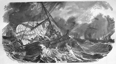
COD FISHERY.
The sea-shad of the Bay of Fundy is one of the most delicious fish found in its waters. It is taken in long drift-nets, attached to a boat, and thus kept stretched across the tide, during the night only. Some are taken off the harbor of St. John, but the principal fishery is within Cumberland Basin, at the head of the bay. In the muddy waters of that basin they attain their highest perfection, owing to the great abundance there of their favorite food, the shad-worm and the shrimp. The usual weight of this fish is from 2 lbs. to 4 lbs., although it sometimes attains the weight of 6 lbs. For winter use the shad is split down the back, and pickled; it must be carefully cleaned and freed from blood or other impurities, otherwise, from its exceeding fatness, it is apt to spoil. Upwards of two hundred boats and five hundred men are employed in the shad fishery, every season, in Cumberland Basin; their annual catch is estimated at something more than 4,000 barrels, worth at least £5,000 sterling.
Besides the sea-fish above described, there are others also taken, of less commercial value, which are usually eaten fresh. Among these are the silver hake, a fish resembling the whiting of Europe; the cunner, or sea-perch; the torsk, or cusk, which is sometimes salted and dried; several varieties of flounder; eels in great abundance and of good quality, occasionally pickle-salted for exportation; the tom-cod, a small variety of the cod family; skate in abundance, and of large size, seldom eaten, not being sufficiently appreciated; and that delicious little fish, the smelt, which in spring is taken in immense quantities, and in great perfection.
Of shell-fish, there are lobsters in considerable numbers; large and small clams; a large flat shell-fish, known as the scallop; the periwinkle; and great abundance of shrimps, with which the market might be amply supplied, but for the scarcity of shrimp-fishers, who might here follow their vocation most profitably.
The islands of Grand Manan, Campo Bello, and West Isles, own and employ in the fisheries sixty-eight vessels, manned by 558 men; 350 boats, manned by 900 men; besides 200 men employed in connection with the herring-weirs. The settlers along the shores of the Bay of Fundy all fish more or less in their own boats, chiefly for their own use. The value of their fishing cannot be stated with any degree of precision.
The rivers which fall into the bay yield a variety of fish; but the most valuable river fishing is in the harbor of St. John, at the mouth of the St. John River, which yields annually about 40,000 salmon, 12,000 to 16,000 barrels of alewives, and about 1,000 barrels of shad. The salmon are large and fine, precisely similar to the salmon of Europe. They are worth at St. John about six-pence sterling per pound, and are sent in ice, in large quantities, to the United States, yielding a considerable profit, and forming a valuable export. The alewife is a small species of shad, generally known in New Brunswick by the name of gaspereau; its length is from eight to ten inches, tolerably good when eaten fresh, early in spring, but very dry when salted. It is exported in pickle to the Southern States, where it is eaten by the slaves; in that hot climate, a fatter fish will not keep. Shad are taken in the river, on the way to their spawning grounds, which are some distance above tide-water. The river shad are much inferior to those taken in the bay, or in Cumberland Basin, and, when salted, are but little superior to the gaspereau.
The fisheries in St. John harbor give employment to two hundred boats and five hundred men; their value is estimated at £20,000 sterling annually.
The Gulf of St. Lawrence.—The fisheries in this gulf are prosecuted only from April until the end of November, the ice preventing their being followed during the rest of the year.
The principal fishery is for cod; it commences early in June, and continues until late in November. In the early part of the season, cod are taken very near the shores; as the season advances, they draw off into deep water. The best fishing grounds, or, rather, those most frequented, are from Point Escuminac to Miscou, and thence along the Bay of Chaleur to the Restigouché. The fishermen go out in boats, from one to fifteen miles from the land, in the morning, and when at the longer distance do not return until the evening of the second day. Their boats are large, but not decked; they have two fore-and-aft sails and a jib. Each boat is managed by two men, and there is frequently with them a boy. The fishermen generally build their own boats during winter: the keel is of birch; the timbers of cedar; and the planks of pine or cedar. The boat has oars, an anchor and rope, compass, and small oven for cooking; the cost is about £18 for each boat and outfit. A boat will last from six to eight years, and so will the sails also, with care.
It is considered a good day's fishing at Miscou, or Shippagan, for one of these boats to take ten quintals of fish, which they frequently do. When first caught, 112 of the small fish, and thirty of the large size, are reckoned to the quintal. The fishermen generally split, salt, and cure their own fish; when they do not, 252 lbs. of green fish, salted and drained, are given to a curer, who returns a quintal, or 112 lbs. of merchantable dry fish.
The Bay of Chaleur cod are more prized in the markets of the Mediterranean, and will at all times sell there more readily, and at higher prices than any other. They are beautifully white, and being very dry, can better withstand the effects of a hot climate and long voyage than a more moist fish. The peculiarity of their being smaller than cod caught elsewhere, is also of great importance as regards the South American market, for which they are packed in tubs of a peculiar shape called "drums," and into which they are closely pressed by means of a powerful screw.
Hake are taken abundantly in the gulf, at night, and on muddy bottoms, as in the Bay of Fundy. But much more attention is given to their cure, and they are exported under the name of "ling." The haddock abounds, but the pollock are not found in the gulf, probably from the absence of those rushing tides and foaming currents in which they so greatly delight. The torsk, or cusk, is more common than in the Bay of Fundy, and is dry-cured as a "scale-fish." Halibut are often taken. They are cut in slices and pickled in barrels, in which state they sell at half the price of the best herrings.
Herrings are taken everywhere on the gulf coast of New Brunswick, around Miscou Island, and within the Bay of Chaleur. Immediately after the disappearance of the ice, at the end of April or early in May, vast quantities of herrings draw near the shores to deposit their spawn; the fishing continues until about the first of June, when, the spawning being concluded, the fish retire to deep water. These "spring-herrings," as they are termed, being taken in the very act of spawning, are thin and poor; of little value as an article of food, whether fresh or salted. Other herrings appear an the coast about the 20th August, and remain inshore for a month; these are called "fall-herrings." They are fat, and in good condition, furnishing excellent food, and a valuable commodity for export. It is admitted that, when first caught, the "fall-herrings" are fully equal in every respect to the best Scotch herrings; and if they were cured in the same manner, this fishery, from the increased price and demand, would became one of the most valuable fisheries of the gulf.
Mackerel abound in the gulf, and are the chief object of pursuit with the numerous American fishing vessels which annually resort to its waters. This fishery commences early in July, and continues until late in October. The mackerel taken in the early part of the season are generally very poor; they improve in quality as the season advances. Those taken latest are by far the best, being large and fat, and in the finest condition. The mackerel fishery, as such, can scarcely be said to be followed by New Brunswick fishermen. They take small quantities only with hook and line, to serve as bait for cod; and a few are taken in nets, along the coast by settlers. This valuable and prolific, though somewhat uncertain fishery, has as yet been turned to very little account by the people of New Brunswick; but, if properly understood, may be prosecuted very extensively, and with much profit, for the mackerel of the gulf bear a very high price, and are in great demand in the United States.
In the spring, the alewife or gasperau enters all the rivers which flow into the gulf, between Baie Verte and Shippagan, and many thousands of barrels are taken annually. The striped bass abounds all along the same coast; while the quantities of smelts are perfectly prodigious. The sea-eel are uncommonly large and fat, and many are salted for exportation. The cunner, or sea-perch, is large and fine in the gulf. Shad are not plentiful, and those taken are thin and of small size, greatly inferior to those caught in the Bay of Fundy. The capelin is a small migratory fish from four to seven inches in length, not unlike the smelt. It is a very delicate fish, and large shoals draw near the shores every season, at places which are favorable for the deposit of their spawn. Flounders are found everywhere in great abundance and variety, as also the tom-cod and the skate; there are also other fishes of less value, among them the dog-fish, the livers of which yield oil largely.
Salmon of the finest description are taken in great numbers along the shores of the gulf, and in the estuaries of the rivers flowing into it. At the entrance of the Miramichi, more than 400,000 lbs. of fresh salmon have been put up in a single season, in tin cases hermetically sealed, for export to the United Kingdom.
The shell-fish of the gulf consist of oysters, of excellent quality; lobsters, in exceeding abundance; large and small clams, in great quantities; crabs, periwinkles, shrimps, mussels, and razor-fish, are found everywhere, in profusion.
River Fisheries.—The numerous rivers, lakes, and streams, which so bountifully water New Brunswick, are filled with fish of excellent quality, and in great variety. Besides those fishes which enter from the sea, including the salmon, the shad, the gaspereau, the striped bass, the smelt, the silver-eel, the sea-trout, and the sturgeon, there are others which remain constantly in fresh water, and may be taken readily.
The finest of the fresh-water fishes is the red or brook trout, which is found in nearly every lake and stream in New Brunswick, up to three pounds in weight, and sometimes even larger, affording excellent sport to the angler, and most delicious food. In the cold waters of the large and deep lakes the great gray trout is caught, up to twelve pounds in weight, but these are not of so fine a flavor as the brook trout. The striped bass passes much of its time in fresh water; it is a good fish for the table, and is sometimes taken of the weight of twenty pounds and upwards. After the fishes of the salmon family, it is unquestionably the most sporting fish in North America; its flesh is firm, white, and well flavored. The small white bass, commonly called the "white perch," is an excellent fish; it abounds in the St. John and its tributaries, but is not found in the rivers flowing into the gulf.—The yellow perch, the roach, the dace, the gudgeon, the carp, the sucker, and the chub, are all found in the fresh waters of New Brunswick; as also the white fish, commonly called the "gizzard fish," and spotted burbot, usually designated "fresh-water cusk," both good in their season. Eels are found everywhere, scarcely any piece of water being without them.
Sturgeon of large size ascend several of the principal rivers for the purpose of spawning. They are sometimes caught, but their flesh, being coarse and strong, is rarely eaten, owing to the abundance of fishes of better quality.
The following is a statement of the official value, in pounds sterling, of the fish exported from New Brunswick during six years, distinguishing the several countries to which the same were exported:—
| To what countries. | 1850. | 1851. | 1852. | 1853. | 1854. | 1855. |
| £ | £ | £ | £ | £ | £ | |
| United Kingdom | 1,835 | 2,613 | 6,185 | 14,605 | 12,285 | 8,553 |
| North American Colonies | 11,051 | 16,507 | 9,792 | 16,659 | 13,713 | 12,224 |
| West Indies | 1,911 | 489 | 1,778 | 788 | 1,841 | 782 |
| Other British Colonies | 55 | 1,761 | 1,274 | 496 | ... | 990 |
| United States | 8,400 | 14,281 | 22,934 | 18,609 | 19,676 | 19,929 |
| Foreign States | 4,067 | 3,320 | 4,096 | 5,793 | 8,830 | 4,715 |
| Totals, | 27,319 | 38,971 | 46,059 | 56,950 | 56,345 | 47,193 |
It is believed that this statement does not include the value of much of the fresh fish which is sent to the United States in ice, or of the larger quantities of fresh and half-cured fish which go from the fishing grounds in coasting and trading vessels, without being reported.
So large a proportion of New Brunswick is now covered with dense forest, and, as yet, has been so imperfectly explored, that no very precise description of the geological formation of the country can be given. At present it can only be stated generally, that according to the information hitherto obtained, New Brunswick consists mainly of certain rocks, which may be thus described:
1. The primary rocks of granite, gneiss, and mica slate, which form a broad belt extending directly across the province, near its centre, in a north-easterly direction. This belt is a spur or branch of the great chain of Alleghany mountains. It enters the province from the United States above Woodstock, embracing Mars Hill, near the Des Chutes river, and the range of hills known as the Tobique mountains, all of which, however, are less than 2,000 feet in height, except one, which rises to the height of 2,170 feet. At the western end, this belt of hilly country is supposed to be forty miles wide; it narrows gradually in its north-easterly course, and the hills decrease in height, until they finally disappear before reaching the Bay of Chaleur, near Bathurst.
Another belt of similar rocks enters the province from the westward, at the Cheputnecticook Lakes and River St. Croix, and also pursues a north-easterly course to Bull Moose Hill, near the Bellisle in King's county, soon after which it disappears on meeting the coal measures. The Nerepis Hills are in this belt, which is narrower and less elevated than that to the northward.
Both these belts of granitic rocks form anticlinal ridges, against which the stratified masses lean, or they border immense troughs containing the secondary and tertiary formations. The regions they occupy are generally stony, often rocky, and not susceptible of cultivation. In the less rocky portions excellent soils are frequently found when the loose stones are removed.
The trap rocks, which include felspar, basalt, porphyry, green-stone trap, and others of a volcanic character, are found largely in connection with these belts of primary rocks, into which they send numerous dikes, veins, and intruding masses. A tract of trap rocks, associated with granite and sienite, and frequently passing into the true granitic rock, extends from Chamcook, near St. Andrew's, to the eastern extremity of the county of St. John. This tract is on the average about ten miles in width, and about ten miles distant from the northern shore of the Bay of Fundy, with the north-easterly course of which it runs nearly parallel. These trap rocks occupy a large space in the counties of King's, St. John, and Charlotte; the lofty columnar basalt, of the island of Grand Manan, is especially remarkable. They form in general a poor and rugged country, but do not necessarily indicate the presence of unfertile soils, because they contain a large percentage of lime. This chemical character eminently distinguishes the trap from the granitic rocks; and the soils formed from each of these classes of rocks respectively, differ widely, and require entirely different modes of treatment. Whenever the trap rocks crumble, from the action of the weather or other causes, as frequently happens, they form reddish soils of much richness; and when these soils are deep, they may be profitably applied as covering to other soils of an inferior character.
2. The lower Silurian rocks, which form a broad belt south of the Tobique hills, running parallel with the north-easterly course of that range, and sweeping around the western end of the coal measures. The slates of this formation are composed of beds of clay that have been gradually consolidated, in which there is no lime. They form soils of medium and inferior quality, which require drainage and the free use of lime.
3. The upper Silurian rocks, which cover nearly the whole northern portion of New Brunswick, from the Tobique hills to the northern boundary of the province, at the 48th parallel of North latitude, where this formation is met by the lofty mountain ridges of Gaspé. The counties of Carleton, Victoria, and Restigouché, rest principally on this formation, which furnishes a large portion of the richest upland soil of New Brunswick. Along the upper Silurian rocks of this region are beds of valuable limestone, frequently abounding in characteristic fossils. The rocks themselves are generally slaty clays, more or less hard, containing lime in considerable quantity as an ingredient, and crumbling down into soils of much richness, and sometimes of great tenacity. These soils are of a heavier character than those of the coal measures, and infinitely more fertile.
The upper Silurian rocks are also found skirting the Bay of Fundy, forming a belt of unequal width, from the Saint Croix to Point Wolf, at the eastern extremity of St. John county. The southern part of Charlotte, and nearly the whole of St. John county, are in this formation. The rocks of this district have been heretofore classed as lower Silurian; but the better opinion seems to be that they belong to the upper Silurian, and have been greatly changed by igneous action. This opinion is sustained by the presence of large beds of limestone, which especially distinguish this district; and by the presence of fossils in the slates which are less metamorphosed. They are not altogether incapable of yielding good soils; but this portion of the province is, for the most part, covered with soils of an inferior character.
4. The lower carboniferous rocks, or red sandstone, which form a narrow belt everywhere between the Silurian rocks and those of the coal measures. They are also found extensively in Westmorland, Albert, King's, Queen's, Carleton, and Gloucester; with small patches in St. John and Charlotte counties. In these sandstones, which are situated beneath the coal measures, large deposits of gypsum are found, and salt springs often occur. This formation consists chiefly of red conglomerate, fine-grained red sandstone, and beds of red clay. The conglomerate does not produce so good a soil as the fine-grained red sandstone, which crumbles into red and sandy soils, light and easy to work, often fertile, and under proper management yielding good crops. The beds of red clay, often called red marl, are interstratified with beds of red sandstone, and crumble down into soils which vary from a fine red loam to a rich red clay. In the neighborhood of lime, these sandstones are themselves rich in lime; and when associated with gypsum, combine to form some of the most generally useful, and, when properly drained, some of the most valuable upland soils in the province.
5. The carboniferous rocks, or coal measures, which cover a large proportion of the breadth of New Brunswick, consist chiefly of gray sandstones of various tints, but sometimes of a dark and greenish hue, and at others of a pale yellow color. The district occupied by these coal measures, extends along the whole gulf shore of this province, from the boundary of Nova Scotia, at Baie Verte, nearly to Bathurst on the Bay of Chaleur, without interruption. It constitutes a large part of the counties of Gloucester and Northumberland; the whole of Kent; the most considerable portions of Westmorland, Queen's, and Sunbury; and extends also into Albert, King's, and York counties. This coal measure district is distinguished by the general flatness of its surface, gently undulating, however, intersected by numerous rivers and several large lakes, but consisting principally of table lands, more or less elevated, over which forests of mixed growth extend in every direction. The sandstones of this formation consist principally of silicious matter, cemented together by a small proportion of clay, chiefly decayed felspar; they crumble readily, form light soils, pale in color and easily worked, retaining little water, ploughed with facility early in spring and late in autumn, but needing much manure, and subject to being parched up in hot and dry summers. Some of these sandstones, however, contain greater proportions of clay, and form stiffer soils; others, that are green or gray internally, weather of a red color, and form reddish soils of good quality.
It has been remarked, that the coal measures of New Brunswick contain a smaller variety of sandstones than those of England and Scotland, and are free from those thick beds of dark-colored shale which occur in the coal-measures of the United Kingdom. The soils there, lying above the richest coal-fields, are often miserably poor, and greatly inferior to those furnished by the carboniferous rocks of New Brunswick.
6. The tertiary deposits, which are found at numerous localities along the coast of the Bay of Fundy. These consist of beds of sand, marly clay, and marl, forming low and nearly level tracts, exposed to the sea, and frequently extending some distance from the shores. In the marl and marly clay of this formation, the remains of marine animals and plants are found in profusion. In the counties of Gloucester and Restigouché, on the coast of the Bay Chaleur, these are similar to animals and plants which still exist in the province, and the marls of that district may therefore be referred to the pliocene period of the upper tertiary formation.
There are two kinds of alluvium in the province, the fresh-water and the marine, both exceedingly fertile. The first of these, composed of the particles of rocks detached by the frost, heat, and moisture, which cause rapid disintegration, are carried downward by the rains, and transported by the floods in early spring along the valleys and river sides, where, being deposited, they form the fertile intervales that border nearly every river in New Brunswick. The marine alluvia are carried inwards by the rapid tides of the Bay of Fundy, and spread along its estuaries, where, in the course of time, they become grass-bearing marshes, and being rescued from the sea by embankments, finally produce clover and wheat. These "diked marshes," as they are termed, possess extraordinary and enduring fertility, and exist extensively in the counties of Westmorland and Albert, near the head of the Bay of Fundy, where the tides rise to the height of fifty feet and upwards.
For information under this head the writer is indebted to the labors of Dr. Gesner, Dr. Robb, Professor Johnston, and Mr. Logan of Canada, in addition to his own observations in every part of New Brunswick.
As the geological character of New Brunswick can as yet be but imperfectly described, its minerals, at the present, are therefore only partially known. The principal mineral substances hitherto found in the province are as follows:—
1. Bituminous coal, of good quality, found in numerous localities in the coal measures of the province, of the fat and caking description, like the Newcastle coal of England. No seam of this coal thicker than twenty-one inches has yet been discovered. The principal workings are in the vicinity of Grand Lake, Queen's county, and the seam is found, on the average, at about twenty feet below the surface. In 1851, nine hundred and forty tons were raised.
2. A highly bituminous mineral, found near the Peticodiac river, in Albert county. A scientific dispute has arisen as to the precise character of this mineral, which one party designates asphalte, and the other pitch coal; hence it has been proposed to establish it as a new mineral, under the name of albertite. It is valuable for making the best illuminating gas, and also for the manufacture of various liquid hydro-carbons and illuminating and lubricating oils, which are distilled from it. The seam at present worked is vertical, and on the average about six feet wide. The deposit is supposed to be extensive. In 1851, fifteen hundred tons were raised.
3. Iron ores, of various descriptions and qualities, are found in almost every section of New Brunswick. An inexhaustible bed of hematite has been found at Woodstock, near the river St. John; extensive iron-works have been constructed there, and in 1851, eight hundred and ten tons were smelted. No other iron-works have yet been established in the province, although rich ores exist abundantly, especially in King's and Queen's counties.
4. Various ores of manganese have been found in connection with the iron ore of Woodstock. Gray oxide of manganese, highly crystallized and of fine quality, has been worked to some extent on the Tattagouche river, near Bathurst, and thence shipped to England. Black oxide of manganese has been found near Quaco, and of this considerable quantities have, at different periods, been shipped to the United States.
5. Plumbago, (graphite) exists in one of the largest beds known in America, at the falls near the city of St. John. It approaches in some degree to a metamorphosed coal, but is still sufficiently pure for the manufacture of lustre, and preparation of moulds for iron castings. It has been worked to some extent; in 1853, eighty-nine thousand nine hundred and thirty-six pounds were exported.
6. Ores of lead (galena) have been found on the island of Campo Bello; also at Norton, in King's county, and lately on the banks of the river Tobique, of very good quality. The extent of the deposit, at the several places mentioned, has not yet been ascertained.
7. Gray sulphuret of copper has been found in small quantities on the shores of the Bay of Fundy, in Charlotte county. It has also been found on the left bank of the river Nepisiguit, near Bathurst, and a company was formed some years since to work the deposit; but the irregular distribution of the mineral rendered their operations uncertain, and the mine has been abandoned.
8. Granite, of the best description, is found on the right bank of the Saint John, above the Long Reach, in King's county. Quarries were opened there some years since, and many public and private buildings in the city of St. John are built wholly, or in part, of the granite quarried there. Although it exists largely in other portions of the province, no other quarries have yet been worked.
9. Gypsum exists in abundance at Hillsborough, about four miles from the Peticodiac river, to which it is transported on a tramway, and thence shipped in large quantities to the United States. It is also found extensively at Martin's Head, in St. John county; at Sussex Vale, in King's county; and near the river Tobique, in Victoria county. There is also a deposit near Cape Meranguin, in Westmorland. A snow-white gypsum, compact, translucent, and approaching the finest alabaster, is likewise found at Hillsborough, in considerable quantity. It works readily in the lathe, and makes beautiful ornaments. The quantity of gypsum quarried in 1851 was 5,465 tons. In 1853, no less than 15,712 tons were exported.
10. Limestones are found in various districts, but are principally burned for quick-lime, in large quantities, near the city of St. John, at L'Etang, in Charlotte county, and at Petit Rocher, on the Bay of Chaleur. Kilns exist at other places, where quick-lime is burnt on a small scale, for local consumption. Hydraulic limestones have been noticed in many localities. The old mountain limestone, abounding with fossils, is found near the Ocnabog lake, in Queen's county, in its usual position with reference to the coal measures; the whole thickness of the band does not, however, exceed one thousand feet. Magnesian limestone has been noticed near the coal mines at Salmon river, in Queen's county. In 1851, the quantity of lime burned was 35,599 casks, of five bushels each.
11. Marbles of very fair quality are worked in the vicinity of St. John, and are also found near Musquash, on the shores of the Bay of Fundy, as well as on the coast of the Bay of Chaleur.
12. Superior dark-red sandstones, as also gray and other sandstones, are quarried at Mary's Point and Grindstone Island, in Albert county, and thence exported to some extent. These sandstones are found in large blocks, and are prized for building purposes. Excellent blue flagstones are likewise found at Grindstone Island. Good sandstones for buildings are found on the banks of the Miramichi, as well as in numerous other parts of the coal measures.
13. Grindstones are manufactured to a very considerable extent in the counties of Albert and Westmorland, as also at Miramichi, and on the coast of the Bay of Chaleur, at New Bandon and Caraquet. They form an export of much value. There were 68,949 grindstones made in 1851.
14. Fine oil-stone (novaculite), equal to Turkish, is found at Cameron's Cove, near the northern head of Grand Manan, whence American citizens carry it off in quantities. Excellent blue whetstone has been worked to some extent near the Sevogle, a tributary to the North-West Miramichi. Fine stone of the like description is also procured from the banks of the Moose Horn brook, in King's county.
15. Double refracting or Iceland spar, of the best description for optical purposes, is found at Belledune, in the county of Restigouché.
16. Roofing slate (argillaceous slate) of good quality is found on the banks of the Tattagouche, near Bathurst, and the roof of the court-house at that place is covered with it. Similar slate has been observed at the narrows of the Tobique river, and on the left bank of the St. John, about three miles above Green river, in Madawaska.
17. Iron pyrites, or sulphuret of iron, abounds in New Brunswick, and may be used in the manufacture of copperas when it occurs in veins. Where dikes of trap-rock have been injected into slate, the latter is often found charged with pyrites; and this pyritiferous slate is an article of much economical value, as, by a very simple process, it may be made to produce both copperas and alum.
18. Bituminous shale; a variety of argillaceous slate, is found in abundance on the banks of the Memramcook river, near Dorchester, in Westmorland—and throughout a large district in that vicinity. This shale is highly charged with bitumen; and from it naphtha is distilled, as also a new liquid hydro-carbon which has been designated kerosene. Atmospheric air, after being passed through this liquid, becomes a powerful illuminating gas. A mineral oil is also obtained by distillation from this shale, and from it parafine is made, a valuable substance for lubricating machinery. Liquid bitumen, or naphtha in its natural state, is found in small quantities flowing from this shale, in several places.
19. Plastic clay, for bricks and pottery, exists in large beds in many districts, and is often found of very fine quality. Beds of fire-clay are found beneath the bituminous coal wherever it exists in New Brunswick. A large outcrop of this valuable clay has been observed at the mouth of the Salmon River, near the head of the Grand Lake, in Queen's county.
20. Peat, of good quality for fuel, exists in large tracts, especially in the counties of Kent, Queen's, and Sunbury. There are two extensive deposits, washed by the sea, on the shores of the Bay of Miramichi—the one at the Black Lands, near Tabusintac; and the other on the opposite side of the bay, at Point Escuminac.
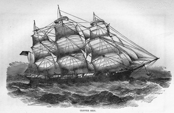
CLIPPER SHIP.
21. Sulphate of barytes has been found north of Fort Howe, near the city of St. John, and is said to exist in other localities.
22. Felspar, in large crystals, has been frequently seen in those granitic rocks which intersect gneiss. When pure, this mineral is admirably adapted for the manufacture of fine porcelain.
23. Milk-white quartz, in veins and beds more or less extensive, occurs in numerous localities. This substance may be profitably employed in the manufacture of flint glass. Quartz crystals, both limpid and smoky, are found in many places. The finest pure crystals have been procured near the Musquash river, in the county of St. John.
24. Ochres and the ochreous earths are found, in beds of considerable thickness, in the sandstones of the coal measures. From some of the ochres, of a ferruginous character, fire-proof paints have been manufactured, at the Scadouc river, near Shediac, in Westmorland.
25. Chlorite, the famous pipe-stone of the Indians, called by them Tomaganops, is procured at Grand Manan, and also at the Tomaganops brook, a tributary of the North-West Miramichi, in Northumberland. When first procured from its native bed it is of a dark-green color, compact, soft, and easily worked; by the moderate action of fire, it becomes very black and quite hard.
26. Jade (nephrite), a stone remarkable for its hardness and tenacity, of a light-green color, and of an oily appearance when polished, is found in the province, in localities known to the Indians. Some of them possess ancient scalping-knives and other weapons of jade, neatly polished, and bearing a fine cutting edge.
27. Jasper is found along the shores of the Bay of Chaleur, and other localities in the northern part of the province. The ancient arrow-heads, spear-heads, and other Indian implements of stone, for use in war or the chase, were chiefly formed of native blood-red Jasper, exceedingly fine and hard, oftentimes emulating the appearance of the semipellucid gems.
28. Hornstone, or chert, is frequently found in the primary rocks, and has been especially noticed at Grand Manan and the Gannet Rock. It has been seen of various colors, and somewhat translucent. The Indians formerly used chert for the heads of their spears and arrows, although these were sometimes formed of white quartz.
29. Soapstone (steatite) is found in the northern part of the province by the Indians. Cooking pots, and other utensils of soapstone, are often found near their ancient camping-grounds.
30. Salt-springs, affording a copious supply of water, exist at Sussex Vale, from which salt has been manufactured for many years, by evaporation in boiling. This salt is peculiarly fine, and is supposed to improve the flavor of the excellent butter made in that valley. Salt-springs are also found along a small tributary of the Hammond river, in King's county, and near the river Tobique, in Victoria.
The origin of these springs is yet an unsettled question; and whether they arise from some unknown chemical action in the bowels of the earth, or are produced by the solution of beds of rock-salt, remains to be determined.
31. Sulphureous and ferruginous springs, and those emitting carburetted hydrogen, are found in numerous localities, in the coal measures and slates of the province; but as none of their waters have yet been analyzed, no precise description can be given of their several qualities.
Very many of the various minerals above described have been observed by the writer, in the localities mentioned; and there is reason to believe that others will be found as the country becomes cleared and more minutely explored.
In addition to the minerals already mentioned, Dr. Gesner states, that Talc and Talcose Slate, Mica Slate, Thompsonite, Stilbite, Apophyllite, Tourmaline, Serpentine, Iserine, Asbestos, Amethysts, Agates, and Garnets, exist in New Brunswick, but he does not indicate their several localities.
The advantages of New Brunswick for ship-building were apparent to its earliest settlers. Jonathan Leavitt, one of the first settlers in the harbor of St. John, built a small schooner there before 1770. This vessel was named the "Monneguash," that being the Indian name of the rocky peninsula on which the eastern part of the city of St. John now stands. In 1773, a large schooner was built at Miramichi, and named the "Miramichi," by William Davidson, the first British settler on that river. From these two schooners the province dates its ship-building, which may be said to have grown up with it, gradually increasing until it has attained its present extent and value.
The forests of New Brunswick supply timber of large size, in any quantity, for building ships of the first class. Such ships are principally built of black birch and larch, or hackmatack. The black birch is used for the keel, floor timbers, and lower planking; larch or hackmatack for all the other timbers, knees, and upper planking. American live and white oak are imported for the stems and posts of superior ships, and pitch pine for beams. White pine is used for the cabins and interior finishing, and for masts. The black spruce furnishes as fine yards and topmasts as any in the world. Elm, beech, maple, cedar, and spruce, are used in the construction of ships of the second class, and for small vessels.
Ship-building is prosecuted more extensively than elsewhere at the ports of St. John and Miramichi, where it first commenced. Vessels are also built at St. Andrew's; at various coves and harbors on the Bay of Fundy, especially at Teignmouth and Quaco; along the banks of the river St. John, for ninety miles from the sea, on the Kennebeckacis, one of its tributaries, and at the Grand Lake. Latterly, ship-building has been prosecuted to a considerable extent on the banks of the Peticodiac river, and at Sackville, in Cumberland Basin. Within the Gulf of St. Lawrence, vessels have been chiefly built hitherto at Shemogue, Cocagne, Buctouche, Richibucto, Kouchibouguac, Miramichi, and Shippagan; at Bathurst and at Dalhousie, within the Bay of Chaleur; and at Cambelton on the Restigouché.
One of Lloyd's surveyors now resides in New Brunswick, and all large vessels are subjected to his strict and careful supervision while in course of construction. Ships built under his inspection are classed before they go to sea; and such ships have justly attained a high character. The "Marco Polo," renowned for her sailing qualities, was built in the harbor of St. John, and has been followed by a fleet of other ships, equally famous for their strength, speed, and durability.
The following is a return of the new vessels registered in the province of New Brunswick, and their tonnage, in each year from the year 1825 to the year 1860, both years inclusive, including vessels built for owners in the United Kingdom, and sent home under certificate or governor's pass.
| Year. | No. of vessels. | Tons. | Year. | No. of vessels. | Tons. |
| 1825 | 120 | 28,893 | 1843 | 64 | 14,550 |
| 1826 | 130 | 31,620 | 1844 | 87 | 24,543 |
| 1827 | 99 | 21,806 | 1845 | 92 | 28,972 |
| 1828 | 71 | 15,656 | 1846 | 124 | 40,383 |
| 1829 | 64 | 8,450 | 1847 | 115 | 53,373 |
| 1830 | 52 | 9,242 | 1848 | 86 | 22,793 |
| 1831 | 61 | 8,571 | 1849 | 119 | 39,280 |
| 1832 | 70 | 14,081 | 1850 | 86 | 30,356 |
| 1833 | 97 | 17,837 | 1851 | 99 | 49,595 |
| 1834 | 92 | 24,140 | 1852 | 118 | 58,399 |
| 1835 | 97 | 25,796 | 1853 | 122 | 71,428 |
| 1836 | 100 | 29,643 | 1854 | 135 | 99,426 |
| 1837 | 99 | 27,288 | 1855 | 95 | 54,561 |
| 1838 | 122 | 29,167 | 1856 | 129 | 79,907 |
| 1839 | 164 | 45,864 | 1857 | 148 | 71,989 |
| 1840 | 168 | 64,104 | 1858 | 75 | 26,263 |
| 1841 | 119 | 47,140 | 1859 | 93 | 38,330 |
| 1842 | 87 | 22,840 | 1860 | 100 | 41,003 |
The vessels built in 1853, it will be observed, were of large size, averaging no less than 585 tons each. The proportions in which they were built in different parts of the province in 1854, may be judged by the following statement from the ports of registry:—St. John, 94 vessels, 56,452 tons; Miramichi, 21 vessels, 13,205 tons; St. Andrews, 7 vessels, 1,771 tons. The vessels registered at Miramichi include all those built in the gulf; and those registered at St. Andrews include all that were built in Charlotte county.
At an average of eight pounds sterling per ton, the vessels built in 1854 were worth £795,408 sterling. As fully half the cost of each ship is expended in labor, the value of employment afforded by ship-building in New Brunswick may be readily estimated. The amount of daily labor in and about the hull and spars of a ship, is, on the average, ten days for each registered ton.
The shipping belonging to the province of New Brunswick on the 31st December of each year, from 1854 to 1860, respectively, is shown in the following table:
| Saint John. | Miramichi. | Saint Andrews. | Total. | |||||
| Year. | No. | Tons. | No. | Tons. | No. | Tons. | No. | Tons. |
| 1854 | 582 | 119,695 | 103 | 10,063 | 193 | 11,696 | 878 | 141,454 |
| 1855 | 566 | 110,451 | 105 | 15,269 | 195 | 12,572 | 866 | 138,292 |
| 1856 | 585 | 135,713 | 110 | 16,051 | 197 | 12,462 | 892 | 164,226 |
| 1857 | 543 | 133,669 | 126 | 18,363 | 188 | 8,476 | 857 | 160,508 |
| 1858 | 497 | 114,457 | 119 | 14,925 | 196 | 9,713 | 812 | 139,095 |
| 1859 | 489 | 112,420 | 126 | 13,556 | 196 | 8,079 | 811 | 134,055 |
| 1860 | 492 | 123,425 | 132 | 14,910 | 201 | 8,748 | 825 | 147,083 |
The number of saw-mills has increased very much in New Brunswick of late years; and recently they have been greatly improved in their construction and machinery. Water power is still used very extensively; but the number of mills worked by steam is becoming large, especially at and near the various sea-ports. In 1833, the number of saw-mills in the province was estimated at two hundred and thirty; by the census of 1851, it appears that the number of saw-mills had then increased to five hundred and eighty-four—giving employment to 4,302 men. Many saw-mills on a large scale have since been erected.
By the census of 1851, it also appears that there were then in the province, 261 grist-mills, employing 366 men; 125 tanneries, employing 255 men; 11 foundries, employing 242 men; 52 carding and weaving establishments, employing 96 persons: and that there were also 5,475 hand-looms, at which 622,237 yards of cloth were made in a year; this was chiefly coarse woollen, for farmers' use. There were eight breweries, manufacturing annually 100,975 gallons of malt liquor; and 94 other manufacturing establishments, giving employment to 953 persons.
The value of various articles manufactured in the province in 1851, is thus stated:—boots and shoes, £89,367; leather, £45,162; candles, £19,860; wooden ware (not cabinet-work), £20,505; chairs and cabinet-ware, £13,472; soap, £18,562; hats, £6,360; iron castings, £20,205.
The rivers of New Brunswick and their tributaries are so large, and afford such facilities for reaching the interior of the country, that for a long period after its first settlement the construction of roads was greatly neglected.
The principal river is the St. John, which is 450 miles in length. It is navigable for vessels of 100 tons, and steamers of large class, for eighty-four miles from the sea, up to Fredericton, the seat of government. Above Fredericton, small steamers ply to Woodstock, about seventy miles further up the river; when the water is high, they make occasional trips to the Tobique, a further distance of fifty miles; and sometimes they reach the Grand Falls, which are about two hundred and twenty miles from the sea. Above these falls the river has been navigated by a steamer about forty miles, to the mouth of the Madawaska; beyond that point the St. John is navigable for boats and canoes almost to its source. The Madawaska river is also navigable for small steamers thirty miles, up to Lake Temiscouata, a sheet of water twenty-seven miles long, from two to six miles in width, and of great depth. From the upper end of this lake to the river St. Lawrence, at Trois Pistoles, the distance is about eighteen miles only.
Another large sheet of water in connection with the St. John, is the Grand Lake, the entrance to which is about fifty miles from the sea. This lake is about twenty-nine miles long, and from two to seven miles in width. The Salmon river enters the Grand Lake near its head, and is navigable for small vessels and steamers for sixteen miles. The Maquapit and French Lakes are connected with the Grand Lake by a deep, narrow channel, through which small vessels can pass.
The Washademoak Lake is about twenty miles long, and, on the average, three-quarters of a mile in width. The stream from it enters the St. John about forty miles from the sea. This lake is navigable for steamers to the mouth of the New Canaan river, which flows in at its head.
The Kennebecasis river, a large tributary of the St. John, is eighty miles long; it is navigable for steamers twenty-five miles from its mouth to Hampton, where vessels of 500 tons have been built. The Oromocto is another large tributary flowing from two large lakes, navigable for vessels drawing eight feet of water for twenty miles from its mouth. It enters the St. John from the westward, seventy-two miles from the sea; within its mouth vessels of 1,200 tons are built. The Nashwaak, the Keswick, the Mactaquack, and the Nackawic are all considerable streams, entering the St. John from the eastward. The Tobique is a large river, eighty miles in length, with its tributaries watering a large tract of country east of the St. John. There are many other tributaries of the St. John both from the eastward and the westward, among which the Aroostook is the most considerable.
The Peticodiac is a large river flowing into Cumberland Basin, near the head of the Bay of Fundy. It is navigable twenty-five miles for vessels of the largest size; and for schooners of sixty or eighty tons burden for twelve miles further, to the head of the tide. The whole length of this river is about one hundred miles; above the head tide-water it is navigable for boats and canoes fully fifty miles.
The Richibucté is a considerable river flowing into the Gulf of St. Lawrence. It is navigable for small vessels for fifteen miles above the harbor at its mouth; the tide flows up it twenty-five miles.
The Miramichi is a large river, navigable for vessels of 800 tons for twenty-five miles from the gulf, and for schooners twenty miles further, to the head of the tide, above which for sixty miles it is navigable for tow-boats. This river has many large tributaries spreading over a great extent of country.
The Restigouché, at the north-eastern extremity of the province, is a noble river, three miles wide at its entrance into the Bay of Chaleur, and navigable for large vessels for eighteen miles from the bay. The principal stream of the Restigouché, is over two hundred miles in length. Its Indian name signifies "the river which divides like the hand,"—in allusion to its separation, above the tide, into five large streams. The main river, and its large tributaries, widely spread, are supposed to drain at least 4,000 square miles of territory, abounding in timber and other valuable natural resources.
The Bay of Chaleur, into which the Restigouché flows, may be described as one immense haven, with many excellent harbors. Its length is ninety miles, and it varies in breadth from fifteen to thirty miles; yet in all this great extent of length and breadth, there is neither rock, reef, nor shoal, nor any impediment to navigation. On the southern or New Brunswick side of this bay the shores are low, the water deepening gradually from them. On the northern or Canadian side, the shores are bold and precipitous, rising into eminences which may almost be called mountains.
Besides the rivers mentioned, there are very many others, of such size as would entitle them elsewhere to be deemed very considerable. An inspection of the map of New Brunswick will show how admirably the country is watered throughout, no portion of it being without running streams, "from the smallest brook up to the navigable river," by which the country can everywhere be penetrated, as mentioned by the railway commissioners.
Great Roads have been made through those lines of country most thickly settled. The principal of these is the line of great road from the harbor of St. John, up the valley of the St. John river to Canada. The next is the line of great road, from the United States frontier, at Calais, across the province, eastwardly, to the city of St. John; thence eastwardly, along the valleys of the Kennebecasis and Peticodiac, to the bend of the latter river. At that point, a branch diverges southerly to the boundary of Nova Scotia; the main line pursues its course to Shediac, and thence northerly, along the Gulf Shore of the province, to the Canadian boundary at the Restigouché. There are also great roads that connect Fredericton with the ports of St. Andrew's and Miramichi; with other great roads of less extent connecting several important points. The by-roads in each county are numerous, penetrating into every settlement; these are being extended continually, as settlers push their way into the wilderness. About £30,000 sterling is appropriated annually from the provincial revenue, for the construction and improvement of roads and bridges. A wire suspension bridge has recently been thrown over the river St. John, situated near the city of St. John, where a toll is levied; with that single exception, all the roads and bridges in the province are free.
There are numerous waterfalls on the rivers and streams of the province; very few are without, and some have falls of great height and large volume. The amount of water power in New Brunswick is exceedingly large, and almost beyond calculation. Few countries of its size possess such facilities for obtaining power to an unlimited extent from running water.
The province was early in the field of railway enterprise. It was only in the year 1825 that the Darlington railroad was opened to supply London with coal. The cars moved by steam at the rate of seven miles per hour, which was considered a marvel then. In 1827, three miles of railway were completed in the state of Massachusetts. In 1828, twelve miles of the Baltimore and Ohio railroad were completed. In 1830, the Liverpool and Manchester railroad, thirty-one miles in length, was opened. It was the opening and successful working of this important line that gave the first grand impulse to railway enterprise. In 1844, only fourteen years after this great era in the means of travel and transit, the St. Andrew's and Woodstock railroad in New Brunswick was commenced. The length of the line to Woodstock, is about ninety miles. Its progress has been slow, partly owing to the depression which occurred in the timber trade shortly after its commencement, partly owing to inefficient management, and partly owing to the fact that the provincial energies were directed to the construction of other important lines of railway. In 1855, twenty-five miles of this road were completed. The company have a grant of one hundred thousand acres of land from the provincial government, ten thousand acres of which they have made over to the contractors at $5 per acre, in part payment for their contract. This road is just announced as being opened all the way to Woodstock station this month (June, 1862). Its cost per mile has been something near $16,000. It was originally intended to extend it toward Quebec, so as to tap the great Canadian lines. In all probability it will be extended in the course of a few years so as to tap the Intercolonial Line which is to be constructed forthwith.
The line of railway between the city of St. John's on the Bay of Fundy and Shediac, a town on the Gulf of St. Lawrence, is the chief line in this province. It has been in successful operation for over two years. This road is one hundred and eight miles in length. The whole line with its full complements of stations, sidings, and rolling stock, has cost the province, up to November 1st, 1861, the sum of $4,548,564.59, or $42,116.34 per mile, equal to £8,774 4s. 7d. sterling per mile.
The road is of superior quality, well-built, well-drained, well-ballasted, with wider cuttings and embankments than the Nova Scotia and Canadian lines, and therefore not costing so much for yearly upholdence and improvements.
The capital amount of the above cost has been expended as follows:
| Engineering account | $214,535.15 | |
| Permanent way | 3,704,785.49 | |
| Buildings | 192,231.94 | |
| Rolling stock and machinery | 358,216.20 | |
| Miscellaneous stock | 15,371.21 | |
| General expenses | 63,424.60 | |
| $4,548,564.59 | ||
| Other expenditures not included in the above | 134,235.89 | |
| Grand Total | $4,682,800.48 | |
The total revenue of this line for the last year was $130,678.15, being an increase on that of the previous year of $14,452.75. This line has already been highly beneficial to New Brunswick and to the city of St. John's. It has attracted the trade and travel of Prince Edward Island toward that city.
The first line of telegraph communication was built in New Brunswick in the year 1848. There is, at present, seven hundred miles of telegraph-line in the province of New Brunswick, being eight hundred miles less than that contained in Nova Scotia. The number of offices are twenty-four; telegraphists, twenty-nine. Number of other employés, ten.
The most important lines, viz.: the line from Sackville to Calais, and from St. John's to Woodstock, via. Fredericton, are let to the American Telegraph Company on terms similar to that on which the Nova Scotia lines are let. The rates of tolls are very nearly the same as in Nova Scotia, making allowance for the difference in the currency of the two provinces.
The extent and value of the commerce and navigation of the province, will be best shown by the following statistical tables, carefully compiled from official returns.
The first is a statement of the numbers and tonnage of vessels, owned and registered in the province, on the 31st day of December, in each of the years mentioned:—
| Year. | Number. | Tons. | Year. | Number. | Tons. |
| 1848 | 763 | 113,825 | 1852 | 782 | 103,641 |
| 1849 | 775 | 117,475 | 1853 | 827 | 114,588 |
| 1850 | 807 | 121,996 | 1854 | 582 | 119,695 |
| 1851 | 796 | 118,288 | 1855 | 566 | 110,451 |
Estimating the population of the province in 1855, at 200,000 souls, the proportion of tonnage to population will be eleven-twentieths of a ton for each man, woman, and child in the country—an unusually large proportion in any community.
The following is a statement of the number of ships and vessels, and their tonnage, which entered inwards at the several ports of New Brunswick, from all parts of the world, during five years,—distinguishing the various countries from which they arrived:—
| Year. | To United Kingdom. | To British colonies. | To United States. | To foreign states. | Total. | |||||
| No. | Tons. | No. | Tons. | No. | Tons. | No. | Tons. | No. | Tons. | |
| 1849 | 325 | 140,024 | 1,213 | 81,050 | 1,304 | 182,007 | 51 | 13,106 | 2,893 | 416,187 |
| 1850 | 233 | 95,393 | 1,281 | 81,424 | 1,457 | 242,104 | 68 | 17,701 | 3,039 | 436,622 |
| 1851 | 273 | 113,665 | 1,275 | 87,965 | 1,453 | 274,594 | 57 | 12,926 | 3,058 | 489,150 |
| 1852 | 219 | 86,203 | 1,535 | 99,642 | 1,511 | 344,187 | 49 | 9,254 | 3,314 | 539,336 |
| 1853 | 248 | 98,592 | 1,863 | 110,414 | 1,767 | 405,345 | 78 | 12,225 | 3,556 | 627,276 |
| 1854 | 208 | 90,944 | 1,741 | 117,912 | 1,642 | 391,930 | 109 | 24,481 | 3,700 | 625,267 |
| 1855 | 126 | 71,417 | 1,615 | 101,704 | 1,659 | 407,126 | 42 | 10,520 | 3,442 | 590,767 |
The next table contains a statement of the number of ships and vessels, and their tonnage, cleared outwards during five years, distinguishing the countries to which they sailed.
The increase in the number of vessels inwards and outwards, during the years stated, has been equal to the increase in imports and exports, and shows the steady advance in trade and navigation.
| Year. | To United Kingdom. | To British colonies. | To United States. | To foreign states. | Total. | |||||
| No. | Tons. | No. | Tons. | No. | Tons. | No. | Tons. | No. | Tons. | |
| 1849 | 769 | 300,806 | 1,172 | 68,097 | 928 | 84,742 | 25 | 3,769 | 2,891 | 457,414 |
| 1850 | 768 | 203,617 | 1,241 | 70,155 | 937 | 87,925 | 25 | 3,286 | 2,971 | 464,983 |
| 1851 | 815 | 347,757 | 1,182 | 73,280 | 950 | 111,772 | 34 | 5,717 | 2,981 | 538,528 |
| 1852 | 793 | 353,013 | 1,465 | 86,652 | 999 | 135,580 | 41 | 6,227 | 3,298 | 581,472 |
| 1853 | 902 | 413,796 | 1,784 | 102,216 | 1,191 | 158,523 | 44 | 6,763 | 3,929 | 681,478 |
| 1854 | 936 | 436,007 | 1,680 | 97,130 | 1,064 | 155,985 | 65 | 11,764 | 3,745 | 700,886 |
| 1855 | 523 | 324,908 | 1,578 | 95,256 | 1,219 | 233,075 | 61 | 10,742 | 3,381 | 663,981 |
The following table shows the value in sterling of the imports and exports of the province of New Brunswick from and to the United States, and from and to all countries, during the last thirty-three years, or between the years 1828 and 1860, both years inclusive.
| From and to the United States. | From and to all countries. | |||
| Imports. | Exports. | Imports. | Exports. | |
| 1828 | £123,662 | £18,084 | £643,581 | £457,855 |
| 1829 | 133,976 | 26,959 | 638,076 | 514,219 |
| 1830 | 146,767 | 30,372 | 693,561 | 570,307 |
| 1831 | 77,476 | 18,017 | 603,870 | 427,318 |
| 1832 | 123,192 | 30,798 | 704,059 | 541,800 |
| 1833 | 136,432 | 29,362 | 694,599 | 558,527 |
| 1834 | 109,606 | 20,411 | 781,167 | 578,907 |
| 1835 | 102,839 | 24,299 | 969,860 | 652,154 |
| 1836 | 112,713 | 29,224 | 1,249,537 | 652,645 |
| 1837 | 124,991 | 25,185 | 1,058,050 | 650,615 |
| 1838 | 121,160 | 25,598 | 1,204,629 | 792,119 |
| 1839 | 249,298 | 35,472 | 1,513,204 | 819,291 |
| 1840 | 254,134 | 23,808 | 1,336,317 | 753,036 |
| 1841 | 267,852 | 18,522 | 1,291,611 | 700,699 |
| 1842 | 162,422 | 29,453 | 548,307 | 487,479 |
| 1843 | 140,259 | 16,190 | 639,686 | 538,592 |
| 1844 | 207,484 | 16,909 | 850,099 | 598,837 |
| 1845 | 312,313 | 27,940 | 1,105,998 | 787,624 |
| 1846 | 298,006 | 15,861 | 1,036,016 | 886,763 |
| 1847 | 340,098 | 44,644 | 1,125,328 | 696,399 |
| 1848 | 244,276 | 44,553 | 629,408 | 639,199 |
| 1849 | 264,562 | 51,582 | 693,927 | 601,462 |
| 1850 | 262,148 | 77,400 | 815,531 | 658,018 |
| 1851 | 330,835 | 83,028 | 980,300 | 772,024 |
| 1852 | 393,210 | 83,792 | 1,110,601 | 796,335 |
| 1853 | 574,070 | 121,858 | 1,716,108 | 1,072,491 |
| 1854 | 711,234 | 97,930 | 2,068,773 | 1,104,215 |
| 1855 | 782,762 | 123,127 | 1,431,330 | 826,381 |
| 1856 | 714,515 | 173,485 | 1,521,178 | 1,073,351 |
| 1857 | 628,510 | 158,697 | 1,418,943 | 917,775 |
| 1858 | 564,245 | 163,702 | 1,162,771 | 810,779 |
| 1859 | 675,095 | 236,014 | 1,416,034 | 1,073,422 |
| 1860 | 688,217 | 248,378 | 1,446,740 | 916,372 |
The following table is a return showing the gross amount of revenue, in currency, of the province of New Brunswick, during each financial year from 1837 to 1860, both years inclusive.
| Year. | Amount in currency. | Year. | Amount in currency. | ||||
| 1837 | £75,320 | 16 | 3 | 1849 | £95,536 | 17 | 4 |
| 1838 | 79,167 | 9 | 3 | 1850 | 104,089 | 9 | 6 |
| 1839 | 123,285 | 7 | 10 | 1851[MM] | 117,363 | 0 | 10 |
| 1840 | 109,942 | 17 | 7 | 1852 | 138,220 | 1 | 2 |
| 1841 | 110,983 | 10 | 9 | 1853 | 184,727 | 4 | 2 |
| 1842 | 55,904 | 2 | 0 | 1854 | 203,054 | 14 | 11 |
| 1843 | 59,498 | 13 | 0 | 1855 | 127,476 | 3 | 11 |
| 1844 | 92,333 | 14 | 2 | 1856 | 149,248 | 7 | 6 |
| 1845 | 127,753 | 1 | 9 | 1857 | 167,063 | 18 | 10 |
| 1846 | 127,403 | 17 | 1 | 1858 | 136,357 | 15 | 1 |
| 1847 | 127,410 | 7 | 2 | 1859 | 193,381 | 1 | 0 |
| 1848 | 86,437 | 14 | 3 | 1860 | 208,331 | 1 | 10 |
|
For eleven months. |
The increase in the imports and exports during the last six years is worthy of especial notice, as marking the steady progress and continued advancement of the country. The apparent deficiency in each year between the value of imports and the value of exports, is amply made up by the sale of new ships in the United Kingdom, the freight of their cargoes to the place of sale, the earnings of the ships belonging to the province, and the prices obtained for articles exported beyond the official estimate of their value when shipped, leaving, on the whole, a large balance of trade in favor of the province.
The chief executive officer is the Lieutenant-Governor, appointed by the Sovereign of England, of whom he is the immediate representative in the province. His functions are extensive, as he performs the duties of Commander-in-Chief, Vice-Admiral, Chancellor, Ordinary, and other high offices. He administers the government with the advice of an Executive Council of nine members, who hold office only while they possess the confidence of the people, as expressed through their representatives in the Assembly, retiring on an adverse vote, precisely as the ministry in England. The Legislative Council, or upper House of the Legislature, consists of twenty-one members, appointed by the crown during pleasure, but usually holding office for life. The lower House, or House of Assembly, is the popular branch, and consists of forty-one members, elected by the people. The several counties, and the city of St. John, are thus represented in the Assembly: Restigouché, two members; Gloucester, two; Northumberland, four; Kent, two; Westmorland, four; Albert, two; county of St. John, four; city of St. John, two; Charlotte, four; King's, three; Queen's, two; Sunbury, two; York, four; Carleton, two; Victoria, two.
The Legislative Council has the power of amending or rejecting bills sent to it by the House of Assembly, and may originate bills, except money bills. The members of the House of Assembly are elected every four years, by freeholders in the several counties, and by the citizens in St. John. This House has the power of appropriating the public moneys, levying duties, investigating the public accounts, and generally of legislating on the affairs of the province, as they are brought under its notice by the government, by its own members, or by the petitions of the people. Bills which have passed both branches of the legislature, must receive the assent of the Lieutenant-Governor before they become law; and they are then subject to the approval or disallowance of Her Majesty in Council.
The Courts of Justice are, the Supreme Court, Court of Vice Admiralty, Court for the trial and punishment of Piracy, Probate Courts, Courts of Marriage and Divorce, Inferior Courts of Common Pleas and General Sessions of the peace, and Justices' Courts. The Court of Chancery has been recently abolished, and its powers and duties transferred to the Supreme Court. This court consists of a chief-justice and assistant judges; its jurisdiction extends to all criminal cases, and civil suits where the amount in dispute exceeds five pounds, except in, cases of appeal from the Justices' Courts. It sits at Fredericton, four terms in each year, and the judges go on circuit, and hold the assizes in each county, the same as in England.
The Court of Vice-Admiralty is held at the city of St. John, and is presided over by one judge, holding his commission from the Crown. This court decides maritime causes, and has jurisdiction over prizes taken in war. The Court for the trial and punishment of Piracy and other offences committed on the high seas, consists of the Lieutenant-Governor, the Chief-Justice and other judges of the Supreme Court, the members of the Executive Council, the Judge of the Vice-Admiralty, the Provincial Secretary and the Provincial Treasurer, with the flag officers and captains and commanders of ships of war on the station for the time being. It sits at any place within the province appointed by any three of its members, the Lieutenant-Governor, the Chief-Justice, or one of the judges of the Supreme Court, or the Judge of the Vice-Admiralty, being one.
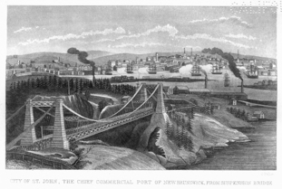
CITY OF ST. JOHN.THE CHIEF COMMERCIAL PORT OF NEW BRUNSWICK FROM SUSPENSION BRIDGE.
The Courts of Probate are held in each county, by Surrogate Judges appointed by the Lieutenant-Governor. These courts are always open for the transaction of business, although regular sittings are usually held once in each month in the counties, and once each week in the city of St. John. The duties of these courts relate to the probate of wills, granting letters of administration for the estates of persons dying intestate, making orders for the distribution of such estates, and compelling executors and administrators to render exact accounts of their proceedings.
The Court of Governor and Council, for hearing and determining cases relating to marriage and divorce, consists of the Lieutenant-Governor, the members of the Executive Council, and usually one or more of the Judges of the Supreme Court. It sits at Fredericton on the second Tuesday in February, and the third Tuesdays in June and October.
The Inferior Courts of Common Pleas, and General Sessions of the Peace, are held in each county four times in the year. They are presided over by three or more judges, appointed by the Lieutenant-Governor in Council, the senior of whom acts as Chairman of the Magistrates at the General Sessions. On the civil side, these courts have jurisdiction of all causes where the sum in dispute exceeds five pounds, except in cases where the title to land is involved. On the criminal side, the Sessions exercise jurisdiction over larcenies and minor offences, not involving capital punishment. The Sessions also, in counties not yet incorporated, appoint county and parish officers and audit their accounts, levy rates and taxes, and exercise a general supervision over parish and county business. In three counties which are now incorporated, these duties are performed by a warden and councillors elected by the rate-payers in each parish; and doubtless other counties will soon avail themselves of the privilege of being incorporated under the provisions of the Municipal Act.
The Justices' Courts are usually held at the residences of the Justices of the Peace in the several counties, whenever necessary or convenient. Two justices are competent to decide in cases of petty theft, or of assault and battery, not accompanied by wounding or aggravating circumstances. In civil suits, one justice decides causes where the sum in dispute is less than five pounds, or the damages claimed are less than forty shillings, except where the title to lands comes in question. An appeal lies from the decision of the justices in these cases to the judges of the Supreme Court.
All lands are held in New Brunswick in free and common socage, or simple freehold, by letters-patent from the Crown, under the Great Seal of the province. No quit-rent, due, or service is imposed; mines and minerals only are reserved to Her Majesty and her successors, but may be worked by the land-owner, on paying a small royalty. Granted land is transferred from one individual to another by simple deed of feoffment, or indenture of bargain and sale, which must be registered in the office of the registrar of deeds, in the county where the land lies, in order to be effective. Mortgages, wills, memorials of judgment which bind real estate, leases, and other instruments affecting the title to land, must also be registered in the same office, where searches can be made and titles ascertained.
In the distribution of real estate, the widow, in all cases, has her right of dower, or one-third during life; when there is no will, the law gives two shares to the eldest son, and one share to each of the other sons and daughters. If there are no children, the estate is divided among the next of kin, in equal shares. Of personal property, the widow takes one-third, and the residue is divided equally among the sons and daughters, share and share alike. If there are no children, the widow is entitled to one-half of the personal estate, and the other half is appropriated among the next of kin, in equal proportion.
The extent of the provision for the worship of God, will be best understood by the following statement of the places of public worship in each county, and the number of clergymen in the provinces:—
Places of worship in Restigouché county, 6; Gloucester, 19; Northumberland, 32; Kent, 21; Westmorland, 38; Albert, 20; St. John, 40; Charlotte, 53; Kings, 61; Queens, 40; Sunbury, 15; York, 45; Carleton, 25; Victoria, 8. Total places of worship in, the province, 423.
The number of clergymen of the several religious denominations in New Brunswick, in 1853, is thus stated:—
The Episcopal Church of England and Ireland, as by law established, one bishop, one archdeacon, and 58 clergymen. The Roman Catholic Church, one bishop, two vicars general, and 23 priests. The Church of Scotland, as by law established, 8 clergymen; the Presbytery of New Brunswick, adhering to the Westminster Standards, 13 clergymen; the Reformed Presbyterian Church of Ireland, 3 clergymen; Presbyterian Church of Nova Scotia, 1 clergyman; Wesleyan Methodists, 33 ministers; Baptists, 52 ministers and 7 licentiates; Free Christian Baptists, 18 ministers; General Baptist Church, 2 ministers; Congregational Church, or Independents, 4 ministers.
With the exception of some assistance received by the clergy of the Church of England from the Society for the Propagation of the Gospel in Foreign Parts, and by the Wesleyan ministers from the Methodist Missionary Society in England, the clergy of New Brunswick are supported almost wholly by the contributions of the members of their several churches, on the voluntary principle, no tithes or other charges for ecclesiastical purposes being known in the province.
New Brunswick, with its limited population and revenue, devotes annually about £12,000 sterling to educational purposes. Few countries in the world, in proportion to population and income, devote so large a sum to the education of the rising generation.
At the head of the educational establishments of the province is King's College, at Fredericton, which was established by Royal Charter dated 18th November, 1823. The object of this College, as declared in the Charter, is "the education of youth in the principles of the Christian religion, and their instruction in the various branches of literature and science." It receives a grant amounting to £2,000 sterling per annum from the province, and has besides a revenue arising from its endowment in lands, which have enabled the College Council to erect a spacious building, provide a considerable library, and the requisite scientific, mathematical, and astronomical instruments.
In each county of the province, except York, King's, and Victoria, there is a Grammar School, supported by subscriptions, tuition fees, and a grant of £100 per annum from the provincial treasury. These Grammar Schools are managed by trustees; instruction is given in the classics, and in the usual branches of English education—and here the foundation is laid for admission into College. In York County, the Collegiate School at Fredericton, under King's College, takes the place of a Grammar School.
The Baptist Seminary at Fredericton is under the general superintendence of the Baptist Association of New Brunswick, by whom it was founded in 1836. The course of instruction comprises the classics, English education, and mathematics. It has no permanent revenues, and its maintenance depends on grants from the provincial legislature and the contributions of the denomination.
The Wesleyan Methodists have an Academy at Mount Allison, a very pleasant situation, at Sackville, in the county of Westmorland. The building, which is handsome and spacious, was completed in 1843, by private subscriptions, and a very large donation from C. F. Allison, Esq., from whom the place takes its name. This institution is incorporated, and a managing committee has the direction of its affairs. The branches of learning taught are, the classics, mathematics, natural philosophy, moral philosophy, and divinity. This Academy receives a small grant from the province annually, but is chiefly supported by tuition money and private subscriptions.
The expenses of board and tuition at the Baptist Academy and the Wesleyan Academy, are about £30 per annum.
An incorporated body, styled "The Governor and Trustees of the Madras School in New Brunswick," is endowed with certain lands and grants of money; it has established schools at St. John, Fredericton, and other places in the province, where many children of the poorer classes are taught gratis, besides being furnished with books, and sometimes with clothing.
But the schools most generally diffused throughout the province are the Common or Parish Schools, which enable the children in every settlement, unless very remote, to obtain the blessings of education.
The Act relating to Parish Schools makes the following provisions, which are now in operation. The Lieutenant-Governor, with the Executive Council and the Superintendent of Schools, constitute a provincial Board of Education. The Governor and Council appoint the Superintendent, who acts as Secretary to the Board, and they also appoint an Inspector of Schools for each county. A Model School and a Training School are established, and examiners appointed of those who desire to become teachers. On the report of the examiners the Board of Education grants licenses to the persons examined as first, second, or third class teachers. The Inspectors of Schools visit and examine the schools in their several districts four times in each year, or oftener, if the Board directs, and make an annual report. Male teachers of the third class receive from the Provincial Treasury £22 10s. currency per annum, and are required to teach reading, writing, spelling, and arithmetic. Teachers of the second class receive £30 currency per annum, and in addition to the foregoing, must teach English grammar, geography, history, and bookkeeping. Teachers of the first class receive £37 10s. per annum, and besides what is taught by the two preceding classes, must also teach geometry, mensuration, land-surveying, navigation, and algebra. Female teachers of the third class receive £17 10s. per annum, and teach spelling, reading, writing, arithmetic, and common needlework. Those of the second class receive £22 10s. per annum, and in addition teach English grammar and geography. Female teachers of the first class receive £27 10s. per annum, and teach history in addition to what is taught by the second and third class teachers. No teacher is paid for a less period than six months, unless under special circumstances, nor unless the inhabitants of the district have raised by assessment, or paid for his or her support, in the same proportion as the provincial allowance. Any parish or district which voluntarily assesses itself for the support of common schools, receives from the provincial treasury twenty-five per cent. more than parishes or districts which do not assess; but in case of such assessment the tuition money must not exceed two shillings sterling per quarter. In every school, three children of indigent parents are admitted as free scholars.
The provincial allowance for schools must not exceed an average of £200 currency to each parish in any one county, or £260 to any one parish therein. The number of parish schools and scholars in each county, in 1853, is thus stated: Restigouché, 22 schools, 508 scholars; Gloucester, 35 schools, 1,167 scholars; Northumberland, 58 scholars; Kent, 36 schools, 1,169 scholars; Westmorland, 95 schools, 2,967 scholars; Albert, 33 schools, 994 scholars; St. John, 64 schools, 2,869 scholars; Charlotte, 122 schools, 2,702 scholars; King's, 97 schools, 2,507 scholars; Queen's, 65 schools, 1,643 scholars; Sunbury, 22 schools, 751 scholars; York, 57 schools, 2,659 scholars; Carleton, 56 schools, 1,612 scholars; Victoria, 12 schools, 275 scholars.
Besides these parish schools, there are four Roman Catholic schools in different parts of the province, an academy at St. Stephen, an infant school at Fredericton, as also an African school and a commercial school at St. John, which received special grants annually from the legislature.
The number of parish schools in 1852, was 588, attended by 18,591 scholars; the numbers in 1853 were, schools, 744, scholars, 24,127; evincing a marked increase both of schools and scholars.
In 1837, the proceeds of all Her Majesty's hereditary, territorial, and casual revenues, and of all sales and leases of Crown lands, woods, mines, and royalties in New Brunswick were surrendered to the province, and made payable to the provincial treasurer. In consideration of this surrender, the sum of £14,500 currency, annually, was granted to Her Majesty to provide for the payment of the civil list of the province. The salaries of the lieutenant-governor and the principal officers of the province are borne on this list, and paid from the sum so granted.
The following statement of expenditure in 1854 and 1855, in pounds sterling, shows the various objects for which the provincial revenues are annually disbursed.
| Heads of expenditure. | 1854. | 1855. |
| Civil list | £13,195 | £12,083 |
| Pay and expenses of the legislature | 9,749 | 9,619 |
| Collection and protection of the revenue | 5,806 | 5,215 |
| Judicial establishment | 1,362 | 1,628 |
| Printing laws, &c. | 2,313 | 3,429 |
| College and Grammar schools | 2,133 | 1,860 |
| Parish and Madras schools | 12,548 | 13,685 |
| Great roads and bridges | 27,016 | 24,525 |
| By-roads | 24,377 | 22,596 |
| Navigation of rivers | 2,326 | 6,448 |
| Public buildings | 765 | 2,169 |
| Wharves and landings | 2,069 | 739 |
| Post-office, couriers, &c. | 4,334 | 3,937 |
| Lunatic Asylum | 5,106 | 3,203 |
| Provincial Penitentiary | 1,500 | 3,062 |
| Destruction of bears and wolves | 210 | ... |
| Erection of oat-mills | 83 | 41 |
| Agricultural societies | 3,498 | 1,758 |
| Fishing societies | 418 | 300 |
| Relief of immigrants | 573 | 741 |
| Charitable purposes | 2,588 | 7,250 |
| Grant to Patriotic Fund | ... | 5,000 |
| Indians | 437 | 415 |
| Return duties | 425 | 230 |
| Miscellaneous | 4,318 | 4,934 |
| Interest on sums borrowed | 4,810 | 3,952 |
| Support of lighthouses | 3,397 | 3,115 |
| Support of sick and disabled seamen | 822 | 1,286 |
| Military expenditure | 287 | 133 |
| £136,463 | £138,353 |
Savings' Banks are established in several parts of the province, where deposits are received to the extent of £50 currency for one person, and interest allowed at the rate of five per cent. per annum. These banks are regulated by law, and the Province Treasurer is authorized to receive the money deposited in them, and allow six per cent. interest; the difference of one per cent. in the interest pays the expenses of these institutions.
The Spanish dollar is taken as the standard of currency; its value is established by law at five shillings currency. The public accounts are kept, and returns made, in army sterling, which rates the dollar at four shillings and two pence sterling. To bring currency into army sterling, it is only necessary to deduct one-sixth; and to bring sterling into currency, to add one-fifth to the several amounts.
The sovereign is a legal tender at 24s. 4d. currency. The English crown-piece passes at 6s. 1d. currency, and other silver coins in proportion. Immigrants should not bring bank-notes, as those are generally sold at less than the same amount in gold or silver.
The legal rate of interest is six per cent. per annum. No greater rate is allowed to be taken, except in the case of bottomry bonds, or the loan of grain, cattle, or live stock, where the lender takes the risk of casualties upon himself.
Immigrants to New Brunswick are especially cautioned against taking passage to Quebec, as there are no regular means of conveyance from that port to any of the Lower Provinces. The only route is by railway to Portland, in Maine, and thence by steamer to St. John, which is expensive.
Passage tickets should always be carefully retained by immigrants, so that if they are not treated according to law, or are landed at a different place from that named in the ticket, they may obtain redress. Immigrants are warned that they have no claim of right on the immigrant fund, and should provide themselves with sufficient means of their own, for their subsistence and conveyance into the interior from the port where they land. Sick immigrants only are provided at the public expense. Agricultural laborers need not bring out implements of husbandry, as these can easily be procured in the province; but artisans are recommended to bring such tools as they possess, if not too bulky. Those who intend to become settlers, should bring a stock of comfortable warm clothing, with blankets and strong boots and shoes for their families. There is no duty on the household effects of immigrants.
The best period to arrive in New Brunswick is early in May, so as to be in time to take advantage of the spring and summer work, and get comfortably settled before the winter sets in. The average length of passages to New Brunswick from great Britain and Ireland is 36 days, but the Passengers' Act requires provisions and water to be laid in for 70 days. Passengers are entitled by law to be maintained on board the ship, the same as during the voyage, for 48 hours after arrival in port. The tax on each passenger is 2s. 6d. currency (2s. 1d. sterling), which is paid by the master of the ship; and security must be given by bond, in the penalty of £75 currency, that any lunatic, idiot, maimed, blind, or infirm person not belonging to an immigrant family, shall not become chargeable to the funds of the province for three years. This bond may however be dispensed with, or cancelled by order of the lieutenant-governor in council, on payment of such reasonable sum as shall be deemed just and proper under the circumstances.
Until immigrants become acquainted with the labor of the country, their services are of comparatively small value to their employers. They should therefore be careful not to fall into the common error of refusing reasonable wages on their first arrival.
Demand for Labor.—The progress of agriculture in New Brunswick causes a steady demand for labor in the rural districts, and, for the last two years, farmers have suffered more than any other class, from an inadequate supply of agricultural laborers and female domestics. In the towns there has also been great scarcity of female servants, and a supply of these is greatly needed. Boys from twelve to eighteen years of age are greatly in demand throughout the province by farmers and mechanics. Unskilled laborers are generally sure of employment, at from two and sixpence to four shillings sterling per day, according to ability and the length of time for which they are engaged. Masons, bricklayers, carpenters, and joiners are in request at good wages; and there is no scarcity of employment for millwrights, smiths, foundrymen, and workers in iron generally, painters, tailors, and shoemakers.
The Clearing of Wild Land is to be understood as cutting down and burning the trees, fencing, and leaving the land ready for crop, the stumps and roots alone remaining to impede the operations of the farmer. The expense varies greatly, according to circumstances, but may be stated at two to four pounds sterling per acre. A comfortable log-house, sixteen by twenty-four feet, two floors, and shingled roof, costs twelve to fifteen pounds sterling, but much less when the work is chiefly performed by the immigrant himself. When properly built, this description of house is extremely warm and comfortable. No immigrant should undertake to clear land and make a farm unless he has the means of supporting his family for twelve months. It is better that the immigrant should engage himself to a farmer for the first year or two after his arrival, by which he will obtain experience as to the work of the country and the mode of conducting a farm, while laying up his wages wherewith to make a beginning in the forest.
If the immigrant is possessed of some capital, he should by no means expend it in endeavoring to make a farm in the wilderness, as he will be almost certain thereby to waste his means. He should buy land partially cleared, either in crop or ready for crop; he will always find persons ready to sell their land, with house and clearing, stock, and implements of husbandry suitable to the country, at a much less price than he could procure them for himself.
By adopting this course, an immigrant that arrives in New Brunswick with £100 sterling, will in a few years find himself in easy and independent circumstances, and the greater number he has in family, the better off he will be.
The Direct Taxes payable by a settler, are for poor rates, county expenses, and occasional assessments for public buildings; in the case of a small farmer, these altogether seldom amount to one pound per annum. The settler is also liable to perform statute labor on the roads, streets, and bridges in his county, but not the first year after his arrival in the country. He may perform this labor either in person or by sufficient substitute, eight hours of actual labor being considered a day's work; or he may commute the same, at the rate of one shilling and threepence currency for each day's labor. The scale of annual assessment for statute labor is as follows:—Persons between eighteen and twenty-one years of age, two days; above twenty-one years, four days; and one day in addition for every £100 in value of his real and personal estate, or one day for every £25 of his annual income, up to sixty days' labor, beyond which no person can be assessed. Every rate-payer is liable to serve the following offices in his parish; constable, pound-keeper, fence-viewer, parish clerk, overseer of the poor, clerk of the market, assessor or collector of rates, road-commissioner, surveyor of highways, trustee of schools, and some other offices peculiar to certain counties, such as surveyors of dams, overseers of fisheries, boom-masters, and timber-drivers, for all which, however (except as trustee of schools), small fees or perquisites are allowed. All persons between sixteen and sixty years of age, are liable to serve in the militia in case of necessity.
Ordinary Diseases.—As yet, no regular bills of mortality are made up in the province; and with respect to the ordinary diseases of the country, their type and prevalence, reference can only be had to the reports of the medical officers in charge of the troops in the colony, which are prepared with great minuteness and precision. In the report submitted to Parliament in 1853, it is stated that common continued fever constitutes about two-thirds of the fevers in this command; but is much less frequent than even among the most favored class of troops in the United Kingdom, and much less severe in its character. The proportion of typhus is also smaller than in the United Kingdom, although its intensity is much the same; eruptive fevers have been so rare as scarcely to require notice. In a former report, attention was called to the fact, that notwithstanding the greater severity of the climate, and the sudden alternations of temperature to which the troops are exposed, the proportion both of admissions into hospital, and deaths by diseases of the lungs, was lower than among an equal number of infantry in the United Kingdom; and the same was observable during the ten years included in the report of 1853. Diseases of the liver are stated to be rare in this command, more so than among the same class of troops in the United Kingdom. Other classes of diseases, although a source of considerable inefficiency, are stated not to add much to the mortality; most of these are produced by habitual drunkenness, arising from the low price and facility of procuring ardent spirits. On the whole, there is much less sickness and mortality, both among officers and men, than in any part of the United Kingdom.
All the fruits generally found in England are grown in New Brunswick, especially apples, pears, plums, currants, gooseberries, strawberries, and cherries. Of the wild fruits, there are strawberries, cranberries, gooseberries, raspberries, blackberries, great whortleberries, blue whortleberries, wild cherries, and some others. Butter-nuts, hazel-nuts, and beech-nuts are plentiful in many places.
The potatoes of New Brunswick are most excellent; those grown in newly cleared land are often drier than others, and of superior flavor. All the varieties of peas and beans, turnips, beets, carrots, parsnips, cabbages, cauliflowers, celery, cucumbers, and squashes, with all other common culinary vegetables of the United Kingdom, are cultivated with success.
Occasionally, wolves annoy the farmer to a small extent; in the more settled districts sheep are usually protected by a fold. The farmer may sometimes lose a stray hog by the bears; but there are many farmers who have lived all their lives in the province without seeing wolf or bear. As in other countries, foxes and smaller animals are destructive to poultry that is not looked after carefully.
Game is mentioned as forming one of the natural resources of the country. The animals hunted are the elk, or moose-deer; the cariboo, a species of reindeer; and the Virginian red deer. Of the smaller animals, which are taken either by hunting or trapping, there are the beaver, otter, mink, musk-rat, marten (a species of sable), fox, fisher (or pine marten), lynx, raccoon, porcupine, woodchuck, ermine, and northern hare. Of birds, there are wild geese, wild ducks, in great variety, and wood grouse, usually called partridges. Snipe and woodcock afford some fine shooting, in their season. There are several sorts of curlew, some very large, and an infinite variety of the plover tribe. The passenger-pigeon sometimes visits the province in great numbers.
As has been already stated, all the rivers, lakes, and streams of New Brunswick abound with fish, in considerable variety; and if a man thinks proper, in the words of Izaak Walton, "to be pleasant, and eat a trout," he can gratify his taste almost anywhere in the province.
There are in New Brunswick two tribes of Indians, differing widely from each other in their language, customs, implements, and habits of life. The marked distinction, in almost every particular, between these tribes, inhabiting the same country, and evidently sprung from the same stock, constitutes a remarkable point of interest.
First in order, not only as the most numerous, but as possessing both moral and physical superiority over the others, are the Micmacs—a tall and powerful race of men, who speak a dialect of the Algonquin language, and frequent the northern or gulf shore of the province. The less numerous and inferior body are the Milicetes, who speak a dialect of the Huron language, and frequent the river St. John and its tributary waters. The Micmacs are strongly attached to the seaside, near which they are generally found; hence the Milicetes call them "saltwater Indians." The Milicetes, on the contrary, have great aversion to salt water; they are thorough woodsmen, and confine themselves to the lakes and streams of the interior, for navigating which their light canoes are well adapted.
An enumeration of the Indians of the province was made by the writer, in 1841, when it was found that their numbers stood thus:—Of Micmacs; adults—males, 229; females, 255; under 14—boys, 215; girls, 236; total, 935. Of Milicetes; adults—males, 111; females, 113; under 14—boys, 107; girls, 111; total, 442. The whole number of Indians in the province, in 1841, was, therefore, 1,377. By the census of 1851, it appears that the numbers then found amounted to 1,116 only; and there is reason to believe, from inquiries recently made, that their numbers do not now reach 1,000. That they are steadily decreasing, is beyond a doubt; and this, in a great degree, is owing to the ravages made among their adults by small-pox and typhus fever, and among children by measles, whooping-cough, scarlet fever, and other diseases to which children are subject. Very few submit to be vaccinated, and hence small-pox is their great scourge. Their unwillingness to undergo regular medical treatment, is the reason why diseases are fatal among them, and not so to persons of European descent.
The Micmacs subsist during the summer chiefly by fishing and fowling; during winter many of them find employment with lumbermen in the forest. On the Miramichi and Richibucto rivers several Micmac families have turned their attention to the cultivation of the soil, and have comfortable houses, with some stock. The Milicetes hunt and trap during the winter; in summer they make baskets and other light articles, varying their labor with fishing and shooting. The people of both tribes live on the most friendly terms with their white neighbors; and they are often engaged by sportsmen as their attendants on excursions along the coast or up the rivers; an employment of which they are very fond.
The observations of Lord Durham, with respect to the capabilities and advantages of the British North American colonies, are specially applicable to New Brunswick. It possesses great natural resources for the maintenance of large and flourishing communities. A wide range of the best soil still remains unsettled, and may be rendered available for the purposes of agriculture. The wealth of forests of the best timber, and of extensive regions containing valuable minerals, yet remains untouched. Along the whole line of sea-coast, around each island, and in every river, are to be found the most productive fisheries in the world. The best fuel and most abundant water-power are available for manufactures. Trade with other countries is favored by the possession of a large number of safe and commodious harbors. Numerous rivers, long and deep, supply the means of easy internal intercourse; the structure of the country, generally, affords the utmost facility for every species of communication by land. Unbounded materials of agricultural, commercial, and manufacturing industry are present. These elements of wealth and special advantages need only capital and labor to be turned to profitable account, and render New Brunswick, with a large and flourishing population, one of the fairest and richest portions of British colonial empire.
The total population or New Brunswick, in 1824, was 74,176 souls; in 1834, it was 119,457 souls; in 1840, it was 154,000 souls; and in 1851 (in the last census), it was 193,800 souls. At present the population is estimated at 210,000 souls, and upwards.
The increase of population in New Brunswick has been greater than that in the neighboring State of Maine, by 7.29 per cent.; than that of New Hampshire, by 11.79 per cent.; and than that of Vermont, by 16.07 per cent.; and it has exceeded their aggregate and average ratio by 10.86 per cent.
| Year. | No. immigrants arrived. | Year. | No. immigrants arrived. |
| 1844 | 2,605 | 1853 | 3,762 |
| 1845 | 6,133 | 1854 | 3,440 |
| 1846 | 9,765 | 1855 | 1,539 |
| 1847 | 14,879 | 1856 | 708 |
| 1848 | 4,141 | 1857 | 607 |
| 1849 | 2,724 | 1858 | 390 |
| 1850 | 1,838 | 1859 | 230 |
| 1851 | 3,470 | 1860 | 323 |
| 1852 | 2,165 |
| Immigrants arrived at the port of St. John in 1860, | 315 |
| Immigrants arrived at Caraquet | 8 |
| Total for New Brunswick in 1860, | 323 |
|
A duty of 2s. 6d. currency, or 2s. 1d. sterling, was imposed by an act or the Colonial Legislature on each immigrant arriving in the province. In the year ending 31st December, 1860, the sum of £40 7s. 6d. currency was collected in this colony on account of immigrant duty. |
Restigouche.—This is the northernmost county in the province. It has a large frontage on the Bay of Chaleur, and is bounded northerly by the forty-eighth parallel of north latitude, which is the dividing line between New Brunswick and Canada in that quarter. It abuts westwardly on Victoria county, and is bounded southerly by Gloucester and Northumberland.
Restigouché county contains 1,426,560 acres of which 156,979 acres are granted, and 1,269,581 acres are still vacant. The quantity of cleared land is 8,895 acres only.
The population, in 1851, was 4,161; of whom 2,353 were males, and 1,808 were females. Lumbering is carried on extensively in Restigouché, which will account for the excess of males. This county is divided into five parishes—Addington, Colborne, Dalhousie, Durham, and Eldon. The shire town is Dalhousie, a neat town at the mouth of the River Restigouché. It is built on an easy slope, at the base of a high hill; the streets are broad and clean. A crescent-shaped cove in front of the town is well sheltered, and has good holding ground for ships, in six and seven fathoms water. There are excellent wharves, and safe timber ponds at Dalhousie, affording every convenience for loading ships of the largest class. The eastern point of Dalhousie harbor is in latitude 48° 4′ north, longitude 66° 22′ west. Variation of the compass, 20° 45′ west. Neap tides rise six feet, and spring tides nine feet. From Dalhousie to the village of Campbelton the distance by the river is about eighteen miles. The whole of this distance may be considered one harbor, there being from four to nine fathoms throughout, in the main channel. At Campbelton the river is about three-quarters of a mile wide; above this place, the tide flows six miles, but large vessels do not go further up than Campbelton. In 1853, ninety vessels, of the burden of 18,217 tons, entered the port of Dalhousie.
The soil in this county is very fertile, and produces large crops; it is especially noted for the excellent quality of its grain. The best wheat grown there weighs sixty-five pounds per bushel; barley, fifty-six pounds per bushel; black oats, forty-two pounds per bushel; white oats, forty-seven pounds per bushel. The productiveness in Restigouché, although so far north, affirms the principle, that "climate, unless it be very severe, is by no means the most influential element in determining the agricultural capabilities of a country." The geological character of any country has more influence upon its economical prospects than climate, and should be equally, if not more carefully studied.
Gloucester.—This county lies between Restigouché and Northumberland, and has a long range of sea-coast, in part on the Bay of Chaleur, and in part on the Gulf of St. Lawrence; it also includes the Islands of Shippagan and Miscon, which form the north-eastern extremity of the province.
Gloucester county contains 1,037,440 acres, of which 332,902 acres are granted, and 704,538 acres are yet vacant. The amount of cleared land is 19,812 acres. The population in 1851, was 11,704 souls, of whom 1,479 were males, and 1,434 were females. Owing to the extent of sea-coast and the facilities for prosecuting the fisheries, there are many fishermen in this county. The value of the catch, in 1851, was returned at £15,693.
There are six parishes in Gloucester—Bathurst, Beresford, Caraquet, New-Bandon, Saumarez, and Shippagan. Bathurst is the shire town. It is pleasantly situated between the Nepisiguit and Middle rivers, on a point of land which has a very easy slope to the harbor. The entrance to the harbor is between two low points of sand and gravel, and is about 230 yards across. Outside this entrance is the bar, on which, at spring-tides, there is fifteen feet of water. Within the entrance, the harbor is a beautiful basin, about three and a half miles in length, and two miles in width, well sheltered from every wind. In the principal channel there is about fourteen feet at low water, and vessels drawing more than fourteen feet usually take in part of their cargoes outside the bar, in the roadstead, where there is from six to ten fathoms water, and good holding-ground. The entrance to Bathurst harbor is in latitude 47° 39′ north, longitude 65° 38′ west; the rise and fall of tide, four to seven feet. In 1853, eighty-four vessels, of the burden of 11,413 tons, entered the port of Bathurst.
The Nepisiguit River, flowing into Bathurst harbor, is eighty miles long, but not navigable, owing to the number of cascades, falls, and rapids. Large quantities of timber are floated down it for shipment. Great numbers of salmon ascend this river every season, as far as the Grand Falls.
At the north-eastern part of this county is the spacious haven of Shippagan, which comprises three large and commodious harbors, between the islands of Pocksoudie and Shippagan, and the mainland. Within these harbors there is good anchorage for vessels of the largest class, which can lie perfectly sheltered from every wind. The rise and fall of tide is from three to six feet. Miscou harbor (formerly called Little Shippagan) lies between the islands of Miscou and Shippagan. It has a good anchorage, well sheltered, with three to five fathoms at low water. This excellent harbor is of much use and importance to fishing vessels frequenting the gulf, which resort to it greatly in stormy weather.
The Caraquet, Pokemouche, and Tracadie rivers are wholly in Gloucester county, and there is much good land yet vacant on their banks.
In 1851, there were 14,302 grindstones made in this county, and 21,157 lbs. of maple sugar. The quantity of butter made was 82,691 lbs.
Northumberland.—This is the largest county in the province. Its front on the gulf includes the whole bay of Miramichi, from Tabusintac to Point Escuminac, whence it spreads out to a great breadth westerly, abutting on Sunbury, York, and Victoria, with Kent to the southward.
The county of Northumberland contains 2,980,000 acres, of which 986,168 acres are granted, and 1,993,832 are still vacant. The quantity of cleared land is 30,221 acres. In 1851, the population was 15,064 souls, being little more than one soul to each 200 acres in the county. The inhabitants are chiefly employed in lumbering, agriculture, and the fisheries, while the ship-yards and saw-mills afford much employment for ordinary labor. There are ten parishes in this county—Alnwick, Blackville, Blissfield, Chatham, Glenelg, Hardwicke, Ludlow, Nelson, Newcastle, and Northesk. The shire town is Newcastle, situated about thirty miles from the gulf, on the left bank of the Miramichi. Douglastown is a thriving village, about three miles below Newcastle, on the same side of the river, with every convenience for business. Chatham is a bustling little town, on the right bank of the Miramichi, about twenty-five miles from the gulf, rather crowded along the water side, but with deep water in front, and many facilities for loading large vessels. In 1853, two hundred and seventy-seven vessels, 34,528 tons burden, entered the port of Miramichi. There is a bar at the entrance of the port; but the river is of such large size, and pours forth such a volume of water, that the bar offers no impediment to navigation, there being sufficient depth of water on it, at all times, for vessels of seven or eight hundred tons, and nowhere less than three fathoms in the entrance, at low water. From the entrance there is six and seven fathoms, in the channel, up to Newcastle. Owing to the size and depth of the Miramichi, ships can load along its banks anywhere for miles; and, consequently, detached villages have sprung up, wanting many of the advantages which would be gained from having one large town. The tide rises from three to five feet. The variation of the compass is 21° west.
In 1853, the following quantities of fish were exported from Miramichi:—herrings, 3,728 barrels; alewives, 7,130 barrels; pickled salmon, 396 barrels; pickled bass, 113 barrels; shad, 45 barrels; oysters, 200 barrels; eels, 21 barrels; salted trout, 7 barrels; mackerel, 167 barrels; 162,500 pounds of preserved salmon; 29,000 pounds preserved lobsters.
The Tabusintac, a river about sixty miles long, enters the gulf, a few miles to the northward of the Miramichi. The tide flows up it twenty miles; but it has only eight feet, at low water, on the bar at its entrance, near which the sea-fisheries are prosecuted to some extent. There is much good land on the Tabusintac yet vacant.
Of late years much attention has been given to farming in Northumberland, with favorable results. In 1851, this county produced 30,854 bushels of wheat; 120,366 bushels of oats; and 289,436 bushels of potatoes; besides other crops of grain and roots. In the same year 202,637 pounds of butter were made in the county, and 5,381 pounds of maple sugar. There are thirty-two places of worship in this county, and 2,116 inhabited houses.
Kent.—This county was formerly part of Northumberland, of which it formed the south-eastern corner. It has a large frontage on the gulf, extending from the northern point of Shediac Harbor to Point Escuminac, at the entrance to the Miramichi.
Kent contains 1,026,000 acres, of which 386,398 acres are granted, and 640,002 acres are still vacant. The quantity of cleared land is 35,496 acres. The population in 1851 was 11,410 souls, little more than one soul to each hundred acres in the county. The inhabitants follow lumbering, fishing, farming, and ship-building. There are six parishes—Carleton, Dundas, Harcourt, Richibucto, Weldford, and Wellington. The shire town is Richibucto, a seaport on the left bank of the Richibucto River, built chiefly along the water side, with wharves, warehouses, and timber-ponds in front. In 1853, one hundred and eight vessels, of the burden of 15,189 tons, entered at this port. There was formerly twelve to fifteen feet on the bar at low water, but it has of late shoaled considerably, owing to a new channel having broken out; measures have, however, been taken to deepen the main channel, and improve the entrance. The tide rises in Richibucto harbor two and a half to four feet.
The Harbor of Buctouche is twenty miles south of Richibucto. This harbor is at the mouth of Great and Little Buctouche rivers; the entrance, between two low sand beaches, is narrow. The tides rise and fall two to four feet; and vessels, drawing thirteen and a half feet, can cross the bar at ordinary tides. Outside the bar, there is instantly three fathoms water, deepening gradually seaward. Inside the bar there is two and a half to five fathoms, the loading place at the bridge, where vessels lie in nine fathoms water. The Big Buctouche is forty miles in length; the tide flows up it thirteen miles. The Little Buctouche is thirty-five miles in length, and the tide flows up it ten miles. There is much good land, and some fine farms on both these rivers. In 1853, thirty-seven vessels, of the burden of 4,323 tons, arrived at this port.
The Harbor of Cocagne, by the coast, is nine miles south of Buctouche. This is also a bar harbor; in ordinary tides there is nine feet on the bar at low water, and fourteen feet at high water; at spring tides there are two feet more. Within, there is a large sheet of water, well sheltered. The tide flows seven miles up the Cocagne River; the land on its banks is of good quality for settlement.
There is scarcely a hill of any magnitude in the whole county of Kent, and it may be described as the most level county in the province. Being wholly within the formation described as the coal measures, it consists altogether of gentle undulations and long swells of country, covered with the finest timber, chiefly hardwood. The maple abounds; and 44,154 pounds of maple sugar were made in 1851. In the same year, 83,171 pounds of butter were made in the county.
Westmorland.—This county has a large extent of low sandy coast, on the Straits of Northumberland, extending from the boundary of Nova Scotia, at Baie Verte, to the northern point of Shediac Harbor. On the south-west it is bounded by the Peticodiac River and county of Albert; and on the west by King's and Queen's counties. It possesses great agricultural capabilities, besides many facilities for lumbering, fishing, and ship-building, in addition to its mines and quarries.
Westmorland contains 878,440 acres, of which 577,440 acres are granted, and 301,000 acres are vacant. The cleared land amounts to 92,822 acres. The population in 1851 was 17,814 souls, dwelling in 2,390 houses. There are seven parishes—Botsford, Dorchester, Moncton, Sackville, Salisbury, Shediac, and Westmorland. The shire-town is Dorchester, a rural village about one mile from the eastern bank of the Peticodiac River.
The Harbor of Shediac, on the gulf shore, is by the coast, ten miles south of Cocagne. Its entrance, at the southern end of Shediac Island, is in latitude 46° 15′ 15″ north, and longitude 64° 32′ 10″ west. The longitude in time is 4h. 18 min. 8.40 seconds; the variation of the compass, 19° west. During the summer solstice, the time of high water, at the full and change of the moon, is 7 a.m.; at and during the winter solstice, at 12 noon; neap tides rise two feet, and spring tides four feet. In the fair-way, or ship-channel, at the distance of two-and a half miles from the harbor, twenty-five feet water is found, which is continued, with little variation, up to the entrance. From thence there is nineteen feet in the channel, gradually lessening, until at the anchorage off Point Du Chene, where sixteen and a half feet is found, at one-third of a mile from the shore. Two small rivers, the Shediac and the Scadouc, fall into this harbor. In 1853, two hundred and twenty-two vessels, of the burden of 21,226 tons, entered at Schediac. The terminus of the railway from St. John is near the entrance to this harbor, whence communication may be had, by steamers and sailing vessels, with Prince Edward Island, thirty-six miles distant, and all other parts of the Gulf of St. Lawrence, as also the Great Lakes of Canada by the River St. Lawrence and its canals. It is therefore quite certain to become a place of much trade and business.
Aboushagan and Tedish are boat harbors, to the eastward of Shediac, between that harbor and Cape Bauld, At Aboushagan there is five feet water on the bar, with good sand beaches near the entrance. Tedish bar is dry at low water, but there is a fine sand beach, on which boats are easily drawn up.
The harbors of Big and Little Shemogue are between Cape Bauld and Cape Tormentine. Big Shemogue is a good harbor for vessels of all sizes, up to 130 tons. At ordinary tides there is ten feet on the bar at high water, with a channel fifty fathoms wide. Inside, the harbor is capable of containing one hundred vessels, with anchorage in two and a half fathoms, well sheltered. Ship-building is prosecuted in this harbor, near which the best ship timber is said to be abundant. Little Shemogue is about three miles east of its larger namesake, but is only a boat-harbor, with two feet water on its bar.
Westmorland has the advantage of several shipping ports on the Bay of Fundy, within Cumberland Basin, and along the Peticodiac River; from each of these there is considerable coasting and foreign trade. In 1853, eighteen vessels, of 1,328 tons, entered at Sackville; ten vessels, of 771 tons, entered at Dorchester; and twenty-one vessels, of 1,646 tons, entered at Moncton. Vessels of all sizes, up to 1,000 tons, are built at each of these places.
The rise and fall of tide on the shores of Westmorland, within Cumberland Basin, and up the river Peticodiac, are very great. At Dorchester Island, near the mouth of the Peticodiac river, an ordinary tide rises thirty-six feet, and spring tides forty-eight feet. The tide rushes up this river with great velocity, and with a tidal wave, usually called "the bore," which at spring tides is five or six feet high. At Moncton, usually called the Bend, because it is situated at the point where the river, which flows thence in an easterly course, turns suddenly, almost at a right angle, and flows to the southward, an ordinary tide rises forty-eight feet, and spring tides fifty-seven feet. Moncton is a thriving village, its population increasing rapidly in consequence of the operations for establishing railway communication with the Gulf at Shediac, and with the city of St. John. A bank has been established there recently, for facilitating extensive business transactions, and this flourishing place bids fair to become an entrepot for trade with the northern counties, Prince Edward Island, and the Gulf of St. Lawrence generally.
The fertile marshes and uplands of Westmorland are well adapted for grazing purposes. In 1851, 322,335 pounds of butter were made. In the same year, this county, with other crops, produced 33,937 tons of hay; 145,396 bushels of oats; and 282,224 bushels of potatoes. The quantity of maple sugar made was 43,485 pounds.
Albert.—This county lies south and west of the River Peticodiac, with the Bay of Fundy in front, and abutting westwardly on St. John and King's counties. It was formerly part of Westmorland, from which it was separated in 1845.
Albert contains 433,560 acres, of which 233,700 acres are granted, and 199,860 acres are still vacant. There are 32,210 acres of cleared land. The population in 1851 was 6,313 souls. There is much good land in this county, and its diked marshes are extensive. A large proportion of the vacant land is of good quality, well adapted for settlement and cultivation. Besides its agricultural capabilities, Albert county possesses valuable resources in its forests, its mines, and its fisheries.
There are five parishes in this county—Coverdale, Elgin, Harvey, Hillsborough, and Hopewell. The shire-town is at Hillsborough, on the western bank of the Peticodiac River. Shipments take place at Hillsborough and Harvey, and at the former place ship-building is prosecuted. In 1853, thirteen vessels, of 1,401 tons, entered at Harvey; and sixty-seven vessels, of 11,377 tons, entered at Hillsborough. These vessels carried the various products of this country to places abroad; and there were many coasters also employed in carrying produce to the port of St. John. In 1851, there were 142,137 pounds of butter made in Albert, and 62,235 pounds of maple sugar.
Saint John.—This county consists of a narrow strip of land, stretching for nearly ninety miles along the shores of the Bay of Fundy, with Albert county on the east, Charlotte county on the west, and King's county to the northward. It contains 414,720 acres, of which 309,147 acres are granted, and 105,573 acres are still vacant, chiefly at the eastern and western extremes of the county. Its population, in 1851, was 38,475 souls.
There are five parishes in this county—Lancaster, Portland, St. John, St. Martins, and Simonds. The city of Saint John is the shire town; it contained, in 1851, a population of 22,745 souls, and the parish of Portland, its suburb, contained 8,429 souls, making together, 31,174 souls. At the present time (1854) the population of St. John and Portland may be estimated at 35,000 souls.
Although this county cannot boast of its agricultural capabilities, yet in 1851 it produced, with other crops, 6,855 tons of hay, 30,961 bushels of oats, 9,758 bushels of buckwheat, 34,438 bushels of turnips, and 105,695 bushels of potatoes. In the same year, 102,716 pounds of butter were made, and 12,960 casks of lime were burned.
The city of Saint John was established by Royal Charter in 1785, and is now divided into seven wards. Of these, five are on the eastern side of the harbor; the other two are on the western side, and constitute that part of the city usually called Carleton. The city government, or common council, consists of a mayor and recorder, with an alderman and councillor from each ward. The mayor, aldermen, and councillors are elected annually by the citizens and freeholders; the recorder is appointed by the crown. All British subjects may become citizens on paying certain fees, amounting to about £5 sterling; but sons of citizens, born in the city, and those who have served an apprenticeship in it, become citizens at twenty-one years of age, on payment of about £1 sterling.
In 1851, there were 3,885 inhabited houses in the city, and 133 in course of erection. The number of stores, barns, and outhouses was then 2,397; these numbers have considerably increased since 1851. There are many good buildings of brick and stone, especially in the business part of the city, where none others are now allowed to be built. The tide rises twenty-one to twenty-three feet at ordinary tides, and twenty-three to twenty-five feet at spring tides. At full and change of the moon, it is high water at eleven hours forty-four minutes. There is good anchorage within the harbor in ten to seventy fathoms water. Owing to the tide-falls at the head of this harbor it is never frozen, or in any way impeded by ice during the winter; vessels arrive and depart every day during the year. Its latitude is 45° 15′ north, longitude 65° 3′ 36″ west; variation of the Compass, 16° 30′ west.
The position of St. John harbor, at the mouth of a large river with numerous tributaries, and its entire freedom from obstruction by ice, give it great advantages over all the northern ports in North America, and render it almost certain of becoming a place of much commercial importance. The existing trade and commerce of the port, with its steady increase, will be best understood by the following statement of the numbers and tonnage of vessels entered inwards, and cleared outwards, during six years.
| No. | Tons. | ||
| 1850— | Inwards | 1,695 | 260,429 |
| Outwards | 1,720 | 284,793 | |
| 1851— | Inwards | 1,528 | 282,566 |
| Outwards | 1,545 | 324,821 | |
| 1852— | Inwards | 1,740 | 334,267 |
| Outwards | 1,746 | 362,917 | |
| 1853— | Inwards | 2,117 | 400,216 |
| Outwards | 2,106 | 400,216 | |
| 1854— | Inwards | 1,9?0 | 353,060 |
| Outwards | 1,990 | 405,812 | |
| 1855— | Inwards | 1,886 | 367,521 |
| Outwards | 1,870 | 420,624 |
The amount of ship-building and the value of the fishing in the harbor of St. John, have been already stated under those heads. In the city and county of St. John, there were in 1851, fifty-one saw-mills, employing 803 men; fourteen grist-mills; seventeen tanneries; six foundries; four breweries; and sixty-one other factories, giving employment to 1,120 men. The numerous ship-yards, and the large quantities of deals and timber continually exported, afford much profitable employment for labor.
There are three banks in the city of St. John—the Bank of New Brunswick, with a capital of £100,000 currency; the Commercial Bank of New Brunswick, with a capital of £150,000 currency, and a branch of the Bank of British North America, established in London, with a capital of £1,000,000 sterling.
By means of the electric telegraph, St. John is in immediate communication with Nova Scotia and Canada, and with all parts of the United States to which the telegraph has been extended. A railway from the harbor of St. John to Shediac, on the Gulf of St. Lawrence, a distance of 114 miles, is now in course of construction. It is proposed to extend this railway to the Nova Scotia boundary near Baie Verte, to meet the railway now being built from Halifax to that point; and also northwardly from Shediac to Miramichi, and to the St. Lawrence and Trois Pistoles, there to connect with the Grand Trunk Railway of Canada, and so with the Great Lakes and the far west. Another line of railway is also contemplated from the city of St. John, westwardly, to the frontier of the United States at Calais, by which connection will be had with the whole railway system of the United States. From this line it is proposed to construct a branch northwardly to Fredericton, and thence up the valley of the St. John, to give greater facilities for traffic, especially in winter.
At present, constant communication is maintained with Portland and Boston by first-class steamers. The time from St. John to Portland by steamer, and thence by railway, either to Montreal or Quebec, is about thirty-five hours—to Boston thirty hours.
The city of St. John is lighted with gas and supplied with water by iron pipes, from a reservoir about four miles from the city. These water-works are to be immediately extended, so as to give every part of the city an ample supply of pure water.
Charlotte County.—This county occupies the south-west corner of New Brunswick, and is nearly square in form. Its front on the Bay of Fundy extends from Point Lepreaux to the St. Croix River, which is the boundary of the United States in that direction. Charlotte county contains 783,360 acres, of which 317,245 acres are granted, and the remaining 466,115 acres are yet vacant. The quantity of cleared land in 1851, was 45,656 acres, or about one-seventh part of the quantity granted. The population of the county in 1851, was 19,938 souls, chiefly engaged in fishing, farming, lumbering, and ship-building. There are ten parishes in Charlotte—Campo Bello (an island), Grand Manan (also an island), Pennfield, St. Andrews, St. David, St. George, St. James, St. Patrick, St. Stephen, and West Isles (a group of islands). The shire town is St. Andrews, which is pleasantly situated on a point of land between the St. Croix (or Schoodic) River, and the inner Bay of Passamaquoddy, on an easy slope, with a southern aspect. The parish of St. Andrews has a population of 3,910 souls. From the harbor of St. Andrews a railroad has been projected, which is at present in course of construction, toward Woodstock on the River St. John, a distance of about ninety miles. Of this railway, twenty-six miles are now completed and open for traffic; and the intention is, after reaching Woodstock, to continue the line by the valley of the St. John, to the River St. Lawrence, and thence to Quebec.
The St. Croix is a large river, flowing from two chains of lakes, widely spread over a tract of country which has long furnished, and still continues to furnish, extensive supplies of timber. It is navigable to the head of the tide at St. Stephen, which is about 16 miles above St. Andrews. St. Stephen and Milltown are two thriving villages on the St. Croix, chiefly supported by the saw-mills in their vicinity, and the traffic in sawed lumber of every description.
The Digdeguash and the Magaguadavic are two considerable rivers falling into the Bay of Passamaquoddy, to the eastward of St. Andrews. There are saw-mills on each of these rivers, and ships load with lumber at their mouths, as also at the entrance to Lepreaux River, in Mace's Bay, at the eastern extreme of this county. The fisheries of Grand Manan, Campo Bello, and West Isles, have already been mentioned. All vessels which enter and clear at the various harbors and loading places in Charlotte county, are enumerated as entering and clearing at the port of St. Andrews. The following is a statement of their numbers, tonnage, and men, during six years, distinguishing countries:—
| Year. | United Kingdom. | British colonies. | United States. | Foreign States. | Total. | ||||||
| No. | Tons. | No. | Tons. | No. | Tons. | No. | Tons. | No. | Tons. | Men. | |
| 1849 | 10 | 2,430 | 66 | 2,887 | 613 | 52,001 | 1 | 230 | 690 | 57,548 | 2,681 |
| 1850 | 12 | 3,437 | 84 | 5,475 | 634 | 63,531 | 2 | 250 | 732 | 72,693 | 3,851 |
| 1851 | 15 | 4,985 | 92 | 8,168 | 694 | 75,407 | 4 | 1,137 | 805 | 89,597 | 4,725 |
| 1852 | 9 | 3,916 | 57 | 4,262 | 675 | 81,693 | 2 | 424 | 743 | 89,845 | 4,322 |
| 1853 | 13 | 3,760 | 91 | 6,029 | 733 | 88,950 | 6 | 1,159 | 843 | 99,898 | 4,881 |
| 1854 | 8 | 2,882 | 55 | 4,586 | 716 | 110,958 | 3 | 1,318 | 782 | 119,744 | 5,115 |
| 1855 | ... | ... | ... | ... | ... | ... | ... | ... | 788 | 127,689 | 5,516 |
| Year. | United Kingdom. | British colonies. | United States. | Foreign States. | Total. | ||||||
| No. | Tons. | No. | Tons. | No. | Tons. | No. | Tons. | No. | Tons. | Men. | |
| 1849 | 50 | 17,548 | 86 | 6,861 | 503 | 36,794 | 2 | 492 | 641 | 61,605 | 2,829 |
| 1850 | 59 | 24,044 | 97 | 6,553 | 504 | 40,594 | 1 | 167 | 661 | 71,358 | 3,867 |
| 1851 | 85 | 34,191 | 124 | 7,430 | 511 | 41,332 | 2 | 364 | 722 | 83,317 | 4,274 |
| 1852 | 94 | 42,846 | 59 | 4,246 | 565 | 44,073 | 2 | 200 | 720 | 91,365 | 4,334 |
| 1853 | 88 | 47,558 | 86 | 5,654 | 629 | 47,978 | 1 | 212 | 894 | 101,402 | 4,909 |
| 1854 | 121 | 63,340 | 48 | 3,810 | 611 | 56,495 | ... | ... | 780 | 123,645 | 5,276 |
| 1855 | ... | ... | ... | ... | ... | ... | ... | ... | 7?0 | ???,3?6 | ?,686 |
There is abundance of both lime and marl in the county of Charlotte, as well as sea manure, and in those respects it possesses advantages over most other counties in the province. By the census of 1851, it appears the crops of that year were as follows:—hay, 17,076 tons; wheat, 3,263 bushels; barley, 7,206 bushels; oats, 69,988 bushels; buckwheat, 14,304 bushels; peas and beans, 1,999 bushels; turnips, 72,419 bushels; potatoes, 168,117 bushels. The quantity of butter made during the year, was 441,522 pounds; of maple sugar, 700 pounds; of lime burned, 15,100 casks.
This county may be described as a hilly country, with a rocky sea-coast studded with islands, everywhere indented with excellent harbors, and the neighboring waters abounding with fish. Numerous rivers and large lakes intersect the interior in every direction, and in the valleys and basins of these rivers and lakes, there is much good land. The quantity of available water power is wonderfully great, and in many places it yet remains to be turned to profitable account.
King's County.—This is an inland county, lying north of St. John, abutting westwardly upon Charlotte county, and widening to the eastward, where it is bounded by the counties of Albert and Westmorland. It contains 849,920 acres, of which 662,752 acres are granted, and only 187,168 acres are vacant. The quantity of cleared land in 1851, was 120,923 acres, and its population, 18,842 souls.
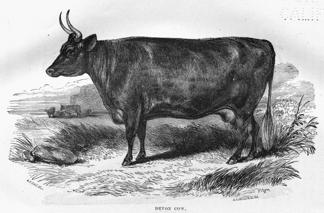
DEVON COW.
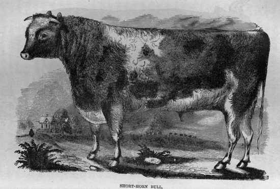
SHORT-HORN BULL.
King's county is divided into two parts by the River St. John, which passes across it from north to south. The eastern part is intersected by the River Kennebecasis, which passes through it from north-east to south-west, and renders much of that portion accessible by water. The western part of this county, on both sides of the St. John, is hilly and dotted with numerous small lakes; while the eastern portion, stretching towards the sandstones of the coal measures, and embracing the lower carboniferous rocks, consists of long swells of land, hills of gentle elevation and rounded summits, with level and fertile valleys between, often of considerable extent and much picturesque beauty.
There are nine parishes in this county, thus designated—Greenwich, Kingston, Hampton, Norton, Springfield, Studholm, Sussex, Upham, and Westfield. The shire town is in Kingston, between the Kennebecasis River and Bellisle Bay. The village of Hampton is a thriving place, twenty-five miles from the city of St. John, on the Kennebecasis River. The tide flows up this river five miles beyond Hampton, but up to the village the river is navigable for small vessels and steamers. As this village will soon be connected with St. John, by the Shediac railway, it will, undoubtedly, become a place of great resort, and a favorite spot for summer residences. The rides and drives in its vicinity are varied and beautiful, and the country, with its numerous lakes and streams, possesses many attractions for the sportsman.
King's is essentially an agricultural county; the crops of 1851 are thus stated in the census of that year:—hay, 38,811 tons; wheat, 14,895 bushels; barley, 5,427 bushels; oats, 178,968 bushels; buckwheat, 206,251 bushels; Indian corn, 2,968 bushels; peas and beans, 4,210 bushels; turnips, 84,359 bushels; potatoes, 303,568 bushels; other roots, 9,142 bushels. There were then in the county, 18,295 head of neat cattle; 8,463 cows; 2,988 horses; and 30,235 sheep. The quantity of butter made in 1851, was 506,292 pounds; and of maple sugar, 37,801 pounds. The number of saw-mills was seventy-five; of grist-mills, forty-six; with seventeen tanneries, and eleven carding and weaving establishments. Apples are found to thrive well in this county, and much attention is now being paid to the growth of that description of fruit.
The facilities of access, both by land and water, from every part of King's county to the harbor of St. John, and a ready market there, give great advantages to the farmers of this county, and render their pursuits in general very profitable.
Queen's County.—This county lies north-westerly of King's county, and between it and Sunbury, being bounded by Charlotte on the south-west, and by Westmorland, Kent, and Northumberland at its north-eastern extremity. It contains 961,280 acres, of which 514,204 acres are granted, and 444,076 acres are still vacant. The quantity of cleared land in 1851, was 63,719 acres, and the population, 10,634 souls.
Queen's county is also divided into two portions by the river St. John, which crosses it from north to south. The largest part, east of the St. John, comprises within its bounds those two large lakes, the Washademoak and the Grand Lake, with several smaller lakes, and the numerous tributaries by which they are fed. That part of the county west of the St. John, is generally broken and hilly, yet there are in this district many tracts of good land. The portion east of the St. John rests almost entirely upon the sandstones of the coal measures, and its prevailing characteristic is that of a low and level country. Along the St. John, there are extensive meadows and large flat islands, formed by alluvial deposits; these possess great fertility, of an enduring character, from their being overflowed every spring, and thus annually receiving a fresh deposit of rich alluvium.
The inhabitants of Queen's county are chiefly engaged in agricultural pursuits, for which the country is well adapted; but some of them follow lumbering, and others are employed in raising coals, at various localities near the Grand-Lake.
The crops of 1851 are thus stated: hay, 22,556 tons; wheat, 7,222 bushels; oats, 97,359 bushels; buckwheat, 89,475 bushels; Indian corn, 8,507 bushels; peas and beans, 2,771 bushels; turnips, 28,925 bushels; potatoes, 168,656 bushels. The number of neat cattle, 10,612; cows, 4,710; horses, 1,514; sheep, 16,040. The quantity of butter made, 242,342 pounds; of maple sugar, 5,587 pounds. There were then 24 saw-mills; 28 grist-mills; 8 tanneries, and 6 carding and weaving establishments, with 454 hand looms in the county, at which 59,283 yards of cloth were made.
Queen's county is divided into nine parishes, thus named—Brunswick, Canning, Chipman, Gagetown, Hampstead, Johnston, Petersville, Waterborough, and Wickham.
Gagetown, a pleasant village, about fifty miles from the sea, is the shire town. It is situated upon Gagetown creek, a short distance from the River St. John, on a fine swell of land, sloping easily to the water's edge, and may be reached by vessels and steamers of large class.
The large navigable lake and streams of this county furnish great facilities for the transport of agricultural produce to the port of St. John, and render it easily accessible from the sea in every part, except at its southwestern and north-eastern extremities.
Sunbury.—This county is of equal breadth throughout, and lies north-westerly of Queen's, between it and York county, with its south-western end abutting upon Charlotte, and its north-eastern extreme bounded by Northumberland.
Before New Brunswick was erected into a separate province, it constituted a county of Nova Scotia, known as "Sunbury;" and now Sunbury is diminished to one of the smallest counties in New Brunswick. It contains only 782,080 acres, of which 377,078 acres are granted, and 405,002 acres are yet vacant. The quantity of cleared land in 1851 was 15,587 acres only, and the population, 5,301 souls.
Sunbury county is divided into five parishes, thus designated—Blissville, Burton, Lincoln, Maugerville, and Sheffield. The shire town is in Burton, on the west bank of the St. John. The county is divided into two nearly equal portions by the River St. John; the western portion consists chiefly of long swells of land and rounded hills of little elevation, while that part east of the St. John is very low and level, resting almost wholly on the gray and other sandstones of the coal formation. Along the St. John there are large tracts of alluvial land, as in Queen's county and in the river several large islands of exceeding fertility, which are flooded nearly every year, and produce large quantities of excellent hay. Lumbering is prosecuted to some extent, but Sunbury may be classed as an agricultural county.
The crops of 1851 are thus stated: hay, 10,069 tons; wheat, 5,551 bushels; barley, 973 bushels; oats, 40,024 bushels; buckwheat, 21,911 bushels; Indian corn, 7,170 bushels; peas and beans, 1,378 bushels; turnips, 17,348 bushels; potatoes, 116,357 bushels; other roots, 2,682 bushels. The number of neat cattle was 4,475; of cows, 2,125, and of sheep, 6,688. The quantity of butter made was 105,704 pounds, and of maple sugar, 1574 pounds.
The only village in this county is Oromocto, situate on the right bank of the St. John, at the mouth of the river of that name, about seventy miles from the sea. The Oromocto, as its name implies, is a "deep river," and ship-building is prosecuted on its banks to some extent; vessels up to 1,300 tons burden being built there, and sent down the St. John to sea. Ship timber of good quality and large size, especially hackmatack (larch), abounds in Sunbury. Large quantities are sent down the St. John, besides affording facilities for ship-building in the county. Bituminous coals are found in Sunbury, but hitherto no mines have been opened or worked.
York.—This is a large county, occupying a central position in the province, and lying across it diagonally. It is bounded by Charlotte county and the frontier of the United States on the south and west, and by Northumberland on the north-east; the River St. John flows across it from west to east, and divides it into two unequal portions. Its geological character is greatly varied; the country is diversified with hills and valleys, and intersected by numerous lakes and streams. Along the latter there are many tracts, or "bottoms," of rich alluvial soil, and the hills in general are not deficient in fertility, even to their summits.
York county contains 2,201,600 acres, of which 970,914 acres are granted, and the remaining 1,230,686 acres are still vacant. The quantity of cleared land in 1851 was 69,017 acres, and the population, 17,618 souls. There are ten parishes in this county, thus designated—Douglas, Dumfries, Fredericton, Kingsclear, New Maryland, Prince William, Queensbury, Saint Mary's, Southampton, and Stanley. The shire town is the city of Fredericton; with its environs, constituting the parish of that name, it contained in 1851, 4,458 inhabitants. This city is the seat of government in New Brunswick; it is situate on the right bank of the St. John, at eighty-four miles distance from the Bay of Fundy, and the river is navigable up to this point for large steamers and the smaller class of sea-going vessels. The town is pleasantly situated on a level plain, consisting of diluvial sand and gravel, several feet higher than the alluvial intervales along the river. It is bounded in front by a wide sweep of the River St. John, which is here three-quarters of a mile wide, and in the rear by a range of hills, moderately elevated, which rise directly from the plain. The streets are wide and airy; they are perfectly straight, and cross each other at right angles; the cultivation of gardens, and the planting of ornamental trees, have added greatly to the beauty of the situation.
The lieutenant-governor of the province resides at Fredericton, in a large stone building known as Government House. In the Province building, which is of wood, the Provincial Legislature holds its sittings, and the Supreme Court also meets there. The Crown Land Office, and other public offices, are in close proximity to the Province building. King's College is a substantial stone building, 170 feet long and sixty feet wide, standing on the hill in the rear of Fredericton; from it there is a very fine view of the river and the adjacent country. There are barracks in the city, near the river, with sufficient accommodation for a regiment of infantry. The city has been incorporated but a few years; its affairs are managed in St. John, by a mayor, aldermen, and councillors, elected by the citizens and ratepayers. The Central Bank, located at this place, with a paid-up capital of £35,000, gives facilities for business, and from its position, there is much trade carried on from Fredericton with the upper country. Altogether, it is a thriving place, which will steadily increase with the settlement and improvement of the country.
York is an agricultural county, although lumbering is pursued within its limits to a large extent. The crops of 1851 are thus stated:—hay, 26,430 tons; wheat, 16,142 bushels; barley, 4,539 bushels; oats, 205,343 bushels; buckwheat, 62,765 bushels; Indian corn, 18,178 bushels; peas and beans, 6,842 bushels; turnips, 44,616 bushels; potatoes, 233,695 bushels; other roots, 6,524 bushels. The number of neat cattle was 11,594; of cows, 5,705; of horses, 2,440; of sheep, 16,734. The quantity of butter made was 447,395 pounds; of maple sugar, 31,077 pounds. There were then thirty-five saw-mills; thirty-one grist-mills; eleven tanneries; five carding and weaving establishments; with 477 hand looms in the county, at which 70,936 yards of cloth were made.
Two very striking instances of success attending the formation of new settlements in the wilderness, by associations of settlers, can be adduced in this county. The Harvey settlement was formed in 1837, by a party of immigrants from the north of England, who landed in the province in a very destitute condition. The teetotal settlement was formed in 1842, by a party of destitute immigrants from the south of Ireland. Both these settlements are now in the most prosperous and thriving condition; many of the settlers, who at the outset were in actual want, are now possessed of large and valuable farms, while some have become positively wealthy. These persons were assisted, in the first instance, by being employed to make roads through the wilderness to their several settlements, for which they were paid at a reasonable rate. This mode of assistance gave them not only profitable employment, but enabled them to reach their lands with facility. The experiment was attended with complete success, and no doubt might be extended to other parts of the province with the like favorable results.
In the north-eastern part of this county, the New Brunswick and Nova Scotia Land Company (incorporated by Royal Charter, in 1834) holds upwards of half a million acres of land in one tract. This company has from time to time expended large sums in making roads, and constructing bridges, mills, school-houses, churches, and other buildings, in order to encourage the settlement of their territory. Stanley, a thriving village on the River Nashwaak, was founded by the company; a good road connects this village with the city of Fredericton. At present, the company sells lots of land, up to 300 acres each, at the rate of four and sixpence currency per acre (equal to three and ninepence sterling), payable as follows:—Deposit on signing agreement to purchase, sixpence currency per acre. The second year no payment is required; the third year and each succeeding year, sixpence currency per acre, until the whole is paid, without interest. Larger quantities of land may be purchased by special agreement, as also improved farms, with buildings; a liberal discount is made by the company to those who pay in full at the time of purchase. Settlements have been established on the south-west Miramichi, Nashwaak Mactaquack, and Keswick rivers; the cleared and cultivated land on many of the farms in these settlements, is from thirty to eighty acres. Much of the land is represented to be of good quality, especially near the rivers, and there are several mill-sites for sale. The company's commissioner resides at Fredericton, and there is an agent at the port of St. John.
Carleton.—This county is nearly triangular in form; it lies north of York, with the State of Maine on the west, York county on the east, and Victoria to the northward. The River St. John runs nearly through its centre from north to south; it contains 700,000 acres, of which 465,802 acres are granted, and 234,198 acres are still vacant. The quantity of cleared land in 1851 was 55,537 acres, and the population, 11,108 souls.
There are seven parishes in Carleton county, as follows:—Brighton, Kent, Northampton, Simonds, Wakefield, Wicklow, and Woodstock. The shire town is Woodstock, a prosperous village on the right bank of the St. John, about sixty-four miles, by the river, above Fredericton. The great post road, by the valley of the St. John to Lower Canada, passes through Woodstock; and it is at the extremity of a high road from the town of Houlton, in the State of Maine, about twelve miles distant, on which there is much traffic. From the rapidity of the current, transportation downward on the River St. John is quite easy. Steamers of light draught ply regularly during the summer, from Fredericton to Woodstock, except when the water in the river is very low; but such improvements are now being made in the navigation between these places, that steamers will be enabled to ply more frequently than heretofore. Being surrounded by a fine agricultural country, the steady advancement of Woodstock is quite certain.
There is much alluvial land of excellent quality along the St. John, and its tributaries, in this county, and the upland is generally very good, producing large crops of grain and vegetables, besides being well adapted to horticulture. The crops of 1851 are thus stated:—hay, 15,718 tons; wheat, 21,165 bushels; barley, 8,512 bushels; oats, 234,628 bushels; buckwheat, 131,482 bushels; Indian corn, 14,650 bushels; peas and beans, 7,163 bushels; turnips, 73,506 bushels; potatoes, 174,416 bushels; other roots, 2,235 bushels. The number of neat cattle in that year was 8,072; of cows, 4,026; of sheep, 14,361. The quantity of butter made was 237,172 pounds; of maple sugar, 37,520 pounds; of iron smelted, 770 tons; and of lime burned, 840 casks.
The completion of the railway from St. Andrews to Woodstock, by giving ready access to the sea at all seasons, will throw open the resources of this county in timber and iron, and rapidly develop its great agricultural capabilities.
Victoria.—Next to Northumberland, this is the largest county in the province. It comprises all the land on the St. John and its tributaries, above Carleton county, which belongs to New Brunswick, and a large portion of territory watered by the upper tributaries of the Restigouché. It is bounded by the State of Maine on the west, by Canada to the north, and by the counties of Northumberland and Restigouché on the east.
Victoria contains 2,872,000 acres, of which only 345,600 acres are granted; the remaining 2,526,400 acres are still vacant. The quantity of cleared land in 1851 was but 26,834 acres, and the population 5,408 souls.
The ranges of high land which cross this county, are generally of the primitive rocks; bold and rugged in their outlines, they give the country a wild and romantic aspect. But although much of the surface is elevated, and rises into lofty eminences, there are not many abrupt precipices, and in general the slopes are not too steep for cultivation. Along the St. John, the belts, of alluvial land become more and more narrow; but there are terraces along the whole course of the river, composed of successive deposits of alluvium, sometimes consisting of five different steps, indicating that number of changes in the level of the stream.
There are six parishes in Victoria, thus designated—Andover, Madawaska, Perth, Saint Basil, Saint Francis, and Saint Leonard. The shire town is Colebrooke, a village situate at the Grand Falls of the St. John, which are about 200 miles from the sea. A sudden turn in the river at this place, forms a little peninsula, upon which the village is placed. The whole waters of the St. John are precipitated over a ledge of rocks seventy-four feet in height, and then rush wildly through a narrow rocky gorge of three-quarters of a mile, descending in that distance forty-five feet. The difference of level between the waters in the basin at the head of the falls, and the waters of the basin at the foot of the rocky gorge, up to which the lower St. John is navigable for tow-boats, and sometimes for small steamers, is 119 feet. Squared timber and round logs, from the extensive forests on the upper St. John and its numerous tributaries, are passed over the falls and down the rocky gorge, but not without considerable loss and damage, even under the most favorable circumstances. All merchandise and supplies for the upper country are hauled by horses across the portage between the upper and lower basins, and this is attended with great labor and expense. A railway has been projected to overcome the difficulties of transit at this point, to be worked by a stationary steam-engine at the summit level, with inclined-planes to the water in either direction, and it is believed that this undertaking, when completed, will be of great public and private benefit.
The Tobique River, which enters the St. John about twenty miles below the Grand Falls, is almost wholly within the county of Victoria. It is a river of large size, and the land along its valley is reported to be of excellent quality; as yet it is in a state of complete wilderness, and almost wholly destitute of settlers. The ledges of red sandstone, and the cliffs of gypsum, in the valley of the Tobique, with other rocks of a favorable character, combine to form an admirable soil along the river, exceedingly well adapted for cultivation. There is here good land sufficient for a large county, needing only the labor of men to bring it into profitable cultivation.
In the upper part of Victoria, at the mouth of the Madawaska river, stands the rising village of Edmundston. From its position on the St. John, at the outlet of a navigable river flowing from extensive chains of lakes, extending to within sixteen miles of the St. Lawrence, and watering a wide extent of timber country, this village bids fair to become a place of some importance and considerable trade.
The population of Victoria is yet too scanty to have done much towards developing its agricultural capabilities. But considering the large proportion of its inhabitants who are engaged in lumbering, the following return of the crops of 1851 is worth notice:—hay, 6,961 tons; wheat, 5,262 bushels; barley, 7,979 bushels; oats, 59,163 bushels; buckwheat, 44,730 bushels; Indian corn, 824 bushels; peas and beans, 7,824 bushels; turnips, 9,195 bushels; potatoes, 84,527 bushels. The quantity of butter made in 1851, was 78,467 pounds; of maple sugar, 55,685 pounds; of gypsum quarried, 4,075 tons.
The Grand River, the Quisibis, and the Green River, are three considerable streams in this county, flowing into the St. John from the eastward; they interlock the Restigouché and its upper tributaries, which flow in the opposite direction. The various streams thus interlaced, drain a tract of country containing more than a million of acres, of which very little is known, the whole being yet in a state of nature, and heretofore visited only by some exploring lumberman, or an adventurous hunter and trapper. The reports of explorers state that there are in this tract thousands of acres of deep rich soil, covered with the finest timber, standing more widely apart than is usual in the forests of New Brunswick, and giving to the country a park-like character.
|
The first newspaper was printed in 1783. |
THE PROGRESS OF NOVA SCOTIA,
WITH A BRIEF VIEW OF ITS
RESOURCES, NATURAL AND INDUSTRIAL.
On the 6th of March, 1496, John Cabot, a Venetian mariner, already somewhat distinguished for skill and enterprise, obtained from Henry VII. of England a patent, in favor of himself and his three sons, to fit out a small squadron, "for the conquest, discovery, and occupation of the lands beyond the western ocean, inhabited by heathens and infidels, and till those times unknown to Christians."
In the early part of May, the following year, this small squadron, consisting of one larger and three small ships, sailed from the port of Bristol for the regions of the setting sun.
On the 24th day of June, 1497, they caught the first glimpse of land in the Western World. They named the spot they had first sighted Prima Vista. There is some doubt as to whether this land which they first sighted was the coast of Newfoundland, Labrador, or Nova Scotia. The best authorities, while admitting the doubt, favor the opinion that it was Nova Scotia. During that and the following year, John Cabot and his son Sebastian explored a great part of the coast of North America. For nearly a century after these discoveries, the English bestowed hardly any attention on North America.
Newfoundland, on account of its valuable fisheries, formed the only exception. It was visited yearly by the ships of English merchants, and attempts were made at an early period to colonize it.
Cape Breton was resorted to by Englishmen, in the year 1590. The earliest attempt to colonize Nova Scotia proper, was made in the year 1598, by the Marquis de la Roche, under the direction of Henry IV. of France. Five years subsequently, M. De Monts was appointed, by the same monarch, governor-general of La Nouvelle France, which embraced Nova Scotia, and extended from 40 to 54 degrees north latitude. He sailed from Havre de Grace on the 17th March, 1604, and arrived at a harbor on the south-east side of Acadia on the 16th of May following. The first European settlement was formed at this date, on the shore of the Bay of Fundy, and on the Annapolis River. They called their headquarters Port Royal (now Annapolis Royal).
Newfoundland was taken formal possession of by Sir Humphrey Gilbert, on behalf of the crown of England, twenty-one years prior to this date.
In the year 1613, the French settlement at Port Royal (Annapolis) was broken up by Sir Samuel Argall, governor of Virginia, in the name of the English, who considered the French as intruders upon British possessions. In 1621, James I. of England granted the whole country called by the French Acadia, by letters patent, to Sir William Alexander. Sir William was a Scottish nobleman, and in the patent the country is named Nova Scotia. He, with several of his countrymen—men of distinction—fitted out fourteen vessels, and effected some settlements. Knights-baronets of Nova Scotia were founded in the year 1624.
Shortly after this date, Sir David Kirk effected the conquest of Canada and Cape Breton.
But just as the British were beginning to establish themselves in the country, Charles I., in the year 1632, in the most unceremonious manner, by the treaty of St. Germans, ceded the whole of Acadia and Canada to the king of France.
In 1654, as the French were occupied with home conflicts, a British fleet was fitted out by Cromwell, which soon effected the conquest of the country, and brought it again under the domain of Great Britain.
In 1667 it was again ceded to France by the treaty of Breda, one of the conditions being the payment by France of £16,000 to Sir Thomas Temple, who had expended that amount on the erection of forts. This condition was never fulfilled. The French population at this time was reckoned at 900 or 1,000 at the utmost. The French now enjoyed peaceable possession of the country for upwards of twenty years. In 1690, however, an expedition under Sir William Phipps succeeded in wresting Acadia from the French; but by the treaty of Ryswick, 1696, it was again restored to France.
The French in Acadia (Nova Scotia, &c.) sought every opportunity of annoying the British colonists of Massachusetts. The people of Massachusetts retaliated as they were able. At length they were fully aroused to the importance of taking Acadia entirely out of the hands of the French. Having obtained the assent of the British government, with the promise that it should not be again ceded to France, they succeeded, in the year 1710, in effecting the conquest of Port Royal. The expenses of the expedition, which amounted to £23,000, were paid by the British government.
Three years after this date, peace having been concluded between Great Britain and France, on the 11th of April, 1713, by the twelfth article of the treaty of Utrecht, "all Nova Scotia, with its ancient boundaries, as also the city of Port Royal, and the inhabitants of the same, were ceded to Great Britain."
The name of Port Royal was now changed to Annapolis Royal, in honor of Queen Anne. It was strongly garrisoned, and continued the capital of Nova Scotia till 1749.
General Nickelson, of Massachusetts, who took a very active part in the subjugation of Nova Scotia, was appointed its commander-in-chief in 1714, and continued to govern it till 1719. He was succeeded by Colonel Phillips, under whose administration a council of eleven was formed. At this period the population consisted chiefly of Acadians and Indians. There were, of the former, 4,000 capable of bearing arms. The attempts to make them swear allegiance to the crown of Great Britain proved, upon the whole, unsuccessful.
The French, having lost Nova Scotia, turned their attention with much vigor to Cape Breton, which remained still in their hands. In 1720, they began the fortification of Louisburg, and, at the cost of £1,250,000 sterling, made it one of the strongest forts in America. In conjunction with the Indians, they made frequent and very destructive forays upon the British settlements in Nova Scotia.
In 1745, an expedition, under the joint command of General Pepperell, of New England, and Commodore Warren, of the West India station, after a brief siege, took the fort and town of Louisburg. The Island of St. John (now Prince Edward Island) fell into the hands of the British at the same time. The French made vigorous but unsuccessful attempts to retake Cape Breton.
In 1748, however, by the treaty of Aix la Chapelle, and much to the annoyance of the New Englanders and the provincials generally, Cape Breton was once more restored to France.
The French, now more anxious than ever to obtain more territory in North America, maintained that it was only the peninsula of Nova Scotia that was ceded by the treaty of Utrecht, and that all the country between New England and the Gulf of St. Lawrence belonged to the French crown.
Roused by strong petitions from New England against this claim, the British government resolved to begin at once the settlement of the country with their own people.
Accordingly 3,760 families were sent out from Great Britain, under the Hon. Edward Cornwallis, who was appointed governor of the province. They arrived at the harbor of Chebucto in the month of June, 1749. They landed, according to the most authentic accounts, on the 21st day of June, 1749, and forthwith began to lay out and build the city of Halifax, which from that time became the capital of Nova Scotia. This city was so named by Cornwallis in honor of the Earl of Halifax, an active promoter of the enterprise which resulted in founding the city. A council of six persons, under Governor Cornwallis, performed the functions of government.
Some five or six years later, Lunenburg was settled by 1,453 Germans. What is now the province of New Brunswick was part of the province of Nova Scotia. Cape Breton was still in the possession of France. In 1755, the French population of Nova Scotia (then including New Brunswick) was 18,000 souls. These were a source of great annoyance and danger to the British settlers. They leagued with the Indians in conflicts with the British settlers. Both they and the Indians were tools in the hands of France, which it used against the British at discretion.
In the month of September, 1755, the French neutrals (Acadians) were removed from Nova Scotia and distributed among the other British possessions in North America. About 7,000 individuals—men, women, and children—shared this fate. Their property, with the exception of money and movables, was confiscated to the government. They had 1,269 oxen, 1,537 cows, 5,070 young cattle, 93 horses, 8,660 sheep, and 4,197 hogs. In the district of Minas (Horton) alone, 255 houses, 276 barns, 15 outhouses, 11 mills, and 1 church were destroyed.
On the invitation of the governor of Nova Scotia, the lands vacated by the expulsion of the Acadians were settled by farmers from New England. The grandchildren and great-grandchildren of these inhabit, at this moment, the richest and fairest portions of Nova Scotia.
Louisburg, in Cape Breton, and Quebec, in Canada, were now the strongholds of the French in America. Louisburg was twice conquered by the British. It was finally ceded to Great Britain by the treaty of Paris, (1763) in which the French relinquished all claims forever to Nova Scotia, Cape Breton, Canada, and all the islands in the Gulf of St. Lawrence.
It was in 1758 that orders were given by Governor Lawrence for the election of the First Provincial Parliament of Nova Scotia. It was convened in October of that year. It consisted of twenty-two members, elected by freeholders among the people, a council of twelve, and a governor appointed by the crown.
In 1763 Cape Breton was annexed to Nova Scotia. In 1784 it was separated from Nova Scotia, and had a distinct government of its own. But in 1819 it was again joined to Nova Scotia, and has continued a part of that province to the present time.
It was only in the year 1784 that New Brunswick was separated from Nova Scotia and erected into a separate province.
In 1769, the parliamentary estimate for the province was £4,375. In 1772 the population of Nova Scotia and Cape Breton was 19,120. In the year 1776, after the revolted American colonies had declared their independence, 1,000 royalists left Boston and arrived at Halifax. It is estimated that the population of the province was augmented by the number of 20,000 from this one source during the American War of Independence.
From this time onwards the progress of Nova Scotia in population, and in the development of her great natural resources, has been marked, steady, regular, and will not suffer by comparison with any of her older and more powerful neighbors.
Position.—As a glance at the map will show, Nova Scotia is situated on the eastern side of the continent of North America. It lies between 43° 25′ and 47° north latitude, and between 59° 40′ and 66° 25′ west longitude. It consists of a peninsula, called Nova Scotia proper, and the Island of Cape Breton, which is separated from the main land by the Strait of Canseau—an outlet of the Gulf of St. Lawrence, joining it to the Atlantic Ocean. The province projects in a southeast direction into the Atlantic. It extends about two hundred miles farther east than any other portion of the North American continent, except the coast of Labrador. This position gives it great and peculiar commercial advantages. It marks it as the great natural highway for travel between Europe and the continent of America, especially as regards the vast portions of that continent lying north and west of the province.
Extent.—Nova Scotia proper is 256 miles in length, with an extreme breadth of 100 miles, and an area of 15,600 square miles. The Island of Cape Breton is about 100 miles in length, 72 in breadth, with an area of 3,000 square miles. The whole superficial area of the province of Nova Scotia is, therefore, 18,600 square miles, or 12,000,000 acres. Still, with an area so limited, it is possessed of vast mineral resources—exhaustless shore fisheries—great diversity of soil, and has the capability of raising with profit a great variety of products.
Natural Features.—Its surface is undulating. Its hills, in some instances, are steep and high, though hardly ever rising to the dignity of mountains,—the highest (the "Cobequid Chain") being only 1,100 feet above the level of the sea. Excellent arable soil is found on the tops of the highest hills, and some of them are covered at this moment with rich crops of various grains and esculents. The Lakes and Rivers, or rather streams of the province, are very numerous. The latest maps give 400 lakes, but this is considerably short of the number. We know four lakes in a single district, of considerable extent, and yielding excellent trout, which have never yet found their way into any map of the province. The lakes generally afford excellent trout. Lake Rossignol is the largest in Nova Scotia proper, being twenty miles in length. The next largest is Ship Harbor Lake, fifteen miles long; and the next again, Grand Lake, near Halifax, nine miles in length. The lakes of Cape Breton are much larger and more important. The principal of them are, however, inland seas rather than lakes. The great Bras d'Or Lake is a magnificent expanse of water, of great depth, about fifty miles in length, and abounding with the best quality of fish,—mackerel, herring, cod, &c.
Of the Rivers of Nova Scotia, thirteen flow into Northumberland Strait; four into St. George's Bay; seventeen into the Atlantic; and twenty-four into the Bay of Fundy. With two or three exceptions, all these are navigable for the ordinary coasting-vessels of the province, for distances varying from two to twenty miles. The most important are the Shubenacadie, the Avon, and the Annapolis, flowing into the Bay of Fundy; the St. Mary's, Musquodoboit, La Have, and Liverpool, flowing into the Atlantic.
Among the Bays of Nova Scotia, the most beautiful is Mahone Bay; the largest and most remarkable is the Bay of Fundy, which is about fifty miles in width, and which, after extending 100 miles inland, divides into two branches. The northern branch is called Chiegnecto Bay, and forms part of the boundary-line between Nova Scotia and New Brunswick. The southern branch is called at its mouth, and for the distance of eighteen miles, Minas Channel; it then suddenly expands into a beautiful sheet of water about forty miles in length, and nearly twenty in breadth, called the Basin of Minas; its Eastern extremity is called Cobequid Bay. The Bay of Fundy is famous the world over for the extraordinary height and rapidity of its tides, and the excellence of its shad fishery. At the mouth of Minas Channel, the spring tide rises about fifty feet, while at the mouth of the Shubenacadie, near the head of Cobequid Bay, at the spring tides it attains to the height of seventy-five feet.
The Harbors of Nova Scotia are numerous, deep, and spacious. There is, perhaps, not another country in the world, of the same extent, possessed of so many and such excellent harbors. The Harbor of Halifax ranks first in importance. It is pronounced by the highest authorities "one of the best in the world." It is of easy access for ships of every class. It is capacious enough to afford anchorage for the navies of all Europe; it is also so situated as to afford protection from every wind. It runs over fifteen miles inland, and after passing the city of Halifax, and having considerably narrowed about three-quarters of a mile above the city, it suddenly expands into Bedford Basin, a beautiful sheet of water covering an area of nine square miles, completely shut in from the sea and affording good anchorage throughout, with from four to thirty fathoms of water. The coast line of Nova Scotia extends over a distance of 1,000 miles; and good harbors are accessible on every side. The best are, however, on the Atlantic coast. Between the mouth of the Bay of Fundy and the Strait of Canseau, a distance of about 300 miles, there are nineteen harbors easy of access, capacious, and secure for first-class ships. There are also on the same coast and within the same distance forty other harbors of inferior capacity, available for vessels of from 300 to 500 tons. There are some excellent harbors also on the north side of the province.
The Island of Cape Breton is second only to Nova Scotia proper, in the number and capacity of its harbors. The "Big Bras d'Or," to which reference has already been made, is one grand harbor. The Strait of Canseau, which is eighteen miles in length, and varies from one-half to one and a half miles in breadth, with from fourteen to thirty fathoms of water, comprises several good harbors. It is the grand highway for vessels running between the Gulf of St. Lawrence and all of the American coast lying west of its southern termination. It is often preferred to the more dangerous route by the north of Cape Breton, by vessels bound up the St. Lawrence from the east side of the Atlantic.
Scenery.—The scenery of Nova Scotia is not grand or imposing, when compared with that of some other countries. Still it is diversified, picturesque, and in some instances, of exceeding beauty. We know of no scenery—natural scenery—that can surpass that of Mahone Bay. It is for sight, not for description. The same may be said also of the view one obtains from the bluff of Cape Blomidon, and some heights of the North Mountain of Cornwallis,—whence may be seen the rich and beautiful valley of Cornwallis—Horton with its Grand Pré—the flourishing little towns of Canning, Kentville, and Wolfville—6,000 acres of the finest marsh-land in the world—upward of 3,000 snow-white cottages and farm-houses—thirty churches—twenty-six school-houses—six temperance halls—thousands of orchards in blossom, or laden with fruit, according to the season,—the Basin of Minas, with its numerous inlets and little estuaries, and the twelve rivers that pour their waters into its bosom, may be all taken in with one sweep of the naked eye—while the glass will add still more to the number and beauty of the objects that constitute the entire scene. A portion of four of the finest counties in the province is before you, while the garden of Nova Scotia is at your feet. The view obtained from one of the peaks of the North Mountain of Annapolis is scarcely inferior. The scenery of Truro, of Pictou, and sections of Cape Breton, is also worthy of mention.
Climate.—The climate of Nova Scotia is by no means so severe as it is reported to be, both in Great Britain and the United States. Though, at some seasons, the weather is very severe, as compared with England, Ireland, the South of Scotland, and a great portion of the United States of America, still it is more conducive to health than the milder but more humid corresponding seasons in those countries. The length and severity of Nova Scotia winters are greatly compensated by the mildness and beauty of autumn,—which is protracted, not unfrequently, into the middle of December,—as well as by the months of steady sleighing which follow.
Temperature.—The extreme of cold is 24° Fahr. below zero; the extreme of heat, 95° above, in the shade. These extremes are not often attained to of late years. The mean temperature of the year is 43°. There are about 100 days in which the temperature is above 70° in summer. There are about twenty nights in the year in which the temperature is below zero. The coldest season is from the last week of December till the first week of March.
The following table exhibits the annual mean temperature of several European cities, as compared with Halifax, Nova Scotia, and Toronto, C. W.:
| Latitude. | Fahrenheit. | ||||
| 44 | ° | 40 | ′ | Halifax | 43.8 |
| 43 | 39 | Toronto | 44.4 | ||
| 52 | 31 | Berlin | 47.5 | ||
| 53 | 23 | Dublin | 49.1 | ||
| 50 | 7 | Frankfort | 49.5 | ||
| 49 | 39 | Cherbourg | 52.1 | ||
| MEAN SUMMER TEMPERATURE. | |||||
| Fahrenheit. | |||||
| Halifax | 62.0 | ||||
| Toronto | 64.5 | ||||
| Greenwich | 60.9 | ||||
| Berlin | 63.2 | ||||
| Cherbourg | 61.9 | ||||
The annual quantity of rain which falls is about forty-one inches. Of this quantity about six and a half inches fall in the form of snow. The annual depth of snow is eight and a half feet. Much of this quantity of snow is not allowed to rest long in its solid form. There are about 114 days of rain on the average in each year, and much of this rain occurs in winter. The average days of snow in each year is about sixty.
Violent tempests are not of frequent occurrence in Nova Scotia. The prevailing winds are the south-west, west, and north-west. In summer the north, north-west, and west winds are cool and dry. In winter they are cold and piercing. The south and south-west are mild—agreeable—delightful. The north-east brings our greatest snowstorms; the east and south-east our most disagreeable rain-storms.
The Seasons.—Spring commences in Nova Scotia with the beginning of April. Seed-time and planting continue till the middle of June.
Summer begins with the latter part of June, and embraces July and August. Vegetation is very rapid in the middle and western parts of the province, where the hay, crop, and usually nearly all the grain-crops, are harvested by the last week of August or first week of September.
Autumn is the finest season in Nova Scotia. It is mild, serene, and cool enough to be bracing, and the atmosphere is of a purity that renders it peculiarly exhilarating and health-giving. The "Indian summer" occurs sometimes as late as the middle of November, and lasts from three to ten days.
The Winter in Nova Scotia may be said to comprise about four months. It begins, some seasons, with the 1st of December, and runs into the month of April. Other seasons it begins in the middle of December and ends with the last of March.
The mean temperature of Spring is 49; of Summer, 62; of Autumn, 35; of Winter, 22.
Variety of Productions as a Test of Climate.—Similarity in agricultural productions furnishes a very fair criterion for the comparison of the climates of different countries. Wheat, rye, oats, barley, buckwheat, Indian corn, potatoes, turnips, mangel-wurtzel, tomatoes, and other roots and grains grow in abundance and perfection in Nova Scotia. Apples, pears, plums, cherries, and a multitude of smaller garden-fruits attain the utmost perfection. In some sections of the country peaches and grapes ripen in the open air.
Health and Longevity.—The climate of Nova Scotia is highly favorable both to health and length of days. Men and women frequently attain to the age of eighty years with the full possession of their mental faculties, and in excellent bodily health. It is not unusual to find men enjoying good health at ninety; and not a few reach one hundred years, while some pass over that extreme boundary.
Let the proportion of deaths to population in Nova Scotia be compared with that in Great Britain and the State of Rhode Island:—
| Nova Scotia, | 1 in 70.71, or less than 1½ | per cent. |
| Rhode Island, | 1 in 46.11, or more than 2 | " |
| Great Britain, | 1 in 44.75, or more than 2 | " |
The climate of Nova Scotia is not noted for the generation of any disease peculiar to itself: Diphtheria has, of late years, been its most terrible scourge.
The natural resources of Nova Scotia are not to be surpassed by those of any country of equal extent on the face of the earth. Our sketch of them here will be comprehensive, though necessarily very brief.
Botanical.—We only enumerate the plants and trees that enter more especially into the industry and commerce of the province. The most important of these are: the white and red pine; the hemlock; the black, red, and white spruce; the fir, and the hackmatack or juniper, of the order coniferœ. The trees enumerated are commonly called soft wood. They are brought into market in the form of boards, plank, shingles, scantling, &c. The hackmatack is very valuable as ship-timber.
Among the most useful hardwood trees are the black sugar-maple, the white sugar-maple, the white soft maple, the red maple, the striped maple, the mountain maple; the white ash, the black ash; the white beech, the red beech; the white oak, the black oak; the yellow, the black, the white, the canoe, and the poplar-leaved birch; and the hazel. The rock-maple ranks high for the superior quality of its timber. The variety known as bird's-eye maple is much used in the manufacture of furniture. The black birch is also much used in the manufacture of furniture, and when highly polished is preferred by many to mahogany, to which, in that state, it bears a very strong resemblance. Birches are also used in ship-building.
Among the ornamental trees of Nova Scotia the principal are the sumach, the wild pear, the mountain ash, the wild hawthorn, the wild red cherry, the willow, the aspen, the poplar, the white-leaved poplar, the acacia. Distinguished among medicinal plants are the black cherry-tree and the sarsaparilla. Among the wild plants of Nova Scotia, distinguished for the beauty of their flowers, are the May-flower, the white pond-lily, the wild rose, the Indian cup, Solomon's seal, the tree cranberry, the pigeon-berry, the Indian hemp, the wild pea, the star-flower, the violet.
The strawberry, raspberry, blackberry, blueberry, whortleberry, cranberry, gooseberry, are the principal fruit-bearing plants.
Agricultural.—For a country of such limited area, Nova Scotia possesses great diversity of soil, and the capability of raising, with profit, a great variety of products.
Young, in his "Letters of Agricola," published some forty-four years ago, classified the principal soils of Nova Scotia as follows:
1. Marsh.—A compound of fine particles of sand, limestone, clay, calcareous earth,—of shells and putrescent remains of vegetables and animals, which lived and decayed upon it.
2. Fresh-water Intervale.—The finest of Nova Scotia loams.
3. Upland Loams.—Of the same material, but the parts are bulkier, and not so well mixed.
4. Sandy or Gravelly Uplands.—Unproductive to any remunerative degree, in their natural state; but capable of great improvement by the addition of clay.
5. Clay in the Unsubdued State.—The most barren of all soils, but capable of being rendered eminently fertile, by the mixing of a quantity of sand with it, sufficient to open its pores, and then spreading over it a small quantity of lime.
Dr. Dawson, Principal of McGill College, classifies the soils of Nova Scotia and Cape Breton under the following heads:
1. The soils of the Metamorphic district of the Atlantic coast.
2. The soils of the Metamorphic districts of the inland hills.
3. The soils of the Carboniferous and New Red Sandstone districts.
4. The Marine and River Alluvia, Marsh, and Intervale soil.
5. Bog soils.
First.—The Metamorphic District of the Atlantic Coast. If you run a straight line from the north of Clare, in Digby, to the head of Chedabucto Bay, nearly all to the south of that line will belong to this district. It is an uneven but not very elevated country. It is composed of slate, granite, and quartzose rocks. It abounds with lakes, streams, and rocky ridges; and contains the greater part of the barren lands of the province. Of cultivable soil, there are two kinds,—the granitic and slaty. The granitic is usually coarse and sandy, and often covered with black vegetable mould. In most cases it produces good crops. This kind of soil is abundant in the county of Shelburne; between Chester and Halifax; at Musquodoboit Harbor; between Indian Harbor and Cape Canseau; and in the southern part of Kings and Annapolis, which are on the northern margin of this district. These soils are generally deficient in lime, gypsum, and phosphates, while often well supplied with alkaline matter. It is a happy arrangement that this kind of soil occurs near the sea, where the very elements of fertility which it lacks can be supplied from sea-weed and fish offal, which are both abundant and accessible in the districts which have most need of them. The slaty variety of this district consists usually of clays—more or less stiff, sometimes light and shingly. When not too much encumbered with fragments of rocks, or too shallow, they are generally cultivable, and sometimes of very fair quality. They are capable of great improvement by draining, sanding, liming, and receiving an occasional covering of sea manure or compost. Soils of this description occur abundantly in Clare, Yarmouth, North Queens, Lunenburg, Halifax, and southern Guysborough;—some of which is under excellent cultivation, and, for some kinds of crops, will take rank with any upland in the province. When properly cultivated, this land yields excellent pasturage, and might be made a source of wealth, by rearing flocks and herds. There are 140,000 acres of cultivable ungranted land in this section of the province.
Second.—We have the soils of the Inland Hills,—the Silurian and Devonian districts. Under this head may be comprised the Cobequid range of hills, extending from Cape Chiegnecto to the east of Earltown, on the borders of Pictou; the hills on the south side of the Valley of Cornwallis (locally called "the South Mountain"); all the hilly country extending from the sources of the Stewiacke through Pictou, Sydney, and Northern Guysborough, with the greater part of the hills of Cape Breton. With some inconsiderable exceptions, the soils of these districts may be characterized as good. They are often deep, and easily worked, and always fertile. In their original state, they are covered with a fine growth of hard-wood timber; and when well cultivated, yield excellent crops of hay, oats, barley, wheat, potatoes, turnips, and other root and green crops. In the more fertile parts of these hilly ranges, as in South Horton, New Annan, Earltown, the Pictou Hills, Lochaber, and northern Cape Breton, there are fine flourishing agricultural settlements. A considerable part of the soil included in the granitic district approaches in quality the soils of these districts, as in Clare, North Yarmouth, Queens, Rawdon, and Douglas in Hants, for example. The quantity of ungranted (crown) lands in these districts may be stated, in round numbers, at about 400,000 acres.
Third.—We come to the soils of the Carboniferous and New Red Sandstone districts. These occupy the low country of Annapolis, Kings, Hants, Colchester, Cumberland, Pictou, Guysborough, Sydney, and the several counties of Cape Breton. In some cases it rises on the flanks of the hills. Dr. Dawson has four varieties under this head.—1. The loamy and marly soils of the carboniferous system, which occur usually in the vicinity of large deposits of limestone and gypsum, and of which the soils of Mabou, Whycocomah, Long Point, Middle River, Baddeck, Boularderie, Red Islands, Irish Cove, and other sections of Cape Breton; Antigonish, South River, Merigomish, parts of East and West Rivers of Pictou, River John, Cape John, Tatamagouche, Gulf Shore of Wallace, Wentworth, and Pugwash; much, also, of South Colchester and South Hants, Stewiacke, Shubenacadie, Newport, Windsor, Gay's River, and parts of Musquodoboit, may be given as good specimens of this class. The soil of all these localities is entitled to the character of first-class uplands, not to be surpassed by the upland of any country, when properly tilled.[94]
2. There are the clays, sands, and stony grounds of the carboniferous district. These are light-colored or reddish stiff clays, white and gray sands, and ground filled with flaggy fragments of hard sand-stone, and sometimes pebbles and other rocks. This soil is greatly inferior to the kind last described, though often in its close vicinity, and even intersecting it.
3. Loams and Sands of the New Red Sandstone. Those are limited to the country bordering on the Bay of Fundy. They occur near Truro; they skirt both sides of Cobequid Bay; occur in several places in Hants; but more extensively in the Valley of Cornwallis, and onward toward Annapolis. Generally they are of a bright-red color, and vary from loams to sandy loams, and light sands. When not "run out," the red loams and sands abound in oxide of iron, lime, and gypsum, but they are deficient in phosphates and alkalies. They are admirable for the culture of the apple and other fruits, also for potatoes and Indian corn; while as grain soils they are inferior to the best soils of the carboniferous and silurian districts.
4. The soil of the Trap district, which is confined to the North Mountain of Kings and Annapolis, and its prolongation in Digby, and to a few isolated patches on the opposite side of the bay, yields well at first, but soon becomes degenerated. It is best fitted for pasturage, and is being largely used for that purpose.
Fourth.—These are the Alluvial soils. These are the best soils of Nova Scotia. There are three varieties of this class: Red Marsh, Blue Marsh, and Intervale.—1. The Red Marsh is far the best. There is no soil in the world to surpass the best portions of it. Some portions of the Grand Pré of Horton, and the Cornwallis Middle and Upper Dykes, have been cropped for upwards of 200 years without manure. The richness of this soil is such, that when carted on upland it makes excellent manure.
| It has | 87.00 | per cent. | of silicious sand, very fine, in its composition. |
| " | 1.5 | " | Organic matter. |
| " | .095 | " | Chlorine. |
| " | .119 | " | Soda. |
| " | .017 | " | Potash. |
| " | .73 | " | Sulphuric Acid. |
| " | .061 | " | Lime. |
| " | 1.285 | " | Alumina. |
| " | .094 | " | Magnesia. |
| " | 3.60 | " | Carbonate of Lime. |
| " | 2.74 | " | Oxide of Iron. |
| " | .11 | " | Magnesia. |
| " | .09 | " | Phosphoric Acid. |
| " | .5 | " | Moisture. |
The weak point of this soil is the small proportions of phosphates it contains; and although it may bear cropping for generations without manure, it will gradually run out. Draining is essential to its fertility. Admitting the sea-water to deposit new layers of mud, is one method of restoring its power. Bone-dust and guano are the best restoratives.—2. Blue Marsh—which is also known by the names, inshore dyke, low marsh, corky dyke, and gray marsh—is much inferior to the red marsh. It contains more vegetable matter than the red, and is often not much superior to boggy swamp. Draining and heavy liming have been tried on this kind of marsh with excellent effect. When drawn out and composted with lime or marl, it makes an excellent top-dressing for upland grass.—3. The Fresh-water Alluvium of Nova Scotia is generally of very good quality. There is hardly a river, or even a brook in Nova Scotia which is not skirted with more or less of this beautiful and productive soil. It is spoken of usually under the name Intervale. There are about 40,000 acres of alluvial soil ungranted in Nova Scotia and Cape Breton.
Fifth.—There are the Bog Soils. Much of the bog land of Nova Scotia is called meadow, and is covered with natural grass. Other portions are covered with spruce, alder, and other trees, and usually called swamps; and others again are covered with low shrubs and moss, and are known simply by the name bogs. The greater part of the bog soil of this province is at present unproductive. It is, however, being rapidly reclaimed. When cleared, and burned, and drained, and limed, and sanded, it is found to be equal in productiveness to good marsh land. After being once well cultivated, it will yield a succession of crops without manuring.
The natural capabilities of Nova Scotia, as an agricultural country, will be best illustrated by the subjoined table, compiled from authoritative documents:
| State of New York. | State of Ohio. | Canada West. | New Brunswick. | Nova Scotia. | ||
| Wheat, | bushels, | 14 | 15¼ | 12¾ | 20 | 25 to 33 |
| Barley, | " | 16 | 24 | 17½ | 29 | 39 to 40 |
| Oats, | " | 26 | 33¾ | 24¾ | 34 | 35 to 45 |
| Rye, | " | 9½ | 16½ | 11½ | 20½ | 35 to 45 |
| Buckwheat, | " | 14 | 2½ | 16¾ | 33¾ | 40 to 45 |
| Indian Corn, | " | 25 | 41¼ | 24¾ | 41¾ | 30 to 60 |
| Potatoes, | " | 90 | 69 | 84 | 226 | 200 to 350 |
| Turnips, | " | 88 | ... | ... | 460 | 400 to 600 |
| Hay, | tons, | ... | 1¼ | ... | 1¾ | 1¼ to 3 |
What relates to the United States, Canada, and New Brunswick, is taken upon the authority of Professor Johnston and Principal Dawson. The rates per acre in Nova Scotia are on the authority of the Secretary of the Central Board of Agriculture, James Iron, Esq., verified by my own observation, and the testimony of practical farmers. In Cornwallis, well-manured upland yields 300 bushels of potatoes per acre; while on the dyked land of that place, 600 bushels have been raised off one acre. Seventy bushels of oats have been raised off the same land. Also forty bushels per acre of wheat. This is of the very best dyke land, but without being manured.
Zoological.—Like most of their brethren on this continent, the aborigines of Nova Scotia lived by hunting and fishing. The early immigrants too found the chief attraction in the chase and the fishery, which the forests and rivers, and lakes, and shores of the country afforded. They prosecuted the department of hunting with such excessive eagerness, that in less than one century, more than one valuable species became extinct, at the same time that the most valuable, both for fur and food, became very scarce.
Among the native quadrupeds of the province, the moose, cariboo, bear, fox, lynx, weasel, martin, otter, minx, fisher, woodchuck, hare, raccoon, porcupine, beaver, musquash, squirrel, rat, mouse, are still to be found.
The moose is the most splendid animal of our forest. He is generally sixteen hands high. His palmated horns, which he sheds annually in February, weigh from thirty to forty pounds. He has no brow antlers. His head is long, neck short, ears large and pointed, and nostrils greatly dilated. His upper lip is very broad and pendent, his legs long, tail short; his hoof is cloven, and when he trots the clattering of it can be heard a long distance. His color is light gray, mixed with a dark red. His flesh is tender, delicate, easy of digestion, palatable, and nourishing. He ruminates like the ox, and feeds on moss, on the natural grass of intervales, and on the tender buds and leaves of a species of maple called moosewood.
The cariboo is distinguished by having brow antlers, which are rounder than the horns of the moose. It is not so tall as the moose, but more swift. Its flesh is very tender, and much esteemed for its nourishing qualities. Both moose and cariboo were very numerous in Nova Scotia forty years ago, but they are fast disappearing.
The only kind of bear in Nova Scotia is the black bear, which attains to a very large size, and weighs from 500 to 800 pounds.
We have four varieties of fox—the red, gray, silver, and black. Their fur, with that of the otter, minx, and beaver, forms a valuable export. That it is not surpassed by any other fur in the world, may be fairly inferred from the fact, that "a medal was awarded to W. J. Coleman, Esq., for a very choice collection of skins—fine specimens of silver, red, and cross fox, otter, and minx," by the jury of the Great International Exhibition of 1862.
The native birds of Nova Scotia are too numerous to be even enumerated here. Each of the six orders into which birds have been divided, is well represented. Of the order Raptores are two families: the falcons and owls; prominent specimens of which are, the bald-eagle, the fish-hawk, hen-hawk, and sparrow-hawk; of the owls, we have the white owl, great-eared owl, speckled owl, horned owl, barn owl. Of the order Perchers, there are the shrikes, warblers, thrushes, fly-catchers, chatterers, finches, crossbills, crows, creepers, humming-birds, king-fishers, swallows, night-hawks; under each of these families there are many species, which I attempt not to enumerate. Of the order Climbers, the woodpecker is the most familiar family in Nova Scotia. Of the order Scrapers, the grouse and pigeons are the chief families in Nova Scotia, of which the birch-partridge, spruce-partridge, and wild-pigeon are well known specimens. Of the order Waders, there are herons, snipes, phalaropes, and plovers. Of the last order, the Swimmers, we have six families—the ducks and geese, divers, auks, gulls, gannets, and grebes.
The reptiles of Nova Scotia are not very numerous, neither are they large in size, nor injurious to man. The principal are the tortoise (fresh water); several species of snakes; some lizards; several species of frogs, toads, and newts.
Fish forms one of the chief natural resources of Nova Scotia and Cape Breton. With the exception of Newfoundland, no other country on this continent can approach Nova Scotia in the article of fish. Her seas, bays, and coasts abound with inexhaustible quantities of mackerel, herring, cod, haddock, halibut, alewives or gaspereau, pollock, salmon, and shad. All these are superior in quality. There is hardly a lake, river, or streamlet, that does not abound with excellent trout, salmon, perch, or some other kind of fresh-water fish. The cod, mackerel, and herring, are the most important and numerous. The cod and haddock frequent the coast of the province throughout nearly its entire extent, and in quantities which hardly know exhaustion. The mackerel come in vast "schules," of several miles in breadth, sometimes so dense as to impede the progress of smaller vessels. With proper appliances immense quantities can be secured at a single haul from these masses. Upwards of 3,000 barrels have been taken in a single night, and 1,000 barrels in a single haul. In the autumn of 1855, upwards of 20,000 barrels of mackerel were taken in the harbor of Halifax alone. Mackerel of the first quality abound in the Great Bras d'Or Lakes, Cape Breton. There is no part of the Atlantic coast where herring may not be caught in abundance. The halibut is a delicious fish, attaining sometimes to the weight of 500 pounds; it is very abundant on the Atlantic coast. The Bay of Fundy shad is a splendid fish, greatly valued, and always in demand at a good price, at home and abroad. It is seldom found on the Atlantic coast, the Bay of Fundy, with its basins, and estuaries, and tributary rivers, being its chief resort. The alewife, aloof, or gaspereau, is caught in rivers and streams, where it resorts in great quantities in spring. The salmon is found in most of the rivers of Nova Scotia and Cape Breton, and is taken on the coast in spring, before it has entered the rivers. The common trout, and salmon-trout are found in all lakes, rivers, and brooks. The eel, perch, and smelt, abound in the harbors and streams.
Of shell-fish our coasts furnish the following specimens: The lobster, muscle, sea clam, cockle, blue crab, nipple-fish, oyster, periwinkle, quahog, scallop, razor-fish, shore clam, sea-spider, soldier-crab, sea-crab, and star-fish.
The study of the increase and origin of the population of a country is both interesting and important. The people of a country, after all, is its most precious treasure. It is its men that make a country great or otherwise. Every thing relating to the origin, character, habits, and progress of the population is, therefore, deserving of careful preservation and study. Till the taking of the last census in this province, there had been a very sad neglect in securing and preserving information on these subjects.
The Mic Mac Indians and French Acadians constituted the bulk of the population of Nova Scotia, inclusive of Cape Breton and what now forms the province of New Brunswick, prior to the year 1755, when the expulsion of the disloyal Acadians took place. A considerable accession to the British population was made in 1749, when the city of Halifax was founded.
At the date of the expulsion of the disloyal Acadians, the British population of the whole province of Nova Scotia was only 5,000.
Three years after this date a proclamation was issued by the governor of Nova Scotia, inviting the people of New England to settle on the lands of the banished Acadians. The terms were very liberal, and hundreds of substantial farmers came over and settled in the several districts left vacant by the Acadians.
In 1764 the population of the province was estimated at 13,000. The American War of Independence added considerably to the population of Nova Scotia. The number of loyalists who sought refuge in the province during that war has been estimated at 20,000. Their descendants are to be found in the counties of Shelburne, Digby, Annapolis, Hants, and Guysborough.
Emigration from Scotland added largely to the population of the province in the years 1770-1775. The eastern part of Nova Scotia proper and Cape Breton are indebted mainly to Scotland for their population.
By the last census—that of 1861—we have only 5,927 Negroes, 1,407 Indians, and 20,859 Acadians.
The following table will give a view of the increase of the population of Nova Scotia, down to the census of 1861:
| Dates. | Population. | Interval of years. | Rates of Increase. |
| 1755, | 5,000, | ... | ... |
| 1764, | 13,000, | 9, | ... |
| 1772, | 19,920, | 8, | ... |
| 1784, | 32,000, | 12, | ... |
| 1818, | 82,053, | 34, | 156.41. |
| 1828, | 153,848, | 10, | 87.49. |
| 1837, | 199,906, | 9, | 29.93. |
| 1851, | 276,117, | 14, | 38.12. |
| 1861, | 330,857, | 10, | 19.82. |
Since the period of the American Revolution, Nova Scotia has received no considerable addition to her population from immigration. A ship-load of immigrants from Scotland, and another from Ireland, might arrive at some of our principal ports, at the earlier period, once a year, latterly once in two or three years, and land half her passengers, and then proceed to Canada or the United States with the remainder. The progress of our population cannot, therefore, fairly be compared with that of Canada or the United States, as a whole. Nearly three-fourths of the population of Canada, by the last census, and about one-half of the population of the United States, have arisen from immigration.
When we compare the rate of increase of population in Nova Scotia with that of older countries, the result is highly gratifying to our patriotism.
Let us compare it with some of the New England States. From the year of the peace of 1783 to 1850, the population of Connecticut increased less than twofold; Rhode Island and Massachusetts, nearly threefold; New Hampshire, nearly fourfold. Nova Scotia proper increased, from 1784 to 1851, more than sixfold, and to 1861, more than eightfold; while, including Cape Breton, it increased more than tenfold.
| 1784. | 1850. | |
| Rhode Island, | 50,400 | 147,545 |
| New Hampshire, | 82,500 | 317,976 |
| Connecticut, | 206,000 | 370,792 |
| Massachusetts, | 350,000 | 994,504 |
| Nova Scotia (1784), | 32,000 | (1851) 276,117 |
The following table win show the increase of the population for the last ten years in the several counties of the province:
| POPULATION. | ||||
| 1851. | 1861. | Increase. | Rate per cent. of Increase. | |
| Halifax (city) | 19,949 | 25,026 | 5,077 | 25.44 |
| Halifax (outside city) | 19,163 | 23,995 | 4,832 | 25.21 |
| Total in county | 39,112 | 49,021 | 9,909 | 25.33 |
| Colchester | 15,469 | 20,045 | 4,576 | 29.58 |
| Cumberland | 14,339 | 19,533 | 5,194 | 36.22 |
| Pictou | 25,598 | 28,785 | 3,192 | 12.47 |
| Sydney | 13,467 | 14,871 | 1,404 | 10.42 |
| Guysborough | 10,838 | 12,713 | 1,875 | 17.30 |
| Inverness | 16,917 | 19,967 | 3,050 | 18.02 |
| Richmond | 10,381 | 12,607 | 2,226 | 21.44 |
| Victoria, | } 27,580 { | 9,643 | } 2,929 | 10.62 |
| Cape Breton county | 20,866 | |||
| Hants | 14,330 | 17,460 | 3,130 | 21.14 |
| Kings | 14,138 | 18,731 | 4,593 | 32.48 |
| Annapolis | 14,286 | 16,953 | 2,467 | 17.26 |
| Digby | 12,252 | 14,751 | 2,499 | 20.39 |
| Yarmouth | 13,142 | 15,446 | 2,304 | 17.53 |
| Shelburne | 10,622 | 10,668 | 46 | .43 |
| Queens | 7,256 | 9,365 | 2,109 | 29.06 |
| Lunenburg | 16,395 | 19,632 | 3,237 | 19.74 |
| Totals | 276,117 | 330,857 | 54,740 | 19.82 |
The average number of members in each family in the province is 6.07; in Canada, in 1851, the average was 6.26, and in Great Britain, at the same date, 4.73.
Origin of the Population.—Out of a population of 330,857, there are 294,706 native born, leaving only 36,151 who have come from abroad; the proportion born out of the province being 10.92 per cent. of the whole.
The following abstract, prepared from the census of 1861, will give an interesting view of our population by origin:
| Native Nova Scotians | 294,706 | Turkey | 2 |
| Scottish | 16,395 | Places in the Mediterranean | 41 |
| Irish | 9,313 | Germany | 198 |
| English | 2,993 | Norway | 8 |
| Welsh | 97 | Belgium | 15 |
| Guernsey | 28 | Denmark | 9 |
| Jersey | 62 | Hungary | 1 |
| Isle of Man | 8 | Holland | 7 |
| Canada | 353 | East Indies | 15 |
| New Brunswick | 2,251 | Russia | 8 |
| Newfoundland | 927 | Africa | 16 |
| Prince Edward Island | 870 | Australia | 8 |
| Magdalen Islands | 12 | New Zealand | 2 |
| West Indies | 216 | Prussia | 17 |
| United States | 1,950 | Poland | 1 |
| France | 83 | Switzerland | 5 |
| Spain | 11 | Sweden | 8 |
| Portugal | 9 | South America | 9 |
| Sardinia | 1 | All other places | 158 |
| Italy | 14 | ||
| Born at Sea | 40 | Total population | 830,857 |
The Religious Census of Nova Scotia may be exhibited as follows:
| Episcopalians | 47,744 | Universalists | 846 |
| United Presbyterians 69,456 | } 88,519 | Quakers | 158 |
| Church of Scotland 19,063 | Sandemanians | 46 | |
| Romanists | 86,281 | Bible Christians | 112 |
| Baptists | 55,336 | Campbellites | 32 |
| Wesleyan Methodists | 34,055 | Evangelical Union | 143 |
| Free Christian Baptists | 6,704 | Swedenborgians | 13 |
| Christian Disciples | 901 | Mormons | 27 |
| Congregationalists | 2,183 | Deists | 8 |
| Reformed Presbyterians | 236 | No creed given | 2,314 |
| Other Creeds not classed | 822 | ||
| Lutherans | 4,382 | Total population | 830,857 |
| PROFESSIONS, TRADES, AND OCCUPATIONS. | |||
| Farmers | 37,897 | Weavers | 196 |
| Farm Laborers | 9,806 | Wheelwrights | 178 |
| Fishermen | 7,659 | Truckmen | 176 |
| Mariners | 5,242 | Saddlers and Harness-Makers | 151 |
| Laborers | 3,908 | Sailmakers | 121 |
| Carpenters and Joiners | 4,468 | Shop-keepers | 107 |
| Shoemakers | 1,976 | Millwrights | 134 |
| Merchants | 1,472 | Hotel and Inn keepers | 139 |
| Blacksmiths | 1,518 | Cabinetmakers | 147 |
| Shipwrights | 1,122 | Carriage-makers | 162 |
| Coopers | 1,145 | Butchers | 147 |
| Tailors | 670 | Printers | 115 |
| Tanners and Curriers | 853 | Bakers | 90 |
| Traders | 868 | Brick-makers | 91 |
| Servants | 474 | Accountants | 41 |
| Painters | 208 | Calkers | 74 |
| Millers | 592 | Grindstone-makers | 76 |
| Lumberers | 507 | Quarrymen | 50 |
| Grocers | 212 | Pilots | 68 |
| Clerks | 494 | Bricklayers | 24 |
| Dressmakers | 209 | Riggers | 88 |
| Masons | 636 | Plasterers | 52 |
| Miners | 665 | Plumbers | 22 |
| Milliners | 76 | Physicians and Surgeons | 170 |
| Machinists | 85 | Barrister and Attorneys | 147 |
| Moulders | 88 | School Teachers | 864 |
| Mastmakers | 28 | Students | 98 |
| Sawyers | 68 | Magistrates | 1,220 |
| Tinsmiths | 181 | High Sheriffs | 18 |
| Tailoresses | 94 | Coroners | 89 |
| Watch and Clock makers | 71 | Judges of Probate | 14 |
| Stonecutters | 82 | Prothonotaries | 18 |
| Telegraph Operators | 21 | Aldermen | 18 |
| Turners | 34 | Clerks of Peace | 22 |
| Tobacconists | 18 | Register of Deeds | 1 |
| Seamstresses | 90 | Collectors and Controllers of Customs | 61 |
| Gardeners | 46 | Heads of Departments | 8 |
| Iron Founders | 15 | Surgeons | 85 |
| Engineers | 64 | Teachers of Deaf Mutes | 2 |
| Dyers | 17 | Winedealers | 8 |
| Carders and Fullers | 21 | Upholsterers | 2 |
| Confectioners | 22 | Trunkmakers | 2 |
| Civil Engineers | 22 | Silversmiths | 4 |
| Boatbuilders | 71 | Stevedores | 20 |
| Cab-drivers | 20 | Ropemakers | 4 |
| Chemists and Apothecaries | 42 | Nailcutters | 8 |
| Carvers and Gilders | 15 | Peddlers | 16 |
| Chairmakers | 15 | Potters | 9 |
| Boarding-house keepers | 18 | Pianofortemakers | 9 |
| Block and Pump makers | 47 | Papermakers | 5 |
| Brewers | 16 | Matchmakers | 7 |
| Architects | 18 | Marbleworkers | 16 |
| Artists | 27 | Musicians | 27 |
| Booksellers and Stationers | 17 | Light-house keepers | 27 |
| Brass Founders | 12 | Lumber dealers | 7 |
| Bookbinders | 12 | Iron-puddlers | 7 |
| Bankers | 8 | Gasfitters | 14 |
| Brokers | 5 | Gunsmiths | 6 |
| Auctioneers | 8 | Farriers | 12 |
| Builders | 6 | Ferrymen | 13 |
| Basketmakers | 7 | Distillers | 5 |
| Boilermakers | 4 | Brushmakers | 7 |
| Jewellers | 11 | Dentists | 5 |
| Judges | 5 | All others | 87 |
| Clergymen and Ministers | 389 | ||
Diseases and Deaths.—The total number of deaths in one year—the year previous to the taking of the census of 1861—was 4,769, being 1.41 per cent. of the entire population. 2,480 of this number were males, and 2,199 females. One-third of the total number of deaths is of persons under five years of age, and over two-fifths of this number take place under one year of age. The census of 1851 showed the mortality of that period to be 2,802, or about one per cent. of the population. The increased mortality, as shown by the census of 1861, is owing to the ravages of that fatal, and, in this province, comparatively new disease, diphtheria. In the year immediately preceding the census it carried off upwards of one thousand persons. The only other disease that approaches it by half is consumption, which had swept off 767 in the same year. Scarlet fever ranks next, being 210; then measles, 152; next croup, 122; inflammation of the lungs and sore throat are the only other specific diseases that have taken off as many as one hundred in the year. The mortality in Upper Canada, in 1851, was under one per cent.; in Lower Canada it was one and one-third per cent.; in New Brunswick it was the same as in Lower Canada.[95]
Deaf and Dumb.—There is 1 of this class in every 1,100 of the population. In Canada, in 1851, there was 1 in 1,372; in the United States, 1 in 2,395; in Great Britain, 1 in 1,590; in France, 1 in 1,212; in Prussia, 1 in 1,364; and in Switzerland, 1 in every 503. The average proportion of this class throughout the civilized world is estimated at about 1 in 1,550 of the population.
The Blind.—There were 136 blind persons in Nova Scotia in 1851. The census of 1861 returns 185 of this class. It is not stated how many of this number were born blind, and how many became so by old age or disease.
Lunatics and Idiots.—In 1851, there were only 166 of this class of unfortunates, being 1 in 1,660 of the whole population. The returns for 1861 give 340. It is more than probable that the number in 1851 was understated. The number of idiots in the returns of 1851 was 299, and in 1861, 317.
| 1851. | 1861. | |||||
| Males. | Females. | Males. | Females. | |||
| Under | 10 years of age | 44,000 | 43,452 | 45,563 | 44,561 | |
| From | 10 to 20 | 33,791 | 33,444 | 40,843 | 39,715 | |
| " | 20 " 30 | 20,277 | 22,385 | 27,998 | 30,148 | |
| " | 30 " 40 | 14,615 | 14,665 | 17,447 | 18,618 | |
| " | 40 " 50 | 10,616 | 10,271 | 12,893 | 13,056 | |
| Above | 50 years | 14,378 | 14,228 | 20,489 | 18,844 | |
| 137,677 | 138,445 | [OO] | 165,233 | 164,942 | ||
|
Column of ages not given not included. |
Under this head may be comprised the Agricultural, Fishing, Mining, Commercial, Ship-building, Manufacturing, and Lumbering interests, with the progress made in each of these departments. The natural resources of Nova Scotia in four of these departments are such as to afford scope for indefinite industrial progress. Her geographical position affords eminent facilities for the pursuits of commerce. Her fisheries have no rivals. Her coal-fields—the umpires of the Great International Exhibition being judges—have no equal; and her iron, gypsum, and gold, no superior; while a great portion of her soil is as fertile and productive as any in the world.
Agricultural.—That this is an important part of our provincial industry, will appear from the fact that there are 37,897 farmers, and 9,306 farm laborers, given in the census of 1861—something considerably over one-fourth of the entire male population of the province. In Upper Canada, which is eminently an agricultural country, only three-eighths of the male population claim to be farmers, in the census of 1851; while the State of New York, in the census of 1855, returned only 321,930, or about one-fifth, as such.
As a grazing country, Nova Scotia takes a very respectable position among her neighbors. The counties of Kings, Annapolis, Cumberland, Colchester, and Hants, owing to their excellent and extensive marshes and intervales, are not to be surpassed by any other place in British America, in this respect. No finer beef is produced in America than that of Kings county, and the praise of Annapolis cheese bids fair to be as wide-spread as that of Gloucester, Cheshire, or Dunlop cheese. As a wheat producing country, Nova Scotia cannot take rank with the Great West. She does not raise her own bread. Still, in this article she surpasses five of the New England States, and twelve of the more recently settled States and Territories. The following table will illustrate this fact:
| Bush. Wheat. | Rye. | Oats. | Buckwheat. | Barley. | |
| Nova Scotia | 297,157 | 67,438 | 1,384,437 | 170,301 | 196,097 |
| Maine | 296,259 | ... | ... | 104,523 | 151,731 |
| N. Hampsh'e | 185,658 | ... | 973,381 | 65,265 | 70,256 |
| Mass. | 31,211 | ... | ... | 105,892 | 112,385 |
| R. Island | 49 | ... | 215,232 | 1,245 | 18,875 |
| Connecticut | 41,726 | ... | 1,258,738 | ... | 19,090 |
| Dist. of Col. | 17,370 | 5,509 | 8,134 | 378 | 75 |
| Florida | 1,021 | 1,152 | 66,586 | 55 | ... |
| Alabama | 294,041 | 17,261 | ... | 348 | 3,958 |
| Mississippi | 137,990 | 9,606 | ... | 1,121 | 229 |
| Louisiana | 417 | 475 | 26,878 | 3 | ... |
| Texas | 41,198 | 3,108 | 178,883 | 56 | 4,776 |
| Arkansas | 199,639 | 8,047 | 656,183 | 175 | 177 |
| California | 17,321 | ... | ... | ... | 9,712 |
| Minnesota | 1,401 | 125 | 30,582 | 515 | ... |
| Oregon | 211,943 | 106 | 65,146 | ... | ... |
| Utah | 107,702 | 210 | 10,900 | 332 | 1,799 |
| New Mexico | 196,517 | ... | ... | 100 | 5 |
| Missouri | ... | 44,268 | ... | 28,641 | 9,861 |
| Kentucky | ... | ... | ... | 16,097 | 95,843 |
| Wisconsin | ... | ... | ... | 79,878 | ... |
| Iowa | ... | 19,916 | ... | 52,516 | 25,098 |
| Georgia | ... | 58,750 | ... | ... | 11,501 |
| S. Carolina | ... | 43,790 | ... | 283 | 4,583 |
| N. Carolina | ... | ... | ... | 16,704 | 2,785 |
| Maryland | ... | ... | ... | 108,671 | 745 |
| Tennessee | ... | ... | ... | 19,427 | 2,737 |
| Delaware | ... | 8,066 | 60,451 | 8,615 | 56 |
| New Jersey | ... | ... | ... | ... | 6,492 |
| Virginia | ... | ... | ... | ... | 25,437 |
| Illinois | ... | ... | ... | ... | 110,795 |
| Indiana | ... | ... | ... | ... | 45,483 |
| Michigan | ... | ... | ... | ... | 75,249 |
| Pennsylva'a. | ... | ... | ... | ... | 165,584 |
| Vermont | ... | ... | ... | ... | 42,150 |
Table continued ...
| Tons Hay. | Lbs. Butter. | Lbs. Cheese. | Bushels Potatoes. | |
| Nova Scotia | 287,887 | 8,618,890 | 642,069 | 1,986,789 |
| Maine | ... | ... | ... | ... |
| N. Hampsh'e | ... | ... | ... | ... |
| Mass. | ... | ... | ... | ... |
| R. Island | 73,853 | 1,066,625 | 296,748 | 651,029 |
| Connecticut | ... | ... | ... | ... |
| Dist. of Col. | 1,974 | 14,869 | ... | 28,292 |
| Florida | 2,690 | 875,853 | 18,824 | 7,828 |
| Alabama | 31,801 | ... | 30,423 | 246,001 |
| Mississippi | 12,517 | ... | 20,314 | 261,482 |
| Louisiana | 20,672 | 658,136 | 1,148 | 95,632 |
| Texas | 8,397 | 2,319,574 | 92,018 | 93,548 |
| Arkansas | 3,924 | 1,854,104 | ... | 198,832 |
| California | 2,688 | 705 | ... | 9,292 |
| Minnesota | 2,069 | 1,100 | ... | 21,145 |
| Oregon | 378 | 211,734 | ... | 91,836 |
| Utah | 4,288 | 74,064 | ... | 43,968 |
| New Mexico | ... | 101 | ... | 3 |
| Missouri | 116,284 | ... | ... | 939,006 |
| Kentucky | 115,296 | ... | ... | 1,496,487 |
| Wisconsin | ... | 888,816 | ... | 1,402,077 |
| Iowa | 84,598 | 1,983,128 | ... | 276,379 |
| Georgia | 28,497 | ... | 46,891 | 227,379 |
| S. Carolina | 25,427 | 2,979,975 | 4,810 | 136,494 |
| N. Carolina | 145,180 | ... | 95,048 | 620,318 |
| Maryland | 145,070 | ... | 8,925 | 764,938 |
| Tennessee | 72,942 | ... | ... | 1,067,844 |
| Delaware | 30,159 | 1,634,867 | 3,187 | 340,542 |
| New Jersey | ... | ... | 500,819 | ... |
| Virginia | ... | ... | 484,850 | ... |
| Illinois | ... | ... | ... | ... |
| Indiana | ... | ... | ... | ... |
| Michigan | ... | ... | ... | ... |
| Pennsylva'a. | ... | ... | ... | ... |
| Vermont | ... | ... | ... | ... |
The above table is based on the census of 1851. It appears from the above, that in the growth of Rye, Nova Scotia exceeds sixteen of the neighboring States and Territories; in the growth of Oats, she excels thirteen; in Buckwheat, twenty-three; in Barley, every State and Territory in the Union, with the exception of Ohio and New York. In the growth of Hay, and in the produce of the Dairy, the larger, more populous, and older States only are in advance of Nova Scotia. In Hay, she is ahead of twenty-two; in Butter, of fifteen; in Cheese, of fourteen; while in Potatoes she leaves twenty-three of them far behind her. In the growth of Indian corn, most of the States surpass Nova Scotia. The quality of the corn raised in the province is excellent, and the rate per acre is larger than in any place we know of. It is only in some of the western counties of the province that any effort has been made to raise it.
The progress of Nova Scotia in husbandry is not by any means what it might be, were skill, and industry, and enterprise applied to her natural resources, as they have been in some neighboring countries. Too little attention is given to the laws of rotation—to the preservation and preparation of manures—to the management of live stock—to the using of improved implements and modes of culture. There is need of a second Agricola, to give a new impetus to our agricultural interests. Agricultural societies in many of our counties are but a mere form, without life or energy; and the Central Board, if not entirely defunct, is certainly asleep for all practical purposes.
Comparison with the past, however, will show that we are making substantial progress.
The number of acres under cultivation at three successive periods were as follows:
| In 1827. | In 1851. | In 1861. |
| 292,009 acres. | 839,322 acres. | 1,028,032 acres. |
The cultivated land of the province is given in the census of 1861, under the following heads. Salt marsh, 20,729 acres; diked marsh, 35,487 acres; cultivated intervale, 77,102 acres; and cultivated upland, 894,714 acres; making a total of 1,028,032 acres, the total value of which is estimated at $18,801,365, the average value given per acre is: of diked marsh, $62.06; of salt marsh, $26.04; of cultivated intervale, $27.45; and of cultivated upland, $15.58. This is undoubtedly an under-estimate of the value of everyone of these classes of land. It is to be accounted for in a great measure by the local prejudices of a great many people against giving the full value of their real estate to the enumerators, for fear that it would be made the basis of taxation. In some counties, cultivated upland sells for $50, $60, $80, and in some cases, $100 per acre; while diked marsh of the most ordinary description brings $80, and the best from $200 to $350.
| 1827. | 1851. | ||
| Wheat, | bush. | 152,861 | 297,157 |
| Barley, | " | } 449,626 | 196,097 |
| Rye, | " | 61,438 | |
| Oats, | " | 1,384,437 | |
| Buckwheat, | " | 170,301 | |
| Indian Corn, | " | 37,475 | |
| Peas & Beans, | " | ... | |
| Potatoes, | " | ... | 1,986,789 |
| Turnips | " | ... | 467,127 |
| Other Roots, | " | ... | ... |
| Apples, | " | ... | ... |
| Plums, | " | ... | ... |
| Hay, | tons, | 163,218 | 287,837 |
| Maple Sugar, | lbs., | ... | ... |
| Butter, | " | ... | 3,613,890 |
| Cheese, | " | ... | 652,069 |
The value of the agricultural products of 1861 is estimated at $8,021,860.
| 1808. | 1827. | 1851. | 1861. | |
| Horses | 6,763 | 12,951 | 28,786 | 41,927 |
| Sheep | 75,364 | 173,731 | 282,180 | 332,653 |
| Swine | 27,695 | 71,482 | 51,533 | 53,217 |
| Neat Cattle, including Milch Cows | 56,972 | 110,818 | ||
| Neat Cattle, exclusive of Cows | 156,857 | 151,793 | ||
| Milch Cows | 86,856 | 110,504 |
The value of the live stock of Nova Scotia is estimated at $6,802,399.
A good milch cow costs from $20 to $40. Sometimes cows of superior breeds sell for $60 and $80.
The best fatted oxen are produced in Kings county. The next best in the county of Cumberland; Hants and Annapolis counties come next.
A pair of fatted oxen of the first quality yield the owner from $190 to $300 at his own barn-yard. This refers specially to Cornwallis, Kings county.
In the department of agricultural industry, Pictou ranks first, Colchester second, Cumberland third, Kings fourth, Annapolis fifth, Inverness sixth, Sydney seventh, Hants eighth, Lunenburg ninth, Halifax tenth, Cape Breton (county) eleventh, Yarmouth twelfth, Digby thirteenth, Victoria fourteenth, Guysborough fifteenth, Queens sixteenth, Richmond seventeenth, Shelburne eighteenth. It will be noticed that those counties which rank the lowest in agricultural, rank the highest in fishing industry.
Fishing Industry.—If we except Newfoundland, Nova Scotia may be safely said to possess the finest fisheries in the world. There is no part of its coast of 1,000 miles, where, at one season or another, a profitable fishing may not be pursued. Its bays and harbors, and inland lakes, seas, and rivers, abound also with excellent fish.
The following comparative statement of the number of vessels and boats employed, and men engaged in fishing, and the quantities of fish cured in Nova Scotia, in 1851 and 1861 respectively, will exhibit the progress being made in this department:
| 1851. | 1861. | |
| Vessels | 812 | 900 |
| Boats | 5,161 | 8,816 |
| Men employed | 10,394 | 14,322 |
| Quintals of Dry Fish | 196,434 | 396,425 |
| Barrels of Mackerel | 100,047 | 66,108 |
| Barrels of Shad | 3,536 | 7,649 |
| Barrels of Alewives | 5,343 | 12,565 |
| Barrels of Salmon | 1,669 | 2,481 |
| No. of Smoked Salmon | ... | 2,738 |
| Barrels of Herring | 53,200 | 194,170 |
| Boxes of Herring, smoked | 15,409 | 35,557 |
The only kind of fish in which there is a decrease in the catch, as compared with 1851, is the mackerel. The migratory habits of this fish will account for the difference. 230,979 gallons of fish-oil have been manufactured in the province in 1860. 43,965 nets and seines are reported in the census of 1861. The value of the vessels, boats, and nets used in the fisheries of the province is estimated at $1,780,450. The value of the fish and oil reported in 1861 is estimated at $2,376,721. Halifax ranks first in this department of industry, Guysborough second, Richmond third, Lunenburg fourth, Shelburne fifth, Yarmouth sixth, Digby seventh, Cape Breton (county) eighth, Inverness ninth, Queens tenth, Victoria eleventh, Annapolis twelfth, Sydney thirteenth, Kings fourteenth, Pictou fifteenth, Colchester sixteenth, Cumberland seventeenth, Hants eighteenth.
The set-line or "trawl" fishing is pursued to a large extent by foreign fishermen, to the serious injury of our fishing interests. It is maintained by good authorities on the subject, that if this method is long persisted in the banks will be rendered entirely unproductive. Lines having hooks suspended to them, about three feet apart, are made to descend nearly to the bottom of the sea, where the mother fish repose to deposit their spawn. These baited hooks are seized by these fish, generally the largest, before they have accomplished the important office of reproduction. The consequence will inevitably be, the extermination of that invaluable kind of fish in that most productive of all regions. Destroy the mother with her brood, her offspring, and the result is one and inevitable in all nature. It is the interest of all governments to put an instant and peremptory stop to this suicidal practice.
The geographical position of Nova Scotia is highly favorable to commercial pursuits,—and as her natural resources become more fully developed, there is no doubt her commerce will increase indefinitely. It was only in the year 1818 that Halifax and St. John were appointed free ports: Pictou and Sydney, C. B., in 1828. Now there are sixty free ports in the province.
The largest portion of the exports of Nova Scotia is drawn from the fishing and agricultural interests. In 1860 the total value of fish exported, after supplying home consumption, was $3,094,499; in 1854 it was $2,093,415. The total value of live stock and agricultural products exported in 1860 was $786,526; of lumber, $767,136; products of mines and quarries, $658,257; furs, $72,218; manufactures, $69,978; vessels, $168,270; miscellaneous, $151,132; imported from other countries and re-exported, $1,019,788: making the total exports for 1860, $6,787,804.
The chief exports to Great Britain consist of ships built in the province, and squared and sawed timbers. The West Indies is the principal market for our fish. The United States is also an important market for some kinds of our fish, also for potatoes, coal, gypsum, and freestone. The trade of Nova Scotia with Canada is rapidly increasing.
Nova Scotia imports the greater part of what she needs of textile manufactures; also, hardware, cutlery, pottery, chinaware, ship-chandlery, chemicals, glassware, &c., from Great Britain.
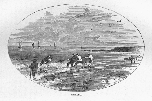
FISHING.
Breadstuffs, tea, sugar, tobacco, woodware, &c., are largely imported from the United States. The value of imports from the United States to the port of Halifax alone, in 1861, was $1,736,879, and of those from Great Britain to the same port in that year, was $2,222,266; from the British North American provinces, $760,800; the West Indies, $107,443; from all other countries, $678,571. Every one of the outports import largely from the United States; Yarmouth imported goods to the value of $224,967 in 1861 from the United States, while the value of all her imports was but $323,597. The "Reciprocity Treaty" has given a very favorable impetus to our commerce with the United States. All unmanufactured articles, the growth and produce of Nova Scotia, may, by virtue of that treaty, be exported free of duty to the United States.
The following statement will exhibit the value of the imports and exports of Nova Scotia from 1852 to 1861:
| Imports. | Exports. | |
| 1852, | $5,970,877 | $4,853,903 |
| 1853, | 7,085,431 | 5,393,538 |
| 1854, | 8,955,410 | 3,696,525 |
| 1855, | 9,413,515 | 4,820,654 |
| 1856, | 9,349,160 | 6,864,790 |
| 1857, | 9,680,880 | 6,967,830 |
| 1858, | 8,075,590 | 6,321,490 |
| 1859, | 8,100,955 | 6,889,130 |
| 1860, | 8,511,549 | 6,619,534 |
| 1861, | 7,613,227 | 5,774,334 |
The value of ships exported is not included in the above. In 1860 that article amounted to 8,842 tons, valued at $295,054.
| Vessels. | Tons. | Men. | |
| Great Britain | 194 | 97,538 | 5,111 |
| British West Indies | 259 | 31,436 | 1,916 |
| British North America | 2,681 | 227,596 | 14,451 |
| United States | 2,851 | 303,638 | 18,225 |
| Other countries | 338 | 36,555 | 2,101 |
| Total. | 6,323 | 696,763 | 41,804 |
| Vessels. | Tons. | Men. | |
| Great Britain | 152 | 68,289 | 4,262 |
| British West Indies | 476 | 52,890 | 4,541 |
| British North America | 2,655 | 239,036 | 14,995 |
| United States | 2,509 | 306,333 | 15,836 |
| Other countries | 297 | 29,034 | 1,886 |
| Total | 6,089 | 695,582 | 41,520 |
In shipping Nova Scotia takes a high rank, in proportion to her extent and population. It was shown, in an official report from the governor of the province to the colonial secretary, in 1853, that Nova Scotia then owned one-third as much tonnage as France—that she surpassed the Austrian empire by 2,400 vessels, and by 69,000 tons; that she owned 116,000 tons of shipping more than Belgium—38,449 tons more than the Kingdom of the Two Sicilies—90,783 more than Prussia. Holland, which once contested the supremacy of the sea with Great Britain, owned at that date (1853) but 72,640 tons of shipping more than Nova Scotia; Sweden, with a population of three millions, surpasses Nova Scotia in shipping by only 36,927 tons. At the same date, only six of the United States of America exceeded Nova Scotia in tonnage, viz.: Maine, Massachusetts, New York, Pennsylvania, Maryland, and Louisiana.
In 1846, the tonnage of all the British North American colonies was 252,832 tons. That of Nova Scotia alone was 141,093 tons—something considerably over the half. In 1853, the tonnage of Nova Scotia had increased to 189,083 tons. It is now (1861) 248,061 tons. The number of vessels is 3,258; estimated value, $6,487,490.
Ship-Building.—Great facilities for ship-building exist in Nova Scotia, and it has attracted the capital and industry of many of the inhabitants, from the earliest settlement of the country. Correct statistics, showing the extent to which this branch of industry was carried on in earlier years, are not attainable. The greater number of vessels built in the province are comparatively small, and adapted to the coasting trade, and trade with the United States. Many are built, however, at Pugwash, New Glasgow, Pictou, Sydney, C. B., Shelburne, Windsor, and other places, of a superior description, and ranging from 300 to 1,200 tons; and they command a ready market in England and elsewhere abroad.
The following statement will exhibit the extent to which ship-building has been prosecuted, from 1853 to 1861:
| Year. | No. of Vessels. | Tonnage. | Value. |
| 1853, | 203 | 31,376 | $1,557,090 |
| 1854, | 244 | 52,814 | 2,546,595 |
| 1855, | 236 | 40,469 | 2,240,710 |
| 1856, | 208 | 39,582 | 1,852,540 |
| 1857, | ... | ... | ... |
| 1858, | 151 | 16,366 | 757,900 |
| 1859, | ... | ... | ... |
| 1860, | 233 | 20,684 | 852,831 |
| 1861, | 216 | 23,634 | 972,448 |
Lumbering.—This department of industry is not prosecuted to the same extent that it had been some years ago, in Nova Scotia; still, however, the products of the forest form an important part of our exports. Deals, boards, scantlings, spars, knees, and other ship-timber; hoops, staves, laths, shingles, and cord-wood, are all comprised under this head.
There are in Nova Scotia 1,401 saw-mills; 130 shingle mills; 6 lath mills. In 1860, the saw-mills turned out 25,072 M. feet deals; 46,607 M. feet pine boards; 36,422 M. feet spruce and hemlock boards. The return of staves for the same year is 7,659 M. Timber, 22,592 tons.
The county of Queens takes the lead in this branch of industry. It saws more than one-half the pine boards that are sawed in the province. Lunenburg comes next, and then Digby. Pictou ranks fourth; it exceeds all the other counties in hewed timber. Halifax exceeds the others in staves; and Cumberland in the quantity of deals.
In the census of 1861; only 507 give themselves as lumberers. Many others, no doubt, devote part of their time to lumbering, while they are given in the census as farmers, or carpenters, or laborers.
Manufacturing.—The manufacturing industry of Nova Scotia is but in its infancy. We are still dependent on Great Britain and the United States, to a very large extent, in this department, as has already been indicated under the head of "Commerce." The position and inexhaustible natural resources of Nova Scotia, however, warrant the expectation that in the course of some years, as her population increases, and these resources become developed by the application of skill and industry and enterprise and capital, she will occupy the first position amongst all her neighbors as a manufacturing country. If she comes short of this, it will be through lack of energy and enterprise on the part of her sons. The number of saw-mills, shingle-mills, and lath-mills, has been already given under the head of "Lumbering." This class of industry is usually placed under the head of Manufactures. In 1851, there were in Nova Scotia 398 grist-mills; in 1861, 414. Hand looms, in 1851, 11,096; in 1861, 13,230. Cloth fulled in 1851, 119,068 yards; in 1861, 281,709 yards. Cloth not fulled, in 1851, 790,104 yards; in 1861, 1,039,214 yards. Malt liquor manufactured in 1851, 71,076 gallons; in 1861, 109,867 gallons. The value of leather manufactured in 1851 was $210,500; of the same article manufactured in 1861, $240,386. There is not much room for comparison with former years in this department of our provincial industry; its history is simply from nihil up to something. That something, however, is hopeful. In addition to what has been already enumerated, we can add the following: 77 carding mills, with 116 employés—value of mills, $39,440; 3 soap and candle factories, value, $7,000; 4 block factories, $1,650; 3 axe factories, $3,130; 2 rake factories, $1,400; 3 chair factories, $4,400; 3 cloth factories, $14,800; 1 paper mill, $1,000; 1 tobacco factory, $800; 2 nail factories, $6,000; 11 iron foundries, $114,600; 10 carriage factories, $19,940; 44 tanneries, $74,600; 3 cabinet factories, $7,100; 1 brush factory, $1,200; 1 gas factory, $180,000; 1 trunk factory, $300; 5 breweries, $46,000; 2 joiners' factories, $14,400; 2 brick factories, $8,200; 15 fulling mills, $18,800; 8 shoe factories, $4,000; 2 planing factories, $7,000; 1 plaster mill, $400; 1 grind-stone factory, $4,000; 1 coal-oil factory, $1,000; 2 baking factories, $7,000; 1 engine factory, $4,000; 1 pottery, $500; 6 bark-mills, $7,600; 1 pail factory, $100; various kinds of factories, 12; value, $59,000. The number of bricks made in 1861 was 7,659 M.; value, $51,703. The number of grind-stones made, 46,496; value, $44,100. Bushels of lime burnt, 136,848; maple sugar made, 249,549 pounds. By the census of 1861, it appears that 13,516 of our population are employed in manufacturing.
Railways.—The oldest piece of railway in Nova Scotia is in the county of Pictou, between the Albion Mines and "the loading ground." It is about eight miles in length; it is owned by the General Mining Association, and was built upwards of twenty years ago.
The Nova Scotia Railways, built and owned by the province, are of more recent date. They were commenced in April, 1854, and completed in December 15th, 1858. They consist of a trunk line from Halifax to Truro, and a branch line to Windsor. The number of miles completed is 92.75. The distance from Halifax to Truro is about sixty miles, and from "the Junction" to Windsor about thirty-three miles. The Windsor branch brings Halifax into railway communication with the Bay of Fundy; the Eastern line, when extended to Pictou, will open railway communication with the Gulf of St. Lawrence. The line from Truro to Pictou is being located. The distance is forty miles.
The cost to the province of the 92.75 miles already built may be stated as follows:
| Cost of building permanent way, including sidings, stations, and buildings | $3,896,148 | 86 |
| Cost of locomotives | 231,179 | 00 |
| Cost of rolling stock (as cars) | 121,600 | 00 |
| Total | $4,248,927 | 86 |
There are on the lines twenty locomotives, ten first-class cars, eight second-class cars, one hundred and sixty other cars, two snow-ploughs. The road will compare favorably with British railroads, and is superior to the railroads on this continent, with the exception of portions of the Grand Trunk line of Canada. The station-houses are built, however, with a special view to economy. The railway is managed by a commissioner who is a member of the government, and who is responsible for its successful management. There are employed under the commissioner a superintendent of the locomotive department; a superintendent of the traffic department; and a general inspector of upholdence and construction. All these are responsible to the Commissioner for the management of the departments committed to them.
The following table will exhibit the revenue of the Nova Scotia Railroad, for the last three years:
| Year ending Dec. 31, 1859. | Year ending Dec. 31, 1860. | Year ending Dec. 31, 1861. | ||||
| Receipts from all sources | $102,872 | 57 | $116,742 | 89 | $120,917 | 66 |
| Working expenses | 111,274 | 88 | 96,472 | 26 | 94,114 | 88 |
| $8,397 | 31 | $20,270 | 63 | $26,802 | 78 | |
In 1859 the road did not pay working expenses; in 1860, it earned $20,270.63 over and above working expenses; in 1861, $26,802.78 over working expenses, while 1862 promises to be far in advance of 1861. The rate for travel per mile is three cents first class, two cents second class cars; rate of speed twenty miles per hour, including stoppages. Nova Scotia railway stock has reached as high as 108 and 109 in the English market. Parties in England hold our debentures to the amount of $3,500,000, bearing interest at 6 per cent., payable half-yearly, on cost of railways. The largest proportion of this interest must, for some years to come, be paid from the general revenue of the country. The extension of the Trunk line to the New Brunswick frontier, and onwards through that province till it unites with the Grand Trunk line of Canada, will cause this line to be highly remunerative. It is highly probable that in the course of 1863, this great line will be located. This will make Halifax the grand winter terminus for British North America. The distance from Halifax to Rivière du Loup (the present terminus of the Grand Trunk line) is 530 miles; of this sixty miles is already made, that is, from Halifax to Truro, which leaves only 470 miles. This is by the north shore route. By the central route the distance is 478 miles; from which deduct eighty-two miles already completed, and we have to be built only 396 miles. Again, there is the St. John River route, which makes the distance from Halifax to Rivière du Loup 593 miles, of which 237 miles is constructed, and which leaves 355 miles to be made. Each of these routes has its advocates in New Brunswick. It has been agreed at an intercolonial convention to leave the decision of the matter to a commission consisting of two from Canada and one from New Brunswick and Nova Scotia, respectively—provision being made for the appointment of an umpire in case of the commissioners failing to agree in opinion.
Canals.—In the year 1825 the "Shubenacadie Canal" was commenced. It is still unfinished. It is intended by means of this canal so to unite the Dartmouth Lakes and the Shubenacadie River, as to connect the Halifax harbor with the Bay of Fundy. It consists of a series of locks and two inclined planes, one 1,320 feet, the other 500 feet in length, to be worked by machinery. The locks are sixty-seven feet in length, seventeen in breadth, with five feet depth of water. It is very nearly completed.
There is also the "St. Peter's Canal," which is to connect the waters of the Atlantic coast of the Island, with the great Bras d'Or lake. The whole length of this canal is to be only 2,300 feet; its breadth, at water line, fifty feet; and depth of water thirteen feet. It is to have one lock at the St. Peter's Bay termination, and a guard gate at the Bras d'Or. Length of lock, 120 feet; width of gates, twenty-two feet. This canal was commenced in the autumn of 1854. The work has been suspended for some time.
Steamers.—The line of steamers from which Nova Scotia derives the greatest advantage is that of the Cunard Company. These call at Halifax to land and receive passengers and freight, both from Liverpool to Boston, and on the return voyage to Liverpool. The freight by these steamers to Halifax is increasing every year. The finer description of merchandise, which was wont to be conveyed in sailing ships, is now almost without exception brought to Halifax in these steamers. When the great Intercolonial Railway is finished, Halifax will undoubtedly have her weekly line of steamers from England, instead of fortnightly as at present. The Cunard Company have also a line of screw steamers, which ply regularly between Halifax and St. Johns, Newfoundland; and Halifax and Bermuda. The steamers to Newfoundland receive a subsidy from the colonial government. There is a steamer also which plies between Halifax, Yarmouth, and Boston. There is a steamer that makes tri-weekly trips between Windsor and St. John, N. B.; also, between Annapolis Royal and St. John, N. B., and connecting with Boston steamers to that city. There is also a line that connects Pictou with Charlotte Town, Prince Edward Island, Shediac, N. B., and Quebec. There is one also on the Bras d'Or lake, and one that plies between Halifax and the principal gold-fields on the Atlantic coast.
Two little steamboats ply between Pictou town and New Glasgow, and two others between the city of Halifax and the town of Dartmouth. The legislature granted the sum of $7,700, in aid of steamers, packets, &c., in 1860; and $7,240 in 1861.
Roads, Stage Coaches, &c.—The high roads of Nova Scotia are very numerous, and generally they are good. Legislative grants are made yearly to aid in opening new roads, and repairing the great post-roads. The grant for this object in 1850 was $96,800; in 1860 it was $103,855; and in 1861, $100,341 34.
The great roads of the province are:—
From Halifax Westward to Yarmouth, by the Atlantic coast, as follows: Halifax to Lunenburg, seventy miles; thence to Liverpool, thirty-six miles; thence to Shelburne, forty miles; thence to Yarmouth, fifty-six miles,—making in all 202 miles from Halifax to Yarmouth. A tri-weekly stage-coach runs this line. Another line of highway is from Halifax to Yarmouth via Windsor, Kentville, Annapolis Royal, Digby, and Clare. The distance from Halifax to Yarmouth by this route is 214 miles. A stage-coach runs this line three times a week. Eastward from Halifax we travel sixty miles to Truro by railway; from Truro to Amherst (within three miles of the New Brunswick line) the distance is sixty miles; from Truro to Pictou the distance is forty miles. An excellent line of stage-coaches run this road daily. From Pictou to Antigonish, fifty miles; thence to the Strait of Canseau Ferry, thirty-three miles. Total from Halifax to Canseau, 188 miles. On Cape Breton side, from Plaister Cove at Canseau, to Sydney town via South of Bras d'Or, seventy-six miles; from Sydney via Sydney mines to Margaree, sixty-four miles; from Plaister Cove to Port Hood, thirty miles; thence to Margaree, forty miles. Another great road runs from Halifax through Musquodoboit via Guysborough to the Strait of Canseau. Another from Halifax to Tangier, Sheet Harbor, &c., by the Atlantic coast. Another important road runs from Pictou via River John, Tatamagouche, Pugwash, &c., to Amherst. The cross-roads and by-roads are too numerous to mention. All those mentioned are run either by daily, tri-weekly, bi-weekly, or weekly stage-coaches.
Postal Communication, &c.—Nova Scotia has regular mail from Great Britain only once a fortnight; with the United States we have weekly, and sometimes bi-weekly postal communication; with Newfoundland, in summer we have fortnightly communication, in winter, monthly; with Prince Edward Island, bi-weekly in summer, or during seven months, and weekly, and sometimes only monthly, in mid-winter; with New Brunswick, bi-weekly and weekly.
The number of offices under the control of the postmaster-general, in 1860, was, 1 general post-office, Halifax, 72 central offices, and 344 branch or way offices. In 1861, the number of way offices increased to 380. The number of newspapers posted at, and delivered at Halifax office during the year 1860, was 2,080,520; in 1861, 2,358,824—showing an increase of 278,304. The number of letters of all kinds sent, received, and delivered in 1,860, was 534,922; in 1861, 705,696—increase, 170,774. The number of parcels received and sent from Halifax and county post-offices in 1860, was 627; in 1861, 717—increase, 90. The amount of money paid through the money-order department of the post-office during the last year, was $67,081.90. This department has been in existence only two years, in this province. The net income for 1861, was $47,115.76. The total expenditure for the same period, $69,444.35½.
In 1860, the length of mail route in existence in the province was 4,115¼ miles; and the actual distance travelled, 751,346 miles. In 1861, the length of route, 4,151¾ miles; distance travelled, 809,032 miles.
There are 289 mail contracts made by the postmaster-general, at an annual cost of $38,604.60.
There is a uniform rate of postage—five cents for letters weighing half an ounce—now established between all the British North American provinces, with the exception of Newfoundland.
Electric Telegraphs.—The province of Nova Scotia contains 1,500 miles of telegraph line, and three sections of submarine cable, viz.:
| Across | Pugwash Harbor | ½ | mile. |
| " | Strait of Canseau | 1½ | " |
| " | Lenox passage (between C. B. and the Isle of Madone) | 1 | " |
| Total | 3 | miles |
The lines in the province are owned by the "Nova Scotia Electric Telegraph Company."
It has fifty telegraph offices; fifty-six telegraphists; thirty linesmen, and a large number of messenger boys. All officers of the company are sworn to secrecy. The rates of tolls for messages of ten words are as follows:
| Over any distance under 80 miles | 12½ cents. |
| Over 80 miles and under 160 miles | 25 cents. |
| Over 160 miles and under 240 miles | 37½ cents. |
| Over 240 miles and under 320 miles | 50 cents. |
| Over 320 miles and under 400 miles | 62½ cents. |
| All distances over 400 miles | 75 cents. |
In proportion to extent and population, the province of Nova Scotia has a greater extent of telegraph wire, a greater number of offices, and the tariff is lower, than in any other country in the world.
The first line in Nova Scotia was erected from Halifax to the frontier of New Brunswick, by the provincial government, in 1848. Another line was built by a local company, between Truro and Pictou, in 1849. In 1851, the legislature chartered the "Nova Scotia Electric Telegraph Company." This company purchased the government line from Halifax to New Brunswick, as well as the one from Truro to Pictou; and they constructed nearly all the existing lines between that date and 1856. In 1860, all the lines of the company were leased for fifty years to the "American Telegraph Company"—a wealthy organization, which controls a great proportion of the telegraphs on the American continent.
Crown Lands.—Only a little over the half of the area of Nova Scotia has been granted, or alienated from the crown. The price charged for crown lands in Nova Scotia is about forty cents per acre. The following statement will show the quantity of granted and ungranted land in the province:
| Quantity already granted. | Remaining ungranted. | Estimated as available for settlement. | Lands open for settlements. | |
| Acres. | Acres. | Acres. | Acres. | |
| Nova Scotia proper | 4,935,349½ | 4,112,384½ | 556,664½ | 3,412,384¼ |
| Cape Breton | 813,543¾ | 1,207,438¼ | 356,676¼ | 777,438½ |
| Total | 5,748,893 | 5,319,822¾ | 913,340¾ | 4,189,822¾ |
The gross proceeds of crown lands sold during 1860, was $20,846.28. In 1861, $16,598.73.
Revenue and Expenditure.—The year 1861 shows a decrease in the revenue of Nova Scotia. This is owing, undoubtedly, to the American war. Nova Scotia has suffered probably more from this war than any of the British North American colonies.
Free trade is the policy of Nova Scotia. It has no protection duties. Its ad valorem duties are lower than those of any neighboring countries.
The following statement will exhibit the gradual growth of our provincial revenue:
| Years. | Revenue. | Years. | Expenditures. |
| 1806, | $82,309 50 | 1766, | $19,464 00 |
| 1825, | 196,455 65 | 1800, | 22,160 00 |
| 1836, | 185,864 00 | 1810, | 40,660 00 |
| 1846, | 331,104 00 | 1815, | 52,860 00 |
| 1851, | 433,120 00 | 1851, | 423,742 00 |
| 1852, | 485,582 00 | 1852, | 482,895 00 |
| 1853, | 510,192 00 | 1853, | 458,712 00 |
| 1854, | 752,642 00 | 1854, | 776,802 00 |
| 1855, | 833,069 00 | 1855, | 783,052 00 |
| 1856, | 691,015 00 | 1856, | 696,397 00 |
| 1857, | 726,666 00 | 1857, | 793,809 00 |
| 1858, | 716,025 00 | 1858, | 737,108 00 |
| 1859, | 698,938 00 | 1859, | 690,595 00 |
| 1860, | 870,055 00 | 1860, | 852,133 00 |
This revenue is derived from import, excise, and light duties, from the crown lands, the mines, the provincial railway, and the post-office department. The expenditure is for the payment of all public officers, the interest of the public debt, grants for roads and bridges, education, agriculture, subsidies for steamers, mail packets, and ferries, militia, &c.
The estimated expenditure for 1861 was $870,771.
Public Debt, Currency, &c.—The public debt has been mainly incurred in constructing the provincial railways. It is almost wholly represented by works of great public utility. At the close of the year 1860, the whole liability of the province was $4,901,305 42, viz:
| Provincial Bonds | $4,000,000 | 00 |
| Provincial Notes | 447,458 | 00 |
| Savings Bank | 453,847 | 42 |
| Total | $4,901,305 | 42 |
The first provincial currency was eighteen shillings sterling to the pound currency, or £100=£90. The next change made the English shilling equal to one shilling and three-pence sterling, or sixteen English shillings equal to £1 currency.
In common with New Brunswick and Canada, Nova Scotia has recently adopted the decimal mode of computation. Dollars and cents have taken the place of pounds, shillings, and pence, with us. In Nova Scotia, the British shilling is twenty-five cents—the British Florin fifty cents—the British crown $1 25—and the British gold sovereign or pound, $5.
The treasury issues £1 Nova Scotia currency, or $4 and $5 notes. The banks issue £5 or $20 notes and upwards; but they are not permitted to issue notes of a less sum than $20. The par of Exchange on England is 12½ per cent.
The oldest bank in the province is the "Halifax Banking Company," besides which, there are the "Bank of Nova Scotia," the "Bank of British North America," and the "Union Bank." There has never yet occurred an instance of a Nova Scotia bank having suspended payment. The new premises of the Union Bank, when completed, will be the finest building in Halifax.
The history of the progress of education in Nova Scotia does not much differ from that of its progress in the neighboring states and provinces. Its progress has been in the face of many and formidable difficulties. The early settlers had to conquer the forest, build houses, make roads, and struggle hard to keep want and grim poverty out of their humble dwellings. They could neither afford to build school-houses nor pay schoolmasters—if they could be had. They had to teach their children at their own firesides, after the toils of the day were ended, without the aid of many books, and often when they could not afford the luxury of lamp or candle to read by. Two of the most distinguished statesmen and orators Nova Scotia ever reared, were thus taught to read. On more than one occasion we have heard one of them relate, for the encouragement of the young of his native city, how on the long winter evenings, at his father's knee, he studied history and literature with no other light than that furnished by the good old-fashioned fireplace. In the year 1787, there was not a single school or school-house in what is now the populous and highly educated county of Pictou. Now there are 116 school-houses in that county, and as many schools, many of which are of a high order. Seventy years ago there were not thirty school-houses in all Nova Scotia, and the majority of those were but log-houses of the humblest description. Now there are upwards of twelve hundred school-houses, many of which are elegant, commodious, and well furnished structures. Thirty years ago the legislative grant for the support of education was only $16,000. In 1861 it was $66,749.02, while that contributed by voluntary subscription was nearly three times that amount.
Sixty and even forty years ago, an old soldier, who could read, write, and "cipher as far as the rule of three"—a broken-down merchant, or an accountant, whose habits had become so unsteady that he could no longer serve with efficiency in the counting-house, would be hired as a schoolmaster. Now it is only the graduates of our provincial normal college for the training of teachers, that can command any of our best common schools. It is not half a century since the "New England Primer," "Dilworth," "The Collection," "Tutor's Assistant," the ferule and the birch, were accounted the orthodox and all-potent instrumentalities for teaching "the young idea how to shoot," and for restraining and correcting it, should it venture "to shoot" on its own account in any forbidden direction. At present our schools are supplied with the latest and best British and American text-books, and corporal punishment, in the best of them, is resorted to but very seldom, and that in extreme cases.
Common Schools.—The province of Nova Scotia, including Cape Breton, is divided into thirty-three school districts, each having a distinct board of school commissioners, whose duty it is to examine and license teachers, determine what shall be the number and what the boundaries of the schools, and distribute the government allowance among the several schools entitled to participate in it. There are 1,227 school-houses in the province, and 1,175 schools were in operation in 1857 (the only educational census taken); 685 of this number were taught by male teachers, 520 by females. About one to every seven of the population is attending school:—a small proportion when compared with some of the New England and Middle States, where the proportion is one to four, and in three of the States, Maine, New Hampshire, and New York, it is one to three. There are school libraries under the direction of every board; 6,844 vols. were in circulation in 1857. The number of text-books reported was 6,360; wall maps, 2,521; blackboards, 640; globes, 56.
Amount contributed for common-school education by voluntary contributions, $128,222.22; by the government, $53,519.25. Maximum salary of common-school teachers, $600; average salary, $180; average cost of each pupil per annum, $2.53. The best common schools are in Pictou, Colchester, and Kings.
Grammar Schools.—There were forty-four grammar schools in the province, by the late educational census. The winter attendance was 1,476, and the summer, 1,738. The number studying the classics and mathematics was 1,074. The support from the people, $9,814.09; from government, $3,274.95. Latin, French, mathematics, including algebra and agricultural chemistry, are taught in the grammar schools, in addition to the branches taught usually in the common schools.
Academies.—There are six academies at present in Nova Scotia, inclusive of Sackville Academy, N. B. All of them, with the exception of Pictou Academy, are under the control of some one religious denomination.
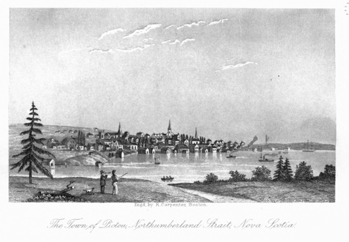
The Town of Pictou, Northumberland Strait, Nova Scotia.
The Windsor Academy, or Collegiate School, which is the oldest, is under the direction of the Episcopalians. It has three teachers. The Pictou Academy comes next in point of age, and first, perhaps, in point of fame. It was started at the early part of this century, under the direction of the distinguished Dr. McCulloch, and gave a powerful impetus to the cause of a thorough and sound education in the province. For many years it was under the control of the Presbyterian Church of Nova Scotia. At present it has but two teachers, and is only a high school for the town of Pictou.
The Horton Academy, at Wolfville, comes next in point of age. It is under the control of the Baptists. It has a principal and two assistants.
The Sackville Academy is under the control of the Wesleyan Methodist body, and is equally patronized and supported by the provinces of Nova Scotia and New Brunswick. It has male and female departments. The male department has seven teachers; the female department, nine teachers.
The Presbyterian Academy, in Halifax, was started in 1847, in connection with the Free Church. It has four teachers.
The Arichat Academy, in the Isle of Madame, C. B., is in connection with the Roman Catholics. It has three teachers.
The Sackville Academy stands, for the Wesleyan Methodist body, instead of a college, theological hall, and preparatory high school. All the other academies enumerated are but preparatory high schools.
Colleges.—There are six institutions in the province of Nova Scotia that go by the name of colleges. The oldest and best endowed of these is King's College, at Windsor. It was commenced in 1788-9. From that date till about twelve years ago it had annually received from the provincial government a grant of $1,777.66. At present the annual grant is $1,000. It has five professors. It is under the control of the Episcopal Church. It was chartered in 1802, by George III., and has the Archbishop of Canterbury for its patron.
Acadia College is in Wolfville, in Kings county. It is under the control of the Baptist denomination. It has four professors—one theological, and three for all the other branches taught. $1,000 of provincial aid, that was formerly given to this college, is now given annually to the academy in the same place and connection.
The Presbyterians have two colleges at present,—a theological college in Halifax, with three professors; a literary and classical college at Truro, with three professors and one tutor. These institutions are endowed, by the liberality of the body with which they are connected, to the amount of $56,000. Arrangements are in progress by which the two may be consolidated.
Goreham College, in Liverpool, Queens county, was set up by the liberality of the late Mr. Goreham of that place, in connection with the orthodox Congregational body. The buildings were destroyed by fire a few years since, and have not been rebuilt.
St. Mary's College is a theological school, in the Roman Catholic connection. The number of professors, &c., is not made known to the general public. It receives $1,000 annually from the provincial government. It is situated in Halifax.
St. Francis Xavier's College is in the town of Antigonish, in the county of Sydney. It has five professors; three theological, and two for other departments. It is under the control of the Roman Catholic body, and receives $1,000 from the government annually.
Dalhousie College is in the city of Halifax. It is a handsome edifice, built of freestone. It was built under the direction, and mainly through the influence, of the Earl of Dalhousie, when he was governor of the province; he procured $39,000 out of the Castine fund for its permanent endowment, and induced the legislature to grant $12,000 towards the erection of the building. It was incorporated in 1820, and was to be conducted on the model of the University of Edinburgh. Several attempts have been made to set it into operation, but hitherto without much success; the main hindrance being the existence of so many denominational institutions under the name of colleges. In the mean time the capital endowment fund has been so well managed by the governors of the college, that from $39,000 it has increased to about $60,000. There is the prospect at present of the Presbyterians and Congregationalists, and perhaps one or two other denominations, combining their several secular colleges with this institution, and thus out of the whole forming one grand provincial university—each denomination to maintain its own theological institute, and the provincial grants that were wont to be given to these, to be given to the university.
The province has no medical or law school or college, nor a single professorship devoted to these branches in any of the existing colleges. This clamant want will be supplied in that university that is to be.
Normal College and Model Schools.—These are situated in the town of Truro, Colchester county, and are, as near as may be, in the centre of the province. They are provincial institutions. The act for the establishment of the Normal College passed the legislature in 1854; and the Rev. Alexander Forrester, D. D., was appointed principal of the institution, and superintendent of education, by the governor in council, in the spring of 1855; and opened the Normal College in November of the same year. The Model Schools were opened in June, 1857. There are five teachers in the Normal College, and six in the Model Schools. There is a model farm attached to these, which is worked under the direction of the principal. The annual cost of these institutions, and of the whole educational supervision of the province, is only $4,680. The Normal College has already trained about 500 teachers, of whom 230 have taken grammar-school and first-class certificates.
The establishment of these institutions has been an important era in the history of education in Nova Scotia. They have been a very decided success. The natural or training system is that pursued. The mechanical, explanatory, and objective systems are made use of only in so far as they enter into the full working out of the one selected. The Model School is conducted on the most approved graded method, having three departments, primary, intermediate, and high-school, each with its own regular teacher. Vocal music and physical exercise are very happily intermingled with the severer business of the school. There is a very great improvement in the furniture of school-rooms throughout the whole province since the establishment of the Model Schools; also in the quality of the education imparted to the young. Adequate support is the great want of our common and grammar schools, at present. The public mind is steadily setting in for a system of general assessment of property and income for the support of schools; the present method—voluntary subscriptions—being found in many sections of the country very inefficient. This appears from the startling disclosures of the late census (1861). It appears from the census, that while in some districts every man, woman, and child who is able to speak can read, and nearly all can write; yet that when the province is taken as a whole, there are, between the ages of five and fifteen years, 36,430 who cannot read, and 45,012 who cannot write; while there are, over the age of fifteen years, 49,430 who cannot read, and 65,444 who cannot write; making in all, 85,860 illiterate persons in the province. This is a state of matters which no patriotic Christian mind can contemplate without the deepest concern for the future of the country. It may be proper to state that a few thousands may be deducted from one of the above items, when it is borne in mind that children in the rural districts of Nova Scotia, generally, do not attend school or learn to read and write till they are seven and often eight years of age.
Institution for Deaf and Dumb.—This institution is but in its infancy. It was established in 1858, under the present highly efficient superintendence. It has very commodious premises, in a very healthy and sightly position in the city of Halifax. It derives its support from three sources: the contributions of the benevolent—fees from the pupils, when the parents are not poor, and legislative grants from the provinces of Nova Scotia and New Brunswick. The whole income of this institution for 1861 was $3,691.85. $2,000 of this sum was from the legislature of Nova Scotia, and $80 from that of New Brunswick. The attendance for the year 1861 was forty-four pupils, thirty of whom were males and fourteen females: eight of this number were from New Brunswick, the remaining thirty-six from Nova Scotia. The system of instruction is emphatically the natural system. The pupils are taught reading, writing, English composition, arithmetic, geography, history, and the principles of Christianity, as taught in the Bible, with remarkable success. There is also an industrial department in this school, both for boys and girls, where no small amount of work is very skilfully and cheerfully performed. The institution is managed by five directors, a secretary, treasurer, principal, and assistant teachers; a matron, physician, dentist, and a committee of eleven ladies. The Right Hon. the Earl of Mulgrave is patron, and lady Mulgrave patroness of the institution. The Rev. Mr. Cochran, the secretary, was mainly instrumental in starting this school. Its present high state of efficiency is owing to the indefatigable labors of the principal, J. Scott Hutton, Esq.
Nova Scotia does not want for religious denominations or places of worship. There are 22 denominations and 831 places of worship. This gives a church for every 400 of the population. It is true that many of the buildings, called churches, are not such as to accommodate 400, but many others again are buildings that can comfortably seat 500, 800, 1,000, and in some cases 2,000.
All religious denominations are considered equal in the eye of the law; in other words, there is no church or religious sect established by civil enactment in Nova Scotia, or in any of the lower provinces of British America.
The Episcopal Church.—This denomination was at one time established by law in Nova Scotia. The law which gave it the supremacy in matters of religion has been repealed, and it is now on the same level with the other churches. It has 47,744 adherents in Nova Scotia and Cape Breton. It has 139 places of worship, and 64 clergymen. The Episcopal bishop of Nova Scotia exercises jurisdiction over the Episcopal church in Prince Edward Island. This denomination has hitherto derived much of its support from the liberality of the Society for Propagating Religion in Foreign Parts. There is at present a very creditable movement among the laity of the body, to raise an endowment fund for the permanent support of religion in that connection.
The Presbyterian Church.—Under this may be included three different bodies, viz.: the Presbyterian church, which has 69,456 adherents, 144 places of worship, and 88 ordained clergymen; the Church of Scotland in Nova Scotia, which has 19,063 adherents, 25 places of worship, and 20 ordained clergymen; and the Reformed Presbyterian Church, which has (by late census) 236 adherents (ought at least to be double that number), 8 places of worship, and 5 ordained clergymen.
The Roman Catholic Church.—In the number of adherents this body ranks next to the Presbyterians. The number is 86,281; places of worship, 121; clergy, 42. It is under the control of the Archbishop of Halifax. It has two diocesan bishops, that of Halifax and Arichat. It owns some of the finest church buildings in the province.
The Baptist Church.—The Associated Baptists have 55,336 adherents, 182 places of worship, and 83 clergymen. Other Baptists have 7,605 adherents, 34 places of worship, and 15 clergymen.
The Wesleyan Methodist Church.—This body is under the superintendence of the Eastern British North American Affiliated Conference. It is a branch of the British Conference, and includes under its supervision the whole of the lower provinces, as well as Bermuda. The president is nominated by the colonial body. Its adherents in Nova Scotia are 34,055; places of worship, 136; clergy, 54.
The Congregational Church.—This body has 2,183 adherents, 11 places of worship, and 10 clergymen.
The Lutheran Church has 4,382 adherents, 4 places of worship, and 3 clergymen.
The Universalists have 846 adherents, 2 places of worship, and 1 clergyman.
There are 158 Quakers; 112 Bible Christians; 27 Mormons; 13 Swedenborgians; 143 Morisonians, or E. U.; 46 Sandemanians; 32 Campbellites; and 3 Deists.
The British and Foreign Bible Society has a branch in Nova Scotia. Its headquarters are in Halifax, but it has numerous auxiliary branches throughout the province.
There are five Young Men's Christian Associations in the province. The one in Halifax has an excellent library and reading-room, and has a course of twelve lectures, of a very high order, during the winter months. There is a mission to the Mic Mac Indians of the lower provinces, which is supported by all evangelical denominations in common. The New Testament has been translated into the Mic Mac, through its means. The Presbyterians maintain 4 missionaries in the South Sea Islands. The Baptists at one time maintained a missionary in Hindustan; but their agent having fallen a victim to the climate, the mission has been abandoned by them. No other denomination has as yet engaged in foreign missionary enterprise.
In Pictou and Colchester counties, the Presbyterians greatly predominate. In the western counties, especially Kings and Annapolis, the Baptists and Wesleyans prevail. In the Island of Cape Breton, the Presbyterians and Roman Catholics are about in equal numbers. In Halifax, the Episcopalians and Roman Catholics prevail; in Hants, the Episcopalians and Presbyterians; in Cumberland, the Wesleyans; in Lunenburg, the Lutherans. Controversy between religious bodies has been at discount, for some years past. Christian benevolence and denominational courtesy are manifestly on the increase.
It is both interesting and instructive to trace the political progress of Nova Scotia, for the last one hundred and fifty years. From absolute despotism it has passed, during that interval, into constitutional government,—the freest, the most equitable, and, withal, the least costly in the civilized world. From the first settlement of the province till the year 1719, its government was vested solely in the governor, and, in his absence, in the lieutenant-governor or commander-in-chief. The seat of government was at Annapolis Royal. In 1719, Governor Phillips received instructions from the crown to choose a council of twelve, who should advise with him in regulating the affairs of the province; he was further directed to regulate himself by the instructions of the governor of Virginia in cases of emergency, and until a legislative assembly should be formed. The names of the first council of Nova Scotia are: John Doncett, Lawrence Armstrong, Paul Mascarine, Cyprian Southack, John Harrison, Arthur Savage, John Adams, Hibbert Newton, William Skeen, William Sheriff, Peter Boudrie, and Gideon Phillips. They were all officers of the garrison or public departments, with the exception of Mr. John Adams. From 1719 till 1749, the governor with this council—both appointed by the crown—combined at once the legislative, judicial, and executive functions of civil government. They had absolute power in all cases, except in so far as they were restrained by the general principles of English law. In 1749, on the arrival of Governor Cornwallis, the seat of government was removed to the newly formed town of Halifax. He had instructions to erect commission courts of justice. He erected three courts. The first was a Court of Sessions. The second was a County Court, invested with powers similar to the Court of King's Bench, Common Pleas, and Exchequer, in England. The third was a Court of Assize and General Jail Delivery, in which the governor and the council for the time being sat as judges. In 1752 the County Court was abolished, and the Court of Common Pleas erected in its place. The General Court of Assize was abolished in 1754, and the Supreme Court established in its place. Jonathan Belcher, Esq., was appointed chief justice of this court the same year.
In the month of May, 1758, Governor Lawrence laid before his council his majesty's instructions for the election of the first representative assembly for Nova Scotia. It was then resolved, by the governor in council, "That a house of representatives of the inhabitants thereof, in conjunction with his majesty's governor, or commander-in-chief for the time being, and his majesty's council for the said province, be the civil legislature thereof." There were sixteen members "elected for the province at large." Any elector voting for one of these sixteen members was compelled to vote for the other fifteen. There were two elected for the township of Lunenburg, and four for the township of Halifax. The whole assembly consisted of twenty-two members: eleven, besides the speaker, constituted a quorum. The first meeting of the first representative assembly of Nova Scotia was on the second day of October, 1758. Robert Sanderson, Esq., was chosen speaker of this first assembly.
In 1761 a new assembly was elected, consisting of twenty-four members. The province was then divided into four counties—Halifax, Lunenburg, Annapolis, and Kings—each returning two members; and into seven townships—Halifax, Lunenburg, Annapolis, Horton, Cornwallis, Falmouth, Liverpool—each sending two members, with the exception of Halifax, which sent four.
The Present Constitution of the Province.—The province had not a legislative council distinct from the executive council till the year 1838. Hitherto the council deliberated with closed doors. From this date the legislative council sat with doors open to the public. In 1841 "responsible government" was inaugurated in Nova Scotia. It was not fully established, however, till the parliamentary session of 1847-8. The departmental system was then fully acted upon for the first time.
The highest authority is vested in the Lieutenant-Governor, who acts as the representative of royalty. He is styled lieutenant-governor, as being nominally subordinate to the governor-general of British North America. The governor is surrounded by an executive council of nine persons, appointed by the crown from the legislative council and house of representatives; these are his sworn advisers, in the exercise of his legislative and administrative duties. They are responsible to the people for the acts of his administration. That is one of the peculiarities of responsible government. Five of the members of the executive council, in accordance with the existing constitution, are heads of departments: the attorney-general, solicitor-general, provincial secretary, financial secretary, and receiver-general.
The Legislative Council is appointed by the crown. It consists of twenty-one members. They choose their own president, subject to the approval of the crown. They are to us instead of peers. They hold their seats for life, if they do not become insolvent. They are magistrates within the province.
The House of Representatives consists of fifty-five members, who are elected once in four years. They represent eighteen counties. Some counties are subdivided into districts; others have townships. Universal suffrage is the law of Nova Scotia, subject to the following restrictions: The elector must be twenty-one years of age; must be native-born, or a naturalized subject of Great Britain. He must be a resident one year in the county, district, or township in which he votes. The members of this house must have a property qualification, and must take the oath of allegiance before they take their seats. The members of both houses are paid $4 per diem each, with travelling expenses during the sitting of Parliament.
The salaries of the officers on the civil list, authorized by law, amount to $52,365. This is inclusive of $6,415 of pensions paid to retired officials. There is usually voted yearly, in addition to the above, $29,680 for clerks and contingencies.
Laws and Courts of Justice.—The laws and forms of judicial procedure of Nova Scotia are founded on those of England, while the common law of England is the law of Nova Scotia, where the case is not otherwise provided for by special provincial enactment. The body of local enactments has been recently revised and consolidated under the supervision of the provincial government. The work is known by the name of "Revised Statutes." The punishment of death is limited by the law of Nova Scotia to the crimes of treason and murder.
Justice's Court.—This is the lowest order of courts for the trial of civil causes. There are 1,412 justices of the peace in Nova Scotia. Each magistrate has jurisdiction throughout the whole county in which he resides. They can adjudicate in civil causes to the amount of forty dollars. In criminal matters their powers are very similar to that of the same class of officers in England. They can fine and commit to the county jail for petty offences, and bind over to keep the peace, or appear for trial at the Supreme Court, for graver offences. They usually issue warrants for the appearance of offenders against the peace.
General Sessions of the peace are held annually in each county, and in some counties twice in the year. These are composed of justices of the peace and other officials, for the transaction of county business. They are presided over by the Custos Rotulorum of each county.
The Court of Probate is a county court, which has the custody of all wills, and disposes of the estates of deceased persons. The judge of this court, who is usually a barrister of good standing, practises at the bar, but cannot be a member of Parliament.
The Supreme Court is by far the most important in Nova Scotia. It has civil and criminal jurisdiction in the highest causes. It is the only criminal court in the province. It has original jurisdiction in all civil causes over twenty dollars, and is the court of appeal from the decision of justices' courts. The province is divided into four circuits, and the Supreme Court holds its sitting twice a year in every county of the province for the trial of civil and criminal causes. It sits in Halifax twice in the year as a court of equity, the Court of Chancery, which once existed in Nova Scotia, having been abolished, and its jurisdiction transferred to this court. It is presided over by a chief-justice and four assistant judges. These judges are appointed by the governor in council, and they hold office for life. Their appointment must receive the royal sanction before they can be considered as fixed in office. Their salaries are fixed upon the civil list of the province.
The Court of Marriage and Divorce is composed of the lieutenant-governor, the executive council, one of the judges of the Supreme Court, a register, advocate, and proctor. It has full jurisdiction over all matters relating to marriage and divorce.
The Court of Vice-Admiralty includes Canada and all the lower provinces within its jurisdiction. The governor-general of British North America is the vice-admiral, and Alexander Stewart, C. B., the judge of this court. It has surrogates, procurators, and advocates in all the British provinces. Its bank of admiralty deposits is the Bank of British North America.
The Court of Error consists of the governor and council. Suits where the amount of the judgment is not less than $1,200, may be brought into this court. Cases for the commutation of capital punishment are also brought before the governor in council by petition. The last appeal is to the queen in council. It is the policy of the British government not to interfere with any local matters in the colonies. We are instructed to make what laws we deem proper, and to appoint whom we choose to administer our laws.
Great progress has been made in every section of Nova Scotia, during the last half century, in all that makes life comfortable and agreeable. The little, rude log-house of two, or at best three apartments, has passed away, to make place for the snug white cottage of at least six or seven rooms, besides the kitchen, or the fine stately two-story house with ten, twelve, or more apartments. Barns and outhouses have improved in a corresponding manner. The hand-mills, or "querns," of seventy years ago, have given place to excellent grist-mills, propelled by water-power or steam. Saw-mills, shingle-mills, carding-mills, dyeing-mills, foundries, and factories, have increased proportionately.
Churches and school-houses of an improved style have sprung up in every settlement. Temperance halls and other county and township public buildings are quite numerous in proportion to the population.
There are 53,215 dwelling-houses in Nova Scotia. The city of Halifax contains only 2,635 of the above number. There are 63,293 farms and outhouses. The number of stores and shops is 3,322; of that number the city of Halifax has 422. There are forty-nine temperance halls in the province, valued at $43,340. Nine of the number are in Hants county, and eight in Kings county. There are only two counties without a temperance hall, viz.: Richmond and Victoria. There are ninety-three public county and township buildings, estimated at $984,160.
The vast improvements made in the mode of travelling, and in the mail communication of the province, have been already noticed. Parties are still living who can remember when there was only a weekly mail between Halifax and Pictou, and when that mail was carried by one man, on his back, in a knapsack, making a journey of one hundred miles on foot. Now there is a daily mail to and from Pictou.
Towns and Villages.—The oldest town in Nova Scotia is Annapolis Royal. From the earliest settlement of the country until the city of Halifax was built, this town was the capital of the province. It was the head-quarters of the forces of France and England, as they alternately possessed the country. The conquest of "Port Royal" was, in those times, considered the conquest of the whole province. It is a small town still, and is not remarkable for any thing, except its having been the ancient French and English capital of the province. Yarmouth is an important commercial town, and owns much shipping. Pictou contests the honor of being the second most important town in the province, with Yarmouth. New Glasgow, on the East River of Pictou, has grown up lately into a town of almost the size of Pictou. Sydney and Arichat, in Cape Breton, Windsor, in Hants, Lunenburg, in the county of the same name, and Dartmouth, opposite Halifax, are the remaining towns of the Province. There are besides, however, quite a number of villages and places near seaports, that are fast growing into the magnitude and importance of towns. Among these may be named Baddeck, in Victoria; Port Hood and Maybon, in Inverness; Antigonish, in Sydney; Truro, in Colchester; Amherst and Pugwash, in Cumberland; Canning, and Wolfville, and Kentville, in Kings; Liverpool, in Queens; Bridgetown, in Annapolis; and Digby and Shelburne, in the counties of the same name.
City of Halifax.—This city was founded by Lord Cornwallis in the latter end of June, 1749. It became the seat of the provincial government early in the following year. It has a noble harbor, which we have already described. It is fortified by St. George's Island in the centre of the harbor; by the Citadel, which is on the hill which rises behind the city, to the height of two hundred and fifty feet above the level of the sea; also, by the fortification of York Redoubt, and several masked batteries on both sides of the harbor. The strength of the fortifications of Halifax take rank next after those of Quebec.
The city extends about two miles and a quarter north and south, on the slope of the hill, by the harbor. Its width, at the most, does not exceed three-quarters of a mile. Just one hundred and one years ago the town contained one thousand houses, and about three thousand inhabitants. At that time one-third of the population were Irish, one-fourth German and Dutch, the remainder English, with a very small number of Scotch.
"There were one hundred houses licensed to sell ardent spirits, and as many more houses that sold spirituous liquors without license; so that," to continue the words of Dr. Styles, who records the fact, "the business of one-half the town is to sell rum, and the other half to drink it." About this time the city was divided into Halifax, Irishtown, and Dutchtown—Halifax the centre, Irishtown the south, and Dutchtown the north end. The population in 1861 was 25,026. Some sections of the city are now exceedingly well built. In the centre of the city, particularly on Granville street and Hallis street, wooden buildings have been replaced by brick, granite, and freestone structures, which are not surpassed by any on this continent.
Of public buildings, the "Province Building" is the chief. It is built of brown freestone, one hundred and forty feet in length, seventy in width, and forty-two in height. On its ground flat are apartments for the various provincial offices—provincial secretary's, financial secretary's, receiver-general's, attorney-general's, customs, excise, and crown-land department offices. On the second are the halls and committee-rooms of the two houses of Parliament, and a very spacious and beautiful apartment occupied by the provincial legislative library. The Government House, the Admiralty House, Dalhousie College, the Asylum for the Insane, the Wellington Barracks, the Court House, the Hospital, the Penitentiary, and the City Market are the remaining principal public buildings. The Queen's Dockyard, in the north of the city, is an important public establishment. It was commenced in the year 1758. It is enclosed on the side toward the city by a high stone wall. It contains workshops, warehouses, and stores of various descriptions, besides very commodious buildings for the residence of its officers and workmen.
The city is divided into six wards, and the corporation consists of a mayor and eighteen aldermen. The Mayor's Court is held on the second and fourth Tuesday of every month. The police office is open on every week-day from ten a.m. till three p.m. The fire department is under the control of the city corporation; and also the water supply of the city. The taxable property of the city, in 1861, was $14,400,000.
There are seventeen places of public worship in the city. Three of these belong to the Episcopalians, four to the Presbyterians, three to the Wesleyans, two to the Baptists, two to the Roman Catholics, one to the Congregationalists, one to the Universalists, and one to the Campbellites.
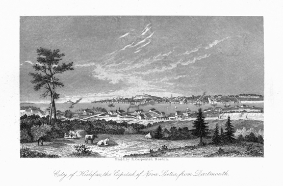
City of Halifax, the Capital of Nova Scotia, from Dartmouth.
There are in the city four commercial banks, and one savings bank, and a building society; the agencies of thirteen British and four American life insurance companies, and of four British and sixteen American fire insurance companies. There are four public libraries in the city, two reading and news rooms, and benevolent societies of various descriptions and nationalities. There are one gas company, five gold-mining companies, and five other joint-stock companies. There are one public museum and one visiting dispensary.
Halifax is important both as a military post and naval station. It is the military head-quarters of all the lower provinces. It is the chief naval station for the whole of British North America and the West Indies. The admiral of the North American station resides at Halifax during the summer months, and in the winter at Bermuda. The commerce of Halifax is considerable. The exports from the port of Halifax, in the year 1860, were $3,902,638. The imports for the same year were $6,431,581.
Literature, &c.—Nova Scotia depends for literature, to a very great extent, on Great Britain and the United States. The quarterly reviews and monthly magazines of those countries are very extensively read in the province. There is no quarterly review published in the province, and the only monthly periodicals at present published are two of a religious character, under the direction of the Presbyterians. Of newspapers, there are twenty-two published in the province at present. In 1828 there were seven. Of these seven, six were in Halifax, and one in Pictou. The first paper started, out of Halifax, was the Pictou Colonial Patriot. The oldest of our existing newspapers is the Acadian Recorder. Of the twenty-two newspapers now published, thirteen are in Halifax, and the remaining nine are published in the following towns in the province: one in Sydney, one in Antigonish (the Casket, partly English and partly Gaelic), two in Pictou, one in Liverpool, two in Yarmouth, one in Digby, and one at Bridgetown. We have no daily newspaper. There are six of the Halifax papers that are published tri-weekly, on alternate days. Some are morning and some are evening papers. Four of the Halifax weeklies are in the interest of religious denominations. There is also a monthly sheet devoted to the cause of total abstinence.
The principal publishing house in Halifax is that of A. & W. Mackinley. The greater part of their publications are school-books.
The principal literary productions of Nova Scotia are those of Judge Haliburton (Sam Slick), John Young, Esq., Principal Dawson (now of McGill College, Montreal), Professor Lyall, and the Rev. George Patterson. Haliburton's History of Nova Scotia is a standard work of over seven hundred and fifty pages octavo. It brings the history of the province down only to the year 1828. The lighter writings of the judge, under the nom de plume of Sam Slick, are very popular, and widely known. The "Letters of Agricola," by John Young, Esq., have been already referred to.
Dr. Dawson's works are chiefly on geology. His Acadian Geology and Archia are widely and very favorably known, both in Europe and America. His Remarks on Agriculture and Husbandry are also very valuable. His attainments in natural science are not second to those of any on this continent, while his style, for simplicity, elegance, terseness, and quiet power, is equalled only by very few living naturalists.
"Intellect, Emotions, and the Moral Nature," has ranked Professor Lyall already with the foremost thinkers and writers of the present day.
"Memoirs of Dr. McGregor," by the Rev. George Patterson, is a work of much interest and well written. The late Dr. MacCulloch was a writer of no ordinary power, and has left behind him some theological works. The Hon. Joseph Howe, the present premier of Nova Scotia, is one of our most beautiful and effective writers. He has produced some political brochures of great power—always written in a fascinating style. No poet of any mark has yet made his appearance in Nova Scotia. There are numerous versifiers among us, but hardly any that has arisen to the dignity of a poet. The nearest approach to poetry has been made by some of our female writers.
The following list of the governors of Nova Scotia is from Haliburton's History, as far as it comes down, and the remaining ones from personal knowledge:
| AT ANNAPOLIS ROYAL. | |
| 1. Colonel Vetch, Governor, October 22, | 1710. |
| 2. Francis Nicholson, Esq. | 1714. |
| 3. Richard Philips, Esq. | 1719. |
| 4. John Doucet, Esq., Senior Councillor, administers government | 1722. |
| 5. Lawrence Armstrong, Esq., Lieutenant-Governor | 1725. |
| 6. John Adams, Esq., Senior Councillor, December 8, | 1739. |
| 7. Paul Mascarene, Esq., Lieutenant-Governor | 1740. |
| AT HALIFAX. | |
| Edward Cornwallis, Governor, July 14 | 1749 |
| Peregrine Thomas Hopson, Governor, Aug. 3 | 1752 |
| Charles Lawrence, Senior Councillor, Nov. 1 | 1753 |
| Charles Lawrence, Lieutenant-Governor, Oct. 21 | 1754 |
| Charles Lawrence, Governor, July 23 | 1756 |
| Jonathan Belcher administers government, Oct. 9 | 1760 |
| Mr. Ellis, late Governor of Georgia, is appointed Governor of Nova Scotia, but never leaves England. | |
| Jonathan Belcher, Lieutenant-Governor, Nov. 21 | 1761 |
| Montague Wilmot, Lieutenant-Governor, Sept. 26 | 1763 |
| Montague Wilmot, Governor, May 31 | 1764 |
| Mr. Green, Senior Councillor, May 23 | 1766 |
| Michael Franklin, Lieut. Governor, Aug. 26 | 1766 |
| Right Hon. Lord Wm. Campbell, Governor, Nov. 27 | 1766 |
| Benjamin Green, Senior Councillor, Oct. 30 | 1771 |
| Michael Franklin, Lieut. Governor, June 30 | 1772 |
| Lord Wm. Campbell resumes government, July 13 | 1772 |
| Francis Legge, Governor, Oct. 8 | 1773 |
| Mariot Arbuthnot, Lieut. Governor, April 27 | 1776 |
| Richard Hughes, Lieutenant Governor, Aug. 17 | 1778 |
| Sir Andrew Snope Hammond, Lieut. Governor, July 31 | 1781 |
| John Parr, Governor, Oct. 9 | 1782 |
| Edward Fanning, Lieut. Governor, Sept. 23 | 1783 |
| Richard Bulkley, Senior Councillor, Nov. 25 | 1791 |
| John Wentworth, Lieut. Governor, May 14 | 1792 |
| Sir George Prevost, Lieut. Governor, April 13 | 1808 |
| Alexander Croke, Senior Councillor, Dec. 17 | 1808 |
| Sir George Prevost, Lieut. Governor, April 11 | 1809 |
| Alexander Croke, Senior Councillor, Aug. 26 | 1811 |
| Sir John Sherbrooke, Lieut. Governor, Oct. 16 | 1811 |
| Major-General Darrock, Commander-in-chief, Aug. 26 | 1814 |
| Sir John Sherbrooke, Lieut. Governor, Sept. 21 | 1814 |
| Major-General Geo. Tracy Smith, Commander-in-chief, June 27 | 1816 |
| Lieut. General Right Hon. Geo. Earl of Dalhousie, Lieut. Governor, Oct. 24 | 1816 |
| Michael Wallace, Senior Councillor, Sept. 13 | 1818 |
| Lord Dalhousie, resumes May 1 | 1819 |
| Sir James Kempt, Lieut. Governor, June 2 | 1820 |
| Michael Wallace, Senior Councillor, May 19 | 1824 |
| Sir James Kempt, Senior Councillor, Aug. 22 | 1825 |
| Michael Wallace, Senior Councillor, May 26 | 1825 |
| Sir James Kempt, Senior Councillor, July 18 | 1828 |
| Michael Wallace, Senior Councillor, Aug. 23 | 1828 |
| Sir Peregrine Mailand Councillor, | 1828 |
| Sir Colin Campbell, Lieut. Governor | 1834 |
| Lord Falkland, Lieut. Governor | 1840 |
| Sir John Harvey, Lieut. Governor | 1846 |
| Colonel J. Bazalgette, Com | 1852 |
| Sir J. G. La Marchant | 1852 |
| Earl of Mulgrave | 1858 |
| During one hundred and fifty-five years, the province had forty-nine administrators of its government. | |
This little island is a dependency of Nova Scotia. It is between 44 degrees and 43 degrees and 54 minutes north latitude, and between 60 degrees 12 minutes and 59 degrees 40 minutes west longitude. It is about eighty-seven geographical miles from Cape Canseau, the nearest point in Nova Scotia to it. It is over twenty-five miles in length, and varies from one to two miles in breadth. It is merely a sand-bank thrown up by the sea and wind. Its highest hillocks are one hundred feet high. Coarse grass, cranberry and whortleberry bushes cover the greater part of its surface. It is famous chiefly as the scene of numerous shipwrecks, for its position is in the usual track of ships sailing between Great Britain and Nova Scotia, and is surrounded by shoals, which are very dangerous to navigators. A superintendent and a staff of men are now placed on the island, and maintained at the joint expense of Nova Scotia and Great Britain, for the express purpose of affording assistance and protection to distressed seamen. Its cost to Nova Scotia for the year 1860 was $3,854.44. The island is visited statedly by a government vessel, for the two-fold purpose of conveying necessary supplies to the island, and bringing off those who have been thrown on shore. The island is searched all round after every storm. The commission takes possession of the wrecks and property saved, and sells them for the benefit of the owner, retaining a salvage for the benefit of the establishment. There is not a tree on the whole island. It has one lake—Lake Wallace, eighteen miles long, and nearly a mile wide. Between this lake and the sea there is a narrow ridge or wall of sand, about two hundred yards in width. Some years ago a breach was made in this wall on the north side, by a violent storm, and an inlet was formed which converted this lake into a very commodious harbor for small coasters. A storm similar to that which opened it closed it again, blockading two small American shallops, which had taken shelter there. The house of the superintendent is on the north side of the lake, opposite its centre. English rabbits, and a species of ponies—"Sable Island ponies"—are the only wild animals running at large, and subsisting on the products of the island. The rabbits are very numerous, and good for food. The ponies are small, but active and strong, and surprisingly hardy. Some hundred years ago this was a favorite resort of fishermen, for the purpose of killing morse and seal. They are now all but exterminated, especially the former.
|
The quantity of ungranted land of this superior class is about two hundred thousand acres. |
DEATHS AND CAUSES OF DEATHS.
| |||||||||||||||||||||||||||||||||||||||||||||||||||||||||||||||||||||||||||||||||||||||||||||||||||||||||||||||||||||||||||||||||||||||||||||||||||||||||||||||||||||||||||||||||||||||||||||||||||
PRINCE EDWARD ISLAND.
Prince Edward Island is situated in that large recess in the Gulf of St. Lawrence which washes the shores of Cape Breton, Nova Scotia, and New Brunswick. It is between 45° 57′ and 47° 7′ north latitude, and between 62° and 64° 26′ west longitude. Its distance from New Brunswick at the nearest point is nine miles; from Nova Scotia, fifteen miles; from Cape Breton, thirty miles.
On the east, north, and west, it is bounded by the Gulf of St. Lawrence, and on the south by the Northumberland Strait.
Extent.—Its extreme length is 130 miles; its greatest breadth, thirty-four miles. Its area is 2,133 square miles, or 1,365,400 acres.
General Features.—In form, the island somewhat resembles a crescent, the concave side being toward the gulf. In general appearance it is flat and gently undulating. There are no mountains, and the several ranges of hills which lie across the country, nowhere rise to any considerable height.
The north-eastern and southern shores of the island are much indented by bays, harbors, and inlets; on the west there is an almost unbroken shore, without bay or harbor.
The principal bays are Holland, Grenville, Harris, Covehead, Bedford, and St. Peter's, on the north; Egmont, Bedeque, Hillsborough, Pownal, and Orwell, on the south; and Cardigan, Boughton, Howe, Rollo, and Colville on the east.
The chief harbors are Charlottetown, Georgetown, Bedeque, Cascampec, Porthill, New London, and Murray harbors.
The lakes are few and small. The ponds or lagoons are numerous.
The principal rivers are the East, West, and North Rivers, meeting in the harbor of Charlottetown; the Ellis, opening on Richmond Bay; the Morell, flowing into St. Peter's Bay; and the Cardigan, Brudnell, and Montague, flowing into Cardigan Bay.
The principal capes are North Point, Kildare Cape, Cape Tryon, Cape Turner, East Point, Colville Point, Terras Point, Cape Bear, Point Prim, Cape Traverse, Indian Point, Cape Egmont, and West Point.
In Richmond Bay there are two islands, Lennox and Bunbury; in Cardigan Bay are Panmure and Boughton; in Hillsborough Bay are St. Peter's and Governor's Islands.
Early History.—In all probability this island was discovered in the year 1497, after the discovery of Newfoundland. Good authorities differ in opinion as to the exact date of its discovery, no details of Cabot's first voyage having been preserved. It was nearly two centuries after its discovery before any attempt was made to colonize it. The Abenaki and Micmac Indians were its original inhabitants.
It is mentioned, and accurately described, as to situation and extent, by Champlain, the founder of Quebec, under the name St. John. It retained this name till the year 1800. It was included by the French in that extensive territory called New France. In 1663, it was granted to Sieur Doublet, a captain in the French navy, for fishing purposes. It was not, however, till early in the eighteenth century, that this island began to be the permanent home of Europeans. A few families from Acadia, with occasional settlers from Cape Breton, were its first settlers.
In 1728, the European settlers were only sixty families. These sixty families were chiefly Acadians, who had removed from Nova Scotia after the Treaty of Utrecht.
In 1752, the whole population of the island was estimated at 1,354. The sections of the island at that time most thickly settled were the lands on both sides of Point Prim, the lands about St. Peter's Bay, Savage Harbor, Charlottetown Harbor, and Hillsborough Bay.
The expulsion of the Acadians from Nova Scotia was the means of more than doubling the population of the island. When it became a British possession, in 1758, the inhabitants numbered 4,100. By the treaty of Fontainebleau, in 1763, this island was finally ceded to Great Britain. It was then placed under the government of Nova Scotia. In 1764, in common with the other British American territories, the British government ordered the survey of the island. This survey was begun in the spring of 1764, and completed in 1766. After the completion of the survey, no doubt remained as to the superior quality of the land of this island for agricultural purposes. Various plans for its settlement were proposed. Lord Egmont proposed that it should be settled on a feudal plan; that he himself should preside as lord paramount, and that a number of baronies should be held from him,—each baron to erect a stronghold, and with their under-tenants and men-at-arms to perform suit and service, after the custom of the ancient feudal tenures of Europe.[96] This plan was rejected as impracticable. The plan adopted was far from satisfactory in its results. It was to the following effect:—The island was divided into a given number of townships, or lots—sixty-seven. These townships, or lots, or parts of them, with certain reservations, were to be granted to parties having claims upon the government, upon certain conditions of settlement, and the payment of quit-rents. Lot sixty-six, about 6,000 acres, was reserved for the crown. Lots forty and fifty-nine had already been promised to parties who had made improvements on them. Sixty-four townships, or lots, remained to be disposed of. There were more applicants than lots. They were disposed of by means of the ballot-box. "When an individual was to receive a whole lot, his name alone appeared on the slip of paper; in other cases two, and sometimes three names were inscribed on one paper, as sharers in one lot. Upwards of one hundred individuals participated in these grants."[97] These grants were made in 1767.
A town-lot and royalty were reserved in each county; while each township was to furnish a glebe-lot of one hundred acres for a minister of the Gospel, and a lot of thirty acres for a school-master. The quit-rents were of three rates, six shillings, four shillings, and two shillings, annually, per hundred acres.
The grantees were to settle on each lot a settler for every 200 acres, within ten years from the date of the grant. The settlers were to be Protestants, from the parts of Europe not belonging to Great Britain, or persons that had resided in America for two years prior to the date of the grant. Emigration from the mother country was then discouraged, from the prevailing notion that it would depopulate the country.
At the request of the majority of the grantees, the island was separated from the province of Nova Scotia, and obtained a separate government, 1770. Its first governor as a separate colony was Walter Patterson, Esq.
When ten years had elapsed, there was but very little done toward fulfilling the conditions on which the land was granted to the several proprietors. No attempt had been made to settle forty-eight of the sixty-seven lots, or townships, into which the island was divided. The proprietors of only ten lots had shown any conscientious zeal in fulfilling the conditions of their grants. Sir James Montgomery deserves to be named first among those who had done their duty in this matter. The grand object of the majority of the proprietors was, how to make the greatest gain with the least trouble and expense.
This land question has been the standing grievance of the island for the last ninety years.
In 1781, nine whole and five half townships were sold for the payment of quit-rents. In 1797, it was found upon investigation, under direction of the provincial parliament, that twenty-three lots, embracing 458,580 acres, had not a single family settled on them; twelve other lots, containing 243,000 acres, had only thirty-six families; six other lots, containing 120,000 acres, had only forty-eight families. The whole population at this time was estimated at 4,500. The knowledge of these facts led to an agitation for the escheat of the lands of those proprietors who made no effort to fulfil the conditions of their grants.
In the year 1798, a bill passed the provincial legislature, changing the name of the island from St. John to Prince Edward. Inconvenience had arisen from the island having the same name with the capitals of two neighboring provinces. The people of the island were anxious to mark their gratitude to Prince Edward, Duke of Kent, the father of Her Majesty Queen Victoria, for kindness extended to them; they therefore resolved to call their country by his name, the change to take effect from the commencement of 1800. At this period the population of the island was not over 5,000.
At the beginning of the present century the arrears of quit-rent amounted to £59,162 sterling. A very liberal arrangement was made by the government for the payment of these arrears. The lots were divided into five classes. The first, those which had the full number of settlers, were to pay only four years' quit-rent, for the amount of arrears from 1769 to 1801. The second class, those having only half the required number of settlers, were to pay five years' quit-rent. The third class, those having less than a half and more than a fourth of the required population, were to pay nine years' quit-rent. The fourth class, those which had less than a fourth of the required number of settlers, were to pay twelve years' rent. The fifth class embraced those lots or townships that were wholly unsettled; fifteen years' quit-rent was required in their case in lieu of all arrears. This was less than half the amount owed by this class. This arrangement had a very beneficial effect on the prosperity of the island. Rapid progress in population and social comfort followed.
There were some proprietors who did not avail themselves of this commutation; it became necessary, therefore, to proceed against them for the recovery of the quit-rents due from them. In 1804, judgments were obtained against ten townships, five half-townships, and one-third of a township. It seems, however, that the nonpaying proprietors had sufficient influence with the home government to prevent the act under which their lands were seized from receiving the royal assent. Under the administration of Governor Smith, lots 15 and 55 were escheated. He was prevented from further progress with that work by orders from the king.
The old conditions for settling the island having been cancelled, as far as they required the immigrants to be Protestants from the parts of Europe not belonging to Great Britain, and the quit-rents having been made lighter, a very healthy impetus was given to the prosperity of the island.
In 1803, the Earl of Selkirk settled about 800 Highlanders on his lands, who soon, by dint of industry, became comfortable and prosperous farmers. In subsequent years immigrants continued to arrive from Scotland, Ireland, and England; so that in the year 1832, the population increased to 32,292. From that time onwards, the history of this little colony has been that of true progress, in all that tends to make a country truly great.
This island differs from the neighboring provinces, in respect of natural resources, in having no mines or minerals. Its chief natural resources may be comprised under these three: the forest, the soil, the sea.
The Forest.—The whole island was at one time covered with a magnificent growth of forest trees; birch, beech, maple, elm, ash, pine, spruce, hemlock, fir, juniper, cedar, willow, and poplar, are the chief varieties. There are hardly any barrens in this island; even where destructive fires, or the constant encroachments of lumbermen, destroyed the original forest, a new growth of trees spring up with wonderful rapidity, and become fit for fuel or fence-poles. At one time a very extensive lumber trade was carried on in several districts of the island. Ship-building is still carried on to a considerable extent.
The Soil.—There is no portion of the lower provinces where agriculture can be prosecuted with better prospects of a good return than in this island. The soil is strong and rich to an uncommonly uniform degree. Even the swamps, with which we meet occasionally, are hardly an exception to this statement, for when drained and limed, they make good hay land. The peat bogs, which, according to Dr. Gesner, are of excellent quality, will one day afford good fuel. They afford also good material for composted manure. The most extensive of these is on the south side of Cascampec harbor. Such is the excellence of the soil, that good crops are produced immediately on its being redeemed from the forest, and for a long time the yield is good, though it remain entirely unmanured, if any attention is given to the rotation of crops. The soil seems equally adapted to the growth of wheat, oats, and potatoes. The facilities for making manure are very great. The bogs, to which reference has been already made, supply one source. The rivers-rather, arms of the sea—creeks, and inlets, which almost everywhere indent the land, have deposited vast stores of sea-manure, which, when spread over the exhausted soil, has the most beneficial effect in fertilizing it. The quadrupeds and birds of this island are, with few exceptions, of the same kind with those of Nova Scotia and New Brunswick.
The Sea.—It is enough to say of the waters of Prince Edward Island, that they are not one whit behind those of Nova Scotia in the abundance and excellence of their fish. The rivers abound with excellent trout, eels, flounders, mackerel, oysters, lobsters, and salmon; and the coast with cod and herring. The oysters of this island are very superior, and large quantities of them are exported annually. The halibut and sturgeons that are caught on the coast, are usually very large. In former times the walrus was wont to frequent the shores in large numbers, and was a source of considerable profit. The harbor seals and harp seals float on the ice toward the north shore in large numbers. Wild geese, wild pigeons, wild ducks, and brant are also very plentiful in their seasons.
Climate.—This island, being situated in the centre of the temperate zone, has a climate that is neither extremely cold nor hot. The variations from the coldest day in winter to the hottest day in summer are however very considerable. On rare occasions, under a keen northwest wind the mercury will be found falling as low as 23 degrees below zero; and on a calm day in July or August, it will rise as high as 90 degrees in the shade. In some sections of Nova Scotia and New Brunswick it rises higher in summer and falls lower in winter than it ever does in this island. The mean temperature of the year is 40 degrees. The number of days of falling weather in a year ranges from 120 to 140 days. The climate of this island is conducive to health and longevity in a high degree. The atmosphere is pure, and remarkably free from fogs. The water is good and very abundant. Many of the prevailing fevers and diseases of the North American continent are almost unknown in this island. Healthy and vigorous old age is rather the rule than the exception here.
Agricultural.—Agriculture overshadows every other department of industry in this island. When in the possession of the French, large quantities of grain were supplied from this island to their fortresses at Louisburg and Quebec. They called it even then the granary of North America. Individual farmers were then wont to export 1,200 bushels of grain annually. The soil and the climate are equally favorable to the pursuit of agriculture. Wheat, oats, barley, and rye, of excellent quality, and at a highly remunerative rate per acre, are raised. The potatoes of Prince Edward Island are famous for their excellence, not only in the British provinces but also in the United States; beans and peas, and all sorts of esculents and culinary vegetables, grow to perfection, and yield large returns. Apples, plums, cherries, currants, &c., grow well, and with due attention yield ample returns. Excellent specimens of live-stock are to be met with in every section of the island. Some of the hardiest and swiftest horses in the lower provinces are raised in Prince Edward Island. The following figures win indicate the progress made in this department of industry during the last three-quarters of a century.
In 1825 there were raised on this island 766 bushels of wheat,; 10,717 bush. oats, and 47,220 bush. potatoes. In 1841 there was raised of wheat, 160,028 bush.; of barley, 83,299; of oats, 611,824; of potatoes, 2,250,114 bush. Number of horses, 9,861; of neat cattle, 41,915; sheep, 73,650; hogs, 35,521. In 1860 (as shown by the census of 1861) there was raised of wheat, 346,125 bush.; of barley, 223,195; oats, 2,218,578; buckwheat, 50,127; potatoes, 2,972,335; turnips; 348,784; hay, 31,100 tons; horses, 18,765; neat cattle, 60,015; sheep, 107,242; hogs, 71,535.
In 1841 there were 141,560 acres of land under cultivation. In 1848 there were 215,389 acres cultivated. The number has largely increased since that date.
The Fishing industry of this island is not what it might have been, if the skill, energy, and enterprise of the inhabitants had been a little more directed into that channel. There is however a decided progress, as shown by recent statistics. The late census (1861) gives as the product of the fisheries during the preceding year: herrings and gaspereaux, 22,416 barrels; mackerel, 7,163 barrels; codfish, 39,776 quintals; fish oil, 17,608 gallons. There were 89 fishing establishments, 1,239 boats, and 2,318 persons employed in the fishery.
Ship-Building is not carried on to the same extent that it was some years ago; still, a good many vessels are built annually, in proportion to the population. In 1846, 82 vessels were built, whose tonnage was 12,012; estimated value, $330,000. In 1847, 96 vessels were built, tonnage, 18,445; value, $553,350. In 1860, 66 vessels were built, value, $309,225.
The Manufacturing industry of the island is not very extensive. The statistical returns of 1861 give the following items under the head of manufactories: grist-mills, 141; carding mills, 46; saw-mills, 176; fulling and dressing mills, 9; tanneries, 55; lime-kilns, 48; brick-kilns, 9. In 1848 there were 13 breweries and distilleries. In 1860 there were 122,940 yards of cloth fulled; and 303,676 yards of cloth manufactured, not fulled; 143,803 lbs. of leather manufactured; 1,331,000 bricks manufactured; 711,485 lbs. of butter, and 109,233 lbs. of cheese.
Commercial.—The commerce of Prince Edward Island is mainly with the British provinces, the United States of America; and Great Britain.
The total value of the imports of Prince Edward Island for 1847, was $718,270; total value of exports for the same year, $356,130. Of the imports, $286,065 were from Great Britain; $395,505 from the British provinces, and $35,325 from foreign countries. Of the exports, Great Britain received $160,980; the British provinces, $190,315; West Indies, $1,245; foreign countries, $4,105. In 1850, the whole value of imports to the island was $630,475; of exports, $325,990. The value of the exports for 1860 was $1,015,970, exclusive of sixty-six new vessels which were built that year. The trade of the island with the United States has largely increased of late years. The value of exports from Prince Edward Island to that country during 1860, was $390,028; being almost as much as the exports to all the lower provinces together.
Population.—In 1752, the whole population of the island was but 1354 souls. In 1758, when it became a British possession, the inhabitants numbered only 4,100.
In 1822, the population had increased to 24,600; in 1833, it was 32,292; in 1841, it was 47,034; in 1851, 55,000; and by the census of 1861, it was 80,856.
The vast majority of the inhabitants are natives of the island. Of those from abroad, the largest number are Scotchmen, next Irish, then English; after that, British colonists. The number from foreign countries is but very small.
Religious Denominations.—The Roman Catholics are the most numerous of all the religious bodies on this island. The number of the adherents of this faith is, 35,797. They have one bishop and twelve clergymen.
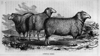
COTSWOLD SHEEP.
The Presbyterians, numerically, take rank next. They number 25,925. They have fifteen clergymen.
The Episcopalians come next in point of numbers, being 6,785. They have one arch-deacon and nine clergymen.
The Wesleyans number 5,804. They have seven clergymen and one supernumerary. The Baptists number 3,402, and have seven clergymen. The Bible Christians number 2,061, and have five clergymen. There are forty-one Universalists, and about 300 who name themselves on no denomination.
Education.—The first effort toward the promotion of public education was made by opening the National School, in Charlottetown, about the year 1821.
The Board of Education was appointed in 1830. It consisted of five members, three of whom formed a quorum for the transaction of business. The Central Academy, at Charlottetown, was opened in January, 1836. The first principal of this institution was the Rev. Charles Loyd. In 1837, a further impulse was given to the cause of a sound and thorough education, by the appointment, for the first time, of a visitor of schools for the whole island. John McNiel, Esq., was appointed to this office. The number of schools at that period, was fifty-one; scholars, 1,649. In 1847, when Mr. McNiel resigned this important work, the schools had increased to 120, and the pupils to 5,000. In 1851, the number of schools was 135; of scholars, 5,360. In 1856, the number of schools was 260; of scholars, 11,000. Towards the close of the same year, a Normal School, for the training of teachers, was opened. It is the law of Prince Edward Island, that the BIBLE be read in all the public schools. This law was passed in 1860, after much agitation on the subject.
The census of 1861 gives 302 public school-houses, and 280 public teachers.
The number of churches is 156.
Civil Government.—This island, like the neighboring provinces, is a British colony. Like all the North American colonies, it enjoys the fullest freedom to make and administer whatever laws are best suited to its peculiar circumstances, without any interference by the parent state.
The Legislature consists of the Governor, who is appointed by the Queen, a Legislative Council, and a House of Representatives.
The House of Assembly, or Representatives, consists of thirty members, and the Legislative Council of twelve members. Both these bodies are elected by the people. The island is divided for civil purposes into three counties—King's, Queen's, and Prince's; each of these elects ten representatives and four councillors.
The Executive Council consists of the Governor and nine members, chosen out of the members of the Legislative Council and House of Assembly.
The Judicial Department embraces the following courts: 1. The Commissioners' Courts, for small debts. These have jurisdiction in settling debts that do not exceed sixty dollars. Each county has six or seven of these courts. They consist of three commissioners, appointed by government. They meet monthly, and are designed to prevent expensive litigation. 2. The Court of Probate, which disposes of wills, and grants letters of administration for the disposal of the property of such as die intestate. 3. The Supreme Court, which is the highest tribunal of civil law. It meets four times in the year in Queen's county, and twice a year in the two other counties. It is presided over by a Chief-Justice and one Assistant Judge. 4. The Court of Chancery, of which the Lieutenant-Governor is chancellor, and the master of the rolls the acting judge. This court adjudicates in cases which cannot be satisfactorily determined by statute law. It aims at deciding according to the equity of the case. 5. The Court of Vice-Admiralty, which is similar in function to the court of the same name in the other provinces. 6. The Court of Marriage and Divorce. The Lieutenant-Governor is the president of this court, and the Executive-Council are the members of it. It exists, as yet, but in name.
The First House of Assembly of Prince Edward Island met in July, 1773. It consisted of eighteen members. The Legislative and Executive Councils were then one body, appointed by the sovereign.
The island was connected with Nova Scotia, in respect of civil government, till the year 1770. In that year it was erected into a separate province. Its first governor, as a separate province, was:
| 1. | Walter Patterson, Esq., | whose term was from | 1770 | to | 1786 |
| 2. | Lieut. General Edmund Fanning, | " | 1786 | " | 1805 |
| 3. | Colonel Joseph F. W. Debarres, | " | 1808 | " | 1813 |
| 4. | Charles Douglas Smith, Esq., | " | 1813 | " | 1824 |
| 5. | Colonel John Ready, | " | 1824 | " | 1831 |
| 6. | Sir Aretes W. Young, | " | 1831 | " | 1835 |
| 7. | Sir John Harvey, | " | 1836 | " | 1837 |
| 8. | Sir Charles Augustus Fitzroy, | " | 1837 | " | 1841 |
| 9. | Sir Henry Vere Huntly, | " | 1841 | " | 1847 |
| 10. | Sir Donald Campbell, | " | 1847 | " | 1850 |
| 11. | Sir Alexander Bannerman, | " | 1851 | " | 1854 |
| 12. | Sir Dominic Daly, | " | 1854 | " | 1859 |
George Dundas, Esq., became governor in 1859, and continues still. He is one of the most deservedly popular governors the island ever had.
The Public Debt of the island on the 31st of January, 1861, was $155,324. To meet this debt, there are 4,190 acres of crown lands, and 73,821 acres of public lands, as well as $66,278 due in instalments for sales of public lands, and bearing interest at five per cent.
Revenue and Expenditure.—For 1859, the revenue amounted to £41,106 3s. 11d., Prince Edward Island currency. The expenditure for that year was £44,707 13s. 1½d. For 1860, the revenue was £43,113 13s. 5d. The expenditure for that year, was £61,794 12s. 9d. The excess of expenditure over revenue during these years, is to be accounted for by the expensive purchase of the large estates of the Earl of Selkirk, for the public good.
The city of Charlottetown is the capital of the island. It is built on gently rising ground, looking toward the south. It is on the north of the East river, and near its junction with the North and West rivers. The streets cross each other at right angles. The six main streets are one hundred feet wide, and run north and south. The other nine streets, crossing the former at right angles, vary in width from sixty to thirty feet. The colonial building is a beautiful and commodious edifice, built of Nova Scotia freestone. The corner-stone of this building was laid on the 16th day of May, 1843, by Sir Henry Vere Huntly, the lieutenant-governor. This building cost about $72,500. In 1848, the population of Charlottetown was 4,000; in 1855, 6,513; in 1861, 6,706.
The only town in King's county is Georgetown. It is about thirty miles from the capital, and contains a population of about 800.
The only town in Prince's county is Summerside. It lies on the north side of Bedeque harbor. Its distance from the capital is forty miles. It is only thirty-five miles from the town of Shediac, New Brunswick. It is a town of recent growth, but it is rapidly increasing, and its trade is considerable.
There are no railways in Prince Edward Island, but its highways are excellent in summer and winter; in the fall and spring they are usually very deep and miry. There is no country of the same size in British North America where there is so much good turnpike road. It has telegraphic communication with the continent of America by means of a submarine cable, eleven miles in length, connecting it with New Brunswick. There is also telegraphic communication between Charlottetown and some of the principal places in the island.
The standing grievance of Prince Edward Island has been the Land Question. The royal commissioners, who sat on this subject in 1861, among other things, recommend the purchase of the estates of large non-resident proprietors by the government, at an equitable rate, to be sold again in retail to the tenants. If the government decline, or is not in circumstances to make the purchase, then the award of the commissioners is, that the sale of the land to the occupant tenants be compulsory on the part of the landlords, on the receipt of a just and reasonable price. They also fixed twenty years' rent as the highest sum that could be demanded by any proprietor. The award further determines, that all arrears of rent due previous to first of May, 1858, are now cancelled. Their report is very able and elaborate, and has had a beneficial effect already. It may be further noticed, that their award does not compel proprietors of less than 1,500 acres to sell their lands to those who may be occupying them as tenants.
|
Montgomery Martin. |
|
Sutherland. Geography and Natural and Civil History of the Island; an excellent work. |
NEWFOUNDLAND.
Situation and Extent.—Newfoundland is an island in the form of an irregular triangle, situate on the east side of the Gulf of St. Lawrence, and lying between the parallels of 46° 40′ and 51° 39′ north latitude, and the meridians of 52° 44′ and 59° 31′ west longitude. On the eastern shore it is bounded by the Atlantic; on the north and northeast by the Strait of Bellisle—fifty miles long by twelve wide; on the northwest by the Gulf of St. Lawrence; on the south and southwest by the Atlantic. Its extreme length, from Cape Race to Grignet Bay, is 420 miles; extreme breadth, from Cape Ray to Cape Bonavista, 300 miles. Its circuit is estimated at 1,000 miles; its area, 36,000 square miles. It is nearer to Europe than any part of the American continent; the distance from St. John's, in Newfoundland, to Valenti, in the west of Ireland, being 1,656 miles.
Discovery, Settlement, &c.—It is said that in the year 1001, A. D., Biorn, a sea-king of Iceland, took possession of this island, and settled near Harbor Grace. Both Robertson and Pinkerton are of opinion that its colonization was at least attempted by the Norwegians, in the eleventh and twelfth centuries. John Cabot, the Venetian, under a commission for discovery from Henry VII. of England, on the 24th of June, 1497, observed a headland of this island, and taking it for a lucky omen, called it Bonavista, which is its name till the present day. The island was then inhabited by a savage race of Indians, with whom it was very difficult to establish any amicable relations. They suffered greatly, in consequence, at the hands of the many adventurers who resorted thither. It is supposed that the last remnant of them emigrated to Labrador. It is some years since one of them has been seen on the island. A colony of Micmacs from Nova Scotia helped to drive them off. They have left many traces of their labors and energy behind them: one of these is a fence, which extends over thirty miles. Its object was to be of help to them in catching deer. It was built from water to water, with one gap, close to which the hunters posted themselves, and watched for their prey.
The earliest attempt at colonizing this island by the English, was in 1536. "Master John Hore," a London merchant, "with divers other gentlemen," sailed thither in that year, but were reduced to great extremities, and were compelled to return to England in the winter, and would have perished had they not met with a French ship laden with provisions, which they seized and brought with them to England.
In 1578, another fruitless attempt was made to settle a colony there, by Sir Humphrey Gilbert, the half-brother of Sir Walter Raleigh. The island having now become a common resort for fishermen and traders of all nations, even pirates having made it a place of rendezvous with impunity, Sir Humphrey Gilbert again, in 1583, embarked with 200 people, in several ships, landed at Bay St. John's, and took possession of it in the name of Queen Elizabeth of England, in the presence of the crews of thirty-six fishing vessels of various nations. Sir Humphrey Gilbert was lost on his way home to England the succeeding winter, his little ship, the Little Squirrel, having foundered in a terrific gale near the Azores. Of all the armament that went out with him, the Golden Hind alone reached England, and she in the most dilapidated condition. Sir Bernard Drake made a further attempt a few years later, but without much success. The next attempt was made in 1610, under a patent granted by James I., to Lord Bacon and others, who established the first permanent colony on the island at Conception Bay.
In 1617, a Welsh settlement was established on the south part of the island, called Cambriol (now Little Britain), under the direction of Captain Whitbourne. In 1623, Sir George Calvert—who afterward, as Lord Baltimore, settled Maryland—formed an important and prosperous settlement at Ferryland, where he remained about twenty years. A few years later, Lord Falkland (Cary) sent a small colony of Irishmen there. About the year 1646 there were sixteen settlements planted on various parts of the coast. Sir David Kirk brought a number of settlers to the island in 1654. There were 350 British families there about this date. The French had a colony of some strength at Placentia. For the next eighty years the colony suffered greatly for the want of regular government, which was mainly caused by the selfish cruelty and mistaken policy of the "Lords of Trades and Plantations," who imagined that a well regulated government would be injurious to their interests there. They even moved the British government, through their misrepresentations and influence, to send Sir John Berry out with orders for the deportation of the settlers, the destruction of their houses, and the wholesale demolition of a colony which had been planted and reared at a heavy cost of blood and treasure to the nation. Sir John Berry was a man of humane character, and while with his left hand he reluctantly and tardily carried out his orders, with his right hand he pleaded successfully for the colonists.
In 1696 all the English settlements of Newfoundland, except Bonavista and Carbonear, were seized by the French, who always set a high value on this island on account of its fisheries. It was the scene of much conflict between Great Britain and France, for many subsequent years. The Treaties of Utrecht, 1715; of Paris, 1763; of Versailles, 1783; and of Paris, 1814 and 1815, all recognize this island as a British possession.
It was in the year 1729 that Captain Osborne was appointed the first civil governor of this colony. He was empowered to appoint justices of the peace. Courts of justice were appointed in 1789. A few years later a chief-justice was appointed, and surrogate courts in various parts of the island. John Reaves, Esq., was the first chief-justice of this colony. In 1824 the island was divided into three districts, in each of which a court was annually to be held.
Newfoundland is in shape almost an equilateral triangle, the apex being to the northward, terminating in Cape Bauld, while the base extends east and west between Cape Ray and Cape Race. The coast-line is very irregular, being indented at intervals of only a few miles with bays, harbors, coves, creeks, and rivers. The shores are rocky, and the headlands, on the south-west side, quite lofty.
Bays.—The most important bays are: on the east side of the triangle, Hare, White, Notre-Dame, Bay of Exploits, Bonavista, Trinity, and Conception Bays; on the south side, St. Mary's, Placentia, and Fortune Bays; on the west, St. George's and the Bay of Islands; and at the northern apex, Pistol et Bay. Most of these are extensive, and contain commodious and well-sheltered harbors. The good harbors are numerous, and have good anchorages with clear good channels.
Rivers.—Rivers are numerous in the island, and though the great majority are small, yet some attain to respectable size. The largest are the Humber, River of Exploits, Gombo, and Great Cod Roy Rivers. Nearly all the rivers of this island issue from lakes or ponds in the interior. Many of them abound with excellent salmon.
Lakes and Ponds.—Fresh-water lakes and ponds are very numerous. They are found over the face of the entire country—on the very tops of the hills. The surface covered with water has been estimated at one-third of the whole island. The Grand Pond is about sixty miles long, and five miles wide. Indian Lake is thirty miles long by six wide. Sixty-seven ponds have been counted from one spot on the top of the N. E. Mountains of Avalon, some two and three miles in extent, none less than 100 yards, and not at a farther distance than ten miles from the base of the hill. Some of the larger and more important lakes have water communication with each other.
Victoria Lake has communication with Bathurst, Wilmot, and George the Fourth lakes.
Mountains and Hills.—There is a long and continuous mountain extending from the three sugar-loaf hills near Cape Roy, to the north-east. These elevations have a steep face toward the north-west, and are rather flat and regular on the summit. The "Blow-me-down Hills," on the south side of the Humber River, have the least elevated peak at 800 feet. "Butter Pots," near Conception, at either end are 1,000 feet. A ridge that runs from Cape Dog to St. Mary's Bay, at the highest elevation ranges from 1,200 to 1,500 feet. The elevations about St. John's, viz.: Signal Hill, South Side Hill, and Bronxscombe Hill, are respectively 520, 700, and 870 feet above the level of the sea. The hills near the mouth of the River of Exploits are from 1,000 to 1,500 feet high. There is more good soil on this island than was supposed some years since. The "Barrens," properly so called, are the tops of hills, and most elevated plains. These are covered with thin scrubby vegetation—berry-bearing plants and dwarf bushes of various kinds.
Trees.—The principal trees are, spruce, birch, larch, willow, mountain ash, and fir-trees. Trees do not attain to a large size. Recumbent and standing evergreens are to be met in great variety; berry-growing bushes abound in every swamp. European and American grasses, also red and white clover, are abundant.
Animals.—The only animal peculiar to this island is the Newfoundland dog, which is famous the world over. A team in the out-districts of Newfoundland consists of a man and two dogs. A team of this description carries two men with a considerable amount of stuff on a sledge or sleigh. All their fire-wood is hauled by teams of this description in some districts. The long-haired pure Newfoundland dog is not very easily procured now. There is, however, a short-haired native breed, a cross with the other, which is abundant, and possesses the chief excellences of the first named. The deer, the wolf, the bear, the beaver, martin, and wild-cat, are to be enumerated among the wild animals of the country. Land and aquatic birds are numerous.
Fish.—The lakes, and ponds, and rivers abound with trout, and salmon, and eels of great size. The lobsters are uncommonly large and of good quality. The mussels are more esteemed than European ones. The capelin, mackerel, herring, and salmon are abundant. The halibut, thornback, and other kinds of fish, are to be found on the coast. The cod, however, is the "fish" of Newfoundland, while all other varieties, as being less important, are called by their specific names. There is no place in the world comparable to the shores and "banks" of Newfoundland for cod-fisheries.
Agricultural Capabilities.—In several sections of the Island agriculture can be carried on with profit. The timber, natural grass, and clover, found in various districts, indicate a productive soil. In the neighborhood of many of the lakes and rivers there are valuable alluvia. The stunted forests on the east and south shores mark a poor country; but the large growth of timber in the interior and toward the west indicates a rich soil, and proves that there is room for successful agricultural enterprise in Newfoundland. The land close by the sea-shore affords no criterion by which to estimate the fertility of the inland districts.
Potatoes yield well and are of excellent quality. Green crops thrive well in many districts. Wheat has been known to yield fifty bushels per acre. Apples, plums, and cherries have been raised with success. Red, black, and white currants; gooseberries, strawberries, and raspberries of very good quality are grown. The season for the growth and ripening of the fruits of the earth is brief, but fervent.
Climate.—The climate, though severe, is not unhealthy. The rate of mortality, according to the population, is lower than in any other country in America. Old age is usually attended here with an uncommon degree of bodily vigor and mental activity.
In 1829, Marten Galen, of Placentia Bay, was over one hundred years of age, lived in excellent health, and in company with his brother, caught that year nine quintals of fish. Seventy years previous to that date he piloted Captain Cook into Placentia Bay. Mrs. Tait died in the same place 125 years old. About twenty-five years since a woman died at Torbay, near St. John's, aged 125 years; shortly before her death she sent for a doctor to see what was the matter with her poor child, who was sick. The child was ninety years of age! The winter lasts from the beginning of December till the middle of April, and sometimes till the end of that month. Frost is less intense here than in Canada. January and February are the coldest months. The bitterest winds are from the north-west. The south-east wind is warm; the north-easterly winds are cold, both in summer and winter. The following table contains the results of meteorological observations for the years 1858, 1859, 1860, taken by E. M. I. Delaney, Esq., C. E.
| 1858. | |||||
| Max. | height of barometer, | corrected to sea level | 30.33 | inches | January 16. |
| Min. | do. | do. | 28.70 | " | March 26. |
| Mean | do. | do. | 29.51 | " | |
| Max. | height thermometer | 84° | August 12. | ||
| Min. | do. | 2° | February 11. | ||
| Mean | temperature for year | 41° | |||
| Quantity of rain. including melted snow | 50.860 | inches | the year | ||
| Prevailing winds | N. W. | ||||
| Rain fell on 98 days; fog prevailed 66 days. | |||||
| 1859. | |||||
| Max. | height of barometer, | corrected to sea level | 30.56 | inches | January 25. |
| Min. | do. | do. | 28.72 | " | December 5. |
| Mean | do. | do. | 29.79 | " | |
| Max. | height of thermometer | 96° | July 13. | ||
| Min. | do. | 8° | March 3. | ||
| Mean | temperature for year | 44° | |||
| Quantity of rain, including melted snow | 64.220 | inches | the year | ||
| Prevailing winds | NNW. & SSW. | ||||
| Rain fell on 110 days; snow on 54; fog, 88; thunder and lightning on 6. | |||||
| 1860. | |||||
| Max. | height of barometer, | corrected to sea level | 30.36 | inches | February 29. |
| Min. | do. | do. | 29.56 | " | February 11. |
| Mean | do. | do. | 29.60 | " | |
| Max. | height of thermometer | 80° | Aug. 11 & 15. | ||
| Min. | do. | 11½° | February 3. | ||
| Mean | temperature for year | 41° | |||
| Quantity of rain and melted snow | 82.040 | inches | the year | ||
| Prevailing winds | NW. & SSW. | ||||
| Rain fell on 117 days: snow on 43; fog, 109; thunder and lightning on 5. | |||||
Grand Banks.—These are the most famous submarine elevation on the face of the globe. In the whole of their extent they occupy six degrees of longitude, and nearly ten degrees of latitude, being over 600 miles in length, and 200 miles in breadth, with soundings varying from twenty-five to 150 fathoms. The mean depth is estimated at forty fathoms. They swarm with cod and other kinds of fish.
Agriculture.—This important branch of industry was for centuries not only systematically discouraged, but actually prohibited by law in Newfoundland. The first important relaxation of the old system regarding the land was made by Governor Sir Richard Keats, in 1815. He was authorized to make small grants of land, limited from two to four acres. In 1825 a further advance was made; under the government of Sir Thomas Cochrane grants of from 250 to 500 acres were made to enterprising settlers; roads were made at the public expense, and agriculture encouraged.
From the returns for 1836, we give the following items:
| 24,117 | acres of land in possession. | ||
| 11,062½ | acres in cultivation; | estimated value, | $606,250 |
| 1,559 | horses | " | 77,950 |
| 5,832 | neat cattle | " | 145,800 |
| 6,923 | sheep | " | 44,615 |
| 4,000 | goats | " | 20,000 |
| 3,155 | hogs | " | 23,660 |
| $918,275 | |||
The returns for the same year give 1,168,127 bushels of potatoes, 10,310 bushels of grain, and 6,975 tons of hay.
The returns for 1845 give the following figures, which show a healthy progress:
| 83,435½ | acres of land in possession. | ||
| 29,656¼ | acres under cultivation, | valued at | $2,990,625 |
| 2,409 | horses | " | 120,450 |
| 8,135 | neat cattle | " | 203,375 |
| 5,750 | sheep | " | 23,750 |
| 5,791 | goats | " | 28,955 |
| 5,077 | hogs | " | 39,075 |
| $3,406,230 | |||
The same returns give 853,352½ bushels of potatoes; 11,695 bushels of grain; 11,013 tons of hay and fodder.
In 1857, the latest Census taken, the whole improved land of the Island, including dyke or marsh land, intervale, and upland, was 49,616-3/8 acres. Tons of hay cut, 16,250-7/8; bushels of oats raised, 9,438; bushels of wheat and barley, 1,932¾; bushels of potatoes raised, 571,480; bushels of turnips, 12,832; bushels of other roots, 3,502; bushels of clover and timothy seed, 731½. Number of neat cattle, 12,962; milch cows, 6,924; horses, 3,509; sheep, 10,737; swine and goats, 17,551. Butter made, 134,968 pounds; cheese, 158 pounds.
Mills and Factories.—There were in the Island, in 1857, fourteen saw-mills, valued at $28,500, and employing fifty-four men; and three grist-mills, valued at $5,000, worked by three men. There was one iron foundry, employing seven men; three breweries, employing thirteen hands. The oil factories and cod-liver oil manufactories are numerous; but the returns of them are incomplete. In one electoral division alone there are eight cod-liver oil manufactories, and one common oil factory. The shoes and boots manufactured the year preceding the census, are valued at $43,455; chairs and cabinet wares, $120; carriages, $490; other wooden wares, $31,220; lime manufactured, 16,500 bushels, valued at $6,000.
Ship-Building.—This department of industry has never been prosecuted to a very large extent in this colony. The native timber does not furnish materials for ships of the first class. The returns for 1857, give eighty-eight vessels as the number built, the tonnage of which was 2,427, which shows that they were vessels of very moderate size. Number of boats built during the same year was 630; number of vessels owned in the island was 212—tonnage, 6,229.
Fishing Industry.—This is by far the most important department of industry in Newfoundland. The cod and seal fisheries rank first in importance.
The fishing season opens in May, when herring are caught chiefly for bait. The cod fishing begins in the month of June, and continues till the end of September, and sometimes till the middle of October. It is carried on in large boats on the great banks, and in boats and shallops near the shore. The first is termed the bank fishery, the other the shore fishery. The bank fisheries are prosecuted chiefly by the French and Americans, while the British direct their chief energies to the shore fisheries. The cod is caught on hooks baited with herring, mackerel, capelin, clams, &c. They are very voracious, and bite with great rapidity. One man often catches 250 good fish in a day. They are carried on shore for curing, with as little delay as possible. When landed, the fish is thrown on a stage, and by a division of labor between four persons—respectively termed cut-throat, header, splitter, and salter—they are rid of heads, opened, cleaned, and piled in salt to cure, at the rate of several hundreds per hour. When completely cured, the codfish are assorted into four different kinds, known as merchantable, Madeira, West India, and dun or broken fish. The first is prime fish; the second is nearly as good; the third is intended for the negroes; the fourth, which is incapable of keeping, is used at home. The tongues and bladders are cut off from the refuse by the old men, women, and children, and pickled in kegs. The livers are exposed to the sun in vats, until the oil drains off; the oil is then barrelled; it is afterward boiled to extract the inferior quality. These several products of this branch of industry are commonly sold by the fishermen to the wholesale merchants for goods or money. During the winter months many of the fishermen are engaged in hunting for game, or trapping for fur. Others are occupied in making boats, oars, staves, hoops, &c.
In 1849, there were exported from Newfoundland 1,175,167 quintals of dried fish, valued at $2,825,895; in 1857, 1,335,649 quintals of fish were cured, the value of which would be over three millions of dollars.
Next in importance to the cod, is the seal fishery. The season for this fishing commences in March. During winter, vessels of from eighty to one hundred and fifty tons are fitted out, and, manned with crews of from fifteen to forty men, set out for the seal regions early in March. The men generally pay for their own provisions, and receive their wages in such a proportion of the seal-skins caught, as may be agreed upon between themselves and the owners of the vessel. They have usually to cut a channel for themselves out of their harbor; then they push their way to the fields of ice and bergs that float down from the Arctic ocean, and are often exposed to terrible dangers. The seals are found in groups on the ice, sunning themselves, or asleep. These places are called "seal meadows." When a "seal meadow" is reached, the men, armed with spiked clubs, beset them on every side, and with a knock on the head dispatch them with great rapidity. If not instantly killed, they utter the most piteous moans, like the cry of children. They are skinned at once and on the spot; and the skins, pelts, and scalps, with the inner coat of blubber on them, are then carried into the vessel, and strewed upon the deck until they have become sufficiently dry to be stowed below.
As many as 800, and sometimes 1,000, have been taken by a vessel in one day. The seals are of four kinds: the bay seal, found on the coast; the hooded seal, which has a hood that it can draw over its head; the square flipper; and the harp seal, the last named being the most valuable.
In 1845 there went out, from the port of St. John alone, to the seal fishery, 126 vessels, of 11,863 tons, and manned by 3,895 men. They took 302,363 seals. In 1852, the seal fishery of the Island employed 367 vessels, of 35,760 tons, manned by 13,000 men, and took 550,000 seals. During the same year, 7,333 tons, 220 gallons of seal oil, valued at $1,188,500; 387 tons, 237 gallons of blubber and dregs; and 534,378 seal-skins, were exported, the whole being valued at $2,085,100.
The census of 1857 gives the number of vessels engaged in the seal fishery at 802, tonnage 57,898-¼, men on board, 14,442. Number of seals taken, 428,143.
Herrings are plentiful, but until recently have not entered much into the fishing industry of the colony. In 1857 there were 157,354 barrels of herring cured.
The same remark applies to the salmon fishing. It has secured more attention of late years. In 1857, 2,940 tierces of salmon were cured, besides 913 fresh salmon that were disposed of in St. John's. The following is the number of boats that were engaged in the shore fishery in 1857; large boats, from four to fifteen quintals, 10,497; large boats, from fifteen to thirty quintals, 797; large boats, from thirty quintals and upward, 1,244,—total, 12,538.
Commerce.—Fish is the great staple of trade and commerce in Newfoundland.
The following statement of the imports and exports of the Island for a series of years, will indicate at once the amount of its commerce, and its stationary character. In 1829 the imports of the colony were valued at $4,096,995; the exports at $3,451,545.
| Imports. | Exports. | |
| 1845 | $4,006,650 | $4,697,190 |
| 1846 | 4,011,435 | 3,795,515 |
| 1847 | 4,217,045 | 4,032,825 |
| 1848 | 3,848,140 | 4,187,905 |
| 1849 | 3,700,912 | 4,207,521 |
| 1850 | 4,163,116 | 4,683,676 |
| 1851 | 4,609,291 | 4,276,876 |
| 1852 | 3,857,468 | 4,306,376 |
| 1856 | 6,356,830 | 6,693,985 |
| 1857 | 7,067,160 | 8,255,855 |
| 1858 | 5,864,310 | 6,594,180 |
| 1859 | 6,620,680 | 6,785,565 |
For 1860, the imports were valued at $6,270,640; the exports at $6,358,560. During the last 260 years, this Island has furnished fish and oil to the value of very nearly $650,000,000.
Population.—In 1785, the population of the Island was estimated at 10,244; in 1806, it was 26,505; in 1825, 45,759; in 1836, 73,705; in 1845, 96,295; in 1851, it was 101,600; and by the census of 1857, it was 122,638. The last census shows that 107,399 of the population were born in Newfoundland; 3,516 born in England; 7,383 in Ireland; 390 in Scotland; 475 in the British colonies; and the balance in foreign countries.
In 1857, the religious census is stated as follows:—Church of England, 44,285; Roman Catholics, 56,895; Wesleyans, 20,229; Kirk of Scotland, 302; Free Kirk, 536; Congregationalists, 347; Baptists and other denominations, 44.
The places of worship are: Church of England, 75; Church of Rome, 63; Wesleyans, 37; Kirk of Scotland, 1; Free Kirk, 2; Congregationalist, 1.
Under the head of trades and professions, we have the following statement:—Clergymen, or ministers, 77; doctors and lawyers, 71; farmers, 1,697; mechanics, 1,973; merchants and traders, 694; persons engaged in catching and curing fish, 39,805; able-bodied seamen and fishermen, 20,887; persons engaged in lumbering, 334.
Buildings.—The number of inhabited houses in the Island in 1857 was 18,364. These were inhabited by 20,187 families. The number of uninhabited houses was 903; of houses then in process of building, 1,026; of stores, barns, and out-houses, 9,940; of fishing-rooms in actual use, 6,006.
Schools.—Denominational schools prevail more in Newfoundland than in any of the lower provinces. Denominational conflicts of a fierce and pernicious description prevail there also. There are Episcopalian schools, Roman Catholic schools, and Protestant dissenters' schools. In 1836, there were but 79 schools in the colony. In 1845, there were 209 schools, with an attendance of 10,266 pupils. In 1857, there 280 schools, and the number of pupils in attendance was 14,136. The sum voted by the legislature for education, in 1859, was $55,968. There is a General Protestant Board of Education and a Roman Catholic Board. There are three academies in St. John's; one under the direction of the Church of England, Church of Rome, and the Wesleyan Church, respectively. There is a high school in connection with St. Andrew's Presbyterian Church. There is a grammar school of a superior character in Harbor Grace. There are ten commercial schools of a superior character.
Legislative.—The first legislature of Newfoundland met in the year 1832. The elective franchise was conferred, in 1832, on the whole male population over twenty-one years of age, and occupying dwelling-houses, either as owners, or tenants for one year. The legislature consists of the governor in council and two houses of Parliament: the upper house, called the Legislative Council; the lower, the House of Assembly. The executive council consists at present of five members; the legislative council of twelve, and the house of assembly of thirty members.
Judicial.—There is the Supreme Court, with a chief-justice and two assistant judges. The spring term of the court begins on the 20th of May; the autumn term on the 20th of November. There is a central circuit court, the spring term of which opens in April, and the autumn term in October. There is a court of vice-admiralty, of which the chief justice for the time being is judge. There are also courts of the justices of the peace.
Board of Works.—This board has the management and superintendence of the public buildings and public works of the colony. Government House, the Colonial Buildings, Court Houses, Customs Houses, Hospital, Lunatic Asylum, and all other public buildings belonging to the Island are under its control. It has also the supervision of all light-houses, buoys, beacons, roads, highways, bridges, &c., &c. The various local boards act under the direction of the central board.
Post Office Department.—There is a postmaster-general in St. John's. There are sixteen post masters and mistresses, and fourteen way-office keepers, in the various other districts of the Island.
The only route on which there is a daily mail is between St. John's and Portugal Cove. On two or three routes there is a tri-weekly mail, by wagon. About four more routes are run weekly, by boat or messenger; the remainder are run fortnightly in summer and monthly during winter.
Electric Telegraphs.—There are five hundred and fifty miles of over-land telegraph in Newfoundland. The submarine line from Aspy Bay, Cape Breton, to Cape Ray, Newfoundland, is seventy-eight miles. This submarine line was laid in 1856. There are fifteen stations and twenty-two employés. The tariff from St. John's to Port Hood, C. B., is three dollars for ten words, and for each additional word, twelve cents. The local tariff is twenty-five cents for ten words. The great Atlantic electric cable was laid on the 5th of August, 1858. Its termini were Valentia Bay, Ireland, and Trinity Bay, Newfoundland.
Banks, &c.—The Savings Bank is governed by three members of the Legislative Council, and five members of the House of Assembly. The bank is opened every Monday for depositors' business, and on every Wednesday for discount business. Three per cent. is allowed on all sums not less than $4. No sum exceeding $400 is received, except on condition that it shall not be withdrawn without two months' notice. As audited the 31st December, 1860, the assets and liabilities were as follows:—
| Assets | $930,633 |
| Liabilities | 839,741 |
| Surplus and assets, | $90,892 |
The Union Bank and Commercial Bank are both in a prosperous condition, and are found sufficient for the accommodation of the community in this department.
There are fire, life, and marine insurance companies, and agencies for British and foreign ones. There are also benevolent, charitable, and religious voluntary associations.
St. John's City.—This is the capital of the Island. It is built mainly of wooden houses. It is built at the mouth of one of the best of harbors, with highlands sheltering it on either side. It is entered from the sea through a narrow passage only about six hundred feet wide, between two lofty cliffs, which are strongly fortified. The city is lighted by gas, and supplied with water from a pond on one of the adjoining hills. One irregular street of about one mile in length comprises the chief buildings of the city. The Colonial Building is built of granite; the Government House is a handsome building, which cost nearly $1,000,000. The new Roman Catholic Cathedral is also a handsome edifice.
The Miquelets.—These are three little islands on the south coast, at the mouth of Fortune Bay, being the only remaining possessions of the French in these regions. They are called Miquelon, Little Miquelon (or Langley), and St. Pierre. The Miquelets are connected by a sandy beach, which is sometimes passable by foot travellers, and at other times cut through by storms. The French maintain a small military force there, and it is the head-quarters of their Newfoundland fisheries. Of late years it has been assuming the dignity and importance of a naval station.
INDEX.
Aborigines of New Brunswick, 624-626.
Acadia College in Nova Scotia, 708.
"Acadia" iron mine of Nova Scotia, 354.
Acadia, New Brunswick first settled under the name of, 542.
Addington colonization road, 305.
Agricultural Association of Upper Canada, history of, 44-48;
tables of the exhibitions of, 45-47.
Agricultural capabilities of New Brunswick, 554.
Agricultural productions of Canada, 52-64;
of New Brunswick, 560, 627-653;
of Nova Scotia, 687;
of Prince Edward Island, 736;
of Newfoundland, 752.
Agricultural productiveness, comparative, of Nova Scotia, 685.
Agricultural products exported from Canada, 291.
Agricultural School at St. Anne, in Lower Canada, 39.
Agricultural societies in Lower Canada, 37-39.
Agricultural societies in Upper Canada, 39-50.
Agriculture in Canada, history of, 32-64;
encouragement of, by government, 42.
Agriculture in New Brunswick, 627-658.
Agriculture in Newfoundland, 749, 751-753.
Agriculture in Nova Scotia, 684-688.
Agriculture in Prince Edward Island, 736.
Ague and fever unknown in New Brunswick, 556.
"Albert" coal of New Brunswick, remarkable properties of, 361.
Albert county, New Brunswick, description of, 636.
Albertite, where found in New Brunswick, 591.
Albion coal mines of Nova Scotia, 350.
Alewife fishery on the St. John River, 580;
in the Gulf of St. Lawrence, 583.
Alluvial soils of Nova Scotia, 671.
Alluvium, two kinds of in New Brunswick, 589.
American clergy in Canada, restrictions on, 376.
American common school system, remarks of Mr. Duncombe on, 396.
American railroad contractors in Canada, extensive operations of, 222-224.
Anecdotes of an American railroad contractor, 222-224.
Anticosti, island of, immense peat bog in, 346.
Anticosti, ship route from, to Superior City, 19.
Apatite, importance of, as manure, 338;
where found in Canada, 389;
value of per ton in England, 339.
Architects of the Government buildings at Ottawa, 98.
Area of Upper and Lower Canada, 14;
of New Brunswick, 552;
of Nova Scotia, 660;
of Prince Edward Island, 728;
of Newfoundland, 744;
of the Labrador peninsula, 81;
of the Ottawa valley, 96;
of the great basin of Lake Winnipeg, 75;
of the timber territories of Canada, 67;
of sedimentary and crystalline rocks in Canada, 28;
of Lake Superior, 14;
of Lake Huron, 14;
of Lake St. Clair, 15;
of Lake Ontario, 16.
Arichat Academy in Nova Scotia, 707.
Ascot copper mine, near Sherbrooke, 327.
Ash, two species of, in New Brunswick, 570.
Atlantic and Pacific, importance of a practicable route between, through British territory, 372.
Atlantic coast of Nova Scotia, soils of, 668.
Authors, distinguished, of Nova Scotia, 724.
Banks, Grand, of Newfoundland, 751.
Banks in Newfoundland, 759.
Banks in Nova Scotia, 704.
Baptist Church in Canada, Literary Institute of, at Woodstock, 439;
theological text-books adopted by, 442.
Baptist Church in Nova Scotia, 718.
Baptist Seminary at Fredericton, 614.
Bark canoe, how constructed, 131-133.
Bark of the birch-tree, numerous uses of, 188.
Barley, production of, in Canada, 59.
"Baron of Renfrew," the great timber ship, 286.
Barytes, sulphate of, where found in Canada, 334.
Basswood-tree in New Brunswick, 572.
Batiscan, Radnor forges at, 319.
Batteau, description and history of the, 133, 134.
Bay of Chaleur cod, superiority of the, 581.
Bay of Chaleur, description of, 602.
Bay of Fundy, sea fisheries in, 574-580;
fogs on, 556.
Bays of Nova Scotia, 661;
Prince Edward Island, 728;
of Newfoundland, 747.
Beauharnois canal, length and course of, 167.
Beaver-skins, early tax on, 275.
Beaver, the, the present symbol of Canada, 275.
Beech, two species of, in New Brunswick, 563.
Belleville Seminary near Pictou, 433.
Bichromate of potash, how manufactured in Norway, 332.
Birch-bark canoe, how constructed, 131-133.
Birch, four species of, in New Brunswick, 563.
Birch-tree and bark, value of the, 133.
Birds of Nova Scotia, 675.
Bishop's College, Lennoxville, history of, 520;
faculty of arts in, 521;
faculty of divinity in, 522.
Blind in Nova Scotia, 683.
Board of Works in Newfoundland, 758.
Boards of Agriculture in Upper Canada, 43.
Bobcaygeon colonization road, 305.
Bog iron ores of Canada, 319.
Bog soils of Nova Scotia, 673.
Bois brulés, or half breeds, Canadian, 87.
Books, value of, imported into Canada in 1850-61, 476.
Botanical Society of Canada, 51, 472.
Boundaries of Canada, 13.
Boundary of New Brunswick settled by treaty, 1842, 551.
Breadth of beam of vessels admitted by the St. Lawrence and Welland canals, 182.
Bridge over the St. Lawrence, plans for, 265.
Bridges in Canada, cost of construction of, 127.
Bridge, the Victoria, origin of, 257;
cost of, 263.
Bridle and winter roads in Canada, 116-119.
British Columbia and Vancouver Island, mineral resources of, 365-371.
British Columbia, influence of, on the settlement of the Saskatchewan, 78, 80;
communications with, 79.
British government, early policy of, in regard to education in Canada, 375.
Brothers of St. Joseph, 537.
Buffalo, Brantford and Goderich Railway, history of, 284-286.
Buildings in Newfoundland, 757.
Buller, Arthur, remarks of, on education in Lower Canada in 1838 (note), 501.
Burlington Bay, railway from, to London, 190.
Bush, list of articles necessary for a settler going into the, 304.
Butternut tree in New Brunswick, 569.
Caleche, description of the, 111.
Campbell, Mr. John, gold found by, near Halifax, 357.
Camping in the Canadian woods in winter, 91.
Canada, physical features of, 13-31;
geographical surface of, 20;
soils of, 22;
climate of, 27;
agricultural history of, 32-64;
Northwest Territory of, 74-80;
agricultural productions of, 52-64;
travel and transportation in, 99-268;
water communications of, 129-185;
history of railways in, 190-256;
action of, in favor of an inter-colonial railway, 241;
electric telegraph in, 266;
trade and commerce of, 268-307;
mineral resources of, 308-350;
historical sketch of education in, 373-541.
Canada Gold Mining Co., operations of, 330.
Canada Presbyterian Church, college of, at Toronto, 438;
text-books adopted by, 442.
Canadian age of iron and brass, 221.
Canadian guarantee law of 1849, unguarded, 220.
Canadian Institute at Ottawa, 471.
Canadian Institute at Toronto, 471.
Canadian Literary Institute at Woodstock, 434.
Canadian railway gauge, 253-255;
advantage of, in case of invasion, 255.
Canadian railway statistics, 193-196.
Canadian securities in England, 200.
Canadians, not "morally responsible" for the failure of the Grand Trunk Railway, 205, 211.
Canadian tariffs, 300.
Canadian trade, total tonnage engaged in, in 1858-61, 295.
Canals in Canada, 149-156, 158-185;
table showing dimensions and cost of, 177;
remarks on the system of, 181.
Canals in connection with the St. Lawrence, 16, 19, 20.
Canals in Nova Scotia, 697.
Canoe, bark, description of the, 131-133.
Capes of Prince Edward Island, 729.
Capital of the Hudson's Bay Company in 1856, 281.
Carboniferous districts of Nova Scotia, soils of, 670.
Cariboo district on Frazer River, 367.
Carioles, description of and mode of travelling in, 90.
Carleton, county, New Brunswick, description of, 649.
Carleton, Sir Guy, governor of New Brunswick in 1785, 544.
Cartier, Jacques, the St. Lawrence discovered by, 268.
Catalogue of useful minerals found in Canada, 313-315.
Catholic college of Regiopolis opened at Kingston in 1846, 395.
Cattle, climate of New Brunswick favorable to the rearing of, 560.
Cedar, the white, in New Brunswick, 571.
Census, religious, of Nova Scotia, 680.
Chair of agriculture in Upper Canada, 51.
Chambly canal, when projected, 150.
Chambly Industrial College, 525.
Channels of Canadian trade, 298.
Characteristics and cost of Canadian canals, 177.
Charlotte county, New Brunswick, description of, 640.
"Charlotte," the first river steamer in Upper Canada, 141.
Charlottetown, P. E. I., description of, 742.
Chaudière Falls, 95.
Chauveau, Dr., appointed superintendent of education in Lower Canada in 1855, 506;
important services of, 506, 507.
Chlorite, where found in New Brunswick, 595.
Christian Brothers' Schools in Canada, 586.
Chromic iron, where found in Canada, 371.
Church of England parochial schools in Upper Canada, 429.
Church of England Schools of theology in Canada, 435;
text-books used in, 441.
Church of Rome, schools of theology of, in Upper Canada, 437;
text-books used in the theological schools of, 441.
Church of Scotland, university of, at Kingston, 438;
theological text-books of, 441.
Churches in New Brunswick, 613; in Nova Scotia, 712, 713;
in Prince Edward Island, 738;
in Newfoundland, 757.
Civil List, revenue, and expenditure of New Brunswick, 617.
Classical and Industrial College of Ste. Anne de la Pocatière, 525;
of Ste. Marie de Mannoir, 527.
Classical College and Theological Seminary of Montreal, 523;
of Nicolet, 524;
of St. Hyacinthe, 524;
of Ste. Thérèse de Blainville, 525.
Classical College of Three Rivers, 530.
Classical schools in Canada in 1785 and 1789, 376.
Clay, plastic, where found in New Brunswick, 594.
Clearing wild land in New Brunswick, 621.
Clergy, American, in Canada, restrictions on, 376.
Clergymen, number of, in New Brunswick, 613.
of New Brunswick, 556;
of Prince Edward Island, 735;
of Newfoundland, 750.
Cloth manufactured in Upper Canada, 68.
Cloudy days at Toronto, table of, 80.
Coal, not found in Canada, 309;
extensive fields of, in Nova Scotia, 350;
amount of, exported at Pictou in 1858;
important mines of, at Cape Breton, 351;
amount raised in Nova Scotia in 1851;
in New Brunswick, 352, 360, 368;
in Newfoundland, 360;
found in British Columbia and Vancouver Island, 369;
mining for, at Nanaimo, 370;
amount exported from Nanaimo, 371.
Coal, bituminous, where found in New Brunswick, 590.
Coal measures of New Brunswick, 360, 588.
Cobalt, traces of, found in Canada, 329.
Cod fishery in the Bay of Fundy, 575;
on the Gulf of St. Lawrence, 580;
of Newfoundland, 758.
Coins, value of, in New Brunswick, 618.
Colborne, Sir John, endowment obtained by, for Upper Canada College, 392.
College preparatory schools in Canada, 433.
Colleges in Lower Canada, 508-540.
Colleges in Upper Canada, 431-467;
theological text-books adopted in, 441-448.
Colleges in Nova Scotia, 707.
Colonization roads in Canada, 61, 303.
Colored separate schools in Canada, 428.
Columbia, British, gold discoveries in, 365-367.
Commerce and navigation in New Brunswick, 606-609.
Commerce and trade of Canada, 268-307;
of Nova Scotia, 690;
of Prince Edward Island, 737;
of Newfoundland, 756.
Common School Act of Upper Canada, the first appropriations under, 384.
Common Schools in Canada, from 1816 to 1822, 384;
in Nova Scotia, 705;
in Upper Canada, grants for, 419;
increase in the number of, 420.
Common school system of America, remarks of Dr. Duncombe on, 396.
Common school system of Upper Canada, distinctive features of, 409;
permanency of, 411;
support of, not compulsory on the municipalities, 412;
text-books, maps, &c., used in, 413-415;
religious character of, 416.
Communications of Canada, by water, 129-183.
"Company of Canada," 270.
"Company of One Hundred Partners," 269.
Conference at Toronto, in relation to an inter-colonial railway, 239.
Congregational Church in Nova Scotia, 713.
Congregational College of British North America, 440;
text-books used in, 448.
Constitution of Nova Scotia, 716.
Continental Church and School Society, 536.
Convents in Upper Canada, 430, 435.
Contractors, American railroad, extensive operations of, 222-224.
Contractors of the Grand Trunk Co., government controlled by, 210.
Contracts of the Grand Trunk Co., defective provisions of, 209.
Contracts, railroad, item, and per mile, compared, 232.
Copper Bay mine, 323.
Copper, gray sulphuret of, found in New Brunswick, 592.
Copper mines of Lake Huron, produce of, 323;
Ascot, 326.
Copper mining in the lake region, 321-323;
Copper on Lake Superior, found in 1687, 271.
Copper ores found in great abundance in Canada, 321;
discoveries of, in New Brunswick, 362;
in Newfoundland, 364;
in Vancouver Island, 367.
Copper pyrites, deposits of, in New Brunswick, 363.
Corduroy roads in Canada, 119.
Corn Indian, production of, in Canada, 60.
Cornwall canal, history of the, 167.
Corporate names of railways in Canada, 193-196.
Cost of public works connected with inland navigation in Canada, 179, 180.
Cost of railways in Canada, 195.
Coteau locks, tolls taken at, in 1818-'24, 148.
Cottages, French Canadian, on the St. Lawrence, 85.
Counties, description of New Brunswick by, 627-658.
Counties in Nova Scotia, agricultural rank of, 688;
rank of, in fishing industry, 689.
County grammar schools in Upper Canada, 432.
Coureurs du Bois, Canadian, mode of life of, 87.
Course of study in the faculty of arts in Canadian universities, 468.
Course of the seasons in New Brunswick, 557.
Courts of New Brunswick, 610;
of Nova Scotia, 717;
of Prince Edward Island, 740;
of Newfoundland, 758.
Criminals, juvenile, schools for, in Upper Canada, 468;
reformatory school for, at Isle aux Noix, 588.
Cronyn, Dr., Bishop of Huron, theological college, proposed by, 437.
Crooks, Mr. Wm., remarks of, on the state of education in Canada in 1818, 387.
Crops in New Brunswick, average produce of, 560.
Crosby iron mine, on the Rideau Canal, 316.
Crown lands of Nova Scotia, 702.
Crown lands surveyed and for sale in Canada, 303.
Crystalline rocks in Canada, area of, 28.
Culture of wheat in Canada, 53.
Currency, provincial, of Nova Scotia, 708.
Customs revenue of Canada in 1851-61, 300.
Dalhousie College in Nova Scotia, 708.
Dams suggested as a means of flooding shoals on the St. Lawrence, 169.
Dawson, Dr., remarks of, on the iron ore of Nova Scotia, 354-356.
Day in the wilderness of Canada, 88-90.
Deaf and Dumb Asylums in Lower Canada, 538.
Deaf and Dumb in Nova Scotia, 688;
institutions for, 711.
Deaf and Dumb School in Upper Canada, 467.
Deaths in Nova Scotia, 681, 682.
Debt, public, of Nova Scotia, 708;
of Prince Edward Island, 741.
Defence, importance of an inter-colonial railway for, 245-247.
Denonville, M. D., hostility of, to English trading in Canada in 1686, 271;
letter of, to Gov. Dongan, 272.
Deposits, superficial, of Canada, 318;
tertiary, of New Brunswick, 589.
Descriptive account of New Brunswick, 552;
Destroyers of wheat in Canada, 54-57.
Directness of Canadian navigation, 180.
Discovery and early fortunes of Nova Scotia, 654-659.
Diseases, ordinary, in New Brunswick, 622;
"Documents de Paris," early history of Canada contained in, 27.
Dogs, employment of, in winter travelling in Canada, 90-94.
Doolittle, Rev. L., Bishop's College, Lennoxville, projected by, 520.
Dongan, Governor, letter of, to Denonville (note), 272;
letter of, on beaver hunting, 276.
Dorchester, Lord, action of, in relation to education in Canada, 377.
Douglas, Sir Howard, governor of New Brunswick, 1824, 546.
Douglastown, destruction of, in the great Miramichi fire, 550.
Duncombe, Dr., remarks of, on the Common Schools of America in 1836, 396.
Dundas Street, established by Governor Simcoe, 113.
Durham boat, history and description of the, 134.
Durham boats, expenses of, from Lachine to Kingston, 148;
capacity of, 149:
time and expense of, from Kingston to Lachine, 149;
trade done in, 149.
Durham, Lord, inter-colonial railway proposed by, 238;
remarks of, on education in Lower Canada, 502.
Early educational efforts in Upper Canada, 374;
in Lower Canada, 1632-1759, 485-488.
Early history of New Brunswick, 542-546;
of Prince Edward Island, 729-733;
Early navigation of the St. Lawrence, 146-150.
Early roads in Canada, 111, 112, 116.
Early trade of Canada, 268-275.
Earnings and expenses of railways in Canada, 196.
Ecclesiastical condition of Nova Scotia, 711-714.
Educational communities in Lower Canada, 584.
Educational department for Upper Canada, 421.
Educational legislation in Upper Canada, from 1806 to 1816, 381.
Educational statistics of Lower Canada, 540.
Education in Lower Canada, historical sketch of, 485-542;
indebted to the Catholic Church, 488;
progress of, from 1801 to 1818, 491-495;
progress of, from 1841 to 1845, 503-506;
public aid to, in 1862, 540;
table showing the progress of, in 1858-'61, 541;
parliamentary grants for, 541.
Education in New Brunswick, 614-621.
Education in Newfoundland, 757.
Education in Nova Scotia, 704-711.
Education in Prince Edward Island, 739.
Education in Upper Canada, historical sketch of, 378-481;
history of, from 1788 to 1805, 374;
legislation in regard to, from 1806 to 1816, 381;
remarks of Mr. M. Smith on the state of, in 1808-12, 388;
popular, from 1816 to 1822, 384;
Mr. Gourlay's remarks on, in 1817, 385;
letter of Mr. Wm. Crooks in relation to, in 1818, 387;
fitful progress of, from 1822 to 1836, 390;
parliamentary inquiry as to, and its results, from 1836 to 1843, 395;
progress of, from 1844 to 1858, 399;
higher and intermediate, from 1858 to 1860, 401;
summary of institutions for, 407;
progress of, 419;
government office of, 421;
additional supplementary aids to, 476;
endowments for, 477;
number, character, and value of institutions for, 478, 479;
tables showing the progress of, from 1842 to 1861, 480, 481.
Education office in Upper Canada, 421.
Electric Telegraph in Canada, 266;
in Prince Edward Island, 742;
in Newfoundland, 759.
Elementary Schools in Lower Canada, 534.
Elgin colonization road in Lower Canada, 62, 306.
Elgin, Earl of, remarks by, on the educational system of Canada, 416.
Elm, the white and red in New Brunswick, 566-568.
Emigration of American loyalists to Canada, 101.
Endowments, educational in Upper Canada, 477.
England, discreditable railroad transactions in, 225, 227.
Enniskillen, petroleum found at, 346;
yield of oil at, 349;
export of petroleum from, to England, 350.
Episcopal Church in Nova Scotia, 712.
Episcopalians in Prince Edward Island, 739.
Europe, large export of lumber to, 68.
Exhibitions of the Agricultural Association of Canada West, 44-48.
Expenditure and revenue of Canada, 161, 162, 300, 301;
of New Brunswick, 617;
of Nova Scotia, 702;
of Prince Edward Island, 741.
Exports and imports between Canada and the United States in 1850-60, 299.
Exports and imports of New Brunswick, from 1828 to 1860, 607;
of Prince Edward Island, 738;
of Newfoundland in 1845-1859, 756.
Exports from Canada, in 1852-'61, value of, 294.
Exports from Canada to the United States in 1851-61, 297.
Exports of fish from New Brunswick, in 1850-1855, 585;
from Newfoundland, 756.
Exports of lumber from Quebec, 287.
Exports of planks and boards from Canada to the United States, 69.
Exports of wheat from Canada, 52, 53, 290, 291.
Exports to Great Britain from foreign and Colonial ports in 1830, 292.
Exports, total, from Quebec, in 1808, 292.
Exports via the St. Lawrence in 1861-61, value of, 298.
Express Companies in Canada, 250-251.
Extravagance of the Grand Trunk Railroad Company, 212.
"Fabrique" School Act in Lower Canada, provisions of, 498.
Fabrique Schools in Lower Canada, 536.
Failure of the Grand Trunk Railway, causes of, 206-214.
Fall of rain at Toronto, 28, 31;
at Montreal, 29.
Fares, cheap, influence of, on railroad travel, 248-250.
Farm practice in Lower Canada, 34.
Farms, French Canadian, divisions of, 33.
Farms in Upper Canada, value of, 63.
Felspar, where found in New Brunswick, 595.
Fertile Belt of the North-West Territory, 76-78;
fertility of, 80.
Fever and ague unknown in New Brunswick, 556.
Fire, great destruction of pine forests by, 70.
Fire, the great Miramichi, of 1825, 546-551.
First establishment of common schools in Canada, 384.
Fish cured in Nova Scotia in 1851 and 1861, 688.
Fish, dried, exported from Newfoundland in 1849 and 1857, 754.
Fish exported from New Brunswick, in 1850-1855, 585.
Fish, fresh-water, of Newfoundland, 749.
Fish of Nova Scotia, 675.
Fisheries of New Brunswick, 574-585;
of Nova Scotia, 688;
of Prince Edward Island, 735, 737;
Fitful progress of education in Canada from 1822 to 1836, 390.
Fogs on the Bay of Fundy, 556.
Forest, tables of the produce of, in Canada, 71, 72;
Canadian, value of the products of, from 1853 to 1861, 287;
product of, in New Brunswick in 1849-1855, 574;
in Prince Edward Island, 734.
Forest industry of Canada, 64-74.
Forest-trees in New Brunswick, 561-574.
Forges, iron, at Three Rivers and in Batiscan, 319.
Form of government of New Brunswick, 609;
of Nova Scotia, 714;
of Prince Edward Island, 739;
of Newfoundland, 758.
"Forty Thieves," the, in the American Congress, 225.
Fossiliferous rocks of Canada, area of, 27.
Frazer river, gold discoveries on, 366.
Fredericton, in New Brunswick, settlement of, 544.
Free grants of lands in Canada, 303;
conditions of, 306.
Free ports, Canadian, value of imports at, 299.
Freight traffic on Canadian railroads, 250.
French Canadian farms, divisions of, 33.
French population removed from Nova Scotia in 1755, 658.
French River and Ottawa navigation, 159-161.
Friends' Seminary, near Picton, 398-433.
Frontenac and Madawaska colonization road, 306.
"Frontenac," the first steamer on Lake Ontario, 138.
Front roads in Lower Canada, 105.
Frost and snow, travel and transport facilitated by, in Canada, 117-119.
Frosts in New Brunswick, effect of, on the land, 558.
Fruit-growers' Association for Upper Canada, 48.
Fruits and vegetables in New Brunswick, 623.
Fulton how far indebted to Symington, 137.
Furs and skins exports of, from Canada in 1851-61, 284.
Galena, where found in Canada, 320.
Game and wild beasts in New Brunswick, 624.
Gaspé Basin, in the Gulf of St. Lawrence, a free port, 299;
value of imports at, 299.
Gaspé, steam and sailing vessels built at, 136.
Gauge on Canadian railways, 253-255.
General Mining Association of Nova Scotia, 350, 352.
General Railroad Law of New York, 234.
Geographical surface of Canada, 20-22.
Geological structure of Canada, 310-313.
Geology of New Brunswick, 585-590.
Gloucester county, New Brunswick, description of, 629.
Goderich, Brantford and Buffalo Railway, history of, 234-236.
Gold, discoveries of, in Canada, 330;
amount of, obtained by the Canada Gold Mining Co., in 1851-2, 331;
amount obtained, in Nova Scotia, 359;
discoveries of, in British Columbia, 365-367;
discoveries of, in Vancouver Island, 367;
yield of, in British Columbia, 368, 369;
discoveries of, in the North-West Territory, 371.
Gold-fields of Nova Scotia, 357, 358;
surveyed and divided, 359;
advantages of, 360;
of British Columbia, 366.
Gore, Governor, trustees of public schools in Upper Canada appointed by, in 1807, (note), 382.
Gourlay, Mr. Robert, remarks of, on the state of education in Canada in 1817, 385.
Government buildings at Ottawa, 96.
Government, form of, in New Brunswick, 609;
in Nova Scotia, 714;
in Prince Edward Island, 739;
in Newfoundland, 758.
Government, imperial, action of, in relation to an inter-colonial railway, 242.
Governors of Nova Scotia, list of, from 1710 to 1858, 725.
Governors of Prince Edward Island, list of, from 1770 to 1859, 741.
Graded roads in Canada, 120;
Grain portage railways in Canada, 236-238.
Grammar schools in Canada, letter of the Duke of Portland in relation to, 379;
efforts of government for the establishment of, 379;
Dr. Baldwin's and Mr. Strachan's, 381;
masters of in 1818 (note), 389;
district schools converted into, in 1839, 397;
improvements made in, in 1853, 402.
Grammar schools in New Brunswick, 614.
Grammar schools in Nova Scotia, 706.
Grand Banks of Newfoundland, 751.
Grand Lake, New Brunswick, 601.
Grand Seminaire at Montreal, 523.
Grand Seminary at Quebec, 513.
Grand Trunk Railway, history of the, 197-206;
causes of failure of the, 206-214;
amount of aid granted to by government, 218;
no return traffic on, 247;
connection of express companies with, 250-253.
Granite, where found in New Brunswick, 592.
Grants, free, of lands in Canada, 303;
conditions of, 306.
Grants made by Canada to the Grand Trunk Railway Co., 203.
Grants, parliamentary, for educational purposes in Canada, from 1832 to 1861, 541.
Graphite, where found in New Brunswick, 591.
Gravel roads in Canada, 122.
Great Western Railway, account of government aid granted to, 218;
items of the cost of, 230;
unnecessary cost of, 231;
defects in the location of, 231;
excellent equipments and management of, 233 gauge adopted by, 254.
Grenville College, building erected for, at Prescott (note), 394.
"Griffon," the, La Salles ship on the lakes, 270.
Grindstones, where manufactured in New Brunswick, 593.
Gulf of St. Lawrence, fisheries in the, 580-583.
Gypsum, where found in Canada, 340;
in Nova Scotia, 353;
uses of, 340;
agricultural and commercial value of, 341;
remarks of Sir Wm. Logan on, 341;
amount of, annually raised in Canada, 341;
value per ton, 342;
where found in New Brunswick, 592.
Habitans, tenacity of, for old customs, 105.
Hackmatack, or American larch, in New Brunswick, 562.
Haddock fishery in the Bay of Fundy, 577.
Hake fishery in the Bay of Fundy, 576;
in the Gulf of St. Lawrence, 581.
Halibut fishery in the Bay of Fundy, 578.
Halifax, history and description of, 721-723.
Harbors of New Brunswick, 627-653;
of Nova Scotia, 662;
of Prince Edward Island, 729;
of Newfoundland, 747.
Harvey Hill copper mine, 326.
Hastings colonization road, 305.
Hay, production of, in Canada, 60.
Healthfulness of New Brunswick, 556;
of Nova Scotia, 666.
Hemlock spruce of New Brunswick, 568.
Herring fishery of the Bay of Fundy, 577;
in the Gulf of St. Lawrence, 582.
Herring fishery of Newfoundland, 755.
Hessian fly, ravages of, in Canada, 56.
Highlanders, settled on Prince Edward Island by the Earl of Selkirk, 733.
Hind, Professor, remarks of, on the value and uses of gypsum, 340;
on slate, 343.
Historical sketch of education in Upper Canada, 378-481;
History, early, of New Brunswick, 542-52;
of Prince Edward Island, 729-733;
History of the Hudson's Bay Company, 279-284.
Hornstone, where found in New Brunswick, 596.
Horseboat, no longer used in Canada, 136.
Horse railways in Canadian cities, 255, 256.
Horticultural Societies in Upper Canada, 50.
Horton Academy in Nova Scotia, 707.
Hudson's Bay Company, history of the, 279-284.
Hull iron mine in Canada, 316.
Humidity of climate of Toronto, table of, 30.
Huronian system of rocks in Canada, 311;
iron ores found in, 315;
cupriferous veins in, 322.
Hydraulic cement, materials for, where found in Canada, 342.
Iceland spar, where found in New Brunswick, 593.
Idiots and lunatics in Nova Scotia, 683.
Immigrant agencies in Canada, 302.
Immigrants, number arrived at Quebec, in 1850-61, 301;
arrival and distribution of, in 1861, 302;
tax on, 302;
number of, arrived in New Brunswick in 1844-60, 627.
Immigrants to New Brunswick, information for, 619-623.
Immigration, expenditure in 1861, 302.
Immigration into Canada, 301-303.
Immigration, total, from Great Britain, from 1815 to 1858, 303.
Imperial government, action of, in relation to an inter-colonial railway, 242.
Imports and exports between Canada and the United States in 1850-60, 299.
Imports and exports of New Brunswick, from 1828 to 1860, 607;
of Prince Edward Island, 738;
of Newfoundland, in 1845-1859, 756.
Imports from the United States into Canada in 1851-61, 297.
Imports into Canada from British and foreign ports, in 1852-61, 293;
Imports, value of, at Gaspé Basin and Sault Ste. Marie, 297.
Imports via the St. Lawrence, in 1857-61, value of, 298.
Improvement of the river St. Lawrence, 161-169.
Incas, of Peru, magnificent roads constructed by, 103.
Indian corn, production of, in Canada, 60.
Indian salmon-spearing in Labrador, 83-87.
Indians in Upper Canada; benefits of the Common School Act extended to, in 1824, 391;
Indians, Montagnais, of Labrador, 82.
Indians, tribes of, in New Brunswick, 624-626.
Industrial and Commercial College of St. Michel, 527;
of Notre Dame de Levis, 528;
of Laval, 528;
Ste. Marie de la Beauce, 528;
of Vercheres, 529;
St. Germain de Rimouski, 529;
of Sherbrooke, 529;
of La Chute, 529;
of Longueuil, 530.
Industrial resources of Nova Scotia, 684;
of Prince Edward Island, 736;
of Newfoundland, 751.
Information for immigrants to New Brunswick, 619-623.
Inheritance, law of, in New Brunswick, 612.
Inland hills of Nova Scotia, soils of, 669.
Institute of Prince Rupert's Land (note), 474.
Institutes, scientific, in Upper Canada, 473.
Intercolonial Railway, proposed, 238-247.
Interest, rate of in New Brunswick, 619.
International communication in New Brunswick, 600-605.
Invasion of the wilderness in Canada, 61.
Invasion, value of an inter-colonial railway in case of, 245-247.
Iron ochres of Canada, where found, 332;
remarks of Sir William Logan on, 333.
Iron ores, where found in Canada, 315-320;
characteristics of Canadian, 317-318;
where found in Nova Scotia, 354, 356;
cost of, in various localities, 355, 356;
discoveries of in New Brunswick, 362;
abundant in New Brunswick, 591.
Iron pyrites, remarkable lode of, in Newfoundland, 364;
abundant in New Brunswick, 594.
Iron steamers on Chaudière and Chats Lakes, 154.
Iroquois Indians, in possession of Upper Canada in 1777, 100.
Iroquois river, navigation of, 151.
Jade, found in New Brunswick, 595.
Jasper, where found in New Brunswick, 595.
Jesuit College de Ste. Marie, Montreal, 526.
Jesuits, forfeited estates of, in Lower Canada, 489, 491;
educational efforts of, in Canada, 534.
Johnston, Prof., on the agricultural capabilities of New Brunswick, 554.
Joliette Industrial College, 526.
Judicial institutions in New Brunswick, 610;
in Nova Scotia, 717;
in Prince Edward Island, 740;
in Newfoundland, 758.
Keefer, Mr. Thos. C., the originator of the Victoria Bridge, 257.
Kennebecasis river, in New Brunswick, 601.
Kent county, New Brunswick, description of, 632.
Kings College in New Brunswick, 614.
Kings College in Nova Scotia, 707.
Kings College, Toronto, charter obtained for in 1827, 391;
charter of, amended in 1837, 397;
foundation stone of, laid in 1842, 399;
name of, changed to University of Toronto, 400.
Kings county, New Brunswick, description of, 642.
Knox's Theological College, 399, 438.
Labor, demand for, in New Brunswick, 620.
Lachine Canal and French River, proposed canals between, 158-161.
Lachine Canal, when projected, 150;
construction and enlargement of, 166.
La Chute, Industrial and Commercial College of, 529.
Ladies of Ste. Croix, 537.
Ladies of the Congregation of Notre Dame, schools of, in Canada, 530.
Ladies of the Sacred Heart, 537.
Lake Champlain, importance of a large canal connecting it with the St. Lawrence, 182.
Lake Champlain route of navigation, 151.
Lake Huron and Ottawa canals, proposed, 158-161.
Lake Huron, description of, 14;
importance of a railway to, from Quebec, 247.
Lake Nipissing, proposed canals to, 159-161;
iron ore found near, 316.
Lake Ontario, description of, 15, 16;
the first steamboat, on, 138-141;
railway from, to the Falls of Niagara, 191;
system of rocks on the north shore of, 312.
comparative area, elevation and depth of, 20;
influence of, on the climate of Canada, 27;
early navigation of, 135;
number and tonnage of Canadian vessels on, in 1850-1861, 136;
steam vessels on, 141;
passenger steamers on, no longer sustained, 233.
Lake St. Clair, description of, 15.
Lake St. Peter, channel of, deepened by dredging, 165.
Lakes of New Brunswick, 601;
Nova Scotia, 661;
Prince Edward Island, 729;
Newfoundland, 748.
Lakes on the Ottawa river, 94, 95.
Lake Superior, description of, 14;
communications with, 78;
copper treasures of, known in 1687, 271.
Lake Winnipeg, great inland basin of, 74.
Lamberville, Father de, on the prices of beaver skins, 276.
Land, tenure of, in New Brunswick, 612;
clearing wild, in New Brunswick, 621;
granted and ungranted in Nova Scotia, 702.
Land question, the, the standing grievance of Prince Edward Island, 732, 742.
Lands, free grants of, in Canada, 303;
endowments of, for educational purposes in Upper Canada, 477.
Lands, crown, in Canada, 303;
in New Brunswick, how sold, 553;
in Nova Scotia, 702.
Lands set apart for educational purposes in Lower Canada, 540.
Land under cultivation in Newfoundland, 752.
Laprairie, railway from, to St. John's, 190.
Larch, American, in New Brunswick, 562.
La Salle, voyage of, on the Lakes in the "Griffon," 270.
L'Assomption Classical and Industrial College, established in 1832, 526.
L'Assomption College established at Sandwich in 1855-6, 402.
Laurentian series of rocks, 23, 27.
Laurentian system of rocks in Canada, 310.
Laurentide Mountains, 21.
Laval, Bishop de, seminary founded by, at Quebec, 1678, 486.
Laval, Industrial and Commercial College of, 528.
Laval, University of, at Quebec, 508-512.
Law course in the Upper Canada Universities, 444.
Law, disregard of railroad companies for, 227.
Law of inheritance in New Brunswick, 612.
Law school of Osgoode Hall, 443.
Law schools in Lower Canada, 533.
Law Society of Upper Canada when established (note), 444;
Laws of Nova Scotia, 717.
Laws respecting repair of roads in Lower Canada, 104-108;
Lead mine, the "Ramsay," 320.
Lead ores, where found in Canada, 320.
Lead ores, where found in New Brunswick, 591.
Le Jeune, Father, first Canadian school opened by, at Quebec, 1632, 485.
Length of railways in Canada, 193, 194.
Letters transmitted in Canada in 1852 and 1860, 115;
carried by Canadian ocean steamers, 144;
received at and sent from the Education Office in Upper Canada, 422.
Libraries, collegiate and other, in Upper Canada, 474;
in Lower Canada, 539.
Library system of Upper Canada, 414, 421.
Life in the Canadian wilderness, 87.
Lighthouses in Canada, cost of, 178.
Limestone where found in New Brunswick, 592.
List of articles necessary for a settler going into the bush, 304.
Literary associations in Upper Canada, 470;
in Lower Canada, 539.
Lithographic stone, where found in Canada, 334.
Liverpool and N. A. Steamship Co., 142.
Live stock in Upper Canada, 63;
in Nova Scotia, 687;
in Prince Edward Island, 736;
in Newfoundland, 752.
Loan fund, municipal, in Canada, amounts taken from, for railway purposes, 216, 217.
Local works in Canada, cost of, 178.
Locks for canals, advantages of timber in the construction of, 161, 175.
Locks for batteaux constructed by the French, 147.
Locks on Canadian canals, 151-156.
Locks on the Welland canal, not adapted to side-wheel steamers, 180.
Locomotives and cars on Canadian railways in 1860, 196.
Locomotives, improvements made in, by George Stephenson, 187-189;
the first used in Upper Canada, 192.
Logan, Sir Wm., provincial geologist for Canada, 310;
remarks of, on Canadian iron ochres, 333;
on mica, 335;
on slate, 343;
on petroleum, 348;
value of the researches of (note), 472.
London, railway from, to Burlington Bay, 190.
Longevity in Nova Scotia, 666.
Longevity, instances of, in Newfoundland, 750.
Longueuil, Industrial and Commercial College of, 530.
Lost Chaudière, 95.
Lower Canada, area of, 14;
agricultural history of, 32-39;
tables of agricultural products of, 35, 36;
comparative progress of in agriculture, 41;
falling off in the production of wheat in, 52;
in 1777, 100;
revenue of, between 1791 and 1841, 162;
historical sketch of education in, 485-542;
academies in, 530.
Loyalists, American, emigration of, to Canada, 101.
Lumberers, operations of, in Canada, 67, 72.
Lumbering in Nova Scotia, 693.
Lumber trade of Canada, 67-74, 284-289.
Lumber, value of exports of, from Canada, 66;
large export of, to Europe, 68.
Lunatics and Idiots in Nova Scotia, 683.
Lutheran Church in Nova Scotia, 713.
Macadam roads in Canada, 123;
Macfarlane, Mr. Thomas, on the manufacture of bichromate of potash, 332.
McGill College at Montreal, founded by Hon. James McGill, 516;
characteristics of, 515;
statistics of, 516;
course of study in, 517;
honors in, 518;
faculty of medicine in, 519;
faculty of law in, 519.
McGill, Hon. James, founder of McGill College at Montreal, 516;
biographical notice of (note), 516.
McGregor, Mr., on the beauty of American forests, 567.
Mackerel fishery in the Bay of Fundy, 578;
in the Gulf of St. Lawrence, 582.
Madawaska river, 600.
Mails, remuneration for carriage of, to the Grand Trunk Co., 253.
Maitland, Sir Peregrine, efforts of, for the promotion of education in Upper Canada, 390, 391.
Manganese ores, where found in New Brunswick, 591.
Mania, railroad, in England, 225, 227.
Manufactures in New Brunswick, 599;
in Nova Scotia, 694;
in Prince Edward Island, 737;
in Newfoundland, 753.
Manures, mineral in Canada, 338.
Maple sugar, manufacture of, in New Brunswick, 565.
Maple-trees of New Brunswick, 564.
Marble, where found in New Brunswick, 593.
Marmora, beds of iron ore at, 316.
Massachusetts Teacher, opinion of the editor of, as to education in Canada (note), 374.
Masson Industrial College, 526.
Matane and Cape Chat colonization road, 306.
Mechanics' institutes in Upper Canada, 468;
in Lower Canada, 539.
Medical course in the Upper Canada Universities, 452.
Medicine, schools of, in Upper Canada, 450.
Meilleur, Dr. J. B., appointed superintendent of education in Lower Canada in 1836, 503.
Merritt, Hon. W. H., projector of the Welland canal, 173.
Metalliferous rocks of New Brunswick, 363.
Metapedia colonization road, 306.
of Newfoundland, 751.
Methodist Churches in Canada, have no theological school, 439.
Methodists, Wesleyan, academy of the, in Upper Canada, 392, 393;
female college of, at Hamilton, 434;
theological text-books of, 442;
academy of the, in New Brunswick, 615.
Mica, where found in Canada, 335;
remarks of Sir Wm. Logan on, 335;
value of, in the London market, 336.
Micmac Indians of New Brunswick, 625.
Michigan line of railway, leased by the Grand Trunk Co., 204.
Michipicoten island, nickel found on, 322.
Miles of railway in Canada, 192, 196.
Milicetes, an Indian tribe of New Brunswick, 625, 626.
Millerite found at Brompton lake, 329.
Mills and manufactories in New Brunswick, 599.
Mills in Newfoundland, 753.
Mineral manures of Canada, 338.
Mineral resources of Canada, 308-350;
of New Brunswick, 360-363, 590-599;
of British Columbia and Vancouver Island, 365-371;
of the North-West Territory, 371, 372.
Mines, minerals, and quarries in New Brunswick, 590-599.
Mining in Canada and in England, 327.
Minor Seminary at Quebec, 513.
Miquelets, French fisheries at the, 760.
Miramichi, description of the great fire in, 546-551.
Miramichi river, 602.
Missionaries, early French, traders in furs, 277.
Miste-shipu river, of Labrador, 82.
Model grammar school for Upper Canada, 422-456;
regulations of, 456.
Model Schools and Normal College in Nova Scotia, 709.
Model Schools in Lower Canada, 533.
Moisic River, of Labrador, 82.
Molson, Hon. John, builder of the first steamboat in Canada, 137.
Molson, the brothers, munificent donations of, to M'Gill College, 515.
Montagnais Indians, of Labrador, 82.
Montreal, situation of, 13;
water communications of, with New York, 131;
disadvantages of, compared with New York, 179;
street railway in, 255;
Classical College and Theological Seminary of, 523.
Montreal Copper Mining Co., 322, 323.
Montreal ocean steamships, table of tonnage, power, and capacity of, 145.
Montreal Telegraph Co., progress of, 266.
Moose, Factory, 282.
Morality, railway, in America, England and Canada, 221-228.
"Moral responsibility" of Canadians for the failure of the Grand Trunk Railway, 205, 211.
Morrin Classical College, Quebec, 530.
of the North-West Territory, 75;
of Newfoundland, 748.
Municipalities in Canada, amounts taken by, from the loan fund for railways, 216, 217;
disregard of obligations by, 217.
Municipalities in Upper Canada, number of, 409.
Municipal railways in Canada, 214-221.
Museums in Upper Canada, 473.
Muskoka colonization road, 306.
Nanaimo, Vancouver Island, coal mining operations at, 370;
coal exported from, in 1861, 371.
Natural resources of New Brunswick, 626;
of Nova Scotia, 666;
of Prince Edward Island, 734;
of Newfoundland, 747.
Navigation and commerce in New Brunwick, 606-609;
of Prince Edward Island, 737;
of Newfoundland, 756.
Navigation in Canada, progress of, 131-141;
the three great routes of, 151-156;
cost of public works for the improvement of, 178;
railways cannot compete with, 206.
Navigation between Montreal and Quebec, opening and closing of, 274.
Navigation between the Ottawa and French River, 159.
Navigation of the St. Lawrence, directness of, 130;
"Navvy," the English, during the railway mania, 226.
Newark, early classical schools opened at, 378.
New Brunswick, action of, with regard to an inter-colonial railway, 238, 240;
mineral resources of, 360-363, 590;
descriptive and statistical account of, 552;
climate of, 556;
course of the seasons in, 557;
the forest in, 561;
fisheries of, 574;
geology of, 585;
mines, minerals, and quarries in, 590;
ship-building in, 597;
mills and manufactories in, 599;
internal communication in, 600;
railways in, 604;
electric telegraph lines in, 267, 605;
commerce and navigation of, 606;
form of government of, 609;
judicial institution of, 610;
tenure of land and law of inheritance in, 612;
religious worship in, 613;
education in, 614;
civil list, revenue and expenditure in, 617;
banks for savings, value of coins, and rate of interest in, 618;
information for immigrants into, 619;
fruits and vegetables in, 623;
aborigines of, 624;
natural resources of, 626;
progress of population in, 627;
description of, by counties, 627-653.
New Brunswick telegraph, 267, 605.
Newcastle, destruction of, in the great Miramichi fire, 549.
New England, railroad passenger traffic in, how sustained, 252.
Newfoundland, Grand Banks of, 751.
Newfoundland, mineral resources of, 363-365;
situation, discovery, and early history of, 744;
topography, natural resources, climate, &c., of, 747;
industrial resources of, 751;
population, civil and religious institutions, &c., of, 756.
New Parliament Building in Ottawa, 94, 96-98.
Niagara Falls, descent of, 15.
Niagara Library at Newark in 1801, 381.
Nickel, where found in Canada, 328.
Nicolet, Classical College and Theological Seminary of, 524.
Normal College and Model Schools in Nova Scotia, 709.
Normal School for Upper Canada, 456;
conditions of admission into, 455.
Normal Schools in Lower Canada, 507, 532.
Northern Railway, amount of aid granted to, by government, 218-220;
cost less than was estimated, 220.
North Saskatchewan valley, 76.
Northumberland county, New Brunswick, description of, 630.
Northwest Company of Montreal, when formed, 278;
incorporated with the Hudson's Bay Co. in 1821, 279, 280.
North-West Territory, description of, 74-80;
mineral resources of, 371, 372.
Norway House, 282.
Nôtre Dame de Levis, Industrial and Commercial College of, 528.
Notre Dame Mountains, 22.
Nova Scotia, action of, in favor of an inter-colonial railway, 238, 240;
mineral resources of, 350-360;
discovery and early fortunes of, 654;
position, extent, and natural features of, 660;
climate of, 668;
natural resources of, 666;
population, statistics, &c., of, 677;
industrial resources of, 684;
commercial industry, 690;
public works of, 695;
crown lands of, 702;
revenue and expenditure of, 702;
educational institutions of, 704;
academies in, 707;
ecclesiastical condition of, 711;
political state of, 714;
general civilization of, 719;
literature of, 723.
Nuggets of gold found in Canada, 330, 331;
in Nova Scotia, 353;
in British Columbia, 367.
Oak, the red and gray in New Brunswick, 572.
Oats, production of, in Canada, 59.
Observatories, scientific, in Upper Canada, 472.
Occupations, professions, and trades in Nova Scotia, 680.
Ocean steamers of Canada, 141-146;
lines of, from Halifax, 698.
Ochres, Canadian and French, 333.
Ochres found in New Brunswick, 595.
Oil-stone, where found in New Brunswick, 593.
Orphan children in Canada, legislative provisions for the education of, in 1799, 380.
Orphan schools in Upper Canada, 467;
in Lower Canada, 538.
Osborne, Captain, first civil governor of Newfoundland, 747.
Osgoode Hall, law-school, of, 443.
Ottawa, growth of the city of, 96;
new parliament buildings at, 94, 96-98.
Ottawa and Lake Huron Canals, proposed, 158-161.
Ottawa and Opeongo colonization road, 61, 305.
Ottawa River, source and tributaries of, 94;
directness of, 130;
timber slides on, 156;
table showing extent and cost of canals on, 177.
Ottawa valley, resources of, 96.
Pacific and Atlantic, importance of a practicable route between, through British territory, 372.
Palæozoic rocks of Canada, 24-27.
Parish schools in New Brunswick, 615-617.
Parliamentary grants for educational purposes in Canada, from 1832 to 1861, 541.
Parliament Buildings at Ottawa, 94.
Parliament, first, of Nova Scotia, 659.
Passengers' act, provincial, provisions of, 303.
Passenger steamers on the lakes, business of, spoiled by the railroads, 233.
Patterson, Walter, first governor of Prince Edward Island, 731.
Pearlash, production of, in Canada, 70.
Peas, production of, in Canada, 60.
Peat, important uses of, 345;
abundance of, in Canada, 346;
immense bog of, in the island of Anticosti, 346;
where found in New Brunswick, 594.
Pemberton, Mr., on the product of gold in British Columbia, 368.
Pembina Mountain, in the North-West Territory, 75.
Peninsula, western, of Canada, rocks of the, 313.
Peru, magnificence of the ancient roads of, 103.
Peticodiac river, in New Brunswick, 601.
Petit Séminaire at Montreal, 523.
Petroleum, where found in Canada, 25, 346;
origin of, 347;
discovery of, 347;
flowing wells of, 348;
commercial value of, 349;
exportation of, from Enniskillen to England, 350.
Phosphate of lime, importance and uses of, 338;
where found in Canada, 339;
value of, per ton in England, 339.
Physical features of Canada, 13-31.
Pictou Academy in Nova Scotia, 706.
Pictou coal mines, 350;
coal raised at, 351.
Pine, white, of New Brunswick, 561.
Pipe-stone, Indian, where found in New Brunswick, 595.
Plank roads in Canada, 122;
Planks and boards, export of, to the United States from Canada, 69.
Plants and trees of Nova Scotia, 666.
Plates in the tubes of Victoria Bridge, 261, 262.
Ploughs used in Canada, description of, 40.
Plumbago, where found in Canada, 334-337;
uses of, and modes of purifying, 337;
where found in New Brunswick, 591.
Political state of Nova Scotia, 714-719.
Pollock fishery in the Bay of Fundy, 576.
Population of Canada, 82, 99, 102.
Population of New Brunswick, progress of, 627.
Population of Newfoundland, 756.
Population of Nova Scotia, in the years 1755-1861, 678;
comparative increase of, 679;
by counties, 679; origin of, 679.
Population of Prince Edward Island, 738.
Portage railways for grain, in Canada, 236-238.
Portland, Duke of, letter of, in favor of the establishment of schools in Canada, 379.
Portland railway, leased by the Grand Trunk Co., 208.
Portland railroad gauge, how forced on Canada, 254.
Post-offices in Canada, table showing the increase of, 115;
revenue and expenditures of, in 1852 and 1860, 115.
Post-offices in Nova Scotia, 701;
in Newfoundland, 758.
Post roads in Canada, table showing the progress of, 15, 115.
Post travelling in Lower Canada, 110.
Potash, production of, in Canada, 70.
Potatoes, production of, in Canada, 60.
Potsdam sandstone, Parliament houses at Ottawa constructed of, 97.
Prairie Plateau of Rupert's Land, 75.
Prairies, winter journey on the, in Canada, 90-94.
Presbyterian Academy at Halifax, 707.
Presbyterian Church in Nova Scotia, 712.
Presbyterian Colleges in Nova Scotia, 708.
Presbyterians, College established by, at Kingston in 1841, 397, 438;
text-books adopted by, 442.
Prescott, roads of Peru described by, 104.
Present trade of Canada, 290-294.
Prices of timber at Quebec, in 1858-61, 287.
Prince Edward Island, extent and general features of, 728;
early history of, 729;
natural resources of, 734;
industrial resources of, 736;
population of, 738;
religious denominations in, 738;
education in, 739;
civil government, 739;
revenue and expenditure of, 741.
Prince of Wales, donations made by, to educational institutions in Canada in 1861, 407.
Private schools in Upper Canada, 430;
in Lower Canada, 534.
Prizes awarded at agricultural and cattle shows in Canada, 45-47.
Produce trade of Canada, 290, 291.
Productions of the forest in Canada, 71;
in New Brunswick, in 1849-1855, 574.
Products, agricultural, exported from Canada, 291.
Products, agricultural, of Lower Canada, 35, 36;
of New Brunswick, 560, 627-653;
of Nova Scotia, 687;
of Prince Edward Island, 736;
of Newfoundland, 752.
Professional schools in Upper Canada, 435;
in Lower Canada, 532.
Professions, trades, and occupations in Nova Scotia, 680.
Progress of Canada, 99;
of Prince Edward Island, 728-743.
Progress of education in Upper Canada, 419.
Progress of navigation in Canada, 131-141.
Progress of population in New Brunswick, 627;
in Nova Scotia, 678.
Progress of roads in Canada, 116-124.
Progress of travel in Canada, 110-115.
Proposed Ottawa and Lake Huron Canals, 158-161.
Prospectus of the Grand Trunk Co., deceptive statements of, 202, 209.
Protestant separate schools in Canada, 427;
section of the law authorizing (note), 427.
Provincial agricultural association of Upper Canada, 44-48.
Provincial Passengers' Act, provisions of, 303.
Provisions necessary for a settler's family going into the bush, 304.
Public elementary schools in Canada, 409;
not receiving legislative aid, 429.
Public Works of Nova Scotia, 695-702.
Quadrupeds, native, of Nova Scotia, 674.
Quarries, minerals, and mines in New Brunswick, 590-599.
Quaternary deposits of Canada, 24.
Quartz gold veins of Nova Scotia, 358.
Quartz, milk-white, abundant in New Brunswick, 595.
steam and sailing vessels built at, 136;
importance of a railway from, to Lake Huron, 247;
ship-building at, in 1715, 284;
tonnage of vessels arrived at Quebec from 1764 to 1861, 274;
tonnage of vessels built at, from 1791 to 1861, 286;
exports of lumber from, 287;
shipments of timber from, in 1860-62, 289;
export of wheat from, 290;
total exports from, in 1808, 292;
number of immigrants arrived at, in 1850-61, 301.
Quebec group of rocks, 312.
Queen's county, New Brunswick, description of, 644.
Rafts on the great lakes, 157.
Railway charters granted in Canada, 191, 192.
Railway contractors, American, extensive operations of, in Canada, 222-224.
Railway contractors in England, extensive operations of, 200.
Railway magnates and railway passengers, 213.
Railway monopoly, danger from, to the western peninsula of Canada, 236.
Railway morality in America, England, and Canada, 221-228.
Railway passengers in Canada, annoyances occasioned to, by express companies, 250.
Railway passenger traffic, influence of cheap fares upon, 248.
Railway passenger traffic in New England, 249.
Railway policy in Canada, 247-248;
injurious effects of, 169-179.
Railways, early, in England, 187-190.
Railways, grain portage, in Canada, 236-238.
Railways in Canada, history of, 190-256.
Railways in New Brunswick, 604.
Railways in Nova Scotia, 695-697.
Railways, municipal in Canada, 214-221.
Railway traffic in Canada, how limited, 248.
Railway transactions in England, discreditable, 225-227.
Rain, fall or, at Toronto, 28-31;
at Montreal, 29.
Rains in New Brunswick, 558.
"Ramsay" lead mine, 320.
Rapids on the St. Lawrence, efforts made to clear the channels of, 162, 163, 168;
descent of, by steamers, 168.
Reciprocity treaty, leading points of the, 296;
table of imports showing the effect of, 297.
Récollets, or Franciscans, the first missionaries and teachers in Canada, 534.
Regiopolis College (Catholic), opened at Kingston in 1846, 395;
founded by Bishop M'Donnell, 437.
Religious census of Nova Scotia, 680.
Religious statistics of Newfoundland, 757.
Religious teaching in the public schools of Canada, 416-419.
Religious worship in New Brunswick, 613.
Repair of roads in Canada, 105-110.
Reptiles of Nova Scotia, 675.
Resources, natural, of New Brunswick, 626;
of Nova Scotia, 666;
of Prince Edward Island, 734;
of Newfoundland, 747.
Restigouché county, New Brunswick, description of, 627.
Restigouché river, 602.
Revenue and expenditures of Canada, 161, 162, 300, 301;
of Nova Scotia, 702;
of Prince Edward Island, 741.
Revenue of Canada from customs in 1851-61, 300.
Revenue of Canadian post-offices in 1852 and 1860, 115.
Revenue of New Brunswick, from 1837 to 1860, 607.
Richelieu river, directness of, 130;
navigation of, 151;
extent and cost of works on, 177.
Richibucté river in New Brunswick, 602.
Rideau canal, route of navigation of, 154;
constructed by the imperial government, 155;
cost of 162;
length of and locks on, 177.
Rigaud Industrial and Commercial College, 527.
River fisheries of New Brunswick, 583.
Rivers of Canada, peculiarities of, 129-131;
of New Brunswick, 600;
of Nova Scotia, 661;
of Prince Edward Island, 729;
of Newfoundland, 747.
Road policy in Upper Canada, 125.
Roads, colonization, in Canada, 61, 305.
Roads in Canada, progress of, 116-124.
Roads in Lower Canada, 104-108.
Roads in New Brunswick, 603.
Roads in Nova Scotia, 699.
Roads in Prince Edward Island, 742.
Roads in Upper Canada, 109, 110, 125-128;
tables showing the length and cost of, 127, 128.
Roads of antiquity, remarks on, 102-104.
Robb, Professor, on the amount of coal in New Brunswick, 360, 361.
Roberval, first viceroy of Canada, 268.
Robinson, Major, on the soil, climate, &c., of New Brunswick, 555.
Robinson, Sir John B., remarks of, on the study of law in Canada (note), 446.
Rochefoucault, Duke de la, remarks of, on education in Canada, in 1795, 376;
on education in Lower Canada, 490.
"Rocket," Stephenson's, speed attained by, in 1830, 187.
Rock formations of Canada, 23-27.
Rocks, Laurentian system of, in Canada, 23, 27, 310;
Huronian system of, in Canada, 311;
of the western peninsula of Canada, 313.
Rocks of New Brunswick, primary, 585;
trap, 586;
lower Silurian, 587;
upper Silurian, 587;
red sandstone, 588;
carboniferous, 588.
Rocky Mountains, principal northern passes in, 79.
Rolph, Dr. Thomas, remarks of, in relation to common schools in Canada in 1832-3, 393.
Roman Catholic Church in Nova Scotia, 712.
Roman Catholics in Prince Edward Island, 738.
Roman Catholic separate schools in Canada, 422;
sections of the act authorizing (notes), 423-425.
Roman roads, ancient, remarks on, 103.
Rooting slate, important uses of, 343;
remarks of Prof. Hind and Sir Wm. Logan on, 343;
where found in Canada, 344;
sizes and prices of, 345;
where found in New Brunswick, 390.
Roof of Victoria Bridge, 263.
Root crops in Canada, increase in, 63.
Root crops, large, in New Brunswick, 559.
Royal Grammar School at Toronto, 431.
"Royal Institution for the Advancement of Learning" in Lower Canada, 492, 494;
powers of, how limited, 535.
Rupert's Land, description of, 74-80.
Rust, damage done by, to the wheat-crops of Canada, 57.
Rye, production of, in Canada, 60.
Ryerson, Rev. Dr., charter obtained by, for Upper Canada Academy at Cobourg, 393;
biographical notice of (note), 393;
remarks of, on American teachers and text-books (note), 394;
appointed superintendent of schools in Upper Canada in 1844, 399.
Sable Island, a dependency of Nova Scotia, description of, 726.
Sackett's Harbor, steamer launched at, in 1816, 139.
Sackville Academy in Nova Scotia, 707.
Sailing vessels, Canadian, registered in 1861, 295.
Sailing vessels on the great lakes, 135;
table of number and tonnage of, built in Canada, 136.
Sailing vessels, total tonnage of, engaged in Canadian trade in 1858-61, 295.
St. Andrew's, New Brunswick, vessels entered and cleared at, in 1849-55, 641.
St. Anne, in Lower Canada, agricultural school at, 39.
Ste. Anne de la Pocatière, Classical and Industrial College of, 525.
Ste. Marie de la Beauce, Industrial and Commercial College of, 528.
Ste. Marie de Monnoir, Classical and Industrial College of, 527.
Ste. Thérèse de Blainville, Classical College and Theological Seminary of, 525.
St. Francis Classical College, 528.
St. Francis Xavier's College in Nova Scotia, 708.
St. Germain de Rimouski, Industrial and Commercial College of, 529.
St. Hyacinthe, Classical College and Theological Seminary of, 524.
St. John, city of, in New Brunswick, 637-640;
shipping and commerce of, 638.
St. John county, New Brunswick, description of, 637.
St. John river in New Brunswick, 600;
fisheries on, 580.
St. John's City, Newfoundland, description of, 760.
St. John's, railway from, to Laprairie, 190.
St. Joseph's College at Ottawa, 400, 437.
St. Lawrence and Atlantic line of railway purchased by the Grand Trunk Company, 208.
St. Lawrence canals adapted to side-wheel steamers, 180.
St. Lawrence river, description of, 16, 20;
appearance of French Canadian settlements on, 35;
table showing extent and cost of works on, 177;
adapted to steam navigation, 181;
value of trade via the, 298.
St. Lawrence river compared with the Mississippi, 129, 130.
St. Lawrence route of navigation, great advantages of for ocean steamers, 145;
prospective value of, to Canada, 298.
St. Mary's College in Nova Scotia, 708.
St. Michael's College at Toronto, 401, 438.
St. Michel, Industrial and Commercial College of, in Lower Canada, 527.
St. Peter's Canal in Nova Scotia, 698.
St. Sulpice, theological seminary of, at Montreal, 487.
Salaries, extravagant, of the officers of the Grand Trunk Railroad Co., 212.
Salmon fisheries on the St. John river, 580;
in the Gulf of St. Lawrence, 583.
Salmon fishery of Newfoundland, 756.
Salmon-spearing in Labrador, 83-87.
Salt-springs, where found in New Brunswick, 596.
Sandstone, where found in New Brunswick, 593.
Saskatchewan river, gold found near the head waters of, 371.
Saskatchewan valleys, account of the, 76-78.
Sault Ste. Marie, a free port, 299;
value of imports at, 299.
Sault Ste. Marie colonization road, 306.
Savings Bank in Newfoundland, 759.
Savings Banks in New Brunswick, 618.
Saw-mills in Canada, 68;
in New Brunswick, 599;
in Nova Scotia, 698.
Scenery of Nova Scotia, 663.
School, agricultural, at St. Anne, L. C., 39.
School apparatus, how supplied in Canada, 415.
School-books, American, remarks of Dr. Ryerson on (note), 394.
School-books, uniform series of, adopted in Canada, 412.
School for the deaf and dumb in Upper Canada, 467.
School-houses in Nova Scotia, 705, 706.
School libraries in Canada, 414, 421;
in Nova Scotia, 706.
Schools in Canada, 373-541. See Education.
Schools in Lower Canada, 485-541.
Schools in New Brunswick, 615-617.
Schools in Newfoundland, 757.
Schools in Nova Scotia, 705.
Schools in Prince Edward Island, 739.
Schools in Upper Canada, 373-481.
Scientific institute in Upper Canada, 470.
Scientific observatories in Upper Canada, 472.
Screw steamers, first lines of, between Liverpool and Canada, 142, 143.
Sea-going vessels built at Quebec, between 1791 and 1861, 286.
Seal fishery of Newfoundland, 754;
statistics of, 755.
Seaports, Canadian and American, competition between, 178.
Sea-shad fishery of the Bay of Fundy, 578.
Seasons, course of the, in New Brunswick, 557.
Seasons in Nova Scotia, 665.
Sedimentary rocks in Canada, area of, 23.
Seed necessary for a settler going into the bush, 304.
Selkirk, Earl of, Highlanders settled by on Prince Edward Island, 731.
Seminaries and academies in Canada, 433.
Seminaries at Quebec, 512-516.
Separate schools in Canada, 422-429.
Separation of Canada into Upper and Lower, 102.
Settlement of New Brunswick, 543;
of Nova Scotia by English and Germans, 658;
of Prince Edward Island, 730-733;
of Newfoundland, 744.
Settlers going into the bush, provisions, seeds, and implements necessary for, 304.
Sexes, relative proportion of, in Nova Scotia, 683.
Shale, bituminous, where found in New Brunswick, 594.
Shareholders, English, in the Grand Trunk, self-deceived, 202-211.
Shell-fish in the Bay of Fundy, 579.
Shell-fish of Nova Scotia, 676.
Shell marl, where found in Canada, 342.
Sherbrooke, Industrial and Commercial College of, 529.
Ship-building in Canada, 284-286;
in New Brunswick, 597;
in Nova Scotia, 692;
in Prince Edward Island, 737;
in Newfoundland, 753.
Shipping of New Brunswick, in 1854-1860, 599;
of Nova Scotia, 692;
Ships built in Nova Scotia, in 1853-1861, 693.
Shows, agricultural, in Lower Canada, 38;
Shubenacadie Canal in Nova Scotia, 697.
Shubenacadie, gypsum found on the banks of, 353.
Side-wheel steamers admitted by the St. Lawrence canals, 180.
Silver fir in New Brunswick, 573.
Silver, where found in Canada, 329.
Simcoe, Governor, roads opened by, in Canada, 112;
biographical sketch of (note), 375;
letter of, to the Bishop of Quebec, in relation to education in Canada, 378.
Simpson, Sir George, governor of the Hudson's Bay Co., 281.
Sisters de l'Assomption, 537.
Sisters of Providence, 537.
Sisters of St. Anne, 537.
Sisters of the Presentation, 537.
Six nation Indians, school for in Upper Canada, 377.
Sketch of the early history of New Brunswick, 542-546.
Slate, important uses of, 343;
remarks of Prof. Hind and Sir William Logan on, 343;
where found in Canada, 344;
sizes and prices of, 345;
where found in New Brunswick, 593.
Slides for timber on the Ottawa, 156.
Slides on Canadian rivers, cost of, 178.
Smelting works in Canada, 316-318, 319.
Smith, Mr. M., remarks of, on the state of education in Canada in 1808-12, 383.
Smyth, Maj.-Gen., governor of New Brunswick, 1817, 546.
Snow at Toronto, fall of, 28-31.
Snow in New Brunswick, 557.
Soapstone found in New Brunswick, 596;
where found in Canada, 334.
Social progress of Nova Scotia, 719.
Societies, agricultural, in Lower Canada, 37;
Societies, literary, of Upper Canada, 470;
of Lower Canada, 539.
Soil, deterioration of, in Canada from overcropping, 54.
Soils of Canada, 22;
of New Brunswick, 555;
of Prince Edward Island, 734;
of Newfoundland, 749.
"South Joggins Section" of New Brunswick, 352.
South Saskatchewan valley, 77.
Spearing salmon by torch-light in Labrador, 83-87.
Special schools in Lower Canada, 532.
Springs, mineral, abundant in New Brunswick, 596.
Spring wheat, yield of, per acre in Canada, 58.
Spruce, black and white, in New Brunswick, 561-573.
Square timber, amount brought to market in Canada in 1845 and 1847, 289.
Stage-coaches in Nova Scotia, 699.
Stages, the first established in Canada, 113-115.
State endowments of education in Upper Canada, 481.
Statistical account of New Brunswick, 552.
Statistics of Canadian railways, 193-196.
Statistics of education in Upper Canada, 479-481;
in Lower Canada, 540.
Statistics, population, &c., of Nova Scotia, 677-683.
Statistics, religious, of Newfoundland, 757.
Steamboats, introduction of, on Canadian waters, 113, 114, 137-141;
number, tonnage, and value of, on the great lakes, 141;
Canadian, registered in 1861, 295;
table of number and tonnage of, built in Canada, 136, 141;
Canadian, registered in 1861, 295;
total tonnage of, engaged in Canadian trade in 1858-61, 295.
Steamers, ocean, Canadian, 141-146;
lines of, from Halifax, 698.
Steatite, where found in Canada, 334.
Stephenson, George, improvements made in locomotives by, 187-189.
Stephenson railway gauge, sufficiency of, 255.
Stone, Lithographic, where found in Canada, 334.
Strachan, Dr. (Bishop of Toronto), biographical notice of (note), 380;
grammar-school opened by, at Cornwall, in 1804, 381;
theological college established by, at Cobourg, 435.
Street railways in Toronto and Montreal, 255;
of little value in winter, 256.
Subsidies granted by the government of Canada to ocean steamship companies, 143, 144.
Sugar, maple, manufacture of, in New Brunswick, 566.
Sugar maple of New Brunswick, 564.
Sulphate of Barytes, where found in Canada, 334;
where found in New Brunswick, 595.
Summary of educational institutions in Canada, 407.
Sunbury county, New Brunswick, description of, 645.
Sunbury, the first English settlement in New Brunswick, 543.
Sunday schools in Upper Canada, 429.
Superintendents and visitors of schools in Canada, 410.
Superior schools in Canada receiving legislative aid, 481;
not receiving public aid, 438.
Supplementary educational agencies in Upper Canada, 467, 468, 476.
Survey for an inter-colonial railway made under imperial direction, 238.
Sydney, coal mines of, 351.
Symington, William, the first steamboat constructed by, 137.
Synopsis of Plans for a bridge at Montreal, 265.
Table land of Labrador, 83.
Tache colonization road, 306.
Tangier river, gold found on, 357.
Tariffs, Canadian, 300.
Taxes, direct, in New Brunswick, 621.
Teachers, American, in Canada, remarks of Dr. Rolph on, 393.
Teachers, number of, employed in the common schools of Canada, 419.
Teachers, worn-out, pensioned in Canada, 415.
Teaching, schools of, in Upper Canada, 453-457.
Telegraph, electric, in Canada, 266;
in Prince Edward Island, 742;
in Newfoundland, 759.
Temiscouata colonization road, 306.
Temperature, comparative, at Hamilton, Toronto, Montreal, and Quebec, 29;
table of, at Toronto, 80;
influence of the rivers upon, in Canada, 129;
ranges of, in New Brunswick, 556, 557;
comparative, of Nova Scotia, 664;
in Prince Edward Island, 735;
in Newfoundland, 751.
Tenure of land in New Brunswick, 612.
Territories of the Hudson's Bay Co., 282, 273.
Text-books, Irish national series of, adopted in Canada, 414.
Text-books, theological, in use in Upper Canada colleges, 441-443.
Theological Institute, established by the Congregationalists at Toronto, in 1840, 398.
Theological Schools in Lower Canada, 582.
Three Rivers, St. Maurice forges at, 319.
Timber, Canadian, prices of, 65;
quantity and value of exports of, 66;
British American, whither exported, 288;
shipments of, from Quebec in 1860-62, 289;
prices of at Quebec, in 1858-61, 289.
Timber rafts on the great lakes, 157.
Timber slides on the Ottawa, 156.
Timber territories of Canada, 67.
Timber trees of New Brunswick, 561-564.
Titanium, ore of, found at Bay St. Paul, 319.
Toll-gates on roads in Upper Canada, 124.
Tonnage of vessels at Canadian ports in 1853-61, 294.
Torch-light, spearing salmon by, in Labrador, 83-87.
street railways in, 255.
Toronto an Indian village in 1777, 100.
Toronto School of Medicine, 452, 458.
Towns and villages in Nova Scotia, 720.
Tracks of wild animals the first roads, 116.
Trade of Canada, early, 268-275;
with France, 273;
total value of, 294;
total tonnage engaged in, 295;
with the United States, 299;
total amount of, with the United States, 277;
channels of, 298.
Trades, professions, and occupations in Nova Scotia, 680.
Transportation, ancient modes of, 102;
facilities for in winter in Canada, 117.
Travel and Transportation in Canada, 99-256;
Travel in Canada, progress of, 110-115;
facilities for, in winter, 117.
Traveller, American, remarks of, in relation to education in Canada in 1794-9, 375.
"Trawl" fishing, injurious results of, 689.
Treaty, the Reciprocity, leading points of, 296;
table of imports showing the effect of, 297.
Trees, enormous destruction of, in Canada, 64, 70.
Trees, forest, in New Brunswick, 561-574;
in Newfoundland, 749.
Trinity College University, faculty of divinity established in, 435;
regulations of the theological faculty in, 436.
Trustees of public schools in Upper Canada in 1807 (note), 382.
Tubes of the Victoria Bridge, 259-263.
Turnips, production of, in Canada, 60.
Turnpike roads in Canada, 122.
United States, education in, compared with education in Canada, 373;
imports from into Canada in 1851-61, 297.
Universities in Canada, 457-467.
Universities in Lower Canada, 508-580.
University of Bishop's College, Lennoxville, 520-523.
University of Laval at Quebec, 508-512;
course of instruction in, 509;
requisites for degrees in, 510, 511.
University of McGill College, Montreal, 514-520.
University of Queen's College, at Kingston, charter granted to in 1841, 391;
remarks on, 460;
course in the faculty of arts in, 466;
University of Trinity College law course, 447;
remarks on, 461;
course in the faculty of arts in, 466.
University of Toronto, buildings of, completed in 1859, 404;
commissioners' recommendations for the reform and re-organization of, 405-407;
remarks on, 457;
course in the faculty of arts in, 468;
University of Victoria College, Cobourg, opened in 1841, 398;
remarks on, 459;
course in the faculty of arts in, 465;
law course in, 447;
Upper Canada, area of, 14;
history or agriculture in, 39-41;
travel and transportation in, 99-256;
history of railways in, 190-256;
commerce and trade of, 268-307;
mineral resources of, 308-350;
Upper Canada College at Toronto, 431;
endowment obtained for, by Sir John Colborne, 392.
Ursulines, convent of, founded by Mme. La Peltrie in Quebec, 1639, 585.
Valley of the Ottawa, resources of, 96.
Valley of the Saskatchewan, 76-80.
Vancouver Island and British Columbia, mineral resources of, 365-371.
Varennes, Industrial and Commercial College of, 580.
Vegetables and fruits in New Brunswick, 623.
Vercheres, Industrial and Commercial College of, 529.
Vessels arrived at Quebec between 1764 and 1861, 274.
Vessels belonging to New Brunswick, in 1854-60, 599.
Vessels built at Quebec, between 1791 and 1861, 286.
Vessels built in New Brunswick, in 1825-1860, number and tonnage of, 598.
Vessels, Canadian, registered in 1861, 296.
Vessels engaged in Canadian trade, total tonnage of, in 1858-61, 295.
Vessels entered and cleared at Canadian ports in 1853-1861, 294;
at ports of New Brunswick in 1849-1854, 607;
at St. John, New Brunswick, 1850-1855, 638;
at St. Andrew's, New Brunswick, in 1849-1855, 641;
at ports of Nova Scotia, in 1861, 691, 692.
Vessels, number and tonnage of, owned in New Brunswick in 1848-55, 606.
Vessels on the great lakes, number, value, and tonnage of, 141.
Vessels, sailing, on the great lakes, 135;
table of number and tonnage of, built in Canada, 136.
Victoria Bridge, account of the origin of, 257;
cost of, 263.
Victoria county, New Brunswick, description of, 651.
Villages and towns in Nova Scotia, 720.
Voting for a "consideration" in Congress, 222.
Washademoak Lake, New Brunswick, 601.
Water communications of Canada, 129-185.
Water of the great lakes, purity of, 19.
Welland canal, when projected, 150;
table showing dimensions and cost of, 177;
locks on, not adapted to side-wheel steamers, 180.
Welland Railway, importance of, for grain portage, 236;
amount of grain transferred by, from lake to lake, 237.
"Wellington" copper mine, 328.
Wesleyan Academy opened at Cobourg in 1836, 393.
Wesleyan Academy in New Brunswick, 615.
Wesleyan Female College at Hamilton, 434.
Wesleyan theological text-books, 442.
Wesleyans in Prince Edward Island, 739.
Westmoreland county, New Brunswick, description of, 633.
Wheat, product of, in Upper and Lower Canada, 52-59;
exports of, from Canada, 290, 291;
transportation of, by portage railways, 236.
Wheat midge, ravages of, in Canada, 54, 55;
description of, 56.
Wild beasts and game in New Brunswick, 624.
Wilderness of Canada, invasion of the, 61;
life in, 87;
Williamsburg canals, when constructed, 167.
Winds at Toronto, table of direction and velocity of, 31.
Windsor Academy in Nova Scotia, 706.
Winter roads in Canada, provisions relating to, 105;
advantages of, 117.
Winter travel in Canada, 117;
on the Prairies of Canada, 90-94.
Winter wheat, yield of, per acre, in Canada, 58.
Wire-worm, ravages of, in Canada, 57.
Woods, Canadian, table of average prices of, 65;
table of export of, 66.
Worship, religious, in New Brunswick, 618.
Yonge Street, the portage from Toronto to Lake Simcoe, when constructed, 112.
York county, New Brunswick, description of, 641.
Young Men's Christian Associations in Upper Canada, 470.
Zinc ore, no available deposits of, found in Canada, 320.
The following printer errors have been corrected or identified:
p. vi be came -> he came
p. xi goverment -> government
p. xxii asssembly -> assembly
pp. 23, 24, 27, index quarternary -> quaternary
p. 24 demarkation -> demarcation
p. 31 Footnote marker against "Number of days in which rain or snow fell 160" removed as there is no footnote text.
p. 44 promotors -> promoters
pp. 67, 269, 303 Saugenay -> Saguenay
p. 69 exposed -> exported
p. 73 inconveniencies -> inconveniences
p. 83 erratices -> erratics
p. 94 ontline -> outline
p. 101 villified -> vilified
p. 117 valuble -> valuable
p. 128 2,83½ -> 283½
p. 165 improvment -> improvement
p. 177 Total Colonial Expenditure amount under "Cost Since Union" changed from $484,958.55 to $484,988.55
p. 178 Harbors amount under "Cost since Union" changed from $641,360.79 to $641,360.76
p. 183 elevaters -> elevators
p. 196 NO. OF EMPLOYES -> NO. OF EMPLOYEES
p. 196 inconsistencies in totals in table "STATEMENT SHOWING THE EARNINGS" etc.
Column "Passenger" total is short by 5
Column "Total Miles" total is short by 60,500
Column "Pr. centage of expens's to earn's"
"Buffalo and Lake Huron" should be 94
"Brockville and Ottawa" should be 62
Column "Net income for 1860"
"Great Western & Branches" short by $94.34
"London and Port Stanley" over by $0.20
"Welland" over by $0.01
p. 212 engineer -> engineers
pp. 114, 220, 380 St. Catherine's -> St. Catharines
p. 227 ascendency -> ascendancy
P. 227 inconsistencies in totals in table "STATEMENT SHOWING THE COST, STOCK, BONDS, LOANS, FLOATING DEBT, AND DIVIDEND ACCOUNTS, OF CANADIAN RAILWAYS IN 1860." retained.
Column "3d preference Bonds" excludes "608,333.33" from total.
Column "Floating Debt" total is incorrect by 1$
Column "1st preference Bonds" is short by $57776.78.
Column "Interest paid on debt in 1860" is short by $95950.00
p. 248 sucessive -> successive
p. 262 6/6 -> 6/16
p. 268 added title "COMMERCE AND TRADE"
p. 297 4,170,278 -> 9,170,278 (to achieve correct row values and column total)
p. 297 $94,268,348 -> $99,268,348 (to achieve correct column total)
p. 303 Kingson -> Kingston
p. 311 crystaline -> crystalline
p. 355 hinderances -> hindrances
pp. 370, 371, index Naniamo -> Nanaimo
p. 372 Winnepeg -> Winnipeg
p. 396 Dunscombe's -> Duncombe's
p. 412 condition than an equal -> condition that an equal
p. 441 E gland -> England
p. 480 Eductional -> Educational
p. 505 estab- -> established
p. 523 celebated -> celebrated
p. 625 inquries -> inquiries
p. 639 Frederikton -> Fredericton
p. 680 Population origin of Nova Scotia table. Total is short by 410.
p. 680 OCOUPATIONS -> OCCUPATIONS
p. 682 Total deaths sum to 4,679, not 4,688 as given.
p. 698 being interest -> bearing interest
p. 700 Tatamogouche -> Tatamagouche
pp. 708, 723 Atigonish -> Antigonish
p. 734 Cascampee -> Cascampsec
p. 738 Great Britain received $160,98 -> Great Britain received $160,980
p. 753 fourteen-saw mills -> fourteen saw-mills
index Express Companies in Canada, 248-251 -> Express Companies in Canada, 250-251
index in Lower Canada, 485-542. -> in Lower Canada, 485-541.
index Rochefoucault, Duke le la, -> Rochefoucault, Duke de la,
index University of McGill College, Montreal, 516-526. -> University of McGill College, Montreal, 514-520.
The page numbers given in the table of contents, especially for the chapters relating to New Brunswick, Nova Scotia, Prince Edward Island and Newfoundland, have been corrected to match the text.
The middle dot character (·) occurred in tables on several pages. On pages 145 and 480-481 it was interpreted as a thousands separator (,) while on pages 159 and 177 it represented a decimal point (.). In each case it was changed accordingly.
In the table summarising characteristics of Canadian canals (p. 177), the lines relating to the Welland Canal appear to be misaligned, and so the relationships shown here may be incorrect.
While both Hessian-fly and Hessian fly occur, the latter has been chosen for consistency.
All references to the Intercolonial Railway as a company have been changed to conform to that spelling. Otherwise uses of the term inter-colonial as an adjective have been untouched.
Printing errors on pages 638 & 641 have rendered data illegible. This occurred in two digital copies and one print copy of the book. The missing numbers are represented by ?.
A small number of punctuation errors have been silently corrected.
Otherwise, the text is as in the original.
[The end of The Dominion of Canada by H. Y. Hind et al.]