* A Distributed Proofreaders Canada eBook *
This eBook is made available at no cost and with very few restrictions. These restrictions apply only if (1) you make a change in the eBook (other than alteration for different display devices), or (2) you are making commercial use of the eBook. If either of these conditions applies, please check with an FP administrator before proceeding.
This work is in the Canadian public domain, but may be under copyright in some countries. If you live outside Canada, check your country's copyright laws. If the book is under copyright in your country, do not download or redistribute this file.
Title: Through London's highways
Date of first publication: 1924
Author: Ernest William Haslehust; Walter Jerrold
Date first posted: June 18, 2016
Date last updated: June 18, 2016
Faded Page eBook #20160620
This eBook was produced by: Dave Morgan, Stephen Hutcheson & the online Distributed Proofreaders Canada team at http://www.pgdpcanada.net
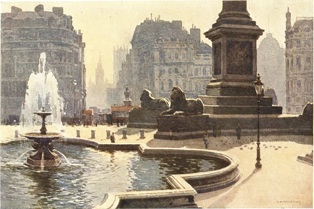
TRAFALGAR SQUARE
This square, dominated by the lofty Nelson Column, has been described as the finest site in Europe. A century ago it was covered with the narrow alleys of a sordid slum.
Text by Walter Jerrold
Pictures by E. W. Haslehust, R.B.A.
BLACKIE & SON LIMITED
LONDON AND GLASGOW
Blackie & Son Limited
50 Old Bailey, London
17 Stanhope Street, Glasgow
Blackie & Son (India) Limited
Warwick House, Fort Street, Bombay
Blackie & Son (Canada) Limited
Toronto
BEAUTIFUL ENGLAND
BEAUTIFUL SCOTLAND
Printed in Great Britain by Blackie & Son, Ltd., Glasgow
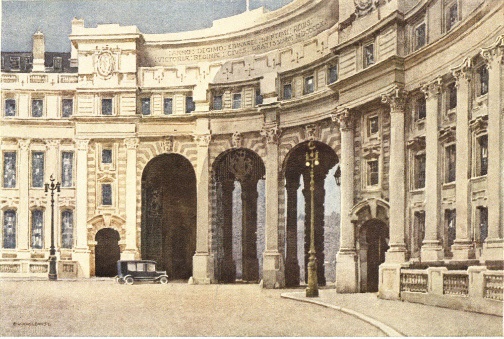
THE ADMIRALTY ARCH
Which forms the eastern end—fronting on Charing Cross—of the processional way along the Mall from Buckingham Palace.
“Why, how now, Babel, whither wilt thou build?
I see old Holborn, Charing Cross, the Strand,
Are going to St. Giles’s-in-the-Field.”
—Tom Freeman (1614).
Of all the many ways of getting to know a town or district there is perhaps none better than that which results from having the time, and inclination, to wander about and acquire the knowledge in a gradual and intimate manner. It is a method for which few but residents over a long period can obtain sufficient leisure, and they in the vast majority of instances lack the inclination. Maybe at the other extreme are those who, with a stentorian guide, are rapidly run round the place under review, and, with but the briefest pauses at the recognized “sights”, are shown everything in a few hours.
In the case of London it might almost be said that neither of these extreme methods is much good. Residents and visitors alike find London impossibly large in square mileage, impossibly crowded with things to be seen, traditions or memories to be recalled; thus it is that the resident is generally content to know, and that inadequately, the district or districts in which his social or business circle moves, and to have but a hazy view in regard to most of the remainder; while the visitor is mostly content to limit himself to certain “sights” selected in accordance with his individual taste, or on the plan of some guide. To visit the main buildings, parks, or monuments of a city, is only to see it partially. Indeed there are almost as many ways of “seeing” a place as there are visitors to see it. Visitors, however, may be divided into two vastly different classes: those who are content to be shown the “sights”, and those who have a desire to gain something of that more intimate kind of knowledge which comes of wandering about seeing the life of a city, and happening only from time to time upon the acknowledged “lions” of the locality. In the vast extent of London—which may be said to be represented by houses, houses all the way for a distance of some twenty miles from east to west, and somewhat about the same from north to south—there are so many objects of interest, 3 places of notable associations, or districts with their own particular “note” that it might well demand, as it has indeed been accorded, a library for its presentation in anything approximating to its literary entirety.
In its great system of motor omnibuses, London has what may be regarded by many people as the best means of seeing the externalities of the great city. By means of many interlinking routes, it is possible to get from wellnigh any point within the metropolitan area to any other point; and along the routes followed a goodly proportion of the “lions” may be glimpsed in passing, or paused at and visited, while a real knowledge may thus be gained of the relative positions of the astounding number of districts comprised within the vastness of London.
It is not surprising that some of the main starting-points of London’s motor-bus routes are found in the neighbourhood of the great railway termini—notably at Liverpool Street, London Bridge, and Victoria. Comparatively few people, it may be believed, start out to see London at the moment of their arrival; it has therefore seemed better to take radiating centres rather than railway stations as starting-points. In a necessarily brief survey of the incalculable mileage of her highways it is not easy to avoid at once the aridity of a mere directory of streets, the staccato 4 statements of a guide-book, and the undue emphasizing of certain places to the exclusion of others. London cannot be epitomized. Each of the centres which I have chosen might of itself provide materials for a volume many times the size of this.
By intersection and criss-crossing of routes it is possible, with but few changes, to get from any one point to another in the whole vast extent of a “Greater London”, which extends over close upon seven hundred square miles. That Greater London—the area within which the Metropolitan Police have jurisdiction—includes many places which the true Londoner still regards as being “out in the country”; here it is to the more central highways of the great metropolis that we must confine ourselves.
“I think the full tide of human existence is at Charing Cross.” —Samuel Johnson.
If we think of London and all that it has to show, in terms of the routes which are followed by its innumerable motor-buses, it is probably the radial centre of Charing Cross that first comes to mind.
From this centre, with its big hotels and numerous shipping offices, east and west, north and south, we may travel into any part of the far-spreading capital. 5 The centre itself, too, is one of interest. Charing Cross is immediately to the south of Trafalgar Square, and not, as many people think, the railway station of Charing Cross a little to the east along the Strand. In the forecourt of that station is a modern representation of the ancient “Eleanor Cross” which gave to the one-time village of Charing, situate between the cities of London and Westminster, the doubled name by which the immediate neighbourhood is now known. The ancient cross—destroyed by fanatical zealots in the mid-part of the seventeenth century—stood on the spot where now stands the old equestrian statue of Charles the First.
To many people Charing Cross and Trafalgar Square are almost convertible terms. The former marks the junction of half a dozen roads, the most notable of which are the Strand, running to the east, and Whitehall to the south. Many are the changes that have taken place here since the memorial to a devoted queen consort was replaced by the statue of a martyred king. Old Northumberland House was cleared away and the broad Northumberland Avenue cut through to the Thames within living memory. Earlier still, there was a great clearance of small slum buildings in front of the Royal Mews, when Trafalgar Square—“the finest site in Europe”—was laid out close upon a hundred years ago, and the site 6 of the Royal Mews itself became that of the National Gallery which forms the north side of the square. The main feature of the square is the lofty Nelson column—surmounted by a figure of the great seaman, and guarded at the base by Landseer’s four great couchant lions. Other monuments need not be particularized, but by the National Gallery stands a bronze statue to that great Englishman who became the first great American—George Washington. A little to the north, in the roadway between the National Portrait Gallery and the porticoed front of the church of St. Martin’s-in-the-fields, is the over-massive monument to the memory of Edith Cavell, the English nurse martyred in Brussels by the invading Germans in 1915. Northwards from here run the old St. Martin’s Lane, towards the Seven Dials and Bloomsbury, and the new Charing Cross Road, towards Camden Town and the “northern heights”.
Returning to our radial point of Charing Cross, we find that to the four points of the compass bus routes may be followed thence, or at least to other ganglia of that traffic which may be said to be the nerves of our corporate city life. It is indeed, as I have suggested, perhaps the most notable setting-out point from which may be started an exploration of London along its main-travelled routes, and that not only because of its linking with those routes, but also 7 because places of great interest are crowded close around.
Standing on the south side of Trafalgar Square we have before us, looking to the south, the broad way of Whitehall with, at the far end, the clock-tower of “Big Ben” dominating the group of the Houses of Parliament. Though short the distance—Big Ben is just half a mile away—there is much to claim attention along its brief course. Before passing along it glances to the left and right may be made: to the left along Northumberland Avenue—the way of big hotels—towards the riverside and the Embankment; to the right—under the handsome Admiralty Arch—is the processional way of the Mall, leading straight to Buckingham Palace along the north side of the picturesque pleasance of St. James’s Park, with its greenery of turf and trees, its lake lively with various exotic waterfowl, and its picturesque views of Government buildings old and modern.
Short as is the distance from Trafalgar Square to Parliament Square, it would provide materials for a considerable volume by itself. We have not gone many yards before, on the right, we see the old Admiralty buildings, surmounted by that new web in which science catches from the air words and signals emitted maybe from ships lonely amid a waste of 8 waters a thousand miles away. This became the head-quarters for Admiralty affairs in the reign of William the Third, and the admired screen shutting off the courtyard from the street was later added by Robert Adams.
A little farther down Whitehall, after passing the handsome new War Office buildings, we have on the right the range of low buildings of the Horse Guards, the mounted sentries at the entrance to which afford one of London’s infrequent touches of military colour. Opposite is the handsome Banqueting House of James the First—designed by Inigo Jones as part of a magnificent new palace of Whitehall, which never materialized further than the existing building. Here are housed the naval and military relics comprised within the Royal United Service Museum. It was from a window in the Banqueting House that Charles the First passed to the scaffold on that momentous day, 30th January, 1649.
Farther along Whitehall, on the right, come a succession of massive modern buildings, housing various Governmental departments. The first turning on the same side, between the Treasury and the Home Office, is perhaps the most famous street of its length in the world. This is Downing Street—where No. 10 has for the past two hundred years been the official residence of successive British Prime Ministers. The pleasant comfortable old residences are dwarfed by the more modern neighbouring offices. Immediately in front is the entrance to the handsome quadrangle of the Foreign Office.
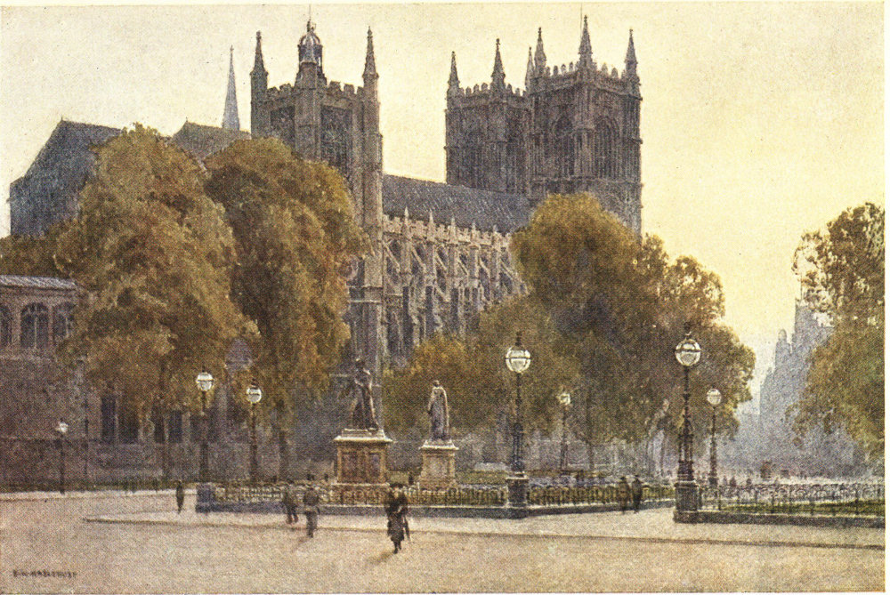
WESTMINSTER ABBEY
North-eastern view from Palace Yard, showing part of the beautiful Henry the Seventh’s Chapel.
Just beyond Downing Street, in the centre of Whitehall, rises in dignified simplicity that beautiful Cenotaph to “The Glorious Dead” who fell in the Great War—a monument far more moving and impressive than the most ornate of those memorials scattered up and down the country by which a generation that had suffered so appallingly sought to give lasting witness to its pride and grief.
“Not here they fell who died a world to save;
Not here they lie but in a thousand fields afar.
Here is their living spirit that knows no grave;
Not here they were—but are.”
Long, it may well be believed, will all that is best in the British character move the passer-by to raise his hat in silent homage to the young manhood of a world-scattered people united in the faith of freedom, who fell in the struggle against the Moloch of militarism.
Shortly after passing the Cenotaph and passing on the left the entrance to the head-quarters of the Metropolitan Police—New Scotland Yard—we reach Parliament Square. Right, the way goes to St. James’s Park, Birdcage Walk, and Buckingham 10 Palace; left, immediately to Westminster Bridge, across which pass many buses and trams to diverge on the farther side along many routes serving the southern suburbs; while across Parliament Square go some buses to Victoria, and others through byways to reach the river again near Vauxhall.
Parliament Square is assuredly one of London’s main centres of sight-seeing. On the farther side—focal point of British history for many centuries—is Westminster Abbey; while on the left, shutting off the river along which they are ranged, are the Houses of Parliament and Westminster Hall. Round about us here, too, are various statues—a specially notable trio which may be mentioned being Oliver Cromwell, Abraham Lincoln, and the Earl of Beaconsfield, representing as they do national ideas and ideals of dramatic diversity.
Westminster has long been honoured with the distinction of being a city, “public complaisance” having permitted it to continue to bear a courtesy title for which it was not ecclesiastically qualified. Here we cannot follow the story of Westminster since it was brought into existence by the establishment on a marshy island by the Thames of the Abbey from which it was to take its name; we are concerned more directly with things as they are than as they were, with the present rather than the past out of which it 11 has developed, with the beautiful Abbey as we can see it to-day rather than with the endlessly ramifying record of its storied stones.
St. Peter’s Abbey Church of Westminster is not one of the exceptions to the fairly general rule, that the magnificent buildings erected by our forefathers are not to be seen to the best advantage from the outside. Other buildings have in course of time been all too often permitted to hem them in and prevent their being seen as beautiful wholes. Of Westminster Abbey some very impressive partial views may be had. At the eastern end is a very memorable view of the sixteenth century Henry the Seventh’s Chapel, with, on the left, the far older octagonal Chapter House in which Parliament met in the thirteenth century. The main entrance to the Abbey at the western end is most conspicuous for the eighteenth century twin towers, the beginning of which was the last work undertaken by the veteran Sir Christopher Wren. The north entrance, or “Solomon’s Porch”, opening into the north transept, is that portion which has most recently been restored, and the view of this side as a whole is broken by the close contiguity of the church of St. Margaret’s. The south side is close crowded with the Precincts, so that it is not possible to get any unbroken view of the beautiful—though never completed—whole. The original design, 12 it may be said, contemplated a tall central spire, and spires also on the western towers.
Within the Abbey there is so much to appeal to architectural taste, to the historic sense, and to the multitude of interests implicit in the fact that Westminster has come to be regarded as the Valhalla of the nation’s great, that it is possible here to do little more than state that fact. Entering by the western door—to reach which we pass the slender column memorial to old Westminster boys who fell in the Crimean War—we come at once into the grand lofty nave, and to the simplest and most impressive of all the memorials within the wonderful place. This is the grave of the Unknown Soldier—the nameless man buried here in Britain’s house of fame to represent those who fell in the Great War of 1914-18. Unknown by any merely individualizing label, he lies here entitled to the name of every man who fell in that momentous struggle to save our civilization.
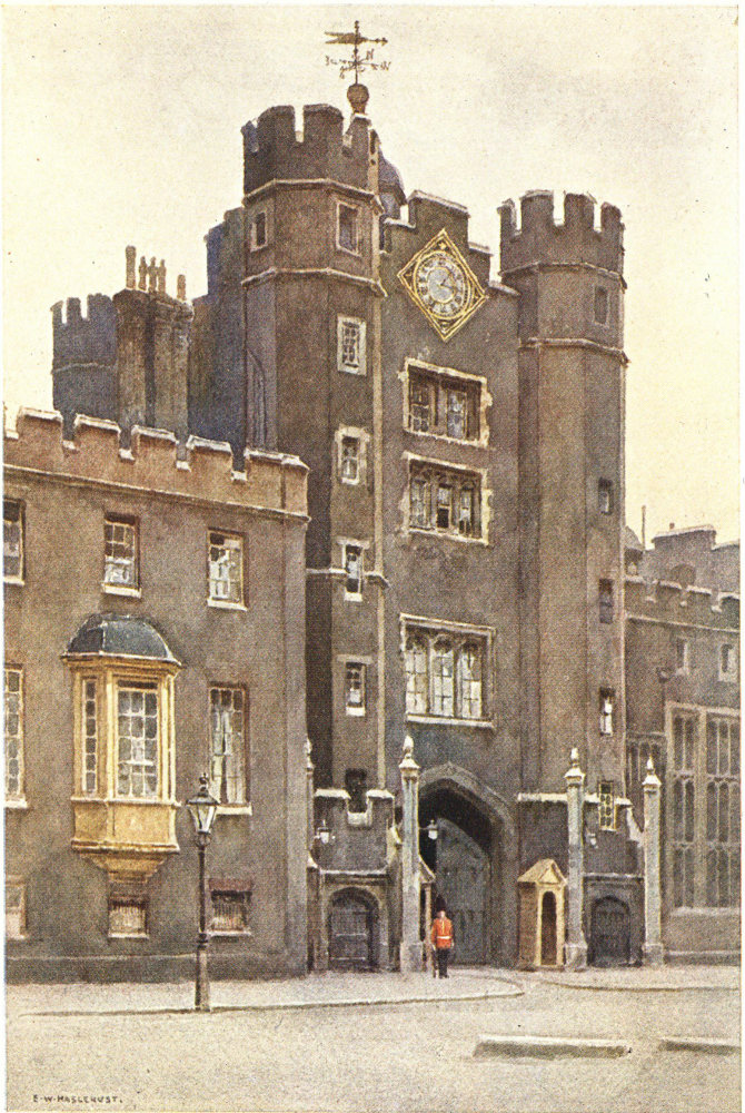
GATEHOUSE, ST. JAMES’S PALACE
Fronting up St. James’s Street, the gateway of Henry the Eighth’s palace is the main portion that is left of that monarch’s original building.
The burial of an Unknown Soldier as representative of all those who fell in the War was, as it were, a consecration of the nation’s Valhalla anew, by making it the shrine of a great idea transcending all the individualities in whose honour inscribed tablets, memorial busts, and monstrous monuments had previously been placed in the national shrine. Massive groups of uninspired marble, however, greatly as they may invite criticism on close inspection, are more or less lost in the grandeur of the lofty edifice. Where the memorials are mostly of a more modest character, in the Poets’ Corner, is the spot to which pilgrims are most strongly drawn. This is the eastern part of the South Transept, with memorials to or busts of a succession of great and lesser poets from Chaucer to Tennyson and Browning, many of whom, including the three named, are actually buried here. Though known as Poets’ Corner, this is the shrine of many men associated with literature and the arts generally. David Garrick and Sir Henry Irving, Samuel Johnson, Macaulay, and Charles Dickens, for instance, are among those buried here, while the memorials to those buried otherwhere include Shakespeare and Milton, Robert Burns and Walter Scott, Oliver Goldsmith and Robert Southey. Near the very beginning of the “Corner” is a bust of Longfellow—the first memorial here to an American contributor to the great body of English literature.
Between the Abbey and the river stands the ancient Westminster Hall, and the whole range of the Houses of Parliament from the Clock Tower at the western end of Westminster Bridge to the Victoria Tower. Westminster Hall also invites to a lingering stay; it is the surviving portion of the old Westminster Palace, and was built by William Rufus at the 14 close of the eleventh century, but was largely rebuilt two centuries later, when its most notable feature, the recently restored magnificent oaken hammer-beam roof was erected. In this Hall were holden, for many generations, great royal banquets and other festivities, including, up to the reign of George the Fourth, the coronation banquets. Here, too, for centuries were held the Courts of Justice, until in 1882 the new Law Courts were opened in the Strand. Many great public events—such as the trial of Warren Hastings—took place in this hall which has for upwards of eight hundred years been associated with the governance of the kingdom.
The best general view of the New Palace of Westminster is that from Westminster Bridge, or from the opposite side of the river, where the fretted range of its beautiful Gothic front, tower-terminated at either end, extends for a distance of about a thousand feet.
Beyond Westminster, by the river side, is Millbank, with the Tate Gallery as the sightseers’ main objective, and beyond that, Vauxhall Bridge. Our particular bus route, however, is that which, passing the western end of the Abbey, goes along the modern highway of offices and shops, Victoria Street, to Victoria Station, and its ramification of routes. On the way thither we may note on the left, standing back off the street itself, the most remarkable of recent 15 additions to London’s ecclesiastical architecture, the Roman Catholic Westminster Cathedral, the lofty campanile of which, rising to the great height of two hundred and eighty-three feet, is a notable landmark from many parts of the West End. This magnificent edifice of red brick with white stone courses, in the early Christian Byzantine style, has something of a bizarre effect among the neighbouring flats and mansions. Though it will be long before it takes on that mellowness which time alone can give to the great work of the architect, the cathedral should be visited, if for nothing else, for the wonderful view—given a clear day—which is afforded from its lofty dome-capped campanile.
“Through the long Strand together let us stray.” —John Gay.
Returning to Charing Cross, we may briefly indicate some of the more notable features observable on the easterly journey by way of the Strand to the City. Passing first Charing Cross Station on the right, we see opposite to it the church of St. Martin’s-in-the-Fields, where lie buried Farquhar the dramatist, John Hunter the anatomist, Nell Gwynne, and Jack Sheppard (infamy needs no description). The Strand—gradually 16 being widened so that it grows to a new thoroughfare—is mostly given over to shops, with some large hotels. Behind these, on the north side, is Covent Garden, and on the south the Adelphi and the Savoy, before we reach that turning on the right which goes to Waterloo Bridge. To the left is the new crescent Aldwych, that, curving northwards, reaches the Strand again by the church of St. Clement’s Danes. Along the main way, before reaching that church, we pass another, St. Mary-le-Strand, also enislanded between opposing streams of traffic, with on the right Somerset House, head-quarters of the Inland Revenue authorities; close neighbouring its dingy but dignified front is King’s College. On the left is the cream-toned stone of the massive new beautiful building known as Bush House; immediately beyond this is the grand block of Australia House, with its fine portico at the farther end fronting the Gladstone Statue and St. Clement’s Danes, the bells of which on occasion ring the familiar nursery rhyme of “Oranges and lemons, say the bells of St. Clement’s”.
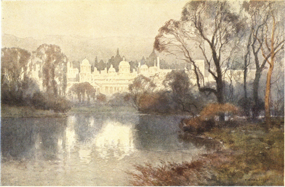
THE SUNK GARDEN, KENSINGTON PALACE
Sometimes called the Dutch Garden, this beautifully kept parterre is in spring and summer one of London’s loveliest spots of floral colour.
Beyond that old island-church on the left are the Law Courts, the smoke-blacked and weather-worn white of the stone work of which makes a striking picture as we approach it under a brilliant afternoon sun. At the farther end of the Law Courts we reach also the end of the Strand, marked by the rampant “Griffin” erected as memorial to the removed Temple Bar. Passing it we are in Fleet Street, with Wren’s gatehouse to the Middle Temple on our right, and just behind it the entrance to the Inner Temple by the old projecting building (much restored), which, wrongly described as a palace of Henry the Eighth’s, is now preserved as a show place. A few doors farther on we pass the Cock Tavern—famous for having its place in poetry as the subject of Tennyson’s “Will Waterproof’s Lyrical Monologue”. Devotees of port and poetry must be reminded that the tavern of which Tennyson sang was nearer to Temple Bar and on the north side of the street. Opposite the present-day tavern is the church of St. Dunstan’s-in-the-West, with a window in memory of Izaak Walton, and over the vestry door a statue of Queen Elizabeth, removed thither from Lud Gate when that city portal was demolished in 1786.
Nearly every building, every court and lane, on either side, as we pass down Fleet Street, recalls memories of past worthies. Now it has come to be “the street of ink”, and passing down it on a bus the names of London, provincial, dominion, and foreign journals are seen on either side, and if we pass into the by-ways it is to find other newspaper offices, printing establishments, and businesses connected with 18 the Press. A little back from the street on the south side, as we near Ludgate Circus, are the handsome storeyed tower and spire (thrice lightning-struck) of St. Bride’s Church, rebuilt by Christopher Wren after the devastating Great Fire.
At Ludgate Circus we reach another crossing-place of bus routes: northwards go St. Bride Street and the broad Farringdon Street, southwards goes Bridge Street to the Thames Embankment and Blackfriars Bridge, with buses and trams for the transpontine districts and for Kentish and Surrey suburbs. Continuing eastwards up Ludgate Hill the route takes us past St. Paul’s Cathedral, the mighty dome of which has, as we came down Fleet Street, shown grandly over the ugly railway bridge that crosses the foot of the hill. Ludgate Hill has little to claim passing attention, for inevitable widening has removed much of interest, and this applies not only to the hill itself, but also to its principal tributary the Old Bailey, which turns north to the criminal court of that name. On the north side of the hill is St. Martin’s Church—one of those re-erected by Wren after the Great Fire—the slender spire of which contrasts strikingly with the great dome of the Cathedral against which it is seen as we go up the hill.
The Cathedral itself—its forecourt frequently a scene of pigeon-feeding comparable with that which 19 most visitors to Venice remember outside St. Mark’s—is perhaps best seen under a bright afternoon sun, which emphasizes the striking contrast of the blacks and whites of its weathered Portland stone, and seems to heighten the massive dignity of the great edifice. Something of a second national Valhalla is the Cathedral—wherein lie buried Wellington and Nelson, and many other famous naval and military leaders, and also many celebrated modern artists and other men of distinction honoured by public burial. Passing the south door with its pediment-sculptured phœnix, our route may take us along Cannon Street, across the City’s scrap of that ancient Roman highway, Watling Street, and so up the modern Queen Victoria Street to the City’s main centre of radiating routes at the Mansion House, or—continuing along Cannon Street, past the railway station of that name and, on the left, the church of St. Swithin, in the wall of which may be seen an iron grille encaging the last fragment of London’s most ancient monument, that London Stone from which Rome’s highways in Britain are supposed to have radiated.
“I have twice been going to stop my coach in Piccadilly, thinking there was a mob: not at all, and it was only nymphs and swains sauntering and trudging.” —Horace Walpole.
Piccadilly Circus seems rather a focal than a radiating centre, more of a centripetal than a centrifugal social point; our bus routes come to mind as going to Piccadilly Circus rather than as going from it. Though several routes meet here it is that along Piccadilly itself which is mainly notable. The one down the Haymarket is but a journey of a few hundred yards and we are in Trafalgar Square; the one down Regent Street by new shops and offices almost at once reaches Waterloo Place and Pall Mall, the specific centre of Clubland, with the tall Duke of York’s column at the top of the steps leading down to the Mall and St. James’s Park. Left and right from the column runs Carlton House Terrace—mansions, backing on the park, which nearly a hundred years ago were erected on what had been the grounds of Carlton House.
Eastward from the Circus runs Coventry Street towards Leicester Square; north-eastward goes Shaftesbury 21 Avenue, most theatreful of thoroughfares. More especially interesting is the north-western route, Regent Street, though its fine colonnaded curves were long since robbed of their colonnades and are now in rapid process of change, the long monotonous sweep of level skyline giving way to such varied skyline as is regarded as contributing in no small degree to the beauty of London. The colonnaded building on the north side of the Circus affords little more than a hint of the old-time colonnade of Regent Street, which was lighter in structure and projected from the first floor of the buildings, with nothing superimposed upon it. This street has come to typify a great shopping centre. Behind it on the right are the innumerable by-ways of Soho, a notable residential centre of the eighteenth century that has come to be a district especially associated with foreign “colonies”.
Piccadilly Circus, also threatened with transmogrification by rebuilding, is often regarded as the special centre from which most of the theatres may be reached, and it is worthy of note that the majority of what are termed the West End theatres will be found within the eastern portion of a half-mile circle drawn from Gilbert’s beautiful fountain. Piccadilly itself, running to the westward, is now largely a street of shops during the first half of its length. 22 There must be many who echo the words of Frederick Locker-Lampson, one of London’s most lyrical lovers:
“Piccadilly! shops, palaces, bustle and breeze,
The whirring of wheels, and the murmur of trees,
By night or by day, whether noisy or stilly,
Whatever my mood is, I love Piccadilly.”
It was a later writer, the genial essayist G. S. Street, who declared that “there is only one side to Piccadilly”, meaning of course that the loungers of the day most frequently used one—which side that was I cannot recall. Piccadilly is said to owe its name to some association with the first shop built there having been that of a maker of a kind of ruff known as a piccadill, so that it is only appropriate that it should have developed into one of the fashionable shopping districts of the metropolis. There are, however, still some buildings that are not given over to the display of merchandise. Near to the Circus, on the south side, is the dignified front of the Geological Museum, and a little farther on the red-brick church of St. James’s built by Sir Christopher Wren. Farther along, on the opposite side, a small courtyard gives entrance to The Albany—for over a hundred years familiar as the home of wealthy bachelors. Then, also on the north side, is the fine frontage of Burlington House, home of the Royal Academy of Arts, the 23 Royal Society, the British Association, the Society of Antiquaries, and other learned bodies.
In the past Piccadilly was the centre of various popular exhibitions and entertainments, and during last century, to name a greatly contrasting trio, Daniel Lambert (87 stones), “The Living Skeleton” (about 5½ stones), and General Tom Thumb were “on show” here. Freaks and monstrosities have fortunately fallen out of fashion, thanks to changing public taste, and the exhibitions at the Royal Academy are nowadays Piccadilly’s principal “shows”.
A little beyond Burlington House, there turns off to the right the somewhat narrow beginning of what may be regarded as Fashion’s most famous thoroughfare—Bond Street, the very name of which has long stood as indicative of the modes of the moment. Beyond Bond Street—which affords a bus by-way linking Piccadilly with its parallel highway of Oxford Street—comes a broad turning on the left. This is St. James’s Street, leading in its short length to the western end of Pall Mall, and immediately to St. James’s Palace and Marlborough House, the fine Tudor gatehouse of the Palace fronting us as we go down one of clubland’s favourite streets, its time- and soot-darkened red brick contrasting greatly with neighbouring buildings. Between the royal residences a narrow way leads into the Mall in the neighbourhood of Buckingham 24 Palace. St. James’s Street, with its many tributary turnings—
“where Sacharissa sighed
When Waller read his ditty;
Where Byron lived, and Gibbon died,
And Alvanley was witty”—
has long been noted as a residential centre for wit and wealth.
Passing beyond the main Piccadilly region of shops and hotels, we come to where, on the left, is the pleasant tree-grown tract of the Green Park, across which may be seen through the trees Buckingham Palace and, beyond, the campanile of Westminster Cathedral. On the right is the famous mansion of Devonshire House, doomed to early demolition, the handsome iron gates of which have been removed and set up farther to the west as a break in the park railings. Fronting the Green Park, all the way to where the north-western corner of that pleasance neighbours the south-eastern corner of Hyde Park, are stately houses, many of them rich in association with noted people of the past and many of them now utilized as clubs. Behind these, reached by a celebrated series of by-ways—Bolton Street, Clarges Street, Half Moon Street, &c.—lies the fashionable district of Mayfair, and also all that is left of that quaint bit, Shepherd’s Market. In this neighbourhood, too, was at one time held that May Fair to which the district owes its name. The most westerly but one of these northerly turnings from Piccadilly is the narrow beginning to Park Lane, which shortly becomes the eastern boundary of Hyde Park as far as the Marble Arch. Its handsome mansions—possession of one of which has been long looked upon as the desired end of social ambition and wealth—look westward over the continuous extent of Hyde Park and Kensington Gardens.
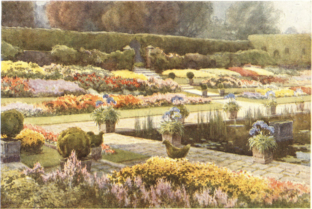
WHITEHALL FROM ST. JAMES’S PARK
Preserved us a pleasance between the palaces of Whitehall and St. James, this park now forms a foreground to Buckingham Palace, and affords picturesque views of Whitehall buildings old and new.
The last great house of Piccadilly is Apsley House, given a hundred years ago by a grateful nation to the victor of Waterloo. Immediately opposite, on one of the plane-planted “islands” of this open space, is a statue of the Duke of Wellington, fronting the house still in the possession of his family. South runs Grosvenor Place to Victoria, on the left of it a high brick wall shutting off the extensive grounds of Buckingham Palace. Between the corner of those grounds and the western limit of the Green Park stands the Constitution Hill Arch surmounted by a handsome quadriga, with a figure of Peace in the chariot.
Through the arch—between the Palace grounds and the Green Park—is Constitution Hill, running down to the Queen Victoria Memorial at the western end of the Mall and fronting Buckingham Palace, the 26 latest and probably plainest of the London houses of British sovereigns. The Palace, fronting on St. James’s Park and the Mall, has, especially from its upper windows, a beautiful outlook across the greenery to Whitehall’s varied range of buildings from the new Admiralty and its handsome arch by the lower weathered stone-work of the Horse Guards to the massy modern Government offices, the Houses of Parliament, and Westminster Abbey.
Returning to Hyde Park Corner—“Let us try one more turn ere we quit Piccadilly”—our highway continues westward past St. George’s Hospital at the back of which extend the squares and streets of Belgravia, the fashionable residential district more especially associated with the social regime of the Victorian period. With Hyde Park and Kensington Gardens successively on our right, the route takes us through Knightsbridge, past the fine Albert Hall, the Albert Memorial (most lavishly abused of all London’s monuments), to Kensington, the Palace of which stands back in its pleasant grounds among the trees on the western confines of those Kensington Gardens which at one time formed the private pleasance of the palace; then past Holland House, hidden behind the trees of one of inner London’s finest extents of private grounds still remaining, and so on to Hammersmith and the succession of western suburbs that lie along 27 what in old coaching days was known as the great Bath Road.
At Knightsbridge, to the left, go off two routes that should be noted: Sloane Street to Chelsea and the river, and the Brompton Road, which in a short journey will take us to the neighbouring piles of the Victoria and Albert (South Kensington) Museum and the Natural History Museum, with the broad Exhibition Road passing between, up to our main highway and the westernmost entrance to Hyde Park.
“The great Mediterranean of Oxford Street.” —Thomas De Quincey.
When we look at a map of London, that highway which, on the whole, appears most notably to approximate towards a straight thoroughfare continued for any great length, is the one which, but for bendy bits here and there and a distinctly twisty bit where it worms through the heart of the City, runs right through Middlesex from east to west, and in that course undergoes many name changes. Along it the visitor to London who wishes to get broad effects from bus-top journeys will get a goodly range of variety in the different districts through which he 28 passes. With two or three changes of vehicle the curious traveller might make the journey from the Essex border to the Buckinghamshire one, passing right across London and its suburban expatiations. Such a journey might well afford a vivid impression of the size of London, giving as it does a journey of about twenty miles without any long sustained break in the continuity of “bricks and mortar”.
Few people, it may be thought, are those who take such a trans-urban journey as that, and I do not propose to follow the course of that highway throughout its length, but to glance here at the more definitely London parts of it as reached from that celebrated centre of the West-end shopping district, which has within the memory of many of us definitely acquired the name of Oxford Circus. In a map of London published in 1897 it was still marked as Regent Circus, the name which it bore as a break in the way designed to link the Prince Regent’s residence, Carlton House, with the Palace which he designed, building at what is now Regent’s Park—the southern part of which lies little more than half a mile to the north of the Circus.
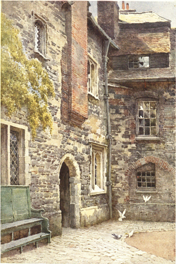
WASHHOUSE COURT, CHARTERHOUSE
Part of the old monastic buildings that remain incorporated in the hospital founded early in the seventeenth century as a home for poor and old gentlemen.
In every direction from Oxford Circus there has during recent years been much rebuilding, and in every direction the change is being rapidly intensified. The half-mile length which connects Oxford Circus with Piccadilly Circus had up to within recent years retained its “old-fashioned” appearance of the early nineteenth century, but changes once begun have proceeded so rapidly that Regent Street will, it may be believed, in a few years have little left beyond its name to remind us of the period in which it was planned. Passing along it from Oxford Circus, we find it a street of palatial shops, the turnings from which will take us on the right to Bond Street and so to the heart of the residential West End, while by the turnings on the left we can immediately reach the network of streets comprised within the Soho district. The first two of the turnings lead at once into Hanover Square, nearby which is that church of St. George’s that was during the nineteenth century the special place for the celebration of “Society” weddings. North of Oxford Circus, Regent Street extends a short distance by the Polytechnic and Queen’s Hall to where it appears to be abruptly closed by the eighteenth-century All Souls’ Church, but beyond which it is in effect continued as the broad residential thoroughfare of Portland Place, a tributary of Oxford Circus that has so far escaped becoming one of those main-travelled routes along which motor buses ply.
Oxford Circus is a nexus of linking routes rather than a starting-point. Oxford Street itself, which to the pavement-haunting De Quincey appeared as a 30 Mediterranean, suggests nowadays rather the wide all-linking ocean than the land-locked sea—such fleets of buses pass along it from places so far apart. If, before setting out eastward or westward, we inquire as to the origin of the name of this thoroughfare, we may be given one or two explanations either of which seems sufficiently satisfactory. One of these is that it was of old the beginning of the Oxford road, the highway linking the capital with the western University. This certainly seems likely enough; but I find it recorded close upon a couple of centuries ago that Oxford Street, then apparently but newly starting from the near neighbourhood of the “pound” that stood to the north of the church of St. Giles’s-in-the-Fields, and Oxford Market, which lay somewhat to the north of our thoroughfare near the Circus, received the name from being “on the estate of the late Earl of Oxford”. In that this one of the main high-roads to the west was also frequently referred to as the Uxbridge and the Tyburn road, this explanation may be the correct one. But it matters not.
To the westward from the Circus there are striking new palaces of modern shopping in the three-quarters of a mile extending to the Marble Arch, and it is not surprising to find that Oxford Street appears to share with Regent Street the distinction of being 31 one of London’s main thoroughfares constantly characterized by sauntering crowds. Though chiefly “a shopping centre” Oxford Street is a highway that takes us through districts with inviting by-ways. On our westward way, for instance, at the first point at which a road crosses it, we may see immediately to the left the greenery of Hanover Square, and to the right that of Cavendish Square. The latter has long been famed as connoting the homes of distinguished doctors, while from its north-eastern corner runs directly northward the straight stretch of that Harley Street which seems of late to have succeeded to the professional associations long connected with the Square.
Farther west along Oxford Street turns off to the left that New Bond Street which, merging with its parent Old Bond Street, becomes a direct link with Piccadilly just half a mile distant. A little beyond, and on the right, goes off the beginning of Marylebone Lane. Though its houses and cottages have long since been superseded by shops and offices, the development was not accompanied by those widening and straightening processes by which progress so frequently obliterates evidence of the past, and here we may still follow the very sinuosities of the old country lane by which Londoners wandered out to the one-time village of St. Mary-le-bone. Yet farther along Oxford Street we find Duke Street leading up to Manchester 32 Square, the northern side of which is occupied by Hertford House, containing one of the richest collections of art treasures accessible to the public.
Behind the shops, as we near the western end of Oxford Street, lie large residential districts. Turnings on the left pass down to Grosvenor and Berkeley Squares and the heart of Mayfair; those on the right lead to Portman, Bryanston, and other well-known residential squares and their tributary streets. A branching bus route at Oxford Street goes off for Baker Street, Regent’s Park, Lord’s Cricket Ground, the Zoological Gardens, St. John’s Wood, Finchley Road, and a veritable new world of north-western suburbs; while up Portman Street, the next turning beyond, on a clear day we can see away over Regent’s Park to the Northern Heights—one of the few glimpses of those heights still left to us from amid London’s crowding accumulation of buildings. At the end of Oxford Street—passing on the left Hereford Gardens, the last residential strip remaining in the street of shops—we come to the north-eastern corner of Hyde Park, with the fine Marble Arch now standing isolated from the park to which, for upwards of half a century, it gave entrance. Originally this arch—built of marble from the famous Italian quarries at Carrara, and designed after the arch of Constantine at Rome—stood outside Buckingham Palace, but it was removed to its present site at the time of the Great Exhibition of 1851. (When originally designed it was to have been surmounted by the statue of George the Fourth which now stands in Trafalgar Square.) Just inside the park here may generally be seen—on fine afternoons and evenings—crowds of varying size gathered about people airing their views on political, social, or religious matters.
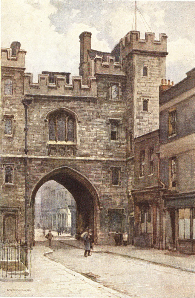
ST. JOHN’S GATEHOUSE, CLERKENWELL
All that remains, and that much restored, of the ancient Priory of the Order of St. John of Jerusalem established in the twelfth century.
To the left, as we reach the Marble Arch, goes off—along the eastern side of the park—Park Lane, the way of large mansions and crowded dwellings of the well-to-do. Immediately beyond the arch, in the middle of what is now the broad roadway, stood of old the ghastly gallows tree of Tyburn, and from it to the right runs the Edgware Road to Paddington, Maida Vale, Kilburn, and other populous suburbs. Beyond the Marble Arch the westward road, along the north side of Hyde Park and its neighbour Kensington Gardens, becomes Bayswater Road, and later the Uxbridge Road, and may be followed for a number of miles through suburbs to the western boundary of Middlesex.
Harking back once more to Oxford Circus and going eastward, we still find Oxford Street a highway of shops, with many turnings going off southwards into Soho, and northward to districts into which Soho’s foreign “colonies” seem ever more extending. On 34 either side the by-ways lead to places associated with notable people of the past, more especially of the late eighteenth and early nineteenth centuries, for the highway that we are following here runs through a comparatively modern part of central London. Where Tottenham Court Road turns off to the left and the new Charing Cross Road and old Bloomsbury High Street fork off to the right, we reach the end of Oxford Street itself in St. Giles Circus. Beyond this crossing point of various routes our way becomes New Oxford Street. Looking down High Street we see the eighteenth-century church of St. Giles-in-the-Fields, near where of old stood a lepers’ hospital. Northward up the Tottenham Court Road—leading to “bleak Hampstead’s swarthy moor” and the north—we see a busy way of shops, with the massy buildings of the Young Men’s Christian Association showing near at the corner of Great Russell Street.
Though New Oxford Street was only formed in the middle of last century, it takes us at once into more storied districts, though the story, could we pause to listen to it, is not always a pleasant one. This thoroughfare was cut through one of the worst of London’s old slum districts, the “Rookery” of St. Giles, which here merged into Bloomsbury, and the district of St. Giles, further greatly cleared and improved within the memory of many of us, lies to the south with the once notorious 35 Seven Dials lying midway between us and Charing Cross. Continuing east we come to where in close proximity Shaftesbury Avenue, with its duplicated beginning, and Drury Lane go off to the right, while to the left Museum Street leads in a few hundred yards to the British Museum, that great treasure-house wherein is epitomized as it were the history of man in the world. When, something under two centuries ago, the mansion of Montague House became the nucleus of the Museum, it stood more or less alone in its fine grounds with fields and farms in the neighbourhood, and the sinister Field of Forty Footsteps immediately to the north. Now it is the centre of the long-fashionable residential district of Bloomsbury. Where the short turning goes to the Museum there branches from our main highway Hart Street, with on the left the church of St. George’s, Bloomsbury, “at once the most pretentious and the ugliest ecclesiastical edifice in the metropolis”, the spire of which is surmounted by a statue of King George the First in Roman disguise. Hart Street, with its continuations Theobald’s Road, Rosebery Avenue, &c., slanting across many of our north-going roads, is the nearest route to Shoreditch, Kingsland, Hackney, and other north-eastern districts.
A little farther to the east and New Oxford Street ceases, the highway continuing successively as High 36 Holborn, Holborn, and Holborn Viaduct into the City. Shortly we have on the left Southampton Row going on through Bloomsbury to the great termini of the northern railway lines: Euston, St. Pancras, and King’s Cross. The broad road to the right is the new Kingsway, its fine substantial buildings leading the eye to the northern front of that massive and impressive Bush House at which we glanced in the Strand. Passing along Holborn we have, behind the shops on our left, successively Bedford Row and Gray’s Inn, and behind those on our right Lincoln’s Inn and its Fields and Chancery Lane—districts long associated with the fraternity of the Law, and each inviting to exploration of byways. Where Gray’s Inn Road comes in on our left from King’s Cross, stood of old Holborn Bars, to indicate the western limit of the jurisdiction of the City of London. Here now stands Toft’s effective monument to those of the City Regiment who fell in the Great War. Here, too, at the entrance to Staple Inn, is the range of old timbered Tudor houses that form the chief survival of domestic architecture of that period left to London, contrasting greatly with the big offices and shops. Just beyond, the red-brick buildings of the Prudential Assurance Society cover the ground that was of old Furnival’s Inn where Charles Dickens once dwelt. Then an unusually narrow turning is the beginning of 37 Leather Lane, while nearly opposite to it, a mixture of small, old-fashioned, dingy shops and large printing works, Fetter Lane, bearing little evidence that it has an age of some six hundred years, goes down to Fleet Street.
Where Charterhouse Street forks off to the left by Farringdon and Smithfield Markets to the Charterhouse, we are in the immediate neighbourhood of Hatton Garden, celebrated as centre of the diamond trade, and Saffron Hill, associated more particularly with the humbler members of London’s Italian colony. On a Saturday evening or Sunday when foot passengers and road traffic are fewest, a glance along Charterhouse Street from this point of Holborn Circus reveals a curiously “foreign” scene, with the small, domed turrets of the meat-market leading the eye on to the distant trees of Charterhouse Square.
Passing on the right that celebrated place associated with popular preaching, the City Temple, and between the business premises of Holborn Viaduct—constructed to span the “valley” along which the old Fleet Ditch meandered to the Thames—we come to the central part of that Viaduct, and looking over the balustrade get a view of busy Farringdon Street, on the right, to Ludgate Circus, and on the left to the markets just mentioned. A little farther on, where the Old Bailey branches off along the western side of the modern Central Criminal 38 Court on the site of the old Newgate Prison, we reach Newgate Street. Opposite the Old Bailey stands the large church of St. Sepulchre, which, almost destroyed by the Great Fire, was “rebuilt and beautified” under the supervision of Wren. Here, too, is Giltspur Street leading directly to the famous old church of St. Bartholomew the Great, and the great hospital of that name, and on into Smithfield.
Continuing eastward we pass along Newgate Street, with memories of the days when the blue-coat boys of Christ’s Hospital were to be seen at their games in a playground on the left. Passing also on the left part of the new General Post Office and the site of the old one, we reach the busy thoroughfare of Cheapside close to the north-eastern corner of St. Paul’s Churchyard, with a really beautiful view of the great dome of the Cathedral above green trees. As we pass along Cheapside we see, just ahead of us on the left, another green tree—the famous plane at the corner of Wood Street.
Almost directly opposite the plane, at the corner of Friday Street, is a red-brick house that bears a plaque indicating that it is the oldest house in Cheapside, having survived the Great Fire of 1666. Though the ground floor has been altered in accordance with modern shopping requirements, the upper part has probably much the same appearance that it had when 39 the old Mermaid Tavern still stood a little farther down Friday Street.
Ahead of us is the steeple of the church of St. Mary-le-Bow—commonly regarded as the finest of the many greatly varied steeples with which Sir Christopher Wren dignified the city on its rebuilding after the Great Fire. A little farther and, glancing up King Street on the left, we get a glimpse of the Guildhall. Then on the same side is the Hall of the Mercers’ Company; and shortly after our highway changes its name to the Poultry for the brief distance to its termination where Queen Victoria Street comes in by the Mansion House. Up a court on the left in the Poultry is the Hall of the Grocers’ Company. Where buildings continue on the left side our highway takes on yet a further name, for the single block opposite the home of the City’s Lord Mayor is by itself dignified as Mansion House Street.
“London, thou art the flower of cities all.” —William Dunbar.
At the Mansion House we are not only at the official residence of the City of London’s first citizen but also at the principal radial centre of that City’s highway routes. Ignoring lesser ways we have here the starting-point of no fewer than eight thoroughfares: 40 the Poultry, becoming in a few hundred yards Cheapside, will take us away to the westward by the route which we have just glanced along; broad Queen Victoria Street goes south-westward to Blackfriars Bridge and the Embankment; narrow Walbrook to the south forms the nearest link with Cannon Street and the river; King William Street goes south-eastward by the Monument to London Bridge; eastward run Lombard Street (becoming Fenchurch Street) and Cornhill (becoming Leadenhall Street) in opposing curves that meet at Aldgate and continue under a succession of names away to the eastern suburbs; between the Royal Exchange and the Bank of England the quaintly named Threadneedle Street leads to Bishopsgate and so to the north; at the farther side of the Bank is the brevity of Princes Street, leading to Moorgate Street and the City Road and so to the one-time “merry” Islington. Several of the streets named are closely bound up with the history of the City, indicating markets that were holden here in mediæval days, or the settlement of certain merchants, and to-day these names connote the fact that we are in what is still the commercial centre of the capital, for several of them have come to be used as synonymous with the special business that has been or still is transacted therein.
THE THAMES FROM BELOW WATERLOO BRIDGE
Among the finest of London’s river views is that citywards from near the southern end of Waterloo Bridge, and it is enhanced if seen from the foot of the bridge steps.
Before setting off on any of the highway routes indicated, we may pause at our central point. The Mansion House is a modern addition to civic life, having been built in the middle of the eighteenth century, before which time the Lord Mayor had no official residence. Turning our back upon its pillared portico of Portland stone, we have in front of us the corner of the low but massive grey stone buildings of the Bank of England, “the old lady of Threadneedle Street”. To the right of it is the fine pillared portico of the Royal Exchange, built in the mid-nineteenth century in place of that one which, destroyed by fire in 1838, had replaced Sir Thomas Gresham’s original building that had disappeared in the devastating conflagration of 1666. The large grasshopper vane, conspicuous on the campanile, and some tessellated pavement within, are all that remain of Gresham’s building. Many statues and fine frescoes by modern British painters are to be seen within.
As that route which continues more or less directly the one from the west, we may glance first along Cornhill, head-quarters of many insurance offices, and Leadenhall Street—their junction being marked by the crossing of Gracechurch Street—and so pass out of the City. As we start along Cornhill, the handsome four-turreted tower of St. Michael’s shows above the offices on the right, like the much-admired tower of Magdalen of Oxford on which Wren modelled it. In Leadenhall Street stood that India Office in which 42 Charles Lamb was clerk for many years. The small church of St. Andrew Undershaft, at the corner of St. Mary Axe, escaped destruction in the Great Fire. At Aldgate the still somewhat narrow City highways give place to what Sir Walter Besant described as one of the broadest and noblest of all the approaches to London. He also noted that the part of outer London through which this highway passes to the City, is one less known to the generality of English people “than if it were situated in the wildest parts of Colorado or among the pine forests of British Columbia”. At Aldgate—with Houndsditch going off to the left up to Bishopsgate, and Minories off to the right down to the Tower—we are at the beginning of that extensive intermingling of districts known comprehensively as the East End, with our main route through it going on by way of Whitechapel, Mile End, and Bow, to the Essex suburbs of Ilford, Seven Kings, and other brick and mortar extensions reaching out to Romford and the rusticities.
At Whitechapel we are in the centre of that quarter which has long had the reputation of being London’s most populous ghetto, and more especially the district into which, for many decades, poorer Jewish immigrants have found their way. Here street marketing is a feature of the neighbourhood, while a very old market survival is to be recognized in the frequent sight of 43 a number of carts, piled high with trusses of hay, ranged down the centre of the road. Just beyond Aldgate Station there goes off on the left that Middlesex Street which is better known to fame as Petticoat Lane, scene of a widely-known Sunday street market for the sale of unconsidered trifles acquired by modern representatives of Autolycus in all parts of the metropolis. In Commercial Street, which goes off shortly to the left, are St. Jude’s Church (with paintings and external mosaic by G. F. Watts), and Toynbee Hall, for many years famous as a centre from which young University men, indefatigable in well-doing, have sought to diffuse sweetness and light through drab and dreary districts. At Toynbee Hall, over thirty years ago, were begun those loan exhibitions of fine art in which originated the Whitechapel Art Gallery now established in the main thoroughfare. To the right, opposite Commercial Street, start Leman Street and the Commercial Road, leading to the unlovely yet strangely fascinating “dockland”—Shadwell, Wapping, Limehouse, Millwall, wherein is to be seen much of depressing monotony, but also may be found a number of quaint and picturesque nooks and corners—and so to Blackwall and its mile-long tunnel linking the Thames-divided counties of Essex and Kent. Through that tunnel we may travel by omnibus to Greenwich and Deptford.
Returning to the Mansion House, we may glance along the highway of King William Street. It leads from the church of St. Mary Woolnoth, one of the most individual of London churches, but now woefully disfigured by having a tube station built about its base. St. Mary Woolnoth, by the way, was for over a quarter of a century in the charge of John Newton, part author, with Cowper, of the “Olney Hymns”. This route takes us between fine imposing modern business premises, across the junction of Cannon Street with Eastcheap—where, on a solid granite base, stands the statue of William IV—and so past the lofty Monument at the confines of Billingsgate Market on the left, and between the old church of St. Magnus and the substantial Hall of the Fishmongers’ Company, on to London Bridge, and the famous view down the Thames of the Pool with its shipping, and of the fine Tower Bridge, and affording a glimpse on the left bank of the ancient Tower of London itself. Across the bridge we enter Southwark, rich in story and associations, but with little to claim the lingering attention of the bus-top traveller. Beyond, we may pass into the ramifying ways that lead to the many districts of South London, and so farther afield to pleasant, still countrified suburbs.
THE “GRAPES”, LIMEHOUSE
A riverside “bit” on the left bank, the quaintness of which is noted by many who pass along the highway of the lower Thames.
South-westward from the Mansion House is Queen Victoria Street, which was finished little more than half a century ago, and is largely given over to shops and wholesale business premises. A little way along it crosses narrow Watling Street, still retaining the name of the old great Roman highway of which it is but a brief lane-like remnant, and Queen Street going north to King Street and Guildhall, and south to Southwark Bridge. Immediately after we cross Cannon Street, with St. Paul’s Cathedral a short distance on the right, and go on down the broad way of modern business premises, past the picturesque College of Arms and the Times offices, to the junction with the City’s oldest thoroughfare, Upper Thames Street, just before reaching the northern end of Blackfriars Bridge, and the beginning of the Embankment.
Yet two other routes from the Mansion House fall to be noted—separated by the massy angle of the Bank. To the right, by Threadneedle Street (with an early turn into the misnamed Broad Street) we may go on into Bishopsgate Street, which lost the last of its famous old houses when the fifteenth century Crosby Hall was removed piecemeal to Chelsea a few years ago; portions of another famous Bishopsgate residence, that of Sir Paul Pindar, may be seen in the Victoria and Albert Museum. Memories of an ancient priory are preserved here in Great St. Helens and other place names, and the old church of St. Helens is full of interest. Continuing past the end of 46 London Wall on the left, and Houndsditch shortly after on the right, we reach the corner of the great railway terminus of Liverpool Street. Continuing alongside the station we may go on through Spitalfields—long celebrated as centre of the silk-weaving industry—to Shoreditch. Here to the left, through Finsbury and Clerkenwell, a road goes back into the west central district near the British Museum, while to the right the Hackney Road passes through thickly populated districts in little more than a mile to the western end of the beautiful Victoria Park, bordered here by the same canal that bounds the north side of Regent’s Park some four miles due west. Followed still farther from Shoreditch our main highway will take us through northern residential districts to Tottenham and Edmonton, by that road along which John Gilpin had his impetuous but involuntary ride.
The route along Princes Street, to the left of the Bank of England, is mainly taken by buses that have their terminus at Liverpool Street. This way leads to Moorgate Street and the Finsbury district, and so by the City Road to Islington.
“Ho! Ho!—to Islington.” —Sir William Davenant.
There are, very roughly parallel, three main east-and-west routes running through London: that which passes through the City and along the Strand; that far longer one the main portion of which is denominated Oxford Street; and that yet farther to the north at which we will now glance. All these routes by more or less abrupt twists and turns towards their eastern terminations may be followed to the City centre at the Mansion House.
Perhaps the best of the many radial centres along this highway at which to start considering the whole is that familiar to generations of Londoners as “The Angel, Islington”—a regular starting-point for the north in the pre-railway days, and for generations one of outlying London’s well-known landmark hostelries, lately become one of the tea-houses of these more temperate times. Of the many thoroughfares to be followed from this point we may consider first that which, going eastwards and trending ever more southerly, will take us in something less than two miles to the centre of the City at the Mansion House. This begins as the broad City Road, and almost at once a turning on the left invites irresistibly all good Elians, for it 48 is Colebrooke Row where Charles Lamb and his sister lived for several years in a house that still stands. After our highway has turned definitely south for some distance, we come to where, on the right, thickset trees and tombstones show we have reached the famous, deeply impressive Nonconformist burial-ground of Bunhill Fields, an old cemetery become a new public garden. Therein are buried many famous persons, including John Bunyan, George Fox, Daniel Defoe, Isaac Watts, and William Blake. It would be well if the authorities who have this extremely interesting ground in their keeping were to appoint an “Old Mortality” to maintain the tombstone inscriptions in a legible state, though it is to be feared that a large proportion of them have already been left too long to time’s obliterating touch. Immediately contiguous to Bunhill Fields—though mainly shut off by its massive castellated buildings from the roadway—is the yet more extensive Artillery Ground, the exercising place since Tudor times of the Honourable Artillery Company. Practically opposite, on the left, is Finsbury Square, and then by Finsbury Pavement and Moorgate Street we enter once more at London Wall into the heart of the City.
A turning that goes more southerly from the Angel is also one that runs down into the City. This is Goswell Road, which later merges in Aldersgate 49 Street and so reaches St. Martins le Grand and the western end of Cheapside. In this highway of shops and business premises it is no longer possible to pick out the likely house in which Samuel Pickwick took “apartments for a single gentleman” with Mrs. Bardell. That “domestic oasis in the desert of Goswell Street” has disappeared—and some time during last century Goswell Street became Goswell Road.
Running roughly parallel with that road and yet more directly south is St. John’s Road, passing through Clerkenwell—long celebrated as centre of London’s watch-making industries—to Smithfield and just to the west of the fascinating old buildings of the Charterhouse. If there is little that is attractive in this much modernized old thoroughfare itself, it is the way of access to places of interesting association—and as much might be said of most of the great city’s highways. To the right as we pass down from the many-parting ways at the Angel are Myddelton Square and other places reminding us of that Sir Hugh who more than three centuries ago brought London its first large external water-supply by means of the New River. Close against the old New River Head (now offices of the Metropolitan Water Board) is that home of many memories for the older generation of London’s playgoers, Sadler’s Wells Theatre. The 50 “Wells” is now in Rosebery Avenue, that new but unattractive highway which was some years ago cut through a dingy district and runs south-westward to the Gray’s Inn Road by Holborn Town Hall. Continuing down the St. John’s Road we reach at its southern end a network of old and new Clerkenwell by-ways, the principal place of general interest in which is the ancient but much restored St. John’s Gatehouse—all that remains of the Priory of the Order of St. John of Jerusalem which once stood here. After being put to most varied uses during the centuries that followed on the suppression of the Order, the Gatehouse has appropriately become the head-quarters of the revived Order of St. John of Jerusalem and of the St. John Ambulance Association.
Northwards from the Angel the highway begins as the busy shopping centre of High Street, Islington—vastly changed from when it was actually the village main street—shortly to fork, the left branch, known as the Liverpool Road, taking us past the Royal Agricultural Hall up to Holloway and a network of northern suburbs. The right branch is itself bifurcated into Upper Street, leading into Highbury, and the Essex Road going north-eastward by Canonbury and on to Hackney and other populous districts. Between these roads, near their beginning, lies all that remains of Islington Green—reminder of the days when this was a village to which London’s citizens came in search of simple rustic recreation. At Canonbury is an old brick tower from which a goodly view is to be gained over the vast tract of London; one tradition says that it was part of a hunting lodge to which Queen Elizabeth was wont to come; another that Oliver Goldsmith here did some of the varied work which he undertook for bookseller taskmasters.
RIVER STEPS, WATERLOO BRIDGE
From immediately below is to be had an impression of the massive proportions of what the great Italian sculptor Canova described as “the noblest bridge in the world”.
Longest and most notable of our highways from the Angel is that which runs westward with a southerly trend. Beginning as the broad and, for London, steep Pentonville Road, it takes us past no fewer than half a dozen of London’s railway termini in little more than three miles. At the foot of Pentonville Road—just beyond where the Caledonian Road goes off to the right—we reach the dingy squat ugliness of King’s Cross. By Caledonian Road, or by the York Road, running along the eastern side of the station, we may make for the northern suburbs by way of that celebrated Caledonian Market which, though primarily a cattle market—the largest in the world, it is said—has come to be celebrated as one of the City’s most attractive street markets. There, on Friday mornings, is to be seen displayed the most extraordinary diversity of second-hand wares. Almost immediately opposite King’s Cross, Gray’s Inn Road goes off to the south through a somewhat depressing district of 52 small streets in process of change, past the large Royal Free Hospital on the left; a little farther on on the right Guilford Street goes off, leading past the Foundling Hospital into the heart of Bloomsbury. By Gray’s Inn Road we may reach Holborn Bars with the quaint old row of timbered Tudor buildings of Staple Inn directly in front of us.
Immediately to the west of King’s Cross—and strikingly in contrast with it—is the great château-like station of St. Pancras, London’s finest railway station thus close-neighbouring its ugliest. A little farther along, on the left, is the Greek-porticoed church which gives its name to the immediate district. Nearby is the beautiful tree-grown space on either side of our highway, Endsleigh Gardens and Euston Square. Through an opening in the middle of the latter is Euston Station. The green stretch of the highway here is but an emphasized feature of the greater part of this route. After crossing Gower Street and the junction of Tottenham Court Road and Hampstead Road we shortly reach Portland Road, with the southeastern portion of Regent’s Park just to the north, the handsome square between giving an unbroken stretch of greenery. The various turnings on the left give more or less direct connection with Oxford Street. Where High Street goes off to the left, the corner house (Devonshire Terrace) was for a dozen years 53 the home of Charles Dickens, and remains much as it was in his time. On the right is the Royal Academy of Music, and next we reach Marylebone Church (where in 1846 Robert and Elizabeth Browning were married), and a little farther along on the right is the palatial, red-brick, creeper-clad building in which is housed the famous collection of waxworks known all the world over as “Tussaud’s”. Here, too, we reach the triple Baker Street Station—giving by “Tube”, “District”, and “Metropolitan”, access to all parts of London and out into the counties of Hertfordshire and Buckinghamshire. Here we cross the broad Baker Street, which to the right would take us almost immediately to the south-western corner of Regent’s Park and along by Lord’s Cricket Ground into St. John’s Wood. Continuing westward, we find the highway avenued with trees, the old-fashioned houses that still remain on the right having long forecourt gardens. Left are tall blocks of flats, contrasting with the handsome stone Marylebone Town Hall. A little farther on the large red-brick building, creeper-clad, is the hotel forming the road front of Marylebone Station. Then come several hospitals established here when Marylebone was still a district of “fields”, and where the main highway bends to the left immediately before terminating in the Edgware Road half a mile from the Marble Arch, we turn to the right, and by Chapel 54 and Praed Streets may shortly reach Paddington, the last terminus along a highway of railway stations.
“St. George’s Fields are fields no more.” —Old Ballad.
The highways of London are so many and so varied, each in its turn affording means of access to byways innumerable and inexhaustible, that it is not possible here to do more than indicate some of the principal ones radiating from a few more or less definitely marked centres. Though oldest London may be said to be within the City confines, and most of the ancient buildings and centres of interest are on the north side of the Thames, yet the south side has come to be extensive enough to form a very considerable city by itself.
In earlier sections I have pointed out from time to time where highway routes cross the Thames and lead to the southern portions of the great metropolis and to the suburbs spreading fanwise far into the neighbouring counties of Surrey and Kent. It may, however, be well to take one of the transpontine radial centres and indicate, though with brevity that means the exclusion of much worthy of note, some of the one-time villages that have been absorbed in the great 55 whole which we know as London. Perhaps the best for present purposes is that from which, by ways more or less indirect, all the others could be reached. This is St. George’s Circus, whence half a dozen roads go off in various directions—and five of them lead to as many of the bridges over the Thames, the most distant being London Bridge just a mile to the north-east. The Borough Road, joining the Borough High Street starting east from the Circus, is the highway in that direction, and the Borough High Street is the Southwark end of that Old Kent Road which was probably the main way from south-east England to London even before the coming of the Romans. Directly north from St. George’s Circus we may go to Blackfriars Bridge in somewhere about three-quarters of a mile, passing the long celebrated home of “transpontine melodrama”, the Surrey Theatre, on the left, and later, on the right, the old Rotunda, a century ago famed as the place where Rowland Hill was preaching. On this south side, along the river between London and Blackfriars Bridge, was that Bankside famous in the annals of the Elizabethan stage. The Waterloo Road goes straight north-westward, passing the “Old Vic” and Waterloo Railway Station, to the fine bridge of the same name, with a grand down-river view, especially from the base of its granite piers on either bank. Westward is the Westminster Bridge Road, which 56 follows a more devious course, reaching the bridge after which it is named between the magnificent new London County Hall and St. Thomas’s Hospital, buildings which, it may be hoped, indicate the beginning of the beautifying of the south side of the river. Southwestward goes the Lambeth Road, reaching the river at the Lambeth Bridge, by the ancient palace of the Archbishops of Canterbury.
Those five highways, each terminating within a mile at one of the Thames bridges, indicate something of the broad sweep of the river as it passes through London, and many of the crossways linking them are worth exploring, though there is here no opportunity for any detailed story. The sixth of our ways, starting from St. George’s Circus, is the London Road, a way of shops leading shortly to what is perhaps south London’s most important junction of many ways—the Elephant and Castle, where tubes, trams, and buses converge from all points. Hence the New Kent Road runs to join the Old Kent Road and so to lead us to New Cross, Lewisham, Blackheath, Lee, and other now populous districts, that but a few generations ago were merely rural centres. The Walworth Road, going more directly south, takes us to Camberwell, Herne Hill, Dulwich, and the Norwood district dominated by the Crystal Palace, which, on its high hill at Sydenham, is a landmark for many miles around. 57 More westerly but still with a southward trend goes the highway which, beginning as Newington Butts, passes the Metropolitan Tabernacle (rebuilt since it provided a pulpit for that extraordinarily popular preacher, C. H. Spurgeon) and so goes on to Kennington Park—one of south London’s more beautiful oases—with, behind the houses on the right, that celebrated cricketing centre “The Oval”. Beyond the park the highway forks: one branch going to Brixton, Streatham, Croydon and so to the residential centres spreading ever farther into Surrey; while the more direct highway goes on by Stockwell to Clapham, Balham, Tooting, Malden, Wimbledon, and other suburbs along the southern side of Thames.
“Sweete Themmes! runne softly, till I end my Song.” —Edmund Spenser.
London’s most ancient highway has come to be most curiously neglected. By the most ancient highway, of course, I mean the River Thames, that river which, in days of old, was not only the way of pageantry but was also, certainly up to the close of the seventeenth century, the route most frequently followed by those wishing to journey between the centre of business activities in the City and Westminster the 58 centre of political, legal, and Court activities. Now it has not merely ceased to be in general use as a highway, but its banks have been only partially preserved for public purposes. Thus embankment schemes, inaugurated and carried out during the latter half of the nineteenth century, have provided us with a noble riverside way stretching from the City to Chelsea, but it is discontinuous, being broken here and again by bank-side buildings. So fine is that riverside way that it is a dream of many that the great work should be undertaken of an embankment along the southern bank of Thames, and London’s great river highway come to be worthily treated. Though the initial attempts at architecturally beautifying that southern bank—the long range of St. Thomas’s Hospital buildings opposite the Houses of Parliament and the dignified beauty of the London County Hall—have been made too near to the river wall to permit of an open embankment, it may well be hoped that later plans will include such an embankment down stream from the County Hall. One scheme for the utilizing, modernizing, and beautifying of the river highway is that of adding new bridges at Charing Cross and St. Paul’s and erecting upon them rows of shops, and so linking London south of the Thames with London north of the Thames, as to make them more truly a single great city than they can be when divided by “a dreary waste of road” carried across the river.
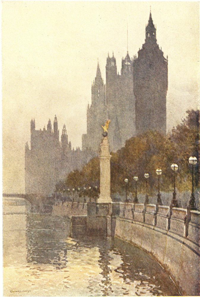
HOUSES OF PARLIAMENT FROM THE EMBANKMENT
Approaching Westminster by the plane-avenued Embankment, we see the Airmen’s Memorial by the riverside, and have the view terminated by the handsome clock tower of “Big Ben”.
However, my concern at the moment is with London’s highways as they are, and here we follow the riverside highway from where it starts by the northern foot of Blackfriars Bridge. From here to Westminster Bridge it is a handsome avenued way, something less than a mile and a half in length, following the great sweeping bend of the Thames, along which its course turns from south to north at the latter bridge to west to east at the former. Though pleasant stretches of greenery, the Temple Gardens and later the triple extent of the Embankment Gardens—dotted with statues and memorials to famous men—occupy a goodly proportion of the way, on our right there is also a goodly variety of impressive buildings. Among the first of these comes the City of London Schools, then, beyond the tree-grown lawns of the gardens, come the varied buildings of the Temple. The next outstanding feature, as we approach Waterloo Bridge, is the river front of the much-weathered Somerset House, the black and white of its Portland stone contrasting with the grim greyness of the massive but graceful granite bridge. Next, lofty many-windowed hotels are followed by the low buildings of the terraced Adelphi and the ugliness of Charing Cross railway station and bridge, before reaching which 60 we pass the sphinx-guarded “Cleopatra’s Needle” on our left and on our right a beautiful embayed sculpture, tribute of Belgium’s gratitude for British hospitality to her refugees during the Great War. Beyond Charing Cross Bridge again is the somewhat ornate block of the National Liberal Club and Whitehall Court. Then come the “garden backs” of Whitehall buildings until we reach the massive dignity, as of some mediæval stronghold, of New Scotland Yard, shortly beyond which, and forming the termination of this section of our riverside highway, rises four-square Big Ben, the clock tower of the Houses of Parliament.
On the riverside of our highway here we have, as we pass up this sweeping bend of Thames, good views of the successive bridges, and of the higgledy-piggledy picturesqueness of factories, wharves, and miscellaneous buildings that have long held the right bank of the river in central London. As we near the end of this section we come to the new eagle-topped memorial to the British airmen killed in the Great War, and beyond across the water see the dignified beauty of London’s new County Hall.
To continue along the riverside we must for a brief while leave the river and pass between the Houses of Parliament and Westminster Abbey, getting back to it beyond the graceful Victoria Tower, where our 61 way successively becomes Abington Street, Millbank Street (reminder of the old name of the district hereabouts), and—beyond the Lambeth Bridge—Grosvenor Road. Opposite Lambeth Bridge goes off the Horseferry Road, reminder of the pre-bridge days when there was a ferry for horses at this point. It is only here that we get actually back to the riverside—with a glimpse across the water of the archi-episcopal palace of Lambeth. From this point, with the exception of a stretch neighbouring Vauxhall Bridge, we may for about two and a half miles keep closely alongside the Thames. Shortly on our right we have the Tate Gallery of Modern British Art, beyond which is little to hold the attention as we pass through the riverside portion of Pimlico. Beyond the Grosvenor Road railway bridge, however, we come to Chelsea Bridge and a very pleasant stretch of our highway; on the right are the grounds of Chelsea Hospital fronting the old stone-faced home of the picturesque veteran pensioners. On the opposite side of the river—stretching for nearly three quarters of a mile—is the refreshing greenery of beautiful Battersea Park. Farther along on the right is the remaining fragment of the fragrant old Chelsea Physic Garden, belonging to the Society of Apothecaries. Small as it is, it is a delightful scrap of old-time London. Beyond Albert Bridge we reach Cheyne 62 Walk—the famous Chelsea river frontage associated with a large number of famous artists and men of letters—Carlyle (of whom there is a statue in the gardens), Whistler, Rossetti, Turner, George Eliot, and others. Carlyle’s house, which is a little way up the turning known as Cheyne Row, is preserved as a memorial. A little beyond again is Old Chelsea Church with its massy tower. Though dating from the twelfth century this picturesque edifice is mainly of the sixteenth and has much to interest the visitor both within and without. By Battersea Bridge—in the neighbourhood of which recent years have seen many changes—our riverside highway comes to an ending, though Cheyne Walk may be continued yet farther, into a region of gas-works or short turnings, to the right taken to the King’s Road and into the populous Brompton district, and so to Fulham, Hammersmith, and other westerly neighbourhoods.
Though I have described this route outwards from its City beginning, those who would follow it in its entirety—a walk of about four and a half miles—will perhaps find it more variedly picturesque by taking it in the down-stream way from the bridge at Battersea to that of Blackfriars. As a single highway it may be said to reveal more of the variety, beauty, and manifold interests of London old and new than any other, and by linking with Upper and Lower Thames 63 Streets, though perforce divided from the river by buildings, we may follow the ancient riverside way to the Tower of London and the open river bank once more. There is a story of an enthusiast who described the Thames to a transatlantic visitor as “liquid history”, and to follow the course of the stream from the western suburbs of London to the neighbourhood of dockland is to be made to realize how essentially true are the words of that enthusiast.
This series of beautifully illustrated volumes is an admirable record of what is most worthy of attention in some of our fairest places. Each book contains 12 reproductions of original water-colour paintings by E. W. Haslehust, R.B.A., in addition to descriptive text.
Attractively Produced Coloured Jacket
| Descriptive Text by | |
| Rambles in Greater London. | Walter Jerrold. |
| Through London’s Highways. | Walter Jerrold. |
| The Thames. | G. E. Mitton. |
| Bath and Wells. | Arthur L. Salmon. |
| The Peak District. | R. Murray Gilchrist. |
| In London’s By-Ways. | Walter Jerrold. |
| Winchester. | Sidney Heath. |
| The Shores of Fife. | John Geddie. |
| Heart of London. | Walter Jerrold. |
| Cornish Riviera. | Sidney Heath. |
| Loch Lomond. | George Eyre-Todd. |
| Dartmoor. | Arthur L. Salmon. |
| Edinburgh. | John Geddie. |
| Canterbury. | Canon Danks. |
| Shakespeare-Land. | Walter Jerrold. |
| The Scott Country. | John Geddie. |
| Oxford. | F. D. How. |
| Cambridge. | Noel Barwell. |
| York. | George Benson. |
| English Lakes. | A. G. Bradley. |
[The end of Through London's highways by Ernest William Haslehust; Walter Jerrold]