* A Distributed Proofreaders Canada eBook *
This ebook is made available at no cost and with very few restrictions. These restrictions apply only if (1) you make a change in the ebook (other than alteration for different display devices), or (2) you are making commercial use of the ebook. If either of these conditions applies, please contact a FP administrator before proceeding.
This work is in the Canadian public domain, but may be under copyright in some countries. If you live outside Canada, check your country's copyright laws. IF THE BOOK IS UNDER COPYRIGHT IN YOUR COUNTRY, DO NOT DOWNLOAD OR REDISTRIBUTE THIS FILE.
Title: Early History of the C.P.R. Road
Date of first publication: 1909
Author: Walter Moberly (1932-1915)
Date first posted: May 1, 2015
Date last updated: May 1, 2015
Faded Page eBook #20150502
This ebook was produced by: Iona Vaughan, Mark Akrigg, Cindy Beyer & the online Distributed Proofreaders Canada team at http://www.pgdpcanada.net
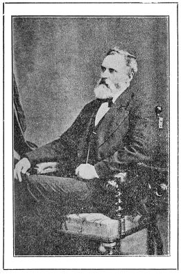
WALTER MOBERLY, C. E.
 N the brief early history of Canada’s
first transcontinental railway
which I am about to outline, and
to accomplish the ultimate construction
of which I took the first
active steps, the important objects
I had in view were as follows:
N the brief early history of Canada’s
first transcontinental railway
which I am about to outline, and
to accomplish the ultimate construction
of which I took the first
active steps, the important objects
I had in view were as follows:
1. To discover that a practicable line could be obtained through the mountains of British Columbia.
2. To be certain that it was the best obtainable line.
3. To find where the best western terminal point on the Pacific Coast would be.
4. To build up a large commercial city at such western terminus.
To accomplish the above objects I had for many years a long, very difficult and often most disheartening road to travel, but by sticking tenaciously to my purpose I found:
1. The way for the railway.
2. The best commercial line to adopt.
3. The western terminal point I selected was Burrard Inlet.
4. The large commercial city I had in view is now the City of Vancouver, and the transcontinental railway I proposed is the Canadian Pacific Railway.
Years spent in making careful and very extensive explorations through the western portion of Canada, especially through British Columbia, convinced me that the latent natural resources of the country were illimitable, and that railway facilities were needed to develop them and change a great, inhospitable and rugged wilderness into a large, flourishing and prosperous community.
The accomplishment and success of the foregoing important works now speak for themselves.
As it will doubtless be more satisfactory to you to learn from one who actually and personally first promoted, and whose exertions insured the accomplishment of the above undertakings, and the important results that have followed, than to form opinions from writers whose ideas and statements were, or are, founded upon hearsay, and in many cases inaccurate or prejudiced data, I will now proceed to relate the part I took before either the Canadian Pacific Railway or the City of Vancouver were heard of, to bring such important institutions into existence, and insure their prosperity, as well as that of the country at large.
In an address to the Canadian Club of this City, which I gave on the 13th of March, 1907, on the subject of “Early Path-Finding in the Mountains of British Columbia, or the Discovery of the ‘North-West Passage by Land,’ ” and also in a subsequent one I delivered to the members of the Art, Historical & Scientific Association of this City, I mentioned many matters and events that were necessarily connected with, and form a part of, the subject of this paper, and as everything relating to the many important events that transpired as years passed on from the time when that great, noble and adventurous Frenchman
SAMUEL DE CHAMPLAIN
first launched his canoe at the mouth of French River, on the beautiful waters of Lake Huron, to gradually bring about and ultimately form and consolidate the scattered and disconnected portions of British North America into a great nation, having an incomparable future before it, must be of great interest to all Canadians, it was suggested to me by Mr. F. C. Wade, president of the Art, Historical & Scientific Association of Vancouver, that I should give an outline history of the first explorations actually undertaken and made with the object in view of discovering a practicable line for a transcontinental railway through British North America, or, to speak more correctly, through that portion of the west of Lake Simcoe, for the railway system of Canada was then insured as far west as that lake, and to the present town of Collingwood, on Lake Huron. I went through the preparatory grades of my profession as a civil engineer, from an axeman upwards, on the first surveys made for this railway between Toronto and Lake Huron.
The history of Canada from the time the French first settled in various places in its eastern and central portions, and made heroic explorations westerly until they saw the great snow-capped range of the Rocky Mountains like a wall rising somewhat abruptly from the prairie country, and which latter country was, in my younger days, generally known as the Nor’-West, until the surrender of Quebec, embraces what constitutes the first or strictly French period.
Shortly after the fall of Quebec, France ceded her right of sovereignty to Great Britain, since which time, with the exception of some matters not fully provided for in the treaty between the Powers, the two races have dwelt together in peace and amity, and no portion of the population of Canada have been more loyal than the French-Canadians in their efforts to assist, together with other British subjects, in building up the great Canadian nation which extends from the Atlantic Ocean to the Pacific Ocean, and from the United States to “the Frozen Ocean” which washes the northern shores of British North America.
As years passed by, and the country east of Lake Huron became populous and prosperous, it was found necessary to build railways to facilitate transportation, and to unite the different portions of the country by constructing a great highway through Upper and Lower Canada and the easterly Maritime Provinces, and for that purpose the Grand Trunk Railway was built, which, together with other important railways then also being built, gave an immense impetus to the settlement and development of the portion of Canada east of Lake Huron.
Until the early fifties of the nineteenth century very little was known of the country west of Lake Huron, and it was generally supposed to be a rugged, cold, barren and inhospitable country, more suitable for wild animals and savage Indians than for civilised settlement and commercial development.
It was in the year 1850, when I was emerging from boyhood, that I met in Barrie an English gentleman from Kent, England, and we arranged to undertake a trip from Barrie to Sault Ste. Marie for the purpose of exploring the north shore of Lake Huron, and also for shooting and fishing, and to be present at the town of Manitowaning, on the great Manitoulin Island, in order to see the annual distribution of the presents that the government in those days gave to the Indians that then inhabited the country around Lakes Huron and Superior.
We purchased a small bark canoe, which we transported by the old military road from Barrie to the Willow River, down which we paddled to the Nottawasaga River, and thence down it to Lake Huron, and then coasted along the shore of Lake Huron to Penetanguishene where we outfitted.
After a delightful trip, during which we saw a great deal of the country bordering the north shore of Lake Huron, we went to see the distribution of the presents to the Indians. There were
SEVERAL THOUSAND INDIANS
congregated, and many of the Indian warriors were very fine looking men. War dances were innumerable, and a canoe race was got up, in which there were upwards of four hundred birch bark canoes. We visited the Wallace copper mine on the Whitefish River, as well as the Bruce mines. We then returned to the site of an old saw-mill, about five miles from the village of Manitowaning, where raspberries grew in profusion, and wild pigeons were innumerable. Having shot a great number of these birds we embarked on the old steamer “Gore”, and proceeded to Sturgeon Bay, and thence in our canoe to the Coldwater River, where we put our canoe on a wagon and transported it to Orillia, and then, launching our canoe on Lake Couchiching, we paddled back to Barrie. It was during this trip that I noticed the large forests of white pine that existed throughout the country we had visited.
In the year 1854 I secured the most available of the above timber by taking up some fifteen hundred square miles of timber limits, and I spent a large portion of the years 1855-1857 exploring through the country north of Lakes Huron and Superior, and between Lake Simcoe and the Michipicoten River, which discharges its water into Lake Superior.
It was when exploring this portion of Canada that the idea of getting an extension of the railway system that centred in Toronto first occurred to me, and which I thought might in due time be extended to the Red River in the present Province of Manitoba.
On my return to Toronto, at the end of the year 1857, I learnt that the Imperial Government had sent out an expedition, under the command of Captain Palliser, to explore British territory between Lake Superior and the Pacific Coast, and at the same time I heard that rich deposits of gold had been discovered in the valley of the Fraser River in British Columbia. It then struck me that it might be possible to extend the railway I had projected from Toronto to the Red River all the way across the continent, entirely through British territory, to the Pacific Coast.
During several years previous to the year 1858 I was intimately acquainted with the celebrated Canadian artist, Mr. Paul Kane, of Toronto, and during the Winters of the years I spent exploring in the Summer months, north of the Great Lakes, I obtained much and very valuable information from Mr. Kane regarding the country west from Lake Superior to Victoria, V. I.
Mr. Kane had, under the auspices of the late Sir George Simpson, then the governor of the Hon. Hudson’s Bay Company, journeyed from Toronto via Lakes Huron, Superior and thence by the old Hudson’s Bay route via Lake Winnipeg, Fort Edmonton, the Athabasca Pass, the Boat Encampment on the Columbia River, and thence to Fort Colville, etc., etc., to Victoria. Mr. Kane returned generally following the same route, and had the opportunity of learning a great deal about the enormous extent and possibilities of the country he had traversed. Mr. Kane published a book entitled “The Wanderings of an Artist,” in which he gives a very interesting account of his travels.
Before I left Toronto, Mr. Kane introduced me to Sir George Simpson, and when I explained to the Governor the objects I had in view in going to British Columbia, he very kindly gave me a letter of introduction to the late Sir James Douglas, who was then at the head of the Hudson’s Bay Company affairs west of the Rocky Mountains.
At that time the Hudson’s Bay Company were lords of the vast territory west of Lake Huron, and Sir George Simpson’s letter was invaluable to me, for, on my presenting it to Sir James Douglas he not only received me most kindly, but offered me a position in the Government service, which I declined, as it would interfere with the objects I had in view, and he gave me a letter that would insure me a welcome and assistance at any of the Hudson’s Bay forts I might visit. Until the day of his death I always found Sir James Douglas to be
A KIND AND INVALUABLE FRIEND.
To accomplish such a grand object as railway communication through British territory to the Pacific Coast, I decided to devote my time, and as in those days there were no rich railway corporations nor governments to apply to for financial assistance to help me to carry out my proposed explorations through the rugged and formidable western ranges of mountains that form the topographical feature of British Columbia, I sold all my timber limits and what other little property I had to raise money, and early in the year 1858 I left Toronto for New York, and thence, visiting Brazil, Patagonia, Chile, California, Astoria on the Columbia River and Puget Sound, I finally reached Victoria late in the year 1858.
I thought I might meet Captain Palliser in Victoria and learn from him the result of his explorations, but on my arrival Governor Douglas informed me that Captain Palliser’s party would not reach Victoria until the following Autumn, and I was unable to get the information I was so desirous to obtain. I left Victoria after a few days’ stay, and sailed for Fort Langley in the H. B. Company’s steamer “Otter”, and arrived the same day at the old and extensive Fort Langley, where I received a hearty welcome from the late Chief Factor, William Yale, and other officers of the company who were then stationed or visiting at that important fort.
I may now say that my explorations for a Canadian transcontinental railway through the mountains of British Columbia fairly commenced on the day I reached Fort Langley, in the year 1858, and in connection with those I had previously made north of Lakes Huron and Superior, the explorations for Canada’s first transcontinental railway made by me really began in 1855, or sixteen years before British Columbia was confederated with the provinces east of the Rocky Mountains. Further on in this narrative it will be seen that six years before British Columbia became a province of the Dominion I had made discoveries that insured to Canada a capital line for the present Canadian Pacific Railway through the mountain region of Canada principally at my own expense.
The Winter, cold, dreary and comfortless, had now set in with much snow and rain falling, which made things very discouraging. A large number of miners who had been mining in the neighborhood of Forts Hope and Yale, and on the Lillooet River, were living in shacks about half a mile below Fort Langley, and they gave very gloomy accounts regarding the portion of the country I proposed exploring, and dilated on the very great difficulties that its extremely rugged nature presented, and also that there was war between the miners and Indians going on in the canyons of the Fraser River, and that several miners and a number of Indians had been shot.
As there was a small stern-wheel steamer, named “The Enterprise”, owned and commanded by a most genial and kind-hearted American—Captain Tom Wright—going up the Fraser to Fort Yale, I proceeded up the river in her. “The Enterprise” was the pioneer steamer to navigate the Fraser River to Fort Yale. Innumerable old pioneers of the Fraser River experienced much kindness from Captain Wright when they were without means and starving, for he not only gave them free passages, but also fed them when on his steamer, and also at the same time had such a pleasant way that he made them feel that they were not under obligations to him, but that they were conferring a favor on him by travelling in his steamer. Captain Wright was a most amusing character, and would keep the passengers in roars of laughter by spinning yarns and telling amusing anecdotes.
At the mouth of the Harrison River, together with several others, I left the steamer. As rain, intermixed with snow, was falling in torrents, we pulled the goods the steamer had left on the bank of the river into a near-by large Indian house, called in those days
“A RANCHEREE,”
and we also found shelter in it, but the smoke and stench in it were very disagreeable.
Having on my way up from Fort Langley arranged with a merchant who had a general store at Port Douglas to take charge of a canoe of his loaded with goods and liquors, I hastily collected a crew and late in the afternoon we started up the Harrison River. At the rapids we all had to get into the icy water and pull the canoe up the rapids, and at dark reached a large Indian house in which dwelt many Indian families, with whom we stayed over night, and thawed our clothes and half frozen bodies.
A few more days of misery, after being buffeted by strong head winds accompanied with heavy snowstorms, when travelling Harrison Lake, saw us in Port Douglas, which was a small village composed of rough shacks and a few better balloon buildings for stores and liquor saloons. The place was crammed with miners and packers and others. I hired an Indian to pack my blankets across the twenty-nine mile portage to Lillooet Lake, and next morning started along a narrow trail through the deep snow that penetrated a dense green fir forest.
After many days spent in walking through the snow, and experiencing endless difficulties and hardships, and without a blanket to sleep in, for I had thrown away my blankets the day before I left Port Douglas, as packing them through the snow delayed me very much, I managed to penetrate the country as far as Pavilion Mountain, some distance above the present turn of Lillooet, and having tried mining near “The Fountain,” which was not a success, and there not being any provisions obtainable, I was starved out and retraced my way back to Fort Langley.
This exploration convinced me this route was not favorable for the construction of the eastern section of my proposed transcontinental railway. I, however, ascertained that there were no great difficulties to be overcome in the construction of wagon roads across the portage between Port Douglas and the present town of Lillooet and thence up the valley of the Fraser River to the Pavilion Mountain.
On my return to Fort Langley, Captain Tom Wright and myself started in a canoe to explore up the Pitt River and lake to see if we could find a better way into the interior than that by the Harrison River and lake. A short exploration in this direction convinced us of the impracticability of this route.
After making this exploration I returned to Victoria and gave the Governor an account of my explorations, and he decided to improve the Harrison rapids in the way I suggested, and also to construct wagon roads across the portage, &c., I had examined between Port Douglas and Pavilion Mountain.
I now made an exploration through the canyons of the Fraser River between Yale and Lytton, which presented great natural difficulties, but in both direction and grades a good line could be obtained for either a wagon road or railway, though the work of construction in either case would be very costly.
When I returned again to Victoria I met Colonel Richard Clement Moody at the Governor’s office, and arranged with him to take charge of the first works required to be done in founding the City of Queensborough — now New Westminster — and at once returned to the Fraser River with Colonel Moody and went to work with a number of men to clear the timber off the townsite, erect some necessary public buildings, &c., and on completing the works entrusted to me I left the service of the Government in which Colonel Moody wished me to remain, and then in company with Mr. Robert Burnaby, who had been private secretary to Colonel Moody, we proceeded to Burrard Inlet with a few men to try and find coal at Coal Harbor—hence its name.
We explored the country all around Burrard Inlet, and then along the easterly shore of Howe Sound and up the valleys of the Squamish and Cheakamus Rivers, and ascertained that a favorable line for a wagon road or railway could be obtained as far as we went, but as it was not in the direction for the western section of the transcontinental railway I wanted to get a line for, I did not explore up the Cheakamus River beyond the 50th parallel of latitude.
At the latter part of the year 1859 I returned to Victoria and met Captain Palliser, the late Sir James Hector and the other members of the Imperial expedition before referred to. I obtained a great deal of valuable information from both Captain Palliser and Dr. Hector, but was inexpressibly disappointed, as Captain Palliser reported that it was
NOT POSSIBLE TO GET A PRACTICAL LINE,
for a railway through the mountains of British Columbia. I had now for a number of years carried on explorations through the most difficult portions of the Dominion west of Lake Simcoe to traverse at the time I made them as there were no roads, and with the exception of the trail across the Harrison-Lillooet portages, no trails. All these explorations, which cost a great deal of money, I had made entirely at my own expense and consequently I now found myself “dead broke.”
The rough experiences I had up to this time gone through when exploring in British Columbia’s “Sea of Mountains,” led me to think that it was possible that Captain Palliser might be mistaken in reporting so unfavorably regarding a feasible line for a railway, and therefore I applied to Governor Douglas to let me have money enough to defray the expenses I would have to incur to thoroughly explore the country west of the valley of the Fraser River to the Rocky Mountains, and bounded by the 49th and 52nd parallels of north latitude.
Captain Palliser’s unfavorable report caused Governor Douglas to refuse my request, and I was then unable to go on with my explorations, but I was determined to resume them as soon as I had an opportunity to do so, for I may say that to find a line for my proposed railway had now become the ambition of my life, for I had now got a tolerably good idea of the immense value and importance, both commercially and politically, my proposed railway would be to the British Empire, to the Dominion of Canada and to British Columbia.
In the years 1860 and 1861 I was engaged in constructing a trail for pack animals and a portion of a wagon road between Fort Hope and Princeton and availed myself of the opportunity of making explorations in that section of the country, and also of making more extensive and accurate explorations of the valleys of the Fraser and Thompson Rivers.
All the explorations I had now made convinced me that the proper line to adopt for a great trunk wagon road to ensure the substantial development of British Columbia was by the valleys of the Fraser and Thompson Rivers, &c., and that it was by this route my proposed transcontinental railway should also be built, provided I could find a practicable line from Kamloops to the valley of the Columbia River.
As I now saw there was no prospect of my being able to get the money needed to make an exploration of such a difficult and then practically unknown and inaccessible country as that east of Kamloops to the Rocky Mountains was, I decided to defer my efforts in that direction to a more favorable time, and in the meantime embark in the rather unpromising undertaking of getting a wagon road built from Yale to Cariboo. In an address to the Art, Historical and Scientific Association of Vancouver in March, 1907, I gave the History of the Cariboo wagon road, and at the end of the year 1864 I saw that the opportunity had arrived that would enable me to get the money granted by the Government to continue my explorations east of a meridian passing through Kamloops.
I was in Cariboo completing the wagon road to the Cottonwood River, &c., &c., at the latter end of the year 1864, and as two members were to be elected, one for Cariboo East and the other for Cariboo West, to represent those districts in the Legislative Council, I decided to contest the election for Cariboo West and the evening before the nomination I forwarded to the Governor my resignation of the office I held, which was that of Government Engineer in charge of all works, surveys, &c., going on in that part of the colony.
I was duly elected and as soon as I reached New Westminster I arranged with Governor Seymour for the money to make “the Columbia River Explorations,” and at the end of the session I resigned my seat, was appointed Assistant Surveyor-General and resumed my explorations. Six weeks after leaving New Westminster I reported that I had discovered
THE “EAGLE PASS”,
through the Gold Range and the probability of a pass through the Selkirk Range by the valley of the Illecillewaet River. From the day that I finished my traverse through the Eagle Pass up to the present time I never had the slightest doubt where the line for Canada’s first and greatest transcontinental railway should be constructed west from Revelstoke to Coal Harbor, and that a large and beautiful commercial city would grow up on the shores of Burrard Inlet, and as the City of Vancouver now fully confirms my belief, formed at the time I discovered that long wished for pass, I don’t think I made a very bad mistake and trust the people of Vancouver will think I did them some substantial benefit, and that Vancouver will become to them, as it has been to me, more loved as longer known.
From my own exploration of the valley of the Illecillewaet River made in 1865, and of its southeasterly branch and Rogers Pass made in the year of 1866 by one of my assistants, Mr. Albert Perry, nearly twenty years before Major A. B. Rogers explored that pass, it is my opinion that the location of the Canadian Pacific Railway across the Selkirk Range of mountains is a very serious mistake. In fact I think the entire line of the Canadian Pacific Railway between Revelstoke and the north-west corner of the Lake of the Woods is on a very inferior location to one that would have been obtained had it not been for the very peculiar course pursued by the engineer-in-charge, who disregarded my recommendations relative to the location of the railway through the mountains and attempted to decide such an all-important matter as the location of the Canadian Pacific Railway through the “Sea of Mountains” from his comfortable office in Ottawa.
As soon as I found out the very objectionable features that a line across the Selkirk Range would have, for all time, to contend with, and which were steep grades, sharp curves, rock and snow slides which would endanger life, delay traffic and necessitate high transportation charges, I decided to explore for a line by the valley of the Columbia River from Revelstoke around the “Big Bend,” passing the Boat Encampment, and thence to and through the Howse Pass, and thus avoid the Selkirk Mountains altogether and cross the Rocky Mountains with a very much lighter grade than could be obtained through the Kicking Horse Pass.
My proposed line would have been favorably located for a branch line running northerly through the valley of the Canoe River, and which branch might eventually be extended to Dawson, and also for a southerly branch through the valley of the Upper Columbia River and lakes, a portion of the Kootenay River and ultimately connect with American railways to Spokane Falls and other points in American territory that were at that time being rapidly settled and developed by the extension of the railway system of the United States.
The Winter coming on when I was exploring the headwaters of the Illecillewaet River, I was forced to discontinue my explorations for that year and returned to New Westminster.
Early next Spring I again resumed my explorations and on my way back to the Columbia River, on arriving at Shuswap Lake, found it covered with ice and the snow deep on the trail I had opened the previous year from Seymour to the Columbia River. I set a large party of men at work to cut away through the snow to enable the numerous pack animals conveying supplies, and that were stopped by the snow, to get through to the Columbia River. I opened a trail from La Porte, the head of steamboat navigation below the Dalles de Mort, into the Valley of Gold River to enable pack animals to reach McCulloch and French Creeks, two tributary streams to Gold River in the beds of which streams very rich deposits of coarse gold had been found the previous Autumn.
I now went down the Columbia River and on my way sent one of my assistants, Mr. Albert Perry, as before mentioned, to explore the southeasterly fork of the Illecillewaet River, &c., subsequently named by the Rev. Principal George M. Grant,
“ROGERS PASS.”
I think it should be named Perry’s Pass, as he was the first white man to traverse it. I also sent my other assistant, Mr. James Turnbull, to try and find a pass from the northerly portion of Kootenay Lake into the valleys of either the Columbia or Kootenay Rivers east of Kootenay Lake.
As both my assistants were expert explorers, and thoroughly reliable men, I felt convinced that in connection with the exploration of the valley of the Kootenay River, between Wild Horse Creek and the Columbia Lakes, and the valley of the Columbia River around the Selkirk Range, and the valleys of sundry tributary streams to those rivers, I was about to make myself, that a thorough knowledge of the Selkirk Range, so far as any pass or passes through the range were concerned would be definitely settled.
At the completion of the Columbia River explorations at the end of the year 1866, I was fully convinced that a remarkably good line for a railway, considering the rugged nature of the country, could be obtained from Burrard Inlet via the Eagle Pass, the valley of the Columbia River and the Howse Pass through the Rocky Mountains, to the prairie country east of the Rocky Mountains, and that a railway built along this line, and extended easterly in an almost air line to Winnipeg, and thence to Rat Portage, would be the best obtainable line for the transcontinental railway I had now been so many years hoping to promote.
The foregoing exploratory surveys, made long before the Dominion of Canada came politically into existence, gave me a personal knowledge of the western portion of British North America that no other person had, and those explorations may, I think, fairly be considered as the history of the first active and substantial steps, undertaken and successfully carried through, in the face of almost insurmountable difficulties, which insured for the people of Canada, before most of those now living ever even knew of such a country as British Columbia, a line for Canada’s first and greatest transcontinental railway—the Canadian Pacific Railway.
On my return to New Westminster at the end of the year 1866 I entertained high hopes that I would be able to induce the Governor, on the opening of the following Spring, to authorise me to construct a wagon road through the Eagle Pass, and open up the Selkirk Range by constructing various trails through the valleys south of the east end of the Eagle Pass, as I felt convinced that portion of the colony was very rich in mineral wealth, and by making it accessible it would attract immigration to the colony from British territory east of the Rocky Mountains, instead of relying upon drawing our future population from foreign countries whose shores are washed by the waters of the Pacific Ocean, and, consequently a large proportion of such immigrants would be very undesirable.
I was much disappointed, for I found that the Governor had decided to charter a steamer to ply between San Francisco and New Westminster and bring people into the colony that way, and consequently I could not get any money for further explorations and works in the Columbia River section, as the very limited resources of the colony would be expended in this useless endeavor to populate the country before it was rendered accessible.
The Governor’s decision caused
SERIOUS DIFFERENCES
between us, and I left the service, and as I foresaw that the development of British Columbia would be retarded for some years, I left the country with the intention of exploring through American territory and getting a personal knowledge of the great States of the American Union west of the Rocky Mountains, and of the projected Central and Union Pacific Railways, and of the probable line of a railway that might be built near the southern boundary of British Columbia and that is now traversed by Mr. J. J. Hill’s Great Northern Railway. I wished to ascertain the probable effect the building of this latter railway would have in drawing away Canadian trade into American channels, in order that my proposed Canadian railway should be prepared to meet such an emergency by branch lines properly located for that purpose.
Thus ended the first episode in the early history of the Canadian Pacific Railway.
I spent upwards of four years in United States territory, and during that time traversed a good deal of California, Nevada, Utah, Idaho, Oregon and Washington, waiting anxiously to hear that the confederation of the different portions of British North America was accomplished, and as I kept up a correspondence with the late Sir Joseph William Trutch, who was Chief Commissioner of Lands and Works, etc., in 1865 and 1866, when I was Assistant Surveyor-General and made the Columbia River explorations, I was kept posted upon what terms British Columbia would agree to join the confederation.
I had strongly urged Mr. Trutch to insist that the construction of a transcontinental railway should be imperative, as it was the only way I could see of having my proposed Canadian transcontinental railway constructed, and Mr. Trutch and his colleagues had the construction of such a railway made a binding condition in the terms agreed upon when British Columbia entered the Confederation. They were generally known as the “Cast Iron Terms,” and fortunately for British Columbia they were made so stringent.
Shortly after the terms of confederation had been arranged I met Mr. Trutch by appointment, at Elko, in Nevada, when he gave me full information regarding the terms agreed upon, particularly those about the railway, and he then told me that as I was the only person living who had a personal knowledge of the interior of British Columbia and where the transcontinental railway should be located, he had recommended Sir John A. Macdonald, then Premier of the Dominion, to engage my services, in order to make certain that no mistake should be made in the location of this all-important railway. Mr. Trutch met me at Elko in 1870. I shortly afterwards went to San Francisco for the Winter.
In the early part of the year 1871 I went to Utah, and about the beginning of June in that year I received a telegram requesting me to go to Ottawa to give information, etc., etc., regarding the country and the proposed exploratory surveys about to be undertaken by the Dominion Government for the Canadian Pacific Railway. I immediately repaired to Ottawa, and gave Sir John A. Macdonald and the engineer-in-chief of the Canadian Pacific Railway the needed information, and, having recommended the line from Burrard Inlet through the Eagle and Howse Passes to be adopted, I hurried back to British Columbia and succeeded in landing the first survey parties to commence the surveys for the Canadian Pacific Railway, on the day British Columbia entered the Con-[federation . . .][1] 1859, when I was employed by the late Major-General Richard Clement Moody, of the Royal Engineers.
I sent one of my survey parties from Fort Hope under the command of Mr. D. C. Gillette, an able American engineer whom I had known for many years, and who had a large experience in locating railways and other works in the United States, with instructions to proceed to the westerly end of the Howse Pass and make an exploratory survey through it.
My other survey party, under the command of Mr. Edward Mohun, a civil engineer long and favorably known in British Columbia, I sent via Kamloops to the west end of the Eagle Pass to survey a line through it and winter in the neighborhood of the present town of Revelstoke, where I promised to visit them during the Winter on my way back from the Howse Pass to Victoria.
Mr. Roderick McLennan, an engineer from the Intercolonial Railway, had been appointed to take charge of the surveys of a line via the North Thompson and Albreda Rivers, and through the Yellowhead Pass, and Mr. John Trutch. C.E., of Victoria, was appointed to take charge of the surveys between Burrard Inlet and Kamloops.
At Kamloops I parted with my survey party under Mr. Mohun, and also with Mr. McLennan’s party, and that of
THE LATE DR. A. R. C. SELWYN,
the Director of the Geological Survey of federation of the Dominion, at the City of New Westminster, which I had founded in Canada, who accompanied Mr. McLennan to the Yellowhead Pass.
I now proceeded with a few horses and three Indians on my way to Howse Pass. I went by the trail via Osoyoos Lake to Colville, where I chartered the old steamer “Forty-Nine,” and loaded her with supplies which I purchased, and sent up to “The Big Eddy,” at the east end of the Eagle Pass, where I had instructed Mr. McLennan to winter, and then proceeded on my way via the trail to Wild Horse Creek, the valleys of the Kootenay and Columbia Rivers, to Kinbaskit’s Landing, where I overtook Mr. Gillette’s party.
I sent a few horses through the woods, along the east bank of the river, to the mouth of the Blueberry River, which has its source near the summit of the Howse Pass, and then embarking my party and supplies on board a flotilla composed of some half-rotten and leaky boats, old log canoes and a few Indian bark canoes, we floated down to a point a short distance south of the mouth of the Blueberry River, where I at once set some men at work to build log huts to winter in, and the survey party running a preliminary survey up the valley of the Blueberry River, and then, taking some horses and three Indians, I started to cross the Rocky Mountains to their easterly foothills, where I expected to meet a party near Mount Murchison, under the command of my brother Frank, who had charge of the exploratory surveys between Red River and the easterly foothills of the Rocky Mountains.
From the summit down the easterly slope of the Rocky Mountains the descent was very gentle, and I anticipated there would not be any difficulty in getting a line easterly by the valley of the Red Deer or Saskatchewan Rivers, but that probably the better line to adopt would be an air line near Mount Murchison, passing through Winnipeg and reaching the north-west corner of the Lake of the Woods. I now knew that on the whole of my proposed line from Vancouver to Winnipeg the only really difficult point to settle was the descent from the summit of Howse Pass to the Columbia River, as the descent from the summit for three or four miles was very steep.
Everything now indicated a very heavy fall of snow, and as I knew from experience what that meant at such a high elevation as the summit of the Howse Pass is, I retraced my way to the survey party and found that they had the trial line partly up the steep grade, and I caused it to be pushed on with the utmost despatch to the summit, and then commenced to make a trial location down the side of the mountain, but just as we began this survey the snow began to fall so heavily that we could not see through it with our instruments, nor could we retain our footing on the steep and slippery side of the mountain, and as the snow continued to fall all day I saw that I could not get this all-important portion of the line properly surveyed, and that to remain any longer on the mountain would cause the death of all our animals. I reluctantly ordered the party to proceed to the depot until better weather set in.
I remained a few days at the depot waiting for the Columbia River to freeze in order that the ice would be strong enough to travel on, and, having got snowshoes made, and men set at work to build boats that I proposed to use in connection with the surveys I intended to make the following year around the Big Bend, I instructed Mr. Gillette as soon as the weather permitted to push forward the survey of the line down from the summit of the pass to the bank of the Columbia River. The next Summer when I reached the Howse Pass, on my way to the Yellowhead Pass, Mr. Gillette informed me that the result of the surveys he had made satisfied him that a good line could be obtained through the Howse Pass, and he was of the same opinion as myself, that a great mistake was made by the engineer-in-chief in abandoning that line in favor of the Yellowhead Pass.
Accompanied by my ever-faithful Indians and the late Hon. Mr. Todd, I started for a long snowshoe walk to New Westminster, and proceeded down the Columbia River to the latitude of Gold River, in order to see if I could get a line through the Selkirks by a high pass between the headwaters of Gold River and those of Gold Creek, or if it would be possible to connect those valleys by a tunnel. If I could get a line this way it would very materially shorten the distance between Revelstoke and the Howse Pass.
After a very fatiguing journey through the Selkirk Mountains by this high pass, in which we were very nearly buried beneath an immense avalanche that came roaring down the steep mountain side when we were near the summit, we reached the almost deserted mining town on French Creek that I had before visited in the year 1866, when I constructed a trail between it and the Seymour Arm of Lake Shuswap.
I here met
SEVERAL OLD ACQUAINTANCES,
and the following afternoon went on to McCulloch’s Creek, which was entirely deserted, and the remains of the few buildings still standing were in a very dilapidated condition. Two more days’ travel against a strong head wind, which was excessively cold, brought us to Mr. Mohun’s winter quarters at The Big Eddy, just before Christmas Day.
I spent a few days with Mr. Mohun’s party waiting for the plan and profile of the line surveyed through the Eagle Pass, which I found showed that a very good location could be obtained, and then having arranged with Mr. Mohun to push forward the survey through the Selkirk range by the valley of the Illecillewaet River, and the pass by its southeasterly fork, which was discovered, as before mentioned, by my assistant, Mr. Albert Perry, in 1866, and was subsequently very improperly named Rogers Pass, I resumed my way westerly through the Eagle Pass to the Great Shuswap Lake.
The weather had now turned quite warm which caused the ice on the Eagle River to be unsafe in places, but as travelling through the thick underbrush, etc., covered with deep soft snow, was very fatiguing and disagreeable, we preferred risking the way by the ice, and consequently all the party, at different times, experienced the discomfort of one or more cold baths.
When we reached the Sicamous Narrows we found there was no ice, and crossed the narrows in a log canoe, and then resumed our way along the south shore of the Salmon Arm.
I was anxious to examine a gap in the low range of hills between the Salmon Arm and the main or easterly arm of Shuswap Lake that I had noticed when first exploring through that lake in the year 1865. This gap, now known as Notch Hill, would, if practicable for railway construction, much lessen the distance that a line for a railway would otherwise have to take to reach Shuswap Lake.
Directing the members of my party to remain on the shore, while I tried to cross Salmon Arm on the rather rotten ice to see if it was strong enough for them with their packs, which contained all the plans, profiles, field books, etc., etc., connected with the exploratory surveys so far made by me, and the loss of which would have been a serious calamity, I started on my adventurous trip.
When about half way across the Arm I fell through the ice, and, being encumbered with rather heavy clothing, I had a long and hard struggle to save my life. When nearly exhausted and benumbed by the ice-cold water, by spreading my snowshoes under my body in order to cover as large an area of the rotten ice as possible, and thus prevent its breaking under the weight of my body, I managed at last to scramble out and reach the shore, where my Indians were in a half-frozen and miserable plight.
We pursued our way along the south shore, and when we were at a point opposite Notch Hill we found the arm clear of ice, and made a raft and crossed to the southerly end of the Notch. The next day we walked through the Notch, when I found it would be the best route for the railway, and in due time reached Cache Creek, from which place there was telegraphic communication with Ottawa, and I sent a telegram to the engineer-in-chief to the effect that a good practicable route for the Canadian Pacific Railway was a certainty from Burrard Inlet to the prairies east of the Rocky Mountains, and that the surveys had progressed in a satisfactory manner.
I was now perfectly certain, within a possible deviation of a few hundred feet, or a shortening of the line by a tunnel through the Selkirk Mountains, between the valleys of Gold River and Gold Creek, where the location of the Canadian Pacific Railway should be from Vancouver through the mountain region of Canada, for I had examined every part of it myself. The objectionable pass, now known as Rogers Pass, I had not been through, but formed my opinion about it from Mr. A. Perry’s report made to me in 1866.
In due course I reached Victoria, after a long and tedious journey, that had consumed much time, and as I knew there was a great deal of extremely difficult work, of the very greatest importance, for me to do the next season, and for which I had to make various extensive preparations, that would require my personal supervision in many different places scattered throughout an immense territory, where travelling and transportation had to be done almost entirely on the backs of animals, I did not go to Ottawa, as it would be only a useless waste of time. The
IMPORTANT SURVEYS
I proposed making during the year 1872 were as follows:
1. A careful location survey from the Columbia River through the Howse Pass.
2. A trial survey through the Selkirk Range by the valley of the Illecillewaet River and Rogers Pass.
3. A trial survey across the Selkirk Range by the valleys of Gold River and Gold Creek to ascertain what length of tunnelling would be required to connect those valleys.
4. A survey from Revelstoke around the bend of the Columbia River to connect with the survey via Gold River and Gold Creek, and with the survey through Howse Pass.
At this time I was so confident where the best line for the Canadian Pacific Railway ought to be located that I had decided to go on with the location surveys after making the above surveys and getting the approval of the engineer-in-chief, which I never doubted for a moment would be given, and had I been allowed to carry out the above work, which Mr. Gillette’s report to me about a line through the Howse Pass fully justified and endorsed, millions of dollars would have been saved to the country, and the Canadian Pacific Railway Company would have had a far better, less expensive and safer line to operate than the present line through the Rogers and Kicking Horse Passes, and make better time over it, and consequently be enabled to have their transportation charges lower than the heavy operating expenses of the present line through the Rocky and Selkirk Mountains, compels them to make, and the people of the country to pay.
Soon after I reached Victoria I forwarded my reports, etc., to Ottawa, and requested the engineer-in-chief to allow me to increase my engineering staff. I shortly afterwards received a telegram from the engineer-in-chief informing me that a trial location through the Howse Pass was considered most important. This telegram led me to infer that the line I had taken so many years to explore and discover, and which I was quite confident would be the best to adopt for the proposed Canadian transcontinental railway, would be adopted.
I at once let contracts for large quantities of supplies to be forwarded at once, and delivered to me at Kinbaskit’s Landing, at the upper Columbia River, to which point boats I had instructed the engineer at Howse Pass to have built and sent, to convey the supplies to the various points along the Columbia River where they would be required.
I now engaged the additional engineers and men required to carry out the extensive surveys I proposed to make during the Summer of the year 1872, and, having equipped them and closed all business affairs in Victoria, I embarked the party on board a steamer that was to sail for Olympia at 3 o’clock on the following morning, and I proposed to accompany the party.
At 11 o’clock that night I received a message from Lieutenant-Governor the late Sir Joseph W. Trutch, requesting me to see him at once at Government House, and on my arrival here he handed me a telegram he had received from the engineer-in-chief, desiring him to inform me that the Yellowhead Pass had been adopted for the Canadian Pacific Railway and that I was to take charge of and make the survey through it, and convey my survey parties and supplies to it by way of the Athabasca Pass.
These instructions completely staggered me. I knew that there was not a person living at that time who had such a knowledge of the country, its great possibilities and requirements, as myself, and I could foresee the future inevitable consequences that would follow by locating the Canadian Pacific Railway on a line far distant from the southern boundary of the Dominion, and thus leave the future trade and commerce of the immense belt of the richest and most important portion of the country, extending from the Pacific Coast to the Red River, and from the 49th parallel of latitude to a great distance north of it, to be tapped and drawn away into United States channels by American Railways. It was very disappointing to one after all the years and money I had spent to prevent the possibility of such an eventuality, and at the same time to obtain the best commercial line for the Canadian Pacific Railway.
It is almost needless to say that I was thoroughly disgusted at the unpatriotic action of the engineer-in-chief in causing the abandonment of the line I proposed for the Canadian Pacific Railway west of the Lake of the Woods, before I was allowed to complete the surveys I intended to make as before mentioned in a thorough and satisfactory manner.
I did not feel the interest in the surveys I had to make from then onward, for I was certain that
I WAS DOING WORK AT GREAT COST
to, and against the interests of the people of the whole Dominion, and particularly against those of British Columbia, and they were then all paying liberally and most generously to have work performed in the most efficient manner to promote their interests, when really what was being done by the surveys then being made west of the Lake of the Woods was directly against their interests.
I was now in a very false position, for I had let the contracts for the large quantities of supplies needed for the surveys I proposed, and knew ought to be made, and the supplies were already well on their way when I received the order to abandon the surveys for which they were intended.
I left Victoria for Portland to meet the contractor who had undertaken to furnish the supplies at Kinbaskit’s Landing, and at Marcus, near Colville, and tried to get out of the contract by offering him a large sum of money. He showed me the contracts he had entered into with the packers who owned the pack animals then transporting the supplies, and also stated that the supplies would be useless to him at Kinbaskit’s Landing, which I was well aware would be the case. He, however, agreed to take back the supplies that were to be sent up the Columbia River to the mouth of the Illecillewaet River for the survey of the line through the valley of that river and Rogers Pass, etc. Unfortunately I was not able to get a quantity of hardware I had agreed to take, and which was then not far from the Columbia Lakes. It was intended to be used in the construction of boats and engineers’ houses, etc., that would be needed during the location and construction of the railway through the district in my charge.
These supplies were rendered superfluous by the abandonment of my line, and I was censured by the engineer-in-chief and subsequently by the members of the Royal Commission that was appointed to investigate the expenditures incurred in connection with the exploratory surveys made for the Canadian Pacific Railway. Both the engineer-in-chief and the commissioners being quite ignorant of the country, etc., where and for what purposes those supplies were to be used, I think a sufficient answer to their fault-finding with me is that when the Canadian Pacific Railway took the railway out of the hands of the Government, and got its location from Vancouver to Revelstoke back to my line, and then got entangled in the Rogers and Kicking Horse Passes, they used during its location and construction, through only a portion of my former district, a very much larger quantity of similar supplies.
To have these large quantities of supplies available for the surveys through the Yellowhead Pass, and to transport my engineers and men and their outfits from the Columbia to the Athabasca River, it was imperatively necessary that I should obtain possession of the pack animals then conveying the supplies to Kinbaskit’s Landing before the packers who owned the animals knew of the change that had been made in the surveys by the adoption of the Yellowhead Pass, and of the “fix” I was in for pack animals to convey the supplies from the Columbia River to the Yellowhead Pass, for there were no other pack animals nor packers available, and if the packers knew how I was then placed they would have either extorted very high transportation charges or have done the same for their animals.
I hurried on from Portland to Wallula by steamer, thence via Walla Walla to Colville, where I engaged Captain A. T. Pingston and a party of boat men to navigate the boats I had ordered to be built during the past Winter at the depot at Howse Pass, and had instructed Mr. Gillette to have them sent up to Kinbaskit’s Landing. I then went on, travelling on horseback to Wild Horse Creek, the Columbia Lakes, etc., to Kinbaskit’s Landing, where I found the boats awaiting me.
On my way up I overtook the different trains of pack animals, which I purchased, and engaged all the packers, thereby getting possession of upwards of four hundred pack animals, all in splendid condition, with their rigging complete, and experienced packers to handle them. I thus got out of the serious “fix” I was in regarding transportation.
My next and most serious difficulty was to open a pack trail along the right or easterly bank of the Columbia River, where the navigation was too dangerous to convey the supplies in boats.
The country through which the trail had to be constructed was rough and heavily timbered, which made the work of opening it tedious and expensive, and as the misbehavior of the men obliged me to dismiss them, my working party was very small, and the construction of the trail proceeded with exasperating slowness.
When the trail was opened to Kinbaskit Lake I was sorry to lose the services of Mr. Gillette. Mr. Ashdown Green took his position as engineer in charge of the party. I now left with three Indians for the Yellowhead Pass, as I expected to meet the engineer-in-chief, who had informed me that he proposed, during the Autumn, to journey through the Yellowhead Pass. A description of his journey was written by the Rev. George M. Grant, Principal of Queen’s University, Kingston, and entitled “Ocean to Ocean.”
Previous to my leaving Victoria I had engaged and instructed Mr. William Cameron McCord, an able, trusty and experienced mountaineer miner and frontiersman, to equip a party of axemen on a pack train, and open a pack trail by the valleys of the North Thompson and Albreda Rivers to and through the Yellowhead Pass, where I promised to meet him as soon as I could get away from the Columbia River.
On leaving Kinbaskit Lake with my Indians, who carried very light packs containing only a pair of blankets each, a little tea, salt and flour, we ascended and crossed over the high mountain spur that rises to a great elevation between the waters of the Columbia and those of the Wood or Portage River, and made in as direct a line as possible for the Athabasca Pass, between Mounts Brown and Hooker. This line of travel we took in order to avoid the long way by the valley of the Columbia to the boat encampment, and thence by the old trail of the Northwest Fur Company of Montreal by the valley of the Wood River to the foot of Mount Brown, etc.
The steep ascent of this mountain side from Kinbaskit Lake was extremely toilsome, and we suffered dreadfully for want of water. The exposed, scantily timbered, rocky face of the mountain, with the sun beating down on us and making the rocks hot, combined with myriads of black flies, rendered this climb trying in the extreme.
When we got high up the mountain, and just before entering a very elevated pass, we had a magnificent view over the northerly portion of the Selkirk range, and also of the easterly side of the Gold, and the westerly side of the Rocky Mountains, and as the sun was shining brightly, the sky blue and the atmosphere clear, the innumerable peaks and sea of mountains visible, covered with snow and glaciers glittering in places, together with the deep green forests which clothed the lower portions of the mountain ranges, and the Columbia River, like a silver ribbon, wending its way through the deep, narrow gorge far below us, impressed me with what stupendous grandeur primeval Nature is endowed.
I have read descriptions of the
MOUNTAINS OF BRITISH COLUMBIA
as given by different “globe trotters,” who rush through the country at the bottoms of some of the valleys traversed by the railways, which although affording truly grand and striking scenery, are not to be compared with those that can be obtained from higher altitudes. I would recommend those globe trotters to climb up above the timber line and then expand their gushings in describing unexplored and more inaccessible places that can, and are, being seen by great numbers of those who travel by rail through the mountains.
We camped on the bank of a lovely stream flowing through a park-like valley, or rather opening through the mountain spur, at an elevation above the sea of probably six thousand feet. The following morning we pursued our way for some distance through this valley, and then reached the northerly steep declivity of the mountain, down which we went, following the dry bed of a water-course which had been cut by the water from the melting snows during the early part of countless Summers.
On reaching the bottom of the valley of the Wood River we had to wade for some distance through the stagnant water containing some reddish-brown substance—probably decomposed iron ore—of a disagreeable nature, and shortly after reached the Wood River, into which we plunged to free ourselves of as much as possible of the nauseous substance which painted us. We followed along the south bank of the river for some distance and then constructed a raft and crossed to the north bank, which we followed until we reached the foot of Mount Brown and found the trail of the old fur traders going up the steep mountain, and then we camped and cooked a porcupine which we found at this place.
The next forenoon, when we had nearly gained the summit of the pass, in the vicinity of
“THE COMMITTEE’S PUNCH BOWL,”
we shot two fine cariboo. As our footgear was in a sadly dilapidated condition, and our feet very sore, we decided to camp and make mocassins out of the green hides, and dry and smoke the cariboo meat to provision us for the rest of the journey, and cache a quantity of the meat on a platform we constructed at the top of three trees, which we stripped of their bark and branches to keep it out of reach of those thieves of the forest—the wolverines—and to supply us with meat on our return journey.
We now travelled along the easterly side of Mount Brown, and leaving the Athabasca Pass, crossed a high ridge and then following a well-beaten Cariboo trail, descended a steep declivity on the north side of the ridge, over a large deposit of perpetual snow, in which we saw some recent tracks of cariboo, and arrived in a beautiful valley surrounded with grand and magnificent scenery. Here we camped at a small spring that is the true source of the Fraser River. Shortly after we camped one of my Indians shot two cariboo and I shot one.
For some considerable distance next day the travelling was fairly good, but in the afternoon we got into thick timber and the valley became narrow, down which the river, which had rapidly increased in volume, dashed and roared through canyons at a great rate.
Shortly before we camped we noticed a bush fire, which was, so my Indians informed me, in the neighborhood of Yellowhead Lake, and was a certain indication that white men were in that neighborhood, for the Indian is careful not to burn the forest which the white man so recklessly and wantonly destroys.
At the break of day the fire, fanned by a wind from the north, had approached rapidly in our direction, and the valley was filled with smoke. To remain in the thick timber meant being burnt to death, so we made a hurried detour by a bare place on the side of an adjoining mountain which enabled us to get behind the blazing and roaring fire. After travelling some distance along the side of the mountain we descended to the valley to resume our way through the
BLACKENED AND SMOULDERING REMAINS
of what had been, a few hours before, a dense, beautiful green forest.
My feet had not recovered from the chafing they got when we were accomplishing the first portion of this journey, and as we proceeded through the smouldering remains of the forest they became very sore and painful. In the afternoon we reached a smaller stream than the one we had been following, and which flowed from the eastward, and I knew it must be the Fraser River. We all plunged into it to wash off the ashes and other filth with which we were covered and begrimed, and to relieve our sore and blistered feet.
Shortly after reaching the bank of the Fraser River I heard the tinkling of a bell which I knew must be attached to a mare, known as the bell-mare, that always leads the mule trains, for the mules will always follow the bell-mare when travelling, and when turned out to grass will not stray away from her.
We waded across the Fraser River and met the pack train, which I found was conveying supplies to Mr. McCord’s camp of trailmakers then on the shore of the Yellowhead Lake, a short distance east of us. I asked the man who was in charge of the train—the Cargadore as they are designated—what his name was, when he informed me that it was MacBrown. I told him that I had met many different Macs in my life, but it had never been my luck to meet a MacBrown before. He gave me the following explanation how he had obtained his uncommon name. When Mr. Roderick McLennan, who was the previous year in charge of the exploratory party, was up the North Thompson River and the Yellowhead Pass, he was engaging men, and Mr. Brown, who was an American, from the State of Maine, and wished to obtain employment, observed that Mr. McLennan appeared to have a strong feeling in favor of men who had the prefix of Mac to their names, and Mr. Brown thought his chance for obtaining employment would be greatly enhanced if he became a Mac, and, therefore, on his applying to Mr. McLennan he gave his name as MacBrown and was employed.
Taking a riding horse out of the train I soon reached Mr. McCord’s camp and heard that Mr. Mohun had the line surveyed west of the Tete Jaune Cache as far as Moose Lake, and I at once sent a letter to him requesting him to meet me the following day at McCord’s camp. I now found the Engineer-in-Chief had not yet passed through the Yellowhead Pass on his way to the Coast.
I remained the following day at Mr. McCord’s camp to see Mr. Mohun, and to doctor my feet, and then, taking some of Mr. McCord’s horses, I proceeded with my Indians along the much-obstructed trail over the summit and down the valley of the Nuette and Athabasca Rivers to meet the engineer-in-chief, and to ascertain where the best place would be to build a depot on the banks of the Athabasca River to Winter my parties in.
When I reached a point a few miles west of Jasper House I came on fresh tracks of men and horses, which convinced me and my Indians that they were those of men from the East, or, as the Indians designated them, Moneasses, a
NOT ALTOGETHER COMPLIMENTARY TERM.
I at once retraced my way and reached the Snaring River some time after dark, when I camped and sent on my Indian hunter with a note to ascertain if the travellers were those I was seeking. Late in the night the Indian returned and brought me a note from the engineer-in-charge, which gave me the desired information, and the following forenoon I overtook the party as they were entering the valley of the Nuette River.
The first person I overtook was that estimable gentleman, the late Dr. George M. Grant, whose writings are extensively known. The doctor was on foot with a long stick in his hand driving some worn-out and very dilapidated pack-animals. The other members of the party were supposed to be ahead, so I pushed on to overtake them, but as they had missed the trail they were in reality behind us. I, however, went on for a few miles, improving the trail as I progressed, and, coming to a meadow where there was good grass for the animals, I awaited the arrival of the party.
After lunch I pushed on with my Indians, clearing the trail of fallen timber as I went, and stopped near a point at which we would have to cross the river. The party did not arrive for some time afterwards, and I sent an Indian back to ascertain what had caused their delay.
Next morning being Sunday, and the grass being very poor and scanty, I proposed that we should go on to Mr. McCord’s camp, where we could find plenty of food for man and beast, and generally be “in clover.” My suggestion was acted upon, and we reached the camp early in the day and had a good rest and I was enabled to give the engineer-in-chief an account of my proceedings since I left Victoria, and the difficulties I had passed through and was experiencing in, getting my parties and supplies out from the Columbia River.
Fresh pack animals and riding horses and packers were now provided for the whole party, and next morning we all started for Mr. Mohun’s camp, which proved to be farther away than I anticipated, and consequently I did not reach the camp until some hours after dark and the rest of the party kept dropping in at different times during the succeeding three or four hours. They were in an excessively bad humor, and blamed me for not telling them how far they had to go when I did not know myself, as they had heard at Mr. McCord’s camp as much as I had regarding the trail, &c.
I was now getting very anxious about my men and animals, who were making their way through the rough and inhospitable country between Kinbaskit Lake and the Yellowhead Pass, and explained to the engineer-in-chief the urgent necessity there was for my immediate return to the Columbia River to look after them. He expressed himself as being much dissatisfied that I had not got the survey farther advanced, and appeared to think I should have accomplished what was impossible to do, and even said I should not have attempted to take my party and supplies through the Athabasca Pass, he himself had indicated, when I was ordered to abandon the surveys on the Eagle Pass line and take charge of the surveys of the Yellowhead line.
I felt so disgusted with the engineer-in-chief for abandoning the line I knew was the right one to adopt, and then at his finding fault with me for not pushing forward the surveys of the Yellowhead line faster when I had done my utmost to carry out his instructions, that I was on the
POINT OF LEAVING THE SERVICE,
which I should have done there and then had I not known the very critical position my men and animals were in on their way by the Athabasca Pass, and how much they relied upon me to see them safely through.
I now returned to Mr. McCord’s camp, and the following day reached the Athabasca River near the site of the old Henry House. The weather had now become very cold and everything indicated a snow-storm. I hurried on through the valleys of the Athabasca and Whirlpool Rivers. I met a large herd of cariboo and a bear on my way through the valley of the Whirlpool River, and, in the evening of the third day from McCord’s camp reached the place where we had killed the cariboo and cached the meat to supply us with meat on our return journey. Grizzly bears had, however, eaten up all the meat and we had a very meagre supper.
Before daylight the snow began to fall heavily, and I pushed on, expecting to meet my party and pack animals at the foot of Mount Brown, but they were not there. Being greatly disappointed at, to me, the unaccountably slow progress the whole outfit had made since I left them at Kinbaskit Lake, we travelled all day until we reached a point not far from the Boat Encampment, and then endeavored to cross the mountain spur between the Wood and the Columbia Rivers, in order to shorten the distance, but as night came on, and the underbrush was dense and the fallen timber very obstructive, we were compelled to stop in the bush where our half-famished horses had nothing to eat. Early next morning we heard the sound of a mule bell, and by returning to and wading down the river soon heard the sound of chopping, and on a high bank on the south side of the river found that Mr. Green and the survey party he had charge of were at work constructing buildings to Winter in, as he had concluded from my long absence that they would have to pass the Winter on the Columbia River.
I knew now that it was touch and go if we could go through the high Athabasca pass, but I determined to take the risk and at once instructed Mr. Green with his survey party and the necessary pack animals to start at once for the Athabasca River and also order all the packers in charge of the large trains of pack animals and supplies to get everything forwarded over the summit of the Athabasca Pass in order that they could, during the Winter, be conveyed by dog-trains along the frozen Whirlpool and Athabasca Rivers to the depot I had instructed Mr. McCord to build about a mile and a half below where in by-gone years stood the old Henry House.
With Mr. Green’s survey party and my little outfit of Indians I started back
FOR THE ATHABASCA RIVER,
and as I travelled much faster than he did, I pushed on ahead in order to get back and have the survey of the line from the summit of the Yellowhead Pass made by Mr. Mohun’s party before the snow fell. I arrived where Mr. McCord had commenced the construction of the buildings for the different parties to Winter in late in the night of the third day after leaving Mr. Green’s party. I was astonished to learn from him that the survey party under Mr. Mohun had started on their return to Victoria.
This was to me at that time incomprehensible, as I had given the engineer in charge of the party definite instructions about the work I wished to have done during the Winter by pushing forward the surveys in that inclement season of the year, and which I had promised the engineer-in-chief that I would have carried out.
Next morning at the break of day, with my two Indians and nearly worn out horses, I started to try and overtake and bring back the party. On my way I met a messenger from the engineer-in-chief, telling me he had changed his mind regarding the surveys of the line through the Yellowhead Pass, and instructing me to bring out my parties and most of the pack animals and report at Kamloops, and place the supplies and some of the pack animals in the hands of a man I had no confidence in.
These peculiar orders it was simply impossible for me to carry out. The Winter had set in with heavy falls of snow in the Athabasca Pass, through which my men and animals were struggling to reach the Athabasca valley, where grass for the animals could be obtained, and when they did reach it they were in a weakened condition. In the valley of the North Thompson and Albreda Rivers and the Yellowhead Pass the grasses would all be covered with snow except the lower portion of the valley of the North Thompson River, and had I attempted to carry out the orders sent to me by the engineer-in-chief, I should certainly have lost all my animals and, perhaps, the lives of some of the men, which were responsibilities I would not assume, and, therefore, was compelled to remain in the Yellowhead Pass.
It is impossible for me to express how much I wished at this time to discontinue my connection with the engineer-in-chief, and I should have done so if I did not think it would be unfair to all my employees, who had served me so faithfully, and to the Dominion Government, whom I felt certain was being misled by the engineer-in-chief regarding the proposed location of the Canadian Pacific Railway.
I subsequently learnt that it was owing to instructions direct from the engineer-in-chief to Mr. Mohun after I parted with the former at Moose Lake that caused Mr. Mohun, on reaching the divide in the Yellowhead Pass to discontinue his survey and return to Victoria. The
ABANDONMENT OF THE LINE
I had so strongly recommended for the Canadian Pacific Railway via the Eagle Pass and terminating in Vancouver, and the instructions and counter instructions I had received regarding a location survey through the Howse Pass and the same peculiarities regarding the surveys through the Yellowhead Pass led me to think that the engineer-in-chief had no very friendly intentions regarding me, and I fully determined to leave his staff as soon as I could fairly do so, and then when I was clear of him endeavor to get a railway constructed by my line from Vancouver to Winnipeg and connecting with the line proposed by the engineer-in-chief at Rat Portage or Selkirk.
I kept my party at work until the end of December, when the snow had reached the Fiddle River, and then went into Winter quarters at the depot, and had some log huts built at Fiddle River for Mr. McCord’s party to Winter in. I sent to Edmonton requesting Mr. Richard Hardisty, the chief factor in the Hudson’s Bay Company, then in charge, to send me dog sleighs to bring the supplies at the headwaters of the Whirlpool River to the depot, all of which were done, and having completed the plotting of our season’s work I sent the plans off to Edmonton with a letter to Mr. Hardisty requesting him to have them forwarded to Ottawa.
As soon as these documents were sent off I set the trail party at work, continuing the survey of the line in the direction of the latter place, as I was led to believe from a printed report of an explorer sent out in 1871 by the engineer-in-chief, and which he had given me at Moose Lake the previous Autumn, that a level sandy plain extended from the Fiddle River to Lac St. Anne. I soon found that the description given in that report and the nature of the country between the Athabasca and the McLeod Rivers were very different, as there was a high ridge—a spur of the Rocky Mountains between those two rivers—that made it difficult to get into the valley of the McLeod River. As the line had been gradually ascending this ridge, crossing several formidable ravines, I directed the engineer to go on with the survey and get into the valley of the McLeod River as soon as possible, and I would explore the country ahead and to the eastward. I found a good line could be obtained by keeping much farther to the eastward without any trouble, but decided to continue the line we were surveying to Victoria. When the line was within a short distance of the McLeod River I was a short distance ahead when a half-breed met me and handed me a letter from the engineer-in-chief. It informed me that he had received the package forwarded by Mr. Hardisty, and directed me to discontinue the survey easterly and to return to the Coast with my party. It also informed me that Mr. Marcus Smith, C. E., had been appointed to take charge of the exploratory surveys in British Columbia. This was
JOYFUL NEWS
for me, for I saw the way clear to get out of the distasteful occupation of making useless surveys.
Shortly after receiving the above despatches I received a letter from Mr. Marcus Smith, informing me of his appointment and requesting me to try and find a line feasible for a railway west from the Tete Jaune Cache into the valley of the Horsefly River, or into the basin of the Quesnelle Lake.
We all started on our return journey, and on our way back, when we got east of Moose Lake, I directed Mr. Green to make a short survey along the south bank of the Fraser, whilst I went up to the head waters of the canyon, and those of the North Thompson Rivers to see if I could find a pass in the direction Mr. Smith desired.
Taking my three Indians with me, I proceeded to explore the country at the headwaters of the Canoe River, and very soon found there was no pass in that direction. I then went to the forks of the Albreda and North Thompson Rivers, and up the valley of the latter. I found the country densely timbered and difficult to travel through until we reached a high elevation. I pursued my way until, at a very high elevation, I was surrounded by high snow-capped peaks and glaciers that presented an impenetrable wall of rock, snow and ice. I returned to the forks of the Thompson and Albreda Rivers, where my Indians found an old log canoe which they patched up and we decided to run down the North Thompson River in preference to walking to Kamloops, as we found that Mr. Green and the survey party had preceded us. The Indians were expert canoe men but knew nothing about that river, nor did I, excepting that the “Black Canyon” was considered a dangerous place for boats or canoes. We swept down the river in fine style and when we got into the canyon the Indians handled the canoe to perfection. We pursued our way and soon after dark came to the place where the party were encamped on the “Blue Prairie.”
Here we left the canoe, and taking my horses and Indians I pursued my way, in advance of my party, through a lovely valley to the
MOUTH OF THE NORTH THOMPSON RIVER,
where I met my commissariat officer, Mr. A. G. Hall. I instructed him to hand over all the pack animals, &c., &c., to Mr. Marcus Smith's agent at Kamloops, and bring me duplicate receipts for the same, and to take all further orders from Mr. Smith. Thus ended all my explorations and surveys for the Canadian Pacific Railway through the mountain region of Canada, and the above instructions were the last I gave in connection with that great national railway for which I had spent so many years of toil, of hardship, of privation and personal expense to secure the best route, and in my opinion, the route to adopt, as before remarked, the engineer-in-chief had advised to be abandoned.
As usual for many years I took up my quarters with my never-failing friends, the officers of the Hon. Hudson's Bay Company, in Fort Kamloops, where I remained a short time and on my telling the officer in charge of the fort for the reasons I have already related, namely that as soon as I could close up all matters in connection with the exploratory surveys I should leave the service, as I entirely disagreed with the course the engineer-in-chief was following, insisted on providing me with horses and Indians to take me down to Yale, as that was probably the last opportunity the Hudson Bay Company would have, in British Columbia, of doing me a service and showing their appreciation of my long social intercourse and business transactions with the company since my arrival in British Columbia in the year 1858.
On arriving at Victoria I met, and soon formed a very friendly acquaintance with the late Mr. Marcus Smith, which lasted until his death. We shortly afterwards left Victoria for Ottawa and in due course arrived there. I was, as I fully expected,
VERY COLDLY RECEIVED
by the engineer-in-chief. He unnecessarily caused my detention in Ottawa after the auditor had passed my accounts in a manner satisfactory to me. He caused the accounts to be sent to another auditor to be gone over again and I had to wait because I could not get my hard earned pay, and actually had to borrow money to pay for my board and lodging.
After several months the engineer-in-chief sent me a cheque for my pay to the time of the completion of the first auditing and would not pay me anything for the time I was compelled to wait, as I had no money to get away, and would not pay me any salary for the time I had to wait for the second auditing, nor would he pay me anything for the expenses I had incurred during the whole time I had been in Ottawa. I protested at this unjust treatment, but without avail. The unjust treatment I received was not in accordance with the written terms of my engagement, made in 1871, and I was defrauded out of a large amount, which the Dominion Government still owes me and ought to pay. I consider that the engineer-in-chief acted both dishonorably and dishonestly to me.
After getting entirely clear of the engineer-in-chief and of the useless and expensive surveys he continued to make for several years after I left the service, and the country tired of his theoretical vagaries and caused his resignation, and I had gone to make my headquarters in Winnipeg for the purpose of getting a personal knowledge of the country west from Lake Superior to the Rocky Mountains, which I obtained, and also of the line the engineer-in-chief was trying to have adopted via Selkirk, the Narrows of Lake Manitoba and thence northerly, I did my utmost, in various ways, to get the line adopted back to my line in order that Winnipeg should be on the main line and the valley of the Columbia reached which would necessitate the line passing through the Eagle Pass and thence to Vancouver. My exertions finally led to the
ADOPTION OF THE PRESENT LINE
from Revelstoke to Vancouver, where it terminates at the magnificent harbor of Burrard Inlet and has brought into existence the flourishing and beautiful City of Vancouver, which is destined to be the finest commercial and progressive city of the Dominion of Canada, and from which other important railways will radiate—the City whose site I pre-empted in 1859 when I sunk shafts to try and find coal in “Coal Harbor.”
It is very gratifying to me that my exertions, extending over a period of nearly a quarter of a century tended very materially to insure the welfare and prosperity of many thousands of people throughout British Columbia, as well as through the country extending from the Rocky Mountains to Winnipeg.
|
[Transcriber Note: There is one or more missing lines of text in the original monograph here. It is reasonable to assume that “Con-” is referring to Confederation but since British Columbia did not join the Confederation until 1871, the text was possibly referring to the entering of discussions in 1859 leading up to the agreement to join the Confederation of Canada in 1871.] |
Numerous misspelled words and printer errors have been corrected. In addition, the following corrections have been made:
—Cheakamis to Cheakamus (River);
—Queenborough to Queensborough, (B.C.);
—Abreda and Alfreda to Albreda (River); and
—Illicillewaet and Illicelliwaet to Illecillewaet (River).
Missing text in most cases were obvious errors of omission or inverted text and have been corrected. In one case, a missing line (or lines) has been noted in the linked footnote above.
Inconsistencies in punctuation have been maintained, including the use of clothed and unclothed emdashes.
A cover was created for this eBook.
[The end of Early History of the C.P.R. Road by Walter Moberly]