The sixteenth century may be said to have belonged to Spain. Hers was the glory of exploration and conquest in a new-found hemisphere; great colonies were added, almost overnight, to her empire, and she stood strong and arrogant, ready to challenge a world. Then came disastrous defeats on land and sea. The gage so recklessly thrown down had been as dauntlessly accepted by the Island Power of the North, and the seventeenth century as truly belonged to England as the sixteenth had belonged to Spain.
But our story is not of warring empires whose great navies line on line swept grandly through the tiny seas of the Eastern Atlantic; nor may we dwell for long upon that ocean's western shore. Far into the heart of the vast Pacific the tale shall lead us, where men and ships are dwarfed to veriest specks which crawl laboriously a little space and then are lost to view. Bordering so vast a sea, with so long a coast-line, the western coast of America remained an unknown, mysterious waste long after a million hardy sons of France and England tilled the nearer Atlantic slope.
The lure of the west, the love of adventure in rough, uncharted spaces, will soon remain but as fragrant memories to be revived from time to time by those of us who curiously open a dusty volume and read in quaint and stilted phrase the simple record of a wondrous age. For now great cities grace our western gates. Where once the sea-otter slept {vi} peacefully, cradled in the long Pacific swell, great ships of steel throw the hollow waves aside, hurrying to bear a nation's commerce.
Could a short one hundred years have wrought such a change? In the tales here to be related, some of the halting steps which led to the present lusty youth of our Pacific littoral are described. It is hoped that these stories may help in the truer appreciation of those who led the way to the far west coast.
One who would seek the trails of long ago must plod many a useless mile, unless he be so fortunate as to have guidance and direction along the way. In this regard Mr. Forsyth and his staff at the Provincial Library, Victoria, have been of the greatest assistance. Valuable comments upon the proof sheets were provided by Judge F. W. Howay of New Westminster and by Professor W. N. Sage of the University of British Columbia. To my good friend E. W. Reid of Vancouver I am indebted for many an hour of inspiration and many a prod to flagging zeal.
V. L. D.
PROVINCIAL NORMAL SCHOOL.
May 30, 1924.
| CHAP. | PAGE | |
| INTRODUCTION | v | |
| I. | THE STRAITS OF ANIAN | 1 |
| II. | HOW THE RUSSIANS CROSSED SIBERIA | 12 |
| III. | VITUS BERING | 18 |
| IV. | THE SECOND VOYAGE | 31 |
| V. | CAPTAIN JAMES COOK, THE GREAT CIRCUMNAVIGATOR | 47 |
| VI. | EXPLORATIONS IN THE SOUTH PACIFIC | 47 |
| VII. | THE SEARCH FOR ANTARCTICA--THE SECOND VOYAGE, 1772-1775 | 85 |
| VIII. | COOK'S THIRD VOYAGE | 102 |
| IX. | ALONG THE COAST OF NEW ALBION | 123 |
| X. | KARAKAKOOA BAY | 139 |
| XI. | LIEUTENANT JOHN MEARES AND THE FUR TRADE ON THE NORTH-WEST COAST OF AMERICA | 161 |
| XII. | MEARES MAKES A SECOND VENTURE, AND DECIDES TO ERECT A PERMANENT FACTORY AT NOOTKA | 169 |
| XIII. | THE NOOTKA SOUND CONTROVERSY | 190 |
| XIV. | CAPTAIN GEORGE VANCOUVER | 215 |
| XV. | THE MAKING OF THE GREAT CHART | 235 |
| XVI. | VANCOUVER AND QUADRA MEET AT NOOTKA | 260 |
| XVII. | COMPLETING THE SURVEY, 1793, 1794, AND THE RETURN TO ENGLAND IN 1795 | 273 |
| BIBLIOGRAPHY | 293 | |
| INDEX | 295 |
| PAGE | |
|
AN ELIZABETHAN GALLEON OF THE TYPE OF "THE GOLDEN HIND" From the Armada Section of the Naval History Portfolio (British Museum). |
9 |
|
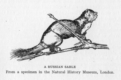
A RUSSIAN SABLE From a specimen in the Natural History Museum, London |
30 |
|
CAPTAIN COOK'S HOUSE, GRAPE LANE, WHITBY From a photograph. |
49 |
| THE "ENDEAVOUR" BARK | 58 |
| MAORI TRIBESMAN | 97 |
|
CAPTAIN JAMES COOK From an engraving after the original portrait by Dance in the Gallery of Greenwich Hospital. |
103 |
| AUSTRALIAN BUSHMAN WITH BOOMERANG | 109 |
| BREAD-FRUIT | 115 |
| THE ISLAND OF OTAHITI | 119 |
|
LIEUTENANT JOHN MEARES From an engraving after the picture by W. Beechey in Meares' Voyages. |
173 |
|
CAPTAIN GEORGE VANCOUVER From a photograph of the original in the National Portrait Gallery. |
221 |
| SOUTH-SEA ISLANDERS IN THEIR CANOES | 230 |
I BELIEVE
That God has poured the ocean round this world
Not to divide, but to unite the lands.
And all the English captains that have dared
In little ships to plough uncharted waves—
Davis and Drake, Hawkins and Frobisher,
Raleigh and Gilbert—all the other names—
Are written in the chivalry of God
As men who served His purpose. I would claim
A place among that knighthood of the sea;
And I have earned it, though my quest should fail,
For, mark me well, the honour of our life
Derives from this: to have a certain aim
Before us always, which our will must seek
Amid the peril of uncertain ways.
Then, though we miss the goal, our search is crowned
With courage, and we find along our path
A rich reward of unexpected things.
Press towards the aim: take fortune as it fares!
From Henry Hudson's Last Voyage, by Henry Van Dyke.
In which is related the story of Juan de Fuca.
Always in the heart of man springs Desire. It may be good or it may be evil. It may be one of pleasure or it may be one which moulds itself around the commercial pursuits of the time. And men yet congregate in the marts and discuss, as from time immemorial they have done, how much easier it would be to do this or that if only such and so were available. Through this budding process of vain desire and speculation come the first faint tentative beliefs, which soon wax strong and sturdy and blossom forth as accepted facts. For there are always those who are willing to help the doubter by most positive statements, and then, presto! "Of course we were right, does he not say he has been there, right through them?"
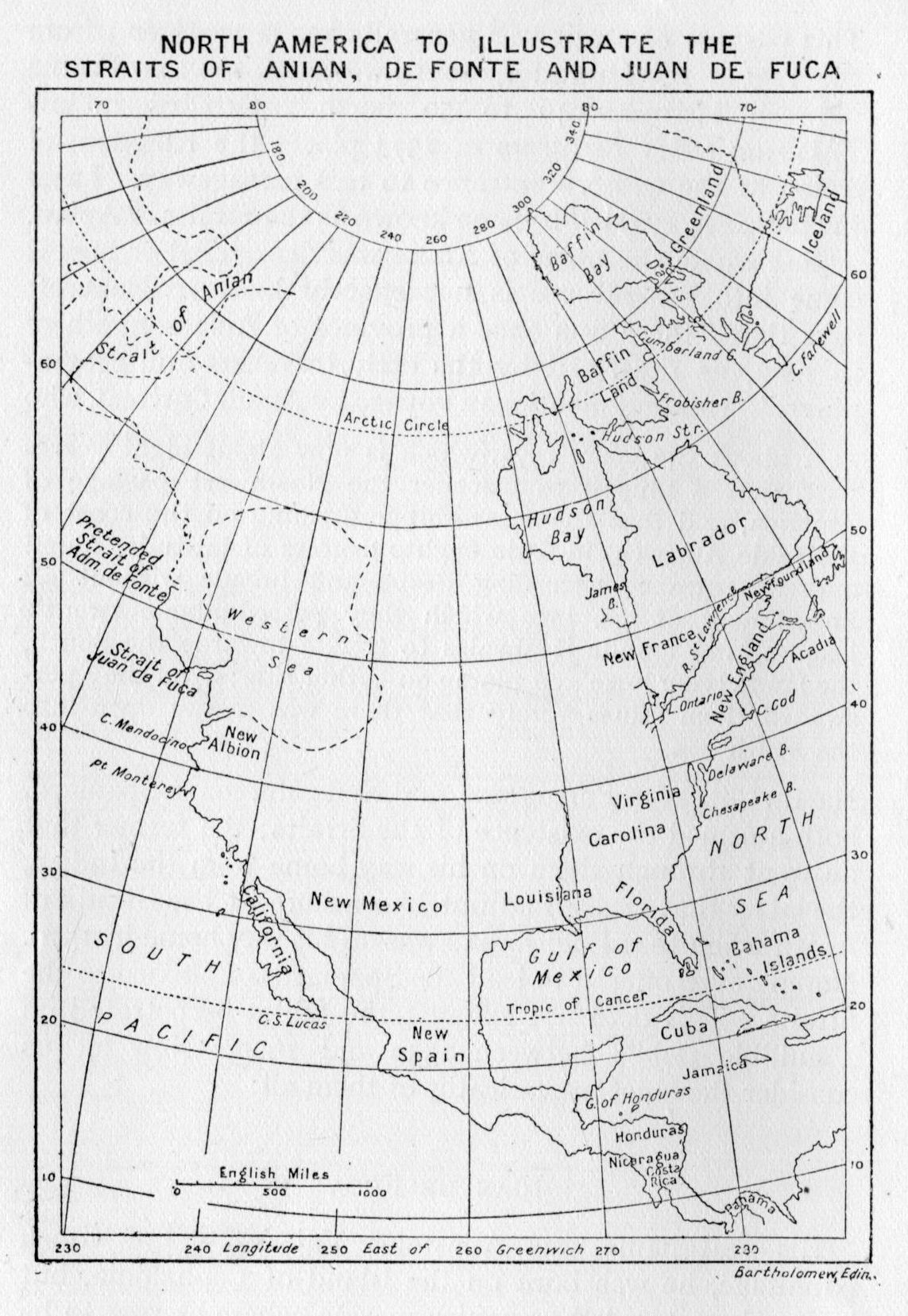
Once established, such beliefs die slowly; Dame Rumour is a hardy wench. Then the world, ready at length to hang its head and admit itself in error, straightway turns about and smilingly says: "Oh! that was a myth!" Such a one was once the famed Straits of Anian. It ranks with the tales of an Ophir, an Atlantis, or of a land of warrior Amazons.
The desire for a passage through North America from the Atlantic to the Pacific was but intensified by the discoveries of Magellan and the golden harvest which Spain began to reap in Mexico and Peru. England's merchants were particularly anxious to find a short, direct, and commodious passageway around or through North {2} America. To this end many small and privately financed expeditions were despatched westward across the Atlantic, there to search the rocky shore for such an opening. France had definitely explored and rejected the Gulf of St. Lawrence, and the openings behind Newfoundland.[1] No passageway there. The Cortereals, Espanola and Verrazano, had cruised the coast from Newfoundland to the tip of Florida.—No opening there. Then it must lie farther north.
So farther north the hardy English sailors pushed the bluff bows of their tiny fifty-ton sloops and pinnaces. Up between Greenland and Labrador, trending a little westward at last; how eloquent of old desire are the names of those cold and stormy passages—Frobisher Bay, Davis Strait, Hudson Bay and Fox Channel! But the elusive passage lay always just beyond; the very difficulty of the task seemed but to rivet the more firmly the belief that a passage did exist, that it would be found, and then if England found it, what a pre-eminence of trade would be hers!
Martin Frobisher (1576-8) was no whit behind the rest in his belief that the inlet which now bears his name would have led him to the South Sea if only he could have gone on. Sir Humphrey Gilbert was one of the noted men of his day who wrote at length upon the possibility of such a passage and the necessity for the discovery and use thereof.
It was then that fact gave way to fancy, when tales of an old pilot who had cruised the Spanish Main were listened to with eagerness and gained credence as they spread from mouth to mouth. Or again it might be some sentence in an old forgotten manuscript which, suddenly brought to light, revived men's fainting hearts to further trials across the ice-strewn sea. Whatever the tales brought back to an expectant Europe may have related, in 1570 geographers began placing in their charts of the land we now call North America a northern passageway through the continent. {3} This passage or strait was generally made to extend from the region of Labrador, south-westerly to the Pacific between latitudes 40 to 50 north. Ortelius in his Theatrum Orbis Terrarum of 1574 places the Kingdom of Anian at the western entrance to this passageway. Later the passageway itself became known as the Straits of Anian.
Just where the name of Anian was discovered or how it came into general use is not exactly known. Bancroft says that "there was once a province of Ania somewhere in Asia, as described by the early travellers and geographers." Hakluyt mentions a voyage by Annus Cortreal, who
... about the yeere 1574, which is now about eight yeeres past, sent a Shippe to discouer the Northwest passage of America, and that the same shippe arriuing on the coast of the saide America, in fiftie eyghte degrees of latitude, found a great entrance exceeding deepe and broade without all impediment of ice, into which they passed aboue twentie leagues, and founde it alwaies to trende towarde the South, the lande lying lowe and plaine on eyther side; And they perswaded them selues verely that there was a way open into the south sea.
Martin Chacke, a Portuguese, and N. de Morena, a Spaniard, both affirmed the existence of the Straits; the former that he went through them on his way home from the Indies; the latter that Drake had put him ashore at the Straits of Anian when that Englishman was on his way home in 1579. Morena even offered to lead the Spaniards of Mexico to the Straits. This does not exhaust the fables perpetrated on a gullible public between 1550 and 1600. Now let us consider the chief prevaricator of them all:
His real name was Apostolos Valerianos: of Greek parentage, he was born on the island of Cephalonia, but had early entered the Spanish marine, where he rose to be a pilot. In November, 1587, he was pursuing his usual {5} vocation when Cavendish captured the Santa Anna off the coast of Southern California. The English privateer, having made a thorough search of the vessel, burned her, while the crew were permitted to make the best of their way to Mexico, there to relate all that had happened. Five years later de Fuca claims to have been despatched by the Viceroy of Mexico in charge of two ships to cruise northward, find the Straits of Anian, and follow said Straits through to the Arctic or Atlantic as the case might be; it being the purpose evidently of the Viceroy to fortify the Straits in the interests of Spain.
It is from the pages of Purchas His Pilgrimes that we learn of the home-coming of the old Greek pilot, and that which befell in the far-off days of 1596. At that time there resided in Venice one Michael Lok, an Englishman. Lok was, as he relates, engaged in a lawsuit "against the Companie of Merchants of Turkic, and Sir John Spencer, their Governour in London," to recover a pension due to him for agent's services at Aleppo. While awaiting the settlement of the lawsuit, there arrived in Venice one John Douglas, a sea captain, and the Spanish pilot Juan de Fuca.
And John Dowglas being well acquainted with me before, he gave me knowledge of this Greeke Pilot, and brought him to my speech: and in long talke and conference betweene us, in presence of John Dowglas: this Greeke Pilot declared in the Italian and Spanish languages, thus much in effect as followeth.
First he said, that he had bin in the West Indies of Spaine by the space of fortie yeeres, and had sailed to and from many places thereof, as Mariner and Pilot, in the service of the Spaniards.
Also he said, that he was in the Spanish Shippe, which in returning from the Ilands, Philippinas and China, towards Nova Spania, was robbed and taken at the Cape California, by Captaine Candish Englishman, whereby he lost sixtie thousand Duckets, of his owne goods.
Also he said, that he was Pilot of three small Ships which the Vizeroy of Mexico sent from Mexico, armed with one {6} hundred men, Souldiers, under a Captain, Spaniards, to discover the Straits of Anian, along the coast of the South Sea,[2] and to fortifie in that Strait, to resist the passage and proceedings of the English Nation, which were feared to passe through those Straits into the South Sea. And that by reason of a mutinie which happened among the Souldiers, through the [misconduct] of their Captaine, that Voyage was overthrowne, and the Ships returned backe from California coast to Nova Spania, without any effect of thing done in that voyage. And that after their returne, the Captaine was at Mexico punished by justice.
Also hee said, that shortly after the said Voyage was so ill ended, the said Viceroy of Mexico, sent him out againe Anno 1592 with a small Caravela, and a Pinnace, armed with Mariners onely, to follow the said Voyage, for a discovery of the same Straits of Anian, and the passage thereof, into the Sea which they call the North Sea, which is our North-west Sea. And that he followed his course in that Voyage West and North-west in the South Sea, all alongst the coast of Nova Spania, and California, and the Indies, now called North America. (All which Voyage hee signified to me in a great Map, and a Sea-card of mine owne, which I laied before him) vntill hee came to the Latitude of fortie seuen degrees, and that there finding that the Land trended North and Northeast, with a broad Inlet of Sea, between 47. and 48. degrees of Latitude: hee entred thereinto, sayling therein more than twentie dayes, and found that Land trending still sometime North-west, and North-east, and North, and also East and South-eastward, and very much broader Sea then was at the said entrance, and that hee passed by divers Ilands in that sayling. And that at the entrance of this said Strait, there is on the North-west coast thereof, a great Hedland or Hand, with an exceeding high Pinacle, or spired Rocke, like a piller thereupon.
Also he said, that he went on Land in diuers places, and that he saw some people on Land, clad in Beasts skins: and that the land is very fruitfull, and rich of Gold, Silver, Pearle, and other things, like Nova Spania.
And also he said, that he being entred thus farre into the said Strait, and being come into the North Sea already, and finding the Sea wide enough euerywhere, and to be about {7} thirtie or fortie leagues wide in the mouth of the Straits, where hee entred; hee thought he had now well discharged his office, and done the thing which he was sent to doe: and that hee not being armed to resist the force of the Salvage people that might happen, hee therefore set sayle and returned homewards again towards Nova Spania, where hee arrived at Acapulco, Anno 1592, hoping to be rewarded greatly of the Viceroy, for this service done in this said Voyage.
Also he said, that after his comming to Mexico, hee was greatly welcommed by the Viceroy, and had great promises of great reward, but that having sued there two yeares time, and obtained nothing to his content, the Viceroy told him, that he should be rewarded in Spaine of the King himselfe very greatly, and willed him therefore to goe into Spaine which Voyage hee did performe.
The account continues the story of how de Fuca came to Spain; that he was welcomed at Court with many pleasant words, but that no material reward could be secured. Accordingly he "stole away out of Spaine" and journeyed through Italy on his way to Cephalonia, where he desired to spend the remainder of his days, "he being very old." And now we come to the crux of the matter. Because the Spaniards had treated him so cavalierly and slighted his just demands,
... and understanding of the noble minde of the Queene of England, and of her warres maintayned so valiantly against the Spaniards, and hoping that her Majestie would doe him justice for his goods lost by Captaine Candish, he would be content to goe into England, and serve her Majestie in that voyage for the discoverie perfectly of the North-west passage into the South Sea, and would put his life into her Majesties hands to performe the same, if shee would furnish him with onely one ship of fortie tunnes burden and a Pinnace, and that he would performe it in thirtie dayes time, from one end to the other of the Streights, And he willed me[3] so to write into England.
Accordingly Lok wrote to the Lord Treasurer Cecil, to Sir Walter Raleigh, and to Master Richard Hakluyt. He {8} prayed that these gentlemen would "disburse one hundred pounds of money, to bring him into England with myself, for that my owne purse would not stretch so wide at that time." Lok heard that the idea met with favour but that the money was not to be had. In the meantime the pilot had journeyed on to his countrymen in Cephalonia.
In July, Lok about made up his mind to return to England. Thinking that he could possibly afford to take de Fuca with him, he wrote to the old man and in November received a reply. Other letters followed back and forth all of the same tenor. De Fuca was willing to go at any time, if Lok would send him the money to make the journey. Apparently Lok was not able to do so and there the matter rested till 1602, when no reply was received from the last letter sent, and the old pilot was supposed to have died.
This is all that is known of de Fuca. Diligent search among the voluminous Spanish Archives and in all that relates to Mexican affairs of that date (1592) fails to find any reference, either to the expedition de Fuca claimed to have made, or to the pilot himself. That he was a pilot on the Mexican and Californian coasts there is no need to doubt. He may even have made the voyage across the Pacific to the Philippines and back. But that he ever saw the strait which to-day bears his name is seriously held in doubt by modern historians. It is a curious fact, not without its droll humour, that John Meares in 1788 should have been one of the first to affix de Fuca's name to the strait to the north of Cape Flattery, for Meares was himself a prevaricator of most magnificent proportions.
Now let us try to put ourselves back into the days of 1600, and examine the conditions which made such statements possible of belief. The art of shipbuilding was in its infancy; not only were the vessels of rude construction, but their lines were poor. They were indifferent sailers, and there was a tendency to build a high unwieldy stern, which did not help the sailing qualities. Voyages in such {9} vessels were slow and uncertain. If the coast along which they voyaged proved barren, if harbourage could not be found, if storms drove them out to seek safety in the open sea, then the water supply would fail, the health of the crews would give way, and the dread scurvy would appear. Thus would the voyage be cut short, a return must be made, and the whole purpose of an expensive expedition set at naught. What a temptation then to invent a few stories to indicate that something had been accomplished in return for the cost of the venture! Then, too, the art of finding the latitude and longitude of places, or of a vessel's station at any given time, was but rudely developed. The instruments in use were crude, the results often from a degree to five degrees out. So that to-day in trying to locate just where some old navigator made a landfall, we are often sadly at a loss where to place his cape or bay. Within a {10} hundred miles of coast there may be several similar promontories—mere verbal description does not always satisfy by any means. The charts themselves varied as greatly as the tales and records brought home by the sailor men. What was once correctly delineated, as in 1550, has been known to be incorrectly shown on a chart of 1650.
What wonder, then, if in an age of world discovery, in an age when colonial empires were rising on the vaguely delineated shores of two great continental masses each larger than Europe itself—what wonder if a few should trade upon the ignorance of the stay-at-homes and seek to make capital out of fantastic lies? And especially were perfectly honest men likely to be led astray by reasoning upon insufficient data. It was accepted as a fact, for instance, that since a passage had been found around South America by way of Cape Horn, that therefore a similar passage must prevail around North America in order that the tides and currents and circulation in the several oceans might be properly maintained! It remained but to find this passage. Then would the English, Dutch, or French have a short and easy route to the Indies, then would Spain and Portugal meet a greater challenge than ever before. It was just as much to the interests of the Spanish to prevent such a measure if possible. But as decade after decade passed away and still the expected passageway could not be found, Spain was lulled to sleep in her secure possession of almost the whole of South America, all of Central America and the Pacific coast of North America, far into the misty north. Spain ceased to explore, and settled down into a decadent and satisfied middle age; from 1600 to 1774 she rested, passive, mighty, opulent, and apparently secure.
We shall learn in a little, how, towards the beginning of the eighteenth century, the Russians awoke to their Siberian possibilities and, under the urge of Peter the Great, set in motion the designs which gave them a firm foothold on what is now Alaska; and how their daring {11} traders pushed their way farther along the Alaskan Peninsula until the success of their operations awoke the Spanish government to renewed activity. But all too late. Not only did Captain Cook chart the unknown coast from forty-three degrees to the Arctic Ocean, but the hungry fur traders of other nations began to infest the western shores of America, exploring, charting, trading, giving to the world the bits of their knowledge. Spain was forced to act in very self-defence. The outcome was the celebrated Nootka affair, the virtual elimination of Spain and the arrival of two lusty contenders—Britain and the United States.
[1] Jacques Cartier, 1534-42.
[2] The Pacific.
[3] Michael Lok.
A tale of Cossack daring and brutality.
From the days of Drake (1579) and of the Juan de Fuca myth (1592) the western coast of America north of the California peninsula remained an unexplored, uncharted waste bordering an equally unknown Pacific Ocean, down to the day of Vitus Bering (1725-1741). Instead of a gradual northward expansion by Spain, or failing that, a leap westward by the French of the St. Lawrence and Great Lake region, we have the strange spectacle of a self-taught Russian potentate setting in motion the forces which should first solve the mystery of the North Pacific.
It will therefore be in order to present this phase of the exploration by a short account of the Russian development of Siberia, and then recount the voyages of Bering and Chirikoff.
Eight years before the famed Armada entered the English Channel to sweep the hated English from the seas, Yermac, the Cossack, with five thousand followers crossed the Urals. He encamped at Tchingi, a small town on the banks of the Tura. There he mustered his troops, but found his army considerably reduced, for "part had been exhausted by fatigue, part carried off by sickness and part cut off in skirmishes with the Tartars." With a bare fifteen hundred effective men at his command, Yermac boldly advanced against Kutchum Chan. And the Tartar prince, having made every preparation to resist the invader, resolved to defend his crown to the last extremity.
For in those days Siberia was partly divided among a number of separate princes, and partly inhabited by tribes of independent Tartars. Kutchum Chan ruled over that tract of country which stretched from the banks of the Irtish and Obi to those of the Tobol and Tura. And who {13} was Yermac? A fugitive Cossack of the Don, who for years had terrorised the province of Astrakan and the trade route across the Caspian Sea. But Tsar Ivan Vassilievitch in 1577 sent a large force to these regions, and, as the tale is told, "part were slain, part made prisoners, and the rest escaped by flight." Retiring northward through the province of Kasan, Yermac and his band next appeared at Orel, on the banks of the Kama, where an outpost Russian settlement was located. There the finger of fate lured him over the Urals, and down to conquest in the Tartar Kingdom of the Obi.
Battle was joined on the banks of the Irtish, near the confluence of the Tobol with that stream. The Tartars, although superior in numbers, were routed, and Kutchum Chan escaped with difficulty, so complete was the victory, and Yermac, pressing hard upon the heels of the flying foe, marched without delay to Sibir, the residence of the Tartar prince. But the news of the defeat had sped before him, and, making triumphal entry, this erstwhile outlaw Cossack of the Don seated himself upon the throne without the least opposition.
With no reinforcements to recruit his dwindling forces, Yermac soon perceived the growing insecurity of his position. He therefore decided to tender his newly-won domain to the Tsar at Moscow. An ambassador was despatched with a tale of all that had happened, and a present of the choicest and most valuable furs. Arriving at Moscow, he was received with every mark of satisfaction; service was held in the cathedral; Yermac and his followers were pardoned, and presents were in turn sent to all who had taken part in the enterprise. To Yermac the Tsar Ivan sent a fur robe which His Royal Highness had worn, "and which was the greatest mark of distinction that could be conferred upon a subject." Five hundred Russian soldiers were also sent as reinforcements under Prince Balkosky, and the conquest of Siberia had begun in earnest.
At the junction of the Tobol and the Irtish a fortified {14} post or Ostrog was built and Tobolsk became in time the metropolis of all that region. The same process was repeated on the Obi, and Tomsk was constructed to dominate the upper valley of that great Arctic river. By ascending any one of a dozen eastern tributaries it was found that a low irregular height of land separated them from streams flowing to the West. There Yeniseisk was established, and the disunited Tartar tribes forced to pay tribute. Ever eastward the course of empire held its way; by 1630 the steady Russian penetration of Siberia had reached the Lena. First Irkutsk, then a few years later Yakutsk, were built, and the third great Arctic river valley of Northern Asia was added to the Tsar's eastern empire. Within ten years hardy spirits voyaged up the Aldan, then up the Maya. Now on horseback and snowshoes across the Stanovoi Range they made their way by the rugged Yudomskaya Krest. Here a boiling mountain torrent, the Urak, led them to the sea, and Okhotsk Ostrog arose amid the sand dunes and beach stones. The great continent had been mastered by 1640.
No similar feat is known to history. By the middle of the seventeenth century no white man had penetrated even half-way across what is now Canada or the United States. Montreal, the product of Maisonneuve's daring, eked out a precarious existence subject to constant Iroquois attack. The New England colonies were just taking root, and Virginia felt no need of crossing the Alleghanies in quest of land or adventure.
For the ensuing hundred years the story of Siberia is the story of the trade in sables. What had been so dashingly won was as gallantly held; not for purposes of settlement, nor that mines, fisheries and timber resources might be developed, but that each year a great rich caravan of furs might wend its way to Moscow, the governing centre of that vast new territory. Within general terms the Siberian fur trade was conducted as a state monopoly from Moscow, with the beautiful sable the standard of {15} exchange. Over each province was a voivode or chief factor, who was an employé of the state, and supposed to carefully guard its interests in the collection of the rich fur harvest from the territory under his control. But the value of his trust, the distance from the centre of control, and the lawlessness of the times proved too much for the average voivode, whose sole endeavour seemed to be to increase the returns brought in by each prikaschik, not that he might win golden opinions from his Tsar, but that he might sequester yearly a larger amount for himself, and thus retire at the end of his term a man of wealth and substance.
The mode of operation of this far-flung government monopoly may have still further perverted the morals of those engaged in it. Instead of barges carrying articles of trade with which to entice the Yakuts and Tunguses to part with their furs, we would find good store of arms and ammunition, and food supplies for the semi-military posts scattered along the great rivers of the north. In the province of which Yakutsk was the commercial centre there were, in the year 1675, some twenty-five stations, many of them hundreds of miles from the governing centre on the banks of the Lena. Upon each tribe adjacent to the station a tribute was laid, and each year at agreed time and place the natives gathered for this purpose. If tribute was refused, then war was declared, and the recalcitrant band exterminated. It was also the custom to demand hostages, not only to secure the prompt payment of tribute but to act as some safeguard against sudden attack and destruction from an outraged people. What furs remained after the tribute had been paid were secured in the usual way of barter.
Such a system based upon the ever-ready appeal to force could not but still further brutalise those who employed it, and a mutiny at some far-off station was not uncommon; a marauding band of deserting Cossacks would sometimes terrorise a whole river valley until in the course of time {16} failing ammunition, disease, and mutual jealousies drove the survivors to the nearest agent for pardon and reinstatement. Roads, bridges, settlements, there were none. The great river systems of the Obi, Yenisei, and Lena, with their thousands of lateral tributaries, provided an almost continuous system of waterways from the Stanovoi Mountains to the Urals. Rafts, barges and long partly decked boats or "koshi" were quickly constructed from the adjacent forests. Hastily constructed, they were as quickly discarded once their purpose had been served. Instead of the picturesque Indian of the Great Lakes in his birch-bark canoe, we see in those far-off Siberian days surly Yukagirs ground down under the merciless heel of a Cossack jack-boot. No staid Hudson's Bay Company ever entered Siberia to supply the natives with their hearts' desire in trinkets or with fowling-piece and trap, that the valuable peltries might be the more readily secured.
In addition to his routine duties, an agent would occasionally construct a rude map of the district surrounding his post. These drawings were for years the only means of gaining any idea of the general contour of the country. One of these men, Michaelo Staduchin, rose above the ordinary level of his compatriots through his bold and adventurous journeys along the frozen Arctic shore of the continent. In 1644 he discovered and explored the Kolyma River, and five years later Deshnef led a party of hunters to the Anadyr.
There the Russians came in contact with the warlike Chukchees who inhabited this far north-eastern corner of Asia. But the severity of the climate, added to the hostility of the natives, long prevented exploration of the peninsula between the mouths of the Kolyma and Anadyr. It became in time a terra incognita, and around it grew up a mass of guess-work and fable usual to those times. Geographers became more and more curious about the northern extent of Asia, and equally curious were they regarding its eastern extent. Did Siberia connect with {17} America, or did a great wide sea exist between them? In the year 1700 no one knew. No exploration had been made of the coast of North America beyond Cape Blanco, nor had adventurers pushing westward advanced much beyond Lake Superior and the line of the Mississippi.
In the light of exploration westward across America by either French or English, the rapidity with which the Russians overran Siberia during the seventeenth century is little short of marvellous. In fact the exploitation of the Siberian fur trade antedates its North American counterpart by a clear hundred years. But there the comparison ceases to weigh against us, and nothing in later Siberian history compares with the marvellous Anglo-Saxon development of the resources of North America from 1750 to 1850.
How he crossed Siberia and voyaged to the Arctic.
The story of Bering is the concluding chapter to the Russian exploration and conquest of Northern Asia. It is a tale of vast spaces, of wind-swept wastes, of frozen tundra and of tossing seas. Again, it is a tale of bearded men, toiling with heavy loads over the rocky ledges of a frozen mountain torrent. Betimes the scene will change; it is summer, and all is bustle and preparation as the bags of flour are tumbled into the rude koshi. Down the main river, up a branching tributary, ever eastward, the voyagers strain to far Yakutsk or even to remote wind-swept Kamchatka. Shall they find what there they seek? Mayhap 'twill be a grave in some lonely isle far from the ken of human kind. No friendly chart to guide them on their way, they can but face the dangers boldly and trust as blindly to a safe return.
The time now drew near for the solution of the question as to the juncture of Asia and America, and of many another fable which had grown up around the seas to the south of Kamchatka. The remarkable reign of Peter the Great was drawing to a close, but the restless mind of the Tsar continued to plan and put into execution great projects for the glory and advancement of his empire. In 1719 he had sent Luzhin and Yevreinof across Siberia with secret instructions to explore certain of the northern Kurile Islands. A boat had been built at Okhotsk and these navigators had ventured as far south as the fifth island of the Kurile group, but, losing their anchors in a storm, they had returned. No attempt had been made to carry out certain instructions to explore the Kamchatkan coast northward, to ascertain a possible juncture with America. {19}
Upon the submission of their report, the Tsar determined upon an expedition which should finally settle the geographical extent of his dominions eastward and northward. If a sea separated the two continents, then it might be possible, he thought, to establish a trade route through the Arctic, round north-eastern Siberia, and down the coast to Japan and China. English and Dutch attempts to find a similar route to the northward of America had come to naught; where they had failed the Russians might succeed, and thus win both honour and profit for their empire.
As best fitted to carry out the undertaking, Peter chose a captain from his navy, that navy upon which so much of the great ruler's time and energy had been expended. When all others failed him, surely this creation of his own heart and brain would not falter. Vitus Bering, to whom this signal honour was given, was then in his forty-fourth year. Although a Dane by birth, he had entered the Russian Navy as a sub-lieutenant at the age of twenty-two. He steadily rose in the service and early won the confidence of his superiors by his energy, foresight, and excellent seamanship. At twenty-six a full lieutenant, three years later a lieutenant-captain, 1710 found him serving in the Black Sea squadron. There he distinguished himself in a dash through the Dardanelles, bringing his ship safely around to the rendezvous in the Baltic. By 1720 he had risen to a captaincy of the second rank, "and took part until peace was concluded,[1] in the various manoeuvres in the Baltic under the command of Gordon and Apraxin."
Owing to the failing health of the Tsar, the assembling and outfitting of the expedition was turned over to the Admiralty, which was at that time controlled by Count Apraxin. Bering received written instructions from the Emperor substantially as follows:
I. At Kamchatka or somewhere else two decked boats are to be built. II. With these you are to sail northward along {20} the coast, and as the end of the coast is not known this land is undoubtedly America. III. For this reason you are to inquire where the American coast begins, and go to some European colony; and when European ships are seen you are to ask what the coast is called, note it down, make a landing, obtain reliable information, and then, after having charted the coast, return.
Bering was given as his lieutenants Martin Spangberg and Alexei Chirikoff. In this he was fortunate. Both men proved to be capable, trustworthy officers, and the latter, Chirikoff, has been spoken of as the brains of the Russian navy. Subordinate officers as well as sailors, carpenters, and mechanics were commissioned in St. Petersburg, and left the capital in charge of Chirikoff, 24th January, 1725. It was the dead of winter, and the snow, instead of impeding the venture, but lent speed to the flying hoofs of the shaggy ponies as the great sleigh-loads of supplies were rushed eastward on the long journey to the Pacific.
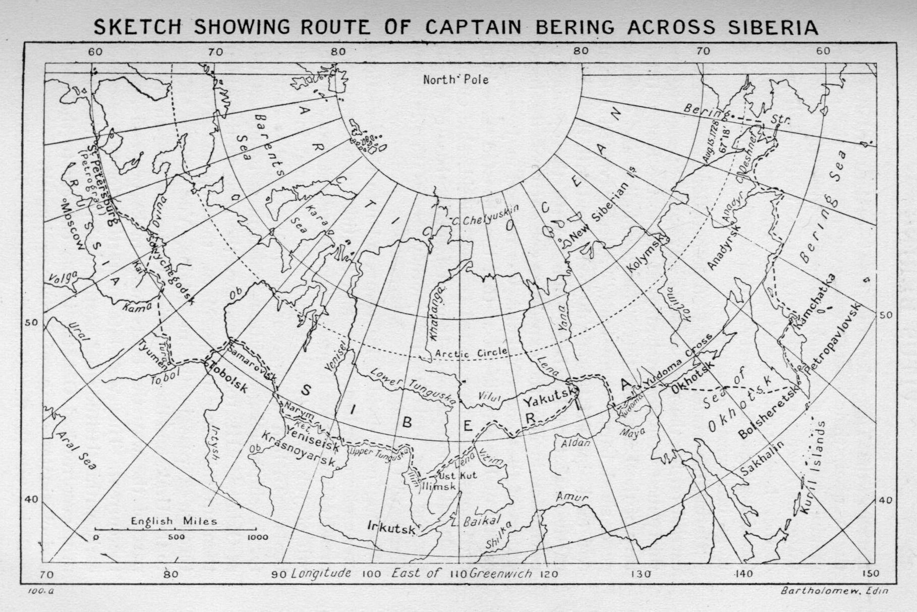
On the 28th the Tsar died. The master mind that had so boldly planned for his loved country was now at rest, and it speaks well for the organisation which he had gathered together that the Kamchatkan expedition suffered no delay in its initial stages. The remainder of the party under the command of Bering left the capital on the fifth of the ensuing month. They overtook the advance guard on the fourteenth and by the middle of March all had arrived at Tobolsk. After a rest of several weeks, during which boats and barges were collected and stores of food replenished, the command embarked on the Irtish. Down to the junction with the Obi, then up that river to the Ketya, they followed the latter eastward to Makofska Ostrog. Here a portage of about forty-five miles brought them to the Yenisei.
Two months had been passed since leaving Tobolsk. Spring had given way to summer, the hills and dales were clothed once again in a resplendent green to delight the eye of the casual visitor in these vast unfrequented spaces. {22} Entering the Tunguska, the great eastern tributary of the Yenisei, their course was ever against the stream, making progress slow and wearisome, while the lessening water in August exposed many a rock to the frail prows of their hastily constructed boats. The last of September found Bering and his party at Ilenisk, where it was decided to go into winter quarters.
During the winter of 1725-26 preparations were actively carried on for the next season's advance. Spangberg and thirty men were despatched overland to the Kut, a tributary of the Lena, and there "fourteen lodkas and eighteen good sized barges were built." Bering visited Irkutsk and made himself thoroughly conversant with the nature of the task that lay before him. With the opening of navigation in May the expedition set out upon the broad waters of the Lena. Yakutsk was reached in June. The capital of Eastern Siberia at that time boasted three hundred houses and represented the last considerable outpost of Russian occupation. It must form the base of supply for the new and dreaded journey across the Stanoyoi Range to Okhotsk.
Bering now divided his command into three sections, one under each lieutenant, and the third under the command of the leader himself. Spangberg got away on the 7th of July with two hundred and four men in thirteen boats. To him were given the heavy supplies destined for the shipbuilding operations which must be undertaken at Okhotsk. His route was down the Lena to the Aldan, then up this river to the Maya, then up the Yudoma, through a pass in the mountains, Yudomskaya Krest, to the Urak, and down this river to the sea. For the larger part of the way the boats must make progress against the current. They were late in starting, for winter comes early within latitude 60° north; and the fact that these men ever reached Okhotsk is due entirely to the pluck and obstinate courage of Spangberg himself.
Bering was the first to reach Okhotsk. Travelling {23} overland with two hundred pack horses, he covered the six hundred and eighty-five miles in forty-five days, and arrived at his destination on the 1st of October, 1726. But here new difficulties met him. The eleven huts which comprised the town were already occupied by Russian fishermen, winter was approaching, and shelter must be secured. All went to work with a will, and soon rows of log shanties began to take form to the noise of hammer, axe and saw. December found them housed, and with a ship on the stocks nearing completion.
On the 21st of December a messenger from Spangberg brought news of that leader's dangerous plight. Winter had descended on his convoy while yet over two hundred and fifty miles west of the Krest. Leaving the rafts and the bulk of the provisions under guard at the junction of the Yorbovaya and the Yudoma, Spangberg and his men, "with what provisions they could take with them on hand-sleds, started out for Okhotsk on foot. Meanwhile, the severity of the winter increased, the mercury congealed, and the snow was soon six feet deep. This forced them to leave their sleds, and for eight full weeks after the 4th of November these travellers sought shelter every night in the snow of Siberia, wrapped in all the furs they could possibly get hold of." Their provisions gave out, and but for the accidental discovery of Bering's trail, all would have perished. The frozen flesh from dead horses and stray bags of abandoned flour sufficed to maintain their strength for the last lap of this terrible journey to the sea. Bering had meanwhile despatched forty-seven sledges to their relief, and on the 6th of January, 1727, Spangberg was given a warm welcome in the newly-erected houses by the sea.
With the return of spring, work was resumed on the ship Fortuna, which was successfully launched on 8th June. In addition an old vessel, built some years before by the tribute gatherers, was secured and repaired. The summer was spent moving the collection of stores at Okhotsk across the sea to the mouth of the Bolshoya River, in {24} South-western Kamchatka, a distance of another six hundred and fifty miles. As shallow water prevented a near approach to the beach, the work of unloading proved to be long and laborious. It had been the intention to transport all the supplies and material that fall to the lower Kamchatka Ostrog by way of the Bolshoya and Bistraya, thence across a portage to the Kamchatka, and down that river to the sea. In the estuary Bering planned to build a vessel in which to prosecute his exploration northward, according to the instructions he had received.
Accordingly, early in the summer, shipwrights had been despatched overland to the lower Kamchatka to begin the construction of the ship. But when the main party were ready to begin ascent of the Bolshoya in September, the low water made navigation, even in small boats, impossible, and the attempt was abandoned. So perforce everything must wait for sledge transport. Then Bering and his command struggled on through the winter snows and intense cold of this inhospitable region, a distance of five hundred and eighty-five miles. For time was pressing. Three years had elapsed, no voyage of discovery had as yet taken place, and the expense to the government had been large: they were now far from Yakutsk, their base of supplies: all felt the need of haste.
A much easier and more rapid route would have been secured had the Fortuna sailed to the mouth of the Kamchatka by way of Cape Lopatka. But Bering subsequently justified his choice of the long and tedious overland route across the peninsula "by saying that he chose the harder course for fear an accident might happen if he came all the way by water." In the light of subsequent voyages, his judgment in this case was seriously at fault, but in the year 1727 the voyage to the south of Cape Lopatka was an almost untried route, and Bering was no doubt strongly opposed to any venturesome course with his precious supplies so far from any base of renewal.
The new vessel, the Gabriel, was launched in June, {25} and measured sixty feet in length, with a beam of twenty feet. The vast amount of labour involved is not indicated in that simple statement. Let it be understood that the ironwork absolutely necessary for the construction of a ship of that size, as well as canvas for the sails, and the rope for the rigging and anchor cables, all had been freighted by boat along the tortuous Siberian riverways. Again, as has been described, long hauls on sledges had been found necessary over hundreds of miles of wind-swept tundra or by rocky mountain gorge. And finally, when these very necessary articles had arrived at Kamchatka, trees had to be felled, squared or sawn into the proper shape by hand, and the frame sheathed with half-seasoned planking. The tar for the cordage and caulking of the seams was also prepared from the trees of the near-by forest, and with an entire absence of the proper facilities for its manufacture it proved to be a most tedious operation.
At length the little Gabriel stood ready to put to sea. Provisions were securely stowed in the hold, and the crew clambered on board to the cheers of their friends on shore. Anchor was weighed on 13th July, and the long-awaited voyage of adventure had begun. The cape at the mouth of the river was rounded the next day, and with a fair breeze a course was laid to the northward with the rugged shore-line of the peninsula standing out bold and clear to the westward.
Without particular adventure, day followed day with much the same tale to recount. A week brought them to the parallel of 60°; on the 27th, Cape St. Thaddeus was sighted. Rain and fog delayed their progress the next day, and on the 30th an abortive attempt was made to secure anchorage and fresh water. The voyage continued with days of calm alternating with fog, rain and wind. Holy Cross Bay was skirted, but no anchorage could be found along its desolate shore; then two days later, 6th August, Transfiguration Bay was discovered. Here fresh {26} water was secured, and an abandoned dwelling of the Chuckchees was seen.
The next day, still skirting the shore, the sailors spied some natives in a boat rowing out to the vessel. Nothing that the Russians could offer sufficed to entice the wary Chuckchees near the ship, but at a safe distance they continued to gaze in astonishment at this, to them, monstrous wooden shape. At last, one bolder than his fellows jumped into the sea, and with the aid of two inflated bladders swam to the ship. By the aid of Koriak interpreters, the native informed the Russians that they had passed the mouth of the Anadyr River: that his people knew of the Russians, and had gone as far as the Kolyma on their deer sleds, but never by water: that there was an island in the sea on which dwelt some of their people, but knew of no other islands or lands. Pleased with a few presents, the swimmer made his way back to the boat, and the occupants paddled back to the shore.
On the 9th our explorers doubled Cape Chukotski, which Bering placed in latitude 64° 18' north. Two days later an island appeared to the eastward, to which Bering, in honour of the day, gave the name of St. Lawrence. During the 12th and 13th of August the Gabriel passed through the strait, meeting head winds and cloudy weather. The Siberian shore was kept in view, and no sign of land was seen to the eastward. On the 14th, East Cape was passed in latitude 66° 6' north. Here the Asiatic coast was seen to swing abruptly to the west. On the 15th they were out of sight of land, and the same northerly course was held till the next day. Then in latitude 67° 18' north the order was given to turn the ship about.
No land had been seen to the eastward; for all he knew the continent of America might be a thousand miles away: no land was now to be seen to the northward, and the coast of Siberia along which they had been cruising for the past month had retreated to the westward, and was now out of sight. Bering concluded that he had carried out his {27} instructions,—Asia and America were not joined, but evidently separated by some great arm of the Pacific. To determine the exact position of the American continent another voyage must be undertaken. The summer was spent, soon stormy autumnal gales would be upon them, and shipwreck upon such a coast was dangerous in the extreme. In fact the weather broke a few days before reaching Kamchatka, the sails were torn from their fastenings, the anchor cable broken, and the anchor lost. In view of these very cogent and weighty reasons, a longer stay in the Arctic seas was deemed perilous in the extreme, and it was decided to return with what speed they could to Kamchatka. It will always be a matter for regret that a few days' sail to the westward were not attempted before abandoning the voyage. That some risk was present in such a course is not to be denied, and Bering's critics have made the most out of this over-cautious side of the commander's character.
On the return, while passing southward through the strait, the island of St. Diomede was discovered and named. At its narrowest point, the strait is only thirty-nine miles in width, and on clear days it is quite possible to see the low-lying American shore on the one hand, and the more rugged Asiatic shore on the other. But once again on the return southward cloudy weather and heavy fogs prevailed, and no land was seen to eastward. This was one of the heart-breaking tragedies so common to all maritime exploration; a fog, a sudden storm, the night descending, and an important river mouth is passed, a long-sought inlet is missed, or, as in this case, the immediate proximity of a great continent is hidden from its eager searchers.
On the homeward voyage the wind and sea so battered and strained the Gabriel that the greatest care was needed to reach the Kamchatka River mouth. During September the vessel was hauled out near the fort, and the crew prepared winter quarters. There the winter of 1728-29 was passed.
{28}During this time Bering became convinced of the nearness of some large body of land to the eastward. He noted that
The waves were more like those of a sea than of an ocean. The driftwood did not indicate the flora of eastern Asia, and the depth of the sea grew less toward the north; the east wind brought drift ice to the mouth of the river after three days, the north wind on the other hand, after five days. The birds of passage came to Kamchatka from the east. The reports of the natives corroborated his inferences. They declared that ... in the year 1715 a man had stranded there, who said that his native land was far to the east and had large rivers and forests and very high trees. All this led Bering to believe that a large country lay toward the north-east at no very great distance.
Accordingly, a second attempt at exploration was made in the summer of 1729. But three days out from port a strong gale with heavy seas forced him to turn about. The little Gabriel scudded before the storm, a south-west course was taken, and, founding Cape Lopatka, he touched at Bolsheretsk on his way to Okhotsk. The observations for latitude and longitude taken on this short voyage and the maps drawn therefrom gave to the world the first accurate idea of the form and extent of the Kamchatkan peninsula. Added to this was the knowledge gained of a safe southern passage from Okhotsk to Kamchatka River mouth, which was to prove of great value in all subsequent voyages and explorations, by avoiding the long overland route from Bolsheretsk to lower Kamchatka Ostrog.
Bering now decided to return to St. Petersburg. Arrangements were made for the care of the vessels Gabriel and Fortuna, and for the upkeep of the supply depots already established. The remainder of the command then set out upon their long return journey across Siberia. What must have been the feelings of the hardy explorers when entering Yakutsk after an absence of three years! How they would {29} tell of their trials, of their hair-breadth escapes from death in a thousand forms; how eagerly would the inhabitants of this far-flung outpost listen to their absorbing narratives! There would be talk of Gama Land and other fabled and mysterious continental masses lying out in these seas beyond Kamchatka. There were fabled islands, too, with great store of gold and silver for the fortunate finder.
But gradually the mists were being brushed aside. The eighteenth century did much to clarify the world's geographical concepts. Bering on this his first expedition had delineated for the first time the Kamchatkan peninsula, and the coast of Asia to its most north-easterly cape. He had proved that Asia and America were nowhere connected south of 67° north latitude, that open water extended to the west north of Siberia as far as he could see, and that the coast trended suddenly in that direction. A voyage down the Lena to its mouth and thence eastward to Kamchatka would of course prove this point.
With, as he thought, these pleasant tidings, the journey across Siberia to St. Petersburg was undertaken. The 1st March, 1730, found him in the capital, his reports ready for delivery, and eagerly looking forward to re-union with his family. Then followed a time of most intense disappointment; certain academicians, Joseph Nicholas d'Lisle, Gerhard F. Müller, and others, cast doubt upon his maps and his conclusions. It is under such circumstances one most admires the sturdy honesty of Bering. He refused to exaggerate his statements in support of his discoveries, nor would he retract one inch from his statement of discovery made and charted. He even volunteered to lead an expedition again into these wilds, and by a further exploration eastward from the mouths of the Obi and Lena substantiate his conclusions as to the termination of Siberia at East Cape and prove as well the untenable position taken by his detractors—that Asia and America were connected north of 67°, the point where Bering had turned homeward on that August day in 1728.
{30}It seems to us at this distance laughable, as well as tragic, that armchair professors who had never been east of the Urals should have the conceit to attack Bering's worth. It is unfortunate that these doubts cleverly cast upon the labours of the great Dane have persisted even to this day; have given rise to controversy and debate, even to denial that he accomplished anything of note either on this his first or on his second and last expedition. It is of interest to observe that Captain Cook was one of the first to assert Bering's greatness, and to perpetuate his name by giving it to the strait between Asia and America.
[1] Peace of Nystad, 1721.
Bering and Chirikoff cross the North Pacific. They find America and return.
But Bering found his new sovereign, Anna Ivanovna, strongly in favour of further Siberian exploration. Even the armchair professors caught the growing interest. Learned disputations waxed long and furious. All available maps and plans were searched. Bering's delineation of coast-line was compared and rejected by these and accepted by others. Exploration suddenly became a craze, a fashionable fad. So plans were laid for an expedition greater than any ever before undertaken by a European state. It was sought to dazzle Western Europe with the magnitude of the undertaking, and little regard was had for the unwieldy personnel which was required.
Three main lines of exploration were to be followed out. The northern coast of Siberia from the mouth of the Obi around to Kamchatka was to be explored and charted. The North American coast was to be sought and explored as far south as the Spanish possessions in Mexico. And the Asiatic coast from Kamchatka to Japan was also to be visited and charted. Added to this were instructions "to supply Okhotsk with more inhabitants, to introduce cattle-raising on the Pacific coast, to found schools in Okhotsk for both elementary and nautical instruction, to establish a dockyard in this out-of-the-way corner, to transport men and horses to Yudomskaya Krest, and to establish ironworks at Yakutsk and other places." As if this were not enough, a scientific exploration wing was added to the expedition. There were geographers, and map {32} makers, those who were to study the flora, others to observe the fauna, of the great Siberian domain and report their findings. But these men could not bear to be separated from their families—then, the families could accompany them, so ran the beneficent royal order. Hundreds of men were employed in moving by successive stages this part of the expedition alone. As might be expected, this part of the expedition accomplished very little, except in the way of piling up expense and halting the progress of that section whose ultimate goal was Kamchatka and the discovery of the North American coast.
To Bering was entrusted the command of the whole affair. With renewed courage and unbounded patience he set himself to the task. And a most thankless one it proved to be.
A year of planning and gathering of material and the huge unwieldy expedition was in some sense ready to start from St. Petersburg. Bering had as captains directly under him the same Spangberg and Chirikoff, "eight lieutenants, sixteen mates, twelve physicians, seven priests," and various soldiers and sailors; altogether about five hundred and seventy men. Spangberg set out in February with shipwrights and carpenters for Okhotsk. They took with them the supplies necessary for their purpose. Bering followed with the main body in March, bound for Tobolsk. There a boat named the Tobol was constructed, and launched on 2nd May, 1734. In a fortnight all was in readiness, and under the command of Lieutenant Ofzyn set sail down the Irtish for exploration and survey work eastward from the mouth of the Obi.
Bering then moved the remainder of the expedition to Yakutsk, which was to be the far-western base of operations. Shipbuilding was again undertaken, and two fair-sized vessels were constructed. By June of 1735 these were ready to descend to the mouth of the Lena. The sloop Yakutsk was to sail westward to the mouth of the Yenisei, the Irkutsk was to sail eastward, and, rounding the {33} north-east part of Siberia, sail down to Kamchatka. The beginning of July found these expeditions under way. Two years had passed since Bering had left St. Petersburg, and although he had spared no efforts much remained to be done.
It is nearly seven hundred miles from Yakutsk to Okhotsk, and to transport the heavy supplies of cordage, chain, iron spikes, and nails for the shipbuilding, as well as the tools used in such construction, barges must be used. Three years were required for a convoy of such material to reach the coast; the suffering and hardships on the way were most exacting. To the indomitable pluck and steady perseverance of the commander we owe it that all these difficulties were overcome, and that, in the summer of 1737, the main force of the expedition was once again gathered at Okhotsk.
But food supplies were exasperatingly slow in coming over the mountains from Yakutsk; Bering was unable to keep his full force of men at work, and frequently had to send bands of them off on hunting and fishing expeditions in order to lessen the demands upon the scanty food supply at his base. The cost to the government had (1738) reached the immense sum of three hundred thousand roubles, and letters of complaint, admonition and warning came through to Bering by every post. To a man already worn down by the executive responsibilities connected with such an immense undertaking, the policy of complaint adopted by the home government could but tend to drive another than a Bering to despair.
Every energy was now concentrated on the building of two vessels, "with the result that by June, 1740, two ships were launched. Each measured eighty by twenty by nine feet, brig-rigged, two masts, and bearing fourteen small cannon. On 4th September, the St. Peter and the St. Paul, accompanied by two others carrying provisions, left Okhotsk." Crossing the sea to Bolsheretsk, the two freight boats were left because Bering feared for their safety {34} while the two ships proceeded around the southern end of Kamchatka and entered the new harbour of Avatcha on 6th October. Here the expedition wintered, while the supplies were brought overland from the mouth of the Bolshoya. In the spring two scientists joined the expedition, the astronomer Delisle de la Croyere and Steller, a naturalist.
Bering took command of the St. Peter, Chirikoff the St. Paul. On board the former was Steller, signed as naturalist and surgeon, and it is due to his pen that we have such a vivid account of this ill-fated expedition. The total complement of each ship amounted to seventy-six persons. All was in readiness the latter part of May, but a favourable wind was not secured till 4th June, 1741, when the order to proceed was given. The course was south-east in an endeavour to discover, if possible, the Gama Land reported by the Dutch to have been seen in that direction. By the 12th the boats had reached the latitude of 46° 09' north latitude, with, of course, no land in sight.
It was now decided to give up this vain pursuit and change course to east by north, striking across the Pacific to locate the western shore of North America. Up to the 20th all went well; then stormy weather was encountered and the ships became separated. Although both the commander and Chirikoff spent several precious summer days in an effort to rejoin one another, their efforts were of no avail. Left to his own devices it must be remarked that Chirikoff displayed unusual resource and decision. Giving up the fruitless search for the St. Peter, on the 23rd a general easterly course was pursued: day followed night with monotonous regularity in the waste of waters that make up the bosom of the broad Pacific. Three weeks had passed since parting from their consort: it was now July, and signs of land gladdened their hearts; driftwood, seals, wild ducks and other aquatic birds which were never found far from land. On the 15th land was seen in latitude 55° 21' north (between Capes Addington and {35} Bartholomew of Vancouver's map). Skirting the shore toward the north, harbourage was eagerly sought, but everywhere the rocky coast presented a bold and rugged appearance. High mountains, snow-capped and gored with the winter's avalanche, assured the weary voyagers that this was no island but the solid bulwark of the long-sought continent of North America. At last on the 17th the St. Paul was anchored at what appeared to be the entrance of a bay in latitude about 58° north (Latuya Bay of La Pérouse). The pilot, Dementief, with ten armed sailors was ordered to take the large row-boat and examine the opening; the water was running low and it was very desirable that the empty casks be filled at the first opportunity. Approaching the land, the boat was soon lost to sight behind a projecting bluff. After several days of waiting for the return of Dementief, the captain decided to send the boatswain in charge of the remaining boat in search of the missing men. He too entered the channel to the bay and was lost to view of those on the St. Paul. Smoke from fires within the bay could be seen from the ship, but no sign of the unfortunate Russian sailors. Now ensued another period of anxious watching; but all in vain: they remain to this day one of the mysteries of that coast. Whether set upon and murdered by the natives or drowned in the dangerous tide rips of the treacherous entrance we know not. The sea keeps well her secrets.
On the 26th a council was held aboard ship. With both boats lost it was now impossible to make a landing, obtain water or collect wood. It was therefore decided to run for Kamchatka, which it was hoped to reach before their dwindling supply of water gave out. The great overhanging arc of the continent in these latitudes continually forced them to the southward. August passed with fog, and an occasional gale, anon a glimpse of a snow-clad mountain warned them of the proximity of the coast. During September they passed by the Aleutian Islands. On the 9th they found themselves embayed, and while awaiting {36} a favourable wind the Adakh islanders came off in their kyaks to view with fearful curiosity this monstrous floating house of wood. Ten days later the westernmost island of all was passed, and the long journey to Avatcha was without further incident other than the increasing illness of the crew. The dread scurvy had made its appearance, as it always did on these long voyages with the crew in cramped quarters. It was further noted that lack of fresh drinking water tended to greatly aggravate the distemper. During the latter part of September nearly all the officers, including Chirikoff, were unable to leave their bunks, and when the Kamchatkan coast was sighted on the 8th of October, Yelogin the mate alone remained on deck. Two days later the St. Paul entered the harbour of Petropavlovsk amid the feeble rejoicings of the sick and decimated crew.
The astronomer, Croyere, who had for weeks been confined to his berth, apparently keeping alive by the constant use of strong liquor, asked to be taken ashore at once, but as soon as he was exposed to the air on deck he fell and presently expired. Chirikoff, very ill, was landed at noon the same day.
We have traced thus far the remarkable trip of this Russian navigator because to Chirikoff is due the honour of first sighting the western coast of North America in a latitude north of 46°. He is accorded the further honour of excellent seamanship in bringing his vessel safe to port and escaping the rigors of a winter on the wild and unknown coast of America. The reports of Croyere and copies of the ship's journals were made up and forwarded to St. Petersburg, where Chirikoff later appeared and was received with due honour.
Let us follow the fortunes of the commander himself and his ship the St. Peter. Sailing more to the north of east than Chirikoff, Bering first sighted land on the 16th of July in latitude 58° 14' north. "The lookout reported a towering peak and a high chain of snow-covered mountains, without doubt Mount St. Elias, and the extending {37} range." Adverse winds prevented a closer inspection of the coast until the 20th, when Kayak Island, some miles to the westward, was discovered. Here anchorage was secured under the lee shore in twenty-two fathoms.
It would seem from all accounts that every one on board was delighted with the happy termination of their long quest. No one doubted that the great snow-capped range to the eastward was the coastal range of the great continent of North America. Although their reckoning for latitude was seven minutes over the mark and the longitude eight degrees out of the way, still great credit is due to these men, considering the instruments in use at that time.
The captain alone seemed oppressed with forebodings of ill, and shrugged his shoulders in answer to his officers' eager congratulations. Bering was already suffering from the insidious scurvy, and seemed completely worn out by his past fifteen years of hardship and privation. For some days he had been confined to his bed and seemed unable to share in the general delight of all that the search for the continental shore had at last been crowned with success. One account has it that
He had no enthusiasm or joy in life, and his depressing spirit dampened what little ardour his men possessed.... Later, in his cabin, in the presence of two of the men, he expressed himself somewhat in the following manner:
"We think we have now discovered everything, but we do not stop to think where we are, how far we are still from home, and what may yet happen. Who knows but perhaps contrary winds will come up and prevent us from returning? We do not know this country, nor have we provisions enough for wintering here."
It is unfortunately necessary to record the fact that among the officers of the ship the best of friendliness did not prevail. This is particularly true of Steller, the surgeon-naturalist of the expedition. Although Bering had urged him to join the expedition in the first place, he now treated Steller with scant courtesy, and Steller was no whit behind {38} in his attitude to Bering. After repeated requests, Steller was permitted to go ashore in one of the boats despatched for fresh water. Accompanied by a fellow-student he made the most of the few hours on shore to examine and collect various plants, and, in a spot which the natives had recently abandoned, he collected many interesting articles of curious workmanship. In a sort of underground storehouse he found smoked salmon, bows and arrows, hand drills for making fire, "and herbs dressed in a manner customary with the Kamchatkans." These and other articles led Steller to believe that Asia and America were somewhere much more nearly united than their present position would indicate, and that intercourse of a sort existed between the natives of the two continents.
The larger boat under Lieutenant Khitroff had also been busy with exploration of the several islands in the bay, and similar objects of native manufacture had been secured. As some return for their depredations, the Russians left in one of the native houses an iron kettle, some tobacco, a Chinese pipe, and a piece of silk. Repeated calls brought the ardent naturalist aboard, thirsting for new adventures on the morrow. But Bering had other plans. Rising early, he found the wind favourable, and at once gave orders to up anchor and away. His officers pleaded for delay, both to explore the country they had come so far to see, as well as to fill some twenty remaining water casks. Steller added his note of angry protest. But Bering was obdurate; he pointed out the lateness of the season, their ignorance of the seas and weather, and deemed it best to effect a speedy return. When one considers the ultimate ending to the voyage, little criticism can be levelled at this most sage decision of the commander.
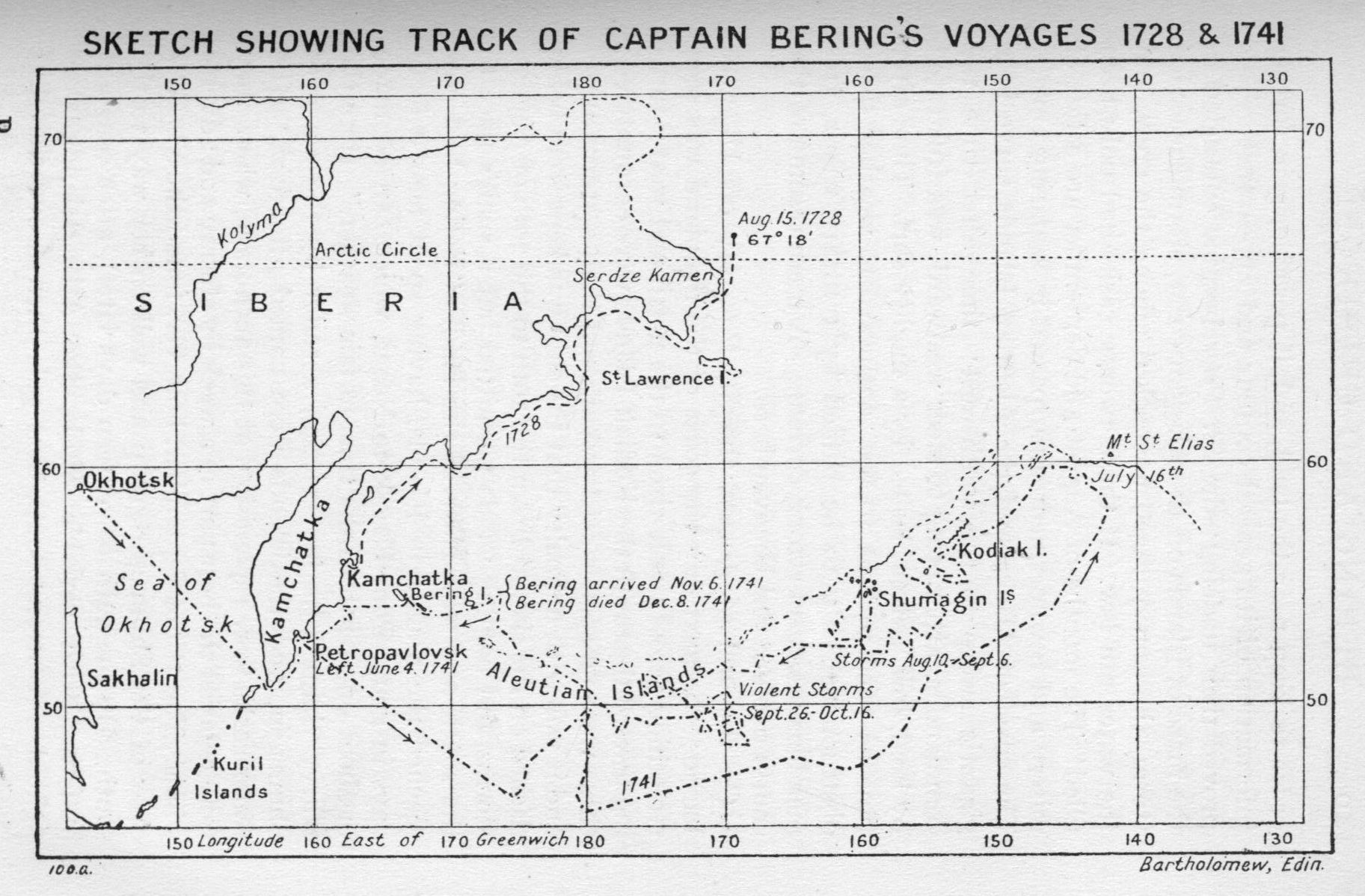
Sailing south-south-west, through rain, fog, and stormy weather, the first portion of the homeward journey passed without mishap or adventure. On the 25th the course was changed slightly to south-west, and on the 31st of July, the weather clearing, a north-west course was taken in {40} order to keep near the land, and, if possible, gain further information of its general contour and appearance. This proved their undoing; the St. Peter became entangled in the maze of islands off the Alaskan coast, storm succeeded storm, the scurvy raged unchecked among the crew, and the water ran low. If those twenty casks had only been filled! The months of August and September are a tale of misery and bewilderment unsurpassed in seafaring annals. The coast of Alaska and the Aleutian Islands curve in a gigantic sweep to the south-west; time after time the commander, attempting to steer westward, was frustrated by land, low, barren, lashed by a mighty surf. Time after time he tried to beat to the southward to weather these obstructions, only to be baffled by contrary winds, tremendous seas and strong currents. A mere résumé of the course pursued can be given here.
On the 2nd of August the St. Peter lay off Ukamak Island; the next day the coast of the mainland was seen stretching across the horizon to the north and west; turning toward the south the Kodiak Islands were encountered; these were no sooner safely weathered than a storm arose, and it was with difficulty that the ship was kept from being dashed on the shore. From the 10th to the 29th of August, storms and baffling winds permitted but a snail's pace to the south and west clear of the land. "Bering had now reached the Shumagin Islands, having spent nearly forty days in going from Kayak to Nogai, which can be made in about one tenth of the time in fair weather." Here the scurvy claimed its first victim, a sailor by the name of Shumagin, and the islands were named after him. The water casks were replenished at this anchorage, where they were delayed the best part of a week by stormy and adverse winds. The 7th of September, however, found the St. Peter clear of the Shumagin group and well on her way to the south. By the 24th (seventeen days later), after constant buffeting with variable winds, the Atka Islands were sighted. A strong south-west gale then drove the ship {41} back on her course. For eight days the gale continued, and the sailors almost gave up hope. Twenty-four of the crew were helpless with the scurvy, two had died, and the commander himself was growing weaker each day. The officers considered the advisability of finding a harbour and wintering on the American coast. To this Bering refused to agree. Then the fight with adverse winds continued—October proved to be as pitiless as September had been harsh. The St. Peter was navigated as wind and wave permitted. On the 25th Amchitka was sighted, on the 29th Semichi Island was passed.[1]
But the long voyage was nearly at an end. The Aleutians had been left behind, and the ship's officers decided on a course along latitude 52° as providing a safe approach to Avatcha. If the wind should blow from the north it would be possible to double Cape Lopatka and find a haven at Bolsheretsk or Okhotsk. On the 30th two islands came in view, and some on board maintained that they were two of the northern Kuriles. Being in doubt, the two lieutenants Waxel and Khitroff, who were now in virtual charge of the navigation of the vessel, decided to sail to the northward. The 4th of November found them in latitude 56°; as this was beyond the latitude of Avatcha the course was changed to the south-west. Then on the morning of the 5th, land was sighted to the westward. Kamchatka at last!
It would now be but a question of a few hours, a day perhaps, to find their greatly desired refuge. Sail was shortened, and the vessel cruised along the coast. The glad news spread like wild-fire through the ship—the sick crawled on deck to cast longing eyes on the mountains to the westward. The commander himself as he lay on his cot gave way to the pervading enthusiasm.
But their joy was of short duration. At noon an observation showed them to be still a clear degree too far north for Avatcha. The bay into which the St. Peter had been {42} so cheerfully navigated in a vain endeavour to find the entrance to Avatcha, they were now as anxious to leave, especially in view of an approaching gale. During the night the storm broke in all its fury, the starboard shrouds of the mainmast were torn asunder, and the mast so badly sprung as to render it useless. Morning of the 6th brought a realisation of the perilous position of ship and crew. A council of the officers was now convened in the commander's cabin to discuss their situation. The state of the crew was wretched in the extreme; ten sailors were all that could report for duty, and these men were so weak that they must perforce assist each other to and from duty at the tiller. Khitroff and Waxel were in favour of trying to make a landing in the bay they had found the previous day, take the sick on shore and prepare to winter. They argued that the state of the crew, the condition of the masts, and the lateness of the season made any further navigation not only dangerous, but almost impossible. They affirmed positively that the coast confronting them was a part of Kamchatka, and that it would be possible in the spring to find their way to Avatcha either overland or, if the ship could find safe anchorage, by sea.
To all of this Bering stoutly objected. He pointed out the herculean efforts already made, that their observations showed them to be but a few days' sail from port, and that they still had five water casks and could use the foremast. Confined as he had been to his bed for the past two months, he was unable to judge correctly the state of crew or vessel; he was daily growing weaker from the ravages of the scurvy, and it was but natural that he should earnestly desire the comforts to be found in the post of Petropavlovsk. It is a question which will always remain undecided, as to which was the better counsel. This much is certain, the indomitable spirit of the commander was not to be crushed even in this dire extremity.
His counsel was overruled, anchorage was sought in the bay, and this was successfully accomplished during the {43} night, but not before two anchors had been lost, and the St. Peter for a time placed in imminent danger of shipwreck.
The bay into which they had entered lies on the northeast coast of what has since been called Bering Island. The island, some ninety miles in length, lies but a few days' sail from the Kamchatkan coast, between latitudes 54° and 56°. To the south and west lay Avatcha, to the north and west could be found the mouth of the Kamchatka River, and the fort at which Bering had passed the winter of 1728-29. In his voyage of 1729 he had come very close to these islands,[2] but in storm and rain had passed them by. The islands were totally uninhabited, and have so remained to this day. Void of the trees or shrubbery which we are accustomed to see in such profusion along our Pacific seaboard, their scarred mountains, barren and rocky, wrapped in the swirl and snow of bleak November, wear no inviting aspect. A short strand merged into a bank of varying height which led to the base of the bare and rugged mountains. However, to the sea-weary and dying Russians any hillside of solid earth appeared a welcome refuge. Steller superintended the transfer of the sick to the shore, some of whom died upon exposure to the biting November air. Shelters of driftwood roofed with canvas were hastily constructed, and in these the sick were at first housed. Later pits were dug in a sandy bank and covered over with driftwood; in these underground shelters the crew proceeded to pass the winter. Twelve sailors had died previous to the landing on the island; by the 10th of November nine more had succumbed, and when the last death occurred in January, thirty-one of the crew of seventy-seven had passed to the great beyond: servants of the Russian government, but martyrs in the cause of that most fascinating of all adventure, the search for the unknown land.
The commander was landed on the 10th and placed {44} in a dug-out next to one occupied by Steller, who did his best to nurse him back to health. But "before leaving Okhotsk he had contracted a malignant ague, which diminished his powers of resistance, and on the voyage to America scurvy was added to this. His sixty years of age, his heavy build, the trials and tribulations he had experienced, his subdued courage, and his disposition to quiet and inactivity all tended to aggravate this disease; but he would nevertheless," says Steller, "without doubt have recovered if he had gotten back to Avatcha, where he could have obtained proper nourishment and enjoyed the comfort of a warm room. In a sandpit on the coast of Bering Island, his condition was hopeless. For blubber, the only medicine at hand, he had an unconquerable loathing. Nor were the frightful sufferings he saw about him, his chagrin caused by the fate of the expedition, and his anxiety for the future of his men, at all calculated to check his disease. From hunger, cold, and grief he slowly pined away.... He died on the 8th of December, 1741, two hours before daybreak," and was buried not far from the huts of the encampment.
It is of little avail to lament at length upon the untimely end of this intrepid seaman. A word of recapitulation will suffice and the tale is told. Let his deeds speak for him. Born in Denmark in a humble home, early to sea, enjoying little if any of the advantages of an education, he rose step by step in his chosen profession by the sheer strength of his energy. Bering was at all times a dependable man in an age and in the service of a country not at all noted for staunchness of character or integrity of command. From the deck of a man-o'-war to the head of an expedition overland through the heart of a great continent is a far cry, and few there are who seem to have recognised the difficulties he must have faced in the new undertaking.
Clothed with absolute power over some six hundred men, the records show him to have been kind and considerate {45} to a fault. Above all, he was a patient man; patient in service, long-suffering with the contemptible Siberian voivodes, with a tenacity of purpose that finally overrode all mundane obstacles and launched him forth on the sea of his dreams. For Bering possessed that qualification which alone lifts one man above his fellows. He was gifted with a rare breadth of vision, which enabled him to visualise a great enterprise, lay out the several steps, and by perseverance see them through to the end. "Whatever faults Bering had," says one, "it cannot be said of him that he shirked a task because it was hard or unpleasant." In the final analysis, he gave his life without complaint in the service of his adopted country.
The survivors were in a sorry plight. It was now the dead of winter in latitude 55° north. Heavy snowstorms added to the discomfort of wind and cold and the long nights of darkness in rude dug-outs. A gale had driven the St. Peter on shore. The food retrieved from the wreck at length ran low, and famine would have been added to their already sore trials had not the island teemed with animal life. Long uninhabited by either Kamchadale or Innuit, the wild life on the island knew no fear of human kind and proved an easy prey to the resolute sailors of the St. Peter.
Arctic foxes proved to be a pest; so numerous and so tame were they that Steller and his assistant killed sixty their first day on shore. Along the shores of the bay were to be found sea-otters, whose valuable fur sold readily in China for one hundred roubles a skin. Sea-lions and fur seals provided the shipwrecked crew with food, oil, and clothing, while from the flesh of the sea-cow excellent food was obtained. This was a huge animal twenty to thirty feet long and weighing about three tons.[3]
With the advent of spring exploring parties determined their insular position. It was therefore decided to break {46} up the stranded St. Peter and build a smaller vessel with which to reach Avatcha Bay. By the 10th of August the new craft was ready for launching. "She had a thirty-six foot keel, measured forty-two feet from bow to stern, and drew five and a half feet of water." A few pounds of flour (all that remained) and some cured meats provided the utmost in the way of food for their trip to Petropavlovsk. On the 13th, forty-six men crowded themselves on this frail bark and by dint of a sail, supplemented by long oars, the mainland of the Kamchatkan peninsula was sighted after four strenuous days. Coasting slowly southward, they made the harbour on the 27th, and disembarked. There they were received with every manifestation of joy, while the more devout among the crew held service in the church for their safe return to home and loved ones.
The expedition cannot by any means be considered as void of results. Apart from the scientific knowledge gained of the relative position of the continents of North America and Asia, a new fur el dorado had been disclosed. The glossy sea-otter furs carried home by the crew of the St. Peter brought them unexpected riches. The tales of vast numbers of seals and other marine and animal life led many an expedition to the Commander Islands and beyond. Within a generation the natives of the whole Aleutian archipelago had been laid under tribute, the Russian Bear had crossed the straits and begun the quiet penetration of a new continent.
[1] East of Attu.
[2] The Commander group, of which Bering and Copper Islands are the largest.
[3] It seems to have frequented the Commander Islands in great numbers, but within twenty-five years was completely exterminated by hunters from Kamchatka.
His early life and training. Being the story of the man who earned the right to be considered the chief explorer and cartographer of the vast Pacific Seas.
It will be necessary to pass over the next period (1741-1778) with the remark that during those years the Russians gradually spread their stations through the Aleutian archipelago of islands, using Petropavlovsk as their Siberian base, and Unalaska as their American base. The news of the Bering explorations soon ceased to excite curiosity among the court circles of Europe. The Russian government threw around the region a mantle of impenetrable silence. The fact that very valuable fur lands had been discovered was as jealously guarded as was the right to hunt in those regions of Eastern Siberia or the North-West of America.
An English navigator on a quest for the North-East Passage, in charge of vessels outfitted at the expense of the British government, was the first to give to the world the general outline of North America from the latitude of Oregon to Icy Cape, in the far Arctic Sea. His sailors found the key to the fur treasure-house of the Russian trading companies, the news was published broadcast, and he who sailed might share.
From a clay biggin on the Yorkshire moors to the position of post-captain in the Royal Navy is a long road to travel by one's own exertions, but the final reward of tireless industry and never-flagging zeal. To become the foremost navigator of his day is an honour which has been accorded to but few men in our long and glorious history as an empire; yet this statement may be safely made in regard to Captain James Cook, with none to deny its simple justice.
{48}The village of Marton is situated in the northern part of Yorkshire, about six miles from Stockton-upon-Tees. There James Cook was born in the year 1728. His father was a day labourer, and often worked for a Mr. Mewburn, who was a well-to-do farmer of the neighbourhood. The home of the Cooks at this time was a clay biggin of two rooms, typical of the humble abodes in which the workmen of that region lived. When James was eight years old his father secured a better position with Mr. Skottowe, of Ayton, and the family moved to Airy Holme Farm. The lad was now sent to the village school, where he showed more than the usual aptitude in his studies. But school days were over all too soon, and James must needs help his father and elder brother with the farm work until he had grown to be a sturdy lad of seventeen. We can now but infer what took place, in the absence of any authentic record. A peep through the doorway and we would see the family circle in earnest discussion. An opening in a general store at Staithes had been found, and Mr. Skottowe had probably advised the youth to accept it.
So to Mr. Saunderson's store James repaired. There he found a picturesque little village nestling "in a narrow cleft in the cliffs" about ten miles north of Whitby. The inhabitants were mostly fishermen who plied their calling in the stormy waters of the North Sea. And the tales young James heard no doubt fired his imagination and whetted a natural desire to engage in something more venturesome than the common tasks assigned him by Mr. Saunderson.
It required but a trivial incident to provide a means of severing the ties which bound him to the store. A bright South Sea shilling had duly come to Staithes in the pouch of a returning sailorman. It was exchanged at the little store for some prosaic commodity of stout Yorkshire manufacture, quite different from a like purchase in the far-away lands of India and the Spice Islands of renown. In the course of the day James had occasion to go to the {50} till and, noticing the shining silver piece, so unlike its fellows, read its curious legend and resolved to keep it. He thereupon deposited one of his own shillings in the till, pocketed the odd and newer coin, and proceeded about his daily tasks. That evening the proprietor noticed its absence and made inquiries about it. The matter was explained to the apparent satisfaction of all concerned; but, if we may be allowed to judge of the youth's feelings at that time from the haughty temper he evinced in later years, James did not forget the suspicions of the storekeeper, and in a short time was able to secure his father's permission to go to Whitby. The South Sea had beckoned, and the lad had acknowledged its salutation.
He now became apprenticed for three years to John Walker, who was a member of a firm engaged in coal shipping from that port. The years of apprenticeship were evidently as pleasant as they were profitable, and very soon the best of feeling existed between Mr. Walker and his charge. In fact this early friendship never waned, and by means of letters and an occasional visit the celebrated navigator of later years evinced his esteem and indebtedness to the man who had given him his opportunity.
In those days Whitby was of some importance as a shipbuilding centre, and the industry was mainly carried on by the merchants interested in the coasting trade. Cook thus early had an opportunity to attend to the outfitting, as well as to the sailing of vessels, a training which was to stand him in good stead on more than one occasion. His early training in seamanship was acquired in the Freelove, employed in the coal trade between Newcastle and London. No better school for the training of mariners is to be found to this day than the stormy waters of the North Sea.
His heart was in his work, and he studied diligently, when occasion permitted, to learn the theory of navigation as well as its practice. This was especially true of the long winter evenings. With the Freelove laid up for overhauling and repairs, Mary Prowd, the housekeeper, would provide {51} him with a table and light in a quiet place for reading and study.
The years of apprenticeship at an end. Cook continued to sail in the North Sea and Baltic trade. At length in 1752, about five years from the time of his arrival in Whitby, he secured the appointment of mate in the Walkers' new vessel, the Friendship. For the ensuing three years he served in that capacity and learned to wield control over the horny-handed sailors of the crew. In his illuminating life of Cook, Kitson makes the following summary:
This was rapid promotion for a youth with nothing to back him but his own exertions, and tends to prove that he had taken full advantage of the opportunities that fell in his way, that he must even then have displayed a power of acquiring knowledge of his profession beyond the average, and that he had gained something more than a smattering of seamanship.
In June of '55 the Friendship lay at anchor in the Thames. Stirring times were toward. The English were girding their loins for a titanic trial of strength with Imperial France to the southward. Forces under Braddock had been despatched to Virginia, and the struggle for the Ohio valley had begun in earnest.
A press of seamen was taking place in all the great seaports of Britain, for in those days that method was employed to man England's ever-increasing navy. These great oaken walls, though they protected her from invasion, and enabled her to carry on a war in each of the seven seas, were now in need of men. Voluntary enlisting could ill supply the ordinary peace demand of the Navy, and when emergency called recourse was had, perforce, to the rough and ruthless press gang.
The moment was propitious; able seamen were scarce, the demand greatly exceeded the supply; new ships were outfitting in all haste at the great Navy yards. Cook had little doubt but that his eight years of training and his present standing (that of mate) would be welcomed on {52} some stout ship of His Majesty's Fleet. So, rather than be pressed, he decided to enter the Navy as a volunteer, "having a mind," as he is reported to have said, "to try his fortune that way." He accordingly repaired to a rendezvous at Wapping, and was duly entered on the muster roll of the Eagle as an A.B.
Letters of recommendation were meanwhile secured from his friends and employers, the Walkers of Whitby, and within a few weeks he was raised to the position of master's mate. Then in October, Captain Hugh Palliser succeeded Hamer in the command of the Eagle. Cook was giving most satisfactory service, and, with the friendly assistance of the Walkers, Captain Palliser recommended him for a master's warrant. In October of '57, James Cook became master (or navigating officer) of the new ship Pembroke.
The ensuing ten years were full of the most strenuous endeavour. In February of '58, the Pembroke became one of Admiral Boscawen's fleet of seventeen sail, convoying one hundred and twenty-seven transports to Halifax for the projected attack upon Louisburg. After the fall of that fortress the fleet wintered at Halifax, and in the spring acted as convoy to Wolfe's command in the attack on Quebec. Cook took part in and witnessed the stirring scenes of that hectic summer of '59, and in the fall prepared to pilot the Pembroke down to the winter base at Halifax.
But Lord Colville, captain of the Northumberland, had been appointed to the command of the North Atlantic squadron, and to Cook fell the honour of appointment to the master's berth on the flagship. There is no doubt that his record during the capture of Louisburg and again at the siege of Quebec won him this coveted position.
The season of 1760 was spent at anchor near Quebec, and the long summer days might well have been spent in pleasant ramblings ashore by one so inclined. It would appear, however, that the new master of the Northumberland could find a more profitable manner of employing {53} his time, something that would be of service to his superior officers and of value to his country. And during that summer Cook made himself master of the navigation of the St. Lawrence, from the sea to Quebec. The existing French charts were revised, new soundings were taken, and additional charts were made. Once again persistent industry added to native worth brought him merited recognition, and, shortly after the opening of the new year, Lord Colville awarded him fifty pounds, in consideration of the extra work he had undertaken that summer of 1760. Though the sum may seem insignificant, recognition had been won—Master Cook of the flagship was different from other masters.
Again the fleet wintered at Halifax. The Northumberland, in fact, spent the whole season of 1761 maintaining watch and ward at that important naval base. The fall of '62 brought news of the capture of St. Johns by the French. Thither sailed the Northumberland in all haste, and lent her aid in the re-capture of the city and the policing of the surrounding waters. Cook, who had been employing his spare time in a survey and chart of Halifax harbour (1761-62), was now called upon to assist Mr. Desbarres, an engineer, in making a survey of the harbour of St. Johns and the waters adjacent, for it was now decided that a complete fortification of the harbour should be made, to render it immune from future raids. This task completed, the Northumberland returned to England, arriving at Spithead, 24th October. In the following month Cook signed off, and, freed from matters nautical, was at liberty to enjoy a well-earned rest amid the pleasures of London town.
Before the year was out he had met, courted, and married Elizabeth Batts, of the parish of Barking. Shortly afterwards the happy couple moved into their own home at Mile End, Old Town. Those who follow the sea have little time to enjoy the comforts of a home, and yet none there are among landsmen who appreciate at any {54} truer worth the strengthening influence of home ties. With no anchor to windward Jack cuts but a sorry figure ashore.
A few short months had passed when Cook received an appointment from the Admiralty to carry out the complete survey of the coasts of Newfoundland. As this was special work with good pay, the opportunity was not one to be lightly turned aside in lieu of some safe billet in home waters. The 1st of May, 1763, then, found him aboard the Antelope, outfitting at Portsmouth, and in due course the ship arrived at St. Johns. As the Islands of St. Pierre and Miquelon were to be handed over to the French, pursuant to the terms of the Treaty of Paris, a hurried survey of the coasts of these islands was ordered by Captain Graves.[1] Cook carried this out with all speed, much to the satisfaction of his superior officer and of the Admiralty. The fall was spent in coastal survey of the shore contiguous to St. Johns. The approach of winter put an end to the work for that year, and Cook returned to England in November.
He returned to St. Johns in June of the following year (1764), and at once took charge of the schooner Grenville, which the Lords of the Admiralty had set aside for his use in the survey. In the meantime Captain Palliser had succeeded Graves as Governor of Newfoundland and a distant acquaintanceship now crystallised into a warm friendship. From this time onward Cook did not lack the hearty support of a friend well placed to aid him.
Cook carried on the survey of the Newfoundland coast from Noddy's Harbour to the Bay of St. Genevieve with great industry. Notwithstanding a severe injury to his hand through the bursting of a powder horn, the work was pushed ahead with vigour and only ceased with the approach of winter weather. He returned to England in the Grenville, and while the vessel was undergoing needed repairs and alterations at Deptford, her master proceeded {55} to London and set to work upon the preparation of his charts for submission to the Admiralty. Thus the winter passed. The return of spring (1765) saw the crew of the Grenville assembled, and, with stores aboard, crossing the broad Atlantic to again continue the survey of the rough and rugged Newfoundland shore. (Great Garnish—Long Harbour.)
Again in the late fall the return to England—more work on the charts and the publishing of them. On the 20th of April, 1766, the Grenville left Deptford, and arrived at Bon Ton Bay 1st June. While off the Burgeo Islands near Cape Ray on the 5th of August, Cook was fortunate in securing a fine day to observe an eclipse of the sun. The survey of the south-west coast was completed this year, and the Grenville arrived in the Channel the latter part of November. During the winter Cook gave a résumé of his observations on the eclipse to Dr. Bevis, "a prominent Fellow of the Royal Society, who communicated them to that body on 30th April, 1767." By means of this Cook once again raised himself from the ordinary level of surveyors in general. Something had been accomplished beyond his daily routine duties, and the favourable notice which he received from that powerful society was the key which in time unlocked the gates to those far-off South Seas whence came that bright shilling of boyhood days.
One more year, that of 1767, was spent in the trusty Grenville completing the survey of the Newfoundland coast-line. Returning to Deptford in November, the winter was spent in preparing charts and sailing directions, all of which were published by permission of the Admiralty. Five seasons had been spent in the survey, and under the most trying conditions of weather; days of fog alternating with gales of wind as only a Newfoundland climate can do. Besides, the coast of the island is deeply indented, which made the navigation of the Grenville most difficult and entailed much work in the small boats. In writing of this period in Cook's life, Admiral Wharton says that the charts were "admirable," that "the best proof of their {56} excellence is that they are not yet wholly superseded by the more detailed surveys of modern times," and that "their accuracy is truly astonishing."
Work well done merits a reward. Nor is it needful that the reward be in gold; rather should it be in the opportunity for more and larger service. The next chapter will tell us how these years of toil were compensated.
[1] Of H.M.S. Antelope, and Governor of Newfoundland.
Captain Cook visits Tahiti, circumnavigates New Zealand, and charts for the first time the east coast of Australia.
The year of 1768 loomed large with promise. While Cook was busily engaged upon the completion of his charts of Newfoundland, the Royal Society began active preparations for the observation of the forthcoming transit of Venus in June of '69. It was decided to send trained observers to North Cape, to far-away Fort Churchill on Hudson's Bay, and to "any place not exceeding 30 degrees of southern latitude west from Your Majesty's Royal Observatory in Greenwich Park." So runs the desire of the society as set forth in a memorial to the King, and praying for assistance, as the cost of the undertaking was beyond their means. The government of the day quickly came to the rescue with a grant of £4,000, and it remained but to select the personnel of the various expeditions.
It was necessary that the expedition to the South Seas be gotten under way at once in order that the slow-sailing vessel of that day might be able to reach a favourable station prior to the date of the transit. The society at first offered the position to Mr. Dalrymple. He had spent some years in the employ of the East India Company and upon his return to England had published a book on the discoveries in the South Pacific, This had brought him prominently before the public and made him a well-known character, one interested in geographical research and discovery. But Dalrymple proved to be somewhat conceited. He demanded the entire command and management of the vessel which was to convey him to his {58} station. As he held no naval rank the Admiralty refused to permit such a procedure, and the society determined to find a more suitable person.
The choice naturally fell upon Cook. His years of survey; his finely executed maps and charts just printed; as well as his interest in astronomy and proven ability to observe such phenomena, a report of which Dr. Bevis had but recently read to the society's members; all these things tended in a most natural manner to bring him to the favourable consideration of the committee of the society. And then there was the added and conclusive qualification, naval rank, that of master of the Grenville.
So, on the 25th of May, Cook received an official communication from the Admiralty to the effect that he had been appointed First Lieutenant of the Endeavour bark, and that he was to command the expedition to the South Seas.
Proceeding to Deptford he went on board and began {59} preparations for the long voyage. The vessel was a comparatively new, Whitby built, bark of three hundred and sixty-eight tons burthen. Bluff of bow, wide in the waist, narrow of stern, she was well fitted for the task ahead. Stores of all kinds for a long voyage would find ample room within her spacious oaken walls; there would be fitting accommodation for the crew of seventy, and, when occasion demanded it, she could be run ashore upon some muddy bank, careened and repaired, without danger to masts and upper works.
The months of June and July were spent in the endless details of outfitting for sea. Supplies of every material which would ensure the success of the venture must be selected and in proper quantities; supplies ranging from the medicine chest to food and clothing for the crew; from articles to trade with the natives of the South Seas to ship's stores, cannon and ammunition. A complete set of instruments for the work of observation as well as for the usual navigation of the ship must be assembled. In this part of the work Cook received every assistance from the members of the Royal Society. Mr. Charles Green was appointed assistant observer, and the society furnished the following instruments: two reflecting telescopes of two feet focus, with a Dolland's micrometer to one of them and movable wires to the other; an astronomical quadrant of one foot radius and stand; an astronomical clock and alarm clock; a brass Hadley's sextant; a barometer, a journeyman clock; two thermometers and a dipping needle.
In addition to his routine duties Cook was also called upon to provide room for a party of ten, who were to accompany the expedition in the interests of science and the advancement of knowledge other than that of astronomy. Joseph Banks, a Fellow of the Royal Society and a gentleman of wealth, had become interested in the expedition, and had received permission to accompany it. He selected Dr. Solander as naturalist, with H. Sporin as assistant. Three artists and four servants completed the {60} party. The presence of Banks and Solander added interest to the voyage from a public viewpoint, but undoubtedly strained the accommodation of the vessel to the utmost. It is greatly to the credit of Captain Cook that he at all times maintained the most friendly relations with his scientific confrères and that the voyage terminated without a single unpleasant episode, something unique in scientific expeditions of those days.
On the 14th of August the Endeavour arrived at Plymouth, where twelve marines were signed on, and additional stores were taken on board. Banks and his party arrived from London on the 20th, and six days later the commander gave the eagerly awaited order to up anchor and away.
While the good ship Endeavour sturdily wings her way to the southward a line of recapitulation may be in order. The expected transit of Venus over the sun's disk was considered an event of the greatest importance by the astronomers of those days. Much valuable information was expected through the proper observation of the transit, and the locations from which to make the observations were chosen with great care. It had at first been thought to use one of the islets of the Friendly Island group which had been discovered by Abel Tasman in 1642. But while the Endeavour was fitting for sea, Captain Wallis had returned from his voyage round the world. He reported to the Royal Society that a more fitting place would be George's Island,[1] which he had discovered on his voyage. Here a good harbour was to be found and a shore suitable for the erection of a temporary observatory. Accordingly, Lieutenant Cook was instructed to proceed to this island—now known as Tahiti—and to observe the transit.
However, this was not the sole object of the voyage. {61} Kippis tells us that "when his chief business was accomplished, he was directed to proceed in making further discoveries in the great Southern Seas." No time limit was set for a return to England. Delays due to wind, wave, or accident upon some unknown coast prevented any limitation as to time; nor were the necessary expenses due to such an undertaking at any stage a bar to its successful completion. Never had an expedition left England's shores in higher spirits, with a better personnel, or with greater opportunity to startle the scientific world with tales of new-found lands, of strange peoples, and curious animal life.
Let us now follow the Endeavour on her long voyage to the Society Islands, and thereby learn something of the route chosen, as well as secure a glimpse of the ports visited on the way.
On the way south through the Atlantic, it was customary for sailing vessels of those days to stop at ports a moderate distance from one another, in order to replenish the water casks, and that supplies of fresh meat and vegetables might be secured. This lessened the onset of the scurvy, which was then (1769) the seaman's scourge. The Endeavour made her first call at Funchal Roads, the harbour of the Madeira Islands. Thence crossing the Atlantic to the Brazilian coast the ship anchored in the harbour of Rio de Janeiro on the 25th of November. No very flattering reception awaited the members of the scientific expedition in this port. The Portuguese governor became very suspicious, would permit no one but the lieutenant on shore, and even provided an armed guard to accompany him as he made his purchase of supplies. In his endeavour to understand the purpose of the expedition, the doughty governor formed the idea that the transit of Venus meant the passing of the North Star through the South Pole, and promptly decided that all Englishmen were crazy.
With stores replenished, the Endeavour headed out to sea, bound southward round the Horn. The 11th of January the {62} land of Tierra del Fuego was in sight and harbourage was sought in the Bay of Good Success. Again the water casks were filled, and wood secured for the galley fire. Head winds and tempestuous seas tested the staunch bark off Cape Horn, and for thirty-three days the crew manned the braces, reefed sail, and tacked ship in a persistent battle with the elements. Cruising up the Chilean coast, March found the Endeavour in latitude 38° 44' south, and longitude 110° 33' west, and the weather gradually growing warmer, much to the joy of the sailors. Anchor was cast in Matavai Bay the middle of April.
Permission was secured from a native chief to erect a small fort on a part of the shore which lay under the protection of the ship's guns, and soon all was in readiness for the observation of the transit. The 3rd of June dawned clear and cloudless; a more perfect day could not have been secured for the observation. Cook remarks in his journal—"The whole passage of the planet Venus over the sun's disk was observed with great advantage by Mr. Green, Dr. Solander and myself.... We all saw an atmosphere or dusky cloud round the body of the planet," etc. The greatest care was exercised in making the observations as accurate as possible, and we may be sure that the report to the Royal Society was a model of precision.
In fact Cook had with his usual thoroughness found time to prepare an elaborate chart of the group of islands of which Tahiti was the most important. To these he gave the name Society Islands because of the friendliness of the natives. Every means was employed to learn the language of the people, their customs and religion, and the whole of this detailed information was duly reported and printed upon the return of the expedition to England. It may be said that the manner of conducting the voyage introduced a standard for scientific exploration in that and the succeeding century. The voyages of Captain Cook have been common property from that day to this, and are still a very necessary part of every public library.
South and west of the Society Islands, where the Endeavour swung at anchor in Matavai Bay, stretched a vast unknown waste of water from the longitude of Cape Horn to the position of Tasman's track in 1642. A hundred years and more had passed since that courageous Dutch navigator had seen the southern end of Van Diemen's Land[2] and the north-west coast of Staten Land.[3] A part of the unknown ocean was now to be explored. Leaving Tahiti on the 18th of July (1769), Cook gradually increased his latitude until he was well south of the tracks of other navigators. Cruising westward, the 25th of August was celebrated as the anniversary of leaving England. A month later, the Endeavour was in latitude 33° south and 162° west longitude. The 3rd of October found them a few degrees farther south, and a good ten degrees farther west.
Various signs now indicated to their experienced eyes nearness to land—at first birds were seen, then a seal asleep upon the water, floating sea-weed, then a piece of wood covered with barnacles, and on the 6th of October land was seen to the westward. As the ship approached the shore it appeared to be of large extent both to the north and to the south—while back from the shore the ground rose in a series of hills, terminating in a lofty range of mountains far inland. On the afternoon of the 7th the opening to a bay, which seemed to extend well inland, was seen, but it was not until noon of the next day that they were able to find safe anchorage therein and make a landing. Smoke ascending from different places along the shore proved that this part of the land was inhabited, but no canoes came off to greet the arrival of the ship as was the custom amongst the natives of the Society Islands. Some natives were seen standing on the shore near the mouth of a small river, but upon the approach of the {64} pinnace and yawl they ran away. The next day every effort was made to make friends with the Maoris, but to no avail. As the water in the river proved to be salty, the natives hostile, and no supplies other than a little wood could be secured, Cook named it Poverty Bay. Cook had fallen in with the east coast of the North Island of New Zealand, which had never before been visited by Europeans. Abel Tasman in 1642 had discovered the western coast and had named it Staten Land.[4] He too had found it impossible to open friendly relations with the natives and gave the name of Murderer's Bay (now Golden Bay) to the place where the Heemskirk and Leehaan for a short time lay at anchor.
Cruising southward, Cape Table was discovered and named. "It is of considerable height, makes a sharp angle, and appears to be quite flat at the top," writes Cook. Below the cape an island was found to which the name Island of Portland was given, "from its very great resemblance to Portland in the English Channel." In this manner the coast was followed as far south as latitude 40° 34', where Cook deemed it wise to alter his course. No really good harbour had been found, and the coast-line continuing in its regularity there seemed to be little likelihood of finding one, so the ship was brought round, and stood to the north, with a fresh breeze from the west. The high bluff head, with yellowish cliffs, which they were abreast of at noon, was called Cape Turnagain, "because here we turned back." By the 22nd of the month (October) the Endeavour was well to the northward of Poverty Bay, and a small bay was at length discovered where wood and water could be secured in safety. The natives also appeared to be more friendly, and a brisk trade in fish, sweet potatoes and yams was begun.
With stores aboard the voyage was continued. East Cape was rounded on the 30th, and on the 9th of {65} November fine weather permitted the observation of a transit of Mercury across the sun's disk. Several days were spent in exploring the bay in which the ship now lay at anchor.[5] Through the courtesy of the natives a party of officers from the Endeavour was conducted to one of the peculiar, fortified Maori villages. Many such palisaded forts had been seen at different times during the preceding months, and the scientists were most anxious to become acquainted with the interior design. Upon returning to the ship all agreed that the hill-top upon which it stood had been converted into a very strong position where a few determined men could defend themselves against many times their number. The Endeavour sailed on the 15th, and the cruise to the northward was continued.
The remainder of November and the month of December were spent in the leisurely survey of the coast; now rounding a promontory, now exploring and charting a bay—gaining in every possible manner an accurate idea of the country, its vegetation, the natives and their customs. At work of this nature Cook was an adept. His long years of training as surveyor of Newfoundland stood him in good stead, and the many dangers to be encountered on an unknown shore were skilfully avoided. By the 17th (December) the ship was off the northern extremity of the land, and to this Cook gave the name of North Cape. Keeping at a good distance from the shore, owing to the strong currents encountered; the Cape was at length weathered (21st December). Christmas Day was spent at sea amid such cheer as the ship afforded.
Violent storms ushered in the new year, and but for the excellent seamanship displayed by the commander the voyage might easily have terminated in shipwreck and disaster. In summing up this part of the voyage, Cook very candidly remarks: "We were three weeks in getting fifty leagues, for at this time it was so long since we passed Cape Brett. During the gale we were happily at a {66} considerable distance from the land, otherwise it is highly probable that we should never have returned to relate our adventures."
Cook now sailed down the western coast of the North Island, keeping as close to the shore as possible. But meeting in turn with squalls from the north-west, winds from the west and gales from the south, the exploration was carried out with great difficulty and not without considerable danger. That he fully realised his position is shown by the following observation: "Nothing is to be seen but long sand hills, with hardly any green thing upon them, and the great sea which the prevailing westerly winds impel upon the shore must render this a very dangerous coast. This I am so fully sensible of, that were we once clear of it I am determined not to come so near again if I can possibly avoid it, unless we have a very favourable wind indeed." For two weeks the battle was maintained. Cook was determined to keep in sight the western shore line as he tried to weather his way to the southward, and he did it. No better example of the man's persistence is to be found in this voyage than the exploration of the northern and western coasts of this island.
On the 12th (January) the Endeavour came in sight of a high peak, towering into the clouds like that of Teneriffe (12,180 ft.). To this was given the name of Mount Egmont, in honour of the Earl of that name.[6] But the weary buffeting with adverse winds on a lee shore was soon to be at an end. Two days later land was seen stretching along the southern horizon almost across their course, and some leagues to the westward. Away to the east of south the sea was clear as far as they could see. A course was laid which would bring the ship over to the new land, which was seen to be "of a considerable height, distinguished by hills and valleys, and the shore seems to form several bays, into one of which I intend to go with the ship in {67} order to careen her (she being very foul) and to repair some few defects, recruit our stock of Wood, Water, etc." The next day a commodious inlet was entered, and soon a safe anchorage was secured in a snug cove.
To this inlet they gave the name of Queen Charlotte Sound, while the large bay, of which they thought this inlet formed a part, was in reality the passage between the North and South Islands, known to-day as Cook's Strait.
While the operations necessary to the repair of the ship were proceeding, Cook and the other gentlemen on board occupied their time in exploration. The sound was found to extend for some twenty-five miles into the land, and its shores were inhabited by small tribes of Maoris, who soon came off in their canoes to stare at the ship, cast a few stones, and, as ever, stood ready to open an attack if the opportunity could be secured. But by mingled firmness and kindness the natives were at length won over. A few presents, a desire to trade, yet instant readiness to defend the ship from attack were the means employed. Evidence was soon forthcoming that the Maoris were cannibals, and that they made a common practice of eating those of their enemies whom they slew in battle. This horrible custom made the whole ship's company doubly careful, and no untoward incident marred their stay in the sound.
On the 22nd, while exploring the eastern side of the inlet. Cook decided to land, climb a near-by hill, and thus get a better view of the surrounding country. Higher hills cut off his view to the southward up the inlet, but he was well rewarded for his trouble. From his new vantage point he could see below him a great strait or passage extending far to the eastward. He resolved to explore this passage at the first opportunity, and remove any doubt as to its connection with the ocean to the eastward. But there was to be no hurried departure of the ship from the present secure berth. The captain was as thorough in his repair of the ship as he had been persistent in his survey {68} of the North Island, as the following extract from his Journal will testify.
Saturday, 27th. Fresh Gales, Westerly. This day we got the Tiller properly secured, which hath been the Employment of the Armourers and part of the Carpenters since we anchor'd at this place; the former in repairing and making new Iron work, and the latter in fixing a transom, for the want of which the Tiller has often been in danger of being broke. Coopers were employ'd repairing the Casks; some hands with the long boat getting on board stones to put into the bottom of the bread room to bring the ship more to the stern; while others were employ'd cutting wood, repairing the rigging, and fishing.
At the end of three weeks all was in readiness to continue active exploration of the strait. The Endeavour cleared the entrance to the sound on the 7th of February and stood to the eastward. Passing through the strait, the coast of the North Island was cruised as far as Cape Turnagain, which completed the circumnavigation of this island. A course to the southward was now decided upon in order to explore the shore-line to the southward of the strait they had just passed through. Each day brought new vistas of mountain, bay and cape. Each night an offing must be secured lest they find themselves dashed upon some projecting arm of this unknown shore—a shore never before coasted by any European. The remainder of February passed in this manner, the ship being navigated ever farther to the southward. The 10th of March found them in latitude 47° 19' south, a heavy swell coming from the south-west by west, and no land in sight in that quarter. To the southernmost land of Stewart Island Cook gave the name of South Cape. This was successfully weathered, and the voyage prosecuted to the westward. An attempt was made to find an anchorage off the south-western extremity of the land, but darkness coming on Cook was afraid to venture farther up the inlet he had selected. He gave to it the name of Dusky Bay, and on his second voyage was {70} fortunate enough to explore it and admire the magnificent scenery which this bay affords.
The ensuing two weeks were spent in a run up the coast to Cape Farewell, the unsettled condition of the weather making a landing out of the question. Rounding the Cape on the 24th, they passed across the mouth of Tasman Bay, and, on the 26th, entered an inlet just to the west of Queen Charlotte Sound.[7] There the empty water casks were refilled, wood was secured, and final preparations made to leave the New Zealand coast. Cook tersely remarks: "As we have now circumnavigated the whole of this country, it is time for me to think of quitting it." But what a wealth of perseverance, what a nicety of seamanship, what an eternal vigilance is compressed within that short statement! A century and a half later Captain Wharton is moved to write the following appreciation, discussing the accuracy of the charts made during the exploration of the New Zealand coast:
But the astonishing accuracy of his outline of New Zealand must be the admiration of all who understand the difficulties of laying down a coast; and when it is considered that this coastline is 2400 miles in extent, the magnitude of the task will be realised by everybody. Never has a coast been so well laid down by a first explorer, and it must have required unceasing vigilance and continual observation, in fair weather and foul, to arrive at such a satisfactory conclusion; and with such a dull sailer as the Endeavour was, the six and a half months occupied in the work must be counted as a short interval in which to do it.
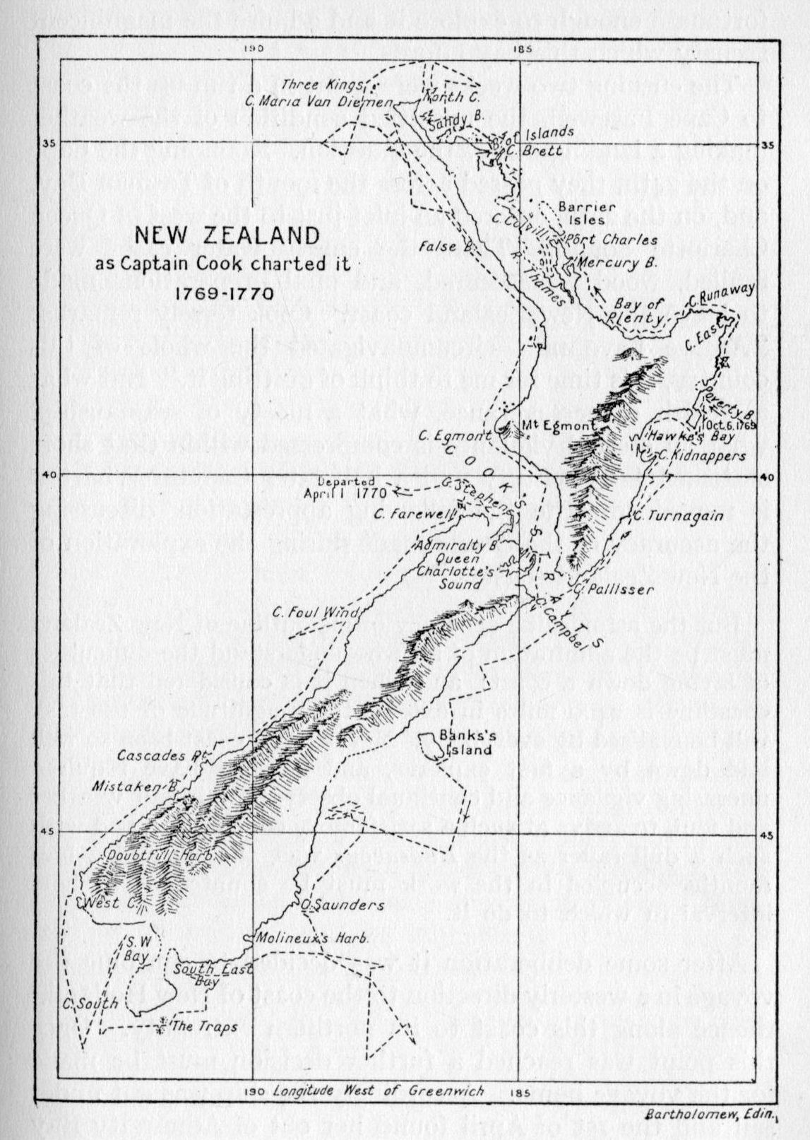
After some deliberation it was decided to continue the voyage in a westerly direction to the coast of New Holland,[8] thence along this coast to its northern extremity. Once this point was reached a further decision must be made for the voyage home. Accordingly the ship was got under sail and the 1st of April found her out of Admiralty Bay and the mountains of New Zealand showing low on the {71} eastern horizon. For the next two weeks the journal of the voyage makes mention of gentle breezes, light airs next to a calm, and calm serene weather. On the 16th April, 1770, strong gales were encountered: "Before 5 o'clock we were obliged to close reef our Top sails, having a strong gale, with very heavy squalls." This weather continued for several days. Birds were then seen, a Port Egmont hen, a pintado bird, some albatrosses, sure signs of approaching land. On the 18th at 6 p.m. "saw land extending from N.E. to W., distance 5 or 6 leagues." This proved to be the south-eastern shore of Australia,[9] and the ship was now steered to the northward along the coast. To the prominent and unusual contortions of the coast-line names were given. Thus Cape Howe, Cape Dromedary, and Cape St. George received the names which they bear to this day. Jervis Bay was seen, but no entry was made. "The N. point of this bay, on account of its Figure, I nam'd Long Nose ... 8 leagues to the northward of this, is a point which I call'd Red Point; some part of the Land about it appeared of that Colour." So the voyage continued, until, the weather moderating, it was possible to approach nearer to the shore, and on the 28th anchor was cast in a large bay. Some natives were seen on the beach, but when the captain, accompanied by Mr. Banks, Dr. Solander and Tupia, went ashore in the boats they all made off into the woods, except two men who seemed bent upon opposing the landing. Cook describes the scene very well, and as it illustrates his method of dealing with the inhabitants of these regions it is given as written in the journal:
As soon as I saw this I order'd the boats to lay upon their oars, in order to speak to them; but this was to little purpose, for neither us nor Tupia could understand one word they said. We then threw them some nails, beads, etc., ashore, which they took up, and seemed not ill pleased with, in so much that I thought that they beckoned to us to come ashore; but {72} in this we were mistaken, for as soon as we put the boat in they again came to oppose us, upon which I fir'd a musquet between the 2, which had no other effect than to make them retire back, where bundles of their darts lay, and one of them took up a stone and threw at us, which caused my firing a second musquet, load with small shott; and altho' some of the shott struck the man, yet it had no other effect than making him lay hold on a Target. Immediately after this we landed, which we had no sooner done than they throw'd 2 darts at us; this obliged me to fire a third shott, soon after which they both made off, but not in such haste but what we might have taken one; but Mr. Banks being of opinion that the darts were poisoned, made me cautious how I advanced into the Woods.
The next morning, while the sailors were busy with the usual routine of securing wood and water, the captain took the pinnace with the intent of sounding and exploring the bay. Again the natives fled at his approach and it was quite impossible to make friends with them. Landings were made at places where the natives were seen to have been busy around small fires, and here fresh mussels were found broiling in the hot embers. Great heaps of oyster shells bore a mute testimony to the habits of the inhabitants, and the size of the shells was particularly remarked upon. But to the scientists of the Endeavour this bay proved to be a veritable wonder-house of new and strange plants. Because of the number of specimens secured by Banks and Solander the name Botany Bay was decided upon. Cook describes it as capacious, safe, and convenient; with an entrance a little more than a quarter of a mile broad.
With necessary stores aboard, the Endeavour sailed out of Botany Bay on the 6th of May. About noon the entrance to another large bay was seen, to which Cook gave the name of Port Jackson. No attempt was made to enter as there were many hundred miles of coast ahead, and the ship stood in no need of refreshment. But in the year of 1788, Captain Phillip decided upon Port Jackson as the most favourable location for the establishment of the first {73} penal colony sent to these shores, and in this manner the city of Sydney was begun. Broken Bay was passed in the evening, and with a favourable wind the ship was steered along the shore all night, "at the distance of about 3 Leagues from the land, having from 32 to 36 fathoms, hard sandy bottom."
On the 10th Port Stephens was passed; the next morning they were abreast of a high point of land, "which made in 2 hillocks; this point I called Cape Hawke." Farther up the coast Smoky Cape received its name, as one may easily conjecture, from the great quantity of smoke arising from a bush fire in the vicinity. The shore continued to be low and sandy, with here and there hills, none of any great height. On the 15th Cape Byron received its name. The next day a low ledge of rocks stretching out some six miles from the coast arrested their hitherto somewhat uneventful passage and gave the captain an anxious hour. Inland could be seen a "peaked mountain, which bears S.W. by W. from them, and on their account I have named it Mount Warning." And to the point of land off which these shoals lay, Cook gave the name of Point Danger.[10] On past Morton Bay, where the city of Brisbane now stands; around and over Breaksea Spit they held their way, ever keeping as near the land as possible, charting the coast, selecting names, many of them most appropriate, for the more prominent coastal features. Life on board the Endeavour was no sinecure for the ship's officers. Yet no hint of weariness is to be found within the covers of the journal. Always the restless energy of the man drove him on to farther and still farther shores. Imbued with the thirst for accurate discovery and exploration, only inaction was painful. These must have been the supreme days of all days for Cook; the transit happily observed, New Zealand charted, and now the unknown shore of a vast island continent undergoing a similar {74} treatment at his capable hands. Truly a wonderful day to have lived, to have enjoyed to the very last dregs: what then could matter?
Anchor was cast in Bustard Bay[11] on 22nd May. But a short stay sufficed, and early in the morning of the 24th they weighed, and with a gentle breeze at south made sail out of the bay. Cape Capricorn was passed the next day, and soon shoal water caused Cook to anchor inside Keppel Island and send the boat ahead to sound. Although he did not know it, he had entered upon a most dangerous course. From Cape Capricorn to Torres Strait shoals infest the coast; in places there were innumerable small flat islets; outside of these, at some considerable distance from the shore, stretches the great Australian Barrier Reef. The wonder is that he ever got through. From Saturday the 26th to Sunday the 3rd of June the account is the same. Shoals, dangerous and strong tides, muddy bays, flow land—to seaward chains of islands paralleling the coast. The latitude of Cape Conway was found to be 20° 26' south, a small advance in eight days.
From the 3rd to the 10th the same tale is told. Their latitude was now 15° 45' south. Evening coming on, Cook decided to haul off shore and get, as he thought, into deeper water, and by morning be in a position to examine a few islands which could be seen in the distance. These he thought might be the islands discovered by Quiros, and which the geographers of those days placed in this very latitude.
The breeze was favourable, the night was moonlit, and in standing off shore the water deepened gradually from fourteen to twenty-one fathoms. What a relief it would be to get well away from the lagoon-infested sandy shore-line of this New Holland coast, whose navigation had proved to be so dangerous and trying for the past fortnight. But now the water as suddenly shoaled to twelve, ten, eight fathoms. {75} Before an anchor could be let go, however, the lead as suddenly showed twenty and then twenty-one fathoms. All went well till just before eleven o'clock, when the depth lessened to seventeen fathoms—"and before the Man at the Lead could heave another cast, the ship struck and stuck fast." Boats were manned in all haste, sails were taken in, and soundings were made. These showed that the ship had struck upon a coral reef, parts of which were bare at low tide.
No time was lost in repining. Anchors were skilfully placed in an endeavour to pull the vessel off, but to no avail. Every effort was then made to lighten her. Water casks were emptied overboard, some of the guns were unceremoniously dumped into the sea, stone ballast was got up from below and rumbled over the side. Then followed much of the usual useless paraphernalia which is bound to accumulate on a long voyage—empty casks, hoop-staves, "oil jars, decay'd stores, etc." In this manner the vessel was lightened of between forty and fifty tons of material, but as this was found to be insufficient to float her, "we continued to lighten her by every method we could think of."
It was a busy scene, yet orderly. Cook was everywhere, directing, encouraging and at the same time careful that no indispensable material was carelessly discarded. Daylight came at last, but only to mock them with its brilliance and show to one and all their desperate situation. Night descended on exhausted bodies and a ship stuck fast on a coral reef miles from the nearest shore of an unknown island continent.
Their situation was indeed one of great danger. Fortunately there was little wind, and the weather continued fine the whole twenty-four hours the ship remained upon the reef. But their labours were not to go unrewarded, and about twenty minutes past ten (p.m.) the ship floated, "and we hove her into Deep Water, having at this time 3 feet 9 inches Water in the hold ... after this {76} turn'd all hands to the Pumps, the leak increasing upon us." In this wise it was now thought best to make for the mainland as quickly as possible. Sail was forthwith got upon the ship, and she stood in toward the shore. As the ship continued to leak in a most dangerous manner it was decided to try fothering, as a last resource. For this purpose a sail upon which oakum and wool were lightly sewn was drawn under the ship's bottom by means of ropes. When the sail came in contact with the leak some of the oakum would be drawn into the torn places by the inrush of the water, and so help to plug the larger apertures of the badly damaged hull. This device proved successful, and in a short time one pump could keep the water down with ease. Hope now revived of being able to save the vessel if a convenient place could be found for laying her ashore. Diligent search was made by the officers in the small boats, while the ship remained at anchor in shallow water a mile from the shore. A narrow channel was at length discovered leading into the mouth of a small river, upon whose gently sloping banks the ship could be laid while repairs were made to the broken planks. But stormy weather prevented them from entering until late on the 17th of June, 1770. All had good reason to be thankful for their deliverance from the dangers of the past week, and the crew set to work with a will to remove the stores on shore, lighten the ship of everything she contained, then lay her on a carefully selected sloping bank so that the carpenters might make the necessary repairs.
While these operations were being successfully carried out, the gentlemen, Mr. Banks, Dr. Solander, the captain and others had opportunity for rambles ashore, and a fairly thorough exploration of the surrounding country was made. On the 24th a most curious animal was seen, and I shall give the description in the captain's own words: "It was of a light mouse colour, and the full size of a Grey Hound, and shaped in every respect like one, with a long tail, which it carried like a Grey Hound; in short, I should {77} have taken it for a wild dog, but for its walking or running, in which it jump'd like a Hare or Deer." About two weeks later Mr. Gore, while on a short excursion up the river, shot one of these peculiar animals. The following description completes the tale:
The head, neck and shoulders very small in proportion to the other parts. It was hair lipt and the Head and Ears were most like a Hare's of any animal I know; the Tail was nearly as long as the body, thick next the Rump, and Tapering towards the end; the fore legs were 8 inches long, and the Hind 22. Its progression is by Hopping or Jumping 7 or 8 feet at each hop upon its hind Legs only, for in this it makes no use of the Fore, which seem to be only design'd for Scratching in the ground, etc.
This animal was called by the natives Kanguroo, and the name has been retained to the present day with slightly different spelling.[12]
July passed, August came, and the ship had been successfully repaired, floated, re-laden, and made ready for sea. To the estuary they now quitted Cook gave the name of Endeavour River. On its banks to-day stands Cooktown, the seaport to a near-by gold-mining district. Proceeding with great caution, the ship followed a winding channel out to the north-east. Past Cape Flattery and Higard Island an opening in the Barrier Reef was discovered, and on the 13th of the month the ship passed through to the deep water beyond.[13] For nearly three months they had been tangled among sandy islets, shoals and reefs. They had sailed "360 leagues by the Lead without ever having a Leadsman out of the chains when the ship was under sail." Probably the like had never happened before nor since.
Sailing northward, the Endeavour eventually passed out of sight of land, and Cook, being anxious to prove whether New Holland connected with New Guinea or no, gave orders {78} to steer west in order to again get within sight of land. By evening of the 15th they were not only in sight of land, but the dreaded Barrier Reef lay there as before, extending away to the southward as far as could be seen and a like distance to the northward. The wind now changed to east and north, which made it a practical impossibility to weather a northerly spur of the reef. Then it fell quite calm. Daybreak showed the mountainous surf breaking on the reefs a bare mile to leeward, and the waves carrying the ship toward them with relentless progress. The pinnace and longboat were manned, and sent ahead to tow, but their united efforts were barely sufficient to delay the onward drift of the ship toward certain destruction. Anchoring was out of the question; no bottom could be found with one hundred and forty fathoms of line, the reef rising almost perpendicularly from the ocean depths. They were now so near the reef that but one wave length separated them from instant destruction, when a light breath of air was observed to just distend the sails. With the aid of the boats, whose crews had not ceased to row with the greatest energy, the course of the ship was stayed and a hundred yards gained. At length the ship was worked into comparative safety some two miles to the eastward and away from the reef, but the flood tide beginning, their utmost endeavour could barely maintain their present position. In this predicament it was resolved to try a narrow opening which was now observed to lie about a mile to the westward. Mr. Hicks was sent to examine it in one of the boats, and upon reporting favourably, the ship was steered toward it. Passing safely through, anchor was cast in the calm lagoon-like sea within the reef, where soundings gave them nineteen fathoms over a coral and shelly bottom. To this opening in the reef Cook gave the name Providential Channel, and truly Providence aided the crew of the Endeavour at the most critical time of the whole voyage.[14]
{79}After consultation with the other officers it was agreed not to again attempt the passage of the reef, but to stay within, and make the best of their way to the northward through the shoals, keeping the mainland in sight and in this way prevent a similar occurrence to the one just described. Cook was determined to find out whether New Holland was connected with New Guinea or no, and to do this it was necessary to keep the mainland in sight, lest he over-run the passage if one there was. It was a bold policy to pursue, yet one indicative of the pertinacity of the man and the only one which would with certainty lead to discovery of importance.
The daily record is the same, as the Endeavour was navigated with the greatest care through the maze of shoals and islets which dot the broad expanse of water between the mainland and the Great Barrier Reef. Two boats were generally kept constantly ahead sounding. Look-outs high up in the rigging swept the sea for a fair passageway up which the vessel might advance. Progress was necessarily slow. In five days they had not made a hundred and fifty miles to the northward. But on the 21st of August, 1770, the mainland was seen to end in a long and moderately high promontory. This was named Cape York, after Edward Augustus, Duke of York, a brother of George III.
A course was then laid to the westward in order to establish this point. The ship was then successfully navigated through a channel between the innumerable islands which infest the sea between Australia and New Guinea. To this passage Cook gave the name of Endeavour Strait, after the ship. Before leaving the vicinity of Cape York, Cook had landed on an island, named Possession Island in honour of the ceremony performed there, and had taken formal possession of the country whose coast he had been the first to explore and map, naming it New South Wales.
Once clear of the islets and shoals of Torres Strait the {80} course of the ship was toward the north-west in an endeavour to fall in with the coast of New Guinea, where refreshment for the crew might be secured and thus help out the dwindling stores aboard. The 26th of August found them out of sight of land and well on their way. Three days later the low-lying shore of New Guinea was sighted. Cape Valsche was weathered on the 31st, and the coast was kept in sight for several days as the Endeavour now pursued a more northerly course. On the 3rd of September the ship was anchored as close to the shore as the shallow nature of the sea would permit, and Cook went ashore in a small boat accompanied by Mr. Banks and Dr. Solander. The natives (Papuans) proved hostile and no attempt at trade was made. Upon regaining the ship Cook decided to leave New Guinea at once, and, by sailing to the southward of Java, pass through the Sunda Straits, and so to Batavia, where a large Dutch settlement and convenient harbour would permit of examination and proper repairs to the vessel, which still continued to leak.
Rounding Timor Island, the north side of Sayu was skirted. Here a landing was made on the 18th and negotiations opened with the Dutch governor for supplies of fresh beef, fruits, etc. Fair promises were made by this individual, but there proved to be a sad lack in their performance. Indeed at this time the Dutch frowned upon any foreign vessel attempting to touch upon or trade with the natives of these islands over which the Dutch claimed sovereignty. But the captain was altogether too adroit for the worthy governor and, by judicious presents to the native chiefs, secured at a reasonable price nine buffaloes, a number of fowl, and a large quantity of syrup. With these welcome stores aboard sail was set and the vessel pursued her westerly course.
The 1st of October found them rounding Java Head and entering Sunda Strait. But adverse winds, powerful currents and the slow sailing qualities of the Endeavour made the {81} passage of the straits a most tedious procedure. From Java Head to Batavia is one hundred and twenty miles, yet it took the ship nine days to complete this part of the trip and it was also found necessary to anchor upon fifteen different occasions. At four o'clock in the afternoon of the 10th of October the Endeavour swung idly at anchor in Batavia Road. There a gladsome sight met the eyes of the sea-weary mariners, two years away from home, and for the larger part of that time completely out of touch with their own kith and kin. Cook mentions sixteen large ships as present in the harbour (three of them English, the remainder Dutch), besides a number of small vessels. It will thus be seen that Batavia was a busy port in those days and the centre for Dutch East India trade amongst the islands contiguous to Java.
The long two years' voyage thus far fortunately concluded, let us note one extraordinary feature. Not one man was on the sick list when the Endeavour arrived in Batavia harbour. Not one case of scurvy was to be found. Lieutenant Hicks, Mr. Green, and Tupia were the only men aboard the ship who were at all below the average of the general good health of the entire crew. Surely the scientific world of those days did well to recognise the merit of a commander who could so successfully overcome the seamen's scourge of the preceding centuries. "Of the many ships which had arrived at Batavia after voyages across the Pacific, none but had come to an anchor with crews decimated and enfeebled through scurvy."
To the governor of the island Cook now addressed himself, desiring to secure permission to heave down the ship so that proper repairs might be made to the damaged hull. This worthy functionary, His Excellency the Right Honourable Petrus Albertus Van der Parra, was pleased to lend every assistance the port provided. Accordingly the Endeavour was warped alongside a wharf, the stores taken out, and the ship keeled over, first to starboard, then to port. The keel was found to be in a very damaged {82} condition; a great quantity of the sheathing was gone and two of the planks were within an eighth of an inch of being cut through. And "here the worms," so runs the journal, "had made their way quite into the timbers, so that it was a matter of surprise to every one who saw her bottom how we had kept her above water, and yet in this condition we had sailed some hundreds of leagues, in as dangerous a navigation as in any part of the world, happy in being ignorant of the continual danger we were in." This entry bears the date of the 9th of November. The rainy, unhealthy season was approaching, but much remained to be done.
By the 16th the repairs were complete and the ship began taking on stores. This proceeded slowly, owing to the increasing illness of the crew. Nearly every one was now down with fever, some indeed died, and Cook was able to muster but an odd dozen hands to forward the work of loading and getting ready for the long voyage homeward which still remained to be accomplished. A month later this entry appears—"Employ'd taking on board Provisions; Scraping and Painting the ship." It was not until the day after Christmas that the Endeavour passed out to sea.
The long, dreary, heat-infested days were over. The good ship, once more stout and firm, gladly lifted her wave-worn bow to the rolling breakers and the fever-stricken crew stretched out gaunt faces to the clean fresh breeze of the ocean spaces. Seven of the crew had died at Batavia, including Mr. Monkhouse, the surgeon. Forty were on the sick list when the Endeavour put to sea, with the remainder of the crew in a weakened condition. Throughout it all Cook himself seems to have led a charmed existence. He was continually alert and active, superintending every phase of the repairs, yet he was able to come through the three plague months in Batavia in perfect health. Men of lesser mould would not have lived to tell the tale.
Passing out through the Straits of Sunda, a course was {83} laid for the Cape of Good Hope. Between the 24th of January and the 6th of February sixteen of the crew entered upon the seaman's last long voyage. Cook redoubled his efforts to keep the ship clean and in a healthy condition. On the 26th he "clear'd ship between decks and washed her with vinegar"; on the 1st of February this operation was repeated, lime was put in the water casks in an endeavour to purify the drinking water. But every precaution seemed of little avail, and the sick grew gradually worse and succumbed one by one. This was a most distressing circumstance when viewed in the light of the fine record of the preceding two years. Before the end of February five more succumbed, making a total of twenty-three members of the crew who died during the voyage to the Cape from the dysentery contracted at Batavia.
On the 5th of March the Endeavour fell in with the coast of Africa off Point Natal in latitude 32° south. With a south-east wind it was necessary to secure an offing, and then beat down the coast. The Endeavour, while staunch, was not a fast sailer, and this part of the voyage proved to be most wearisome to the decimated crew. Cape L'Agulhas was passed on the 11th, and, rounding Cape of Good Hope on the 13th, anchor was cast in Table Bay two days later. The first consideration was to find quarters ashore for some twenty-eight convalescent members of the crew. This was speedily accomplished, and then the usual procedure of taking on fresh stores was begun. The latter part of March was spent in this manner, as well as in overhauling and repairing sails, a never-ending task for the nimble fingers of the sailors detailed for this work.
While in Table Bay Cook took advantage of the opportunity afforded him to sign on a sufficient number of sailors to make good the losses he had suffered through illness, and when the Endeavour put to sea on the 14th of April, 1771, it was once more with a full complement. Just prior to his departure word was brought by an {84} incoming vessel that war was daily expected between England and Spain. This news, however, did not deter the captain from his decision to sail at once for England. The voyage as far as St. Helena passed without incident. Anchoring in the roadstead of St. Helena on 1st May, Cook found two British warships swinging at anchor and twelve Indiamen.
The Endeavour joined the convoy which put to sea on the 14th. But her slow sailing qualities made Cook decide to let the convoy proceed homeward ahead of him, and on the 24th, when some eight degrees north of the equator, the rearmost ships of the convoy were out of sight. June came, and dragged its weary length through to the end. No time is so long as that which counts each day the lessening hours which separate us from a sight of home and dear ones there. The 10th of July this entry appears in the journal: "At noon we saw land from the Mast Head, bearing N., which we judged to be about the Land's End.... At 2 in the P.M. saw the Lizard land, and at 6 o'clock the lighthouse bore N.W., distant 5 Leagues." Two days later this entry appears: "At 3 o'clock in the P.M. anchor'd in the Downs, and soon after I landed in order to repair to London."—(Signed) JAMs COOK.
The long voyage was at an end.
[1] Named Otaheite in Cook's Journals.
[2] Now Tasmania.
[3] Now New Zealand.
[4] The map as Tasman left it in 1644 remained practically unaltered until after this voyage of the Endeavour.
[5] Cook's Bay.
[6] Earl of Egmont, First Lord of the Admiralty from 1763 to 1766. Altitude of mountain, 8,300 feet.
[7] Admiralty Bay.
[8] Australia.
[9] Cook's landfall was Cape Everard of present charts.
[10] Point Danger is the boundary point on the coast between New South Wales and Queensland.
[11] A seventeen-and-a-half pound bastard was shot here, hence the name.
[12] The first time this animal was properly identified.
[13] Now known as Cook's Passage.
[14] No other navigable opening is to be found within a score of miles.
In which the demon scurvy is roundly trounced.
After interviewing the Lords of the Admiralty, we may be sure that Cook repaired to his cosy home at Mile End. There he learnt that his youngest child had died, as well as his daughter Elizabeth, who had just passed her second birthday when he sailed from Plymouth in August of 1768. Such were the pangs of disappointment which tempered the joys of family reunion in those far-away days. The returning sea-farer, through lack of any means of communication, was kept perforce in complete ignorance of his family's welfare until port had been made and friendly faces met him at the wharf.
One would naturally think that the leader of such a strenuous expedition would be entitled to a long period of rest and recuperation on shore; that time would be given in which to renew old acquaintances about town, visit his parents at Marton, and see the Walkers of Whitby. Even a jaunt down to old Saunderson at Staithes, were the good man alive, would, no doubt, add to the pleasure of a week in Yorkshire. Had not his fame spread far and wide? Out of the vast spaces of the southern ocean great fertile islands had been re-discovered, completely charted, and in a manner added to the Empire's possessions. A large part of the New Holland coast had been likewise treated, and formal possession of that land announced by the lieutenant of the Endeavour. His brother officers, the Royal Society, all those who followed the sea in a sea-girt isle gave him due meed of praise and acclaim.
{86}But the business of the Admiralty may not wait. Besant sums up the next few months very well: "It would seem, however, as if there were little leisure for anything but business. He had first to put in order, and to deliver to the Admiralty, all his notes, journal, log books, and observations, with the drawings and charts." This done he found time to write a paper for the Royal Society, called "An Account of the Flowing of the Tides in the South Sea, as observed on board His Majesty's Bark, the Endeavour." A further paper on the scientific results of the voyage soon followed. James Cook, one-time mate of the coal barge Freelove, was coming into his own. His opinions in the nautical world of Britain were eagerly read, and the Admiralty, in recognition of his services, promoted him to the rank of commander.
November brought new responsibilities. In the previous year Dalrymple had published a Collection of Voyages. This stay-at-home geographer and dry-land sailorman had managed to swallow the Antarctic Continent fable. His book raised the controversy afresh. When Cook returned in '71 those who firmly believed in the existence of such a continent were eager to point out that Cook's discoveries in no wise proved them in the wrong, and, in fact, his discovery of New Zealand seemed but to add fresh fuel to the controversy. The Admiralty at length became interested in the question and Lord Sandwich was instrumental in securing the consent of the government for an expedition "which should endeavour to clear up and finally settle the controversy concerning the continent." The command of this expedition was offered to Cook, and he accepted it at once, 28th November, 1771.
From that time until he sailed we must think of him as attending in his usual thorough manner to the thousand and one details of the selection and preparation of the vessel for the projected voyage to the Antarctic Seas. The Admiralty had decided to once and for all lay the Antarctic Continent Ghost, and had wisely selected, as leader, {87} the one man who, above all others, had shown himself efficient in seamanship, dogged of purpose, skilled in observation, and in every respect master of his craft. Owing to the dangers consequent upon such an undertaking, Cook prevailed upon the Admiralty to purchase and outfit two vessels, for, true to the resolve he had made after those harrowing hours upon the coral reef of Australia, Cook had decided never again to venture upon such a lengthy voyage in a single vessel, the danger of loss of the vessel, crew, and records of the expedition being too great to warrant the less expensive method.
In his introduction to the second voyage, Captain Cook gives a clear and lucid account of the initial preparations as undertaken by the Navy Board. Excerpts from this account are given below in order to throw an added light upon the painstaking care with which he went about the preparations for the voyage.
"Soon after my return home in the Endeavour, it was resolved to equip two ships, to complete the discovery of the Southern Hemisphere. The nature of this voyage required ships of a particular construction, and the Endeavour being gone to Falkland Isles, as a store-ship, the Navy Board was directed to purchase two such ships as were most suitable for the service. At this time various opinions were espoused by different people, touching the size and kind of vessels most proper for such a voyage...." Here follow the proposals—large ships of forty guns, East India Company ships, good sailing frigates, three-decked ships, etc. After discussing at some length the necessity for care in selection of the type of ship, Cook decides that a vessel used in exploration should be "of a construction of the safest kind, in which the officers may, with the least hazard, venture upon a strange coast. A ship of this kind must not be of a great draught of water, yet of a sufficient burden and capacity to carry a proper quantity of provisions and necessaries for her complement of men, and for the time requisite to perform the voyage. She must also {88} be of construction that will bear to take the ground; and of a size which, in case of necessity, may be safely and conveniently laid on shore, to repair any accidental danger or defects. These properties," he declares, are to be found only in "north country built ships, or such as are built for the coal trade.... In such a vessel an able sea-officer will be most venturesome, and better enabled to fulfil his instructions, than he possibly can in one of any other sort of size."
To the lack of care and foresight in selecting their vessels, Cook lays the true cause of the many failures and even disasters which dogged the track of many a would-be discoverer of that century. In nearly all authentic and short accounts of the life and voyages of Captain Cook, this point has been quite overlooked, although without doubt it was one of the chief assets of the three great voyages undertaken by this navigator, and it is the point most strongly emphasised by the captain himself.
Two such ships were accordingly purchased of Captain William Hammond, of Hull. They were both Whitby built by the same person who built the Endeavour, and were, in the opinion of the captain, as well adapted to the intended service as if they had been built for the purpose. The larger of the two was of 462 tons burthen, and was named Resolution. The other was of 336 tons burthen, and was named Adventure.
Space will not permit of remarks anent copper sheathing, which was just at that time coming into vogue, but Cook was averse to the new method and preferred to have them sheathed with wood. Cook took command of the Resolution and Tobias Furneaux, who had been second lieutenant with Captain Wallis, was promoted to the command of the Adventure. Several of the officers who had accompanied Cook in the Endeavour were to fill similar positions on the Resolution, and amongst the roster of able seamen is a name afterwards to become famous in the settlement of the Nootka Sound controversy, George Vancouver.
{90} The crew of the Resolution numbered 112; that of the Adventure 81 men.
Probably no vessels ever before this time sailed from a port so well and thoroughly equipped. All the knowledge which science in those days could supply was called upon to this end. It was resolved to test out every kind of anti-scorbutic thought to be of use in fighting this dread disease of the slow-sailing vessel of 1771. Wheat was substituted in the place of so much oatmeal, and sugar in lieu of so much oil; and when completed, each ship had two and a half years' provisions on board. In addition the following were supplied as anti-scorbutics—malt, sour-crout, salted cabbages, portable broth, saloup, mustard, marmalade of carrots, and inspissated juice of wort and beer. We shall see later how Cook handled this phase of the voyage and the additions made to science in this regard. It may be stated here that had the voyage no other result than the finding of proper means for the prevention of scurvy on long voyages, then the voyage might be termed an entire success and Captain Cook deserving of every honour as a benefactor to all those who go down to the sea in ships.
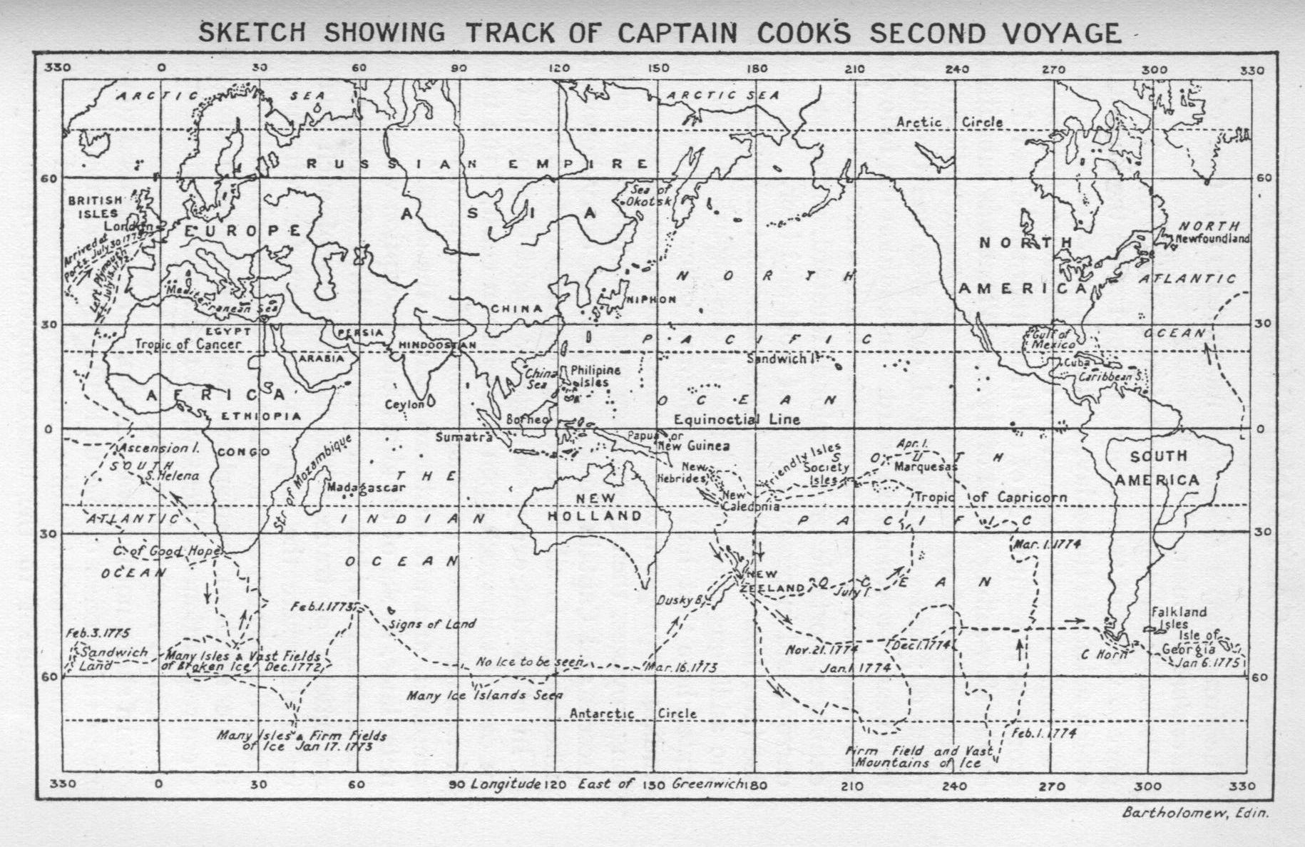
In order that every contingency might be provided for in case of shipwreck upon some barren coast, "the frame of a small vessel, of twenty tons burthen, was properly prepared, and put on board each of the ships." Fishing nets, lines, hooks of all kinds and description were among the stores provided by a generous Navy Board, as well as articles of trade with the natives of such islands or lands where the ships might touch for refreshment. Since the voyage was to take the vessels to high latitudes in the southern hemisphere, supplies of warm clothing were requisitioned: these were to be issued to the seamen as occasion might demand.
"In short, nothing was wanting that could tend to promote the success of the undertaking, or contribute to the conveniences and health of those who embarked in it."
In addition to the usual complement of lieutenants, {91} master, and master's mates, midshipmen, sailmakers, armourers, sailors and marines, the Admiralty engaged the services of William Hodges, a landscape painter. He was to make drawings and sketches of places of interest visited during the voyage, of the aboriginal people met with, their dress and modes of life. Nor was natural history neglected, and John R. Forster and his son were selected to fill this position. Wales and Bayley were selected by the Board of Longitude to make observations and thus relieve the captain from much routine work. The Board furnished them with the very best instruments obtainable and the results of their labours were published upon the return of the expedition in 1775.
For our purposes it will suffice to note briefly the route followed, and state the results of this expedition. The Resolution and Adventure sailed from Plymouth the 13th of July, 1772. The first stop was at Funchal Roads, the line was crossed on the 8th of September, arriving at Table Bay the end of October. While lying at anchor there, Cook noted the arrival of two Dutch East Indiamen from Holland. They had been five months en voyage, and from the crew of the first, forty-one had died "by the scurvy and other putrid diseases," while the second vessel had lost one hundred and fifty in the same manner. Added to this a large number of the remaining seamen were so ill that they were conveyed to hospital on shore at once. This terrible record was no exception to the rule in those days, and explains to some extent the length of time it had taken to forward exploration in the far reaches of the Pacific. Of the crews of the Resolution and Adventure it may be said that they were in excellent health. There had been but two deaths since leaving England; one by drowning, one by illness. Attention to some of the ordinary {92} rules of sanitation so well known by all to-day was bringing its own reward.
The latter part of November the expedition sailed to the southward. Three weeks later the floating ice islands of the Antarctic were sighted, and the middle of December found the ships on the edge of an immense field of solid ice in latitude 55° south. A course was then laid to the eastward, following the edge of the ice pack. By the 8th of January (1773) Cook had reached 61° south along the 31st meridian. Sailing on eastward, a week later he crossed the 67th parallel, where further progress was found impossible, solid fields of ice blocking the way.
Turning northward to the latitude of 48, an easterly course was followed through part of February, during which time the vessels became separated. The Resolution again sought the ice pack, this time in the longitude of 95° east. Cook was determined to comb the Antarctic, and either discover or dispose of for ever the fabled continents of that sea. At 62° south he was forced to select a more northerly course and continued to the east between the parallels of 58 and 59. The middle of March found him on the 146th meridian; still no land in sight, nor any signs of land in the vicinity. He was actually sailing over lands which had for two hundred years fancifully bedecked the mariners' charts. He was pushing back the northern limits of Antarctica to within the parallel of 60° south, and to the same amount extending the limits of the great cold southern ocean.
Cook now steered for New Zealand, and on the 26th moored in Dusky Bay. They had been one hundred and seventeen days at sea, had covered three thousand six hundred and sixty leagues in that time, and without once sighting land. But one sailor on board was ill of the scurvy. This was entirely due to the precautions taken before leaving England, in supplying the ship with sweet wort, portable broth and sour-crout. Already the voyage had been a success in proving the efficacy of these as {93} anti-scorbutics. Cook also gives credit to the frequent airing and cleansing of the men's sleeping and living quarters, a course which he rigorously followed on all his voyages.
Exploration was resumed in May. The Adventure was located in Queen Charlotte Sound.[1] A few weeks later the ships again put to sea. Passing through Cook Strait, that part of the sea east of New Zealand was cruised as far south as latitude 45, and as far east as the 133rd meridian of west longitude, a space that had not been visited by any preceding navigator. Due to the appearance of scurvy on board the Adventure, it was decided to re-victual at Tahiti, and port was made the middle of August. In October, the expedition revisited New Zealand, the Adventure again losing touch with her consort. The Resolution then pursued her way alone down the 179th meridian to latitude 62° south. Steering eastward, Cook followed the ice edge as close as he dared go, finally reaching 66° south in longitude 159° west. Again a thrust north to 47, then a zig-zag south-east to 62; longitude now 116 west. Cook came to the conclusion that no large land mass existed between New Zealand and South America. The previous year he had demonstrated the same thing to be true from the longitude of Africa to New Zealand. He had now, the latter part of January and in longitude 106° west, latitude 71° 11' south, proved the same to be true of that part of the Antarctic from the longitude of New Zealand to that of South America. In March, refreshments were secured at Tahiti, and June, July and August were spent in a leisurely survey of the Polynesian islands to the westward of the Society group, arriving eventually in Queen Charlotte Sound of New Zealand. With the return of spring to the southern hemisphere, Cook again set out on an easterly course, this time along the 50th parallel. He made the run to the Straits of Magellan in thirty-eight days, the first time such a thing had been attempted. At this point Cook sums up his explorations {94} in these words: "I have now done with the Southern Pacific Ocean, and flatter myself that no one will think that I have left it unexplored; or that more could have been done, in one voyage, towards obtaining that end, than has been done in this." Here was the consciousness of work well and truly done, and posterity has answered in the affirmative.
Founding Cape Horn, January of 1775 found the Resolution cruising the Southern Atlantic. There ice-scarred South Georgia was discovered. Continuing easterly along the 58th parallel, Cook finally linked up with his exploration of 1772 south of Africa. The Resolution was accordingly headed to the northward, having, as Cook tersely remarks, "no business farther south."
He had now completed his circuit of the great Antarctic Ocean in a latitude ranging from 55° to 65° south. It had been traversed in such a manner "as to leave not the least room for the possibility of there being a continent, unless near the pole, and out of reach of navigation.... Thus I flatter myself that the intention of the voyage has, in every respect, been fully answered; the southern hemisphere sufficiently explored, and a final end put to searching after a southern continent." Of the continental mass which Cook did believe existed over the South Polar regions, it was found to lie in such a high latitude and to experience such an extreme of cold that he was positive no commercial importance could in any manner attach thereto. Nor could large areas ever be seen, ringed as it was with floating ice islands of huge size and of enormous extent. On parting from them he wrote: "Lands doomed by nature to perpetual frigidness; never to feel the warmth of the sun's rays; whose horrible and savage aspect I have not words to describe—such are the lands we have discovered; what then may we expect those to be which lie still farther to the south?"
And what were the conditions of crew and vessel after all these years at sea? Of the former it may be said that {95} not one man was ill; all were in good health, due to the precautions taken by the lieutenant commander. At every anchorage fresh water had been secured, without which no crew could long remain in good health. Diligent search had been made for fresh meat to supplant the heavily salted or pickled meats. Whenever an over-supply had been secured the remainder had been put in pickle, but one of considerably less strength than that in general use. Fresh vegetable material of every description which could be boiled and made into a soup or broth had also been procured whenever diligent search rewarded their efforts. From the standpoint of the health of the crew it would seem that the voyage might have been continued indefinitely. And this will bear repetition, that of no voyage of like duration could this have been said. Always the dread scurvy had made its appearance, always a large number of the crew sickened and died miserably at sea. The brave remainder, often more dead than alive, navigated the vessel to the nearest port, there to remain for many weeks recuperating, while the officers sought far and wide for more sailors to fill the empty hammocks. It may be truly said that in this, his second great voyage, Captain James Cook mastered the demon scurvy, and, by giving his record to the world, was the direct cause of promoting and adding to the security and happiness of all who go down to the sea in ships.
Other features now made a return to England an imperative matter. The biscuits were by this time in a state of decay, so infested with weevil as to burn the mouths of those who tried to eat them. The sails and cordage were much worn, so much so that something was giving way every hour; and little was left in the great store rooms of the vessel with which to effect replacement or repairs.
A course which would bring them to Table Bay was accordingly decided upon, and one and all bade farewell to the Antarctic which had been their goal of endeavour {96} for the past three years. With what speed the baffling winds would permit, the good ship made her way all too slowly for the anxious hearts of the crew, now longing for a sight of bronzed English faces on the ships of the East India Company, surely to be found at call in the spacious Cape Town harbour, and the 21st of March found them safely at anchor in the much-desired haven.
A salute of thirteen guns was made, the compliment as duly returned by the Dutch officer in command of the port. Boats put off from the Resolution, one to the Ceres, an English East Indiaman homeward bound from China, another to the quay to present Cook's compliments to the governor and politely ask for supplies. By the Ceres, due to sail, letters, charts, etc., were sent to the Admiralty Board in London. From the governor came kind permission to purchase needful stores. A spectacular and fitting entry to the fringe of civilisation after years of wanderings in far distant seas!
News now came, in the shape of a letter, bearing intelligence of the Adventure. It appeared that, after the separation from the Resolution in the storm near the New Zealand coast, the Adventure had gained the shelter of Queen Charlotte Sound about a week after the departure of the Resolution from that anchorage. While refitting, the large cutter had been sent to a distant part of the sound to gather wild celery, where the natives had attacked the boat, captured her and killed the crew of ten. When Captain Furneaux learned of this sad occurrence, he had no other recourse than to leave the sound and proceed, by way of Cape Horn, to Cape Town. Refitting there, he sailed for England, where the Adventure arrived on the 14th of July, 1774.
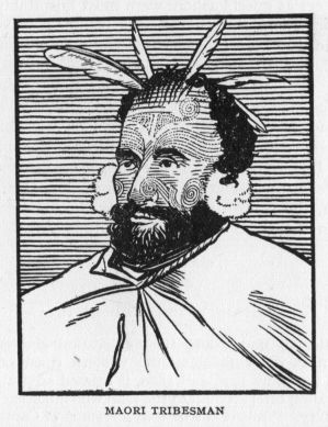
This was in a manner satisfying intelligence to those who had for long feared the total loss of their consort. Repairs to the Resolution were hastened, and on the 26th of April, 1775, the homeward journey was begun. The middle of May found her at St. Helena, where Governor {97} Skettowe treated his distinguished visitors with every courtesy. The voyage was resumed on the 21st, and a week later, Cross Bay on the north-west side of Ascension Island was entered, and for several days the crew of the Resolution were actively engaged catching turtles. Twenty of these monsters were secured, averaging 400 pounds each. They proved to be a welcome addition to the larder, and no doubt Cook's idea was to proceed in such a leisurely fashion as to bring home his crew in as fine a state of health as possible, besides avoiding the high prices he would have paid for fresh beef, either at the Cape from the Dutch or at St. Helena from the English East India Company. His native thrift ever showed itself in such devices. And what an illuminating picture of those days, of the manner in which voyages were conducted, before the days of the {98} squat, rust-streaked tramp drove the picturesque white wings from the sea lanes.
Cruising northward past the island of Fernando de Noronha, off the Brazilian coast, past the eastern edge of the Sargasso Sea, 13th July found our company off the Island of Fayal, one of the Azores. A week was spent here, the officers as guests ashore were most hospitably treated; then once more the voyage was resumed. Ever northward the ship bore them, nearer and nearer came the beloved shores of the homeland—at last land was sighted on the 29th near Plymouth. The next morning the Resolution was anchored at Spithead, and that same day Cook and several of the gentlemen on the ship landed at Portsmouth, and set out for London. Another long voyage had come to a happy end, weary seamen might now receive their dearly loved shore leave, then, in some tidy inn, the centre of an admiring throng, relate a tale of distant lands far down below the old earth's brim.
In order to understand the exploration and subsequent development of trade along the western coast of America between the years 1776 and 1800, it seemed advisable to give the preceding brief account of the man who made such voyages a possibility. While it is true that a résumé of Captain Cook's life takes us far from the west coast of North America, we see where the great additions were made to geography during the years following Bering's voyages from Kamchatka. With the southern hemisphere delineated in 1775 in a manner approaching the charts of to-day, there remained but three hazy outlines: the Arctic shores of America from Hudson's Bay to the vicinity of East Cape in Siberia; the Pacific Coast of America from San Francisco Bay to Kodiak Island, and that part of the Alaskan shore northward to the Arctic Sea; the coast of Japan and China from the Kurile Islands southward to the vicinity of Formosa. In an age of discovery, when {99} the tools at hand had been greatly improved, it would be strange indeed were there no revival of interest regarding these dim coasts. The following chapters tell the tale and introduce Captain Cook in charge of the first English expedition to the North Pacific.[2]
The country most concerned in these Pacific explorations was undoubtedly Spain. Her government had heard with grave misgiving of Russian encroachment in the far north. She now witnessed the further discoveries by the English in the far southern Pacific waters. It behoved her to do something to assert her claim to the sovereignty of that ocean and its bordering American coast. Accordingly, about the year 1774, the port of San Blas was fortified, warehouses were erected, and shipbuilding actively carried on. That same year Juan Perez, in command of the corvette Santiago, was despatched northward from San Blas on a reconnaissance voyage. He was instructed to examine the coast as far as the 65th degree of north latitude. If Russians were encountered, their posts were to be noted, and the amount of coast-line which they had occupied. Sailing late in January of '74 and touching at Monterey, the trend of the coast was followed in a vague manner to the 53rd parallel, where mountains were seen to the eastward—the Queen Charlotte Islands of to-day.
Although badly in need of water, no anchorage could be found, and Perez turned southward without attempting to reach latitude 65°. On the homeward voyage an attempt was again made to anchor, this time in the vicinity of Nootka Sound, midway of the west coast of Vancouver Island. But a sudden storm almost drove the Santiago on a dangerous reef, and Perez continued on his way southward without having once landed on that coast which he had come so far to explore. He arrived at Monterey 27th August. "Beyond a cursory examination of one or {100} two points, and ascertaining the general trend of the coast line, little was accomplished by this expedition."
Nothing daunted, the Mexican viceroy outfitted another expedition the following year. Don Bruno Heceta took command of the Santiago, and a little schooner, the Sonora, was assigned to Lieutenant Quadra, an enterprising official in the San Blas district. In July of '75 the expedition had reached latitude 47, and came to anchor near Point Grenville, a few miles north of the Grays Harbour of to-day. Upon landing, formal possession of the country was taken in the name of the Spanish monarch. These were the first Europeans to set foot, so far as we know, upon the west coast south of the confines of Alaska, and north of the Spanish settlements in Southern California.
In a brush with the Indians the Sonora lost part of her crew, and Heceta was for returning to Monterey at once. Quadra on the other hand held out for a continuation of the voyage northward. Becoming separated in a storm, Heceta improved the opportunity to sail homeward, but Quadra carried on, and reached the Alaskan coast islands in the vicinity of Mount Edgecumbe and Norton Sound. He had sailed to latitude 57, two hundred miles beyond Perez, and in a schooner but twenty-seven feet in length, mustering a crew of fifteen. The voyage has been aptly described as "an effort as heroic as it was foolhardy in such an unseaworthy and ill-equipped craft."
On the homeward voyage Quadra landed on the west coast of Dall Island, and took formal possession of the country for his sovereign. The Sonora reached San Blas in November, and was welcomed with much acclaim. While the endeavours of Quadra deserve the highest praise, they exemplify more the bold and resourceful nature of the man than the record of any practical addition to geographical knowledge. The most that may be said is that a few widely separated bits of coast had been seen along a hitherto unknown shore-line. No continuous exploration had been made of even a hundred miles of coast. What inlets, bays, {101} gulfs or islands lay along that shore no one in San Blas could tell from a perusal of the charts brought home. In a very general way the trend of the coast had been laid down almost up to that portion seen by Bering thirty-four years before. With the voyage of Captain Cook along these shores, and the multitude of fur traders who followed, the shore-line of the far west coast of America began to take on actual form and contour.
[1] Not far from Tasman Bay at the north end of the island.
[2] At least since the days of Drake, 1579.
A voyage to the Pacific Ocean to determine the position and extent of the west side of North America; its distance from Asia; and the practicability of a Northern Passage to Europe. Performed under the direction of Captains Cook, Clerke and Gore, in His Majesty's Ships the Resolution and Discovery, in the years 1776, 1777, 1778, 1779, 1780.
After reporting to the Admiralty, Cook repaired to his little home at Mile End, Old Town. But he was almost immediately summoned to attend an audience with the king (9th August). In reward for his services the king handed him his commission as post-captain, and appointed him to the command of H.M.S. Kent. Three days later he was further rewarded by a captaincy in Greenwich Hospital. This carried a salary of £200 per annum, together with certain other emoluments, and was considered to be an easy, well-paid billet. It was thought that he who had led so strenuous a life would enjoy the relief from exacting cares which this appointment ensured. Cook, however, had no notion of rusting out on shore like some worn discarded anchor, and he was careful to reserve for himself the right to re-engage in active service at any time, should occasion warrant the move.
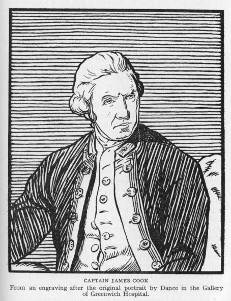
The 19th of August, 1775, found him again at Mile End, writing to his old friend Walker of Whitby. Then came months of worry and much hard work preparing the journal of his voyage for publication. This seems to have kept him busy till June of '76, and the manuscript was {103} completed just prior to setting sail on his third voyage of discovery and exploration. At the same time other matters of moment were attended to in the captain's usually thorough manner. On the 29th of February, 1776, Captain Cook was elected a Fellow of the Royal Society. The week {104} following he was formally admitted to this distinguished body, and there read a paper on the "Prevention and Cure of Scurvey." In this he embodied the facts learned by investigation and experiment during his two voyages to the southern seas. It may be said to mark a decided change for the better in the lot of the common sailor, both of the mercantile as well as of the purely naval service. In recognition of his valuable services to mankind, the Society later in the year awarded to Cook the Copley Gold Medal for the best paper contributed during the year.
Now it had been noised abroad that the Admiralty had in mind the sending out of still another expedition to the Great South Sea, and even into the far reaches of the North Pacific. It was proposed that two vessels be sent to the Pacific by way of the Cape of Good Hope; thence by way of New Zealand to the Society Islands where Omai[1] should be repatriated. From there a northward course would be taken to the coast of North America. Somewhere north of 45° north latitude[2] a port was to be found, and refreshments for the crew secured. The coast was then to be investigated in the hope of finding a passage either through the continent to Hudson's Bay, or failing in that, by way of Bering Strait and the Arctic Ocean. If no passage were found the first season the expedition was to winter at Petropavlovsk, and make another attempt the next year. All new lands discovered were to be formally taken possession of by the expedition in the name of the king.
At the same time the Admiralty proposed to send an expedition by way of the Atlantic to explore Davis Strait and Baffin's Bay "with a view of obtaining information as to the existence of any passage into the Pacific." Perhaps the two expeditions might join hands in mid-Arctic regions, {105} and be of assistance to each other! For some years there had been a standing offer from the Admiralty of £20,000 to any British merchant ship discovering a passage from Hudson's Bay to the Pacific. The offer was now enlarged to include the Royal Navy, and the passage might be either east or west so long as it was north of latitude 52°. By both sending out expeditions and offering a huge reward, the Admiralty hoped to find such passage should one there be, and at the same time obtain control of the passage in the interest of the empire.
It was an ambitious plan. Not since the days of Peter the Great and Vitus Bering had such inducements been offered, nor had such large government expenditure been authorised in behalf of that elusive will-o'-the-wisp the North-East Passage. It might also be noted that the conflict with the Thirteen Colonies had begun its chequered career, but the preparations for this great struggle do not seem to have had any effect upon the prosecution of the venture under review, nor is any mention made of it in the early part of the journal of the voyage.
After discussion of the plan with Lord Sandwich, Sir Hugh Pallister and Mr. Stephens, Cook decided to apply for the command of the Pacific Coast expedition. The quiet backwaters of Greenwich Hospital did not appeal to his active mind and in fact he had never taken up his residence there. His offer was immediately accepted by the Lords Commissioners of the Admiralty and Cook at once repaired to Deptford, where the Resolution was undergoing extensive repairs. As consort, the Discovery, another Whitby built ship, was secured, and the command given to Charles Clerke, who had been second lieutenant on board the Resolution during the second voyage.
From the 9th of March to the 15th of June, 1776, the vessels were taking on stores. These included not only the usual food supplies for the sailors but all that had been found so successful during the preceding voyages in conquering the scurvy. Warm clothing was also carried {106} in addition to the usual allotments, as the voyage was to lead this time to the far northern Pacific and possibly well within the Arctic Circle itself. Both ships were provided with a proper assortment of iron tools and trinkets, which Cook informs us would enable them "to traffic and to cultivate a friendly intercourse with the inhabitants of such new countries as we might be fortunate enough to meet with." The most accurate watches obtainable were furnished them by the Admiralty in order that the observations should be accurate and the charts made be of service to future navigation. It is notable that on this voyage Cook decided to perform the duties of observer in person, a position which heretofore had been filled by a trained astronomer. The captain was now considered competent to fill this difficult post as well as carry the responsibility of the whole voyage and the general oversight of both vessels; a task fit to try the best of men. But Cook at this time seemed the embodiment of tireless energy. No multiplicity of detail ever worried him—and his journals are full of the joy of endeavour which brimmed his cup with the sweets of accomplishment.
To Mr. Anderson was given the dual post of surgeon and naturalist, and to Mr. Webber that of artist. Many members of the crews of the second voyage enlisted for service in this voyage, and probably no expedition ever sailed from England's shores carrying a more experienced and more loyal crew.
An element of interest also attaches to Omai, the South Sea Islander, who had accompanied Captain Furneaux from Huahaine to England. "Being the first native of the South Sea Islands brought to England he was sought after as a wonder, and became the 'lion' of a season; he was introduced to fashionable parties, conducted to the splendid entertainments of the highest classes, and presented at court. When he departed from England he was loaded with presents, but few of which were calculated to be of real service. He carried with him a coat of mail, {107} a suit of armour, a musket, pistols, cartouch-box, cutlasses, powder and ball; a portable organ and an electrical machine." One can but smile at the curious array of material. Yet the possession of such a collection of warlike implements and the knowledge of their use could not but make Omai a most wonderful person when set down in his native habitat. In fact we shall learn that the King of Huahaine made him a chief, "gave him his daughter in marriage, and honoured him with the name of Paari (wise or instructed)."
For his own part Omai left London with a mixture of regret and satisfaction. When the conversation would be about England and those who had honoured him with their protection or friendship his spirits were sensibly affected and it was with difficulty he could refrain from tears. But the instant the conversation turned to his own islands, his eyes began to sparkle with joy. The captain and his charge boarded the Resolution where she now lay at anchor off the Nore, and on the 30th of June joined the Discovery at Plymouth.
Contrary winds detained the vessels in the sound for the best part of a fortnight; then the Resolution sailed for the Cape of Good Hope with orders for the Discovery to follow. Captain Clerke was detained in London, having taken refuge "within the Liberties of the Fleet prison." He had become financially involved through the inability of a friend to meet certain obligations which Clerke had guaranteed, and the worthy captain had taken this novel means of eluding the moneylenders, who, as usual, wished to extract their pound of flesh.
Let us then follow the fortunes of the Resolution. On the 14th of July, 1776, she was within sight of the Lizard, five days later sufficient sea room to the west had been gained and the long southern route was begun. "We passed Cape Finisterre, on the afternoon of the 24th, with a fine gale at north-north-east." On the 30th of July, "at six minutes and thirty-eight seconds past ten o'clock {108} at night, apparent time, I observed with a night-telescope, the moon totally eclipsed." A call was made at the island of Teneriffe for supplies and the ship anchored in the road of Santa Cruz. No less than eighteen sail of various nationalities were found at anchor in the road, an interesting side-light on the sea-borne commerce of those days, when it was the custom to make calls at convenient ports for refreshment of crew and officers alike.
Continuing southward past the Cape Verde Islands, the close sultry weather with continual rains caused much discomfort. The deck seams had been poorly caulked and there was not a dry spot between-decks. To combat this condition Cook redoubled his efforts, drying the interior of the vessel by fires, and airing spare sails and the men's bedding on such days as the weather permitted. The line was crossed on the 1st of September, with the usual ceremony of ducking those who had not crossed the equator before. Day followed day in monotonous tropical sameness. The least sign of bird life was sufficient to cause a flutter of excitement, an albatross, a few petrels, and after passing the southern tropic some penguins were seen. At last the Cape of Good Hope was sighted on the 17th of October and the following day anchor was let go in Table Bay.
The Discovery arrived on the 10th of November and Captain Clerke informed his commander that he had sailed from Plymouth on the 1st of August. Cook's journal omits to tell us how Clerke escaped from the Fleet Street sanctuary and gained the security of his own quarter-deck. The remainder of November was occupied in fitting out each ship for the long journey into the heart of the Pacific. The 1st of December found both vessels out beyond Penguin Island and heading south-east to get into the track of the roaring forties.
Christmas Day was spent in a small harbour among the islands discovered by Kerguelen in 1772, but it was not until the 27th that leave could be granted the {109} hard-working sailors in which to celebrate the day. Christmas Harbour, as their anchorage was named, was but a barren spot, the weather was wretched, fog alternating with wind and rain, so that small cheer was to be had from a ramble ashore to explore the mysteries of this practically unknown land. For some days the vessels coasted the shore-line of this lonely island group, then, on the last of the month, a course was laid for New Zealand.[3]
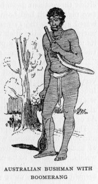
After three weeks and three days of voyaging ever eastward, the welcome shores of Van Diemen's Land[4] came in sight to the northward. The ships put into Adventure Bay on the south-east shore of the island, and proceeded to recruit their wood and water. The following day they were agreeably surprised by the appearance of some natives, eight men and a boy. Let the journal tell the story:
They approached us from the woods, without betraying any marks of fear, or rather with the greatest confidence imaginable; for none of them had any weapons, except one, who had in his hand a stick about two feet long, and pointed at one end. They were quite naked, and wore no ornaments; unless we consider as such, and as a proof of their love of finery, some large punctures or ridges raised on different parts of their bodies, some in straight, and others in curved lines. They were of the common stature, but rather slender. Their skin was black, and also their hair, which was as woolly as that of any native of Guinea; but they were not distinguished by remarkably thick lips nor flat noses. They had pretty good eyes and their teeth were tolerably even, but {110} very dirty. Most of them had their hair and beards smeared with red ointment; and some had their faces also painted with the same composition.
So much for the appearance of the native Tasmanian in the days of long ago, when the white man first saw him under natural conditions.
The captain tried them with presents, but the natives either threw them down in disgust or returned them. But two pigs, which had been brought on shore, were at once seized upon by the Tasmans as prizes of great value. The native carrying the stick was at length persuaded to show its utility. He set up a piece of wood as a mark at about twenty yards distance, and proceeded to throw at it. "But we had little reason to commend his dexterity," so runs the account, "for after repeated trials, he was still very wide from the object." Then follows an amusing touch. "Omai, to show them how much superior our weapons were to theirs, then fired his musket at it, which alarmed them so much, that notwithstanding all we could do or say, they ran instantly into the woods."
The next day a larger group of natives were encountered, and some of the women were observed to wear large pieces of kangaroo skin tied over the shoulders and round the waists. It seemed to be used mainly as a support for their children when carried on their backs. All these natives seemed to be in a most wretched or shall we say primal state of civilisation. Blackened coals near the beach, and ascending columns of smoke in the distance, gave every evidence to their use of fire, while large heaps of mussel-shells showed the Englishmen what food the natives were in the habit of eating. But their refusal to eat freshly-caught fish, the absence of weapons, and the miserable shelters made of sticks covered with bark, alike bore mute witness to the simple habits of the native inhabitants.[5]
The 30th of January, 1777, dawned bright and clear—and with a light breeze from the west the ships cleared the bay and made all sail to the eastward. Twelve days later anchor was cast in Queen Charlotte Sound. Preparations were at once begun for a stay of several weeks. Empty water casks were got on shore, tents were erected, and an observatory made in order to check up the ships' watches. Two men were appointed to brew spruce beer; the carpenter and his men set about cutting a supply of firewood for the vessels; "a boat, with a party of men, under the direction of one of the mates, was sent to collect grass for the cattle; and the people that remained on board were employed in refitting the ship, and arranging the provisions. In this manner, we were all profitably busied during our stay." A busy scene, full of action and colour. It needed but the native Maoris to complete the tableaux, and these were not wanting.
The ships had been at anchor but a short time when several canoes filled with Maoris came alongside. Few of them would venture on board until Omai, who understood their dialect, assured them of the captain's kindly intentions and that no revenge was to be taken for the massacre of the boat's crew belonging to the Adventure.[6] The news spread along the sound to the other Maoris and soon the shores in the immediate vicinity of the tents were dotted with the rude huts of the natives. This was considered a very fortunate state of affairs by the captain, as the natives were expert fishermen, and every day, when the weather would permit, some of them would go out to catch fish. By the simple process of barter large quantities of fresh food were then easily secured for the crews of both vessels. It was by attending at all times to the securing of fresh food that the excellent state of health of the crews was maintained.
{112}Nor does Cook appear in the least to have held the Maoris in fear. Their numbers did not cause him alarm; ever he seems to have trusted in his ability to get along with the natives by peaceful means. He did not neglect any necessary precaution on the other hand; boats were not permitted to go far up the sound, and those away on short errands went well armed. The captain at length, with a well-armed boat's crew, visited the cove where the crew of the Adventure's boat had been set upon and killed. By means of Omai every possible circumstance surrounding the affair was gathered from the natives, who told about it in the frankest manner. It would seem that there had been no premeditation in the assault which had been made. A Maori had been caught stealing some object from the boat, and had been severely whacked by the lone member of the crew left in charge. His cries had aroused the assembled natives. They at once fell upon the other members of the crew, who were seated at some distance, peacefully eating their supper. In a few moments every Englishman was dead, and shortly afterwards the boat itself was torn in pieces.
Cook, in the most generous and broad-minded manner, wisely decided to pass over the incident as an unfortunate occurrence, which no attack of his could remedy or repair. Rather did he try the more to make fast friends of the natives of the sound, and in this it would seem he quite succeeded.
With everything in readiness, the 25th of February, 1777, found the Endeavour standing out of the sound, the Discovery following, and, passing through the strait, a course to the eastward was laid. March passed and April came as the ships pursued their eastward journey, ever tending to the northward to reach Matavai Bay, and once again renew old friendships. A few new coral-rimmed {113} islands were discovered, but the absence of good anchorage forbade any but the most cursory investigation of them. By the middle of the month the small islets of the Palmerston group were seen. A landing was effected, and several boat-loads of fresh cocoa-nuts were secured, but of the much desired fresh water there was none. Cook now decided to touch at Anamooka, where he hoped to secure the necessary supplies of fresh water and grass. The first fortnight of May was accordingly spent at a snug anchorage on the north side of the island. The natives of this group—the Friendly Isles—as their name implies, gave a most cordial welcome to their unexpected visitors; trade was brisk, all the products of which the land boasted could be easily secured for a few nails, beads, a hatchet, etc. One can gain but a remote idea of the extraordinary value a South Sea Islander was wont to set upon a bit of iron.
Proceeding to Lefooga, a most enjoyable week was spent by one and all. The natives brought down from their plantations great heaps of yams, cocoa-nuts, plantains and bread fruit. The chiefs presented the captain with hogs and fowls, while in return presents were duly despatched from the ships to the chiefs. Nor did the entertainment cease with these exchanges. On one afternoon the islanders formed themselves into a great circle around an open grassy space. To this carnival the English were invited. The first number on the programme might be called single combat with native clubs made from green branches of the cocoa-nut tree. After parading around the circle, the club men divided, half to one side, half to the other.
Soon they successively entered the lists and entertained us with single combats. One champion, rising up and stepping forward from one side, challenged those of the other side, by expressive gestures more than by words, to send one of their body to oppose him. If the challenge was accepted, which was generally the case, the two combatants put themselves in proper attitude, and then began the engagement, which continued till one or the other owned himself {114} conquered, or till their weapons were broken. As soon as each combat was over, the victor squatted himself down facing the chief, then rose up and retired. At the same time some old men, who seemed to act as judges, gave their plaudit in a few words, and the multitude, especially on the side to which the victor belonged, celebrated the glory he had acquired in two or three huzzas.
This was followed by wrestling matches, boxing matches, and other feats of strength. About three thousand people viewed the exhibition, and throughout there was the best of good humour on all sides, though, as Cook relates, "some of the champions received blows, which, doubtless, they must have felt for some time after."
Feenou, the head chief of this group, now asked that the marines be paraded so that he might see the English manoeuvre. Cook readily granted the request and never were British seamen more vociferously applauded. Several volleys were fired at the conclusion of the entertainment, and this lent a fitting climax to an afternoon of friendly sport. That evening Cook arranged to set off fireworks which quite astonished the islanders. In return, a dance by a chorus of twenty young women was arranged for, and the English visitors were delighted with the soft music of the rude orchestra, the beauty of the performers, as well as by the intricate mazes of the dance.
Thus ended a gala day at Lefooga. The mild nature of the climate, the tropical luxuriance of the surrounding foliage, the bright lights at night, the concourse of happy people, all left a most pleasing impression on the visitors. Coming as it did after many months of sailing, buffeted by wind and wave, this seemed the Lotus Land of all endeavour. Why journey on to the far north, to the cold and ice of Alaska? Why not remain here, mid sunny glades, in a gentle clime, with friendly joyous people? But England's sons have sterner duties to perform, the island was soon low on the horizon's edge, as the vessels resumed their voyage to Tahiti.
{115}
It was now the 17th of July, and high time that the voyage be continued, if the Society Isles were to be visited, Omai repatriated and the objects of the northern cruise undertaken. Cook had apparently given up the idea of searching the North American coast this season (1777). Contrary winds had assailed them after leaving New Zealand, and in order to save the cattle he had on board, it had been deemed best to put in at the Friendly Isles rather than risk the run to Tahiti with scanty stocks of fodder. The cattle, which the journal frequently mentions, consisted of male and female kine, sheep, goats, swine, and turkeys. It was the intention of the Admiralty to leave pairs of them at different places throughout the South Pacific in the hope that the natives would care for them, that these new shores would soon be stocked with these useful animals and thus be of much value to the natives as well as providing varied means of refreshment {116} to trading vessels of the future. Surely this was a laudable undertaking. But the mildness of the climate, added to the apathy of the native inhabitants, led Cook to frequently remark that he had little hopes of the scheme succeeding. It is true that the islands of Polynesia boasted hogs of a kind, but they were small of size and in no way comparable to the heavy English breeds. There are those who believe that the Maoris of New Zealand did save some swine left there, or that, becoming wild, they propagated themselves under natural conditions; for when the English took formal possession of those islands the Maoris were found in possession of good-sized herds of a large breed. The like cannot be said of the gifts to the chiefs of the Friendly or Society Islands.
Nature had been too lavish with her gifts, life was easy, the temperature mild, the food abundant. Fish were a never failing source of supply; the yam was their potato; the bread-fruit their loaf, the cocoa-nut furnished them with sweetest milk. Why should one care for the stubborn goat, or the ever hungry cow and her troublesome offspring? To the end that some ship might call and pay much in iron, beads or cloth for these animals? The South Sea Islander could not understand that condition, could not see into the future that far. His thought was on his present happiness. What else mattered?
The journal of the voyage tells us in a most pleasing manner of the reflections of officers and crew upon leaving the Friendly Isles, a portion of which is reproduced:
Thus we took leave of the Friendly Islands and their inhabitants, after a stay of between two and three months; during which time, we lived together in the most cordial friendship. Some accidental differences, it is true, now and then happened, owing to their great propensity for thieving; but, too often encouraged by the negligence of our own people. But these differences were never attended with any fatal consequences; to prevent which, all my measures were directed, and I believe, few on board our ships left our friends here without regret. The time employed amongst them was not thrown {117} away. We expended very little of our sea provisions; subsisting in general upon the produce of the islands, while we staid; and carrying away with us a quantity of refreshments sufficient to last till our arrival at another station, where we could depend upon a fresh supply.... We found that the best articles for traffic at these islands are iron tools in general.... Axes and hatchets; nails, from the largest spike down to the tenpenny ones; rasps, files, and knives are much sought after. Red cloth, and linen, both white and coloured; looking-glasses and beads, are also in estimation; but of the latter, those that are blue are preferred to all others; and white ones are thought the least valuable.
Of the people Cook has this to say:
The natives of the Friendly Isles seldom exceed the common stature; but are very strong and well made, especially as to their limbs. They are generally broad about the shoulders; and though the muscular disposition of the men, which seems a consequence of much action, rather conveys the appearance of strength than of beauty, there are several to be seen who are really handsome. Their features are very various; ... we met with hundreds of truly European faces.... Their eyes and teeth are good; but the last neither so remarkably white, nor so well set, as is often found amongst Indian natives, though, to balance that, few of them have any uncommon thickness about the lips.... The general colour is a cast deeper than the copper brown; but several of the men and women have a true olive complexion.... There are few natural defects or deformities to be found amongst them ... they may be considered as uncommonly healthy; not a single person having been seen, during our stay, confined to the house by sickness of any kind.
All the officers were struck with the attention to personal cleanliness exhibited by the natives. They were seen to bathe frequently in the warm pools of brackish water near the low-lying coral strands. Afterwards they would anoint themselves with quantities of cocoa-nut oil, rubbing the whole body over briskly, and producing thereby that smooth skin which was the constant envy of the sailor folk.
{118}On the morning of the 12th of August the familiar shores of the island of Tahiti appeared on the horizon's edge. Cook decided to draw what provision he could from the south-eastern part of the island before proceeding to Matavai Bay, on its northern shore, where the principal settlements were to be found.
Accordingly the vessels came to anchor in Oheitepepa Bay. Omai was at once recognised by his friends of former days and lost no time in making a triumphal landing, where, some time afterward, the captain found him mightily haranguing the multitude who gathered to hear his story. On the 23rd the vessels proceeded to Matavai Bay.
The next morning Otoo, the king of the whole island, attended by a great number of canoes full of people, came from Oparee, his place of residence, and having landed at Matavai Point, sent a message on board expressing his desire to see the captain. Cook, accompanied by Omai and a number of the officers, at once landed and found the king seated in the midst of a vast concourse of curious natives. After the exchange of suitable presents the king and his retinue repaired on board the Resolution, where the officers entertained them with a suitable repast. During the following weeks both vessels were thoroughly overhauled against the long cruise to the northward. The natives maintained a friendly demeanour and no untoward incident marred the stay of the vessels and their crews. This was largely due to the careful oversight and strict control exercised by Captain Cook and his officers. Every detail was carefully arranged; trade was carried on each day for produce which the islanders brought to the ships' sides in their canoes; the sailors were permitted to purchase such articles of native manufacture as appealed to them, but any departure from the strictest honesty was severely punished, be it English sailor or Otaheitan native. And it may be readily seen that the Society Islanders soon came to anticipate with trust and pleasure the visits of the {119} English who came so mysteriously over the horizon's edge in their great white-winged vessels.
But one thing remained to be done. Omai had yet to be repatriated. He had selected the island of Huahaine as his future residence, and Cook, in his usual thorough manner, decided to see Omai properly established there before bidding farewell to the Society Island group. The middle of October, accordingly, found the ships anchored in a snug bay on the west side of the land. Negotiations were at once begun with the principal chiefs of the island, land was secured, and a house was built for Omai. Cook also supplied him with a stallion and a mare, a boar and two sows, and a goat and kid. It was hoped that Omai had seen enough of these animals in his travels to appreciate their utility, and that through his care the islands would become stocked with these animals. Of weapons he had a liberal supply—"a musket, bayonet, and cartouch-box, a fowling-piece, two pairs of pistols, and two or three swords or cutlasses." The possession of these articles seemed to give Omai the greatest satisfaction. They no doubt raised him in the estimation of the tribal chiefs, who might have been inclined to belittle Omai's accomplishments. But the mysterious power latent in {120} such weapons was for long to hold them in awe and wonderment, and Omai soon became a man of means and authority in the island.
It was the 8th of December before Captain Cook was ready to leave on his long sail to the northward. With mingled feelings of regret and expectation the crews saw the shores of Ulietea and Bolabola fade away in the distance. Those sunny isles were left; far to the northward they must fare. What awaited them in their new adventure? Would they discover another New Zealand and chart its indented shore? Would more groups of coral islets to the north be encountered, where curious natives would throng the beach to give them joyous welcome? No one knew: the great Pacific lay before them; theirs to sail it and unravel some of its mystery.
The principal object of the voyage was now under way. Seventeen months had elapsed since leaving England—months of leisurely progress from port to port. It is true that baffling winds had delayed them in their voyage from New Zealand to Tahiti, but it was excellent management on the other hand that the crews of both vessels be given several months in which to recuperate from the long voyage to that point. Else the ever-latent seeds of scurvy might break forth in all their virulence and thwart the captain in his ultimate design—the search for the northeast passage to Hudson Bay. Hence the many weeks spent in and around the Friendly and Society Islands may not be considered as wasted. There quantities of fresh vegetable food could be had, to say nothing of fresh pork and fresh fish. And Cook had learned by hard experience that on such a diet the sailors were most readily fortified against the ravages of the scurvy. Had he been aware of the Hawaiian Islands and the prolific vegetation of those islands, he would no doubt have acted differently; his northward voyage would have been accelerated by several months at least. We must not, however, try to judge Captain Cook by the light of twentieth century information.
{121}Just north of the equator, and in longitude 157 west, a low coral atoll was discovered. It proved to be uninhabited, but Cook in his practical way sent the ship's boat in shore to make a more thorough examination. Fish in abundance were found near the encircling reef, which is always found in the vicinity of such islets, but to the sailors' great delight giant green turtles of one hundred pounds or more in weight were secured. While the ships swung at anchor the boats made many a trip to the islet, returning laden with turtle or fish as the case might be. Both Christmas and New Year were passed at this anchorage, and in view of this Cook gave the name Christmas Island to the little atoll.
From the 2nd to the 18th of January, 1778, the vessels held their northward way; but at daybreak in the morning of the 18th an island made its appearance, bearing northeast by east; and soon after more land was seen bearing north; "and entirely detached from the former. Both had the appearance of high land." A strong easterly wind prevented the ships coming rapidly up to the distant shore, and it was not till the 19th that the officers on board the Resolution were near enough to examine the coast through their glasses, and see that the land was inhabited. Canoes were seen putting off, and much to the delight of the English the islanders were found to speak the same language as that of Otaheite. Fairly safe anchorage was at length discovered in a shallow bay, the boats were sent ashore for fresh water, and a brisk trade was opened up with the natives for the vegetable products of the island which resembled closely those secured at the Society Islands. To this island group Cook gave the name Sandwich Islands, in honour of the Earl of Sandwich. Five of the islands were seen by the English at this time, and from the natives it was learned that still others lay to the eastward. The island which afforded them their present anchorage was called Atooi;[7] three smaller ones to the south-west {122} were Oneeheow, Oreehoua and Tahoora, while to the eastward lay another larger island, Woahoo.[8]
Owing to the absence of good harbours, the heavy surf which continually rolled in upon the shores made a protracted stay out of the question, and the 1st of February found the ships sufficiently well provided with water and provisions to continue their voyage to the American coast. This was accordingly done, Cook leaving the group without having seen the large islands to the east, the principal one, Hawaii, having of late given its name to the whole archipelago.
[1] A South Sea Islander who had accompanied Captain Furneaux to England in the Adventure.
[2] In order not to conflict with the Spaniards; who occupied the coast as far to the northward as San Francisco Bay.
[3] The islands mentioned are in latitude 49° S.-68° E.
[4] Tasmania.
[5] The aborigines of Van Diemen's Land, "after a protracted resistance," have all been conveyed to Gun Carriage Island, in Bass Straits, "which has been given up to their undisputed possession."
[6] See account of this on page 96, Second Voyage.
[7] Kawai of recent maps.
[8] Oahu; upon its southern coast is the city of Honolulu.
From Cape Foulweather to Nootka, and northward to Alaska.
Sailing northward for the next fortnight, "and being now in the latitude of 37° N.," a more easterly course was pursued. On the 7th of March the coast of New Albion was seen "Extending in from north-east to south-east, distant ten or twelve leagues." The latitude was now 44° 33' north, and a few miles to the northward Cape Foulweather was located and named. Strong weather now conspired with the uncharted coast-line to hinder their progress. But in such a struggle the pertinacity of the commander was bound to win through. Day and night, in fair and foul weather, he hugged the coast, refusing to admit defeat. Long years of experience in such matters made the task merely one of routine duty. It was their custom to make a secure offing by nightfall—ply back and forth—and the next day take up the charting and examination of the shore where night had interrupted their labours.
Cook noted the regularity of the coast-line at once. In his journal the following remarks are recorded, giving us some idea of how the land appeared to the officers on the vessels:
The land appeared to be of moderate height, diversified with hills and valleys, and almost everywhere covered with wood ... in some places it rises higher within. It was diversified with a great many rising grounds and small hills; many of which were entirely covered with tall trees; and others, which were lower, and grew in spots like coppices; but the interspaces and sides of many of the rising grounds were clear. The whole, though it might make an agreeable {124} summer prospect, had now an uncomfortable appearance, as the bare grounds toward the coast were all covered with snow, which seemed to be of a considerable depth between the little hills and rising grounds.... The coast seemed everywhere almost straight, without any opening or inlet; and it appeared to terminate in a kind of white sandy beach; although some on board thought that appearance was owing to the snow.
So unsettled and stormy did the weather become that the Resolution and Discovery were a full two weeks battling with gales in a futile endeavour to maintain their position near Cape Foulweather. In fact, on the 13th March, 1778, they had been blown as far south as latitude 42 and it was not until the 22nd that they were able to regain the coast north of latitude 45. In doing so Cook missed the mouth of the Columbia River, his landfall on the 22nd being in latitude 47° 3' north. From here the shore-line was examined with care until evening, when the ships lay to and the next day resumed their quest. And now let the journal tell its own story:
At this time we were in forty-eight fathoms' water, and about four leagues from the land, which extended from north to southeast half east, and a small round hill, which had the appearance of being an island, bore north three quarters east, distance six or seven leagues, as I guessed; it appears to be a tolerable height, and was just to be seen from the deck. Between this island or rock, and the northern extreme of the land, there appeared to be a small opening, which flattered us with the hopes of finding a harbour. These hopes lessened as we drew nearer; and, at last, we had some reason to think that the opening was closed by low land. On this account I called the point of land to the north of it Cape Flattery.... It is in this very latitude where we now were, that geographers have placed the pretended strait of Juan de Fuca. We saw nothing like it; nor is there the least probability that ever any such thing existed.
With the evening shadows creeping over the face of the waters and rendering further search dangerous. Cook stood off to the south-west to gain an offing, intending the next {125} morning to resume his search north of Cape Flattery. But during the night another violent gale descended upon the coast, as Cook says: "having a very hard gale, with rain, right on shore." Seven days later the vessels regained the coast, but in latitude 49° 29' north. Again had stormy weather, like some diabolical demon, snatched from his grasp a discovery of paramount importance, for he was now some seventy miles north of the strait and an equal distance up the coast of Vancouver Island.
Cook's trained eye noted at once the changed appearance of the shore-line. The land before him he described as full of high mountains, whose summits were covered with snow, while the valleys right down to the shore itself were covered with high straight trees, "that formed a beautiful prospect, as one vast forest." An inlet was soon discovered and, entering this, anchor was cast in a snug cove upon the north-west side. Nearly two months had passed since leaving the sunny shores of Atooi. Latterly storms and cold, rain and sleet had been their lot. This was their first anchorage on the North American shore, and a most welcome respite after their battle with the elements for the past month.
The natives viewed these strange floating visitors with mingled feelings of curiosity and alarm. A few of the more venturesome spirits leaped into their canoes and paddled in a wide safe circle around the Resolution and Discovery. Gaining confidence, other canoes put off from the shore until more than thirty encircled the ships. It was an odd spectacle; from time to time a native would arise and in a loud tone harangue the ship. From his gestures the officers thought that an invitation to land was being extended, for not a word could the English understand. Tiring of his efforts, the first orator would seat himself, when others would arise, and in a similar manner address the ships. One native varied the usual procedure by singing a song, whose melody and sweetness was favourably remarked by the captain. Another, by his appearance a chieftain, {126} had arrayed himself in the savage finery due to such an occasion. His head was bedecked with white feathers, and his features brightly painted. Standing erect in his canoe, he rattled a large carved bird made of wood, the while he mightily harangued the vessels and those within them. Cook tried by every wile to entice some of the more venturesome Indians on board, but with no success.
The next day, however, a sort of rude barter was opened up between the members of the crew and the occupants of the canoes, now grown more friendly. In return for knives, chisels, pieces of iron and tin, nails, looking-glasses, buttons, etc., the Indians gave cleverly tanned skins of the bear, wolf, fox and deer; "and in particular," says Cook, "of the sea otters, which are found at the islands east of Kamschatka." Of all the furs with which the Indians seemed so plentifully supplied, those of the sea otter were the most beautiful. The Indians were accustomed to make great cloaks of this fur, cloaks which encased them from neck to ankle, but so eager were they for the precious iron, a knife, a hatchet, or a chisel, that they willingly parted with their most prized ceremonial robes of state. A king's ransom for a bauble! Well did some of the hardy English sailormen know the value of their purchases from the Indians; well and truly did they improve the occasion; and, as we shall learn a little later, well did they reap a rich reward in far-away China.
The third day the number of canoes increased to over one hundred. Cook estimated no less than five hundred natives had assembled in the cove, to which was later given the name Friendly Cove, and to the large inlet that of Nootka Sound. The Indians now began to come on board, and, through the kind treatment they received, seemed to have lost all fear of the strange white men. The commander, in his usual precise and business-like way, lost no time in getting under way the necessary repairs to the ships. The caulkers were set to work; the observatories were carried ashore and placed on a large rock well within gun range of {127} the Resolution. A party was detailed to cut wood and to make arrangements for securing a supply of fresh water. Repairs to masts and rigging were also undertaken. Everything was well ordered, proper guards and look-outs were maintained watch and watch, so that the naturally observant native found no chance to catch the English off their guard, overwhelm the vessels and capture the whole of that wonderful iron which these big winged canoes seemed to possess in such magic quantities! The fate of the Tonquin a few years later is ample proof that such a danger was ever present.
It was not until the 10th of April that Cook was able to leave the supervision of repairs to less capable hands and in a well-armed row boat proceed on a tour of the sound, which stretched off to the east and north with long arms making into the land. A week later, preparations for sea having been completed, the ships dropped down the sound. Some of the natives remained on board till the last minute importuning the English to come again and promising to have ready a large collection of furs. And Cook makes this very simple yet wise conclusion:
I make no doubt, that whoever comes after me to this place, will find the natives prepared accordingly, with no inconsiderable supply of an article of trade, which they could observe we were eager to possess, and which we found could be purchased to great advantage.
Everything being now ready, in the morning of the 26th I intended to have put to sea, but both wind and tide being against us, was obliged to wait till noon, when the S.W. wind was succeeded by a calm; and the tide turning in our favour, we cast off the moorings, and with our boats towed the ships out of the cove. After this, we had variable light airs and calms till four in the afternoon, when a breeze sprung up northerly with very thick hazy weather. The mercury in the barometer fell unusually low; and we had every other forerunner of an approaching storm, which we had reason to expect would be from the south-ward; this made me hesitate a little, as night was at hand, whether I should venture to sail or wait till the next morning. But my anxious impatience {128} to proceed upon the voyage, and the fear of losing this opportunity of getting out of the Sound, making a greater impression on my mind than any apprehension of immediate danger, I determined to put to sea at all events.
The strong signs of an approaching storm did not deceive them. They were hardly out of the sound before the wind, in an instant, shifted from north-east to south-east-by-east, and increased to a strong gale with squall and rain, and so dark a sky that one could not see the length of the ship. "Being apprehensive, from the experience I had since arrival on this coast, of the wind veering more to the S. which would put us in danger of a lee shore, we got the tacks on board and stretched off to the S.W. under all the sail the ships could bear." By daylight the next morning both vessels were fortunately well clear of the coast. But by mid-afternoon "it blew a perfect hurricane." The vessels were then brought to with their heads to the southward and rode out the gale under fore-sail and mizzen stay-sails. Noon of the 28th it cleared up sufficiently to take an observation, latitude 50° 1' north, is the record in the journal. This day the course of the Resolution was north-west-by-north. The night brought a return of wind, squall, and rain. In such a case a safe offing from an uncharted shore-line was a vital necessity, although Cook expresses his regret that he must continue to sail northward out of the sight of coast. On the 30th he altered his course, more to the northward "in order to make the land." Continuing the narrative he says: "I regretted very much indeed that I could not do it sooner, for this obvious reason, that we were now passing the place where geographers have placed the pretended straits of Admiral de Fonte."
An observation at noon placed them in latitude 53° 22' north, longitude 134° 46' west. Between the 26th and the 30th the south-east gales had blown the Resolution and her consort three hundred miles to the north and west. The great gulf lying between Cape Scott and the Queen Charlotte {130} Islands had been passed by amid storm and lashing of mighty seas. The vessels were now (30th April) about one hundred miles off the coast of Graham Island, but the officers knew naught of the configuration of the coast to the eastward, nor that the mainland lay a good 4° east of their present position. Like one groping in the dark, earnestly desiring to touch the much-desired object, yet fearful of traps and pitfalls for unwary feet, Cook now steered north-easterly, and at seven in the evening of the 1st of May land was sighted in latitude 55° 20' north.
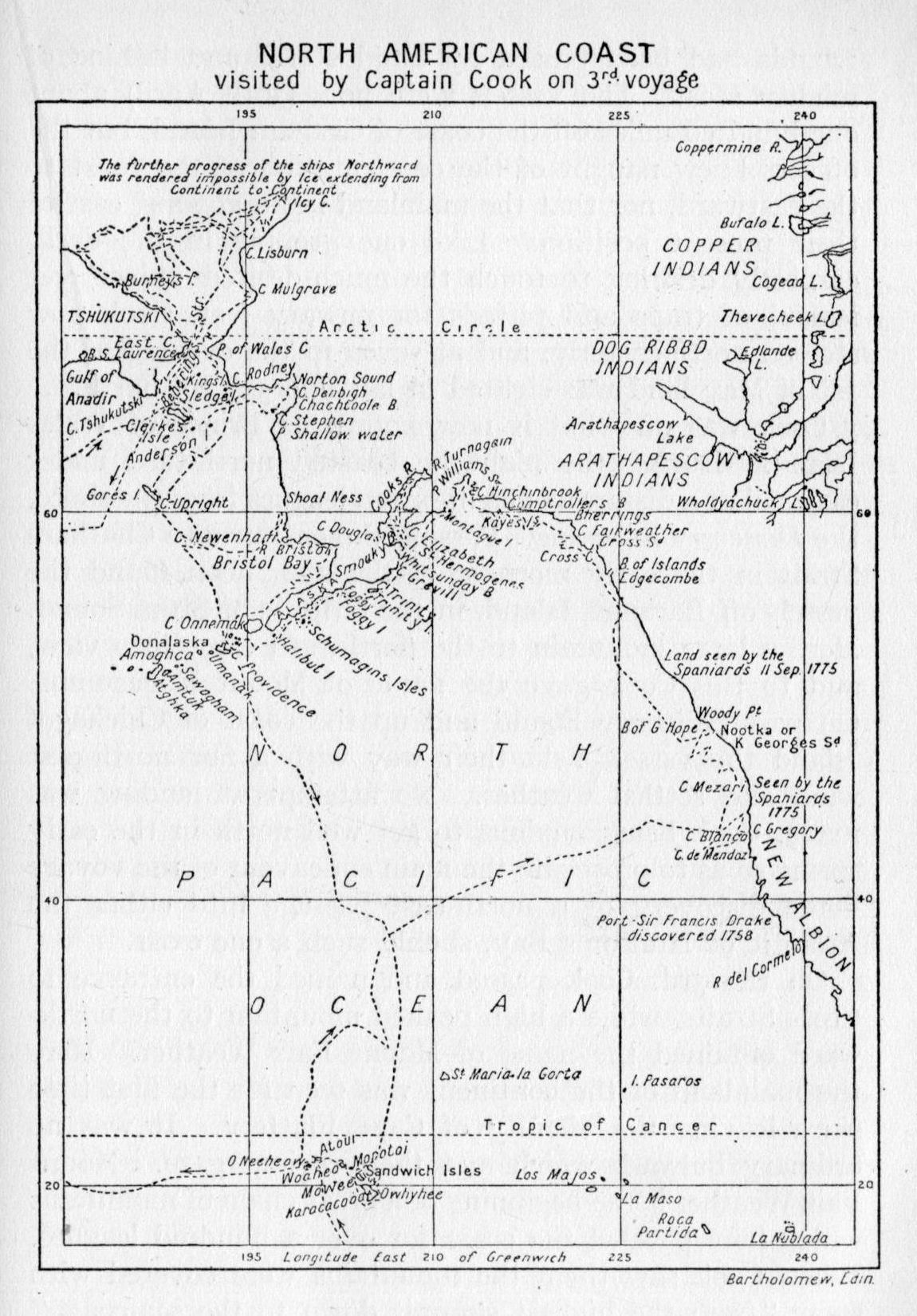
Cook was off what is now known as Prince of Wales Island. During the night he coasted northward under easy sail at a distance of eight or ten leagues from the shore, the Discovery following. Passing the entrance to Chatham Strait in the early morning of the 2nd, noon found the vessels off Baranoff Island, in the latitude of Sitka Sound. Here a large mountain to the northward came into view, and to this Cook gave the name of Mount Edgecumbe. On past Salisbury Sound and up the coast of Chichagof Island the vessels held their way with a fair north-east wind and settled weather. No attempt at landing was made, Cook being anxious to get well north in the early spring so as to prosecute the main endeavour of the voyage—the discovery of a north-east passage into either the Atlantic or Hudson's Bay, should such a one exist.
On the 3rd, Cook passed and named the entrance to Cross Straits, while a high peaked mountain to the northward obtained the name of Mount Fair Weather. Here the mainland of the continent was seen for the first time since leaving the vicinity of Cape Flattery. It was no ordinary bulwark which met their curious gaze. Mount Fair Weather is the beginning of a great chain of mountains which here parallel the coast for over a hundred leagues. When Cook saw them the mountains were covered with snow "from the highest summit down to the sea-coast." The great valleys were filled with glaciers whose scintillating fronts jut out over the narrow shore, only to break {131} off with resounding roar and splash into the ocean. It was in this very latitude that Vitus Bering in 1741 fell in with the continental shore of America, a shore which provides neither safe anchorage nor any form of sustenance for the unwary navigator who should through necessity desire harbourage and refreshment there.
The next day, far to the northward, "the summit of an elevated mountain appeared above the horizon ... and, as was afterward found, forty leagues distant." What could this be? Searching the only available chart, that prepared by Bering over thirty years before, Cook decided that this must be Mount St. Elias, seen by Bering on his last voyage. Accordingly, on the chart which Cook and his officers were now preparing, this giant of the north land was so named. Throughout his years as an explorer and cartographer Cook was most punctilious to perpetuate the names given by former discoverers, a trait which was not so conspicuous in his contemporaries.
From the 4th to the 9th of May light airs and calms impeded their progress. At this time Cook noted the shore trending more and more to the westward. On the 11th he discovered and named Kaye's Island in longitude 143° 2' west. As the Resolution had for some time been leaking, Cook tried to navigate his vessels into a bay lying behind this island; but the wind veering to due north made him abandon the idea. However, the commander went ashore in a row boat and climbed the rugged cliffs of the island's southern extremity. "At the foot of a tree, on a little eminence, not far from the shore, I left," writes Cook, "a bottle with a paper in it, on which were inscribed the names of the ships, and the date of our discovery. And along with it I enclosed two silver twopenny pieces of his Majesty's coin of the date of 1772." In such wise the navigator of olden days left mute record of his visit of discovery, and on such evidence did wily diplomats lay claim to the new places of the earth. To the break in the coast at this spot Cook gave the name Comptroller's Bay.
{132}Coasting westward, another inlet was discovered. Into this the vessels were successfully navigated, the wind having changed to south-east, with every appearance of a break in the weather. A snug anchorage was found within Cape Hinchinbroke, and preparations made to await clearer weather, the fog having shut down on them and excluded the distant shores from view. Here Cook came in contact with the Innuits, or Esquimaux-like inhabitants of Southern Alaska. Several of these came off cautiously in their skin canoes or bidarkas, but refused to be enticed aboard. The next day the ships were moved some distance up the sound, which was now seen to be of considerable extent, and with great arms extending into the land. At length a safe anchorage was found in what Cook was pleased to call Snug Corner Bay, and, after heeling the Resolution, the carpenters were put to work to stop the leak. Armed boats under command of Mr. Gore were sent to explore the inlets at the head of the sound, but as these were found to terminate it was decided to put to sea the way they had entered. However, a shorter passage was found to the south-westward, and Montagu Island was discovered and named. To the broad expanse of land-locked waterways which he had just left Cook gave the name of Prince William's Sound. Its shores had proved to be occupied by several hundred of the Alaskan natives, and after several days the sailors had begun brisk trade in iron and beads in return for the valuable sea-otter cloaks of the natives. The latter were found to be of as thievish a disposition as any met with at Nootka or elsewhere, and in addition to this they evinced a readiness to quarrel and fight which made them treacherous individuals to harbour.
Rounding Kenai Peninsula, the broad expanse of Cook Inlet held out hopes of a navigable channel through the land to the northward. Several days were spent in following up this possible clue, only to find the inlet came to a definite end with a large river flowing in at the head of it. {133} It was now June; if the cruise into the Arctic were to be accomplished that season they must hurry. To quote from the journal of the voyage, this is the situation as it appealed to Cook following his exploration of what is known to-day as Cook Inlet: "The delay thus occasioned was an essential loss. The season was advancing apace. We knew not how far we might have to proceed to the south; and we were now convinced that the continent of North America extended farther to the west than from the modern most reputable charts we had reason to expect.... It was a satisfaction to me, however, to reflect that, if I had not examined this very considerable inlet, it would have been assumed, by speculative fabricators of geography, as a fact that it communicated with the sea to the north, or with Baffin's or Hudson's Bay to the east; and been marked, perhaps, on future maps of the world, with greater precision, and more certain signs of reality, than the invisible, because imaginary, Straits of de Fuca and de Fonte." How Cook did love to score off those old-world map makers and shatter their fond beliefs!
It was the 8th of June before our seafarers were clear of the inlet and once again in open water, this time beating down the coast, which here trends to the southward, extending into the long arm of the Alaskan peninsula. Past Kodiak Island, then the Shumagin Islands and scores of lesser islets, they felt their way through fog and mist, ever fearful of becoming embayed in some maze of reefs or, on the other hand, if the open sea were sought, losing touch with the Continental shore and passing by some favourable passage through to Bering Sea. But the winds remained light, and somewhat variable; progress was slow, but the coast-line was held in sight. At length, near the latter end of June, the passage between Unalaska and Unimak Islands was discovered. On the northern side of Oonalashka, as Cook spelled it, a harbour was found. There the vessels lay at anchor several days, replenishing their water supply and trading with the natives for peltries {134} and fresh fish. The natives called the harbour Samganoodha, and appeared to be quite used to Europeans and their ways; as Cook wisely suggests, through intercourse with Russian fur traders from Kamchatka. But none of the Russian traders were met with at this time by the English navigators.
By the 9th of July the northern side of the peninsula had been examined up to the shallow waters of Bristol Bay. From here to Cape Newenham the coast was charted with considerable care. But farther north the shoals which extend across Kuskokwim Bay made a close examination of the shore-line an impossibility except in the small boats, and this was not attempted. On the 28th their latitude was 59° 55' north, longitude about 170° west, about midway between Nunivak Island and St. Matthew Island. Continuing northward, Cook passed to the east of St. Lawrence Island and struck the mainland of the continent in latitude 64° 27' north, having passed by the mouths of the Yukon and Norton Sound. Progress was slow owing to the shallow nature of the water, the almost incessant fogs, and the variable breezes. It was not until the 9th of August, 1778, that the westernmost extremity of the continent was passed, and to this point Cook gave the name Cape Prince of Wales.
The next day the vessels stood over to the Asiatic shore and cast anchor in a large bay. This was necessary in order to secure shelter from the wind, which bade fair to drive them into the shallows which everywhere seemed to guard against too close an inspection of the American shore-line. During the 10th and 11th the vessels passed through the strait and proceeded easterly along the northern shore of Alaska in the direction of what is known to-day as Kotzebue Sound. Following the trend of the coast north and then east, they at length reached latitude 70° 44' north. Here great fields of ice were encountered, stretching as far as the eye could see and effectually barring their progress. Turn which way he might Cook could find {135} no opening or lead through the solid pack in front of him. He describes the appearance of the ice in these words:
We were at this time, close to the edge of the ice, which was as compact as a wall, and seemed to be ten or twelve feet high at least. But farther north, it appeared much higher. Its surface was extremely rugged, and here and there we saw upon it pools of water.... At this time the weather, which had been hazy, clearing up a little, we saw land extending from south to southeast by east, about three or four miles distant. The Eastern extreme forms a point, which was much encumbered with ice; for which reason it obtained the name of Icy Cape.
It was now decided to follow the ice pack westward in order to see if by any chance a channel could be found through it in any direction, east, north or west. From the 19th to the 29th the ice sheet was skirted, generally along latitude 69°; then the rocky Asiatic shore came into view and forced the vessels to turn about. There was no way out. The ice formed a great arc, stretching from Icy Cape across to the Asiatic shore, which it joined in (about) longitude 180°. The season was now far advanced, the northern winter would soon set in: it was therefore decided to pass down through Bering Strait and make for winter quarters at the Sandwich Islands. In the spring another attempt would be made to seek the north-east passage to the Atlantic.
On the evening of the 2nd of September East Cape was rounded and, still keeping the Asiatic shore in view, they passed by St. Lawrence Bay on the morning of the 3rd. Always fair to those who had preceded him on voyages of discovery, Cook pays a graceful compliment to the great Bering, who in 1728 sailed up this coast in his little ship the Gabriel.
In justice to the memory of Bering, I must say that he has delineated the coast very well, and fixed the latitude and longitude of the points better than could be expected from the methods he had to go by.
In view of the uncertainty in those days regarding the coast of the American continent to the east of St. Lawrence Island, Cook now decided to employ the rest of the period of warm weather in a more particular survey of the coastline south of Cape Prince of Wales. A late Russian map had placed a large island, Alaschka, in this very latitude. While doubtful of its existence, Cook was determined to make a closer survey of the coast down to Cape Newenham than had been possible in his northward cruise. Accordingly he sailed north of St. Lawrence Island, eastward to the American coast, which he fell in with about the present city of Nome. The sound which was then explored gave some hopes of a passage to the Arctic, but as the vessels proceeded up past Cape Darby the shoaling water indicated that this would prove to be but another fruitless errand. The ships' boats were then ordered out, under the command of Lieutenant King, to make a tour as far as possible to the head of the sound, and to assure themselves of its eventual ending. While waiting for the boats to return a cove was found where wood and water could be secured. Of the former they were in dire need, no supplies having been taken aboard since leaving Prince William Sound. On the evening of the 16th Mr. King returned with the news that the sound terminated some thirty miles beyond the point where the vessels had turned back, and that there was no channel of any kind connecting with the Arctic. Cook then remarks: "In honour of Sir Fletcher Norton, Speaker of the House of Commons, and Mr. King's near relation, I named this inlet Norton's Sound."
Cruising along the southern side of the sound, Stuart's Island was named. About thirty miles farther on, the water shoaled to less than eighteen feet, forcing the vessels off the coast to the westward league after league. The small boats were sent ahead to sound, but no channel could be found. From Point Shallow Water, which Cook called the most westerly point of the continent at this part, down to Nunivak Island, no exploration was made that season.
{137}In his journal he frankly admits his inability to do so, saying: "Probably it is accessible only to boats or very small vessels; or, at least, if there be channels for larger vessels, it would require some time to find them.... From the mast-head, the sea within us (to the south and east) appeared to be checkered with shoals; the water was very much discoloured and muddy, and considerably fresher than at any of the places where we had lately anchored. From this I inferred that a considerable river runs into the sea in this unknown part." As usual, Cook's keen observation was not at fault. The mighty Yukon pours its flood into the sea at this very part of the coast, and is building up year by year the vast sandbanks which drove our explorers a good forty miles out to sea to get around them.
The remainder of the month of September was occupied in the voyage southward to Oonalashka. On the way the Resolution sprang a leak, and, upon arrival at Samganoodha harbour the carpenters were put to work making the necessary repairs. During this time some Russian fur traders paid them a visit. Their leader, Ismyloff, seemed to be a bright, intelligent fellow, and gave Captain Cook much valuable information regarding the islands of the Aleutian archipelago. The English gained the impression that the Russians had done little or no exploration upon the continent itself since the voyages of Bering and Chirikoff in 1741. To the mainland the name Alaschka was given by Russians and natives alike. With a slight change in spelling it has been retained to this day for that far northern portion of America.
A stay of three weeks in harbour sufficed to make all necessary repairs to the vessels, re-stow the cargo, take in ballast, replenish wood and water, and, that which Cook never neglected, refresh his crew with such products as the country afforded. Cranberries, hurtle-berries, heathberries, and partridge-berries were found at this season in great profusion on the island. The sailors in relays {138} of thirty or more were sent into the country to gather these berries as well as "wild purslain, pea-tops, a kind of scurvy-grass, cresses, and some others." These were used either in soups or as salads. By means of fresh fish—sea-trout, salmon, cod and halibut—latent seeds of scurvy were eliminated, the crews were kept in a fine state of health, and ready to stand those months at sea when exigencies of wind and weather and an inhospitable coast made a landing out of the question.
Cook's death—A second attempt to locate the passage—The expedition returns to England.
Monday, the 2nd of November, found both vessels safely through the passage to the east of Oonalashka, and heading down the broad Pacific for winter quarters at the Sandwich Islands. After an uneventful voyage of three weeks and three days the volcanic shore of Maui was seen rising above the southern horizon.
The ships came up under the land, and for some time there ensued a brisk trade in the vegetable produce of the island. A course was then taken to the south-eastward, where a larger island gave promise of finding a harbour. Plying off and on along the northern shore of what we now know to be Hawaii, the officers secured some sugar-cane in way of trade from the natives, who kept coming off from the shore in their large double canoes, laden with every product the island boasted. Cook decided to brew some of the sugar cane and make a beer for the crew. But when the cask was broached not one of the crew would taste the beer. The commander then gives us a curious insight into the beliefs and actions of the average British tar of a hundred years ago:
It has the taste of new malt beer; and I believe no one will doubt of its being very wholesome. And yet my inconsiderate crew alleged that it was injurious to their health.... Every innovation whatever, on board a ship, though ever so much to the advantage of seamen, is sure to meet with their highest disapprobation. Both portable soup and sour krout were, at first, condemned as stuff unfit for human beings. Few {140} commanders have introduced into their ships more novelties, as useful varieties of food and drink, than I have done.... It has, however, been in a great measure owing to various little deviations from established practice, that I have been able to preserve my people, generally speaking, from that dreadful distemper, the scurvy, which has perhaps destroyed more of our sailors, in their peaceful voyages, than have fallen by the enemy in military expeditions.
These are high words and were not written in any sense of self-praise, but rather in a spirit of indignation that all his efforts to promote the welfare of the men under his care met with so little goodwill on their part.
From the 1st of December to the 16th of January, 1779, the vessels plied along the northern, eastern and southern shores of Hawaii, stopping frequently to allow the natives to come off in their canoes with fresh vegetables, pigs and fowls for trade. In this the islanders proved themselves to be adept canoe men, excellent swimmers and perfectly at home in the billowing seas which tossed the great English vessels about like corks and rolled on but to break in tremendous surf upon the coast. A harbour in Karakakooa Bay[1] was at length discovered in the far western side of the island, and there anchor was dropped on the 17th of January, 1779.
Here ends the journal of the great navigator. Whatever of further comment is necessary will be taken from the journal of Captain King, who succeeded to the command of the Discovery upon the death of Captain Clerke.
As soon as the native inhabitants of the bay found that the vessels had anchored, hundreds of them put off from the shore in their canoes and soon the decks and rigging of both ships were covered with them. In the resulting confusion Captain Cook had recourse to the services of a principal chief named Pareea. By means of a few presents, Pareea was induced to clear the decks and have the canoes removed to a convenient distance. The common people {141} seemed to obey their chiefs with the greatest alacrity and goodwill, many of them bounding over the side into the sea in their hurry to obey.
The story of the succeeding fortnight is one of entire satisfaction and pleasurable enjoyment on the part of the English sailors and the natives. Trade was brisk, and in return for a few bits of iron, quantities of cocoa-nuts, plantains, sugar-cane, yams, etc., were secured, as well as fresh meat in the shape of hogs and fowls. In fact so many hogs and pigs were brought to the vessels by the natives that many casks of salted pork were laid down, much to the delight of the thrifty commander, who well knew that these supplies could not be purchased elsewhere at one hundred times their present cost.
Officers and sailors alike were given shore leave and everywhere met with the most courteous treatment from the inhabitants. Whenever Captain Cook went ashore he was accorded the greatest possible honour. Kaireekua and other native priests attended him, and showed a respect amounting to veneration. They had conceived the idea that the captain was a reincarnation of their god Orono, who some time in the legendary past had left the island in a canoe and sailed away into the heart of the Pacific. Believing that Orono had now returned, the priests of Hawaii clothed Captain Cook "with the sacred cloth worn only by the god, conducted him to their temples, sacrificed animals to propitiate his favour," and the people prostrated themselves before him as he walked through the village or out into the country district.
The beginning of February, 1779, found preparations under way for a departure from this friendly and contented place. The rudder of the Resolution had been repaired as well as the head rail-work. Provisions too were growing less on shore, and the chiefs had been making subtle inquiries regarding the probable date of the vessels' departure; but promising that if the sailors would come again next bread-fruit season more supplies could be purchased. {142} Whatever hallucinations the priests may have had, the chiefs proved themselves to be hard-headed administrators and foresaw a period of want for their own people if the present drain upon the resources of the island were long continued. Captain Cook was equally alive to this state of affairs, and, accordingly, early on the morning of the 4th the ships sailed out of the bay intending to visit in turn the western islands until such time as it became necessary to fare away to the Alaskan coast for further exploration.
Then befell a period of stress, storm and accident. Proceeding northerly along the coast, about midnight of the 6th they encountered a violent gale, peculiar to such latitudes. The fore and main topsails on the Resolution were split and the sails destroyed. By noon the next day there was fair weather and a light breeze. Midnight of the 7th the gale returned in all its fury; this time it was necessary to get down the top-gallant yards. The next morning it was found that the foremast had been damaged, and a closer inspection proved it to be in a most dangerous condition. In this plight it was deemed necessary to find some safe anchorage immediately, where the mast could be taken out and the necessary repairs effected. Captain Cook was in doubt what course to follow. Should they proceed to the westward on the chance of finding a safe cove on some one of the almost unknown islets known to lie in that direction? Or should they return to Karakakooa Bay, which was a day's sail to the east and south—a bay which they knew and one which afforded them the necessary conveniences for their repairs?
It was decided to return to Karakakooa. Every evil force of wind and wave, at whose envious fling and surge the doughty captain had so often laughed and come off the master, seemed to have merged in a concerted effort to lure him to his destruction. Early on the morning of the 11th, anchor was cast in the bay in virtually the same place as one month before. It took two days to get the {143} foremast out and ashore, where the carpenters were at once put to work on it. The sailmakers were also sent ashore—all on the south side of the bay near a "morai" or native rude stone temple—and there set to work repairing the damaged canvases.
In the meantime what had happened to the natives of the northern and western shores of the bay where the villages were located? Where were the thousands of happy natives who had once so clamorously assailed the ships? Mr. King describes the scene in graphic words: "We were surprised to find our reception very different from what it had been on our first arrival; no shouts, no bustle, no confusion; but a solitary bay with only here and there a canoe stealing close along shore.... Our anxiety was at length relieved by the return of a boat, which had been sent on shore, and brought us word that Terreeoboo[2] was absent and had left the bay under the taboo."[3] It is easy to be wise after the event; we may now conjecture the cause of these actions on the part of the natives. The chiefs were not all friendly to the English; some sort of council had been held, plans had been laid to annoy their unwelcome visitors so that they would go away. If intrigue there was, the old chief, Terreeoboo, was at no time party to it or cognisant of it. With this in mind the stage is set for the final scene.
On the morning of the 12th, Terreeoboo and his retainers arrived at the bay and at once came off to the Resolution to visit Captain Cook. The taboo was removed and the natives returned at once to their former friendly intercourse. This was but the calm before the storm. The next afternoon, while the sailors of the Discovery were busy filling the water casks at a well near the beach, some chiefs arrived and drove away those of the natives who were helping in the work. A marine was detailed to go to the sailors' assistance, but the conduct of the natives became only the more unfriendly; some picked up stones and crowded {144} down on the little watering party in a threatening manner. Mr. King was sent for, and upon his arrival the islanders ceased their hostile attitude and permitted the completion of the work. From other incidents related in the journal it would seem that Lieutenant King was held in high esteem by the natives, who thought he was Orono's son. However, this much is clear; some of the chiefs had come upon a party of sailors and Hawaiians working together in a friendly manner and had incited the latter to sudden hostility, showing not only the design which lay behind the act, but the fickle and uncertain temper of the mass of the common people.
Shortly after this slight unpleasantness a canoe was seen leaving the Discovery in great haste and pursued by one of the small boats. Lieutenant King rightly concluded that some theft had been committed and gave chase along the shore to head off the fugitives; but to no avail, the islanders escaping into the woods. Mr. King and those with him followed on in a vain endeavour to locate the absconding natives, only to return about dusk without having caught up with them. In the meantime a chief, Pareea by name, had arrived on the scene and demanded the canoe from the guards who had been left to hold it as security for the stolen goods. "A scuffle ensued," Pareea was knocked down, and some natives, who had collected as crowds will, armed themselves with beach stones and drove the English sailors into the water. Pareea then quieted the natives, restored to the sailors their pinnace, which had been drawn up on shore, and tried to smooth over the difficulty as best he might. He then resumed possession of his canoe and paddled away across the bay to the village on the farther shore. Had he forgotten and forgiven? He appeared to have done so, but in reality he had not, and the subsequent happenings show how this must have lent added fuel to the malcontents amongst the natives.
That night the cutter of the Discovery was stolen, as {145} was afterward found, by Pareea's order. Captain Cook now decided to use stern measures for the recovery of the boat and at the same time teach the natives a lesson. In all such cases amongst the Friendly and Society Islanders, it had been his custom to secure possession of the person of some noted chief, take him aboard ship, and hold him as hostage until the stolen article should be returned. A strong landing party, under the direct command of Captain Cook, was at once got ready and proceeded to the village in the row boats. In the meantime a cordon of boats had been stretched across the lower end of the bay with orders to prevent any canoes from leaving. Before the landing party were clear of the Resolution two large canoes were seen trying to slip out of the bay, and the large cannon on the ships had fired a few shots at them to halt their progress. Upon this, at the time seemingly minor incident hangs the deciding issue of the next hour.
Captain Cook, accompanied by Mr. Phillips, and nine marines, then set off in the pinnace for the village of Kowrowa, where Terreeoboo resided. At the same time the launch with its armed party was called in from picket duty in support of the pinnace. The captain and his marines at once landed, marched into the village and inquired for the chief, Terreeoboo. He had just wakened; knew nothing of the loss of the cutter and readily acceded to Cook's invitation to spend the day aboard the Resolution.
While walking toward the pinnace, suddenly one of the king's wives rushed up and "with many tears and entreaties besought him not to go on board. At the same time, two chiefs who came along with her, laid hold of him, and insisting that he should go no farther, forced him to sit down." The natives, to the number of many hundreds, now began to collect along the beach and to crowd round the central actors in the tragedy. To better use their arms in case occasion should require it, the marines drew up in line along the shore about thirty yards from the place where Terreeoboo was seated.
{146}Captain Cook continued to urge the king to accompany him; the chiefs as firmly refused to let the old king move. It was now evident to all that the plan had failed; the numbers of the natives continued to increase, and if force were to be used, many would be killed. The captain accordingly ceased his urging and was proceeding slowly to the shore when news arrived which set the vacillating temper of the natives on fire.
A canoe, having attempted to leave the bay, had been fired upon, and a chief of the first rank had been killed. This news had just arrived at the village. Immediately the women and children scuttled off into the woods while the men put on their war mats and armed themselves with spears and stones. A general mêlée now ensued. The marines fired, but the islanders, excited beyond fear, rushed to the attack and killed four of them, three more were dangerously wounded, and Lieutenant Phillips shot his assailant just as the man was in the act of striking him the second time.
In the meantime Captain Cook had retreated to the water's edge, facing the natives, who apparently desired to attack him, yet dared not. Seeing the confusion into which the marines had been thrown, he then turned round to signal the launch to cease firing and row in to him. As he did this a native stabbed him in the back and he fell "with his face into the water. On seeing him fall, the islanders set up a great shout, and his body was immediately dragged on shore and surrounded by the enemy, who, snatching the daggers out of each other's hands, showed a savage eagerness to have a share in his destruction. Thus fell our great and excellent commander!"
Whether or no Cook erred in going ashore on such an errand is of small moment at this late date. He was doing his duty as he saw it, in a fearless manner as was his wont. We may, however, regret that the life of the great navigator should be cut off in such a manner by the crazed natives of an unknown island bay. Officers and crews of both vessels {147} were stunned by the sudden catastrophe. Until that moment they little realised how much they had one and all come to depend upon the master-mind of the commander. Their attachment to him partook of a most sincere and altogether enviable admiration. For the past three years their daily life had been controlled and ordered by the direction of his masterly will. Now that he was gone their little universe seemed shattered, all out of order, and quite disarranged.
The pinnace and launch now returned to the Resolution. No attempt was made to recover the bodies of the slain, due partly to the cowardice of the lieutenant in charge of the launch, and partly to the wholesome dread of the vast concourse of excited natives which now covered the beach. A council was hurriedly held on board the Resolution, Captain Clerke presiding, as senior officer. It was at length decided to send Lieutenant King and several armed boats over to the village to hold a parley with the natives and try to secure from them the body of the captain and those of the marines. Under no circumstances were the boats to land, and there was to be no firing unless attacked.
The islanders in a great crowd assembled on the beach, arming themselves ready for any attack. King learned that the captain's body had been carried up into the country, but that Terreeoboo promised it should be brought back the following day. Content with this promise as the best that could be done under the circumstances, the boats returned to the Resolution. An uneasy night was spent in hourly expectation of an attack, but none was attempted. The next day the hill-sides of the bay disclosed many additional war parties coming in from the interior, and the whole population seemed to be girding itself for some expected trial of strength with the occupants of the two vessels in the harbour.
Meanwhile work on the foremast of the Resolution was rushed, the stick having been safely brought off to the ship the previous day, and certain necessary alterations in the {148} commissions of the officers were made. Lieutenant Gore was made captain of the Discovery, and Midshipman Harvey promoted to the vacant lieutenancy. So the 15th passed, night came, and the guards were stationed. No attack had yet been made by the natives in their canoes; would one be made this night? Later in the evening a single canoe cautiously approached the ship. It was occupied by two natives, who loudly proclaimed their friendship, and that they had something belonging to Captain Cook. Coming on deck one deposited a bundle of flesh on the deck wrapped up in a piece of native cloth. As for the rest, he said the body of the captain had been dismembered, given to the various chieftains, and then burnt.
The disconcerting and revolting news but strengthened the determination of the officers to secure possession of the captain's remains, and if necessary teach the natives a lesson that the forbearance of the past two days could be changed to one of retribution if necessary. By noon the next day it was observed that many of the assembled war-parties were leaving the bay and returning over the hills to their homes. This augured well for a change of attitude on the part of the inhabitants. The next day fully-armed boats of both ships were sent to the watering place to replenish the casks, but, the islanders proving hostile, the sailors and marines set fire to the near-by houses, and the cannon of the Discovery dislodged the assailants. This had the desired effect, and during the next two days presents were brought by various chiefs and a sort of rude peace was concluded.
On the morning of the 20th the foremast was stepped, much to the satisfaction of the sailors, who now felt more secure than at any time during the past week. About noon a procession of natives approached the beach and the ships' boats sent to meet them brought back the pitiful remains of the captain. The following day these were consigned to the deep with the usual military honours. On the {149} evening of the 22nd the ships unmoored and passed silently out to sea past throngs of the wondering natives who lined the shores, "and, as we passed along," says Lieutenant King, "received our last farewells with every mark of affection and goodwill." With natures like that of their own clime we may not harshly blame them. Smiles and sunshine, then a sudden lowering of black clouds, and the storm breaks loose in fury unchained. A few moments the passionate gust will rage—then the sun breaks through, again we come bearing flowers and smiles.
While the Resolution and Discovery visit the islands to the westward, let us examine into the life of the brilliant navigator whose career was so suddenly ended. Surgeon Samwell of the Discovery has left a manuscript relating to the serious events just described, and he has this to say regarding his much-esteemed commander:
The character of Captain Cook will be best exemplified by the services he has performed, which are universally known, and have ranked his name above that of any navigator of ancient or modern times. Nature had endowed him with a mind vigorous and comprehensive, which in his riper years he had cultivated with care and industry. His general knowledge was extensive and various; in that of his own profession he was unequalled. With a clear judgment, strong masculine sense, and the most determined resolution; with a genius peculiarly turned for enterprise, he pursued his object with unshaken perseverance;—vigilant and active in an eminent degree; cool and intrepid among dangers; patient and firm under difficulties and distress; fertile in expedients, great and original in all his designs; active and resolved in carrying them into execution. These qualities rendered him the animating spirit of the expedition; in every situation he stood unrivalled and alone; on him all eyes were turned; he was our leading star, which, at its setting, left us involved in darkness and despair.
His constitution was strong, his mode of living temperate. He was a modest man, and rather bashful; of an agreeable, lively conversation, sensible and intelligent. In his temper he was somewhat hasty, but of a disposition the most friendly, {150} benevolent, and humane. His person was above six feet high, and though a good-looking man, he was plain, both in address and appearance. His head was small, his hair, which was a dark brown, he wore tied behind. His face was full of expression; his nose was exceedingly well shaped; his eyes, which were small and of a brown cast, were quick and piercing; his eye-brows prominent, which gave his countenance altogether an air of austerity.
He was beloved of his people, who looked up to him as a father, and obeyed his commands with alacrity. The confidence we placed in him was unremitting; our admiration of his great talents unbounded, our esteem for his good qualities affectionate and sincere.
Writing at this late date one cannot hope to approach the sincerity of appeal contained in such a heart-felt message. It is well to remember that this is but one of many such character studies written by contemporary men in various walks of life, who one and all pay loud tribute to the greatness of the master circumnavigator.
From the 22nd of February to the 13th of March, Captain Clerke directed the navigation of the vessels to the westward, calling in turn at the principal islands of the Sandwich group. Their course lay across the Alenuihaha Channel, around the southern coast of Maui, thence south of Lanai and up to the western part of Molokai.[4] Contrary winds and baffling currents prevented a close inspection of the shores they passed. Crossing over Kaiwi Channel on the 26th, they coasted the northern shore of Oahu. A large bay was seen, but the weather being hazy and the wind blowing strongly on shore it was not deemed wise to attempt an anchorage. Rounding the north-west extremity of the island a large open road was discovered and anchor was let go "in thirteen fathoms water, with a sandy bottom." A little river which entered the bay held out hopes of a good watering place, but the water proved to be brackish for some distance up the stream and the design was abandoned. It is interesting to note here {151} that the officers of the ships were struck with the unusual beauty of this island, and Mr. King is fain to remark: "The banks of this river, and indeed the whole we saw of the northwest part of Woahoo (Oahu), are well cultivated, and full of villages; and the face of the country is uncommonly beautiful and picturesque." This seems quite in keeping with modern ideas of Oahu and its equally beautiful south-east coast.
The next day the Resolution, accompanied by the Discovery, crossed the Kaieie Waho Channel to Kauai, and on the 29th anchored in the familiar roadstead of the previous year.[5] Their principal object in so doing was to obtain a full supply of fresh water with which to begin their northern cruise. For it had been decided to once again explore the Arctic Ocean to the north of Bering Strait in an endeavour to find if by any chance a north-east passage existed. A week was spent in the Kauai road, then a few days at Nihau and the preparations for departure were considered to be complete. "On the 15th of March, at seven in the morning," the ships put to sea, and sailing westward along the 20th parallel of north latitude, a sharp look-out was kept for new islands which might lie in these hitherto unexplored wastes. Two weeks later, being then in the same latitude but well under the 180th meridian, their course was changed to north-west-by-north with Avatcha Bay their rendezvous.
During this voyage the health of Captain Clerke began to give way. It is thought by some that he had contracted the germs of consumption while in the Fleet Street prison prior to joining the Discovery at Plymouth. The journal of the voyage mentions his indisposition while the ships lay at anchor in Karakakooa Bay, but it was now apparent to all that he was a very sick man and had not long to live. In such a state of health the projected voyage to the northward was to him little better than suicide, but no thought of his own comfort or discomfort adorns the simple {152} record of the voyage. There is a quiet bravery in the mere performance of one's daily duty, which at times transcends the more spectacular or muscular type. On the 18th of April, and while the vessels were approaching the 50th parallel, this entry appears:
To add to Captain Clerke's difficulties, the sea was in general so rough, and the ships so leaky, that the sail-makers had no place to repair the sails in, except his apartments, which, in his declining state of health, was a serious inconvenience to him.
On the 23rd April the coast of Kamchatka was sighted. The mountains showing through the mist were seen to be covered with snow, while the coast showed a straight and uniform outline devoid of inlet or bay, altogether a "dismal and dreary prospect." In this connection it may not be amiss to give the reader some idea of the trials which navigation upon the Siberian coast in the month of April may entail.
The wind continued blowing very strong from the northeast, with thick hazy weather and sleet, from the 24th till the 28th. During the whole time, the thermometer was never higher than 30½°. The ship appeared to be a complete mass of ice; the shrouds were so incrusted with it, as to measure in circumference more than double their usual size, and, in short, the experience of the oldest seaman among us had never met with anything like the continued showers of sleet, and the extreme cold, which we now encountered. Indeed, the severity of the weather, added to the great difficulty of working the ships, and the labour of keeping the pumps constantly going, rendered the service too hard for many of the crew, some of whom were frost-bitten, and others laid up with bad colds. We continued all this time standing four hours on each tack, having generally soundings of sixty fathoms when about three leagues from the land; but none at twice that distance. On the 25th, we had a transient view of the entrance of Awatska Bay,[6] but, in the present state of the weather, we were afraid of venturing into it. Upon our standing off again, we lost sight {153} of the Discovery, but, as we were now so near the place of rendezvous, this gave us no great uneasiness. On the 28th, in the morning, the weather at last cleared, and the wind fell to a light breeze from the same quarter as before. We had a fine warm day, and as we now began to expect a thaw, the men were employed in breaking the ice from off the rigging, masts, and sails, in order to prevent its falling on our heads ... about three in the afternoon, a fair wind sprang up from the southward, with which we stood in, having regular soundings from twenty-two to seven fathoms.
However, the welcome accorded our weary mariners by the people of the little town of St. Peter and St. Paul more than made up for the inclemency of the weather, and the resulting fatigue. The commander of the principal Russian Ostrogs of Southern Kamchatka was at this time residing at Bolcheretsk, on the western side, 135 miles away. Accordingly, Captain Gore and Lieutenant King made an overland trip to Bolcheretsk by dog team. Wrapped in great bear skins, and guided by native Kamchadales, the trip proved both novel and entertaining. Major Behm met the sailors with every mark of respect, ministered to their wants in every way he could, and accompanied them back to Petropavlovsk.
What provisions the two small places provided were given the officers, and the doughty major would not hear of pay, claiming that the work the English were engaged upon was of a scientific nature and a benefit to all people; that his sovereign would, he was confident, so consider it, and would wish him to aid them in every way. Such consideration touched the hearts of every man on the ships, and the three rousing cheers which broke forth when the major went ashore on his way to Bolcheretsk bore ample testimony that his many kindnesses were appreciated.
A packet of letters, maps, and journals of the voyage to date had been made up and were entrusted to the worthy major's care. By fast express across the vast Siberian plains it passed from sledge to pony, from pony to river {154} boat, until six months had elapsed. Then this entry appeared one morning in the London Gazette under date of 11th January, 1780:[7]
Captain Clerke of His Majesty's Sloop the Resolution, in a letter to Mr. Stephens, dated the 8th June, 1779, in the Harbour of St. Peter and St. Paul, Kampschatka, which was received yesterday, gives the melancholy account of the celebrated Captain Cook, late Commander of that Sloop, with four of his private Marines having been killed on the 14th of February last at the island of O'why'he, one of a group of new discovered Islands in the 22nd Degree of North Latitude, in an affray with a numerous and tumultuous Body of the Natives.
So the news came to the waiting Admiralty and to the widow at Mile End, Old Town.
Now let us follow the fortunes of the expedition on their northward journey. On the 13th, 14th, and 15th of June the Resolution and Discovery were employed in getting out of Avatcha Bay, a tedious process with fog, head winds, and a rudely charted channel. The next day they resumed their northward cruise, keeping as close to the shore as possible in order to chart its general contour. It is not necessary to follow the course of this part of the voyage in detail, but the following may prove to be of interest in marking from time to time the progress of the expedition. The 1st of July found them in latitude 62°, off the Gulf of Anadyr; three days later they passed by St. Lawrence Island; on the 5th the straits were navigated, and a course to the north-east was decided on. On the 7th solid field ice barred their passage in latitude 68°. "The whole presented," so runs the journal, "a solid and compact surface not in the smallest degree thawed and appeared to us likewise to adhere to the land." The northern passage through the Arctic Ocean to Hudson's Bay, Baffin's Bay or any other bay, it was apparent to all, was a delusion and a dream. If solid fields of ice bound {155} the continental shores to the polar regions in the month of July, what possible chance remained of finding a channel in any other month of the year?
Yet they had come from afar to prove this thing to the hilt; let assurance be made doubly sure: so back along the pack-ice edge they sailed over toward the Asiatic shore, buffeting the floating ice, ripping the frail sheathing from their bows, until the Discovery signalled she dared go no farther. Then, and with still no passageway found, it was decided to abandon the fruitless search and fare away to Avatcha Bay, make repairs, and then—could it really be true?—then home!
The end of July, 1779, saw the expedition safely through the strait, and making as quick a run down the Kamchatka coast as the slow sailing qualities of the vessels would permit. On the 17th of August, the journal tells us, Captain Clerke "was now no longer able to get out of his bed," and five days later this is entered: "At nine o'clock in the morning, departed this life Captain Charles Clerke, in the thirty-eighth year of his age." He had proved to be a capable, zealous officer and was much beloved by the crews of both vessels. Lieutenant King now assumed the responsibility of navigating the vessel into Avatcha Bay, which was not many miles distant, and on the 24th the Resolution and the Discovery swung idly at anchor before the little village of Petropavlovsk.
There the vessels remained for six weeks, undergoing extensive repairs to hull, rigging and sails. Fresh provisions of flour, beef and fresh fish were also secured during this needed interval. On the 29th both crews walked in solemn procession to the grave at the foot of a tree overlooking the harbour: there the last rites were read over the remains of Captain Clerke, while the vessels in the harbour boomed minute-guns, followed by three volleys from the marines. One cannot help thinking on how many far-flung shores similar simple rites have been accorded the empire's sons, who have risked their lives in peace and in war {156} that the realm they love may endure. Nay more, that it may increase and grow strong, a beacon-light to all nations.
The command of the expedition now devolved upon Captain Gore. He proceeded to take charge of the Resolution, advancing Lieutenant King to the command of the Discovery. When all was in readiness for departure, it was agreed to sail down the coast of Kamchatka, investigate the Kurile Islands, thence along the eastern coast of Japan, then over to the Chinese shore and to Macao, their next place of rendezvous in case of separation. The vessels cleared the bay on the 9th of October, and three days later passed Cape Lopatka. On the 16th the vessels were in latitude 45° 27', and in the very portion of the sea supposed to contain the De Gama land of the old chart-makers. They accordingly turned more to the eastward in an attempt to find some trace of this much-charted land, as well as those areas known as Company's Land, Staten Island, etc. Although the weather badgered the ships with violent gales and high seas, a constant search was maintained along the 150th meridian, and to the westward of it, for six days, but no lands greeted their view, and once again an arm-chair theory was annihilated, one which had persisted for upward of a century and a half. On the 25th the search was abandoned and the vessels that day approached the 40th parallel on their journey to the southward. The next day the coast of Japan was sighted. As they came up to the shore the land was seen to be of a moderate height, abounding with wood, and with a "pleasing variety of hills and dales." The smoke of several villages was seen, and the houses near the shore were seen to be in pleasant and cultivated situations. No attempt to land was made, however, and the vessels proceeded on their way down the coast. Three days later two large junks were seen, whose crews hurried them to shelter as the English vessels approached.
A succession of gales then drove the vessels far off the {157} coast, and, in view of the leaky condition of the ships, the rotten nature of the cordage, which now broke upon the least strain, it was decided to make for the China coast without further delay. This was accordingly done and the vessels were brought to an anchorage in the Typa on 4th December, 1779.
After three weeks of negotiations with the Cantonese merchants the needful ships' stores were purchased, and the officers began to make preparations for sea. Captain King, however, had carried ashore with him in his quest some twenty sea-otter skins, "chiefly the property of our deceased Commander." These furs he proceeded to dispose of at the best price obtainable. After much haggling eight hundred dollars were offered by the Chinese fur merchant, and the deal was closed. When one stops to realise the great purchasing power of a dollar in those days the sum Captain King received for the twenty peltries is astonishing. In the meantime the sailors had not been less active, as the subjoined account will testify:
One of our seamen sold his stock alone for eight hundred dollars; and a few prime skins, which were clean and had been well preserved, were sold for one hundred and twenty each. The whole amount of the value in specie and goods, that was got for the furs, in both ships, I am confident did not fall short of two thousand pounds sterling; and it was generally supposed that at least two-thirds of the quantity we had originally got from the Americans were spoiled and worn out, or had been given away, and otherwise disposed of, in Kamtschatka. When, in addition to these facts, it is remembered that the furs were at first collected without our having any idea of their real value; that the greatest part had been worn by the Indians, from whom we purchased them; that they were afterward preserved with little care, and frequently used for bed-clothes, and other purposes, during our cruise to the north; and that, probably, we had never got the full value for them in China; the advantages that might be derived from a voyage to that part of the American coast, undertaken with commercial views, appear to me of a degree of importance sufficient to call for the attention of the public.
And the subsequent happenings leading up to the Nootka Sound controversy are proof positive that the "public" did take notice of the "commercial views" Captain King expresses.
The sailors were wildly excited at their proceeds from the miniature fur sale, which had been held for some days on the deck of the Resolution. They were clamorously insistent to return at once to Cook's River, Prince William Sound, Nootka, anywhere along the rugged coast, and secure a larger and greater cargo of sea-otter skins, which the Chinese bought so readily. The eagerness of the sailors was little short of mutiny, and they were with difficulty restrained. Captain King, himself, was almost persuaded of the feasibility of the plan. On the 11th of January two seamen deserted and all search that could be made for them was of no avail. It was supposed these men were determined to engage in the fur trade; with this defection the scene closes, but we may well imagine the solemn resolves which some of the crew would make, that when once discharged in England—well, we would see!
While at anchor in the Typa the officers received further intelligence of the war between England on the one hand and the revolting colonies, France, and Spain on the other. This gave them some alarm lest they be captured on the way home by some enemy frigate. But the East India Company agents at Canton assured them there was little danger of any such capture being contemplated. In fact recent despatches from England were to the effect that all French ships of war carried directions from their government not to molest the ships that had sailed under the command of Captain Cook. The same orders were said to have been given by the American Congress to the vessels employed in their service. In this wise the vessels set sail on 12th January, and three months later to the very day anchored at the Cape. Here they were royally entertained by Baron Plettenberg, the Dutch governor. {159} He had become strongly attached to Captain Cook during the latter's stay in that port on former visits, and was now most anxious to learn complete details of the voyage.
On the 9th of May, 1780, the voyage was resumed. Their course lay to the westward of St. Helena and Ascension Islands; about the middle of June the equator was crossed, "for the fourth time during the voyage." Still keeping clear of the usual trade routes, and well out in mid-Atlantic, they steered for the Irish coast, intending to put into Port Galway. But strong southerly gales forced them to the northward, and it was not until the 22nd of August at eleven in the morning that both ships came to anchor at Stromness. At this point Captain Gore despatched Captain King to London to acquaint the Admiralty with their arrival, "and on the 4th day of October the ships arrived safely at the Nore, after an absence of four years, two months, and twenty-two days."
Following upon the receipt of the news from Siberia, early in 1780, the king at once gave orders that a pension of £300 a year be granted to Mrs. Cook. A coat of arms was also granted in recognition of the services rendered the nation by Captain Cook. Nor was the Royal Society one whit behind the government in its desire to do honour to a distinguished member. A special gold medal was struck in Cook's honour and duly forwarded to Mrs. Cook by the then president, Sir Joseph Banks.
Of the six children, two sons at that time survived. James, the eldest, had been educated at the Royal Academy, Portsmouth, and had then joined the navy, where he "rose to the rank of Commander in 1793." Hugh, the youngest, that same year entered Christ's College, Cambridge. But the scarlet fever made its appearance and the young lad succumbed. He had been in residence but two months and was but seventeen years of age. In January of '94 James took command of the sloop Spitfire. His new command lay at Portsmouth, and in endeavouring to join {160} the vessel, his row-boat was upset in the rough sea running at the time, and all the occupants were drowned. Mrs. Cook was now thrice widowed, but is said to have maintained the greatest fortitude throughout her bereavements. She survived her son James by forty-one years, and died at Clapham at the ripe old age of ninety-three.
[1] Kealakekua Bay of later maps.
[2] The head chief or king of the island.
[3] A sort of blanket interdict.
[4] On this island there is now a large leper settlement.
[5] On the south-west coast.
[6] Avatcha Bay.
[7] Kitson, page 491.
In preparing the narrative of the early fur-trading days along the North-west coast of America some unusual difficulties were encountered. In the first place a large part of the subject matter had for long been one of a controversial nature between Britain and Spain. Exaggeration, concealment of this or that important fact, even fair-sized lies, have alike tended to distort the truth about the exciting events in far-off Nootka.
Meares himself has been the chief obstacle. He is a lovable rogue, full of high-sounding phrases and grand ideas. Never downcast, always hopeful, he will tell you a barefaced falsehood on one page, while on the next he regales you with a beautiful paragraph descriptive of some islet, bay, or Indian chieftain. He must have been a born actor and quite unconscious of the fact, forever seeing things as they ought to have been, but seldom as they really were.
That he was persistent in what he undertook is amply proven in the narrative. Brave to a degree but tricky in the extreme, his seamanship questionable, his reputed discoveries and "butter pat" maps as unreliable as they are laughable, he barely escapes the fate history awards a Juan de Fuca.
Yet John Meares may be said to have set two nations on the verge of war and then to have recouped a doubtful venture by the acquirement from one—Spain—of a huge indemnity. Where may one find a parallel to such audacity? {162} This is the story of a fur trader on the North-west coast of America, and is intended to present in a simple readable form the picture of the times from the death of Captain Cook in 1779 to the arrival of Captain Vancouver in 1792.
The complete journals of Cook's last voyage were in the hands of the British Admiralty in the year 1780. But owing to the unsettled times publication was delayed until the year after the Treaty of Versailles, 1783. Considerable mention is made in the concluding remarks of Captain King, who brought the Discovery safely home from China, of the great value set by the Chinese on certain furs of skins of the sea otter. These furs had been secured from the Indians for bits of iron, beads or other trinkets of little value, by the crews of the Discovery and Resolution. King further recites in his narrative the great desire of his sailors to return at once to Nootka for further trade with the Indians.
One would naturally expect that statements from such a reputable and trustworthy source would encourage some adventurous spirits to make such a voyage. Accordingly we find Captain James Hanna in 1785 sailing from China to Nootka in a small vessel, and returning with a cargo of 560 sea-otter skins, which he successfully disposed of in Macao. The undoubted success of this voyage could but add speed to those who might be making preparations for a similar undertaking. And the year 1786 is notable for the number of expeditions which outfitted for the American coast.
From Bombay sailed the Captain Cook and the Experiment, under Captains Lowrie and Guise. These vessels spent some time at Nootka and traded northward as far as Prince William Sound, returning to China in the autumn.
From London came the King George and Queen Charlotte, under Captains Portlock and Dixon. Messrs. C. and J. Etches were the prime bankers of this enterprise and they had secured from the South Sea Company of that time a licence to enter this trade.
{163}Meares also mentions the Sea Otter and the Lark as having sailed from China in pursuit of the fur trade. In addition to these we have the Nootka and Sea Otter outfitting from Calcutta under the command of John Meares—with William Tipping in subordinate command.
Eight vessels of varying tonnage: truly the quest of the sea-otter had begun in earnest. It is with the fortunes of the Nootka and Sea Otter, or the Meares expedition, that we wish to deal here, and as the narrative proceeds sorrowful happenings and strange meetings on far distant coasts will be recorded. Not all expeditions have happy homecomings, and certainly the first attempt of John Meares to enter the sea-otter trade was anything but pleasant and profitable. But let this following brief account tell its own story.
Upon the conclusion of the Treaty of Versailles (1783) Lieutenant John Meares had retired from service in the Royal Navy. Taking command of a merchant ship bound for India, he arrived in due course at Calcutta. There he was instrumental in forming a company to engage in the fur trade on the North-west coast of America.
Two small vessels were purchased: the Nootka of 200 tons, the Sea Otter of 100 tons, burthen. The latter was placed under the command of Captain Tipping and put to sea the latter part of February. Proceeding by way of Malacca, where a consignment of opium was unloaded, she continued her voyage across the Pacific with orders to rendezvous with Captain Meares in Prince William Sound.
The Nootka sailed from Calcutta by way of Madras, thence to Malacca, which was left on 29th May, 1786, and the long voyage across the Pacific really began. A northerly route was chosen, and the ship touched at the Bashee Islands 26th June. "We remained here four days," says Meares, "during which time we obtained great plenty of hogs, goats, ducks, fowls, yams, and sweet potatoes, in return for unwrought iron." Meares now steered to the north-east, {164} and after passing the latitude of 25° north is fain to remark: "we had one continual fog, which was oftentimes so thick that it was impossible to see the length of the vessel."
Land was sighted the 1st of August, and it proved to be part of the island archipelago off the western coast of Alaska, now known as the Aleutian Islands. The fog continued to be so thick that it was impossible to see any object at twenty yards distance from the ship. Under these circumstances the navigation of the ship was perilous in the extreme; dangerous swift currents run in and out through this maze of islands, the sounding line is of little use for they are but the submerged tops of a sunken coast range and slope precipitously beneath the waves. The sound of the heavy surf dashing on the rock-bound shore was the only warning the mariner of those days could rely upon, and the vessel sheering off from one danger was as likely to encounter another as to find open water and safety.
But on the 5th of August the fog cleared, and the vessel was soon in safe anchorage at Unalaska. Here a Russian settlement was found. Meares describes the peculiar manner of life on these frozen and inhospitable shores so well that the following excerpt from his journal is given:
The Russians of these isles, came from Ochotsk and Kamschatka in galleots of about fifty tons burthen, having from sixty to eighty men in each. They heave their vessels up in some convenient place, during their station here, which is for eight years; at the end of which time they are relieved by another party. They hunt the sea-otters and other animals whom nature has cloathed in furs. The natives of the different districts are also employed in the same occupation, and are obliged to give the fruits of their toil, as a tribute to the Empress of Russia, to whom the trade exclusively belongs. In return, they receive small quantities of snuff, of which they are immoderately fond; and, obtaining that favourite article, they are content with their wretched condition, from whence, as far as respects any exertion of their own, they will never emerge.
The houses of the Russians are constructed upon the same {165} principles as those of the natives, but on a plan of larger extent. They consist of cavities dug in the earth, and a stranger might be in danger of falling into them, without having the least suspicion that he was within the verge of any habitation; as the only entrance into these subterraneous places of residence, is through a round hole at the top of them, and by a post with steps cut in it, as the means of descent. Indeed, such an accident happened, on the first evening of our landing, to the first officer and surgeon of the Nootka. On their return from a Russian village, they suddenly disappeared through one of these holes, and intruded themselves, in a very unexpected manner, to a household of the natives. The fright on the occasion was mutual; the one hurrying out of the place as fast as their fears could carry them, leaving the fallen gentlemen, in expectation that the invaded people ... would instantly give the alarm, and call their friends to revenge the innocent invasion by murder and massacre. They found, however, on their return above ground, that the natives had fled in extreme confusion and affright. The next morning, the accident was explained; and a small present of tobacco made the poor people ample recompense for the alarm of the preceding evening.
The sides of these dwellings are divided into compartments for the purpose of sleeping, the skins of animals serving them for their beds; and in the centre is the place for dressing and eating their victuals.... Their diet consists entirely of fish with the oil of the same for sauce. The only vegetable these islands produce is wild celery, which the natives eat as it is pulled out of the ground.... The only animals on these islands are foxes, some of which are black, and whose skins are very valuable.
The rest of August was spent in a run down the coast of Alaska in an endeavour to get below the Russian settlements so that furs might be secured from the natives. Anchor was cast under Cape Douglas at the entrance to Cook's River. The weather proving stormy, it was the 20th of September before they were able to leave their anchorage and proceed to the rendezvous at Prince William Sound. Evidences were found that some vessel had lately been there, and Meares decided that the Sea Otter, fearing to {166} remain longer in these high latitudes, had returned to China with her season's trade. But she was never heard of again; the Pacific had claimed still another for its mounting tale of the lost at sea.
Meares was in a quandary—it was now October, gales of wind, accompanied with sleet and snow, held little hope of finding a safe harbour to the southward. Their only alternative once they should quit their present anchorage was a straight run to the Sandwich Islands. But the men were becoming dissatisfied with this voyage through fog and sleet and snow along a rock-bound and dangerous coast. Once at Hawaii it might not be possible to persuade them to return for further trade in the spring. So he decided, in view of this and the small number of furs he had been so far able to collect, to remain for the winter in the sound. Meares much preferred to face the rigours of a northern winter within latitude 60° north, than the disappointment and anger of the Calcutta merchants at the failure of the venture.
Preparations were accordingly made for an inhospitable winter in the sound. The vessel was unrigged, a log house was erected on shore; spars and canvas were used to cover the sides, and form a roof over the top deck. The work was partly completed by the time that the snow on shore became so deep that no more timber could be secured.
Ice formed around the ship, and for a time skating was indulged in, much to the enjoyment of the crew. Then the sun almost disappeared, and they "had at noon but a very faint and glimmering light.... While tremendous mountains forbade almost a sight of the sky and cast their nocturnal shadows over us in the midst of day, the land was impenetrable from the depth of snow, so that we were excluded from all hopes of any recreation, support or comfort, during the winter, but what could be found in the ship and in ourselves.... The new year set in with added cold, and was succeeded by some very heavy falls of snow, which lasted till the middle of the month. Our {167} decks were now incapable of resisting the intense freezing at night, and the lower parts of them were covered an inch thick with a hoary frost, that had all the appearance of snow, notwithstanding three fires were kept constantly burning twenty hours out of the twenty-four."
By the middle of January twelve were down with the scurvy, by the end of the month four had died, but more were afflicted, until twenty-three of the crew were seriously ill—including the ship's surgeon. The end of February brought no relief, five more were prostrate and so ill "that none of them had sufficient strength to get out of their hammocks—four more died in the course of the month." During March the surgeon and pilot died, leaving them without the medical advice of which they stood in such sore need. It would appear that but three men of the whole ship's company remained in a state of health that permitted them to succour the sick seamen.
Every advantage [Meares writes] that the sick could receive from the most tender and vigilant attention, they received from myself, the first officer and a seaman, who were yet in a state to do them that service. But still we continued to see and lament a gradual diminution of our crew from this terrible disorder. Too often did I find myself called to assist in performing the dreadful office of dragging the dead bodies across the ice, to a shallow sepulchre which our own hands had hewn out for them on the shore. The sledge on which we fetched the wood was their hearse, and the chasms in the ice their grave.
April passed with stormy winds, but with a welcome rise in the temperature. Seven more of the crew succumbed to the disease and were buried with what ceremony the little company could muster. With the return of warm weather in May the spirits of the crew revived and the Indians daily brought them fresh fish and fowl. On the 19th there arrived a boat, conducted by canoes, in which was Captain Dixon of the Queen Charlotte, from London. He was welcomed [says Meares] as a guardian angel with tears of joy.
Dixon reported two ships were anchored in the sound {168} some twenty miles below the Nootka at Port Etches; his own and the King George, under Captain Portlock, who was the commander-in-chief of this fur-trading expedition, sent out from London in 1785 by the King George Sound Company; that they had wintered at the Sandwich Islands and were now on a trading venture along the coast. Now rival traders of those days were not noted for their humanity to each other, even in times of direst want, and although Captain Portlock rendered some assistance to the crew of the Nootka, Meares was made to pay roundly for every service rendered.
The reduced strength of the crew of the Nootka made it almost necessary for Portlock to lend some seamen from the strength of his vessels; accordingly two able-bodied seamen were furnished Meares. A month was spent in caulking seams, stowing ballast, and overhauling the rigging, in which work the ship's carpenter from the King George proved of invaluable assistance. In return for their assistance, for which Captain Meares paid in articles for trade as well as sight drafts on Canton, Portlock demanded at the last moment a bond of one thousand pounds that Meares would refrain from fur trade that season, and that he sail direct to the Sandwich Islands—and thence to Canton; thus eliminating at least one competitor for that year. As will readily be seen, this meant the ruin of the enterprise of which Meares was the moving spirit. All his suffering in Prince William Sound would go for naught. Ill luck seemed at this stage to dog his every step. Would not men of less perseverance have given up in despair? Meares signed the document. Once clear of the sound on the 21st of June, fair weather and favourable winds wafted them on their way to Owhyhee—where a stay of a month put every man in condition. Sailing thence on the 2nd of September, anchor was cast in the Typa, a harbour near Macao, on the 20th of October, 1787.
Neither the hardships of the voyage nor the small returns seemed to daunt the spirits of Meares and his friends in the venture. Fortunes were being made by others; the Indians were anxious to trade valuable sea-otter and beaver skins for trinkets of iron, beads of glass and hatchets and knives of steel. The wealthy Chinese were very anxious to secure these furs for their ceremonial robes of state, and in turn willingly paid forty to fifty dollars for a prime sea-otter skin, which cost the fur trader a mere fraction of that sum. Captains Portlock and Dixon are known to have secured on their voyage of 1786-87, 2552 skins, which brought them in China the sum of 54,857 dollars. Other traders that year (1787) secured another 2481 skins, which were probably sold for a similar amount.
Three months after his arrival, in January of 1788, Meares was successful in purchasing two vessels for the further prosecution of the fur trade—the Felice of two hundred and thirty tons and the Iphigenia of two hundred tons burthen. He assumed command of the former, while the latter was entrusted to the care of Captain Douglas. On this voyage fifty Chinese artisans were employed, in addition to the usual European crew, it being the intention of the venture to erect a post or factory at Nootka or some convenient place, and there build a small vessel for the coasting trade.
Sailing from Typa the latter part of January, 1788, a southerly course was maintained through the maze of islands of Oceania. Great heat, violent storms and constant dangers from sunken and uncharted reefs were their {170} daily menu. At the south-eastern end of Mindanao the Felice parted company with her consort, which lay to in the harbour of Zamboingan to secure a new foremast. The Felice, baffled by north-east winds, found herself on 4th April safely north of the Ladrones, then, with better weather, a general north-east course for Nootka Sound was maintained. Anchor was cast "in Friendly Cove, in King George's Sound, abreast of the village of Nootka, in four fathoms of water, and within a hundred yards of the shore, after a passage of three months and twenty-three days from China.
"In a short time the ship was surrounded with a great number of canoes, which were filled with men, women and children; they brought also considerable supplies of fish, and we did not hesitate a moment to purchase an article so very acceptable to people just arrived from a long and toilsome voyage."
Accompanying Meares in the Felice was an Indian chief, Comekcla by name. This enquiring Nootkan had been taken to China the previous year, and now, decked out in scarlet coat, brass buttons, a breastplate of shining copper, and a military hat "set off with a flaunting cockade," prepared to go ashore. As if this dress were not sufficiently startling, "he contrived to hang from his hair, which was dressed en queue, so many handles of copper saucepans, that his head was kept back by the weight of them, in such a stiff and upright position, as very much to heighten the singularity of his appearance." In addition to these strange copper ornaments he had succeeded in wresting from the cook an enormous spit; this Comekcla held in his hand as a spear. The whole village came down to the beach to bid him welcome and, all the while the centre of admiring eyes, he was led to the principal house of the town where a great feast of whale blubber and oil was prepared; a delectable repast among the Nootkan Indians, and one, let us hope, that Comekcla was still able to enjoy.
Now it so happened that the two important chiefs of {171} the sound, Maquinna and Callicum, were absent when the Felice cast anchor in Friendly Cove. But these two personages arrived on Friday the 16th, accompanied by a number of war canoes. "They moved with great parade round the ship, singing at the same time a song of a pleasing though sonorous melody: there were twelve of these canoes, each of which contained about eighteen men, the greater part of whom were cloathed in dresses of the most beautiful skins of sea otter, which covered them from their necks to their ancles. Their hair was powdered with the white down of birds, and their faces bedaubed with red and black ochre, in the form of a shark's jaw, and a kind of spiral line, which rendered their appearance extremely savage. In most of the boats there were eight rowers on a side, and a single man sat in the bow. The chief occupied a place in the middle, and was also distinguished by an high cap, pointed at the crown, and ornamented at the top with a small tuft of feathers."
After twice circling the ship the canoes were brought alongside and the two chiefs came on board. Maquinna "appeared to be about thirty years, of a middle size, but extremely well made, and possessing a countenance that was formed to interest all who saw him.... A present consisting of copper, iron, and other gratifying articles was made to Maquinna and Callicum, who, on receiving it, took off their sea-otter garments, threw them, in the most graceful manner, at our feet, and remained in the unattired garb of nature on the deck.—They were each of them in return presented with a blanket,—when, with every mark of the highest satisfaction, they descended into their canoes, which were paddled hastily to the shore."
Negotiations were at once opened with Maquinna for the purchase of a piece of land, upon which a house was begun, for the accommodation of those members of the crew who were to construct a small coasting vessel. The chief "not only most readily consented to grant us a spot of ground ... but promised us also his assistance in forwarding our {172} works.... Great advances were made in building the house, which on the 28th was completely finished."
This was of two storeys—the ground floor was to be used as a workshop, the second floor as a combined dining-room and dormitory. To the natives of the sound it appeared no doubt a wonderful creation. Around the house as an added means of protection was thrown up a strong breast-work, with a cannon placed in such a position as to command the Indian village near by. On the beach the carpenters now laid down the keel of a vessel of some forty tons burthen, and soon all were busily employed; some in cutting timber in the adjacent forest, others in shaping the logs into the necessary forms, and still others busy at the forge making bolts, nails, etc., for the frames.
A month having passed in these activities. Captain Meares resolved to sail southward along the coast for some distance in search of further trade and adventure. The 10th of June saw the Felice safely out of the sound and on the way to the village of Wicananish, situated in Clayoquot Sound, some leagues to the southward of Nootka. Here a brisk trade in fine sea-otter skins was carried on for some days.
Proceeding southward the Felice touched at the entrance to the Strait of Juan de Fuca (which had been discovered by Captain Barkley in the Imperial Eagle the previous year). It was desired to carry on trade with the Indians who inhabited the southern side of the entrance at Tatooche. But the chief of Tatooche and the natives in general proving surly and in some respects openly hostile, the ship continued her voyage that evening, Captain Meares intending to give the strait some attention on his return from the south.
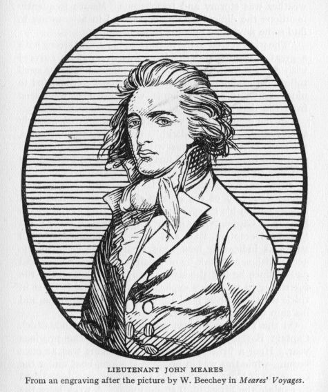
From Cape Flattery to the mouth of the Columbia the coast was observed and charted with a considerable degree of accuracy. Meares was anxious to find harbourage where the ship could remain in security for some days, while a trade with the Indians was carried on. Spanish charts of {173} the time told of a river, St. Roc, somewhere in these latitudes, and of safe anchorage, but try as he might no place of safety could be found. Bays there were, but they were shoal, and sand-bars appeared to stretch across the entrance in each case. The captain mentions Shoal Water Bay, Quicksand Bay, and Deception Bay as names given {174} to represent the kind and condition of the harbourage to be found in latitude 46° north. Although it was July, the weather was stormy and treacherous. Meares frequently mentions the difficulties this occasioned in attempting to find some navigable opening in the shore-line.
"The wind veered to the north, and blew very strong with a great sea: ... and the land was everywhere covered with a thick mist." Again: "A prodigious easterly swell rolled on the shore—as we steered in, the water shoaled to nine, eight and seven fathoms, when breakers were seen from the deck, right ahead."
"In the offing it blew very strong, and a great westerly swell tumbled in on the land." Continuing the narrative, we read: "As we had met with nothing but discouragement, we here gave up all further pursuit, and closed our progress to the southward; we therefore hauled our wind, in order to proceed again to the northward."
The discovery of the great Columbia River had been almost within his grasp. But this was fated to fall to the honour of Captain Gray in the ship Columbia, three years later.[1] Deception Bay and Cape Disappointment still stand as indicating how near Meares had been to the accomplishment of this by no means easy task. A week had passed since he left the strait, for it is no business of the fur trader to pass days exploring an inhospitable coast in thick weather, when his base of supplies is in China and his ship in constant danger.
On the 11th anchor was cast in Barkley Sound, which Captain Barkley had explored and named the previous year. Here a brisk trade with the Indians was at once begun—while this was in progress the long-boat under the command of Robert Duffin, the first officer, was despatched to explore the Strait of Juan de Fuca. A week later the boat returned (20th July). It had entered the strait for some distance and preparations to land were being made when the Indians had come off in their war canoes to the {175} attack. It would appear that the conflict had been severe and that the Indians had pressed their onslaught with vigour and determination. Four of the boat's crew were suffering severely from barbed-arrow wounds. "The rest of the people were bruised in a terrible manner by the stones and clubs of the enemy; even the boat itself was pierced in a thousand places by arrows, many of which remained in the awning that covered the back part of it; and which by receiving the arrows, and breaking the fall of large stones thrown from slings, in a great measure saved our party from inevitable destruction."
Meares claims that the long-boat had penetrated thirty leagues into the strait—that there the strait was fifteen leagues wide, with a clear easterly horizon. This is one of his distressing exaggerations. At any rate the long-boat immediately returned to the Felice in Barkley Sound, and the next day Captain Meares put to sea.
26th July found him safely at anchor in Nootka Sound. All now bent their energies to the completion of the little vessel, which was to bear the honour of being the first ship launched from these northern shores. On the 27th of the ensuing month the little settlement at Nootka were gladdened by the arrival of the Iphigenia. It will be remembered that she had parted company with the Felice at the Philippines; thence choosing a more northerly course had approached the coast in the latitude of Prince William Sound, and had spent the summer trading southward. Captain Douglas had much to relate in the way of trade and adventure. But in order to more fittingly celebrate his safe arrival a holiday was decreed for all and sundry of both crews. One may easily imagine the scene: the groups of new arrivals inspecting and commenting upon the little vessel on the ways; the house and its miniature earthworks would be examined; the Indian village near by would be a source of wonder and amusement; over all the August sun shining through the haze of approaching autumn. Dangers of the sea would quickly vanish, to give place to {176} pictures of green forests, peaceful shores, odd people in strange dress, and the feel of firm land beneath the feet. No one can pack more hilarity and enjoyment into a few hours or days on shore than the deep-water sailorman, and we may rest assured that the day was fittingly observed.
The next and succeeding days' work was pushed with added vigour, all hands turning their attention to the speedy conclusion of their immediate enterprise—the launching of the sloop. Three weeks had passed in this manner when, on the 17th of September, a strange sail was seen in the offing.
The long-boat [says Meares] was immediately sent to her assistance, which, instead of the British vessel we expected, conveyed into the sound a sloop, named the Washington, from Boston in New England, of about one hundred tons burthen.
Mr. Grey, the master, informed us, that he had sailed in company with his consort, the Columbia, a ship of three hundred tons, in the month of August, 1787, being equipped, under the patronage of Congress, to examine the Coast of America, and to open a fur trade between New England and this part of the American Continent, in order to provide funds for the China ships, to enable them to return home teas and China goods. These vessels were separated in an heavy gale of wind, in the latitude of 59° south, and had not seen each other since the period of their separation: but as King George's Sound was the place of rendezvous appointed for them, the Columbia, if she was safe, was every day expected to join her consort at Nootka.
The master of the Washington was very much surprised at seeing a vessel on the stocks, as well as on finding any one here before him; for they had little or no notion of any commercial expedition whatsoever to this part of America.
Gray's arrival was quite opportune, for three days later the North West America was launched. Meares gives a graphic though somewhat wordy description of the launching, parts of which are here given:
The vessel was then waiting to quit the stocks; and to give all due honour to such an important scene, we adopted, as far {177} as was in our power, the ceremony of other dock-yards. As soon as the tide was at its proper height the English ensign was displayed on shore at the house, and on board the new vessel, which at the proper moment was named the North West America, as being the first bottom ever built and launched in this part of the globe.
It was a moment of much expectation.... Maquinna, Callicum, and a large body of their people ... were come to behold it.
He then goes on to describe the presence of the Chinese carpenters, the Sandwich Island chief, Tianna, and the Americans—and continuing the narrative we read:
But our suspense was not of long duration; on the firing of a gun the vessel started from the ways like a shot. Indeed she went off with so much velocity, that she had nearly made her way out of the harbour; for the fact was, that not being very much accustomed to this business, we had forgotten to place an anchor and cable on board, to bring her up, which is the usual practice on these occasions; the boats, however, soon towed her to her intended station, and in a short time the North West America was anchored close to the Iphigenia and Felice.
Four days later Meares sailed for China, leaving Captain Douglas in charge of the establishment at Nootka, with orders to winter at the Sandwich Islands, and to return to Nootka the following spring to carry on the trade with the Indians of those regions. Captain Gray wintered at Nootka, where he was in due course joined by Kendrick, his commander in the venture, in charge of the ship Columbia.
All was apparent peace and quiet. To Meares on his homeward journey the future held bright prospects. From his base at Nootka an ever-increasing fleet of coasting vessels would venture forth to barter with the Indians in the secluded bays and passages of the tortuous northern coast. Surely a monopoly of the whole region could be thus secured, and annual shipments of great value be received at the company's headquarters in China.
This was not to be. Other nations were jealously {178} watching this growing trade, and, in this very year of 1788, a Spanish expedition under Martinez and Haro had been investigating the Russian settlements in Alaska. Upon returning to San Blas, Martinez had reported to Florez, the viceroy of Mexico, that the Russians contemplated the establishment of a settlement at Nootka; this was to be done in view of "the commerce which the English from Canton are carrying on at Nootka,"[2] and of the Russian claim to the North-west coast through the discoveries of Bering and Chirikoff in 1741. Martinez then urged upon the viceroy the need of Spain to forestall the Russians and by immediate action "occupy the said port and establish a garrison in it." To this end he volunteered his services. Florez acted quickly, and instructed Martinez to begin preparations for the expedition. Two vessels were outfitted, the Princessa mounting twenty-six guns, and the San Carlos sixteen guns. They set sail from San Blas on the 17th of February, 1789, six weeks after Martinez had reported in his letter to the viceroy.
The instructions given Martinez were as minute and exact as it was possible to make them. He was to endeavour to secure the goodwill of the Indians; four missionaries accompanied the expedition to assist in this as well as in the propagation of their religion. A formal establishment was to be erected at Nootka, and Spanish sovereignty proclaimed. Directions were also given as to the manner in which he (Martinez) was to deal with (a) the English he might meet and (b) the Russians who were expected to arrive, (c) the vessels of the Independent American Colonies, should they appear on the coast of North California. The coast from Prince William Sound to San Francisco Bay was to be fully explored and charted. Throughout the instructions there runs a tone of measured regard in relation to the way Martinez was to conduct himself—and in view of the violence of his actions a few months later the following excerpt is given, showing in {179} what manner the letter and the spirit of the instructions by Florez were disregarded:
No. 10. If Russian or English vessels should arrive, you will receive their Commanders with the politeness and kind treatment which the existing peace demands: but you will show the just ground for our establishment at Nootka, the superior right which we have for continuing such establishments on the whole coast, and the measures which our superior government is taking to carry this out, such as sending by land expeditions of troops, colonists and missionaries, to attract and convert the Indians to the religion and the mild dominion of our august Sovereign.
No. 11. All this you ought to explain with prudent firmness, but without being led into harsh expressions which may give serious offence and cause a rupture; but if, in spite of your greatest efforts, the foreigners should attempt to use force, you will repel it to the extent that they employ it, endeavouring to prevent as far as possible their intercourse and commerce with the natives.
The Princessa arrived in Nootka Sound on 5th May, 1789. In the harbour at anchor lay the Iphigenia, under the command of Captain Douglas, and the American ship Columbia in command of Captain Kendrick. The Columbia and her consort the Lady Washington had wintered in the sound, but the latter had lately left on a trading cruise in northern waters. The Iphigenia and the North West America had returned from the Sandwich Islands in April, the latter also leaving for an initial trading venture.
At first all went well; Douglas was invited to dine with Martinez on his vessel, then a few days later Kendrick invited the officers of the Iphigenia and Princessa to dine with him, and the following day Captain Douglas extended the same courtesies to the Spanish and American officers. With the Spaniard in possession of the harbour it was now necessary for Captain Douglas to present his instructions and the passport of his ship. If these were found in good order, under ordinary conditions the ship would be given clearance and permitted to put to sea. And just there the {180} first trouble began. It would appear that Meares, in an endeavour to escape the high port charges at that time levied on all other nationals,[3] had sailed from Macao under Portuguese colours, and with a Portuguese passport signed by the governor of Macao, and purporting to belong to John Cavallo, a resident merchant of that place. Martinez was unable to reconcile these apparently correct papers with the visual evidence, viz.: "I found a packet boat with its captain (flag) and passport of the Portuguese nation, but its supercargo (who was really the captain), its pilot, and the greater part of its crew English." On the 13th, Viana, who was made to appear to be the captain, Douglas in the rôle of supercargo, and Adamson, the first pilot, repaired to the Princessa, there to undergo a searching oral examination. The Spaniard took exception to certain clauses in the instructions, refused to credit any explanation offered, and placed the officers under arrest.
All accounts agree that errors had been made in the translation of the instructions from the Portuguese to the Spanish language. Whether this error was afterwards discovered, we do not know, but twelve days later the Iphigenia was restored; the reason for this step as given by Martinez being "on account of the difficulty of sending the captured vessel to San Blas, owing to the scarcity of men to man her."
Truly a strange reason in the light of later events. To safeguard himself from the possible displeasure of the viceroy of Mexico he had ordered a complete inventory to be taken of the ship's cargo and a bond to be executed, obliging the owner Cavallo to pay the value of the vessel and contents should she be subsequently considered a lawful prize for "having been found anchored in the port of Nootka without having a passport, permission, or licence from His Catholic Majesty for navigating or anchoring in seas or ports belonging to his dominion." This was signed {181} by Viana and Douglas and witnessed by the American skipper Kendrick, and by Ingraham. The 31st (the last day of May) saw Douglas once again in full command, and with the hills of Nootka fading in the distance, ostensibly bound for Macao by way of the Sandwich Islands. But after darkness hid him from view he daringly turned his ship to the northward and for the space of a month prosecuted the trade in furs, refusing, as he said, to run to Macao "with only between sixty and seventy sea-otter skins which I had on board."
A week later the North West America returned to Nootka, in quest of supplies. She was promptly seized by Don Martinez and her crew held as prisoners. A prize crew was put on board, the name changed to Gertrudis, and she was employed the remainder of the season in the sea-otter trade by the Spaniards. The 215 otter skins on board at the time of the seizure were also appropriated by the captors. While these events had been transpiring the operations on shore had been actively prosecuted. The Spaniards had fortified a hill which commanded the harbour entrance, and placed a garrison therein. A lodging house or barracks, a workshop and a bakery had been built. Nothing remained but to take formal possession of the harbour and district in the name of King Carlos.
But let us pick up one of the other important threads of the story. What had become of Captain Meares and his ship the Felice? His passage to China in the previous fall had been without particular incident, and in due course he arrived at Macao, 5th December, 1788. He thereupon sold the cargo of furs and also the ship. Shortly afterwards two vessels in the employ of Etches and Co., of London, made port en route to the west coast of America. On board as supercargo was Mr. John Etches and with him Meares made an agreement looking toward the elimination of the existing competition and the establishment of a monopoly in the growing sea-otter trade. A joint stock company was formed, to take over all the vessels and {182} property employed in this trade, and the command of the spring sailing was entrusted to Captain James Colnett. He was also given charge of all the business of the company on the American Coast (i.e. of the Iphigenia, North West America, and the house and land at Nootka).[4] The Princess Royal, in command of Captain Hudson, left China in April; the Argonaut, Captain Colnett in charge, followed in May of 1789. These vessels were fully outfitted for a three years' cruise, and the Argonaut carried in addition a small vessel in frame, and a number of Chinese artisans.
The instructions given to Captain Colnett directed him to make Nootka his base of operations. There he was to erect a substantial house on the land purchased the preceding year by Meares, and thus lay the foundation of a permanent settlement. Trade was to be carried on with the Indians and commercial treaties entered into with them. Each fall a ship was to be sent to China with the season's furs. Each spring a supply ship would leave China for Nootka. Such in brief were the plans of the new company, The Associated Merchants of London and India.
In total ignorance of the occupation of Nootka by the Spaniards, of the seizure of the Iphigenia and the North West America, the Princess Royal approached the harbour on the evening of 15th June. Two launches now sped out {183} from the entrance. They were hailed by Captain Hudson, who could not ascertain their purpose or intent in the gathering darkness. Then Martinez, Kendrick and Funter came on board, and passed the night as guests of Captain Hudson. The next morning the launches towed the Princess Royal into the harbour. That night was spent as guests of Captain Kendrick on board the Columbia; the following day, the 17th, Hudson was formally notified by Martinez in a note that the port of Nootka now belonged to Spain. A demand was also made that he give his reasons for anchoring in the sound. Fitting reply was made, that owing to the long voyage across the Pacific the ship stood in need of wood and water and of certain repairs, and that as soon as these wants were attended to he was ready to leave. To this reasonable request Martinez agreed.
While this was going forward the Spaniards proceeded to formally take possession of Nootka Sound and the lands adjacent thereto. The document is a flamboyant affair in the usual style of those days, and was attended with all the pomp and ceremony the Spaniards were able to muster. For a few brief weeks Don Martinez was enjoying his power to the full. His subsequent actions would seem to indicate that the wine of success had turned his head as it has a fashion of doing with those of a shallow and conceited nature. The following is an interesting part of the ceremony, which took place on 24th June, 1789:
Then the chaplains and friars sang Te Deum Laudamus, and the canticle having been concluded, the commander said in a loud voice:
"In the name of His Majesty the King Don Carlos the III., Our Sovereign whom may God keep many years, with an increase of our Dominions and Kingdoms, for the service of God, and for the good and prosperity of his vassals, and for the interests of the mighty lords and kings, his heirs and successors, in the future, as his commander of these ships, and by virtue of the orders and instructions which were given to me in his Royal Name, by the aforesaid His Excellency the Viceroy of New Spain, I take, and I have taken, I seize, and {184} I have seized, possession of this soil, where I have at present disembarked ... for all time to come, in the said Royal Name, and in the name of the Royal Crown of Castille and Leon, as aforesaid—as if it were my own thing, which it is, and shall be and which really belongs to the King aforesaid, by reason of the donation and the bull Expedio Notu Proprio of our Most Holy Father Alexander VI., Pontiff of Rome, by which he donated to the Most High and Catholic Monarch Ferdinand V. and Isabel his spouse ... one-half the world by deed made at Rome on the 4th day of May in the year 1493, by virtue of which these present lands belong to the said Royal Crown of Castille and Leon...." etc.
And as a sign of such possession he drew his sword which had hung by his side, and with it he counted the trees, the branches and the lands; he disturbed the stones on the beach and in the fields without encountering any opposition, asking those present to be witness of these facts.... Then taking a large cross on his shoulders, and the crews of both ships having been formed in marching column, armed with guns and other weapons, the procession marched out, the chaplains and friars chanting the Litany of Rogation—the whole troop responding—and the procession having halted, the commander planted the cross in the ground, and made a heap of stones at the foot thereof—as a sign and in memory of the taking of possession in the name of His Majesty Carlos III. King of all Spain.[5]
The Princess Royal was permitted to sail on the 2nd of July; as she passed out of the harbour she was observed by her consort, the Argonaut, just arriving from China. Again two launches approached the incoming ship, and Martinez, boarding her, introduced himself with a letter from Captain Hudson. This time Martinez pretended that his ships "were in great distress from the want of provisions and other necessaries and urged the English commander to go into port in order to supply their needs, inviting him to stay for some time."[6] Colnett hesitated. {185} Funter, of the captured North West America, who was one of the launch party, had informed him of the June happenings, and had advised him to anchor outside the cove until morning. Perceiving that the captain of the Argonaut was unwilling to comply with his request, Martinez redoubled his persuasions and promised on his honour "that if I would go into port and relieve his wants I should be at liberty to sail whenever I pleased." The Argonaut was thereupon towed in and anchored about midnight between the two Spanish men-of-war.
The next day Captain Colnett prepared to supply Martinez with certain stores, which had been agreed upon, and indicated his intention of sailing out to sea at once. But the wily Spaniard delayed, making first one pretext, then another. Finally he demanded the ship's papers, and Captain Colnett took them on board the Princessa. He then refused permission for the Argonaut to sail that day. Then a quarrel arose; the English captain "declared that he would sail at once, with or without permission, unless the Spaniard fired on him, in which case he would haul down his colours and surrender." Further words led to an angry scene, then Martinez, secure in his superior strength, ordered Colnett to be seized and made prisoner. The Argonaut was then boarded by the Spaniards, the crew and officers made prisoners, and the Spanish flag run up to the masthead.
It is needless to recount the pillage of the ship's cargo, and the personal belongings of the officers and crew, of how the North West America was outfitted and employed in the fur trade by the Spaniards, or of how Captain Colnett, hoodwinked and thus basely used, went temporarily insane. The whole proceeding was a miserable blunder for Martinez to make; within a twelvemonth England and Spain were arming, and the haughty Martinez, shorn of his command, had been ordered to Spain to answer to the plea of non-support entered by a neglected wife and daughter.
{186}But the tale is yet to be enlivened with one more seizure by the Spaniards. On the 13th the Princess Royal, having been blown far to the southward in a gale, had managed to beat back opposite the ill-fated sound. Wishing to ascertain whether the Argonaut had arrived, Hudson left his ship outside and proceeded in with the launch. He was invited on board the Princessa; there friendly disguise was thrown aside, he was seized, disarmed and made prisoner. "Seeing the futility of resisting, he advised his lieutenant to surrender. The vessel was taken at midnight and brought in the next morning."
The two prizes were immediately sent to San Blas, where their fate was to be decided by the viceroy. On board were the English crews as prisoners. Martinez himself reached that port on 6th December. But one of his many strange actions remains to this day somewhat of a puzzle. Why did he not molest in any way the two American ships, the Columbia and the Lady Washington? The Columbia lay in the sound during the whole of the transactions of May, June and July. Captain Kendrick accompanied him on every occasion, appeared to be hail-fellow-well-met and general confidant of the haughty Don. The Washington was permitted to enter and leave at will on short trading cruises up and down the coast. Mr. Duffin, second in command to Colnett, and a man of fair and impartial judgment, also notes this favourite treatment of the Americans. In writing to Meares he says: "I am sorry to inform you that the Spaniards have taken the chief part of our copper, all our guns, shot and powder, with the spare canvas, etc. The former he means to trade with, as I am informed he sends his furs to Macao by Captain Kendrick, who also trades for him on shares." It would thus seem that, while Martinez dealt in a most harsh, brutal, and high-handed manner with all British ships, he made it a point to be very friendly, even to the extent of a trading partnership, with the American skippers. It seems that Kendrick had decided to remain on the coast {187} another winter. To do this he needed stores and provisions. These were transferred from the Columbia, which he quitted, changing places with Gray. Certain seamen were also taken from the Columbia and placed on board the Washington. This left the Columbia short-handed; how could the deficiency be met? Evidently by making use of some of the captured English seamen. For Martinez had agreed to return the crew of the North West America to China by the Columbia. While Martinez apparently provided these men with a free passage to Macao, yet the fact that their presence was so soon made use of is certainly one more proof of the "full friendship and alliance" which Funter and his men declared to have existed between Kendrick and Martinez.
On the other hand it may be urged that the American skippers had no intention of forming a settlement or factory on that coast; the English did so intend. More Chinese artisans had been brought by Colnett. A second ship, in frame, lay in the hold of the Argonaut; land had been purchased from the Indians the preceding year, and a house had been erected. Martinez was fully aware of these happenings and of the contemplated plans. Colnett had been at small pains to disguise his intentions. If the land actually belonged to Spain then Martinez was in small measure overstepping his rights, but this point must be established, else such high-handed actions would be sure to bring a prompt protest and as prompt action from England.
The first news of these happenings on the far-away coast of North America to reach England came by way of a letter from Anthony Merry, the British Chargé-d'affaires at Madrid. The account furnished was meagre and left much to be imagined. Later, in February of 1790, an official letter from the Marquis del Campo arrived, recounting the Spanish occupation of Nootka, and the presence of certain American and Portuguese ships at Nootka—and that "the English prisoners have been liberated through {188} the consideration which the King has for his Britannic Majesty." The British Government replied that a just and adequate satisfaction should be made for a proceeding so injurious to Great Britain, that the vessel seized must be restored, and that details of the ultimate satisfaction which might be found necessary must await further and more complete information on the whole affair.
Meanwhile Meares had learned from the returned men on the Iphigenia certain of the events herein described; from the crew of the North West America, which returned to China and November, 1789, on the Columbia, he learned the rest of the sad story. Collecting these accounts Meares took passage for England, where he arrived in April, 1790, and presented his famous memorial. This paper, dated 30th April, was considered by the Cabinet and confirmed them in their attitude. On the 5th a brief recital of the main points at issue was sent in a message from King George III. to both Houses of Parliament. It was also pointed out that certain negotiations had been under way with Spain, but that "no satisfaction is made or offered, and a direct claim is asserted by the Court of Spain to the exclusive rights of sovereignty, navigation and commerce in the territories, coasts and seas in that part of the world." And "having also received information that considerable armaments are carrying on in the ports of Spain, has judged it indispensably necessary to give orders for making such preparations as may put it in His Majesty's power to act with vigour and effect in support of the honour of his crown and the interests of his people." Parliament at once voted £1,000,000 to enable His Majesty to act "as the exigency of affairs might require."
The British Government acted quickly, and full preparations were made for war with Spain. Meanwhile negotiations continued, the British Government claiming restitution of the vessels, indemnification to Meares and refusing to agree to Spain's claim to sovereignty of the whole Pacific coast. After many weary months of uncertainty, {189} popular resentment forced matters to a climax, and Spain, fearing the growing strength of England, agreed to the terms in the main as presented by England. On 28th October, 1790, King Carlos III. signed the Nootka Sound Convention, war was averted and the great fleets once more returned to their bases.
In conclusion it might be well to remark that Meares was paid a large indemnity by the Spanish Government, in satisfaction of a statement of losses submitted. The vessels seized, viz. the Princess Royal, the Argonaut, and the North West America, were all returned to the Meares-Etches company. The British prisoners were released. The land and buildings at Nootka, "of which the subjects of His Britannic Majesty were dispossessed, about the month of April, 1789, by a Spanish officer, shall be restored to the said British Subjects." And it was further agreed that, for the future, the subjects of both nations were to have equal rights in the trade, commerce, and settlement of all that portion of the Pacific coast of North America north of the parts of the said coast already occupied by Spain.
The indemnity paid to Meares and his associates amounted to "two hundred and ten thousand hard dollars in Specie."
[1] See voyage of Captain Vancouver, page 234.
[2] From a translation of Martinez' report: Manning, page 300.
[3] Or perhaps to escape the monopolies of the South Sea Company and the East India Company.
[4] Permission to use a portion of the beach at Friendly Cove was undoubtedly secured by Meares in May of 1788. He built a house and framed a vessel. The Indians remained friendly. Whether a purchase, outright and in perpetuity, was then contemplated by Meares and so understood by Maquinna is a very doubtful point. One is driven to the conclusion that two years later much more was made of this "purchase" by Meares than the very simple transaction in 1788 warranted. De Roquefeuil, in the ship Le Bordelais, visited Nootka in 1818. Being curious regarding this point, he questioned Maquinna and learned "that Meares's house had been built with the permission of Macouina, but that there had not been any act of cession or treaty between them."
The house which Meares had built was torn down that fall by Captain Douglas. He took the boards on board the Iphigenia and gave the roof to Captain Kendrick before sailing to the Sandwich Islands. We are reasonably certain that the house did not exist at the time of Martinez' arrival in May of 1789.
[5] From the translation in Howay and Scholefield's History of British Columbia, vol. I. page 141.
[6] Manning, pp. 332-334.
Now let us examine a little more closely the various happenings in Europe which led up to the voyage of Captain Vancouver to Nootka Sound.
By treaty with England (1713), as well as by the neglect of other European nations, the western coast of America north of the Gulf of California had long been considered by Spain to be part and parcel of her great American empire. From the days of Drake to the days of Bering no foreign prow had parted the swell of the North Pacific. On the other hand a mere dozen circumnavigators had rounded the Horn in quest of adventure, fame and wealth. By far the greater number of even this handful had kept close to the equator, and the great South Sea rolled on, to thunder on many a coral isle still uncharted and unknown. From Valparaiso to San Diego the coast of the Americas was barred to the foreigner. But not content with this vast stretch of virgin domain, the shadow-like power of the Treaty of Tordesillas (1494) was extended to include the whole western coast of North America from San Diego to the tossing ice pans of the misty north.
Out of those mists ventured a few hardy Russian fur traders following in Bering's track. Gradually the Aleutian Islands were secured by discovery, trade and settlement. Ever southward the bold hunters pushed their way, invading Prince William Sound, enslaving the native inhabitants, and living in rude huts modelled after the plan of those whom they dispossessed. News came to Madrid of these encroachments on her domain. But the power of the once mighty nation to cope successfully with such a situation {191} was but a mere shadow of its former strength. The ability of the Spanish people to colonise further areas seemed exhausted. Instead of boldly dotting the Californian coast with strategic outposts (if she really wished to hold these shores inviolate), a tiny reconnaissance vessel under command of Juan Perez was, in 1774, despatched northward from San Blas in Mexico.
No formal acts of "taking possession" of new-found shores were made by this expedition. But the next year a more ambitious venture was despatched from Mexico under Heceta and Quadra. When in latitude 50, Heceta turned back, but Quadra pushed on to 58, and formally took possession of the land for the King of Spain. However, following her usual custom, Spain made no open contribution to the world of these voyages and of her intentions. Rather were the journals of the commanders filed away in true mediaeval fashion. The Russians might have the cold, rock-bound north: what Spaniard wished that land? But publish these recent voyages, add something of geographical interest to a waiting world? Not so! that would but draw the attention of some daring, scheming foreign power. So must have reasoned the average Spanish executive of that day and generation. "Better let well enough alone" seems to have been the motto, faithfully but most unwisely followed.
A new era had begun, an era of scientific exploration, which was to culminate in the complete re-charting of all the vast Pacific, which was to add multitudes of islands, both great and small, where before blank seas swept their ancient way. Captain Cook and his intrepid sailormen led the van. Each voyage was faithfully described, charts were made, thousands of copies both of journals and charts were printed. He who ran might read. No secrecy here; "Let in the light of day," might well have been the motto of the English explorations of that date. What a powerful lever such publicity became when announced "acts of taking possession" were acquiesced in by an informed {192} world! How much more powerful than the Spanish method of procedure!
In 1778 such an exploration was made by Cook of the Nootka Sound region. He made a careful chart of the sound, and gave it a name. Although he found two silver spoons in the possession of some Indians, he could not find that this port had ever before been visited by white men. The journal of the expedition was duly published, but no diplomatic protest came from Spain. When that protest did come, it was too late. Not only did the Cook expedition give to the world the first authentic sailing chart of the Nootka Sound region, but it described the furs of the coast as well, and told how eager the Chinese were to buy the furs the Indians parted with so easily.
This led to trade. From 1785 to 1788, vessel after vessel set out on the sea-otter quest. If Spain deemed these shores worth claiming, why did she not send her voyagers up from Mexico to reap the rich harvest? But no such quest remained to the Spaniard of that day. Gone was the adventure of a Cortez, the iron courage of a Pizarro; sloth had replaced adventure, a dog-in-the-manger attitude had eaten into the body politic, until in fits of jealous madness acts were performed which almost led to national disaster.
Some such sudden accession of energy led to the Martinez expedition of 1789. We hear of dramatic meetings at Nootka, the seizure of British trading ships, the imprisonment of British sailors, and the fortification of Nootka itself, under instructions from the Mexican viceroy.
Meares learned of the loss of his vessels from the officers of the Iphigenia, and the sailors of the North West America who had reached China on Captain Gray's ship. Gathering together his sworn depositions, Meares at once set sail by way of the Indian Ocean and the Cape of Good Hope for England. There he planned to lay before the British government an account of these high-handed proceedings of haughty Don Martinez. But this news must travel by a long circuitous route. The first intimation {193} of what had occurred came by way of Mexico to Spain on 30th December. Accordingly we find Anthony Merry, the British Chargé-d'affaires at Madrid, listening to strange rumours, which seemed to warrant a report to London. And in January of 1790 he sent the following despatch covering the incidents he had heard:
Accounts have just been received here from Mexico, that one of the small Ships of War on the American Establishment, commanded by a Subaltern Officer of the name of Martinez, has captured an English vessel in the Port of Nootka (called by the Spaniards San Lorenzo) in Latitude 50 North of the Coast of California. There are different relations of this event. Some of them state that the Vice-roy of Mexico, having had notice that the English were forming an Establishment at the above-mentioned place, ordered a ship there to take possession of it; that M. de Martinez found in the port Two American Vessels, a Portuguese from Macao, a Russian from some Port of Her Imperial Majesty's Eastern Dominions, and an English one, which had come direct from a Port of Great Britain, with People and Necessaries on Board, to form a Settlement: That the American, Portuguese and Russian ships were suffered to depart, it appearing they had only gone there to trade for Furs; and that the English one alone had been detained. Other Accounts mention, That the Spanish Ship had sailed from St. Blas on a Voyage, which it is said, is annually performed, to reconnoitre the North-West Coast of the Continent: That, when she put into Port Nootka, the English Vessel was not yet arrived: That the latter was seized as soon as she appeared: That the Russian and Portuguese Ships were also captured; and that only the Americans were suffered to go away. The Name of the English Vessel, or of the Master, is not mentioned in any of the Statements of the Transaction which I have yet been able to see; but they all say that she had been fitted out by a Company of Merchants in London, for the Purpose of forming a Settlement; and that it had been discovered that she was to be followed by Two others. The different Accounts also add that she had been manned with Spanish Seamen, and dispatched with the News to the Vice-roy of Mexico.
On the 25th of January the government in London {194} received a second letter from Mr. Merry containing an account of Martinez' voyage to Unalaska in 1788, and relating briefly the seizure of Portuguese and English vessels. In addition he wrote that Spain had commenced an establishment at Nootka "by building some Houses and Stores of Wood, and by erecting a Battery at the Entrance of the Port." The letter further states that a second English vessel had arrived at Nootka, and that she had been captured, and sent to San Blas, Mexico. It may well be imagined that such rumours would cause the utmost disquiet in the English court circles. What was Spain up to now? Where was this Nootka anyway? So began a hasty turning over of charts, a searching of records and discussions pro and con.
At last came official communication from Spain under date of 10th February, and, in order that the Spanish stand in the matter may be clearly understood, the letter is printed in full:
MY LORD: Continuing the frequent expeditions which the King, my master has ordered to be made to the northern coasts of California, the Viceroy of Mexico sent two ships, under the orders of Don Estevan José Martinez, ensign of the navy, to make a permanent settlement in the port of San Lorenzo, situated about the fiftieth degree of latitude, and named by foreigners "Nootka" or "Nioka," of which possession had formerly been taken. He arrived there the 24th of last June. In giving his account to the Viceroy, M. Martinez said that he found there an American frigate and sloop, which had sailed from Boston to make a tour of the world. He also found a packet-boat and another vessel belonging to a Portuguese established at Macao, whence they had sailed with a passport from the governor of that port. He announced also that on the 2nd of July, there arrived another packet boat from Macao. This was English and came to take possession of Nootka in the name of the British King. She carried a sloop in pieces on board.
This simple recital will have convinced your excellency of the necessity in which the Court of Madrid finds itself of asking His Britannic Majesty to punish such undertakings in {195} a manner to restrain his subjects from continuing them on these lands which have been occupied and frequented by the Spaniards for so many years. I say this to your excellency as an established fact, and as a further argument against those who attribute to Captain Cook the discovery of the said fort of San Lorenzo. I add that the same Martinez in charge of the last expedition was there under commission in August of 1774. This was almost four years before the appearance of Cook. This same Martinez left in the hands of the Indians two silver spoons, some shells and some other articles which Cook found. The Indians still keep them, and these facts, with the testimony of the Indians, served M. Martinez to convince the English Captain.
The English prisoners have been liberated through the consideration which the King has for His Britannic Majesty, and which he has carefully enjoined upon his viceroys to govern their actions in unforeseen events. His Majesty flatters himself that the Court of St. James will certainly not fail to give the strictest orders to prevent such attempts in the future, and, in general, everything that could trouble the good harmony happily existing between the two crowns. Spain on her side engages to do the same with respect to her subjects.
I have the honour to be, etc.,
THE MARQUIS DEL CAMPO.
His EXCELLENCY M. THE DUKE OF LEEDS.
(Dated, Manchester Square, February 10, 1790.)
Not only is the Spanish note most harsh and peremptory, it is inaccurate as well. It is such a communication as a strong overbearing nation of that age and time might address to a weak and timorous state. No self-respecting European power could afford to submit tamely to such reproof. The British nation of 1790, virile and alive to any and every subtle suggestion of inferiority, could not afford to ignore or meanly submit to the mediaeval demands of Spain. Now was the time and opportunity to assert in no unmistakable terms the new doctrine of the open door and equal privilege in those wild spaces of the earth as yet undeveloped by the pursuits of commerce.
{196}It will be noted that in the first paragraph the Spaniards claim to have taken possession of Nootka at some time previous to the arrival of Martinez in 1789. But this had not been done. Martinez arrived at Nootka on 5th May, not 24th June, as the note would have us believe. The latter date is the one on which "formal possession" actually took place. Again, in the second paragraph Spain would have the English government believe the Nootka region to have been "occupied and frequented by the Spaniards for so many years." Evidently this claim is based on the voyages of Perez (1774), Heceta and Quadra (1775 and 1779). But of these three voyages the most that may be said of them is that the ships touched at a few places on the coast, a few bits of coast-line were seen here and there, and the vessels returned to Mexico. No trade sprang up with the Indian inhabitants, no settlement was attempted, and for the ensuing eleven years Spain left the north-west coast absolutely unvisited, unfrequented and unoccupied.
Nor is the note fair in its statement of seizures made by Martinez. It would seem perfectly plain that Spain attempted, on the one hand, to magnify discovery, occupancy and ownership, while, on the other hand, she sought to belittle the actual seizures of British vessels and the imprisonment of their crews. But one vessel is mentioned (the Argonaut). No reference is made of the Princess Royal, which was also sent as prize to San Blas. Full accounts of this seizure were in the hands of the Spanish authorities when the note was forwarded to Campo. Nor is the North West America mentioned. It would indeed have been difficult to explain away the building of that little sloop in the very port which Spain now claimed to have "occupied and frequented for so many years."
But the English prisoners have been liberated! The truth of the matter is that Captain Colnett and his sailormen were not set at liberty until 11th May, and the Mexican viceroy, Revilla-Gigedo, is now known to have {197} released his prisoners before he had received permission from Spain. An order for the release was forwarded from Madrid 23rd March, but this order did not reach Mexico city till June.
After full consideration, the British Cabinet instructed the Duke of Leeds to forward a reply. Taking the note at its face value, adding to it the letters received from Merry, native shrewdness and wit enabled the government to take a firm stand in the matter from the very beginning. Leeds replied that while he intended to await more precise information, he had in the meantime His Majesty's orders:
To inform your excellency that the act of violence spoken of in your letter as having been committed by M. Martinez in seizing a British vessel under the circumstances reported makes it necessary henceforth to suspend all discussions of the pretensions set forth in that letter until a just and adequate satisfaction shall have been made for a proceeding so injurious to Great Britain. In the first place it is indispensable that the vessel in question shall be restored. To determine the details of the ultimate satisfaction which may be found necessary more ample information must be awaited concerning all the circumstances of the affair.
At the same time, the Duke of Leeds wrote Mr. Merry "to be extremely guarded" in what he might have to say on the subject; it being a matter of equal delicacy and importance, in which he ought to be very cautious of giving even a hint, which might be construed into a dereliction of our right to visit for the purposes of trade, or to make a settlement in the district in question, "to which we undoubtedly had a compleat right, to be asserted and maintained with a proper degree of vigour, should circumstances make such an exertion necessary."
This may be considered the first intimation which we have of the real plans and purposes of the then British government in regard to Nootka Sound and adjacent territories. It is clear that Pitt had decided to contest {198} Spain's claim to sovereignty in the Nootka region. Were those statesmen farseeing enough to look ahead to the day when Quebec province would need a western outlet? At least the fact remains that the government of that day had made up its mind to use this incident to check Spain's growing ambitions. Hence the sharp reply and the demand that satisfaction be given before discussion could or would be held on the point of Spanish sovereignty.
The effect of this communication upon the Spanish court was duly reported by Mr. Merry in a series of letters received in London during April. At first Mr. Merry wrote that the Spanish premier, Count Florida Blanca, had "expressed much dissatisfaction at the answer he had received from the Court of London, on the subject of the seizure of the English vessel at San Lorenzo ... he gave me to understand, that it was not the matter itself in question which affected him so much, as the fear, that, from the manner in which we have taken it up, we may at any time make use of it as a ground for quarrelling."
Again, Mr. Merry wrote that his excellency "dwelt much on the circumstance of our demanding satisfaction before any discussion had taken place of the matter of right on either side, etc." Evidently the count was endeavouring to draw from the British Chargé at Madrid some inkling as to the probable firmness of the British government, and whether that government intended to prepare for war. At any rate the Spanish government suddenly decided to take stock of their warlike equipment, as the following excerpt from another of Mr. Merry's despatches will show:
[5th April] The alarm, which the Court of Spain has taken at our answer about the Affair of Nootka, is so great, that they have given orders for reports to be immediately sent from the Spanish arsenals of the quantity of copper for sheathing ships, which there is in the storehouses, and of the number of ships of the line which can be got ready for sea at a short notice.
On the 20th of April there arrived an answer from Spain to the British ultimatum of 26th February. The claim of full sovereignty to the north-west coast was again reiterated, but late advices from Mexico were to the effect that the captured vessel as well as the crew had been released. The viceroy of Mexico being "convinced that nothing but ignorance of the rights of Spain could have encouraged the individuals of any nation to resort to that coast, with the idea of making an establishment, or of carrying on commerce there." (Mention is as yet made of but one vessel having been captured and released.) More honeyed words follow regarding the friendship of the two peoples, etc., etc. Then the conclusion:
For these reasons ... His Catholic Majesty considers and understands this Affair to be at an end, without entering into disputes or discussions on the indisputable rights of his crown; and He flatters Himself that His Britannic Majesty will command all his subjects to respect them, according to the request contained in the Marquis's first letter.
The Spanish note had ignored the demand for satisfaction which the note from England had expressly stipulated to be a "condition of further negotiation." Preparations for war were being secretly but actively carried on in every seaport of the Peninsula, and the firmness with which Spain reiterated her claims to full sovereignty over the Nootkan region lent but added assurance to the British government that a distinct and serious crisis had now arrived.
Whatever might have been the British reply we may never know. For who should arrive on the scene at this very time but John Meares and his bombastic memorial. If ever a stage had a finer setting, history does not disclose it. The dispute was in full swing, each contestant heated by the terse communications which had passed to and fro; a match thrown into a powder magazine could not have produced more instantaneous results than Meares and his memorial!
{200}A cabinet meeting was called immediately (30th April, 1790) and an address prepared and forwarded to the king:
Your Majesty's servants have agreed humbly to submit to Your Majesty their opinion that Your Majesty's Minister at the Court of Madrid should be instructed to present a memorial demanding an immediate and adequate satisfaction for the outrages committed by Monsieur de Martinez; and that it would be proper in order to support that demand and to be prepared for such events as may arise, that Your Majesty should give orders for fitting out a squadron of ships of the line.
Four days later a messenger was despatched to Mr. Merry at Madrid instructing him to represent to the court of Madrid that the last communication delivered by the Marquis del Campo was considered by His Britannic Majesty as unsatisfactory, and that it did not afford that reparation which His Majesty had a right to expect on this occasion, that no satisfaction whatever had been made or offered to His Majesty "for a proceeding so offensive to the honour of his crown." Mr. Merry was further directed to impress on the Spanish government that the British now demanded:
(a) The entire restitution of all the captured vessels, with their property and crews;
(b) an indemnification to the individuals concerned in the said vessels, for the losses sustained by their unjust detention and capture;
(c) and above all, there must be "adequate reparation to His Majesty for the injury done by an officer commanding His Catholic Majesty's Vessels of war, to British subjects, trading, under the protection of the British Flag, in those parts of the world, where the subjects of His Majesty have an unquestionable right to a free and undisturbed enjoyment of the benefits of commerce, navigation and fishery; and also to the possession of such establishments, as they may form with the consent of the natives, in places unoccupied by other European nations."
(d) a speedy and explicit answer to these demands was to be secured by Mr. Merry.
These demands state the British case in a complete and comprehensive manner. From them there was no turning or wavering. The old Spanish pretensions to the whole western coast-line of North America were to be broken down, and, in those unoccupied parts, England's sons were to be henceforth free to trade and traffic as their business might direct. Whether Spain was right and Britain wrong is a matter for those who love fine-spun argument. If the reconnaissant voyages of Quadra and Heceta (1775) and of Captain Cook (1778) be dismissed, the question of prior occupancy depends upon Meares' statement of land purchased from Maquinna at Nootka (1788). And even that claim is held in serious doubt.
We must remember, however, that in 1790 no love was lost between the two nations: that it was an easy matter for the governing officials to fan to white heat the latent hates of a fierce and sea-roving people, especially with such good tinder as that provided in Meares' memorial.
Having sent the final demands to the Spanish court, let us look behind the scenes and follow the remaining moves of the players. The very night that saw the special messenger despatched to Madrid witnessed as well a press of seamen throughout the ports of England. And the nation awoke on the morning of the 5th of May to the fact that war with Spain was a most imminent matter. Ships of the line were hurriedly commissioned, officers on leave were as quickly recalled, and in every port the utmost activity prevailed. For a fortnight past similar proceedings had been under way in the great seaports of Spain. If England's demands were to mean anything, she must be ready to enforce them.
It is rather remarkable that the whole affair had been kept a profound secret up to the morning of 5th May. With curiosity at fever heat, newspapers, magazines and pamphlets were quickly published to inform and stimulate a waiting public.
That same day a message from the king to Parliament {202} informed that body of the main outlines of the affair. Parliament further learned that the negotiations with Spain had so far proved unsuccessful. Spain had refused to give satisfaction for her high-handed acts, and had claimed full sovereignty over all the lands in the region in dispute. It was now known that Spain was arming and the king had given orders to put the country in a state of preparedness. An appeal was then made for the necessary supply to carry on Britain's warlike activities.
On the 6th of May the House of Lords and the House of Commons sent addresses to the king, assuring him of their support in the matter. The Commons close their address with these words:
We feel it our indispensable duty to assure His Majesty of the Determination, of His faithful Commons to afford His Majesty the most zealous and effectual support, in such measures as may become requisite, for maintaining the dignity of His Majesty's Crown, and the essential interests of His Majesty's Dominions.
At the same time, notices were sent by fast sailing vessel "to the several Consuls on the coast of Barbary, and to Major-General O'Hara, Commanding at Gibraltar. Lord Heathfield, the Governor of that important fortress, solicited and obtained His Majesty's permission to resume his command, and set out on his return to the garrison. The Seventh Regiment of Foot was ordered to embark without delay to the same place, to join their Colonel, His Royal Highness, Prince Edward."
The following is also a quotation from an old account of the time. Throwing as it does an interesting sidelight on Lord Dorchester and Canada of those days, it is given below:
Lord Dorchester, the Governor of Canada, who had signified his intention of returning to England, the ensuing summer, was directed to remain in his government, where his experience and abilities were judged to be of the greatest importance. {203} As it was doubtful whether, consistently with the exigencies of the state, a reinforcement of troops could be sent out this year to Canada, his Lordship was directed to take proper measures for embodying the Militia in that province, should such a measure in the course of events appear to him to be necessary, etc., etc.
with particular instructions that he (Dorchester) try in every way to maintain a friendly attitude with the United States and that he prevent them in so far as he was able from engaging on the side of Spain in case war broke out.
Notices to the West Indies, to far-away Bengal—the necessary business which must be attended to before "going to war" is little realised by the average person, either of that day or this.
From the middle of May, on through June and July the diplomats of England and Spain wrangled over the Nootka question. Fitzherbert had been sent to Madrid clothed with large powers and armed with full instructions to insist on satisfaction, restitution, indemnification and abandonment of the claim of sovereignty to the Nootkan region. On behalf of the Spanish government, Count Florida Blanca tried every diplomatic wile and artifice to avoid the main and direct issue: that of acknowledgment of lack of sovereignty over the lands in question.
While these discussions were taking place each contestant sought help from continental allies. From the Dutch a favourable reply was received and a fleet of ten sail of the line under Admiral Kinsbergen left the Texel on 17th June and joined the English fleet at Portsmouth three weeks later. Prussia also agreed to support England in case war should be declared.
Spain in no wise lessened her own activities. Communications had been opened with Montmorin, the French Minister for Foreign Affairs, requesting aid against England should war break out. After some delay, a favourable reply was received at Madrid, that the King of France {204} (Louis XVI.) was ready to do all he could in the interests of his dear friend and ally. But the advancing giant of the French Revolution had already cast his paralysing shadow over the puny Paris government and no strong and well-directed effort could be assured. For the Bastille had fallen the previous year, the National Assembly had begun its stormy sessions, while the king himself was become virtually a prisoner of the excited Paris mob. However, the middle of May (1790) the Assembly was informed of a royal order providing for the speedy armament of fourteen ships of the line, and of the urgency in being prepared should England and Spain go to war. After much debate, the order was confirmed by the Assembly, and the necessary supply was voted. But Spain could not feel at all sure of her ally in the light of the chaotic condition into which France was rapidly drifting.
On the other hand his interests in the West Indies and the Mississippi valley were a source of grave anxiety to the Spanish sovereign. In event of war, there was the fear that England might attack her long-treasured Mexican possessions and might even oust her from the Mississippi valley, thereby gaining not only Nootka and the North-west coast, but the whole great hinterland of the continent. And, as a matter of fact, Pitt entertained those very plans.
The condition of France was as much a source of satisfaction to England as it was a source of worry and despair to Spain. From time to time the cabinet through Fitzherbert renewed the demands and pressed for an immediate and definite reply. When artifice could no longer avail, Florida Blanca gave way on the point of satisfaction: at length restitution and indemnification were promised; finally sovereignty was thrown open to negotiation. In order that something binding might be had in the matter, which now seemed to be on the point of adjustment, the following Declaration and Counter Declaration were signed on 24th July.
His Britannic Majesty having complained of the capture of certain vessels belonging to his subjects in the port of Nootka, situated on the Northwest Coast of America, by an officer in the service of His Catholic Majesty, the undersigned counsellor and principal secretary of state to His Majesty, being thereto duly authorized, declares in the name and by the order of His Majesty, that he is willing to give satisfaction to His Britannic Majesty for the injury of which he has complained, fully persuaded that His said Britannic Majesty would act in the same manner toward His Catholic Majesty under similar circumstances; and His Majesty further engages to make full restitution of all the British vessels which were captured at Nootka, and to indemnify the parties interested in those vessels for the losses which they may have sustained, as soon as the amount thereof shall be ascertained; it being understood that this declaration is not to prejudice the ulterior discussion of any right which His Catholic Majesty claims to form an exclusive establishment at Nootka.
In witness whereof I have signed this declaration and sealed it with the seal of my arms at Madrid the 24th of July, 1790.
COUNT FLORIDA BLANCA.
His Catholic Majesty having declared that he was willing to give satisfaction for the injury done to the King by the capture of certain vessels belonging to his subjects in the Bay of Nootka; and Count Florida blanca having signed, in the name and by the order of His Catholic Majesty, a declaration to this effect, and by which His said Majesty likewise engages to make full restitution of the vessels so captured and to indemnify the parties interested in those vessels for the losses which they shall have sustained, the undersigned ambassador extraordinary and plenipotentiary of his Majesty to the Catholic King, being thereto duly and expressly authorized, accepts the said declaration in the name of the King: and declares that His Majesty will consider this declaration with the performance of the engagements contained therein, as a {206} full and entire satisfaction for the injury of which His Majesty complained.
The undersigned declares at the same time that it is to be understood that neither the said declaration signed by Count Florida blanca nor the acceptance thereof by the undersigned in the name of the King, is to preclude or prejudice, in any respect, the rights which His Majesty may claim to any establishment which his subjects may have formed, or may desire to form in the future, at the said Bay of Nootka.
In witness whereof I have signed this counter declaration and sealed it with the seal of my arms at Madrid the 24th of July, 1790.
ALLEYNE FITZHERBERT.
Word of the signing of these initial documents reached London the 5th of August. The government officials were highly elated with the successful course which the negotiations were taking under the skilled manipulation of Fitzherbert. There remained but to adjust the "right of sovereignty" to those lands of the North-west coast from San Francisco Bay to Prince William Sound. But this feature of the negotiations contained such elements of danger that the British government did not dare reduce the navy to a peace footing, nor was it considered wise to halt the preparations already well under way.
From the middle of July Spain had maintained at sea a fleet of thirty-four ships of the line, together with sixteen smaller craft. England had gathered together the greatest naval armament known to history in those days. To these vessels had been added the Dutch fleet under Kinsbergen. It is a matter of record that Spain earnestly desired to secure a mutual disarmament, but to all these overtures the British government turned a deaf ear, although it was known full well that some chance encounter of armed vessels might precipitate the very war the diplomats were endeavouring to avert.
In the meantime discussions were begun between Fitzherbert and Florida Blanca, which it was hoped would lead to a definite settlement of the Nootka lands.
{207}On the 17th of August a messenger was despatched to Fitzherbert with instructions for the regulation of his conduct in these negotiations. In addition a draft treaty of five articles was forwarded, and Fitzherbert was authorised to propose these to the Spanish minister.
Article One arranged for the restoration to the Meares-Etches company of the buildings and land at Nootka.
Article Two arranged for an agreement that England had equal right with Spain in the navigation and carrying on of fisheries in the Pacific Ocean or South Seas; that her subjects could land on the coasts, carry on commerce with the natives, or make settlements in unoccupied places.
Article Three provided for the security of the present Spanish possessions and the limitations of English settlements to that portion of the coast north of latitude 31°[1] and the prohibition of trade with the Spanish settlements to the south of that line. Nor were British vessels to approach within five leagues of said Spanish coast (that south of 31° north).
Article Four provided that north of 31° the subjects of either crown should have equal right to make settlements, with full liberty of trade.
Article Five arranged for control of the southern tip of South America. (It is of little value to the main discussion.)
Fitzherbert duly presented the five articles to the Spanish court, and on 13th September Florida Blanca held a conference with him on the subject. Spain now proposed to desert her French alliance in view of the manner in which the National Assembly and French populace had acted. In fact His Catholic Majesty wished now "to establish an intimate concert and union with England." Florida Blanca pleaded for delay in order to send to America that they might locate quite definitely "the {208} northern and southern limits of the Spanish settlements as proposed." In the meantime a preliminary agreement might be made, he thought, which would meet the British view.
But the more Spain gave way the harder Pitt pressed for exact compliance with the terms of the five articles. Instead of meeting the Spanish proposals in a friendly manner, not only did the British government refuse to have anything to do with the consideration of a temporary agreement, but instead sent to Fitzherbert on 2nd October a draft of a treaty with instructions to present this draft to the Spanish government. Ten days were to be allowed in which to decide on an answer. "If at the end of that time an answer had not been received the ambassador was to quit Madrid." With the sending of this ultimatum, for it can be considered as nothing less, the British government made further active preparations for war. In cabinet circles there was little hope of peace; we may almost say little desire that a peaceful termination to the affair be secured.
On 12th October Fitzherbert received the draft and final instructions to govern him in his conversations with the Spanish court. Three days later he handed Florida Blanca the treaty. On the 16th the count made objections to certain of its provisions, but the ambassador refused to make any change. On the 19th a special junta was called. It consisted of eight of the principal ministers, and sat in lengthy session up to and including the 25th. The junta declared that it was impossible to accept the British terms and declared for war.
In the meantime Florida Blanca and Fitzherbert continued their discussions. Minor points were conceded, and on the 23rd the final revised draft was given Florida Blanca for submission to the Spanish monarch. "When their conference was closed, the Spanish minister said that he was still in doubt whether the reply which he should give the next morning would be for peace or war." But {209} with the coming of a new day came the welcome tidings to the British embassy that the king would sign! Despite the advice of the junta, the Nootka Sound Convention was signed on 28th October.
Their Britannic and Catholic Majesties being desirous of terminating, by a speedy and solid agreement, the differences which have lately arisen between the two Crowns, have considered that the best way of attaining this salutary object would be that of an amicable arrangement which, setting aside all retrospective discussions of the rights and pretensions of the two parties, should regulate their respective positions for the future on bases which would be conformable to their true interests as well as to the mutual desires with which Their said Majesties are animated, of establishing with each other, in everything and in all places, the most perfect friendship, harmony, and good correspondence. With this in view, they have named and constituted for their plenipotentiaries, to wit, on the part of His Britannic Majesty, Alleyne Fitzherbert, of the privy council of His said Majesty in Great Britain and Ireland, and his embassador extraordinary and minister plenipotentiary to His Catholic Majesty; and on the part of His Catholic Majesty, Don Joseph Monino, Count of Florida blanca, Knight Grand Cross of the Royal Spanish Order of Charles III., Counsellor of State to His said Majesty, and his principal secretary of state and of the cabinet, who, after having communicated to each other their full powers, have agreed on the following Articles:
Article I
It is agreed that the buildings and tracts of land situated on the Northwest Coast of the continent of North America, or on the islands adjacent to that continent, of which the subjects of His Britannic Majesty were dispossessed about the month of April, 1789, by a Spanish officer, shall be restored to the said British subjects.
{210}Article II
Further, a just reparation shall be made, according to the nature of the case, for every act of violence or hostility which may have been committed since the said month of April, 1789, by the subjects of either of the contending parties against the subjects of the other; and in case any of the respective subjects shall, since the same period, have been forcibly dispossessed of their lands, buildings, vessels, merchandise, or any other objects of property on the said continent or on the seas or islands adjacent, they shall be replaced in possession of them or a just compensation shall be made to them for the losses which they have sustained.
Article III
And in order to strengthen the bonds of friendship and to preserve in the future a perfect harmony and good understanding between the two contracting parties, it is agreed that their respective subjects shall not be disturbed or molested either in navigating or carrying on their fisheries in the Pacific Ocean or in the South Seas, or in landing on the coasts of those seas in places not already occupied, for the purpose of carrying on their commerce with the natives of the country or of making establishments there; the whole subject, nevertheless, to the restrictions and provisions which shall be specified in the three following articles.
Article IV
His Britannic Majesty engages to employ the most effective measures to prevent the navigation and fishery of his subjects in the Pacific Ocean or in the South Seas from being made a pretext for illicit trade with the Spanish settlements; and with this in view it is moreover expressly stipulated that British subjects shall not navigate nor carry on their fishery in the said seas within the distance of ten maritime leagues from any part of the coast already occupied by Spain.
Article V
It is agreed that as well in the places which are to be restored to British subjects by virtue of the first Article as in all other parts of the Northwest Coast of North America or of the {211} islands adjacent situated to the north of the parts of the said coast already occupied by Spain, wherever the subjects of either of the two powers shall have made settlements since the month of April, 1789, or shall hereafter make any, the subjects of the other shall have free access and shall carry on their commerce without disturbance or molestation.
Article VI
(A similar provision relating to that part of South America south of the latitude of Chiloe Island.)
Article VII
In all cases of complaint or infraction of the articles of the present convention the officers of either party without previously permitting themselves to commit any act of violence or assault shall be bound to make an exact report of the affair and of its circumstances to their respective Courts, who will terminate the differences in an amicable manner.
Article VIII
The present convention shall be ratified and confirmed within the space of six weeks, to be counted from the day of its signature or sooner if possible.
In witness whereof we, the undersigned plenipotentiaries of their Britannic and Catholic Majesties, have, in their names and by virtue of our full powers, signed the present Convention, and have affixed thereto the seals of our arms.
Done at the palace of San Lorenzo the 28th of October, 1790.
ALLEYNE FITZHERBERT.
THE COUNT OF FLORIDA BLANCA.
The treaty was formally ratified the latter part of November. The Convention was received with rather mixed feelings by the other members of the Spanish cabinet, and especially by those of the junta whose recommendations had been so arbitrarily cast aside. Strong opposition developed to Florida Blanca and his policies. The great nobles grew jealous of his power over the king and the count did not long survive the treaty, for whose {212} articles he had striven so mightily. In February of 1792 he was dismissed from office, to be succeeded by a man by no means his equal in breadth of view or executive ability.
Far different was the reception by the British court circles of the news that the Convention had been signed. Leeds sent congratulations to Fitzherbert; the House of Lords "accorded enthusiastic thanks and congratulations to the king and his ministers for the able manner in which the whole affair had been handled," the Commons added their approval. In a short time Fitzherbert was raised to the peerage as Baron St. Helens.
For six months the country had been girding itself in preparation for an immediate outbreak of war. It now became possible to reduce to some extent the "great armament," and to enter once again full-heartedly into the greater game of trade and colonial expansion. But what had been gained in the long-drawn-out dispute with Spain? What had Spain lost? What advantage accrued to either contestant?
In the first place we may consider that at no previous time in the empire's history had British ships been as free to sail the Seven Seas as they were now free to do. Any pretensions, whether enforced or no, which the Spaniard had thought to assert regarding the exclusive sovereignty to the navigation of Pacific and South Sea Oceans had been, by the Nootka Convention, once and for all completely frustrated.
In the second place, England had formally demanded and received from Spain an acknowledgment of equal sovereignty over the lands of the Pacific littoral of North America lying to the north of the Spanish settlements, which at that date (1790) extended no farther than San Francisco Bay. It may in a sense be claimed that the present seaboard of British Columbia as the Pacific Coast Province of the Dominion owes its existence to the firmness of the British government of those days. It was not the value of the sea-otter trade which influenced the ministry {213} to make this demand an essential part of the treaty. Nor was it by any means merely a desire to humble the proud Don. Rather was it an effort to establish the principle that a Papal Bull of 1493 could in no wise bind and cripple commercial expansion of 1790. That prior discovery, no matter how painstaking and complete, carried no right to sovereignty if hushed up in official archives and denied the rightful publicity an eager world desired. The manner in which the voyages of Perez (1774), Heceta and Quadra (1775), and Captain Cook (1778) had been handled by their respective governments were cases in point. The former account had been withheld, the latter had been published officially and speedily translated into the several European languages. The one was secret, the other fair and above board. Pity it was that a great nation should have acted upon such motives, that it should have fallen so low as to be afraid to give honour to its sons who had braved the tempests of the north in frail cockle-shells from distant Mexico. And finally, that when discovery is allowed to lapse, is not followed up by use and occupation, then is that discovery of no value as a claim to sovereignty. Its virtue departs with the onrushing years. To those hardy sons who make use of the land falls the eminent right of domain. This principle was championed by England in 1790, and has remained in general acceptance from that time to the present.
In the third place may be considered those minor demands which at one time bulked so large. Satisfaction was demanded, and at length granted by Spain. This was accomplished by His Catholic Majesty stating that he was willing to grant said satisfaction. A sort of diplomatic bow, but you must bow first if I ask it! No more may Spanish governors of small out-flung posts forcibly take possession of a British vessel, throw the crew in irons, and send them prisoners to Mexico or any other port. The hauling down of a British flag by foreign hands was to be considered henceforth a most dangerous procedure; even {214} though that flag be at the masthead of a small trading vessel in Nootka Sound. An indemnity was to be paid, all losses to the Meares-Etches Company to be made good; the vessels were to be returned as well as the lands and houses erected by Meares at Nootka in 1788. That was a costly appointment which Florez, viceroy of Mexico, made, when he sent young Martinez north to Nootka in the spring of '89.
But the lands at Nootka which had been formally seized by Martinez must be as formally returned to the original owners. It was therefore decided that each government appoint a commissioner. These government agents were to proceed to Nootka and there carry out the intent and purpose of Article I. On the part of Spain, Don Bodega y Quadra was appointed to act as commissioner; on the part of England, Captain George Vancouver was chosen to fill that post. Both met at Nootka in the summer of 1792. It will be the duty of the next chapter to introduce the commissioners and relate their conferences at historic Nootka.
[1] With secret instructions to raise this to the line of 40° if necessary.
A short account of his early life and of his voyage round the Cape to the Pacific.
The signing of the Convention resulted in a withdrawal of the great "armament" which England had maintained at sea for the past six months. And in order that the "repossession" of the lands at Nootka might be as formal as the Spanish act of possession in 1789, it was decided that each government should send an agent or commissioner to Nootka Sound where the formal abandonment by the Spanish official would be made and the lands as formally received by the British representative.
Spain selected Bodega y Quadra, who, after receiving his instructions, left San Blas in Mexico and arrived at Nootka in May of 1792.
England appointed Captain George Vancouver as her commissioner, and with two ships, the Discovery and the Chatham, he left Falmouth on the 1st of April, 1791, arriving at Nootka the 28th of August of the following year.
Who was this man, and why was he selected for this responsible position? are questions which may well be asked. Let us examine then his early life and training to gain a satisfactory answer.
George Vancouver was born on 22nd June, 1757, at King's Lynn, Norfolk. At the early age of thirteen he joined the British navy and began that life of adventure and discovery so dear to the hearts of all healthy boys the wide world over. And in 1770 opportunities for adventure were still abundant. The North Polar seas were an uncharted frozen waste. No Nordenskiold in his Vega had {216} traversed the ice-strewn fields north of Eurasia from Nova Zembla to East Cape. No Nansen in his Fram had conquered the seas between Point Barrow and Davis Strait. Hearne had not yet made his trip down the Coppermine, nor had any hardy soul crossed North America nor dashed through the canyons of the Rockies down to the shores of the great South Sea. Africa was still a dark continent; no Livingstone had carried a torch of light and love through its gloomy depths; no Stanley had startled the world with vivid accounts of the mighty Congo.
New Holland and Staaten Land, the talk of 1650, had been well-nigh forgotten by 1750. Added to all these unknown spaces remained the great Antarctic regions. Here the men of 1770 placed a great continental mass. It was supposed to extend as far north as the region of Cape Horn, to be of unknown extent in the South Pacific, very likely protruding northward at the misty Staaten Land once seen by Tasman. The great Antarctic continental mass thus envisioned was supposed to be peopled by divers races and tribes of men, and by strange and unusual animals and birds. It but awaited the hardy and adventuresome mariner to seek, to explore, to conquer, and grow rich.
Portugal's bid for power had long ago ended in collapse; the Dutch had been curbed by Cromwell and the later Stuarts; Spain remained outwardly an arrogant power, but if the truth were known, a hollow sham. France had lost the greater part of her colonial possessions in 1763 at the end of the Seven Years' War. England had acquired mighty possessions, and in 1770 stood in a conspicuous and commanding position among all maritime nations—a real Mistress of the Seas.
It is no wonder, then, that the next quarter-century, or the end of the eighteenth century, should find many of the unknown spaces of the earth thoroughly charted and explored by seamen of England. Though thirteen colonies broke away and set up a government of their own, we find {217} the foundations of a strong British dominion being laid in the vast spaces of the north; we find New Zealand and Australia re-discovered and definitely added for all practical purposes to the empire, while Hastings in India followed up Clive's work in the great peninsula of the Deccan.
During these stirring times there flashed across the scene the great navigator. Captain James Cook. From 1765 to 1779 he accomplished three circumnavigations. No other single commander of England before his time nor since ever did so much in the way of opening up new lands and regions for the trade of British merchants.
Returning in 1771 from his first circumnavigation, Captain Cook was at once engaged by the Admiralty to lead a second voyage of discovery and exploration into the far South Seas. On the roll of the Resolution we find the name of George Vancouver, in the humble capacity of able seaman. For three years he was to be thrown into almost daily contact with the greatest navigator of that time. In all that meant training in good seamanship, his was a master tutor. On no voyage did Cook evidence more determination to succeed than the years he spent limiting and defining the probable extent of the South Polar ice cap, and at the same time exploding the theory of a great Antarctic continental mass.
When the Resolution dropped anchor in Portsmouth on 13th July, 1775, Vancouver had just passed his eighteenth birthday. He had circumnavigated the globe, seen strange lands and peoples, and become thoroughly versed in the art of seamanship. His services would now be eagerly sought for the next voyage of Captain Cook to this same ocean, and in 1776 we find him, now a midshipman, again a member of the expedition. This was to be his captain's last voyage, but one to have a very important bearing on Vancouver's career ten years later. Certainly no better training could have been found in those days than this close association with the foremost navigator of that time, and Vancouver is fortunate in this respect. That he {218} improved his opportunities is evident from the fact that he was appointed to a lieutenancy in the sloop Martin soon after his return to England in 1780.
He joined the Fame the next year, and saw service with Rodney's fleet in West Indian waters, and was present at the great Battle of the Saints, 12th April, 1782. Returning to England, he appears two years later in the Europa, where he served for the ensuing five years. Then at the suggestion of Commodore Alan Gardner, Vancouver was appointed to go out with Captain Henry Roberts as second in command of a scientific expedition to the South Seas, which the Admiralty proposed to finance. Preparations were immediately made for the voyage, the Admiralty bought a new ship, completing on the ways at Randall and Brents's on the Thames, and named her the Discovery.
But threatened war with Spain brought all further preparations to a standstill, and the ensuing series of events might well be told in Vancouver's own words:
Toward the end of April[1] the Discovery was, in most respects, in a condition to sail down the river,[2] when intelligence was received that the Spaniards had committed depredations on the coast of north-west America, and that they had seized on the English vessels and factories in Nootka Sound. This intelligence gave rise to disputes between the courts of London and Madrid which wore the threatening appearance of being terminated by no other means than those of reprisal. In consequence of this an armament took place, and the further pacific equipment of the Discovery was suspended; her stores and provisions were returned to the respective offices and her officers and men engaged in more active service. On this occasion I resumed my profession under my highly esteemed friend Sir Alan Gardner, then Captain of the Courageaux, where I remained until the 17th of November following, when I was ordered to repair to town[3] for the purpose of attending to the commands of the board of Admiralty. The uncommon celerity and unparalleled dispatch which attended the equipment of one of the noblest fleets that Great Britain {219} ever saw, had probably its due influence upon the court of Madrid, for in the Spanish Convention, which was consequent upon that armament, restitution was offered to this country for the captures and aggressions made by the subjects of his Catholic Majesty; together with an acknowledgment of an equal right with Spain to the exercise and prosecution of all commercial undertakings in those seas, reputed before to belong only to the Spanish Crown. The extensive branches of the fisheries, and the fur trade to China being considered as objects of very material importance to this country, it was deemed expedient, that an officer should be sent to Nootka to receive back, in form, a restitution of the territories on which the Spaniards had seized, and also to make an accurate survey of the coast, from the 30th degree of north latitude north-westward toward Cook's River; and further, to obtain every possible information that could be collected respecting the natural and political state of that country. The outline of this intended expedition was communicated to me, and I had the honour of being appointed to the command of it.[4]
Very explicit instructions were issued by the Admiralty to Vancouver regarding his voyage to Nootka, and the manner in which he was to receive back from a Spanish commissioner who would meet him there, "the buildings and tracts of land, situated on the north-west coast above mentioned, or on islands adjacent thereto, of which the subjects of his Britannic Majesty were dispossessed about the month of April, 1789, by a Spanish officer." Two ships were provided, the Discovery, of three hundred and forty tons burthen, and the armed tender Chatham, of one hundred and thirty-five tons burthen. The Discovery was a well-built vessel, copper fastened throughout and sheathed with copper, mounting ten four-pounders and ten swivels; the Chatham was smaller and mounted fewer guns.
Lieutenant W. R. Broughton was placed in charge of the smaller vessel, while Vancouver had with him in the Discovery three lieutenants, Zachariah Mudge, Peter Puget, and Joseph Baker. The whole ship's complement amounted to one hundred men; that of the Chatham {220} forty-five men. Accompanying the expedition as botanist was Archibald Menzies, a surgeon in the Royal Navy, but a man well versed in botanical lore, and one who lent considerable strength to the personnel of the expedition. All that had been learned on the long voyages of Captain Cook was brought to bear in providing necessary stores of food and medicines to ward off the dread scurvy, and throughout the years the ships were absent from England, very little sickness was experienced by either officers or crew.
The selection of Vancouver as captain of this expedition rather than Rogers was due primarily to the fact that the latter was on duty in the Mediterranean, while Vancouver was near at hand, and at once available. It is probably true that while Rogers would have answered all requirements as commander for an expedition to the South Seas, Vancouver had the added advantage of having been actually at Nootka with Cook on his third voyage. In fact it was through the publication of Cook's third voyage that the eyes of the Pacific fur traders had been turned toward the north-west coast of America. It may also be noted that Vancouver makes special mention of Sir Alan Gardner as his "esteemed friend"—and there is small doubt that Gardner used his influence to aid his erstwhile lieutenant in securing the command of the expedition.
Whatever the immediate causes may have been which led the Board of Admiralty to select Vancouver, it was a happy selection on the part of the Board and a most fortunate appointment for the individual concerned. As a result Vancouver's name is indelibly stamped on this coast, a great island bears his name, and Canada's great ocean port on the Pacific bears its daily meed of praise in honour of the man who first piloted a ship through the maze of islands and inlets which fringe and cut the rugged coast of British Columbia.
The heights by great men reached and kept
Were not attained by sudden flight.
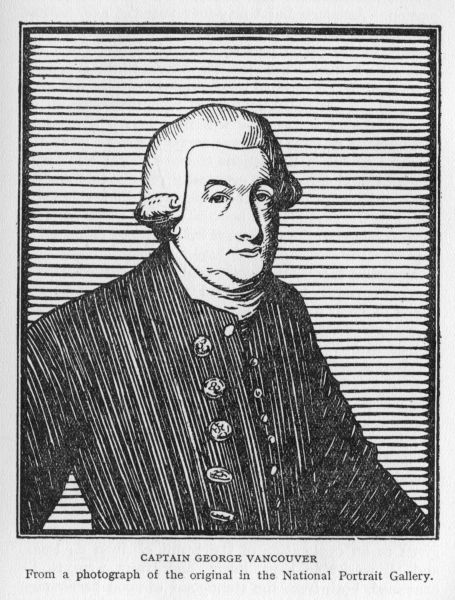
That has been eternally true; Vancouver was no exception. Although but thirty-four years of age, he had been almost continuously at sea for the preceding twenty years. In that time he had twice circumnavigated the globe. He had risen from the lowest rank to the command of a vessel, had associated with people of culture and good breeding, and in every nautical manner made himself an accomplished seaman. He was now to try a hand at geographical research; he was to be for some years the supreme arbiter of the actions of one hundred and forty-five men, and he was to eventually pit his wits against those of Don Quadra in far-off Nootka. Thus there was added to the expedition a political flavour which in small wise pertained to the voyages of his illustrious predecessor, Captain Cook.
Altogether it was an appointment which carried with it every opportunity for success and fame. But, as in all such affairs of men, it presented an equal number of chances where failure would be the considered verdict of his peers. Let us wish Vancouver "God-speed" as he embarks on his stout ship the Discovery.
With a fair wind to blow them down the Channel, the two vessels set sail from Falmouth on the 1st of April, 1791. Their voyage was to be a long one, southward the length of the Atlantic, round the Cape of Good Hope, across the Indian Ocean to Australia and the South Sea Islands, then northward to the Sandwich Islands, and thence eastward to the shore-line of the continent, which they were to follow closely and carefully examine from latitude 30° to 60° north. Particular attention was to be given to an exploration of the Strait of Juan de Fuca, and all navigable bays, inlets, and rivers were to be examined, both from the standpoint of good harbourage and trade as well as to once more slay that chimera of a north-west passage which seafaring folk would resurrect. Maps were to be made as the exploration proceeded, copies of which were to be forwarded to the Admiralty at {223} convenient intervals. Such were the orders given the commander in addition to those already mentioned.
As the Chatham proved to be in need of ballast, a stop of about a week at Teneriffe was made, and there fresh stores were taken aboard. Sailing from the Canaries on the 7th of May, the Cape Verde Islands were passed on the 14th, and on the 9th of July anchor was cast in False Bay, near Cape Town of to-day. Considerable time was spent at the Cape, replenishing stores and overhauling the ships preparatory to their cruise eastward. A start was made on the 17th of August, and after a very stormy passage the vessels rounded the southern part of Australia and put in at a small bay in longitude 118° 16' east.
Thursday, the 29th of September, 1791, opened bright and clear, a welcome sight after the days of rain, mist and fog which had been their lot almost continuously since leaving Africa. After a day spent in reconnaissance of the adjacent shores, it was decided to take formal possession of the lands recently seen. Let the journal of the voyage tell the story:
The necessary observations being made at this station, the British colours were displayed, and having drunk his Majesty's health, accompanied by the usual formalities on such occasions, we took possession of the country from the land we saw north-westward of Cape Chatham, so far as we might explore its coasts, in the name of his present Majesty, for him and for his heirs and successors. This port, the first which we had discovered, I honoured with the name of "King George the Third's Sound"; and this day being the anniversary of her Royal Highness Princess Charlotte Augusta Matilda's birth, the harbour behind point Possession I called "Princess Royal Harbour."
On Sunday, while making a more extended survey of the shores of the new harbour, Vancouver and his officers came to a point "where a small shallow stream of excellent water" emptied itself into the bay. "On tracing its meanders through a copse, it brought us to a deserted {224} village of the natives, amidst the trees, on nearly a level spot of ground, consisting of about two dozen miserable huts, mostly of the same fashion and dimensions with that before described."[5]
These were the huts of the primitive bushmen, true aborigines of the great Australian land. They were as a rule timid in the extreme, and seldom disputed the white man's occupation of the country. Their very simple mode of life was a constant wonderment to the early navigators, who examined their wattle huts with the greatest curiosity. Then in the narrative of the voyage there occurs the following bit of kindliness:
In one of the larger huts, probably the residence of a chief, towards which were several paths leading in different directions, some beads, nails, knives, looking glasses and medals, were deposited as tokens of our friendly disposition, and to induce any of the natives, who might, unperceived by us, have been in the neighbourhood, to favour us with a visit.
On Tuesday (4th October) having replenished the water casks, and taken on board a supply of firewood, Puget and Whidbey were despatched to Oyster Harbour with three boats, "for the purpose of hauling the seine, and obtaining a quantity of those shell fish, previously to our proceeding the following morning to sea." A heavy gale prevented the return of the boats until the next morning. It was found that, while the seine had yielded small results, the boatmen had secured several hundredweight of oysters. One can easily reconstruct the scene, the exclamations of delight on all sides, for there were {225} sufficient of these "delectable" shell fish (as Vancouver terms them) for several meals for the whole ship's complement.[6]
The weather would not permit of a resumption of the voyage until Tuesday (11th October), when the commander decided to weigh anchor and stand out to sea on the next stage of the voyage. For the ensuing twelve days an effort was made to keep the southern coast-line of the continent in view, but stormy weather caused Vancouver to abandon the attempt in latitude 35° 30' south, longitude 122° 40' east. To this point three hundred miles of new coast-line had been fairly well laid down. A commodious harbour had been found and bearings taken, so that in future ships passing this way could steer for the positions given on the new charts and be sure of a safe retreat from stress of wind and wave, or where repairs could be made in safety. Many a great and flourishing seaport of to-day owes its inception to the early enterprise of some wayfaring seaman, some Hudson, Cook or Vancouver, to first pilot the way in, describe its natural advantages, and then give to the world in journal form the result of his labours. These were the three great essentials, to seek, to find, to relate, and in no period of British exploration is this three-fold plan more successfully carried out than in the voyages of Cook and Vancouver.
As any true explorer would, Vancouver felt somewhat chagrined that he could not afford the time to continue his exploration of the southern coast of Australia on eastward, to that point where, on the charts of those days, Van Diemen's Land was marked. He wished to determine whether New Holland connected with or was separated from this Van Diemen's Land. In other words, the true extent of the Great Australian Bight was as yet unknown, and no one had determined the insularity of Tasmania. {226} However, this was not accomplished until 1798, when Mr. Bass, a surgeon of the British Navy, circumnavigated it.
On the 26th, the Discovery passed to the southward of Tasmania, the land lying on the northern horizon "6 to 7 leagues distant." The journal continues the story of the voyage in a clear-cut manner, and the following lines are given as written by Vancouver:
Having now a fine gale at N.N.E. we took two reefs in the topsails; shaped a course for Dusky Bay in New Zealand; and by signal to the Chatham appointed Facile harbour in that bay as the next place of rendezvous.
The dysentery, though nearly subdued on board both vessels, had left those who had been afflicted with it in a very feeble and reduced state; and not knowing of any place so easily within our reach, where such excellent refreshments could be procured with so much facility, together with timber for planks, spars, tentpoles, etc., etc., of which we stood in great need, I was induced to make choice of Dusky bay, notwithstanding the disadvantages it labours under from the great depth of water, and want of anchorage in its entrance.
A favourable wind, attended in general with tolerably fine weather, varied between the N. and W., and afterwards between the W. and S. with fresh gales, until Wednesday the 2nd of November; when about nine in the forenoon we were brought within sight of the coast of New Zealand, bearing by compass E.N.E., 12 or 14 leagues distant.
And that evening, about nine o'clock, the vessels had entered Dusky Bay, and stood anchored in the arm leading into Facile Harbour.
While making a reconnaissance of the harbour the next morning in the small boats, a strong gale came up, and the Discovery began to drift out into the broader reaches of Dusky Bay. By five in the afternoon the wind had increased in violence, and one squall carried away some of the top hamper and split the staysail on the fore-topmast.
It was exceedingly fortunate [writes the captain] that we had Anchor Island Harbour to leeward of us, for which we immediately steered; and running in by the western entrance, {227} anchored at the mouth of the cove in 26 fathoms, soft muddy bottom; and after veering to half a cable, our stern was in 13 fathoms water, about 40 yards from the island that lies at the bottom of the cove. The ship was steadied by hawsers, from the bows to the points of the cove, and from the quarters to the trees on each side. The gale increased during the night; and it became necessary to strike the lower yards and top-gallant masts. Our apprehensions for the safety of the Chatham were not relieved until, by rowing over to the Petrel islands, the next forenoon, Friday, the 4th, and by walking across the land, we had the happiness to see her ride in perfect safety; but as she was directly to windward, and the gale continued to increase, Mr. Broughton was unable to get on board. Satisfied with the security of her station, we returned to the Discovery, when the violence of the gale from the N.W. obliged us to strike the topmasts, it not being in our power to veer more cable, or allow the ship to drive, without her being on the rocks astern; of which, even with these precautions, we entertained some fears, although in a situation perfectly landlocked, and the weather shores not more than five cables' length distant. The violence of the gale still continuing, the small bower anchor was dropped under foot. In the evening the wind moderated a little, which seemed to be for the sole purpose of acquiring and returning with new vigour, as, by two on Saturday morning the 5th, the gale increased to so violent a storm, as to oblige us to lower the top-masts close down to the cap, and to get our yards and top-gallant masts fore and aft on the deck. From five o'clock until eight it blew a perfect hurricane, attended with torrents of rain. We were happily in a very snug, secure little harbour, yet the sea beat with such unremitting violence against the rocks immediately astern of us, that had either the anchor or cable given way, little else but inevitable destruction must have followed. Our anxiety was infinitely increased by our solicitude for the welfare of the Chatham; but as the storm with us at N.W. by W. was directly from off the high land under which she rode, we comforted ourselves with the hope she might not experience its fury to the degree it affected us. About nine a most tremendous gust caused the ship to roll excessively; this was immediately followed by a flash of lightning and a heavy crash of thunder, which broke up the storm, and in the space of {228} half-an-hour, the weather might be considered, comparatively speaking, as fair and pleasant.
Mr. Broughton had the pleasure of finding that the Chatham had ridden out the gale in perfect security.
It will readily be seen from the account just given that cruising strange shores far from the haunts of civilised communities has its hours of intense anxiety. A parting cable, and a great ship, the home of a hundred men, is dashed to pieces. Only the greatest watchfulness, care and foresight could bring the expedition through the perils and vicissitudes of the next three years.
While general repairs were going forward the officers of the two vessels made up a large party for the purpose of exploring the far upper reaches of Dusky Bay. This part of the bay had not been visited by Captain Cook, who had jocularly called it "No Body Knows What." The 13th, 14th and 15th were spent in this pleasant manner and upon their return to the Discovery Vancouver makes the following entry: "The heads of these Arms, in conformity with Captain Cook's name of their entrance, I have called 'Some Body Knows What.'" Rather elephantine humour for so small a subject! The native Maoris, who had been present in fair numbers fifteen years previously, were no longer in evidence. The bay and its environs seemed to have been long deserted.
It was not until the 22nd that a favourable breeze permitted the vessel to stand out to sea. In summing up his impressions of Dusky Bay, the captain makes the following remarks which may not be out of place if literally transcribed:
Thus we quitted Dusky bay, greatly indebted to its most excellent refreshments, and the salubrity of its air. The good effects of a plentiful supply of fish, and spruce beer were evident in the appearance of every individual in our little society. The health of our convalescents was perfectly re-established, and excepting one with a chronic complaint, and two wounded by cuts in their legs, we had not a man on the {229} surgeon's list; though on the most trifling occasion of indisposition, no person was ever permitted to attend his duty....
No time should be lost on arriving in this bay, to seek security in some of its harbours: which, as Captain Cook truly observes "are numerous, safe, and convenient." For although the weather we experienced after the storm on our arrival, may justly be considered as delightful weather, yet it cannot be denied that the northerly winds blow with incredible fury.... This was my fifth visit to New Zealand and its neighbourhood; and although I have certainly seen much boisterous and tempestuous weather, I never before contended with so violent a storm.
Rounding the Snares[7] a course was laid to bring the Discovery to Matavai Bay, the next port of rendezvous: the Chatham having been lost sight of in a violent storm soon after leaving Dusky Bay, it was presumed she would make the best of her way to Tahiti, and no time was lost in vainly searching for her in the waste of waters which lie south and east of New Zealand. This proved to be a wise course, for, after a rather uneventful voyage, the Discovery made Matavai Bay on 30th December (1791) and to the great relief of the captain, discovered the Chatham swinging safely at anchor in the harbour. Lieutenant Broughton was pleased to relate the discovery of an island to which he gave the name of his vessel.[8] It was found that the Discovery had passed about thirty leagues to the north of Chatham Island, that Captain Cook in 1777 had done the same, while in 1773 he had passed a similar distance to the southward. In view of these circumstances, Broughton was indeed delighted with his lucky find.
The month of January was spent by the officers in a round of social functions, entertaining visiting chieftains, making presents and receiving such food products in return as the islands of this group provided. The other members of the crews were busily engaged in a general refit and {230} overhaul of the vessels, getting them ready for the voyage northward to the coast of New Albion and Nootka Sound. On the 24th the vessels set sail, bidding adieu to the friendly inhabitants of the Society Isles. Sunday, 12th February, the line was crossed, and on the first of the next month, Owhyhee came in sight. The entrance to Karakakooa Bay was seen as the vessels passed up the coast. But no one on board had any desire to again visit that ill-fated spot. For the previous six years the fur trader had been making of the Sandwich Islands a winter stopping place, and at other times a convenient half-way house on his return from the North-west coast of America to China. Evil deeds had been done, the natives had secured firearms and now looked on each and every ship as fair prey. Civil wars among rival chieftains still further complicated the situation. To Vancouver and the members of the expedition came rumours of the changed temper of the islanders, and it was resolved to find harbourage {231} at one of the smaller western isles. The vessels were accordingly brought to in a small bay[9] on the south side of Atooi Island.
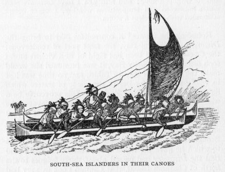
The 16th of March (1792) found both the Discovery and the Chatham, with stores aboard and minor repairs completed, steering a course for their ultimate destination. From a perusal of the journal of the voyage one would gather that it was with small regret that the whole ships' company saw the volcanic peaks of Atooi sink down on the south-western horizon. In case of separation of the vessels by storm, Barkley Sound had been set as the next place of rendezvous, but while the ships kept together it was Vancouver's intention "to fall in with the coast of New Albion as far to the southward of that station as circumstances would permit." Thus four weeks passed by in the usual way of vessels at sea: days of sunshine and clear sparkling weather, succeeded by days of mist, fog and rain. As they were now (17th April) approaching the continental coast in latitude 40° north, the thick weather and the intermittent gales made it very necessary to observe the greatest precautions. For on that long stretch of coast-line from San Francisco Bay north to Barkley Sound no safe harbourage was shown on the maps of that day.
Soon quantities of driftwood, grass, sea-weed, as well as numbers of ducks and other aquatic birds, gave every indication of land near at hand, "although," as Vancouver remarks, "we were prevented seeing any object more than three or four miles distant, by the weather, which had become very thick and rainy. Being anxious to get sight of the land before night, if possible, we stood to the eastward with as much sail as we could carry, and at four in the afternoon reached soundings at the depth of 53 fathoms, soft brown sandy bottom. The land was now discovered bearing by compass from E.N.E. to {232} E. by S. at the distance of about two leagues, on which the surf broke with great violence. We stood in for the shore under our topsails for about an hour, and perceived the coast to extend from N. to S.E. The nearest shore was about two miles distant. The rain and fog with which the atmosphere was now loaded, precluded our seeing much of the coast of New Albion. The shore appeared straight and unbroken, of a moderate height, with mountainous land behind, covered with stately forest trees.... During the night we plied under an easy sail, in order to be near the land the next morning (the 18th)."
A gentle breeze from the south now wafted our sailors on their northward journey up the coast. Let the journal tell its own story for a space that we may get again the flavour of those long gone first impressions:
The weather was delightfully pleasant; and as we drew nearer the land, the shore seemed to be perfectly compact, formed, generally speaking by cliffs of a moderate height and nearly perpendicular. The inland country, which rises in a pleasing diversity of hills and dales, was completely clothed with forest trees of considerable magnitude;[10] and those spots which, on our first view, had the appearance of having been cleared of their wood by art, were now seen to extend, generally, along the sea-side; and their being destitute of wood, was evidently to be ascribed to some natural cause. They were beautifully green, with a luxuriant herbage, interrupted by streaks of red earth.... In the afternoon we passed Cape Mendocino.
Continuing their northward cruise along the coast, the 25th brought them abreast of Cape Blanco. Vancouver remarks upon the conspicuous nature of this cape when seen from the north, "being formed by a round hill on high perpendicular cliffs, some of which are white, a considerable height from the level of the sea."
{233}Two days later the Discovery approached the vicinity of Cape Disappointment and the mouth of the great Columbia River. To the men on the ship, however, there seemed little to cause concern or excite curiosity. Vancouver notes that to the south of the cape "was the appearance of an inlet, or small river, the land behind not indicating it to be of any great extent; nor did it seem accessible for vessels of our burthen, as the breakers extended from the above point two or three miles into the ocean, until they joined those on the beach nearly four leagues south." But such an occurrence is often the very sign and indicator of the mouth of a large river, a river so large that it has deposited its load of silt and sand far out beyond the shore-line, forming bars upon which the waves break with tremendous fury.
Again quoting from the next paragraph, "The sea had now changed from its natural, to river coloured water; the probable consequence of some streams falling into the bay, or into the ocean to the north of it, through the low land." This would of course indicate a stream or streams, but the extent of the discoloration must surely have been some guide to the size of the river which produced it. It would seem that Vancouver had failed to associate three things, the great extent of the line of breakers, the extent of the discoloration of the sea adjacent, and, lastly, the extent of the continental mass along which he was then sailing.
Had the entrance to the river presented any clear-cut channel, Vancouver would doubtless have sailed in, in quest of the harbourage which he was now anxious to secure, but if such had been the case, Meares would have made the discovery in 1788 when he examined these very shores for a possible opening whereby to prosecute his trade in furs. Meares was afraid to venture within the line of breakers as stormy weather prevailed at the time. No such excuse can be held out in Vancouver's case. Vancouver has been blamed, and to a large extent with {234} justice, in failing to find the mouth of the Columbia. It is useless to try to gloss over the facts as they stand; it is silly to expect or to seek to establish perfection in any character. Rather let us accept the records and if censure is due, give it as readily as the praise for work that has been well done. The name of the river bears eloquent testimony to the ship[11] and to the captain who did brave the line of breakers and who did find an opening through them and who led the way to the calm broad reaches of the mighty river. May we close the incident with the following sentence from Vancouver's journal: "Not considering this opening worthy of more attention, I continued our pursuit to the N.W., being desirous to embrace the advantages of the prevailing breeze and pleasant weather, so favourable to our examination of the coast."
Sunday morning, 29th April, 1792, found the expedition a few miles to the southward of Cape Flattery. Here a vessel was seen standing in shore and all hands crowded the decks to view the stranger. It had been eight months since the members of the expedition had seen another ship.
"She soon hoisted American colours, and fired a gun to leeward. At six we spoke her."
Vancouver at once sent Lieutenant Puget and Mr. Menzies on board to interview the captain. They returned with the information that Gray was then on his way south from Clayoquot on a trading venture, that some time previously he had been for nine days off the mouth of a large river in latitude 46° 10', but had been unable to enter because of the strong outset of the current. And it may be in order here to relate that just twelve days[12] later Gray found his way into the great river which had baffled all other attempts, and that he named it the Columbia, after the name of his ship.
[1] 1789.
[2] Thames River.
[3] London.
[4] Captain Rogers was on duty in the Mediterranean.
[5] "The shape of the dwelling was that of half a beehive ... in height about three feet, and in diameter about four feet and a half; it was however constructed with some degree of uniformity, with slight twigs, of no greater substance than those used for large baker's baskets.... This kind of basket hut was covered with the bark of trees and small green boughs; just within its front, which was open the whole of its diameter, a fire had been made."
[6] The preceding is related merely to give a view of a few days spent in entirely new surroundings, in a hitherto unknown bay, by a ship's crew of 1791.
[7] Discovered by Vancouver on this voyage.
[8] Chatham Islands, S. latitude 43°, longitude 183° E.
[9] Whymea Bay.
[10] Vancouver was quite accurate in his observations. He saw the southern part of the great fir forest of Oregon, Washington and British Columbia. The "magnitude" of the trees is remarkable even in this day of many wonders.
[11] The Columbia, Captain Robert Gray, of Boston, who had been for some years trading out of Nootka.
[12] 11th May, 1792. Meany, p. 35, says, "This discovery had most of all to do with giving the Americans a standing among the powers contending for sovereignty on the Pacific Coast."
We enter the Strait of Juan de Fuca and complete the circumnavigation of Vancouver Island.
The Discovery then continued on her course with the Chatham in the lead, and keeping as close to the shore as possible because of the thick rainy weather, the projecting and conspicuous promontory of Cape Flattery was soon in view. This name had been given by Captain Cook on his voyage along these shores in 1778, but, being overtaken by a gale shortly after sighting the promontory, he had stood out to sea and when he next sighted land was many leagues to the northward, thus passing the entrance to the strait, whose existence he denied.[1] Other navigators since that time had penetrated the strait for some distance, but none had made any accurate or complete survey of the great inland waterways that we now know as Puget Sound and Gulf of Georgia.[2]
A little after noon of the 29th Vancouver rounded Tatooche Island and coasted the southern or mainland shore for some distance, anchoring for the night about eight miles within the entrance. The following day {236} the voyage was continued: "Every new appearance as we proceeded, furnished new conjectures." In this delightful state of mind the day wore on. In the afternoon "a high conspicuous craggy mountain, bearing by compass N. 50 E., presented itself, towering above the clouds: as low down as they allowed it to be visible, it was covered with snow." This mountain was first seen by the third lieutenant and in compliment to him was named Mount Baker.
Anchoring for the night again, the spit of land which gave them shelter was named New Dungeness "from its great resemblance to Dungeness in the British Channel." The next day, May Day, was spent in exploring the near-by coast in the cutter and yawl for a supply of fresh water, and a comfortable berth where the ships could be overhauled.
But this was no easy task. From Cape Flattery to New Dungeness no suitable harbour had been found, behind a regular coast-line towered the great snow-clad range of the Olympics, their peaks gashed and torn by the winter's avalanche, while up their broad base from the very shore itself crept the blue dense forest. However, as the day wore on the boatmen came to an island, and behind it there opened into the land a safe and commodious harbour. Here a stream of clear cold water came dashing down from the mountain to pour its silvery flood into the quiet waters of the bay.
Vancouver and his men were delighted with the port they had discovered. It suited their every purpose, and it was decided to bring the ships in at once. To the island they gave the name "Protection Island" for, as Vancouver remarks, "Had this insular production of nature been designed by the most able engineer, it could not have been placed more happily for the protection of the port." The harbour itself was named, after the captain's ship, Port Discovery. This was the first safe and ample harbour which Vancouver had been able to locate in all that stretch of coast from parallel 40° north to the {237} termination of Cape Flattery and along the southern shore of the Strait of de Fuca.
The vessels were now in need of a complete overhaul and refitting. The temporary repairs made at the Society Islands had served their purpose admirably, but if a final exploration of the waterways which lay spread to the east and north-east was to be made with any degree of care, the Discovery and the Chatham must be put in as good a state of repair as the skill of the crews would provide. In fact no small measure of the discoveries of the next three months must be attributed to the condition of the vessels as well as to the rested and healthy condition of the men who composed the crews.
The ensuing weeks were therefore filled with the ordered activities of a general overhaul. The vessels were anchored in Port Discovery close to the outfall of a stream of pure water. By afternoon a gang of men were at work making a clearing along its bank, while others landed the tents, observatory and other instruments. It was indeed a busy scene, that next morning the 3rd of May, 1792. On shore the sailmakers were already repairing and altering the sails; coopers were inspecting the casks, the gunners airing powder, while small parties were cutting wood, brewing spruce beer, and filling the sound, but empty, water casks. On board, others were as busily employed in necessary repairs about the rigging; "getting the provisions to hand; clearing the main and after holds for the reception of shingle ballast, of which we had for some time stood in much need; some of our carpenters were stopping leaks about the bows, and the rest assisted in caulking the Chatham's sides." Vancouver makes further entry in his journal regarding the serenity of the climate and season as one extremely favourable to the execution of their several duties; and that Port Discovery being nearly destitute of inhabitants, few circumstances occurred to divert their attention, or interfere with the pursuits in which they were all engaged.
After four days spent in the general oversight of these {238} activities, and with everything well under way, the captain decided to take the yawl, launch, and cutter on a trip of exploration to the eastward. Provisions for five days were stowed away in each boat, the men were armed, and on the morning of the 7th the little flotilla passed out by the south-east of Protection Island and began their little voyage into the unknown. Noon brought them to a new inlet, even larger and more commodious than Port Discovery. To this harbour Vancouver gave the name of Port Townsend, "in honour of the noble Marquis of that name." The night was passed camped on the shore; at daybreak the next morning the boats were manned and the trip of exploration continued. By noon the general survey of the port had been completed and the boats were following the coast-line in its great bend to the southward. Far to the north-east towered Mount Baker, in front and away to the south stretched the "snowy range" of the journal; and there, rising up as if to mark its southern-most termination, rose another giant rounded peak, which, after his friend Rear-Admiral Rainier, Vancouver distinguished by the name of Mount Rainier.
A strong ebb tide now delayed the progress of the boats in their southerly advance. To add to their difficulties, the fine weather gave way, about sunset, to a heavy rain storm. Still Vancouver persevered to reach a point of land which lay some distance ahead. By eleven o'clock he gave up the attempt, called in the launch and cutter by signal, steered for the nearest shore, "and landed about one in the morning, completely drenched." With some difficulty a fire was started, canvas was stretched, and the weary crews got what warmth and shelter they could. It may be remarked that exploring a coast-line in the ships' boats, while it gave a most accurate and complete idea of a coast-line, provided as well a sum total of hardship, misery and fatigue which few navigators were willing to undergo in person. Captain Cook had set a sterling example in always taking charge of one of his boats when {239} utilising them for such excursions. Vancouver had been well trained by the Master Mariner of his day. He, too, at great personal risk and discomfort, led many such reconnaissance parties. His early and untimely death at the age of forty may well be attributed to the exposure undergone during his determined and painstaking survey of the waterways and inlets while charting the extent of this western Mediterranean sea.
Oak Cove, as they termed their place of retreat, saw their enforced idleness during Wednesday the 9th, but daybreak of Thursday saw them again on their way southward, following the continental shore, the weather having moderated. Friday was spent in a similar manner, coasting slowly southward, at times impeded by the strong ebb tide, which forced them to land and await the flood. On Saturday the 12th, provisions began to run low. The few Indians met with had proved friendly enough, but had brought little in the way of barter. The boats had been provisioned for but five days when leaving Port Discovery; the sixth day had arrived and still the narrow inlet they were following wound its southern way between forest-clad slopes. The captain decided that the termination of the inlet must be discovered before returning. So much remained to be done that a return could not be contemplated.
In this mind then the cruise was pushed forward. Mr. Johnstone, in charge of the cutter, was detailed to the task of circling the inlet to its head, while Vancouver and Lieutenant Puget visited an Indian encampment. Upon Johnstone's return the whole party embarked on their return journey. They were now seventy miles from Port Discovery, and it behoved them to make a speedy return. But a head wind and approaching darkness caused a halt when but two miles had been covered. To the inlet which had just been explored Vancouver gave the name of Hood's Channel, after the Right Honourable Lord Hood.
It was the afternoon of Monday the 14th before the {240} expedition got clear of the canal, so slow was their progress. And no sooner was this accomplished than the uncertain weather descended in torrents of rain. Although camp was made in an endeavour to secure fair weather for the remainder of the homeward journey, the rain continued with no sign of abatement. In this situation, with provisions quite exhausted, it was decided to defy the elements, and the return to Port Discovery was safely completed on Tuesday the 15th, much to the joy of everyone: for there had been many misgivings by those left on board the ships when the exploring party had failed to return within the five-day limit that had originally been intended.
Vancouver found that during his absence the general repairs had been completed. The weather moderating, on the 18th the ships stood out of Port Discovery and followed for some distance the track of the small boats.
The Discovery was anchored on the afternoon of the 20th in a convenient cove near the point where Hood Canal branches off from the main continuation of what we know to-day as Puget Sound. It was the intention of Vancouver to now thoroughly explore this larger inlet in the ship's boats. Accordingly at four the next morning Lieutenant Puget and Mr. Whidbey left with the launch and cutter to complete the exploration. Provisions for a week were taken, and the officers were instructed to keep "the starboard or continental shore on board," thus linking up the new survey with the one recently completed by the captain himself. By the 30th this had been accomplished, and to the waterways discovered Vancouver gave the name of Puget Sound, in honour of the lieutenant, who had been in charge of the work. To-day the two large cities of Seattle and Tacoma grace its southern shores. More than a half-million people now reside upon the virtually uninhabited forest-clad slopes of the sound of 1792. Huge ocean-going ships ply its waters, engaged in the ever-growing trade of the north-western United States. {241} Little did Vancouver dream of so sudden and vast developments at the end of the ensuing century.
In like manner the eastern shore-line of the sound was explored. First the vessels were moved to a new station some leagues to the northward. Again the small boats were manned. Ever the growing charts disclosed new islands, new irregularities of coast, new inlets, and new bays.
Monday the 4th of June was celebrated in the best style that the ships' simple menu provided. A good dinner was served the crew "with a double allowance of grog to drink the king's health, it being the anniversary of His Majesty's birth." This simple entry in the journal of the voyage is not without its deeper meaning. It bespeaks the loyalty of the seamen of that day to their flag and to their country. Far from home, on the far side of the world, they stop to "drink the king's health," to the end that they pledge themselves anew to the land of their birth, and to those ideals for which that land stood among the nations of the earth. The ceremony loses nothing in being carried out under such strange and unusual surroundings; rather is the rite stripped of all worthless and obscuring dross and stands out in all its clear and admirable intent.
That same day, Vancouver and Broughton went ashore, "and under the discharge of a royal salute from the vessels," took possession of the land of New Albion; and to the great "interior sea," a portion of which had now been thoroughly explored and charted, Vancouver gave the name of Gulf of Georgia.
The vessels were now at anchor near the present site of Everett, and the next day the northward exploration was continued. Whidbey Island was discovered by the master of the Discovery while in charge of the cutter. A new station for the vessels was secured just below the present Point Roberts, and on the morning of the 12th of June, Vancouver and Puget set out in the yawl and launch to {242} prosecute their discoveries, as they said, "up the main inlet of the Gulf."
During the afternoon the boats found themselves entering the shoal waters which lie to the north of Point Roberts. Edging off into deeper water and continuing northward up the gulf, evening found them pretty well in the middle of the channel, which here separates the mainland from Vancouver Island. At no point had the yawl or the cutter been able to approach within four or five miles of the low-lying distant eastern shore. The explorers noted the partially submerged sand-banks, which here stretch far out into the Gulf of Georgia; they noted as well the serrated line of stranded fantastic stumps and driftwood which then as now dot the shallow waters of this particular bit of coast. But all unsuspecting of what these signs betokened, the huge accumulation of sand-banks and bars, the muddy discoloured water, the line of sentinel stumps, and with darkness descending, Vancouver decided to cross the fairway to the western shore and there find shelter for the night. In this wise the outlet of the greatest river between the Columbia and the Yukon was passed by in absolute ignorance of its immediate presence.
It is true that to this day one would look in vain to actually see the mouth or mouths of the Fraser. Nor would one think from the configuration of the mainland shore that here was the outlet to a drainage basin one hundred thousand square miles in area. But one sign was discarded, or at best left untried. If the water had been tasted, its slight saltiness would have quickly aroused the suspicion that here a stream of considerable magnitude must debouch from the hinterland of the snowy range visible along the distant eastern horizon. Then would the other signs have been read in their true significance. This was a common device among sailors of that day, and one which Captain Cook adopted when driven fifty miles from shore by the sand flats at the mouth of the Yukon. That navigator correctly recorded his belief that a mighty river poured {243} its waters into Bering Sea from the American continent, although unable to get close enough to shore to see a single channel or study the conformation of the immediate delta lands through which the Yukon flows. Vancouver has been blamed severely for his failure on this his second opportunity to discover one of the great rivers of western America, and it must be admitted in all fairness that he did show a rather consistent denseness in the reading of river signs. But while such may be recorded against him, it does not disqualify either his thorough and painstaking exploration of the Gulf of Georgia, nor the great detailed chart of the whole coast from California to Alaska which the expedition prepared upon its return to England. There are those who in a paragraph or two of biography give a miss a prominence and an emphasis out of all proportion to the true labour accomplished. Let us rather weigh that which was well and truly done against that which was omitted, and then give judgment.
In order that the reader may envisage the scene as Vancouver saw it, the following excerpts from his journal are appended:
[Leaving the Discovery] we proceeded [northward past Point Roberts], but soon found our progress along the eastern or continental shore materially impeded by a shoal that extends from Point Roberts N. 80 W. seven or eight miles, then stretches N. 35 W. about five or six miles further, where it takes a northerly direction towards the above low bluff point [Point Grey]. Along the edge of this bank we had soundings from ten to one fathom, as we increased or decreased our distance from the eastern shore; to approach which all our endeavours were exerted to no purpose, until nine in the evening, when the shoal having forced us nearly into the middle of the Gulf, we stood over to its western side, in order to land for the night, and to cook our provisions for the ensuing day, which being always performed by those on watch during the night, prevented any delay on that account, in the daytime. As we stood to the westward, our depth soon increased to fifteen fathoms, after which we gained no bottom until we {244} reached the western shore of the gulf, where, on our arrival about one o'clock in the morning, it was with much difficulty we were enabled to land on the steep rugged rocks which compose the coast, for the purpose of cooking only, and were compelled, by this unfavourable circumstance, to remain and sleep in the boats.
At five in the morning they were off again, and landed about noon on the low promontory to which Vancouver gave the name Point Grey. Standing there and looking backward toward Point Roberts, Vancouver remarks:
The intermediate space is occupied by very low land, apparently a swampy flat, that retires several miles, before the country rises to meet the rugged snowy mountains, which we found still continuing in a direction nearly along the coast. This low flat being very much inundated, and extending behind Point Roberts, to join the low land in the bay to the eastward of that point, gives its high land, when seen at a distance, the appearance of an island: this, however, is not the case, notwithstanding there are two openings[3] between this point and Point Grey. These can only be navigable for canoes, as the shoal continues along the coast to the distance of seven or eight miles from the shore, on which were lodged, and especially before these openings, logs of wood, and stumps of trees innumerable.
From Point Grey the boats proceeded northward along the shore. Crossing the mouth of what is now False Creek and rounding a high shoulder of rock, our sailors passed into a wide and spacious inlet. To this landlocked harbour Vancouver gave the name of Burrard's Channel, "after Sir Harry Burrard of the Navy." This inlet, as it is now termed, they followed to its head, and, as the shadows of evening stole over the placid waters, the boats were moored near the shore, about a mile and a half from the present site of Port Moody. The steep rocky cliffs at this point presented no favourable place for the tent, so the {245} crews were again by necessity compelled to sleep in the boats. However, it would seem that some of the "young gentlemen" preferred the stony beach to a second night in such cramped quarters. Carelessly selecting any convenient nook in the gathering darkness, no attention was paid to the line of high water, with the result that a few hours later they were rudely roused by the icy fingers of the incoming tide. One poor tired fellow slept on, "and might have been conveyed to some distance, had he not been awakened by his companions." One may readily imagine the raillery from those in the boats at the plight of the young fellows on shore, but soon the dawn brought all to their wonted tasks, and by four o'clock the boats were heading down the inlet and out into the gulf.
A great forest then spread from the shores of the inlet and up the sloping hillsides. Fold upon fold, the higher hills and mountains were rolled in feathered green of stately Douglas fir and giant red cedar. A lumberman's paradise to be! But to Vancouver and his boatmen this presented no unusual sight, for from the far distant Cape Blanco to Cape Flattery, from Flattery to Puget Sound, the same great forest stretched away in vast immensity its dense and unbroken ranks.
But of all the inlets seen and to be seen, this particular inlet should have received the explorers' utmost consideration. Fate and a railway were one day to determine that Burrard's Channel should be a great harbour; that here Canada, spreading now from the Atlantic to the Pacific, should have her western gateway. It was indeed a fitting climax to give the name Vancouver to the city which proudly rose from the slashed and retreating forest along the shores of Burrard's Channel. Sleeping in open boats, awake and away at dawn, ever pushing on from one inlet to the next, taking observations and making charts of each headland, bay and channel, those days of hard endeavour and often dreary labour were to have as magnificent a reward as posterity could well provide.
{246}In the days that followed, Howe Sound was explored and named. As this sound proved to be of large extent, and heavy rains occurred to delay their progress, it was Saturday the 16th before the boats were clear of Point Gower and coasting northward along the gulf shore. In this wise they passed Thormanby Islands, entered Malaspina Strait and saw the shores of Texada Island rising to the westward. The night was spent at the entrance to Pender Harbour. The ensuing three days were occupied in a thorough exploration of Jervis Inlet, when dwindling provisions warned them it was time to return to the ships, from which they were now distant a good hundred miles.
In this wise, while rowing "for Point Grey, purposing there to land and breakfast, we discovered two vessels at anchor under the land ... on a nearer approach it was discovered, that they were a brig and a schooner, wearing the colours of Spanish vessels of war, which I conceived were most probably employed in pursuits similar to our own; and this on my arrival on board was confirmed." The strangers proved to be the brig Sutil, commanded by Don Galiano, and the schooner Mexicana, in charge of Don Valdes. They had sailed from Acapulco the 8th of March, arriving at Nootka the 11th of the following month. The 5th of June had seen them on their way to continue the explorations of Quimper and Eliza of 1790-91. Vancouver remarks that he "experienced no small degree of mortification" in finding that others had preceded him in the exploration of these waterways. However, when he was accorded an opportunity of examining the charts which the Spanish officers had prepared, courage and hope returned. These charts showed that while the general outline of the Strait of Juan de Fuca and Gulf of Georgia were properly delineated, there had been no attempt to examine the many inlets and bays, whose exploration and charting had meant so many weary hours and days in the small boats. Hood Canal, Admiralty Inlet, Puget Sound, Burrard Channel, Howe Sound and Jervis Inlet—none {247} of these appeared on the Spanish chart. It was also noted that the farthest limit of the Spanish explorations extended but to the north end of Texada Island, a few miles beyond Vancouver's recent boat trip to Jervis Inlet.[4]
The Spaniards proved to be most friendly and hospitable. They eagerly embraced an opportunity to join forces with the British expedition in prosecuting the northward exploration of the gulf, and the determination, if possible, of any navigable channel connecting with Queen Charlotte Sound. On the afternoon of the 24th of June the little flotilla set out upon the next stage of their adventures.
In which the insularity of Vancouver Island was first definitely established.
Passing through Malaspina Strait, Harwood's Island and Savary Island were discovered and named. Vancouver then selected a suitable anchorage within the entrance to Desolation Sound, and several days were spent by the small boat parties examining the indentations of the coast in this locality, as well as the numerous islands which {248} fringe the shore and provide a bewildering array of connecting channels. From this station the exploration of Malaspina Inlet, Lewis Channel, Bute Inlet and Sutil Channel were carried on.
On 5th July, Mr. Johnstone was again despatched in one of the small boats, with a week's provisions, to continue the exploration of the channel which extends beyond the mouth of Bute Inlet—the Cardero Channel of to-day. In the meantime, Lieutenant Puget returned from an exploration of the western side of the gulf and reported having penetrated an inlet (Discovery Passage) which he had followed for some fifteen miles, finding it to become more extensive as he progressed and to be without any apparent termination.
Everything pointed to the finding of a passage to Queen Charlotte Sound. Either the inlet of unknown termination, partially explored by Lieutenant Puget, would prove to be the desired passage, or the course now being followed by Mr. Johnstone. This man had proved himself to be of excellent service on trips of such a nature, and high hopes were entertained that he would succeed in unravelling the maze which confronted the expedition. Even a casual glance at a map of this region will show the difficulties which Vancouver was encountering. The broad gulf had narrowed to two widely separated channels, or to put it another way, the gulf had become choked with islands. It will be admitted that only by a thorough testing, such as Vancouver had instituted, could a navigable passage be found from among the many which presented themselves. And it was just that element of persistent, careful, methodical search which we have already remarked upon that led to the success of the expedition and added much renown to Vancouver.
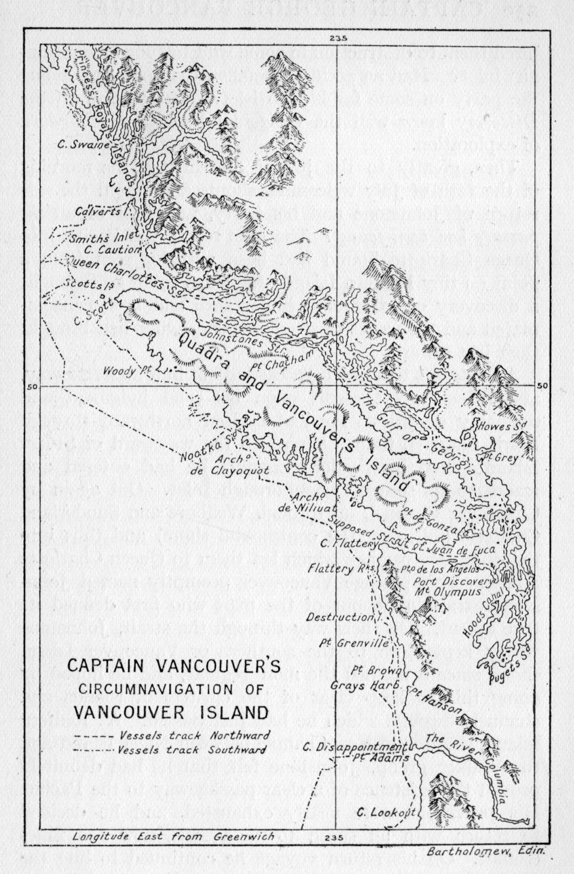
But what had become of Johnstone and his party? Days passed; a week dragged by. Still no sign of the launch. Vancouver wrote in the journal: "I began to be anxiously solicitous for their welfare." Had treacherous Indians {250} lured them to destruction in some wild tortuous mountain-girt inlet? Had an accident befallen the boat, marooning the party on some far hidden islet? The officers on the Discovery knew well the dangers inherent in this work of exploration.
Then, greatly to the joy of all, early in the morning of the 12th of July welcoming shouts announced the safe return of Johnstone and his party, and best of all the passage had been found! The blue roll of the Pacific into Queen Charlotte Sound had been actually seen from a point on tiny Redfern Island; the ships could go through; a discovery of paramount importance had been consummated and the weeks of strenuous endeavour had brought their just reward.
Johnstone's trip had been carried out in a masterly way, and reflects great credit upon his good judgment and seamanly qualities. He had cruised northward through Lewis Channel, Calm Channel to the westward of Stuart Island; then by Cardero Channel he had entered and traced to its source Loughborough Inlet. Out again by Chancellor Channel, up through Wellbore and Sunderland Channels (following the continental shore) and thus into the wide free passage which led them to Queen Charlotte Sound. This passage Vancouver promptly named Johnstone Strait in honour of the man who first defined its true extent. On their way through the strait, Johnstone wisely kept close to the southern or Vancouver Island shore, since it seemed the more regular, and he hoped by doing this to keep clear of the clusters of islands and channels through which he had just passed. At Redfern Island, situated in New Channel between Nigei Island and the Walker group, Johnstone felt that he had definitely proved the existence of a clear passageway to the Pacific. His provisions were nearly exhausted, and he decided to return with all speed to the vessels, now 120 miles distant. On his return voyage he continued to hug the southern or Vancouver Island shore. He passed by the {251} entrances to Sunderland and Chancellor Channels, and continued on to the vicinity of Chatham Point, where he branched off by Nodales Channel and thence by Cardero and Lewis Channels to the Discovery's station in Desolation Sound.
Johnstone reported that the navigation of the ships past Stuart Island would be very difficult. But Vancouver was now able to connect up the exploration of Lieutenant Puget, via Cape Mudge, with the southernmost point reached by Johnstone,[5] and it was at once decided to try the southern passage into Johnstone Straits as the one presenting the easiest route to the Pacific.
Accordingly preparations were begun to move the ships. The Spanish captains now begged to be excused from further participation in the venture; the exacting work in small boats evidently did not appeal to them. The Discovery and Chatham were got under way, and, crossing the gulf, rounded Cape Mudge and passed up the inlet, anchoring for the night in Menzies Bay. On the afternoon of the 15th the ships were navigated through Seymour Narrows and the next day proceeded past Chatham Point into Johnstone Strait. Thurlow Island now received its name, and the vessels sailed slowly up the strait, anchoring from time to time to hold their position against the strong tide which rushes in from the sound to the westward.
Late on the evening of the 19th the Discovery cast anchor near the Indian village at the mouth of the Nimpkish.
From time to time in his exploration and delineation of the New Albion coast-line, Vancouver had encountered Indian villages which ranged all the way from a few deserted hovels to populous, well-arranged, and orderly {252} village communities. This village proved to be the largest and, in many respects, the most interesting of those which he had as yet visited, and the captain spent several hours strolling from house to house and noting with a keen eye the homely tasks of the inhabitants. The following account abridged from the journal seeks to portray the scene as Vancouver saw it, as well as carry across the intervening years to us the flavour of old romance and the strangeness of an almost vanished stone-age civilisation. Let us, then, enter the cutter, together with Mr. Menzies and several of the young gentlemen, and be rowed ashore; upon landing:
The Ty-eie, or chief of the village, paid us an early visit, and received from me some presents which highly delighted him. I understood his name to be Cheslakees.... On inquiring if Maquinna[7] was at the village, he answered in the negative, saying they seldom visited; and that it was a journey of four days across the land to Nootka Sound.
Accompanied by some of the officers, Mr. Menzies, and our new guest, Cheslakees, I repaired to the village, and found it pleasantly situated on a sloping hill, above the banks of a fine freshwater rivulet, discharging itself into a small creek or cove. It was exposed to a southern aspect, whilst higher hills behind, covered with lofty pines, sheltered it completely from the northern winds. The houses, in number thirty-four, were arranged in regular streets; the larger ones were the habitations of the principal people, who had them decorated with paintings and other ornaments, forming various figures, apparently the rude designs of fancy, though it is by no means improbable, they might annex some meaning to the figures they described, too remote or hieroglyphical, for our comprehension.... The whole, from the opposite side of the creek, presented a very picturesque appearance.
The houses were constructed after the manner at Nootka, but appeared rather less filthy.... Several families lived under the same roof; but their sleeping apartments were separated, and more decency seemed to be observed in their domestic economy, than I recollected to be the practice at {253} Nootka. The women were variously employed; some in their different household affairs, others in the manufacture of their garments from bark and other materials, the fabrication of mats for a variety of purposes, and a kind of basket, wrought so curiously close, as to contain water like an earthen vessel without the least leakage or drip, comprehended the general employment of the women, who were not less industrious than ingenious....
At the conclusion of this visit, we were entertained at the house of an elderly chief, to whom Cheslakees, and every other person paid much respect, with a song by no means unmelodious.... The song being finished, we were each presented with a strip of sea-otter skin; the distribution of which occupied some time.
In this manner Vancouver and his companions spent a pleasant hour ashore, visiting the natives, giving and receiving presents, and quite enjoying a ramble amid such pleasant surroundings. Even Indian aborigines were interesting after a fortnight on ship in Desolation Sound. The effect of the fur trade along the west coast of the island was already shown to have reached the inland waterways in the increased value the Indians put on their furs. The sea-otter skin was still the most prized of all the furs in their possession, but they would no longer part with them for a few hawk's bells, or a handful of beads. The Indians were now most eager to secure firearms and ammunition. When they found that the English refused to trade muskets for furs, their interest waned, and it was with difficulty any other article could be found which the Indians desired. In 1785 probably not one musket was possessed by any Indian living on Vancouver Island. It was now 1792. What a change in seven years!
On Saturday the 21st, the Discovery was moored across the strait and anchored close to the shore of Hanson Island. Here Vancouver awaited the return of the Chatham, which had been engaged on a trip of exploration along the continental shore to the northward of this point. The ensuing week proved to be most irksome, lying at {254} anchor awaiting the Chatham's return. It was not till the afternoon of the 27th that Lieutenant Broughton arrived in his cutter. He reported the exploration of those waterways known to-day as Havannah Channel, Call Creek,[8] Chatham Channel,[9] and Knight Inlet;[10] thence he had passed into Queen Charlotte Sound by way of Tribune Channel and Fife Sound and then southward to the rendezvous at Hanson Island.
The next day the Discovery, together with the Chatham, were navigated northward to Fife Sound, and on the succeeding day anchored under Deep Sea Bluff, which separates Tribune Channel from Simoon Sound. As this was the last point on the mainland seen by Broughton, it was Vancouver's intention to carry on the exploration of the continental shore, northward or westward as the case might be, from this point. Though a tempting clear wide sound stretched westward from Hanson Island to the open Pacific, Vancouver was not to be turned aside from his inspection of the continental shore. He was evidently determined to follow every canal and inlet right to its head, and in this way let the shore-line lead him to the ocean. At no other time in his whole exploration of the Gulf of Georgia does the absolute stark determination of this master mariner stand out more clearly.
The small boats were now manned and set out on a survey of the new channels to the westward. In this manner, Kingcome Inlet, Sutlej Channel, Mackenzie Sound, Kenneth Passage, Grappler Sound, and Wells Passage were discovered, and their outlines laid down on the chart, which was gradually taking a form similar to that of to-day's map of the British Columbia coast. Vancouver returned to the Discovery on the 3rd of August, and at once ordered the ships moved to the western end of Wells Passage. Two days later the vessels were to be dimly seen creeping along the coast past Point Boyles. Fog and {255} haze obscured everything to the south and west, except from time to time a distant view of the Vancouver Island mountains.
In this wise progress was very slow, and the utmost caution was observed. Sunken rocks and dangerous reefs made their presence known merely by the swell breaking on them. For a time these were successfully avoided, but the haze which obscured everything at a half-mile's distance made it impossible to pick out a channel through the veritable labyrinth of rocks, islets, and reefs which infest the broad reaches of Queen Charlotte Sound. Despite every care, on the afternoon of the 6th the Discovery suddenly grounded on a bed of sunken rocks.
The Chatham at once anchored and sent her small boats to the assistance of her stranded consort. "The stream anchor was carried out, and an attempt made to heave the ship off, but to no effect." The situation was indeed one of extreme danger. As the tide fell the ship heeled over to starboard, and it was fortunate that the sailors had succeeded in getting down the top hamper before this occurred; otherwise the strain would have assuredly opened the seams, and the Discovery would have gone to the bottom with the next high tide. Spars and spare top-masts were used in a vain endeavour as props to hold the vessel in as upright a position as possible. While these things were under way, others began lightening her by emptying the water casks, throwing overboard the fuel and the stone ballast. By the time it was low water "the starboard main chains were within three inches of the surface of the sea," while the ship's forefoot "was only in about three and a half feet of water."
During this time the sea remained perfectly calm, and to this fact Vancouver attributed the salvation of the vessel. Everything had now been done that human ingenuity could devise. Through the midnight hours the sailors kept watch on deck and in the small boats which surrounded the stranded helpless vessel. But {256} gradually the Discovery righted with the flood tide. Another heave on the anchor and she slid off into deep water, amidst the cheers of the crew, and apparently none the worse for the mishap.
"After about three hours' rest, all hands were employed in the re-equipment of the ship."
By one o'clock in the afternoon the Discovery was again under sail, once again threading the intricate channels along the continental shore.
But they were no sooner clear of one danger than another arose to threaten the continuance of the voyage. At six that evening the Chatham grounded in a similar manner. Similar exertions by the crew, under the command of Broughton, resulted in the vessel being hauled off during the night, and with no appreciable damage to hull or rigging.
Two days later the vessels were navigated by a more southerly route out to sea between Pine and Storm Islands. Immediate dangers safely passed, anchorage was secured off the northern coast of Nigei Island, near the entrance to Bate Passage. While the vessels remained in this situation, awaiting the return of clear weather, all hands had a welcome opportunity to recuperate from their strenuous labours of the past week. And what were the feelings of the officers on this occasion?
On this point the journal is silent. We may, however, be permitted to suggest a most probable scene. In the chart room would be found the officers of the Discovery, with Lieutenant Baker adding the finishing touches to the great chart which he had begun after entering the strait at Cape Flattery. There were the deep inlets of Puget Sound, Burrard's Channel and Howe Sound, here were the recently discovered Johnstone Strait and Cheslakees Village. And there proven and known for the first time a great island had taken form. Then passed swift words of congratulation and even of thankfulness that this task had been safely, thoroughly, and honestly accomplished. It must have been a proud moment for one and all. {257} Each had given days of the most exacting labour in the small open boats that this feat might be a success, that the secrets of these inland waterways might be laid bare, and that one more bit of ocean shore might proudly bear the imprint of England's sailormen.
Through all there runs the quiet, steady, relentless determination of the captain to push on, to chart, to win through if passageway there be. Only with such a man to guide, a man of great patience and of great perseverance, could there have been a successful outcome to the undertaking. His qualities of leadership are further shown in the instant alacrity with which his men set out on the many "small boat" trips from the various stations, and the energy with which they pursued their objectives to and even beyond what was expected of them. The Spaniards turned back after a fortnight's association; the pace was too strenuous, the task too complicated for their limited strength. And as if to set its seal forever upon the months of hard endeavour, posterity has decreed that the great island should be honoured by the name of Vancouver, likewise the lusty city spreading along the southern shores of Burrard's Channel.
Now that so much had been accomplished, why not sail for Nootka and meet Don Quadra, who for several weeks had been impatiently awaiting the arrival of the British Commissioner? But this question evidently received scant consideration, for the journal is again quite silent on this point. Had Vancouver received secret instructions before sailing to make an extensive survey of the North American coast-line, not alone to chart its indentations, but to survey its commercial possibilities as well? It would seem so. Galiano and Valdes had acquainted Vancouver on 22nd June with the news of Quadra's arrival at Nootka in May.[11] It was now the 10th of August. Why keep Quadra waiting?
{258}The other possible solution is, that the recent discoveries had so fired the imagination of the officers of the Discovery and Chatham that they gladly relegated their Nootka meeting to that beautifully indefinite period of "sometime soon," and set about carrying on their exploration of the continental shore to the northward beyond Queen Charlotte Sound.
Whatever may have been the reasons which actuated him, Vancouver left his anchorage on the morning of the 10th, and with an easterly breeze and clear weather stood across the mouth of the sound for the entrance of Smith Inlet. The ensuing week was but a repetition of the activities carried on from a chosen station; small boat parties, more rainy weather, much suffering from wet clothes and cramped quarters. Smith Inlet, Rivers Inlet, Schooner Passage, Point Menzies, Fitzhugh Sound were explored and their sinuosities added to the great chart, which now recorded for the first time the correct continental coast-line of North-west America from latitude 39° 5' north to latitude 52° 18' north.
It was now Vancouver's expressed intention to remain on this coast and continue the exploration to the northward beyond Point Menzies until at least the middle of September, when the advent of fall and severe weather would of itself cause its abandonment. However, on Friday the 17th, a brig under English colours arrived off the entrance to Safety Cove. She proved to be the Venus, {259} of Bengal, Captain Shepherd, and recently from Nootka, now cruising the shores and inlets seeking sea-otter skins wherever they might be purchased.
From Shepherd, Vancouver learned that the store-ship Daedalus had arrived at Nootka with a full supply of provisions and general stores for the use of the British expedition. And by the way, that Senr. Quadra "was waiting with the greatest impatience to deliver up the settlement and territories at Nootka." (One would suspect as much.) But Shepherd also conveyed the startling news of the murder at Woahoo[12] of Lieutenant Hergest, the commander, Mr. Gooch, the astronomer, and a seaman, of the Daedalus. Vancouver was greatly affected by this intelligence. Hergest had been for years his intimate friend; while the services of a trained astronomer would have materially added to the efficiency of the official chart-making and coastal delineation.
[1] Beconner de Fuca had placed his strait between 47° and 48°.
[2] Captain Barkley, in the Imperial Eagle (1787), was the first to see the opening and suggest the possibility of its being the strait reputed to have been discovered by Juan de Fuca. The next year Meares (who had seen Barkley's papers) entered the strait a few miles. His published account in 1790 helped to fix the name Juan de Fuca to the strait. Captain Gray is also known to have penetrated a distance of fifty miles within Cape Flattery. These men were fur traders. Discovery and exploration were but incidental to their business.
[3] Undoubtedly the mouths of the Fraser. Vancouver was looking across the great river delta lands at the Fraser mouth.
[4] It must in fairness be remarked, however, that the Eliza Expedition of 1791 had read aright the signs at the mouth of the Fraser, and had bestowed upon it the name of Rio Blanca. However, neither Galiano nor Valdes had been able to locate the Rio Blanca. Evidently they were with Vancouver equally at a loss to solve the riddle of the huge sand-bank which lay between Point Grey and Point Roberts. One other matter may be noted in this connection; that upon leaving Point Grey on his way to rejoin the Discovery and Chatham, Vancouver purchased from the Indians some fine sturgeon of "from fourteen to two hundred pounds each." Now Vancouver and his sailors must have known that the sturgeon frequents the mouths and lower reaches of rivers. What perverse imp of darkness beclouded their vision and reasoning powers on this their second opportunity to locate the river's mouths! One may well exclaim, "All the more honour to staunch Simon Fraser of the Nor-Westers!"
[5] Chatham Point.
[6] An Indian name meaning "Welcome, noble stranger," is uttered Kaiser-Kesla. It may be that Vancouver understood the salutation to be the name of the chief of the village.
[7] The great chief of the Nootka Indians.
[8] Named Call Channel by Vancouver after Sir John Call.
[9] After Broughton's vessel.
[10] After Captain Knight.
[11] The text is as follows (Vol. II. page 211): "I likewise understood that Senr. Quadra, the commander in chief of the Spanish marine at St. Blas and at California, was, with three frigates and a brig, waiting my arrival at Nootka, in order to negotiate the restoration of those territories to the crown of Great Britain." This conversation took place on 22nd June, near Point Grey. Galiano and Valdes had arrived at Nootka 11th April, and had left Nootka the 5th of June on their voyage through the Strait of Juan de Fuca. The Spaniards it would seem were also curious about the size and importance of these inland waterways. If lands were to be given up, then it would be well to know what type of lands these were. If the lands should prove to be commercially valuable, then quibbles might be raised, a part might be given, a part retained. England's commissioner was in the same position.
[12] Oahu, one of the Sandwich (Hawaiian) Islands.
The Nootka news was most disquieting. Quadra impatient, the Daedalus under the temporary command of her master, Mr. New, Vancouver wisely determined to abandon any further exploration for that season, and to sail at once for Nootka. Two days later the vessels were navigated out to sea. On the 25th, Cape Scott was rounded, thick rainy weather having delayed their progress. Three days later the Discovery and Chatham anchored in Friendly Cove. A salute of thirteen guns was promptly returned by the Spanish batteries, and, upon landing, Vancouver and his officers were received "with the greatest cordiality and attention from the commandant," Don Quadra. And thus began that series of visits, of proposals and counter-proposals, which shall now occupy our attention for a space.
The next morning Quadra, accompanied by several of his officers, paid an official visit of welcome to the Discovery, while the remainder of the day was spent on shore, where the British officers were the guests of Don Quadra at a sumptuous repast. Vancouver describes it as "a dinner of five courses, consisting of a superfluity of the best provisions, [and] served with great elegance." In the light of subsequent events, it was evidently the desire of the Spanish commissioner to encourage the most friendly relations with Vancouver toward the end that he might the more readily persuade Vancouver to accept the proposals which the Spaniard must have had already well in mind.
The next day arrived an official communication from Don Quadra. It was written in Spanish, and, as Vancouver {261} had no understanding of that language, an interpreter must be found, someone who could translate the flowing periods of kingly Spain into the hard business terms of English. Then a searching and questioning: at last on the store-ship, the Daedalus, was found young Mr. Dobson, "who spoke and translated the Spanish language very accurately." Fortunate Vancouver: it would not do to admit defeat in the very opening skirmish for position; lucky Dobson: he will now reside on board the Discovery, he will enjoy his day of importance, it will make good telling in after years.
The communication and its accompanying documents proved to be quite lengthy. Quadra may have been impatient awaiting Vancouver's arrival, but he had been occupying his time to good advantage. He had sent out his vessels on reconnaissance voyages up and down the coast. (The Galiano and Valdes expedition was a result of his activities.) He had talked with traders, he had taken depositions, he had seen Gray of the Columbia. He had made a study of the history of Spanish exploration northward since 1774. He reviewed, in fact, in his letter, the Spanish side of the case from the day of John Meares and his Iphigenia down to the seizures by Martinez and after. And all to the purpose, so it would seem, of trying to obscure the main issue—to return those lands, buildings, etc., of which Meares was dispossessed in 1789. Quadra even advanced the claim that Meares had had no commercial establishment or building on the shores of Nootka other than a small hut, which was abandoned when the Iphigenia and North West America left to winter at the Sandwich Islands, and that said hut did not exist when Martinez arrived: that Meares bought no land from the chiefs of the adjacent villages, and therefore, this being the case, Spain had nothing to deliver up! When this is read in conjunction with the provisions of the Nootka Sound Convention in 1790, one sees the loophole through which the Don was trying to wriggle. He would save {262} the honour of Spain, if it could be done, even at the last minute. There would be no giving back of lands wrongfully seized. No lands had been purchased, therefore no wrong had been done: there was nothing to give back, Meares' building had disappeared.
Then to prove his magnanimity, to give largely where no compulsion existed, Quadra coolly proposed to cede, "without prejudice to the legitimate rights of Spain, the houses, offices and gardens, that had with so much labour been erected and cultivated."[1] Quadra would at once move his headquarters to Neah Bay, just within the entrance to the Strait of de Fuca (where a small party was already at work); and the English should in future confine their activities to the northward of Nootka and refrain from passing to the south of Cape Flattery.
But Vancouver was not to be led into any such "retrospective" discussion, and in his reply to Quadra very clearly stated his position in the matter. He requested the restoration by Quadra of "the buildings and districts, or parcels of land which were occupied by the subjects of his Britannic Majesty in April, 1789," quoting from Article One. In reply to the new pretensions of the extension of Spanish sovereignty northward to Cape Flattery, Vancouver quoted Article Five of the Convention (see page 210), and refused to consider Spanish pretensions to the west coast of North America as extending northward of San Francisco Bay. The day following the despatch of this letter, Vancouver and Quadra met on shore and, in a most friendly and informal manner, Quadra expressed (orally) his satisfaction in finding in Vancouver such a fine person with whom to transact the business of delivering up Nootka. He stated that he would, if agreeable to Vancouver, continue his residence on shore until the carpenters had finished some alterations to his brig. Then he would be pleased to accompany Vancouver southward, or he would sail and await Vancouver's arrival at either San {263} Francisco or Monterey. Quadra even enquired whom Vancouver proposed to leave in charge of Nootka. The Spanish storehouses were ordered cleared and he most graciously piloted Vancouver around the whole Spanish encampment, which was well built and of large size. The poultry would be left, some cattle would be presented. Quadra was most kind, most gracious. Yes, Lieutenant Broughton would be able to pass a very pleasant winter in charge of this large and well-ordered establishment. It was in truth a most tempting bait that the astute Quadra dangled in front of Vancouver and his officers. Quadra was playing upon these men, trying to arouse strong desires for immediate possession and the use of power in administrative capacity. Could he make Broughton an ally, maybe Vancouver would weaken. And so Sunday passed in pleasant conjecture and plans for the future.
Monday, the 3rd of September, Quadra breakfasted on board the Discovery: a trip was planned for the next day up the sound to pay a state visit to Maquinna. This would put the English on a friendly footing with the large Indian population of the sound. But that evening a further letter appeared from Don Quadra. What could this mean? Oh, possibly some minor point regarding the method of transfer. And the translation must wait; Mr. Dobson was ill. No matter, we will leave the letter, and go on our arranged trip to-morrow. This was done and throughout the next two days Quadra exerted himself to play the perfect guide and host. He requested that Vancouver select some port or island and name it after them both, "to commemorate our meeting and the very friendly intercourse that had taken place and subsisted between us." Vancouver met the overture in most generous fashion and wrote the name Island of Quadra and Vancouver on the great chart where now a large island had taken form.
A week passed before Mr. Dobson was able to make the {264} translation, and Vancouver was "not a little surprised" when he read that Don Quadra now proposed to restore the buildings and portions of land which in April of 1789 were taken possession of by Martinez, but that the "small hut" was not in existence when Martinez arrived and, too, the Spaniards did not now have their establishment even near the supposed location of Meares' shanty. And so, of course, there was nothing to restore. If, then, Vancouver could not agree to this statement of the case, Quadra recommended that each should lay before his respective government the circumstances of the negotiations to date, and await further instructions. In the meantime Quadra offered to leave Vancouver in possession of what Meares had once occupied, and at Vancouver's command, he would turn over the houses, gardens, and offices then occupied by the Spaniards.
It now seems perfectly apparent that the Spanish commissioner had no intention at any time to restore to Vancouver the lands in question. He would not be the one to lower the Spanish flag over Friendly Cove. If it must be done, some other agent could witness the passing of Spanish sovereignty; it would not be Don Quadra. To this end, every artifice of persuasion was used by attacking the justice of the Nootka award and then in quibbling over the existence of Meares' establishment. Every argument which could be devised was put forward in an effort to retain for Spain a large share of the Nootka region. While it is true that the Spanish commissioner maintained throughout a most courteous and friendly demeanour it is also true that he proved himself a master strategist in his conduct of the negotiations.
But the whole carefully laid scheme failed of its purpose in so far as it was hoped to dislodge Vancouver from his initial and correct standpoint. The captain of the Discovery very clearly and quite properly in his reply refused to trade the temporary possession of Nootka Sound for the acknowledgment by himself of {265} Spanish rights of sovereignty to the coast of North America from San Francisco Bay to the Strait of de Fuca. Vancouver did agree to transmit to London the results of the negotiations to this point, and to await further instructions. No gentleman could have done more; in fact what else was there to do?
For the ensuing five days these same points already enumerated were repeated in letter after letter which passed between the commissioners. At length Quadra made a slightly different proposal. He announced that he would be willing to restore the exact spot of land upon which Meares had erected his house and had carried on the building of the North West America; but that he must leave the question of the ownership of the Nootka region until it should be decided by the courts of London and Madrid. To this Vancouver made reply that he considered the restitution should comprise the whole of Nootka, not a small portion, and that he could not consider such a proposal. Finally Vancouver terminated the discussion by demanding to know whether Quadra would restore the territory of Nootka Sound or no. Quadra refused to do so, and Vancouver indicated that the negotiations were thereby at an end.
Quadra at once made preparations to leave Nootka Sound, and suggested Monterey as the place where he would await Vancouver when the latter had completed his business in the north and should return his vessels southward for the winter season. Three days later Quadra departed, bearing with him despatches destined for the Admiralty. These documents he had courteously undertaken to "forward by the earliest and safest conveyance."
Now that we have traced the negotiations for the return of the Nootka Sound region to their completion, let us examine for a brief space the general result. Quadra had attained his aims, at least for a time. He had succeeded in delaying the event, and diplomatic delays are pregnant {266} with possibilities. Mayhap the British government of 1793 would weaken from its stand of 1790. Although the Spanish government had formally agreed to abandon its far-flung claims to the whole coast of North-west America, its representative, Quadra, had not yet given force or point to that agreement. He had successfully and ingeniously evaded doing so. And because of this Vancouver has been blamed by many who have had cause to include this incident in the course of their narrative. Quadra has been lauded to the skies, while Vancouver has been treated with scant courtesy, as an easily deluded, simple-minded, trusting sailorman.
But what should Vancouver have done in the circumstances? A profound and sphinx-like silence is at once the attitude assumed. A swashbuckling stand on Vancouver's part might easily have plunged the two nations into war. Vancouver had no instructions to seize Nootka. He expressly states that his instructions were the terms of the Nootka Sound Convention of 1790. He was to receive back the lands; the Spaniard was to deliver them to him. But Quadra refused to do so; the refusal was point-blank and unequivocal. Vancouver chose the honourable course to refer back to his government for advice. The eventual results prove how correct was the stand Vancouver had maintained throughout.
One other point may be considered at this stage. In the foregoing narrative the courtesy and suavity of Don Quadra has been frequently noted. Vancouver maintained an equally deferential and gentlemanly attitude. Though Quadra could not prevail upon Vancouver to depart from the strict reading of the Convention articles, he respected that stand none the less. Though Vancouver could not prevail upon Quadra to abandon his ideas of a compromise, it is evident that the captain of the Discovery respected as well the loyalty to his cause evidenced by the Spanish Don. Under these circumstances it is not strange that a strong friendship grew up between the two antagonists. {267} Each saw sterling points in the other; both were thrown into almost daily contact for a period of several weeks. The subsequent meetings of these men in California and in Mexico served but to cement that friendship begun at Nootka, and but serves to emphasise a most pleasant ending to the stormy and hectic days of September and October of 1790. The reasonable attitude of these sailor diplomats throws into high relief the perfectly grotesque antics of Don Martinez in 1789, whose exuberance almost led his country into war with England.
There remains then to chronicle the subsequent adventures of Vancouver in the briefest manner. On the 30th of the month (September) the first lieutenant of the Discovery, Mr. Mudge, was despatched by the fur-trading ship Fenis and St. Joseph via China and the Indies to London. He carried a copy of the great chart, extracts from the journal of the voyage, and a complete record of the negotiations at Nootka. Vancouver then prepared to await instructions from the Admiralty as to his future conduct. He accordingly completed his refitting at Nootka and sailed to the southward on the 12th of October. It was his intention to examine the entrance to the Columbia River, which had been discovered by Captain Gray and named after his vessel. A week later the Discovery and Chatham anchored off the breakers which lined the river's mouth. As the Chatham was much the smaller vessel and drew much less water than the Discovery, she was directed to proceed ahead for a small opening of clear water discovered in the almost continuous line of surf. In this the Chatham was successful, passing safely through the lines of accumulated sand-bars and on up the deeper reaches of the river within. Broughton[2] explored the Columbia {268} to a distance of eighty-four miles from its mouth, and after twelve days passed out to sea, rejoining the Discovery at San Francisco Bay. In the meantime the Discovery, after repeated trials on three succeeding days, had been forced to abandon the attempt and had continued her voyage along the coast to the southward.
This part of the voyage was carried out in a leisurely fashion, and an accurate delineation of the coast-line was secured. On 14th November, the Discovery entered San Francisco Bay, and the next morning Vancouver was welcomed by the Spanish officer in command at that station.
This was Spain's most northerly point of settlement, if one may be permitted to reject the abortive attempt to hold Nootka Sound. Although the port had been occupied for about twenty years, Vancouver was not impressed with the progress that had been made either in the creation of a strong military station or along agricultural lines. Franciscan friars were earnestly at work among the missions and two stations had been built, one at the port and the other some forty miles to the southward. Neither did the aborigines appeal to the eye of the British sea captain, who describes them as lazy, dirty, and stupid of countenance, "devoid of sensibility or the least expression." Rather a strong indictment, but apparently one with which the hard-working missionaries were not in full accord.
Ten days were passed at anchor in the spacious harbour while minor repairs to the vessel were completed, the stock of water renewed, and fuel secured. Upon the {269} arrival of the Chatham on the 23rd, preparations were made to resume the voyage, and two days later the vessels passed out to sea and arrived at Monterey on the 26th, where the Daedalus had already arrived. Don Quadra hastened to welcome his distinguished guests and repeated his assurances of friendship and hospitality.
Vancouver now resolved to send Lieutenant Broughton to London by way of San Blas and Vera Cruz. It was intended that Broughton should carry complete copies of the charts completed to date by the expedition as well as certain Spanish charts which had been given Vancouver. He was also entrusted with a complete account of the negotiations at Nootka Sound, and would be able to supplement the written data with invaluable oral explanations should the Admiralty so desire. Quadra readily gave his consent to the proposed itinerary of Mr. Broughton, and generously offered to take the lieutenant to San Blas, and there speed him on his way.
On the 29th of December, the Daedalus was despatched to Port Jackson[3] in New South Wales, where England in 1788 had begun the establishment of a penal colony. During the preceding weeks, Vancouver had taken from the store-ship those provisions which would be necessary to enable the Chatham and Discovery to remain on the north-west coast another full season. In return he had shipped to Port Jackson a number of the black cattle which were to be found in large herds near each presidio and mission station from San Francisco to Peru.
Lieutenant Hanson was instructed to proceed via Tahiti and there to rescue the shipwrecked crew of the Matilda, of London.[4] At Port Jackson he was to obtain from {270} Commodore Phillip fresh stores and return in due course with these to Nootka Sound, where further instructions would await him.
All was at length in readiness for the departure of the little squadron from its quiet anchorage at Monterey. Lieutenant Broughton prepared to transfer to the Activa, and on the evening of the 6th January, 1793, Vancouver gave a farewell dinner to Quadra and the several Spanish officers of the port. But at this juncture the desertion of the armourer and a marine from the Chatham's complement was discovered. Every effort to locate the missing men was made, but met with no success, while several days passed in the hope of their return or apprehension. The Discovery weighed anchor and stood out to sea on the 14th, followed the next day by the Chatham (now in charge of Lieutenant Puget), the Activa and Aransasu. Joining the Discovery, the four vessels sailed slowly southward until the 18th, when it was decided to say adieu, the Spanish vessels proceeding on to San Blas, the English vessels to make the best of their way to the Sandwich Islands.
A parting dinner on the Discovery brought to a close the friendly associations of Quadra and Vancouver. The latter thus describes the unique occurrence:
The wind blew a gentle breeze from the north; the serenity of the sky and smoothness of the sea, prolonged my pleasure on this occasion until near midnight; when we exchanged our mutual good wishes and bade our friends of the Active farewell. Amongst all that valuable society, there was but one friend who we could reasonably hope and expect to see {271} again,[5] whilst the prospect of never again meeting Senr. Quadra and our other friends about him was a painful consideration. To the feelings of those perusers of this journal who have experienced moments like this I must appeal. Their recollection will enable them to conceive the sensation which, inspired by the grateful recollection of past kindnesses, occurred in thus bidding adieu to Senr. Quadra; who was the mainspring of a society that had produced us so much happiness, who had rendered us so many essential benefits, and whose benevolence and disinterested conduct had impressed our minds with the highest esteem and veneration. On reaching the Active, our friends took their leave; we saluted them with three cheers, which they cordially returned, and we pursued our respective voyages with all sail set.
From the time Vancouver met the commandant at San Francisco Bay he marvels at the kindness and hospitality shown him by each and every Spaniard, both there and at Monterey. Everything that the Spanish ports produced in the way of cattle, sheep, poultry, grain, and vegetables, all were supplied the British vessels in the most generous quantities. When Vancouver pressed for a bill of the provisions received, Quadra refused to consider any such undertaking and smilingly passed the whole question on to the haze of some future time. Vancouver was his guest in every sense of the word, and Quadra exercised the most gracious tact in the manner in which his largess was distributed.
This was evidently a novel and most unexpected situation for Vancouver. In his journal he repeatedly refers to the generosity of the Don and praises him in unstinted measure. A strong and lasting friendship had resulted from the Nootka Sound Conference. The months at Monterey cemented this and there is every evidence that the commissioners parted from each other with deep and real regret.[6]
{272}On Tuesday the 12th of February, the Discovery and Chatham fell in with the eastern coast of Hawaii. Ten days later the vessels anchored in Karakakooa Bay of evil memory. Vancouver had vivid and painful recollections of the occurrences there in February of 1779, when, as a midshipman, he had witnessed the death of his beloved commander, Captain Cook.
What a change had been brought about in the fourteen years since their discovery! Ship after ship now winged her spume-flung way from the winter gales and driving storms of the rough American coast to spend in and about the Sandwich Islands a few months of their balmy, semi-tropical weather. The natives who had so short a time before gazed in wonder and dismay at these huge white-winged monsters from which white-skinned gods descended, now boldly put off in their crowded canoes, intent on barter, ready to purloin any loose article, brazenly demanding firearms and ready to seize an unguarded moment to swarm the decks, capture the ship and murder the crew.
But to the hardy seafaring trader of those days, contact with the "clever, designing, resolute people" of the Sandwich Isles added the very spice of danger which was needful to supplement the relaxation afforded by the mildness of the climate and the lack of pressing work on board ship. It was ever a game of wit, of watchfulness, of seeming security where greatest danger ever lurked. When Vancouver departed on the 8th of March, with no untoward incident to mar his visit at Karakakooa, we may be well assured that every precaution had been well taken and continually maintained.
[1] That is, the then site of Nootka.
[2] This exploration was conducted in the small boats, and occupied seven days of strenuous work against the current and a strong east wind. The eighty-four miles were charted in the usual thorough manner for which the expedition became noted. Gray had in reality barely reached the true mouth of the river, but he had shown great skill in conquering the lines of sand-bars which stretch across from Cape Disappointment to Point Adams, and he had proven the existence of a mighty outflow of fresh water. In honour of these initial efforts, the name Gray gave to the river has been retained. To Broughton, however, must be given credit for the first exploration and charting of the river's lower reaches as far as Point Vancouver. Provisions being exhausted, any further exploration up the stream was abandoned and Broughton returned to the Chatham on 3rd November, having been absent from his vessel nearly twelve days.
[3] The present Sidney, the largest city in Australia.
[4] Word had reached Vancouver while at Nootka Sound that twenty-nine survivors of the Matilda had made their way to Tahiti after their ship had grounded on a ledge of rocks 22° S. lat., 138° 30' W. lon. The second mate and two sailors had soon after headed for New Zealand in an open whaleboat. The captain and four others had taken passage from Tahiti on a trading vessel, the Jenny, of Bristol, and had duly arrived at Nootka. From there Quadra had furnished them with money and a safe-conduct through Mexico on their way to England. The remainder of the crew, twenty-one in all, had chosen to remain at Tahiti. A tribal war had arisen in which some of the shipwrecked sailors had taken one side, some the other, with disastrous results to the inhabitants of Matavai Bay. It was Vancouver's intention to have these men removed before more depredations were committed, and the island of Tahiti become a place unfit for vessels to use as a port of call.
[5] Lieutenant Broughton (?).
[6] Vancouver did not see Quadra again. He died the next year, while carrying on his duties at San Blas.
Vancouver arrived at Nootka the latter part of May, having been preceded by the Chatham. The continuance of the survey from Fitzhugh Sound northward now engaged the captain's attention, and from the 26th of May to the 21st of September the delineation was conducted with consummate precision and at times almost desperate perseverance. The extent of coast-line thus surveyed and charted for the first time extended to 56° north, to Cape Decision and Prince of Wales Island. The intricate waterways of Burke Channel, Dean Channel and Bentinck Arm were explored during the early part of June. Thence came a more difficult section, including Graham Reach, Gardner Canal and Douglas Channel. July found the expedition at anchor off the east coast of Stephens Island. The Skeena estuary was explored. Port Essington was given its name, but scant respect was paid to the principal river which tears its way through the coast range in this section. The wide, shallow mouth of the Skeena, in which lie several low islands, gave little indication that behind lay a stream bed two hundred and fifty miles to the source. A more thorough survey was given to Portland Canal and Observatory Inlet. These great arms penetrating into the mountains gave occasional hope that some of them might prove to be the fabled Strait of de Fonte. If such a strait could be found leading to the Arctic or to Hudson's Bay, one of the prizes of all this minute coastal survey would be attained. One by one the fabled straits were fading from the newer maps of North America. First to {274} go were the Straits of Anian; Captain Cook pretty well disposed of that myth. Then de Fuca's Straits; Vancouver had already traced them to their uttermost end, and discovered a great island mass in the doing of it. Now, last of the myths, the "Strait of Admiral de Fonte" was to be erased from this and all future charts. No strait or inlet penetrated through the great mountain barrier; always the giant towering iron-ribbed mountains barred the head of every promising passage.
Nor were these explorations of Vancouver's carried on with any degree of ease and comfort. The very length of the inlets, the intricacy of the connecting channels, the numbers of large and small islands, all contributed to make the small boat excursions long and laborious. While conducting in person the exploration of the coast from the vicinity of Prince Rupert, north to Revilla Gigedo Island, Vancouver was absent from the Discovery twenty-three days, and covered a distance of at least seven hundred miles. The Indians of the region proved to be both warlike and treacherous. Escape Point and Traitor Bay, in latitude 55° 37' north, tell a story of a most fortunate deliverance from a well-conceived attempt of the Indians to overpower the occupants of the launch.
To the lands he had delineated, Vancouver proceeded to give names mindful of old England and her sovereigns. In 1793 the general[1] name for that part of the coast lying between Cape San Lucas and Cape Flattery was the one bestowed by Drake—New Albion. To the lands stretching from the Straits of de Fuca and Cape Flattery to Desolation Sound, Vancouver had already given the name of New Georgia. He now applied the name New Hanover to the mainland shores from Desolation Sound northward to Gardner Canal, while that of New Cornwall was given to the mainland stretching from Gardner Canal to Point Rothsay. These names have quite disappeared: New Albion is now California, Oregon and Washington states; {275} New Georgia is divided between the State of Washington and the New Westminster district of British Columbia; Prince Rupert and the Bella Coola occupy the one-time New Hanover of Vancouver, while an international boundary line divides New Cornwall.
Stormy weather during the latter part of September caused a halt in the northward progress of the expedition. The amount of coastal survey accomplished that year seemed pitifully small in comparison with the vast sweep which remained yet to be done north of Prince of Wales Island. Vancouver was much put out that more had not been accomplished during the four months he had spent in the work, but no one to-day cares to accord other than the highest praise to the amount of work which the expedition accomplished along one of the most difficult coast-lines to be found on any continental mass.
The 5th of October Vancouver arrived at Nootka. But no Daedalus met him there, nor were there any instructions from the Admiralty. The port bore an almost deserted appearance. Few vessels had called there during the summer, no vessels were then in harbour, and but for the small company of Spaniards in their blockhouse, Friendly Cove presented an abject and forlorn sight. In fact the little village of Nootka had seen its great days; in another ten years it would revert to its pristine quiet, broken only by the rasp of paddle against gunwale as a lone dug-out crept along the shore.
On the 8th Vancouver put to sea, leaving word with the commandant to send the Daedalus, should she arrive, on to San Diego, their proposed place of rendezvous. The 19th found the Discovery and Chatham again at anchor in San Francisco Bay. Enquiries were made regarding news or letters from London, to no avail. The silence of the Admiralty was most puzzling. In fact it has never been explained. Other worries pressed their way to the fore. Vancouver found that since his first visit the Spanish regulations regarding foreigners had been put {276} into full force. No one was allowed on shore at night, which meant that there would be no opportunity to erect the tents and conduct the necessary observations with regard to fixing the rate of the chronometers. If this were not attended to from time to time the accuracy of the longitude assigned to capes and headlands would suffer and part of the survey work be set at naught. Sailors and officers had been looking forward to a few days' ramble on shore after months of the most exacting labour on ship and in the small boats. No one was to land except the captain and a midshipman, and a Spanish marine would be in constant attendance, a sort of spy on their every movement. Wood and water for the ships must be secured as quickly as possible between the hours of sunrise and sunset. To-day these regulations seem ridiculous; they were equally so then. In 1793 such rules were outgrown; they were merely a hold-over from the Middle Ages, from the days of Columbus, when a nation owned in a most absolute form some infant colony and legislated for that colony in a crude and domineering manner. It was a desire to monopolise the trade of the colony for the mother country alone; it was an attempt to keep the outside world in total ignorance of the nature of the soil and products of the colony, and to conceal its state of defence. It was apparently based upon the assumption that ignorance of all these things by the foreigner was the surest safeguard. No more futile policy could have been adopted, because, while it did drive away the foreigner to a great extent, it so protected and encompassed the colonial inhabitants that they settled down without exception to lives of ease, sloth and ignorance. It was a boomerang policy which hurt the Spaniards more than it injured the foreigner at whom it had been aimed.
Quadra had taken particular pains to see that these obnoxious rules were held in abeyance that pleasant autumn season of '92, but Quadra had departed for San Blas. A new commandant, Arrillaga by name, had arrived {277} at Monterey. He had again put in force the restrictions on foreigners. Thinking that a personal appeal would be effective, Vancouver sailed five days later (24th October) for Monterey, where he arrived the 1st of November.[2] But Arrillaga proved to be merely stubbornly obdurate, and four days later Vancouver again put to sea, this time hoping for fairer treatment at San Diego.
On the way the vessels stopped at Santa Barbara mission. The priests met the officers with every expression of good will and generosity. Fresh vegetables were secured in abundance from their gardens, also fresh meat. A most pleasing change from the formal and niggardly attentions received at the instigation of Arrillaga! Arriving at San Diego on the 27th, packets were made ready to be forwarded to the Admiralty via San Blas on the next Spanish vessel going south. Letters to Quadra were also enclosed. No doubt the Don was informed of the changed attitude of the Monterey presidio. With all possible despatch Vancouver put to sea, both officers and crew rankling under the close confinement and irksome restrictions imposed upon them by the command of Arrillaga.
The Sandwich Islands were reached in the early part of January and on the 14th the three vessels anchored once again in Karakakooa Bay.[3]
Tamaahmaah, the ruling chief of the island of Hawaii,[4] {278} seemed glad to meet Vancouver again. The relations of the past winter had been most happy and a real friendship had grown up between the two men.
On the 8th of February, 1794, Lieutenant Hanson, in command of the Daedalus, departed for Port Jackson. Her stores had been transferred to the Discovery and Chatham, which would permit these ships to continue for another season on the survey of the North-west coast of America. In this manner England's newest Pacific outpost in the far south was able to furnish very necessary assistance toward the success of the scientific expedition in the far north of the Pacific. With the help of the ships' carpenters a small vessel was begun on the Karakakooa shore for the use of King Tamaahmaah. Three merchant sailors, Young, Davis and Boid, undertook to finish the vessel, if its framework were begun for them. The first two had been for some time in the employ of Tamaahmaah, while Boid had but recently left his position as mate of the Lady Washington to enter upon service under the native chieftain. The kind and courteous assistance rendered by Vancouver toward the building of the little vessel was done in the hope that the islanders would thereby learn to build vessels of European design and thus enjoy the many advantages which such models possessed over the native-built canoe. Beside the three white men resident with the islanders at Karakakooa Bay, Vancouver heard of eight others in the employ of the several lesser chiefs whose rule extended over the far eastern and northern sections. Their influence had not yet led to civil war between this or that chief, but reports had already come to hand of these very happenings on the more westward islands of the Sandwich group, and Vancouver was fearful of the ultimate result to the peace and good order so far maintained on Hawaii by Tamaahmaah.
In view of these things the British commander made an alliance with the king of Hawaii, and with due form and ceremony the chiefs gave voluntary allegiance to the {279} Crown. In this way Vancouver thought to provide for the maintenance of order should the white settlers continue to increase. It was now seen that the Sandwich Islands were yearly becoming an important Pacific half-way house and wintering station to those who prosecuted their trade in furs on the North-west coast of America. Some nation would soon lay claim to them, and Vancouver, an accredited representative of the British government, was in the position to forestall such action and secure the islands for his own people. But the sea-otters were soon almost exterminated, the Napoleonic Wars convulsed Europe and dislocated trade, the oceanic fur trade along the Pacific coast vanished as suddenly as it had sprung into being, and with it passed for a time the use and importance of the Sandwich Island group. With the falling off in trade passed also the momentary British interest in these islands, and for several decades they reverted to their wonted isolation in mid-Pacific.
The 15th of March the Discovery and Chatham set out on their last northward cruise. This time Vancouver proposed to strike the American coast in the latitude of "Cook's River"[5] and to explore along the mainland from there south to Prince of Wales Island and Cape Decision, thus completing a minute survey of the whole Pacific coast-line of North America from Kodiak Island to San Diego. If the famed Straits of De Fonte were to be found they must lie in the portion now remaining to be explored. Of a certainty they did not exist anywhere in that part of the coast from Mexico to Prince of Wales Island. Vancouver had proved that point conclusively. They did not lie in the Alaskan coast-line from Kodiak Island to Icy Cape. Captain Cook and the Russians after him had found no openings there through the land to the Arctic Sea or Hudson Bay. Besides, in that latitude their commercial value would be very slight. The most likely places for some huge inlet or strait or navigable river making {280} far into the land and connecting with some Arctic or Hudson Bay channel, must lie then in either the latitude of Cook's River or Prince William Sound. Vancouver then, in view of these reasons, decided to sail northward to the Cook's River region and thus be enabled to spend the best of the summer season in those high latitudes, descending southward to link up with his former explorations as the fall set in. Neither Cook's River nor Prince William Sound had been followed to their respective heads by the Cook expedition of 1778 and 1779, and no complete chart of those regions existed. If then the De Fonte Straits existed, they would in all probability be here. So thought Vancouver, and laid his plans accordingly.
Early in April Chirikoff Island was sighted and named in honour of Alexei Chirikoff, Bering's fellow-commander on the ill-fated expedition of 1741. Ten days later the vessels began their exploration of the "River." After many hardships, through cold, fog, and floating ice cakes, the shores were traced to their termination. It proved to be no river, but a huge inlet of the sea with small streams flowing into it. So the name was changed to Cook's Inlet, and the vessels were navigated along the coast to Prince William Sound. The remainder of May and part of June were spent in a delineation of this great indentation, but again huge craggy mountains, gleaming white in their Alpine sheet, closed in every arm and bending channel. No communication there with the vast interior of the continental mass!
Then down the coast, past Mount St. Elias, and the bay in which Bering had anchored.[6] Here and there giant glaciers thrust their corrugated snouts into the sea and icebergs floated lazily in the long ocean swell. No opening here, through this mass of ice, rock and huge frowning mountain mass: the mightiest range on the continent barred and locked the gate. Entering Cross Sound, anchorage was found, and the small boats set out to trace the {281} windings of the indentations which here begin and extend without interruption to Cape Flattery and the Strait of Juan de Fuca.
In this wise Icy Strait, Lynn Canal, and Stephens Passage were explored and charted. The Indians proved treacherous, and the work was carried on with great danger. The ships were then navigated by sea to the south-eastern end of Baranof Island, where the small boats were despatched to link up this year's survey with the stopping-point of '93. The accomplishment of this task took much longer than Vancouver had expected, and when the boats failed to return at the end of two weeks the captain was thrown into a state of anxious suspense. Would this last excursion end in disaster? Would the fine record of the preceding years suffer a shattering blow at the very end? Had the Indians been at last successful? These and many more queries passed from mouth to mouth as day by day the men on the Discovery and the Chatham watched the reaches of Chatham Strait for their overdue comrades. Four boats were away; two under the command of Whidbey, master of the Discovery, two under the command of Johnstone, master of the Chatham. No better or more experienced sailormen were to be found anywhere for such work than these two. Their resource and bravery were known to all. They were respected and popular among the seamen of the crews. In them the captain reposed the utmost confidence. Finally, on the 19th of August, seventeen days absent, "in the midst of a deluge of rain, with the wind blowing very strong from the S.E. we had the indescribable satisfaction," notes Vancouver, "of seeing the four boats enter the harbour together from the northward."
The parties soon reached the vessels, all well, and communicated the glad tidings of their having effectually performed the service, and attained the object that had been expected from this expedition.
The accomplishment of an undertaking, the laborious nature {282} of which will, probably, ... be more easily conceived than explained; a service that had demanded our constant and unwearied attention, and had required our utmost abilities and exertions to bring thus to a conclusion, could not, after the indefatigable labours of the three preceding years, fail of exciting in the bosoms of our little community, sensations of a nature so pleasing and satisfactory, that few are likely to experience in the same degree, who were not participators in its execution: and to the imagination of those alone, must I refer the happiness we experienced on this interesting event.
In order that the valuable crews of both vessels, on whom great hardships and manual labour had fallen and who had uniformly encountered their difficulties with unremitting exertion, cheerfulness and obedience, might celebrate the day, that had thus terminated their labours in these regions; they were served with such an additional allowance of grog as was fully sufficient to answer every purpose of festivity on the occasion. This soon prompted a desire for mutual congratulations between the two vessels, expressed by three exulting cheers from each; and it may be easily conceived that a greater degree of heartfelt satisfaction was scarcely evermore reciprocally experienced, or more cordially exchanged.
A right royal time it must have been. Let us hope that the iron discipline was relaxed for a day, that for several days the sailors were allowed all possible latitude: it was certainly needed, they had well and truly earned a respite. To the bay, their present anchorage, Vancouver gave the name of Port Conclusion, while New Norfolk was applied to the continental shore from the confines of New Cornwall to the limits of Cross Sound. Vancouver concludes his description at this stage with these remarks:
The principal object which His Majesty appears to have had in view in directing the undertaking of this voyage having at length been completed, I trust the precision with which the survey of the coast of North-West America has been carried into effect, will remove every doubt, and set aside every opinion of a north-west passage, or any water communication navigable for shipping, existing between the North Pacific, and the interior of the American continent, {283} within the limits of our researches. The discovery that no such communication does exist has been zealously pursued, and with a degree of minuteness far exceeding the letter of my commission or instructions.... The very detached and broken region that lies before so large a portion of this coast, rendered a minute examination altogether unavoidable.
Written a century and a quarter ago, these lines stand to-day without fear of adverse comment or detraction. Rather does our more extensive knowledge but tend to justify the frank avowals of the captain. The work was carried out with precision; with minuteness as well; with hard labour and suffering; but it was done. Vancouver deserves praise; even the great honours which have perpetuated his name have been all honestly earned. It is a rare and pleasurable experience to meet in the course of historical researches a man of such modest manner, of such convincing honesty coupled with a shy reserve; and underneath it all a will of abounding resolution and tremendous determination.
There remains then but to follow in the briefest manner the return of the expedition to England.
On 22nd August, 1794, the Discovery and Chatham put to sea. The 2nd of September they arrived at Nootka. Here Vancouver learned of the death, in March, of Don Quadra. A new governor for Nootka had just arrived from San Blas in the person of Don Alava. To him Vancouver paid his respects the following day. He reported that instructions relating to the cession of Nootka were daily expected by packet-boat from San Blas, and Vancouver agreed to await their coming in the hope that his instructions might arrive by the same mail.
But no word came to Nootka from the south, and on the 16th of October, Vancouver quitted Nootka for the last time. Alava followed the next day, agreeing to meet Vancouver at Monterey, where the belated instructions might be waiting. Arriving at Monterey the 6th of November, the officers of the Discovery were greatly pleased to {284} learn of the recent resignation and removal to a more remote inland sphere of Arrillaga, that haughty Spaniard who had made their visit to these ports in the fall of '93 so useless and unpleasant. The treatment which was now accorded the expedition was of a more reasonable and friendly character. This would tend to the belief that the discourtesy of the preceding year had sprung largely from the jaundiced disposition and archaic notions of Arrillaga himself, and that his governing instructions might have been construed in a much more intelligent and humane manner. Alava arrived on the Princessa a few days later, and lent every endeavour to make the remaining weeks at Monterey as pleasant and sociable as possible.
The long-awaited instructions arrived from San Blas on the 12th. They were for Alava, however; not one word or scrap of written instructions from the Admiralty for Vancouver. The situation was a most extraordinary one. Since Vancouver had left England in 1791 he had received no instructions whatever from the Admiralty or any other government department. Although he had regularly sent home despatches of the utmost importance he had been favoured by not so much as an acknowledgment. Somebody occupying an office chair in a department of the Admiralty was blundering; for there is no reason to believe that either the government or the heads of the Admiralty were at all displeased with the results which the expedition had already accomplished.
It may be pleaded, with some degree of justice, that those were anxious and busy times withal in the political corridors of Westminster, as well as in the capitals of Europe. France was in the throes of a revolution which was to end in the long-drawn-out Napoleonic Wars. The times were turbulent, men were uneasy, the coast of North-west America was far away.
From Alava, Vancouver learned that the British and Spanish courts had at length agreed to an amicable {285} interpretation of the precise meaning of Article One of the Nootka Sound Convention. It appeared that an adjustment had been agreed upon, "and nearly on the terms," writes Vancouver, "which I had so repeatedly offered to Senr. Quadra in September of 1792." But the ceremony of cession was this time to be carried out by Alava and a new commissioner appointed by the British government.[7]
"Having maturely considered the several parts of this intelligence," Vancouver concluded that, because of the length of the voyage to date, the government did not expect a longer stay in the North Pacific; particularly in view of the fact that the survey of the coast had been completed. Vancouver continually stresses the importance which the British government placed upon this phase of the expedition's work. Nor were the vessels in a fit condition to have remained for another season. Their stores were in an exhausted state, rope, cables, canvas, especially needed renewal. Each gale now meant rent sails and the splicing of gear. Added to this was the state of the captain's health. During that month of November at Monterey, the pleasant weather led to "excursions of several parties into the country on foot and on horseback"; there were also social evenings at the presidio. But Vancouver "was {286} seldom able" to avail himself of these social relaxations "from the very debilitated state of my health, under which I had severely laboured during the eight preceding months." This is the first mention or reference to failing health, and in view of Vancouver's sudden demise in 1798 we may well believe that the tubercular trouble had already made heavy inroads upon his strong constitution. Nor could the fog and cold of the recent Alaskan delineation have done other than aggravate the disease. When the curtain is parted a trifle we see much that was unexpected. The record of those last months along the Alaskan coast is one of painstaking care, and filled with the desire that everything be correctly done; no hurry is evidenced; while health is palpably failing the work must go on: there is seen true bravery and true loyalty, fine courage and indomitable will.
Preparations to depart from Monterey were completed by the end of November, and on the 2nd of December the Discovery and Chatham sailed southward on their voyage around Cape Horn. It was now three years and eight months since these vessels had left Falmouth. In that time they had cruised the length of the Atlantic, crossed the Indian Ocean to the southward of Australia, to New Zealand, and on to the Society group, from there northward through the vast expanse of the Pacific via the Sandwich Islands to the coast of North America. A year and more to reach their destination! Then had ensued three seasons' work exploring, delineating and charting the intricacies of that coast from California to Cook's Inlet in Alaska. As an incident almost in the course of their real endeavours had come the meetings with Quadra and Alava regarding the restitution of Nootka Sound. The values had suddenly shifted. That which had been of considerable moment in 1790 had shrunken to insignificant proportions. The expedition would never have survived in the pages of history had it confined itself merely with the repossession of Nootka. Its place was established, its {287} fame secured by carrying out to the fullest extent, to the very uttermost of human endeavour, the Admiralty's request that the coast-line of the continent should receive a further searching for the elusive phantom of a north-east passage. Vancouver and his officers had seized their golden opportunity; they had used it well, they were now returning with an addition to the world's geographical knowledge such as had seen no counterpart since the days of Bering and Captain Cook. It is indeed fitting that the Pacific Ocean should have such great characters associated with its early discovery and exploration.
Balboa was the first to cross the narrow lands from the Atlantic and gaze upon its trembling waves; Magellan the first to cross its giant length; a Drake dared to use it as a screen for retreat; Anson and Tasman strove and won. Then a lull. In the far and misty north two tiny cockles put forth and Bering's track blazed the way to Alaska. Then Spanish prows from Mexico crept northward along the coast: Perez, Heceta, Quadra. At last came Captains Cook and Vancouver, laying bare the last secrets, exploring the last wave-lapped shore, showing the way to the fur trader, carrying behests for wrangling diplomats, welcoming the Pacific into the sisterhood of great waters and giving her true limits and new bounds.
Passing southward to the Horn, their fourth Christmas Day was passed at sea in latitude 17° north. Torrid heat and sultry weather provided little semblance to the festive English season of Yuletide logs and driving snowflakes. But fresh beef, mutton and poultry, purchased at Monterey, provided an ample repast for all, and "an extra allowance of grog" lent at least a momentary gaiety to the scene. The latter part of January found the expedition at Cocos Island, that silent treasure-house of cut-throat bands. Wood and water were found in plenty, and, although the surf ran high, these necessaries were shortly embarked and the voyage was continued. Baffling winds, calms, adverse currents made this part of the voyage most tedious. {288} By the middle of February the ships were but ten degrees south of the equator. The doldrums are ever a weary waste of oily seas and Vancouver in his indifferent state of health found the delays most irksome.
The 25th of March found the Discovery and her consort at anchor in Valparaiso Harbour. Here Vancouver intended to repair the Discovery's broken foremast and recruit the health of the crew, among whom the scurvy had made its appearance. Much to his surprise and delight, he found the governor of the port to be Don Lewis Alava, the brother of the new governor and commissioner at Nootka. Courteous treatment was met with on all sides, the fame of the expedition having penetrated even to these far southern colonies of Spain's vast colonial empire. It was, in fact, considered a distinct honour by the Chilian authorities to minister to the needs of the officers and crew. This was in large measure due to the wider vision of Alava, nobly seconded by the governor of Chili, Don Ambrosio Higgins de Vallemar.[8] The latter sent a hearty invitation to Vancouver to visit Santiago, the capital of the province. The officers gladly availed themselves of this opportunity to fill in the time while repairs were going forward on the vessels, and a most enjoyable time was spent as guests of the governor.
To Vancouver the days ashore passed all too quickly. He was glad to be able to reside on shore, freed for a time from the cramped quarters on board ship. His health {289} was still very "indifferent." In fact, he was in such a weakened condition that he was forced to forego many of the social functions arranged in his honour. The disease or illness which caused this condition is not mentioned in the pages of the journal, but it is generally supposed to have been the first stages of tuberculosis.
At the end of about six weeks all was in readiness to depart. The rendezvous was to be St. Helena, in those days an important British convoy base for the India trade. On the way to Cape Horn every precaution was used to ease the strain on sails, masts, and rigging. But these were in such an "extremely rotten and decayed" condition[9] that day by day something gave way. Their progress was irritatingly slow, and it was the end of May before a good position could be secured from which to weather the Horn.
Fifty-eight days out from Valparaiso, anchor was cast in St. Helena Bay. No part of the whole voyage had been more laborious nor more vexatious. May, June, and July are winter months in Cape Horn latitudes. Howling gales, rain, sleet, snow and mighty seas are the rule. Those on the Chatham had suffered more than the crew of the Discovery, and many men on the smaller vessel were ill from the constant exposure, opened seams having let in enough water to keep everything damp.
War with Holland, all Europe in a ferment, convoys being rushed northward, an expedition being prepared against the Dutch colony at Cape of Good Hope—such were the bits of exciting news and gossip which met the expedition upon its arrival at St. Helena. What a change from the comparative quiet of the Pacific; what a change of ideas! What a host of questions to ask after a four years' absence! For those were stirring times and the political pot was all a-boil.
{290}St. Helena presented a busy appearance. Warships sailed in, sailed out; merchantmen dropped anchor to await convoy to home ports. The Chatham was hurried off to the Brazilian coast carrying naval despatches of importance. The Discovery gave up her heavy ordnance and powder to the troopship Armiston. While repairs to the Discovery were being completed, the crew were on occasion pressed into service,—a rush order to fill the water-casks of H.M.S. Sphinx; again it was ferrying troops from shore to vessel. Altogether not much rest for officers or weary sailormen. But wherever England's sons may be, the call to arms enlists their aid: the welfare of the service is paramount. It might be said that the voyage ceased to be a scientific expedition the morning the Discovery moored at St. Helena, and became at once an auxiliary section of the Royal Navy ready for war.
On the 16th July the Discovery continued her voyage to home ports. Vancouver had decided not to await the sailing of the next convoy. The 5th of August the Cape Verde Islands were seen, and soon after the Discovery overtook a large British convoy homeward bound.[10] Essington welcomed Vancouver in the heartiest manner, and the next few weeks were passed in the security and pleasant fellowship of brother officers whose cheery friendliness enlivened the slow-footed days; for many of the convoy were indifferent sailers.
It was the 12th of September that land was seen from the masthead of the Discovery.[11] Homeland at last! The next day the whole convoy lay at anchor in the Shannon, while Captain Essington awaited assistance in bringing the valuable cargoes around to one of the Channel ports. Vancouver at once set out for London and reported to {291} the Admiralty. The immediate business of completing his charts no doubt occupied several months, possibly until the spring of '96. On this point, however, the record is silent. We do know that his health did not improve, and that some time in that year he removed to Petersham, near Richmond, Surrey. There he busied himself, as failing strength would permit, writing the journal of his voyage. Two years later, 10th of May, 1798, he was laid to rest in the churchyard.
Vancouver was but forty years of age when he died—an age when men of to-day are in their prime, and still looking forward to the rewards of high endeavour. Yet he had so employed himself that at the age of thirty-three he had been selected to lead an expedition to the heart of the Pacific. The exposure he had undergone while carrying out his instructions had undoubtedly undermined his constitution. Although he had hied himself on board ship at thirteen, his journal reveals on every page that he possessed the well-stored mental equipment of a well-educated man of his day and generation. Serious attention to duty, long hours of study, a relentless pursuit of knowledge, a love of refinement—all must have been brought to fruition by a strong will and a steadfast purpose. The West, we like to think, has been peopled by self-made men. One of the first of the westerners, Captain Vancouver, R.N., was a self-made man.
With the passing of the Vancouver expedition we also witness the gradual decline in the sea-otter trade. The closing of the Nootka incident in the Pacific, however, serves but to accentuate our interest in the struggle for domination between the Hudson's Bay and North-West Companies in the heart of the continent; a struggle which carried the fur-traders across the broad prairies to the very foot of the Rockies. At length the intrepid Mackenzie blazed a path to the sea; Fraser followed his river to the Gulf of Georgia; Thompson explored the Upper Columbia, while farther south the Lewis and Clark expedition thrust {292} its way up the Missouri and down to the Columbia mouth.
Then began a building of forts, a linking up of fur-brigades through the mountain passes, a trade in beaver peltries, a spying out of the land. It is a story in itself. With the amalgamation of the Nor'Westers and Hudson's Bay Companies in 1821 we leave the troubled and uncertain days for a space and enter upon a phase of gradual growth only to be rudely awakened by the sudden flare of the gold rush.
Again the ocean lanes were dotted with the white wings of the tall square-riggers. But this time the land trails lent their aid; sea and land met in amity, man claimed the far west coast as his permanent home and gave honour to the pioneer.
[1] At least the English navigators used it extensively.
[2] On the day after leaving San Francisco Bay, the Daedalus was spoken. She was on her way southward, having put into Nootka a few hours after Vancouver had sailed out from that port on the 8th.
[3] They found at anchor in Karakakooa Bay the brig Lady Washington, under command of John Kendrick, the erstwhile friend and boon companion of Martinez during those hectic months of May, June and July of 1789. Kendrick and Gray had originally left Boston in 1787 via Cape Horn for Nootka on a trading venture. Kendrick was then in charge of the Columbia, Gray master of the Lady Washington. While at Nootka the skippers had changed vessels, and Gray had gone to China with the season's catch. Gray seems to have been the finer character of the two.
[4] Spelled Owhyhee by Cook and adopted by Vancouver in his journal.
[5] Cook Inlet of to-day.
[6] Yakutat Bay (?).
[7] Vol. VI. p. 118. Vancouver has a footnote which reads: "This however was not the fact, as the fresh instructions were addressed in the first instance to me." Vancouver had evidently made enquiries upon his return to London as to why he had been superseded. He offers no further explanation than the bare statement just quoted. We are left to conjecture. It is probable that the British government feared their instructions might go astray, that Vancouver had left his station on the west coast. In that event great delay would ensue. Hence the appointment of the new commissioner to leave England, fully instructed, proceed direct, via Mexico to Nootka, and there go through the prescribed forms of cession and repossession with Alava. This explanation is suggested for the consideration of those who would use this incident, as some have done, to assail Vancouver with having failed in his negotiations with Quadra, and that the British Government was angry with the manner in which he had carried on the negotiations.
[8] "He had now been resident in New Spain twenty-four years ... he was a native of Ireland from whence he had been absent upwards of forty years ... at an early period he had entered the English Army; but not obtaining in that service the promotion he had expected, he had embraced more advantageous offers on the Continent." In the service of Spain he had risen from the engineers, through the dragoons, where he became a lieutenant-colonel. He had been appointed military commander on the frontiers of Chili and had met with unexpected success. Spain had then rewarded him with the governorship and various titles of distinction.
[9] This is a sample of what happened: "Our starboard maintopsail sheet broke, the gib-boom snapped short off about the middle, and the wind split the mizzen topsail," etc.
[10] Twenty-four Indiamen under the protection of the ship Sceptre, sixty-four guns, Captain Essington.
[11] Arrived in the Thames, 20th October, under command of Lieutenant Baker. The Chatham arrived in England on the 17th of October.
The following list is not exhaustive, but presents those books which the author found interesting and helpful.
1. Purchas, Samuel, Hakluytus Posthumus, or Purchas His Pilgrimes. Glasgow, James MacLehose and Sons, 1905-7. 20 Vols.
2. Coxe, William, Russian Discoveries between Asia and America. London, 1780.
3. Lauridsen, Peter, Vitus Bering, the Discoverer of Bering Strait. Translated from the Danish by Julius E. Olson. Chicago, Griggs, 1889.
4. Colder, Frank Albert, Bering's Voyages ... with a Chart of the Second Voyage by E. P. Bertholf. New York, American Geographical Society, 1922. 3 vols.
5. Cook, Captain James, Voyages to the Pacific Ocean. In three volumes. Published by order of the Lords Commissioners of the Admiralty. London, Nicol and Cadell, 1784.
6. Kippis, Andrew, Voyages by Captain Cook, with his Life, London, 1878.
7. Besant, Sir Walter, Captain Cook. London, Macmillan, 1894.
8. Kitson, Arthur, Captain James Cook—"The Circumnavigator." London, Murray, 1907.
9. Howay and Scholefield, History of British Columbia, vol. 1, pages 1-197. The S. J. Clarke Publishing Co., Vancouver, 1914.
10. Begg, Alexander, History of British Columbia. Toronto, 1894.
11. Bancroft, Hubert Howe, History of the North West Coast. San Francisco, The History Co., 1890. 2 vols.
12. Meares, John, Voyages in 1788 and 1789 from China to the North West Coast. London, 1790.
{294}13. Manning, William Ray, The Nootka Sound Controversy. Report of American Historical Association, 1904.
14. Nootka Sound. Dispute between England and Spain, 1790. A narrative of the negotiations occasioned by the Dispute between England and Spain in the year 1790. One of three rare copies.
15. Vancouver, Captain George, A Voyage of Discovery to the Pacific Ocean, and Round the World.... London, Stockdale, 1801. 6 vols.
16. Menzies' Journal of Vancouver's Voyage, April to October, 1792. British Columbia Provincial Archives, Memoir No. V. Victoria, 1923.
17. Roquefeuil, Camille de, A Voyage Round the World, 1816-1819. London, 1823.
18. Newcombe, Dr. C. F., The First Circumnavigation of Vancouver Island. Printed at Victoria, King's Printer, 1914.
19. Meany, Edmond S., Vancouver's Discovery of Puget Sound. New York, 1907.
20. Wallbran, John T., British Columbia Coast Names, 1592-1906, Their Origin and History. Ottawa Government, 1909.
Admiralty Bay, 70
Adventure, ship, description of, 87, 88; word of, 96
Alava, Don, 283
Aldan, river, 22
Anian, Strait of, 3
Argonaut, ship, 182
Ascension Island, 97
Avatcha Bay; at its head lies Petropavlovsk, 34
Baker, Joseph, 219
Baker, Mount, 236
Banks, Joseph, 59
Barkley, Captain, 172
Batavia, 81
Bering, Vitus: life and explorations, 19-46; early life, 19; at Okhotsk, 22; the voyage to the Arctic, 25, 26, 27; second voyage, 31-46; in sight of America, 36-37; storms, 40; death, 44
Bolshoya, river, 23
Botany Bay, 72
Bread-fruit, 116
Broughton, Lieut. W. R., 219, 267, 269
Bushman, with boomerang, 109; huts, 224
Callicum, 171
Cape Flattery, discovery, 124; seen, 172, 174; rounded, 235
Cape York, 79
Chatham, armed tender, 219; aground, 256
Chatham, Island, 229
Chirikoff, Alexei, 20-36
Chirikoff Island, 280
Christmas Island, 121
Chuckchees, 16
Clerke, Captain Charles, 105, 150, 155
Columbia, river, exploration of, 267-8 and footnote
Comekla, 170
Commander Islands, 43
Cook, Captain James, 47-160; early life, 47-56; first voyage, 57-84; second voyage, 85-101; third voyage, 102-160; at Sandwich Islands, 121; at Nootka, 125; death, 146
Cook Strait, 93
Cook's Inlet, 280
Daedalus, store-ship, 259, 269
Deception Bay, 174
Declaration, and counter-declaration, 205
Disappointment, Cape, 174
Discovery, ship of Clerke, 105
Discovery, ship of Vancouver, 219; aground, 255
Discovery Passage, 248
Dixon, Captain, 167
Douglas, John, 5-8
Dusky Bay, 68, 92; storm in, 226-27
Edgecumbe, Mount, 130
Egmont, Mount, 66
Etches, John, 181
Fairweather, Mount, 130
Felice, ship, 169
Flattery, Cape, discovery, 124; seen, 172, 174; rounded, 235
Fortuna, ship, 23
Fraser, mouth of, 243, 244, 247 n.
Friendly Cove, 126; Meares, 170; Vancouver, 260
Friendly Isles, description of native customs, 113, 116, 117
Fuca, Juan de, 3-8; Strait of, 124, 125, 172, 174, 175, 235
Funter, Captain, of the North West America, 182
Furneaux, Captain Tobias, 88
Galiano, Don, 246
Gray, Captain, 176, 186, 234, 267
Heceta, Don, 100
Hood Canal, 239
Howe Sound, 246
Icy Cape, 135
Iphigenia, ship, 169, 175, 179, 180
Jervis Inlet, 246
Karakakooa Bay, 140
King, Captain, 140-158
Luzkin, 18
Maori, fort of, 65; character, 111
Martinez, Don, 178; seizures of British vessels, 180, 181, 185; possession of Nootka, 183
Marton, village of, 48
Matavai Bay, 62
Maya, river, 22
Meares, John, 163; voyages, 163-189
Menzies, Archibald, 220
Merry, Anthony, 187
Mexicana, schooner, 246
Monterey, port of, 269
Müller, Gerhard F., 29
New Albion, 274
New Cornwall, 275
New Georgia, 275
New Hanover, 275
New Zealand, 63-70
Nootka, 125, 126, 169; taking possession of, 183; controversy, 193-214; convention, 209
North West America, sloop, 176
Norton Sound, 136
Orono, 141
Ostrog, or fort, 14
Otoo, 118
Pareea, 144
Perez, Juan, 99
Point Grey, 244
Port Conclusion, 282
Port Discovery, 236
Port Jackson, 72
Portlock, Captain, 168
Prikaschik, 15
Princessa, ship, 178
Prince of Wales, Cape, 134
Prince William Sound, 132
Princess Royal, brig, 182, 184
Providential Channel, 78
Puget, Peter, 219; exploration of sound, 240
Quadra, Don, 100; news of, 257; meeting with Vancouver, 260; negotiations at Nootka, 261-266
Queen Charlotte Sound, of New Zealand, 67
Queen Charlotte Sound, of Vancouver Island, 256, 257
Rainier, Mount, 238
Resolution, ship, description of, 87, 88
Sable, 14
St. Elias, Mount, 131
St. Paul, ship, 34
St. Peter, ship, 34
San Blas, 99
San Carlos, 178
Sandwich Islands, 121
San Francisco Bay, 268
Scurvy, 61, 85-101; treatment of, 90; ravages of, 91; cure of, 94-95
Shumagin Islands, 40
Society Islands, naming of group, 62; visited by Cook on second voyage, 93; on third voyage, 118; visited by Vancouver, 229
Spangberg, Martin, 20
Staduchin, Michaelo, 16
Sunda Strait, 80
Sutil, brig, 246
Taboo, 143
Tahiti, island of Society group, 60, 93, 119, 229
Tasmania, 109
Timor Island, 80
Tobolsk, 14
Tomsk, 14
Torres Strait, 79
Vancouver, Captain George, 88; early life, 215-218; voyages, 218-end; voyage from England to Cape Flattery, 219-234; circumnavigation of Vancouver Island, 235-259; at Nootka, 260-267; from Nootka to California, Sandwich Islands and return to Nootka, 267-272; survey from Fitzhugh Sound northward (1793), 273-275; California and Sandwich Islands, 275-279; survey from Cook Inlet to Prince of Wales Island (1794), 279-283; Nootka to England via Cape Horn, 283-291
Voivode, 15
War, preparations for, 202
Whidbey Island, 241
Whitby, 50
Yevreinof, 18
Yudoma, river, 22
Yukon, river, presence of, 137