* A Distributed Proofreaders Canada eBook *
This ebook is made available at no cost and with very few restrictions. These restrictions apply only if (1) you make a change in the ebook (other than alteration for different display devices), or (2) you are making commercial use of the ebook. If either of these conditions applies, please contact a FP administrator before proceeding.
This work is in the Canadian public domain, but may be under copyright in some countries. If you live outside Canada, check your country's copyright laws. IF THE BOOK IS UNDER COPYRIGHT IN YOUR COUNTRY, DO NOT DOWNLOAD OR REDISTRIBUTE THIS FILE.
Title: The Story of the Counties of Ontario
Date of first publication: 1913
Author: Emily P. Weaver
Date first posted: Sep. 30, 2014
Date last updated: Sep. 30, 2014
Faded Page eBook #20140936
This ebook was produced by: Marcia Brooks, Paulina Chin & the online Distributed Proofreaders Canada team at http://www.pgdpcanada.net
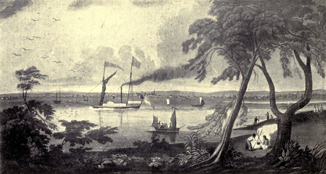
OLD TORONTO
THE STORY
OF THE COUNTIES
OF ONTARIO
BY
EMILY P. WEAVER
AUTHOR OF “A CANADIAN HISTORY FOR BOYS AND GIRLS”
“OLD QUEBEC: THE CITY OF CHAMPLAIN”
“THE TROUBLE MAN,” ETC.
WITH 16 ILLUSTRATIONS AND A MAP
TORONTO
BELL & COCKBURN
MCMXIII
Printed by Ballantyne, Hanson & Co.
at the Ballantyne Press, Edinburgh
The story of the counties of Ontario is a story of conquest—not of men against men—but of men, with little resource save their own strong arms, iron wills and alert intelligence, pitted against wild, beautiful, prolific Nature, and prevailing to subdue the earth. Carving their little farms from “the forest primeval,” planting their own towns and cities at the meeting-places of mighty waters, making highways of every lake and river and streamlet deep enough to bear up a birch-bark canoe, our Loyalist “Pilgrim Fathers,” many of whom had been cast out as unworthy by the land of their birth, were privileged, as has often happened with outcasts, to found a new order of things and a new nation.
This Province had not, of course, a monopoly of all the Loyalist settlers who came northwards after the revolution, but it had enough to bring it into being with a distinctive character of its own, enough, exclusive of other brave and useful pioneers, to furnish it with heroes—and heroines—for the early days of stress and strain and struggle—those days over which for us hangs the fairy glamour of romance, though few of us would have discovered it had we had to live through them. I suppose this charm of the past and—in some measure—of the distant, is akin to the misty blues and purples of the far-away horizon. It comes from a certain point of view, far enough from the things seen to enable us to lose sight of details and realise the relative proportions of objects. So, though in literature we often associate romance with the quaint trappings and customs of bygone days, its real concern is with the heroes and with the big things of life—love and hate, good and evil, contest and victory: and great dramas may be played out on a narrow stage.
This story, with its chapters of adventure, of patriotic warfare, of political struggle, and of effort to make the best of marvellous opportunities, is still in the making. The age of explorers and pioneers and (let us hope) of patriots is not past, while that of “merchant princes,” “captains of industry,” and organised armies of labourers has begun; but time’s changes only add to its interest.
Gleaning in the fields of Ontario’s local history has proved a fascinating task; but for the handfuls gathered, whole sheaves are left untouched. In other words, this book makes no profession of being a formal history. It is but hoped for it that it may do a little to stimulate interest in the history of the Province, especially amongst Ontario’s own sons and daughters, and may incline them to make greater efforts to preserve the records and memorials of their past.
Already the history of some counties and townships has been written with loving care, and it was an easy and a pleasant thing to follow in paths so well marked. In other cases, the material had to be gathered with arduous labour, here and there, far afield; but in all difficulties I was fortunate enough to have the able and untiring assistance of the ladies in charge of the Reference Library at Toronto—Miss Staten and Miss Moir—and I cannot let this book go to press without a very grateful acknowledgment of the debt that I owe to them.
The illustrations are reproductions of old prints and pictures in the Archives at Ottawa; and I have to thank Dr. Doughty for permission to use them, and his assistant, Miss Casey, for her kind help in finding suitable subjects.
The map at the end of the volume shows the extent of the Province of Ontario as it is to-day.
E. P. W.
| I. | FRONTENAC | 1 |
| II. | LENNOX AND ADDINGTON | 7 |
| III. | PRINCE EDWARD | 12 |
| IV. | HASTINGS | 17 |
| V. | NORTHUMBERLAND | 22 |
| VI. | PETERBORO’ COUNTY | 27 |
| VII. | HALIBURTON | 32 |
| VIII. | DURHAM | 37 |
| IX. | VICTORIA | 43 |
| X. | ONTARIO | 49 |
| XI. | YORK | 54 |
| XII. | PEEL | 63 |
| XIII. | HALTON | 68 |
| XIV. | SIMCOE | 74 |
| XV. | DUFFERIN | 80 |
| XVI. | LINCOLN | 85 |
| XVII. | WELLAND | 95 |
| XVIII. | GLENGARRY | 100 |
| XIX. | STORMONT | 105 |
| XX. | DUNDAS | 110 |
| XXI. | PRESCOTT | 116 |
| XXII. | RUSSELL | 121 |
| XXIII. | GRENVILLE | 126 |
| XXIV. | LEEDS | 131 |
| XXV. | CARLETON | 136 |
| XXVI. | LANARK | 146 |
| XXVII. | RENFREW | 152 |
| XXVIII. | WENTWORTH | 157 |
| XXIX. | BRANT | 167 |
| XXX. | HALDIMAND | 172 |
| XXXI. | WATERLOO | 178 |
| XXXII. | WELLINGTON | 184 |
| XXXIII. | NORFOLK | 189 |
| XXXIV. | ELGIN | 194 |
| XXXV. | OXFORD | 199 |
| XXXVI. | MIDDLESEX | 204 |
| XXXVII. | KENT | 209 |
| XXXVIII. | ESSEX | 214 |
| XXXIX. | LAMBTON | 224 |
| XL. | PERTH | 229 |
| XLI. | HURON | 234 |
| XLII. | BRUCE | 239 |
| XLIII. | GREY | 245 |
| I. | MUSKOKA | 250 |
| II. | PARRY SOUND | 256 |
| III. | NIPISSING | 261 |
| IV. | SUDBURY | 265 |
| V. | TIMISKAMING | 269 |
| VI. | ALGOMA | 276 |
| VII. | MANITOULIN | 281 |
| VIII. | THUNDER BAY | 286 |
| IX. | RAINY RIVER | 292 |
| X. | KENORA | 297 |
| XI. | PATRICIA | 302 |
| INDEX | 309 |
THE STORY OF THE
COUNTIES OF ONTARIO
“What constitutes a state? ...
Men who their duties know,
But know their rights, and knowing, dare maintain—
These constitute a state.”
W. Jones.
Two hundred and forty years ago, the spot where the city of Kingston now stands was a wilderness, but its site at the mouth of the Cataraqui was much frequented by the Indians. It was, indeed, such a strategic position that the vigorous governor of Canada, Count de Frontenac, determined to erect a stronghold there. Accordingly in the summer of 1673 he sent word to the Indians of the district to meet him at Cataraqui, and thither, attended by a multitude of the gay and gallant gentlemen of his little court, with his impressive flotilla of canoes and gorgeously painted boats, he came—the embodiment of undaunted courage and imperious will. At his word, as if by magic, rose the first Fort Frontenac, and the Indians, awed by his good-humoured contempt and delighted with his lavish gifts, seemed in very deed to become the “children” he called them.
Two years later the wooden fort was rebuilt of stone by the valiant but luckless explorer, La Salle, who had received a royal grant of lands at that place. It continued to be an important French post till the year preceding Wolfe’s victory on the Plains of Abraham, when, by a “masterly stroke,” Colonel Bradstreet captured and demolished Fort Frontenac. But it was another war—that of the American Revolution—that gave the first impetus to settlement in Ontario (or Upper Canada). In 1783, Haldimand, then Governor of Canada, desiring to make preparation for the influx of Loyalists, which was indeed already beginning, ordered the survey of lands on the Bay of Quinté. This, it is believed, was the first survey made within the boundaries of Ontario. About the same time the first mill was built at Cataraqui.
The following year was marked by a greater event, to which the others had led up. In June 1784 there came up the river in open boats a party of Loyalists, led by one Captain Michael Grass, who took up lands in the township of Kingston, and thus laid the foundations of “the first effective settlement” in Upper Canada. But it was still counted part of Quebec, and the newcomers did not like having to submit to French laws. At last, in 1791, after a vast amount of debate and heart-burning, the Constitutional Act became law, by which Upper Canada was separated from the Lower Province and was put under English law, and Colonel Simcoe was appointed the first Governor of Upper Canada. He threw himself with enthusiasm into plans for organising the new province, but was unable to reach Upper Canada till half of the year 1792 was over.
It was almost nine years since the building of Ontario’s first mill; and the little settlement of Kingston numbered about fifty houses on the summer Sunday when the new Governor’s big bateau was seen entering the harbour. It was greeted by a salute from the guns of the garrison; and, thus warned, the population of the village hurried to the wharf to see Governor Simcoe and his “lady” come ashore—the first a trim, soldierly-looking man in the prime of life; the other a bright-faced little woman, some years his junior.
With a kind of prophetic appropriateness the day of this arrival of the first Governor of Upper Canada in its first settlement happened to be July 1, the day which the future generations of Canadians were to celebrate as the birthday of the “Dominion.” Though it was a very small crowd that gathered to welcome the representative of the British Sovereign, the event was an important one in the history of Canada, for it marked the granting to the stalwart Loyalists of some beginnings of the British liberty they loved (in spite of all their maligners said of them), and the gift was like a tiny seed which contained the germ of a mighty forest tree.
No doubt Simcoe saw some familiar faces in the crowd, for he had served through the Revolutionary War, and had for several years commanded the Loyalist corps called the “Queen’s Rangers.” He understood the dispossessed and defeated, but not beaten, adherents of the British Crown, and with all his force he meant to do what he could to make the conditions of their new life tolerable, and to lay solid foundations for a new British State in America.
He was, perhaps, a less picturesque figure than that of the old French Governor whose name he bestowed on the county, and his coming with his young wife and little children made a far less imposing spectacle than Frontenac’s arrival with his hundred or more war canoes. But the age had gone by when the magnificent woods and waters of our Province were merely a setting for the exploits of bush-rangers and Indian fighters. A new era was dawning, and henceforth Upper Canada was to be a land of homes and settled folk.
A week later, on the following Sunday, Colonel Simcoe solemnly took the oath as Governor, in the tiny wooden church that then stood on the site now occupied by the offices of The British Whig. In those early days, by the way, the music was led by a barrel-organ, and there are dim, misty traditions of the faded and out-of-date finery brought out by the assembled Loyalists to do honour to the great event. A few days afterwards a wilder scene occurred in the Governor’s honour, when a band of Mississauga Indians, in their war paint, danced before him to the music of their native drums and the chanting of a dismal tune, varied by fierce war-whoops. In Mrs. Simcoe’s Diary, edited and published recently by Mr. J. Ross Robertson, are many interesting details of the three weeks spent by the Governor and his family at Kingston.
She tells of pleasant wanderings in the woods, and of sailing “in a pretty boat ... attended by music, to Garden Island.” She delighted in the new wild flowers she found and in the strange effect of fires amongst the trees, which at night seemed to turn the forest into “an enchanted wood!” and trees were then and there so much too plentiful that her pleasure in the picturesque scene of destruction was quite unmarred by disturbing thoughts of “conservation.” She is very outspoken, which adds zest and reality to her bits of description. For instance, when with her husband she visited the shipyards, which in coming years were to supply a great fleet of vessels to ply on the lakes, she mentions specially the extraordinarily “bad construction” of two new gun-boats, adding that the Governor named the clumsy things “the Bear and the Buffalo.”
Kingston would have been well pleased had Colonel Simcoe decided to make it his capital, but he thought the place indefensible and would not be persuaded. Half a century later, however, for a brief period Kingston was capital of the United Provinces of Upper and Lower Canada. Real estate rose immensely in value, houses to rent grew scarce, but the dream of pre-eminence for the Limestone City soon faded. But we are getting on too fast. Amongst Frontenac County’s first things had been a school opened by Dr. Stewart, in 1786, and a few years later Hon. R. Cartwright employed a young Scot, who was to make his mark on the educational institutions of the Province, to teach his four sons and several other lads. The teacher lived to be Bishop Strachan, and amongst the boys also was a bishop and two chief justices of the future. At a later date another lad, John A. Macdonald, destined to still wider fame, passed his school-days in Kingston. To this day the city has retained distinction in educational matters, for it is the seat of Queen’s University and of the Royal Military College.
Long before the establishment of the latter, however, Kingston, which was a garrison town and naval station for the gunboats of the lakes, served as a training-place where raw country lads were turned into soldiers.
One June day, a century ago, in 1812, there came word by private letter that the United States had declared war on England. Half an hour later the drums beat to arms, and couriers were despatched in hot haste through all the countryside to “warn out” the militia. In those days and for more than thirty years to come the streams and lakes of Frontenac County formed her highways (for the era of road-building did not begin till about 1840), but speedily the appalling news was carried to every little hamlet for miles round, and the sturdy woodsmen, young and old, came pouring into the town to defend it against the expected attack.
Once, in October 1813, a “Yankee fleet of 14 sail” appeared off the Upper Gap, and a shot was sent from the Old Windmill to tell the American commander that the sons of the Loyalists were ready for him. Indeed, as the hostile boats came on, troops marched along the shore, and the woods were fired to prevent their furnishing cover for the invaders, but no landing was made.
During the years of warfare, Kingston and the neighbourhood were kept in a ferment of excitement by the coming and going of troops, the setting out of naval expeditions, the arrival in boats and bateaux from the Niagara frontier of prisoners of all ranks (from generals downwards), and, after the capture of York by the Americans, the coming of pitiful boat-loads of wounded in dire need of help and comfort.
In the “century of peace” which has passed since those sad days, the aspect of Frontenac County (as indeed of a great part of old Ontario) has been greatly changed. Not only roads, but railways and telegraph and telephone lines, make communication easy. The once-wooded country is studded with small towns and prosperous homesteads, and the much-frequented market of Kingston (which was supposed by some people in early days to be the centre of a country so unproductive that it could not be expected to supply the wants of a capital city) tells a tale of prosperity and industry. As for the city itself a pleasant air of restfulness and dignity seems to brood over its shady streets and old grey houses, while the picturesque bustle of its wharves and water-front keeps in mind the busy days when it was a naval station.
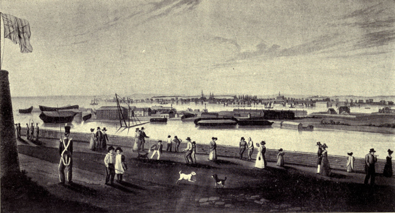
KINGSTON, FROM THE CITADEL
“We piled with care our nightly stack
Of wood against the chimney-back—
Heard the sharp crackle, caught the gleam
On whitewashed wall and sagging beam,
Until the old, rude-furnished room
Burst, flower-like, into rosy bloom.”
Whittier.
The names of the twin counties and their townships, with one or two exceptions, are memorials of English princes and noblemen who flourished—to use the quaint old phrase—a little over a century ago. The townships of Ernestown, Fredericksburg and Adolphustown were named after three of the many sons of George III. The counties themselves were called, respectively, after Charles Lennox, Duke of Richmond, and Henry Addington, Viscount Sidmouth. Many of these men were great in nothing but rank and fortune, and their mode of life was singularly unlike that of the sturdy pioneers and industrious farmers who were to hew their farms from the green woods. Even to-day there are no large towns and very few villages within the bounds of Lennox and Addington. Napanee, the county town, though a busy little place, with its flour mills, foundries, factories and elevator, has a population scarcely reaching three thousand souls.
The special interest of the story of these counties lies perhaps in what we can glean concerning the everyday life of the pioneers. Happily some records by their own hands remain to us. Such a typical story is that of Hon. Henry Ruttan, published by the United Empire Loyalists’ Association of Ontario. Mr. Ruttan, who lived to be Speaker of the Assembly, colonel of militia, and sheriff (for thirty years) of the Newcastle district, began life as the child of a Loyalist family in Adolphustown.
The Ruttans were descended from a Huguenot, who settled in America about 1734. When the Revolutionary War broke out, Henry’s father and his “Uncle Peter” took up arms for the King, and became, the one, a lieutenant, the other, a captain in the 3rd Battalion of the Jersey Volunteers. At the close of this struggle the brothers joined Major van Alstine’s party of Loyalists, and each obtained a grant of twelve hundred acres in Adolphustown. Some four years later the lieutenant married Margaret Steele, an Irish girl, who had come to Canada with her parents. She became the mother of seven children, some of whom had also large families.
The clearing of the forest for the first crops involved long and heavy labour, but when “industry was the order of the day” the newcomers slept so soundly through the nights that wolves prowling about their little cabins rarely disturbed them. They kept the savage brutes at bay, however, by building fires, and in summer-time the same means were used to gain some rest from the tormenting clouds of mosquitoes.
Peter Ruttan had two sturdy, hard-working black slaves, a man and a woman; they did good service in the early days. The Loyalists, for the most part, brought into the country little but a few clothes, and had to depend on their own ingenuity and diligence for everything they needed, except that the Government supplied them with some tools and with rations for a few years. The Ruttans, better off than many of their neighbours, had brought a cow, which, in the terrible time long known as “the Hungry Year,” saved their lives.
Very soon after the Government rations were stopped, the crops failed, and in the following year, 1783, the settlers, for months at a time, had to look starvation in the face. During the winter the snow was so deep that the deer fell an easy prey to the wolves; they grew fat, but the human beings were all wasted by want. Nothing was to be had in the woods, and at least five of the settlers were found dead, one being a woman, on whose breast lay a living baby, which was saved and cared for.
At the best of times, it was hard to get provisions in any little hamlet where they fell short, for there were no roads save the rude cuttings through the bush made by the settlers themselves. For instance, if the people at Adolphustown needed to get a barrel of pork or to have a sack of grain ground, they had to go all the way to Kingston. But in “the Hungry Year” the soldiers in the garrison were put on an allowance of a biscuit a day, so it was vain to look for help in that quarter. At last, in desperation, Peter Ruttan, who had saved some money from the sale of his captain’s commission, sent two men all the way to Albany, in New York State, for four bushels of Indian corn. It was a perilous journey through the trackless woods deep in snow; but they returned in safety with the precious grain, and upon this, the milk of their cow, and the roots and berries they could gather in the woods, the family of eight persons lived till harvest. Before the corn could be made into cakes or bread, it had to be pounded in the hollowed-out stump of a tree. By the time Governor Simcoe arrived the farms of the earlier settlers were greatly improved, and additional settlers coming in made life altogether more cheerful.
The young folk were packed off early to bed in the little dimly-lighted log cabins; but the boy who wrote the story of those days remembered how, when awakened by a sudden clap of thunder or storm of wind, his busy mother was still sitting, far into the night, at her spinning-wheel or loom; and when the cloth was woven it was she who fashioned it into garments for all the family. Another scene used also to come back to him. That same hard-worked mother gave him his first lessons, and told the children all the strange, exciting stories of the war, which were their tales of adventure.
Books were scarce in the settlements and so were teachers. Indeed, it was often those having some infirmity, which rendered manual labour impossible, who gave their time to teaching, and young Henry Ruttan went from school to school, finding in each Dilworth’s Spelling-book and the New Testament as the only textbooks. One teacher, who worked hard during the day, kept a night-school five miles away; and to this Henry’s brothers went on snowshoes, thinking it an enjoyable excursion on moonlight nights, especially when some girls were of the party.
The young people, as a rule, grew up strong and healthy; and, though life in the woods was somewhat monotonous, it had its own pleasures.
Adolphustown village was for years a rival to Kingston, and was “always the centre of Upper Canada.” At one early general election four of the representatives of the people were Adolphustown men. Courts were held in the village twice a year, alternately with Kingston. As it was summer-time, the first court was held in a barn, the next (in winter) was held in the Methodist Church, though some of the brethren made quaint objection to turning it into “a den of thieves.”
In the different townships life ran on in much the same groove, yet each has its special claim to distinction. In Fredericksburg, for instance, in 1786, was opened the first common school in the Province. At Ernestown (now Bath) there lived at the close of the eighteenth century Rev. John Langhorn, an eccentric Welsh bachelor and clergyman of the Church of England, who was the first man authorised to celebrate marriages west of Kingston. He divided Lennox County into parishes and erected log churches at Ernestown and Fredericksburg, the former of which was in use at least as late as 1899. About a mile west of Ernestown, there was built in 1815 the first steamer that was ever launched on the waters of Upper Canada. She was named the Frontenac. Three years later the Charlotte steamboat was built in the same place, and at her launching hundreds of people gathered from all the country round, many coming long distances on foot to see the spectacle.
“Ontario, Ontario,
Thy water rolls as blue
As in the days thy bosom bore
The Indian’s birch canoe.”
Anon.
Jutting out into the blue waters of Lake Ontario is a sunny, fruitful “half-island”—to use the Nova Scotian phrase—which by cool breezes, excellent roads, and fine fishing attracts numerous summer visitors and pleasure-seekers. But, better than that, with its fertile fields, its rich orchards, and its sleek, well-nourished herds of cattle, it might seem that it had become a little paradise for the farmers were it not that it is so hard for them to obtain a sufficient number of men to carry on the “intensive” methods of cultivation now so much in favour in the district. With all but a small fraction of its area rated as arable land, with no great towns, but with several thriving smaller centres of population, it is emphatically a farmers’ county. Of the hundred automobiles owned in Prince Edward County, fifty belong to farmers. Of the several hundred motor-boats that give life to its many bays and inlets, farmers possess two hundred, whilst a large proportion of the twelve hundred telephones of the county serve the rural population. Moreover, in Prince Edward, the plan of rural mail delivery has passed the experimental stage, and there are nine rural mail routes, with 450 boxes.
Originally connected with the mainland at the old Indian “Carrying Place” by a narrow isthmus, the county has been made into a second Prince Edward “island” (in many respects resembling its larger namesake in the Atlantic), by the cutting of the Murray Canal, five miles in length and deep enough to allow the passage of large boats. But, as if to make up for this interference with nature’s plans, a bridge gives connection with Belleville. Without this, however, the county would be by no means devoid of easy communication with its neighbours, for no part of it is over six miles from navigable water, and several lines of steamboats ply from its ports to those of the mainland.
This pleasant farmers’ county, called “Presqu’ Isle de Quinté” by the French, now bears a royal name. About the time of the division of Upper from Lower Canada, the Duke of Kent, on his return from a journey to Niagara, called at Marysburg, and in memory of that brief visit the county received its name of Prince Edward. Of the numerous sons of George III, Edward was the most popular. In many relations of life he is said to have been kind, courteous, and gracious, but, as a soldier, his notions of necessary discipline led him into harshness and severity. He had no special opportunity to win distinction, and much of the posthumous interest in his character has arisen from the fact that he was the father of the future Queen Victoria, though she was but an infant when he died.
The three original townships of the county, afterwards subdivided to make seven, were named after the Prince’s sisters, Mary, Sophia, and Amelia. The latter was the youngest child of King George, and was described by her eldest sister as “a sweet, amiable, pious, good little soul, patient (during a long illness) beyond all description.” Another writer (quoted in Mr. Gardiner’s Nothing but Names) says: “Amelia! Everyone who has read Thackeray remembers her—the pretty little maiden, prattling and smiling in the arms of the fond old King, her father—and then her death in the bloom of womanhood and the shock to the father’s reason.”
It is said that Prince Edward County, or part of it, was included in the seigniory granted to La Salle. In the middle of the eighteenth century, Indians of different tribes were scattered along the shores from Gananoque to the Bay of Quinté, but they relinquished their claim to most of the land in consideration of the promise of an annual payment to each brave of two blankets, cloth for a coat, a gun and some other articles. To receive these things they used to go in their canoes to Fort Frontenac, and sometimes as many as a thousand men were afloat at one time on the bay. Many years later, the small island called Waupoos, about a mile from the coast of Prince Edward, was still the home of an Indian chief.
The settlement of Prince Edward County was begun by the Loyalists, many of whom were officers or soldiers. A number of Hessians settled in Marysburg, but the first house in the township was built by a Scot, Colonel Archibald Macdonald. This building, erected by ships’ carpenters instead of amateur joiners, was not of the usual pattern. The walls were built of hewn logs, nicely squared and dove-tailed at the corners. It stood for over a century, but was torn down in 1900.
Colonel Macdonald never married, but his niece, Frances, who kept house for him, married a French gentleman, Mr. Prinyer, and her descendants preserve as heirlooms the old “grandfather’s clock,” the despatch box, and mahogany chairs, desk, and table brought out by the Colonel from Scotland.
It is told in a paper read to the Women’s Historical Society of Ottawa how during the War of 1812 a party of Americans landed at Macdonald’s Cove, intending to carry off the master of the old house, for colonels were esteemed “big game.” But Macdonald was too “canny” for them. Knowing the Americans’ dread of the Indians, he placed two or three men in the woods to whoop and yell like savages, then sent his nephew to demand the surrender of the interlopers, with the suggestion that otherwise their scalps might soon be adorning the belts of the ambushed warriors. In terror of such a fate his would-be captors surrendered, and were imprisoned in a blockhouse near the Colonel’s dwelling till he could find opportunity to send them to Kingston.
No land was taken up in Sophiasburgh till 1788, when it was settled by Loyalists, who had previously spent a few years in Nova Scotia or in the neighbouring township of Adolphustown, or were “late Loyalists,” who before leaving their native land had tried the uncomfortable experiment of remaining there under the new Government. These did not receive grants on the same terms as the original Loyalists, but were able to buy lands at very small cost. For instance, one of the best farms in Sophiasburgh, valued a few years ago at seven or eight thousand dollars, was then purchased for an old horse.
The first man to set foot on the site of Picton (of which there is a most picturesque view from the water between the lofty shores of the bay) was Colonel Henry Young, with his two sons. That was in the year 1784, when a dense forest covered the spot; but it was over thirty years later when Mr. McAuley, the minister and builder of the first church in the settlement, bestowed upon it the name of Picton, in honour of a general who had fallen in the battle of Waterloo. The name did not appeal to everyone, and for some time the village to the south of the bay clung to its designation of Halliwell, still perpetuated in the name of the township. As early as 1798, by the way, “the town meeting” of Halliwell had shown its interest in agricultural matters by passing by-laws about fences, and ordering that any freeholder suffering “the Canadian thistle,” that bugbear of careful farmers in our own day, to go to seed on his premises should be fined twenty shillings.
For years the growth and progress of Picton was very slow, but 1830 saw the first issue of The Halliwell Free Press, and the formation of a company to run a steamer between Picton and Prescott. In the following year Prince Edward became a separate county, and a courthouse and jail were added to the buildings of Picton, which now has a population of about 4000 souls.
Ten miles away in a northerly direction is the village of Demorestville, near which was built “the first canning factory in Canada.” Ten miles southward of the county town are “the far-famed sandbanks,” or hills of white, shifting sand, which stretch for four and a half miles along the shore of West Lake, and five miles to the east is the curious, clear, circular “Lake-on-the-Mountain,” 200 feet above the little village of Glenora. From this lake water was brought down the hill in iron pipes to turn the wheels of a grist mill which was once rented by the father of John A. Macdonald, then a lively little lad.
“From the cedar swamp the gaunt wolves howl,
From the oak loud whoops the felon owl;
The snowstorm sweeps in thunder past,
The forest creaks beneath the blast.”
Susanna Moodie.
“The old Indian names along the Quinté shores were nearly trampled underfoot in the shameless tuft-hunting of our early Governors,” quotes Mr. Gardiner from Picturesque Canada. One instance will suffice. At Belleville, the ancient River Sagonaska was re-named to flatter the Earl of Moira, and even his baronies were detailed in the county of “Hastings” and the townships of “Rawdon” and “Hungerford.” In this case (though by no means always), the names recall individuals of some note. In his younger days, as Lord Rawdon, this particular aristocrat served throughout the revolutionary war from Bunker’s Hill onward; as the Earl of Moira, he commanded a British force sent to Flanders; and, as Marquis of Hastings, was Governor of Bengal, acquitting himself so much to the satisfaction of the East India Company that they presented him on his retirement with £60,000. Green, by the way, gives him “credit for paving the way for the abolition of suttee”—that terrible custom which bound the widows of India to die in the flames consuming the bodies of their husbands.
Other names suggestive of interesting personalities are written on the map of this county—including those of the scientists Faraday and Herschel, and the Arctic explorer McClure, who in 1850 took a British vessel through the long-sought North-west Passage. But, with the exception of the last, who is said to have “served in the lake fleet during the rebellion of 1837,” their owners had no actual connection with the Province.
The settlement of Hastings County, which fronts for thirty miles on the Bay of Quinté, was begun by the Loyalists. The most easterly of Hastings’ front townships bears the Indian name of Chief Brant, “Tyendinaga,” and was granted at the close of the war to the Indian Loyalists of the Mohawk tribe. Portions of the township were afterwards surrendered, but there is still an Indian reserve of about 17,000 acres bordering on the bay. The greater part of this is good land, and part of it is well cultivated. Some of the farms are leased to white people, but there are Mohawk farmers who have good buildings and clean, productive fields. Nine or ten years ago an agricultural society was established, and a number of very successful “fairs” have been held in the “Council House” of the tribe. There are several schools and two fine churches on the Indian land.
The adjoining township of Thurlow (then called “Nuitte Town”) was surveyed in 1787, and in the spring of 1789 fifty Loyalists (many of them forced by persecution to leave their old homes in the United States) came to that township and its westerly neighbour, Sidney. They suffered many hardships, for they arrived after the Government had ceased to allow rations to the Loyalists. In the following year John Taylor settled near the mouth of the Moira (then called “Singleton’s Creek,” after an early settler who died very soon), and the spot where he built his log cabin is now one of the busiest parts of the city of Belleville. The energetic Captain John W. Meyers came next after Taylor, and from him the future county seat was called “Meyers’ Creek” until 1816, when, according to Dr. Scadding, Governor Gore jocosely suggested the abbreviation of his wife’s name, Arabella, as a good name for the village. No doubt nine persons out of ten imagine that it is merely a tribute to the beauty of the town or its situation.
The Historical Atlas claims for Meyers that, after constructing a dam and erecting a mill, he built, in 1794, “the first brick house that Canada had ever seen.” This remarkable dwelling was set on a hill and stood for eighty years. Ten years later the first bridge—a covered one—was thrown across the narrowest part of the river. Belleville’s first church was built by the Methodists in 1810. Pulpit and seats were made of rough boards (in the latter case they were mounted on small blocks of wood), but twenty years went by before it was superseded by a more commodious building. Meantime, in 1820, the Anglicans of Belleville had erected their first church in that district, west of Adolphustown.
At the time of its re-christening, the site of the village comprised two hundred acres. Now the city of Belleville covers about nine times that area, and has a population of over 10,000 souls. Its “first flag-stone sidewalk” was laid down in 1836. Three years later the Court of Quarter Sessions was held for the first time in the Court House, which had been recently erected, costing, with the jail, nearly $24,000. Belleville was incorporated as a town in 1850, a year memorable also for the commencement of the making of gravel roads. At first tolls were charged on them, but in 1859 they became toll-free.
Belleville’s first newspaper, published in 1831, had a brief existence, like many of its immediate successors. Amongst these was the Plain Speaker, which in 1836 essayed to give support to Mackenzie’s party. The editor, Hart, was put into the penitentiary for an attempted raid on a bank at Cobourg. A little later the paper appeared one morning with the British arms upon it, upside down, and, regarding this as a deliberate insult to the Government, a company of loyal volunteers marched to the office, upset the type-fonts and “trailed” the luckless manager through the snow and slush. In 1841, Mr. and Mrs. Moodie, who had come to live in Belleville two years earlier, when the former was appointed Sheriff of Hastings County, became joint-editors of another unfortunate literary venture, The Victoria Magazine. The lines at the head of this chapter are by Mrs. Moodie, who was one of the notable Strickland family.
The first annual township meeting of Sidney was held in 1790, and in an early record of resolutions dealing with the height of fences and the running of animals on the roads, it is quaintly stated that “Hogs is to be free commons till they done damage”! At the extreme west of Sidney is the flourishing town of Trenton, which now has about 4000 inhabitants. Its first Loyalist settlers arrived in 1790. A few years later, Dr. Strachan, the future Bishop of Toronto, bought land on the broken front of Sidney. This he laid out in town lots, giving to the subdivision his wife’s maiden name of “Annwood.” It has long ago been absorbed in Trenton, formerly a great lumbering centre, to which thousands of feet of lumber were rafted down every year. One of the old type of covered bridges spanned the river at this place.
There was another bridge higher up the stream at Frankford, built some time after the spot was visited by that versatile Governor, Sir Francis Bond Head, for it was he who named the ford after himself. Another Hastings County name to which a suggestive little anecdote is attached is that of “Thrasher’s Corners.” It does not now appear, however, in the list of post-offices, so perhaps the name has been changed by the generation which knew not “old Mr. Thrasher,” and can no longer glory in his exploit of engaging single-handed, armed only with a club, in combat with two full-grown bears. With this primitive weapon he slew them both, so well earned the right to give his name to the “Corners” where the deed was done.
Such sturdy, valiant men were common amongst the pioneers. But very early the authorities decided that discipline and training are needful to make the best of courage, so, in 1799, the Hastings militia was organised, and every other Saturday, in pioneer days, the men were put through their drill. In 1812 Hastings men helped for weeks to garrison Kingston, and in 1838 they were hurried to Gananoque to look after filibusters threatening the border. For this they claimed a promised payment of three shillings per day, but the Adjutant-General “refused to certify their pay and allowances,” and, despite a great outcry, the money was not forthcoming.
Within more recent years it has been discovered that the county is rich in minerals, ranging from granite, limestone, marble, and beautiful blue sodalite, used for building purposes, to arsenic, corundum, talc, zinc, and iron pyrites, which are obtained in different townships. In the town of Deseronto the smelting of iron has been carried on since 1898. Hastings County, moreover, has had its attack of gold fever. Nearly half a century ago traces of the precious metal were discovered in Madoc and later in Marmora and other townships, and for a season people went wild with excitement. Thousands of dollars were wasted in speculation and in putting expensive machinery into mines which gave insufficient returns. The story is largely one of lawsuits and disappointments, but Hastings County, dowered with so much other wealth, can well afford to let go its dreams of being an Eldorado.
“A breath from the tropics broke Winter’s spell
With an alien rain which froze as it fell,
And ere the Orient blushed with morn
A beautiful crystal forest was born.”
Barry Straton.
Northumberland County, named after the English shire, was one of the original nineteen counties set apart by Simcoe in 1792. With Hastings, it sent one member to the first Parliament of Upper Canada. In 1798 it became part of the Home District, but by an Act passed at the beginning of the year 1800 it was provided that, as soon as the two counties of Northumberland and Durham attained to a population of one thousand souls and had no less than six townships holding town meetings, the new District of Newcastle was to be formed. According to the “Historical Atlas” of the two counties (which were long united), the Newcastle District was set apart in 1802, and for a time the magistrates were empowered to decide where the courts should be held. This was found inconvenient, and in 1805 they were authorised to erect a jail and court-house in either Haldimand or Hamilton Township.
Indirectly, the cutting off of the Newcastle from the Home District led to a tragedy. This is the story. An Indian, who in 1804 murdered a trader at Oshawa Creek, betrayed himself when drunk and was captured on Toronto Island, but his counsel objected to his being tried at York, because the crime was said to have been committed within the boundaries of the new Newcastle District. On account of this technicality the court and prisoner embarked upon the Speedy on their fatal voyage down the lake, and the ingenious lawyer paid with his life for his legal quibble.
For years after that there was no suitable accommodation in Northumberland for a court. At length buildings were begun on the site of the present county town, but questions were raised as to the right of the magistrates to erect them, and a quarter of a century after the foundering of the Speedy the matter was carried to the Court of King’s Bench. Finally, in 1831, an Act was passed giving legal sanction to the proceedings of the magistrates and indemnifying them for their illegal expenditure on the jail and court-house, then in course of erection.
The county seat has borne a bewildering number of names. At first it was called Amherst, in honour of the General who was Wolfe’s superior officer. Next it was called Hamilton, to correspond with the township in which it was situated, and finally it was baptized Cobourg, by which name it has been designated for the last sixty or seventy years. As if these changes were insufficient, it was at one time known locally as Buckville, after an early settler, Elijah Buck, who deserves remembrance as the maker of the first wagon ever put together in Hamilton Township. As a mere nickname, moreover, the struggling little hamlet, destined to develop into the clean and prosperous town of Cobourg, was once unkindly called “Hardscrabble,” in reference to the supposedly overwhelming difficulties of those who undertook to make a living in it. The village was situated unpromisingly in the midst of a cedar swamp, and consisted for long of little more than a main street, so cruel to the wretched animals forced to drag a load along it, that it was described as “a founderous morass.”
The earliest surveys in Northumberland were made in 1791 by Augustus Jones, a man of Welsh extraction, who took an Indian bride, variously described as the daughter of “a noted Mohawk warrior” and an Ojibway chief, and thus became father to “the famous Wesleyan Indian missionary,” Peter Jones, who was brought up, till the age of fourteen, in the customs and superstitions of his red mother. He rejoiced in a many-syllabled Indian name, translated as “Sacred Waving Feathers.”
The county had many Irish pioneers, a smaller number of Scotch and English ones, and some Americans, coming chiefly, perhaps, from Vermont. James Keeler, the first settler in Colborne (Cramahé township), was a Vermont man. He arrived in 1789, and was so well pleased with the country that, four years later, he brought in forty other settlers. Keeler gave free sites for churches and a public square to Colborne and built mills. A notable pioneer of Murray Township was Asa Weller, who kept a tavern at the Carrying Place, and used to convey travellers up the Lake Shore by means of a “sled” and a yoke of oxen. Another Weller, William (doubtless of the same family), was proprietor of a more ambitious “stage,” and became the first Mayor of Cobourg after its incorporation as a town.
Early in the War of 1812 Robert Wilkins (also of Murray) raised a company of volunteers, but soon resigned his captaincy to take charge of the commissariat department of the district, and he made the Carrying Place his headquarters. Being a man of decision, though conciliatory in manner, he usually succeeded in obtaining supplies, without having recourse to “the half-martial law” of the time, in spite of the somewhat general disposition to stick out for fancy prices.
Notwithstanding the hardships they had to endure, many of the pioneers were long-lived folk, and two Northumberland men, Gibson and Lawson, were amongst the last of the veterans of 1812 to draw their $20 pensions. Gibson could recall a time when it was no uncommon thing to see five or six bears together, eating beech-nuts, and Lawson used to tell how, when “drafted” in 1812 for military service both by land and water, and, preferring to do duty on the lake bateaux, he had swum three miles to escape impressment by the land force.
Upon the first survey of Seymour (about 1819), a number of half-pay officers took up land, and Campbellford (now a flourishing town of about 3000 inhabitants) was founded and named by Major Campbell of Cobourg. The incorporated village of Hastings, on the Trent (down which, season after season, for several generations, logs have swirled with the current from the woods of Victoria and Peterboro’ counties), is half in the last-named county and half in Percy Township of Northumberland. Part of the neighbouring township of Alnwick is taken up by an Indian reserve, bordering on Rice Lake, which still affords good fishing.
About 1827 a young Methodist preacher, whose name—Egerton Ryerson—was to become a household word in Upper Canada, began to pay occasional visits to these Indians. Probably he was the more readily interested in them because he had already lived some time with the Indians on the Credit, giving them instructions in various useful arts as well as in the Gospel. In Northumberland he had, however, little time to devote to the red men, for he was in charge of the whole Cobourg circuit, then extending from Brighton to Bowmanville. His sermons were often composed on horseback, but he was soon recalled from Cobourg to edit The Christian Guardian at York.
Through the Upper Canada Academy, however, the young minister was again to become connected with Cobourg. The building erected for this famous school was “classic in architecture and imposing in appearance.” The workmanship was so good that after more than “seventy years the Government of Ontario find it still a substantial, valuable building.” But the cost of the building and its furnishings ran up to £9000, more than double the amount collected up to 1834 by a thorough canvass of the Methodists and their friends. To go on with the work, the trustees had to pledge their personal credit for a large sum, and, feeling that something more must be done, they appointed Egerton Ryerson their agent to go to England to solicit funds and petition the Imperial Government for a Royal charter. The task was difficult, but it was accomplished.
Mr. Ryerson returned with a considerable sum of money for the building fund, and “with the first Royal charter ever granted by the Imperial Government for an educational institution outside of an established church.” Owing largely to Ryerson’s exertions, the Academy was opened on June 18, 1836. Five years later it was granted university powers under the name of “Victoria College,” and Mr. Ryerson became its first President, holding office until, in the autumn of 1844, he took up his great work of improving the common schools of the Province. As for the university, which he had done so much to establish—it ultimately entered into federation with the University of Toronto, and half a century after the inauguration of its first President it removed to its new and beautiful home in Queen’s Park, Toronto, to the regret, it may be said, of not a few who had spent their happy undergraduate years in the old Victoria College at Cobourg.
“Brighter hopes shall greet them
Amidst the pathless wild,
Than e’er on Britain’s cultured soil
For British peasants smiled.”
Agnes Strickland.
The fifteen townships of Peterboro’ County, which takes its name from its chief town, are somewhat sparsely settled. It is a country of lakes and woods, and in some districts the camps of the aboriginal red men are still occasionally to be seen. The county seat is, however, a flourishing city of about 16,000 inhabitants; and in the agricultural country surrounding it are many pleasant farms and a few villages. Some sixty years ago the present county was known as the North Riding of Northumberland, and for a time after its separation from its southern neighbour it comprised what is now Victoria County.
Before the beginning of its history as a white man’s town, the place where Peterboro’ now stands was known as Indian Plain. In the earlier decades of last century, a chief, remarkable for his great stature, claimed a kind of ownership of Stony and other lakes, and though he permitted the white men to fish and to shoot deer and partridges, he jealously guarded the privilege of trapping fur-bearing animals. He was called “Handsome Jack,” a name commemorated in those of Jack’s Lake and Jack’s Creek, whilst the Polly Cow Islands in Clear Lake dimly recall the traditionary account of his daughter, a lovely Indian girl, who died of fever at the age of sixteen, and was buried by her heart-broken father under a balsam tree on one of the islands. So that the spirit of his child might be able to wander at will down to the water’s edge, the chief cleared the forest trees from the shore. He could not tear himself away from his darling’s grave, and was still watching over it when death came at last to release him from his sad task.
The first settlers in this Canadian Lake District came in 1818 from the more famous English “Lake District,” and in the same year a little party of young men, headed by one Adam Scott, crossed the treacherous Rice Lake, and made its way up the Otonabee River to the site of the future city. Arriving late on a day in May, one of them struck a spark from his gun flint into a heap of dry leaves, and so kindled the precursor of all Peterboro’s “household fires.” After cooking and eating their supper, the young fellows lay down to sleep under the oaks and chestnuts. On the morrow some of the party went by the “blazed” trails to seek out earlier settlers, and Scott explored the neighbourhood to find a suitable site for a mill he was planning.
He was successful in finding a creek which answered his purpose, and before two years had gone by he had erected a combined grist and saw-mill. For years this was the most important building in the neighbourhood, serving as a kind of social centre, where the settlers exchanged the news of the day in addition to obtaining supplies of flour and lumber. Soon after it was built something went wrong with the crank of the mill, and Scott set off on a March day to trudge through the snow, all the way to Smith’s Creek (now Port Hope), with the broken crank upon his shoulders. It weighed 250 pounds, and, though the round trip took several days, Scott returned home in triumph with the crank again in working order.
Some little time later, when a state-aided band of over two thousand immigrants arrived from Ireland, Scott displayed his customary enterprise in less commendable fashion. Having a superfluity of Government rations, the new arrivals turned an honest penny by selling the food they could not eat. They had, however, a craving for whisky, which was difficult to satisfy till Scott contrived a rude still, in which he made a quantity of a coarse spirit to sell at the rate of ten or fifteen cents a gallon!
Meanwhile, the Hon. Peter Robinson (a member of the well-known Loyalist family), who had undertaken to settle the immigrants near Peterboro’, had a difficult task. On the voyage from Ireland fifteen of the emigrants had died, and before a twelvemonth in the new land had rolled its course eighty-seven more found graves in the forest, dying chiefly of malarial fevers.
The task of marshalling the host of new-comers to their destination had cost their leader endless toil and thought. On the way they had had to camp at Kingston, from which place they were brought up in detachments by boat to Cobourg. Before they could proceed farther Robinson had had to make passable a twelve-mile road to Rice Lake, and to carry the settlers and their goods up the Otonabee he had built a huge flat-bottomed boat sixty feet long by eight feet wide. When at last they reached Scott’s Landing (as Peterboro’ was then called) there were neither houses to shelter them nor roads by which they could proceed to their destined homes.
Happily, Robinson found an able second in a naval officer named Charles Rubidge, who had had the experience of settling with his wife and child in a log-house without doors or windows, and knew what it was to be almost eaten by mosquitoes and blackflies. Afterwards he was able to boast that he had “made” a farm in the country and had worked hard on it for twenty-two years. It was he who cut the road, now called Keene road, from Peterboro’ to Rice Lake, and was rewarded for this service by Governor Maitland with the grant of a town and park lot. Later he was the first postmaster of Otonabee, and, for convenience of distributing the letters to people whom he might chance to meet, was accustomed, it is said, to carry “the mail” about with him in his hat. Under his directions the older settlers were employed to put up cabins for the newcomers at the price of ten dollars a house.
The name of Peterboro’ was chosen at a dinner, given by Robinson in his tent, in honour of the host. In the following year, when the village of log cabins, “sown broadcast,” with blackened stumps sticking up in its streets, was in the roughest condition imaginable, the lieutenant-governor, Sir Peregrine Maitland, visited the settlement. Not popular with some of the people, here he won golden opinions. Cedar-boughs were strewn in his honour along the sleigh-track, and a triumphal arch of evergreens was erected. He held a reception in the biggest log-house in the place, which was, perhaps, that used by the Roman Catholic father for service in days when the present cathedral was undreamed of.
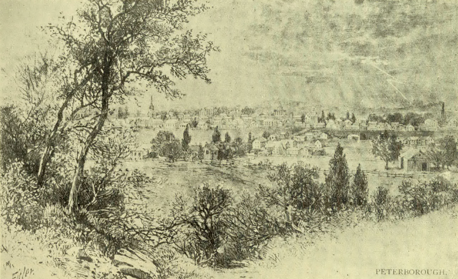
PETERBOROUGH
In 1831 a second large body of immigrants was sent by the British Government to the neighbourhood of Peterboro’. Meantime a few colonists of a higher class were struggling with the hardships of “Roughing it in the Bush,” as Mrs. Moodie, one of the Strickland family—almost all of whom seem to have wielded the pen of the ready-writer—phrased it. Her brother, Major Strickland, gives a graphic account of a journey through eleven miles of bush to seek land he had bought at Lakefield, and also to find the free grant of a poor English blacksmith who had been sent out to him from his home village in Suffolk. The man, on reaching his journey’s end, with a wife and child, had one halfpenny in his pocket. But he lived to own a comfortable little homestead. He was at first so dismayed, however, by the trackless woods that he positively shed tears. The Major describes with zest his own achievements as a joiner, stone-mason, and wagon-builder, but some English gentlemen, after wasting money in “fancy log-houses,” speedily disappeared from the scene.
It was the lumber trade which gave to Peterboro’ its first impetus towards prosperity. Now many of its people find employment in factories, some of which make the noted “Peterboro’ canoe.” Peterboro’s great claim to distinction, however, rests on its “Lift Lock,” in connection with the Trent Valley Canal. This is the largest lock of its type in the world. It was designed by Mr. R. B. Rogers, and the engineer in immediate charge of the work was Mr. W. J. Francis. The lock was formally opened on July 9, 1904.
“Poverty bought our little lot,
Flooded with daisy blooms;
Poverty built our little cot,
And furnished all its rooms.”
Ethelwyn Wetherald.
On a first glance at the map the provisional county of Haliburton forcibly suggests the title of a book (already mentioned) by Mr. H. F. Gardiner, which was published a few years ago, and deals from an interesting point of view with Ontario. This title is Nothing but Names; and on a recent official map of Ontario eleven of the twenty-three townships of Haliburton are represented, without a hint of the existence of a hamlet or any centre of population whatever. In fact, in the whole county there is neither city nor town nor even a large village, and much of it offers a fine field for the sportsman.
But, regarding it for a moment from the standpoint of names alone, Haliburton is worthy of special attention, for there is no part of Ontario where great names are clustered more thickly than in this county. It has its share of place-names, many of them Welsh, though the English county of Leicester has lent the name of Lutterworth (famous for its connection with John Wycliffe, “the Morning Star of the Reformation”) to the township in the extreme south-west. Striking diagonally across to the north-east and touching in passing at Havelock, named after one of the heroes of the Indian Mutiny, one reaches a township recalling the memory of one of the world’s great women, Florence Nightingale. Turning westward, one crosses the township of Lawrence, called after the Governor of the Punjab, who served his country so well during the Mutiny that he won the title of “the saviour of India.” Next in order is the township of Livingstone, named in honour of the missionary traveller, who from his grave in Westminster Abbey still seems to raise a battle-cry of freedom for the enslaved Africans. Lastly, still “stepping westward,” the name of M‘Clintock carries one in thought from the burning tropics to the regions of eternal frost, where Sir John Franklin and his men lost their lives, for it was M‘Clintock, sent out by Lady Franklin, who in 1857 discovered the fate of the gallant explorers.
Across the whole county is written the name of a man who, though “cast in less heroic mould” than those mentioned above, certainly has claims to be remembered by his countrymen of the Dominion, for he was the first of Canadian writers to win recognition throughout the English-speaking world. Thomas Chandler Haliburton was a Nova Scotian by birth, and became in turn a member of the Assembly, a judge, and the historian of his native Province, but it was as a humorist that he won his fame. He so identified himself with the quaint character of his Yankee clockmaker, who went “on circuit” amongst the country folk and villagers “down by the sea,” that he used as a pseudonym the name of “Sam Slick.” Whilst selling his clocks “Sam” picked up many amazing “yarns,” in repeating which he loved to give sly hits at what he was pleased to consider the laziness and slowness of the “Blue-noses.”
Being a “Blue-nose” himself, Haliburton evidently felt criticism of their shortcomings a patriotic task, but, like good old John Bunyan, the Nova Scotian writer believed in wrapping up wholesome truths in parables, and in trying by gibes and jests to sting his countrymen into energy.
He described Nova Scotia as “the best location in all America,” but at last went to live in England, where he married a second time and became member of Parliament for Launceston, though it is said that he regarded himself rather as a representative of England’s overseas dominions. He died in 1865 and was buried at Islesworth on the Thames, in the churchyard where the explorer Vancouver had earlier found a resting-place.
His name was given to the village in Dysart Township, and was afterwards applied to the county, because he was director and first Chairman of the “Canadian Land and Emigration Company,” which in 1861 bought ten townships, comprising about a million acres, in the future county. The object of the company was largely speculation, and, to cut a long story short, it may be said that those who took stock in it lost more than they gained.
Already there was a beginning of settlement along the colonisation road, which struck northward from Bobcaygeon deep into the beautiful wilderness of the hills and lakes and dense forests of maple, birch, hemlock and (before the advent of the lumber-men) pine. The oldest village in the county is Minden, situated at the point where the Bobcaygeon road crosses the Gull River. The first settlers arrived there about 1859, and by 1864 the village was able to boast of a saw-mill about a mile up the river, and of a store or two, a blacksmith’s shop, and a hotel. In those days (unless the early settlers have been sadly maligned) the arrival of a barrel of whisky at “Buck’s Hotel” (as at some other places) was an event which drew together the scattered population from far and wide, to indulge in wild and long-continued dances and merry-making. On New Year’s Eve, 1864, a dance began at “Buck’s” which, with slight intermissions, lasted four days and five nights.
This same year, 1864, saw the building of a saw-mill on the village plot of Haliburton, in Dysart Township. The settlers here were of a higher type than the too zealous patrons of Buck’s Hotel at Minden, and soon a tiny church, 16 feet by 24 feet, was put up by Mr. Stewart, the Manager of the Land Company. The first services were read by a surveyor, whilst an English doctor “led the choir, with an accordion, mounted on a little frame and worked with a treadle.” Unfortunately, the doctor’s repertoire consisted only of two tunes, “The Evening Hymn” and “The March of the Men of Harlech.” Settlers of all denominations attended the services and sent their children to the Sunday school, and after a time the little church was replaced by a much better one, whilst the accordion was superseded by an organ, given by Haliburton, the widow of the Nova Scotia humorist.
At this time most of the Haliburton townships made part of Peterboro’ County, but, when the great project of a line to give a railway connection with Lindsay was mooted, the settlers in what are now the southern and central townships of Haliburton grew restive, for they desired that railway so earnestly that they were prepared to tax themselves to the utmost to get it; but the Peterboro’ County Council, like a prudent parent, refused to let them take up the burden of bonusing the railway.
Still the ambitious young townships, believing that they knew what was best for themselves, refused to give up the project. Their next demand was separation from Peterboro’, and they got it. In 1874 the new county of Haliburton, comprising twenty townships of Peterboro’ and three of Victoria County, came into being, with a Municipal Council, a Registrar, a Stipendiary Magistrate and a Division Court Judge of its own, though for the administration of justice and for the election of members of Parliament it was attached to Victoria County. The two villages of Minden and Haliburton were both eager for the honour of being the “chief town” of the new county.
The Government decided in favour of Minden, and there, in the summer of 1874, the Municipal Council immediately set to work to raise money—$55,000—to present to the Victoria Railway Company. For this sum only the townships likely to receive direct benefit from the line were made responsible. At first all went merrily, but soon the financiers of the county got into difficulties. Payments came due, and there was no money to meet them. The sheriff had much disagreeable duty to perform, and the credit of the county fell. At last, in desperation, the Council, accompanied by the clerk, the treasurer, and the constable, went up in a body to Toronto to seek relief. They received sympathy, but no promise of assistance, so they went back home manfully to face and conquer the difficulties of their position. Ultimately the railway, which cost the county so dear, became a branch of the Grand Trunk System.
No doubt it did something to benefit the settlers, but the rush to the west, beginning very shortly after Haliburton County was organised, for a time actually lessened the population. Instead of new settlers coming in, men who owned farms became in some instances so anxious to remove that, being unable to find purchasers for their lands, they simply abandoned them. After these troublous times the population again began to increase, and a second railway line now crosses the southern townships.
“Where health and wealth and hope abound,
Where gold waves in the breeze;
Where rivers hasten with sweet sound
To join the inland seas.”
Anon.
Probably the first white man to settle in what is now Durham County was the trader Peter Smith, after whom Port Hope’s little river was long called Smith’s Creek. He was succeeded by another trader named Herchimer, but the first permanent settler, according to the Historical Atlas, was a United Empire Loyalist, Myndert Harris, who had come from Nova Scotia by a roundabout route through New York State. Crossing into British territory at Newark, he and his family were treated most courteously by Governor Simcoe himself, who helped the new-comers over the last stage of their journey by sending a gunboat to carry them to Smith’s Creek. There they landed on June 8, 1792, but they were alarmed by the number of Indians who, on their part, took them for Yankees! Captain Walton, of the gunboat, and the trader Herchimer kindly did their utmost to persuade the red men that the new arrivals were good British Loyalists, and the Indians did not prove bad neighbours; but no doubt the Harrises were extremely thankful when before winter two other families arrived from Nova Scotia.
Fish and game were plentiful, but flour was hard to obtain. At first there was no mill nearer than Kingston, but within two years a grist-mill was in operation at Belleville, and that shortened the journey for flour by forty miles. The next improvement, three years later, was the erection of mills at Smith’s Creek itself.
Meanwhile other little settlements had been begun. In the autumn of 1794 the three families of John Burk, John W. Trull, and Roger Conat settled in Darlington Township, on Barber’s Creek, later called Port Darlington. These families were from the Susquehanna River, and some of the party had coasted in large bateaux round the head of Lake Ontario, whilst others had driven their stock—one horse and two cows—along the shore. When the bateaux reached Newark these newcomers also received from Governor Simcoe not only a kindly welcome, but some practical assistance, for he sent back a man to help them in driving their animals to Niagara and as far as York.
Arriving at the beginning of October, these settlers had barely time to build their log shanties, roof them with bark, and plaster them with mud before winter. In their case the journey to the nearest mill and back took two weeks, so they economised flour in every way possible. Sometimes they contrived to make a coarse wheat meal by grinding the kernels in a coffee-mill, or, taking pattern by the Indians, they pounded Indian corn in a stump hollowed out by burning, and so made “samp,” or they gathered wild rice, parched, and pounded, and made it into cakes.
The Indians, though not dangerous, were rather troublesome neighbours. Generally the settlers were careful not to anger them, but one of their number, John Burke, must have caused his friends a good deal of anxiety, for on the least provocation he was always ready to administer a thrashing to the red men. One of the Trull family, who was a boy when the incident occurred, used to tell how a squaw came with four “papooses” to his mother’s house and demanded flour. It was scarce, and the white woman ventured to refuse it. This was of no avail. The squaw searched the house, and found some of the coveted luxury in a kneading-trough, hidden away. But the Indian woman had her own standards of justice. Taking the flour “in double handfuls,” she proceeded to divide it amongst all the company, beginning with the mistress of the house, taking next a portion for herself, then giving some to each white child and “papoose” in order, till all was distributed. Finally, carrying off her own and her children’s shares, she decamped.
About 1796, an Irishman, Richard Lovekin, came from Cork to Clarke, the middle one of Durham’s three lakeside townships. He had left his family behind, but brought with him two hired men. On one occasion these men, going up the creek to cut grass, heard wolves snarling and yelping, and began to mock them. The wolves appeared to resent the impertinence, and the whole pack gathered together. Thoroughly frightened, the men rowed down the creek towards their shanty as if they were pulling in a great boat-race, but the wolves kept up with them along each bank, and, so long as one of the fierce brutes remained in sight, they dared not land. At last, however, they reached the shanty in safety, and all night long kept up a great roaring fire.
After building a house, Lovekin prepared to go back to old Ireland to bring out his family. Having one hundred and fifty dollars in silver more than he expected to need, he wrapped it in paper, tied it up in an old stocking, and hung it inside the trunk of a hollow tree. But he had not reckoned on the needs and the doings of the “kindred of the wild.” On his return he found a bear in possession of his house. It had made a bed for itself of dry leaves, and when he entered—so the story is told—came rushing wildly down the stairs. Going next to the tree, Lovekin found nothing of his treasure but the string that had held it. Later he cut down the tree, and discovered his money mixed up with the moss and grass of a field-mouse’s nest. In after years, Lovekin, going to Smith’s Creek on a “Training Day” (June 4), and lacking money, carried with him a pack of furs. It was a very hot day, and this form of currency was most burdensome; but furs were amongst the very few things for which cash could then be obtained. As part of the price he received, it is said, a gold doubloon (of the value of about $16), and this he kept for six or eight years before he found anyone in his own neighbourhood able and willing to change it.
Before 1812 Lovekin had become a magistrate, and during the war time administered the oath of allegiance to many patriotic folk. In 1815 he invited his friends to a “corn-husking bee,” but after their arrival discovered an old bear busily husking on his own account. There were several dogs with the company, and these attacked Bruin. The creature escaped, but the “bee” was a failure. A day or two later, however, the farmer had his revenge. Following the animal’s tracks, he found and shot him on the brow of the hill, where was afterwards Bowmanville cemetery, and had the skin made into an overcoat.
Much of the land on which Bowmanville (once Darlington Mills) stands was drawn by John Burke. After building saw-mills and grist-mills, he sold out to a man named Purdy, but the property came again into Burke’s possession, and he sold it a second time to Lewis Lewis, who opened the first store in Darlington about 1820. Already, however, there had been a post-office for some years—the mail being brought in once a week in a sleigh or on the back of a mule. By the way, the post-mule is said to have lived well on into the sixties!
Bowmanville got its name from a Scot from Arbroath. One of his employees in the early days was John Simpson, also a Scotchman, and akin to the famous Sir George Simpson of the Hudson Bay Company. He lived for fifty-two years in Bowmanville. In 1837 many men in Darlington and Manvers sympathised with Mackenzie, but Simpson was on the side of the established government and order. The stores at Darlington Mills were used as barracks for the loyal troops. Half a dozen years later, at a bitterly contested election at Newtonville, when stones flew freely and one luckless voter was killed, Simpson put himself at the head of “forty good men and true” and prevented the roughs of the opposing party demolishing the polling booth. At Confederation Simpson was appointed a Senator of the Dominion. An incident in connection with the mills which gave Bowmanville its earlier name is the grinding from wheat grown in Clarke Township of two barrels of flour, which were sent to London and received a prize at the Great Exhibition of 1851.
During these years the future county seat of Durham had also been growing and improving, though very slowly at first. For twenty years after the mills were built on Smith’s Creek there was no store in the village, and it depended for supplies on the vessels which came in from time to time. About 1820, “when wheat was a drug in the market at 25 cents the bushel,” the settlers who wished to trade their grain for groceries were met by the discouraging intimation that “tea was a cash article!” And it was the same with other groceries. Gradually the name of Smith’s Creek fell into disuse, and for a time the village was known as Toronto! When a post-office was opened, the old name was officially revived; but there was such confusion between the two names that a public meeting was called to settle the difficulty, and this decided upon the pleasantly-suggestive name of Port Hope. In 1857 the town obtained good railway connection by means of the Grand Trunk, and also a line to Lindsay. Two years later the town was of sufficient importance to separate from the county, and now it is a flourishing place of 5000 inhabitants. Since 1868 Port Hope has been the seat of Trinity College School, which was moved thither from Weston, near Toronto.
“Her court was pure; her life serene;
God gave her peace; her land reposed;
A thousand claims to reverence closed
In her as Mother, Wife, and Queen.”
Alfred Tennyson.
This county—the only one in Ontario called after a sovereign of England—bears a truly noble name in that of the queen during whose long reign the Dominion, free and prosperous, began to be. But, as Mr. Gardiner recalls in his Nothing but Names, the great queen’s most familiar designation was given to her in an almost accidental fashion. Her father wished her, it is said, to figure in history as “Elizabeth II,” whilst her uncle, the Prince-Regent—afterwards George IV—desired that she should be called Georgiana or Georgina, after himself. He insisted, however, that this name should be put before that of Alexandrina—to be given to the child in honour of the Czar of Russia. This being thought impolitic, he declined to allow the infant to be called after himself at all, so, at the last moment, her father added her mother’s name Victoria, and when in 1837 the young girl ascended the throne it was by this name that she preferred to be known.
Victoria County was once part of Durham, and later part of Peterboro’. It became a county in 1851, but continued to be connected with Peterboro’ judicially till 1863. The old townships of Emily and Ops (the former surveyed in 1818 and the latter in 1825) were settled in part by some of the Irish emigrants brought out to Peterboro’ (as already related) by Peter Robinson, the son of a Loyalist and elder brother of the better-known Chief Justice of Upper Canada, Sir John Beverley Robinson. But Peter also was a notable man in his day. Physically he was remarkably strong, and he had a taste for athletic sports. In the war of 1812 he commanded a volunteer rifle company, which took part in the capture of Detroit. For several years he represented the East Riding of York in the Assembly of Upper Canada, and was afterwards a member of the Legislative Council. In 1827 he was appointed Commissioner of Crown Lands, but it was before that, in 1825, that he was concerned in the great assisted emigration scheme, which led to the bestowal of his Christian name upon the town and county of Peterboro’.
He was very popular with the impulsive Irish settlers, though, in spite of all the assistance they received, the new-comers did not escape the common troubles of the inexperienced in a strange country. Yet the Government certainly provided for them in a fashion at once liberal and paternal. Each head of a family received a grant of one hundred acres (this was, of course, wild land), and in addition a log-house was built for him, and he was started on his farm with a cow and a variety of useful implements—from an axe and spade down to an iron pot and a frying-pan. Five bushels of seed potatoes and eight quarts of Indian corn were added, and blankets if the family was very ill-provided with comforts. The scheme was criticised at the time as ineffective, but in the first year (when 1878 persons were brought out, of whom considerably more than a third were children) 1386 acres were cleared.
Victoria’s share of these immigrants gave her her first start as “a white man’s country”; and by 1836 “the fine townships of Ops, Emily, Fenelon, Bexley, Somerville, and Verulam (surveyed between 1823 and 1835) were settling fast. The water-power of Fenelon Falls, a miniature “Horse-shoe Falls,” sixteen feet high, was soon taken advantage of for the working of mills, and amongst the settlers of this district were a number of young men of good family. The falls and township of Fenelon were named after a zealous Sulpician missionary who laboured amongst the Indians north of Lake Ontario from 1668 to 1670. He was stepbrother to the more famous Abbé Fénelon, who wrote Télémaque. The Canadian Abbé engaged in a heated quarrel with Frontenac, was sent as a prisoner to France, and was forbidden to return to Canada.
From the beginning of white settlement in Victoria, the problems of communication and transportation were, of course, vital questions, and in 1833 the scheme of the Trent Valley Canal, by which the navigable lakes and streams between the Georgian Bay and the Bay of Quinté were to be connected with artificial waterways, was mooted. Governor Colborne appointed a civil engineer, named Baird, to make a survey and estimate the cost of the proposed canal. His estimate was half a million pounds, but he suggested that the expense could be cut down by using railway connections in places instead of canals, and recommended that long steamers should be built upon which trains of cars might be run.
The undertaking was begun, and some £90,000 was expended on the Trent and on works at Peterboro’, but the troubles of 1837-38 checked the enterprise, and to this day part of the canal is still under construction. The portion going through Victoria County is, however, in operation, and the township of Eden possesses a remarkable engineering work in the Lift-lock at Kirkfield. Its two chambers, into which the vessels enter, are even larger than those of the Lift-lock at Peterboro’; but the height of the lift at Kirkfield is only 48 feet 6 inches as against Peterboro’s 65 feet.
A branch of the canal, extending across the township of Ops, connects Lakes Sturgeon and Scugog, the latter of which was much increased in size by the building of the mill dam at Lindsay. This, indeed, did so much injury to the farms higher up the Scugog that the courts ordered that the dam should be lowered. The result was that the mill at Lindsay became unworkable, and this was of such great importance to the community that the dam had to be raised again regardless of the drowning of the lands along the Scugog River.
In the early fifties, Victoria and Peterboro’ Counties took stock to the extent of £100,000 in the Grand Junction Railway Company, but owing to the amalgamation of this company with the Grand Trunk, which had many irons in the fire, and to the stringency in the money market due to the Crimean War, there was long delay in the construction of the promised line. Meanwhile the Port Hope and Peterboro’ Railway Company offered to build a line through Victoria to the west boundary of Mariposa; but Peterboro’ declined to take stock in the scheme. £20,000 was subscribed in Ops, however, on condition that the line should be built to Lindsay, and in 1857 the first locomotive ran into the town, and, even before the line was completely ballasted, the railway did a good business. Now all the townships of Victoria, except the five most northerly, are served by branches of the Grand Trunk Railway, and a branch of the Canadian Pacific Railway runs through Lindsay to the picturesque village of Bobcaygeon. From this settlement, over half a century ago, a colonisation road was opened northwards, and the lots upon it were very quickly taken up by young farmers—no less than two hundred coming in in nine months. The town plot of Bobcaygeon was laid out on the mainland, but the individuals who actually founded the village preferred to build on the beautiful rocky island between Pigeon and Sturgeon Lakes.
In Mackenzie’s time the neighbourhood of Lindsay was a stronghold of “Reform,” and upon the collapse of the attempt on Toronto, in December, 1837, it was imagined that some of the rebel leaders might seek refuge in this district, so it came to pass that a company of loyal Peterboro’ militiamen, who had vainly endeavoured to get transportation from Port Hope to the scene of the disturbances, was sent into Victoria. These valiant fellows did their duty with a zeal alarming to some unoffending citizens. For instance, they stopped a farmer driving home with a small load of hay, while they prodded it with their bayonets in the belief that William Lyon Mackenzie himself might be lying concealed within.
Lindsay was “the county town elect” of Victoria before separation from Peterboro’ was effected. The town site was surveyed in 1833, but “owing to bad roads and distance from the sea-board” its growth was slow; and at the close of its first quarter of a century, it had something less than two thousand inhabitants. In the next half-century, however, its population was multiplied by three, and now it is a town of between 7000 and 8000. It is at its liveliest when the summer season brings its crowds of sportsmen and tourists bound for the beautiful Kawartha Lakes. Of these, Sturgeon, Cameron and Balsam are within the bounds of Victoria, lying in a wild, sparsely-inhabited region of granite crags, forest-covered hills and clear limpid streams.
Lindsay is the home of Colonel Sam Hughes, the veteran Parliamentarian of twenty-one years standing, and at Kirkfield Sir William Mackenzie, President of the Canadian Northern Railway, whose connection with railway building began as a contractor for part of a line in Victoria County, was born. Ernest Thompson Seton, the author, artist and naturalist, made his first acquaintance with the denizens of the Canadian wilds in the woods about Scugog, near which his English parents made their home in his early childhood. But limitations of space forbid any attempt to chronicle the doings, at home and abroad, of these and other Victoria “Old Boys.”
“Secure from winter’s frost and snow—
From bears and wolves, then prowling round—
A home that wealth could not bestow—
Content and happiness we found.”
Joseph Gould.
Simcoe gave the name of Ontario to a county composed of Wolfe, Howe, Amherst, and other islands, now forming parts of Frontenac and Lennox Counties. But this was very soon abolished, and about sixty years ago its name was given to another county, cut off from York.
It is difficult even to sketch slightly the story of this county within the prescribed limits, not so much because it was the scene of specially thrilling events, but because one of its sons—Joseph Gould—was blessed with an interest in local history, which impelled him to gather together and record many tales that he heard from the lips of the pioneers.
His own sturdy figure is an interesting one, and we can hardly suggest the story of Ontario County better than by telling something of the life of this man, whose home it was from birth till death.
Gould’s father, a man of Irish descent, was one of the Pennsylvanian pioneers who very early in last century “trekked” northward in their great covered wagons to found new homes in this Province. A number of Pennsylvania folk settled in the township of Uxbridge, after a journey of three weeks, through New York State, across the Niagara River above the Falls, around the head of Lake Ontario to Little York, thence up Yonge Street to Newmarket, before making the final plunge into the scarcely-broken forest. The elder Gould, dissatisfied with the country, worked two years to save a couple of hundred dollars to take back his family to his old home, but he left the money in his master’s hands. He failed, and all Gould could obtain, instead of his two hundred dollars, was a lot of wild land in Uxbridge Township. There he settled, however, and there, on Dec 29th 1808, his son Joseph was born.
In the neighbourhood there were a dozen widely-scattered “Dutch” families, but not a single white man had taken up land north of Uxbridge. Indians were numerous and, happily, friendly. In clearing the ground the Pennsylvanians grubbed up the earth with a mattock, and at harvest-time used an American sickle, men and women working together in a kind of useful version of the old game of “Follow my Leader,” with the best worker to set the pace.
In those days neighbours were usually neighbourly, “changing” work and helping each other in all emergencies. People going away from home used to carry horns, so that, if they lost their way in the woods, they could make signals of distress. (Joseph’s mother possessed a sea-shell instead of a horn, and on a calm night the sound from this carried as far as five miles.) Anyone hearing a horn, answered it, according to pre-concerted arrangements, and if the member of a family was belated and did not reach home when expected, at nightfall the horn was sounded to guide the wanderer or to give the signal for searchers to turn out. A general “tattoo” was the joyous signal to cease from searching.
These were by no means unnecessary precautions when the woods were scarcely tracked and were infested with wolves and other wild beasts. Indeed, some of Gould’s reminiscences are of a tragic character. He connects a terrible little story with the spot where now stands the village of Beaverton. An ex-soldier, Corporal Crawford, when hunting with an Indian friend, was attracted by the beauty of the situation, and, putting up a little log-cabin, took his wife and two small children to live there, far from any other human habitation. The wife wished to return for the winter to York, but late in the autumn another child was born, and it seemed impossible for her to take the journey with a young baby. The winter proved exceptionally severe. The father was obliged to go hunting to provide for the family. One night he was very late, and his wife sounded the horn again and again. He was indeed scarcely a mile from his home, and had just wounded a buck, when he was overtaken by a pack of wolves and had to climb into a tree. But the wolves took up the chase of the buck, which fled toward the little cabin, and the wife, hearing their howling, and fancying, it was supposed, that they were in pursuit of her husband, opened the door. At daylight the corporal hurried home, to find his little daughter safe under a heavy crib, which apparently had been overturned in the first mad rush of the hungry brutes. But there were many signs that his wife and two little ones had met a fate too dreadful for words. The wretched man lost his reason in the horror of it, but was adopted and kindly cared for by his Indian friends.
But to return to Joseph Gould. He learned his letters by the red light of the huge winter’s fires, but had little regular education. At first there was no school within reach, and then but a poor one. He read everything that came in his way—even to Blackstone’s Commentaries on the Laws of England, and amused himself by making rhymes. The handling of an axe was an accomplishment he acquired early, and he paid for his first pair of boots by cutting seven cords of wood, only to find when he got them home that “one was a number seven and the other a number nine!”
During the War of 1812 new settlers almost ceased to come in, and many Americans returned to the land of their birth. Later the immigration of Americans began again, and Ontario County thus got some useful settlers and a few rogues, whose escapades caused some excitement in the little backwoods settlements. In 1826 came John Plank, a “wide-awake Dutchman,” from New York State, who built a tavern at Uxbridge and a sawmill a little higher up the river, which he afterwards sold to Joseph Gould. By that time the young man had learned the trade of a carpenter, and had prospered as a farmer. The story of his early enterprises and ventures throws much light on the ways of the pioneer communities, but I can only recommend those interested to read The Life and Times of Joseph Gould for themselves.
About 1836 Joseph, who, though brought up in Quaker fashion, had indulged very freely in “worldly amusements,” fell in love with a pretty Quakeress, Mary James. She wore the Quaker garb, “rich, plain, clean and tidy,” which, in the opinion of her lover, was the most sensible and becoming any woman could wear. After due consideration the young lady consented to become his wife, but a sudden cloud rose on the horizon.
Gould had energy to spare from his multifarious private undertakings for political matters. He worked hard to return Mackenzie as member for York each time he was unseated, and was present when the rebel leader held a secret meeting at Stouffville to discuss plans for the attack on Toronto. Gould remonstrated against violent measures, but marched with his friends to Montgomery’s Tavern, and after the fight, being “on the wrong side of Yonge Street to get home,” was captured in the woods. The jail being crowded, he was lodged in the Legislative Council Chamber. He narrowly escaped being sent to Van Diemen’s Land, but was pardoned by Lord Durham, and celebrated New Year’s Day, 1839, by wedding Mary James. In 1854 he was elected to the Assembly, and died at Uxbridge in 1886.
Gould struggled earnestly for the independence of his county. Whitby, once Perry’s Corners, became county town, but, despite this advantage, its good harbour and the coming of the Grand Trunk Railway, its progress was slow. Perhaps it was retarded by the eagerness of speculators.
The largest town in the county is Oshawa, founded by two brothers named Farewell, who, exploring the shores of Lake Ontario at the beginning of the nineteenth century, paddled their canoe up Oshawa Creek and encamped on its banks. A little later, when going to trade with the Indians on Lake Scugog, they left a man named Sharp in charge of their camp. On their return they found that he had been killed by an Indian; and it was the latter who was embarked with his judge, the Solicitor-General, the witnesses, constables, and other passengers on the Government schooner Speedy, which foundered in a fierce October gale with every soul on board.
It was after the townships had been surveyed that the dam constructed at Lindsay turned Scugog Township into an island, but the building of a bridge, after it became a separate municipality in 1856, immensely increased the value of the property within it. About the middle of last century the settlements of Rama, begun by British officers, were perhaps the most northerly in the Province. By that time, however, most of the officers had left, and its population consisted almost entirely of Indians, who in 1838 had removed from Orillia.
“Where the blue hills of old Toronto shed
Their evening shadows o’er Ontario’s bed.”
Thomas Moore.
To tell in full the story of York County would be to re-write much of the history of Ontario—one might almost say of Canada itself. But my endeavour will be, while making slight reference to the great historical events, to use the very limited space at my disposal in picturing to the best of my ability what one might call the domestic life of the county.
Long before the cession of Canada to England, what is now York County was known as the Toronto region, and in the middle of the eighteenth century the French fort, Rouille, often called Fort Toronto, was erected just east of the Humber River, with a view to the discomfiture of the enterprising English traders who had been known to cross the lake from the south to traffic with the Indians, bringing their rich supplies of furs down the Humber.
The first exploration of the place under the English Government was made in 1788, when Deputy Surveyor Collins reported to Lord Dorchester that “as a military post I do not see any striking features to recommend it.” In 1791 surveyors began to mark out a row of townships along Lake Ontario. Of these York Township was first named Dublin, and Scarborough Glasgow.
In that year Lord Dorchester ordered that grants of land of 700 and 1000 acres in extent should be laid out at Toronto for three French gentlemen, but before the order was executed “the new Province was duly constituted,” there was a change in the regulations, and the three got no land near the site of the capital of Upper Canada, which was started in its career as “a very English town” by that sturdy Briton, John Graves Simcoe. He baptized it with the English name of York, and established there as close a copy of British political institutions as he could contrive. For many years to come, moreover, it was a common, and the Canadians used to think a reprehensible, custom to bring in Englishmen to fulfil the executive functions of government, in due accordance with English precedents and traditions. At first the development of York depended almost wholly on its being the seat of government.
In 1797 Chief Justice Elmsley, who had just arrived from England, objected to the removal of the courts from Newark to York, on the ground that the latter place “was forty miles beyond the most remote settlements at the head of the lakes” (I quote from Mr. Yeigh’s book on Ontario’s Parliament Buildings), and that “the road to it passed through a country belonging to the Mississaugas. There was no jail or court-house there, no accommodation for grand or petit juries, none for the suitors, the witnesses, or the Bar, and very indifferent for the Judges, so that those attending had to remain in the open air or be crowded in tents. Many of the jurors, too, would have to travel sixty or eighty miles, and be absent from home not less than ten days, so that a mere fine would have no effect as against the expense, loss of time and fatigue in going to that point; in fact, he very much feared that he would not be able to form a jury at York.” The Chief Justice, however, was forced to give way and resign himself to holding courts in York.
The first jail was a squat wooden building, surrounded by a high stockade. It stood a little east of that now busy spot in Toronto—the intersection of Yonge and King Streets. By the year 1811 the building was dreadfully dilapidated, and an order was given to repair it. Then it was discovered that there were no suitable spike-nails to be had of any of the dealers in the town, but after long delay some were furnished from the military stores. In the following December the Sheriff reported that “the prisoners in the cells ... suffer much from cold and damp, there being no method of communicating heat from the chimneys, nor any bedsteads to raise the straw from the floors, which lie nearly, if not altogether, on the ground.” He suggested that a small stove should be placed “in the lobby of each range of cells,” and that some rugs and blankets should be supplied. This was done, and the poor prisoners must have blessed Sheriff Beikie for his humanity. Debtors as well as criminals were confined in the jail, and in those days York had its stocks, its pillory and frequent hangings. But in 1817 a number of men arrested in the town in connection with the troubles of the Selkirk Settlement on the Red River had to be taken for safekeeping to Montreal. Seven years later a new jail and a court-house of a rather pretentious type of architecture in red brick were erected.
By this time there were many settlers in the country round. At first communication between the different settlements was, of course, chiefly by water, but Yonge Street, leading northwards, and Dundas Street, leading westwards, were cut through the county at an early date. As now, the pioneers of the new settlements were of different “nations and languages.” Of the Quaker immigrants from Pennsylvania (some of whom settled in King and Whitchurch Townships), something was said in the article on Ontario County. These settlers, by the way, were considerably annoyed by long delays in the issue of patents for their lands, but on appealing to the newly-appointed Governor Hunter, a vigorous soldier, they obtained them in two days.
In 1794, some years before the arrival of the Quakers, sixty German families came from the south side of Lake Ontario and settled in Markham Township. Some of the Germans travelled, it is said, in wagons with bodies of close-fitting boards with caulked seams, so that, in case of necessity, “by shifting the body off the carriage” it served, presumably as a boat, “to transport the wheels and the family.” In going from York to Holland Landing the pioneers often used ropes passed around saplings to haul their wagons up or steady their descent down the steeps of Yonge Street.
At the close of the eighteenth century grants were made to a number of French military refugees who had been driven from their own country by the Revolution. Wishing to take up lands in a block, they were settled in the rather sterile region known as Oak Ridges, just where the four townships of King and Whitchurch, Vaughan and Markham, come together, and for a little while counts, viscounts and “chevaliers” followed more or less successfully that strenuous mode of life, “roughing it in the bush.” Occasionally they went down to York to add a special lustre to the balls given by the Governor or other officials, and it is on record that the jewels of one aristocratic lady, “Madame la Comtesse de Chalus,” created a great sensation. A good many years later, York’s first fancy-dress ball, given “on the last day of 1827, conjointly, by Mr. Galt, Commissioner of the Canada Company, and Lady Mary Willis, wife of Mr. Justice Willis,” caused a great stir. But little “Muddy York” seems to have had no lack of excitements concerning more important matters. There were the comings and goings of Governors, the sittings of the courts, the doings of the Legislature, and, above all, the happenings during the years of warfare, 1812 to 1814. On the outbreak of the strife volunteers from York were sent promptly to the front, and everyone knows that the gallant Brock was leading men of this county to the charge at Queenston Heights when he got his death wound. Indeed, his last words were, “Push on, brave York Volunteers!”
In 1813 the men of York twice found the war carried into their own home district. On April 27, 1600 Americans under Generals Dearborn and Pike swooped down upon the little town and effected a landing in Humber Bay. They were pressing eagerly forward to drive out the defenders of the fort, when a magazine suddenly exploded in the western battery, and a number of men on both sides were killed and wounded. Amongst the latter was General Pike, who died on shipboard a few hours later.
Thinking the town indefensible, Major-General Sheaffe, with his few British regulars, retreated towards Kingston, and the invaders burned all the public buildings. It is said that when they were on the point of setting fire to the Parliament buildings they found above the Speaker’s chair in the Legislative Chamber what they took to be a human scalp. “This startling prize, however, turned out to be but a periwig, or official peruke, left behind by its owner.” Unfortunately all the state papers were burned with the building.
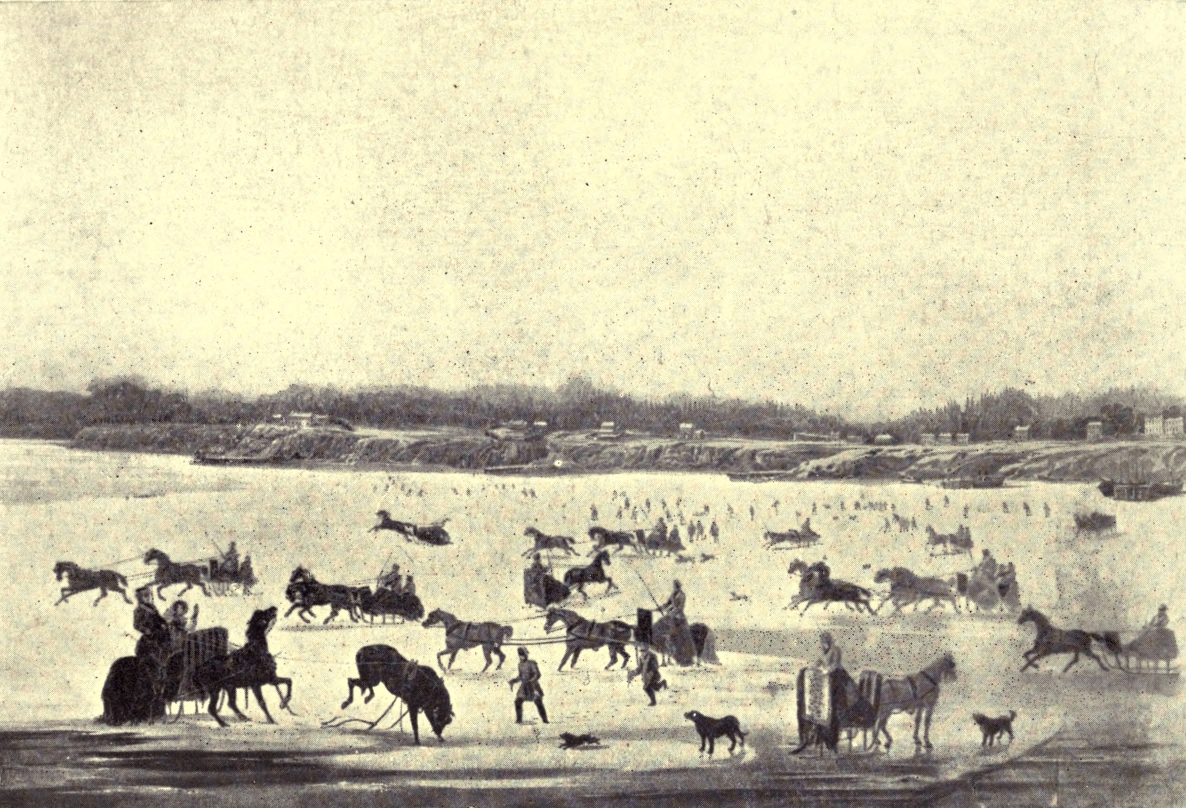
WINTER SCENE ON TORONTO BAY
It was on March 6, 1834, that the town of York became (with extended limits) the city of Toronto. The first mayor of the municipality (in fact, the first mayor in Upper Canada) was William Lyon Mackenzie, the popular hero, who had been five times expelled from the Assembly and had been as persistently re-elected by the “free and independent electors” of York County. Indeed, it is safe to say that, for a considerable number of years, this “wiry and peppery little Scotsman, hearty in his love of public right, still more in his hatred of public wrongdoers,” was the most conspicuous figure in York County, not excepting even the Governors in their picturesque trappings of state.
Mackenzie, moreover, was the occasion of, or the actor in, many lively scenes characteristic of the early days, and therefore I make no apology for dwelling at some length on his doings and sufferings, though I cannot pretend even to mention the names of many men who served their country more wisely and not less well.
When the little capital in the wilderness could boast only a population of two or three thousand souls, political contests were waged with the bitterness and the fierce personalities of an ancient hand-to-hand fight, and apparently the onlookers took much the same kind of savage delight in the shrewd blows given and received as their ancestors had found in the single combats of accredited heroes.
This is the portrait of the redoubtable little champion of the rights of the people and the freedom of the press, as sketched by a friendly hand: “Mackenzie was of slight build and scarcely of medium height, being only five feet six inches in stature. His massive head, high and broad in the frontal region and well rounded, looked too large for the slight, wiry frame it surmounted.... His keen, restless, piercing blue eyes ... and the ceaseless and expressive activity of his fingers ... betrayed a temperament which could not brook inaction. The chin was long and rather broad. The lips, firmly pressed together, were in constant motion, with which the twinkling of the eyes seemed to keep time, giving an appearance of unrest to the whole countenance.”
Shortly after Mackenzie’s settlement in York a mob of young men connected with the officials invaded his newspaper office, broke his press and scattered his type, flinging some of it into the bay. The somewhat unlooked-for result of the outrage was to extricate the enterprising editor from financial difficulties, for he was awarded heavy damages. Soon afterwards, without waiting for an invitation from anybody, Mackenzie announced himself as a candidate at the approaching election for one of the two seats for York County. At the same time he declared that, contrary to the all but universal practice of the period, he would “keep no open houses” and “hire no vehicles to trundle freemen to the hustings to serve themselves.” His daring was justified by success. He and Jesse Ketchum, the philanthropic tanner, found themselves at the head of the poll. A little later Mackenzie’s repeated expulsions from the House kept the county in a ferment, and Dr. Scadding, in his Toronto of Old, recalls seeing a crowd pelting Mackenzie in the old Court House Square with “the missiles which mobs usually adopt.” On the same day, when Jesse Ketchum was haranguing the throng from a farmer’s wagon, some sturdy fellows suddenly laid hold of the vehicle and wheeled it rapidly down King Street, nearly throwing the speaker off his balance.
At another time, Mackenzie, “after one of his re-elections,” was “borne aloft in triumph on a kind of pyramidal car,” with a massive golden chain, the gift of his admirers, about his neck, whilst in the procession was a printing-press “at work in a low sleigh, throwing off hand-bills,” which were tossed to right and left into the attendant crowd.
Year by year the plot thickened. Despairing of any redress of their grievances, the more ardent of the Reformers began to think of emulating the example of the American “Patriots,” of Revolutionary memory, and declaring for independence. The theatrical indiscretions of Sir Francis Bond Head made bad worse, and at the end of July 1837 there was a meeting of the disaffected in a Bay Street brewery, at which a Declaration of Independence was adopted, and then Mackenzie went out into the country, holding meetings at Newmarket and, it is said, at some two hundred other places, to organise vigilance committees and prepare for revolt. He did not by any means confine his labours to York County, but when the attempt on Toronto was determined on, Montgomery’s Tavern, on Yonge Street, a few miles from the city, was appointed as the rendezvous for the rebels; and it was there that they were completely defeated by the loyal forces.
After that, for over a decade, Mackenzie disappeared from the county, and, though his return to Toronto in 1849 was the signal for rioting on the part of some hot-headed Tories, and for the burning of the effigies of Attorney-General Baldwin, Solicitor-General Blake and Mackenzie himself, he was a worn and broken man, and never again played his former energetic part.
At the time of his return, Lord Elgin was Governor-General. In private life he appeared as “an unassuming, good old gentleman,” and was often seen “walking arm in arm with his wife in the good old-fashioned way,” but he used to go in state to open or prorogue the House, in his Viceregal chariot, drawn by a “gaily caparisoned four-in-hand,” and attended by a “full complement of postilions.”
Mr. Yeigh tells of many famous scenes in the old Parliament buildings on Front Street, as when George Brown, in April 1857, introduced his motion declaring for “Representation by Population,” or when John A. Macdonald, violently attacked by the brilliant Irishman D’Arcy M‘Gee, calmly went on sealing a pile of letters with wax, as if absolutely deaf to the storm raging about his head.
After the union of the Canadas, when the Legislature sat in Montreal, the building was put to other uses, serving at one time as a medical school in connection with King’s College, and at another as a lunatic asylum, after which it was reoccupied by the Parliament of the United Provinces. Next it was used as military barracks, but from Confederation until 1892, when the new Parliament buildings in Queen’s Park were ready for occupation, it was the home of the Legislature of the Province of Ontario.
Reading its old history, one gets the impression that the capital of Upper Canada was always a lively, stirring place, and though John Galt was unkind enough to refer to it in terms implying that it was superlatively dull, from the first it had one great advantage, apart from its position as capital. It was comparatively easy of access, for in pre-railway days it was served by numerous sailing vessels and steamers. (The first steamer to ply on Lake Ontario was built in 1816.) Then, as already mentioned, York town and York County were far better off for roads in the early days than most pioneer communities. The importance of Yonge Street as a route towards the upper lakes was recognised in a practical fashion by the old “North-west Company,” which in 1799 gave £12,000 “towards making Yonge Street a good road.”
Towards the middle of the nineteenth century the demand for good roads became secondary to the agitation for railways. The first of the iron roads upon which an engine ever ran in Upper Canada was the Northern Railway, which was cut through the centre of the county. The first sod was turned by the Earl of Elgin on October 14, 1851, but the line was not opened for traffic throughout its ninety-five miles of length till New Year’s Day, 1855.
“The air is still—the night is dark—
No ripple breaks the dusky tide;
From isle to isle the fisher’s bark,
Like fairy meteor, seems to glide.”
Susanna Moodie.
The beginnings of the story of Peel County centre about the River Credit, famed once as a fine salmon river. That lively Welshwoman, Mrs. Simcoe, wife of the first Governor of Canada, tells, in her recently published Diary, how, on a June day in 1796, when coasting along the north shore of Lake Ontario from Burlington to York, she and her husband and little daughter Sophia were caught in a fierce storm. A continued east wind had raised a great swell, and when, after an interval of comparative calm, the wind “rose violently from the west, coming against the late swell,” it “formed a terrifying sea.” Mrs. Simcoe, who a year or two earlier had recorded the wreck of a boat carrying letters along this shore, adds: “My fears awoke also, till we landed at three o’clock at the River Credit, twelve miles from York. We were surprised to see how well the canoe made her way through this heavy sea. She rode like a duck on the waves. After dinner we walked by the River Credit. Numbers of Indians resort here at this season to fish for salmon, and the Governor, wishing to go some way up it, which our boat was too large to do, made signs to some Indians to take us into their canoe, which they did; there were two men in her, which, with ourselves and Sophia, completely filled the canoe. They carried us about three miles, when we came to rapids and went on shore.”
Nearly a quarter of a century later the village of Streetsville was founded beside these rapids, which still exist; “but these,” says Mr. J. Ross Robertson, the editor of the Diary, “are greatly reduced in volume as compared with what they were even sixty years ago.” In early days “venturesome lumbermen” used to “run their timber rafts down them during the spring.” Mrs. Simcoe continues: “The banks were high, one side covered with pine, and a pretty piece of rocky country on the other.” Some time during the afternoon she made a sketch of a bend in the river, winding between high bluffs and shaded here and there by trees.
On returning to the boats, where they had neither provisions nor money left, the stately Governor was again forced to go through a pantomime to show the Indians “that they would be recompensed for their trouble if they came to York. About five, the weather being calm,” the voyagers adventured themselves again on the water, and arrived at York at nine.
The first house built at Port Credit was often called “Government House,” because it was erected by the Government as an hotel and residence for a ferryman to take travellers across the Credit. It was kept at first by Thomas Ingersoll. When he died, his widow, Sally, and his son, Charles, applied for a licence of the tavern. Charles, however, ultimately moved westward and founded the town of Ingersoll, in Oxford County. His successor at “Government House” was a man named George Cutter, who once had to pay the large fine of £10 for selling liquor to Indians. A few years later a ferryman was no longer needed, for in April 1820 a grant of £50 was made to build bridges over the Humber, the Mimico, and the Credit.
For a time the ferryman and his family were, it is believed, the only white settlers in the township of Toronto, but in 1806 what was afterwards called “the Old Survey” was made. A strip of land one mile wide on each side of the Credit was then reserved for the Mississauga Indians, with special privileges as to fishing. Without their consent no white man might fish in the river. Subsequently, alarmed perhaps by the advancing tide of civilisation, they sold their lands and removed to the Saugeen River, in Bruce County.
The real settlement of Toronto Township began about 1807, upon the completion of the survey. For five years new-comers continued to arrive. Then the progress, not only of Peel County, but of the whole country, received a severe check through the war of 1812. Soon after the return of peace “the New Survey” of Toronto Township was made, and in 1819 a colony of Irish folk, who had intended to settle in the United States, but found conditions not to their liking, arranged, through their agents, Beatty and Graham, for a portion of the township to be set apart for them.
About 1835 the town of Port Credit was laid out by the Government, and lots in it were put on sale. A few miles inland and eastward of this once flourishing little port lies the old village of Cooksville, which, in John Lynch’s sketch of the “History of Peel,” is said to have been ruined by the making of the railways to the north and south. It had perhaps the first vinery and wine-making establishment in the district.
The township of Chinguacousy—a word of Indian origin meaning a pinery, and akin to the name of the Chief after whom the Shingwauk Home for Indian Boys at Sault Ste. Marie was called—was settled in part by persons entitled to write after their names that title to honour, “U. E. Loyalist.” Brampton, now the county seat of Peel, was once a famous hunting-ground for deer and partridges, and it is told that a colony of beavers and its first human settlers arrived on the scene about the same time; but the former soon left their unfinished dam and retreated further into the wilderness. It seems almost a matter of course that Brampton’s early buildings should have included a store, a mill, an ashery, and a distillery!
In Caledon Township, about ninety-five years ago, a violent attack of “gold fever” seized the settlers in the neighbourhood of what is now the little village of Cataract. For some reason the idea went abroad that the Devil’s Pulpit and other hills along the Credit contained the precious metal, and for months many a settler neglected more profitable labours to give himself to prospecting. One young Scot, Grant by name, failing to discover gold, imagined he had found a mine of wealth in a spring of brackish water near the Credit Falls. He determined to make salt, but this venture ended, like his prospecting, in loss and waste of time.
Though for many years part of its population had agitated for municipal independence, Peel County was united with York until 1865. In very early days Toronto Township had, it is said, “more business with the ‘Court Book’ at York than any other outside township, excepting perhaps Scarborough.” This business largely took the form of actions for “assault and battery,” applications for tavern licenses (which appear to have been granted in abundance), and disputes about statute labour.
As early as the autumn of 1793 Port Credit was connected with York by Dundas Street, a highway ultimately extended westward to Amherstburg. At a later period the Hurontario road was cut through Peel County from Port Credit to Orangeville. In pre-railway days good roads were of even more vital importance than they are now, but some of the pioneers seem to have found road work so peculiarly distasteful that, rather than do it, they put the luckless “path-master” in “bodily fear” with threats and blows. In 1812 Philip Cody, then path-master, brought complaint against James M‘Nabb for assault and battery, but, as both in that and the following year the defendant was found to be exercising his pugnacious instincts in a useful and patriotic fashion with the loyal forces on the Niagara frontier, the case against him was dismissed. At that date, by the way, the war took so many of the able-bodied men out of the district that it was hard to find constables.
Then, as now, attempts to evade the import duties were not infrequent, but on one occasion a Toronto Township man had the good luck to reap the fruits of some other person’s adroit smuggling. One day he bought in York a barrel of American salt. On opening it he discovered within it “a keg of good tobacco,” worth £5 or more. The York merchant endeavoured to recover its value, but failed to do so.
“The memory of the Red Man,
How can it pass away,
While his names of music linger
On each mount and stream and bay?”
Anon.
Surely Halton County has its share of the “wild names” of which the poet sings, for, of its four townships, two bear the Indian appellations of Esquesing and Nassagaweya. The other two, set apart in 1806, a few months after Nelson’s death and victory off Cape Trafalgar, were named in honour of the hero and “his last sea-fight.” Moreover, in Trafalgar Township, a little, old fishing village calls to mind a foreign title bestowed on Nelson by the Neapolitan Government before he was created an English Peer. In 1799 he was made Duke of Bronte, receiving with the title the market-town of Bronte, in the Val di Demona, in Sicily, its territory and an income of £3750 a year. Thirty-five or forty years ago, the Canadian Bronte was more important than now; and from it were shipped annually about 80,000 bushels of grain.
As first constituted in 1816, Halton was an immense county, comprising several townships of the present Wentworth County, and much of Wellington and Waterloo. Now it is a very small one, and it has no large town within its borders, for neither Oakville (a name of note in connection with the culture of strawberries) nor Milton, the county seat, named after the poet, has as many as three thousand people. In 1824 Oakville was represented by one log-cabin, and it was in 1822 that the first settlers came to Milton at a time when “roads were rather imaginary than real.” But perhaps better than large towns are the many pleasant villages and fruitful farms which make little Halton a prosperous county, though, in common with other rural districts of Ontario, its population has rather fallen off than increased within the last half-century. Originally Halton County had been included in York, and had formed part of the Mississauga Indian Reserve.
A few years before his death the great Mohawk, Brant, received a Royal grant of what is now Burlington, once called Wellington Square. Just at the head of Burlington Beach the Chief erected a large two-storey house, which is still standing, though much altered. It was built of red cedar brought from the Thousand Isles. He furnished it in English style. There he spent his closing years, and there, on November 24, 1807, he died at the age of sixty-four. His body was taken for burial to the Mohawk Reserve on the Grand River, and his wife, Catherine, who preferred the Indian mode of life, returned to dwell amongst her own people. But in later years, after fighting bravely in the war of 1812, her youngest son, John, whom his mother (having the right to do so by the custom of her people) had appointed Chief, came back to the Brant House at Burlington with his youngest sister, Elizabeth.
An English traveller, Hall, says that, except for wearing moccasins, the young man dressed in European style, whilst some other travellers (Buchanan, the British Consul at New York, and his two daughters) having an introduction to “a Miss Brant,” were astonished at first to discover that she was “an Indian Princess,” and then to find that her manners differed little from those of any other well-bred lady. These people, arriving very early in the morning and seeing no one about, entered the house, and had time to note the “pier and chimney glasses” in the parlour, “the fashionable chairs,” and the guitar, that suggested a fashionable accomplishment, before their hostess, “a charming, noble-looking Indian girl,” came to greet them. She was clad all in black silk, from her stockings to her tunic and short skirt, and her head was covered with a silk net, which, however, allowed her hair to fall in loose tresses on her shoulders. She talked easily and composedly till a squaw, wearing “a man’s hat,” began to make preparations for a substantial breakfast of tea and coffee, hot rolls, eggs, ham, and broiled chickens. The guests were surprised to see no Indian weapons in the hall, but the young Chief explained that his English guests, of whom he had had many, had begged from him all of such things that he had once possessed. In 1832 John Brant died of cholera, but his sister, who had married a grandson of Sir William Johnson and Molly Brant, named Kerr, lived with her husband and children at the Brant House. Like her father, she translated portions of the Scriptures into Mohawk for the benefit of her own people.
Meanwhile white immigrants were coming into the country, and in a book on “The Canadas,” compiled from papers furnished by John Galt, there is to be found some interesting information as to the state of things in Halton County about 1830, in letters written home by an English day labourer. This man, Thomas Hunt, had settled in Nelson, about nine miles from the lake, and with his two brothers had bought two hundred acres of land at 12s. 6d. an acre, to be paid in instalments.
“We are in a good country for poor folks,” he wrote, “we have plenty of good fire and grog.” Then he gives some of the current prices—wheat, 4s. per bushel; Indian corn, 2s. 6d.; oats, 2s.; potatoes, 1s. 3d.; rum, 10d. per quart; good whisky, 7½d.; brandy, 9d.; tea, 3s. 6d. per lb. Beef and mutton were then 2d. per lb., fat geese only 1s. 6d. each, and good apples 1s. per bushel. “We make our own sugar, our own soap and candles, and bake good, light bread,” he says. “We shall never want for water or timber. We have several adjoining houses, chiefly English people. We can raise up a good house in a little while at little expense.... It is called the healthiest place in Upper Canada.... They that think to work may do well. But,” he adds, “if our fathers and mothers were here, they should never be obliged to do a hard day’s work, for we would keep them without work if they were not able.”
Six months later Hunt wrote again to tell his friends at home that the house was built, and that they hoped “to get a plough of oxen this summer and a cow or two.” Part of the time in those first years he and his brothers “had to work out sometimes,” getting three pounds the month and living with their masters. But they looked forward to being able soon to work “all the time on their own farm.” And one hopes that the rosy dreams of these simple folks were realised, and that they did not fall victims to too cheap and too plentiful “grog” in any form.
In 1837 William Lyon Mackenzie had some very trying experiences in Halton County. About three o’clock in the afternoon of the day after the fight at Montgomery’s Tavern, the rebel leader, with a lad of about nineteen, Allan Wilcox, as his sole companion, reached Streetsville, on the Credit, and went to ask for some bread and cheese at the house of a miller bearing the auspicious name of Comfort. The good wife pressed the fugitives to stay for dinner, and then the miller sent his man with a wagon to help them on their way westward. Mackenzie had heard at the mills that parties of men were out searching for them and he saw “bills duly posted” offering the reward of a thousand pounds for his apprehension, but, though it was still broad daylight when they left Comfort’s house, no one tried to stop them. The roads were rough and frozen, and it was hard travelling. At length they discovered that they were being hotly pursued by mounted men, and, hearing when they approached the Sixteen Mile Creek (at the mouth of which is Oakville), that a party was guarding the bridge, they jumped from the wagon. To put their pursuers on the wrong track Mackenzie asked a labourer the way to Esquesing, then turned with his companion into a patch of woods, near the deep ravine, at the bottom of which runs the creek, then swollen with heavy rains. Regarding Trafalgar as “a hotbed of Orangeism,” and a district where he could “hope for no friendship or favour,” Mackenzie felt that his one chance of escape was to cross the stream and press on westward. Wilcox insisted on sharing his fate, so stripping and holding their clothes in bundles above their heads, they plunged up to their necks into the turbid stream, thick with cakes of ice, which beat and buffeted against them. It was a bitter December night, and the icy water chilled them through and through, so that when they gained the other side the frozen bank seemed almost warm to their feet.
An hour and a half later they reached a house, where they were fed and warmed and given a place to rest in, while the sons and daughters of the Nelson farmer kept a silent watch outside in the cold. But the fugitives dared not rest long, for they had to make the most of the hours of darkness. About eleven o’clock they crossed Dundas Street, and at midnight passed over what they supposed was the Twelve Mile Creek (Bronte’s little river) on the trunk of a fallen tree. About four in the wintry morning they reached the house of another friendly farmer at Wellington Square, and, hearing that M‘Nab’s men were scouring the country in all directions, Mackenzie parted from his young friend and hid in a pea-stack, from which, like Charles II in his oak tree, he had the pleasure of watching the Sheriff and his men searching for him. The rest of his adventures (and they were many) do not belong to the story of Halton County. Mackenzie safely reached the United States, and one cannot help thinking (with him) that it is something to be proud of that no Canadian was base enough to try to sell him for Head’s thousand pounds.
“Clear the land of evil, drive the road and bridge the ford.
Make ye sure to each his own
That he reap where he hath sown;
By the peace among our peoples let men know we serve the Lord!”
Rudyard Kipling.
Large as Simcoe County now is, it once contained half as many more townships than it does at present, and was also for a time the mother county of the districts of Muskoka and Parry Sound, being responsible for the maintenance of order and the dispensing of justice throughout that vast wild region. A quarter of a century ago Simcoe was relieved of this burden, but still contains sixteen townships. The names of some of these are derived from Spanish, African, Welsh, and Irish sources, whilst others commemorate (if tradition speaks truly) two Indian beauties, a great chief and (in Tiny, Tay, and Floss) the pampered lapdogs of a Governor’s lady.
The name of the county itself is borrowed from that bestowed on the lovely lake, forming much of its eastern boundary, by the energetic first Governor of Upper Canada, in honour of his father, Captain John Simcoe, who was killed during Wolfe’s siege of Quebec.
The story of Simcoe County has been written at length, and I must gratefully acknowledge my indebtedness to the labours of its historian, Mr. A. F. Hunter. He devotes many interesting pages to accounts of the Indian peoples who occupied the district before the period of immigration from Europe, and reminds us that it was the scene of those weird Feasts of the Dead when the Hurons interred in one huge common grave the remains of all their kindred who had died within ten or twelve years.
In 1615 Champlain made his way up the Ottawa, Lake Nipissing, and French River to the Georgian Bay. Then, attended by a friendly band of Indians, he explored the eastern coast of the bay, passing the spot where Parry Sound now stands, and turning inland from the site of Penetanguishene to the Huron town of Otouacha, whither the Recollet missionary, Le Caron, had come before him. Champlain had promised the Huron chiefs who had visited the settlements on the St. Lawrence his help against the Iroquois; and his arrival was the signal for the mustering of a great war party, at the head of which he travelled through the heart of our Province.
The warriors crossed Lake Simcoe, and paddling on by lake and stream came down the Trent to its mouth, where Champlain was not much more than two hundred miles from his starting-point at Montreal. But this was his first sight of Lake Ontario, over which he passed with his army of painted braves into the Iroquois country. Unfortunately his fire-breathing arquebus seemed to have lost its magic, and, lamed by a severe wound, he had to make much of the long return journey cramped up in a basket on the back of a stalwart Indian. Obliged to spend the winter in the Huron country, he continued his explorations, and amongst other journeys made one through the territory now forming the counties of Bruce and Grey.
The next great chapter in the history of the county is the tragic story which has been told with so much brilliancy and pathos by Francis Parkman, of the founding and destruction of the Jesuit missions to the Hurons. The chief of the mission towns, in those brief days of sunshine when the courage and patience of the “Black-robes” had triumphed over the distrust and stupidity and the superstition of their dusky flocks, was Ste. Marie, situated on the Wye, a little east of Midland in Simcoe County. With energy still to spare for other labours the valiant Brébeuf once penetrated into the country of the ferocious Neutral Nation in the Niagara Peninsula, but after months of deadly peril was forced to retreat. Thus narrowly he escaped the crown of martyrdom, only to win it a few years later at the hands of the Iroquois, who in one terrible year swept the Christian villages out of existence and broke forever the proud spirit of the Huron warriors. In later years another tribe entered into their ancient hunting-ground, and when the white men desired to possess the land they had to purchase it from the Chiefs of the Ojibways.
The fur-traders, of course, followed the Indians to the wilderness, and early records afford glimpses of many a picturesque figure doing business with the red men at strategical points on the great inland waters. Near Matchedash Bay there settled an English trader, Cowan, who, as a captive in boyhood, had learned the Indian speech and ways, and relics of his dwelling-place are still to be seen on the shore. Another trader whose story reads like a romance established himself at the beginning of the nineteenth century at the “Narrows” of Lake Simcoe, where Orillia now stands. This was the French exile of the Reign of Terror, Quetton St. George, who, having landed in England on St. George’s Day, had “in gratitude added the saint’s name to his own.” The Indians, with whom he was popular, called him “White Hat.” He was a successful trader, and ultimately returned—a wealthy man—to his native land.
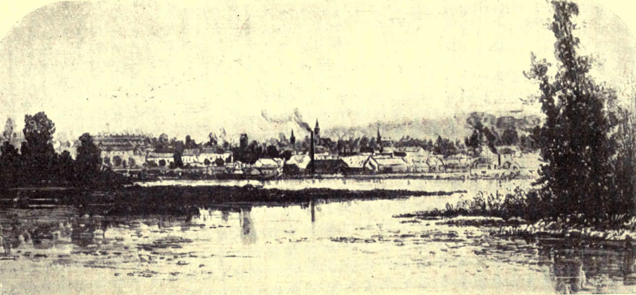
ORILLIA, FROM “THE NARROWS”
In early years, owing to its position with regard to the lakes, the great route to the west lay through Simcoe County. In 1813 a gallant force of 250 men, consisting chiefly of Glengarry Light Infantry, passed through to reinforce Michillimackinac—and many a civilian travelled the same road. Amongst these was that “heroic sailor-soul,” Sir John Franklin, who, twenty years before his last disastrous voyage, set out from Penetanguishene to explore the Arctic coasts of Canada.
The first surveys were made in Simcoe County, a little before the War of 1812, but some of the work was done carelessly, giving rise in consequence to many disputes over boundaries. Many towns were laid out on paper, but only two or three actually came into being, and for years these grew very slowly. In the pioneer period free grants were given to U. E. Loyalists and their descendants, to the militia-men of 1812, and to retired British officers, but other settlers had to obtain their lands by purchase, and the “land-grabbers” and speculators did their utmost to escape any share in the cost and labour of opening up the country. Patents for lands were sometimes issued by those in power in return for votes. In one case it is said that the number of patents issued before an election exceeded the whole number of settlers in the township. In fact, election scandals were as common then as now.
The first election for Simcoe County (or rather district) was held at Holland Landing, then in Simcoe, and the only polling place for the huge constituency. The election lasted six days, and each candidate kept open house at a tavern for his supporters. On the Monday a settler, an ex-soldier, established himself at the inn where the adherents of Robinson, the “Family Compact” candidate, refreshed themselves. There he remained, keeping high revelry till Saturday, when he went to the poll, attended by a mob of his late boon companions, and to their intense disgust recorded his vote for “Cawthra.” He was, indeed, in danger of rough handling, but an audacious excuse saved him. “Gintlemen,” he shouted, “I sarved under Wellington in the Peninsoolar, an’ moi Giniral larnte me to faste on moie innimies. Now,” he added, with an oath, “haven’t oi done it?”
In a new country almost every other problem seems to hang on that of transportation, and for long years the history of Simcoe County is the history of the efforts of the people to get roads cut, bridges built, steamboats put upon the lakes, railways driven through the country, and now (in this era of bicycles and automobiles) the old question of usable roads is again to the fore. Simcoe’s first road was the “Nine-mile Portage,” between Kempenfeldt Bay and Willow Creek, a tributary of the Nottawasaga. This was in one place so steep that when, in 1813, cannon had to be taken over it, it was necessary to put ropes round the trees at the wayside to prevent the loads going too fast. Later, in some districts, “planked roads” were tried, proving a great boon at first, but soon wearing out. A feature of the times was the enormous number of taverns, the more travelled roads having one to every mile or so. Innkeepers and carters opposed the building of railways “tooth and nail,” but in vain.
Simcoe County, which was destined to have “a woeful experience” of the costliness of the early railways, can at least claim the honour of having, in the Northern Railway, the first line “of any extent completed in Ontario.” The engine which pulled the first train out of Toronto on a bright May morning in 1853 was the first ever built in Canada. It was appropriately named “the Toronto”—an earlier engine, “the Lady Elgin,” used in construction work, having been built in New Jersey.
A subject nearly related to roads and railways is that of the mails, which before 1837 were earned chiefly by men on foot or horseback. In those days it cost fourpence-halfpenny to send a letter from Toronto to Barrie, and to more distant places in proportion. This, of course, kept down the number of letters. In 1832 the postmaster of Orillia found plenty of space for the mail of the whole countryside in a birch-bark basket, and during “the fifties” the good-natured postmaster of Innisfil, by way of saving the settlers many a long walk, used when going to church on a Sunday to “crowd” his tall “plug hat” full of letters.
Speaking of churches, the first Protestant place of worship appears to have been a log-cabin built about 1823 in the “Scotch Settlement” (of refugees from Lord Selkirk’s ill-fated Red River Colony) in West Gwillimbury. An interesting old church of Simcoe’s pioneer days still stands at Shanty Bay, a neighbourhood which was once largely settled by half-pay officers. The edifice is built of mud-bricks, and has been kept in excellent repair. Within is a memorial tablet to Lucius O’Brien, one of Canada’s earliest notable artists, and not far distant is the large old log-house built by his father.
The historian of Simcoe County dates events before and after the Rebellion of 1837. At that time there was some disaffection, especially in the southern parts of the county, but the population, on the whole, was eagerly loyal. The men sprang to arms, leaving only women and children in the settlements. It is told that the day after the fight at Montgomery’s Tavern six hundred men of Simcoe, under command of Lieutenant-Colonel Dewson, came marching down Yonge Street, headed by Highland pipers playing the national pibroch. With this party were brought in sixty prisoners, tied to a long pole.
Many of these were released on parole, but Samuel Lount, who had formerly represented Simcoe County in the Assembly, was captured after attempting to escape in an open boat across Lake Erie, and, in spite of many petitions to Governor Arthur for mercy upon him, was executed in the following April.
“He’s a king upon a throne
Who has acres of his own!”
Alexander M‘Lachlan.
This little county, which from the first has always been essentially a farming district, long laboured under the disadvantage of being somewhat swampy. This seems strange, when it is remembered that it is one of the highest parts of old Ontario, and is, in fact, the watershed between the four lakes—Huron, Simcoe, Erie, and Ontario. The altitude of Orangeville, which is only forty-nine miles from Toronto, is 1395 feet above sea-level, or 1100 feet above the spot occupied by the City Hall of Toronto. But this “roof of Ontario,” as it has been called, is a very flat and in places a depressed roof, so that, fifty years ago, it was described as a dreary level of cedar and tamarack swamps, out of which the head-waters of the numerous streams that take their rise in the county “oozed” as little rivulets. But though, during the last few decades, Dufferin, like some larger counties, has lost population to the cities and to the West, its swamps are being gradually reclaimed, and now, especially during the last year or two since the county has had the benefit of a District Representative of the Department of Agriculture, the work of drainage has been going forward with great rapidity. A citizen of Orangeville owns a modern ditching machine, and at the little village of Laurel, which is only a flag-station on the Canadian Pacific Railway, no less than four cart-loads of tiles were delivered during one season, whilst one Dufferin County farmer put in “well over five miles of drains himself.”
The settlement of the county began in the twenties of last century, but for years the population was very thinly scattered. As late as 1841 Amaranth and Melancthon Townships together had only 105 inhabitants, but by 1851 this number had multiplied by five, whilst the less swampy township of Mono had over 1000 inhabitants.
Dufferin County was, of course, named after the popular nobleman who was Governor General of the Dominion from 1872 to 1878, but the origin of its somewhat odd township names is involved in an obscurity which even Mr. Gardiner’s painstaking industry can scarcely penetrate. Mulmur and Garafraxa are supposed to have been derived from Indian names—Mono is Spanish for “monkey,” but why it was applied to the township is not clear—and Amaranth may have been named after a common weed or the “imaginary unfading flower” of the poets. As to Melancthon and Luther, there is a local tradition that a Roman Catholic surveyor, disgusted with the swamps, determined to name them after “the meanest man he had ever heard of!” But as the name of the gentle Philip Melancthon was his German patronymic, Schwarzerd (meaning “black earth”) done into Greek, is there not a possibility that the township name merely refers to the colour of the swampy soil, and that the giver of the name Melancthon may have added that of his great associate, Luther, as an afterthought?
There is a pitiful pioneer tragedy connected with Melancthon and the scattered settlement of Horning’s Mills. One day a son of Horning and three other children, named Van Meer, were sent to fetch the cows for milking, and from that hour were never seen again. Long there lingered a notion that they had been carried off by Indians, and twenty years later a young man turned up, claiming to be the lost Horning boy. But he gave such a contradictory account of himself that his story was not believed, and the mystery of the children’s fate was never cleared up. There were rumours in the pioneer days of a silver mine, known only to a few white men and Indians, on a kind of island of rock in Melancthon swamp, but no one has ever been the richer for its mythical treasures.
Sixty years ago large quantities of maple sugar used to be made in Garafraxa and other parts of the county, and to the young folk at least sugar-making, though there was plenty of hard work connected with it, seemed one of the pleasantest tasks of the year. It belonged to the bright weather of early spring, when, though the snow still lay deep in the woods and the nights were sharp and frosty, the sun’s power was making itself felt in the lengthening days. Before the sap began to run, the careful pioneer made ready plenty of troughs and buckets, casks and kettles, for the “tapping” of his trees, often two or three hundred in number. The first step of the process was to make an auger-hole through the bark, in which to fix a “spile” or spout of metal or wood to carry the sap into the receptacles below. The sap was collected once or twice a day, and was boiled in great kettles hung from a pole held in crotched sticks over a fire in the open air. This fire was often built along the great trunk of some fallen tree. If possible each day’s “run” of sap was finished the same night. When the syrup was sufficiently well boiled, the kettles were taken from the fire, and their contents were stirred till they turned to sugar, which was set in moulds to harden. “On these occasions,” writes one who had often taken part in such frolics, “the fun was free and boisterous,” and when the youngsters at last made their way homewards, they were usually very hilarious and sticky.
Mr. C. R. M‘Keown, who since 1907 has been the representative of the county in the Provincial Legislature, and has been kind enough to give me some notes concerning its history, says that “Dufferin was formed in 1879, by taking Orangeville, East Garafraxa, East Luther, and Amaranth from the county of Wellington, Mono and Mulmur from Simcoe, and Shelburne and Melancthon from the county of Grey. The Act forming the county was so shaped that Orangeville, upon the passing of the Act, became at once the county town. This caused great rivalry between this town and the village of Shelburne, which, though small as compared with Orangeville, was situated in the very centre of the new county. The Separation Act, however, carried, and Orangeville became the county town.”
With the exception of one instance, Dufferin has always been represented in the Dominion and Provincial Legislatures by Conservatives. It first became entitled to representation as a separate county in the Dominion House in 1905, and Dr. Barr of Shelburne was its first member in the House of Commons.
The county has been the scene of many triumphs in the cause of temperance, and, except in the village of Grand Valley, there are no licensed hotels within its borders. In some other respects Dufferin is a progressive county. It has many rural telephones and a number of rural mail delivery routes. In connection with its high schools, short courses have been given in judging stock and seed, and a few months ago six rural schools united to hold a school fair at Laurel, the exhibits coming, not from school gardens, but from the home-farms of the pupils.
The couplet at the head of this sketch was written by a Scotsman, who in more senses than one may be counted a “pioneer” Canadian poet. Like Kingsley’s Alton Locke, M‘Lachlan was both “tailor and poet,” having learnt his trade in Scotland, before coming out to try, somewhat unsuccessfully, to make a success of bush-farming. Like Kingsley’s hero too his ideals were democratic. His early volumes of verse were printed in Toronto and published, not very effectively, by himself. But he made many good friends in his life. D’Arcy M‘Gee in 1862 obtained for him the appointment of Government Emigration agent in Scotland, and twice his admirers, of whom there were many, subscribed to “testimonials” in the form of sums of money for his benefit. When nearly sixty, he settled with some members of his large family on a farm in Amaranth Township; and in the last year of his chequered life he bought “a substantial brick house in Elizabeth Street, Orangeville.” There he died suddenly on March 20, 1896, and his mortal remains were laid to rest in the pleasant Greenwood Cemetery, two miles west of the town.
In the early nineties, a barrister and prominent citizen of Orangeville, Elgin Myers, who was created Queen’s Counsel in 1890 and County crown attorney of Dufferin in the following year, startled the community by his written and spoken recommendations of annexation to the United States. When it was objected that “public advocacy of the transfer of Canada and its people to a foreign nation” was “inconsistent with the holding of a public office in connection with the administration of justice,” he insisted on his right of free speech and declined to resign. Finally, after much correspondence, he was dismissed from his office by Hon. Oliver Mowat’s Government in 1892.
“Where once the pagan rite was seen,
Or French or Indian warlike bands,
Where fratricidal strife had been,
Two Christian nations now clasp hands.”
Janet Carnochan.
We have all heard the oft-repeated sneer that “Canada has no history,” but the story of this one county, if it could be told at all adequately, would effectually disprove the assertion. The trouble in writing of Lincoln is not paucity of historic material, but difficulty of selection from an embarrassment of riches. From the days of La Salle onward, the district about Niagara has supplied many a vivid page to the history of Canada. Like Quebec in Lower Canada, it is in our upper Province the chosen home of romance. Now cultured and fruitful and peaceful as a very garden, the peninsula, three parts surrounded by the mighty lakes and the majestic river, has formed a background for the deeds of heroes and for the intricate play of the most varied human activities.
During the Revolutionary War that grim Loyalist, Butler, and the noted Mohawk, Joseph Brant, wintered several times at Niagara, and when peace was made Butler’s disbanded “Rangers” settled along lake shores and river bank, to begin a bloodless warfare on the great trees which seemed to them little better than “cumberers of the ground.” In the struggle to subdue the earth and to make homes in the wilderness for their large families of children (sometimes numbering twelve, sixteen, and even twenty lads and lasses), not only the military pioneers but their stout-hearted wives proved their mettle. Slowly they triumphed over their difficulties, but the records of the old churches hint that the hardships and privations and perhaps ignorances of the time were too much for many a tender little blossom of humanity, and, more even than in our own day, babies were born but to die in a few weeks or months. Those hardy enough to struggle through the first year or two often grew up strong and sturdy, able (both men and women) to bear burdens and to toil for hours, which would make their descendants think themselves greatly ill-used.
At first, the new-comers lived under something like martial law, but the Loyalists, notwithstanding traditions to the contrary, were as much in love with liberty as their brethren who had driven them from their old homes, and they appealed—not in vain—for British law.
It was a great day in little Niagara (or Newark), the chief settlement of Lincoln (then a much more extensive county than to-day), when Governor Simcoe opened there the first Parliament of Upper Canada. It is sometimes said that the ceremony took place under a tree, but the fact is that the importance of the occasion was marked by all possible pomp and ceremony. That first meeting of the Legislature of our Province took place in the Indian Council House, on a hill above the river. The Governor, stately and gorgeous in his military uniform, was attended by soldiers from Fort Niagara as a guard of honour, and right royally he played his part that day as the representative of the Sovereign, while the guns from the fort and the shipping in the river boomed out their sonorous applause.
For five successive years (until the giving up of Fort Niagara, on the opposite side of the river to the Americans, threatened the security of the town) Parliament met at Newark; but long after it ceased to be capital its geographical position, and perhaps the character of its early settlers, ensured the continuance of its eager, stirring life. Many an old-time visitor to Canada has a good word to say for the busy little frontier town and its “very agreeable” society, which was indeed composed to a remarkable degree of people of a fine type, who had energy to spare for the things of the mind and the spirit, despite the pressure of the material needs of a pioneer community.
The records of the Anglican Church of St. Mark and the Presbyterian Church of St. Andrew, beginning respectively in 1792 and 1794, have been lovingly studied and interpreted by Miss Janet Carnochan, whose various papers on Niagara give many a glimpse into those old days. During the War of 1812 St. Mark’s was used as a hospital by the British and as a barracks by the Americans. In the churchyard are still to be seen traces of rifle-pits, and a large tombstone, hacked and broken, shows evidence of having been used by the soldiery as “a butcher’s block.” As for the church, only its solid stone walls escaped destruction when the town was set on fire by the Americans in 1813 on that
“day of fear and dread
When winter snow robed dale and down,
And mothers with their children fled
In terror from the burning town.”
Soon after the war it was restored, and “the picturesque grey-stone church, with its projecting buttresses and square tower peeping through the branches of magnificent old trees,” still stands. The Presbyterian church, though built in 1795 of extraordinarily solid timbers, was totally destroyed in the conflagration, and the later St. Andrew’s, now guarded “by a belt of solemn pines,” was not begun for seventeen years after the war. Another early church of the county which did duty as a hospital when the country was invaded was that at Twelve-mile Creek, near St. Catherine’s, now the county seat.
There were not a few book-loving folk about Niagara in its early days, and the little town has to its credit not only the publishing of the first newspaper in the Province, in 1793, and the formation of the first agricultural society, but also the foundation of the first public library. The fact had been long forgotten, when an old record fell into Miss Carnochan’s hands, which told the whole story from its foundation in 1800 to its dissolution nearly twenty years later, after having been sadly “wasted” in the time of the American occupation. It was supported by subscriptions, and during the course of its existence nearly a thousand volumes were bought, at a cost of over five hundred pounds. It was strong in works on history and agriculture and other grave subjects, but was more sparsely supplied with works of fiction and poetry. In those days books were an expensive luxury, but the trustees of the library did not scruple to pay six guineas for a Life of Pitt, or, which is more surprising, half as much for Jane Porter’s Scottish Chiefs. After this library was scattered the congregation of St. Andrew’s established one which ultimately numbered over nine hundred volumes; and there is still in existence a most valuable collection of books sent out from England to the first clergyman of St. Mark’s and presented to the church by his heirs. Fortunately, when Niagara was burned in 1813, these books were at a log-house, called Lake Lodge, about three miles out of the town.
But it was not only the taste for books that gave savour to life at Niagara. The little group of people gathered in the wilderness had come from the ends of the earth, and there was a constant change in the personnel of society in all ranks. There was much coming and going of soldiers and officers, and, for a time, of the Government officials. Governor Simcoe, with his vivacious Welsh wife, long made it his headquarters, and that alone brought many visitors and settlers to Niagara. A misty figure in the traditionary lore of old Niagara was “the old French Count”; but investigation has proved him to have been a very real, very human personage, who lived through as many misfortunes and adventures as any hero of romance. The Count de Puisaye was conspicuous amongst the crowd of noblemen to whom the French Revolution brought disaster, and his name appears in every history of that dread time, “The Reign of Terror.” At first he had taken the popular side, but alarmed at the excesses of its leaders had set himself in 1792 to raise an army to aid the king. A price was set on his head, and he was obliged to flee. With the help of the English Government, a rising in Brittany was organised, and De Puisaye was one of the leaders. The attempt ended in disaster, and De Puisaye spent months in concealment in a cavern in the woods of Brittany. Failing to raise another force, he planned to lead a military colony of French Royalists to Canada, and received a promise of lands and assistance from the British Government. Only forty Royalists joined him, and this scheme too was a failure, though for a time the French Countess de Beaupoil dazzled society at York with her jewels, while De Puisaye and other noble gentlemen shed lustre on the social gatherings at Niagara and elsewhere. Clever, ambitious, graceful in manner and person, strangely dogged by misfortune, the gallant Count seemed formed to be a hero of romance; but, alas for him, it was a romance with a dismal ending, for after a few years in Canada, he returned to England to drag out his last years in exile and loneliness.
Of all the notable people who at one time or other have had a connection with Lincoln County, perhaps, in the eyes of Canadians, the imposing figure of Isaac Brock looms largest. Born at St. Peter’s Port, Guernsey, “the hero of Upper Canada” was the eighth son of a family of fourteen children. Even as a boy he was very tall, strong, and athletic. At fifteen he obtained a commission in the army, and before he was twenty-nine had attained the rank of Lieutenant-colonel. He saw active service on the continent of Europe during Napoleon’s wars, but it was in our own land that he gained his lasting fame. It was not a little thing that in those days of terrible severity, when three subordinate officers could order a man to receive “999 lashes with a ‘cat’ steeped in brine,” that Brock won the love of his men. Yet he could be stern enough upon occasion.
Soon after his arrival in Canada, he visited Niagara under strange circumstances. He was at York when he heard that six deserters had gone off with a Government bateau across the lake, and at midnight he started in pursuit in an open boat with a crew of twelve men. “It was a hard pull of over thirty miles,” but Brock took his turn at the oar, and the deserters were duly captured.
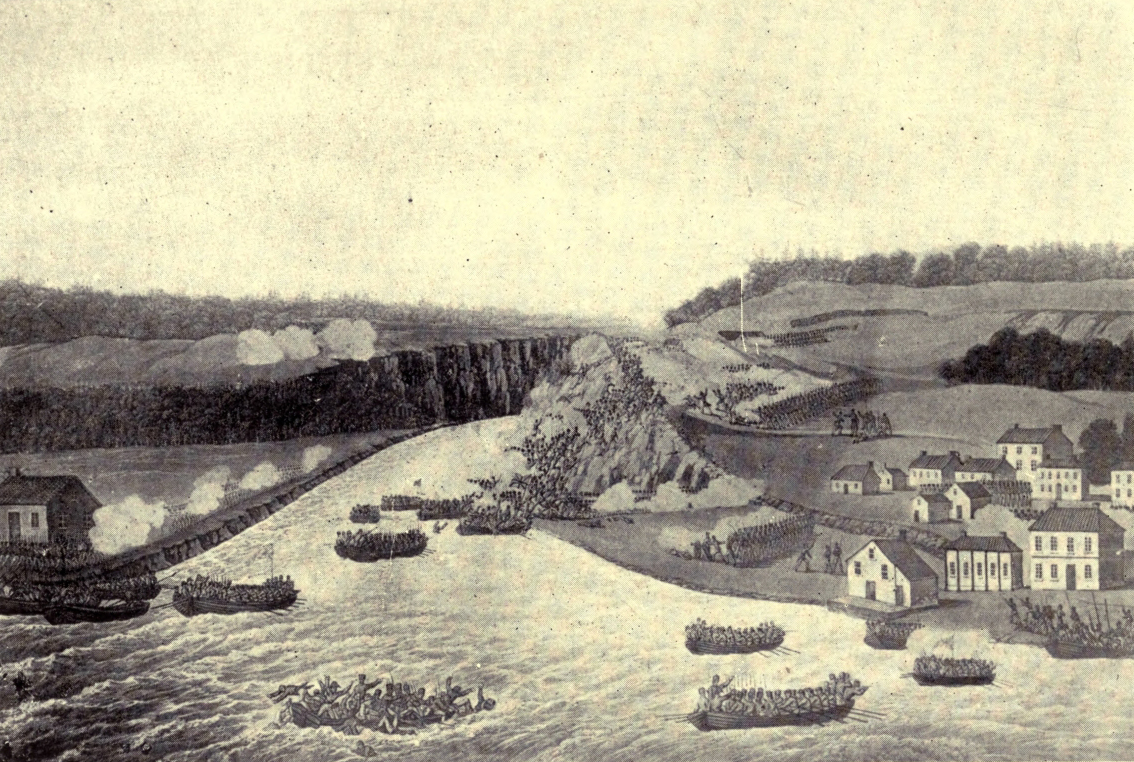
BATTLE OF QUEENSTON. OCT. 13TH, 1813
A few months later news came that a plot was on foot at Fort George to murder the commanding officer, Sheaffe; and again, without an hour’s delay, Brock crossed the lake, walked quietly into the barrack square, found some of the suspected men on guard, and had them handcuffed and marched off to the cells before they could take breath. Four of the mutineers and three deserters were shot at Quebec, and Brock, assembling the garrison at Fort George, read the account of the execution, but he added, in a voice that trembled, “Since I have had the honour to wear the British uniform I have never felt grief like this”; and when he took command at Fort George there were no more desertions.
Brock was a good friend and a true-hearted brother (as there are many incidents to show), as well as a great soldier. At first he found life at Niagara somewhat dull, and “would travel the worst road in the country—fit only for an Indian mail-carrier—to mix in the society of York.” But he did his share to enliven the little town, giving annually a ball, which was one of the events of the season. Perhaps one of the attractions that drew him to York was the fact that “a log mansion” on the outskirts of that little capital was the home of a young lady named Sophia Shaw, to whom he became engaged. Often, however, she used to go to visit a sister who lived near Niagara.
Mr. Nursey, in his vigorous and picturesque Story of Isaac Brock, says that a vast quantity of freight was sent up from Kingston to Queenston, “the remote North-west looking to Niagara for food and clothing—the return cargoes being furs and grain.” The goods were carried in farmers’ wagons round the Falls, “and the entire length of the portage from Lake Ontario to Lake Erie was practically a street,” full of bustle and activity. “A quite pretentious wharf lined the river, and from this on any summer afternoon a string of soldiers and idle citizens might be seen—casting hook and troll for bass, trout, pickerel and herring, with which the river swarmed.” Once Brock himself helped “to haul up a seine-net in which were 1008 white-fish of an average weight of two pounds, 6000 being netted in one day.”
But all the time while Brock was in Canada the storm-clouds of the coming war were slowly gathering. For years he was trying to prepare for the tempest, and before it broke he was appointed head both of the forces and the civil government in Upper Canada. When war was declared, more men than he could clothe and arm rallied to his standard, but in all Canada there were less than 1500 regularly trained soldiers, and the whole population of the two Provinces could have been packed into a city of the size of present-day Toronto, whilst the United States had 8,000,000 people. Moreover, Brock, subject to the orders of his far less able superior officer, Sir George Prevost, had not a free hand; but, in spite of all drawbacks, his success at Detroit and his personality inspired the hard-pressed Canadians with such confidence that he fairly earned the title, with which he was greeted everywhere on his return from the west, of “the saviour of Upper Canada.” By an odd coincidence the bells in England clanged out upon his birthday for the capture of Detroit, and a knighthood was bestowed upon Brock, but he never knew it, for before the news reached Canada he had gone up to fight and fall on Queenston Heights.
I have no space—nor is there need—to tell again the story of that grim battle for the possession of the Heights; nor of the first burial of Brock and his gallant aide, Macdonnell, in a grave within a bastion of Fort George, soon to be desecrated by the footsteps of the invaders; nor of the building and destruction (in 1840) of the first monument, and of the gathering in that year of a mighty concourse of thousands to testify to their admiration for the dead hero and their love of British institutions; nor of the erection of the tall shaft beneath which Brock’s remains, three times disturbed, have now rested in peace for all but sixty years.
We must pass on to speak of a building, erected in old Niagara soon after the war, to which cling as many historic associations as to the remaining vestiges of Fort George and to old St. Mark’s. I refer to Niagara’s second jail and court house, once counted the handsomest building in Upper Canada, and transformed in 1866 from a grim abode of misery and despair to a house of hope, for in that year it was bought by Miss Rye to shelter the little English waifs to whom she was giving a new chance in Canada; and the court-room, which had witnessed many exciting trials, became a dormitory.
Here, on an August day in 1819, assembled a huge crowd to witness the trial of Robert Gourlay, self-elected champion of liberty and good government, whom some of the officials were determined to crush. At the time they seemed to triumph, not only driving Gourlay into banishment, but daring also to condemn the editor of The Niagara Spectator, in which had been printed a letter of Gourlay’s, to a punishment of unheard-of severity. This included a fine of fifty pounds, an hour in the pillory, eighteen months’ imprisonment, and the obligation, under peril of a debtor’s prison, to give for seven years a security of a thousand pounds. This sort of thing, however, only provoked the advocates of justice to go to greater lengths.
In 1824 William Lyon Mackenzie began at Queenston to edit The Colonial Advocate, dragging abuses into the light and agitating for reform so unceasingly and fervently that he worked up himself and his followers into such a state that rebellion seemed the only hope of remedy. But there was no Canadian revolution, and on another August day, in 1838, the court house was again packed, while the judge, to the horror of many present, pronounced on two of the captured rebels the terrible old sentence for treason. Then were heartbreaking interviews with the prisoners through the narrow grating of the tomblike condemned cell. But at last, when all was ready for that dreadful hanging and quartering, the town was thrilled by the news that just in time had come a respite, won by two brave women, Wait’s young wife and Chandler’s daughter, who had made a hasty, difficult journey of seven hundred miles to Quebec to appeal to Lord Durham himself.
A year earlier Niagara had witnessed a desperate struggle to save an escaped slave from being cast out of the land of freedom, to which, when the Southern States were slave States, many a negro steered his course by the light of the North Star. A charge of robbery against the slave was the master’s excuse for demanding his extradition, and the authorities of Upper Canada allowed it. But, led by Holmes, a coloured preacher, the negroes, hundreds strong, guarded the jail, and finally, at the cost of two lives, succeeded in rescuing the man from the Sheriff as he was being taken to the frontier. It is good to know that at last the slave reached England safely, and so got beyond his master’s reach.
“Over the hillsides the wild knell is tolling,
From their far hamlets the yeomanry come;
As through the storm-clouds the thunderburst rolling,
Circles the beat of the mustering drum.”
O. W. Holmes.
This fair and extraordinarily fruitful region of farms and orchards (for over half a century included within the bounds of Lincoln County) has a chequered history of war and peace, of struggle and achievement. During the War of 1812 Welland shared with its parent county the perilous honour of being again and again the battle-ground upon which the defenders of our land staunchly resisted the invaders. It is not possible to tell in detail the story of the struggle, even as it specially touched Welland; but no sketch of the county’s history would be worthy of the name which passed over those brave old days in silence. No episode in the three years’ war is more dramatic than the “Battle in the Beechwoods” at “Beaverdams,” and, though the opening scene of the drama had Queenston for a stage, the fifth act was played out in what is now Welland County, as is testified by a monument near the railway station of Thorold. This British victory, as no Canadian needs to be told, has a heroine as well as a hero, and, throughout, it was a triumph not of superior force, but of keen wit.
In the early summer of 1813 the gallant Irishman, Lieutenant FitzGibbon, with a small party of daring followers, was finding a multitude of ways of rendering himself annoying to the Americans, who had seized upon Niagara and made it their headquarters. He so distinguished himself that at last the American Colonel, Boerstler, was ordered to take some five hundred men to surprise him at his post at Beaverdams, but a couple of officers ventured to discuss the scheme in the hearing of Laura Secord. Daughter of a Loyalist, wife of a militiaman (still disabled by a wound received at Queenston Heights), mistress of the house to which the body of General Brock had been carried after he fell, she was every inch a patriot, and when the Americans rose from the table where the quiet woman had been ministering to their wants the plan was foredoomed to failure.
Very early next morning Laura Secord passed the invaders’ sentries by means of a ruse, and set out on a twenty-mile walk to put FitzGibbon on his guard. The enemy held the roads, so Laura plunged into the woods, to toil all the long day by blazed trails, through swamps and over fallen trees, across creeks swollen to torrents by recent rains, to come out at dusk in a clearing on the outskirts of FitzGibbon’s camp, and to find herself surrounded by a horde of painted, yelling Indians. Weary, dishevelled, but high-hearted still, she made the chief understand by signs that she must speak to the British leader.
At once the valiant Irishman fell into the spirit of the thing. Outnumbered by something like ten to one, he might have been content to beat a masterly retreat. Instead, he stood his ground, bent on the capture of his would-be captors, and so posted his Indian allies that when the Americans entered the beechwoods, weary from the march and unnerved by the disquieting attentions of a troop of Indians who had hung on their rear, they were greeted with a pandemonium of yells and screeches and dropping shots. Prompt surrender seemed then the better part of valour, yet it taxed FitzGibbon’s Irish wit and audacity to the utmost to keep the perilous secret of his troops’ scanty numbers.
From the British point of view, the affair at Beaverdams was a cheerful little burlesque, but Welland County had its share of the grimmest side of war. In those unquiet years many a farmhouse went up in smoke and flame. Early in July 1814, an American force took possession of Fort Erie, and defeated the British on the banks of Chippewa Creek. Soon afterwards both armies received reinforcements, and the British took up a strong position near the Falls of Niagara, at the end of a narrow road called Lundy’s Lane. Their guns commanded the lane, but the Americans attacked them furiously. It was late in July, and the battle, beginning at six in the evening, raged, with a brief lull, till after midnight. The opposing guns roared almost mouth to mouth, drowning for the time the mighty voice of the great cataract. Sometimes a fitful gleam of moonlight shone down on the combatants, but for the most part the struggle was shrouded in the black darkness of a cloudy night. In this battle the carnage was greater than in any other during the war, but the smaller British force held their ground, and the Americans retreated to Fort Erie, where they were besieged in vain by the British. At last, however, they blew up the fortifications and returned to their own country.
Twenty-three years later, in 1837, William Lyon Mackenzie, after a futile attempt to overturn the Canadian Government, fled to the United States, only to venture back into British territory, with a few followers, whom he called the “Patriot Army.” Making Navy Island, in the Niagara River, now part of Welland County, his headquarters, he set up a “provisional government,” offered a reward of five hundred dollars for the capture of Sir Francis Head, and promised land grants to all who would aid in the conquest of Canada. For several days the “provisional government” was suffered to rule undisturbed in Navy Island, then Colonel M‘Nab, with a force of loyal volunteers, determined to capture the little steamer Caroline, which the rebels used for carrying over supplies from the mainland. Accordingly, after dark on December 29th, a few brave volunteers crossed the rapid river to the wharf where the vessel lay, drove the crew ashore, and, setting the boat on fire, towed it out into the current. The blazing vessel cast a red light on the rushing waters, then suddenly sank, and all was black. Colonel M‘Nab was knighted for this exploit, but as the Caroline was the property of American owners it caused a great outcry in the United States.
The rebels held Navy Island for a month, secure against musket shot in the protection of its woods, but when heavy guns were sent up from the St. Lawrence they hastily retired across the boundary.
A generation later, in 1866, the township of Bertie was invaded by 900 armed “Fenians” and sympathisers, many of whom had served in the American Civil War. They made a raid on the village of Fort Erie, tore up the railway tracks, cut the telegraph wires, and marched westward. A few regulars and some companies of “the Queen’s Own” and other volunteers from Toronto and Hamilton were promptly sent to look after them, but owing to some mistake the volunteers were hurried forward in advance of the regulars, and, falling in with the Fenians at Ridgeway, were ordered to attack. Under the fierce onslaught of the Canadians, many of them young lads, the Fenians wavered. Then they rallied and poured a murderous fire on their assailants, killing nine, wounding thirty, and forcing the rest to retire; but O’Neil did not care to stand up against the regulars, and that same night he and his marauders made the best of their way out of Canada.
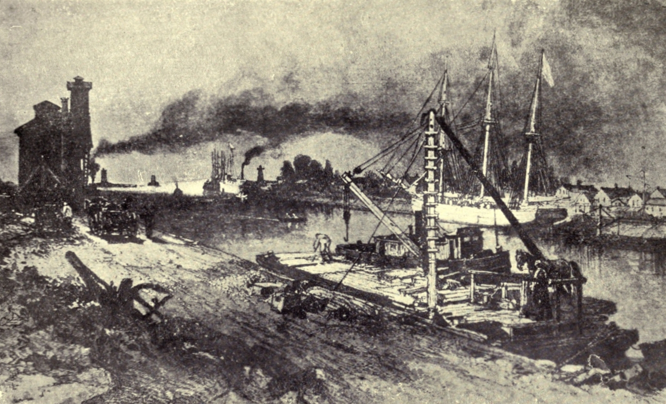
PORT COLBORNE, NEAR ENTRANCE TO WELLAND CANAL
But even in Welland such conflicts between man and man were only episodes in the greater struggle, which has lasted now for well over a century, “to replenish the earth and subdue it,” and sometimes the early settlers “builded better than they knew.” For instance, it is told that the idea of cutting the Welland Canal (which, besides its use as a waterway, supplies water for scores of factories and workshops) arose from the desire of its promoter, William Hamilton Merritt, to secure for his mill a water-supply which would not fail in dry weather. Soon, however, he grasped the full significance of his idea, and, getting his neighbours to help him, made the first rough survey for the canal. That was in 1818, and for half a dozen years Merritt worked unceasingly to interest the Government and the capitalists in his project. The result was that it was finally taken up by a private company, with a Welland County man, George Keefer, as its first president. In 1824 the first sod of the canal was turned; and in 1829 hundreds of people gathered at St. Catharines (of which city it has been the making) to see two vessels gaily decorated with flags pass up the new waterway towards Lake Erie. Since then it has been several times enlarged, and has been taken over by the Government, which is now constructing a larger and deeper Welland Canal. Through the present one, however, there passes annually something over two million tons of freight.
Last but not least of the distinctions of Welland County, its boundary takes in the Horseshoe Falls of Niagara, and owing to this its soil has been trodden by every visitor of distinction—artists, authors, poets, statesmen, princes—since the days when the only access to the foot of the cataract was by “an Indian ladder” or pine tree, with branches lopped off near the trunk. To these and to thousands and thousands of other men and women the mighty cataract has spoken messages of awe and wonder and delight; and now, in this last decade, man has found a way to make a servant of “the Thunderer of Waters,” and Niagara power turns his wheels and lights his streets not in Welland County only, but in a dozen others.
“From the lone shieling of the misty island
Mountains divide us, and a waste of seas—
Yet still the blood is strong, the heart is Highland,
And we in dreams behold the Hebrides:
Fair these broad meads—these hoary woods are grand;
But we are exiles from our fathers’ land.”
To anyone who has ever felt the enchantment of Sir Walter Scott’s poetry and romance, the very word “Glengarry” calls up visions of chivalrous chieftains in waving tartans and plumed “bonnets,” and of their wild following of kilted clansmen, armed with dirk and claymore and almost drowning the skirling of the war-pipes with their fierce battle-cries. Their tongue to most of us may be unknown, yet, thanks to the “Great Magician’s” wondrous art, we know and love them as if they were our kin. Our hearts beat in sympathy with their passionate love for their deep glens and misty mountains, and we mourn with the exiles torn from their “own, their native land.” Many of us, I doubt not, in days when the romance-world was almost more real to us than the calmer life about us, have gone campaigning with “bonnie Prince Charlie,” that graceless, fascinating, most luckless of mortals, and, forgetful of due respect to our forbears, have all but learned to hate the Saxon—or let us say “the Sassenach.” We have looked on at many a hard-fought field, and so we approach the story of “Glengarry” in Canada in a mood inured to the clash of blades and shouts of men in deadly combat; and it is well, for it was the tide of war which first swept the hot-hearted Celts into our now quiet land, and in a later struggle—the War of 1812—Glengarry men, gallantly defending the soil of their new country as they had defended the heathery mountains of their fatherland, again and again drank “delight of battle with their peers.”
It was after the suppression of the Jacobite rebellion of 1745 that the Highlanders of old Glengarry in Scotland first emigrated to America, settling, at the invitation of Sir William Johnson (the friend of Brant and his Indians), in the Mohawk Valley. It was a beautiful and fruitful land, but not for long did the Highlanders give themselves to the quiet cultivation of their farms and orchards. The Revolutionary storm was brewing when they arrived, and when it broke many of the Gaelic clansmen took up arms to strike for the King. Soon the war was raging with peculiar fury along the banks of the Mohawk. Fire and sword turned the fruitful farms into blackened deserts; cruelty and rapine were repaid in kind and with interest, hundreds of wives became widows and thousands of children orphans. Men languished for years in prison, infants were snatched away by the Indians to grow up white savages, families starved while their bread-winners were with the army, and war, shorn of all glamour save that which through every horror clings to deathless courage, appeared as the grim, heart-breaking, evil thing it is.
From time to time, parties of the non-combatants, left behind in the Mohawk Valley, made their way to Canada. Once a large number of women and children were brought off by an armed band of their husbands and brothers, but others came, a few at a time, suffering many a hardship and adventure in their weary journey through the woods. One woman, it is told, undertook to carry two small children on her back. On one occasion it occurred to her that her burden had become strangely lighter, and she discovered that she had actually dropped one little fellow by the way. Hurrying back along the track, she found the child, sleeping peacefully beside a decayed log over which she had had to climb. His hands were begrimed with earth, and to old age he was known by the nickname “Spogan Dubh,” or “Black Paws,” as his mother had exclaimed on finding him.
The war ended, many of the Highlanders settled in what are now the three counties of Glengarry, Stormont, and Dundas. As a rule, the heads of families made their way to New Johnstown (now Cornwall), where the Government land agent allotted lands to them by letting them draw from numbered slips of paper shaken together in a hat. Amongst the new-comers were a number of Highland gentlemen who had held commissions in the “Royal Highland Emigrants” and other regiments; and the half-pay received by these ex-officers was for some years the chief source of the very limited supply of cash which circulated in the settlements.
Sir John Johnson (son of Sir William, previously mentioned), who had lost an enormous amount of property, received some lands in Glengarry. He built a mill at Williamstown, named after his father, and later presented to the people twelve acres for “fair grounds,” still in use under the name of the “Glengarry Agricultural Grounds.” Lord Dorchester recommended his appointment as the first Lieutenant-Governor of Upper Canada, but the authorities at home thought it better not to choose a resident of the colony.
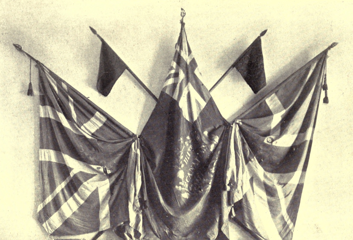
CANADIAN FLAGS USED IN THE “WAR OF 1812”
But in the history of the county, where the good old Scottish names of the early settlers still abound, Macdonell is a greater name than Johnson. In the first Parliament of Upper Canada, two Macdonells, brothers, sat for Glengarry, and one of them was elected Speaker. The famous Glengarry Regiment of Light Infantry, which so distinguished itself throughout the War of 1812, was raised chiefly through the exertions of two other men of the name; and a Macdonell shared the fate and the glory of Brock in the battle of Queenston Heights. Yet another Macdonell, a priest, Alexander, came from Inverness in 1786 with almost his whole parish of about five hundred souls, to found in the new Glengarry St. Raphael’s, the pioneer parish of his communion in Upper Canada. Here he built the first Roman Catholic church, known as the “Blue Chapel,” upon the site of which another priest of the same name, who became the first Roman Catholic Bishop in Upper Canada, erected a large and handsome church.
This last-mentioned Alexander Macdonell is a most interesting figure. Physically, almost a giant, he held, it is said, that every man of his race should either be a priest or a soldier, and, though his cloth forbade him to fight, it did not prevent his working with might and main to raise Highland regiments, first in Scotland and afterwards in Canada. It must be said, however, that his object, in the first instance, was to relieve the distress of his parishioners, who had been thrown out of employment by the war between England and France; and when the regiment was disbanded he was instrumental in bringing a large number of them to settle amongst their kinsmen in Upper Canada. Later, when war with the United States was threatening, the future Bishop, actuated by patriotic motives, was “most active in rousing and recruiting the Glengarries.” “The fiery cross” had passed through the land and every clansman “obeyed the summons,” the more readily, no doubt, for the exhortation and example of the valiant chaplain. But by no means were all his energies devoted to military affairs. As a missionary, the sphere of his labours extended over a great part of Upper Canada, and, as a pastor, he laboured for the temporal as well as the spiritual benefit of his flock. For instance, immediately after his arrival in Canada he made it his business to obtain legal patents for the lands held by the Highlanders—a matter of which few of them understood the importance.
Another Scot who had also been an army chaplain, the Rev. John Bethune, was for long the only minister in Upper Canada of the Kirk of Scotland. He settled at Williamstown, but ministered also to congregations at Martintown, Lancaster, and Cornwall. One of his six sons, Alexander Neil Bethune, succeeded Dr. Strachan, whose pupil he had been, as Bishop of Toronto. It is a somewhat curious circumstance that these two earliest Bishops of the diocese should have begun life as Presbyterians and have passed some of their youthful years amongst the people of Glengarry.
The “Man from Glengarry,” however, has always had the reputation of being strong and forceful, and it has been said that the history of the county “is a proud record of most valuable services rendered to the country in early times, when the men of that county made its name famous in war and peace.”
“Not drooping like poor fugitives they came
In exodus to our Canadian wild,
But full of heart and hope, with heads erect
And fearless eyes victorious in defeat.”
William Kirby.
The stories of the neighbouring counties of Glengarry, Stormont, and Dundas, almost inextricably interwoven, must be taken as supplementing one another. Stormont, possessing at Cornwall (now a flourishing town of some 6600 inhabitants) a Court House and Jail, ranks as the senior county of the three, which together have only twelve townships.
The pioneers of Stormont were Loyalists, many of whom had served in Sir John Johnson’s “Royal Regiment, of New York.” Having been farmers before they took up arms, they were better fitted for life in the wooded wilderness than most of the officers and soldiers of the regular army, though some settlers of this class also “made good.” About one-third of the first settlers were Highlanders, one-third Germans, and the remaining third were English, Irish, and Lowland Scotch.
In some cases the holders of land grants disposed of them for very trifling amounts. One allotment of two hundred acres changed hands, according to tradition, for a gallon of rum. It is perhaps still more curious that persons who were toiling with might and main to make their farms, neglected for years to obtain a legal title to them. The first land patent issued in the three counties bore the date of 1793, and the first for a lot in Cornwall 1803, respectively ten and twenty years after the great Loyalist immigration. Perhaps the hard toil necessary to clear a little space on which they might build up the tiny log-house and sow a little corn for the support of their families distracted the minds of the pioneers from thoughts of legal formalities. At first the settlers of Stormont had neither oxen nor horses, so they loyally helped each other with the heavier tasks, and little by little tamed the wilderness to their will. If ever sturdy grit and common sense and ability to make the best of resources all in the rough were desirable, these qualities were needed by the pioneers. In his little book, entitled Lunenburg: or the Old Eastern District, Judge Pringle has brought together many an interesting fact which throws light on the lives led by our Canadian “Pilgrim Fathers.” In every district the erection of a grist-mill was an event of an importance difficult for us to realise in these days of railways and steamboats. When they were built those first grist-mills freed our great-grandfathers from the toil of carrying huge sacks of grain on their backs for many a day’s journey or set our great-grandmothers at liberty from the exhausting labour of grinding meal for their households in a hand-mill. On account of “the shoving of the ice,” Cornwall could not have a watermill, but two windmills were soon erected, one of which, after helping to supply the settlement with flour for many a long year, was turned into a blockhouse.
In the pioneer days Cornwall was the headquarters of the officials who distributed rations and other supplies to the Loyalists. Soon it became a centre for general business, with a store or two, a smithy, and a tavern, and about 1794 a Court House and Jail were erected.
This was a time of severe old-fashioned punishments and of rough and ready justice. In default of regular stocks, it is said that a culprit’s feet were sometimes fastened between two rails of a justice’s fence, or that by way of “hard labour” an offender was set to hoe the magistrate’s corn or potatoes. For petty larceny offenders were made to stand in the pillory, to receive “thirty-nine lashes on the bare back,” or (in the case of a woman in the year 1800) to be whipped till the blood came.
Like the famous Fleet and Marshalsea prisons in London, Cornwall jail did duty as a debtors’ prison. An Act, passed in 1805, requiring the creditor to pay an insolvent debtor five shillings a week for his support in prison may, however, have done something to discourage the practice of imprisoning persons for debt. In 1822 debtors were allowed, if their friends would give bail, to go outside the jail, keeping within certain specified limits. But if they accepted this privilege they could no longer claim support from their creditors. In Cornwall the limits were marked by white posts. Originally the Courts of Quarter Sessions, besides having jurisdiction in criminal cases, attended to many matters now under the control of the municipalities, such as the making of roads and bridges.
During the War of 1812 (of which there will be more to say in connection with Dundas County), the courthouse and jail at Cornwall were used as barracks. In November 1813, when almost all the men were absent with the militia, American troops occupied the town. They helped themselves to goods from the stores, and a woman who had buried her stock of preserved fruit in a garden bed was unlucky enough to have it discovered by a Yankee prodding about with an iron ramrod; but on the whole, “the enemy” scarcely wrought more mischief than was done at times by the riotous parties of British seamen who used to stop at Cornwall on their way to man the warships of the lakes. It is told that one night some of these fellows, probably the worse for drink, capturing what they took for a calf, killed, cooked, and ate it, to discover in the morning, from the animal’s hoofs, that they had supped on a colt! Twenty years later, when the great cut was being made for the Cornwall Canal to overcome the Long Sault Rapids, the army of rough navvies, a thousand strong, became a positive terror to the country people having business in town. Finally, after a trifling dispute a man was killed. For this one of the navvies was hanged, and afterwards the rest were less unruly.
It was in the autumn of 1834 (a notable year in the history of Cornwall) that Chief Justice Robinson cut the first sod of the canal, which was eight years in the making. In the same year, Cornwall (which had before been assessed with the township and received such small grants for roads that its streets were almost impassable with mud) was incorporated. Almost immediately the town began to provide sidewalks of flagstones, but, till cured of the dangerous habit by heavy fines, the country-folk coming into town on horseback insisted on riding along them.
In 1834 Cornwall first sent its own member to the Assembly. As everywhere in early days, elections caused vast excitement, and not a little disorder. It is said that in the first or second election held in Stormont the number of votes cast exceeded that of the whole population. At that date every man having a freehold in land was entitled to vote, so some ingenious persons, intercepting the boatmen on the river, provided them with deeds for lands in the county, and marched them to the poll. One candidate had the forethought to provide printed forms of deeds, whilst on the other side they had to be laboriously written out by hand; consequently, the former captured five or six times as many votes as the latter. In Glengarry and Stormont the candidate’s piper played his adherents to the poll.
At funerals the bagpipes “whustled mony a braw lad to his grave.” At one time the music for fashionable parties in Cornwall was supplied by a one-legged negro fiddler, who played six or seven tunes by ear, not very well when sober, and execrably when drunk. A few years later, there were three pianos in the town, and one in the neighbourhood, spindle-legged and rather “wiry in tone,” but highly prized.
In 1803, the future Bishop Strachan opened the school famed as “The Cornwall Grammar School.” In 1808 he built a schoolhouse, which, when he left for York four years later, he conveyed to trustees for a District School. About 1824 the Anglican Church, painted white, with a tin-covered spire, was one of the most imposing buildings in the place. The Roman Catholics of Cornwall were then regarded as belonging to the parish of St. Andrews, which, by the way, was long the home of the notable explorer Simon Fraser.
“War in all men’s eyes shall be
A monster of iniquity
In the good time coming;
Nations shall not quarrel then,
To prove which is the stronger,
Nor slaughter men for glory’s sake—
Wait a little longer.”
Mackay.
Dundas is one of those counties which, with a fairly well distributed rural population, has no great town within its borders. Morrisburg, the largest of its villages, situated in a good dairy country, has a population of about 1700 souls. Its chief industries are poultry-fattening and certain manufactures of iron and steel, including the making of stoves, nails, and tacks.
The German Loyalist pioneers of this county had an interesting history. Their Lutheran forefathers had dwelt on the banks of the Rhine in the “Palatinate.” More than once at the close of the seventeenth century the district was terribly ravaged by the French, and, in 1708 and 1709, 15,000 “Palatines” sought refuge in England, where Queen Anne gave them a daily cash allowance and the use of the army tents from the Tower. The refugees encamped at Blackheath, where they were visited by the Mohawk chiefs, who chanced then to be in England; and from them the distressed Germans received an invitation to take up lands in their territories in the province of New York. In the following year 3200 of the Germans set sail for New York in ten ships, one of which was lost on the way with all on board. The rest of the immigrants were settled by the Governor of New York on the Hudson, where they were employed, not very successfully, in making tar from the pines for the British navy. Afterwards some of their number went to Pennsylvania and more to the Mohawk Valley. Many of the latter served in Sir John Johnson’s Loyalist regiment, and at the close of the war were finally settled on the St. Lawrence in the townships of Williamsburg and Matilda. Here each family soon built a small house and cleared a little plot of ground, living for a time under a kind of military rule.
The settlers drew their lots and obtained rations at Cornwall, to which their descendants still look up as the judicial centre of the district. The pioneers used often to take home their goods on hand-sleighs. At first there was no mill nearer the settlements than one, in each direction, sixty miles away. Occasionally several men, joining together, took down a boatload of grain to be ground at once, but it is no wonder that the phrase “once to church, twice to mill, makes a traveller,” should have become proverbial in the eastern counties. Now, crossed by two great railways, they have easier communication both with the Atlantic and the Pacific coasts than they had a little over a century ago with Montreal and Quebec.
It is indeed astonishing how much travelling was done in the open boats, by blazed trails, and on roughly-cut-out woodland roads. I suppose it was often a case of necessity rather than choice, for all kinds of business obliged an occasional visit to some centre of trade or to the seat of government, and, despite their amazing ingenuity, there were some necessaries that the pioneers could not make for themselves.
The Dundas settlements had much traffic with Montreal. In winter goods were brought up on the short sleighs with solid runners, known as “Canadian trains.” The shafts were hung by short chains to the bottom of the sleigh and the horse travelled in the middle of the road. If the load was heavy, a second horse was harnessed, tandem, in front of the first. The drivers, picturesquely clad in rough homespun or blanket capotes, gay sashes, red or blue caps and leather moccasins, liked to travel in brigades. Going down to Montreal, though a few of the sleighs might be laden with grain or potash, many would be empty, and the drivers, leaving their horses to their own devices, used to get together in one sleigh to jest and chat and troll out their French songs.
The occupants of a single sleigh dreaded meeting one of these brigades, for the drivers would not turn out of the track for anyone, and if their obstinacy resulted in the upsetting of the other vehicle, the accident was but the signal for delighted jeers. The overtaking of a brigade was no less vexatious for a traveller eager to press on, for often he would have to travel for miles in the rear of the cavalcade before he could get past it.
In summer goods for the west were carted from Montreal to Lachine, and there put on board bateaux or Durham boats to be carried to Kingston or the little intervening ports.
The bateau was a flat-bottomed boat, thirty feet in length and pointed at each end. It was steered with a large paddle, had a movable mast and a square sail, and was manned by six or seven men, who, going against the current, pushed or “set” the boat with long, iron-shod poles. Where the stream ran too fast for this, several of the men went ashore to tow with a rope, but two always remained on board to keep the craft off the rocks. The bateaux, like the “trains,” frequently went up in brigades, so that the crews might help each other.
The Durham boat was a larger vessel, built with a round bow and square stern. It was decked for some feet at the ends and had a gangway at each side for the convenience of the crew in pushing it up the stream. Beginning at the bow, the men set their poles against the bottom of the river and walked towards the stern, pushing with all their might. They returned to the bow, dragging their poles, and the iron-tipped points struck against the stones with a clank that sounded far on a still day.
At night the crews of boats or bateaux bivouacked on the bank, supping on pork and pea-soup and sleeping in the open. In places tow-paths were made and oxen or horses were used to tow up the heavy boats. In going up the Long Sault of the St. Lawrence and the rapids above, the boats were unloaded and the goods carted up. About 1844 three short canals were made along the Dundas shore to overcome different rapids. The passage downstream was comparatively easy, and experienced boatmen took down heavily-laden boats with few accidents. Going down, rafts of timber were often utilised for conveying passengers and goods. In the early days a person wishing to take passage up or down stream would watch on the bank till a boat appeared, then, going out in a canoe, would bargain with the captain to be taken on board. Usually there was no difficulty about this, as the passenger always provided his own food and blanket. But some travellers preferred to go up on horseback.
The first vehicles used in Dundas and the district were lumber wagons and ox-carts, with an occasional two-wheeled gig, which had a body hung on leather straps and a hood resembling that of a covered buggy. It is stated in Croil’s Dundas that in 1825 “the three counties” had eleven gigs, eleven pleasure wagons (also with leather “springs”) and one close carriage. The first stage coaches, though ponderous affairs, gorgeously painted, had bodies mounted, like the other vehicles intended for easy travelling over the rough roads, on leather straps.
As late as 1833 a journey from Cornwall to York took eighty-six hours, exclusive of a delay in Kingston of thirty-four hours. After the introduction of steamboats, which at first were anything but luxurious, according to modern notions, people travelled by them whenever possible, but for the greater part of the year the stages still ran until the Grand Trunk Railway was opened in 1856.
Originally Dundas was covered with fine timber. Amongst its trees were white oak and huge pines, much prized by shipbuilders. One of the latter, of such size that it took the united efforts of fifteen or sixteen teams to drag it from the woods, was sold in Quebec for a bowsprit for a sum of $200. Later elm and ash found a ready market, but beech and maple, thought useless except for the making of potash, were rolled together and burned in great piles.
The settlers along that great highway, the St. Lawrence, were far less isolated than many others of the pioneers, but even in their case the education of the children was a difficult matter. For long, there was no school in Dundas, but a good old German went from house to house teaching. His plan was to stay in a neighbourhood for two weeks, and then to move to another. The early settlers had a great reputation for honesty, but their detractors accused them of being too fond of “dancing and carousing.”
During the War of 1812, the inhabitants of the county found themselves almost too much upon the highway. Several times brigades of boats were attacked by parties of Americans, and in November 1813, a hostile army commanded by General Wilkinson, passed through the county, on the way (if the plan had not miscarried) to join General Hampton in an attack on Montreal. Happily, Hampton’s defeat at Chateauguay by De Salaberry and his resolute little force had utterly discouraged him before Wilkinson, ignorant of the mishap, set out to meet him.
Wilkinson threatened both Kingston and Prescott, but it was in Dundas County that he landed his troops, creating great consternation amongst the country people, though he paid with Spanish dollars for the provisions that he took. Halting at the lower limit of Williamsburgh township, he sent a force to try to capture the Government stores at Cornwall. But the Canadians, mustering every wagon in the countryside, had driven inland with the stores, which at last were carried safely to Coteau.
Meanwhile Colonel Morrison, with a few armoured vessels and a small British force, was hurrying in hot haste from Kingston. Overtaking the Americans at last, he succeeded, on November 11th, in forcing a battle on ground of his own choosing at Chrysler’s Farm, just within the bounds of Dundas. The struggle, in which, by the way, the militia of the county gave a good account of themselves, lasted for hours, but the little British force came off victorious, a fact which, with the news of Chateauguay, decided Wilkinson to retreat across the border. After the battle, Chrysler’s farmhouse became a hospital, where friend and foe lay side by side, whilst the dead found a common resting-place in the green fields near by.
“Fiercely the Iroquois had sworn to sweep, like grains of sand,
The Sons of France from off the face of their adopted land,
When, like the steel that oft disarms the lightning of its power,
A fearless few their country saved in danger’s darkest hour.”
George Murray.
Prescott County, set apart in 1798 and named after the Governor of Canada, who succeeded Lord Dorchester, has special links with the French régime. There is a tradition that the rude little fort at the foot of the Long Sault Rapids on the Ottawa, where Daulac—or Dollard—des Ormeaux, with his sixteen heroic Frenchmen, made his stand against the Iroquois, was at Greece’s Point in Hawkesbury Township. It is not wonderful, however, that the details of the story are involved in obscurity, for not one of the Frenchmen lived to tell the tale which, carried to Montreal by three Indians, reads like one of Macaulay’s “Lays of Ancient Rome.” On first entering the stockade of tree trunks, the French were joined by a few Indians. These soon deserted to the enemy, yet for eight terrible days the little band of heroes fought off their assailants, to be overwhelmed at last by sheer force of numbers. But they did not die in vain, for the Iroquois lost so many of their braves, that they did not venture that year to attack the French at Montreal, as had been expected.
The township of Longueuil represents one of the very few grants made during the French régime, on the feudal system, within the limits of what is now Ontario. On a map of 1828 it was marked as the Seigniory of Pointe à l’Original. It was owned by descendants of Charles Le Moyne, elder brother of the famous D’Iberville, but in 1796 was sold to an American named Treadwell, who opened it to immigrants. Not being a Loyalist, he declined on the outbreak of the war of 1812 to take the oath of allegiance. Upon this his property was confiscated, and when he would have returned to his native land, he was held a prisoner at St. John’s in Quebec. Afterwards he settled near Plattsburgh, in New York State, and prospered until his mills were ruined by a great freshet in 1830. After that misfortune he returned to spend the last ten years of his life at L’Original, where his son Charles, having recovered the confiscated property, had already been living for seven years. In 1834, the younger Treadwell was appointed High Sheriff of Prescott and Russell Counties. Both father and son are depicted in Mr. Thomas’s History of Prescott County as men of fine character, and Charles Treadwell was a pioneer in religious reforms, improved methods in agriculture, and projects for railways. In fact, it is said that he was the first Canadian to advocate a Pacific railway.
At Treadwell, in North Plantagenet, lived Thomas Kairns, who had been a midshipman on Nelson’s Agamemnon, and had been present in 1814 at the capture of Washington. He gained the title of “Captain” from running the steamer Shannon on the Ottawa; but in 1853 was called home to serve throughout the Crimean War as senior purser, on Nelson’s old Victory, which lay all the time at Portsmouth. Returning to Canada, he died in Montreal.
To go back to earlier times—another American, Eden Johnson, settled in Hawkesbury Township, under circumstances suggestive of a romance, for on his first visit to Canada, as a member of Montgomery’s invading force, he had come with arms in his hands, but by some chance had been led captive by the charms of a British captain’s daughter, and though in the first instance, he persuaded her to go with him to New Hampshire, she (we may suppose) ultimately brought him back to the land of the old flag. His youngest son, also named Eden, received a grant of Government land, on account of having been the first white child born in Hawkesbury, and one of Johnson’s grandsons was captain of the first steamboat plying on the Ottawa, between Bytown and Grenville. Johnson himself, while chasing a deer along the frozen river, fell into a hole in the ice and was drowned.
Both U. E. Loyalists and Americans who sympathised with the other side in the struggle with Britain were numerous among the Prescott pioneers; but in the new environment the old differences were forgotten. Moreover, settlers of French race, cultivating the low-lying lands, which did not attract the English, also helped to build up the county, and of late years the French element in the population has been increasing.
During the War of 1812 (at which period the county was grouped with its southern neighbour for Parliamentary representation) Prescott men of both races fought for England, and probably joined the famous Glengarry Light Infantry. It is on record that one young fellow of sixteen, François Laroque, joined a French Canadian company which, going by forced marches to Kingston, was sent to the Niagara frontier, in time to take part in the grim conflict in the dark at Lundy’s Lane. Laroque was wounded in his first battle, and afterwards settled in Hawkesbury.
Half a century after the war, the militiamen of Prescott were called out of the churches on a June Sunday to go to Ottawa, and thence to the town of Prescott (in Grenville County) to be ready to drive back the Fenians gathering on the opposite side of the St. Lawrence. The Hawkesbury company of militia was called out again in 1870, to report for duty at Cornwall, when the whole Dominion was seething with excitement over the murder of Scott on the Red River; but the services of the Prescott men were not then required.
In connection with the beginnings of Hawkesbury, which was incorporated as a village in 1859 and as a town in 1896, there is a tragical story that seems almost like a modern version of the Book of Job. In 1805 a mill was erected at Hawkesbury, which was bought three years afterwards by three brothers named Hamilton, one of whom, George, was left in charge. All went well for some years, then, “in one fatal summer,” misfortune followed misfortune. The two absent brothers died, and George received an intimation that he must pay off the mortgage on the mill for which one of them had arranged. Next a flood carried away the dam at a time when the mill-pond was full of logs. A few nights later, Hamilton’s dwelling-house was burned to the ground, and nothing was saved nor insured. Last and worst of all, when the unfortunate man was taking his family down the river to Montreal, his canoe upset in the rapids. The boatmen managed to cling to the upturned boat, but George Hamilton, though a swimmer, tried in vain to save his three children. He supposed his wife had shared the same fate, but, strange to say, when the canoe was righted, she was found beneath it quite unconscious, but clinging with a desperate grip to the thwarts. The story ends, however—still like that of Job—with renewed happiness and prosperity for the much-tried pair. Hamilton managed in some measure to retrieve his broken fortunes, and after the loss of the three elder children seven others were born, of whom one became a senator and another was in succession Bishop of Niagara and of Ottawa. By the way, the parish of Hawkesbury originally included the whole of Prescott County, but in 1869 the two parishes of Vankleek Hill and Plantagenet were set off from it.
Prescott is a well-watered county, but it long suffered from want of roads. Gourlay, in 1818, said that the district had had no communication with other parts of the province (except by water) till 1816, when some Scottish settlers of Glengarry had helped to open roads. Much of the landed property was held by merchants in Montreal, and the farmers of Hawkesbury Township were “so kept at arm’s length by untaxed lots that they could do little for the public good or their own relief.”
L’Original (the French word for “moose”), though the county seat, is still only a village of twelve or thirteen hundred souls. Formerly most of its inhabitants were English, now there are as many French. It is a picturesque little place, especially from a distance, but its progress has been slow. At first the court sat in a school-house, and a private house, generally the sheriff’s, was used for a jail. But about 1824 small county buildings were erected on land given for the purpose. The punishments dealt to offenders in pioneer days now seem very severe. In 1817 a man convicted of stealing a little flour received thirty-nine lashes, and in 1828 a person convicted of larceny was sentenced to ten days in jail and an hour in the pillory. Twice within the last thirty years L’Original has been the scene of executions, in both cases for peculiarly revolting murders.
Another village, in Caledonia Township, was once quite noted as a “spa,” or watering-place. In 1806 a white man, hunting beaver, came upon a spring, which the Indians regarded as medicinal. They had marked the trees about it with their strange hieroglyphics, perhaps to guide sufferers to its healing waters; but in later years an enterprising settler built a hut at Caledonia Springs and charged a small fee to visitors.
“A crystal pavement, by the breath of Heaven
Cemented firm, till, seized from shore to shore,
The whole imprisoned river growls below.”
Cowper.
This county was not one of the nineteen created by Simcoe in 1792, but was set apart in 1798. It was called after Peter Russell, who had been military secretary to Sir Henry Clinton during the Revolutionary War, and came out with Governor Simcoe as Inspector-General of Upper Canada. He had a seat in the first Assembly of the Province, also in the Legislative Council. When Simcoe left Canada he was senior member of the Council, and so it fell to him to administer the Government until the arrival of General Hunter in 1799.
In Dr. Scadding’s Toronto of Old there are numerous references to Russell, who had a place called Petersfield near “the Grange,” where Professor Goldwin Smith lived for many years. Petersfield, in 1803, was practically in the country, and old advertisements show that Russell’s hen-roosts were sometimes robbed. Another advertisement betrays the fact that, like many of his aristocratic contemporaries in Canada, he kept slaves; for, in February 1800, he offered for sale a woman of forty, named Peggy, and a boy of fifteen, Jupiter—asking, for the former, $150, and, for the latter, $200, “payable in three years secured by bond; but one-fourth less would be taken for ready money.” Miss Elizabeth Russell, his sister, had a negress, “named Amy Pompadour,” who used to wait on her in a red turban. Russell was one of the committee appointed to arrange for the building of St. James’s Church in Toronto.
Above all else, however, Peter Russell is famous as a land-grabber. There are traditions that he granted lands to himself as well as to all his friends; and, though he made few personal enemies, his administration was not good for the country. He never married, and died at York in 1808, leaving a part of his estate to the Baldwin family.
One of the four townships of Russell County is also called Russell. The other three—Cambridge, Cumberland, and Clarence—were named after the same royal dukes whose Christian names are recalled in the townships of Ernestown, Adolphustown, and Williamsburg, in the counties of Lennox and Dundas.
In 1827 an agent of the “Canada Company” made a careful inspection of the townships in the Ottawa district, and found that in 1824 the two counties of Prescott and Russell had a population, all told, of 2560—a number which could be housed easily in two small villages. These people were of mixed race—Americans, Scotch, Irish, Canadian—and the former having the benefit of experience were said to “show the others a good example in clearing their lands,” while the Canadians who, “by their industry and perseverance,” got on as well as the Americans were “much more economical in their way of living,” and saved “what the others would lay out in luxuries.” The farmers of this district found a good market for all they could raise in supplying the wants of the lumbermen and of those working on the “Grenville Canal” on the Quebec side of the Ottawa, obtaining “generally double the Montreal price, at least.”
In Clarence Township the concession fronting the Ottawa was granted to U. E. Loyalists, and very few settlers had, in the twenties, settled “back from the river.” There were then no roads in Clarence, but apparently the inhabitants managed very well without them, as a steamboat passed and repassed their doors twice a week, and when the winter set in the river made an excellent road. “The transport up the river on the ice is immense,” said the report. In fact, winter was the time preferred for travelling, and was looked forward to as the chief season for enjoyment.
All over the country, upon the first touch of frost, the sleighs were prepared for visits of pleasure and business, and Russell was in the region where a hard frost and a long winter might reasonably be expected. “It is generally conceived in England,” said M‘Taggart, who was surveyor for the Rideau Canal, “that the long snowy winter acts against Canada—nothing can be farther wrong than this idea. The farmer requires it all, and the lover thinks it much too short, for it is only in the sleighing season that he has a chance of seeing his mistress.” “A farm in a tract of country that has five months’ sleighing snow in the year is considered to be in a more favourable climate than that which has but three.”
Philemon Wright, the founder of Hull, travelled up the Ottawa on the ice in the year 1800, sixty-five miles from the head of the Long Sault, passing on his way the riverside settlements of Prescott and Russell. It was a patriarchal company of thirty men, women, and children, in covered sleighs. At the head of the procession went the axemen—“trying every rod of the ice,” which was so covered with snow about a foot thick “that it was impossible to know whether it was good or not without sounding it with the axe.” Greatly dreading that in spite of all these precautions they might lose some of their “cattle,” they “travelled up the ice very slow”—doubtless to the scorn of the gay young people taking their pleasure in the lighter “carioles.” At the beginning of their journey on this ice road they fell in with “a savage and his wife drawing a child upon a little bark sleigh,” and this Indian, promptly sending his wife to camp in the woods till his return, volunteered by signs to guide the party to its destination. He accomplished his self-appointed task most satisfactorily, and appeared delighted with the presents and thrice-repeated huzza given to him on his parting from Wright’s company.
Through the townships of Clarence and Cumberland runs a fine stream called Bear Brook, which served the lumberers in summer in bringing down their logs, and the settlers in winter for a road. “Back from the Ottawa” there was “little or no settlement,” and almost all the land was held by speculators and absentees. A great part of the land fronting on the river was owned, eighty-five years ago, by a Mr. M‘Kindly, who had bought it from the “Loyalists,” to whom it had been granted. The township of Russell had, in 1827, “only one settler—Mr. Loucks, who built a mill on the Castere River”—but there was promise of more, for the township had “lately been located by emigrants from Scotland and militiamen who served during the last war with the United States.” Fifteen years later it had 196 inhabitants, a number which was doubled by 1850. In the other back township of Cambridge, a family named Rankin, living in the United States, owned 5000 acres, while another family, named Kuylu, owned about as much. In 1827 only every second concession line had been surveyed, and even these were difficult to trace, as many of the corner posts had been destroyed by the lumber-men, who had been through the county and stripped it of almost all the oak and pine fit for market before the Crown Reserves were bought by the Canada Company.
Smith, writing about 1850, when the population of the county was still under 2000 souls, says the lack of roads had kept back settlement. Upon the whole, however, the slow progress of Russell has gone on steadily, decade after decade, and it is not amongst the counties which during the last few years have shown a falling off in their population, either rural or urban. Indeed, in the year 1900 it had between eight and nine times as many people as in 1850, and the increase has continued during the early years of the twentieth century.
In 1822 Russell was united with Prescott for Parliamentary representation, and though it has long had representatives of its own, both in the Dominion and Provincial Houses, it still is joined with Prescott in its judicial affairs, and looks to the village of L’Original as county town.
“The thick roof
Of green and stirring branches is alive
And musical with birds that sing and sport
In wantonness of spirit; while below
The squirrel, with raised paws and form erect,
Chirps merrily....”
Bryant.
This small old county (named after a British Secretary of State) was first surveyed at the end of the eighteenth century, when it had three rows of townships. Now it has but five townships in all, of which three front on the Rideau and two on the St. Lawrence. The two latter are named respectively Edwardsburg, after the Duke of Kent, and Augusta, after George III’s second daughter. The county town, Prescott, from which a car ferry giving connection with the New York Central Railway plies, winter and summer, across the St. Lawrence, is partly in one of the townships and partly in the other.
Ages ago the neighbourhood of Prescott and of Spencerville, in Edwardsburg, were favourite Indian resorts. At the latter place is a great embankment, three and a half acres in extent, in the shape of a moccasined foot, where numerous Indian relics have been unearthed. Clay pipes, fragments of pottery, and implements for dressing skins have been discovered in company with the bones of human beings, sharks, and walruses, on terraces from one to two hundred feet above the level of the water, whilst rooted in the earth above them are the stumps of enormous pine-trees.
It almost goes without saying that the first white settlers in this county were Loyalists. At the close of the War two Provincial corps, under Majors Jessup and Rodgers, after wintering at St. John’s in Quebec, came up the St. Lawrence to take up lands in Leeds and Grenville counties. At that time not a tree had been cut by an actual settler from the eastern boundary of our Province to Kingston, a distance of 150 miles. In a paper read a few years ago by Mrs. Burritt to the Women’s Historical Society of Ottawa are quotations from the reminiscences of one of the children of the pioneers, old Sheriff Sherwood, who remembered seeing the cutting of the first tree in Grenville County, the planting of the first hills of corn and potatoes, and recalled with affection the memory of a little dog, named “Tipler,” at one time the only domestic animal in the district. “Tipler” was a mighty hunter, and had vast opportunities to exercise his powers, for deer and other game abounded in the woods. Wild plums, cranberries, and other berries were all to be had for the gathering, while, as to the wealth of provision from lake and stream, no modern “fish story” sounds at all astounding beside the marvels gravely recorded in diaries and papers of the fishings of those old days. The pity of it all seems that our modern apostles of “conservation” were not born a century earlier.
But wild meat palls on the appetite of civilised man, for he has acquired tastes which nothing save his own labour can satisfy. The pioneers longed for bread, but it does not appear that those of Grenville County shared in the distribution of hand-mills made by the Government, so they had to depend at first on home-made substitutes for mills. The more enterprising settlers planted a great stump firmly in the ground, burnt out its heart, and within the hollow pounded their Indian corn into meal with the trunk of a young ironwood tree made into a pestle. This simple contrivance was of little use for wheat, but the Indian meal made fine porridge, which the English-speaking people called “samp” and the Dutch “suppawn.” When, after a few years, horses were brought into the country, the pioneers took their grist to mill along the frozen river, which in those days made a fine winter road, though, added the old settler referred to above, “Providence only sent the ice-road when it was needed,” and later, in not one winter for fifty years, would it have been possible to take loads of grain upon the ice.
In very early days Grenville was fortunate enough to have a doctor, but it was years later before the first minister settled in the county (though one came to Leeds in 1811), and persons wishing to get married had to go to a magistrate.
The first settlers “who went back and settled on the Rideau” were named Burritt. During the Revolutionary War two brothers, Stephen and Adoniram Burritt, fighting on the king’s side, found a young American lying wounded after the Battle of Bennington in Vermont. They carried him to a place of safety, and he was nursed until well. A year later the brothers were arrested and taken to Bennington Jail. Luckily for them, the American whom they had befriended was set to guard them, and he planned their escape.
Stephen Burritt, as a U. E. Loyalist, drew lot 29 in the first concession of Augusta. Thither he brought his father and family, and there the old man lived to be nearly a hundred. But Stephen, after the exciting work of the War, could not at once settle down. He tried fur-trading, and went on an exploring expedition to the Rideau. Striking the river at Cox’s Landing, he made a raft and floated down to a place now called after him, Burritt’s Rapids. There he settled, but the Indians regarded him as an interloper. While he was chopping in the woods one attacked him, but Burritt had the better of it, and, standing over the prostrate red man with an axe, forced him to beg for mercy and promise friendship. Once made, the promise was kept faithfully, and in after years Burritt and the Indians were fast friends.
The adventurous young fellow, carrying his supplies for thirty miles into the wilds, had taken a wife to the Rapids. Soon after their arrival the pair were attacked by fever. Not a neighbour was within reach, and, unable to leave their beds, they lay for three days expecting death. But a band of Indians arriving at the Rapids proved very “Good Samaritans.” The squaws nursed the invalids back to life, and the braves harvested Burritt’s little crop of corn. Burritt lived to be a prosperous and important man in the country, but he never forgot his debt to the Indians. He kept open house for them, and sometimes when he went down in the morning he found them in possession of the place. Stephen’s son, born at the Rapids in December 1793, was the first white child born on the Rideau.
The town of Prescott was founded by Colonel Jessup in 1810, and it was on the homestead of the first pioneer that Fort Wellington was afterwards built.
From Prescott on a wintry February day in 1813 went forth the force, led by one of the gallant Macdonells, to avenge, by the capture of Ogdensburg, with many prisoners and much booty, the recent raid upon Brockville. In 1822 a West Indian merchant, Hughes by name, erected at Prescott a stone windmill (which in 1873 was transformed into a lighthouse), on Windmill Point.
Once at least during the rebellion in 1838 this building did duty as a fortress. Earlier in the year there had been organised along the frontiers of the United States societies called “Hunters’ Lodges,” the object of which was to help the Canadian rebels to overturn the Government; and in November two hundred of these Hunters, led by a Pole named Von Schultz, who regarded the Canadians as grievously oppressed, crossed the St. Lawrence and landed near Prescott.
Von Schultz expected to be hailed as a deliverer, but the country people did not flock to his banner. Armed steamers patrolling the river rendered retreat impossible, and after a fight, in which many of the Hunters lost their lives, Von Schultz took refuge in the windmill. Here he held out for three days, till Colonel Dundas arrived from Kingston with artillery and opened a heavy fire on the mill. Several Canadians were killed, but resistance was useless, and soon Von Schultz surrendered at discretion. A hundred of the daring aggressors were thus made captive, to be tried by court-martial at Kingston and London.
Von Schultz was ably defended at his trial by a young barrister, who afterwards won wide fame as Sir John A. Macdonald. But his eloquent plea was unavailing. The Pole was condemned to die, and was executed at Kingston on a December day, with nine of his followers. He left four hundred pounds to the widows of the Canadian militiamen who had fallen in the fight, and perhaps his fate seems the more tragic because he realised before his death that he had been acting under a mistake.
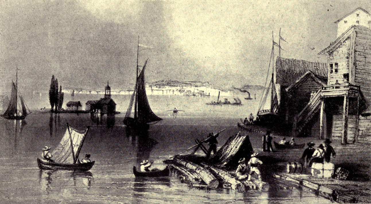
PRESCOTT, FROM OGDENSBURG
“... So shanties grew
Other than his among the blackened stumps;
And children ran with little twigs and leaves
And flung them, shouting, on the forest pyres,
Where burned the forest kings.”
Isabella Valancy Crawford.
Leeds is the largest of the five counties set apart along the St. Lawrence in 1792; but the country is much broken with lakes, some of which have been taken advantage of in the making of the Rideau Canal from Ottawa to Kingston. The county was named after Francis Godolphin Osborne, fifth Duke of Leeds, and there is a romantic and well-known story connected with a far-back ancestor of his, the founder of the noble family, telling how a young apprentice, Edward Osborne, leaped from London Bridge to save from drowning his master’s infant daughter. The little girl lived to marry the bold apprentice, who ultimately “became Lord Mayor of London and Member of Parliament for the city.”
But we need not travel so far afield for stories connected with the county. In some respects there is no better way of making real to ourselves the conditions of earlier days than by following in detail the life-story of some individual. I will, therefore, venture to tell again here the history of Colonel Joel Stone, the Loyalist founder of Gananoque, only explaining that I am indebted for the facts to the vividly painted sketch of this pioneer by Miss Agnes Maule Machar, printed in the Transactions of the U. E. Loyalist Association.
About 1785—so Miss Machar paints the picture—a stalwart, handsome, dark-eyed man, in the prime of life, was roaming along the shores of the St. Lawrence, near where the Thousand Isles begin to cluster in the stream. At length he came upon one of the great river’s tributaries, which, after a long, placid journey through the shady woods, between banks fringed with flowers, leaped full thirty feet over a barrier of brown rocks, with a force and suddenness sufficient to turn its dark clear waters to the likeness of snow. The Indians called the place “Rocks in Deep Water,” or “Cadanoghue,” a word which on our English tongues has become “Gananoque.”
Whether it was the wild beauty of the spot or its possibilities as a site for settlement that appealed to the wanderer, here he determined to make his home. Almost, of course, Captain Joel Stone was a Loyalist and a man whom the troubles of the Revolution had turned into a soldier. Born in Connecticut, he was descended from one of twenty-four “pilgrim-pioneers,” whose arrival at New Haven in 1659 had been celebrated with a thanksgiving service by the few colonists previously settled there. Joel Stone himself was a capable business man, who had made money as a merchant, and was prospering greatly under laws and a system of government which he regarded “as the best in the universe,” when the country was plunged “into the horrors of an unnatural war.” Stone was one of those who determined never to flinch from his “duty to the best of sovereigns” (it was the custom of the time to deal boldly in superlatives), and he resolved “sooner to perish in the general calamity than abet in the least degree the enemies of the British Constitution.”
And these were not words merely. Refusing to take up arms against the King, he had to flee from his home; he was taken prisoner and escaped; but his house was looted by a mob and his property was confiscated. During the war he married and children were born to him. At the peace he spent two years in England, with the result that he secured rank as captain, and received a pension of forty pounds a year.
Coming to Canada, he tried first for land in Cornwall. Too late for this, he turned westward, and eventually obtained a grant of five hundred acres on the Gananoque River, with half the water-power—Sir John Johnson obtaining a grant on the east bank. Before settling down he travelled overland to his old home, with his son and daughter, to visit his aged father in Connecticut. In the following year he returned to take possession of his grant, coming down the river in a bateau, probably from Niagara.
From the site of Stone’s future home no human habitation was in sight, save one solitary fisherman’s hut on an island about a mile away. To this Stone made his way, receiving kind hospitality from its owner, a Frenchman named Cary. There he housed his goods and stayed on for some time—a luckless proceeding, as it proved, for one day a fire broke out, consuming the hut and all its contents. Undaunted by this misfortune, Stone began to build for himself. Soon he opened a store, began a lumbering business, and constructed a boat, which was probably “the first built in Canada since the French régime.”
Having lost his wife five or six years earlier, he heard that a Mrs. Dayton, who had been a neighbour in Connecticut, and had settled with her husband in Brantford, had become a widow. Waiting for “a year and a day” after her husband’s death, he then wrote a quaintly guarded letter to the lady. This he followed, long before there was time in those days of slow travel to get an answer, with a more outspoken epistle, in which he asked permission to visit the widow. Before he received a reply he was obliged to go to Montreal on business, which he feared might prevent his getting to Brantford that year, so he magnanimously declared that if she “had a good offer from another,” he would not stand in the way, but added, “I only trust in your good sense that you will not accept a very crooked stick till I can have the pleasure of seeing you.”
Despite the calm coolness of the preliminaries, the marriage duly took place, and proved a happy one. Indeed, the widow became not only a true helpmeet to her second husband, but a kindly mother to his children as well as her own. Moreover, she was a regular “Lady Bountiful” to the neighbourhood, though the phrase hardly gives a fair idea of her charities, for she bestowed upon the needy not only material comforts but much personal service. Being an expert horsewoman, she acted as both doctor and nurse to the sick within a radius of forty miles. As cows were scarce, she “dispensed” the milk of hers. She gave a hospitable welcome to the poor wayfarers, who would now be dubbed tramps. At Christmas she sent round a wagon-load of good things to those less fortunate than herself, whilst on New Year’s Day she entertained the Indians, who paid her husband the compliment of calling him “Father”! Mrs. Stone was a good Methodist, but, living in days when less stress was laid on the duty of temperance than now, she provided for her red-skinned guests not only quantities of cake but of rum!
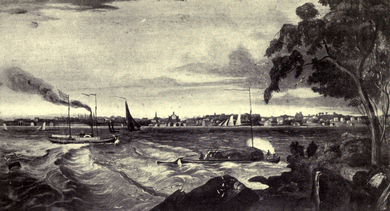
BROCKVILLE
During the War of 1812 Colonel Stone became Colonel of a militia regiment, a position which often took him away from home. On one occasion during his absence the settlement of Gananoque was attacked by a party of Americans; but Mrs. Stone was equal, as usual, to the emergency. She barricaded the house and boldly directed its defence. Not even when a chance shot wounded her in the thigh, did she show any sign of quailing, and her companions only discovered what had happened after the immediate danger was past by the blood which had flowed into her shoe. She was then carried two miles inland to have her wound dressed, but it left her lame till the day of her death.
Under her influence Joel Stone also joined the Methodist Church. He was the superintendent of the first Sunday school in Gananoque, and exercised a patriarchal influence in the little community on the side of law and order. As a Justice of the Peace he forced many a drunken husband to do his duty to his family. He married many couples, sometimes with such an odd substitute for the regulation ring as a blacksmith’s door-key. Both husband and wife lived to a good old age, seeing their children’s children grow up.
Gananoque is now a busy little town of about 3800 inhabitants, who are employed in a variety of industries. It is also a favourite summer resort, and a port of call for the steamers plying east and west.
But the county town, Brockville, is a much more important place, with a population of nearly 9500. Formerly called Elizabethtown, it was renamed by General Brock after himself. Early in its history, in the winter of 1813, the little settlement had a day of terrible excitement, when a body of troops from the American side crossed the river, and carried off as captives fifty-two of Brockville’s citizens; but this indignity was soon avenged.
“Above her river, above her hill,
Above her streets of brief renown,
In majesty austere and still
Ottawa’s gloried towers look down.
Dim in the sunset’s misty fires,
Set on the landscape like a crown,
Loom tower and bastion, as the spires
Of some old-world cathedral town.”
William Wilfred Campbell.
The name Carleton recalls the memory of that successful defender and early Governor of Canada, Sir Guy Carleton, or Lord Dorchester; and, appropriately enough, there were many officers and soldiers amongst the pioneers of the county. Half-pay officers settled thickly along the banks of the Ottawa, or Grand, River, and private soldiers filled many a concession behind them. The district was emphatically one of magnificent forests, and in the days when roads were not it was a vast advantage to obtain lands on the river, even though the only craft the settler had at his command might be some such rough, home-made apology for a boat as a “dug-out” cut from a huge pine.
The woods were, indeed, so thick that people might live in the same district for months without knowing of each other’s existence, until some accident led to the pleasant discovery of neighbours. For instance, two runaway steers, owned by different men, but usually worked together, led their masters (settlers of South Gloucester) to the clearing of Colonel Macdonell, a few miles distant in Osgoode Township. This gallant soldier, by the way, had had exciting experiences during the War of 1812 as a despatch rider, and, between a grant made to himself as an officer and that to his U. E. Loyalist wife, possessed a farm of a thousand acres, which he was beginning to clear. The oxen had begun their wanderings along a newly-cut road leading inland from the Rideau River. Reaching its eastward end, they had then made their own trail to the Colonel’s dwelling-place. Happily, their escapade gave him a hint, and, calling his five or six neighbours together, they cut a road, following the track surveyed, so to speak, by the oxen. At first it was but “brushed” and “blazed,” but soon became the winter road to Bytown for all that district, and it was eventually “the highway to market, mill, and store.”
Osgoode Township was settled later than most of the other nine, and chiefly by Scottish folk, whilst in the rest of the county there was a mixture of English, Scotch, Irish, and Welsh. Some of the townships had belonged to Russell County, some to Grenville, whilst Goulbourn and the four townships in the north-west corner of Carleton were not set apart till 1816 and later. Every township has its own interesting stories (many of which can be discovered in Mr. J. L. Gourlay’s History of the Ottawa Valley), but, of course, in all there was much similarity in the experiences of the pioneers.
Wolves were common enough anywhere, but it was within eight miles of the future capital of the Dominion that, in the thirties, the young wife of an officer had the experience of spending days alone in a log-house “with wolves howling madly round, the fiercest of them thrusting their noses against the window-panes.” Huntley also has its stories of wolves and bears; of thick clouds of wild pigeons, and yet thicker clouds of mosquitoes, which, of course, particularly tortured newly-arrived immigrants. One Irishman, marching through the swamps with an iron pot on his head, and his back and arms burdened with heavy “government” hoes, was most grievously bitten by his vicious little tormentors.
Many of the log shanties built by inexperienced new arrivals can hardly have been weatherproof, but it was the wife of an officer, the first settler in March Township, Mrs. Monk, who used a large tin tea-tray to shelter her baby in its cradle from the rain pouring through the roof. There was one man, an English merchant, Hamnet Pinhey, who “came rich to March,” and used his wealth in building a grist-mill, a sawmill, and a church, to the general benefit of the little community. The little village of North Gower, in the township of the same name, also owed to its first settler, Rev. Peter Jones, a retired Methodist minister, both church and school; at least he used his own fine shanty, one “with ornamental corners,” for preaching on Sundays and for teaching the children during the week.
It was not only in one township that girls (and others) occasionally lost themselves in the woods, but to Fitzroy belongs the story of the young lady who “on two occasions spent the night on a tree,” and so won from the boys the name of “the angel of the swamp.” It was also in Fitzroy that a young girl who was “lost with her faithful dog, and was eight days away, living on berries,” at last had the happy thought that “the dog might take her out.” Accordingly “she scolded him, ordering him home. He went reluctantly, every few minutes turning to look at her, but at length brought her out.” Possibly in other townships, too, darning-needles were in the pioneer days scarce and valuable, but in Fitzroy (so the story goes) when the solitary darning-needle of the settlement got lost, the people “turned out in force and found it.”
There is a dim tradition that Gloucester had a white inhabitant as early as 1803, but the first white man to make a home in the township was Braddish Billings, who had been employed by Philemon Wright, the energetic founder of Hull, to “take out staves” in the woods along the Rideau. Higher up the stream lived a beautiful and charming girl, Almira Dow, who, though still in her teens, had for some months taught a settlement school at a salary of seven dollars a month, with the privilege of “boarding round” at the homes of the pupils. But when pay-day came no cash was forthcoming; nothing but notes, promising certain amounts of wheat. Hoping to obtain money for these, Miss Dow walked thirty miles through the woods to Brockville. The merchants there would do no more than promise goods for the wheat upon its delivery in Brockville, so the resourceful damsel walked back home, collected her wheat, drove with it to Brockville, received her “store pay,” and returned in safety. When she married she helped her husband to harvest his first crop of corn, and showed in at least one perilous emergency the same qualities of courage and determination that had marked her as a girl.
Sometimes the hopes of the new-comers proved, from some cause or other, delusive. In 1818 there came up the Ottawa a company of officers and men of the 99th and 100th Regiments, but, though they settled their families temporarily in tents near the spot where the capital now stands, they proceeded to cut a road to the River Jock, or Goodwood, where, with high hopes, they founded what they anticipated would in the future be the city of Richmond. (The only Duke to be Governor-General of Canada till the coming of the present royal representative of his Majesty had just arrived, and at that date “all was Richmond!” though the Duke’s critics broadly hinted that his character was less exalted than his rank.)
The town-planning spirit was abroad amongst the military pioneers, and lots were reserved for public buildings and parks, but the remaining months before winter were too short to allow of the building of a sufficient number of houses and shanties. Some, therefore, had to spend the winter in tents.
One evening in the following August two men arrived at midnight with the exciting intelligence that his Grace of Richmond was close at hand, and was intending to visit the village named in his honour, having come on foot thirty miles through the woods from Perth for the purpose. In the morning “every piece of board, plank, or flat stick to be found was carried by scores of willing hands to enable the Duke” (who had spent the night at a not far-distant tavern) “by temporary bridges to cross the gullies.” Had he let them, the delighted people “would have carried him the three miles through that slough.”
Arrived at the village, the Duke ordered a fine dinner for the leading people, and was most sociable and kind; but his visit ended tragically. At the sight of water he showed, it was remarked, a strange nervousness, and he slept ill. In the morning he set out for Hull, taking the boat, as previously arranged, to go down the Jock to Chapman’s farm, where he was to be met and taken on towards Hull by a wagon and two yokes of oxen. Before reaching the landing-place, he became violently excited, and leaping from the boat, fled through the woods, to be found in a barn in a terrible paroxysm of hydrophobia, caused by the bite of a tame fox. In hot haste doctors were sent for, but they could do nothing, and the oxen and wagon served for a funeral car to carry the Duke’s lifeless body to the Ottawa river.
A few years later Richmond’s two annual fairs were the occasions of wild brawls between the lumbermen and ex-soldiers, when excited with drink, but at times a gigantic Irish priest, Father Peter Smith, used to scatter the combatants with a long whip. Ottawa, or rather its embryo village of Bytown, frequently witnessed similar scenes.
Apart from the construction of the Rideau Canal (to which, indeed, the city owed its beginning), lumber and legislation are the key-words to the history of Ottawa. It was in 1806 that that “sharp lumberer,” Philemon Wright, took the first raft of timber down the Ottawa to Quebec. That was a score of years before the beginning of Bytown, but the trade in lumber and in manufactures of which wood is the basis are still the chief industries of the twin cities on the Ottawa, and at certain times of the year it is a most interesting sight to see the logs come down the timber-slides at the Falls.
Hull was a flourishing village before a single settler had established himself on the site of Ottawa. In fact, in 1816, when one of the pioneers died on the south side of the “Grand River” (as the earliest settlers liked to call the Ottawa) his body was ferried over to Hull for burial. As for getting married, the people on the south side used sometimes to fetch a justice of the peace from a long distance to perform the ceremony, and, as in the Province of Quebec marriage by a magistrate was not legal, some ingenious settlers of Hull crossed in winter to that half of the river which was under the jurisdiction of Upper Canada and were then married by a magistrate on the ice.
As late as 1818 a cedar swamp covered the site of Ottawa, and there was good duck-shooting on a pond where are now fine streets. Years later “when the cows waded along (the future) Bank and O’Connor Streets they had to be washed before they could be milked.” Yet in very early years there were not wanting prophets who predicted Ottawa’s future greatness. The War of 1812 had set the military authorities searching anxiously for some other route for the transportation of troops and stores than that by the St. Lawrence, which seemed too much exposed to the possible attacks of the Americans; and before the name of By was heard at the Chaudière Lord Dalhousie (then Governor-General), strolling on the beach at Hull, observed to a friend that the Duke of Wellington had proposed a scheme for uniting the Ottawa with Lake Ontario, and went on to predict that, in that event, the very eminence which we call Parliament Hill would be the seat of government for the two Canadas. The noble Earl did not see quite far enough to discern one Canada stretching from ocean to ocean.
It was not till the year 1826 (“the birth year of Ottawa”) that the Imperial Government actually began the construction of the Rideau Canal. The work was put in charge of Colonel By, and for the next six years his stalwart, soldierly figure, often mounted on a great black horse, was a familiar sight in the village (bearing his name), which sprang up like a mushroom. Unquestionably Ottawa is a name at once more euphonious and more dignified than Bytown (which somehow seems to savour of the odd place-names in Bunyan’s Pilgrim’s Progress); but it seems a pity that the gallant Colonel’s name had to be superseded.
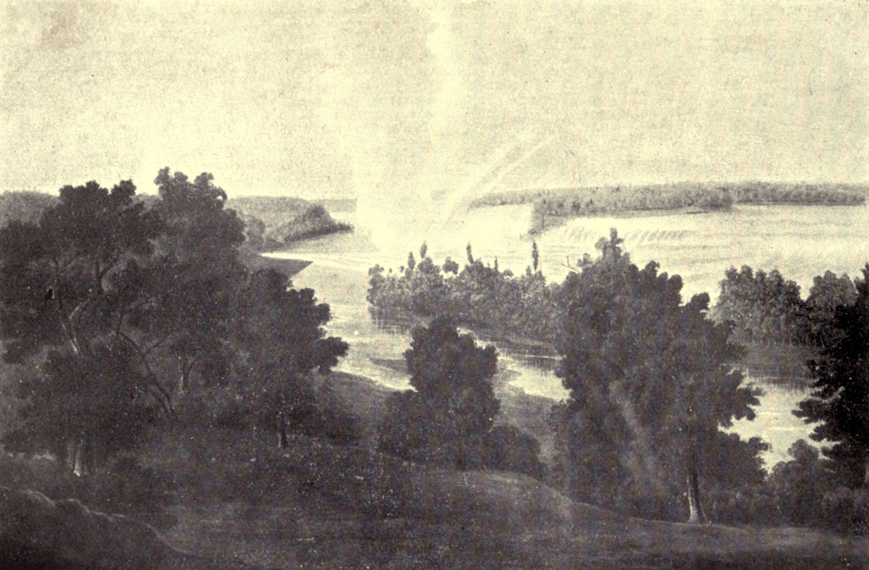
OTTAWA IN EARLY DAYS
He was of a fine type of British soldier. He had his share of that bulldog tenacity of purpose which refuses to acknowledge defeat—a quality which inspired him, on the one hand, in a long struggle to persuade the British Government to build the new waterway on a scale which could be used by the steamboats, then beginning to supersede the old Durham boats; and, on the other, enabled him to rise superior to the natural difficulties of his task. When the almost completed dam at the Hog’s Back was washed away by a spring flood, he is reported to have said that he would rebuild the dam “until it would stand, if he had to build it with solid half-dollar pieces!” An enthusiast for his work, he would allow no shirking or scamping or poor workmanship; but, though a strict disciplinarian, he was also kind and charitable.
He first pitched his tent in the unbroken forest of Nepean Point, but soon removed to a house built of boulders, with “very rustic woodwork,” on what is now Major’s Hill, while barracks were erected for his company of sappers and miners on the hill now crowned by the Parliament buildings.
Early in 1827 Lord Dalhousie visited Bytown to witness “the ceremony of breaking ground for the canal”; and in August of the same year the famous Arctic explorer, Franklin, laid the corner-stone of the locks. But these only represented part of By’s activities. He was busy with a bridge at the Chaudière to give the first land-communication between the two Provinces, with the Deep Cut, the Sappers’ Bridge, and some twenty-six miles of road.
Money for the payment of the workmen used to come out from England in half-crowns, packed in kegs like nails. Once the head came out of one of these kegs, and its contents were scattered in the street. The cost of the canal amounted in all to about $5,000,000. The distance by the Rideau Canal from Ottawa to Kingston is 126 miles, but much advantage was taken of natural waterways. Twenty-four dams and forty-seven locks (eight of which are within the limits of Ottawa) had to be constructed to turn numerous rapids into still water and to overcome differences of level. In the spring of 1832 the first steamer passed through the locks. This vessel was called by the inelegant name of the Pumper; and the second steamer to go through was the Union.
After this, till the completion of the St. Lawrence canals, the whole trade of Upper and Lower Canada went past Bytown. Sometimes hundreds of immigrants passed through in a day, and it was the chief amusement of the townsfolk to watch the vessels going through the locks. For the first quarter of a century, however, visitors noted that the Bytown folk seemed to have no time to pave their streets, to think of gardens or flowers, or even to remove the boulders lying about amongst the houses. The upper and lower towns were separate villages, with “the wooded spur of the hill,” on which the barracks stood, between; and from all accounts a rough, lawless, little place it was, frequented by lumbermen, of different nationalities, for business and pleasure, and these often fell to fighting amongst themselves or with the wild Irish “shiners,” who also found employment rafting lumber down the river. Whisky was cheap, and, as “Ralph Connor” says of the lumberers in The Man from Glengarry, “drunken rows were their delight, and fights so fierce that many a man came out battered and bruised to death or to life-long decrepitude.” Escape to the woods was so easy that it put a premium on crime, and in 1837 the law-abiding citizens formed an “Association for Preserving the Public Peace in Bytown,” the object being mutual protection against “felonious assault.” Nor was it only in Bytown that peaceful settlers suffered from the lawless lumbermen. All along the canal the “shiners” were always on the look-out to pick quarrels with the farmers, some of whom were themselves “rough-and-ready fighters.”
But despite the rude accompaniments of the trade, it was building up Bytown, which was incorporated as a town in 1847, with 6000 inhabitants, and as a city in 1855, when it changed its name to Ottawa. At the earlier of these two dates, about half the population was Irish and a quarter French-Canadian. From morning to night the streets were filled “with Lower Canadian caleches,” and altogether, to an English observer, the scene was “exceedingly foreign.”
In 1857, as every Canadian knows, Queen Victoria chose Ottawa to be the capital of the Canadas, on account not only of its central position with regard to the two Provinces, and of its distance from the frontier, but also because of the striking beauty of its site, which is a worthy setting for Parliament buildings, not now of “the Canadas” alone, but of the Dominion. A new chapter of the history of Ottawa was begun in 1867, but it belongs to the story of the nation rather than to that of the counties.
“Hath not old custom made this life more sweet
Than that of painted pomp? Are not these woods
More free from peril than the envious court?”
Shakespeare.
Immediately after the War of 1812 (to which period belongs the beginning of settlement in Lanark County), the military and civic officials in Canada, the half-pay officers and other educated British settlers, seem to have been obsessed (not unnaturally) with fear and dislike of the Americans. The travellers of the time constantly held up to ridicule and obloquy American manners and American morality, but this distrust did not deter “Yankee” pioneers from flocking into the country, from making, as individuals, as much as possible of it their own, nor from doing it good service by their experience of similar conditions of life.
As was mentioned previously, the Rideau Canal owed its inception to this chronic suspicion of our neighbours, and, of course, it was always in the thoughts of the actual constructors of the work. Possibly, therefore, their accounts of the Yankees, in Lanark and elsewhere, may not have been quite free from prejudice. There are, however, some interesting pages concerning Lanark County in a book, published about 1828, by John McTaggart, clerk of the works on the canal, who was sent through the country to make careful surveys and reports, and from his pages one can glean many a picture of the state of the district through which the canal was to pass. Of course, his first interest is in the river, vexed in its course by rapids or plunging madly over great ledges of rock, but he gives some glimpses of the scattered settlers and their doings.
Hinting now and then at the lonely beauty of the wilderness, he paints the land, upon the whole, in somewhat forbidding colours. He tells of long stretches of swamp where, by actual measurement, the black mud was over three feet in depth. These dread morasses were the haunt, as canal-workers and settlers alike found to their cost, of fever and ague. They were the haunt, too, of all manner of noxious stinging and biting insects—black flies and hornets and mosquitoes in clouds—which tortured all the workers at their patient measuring and surveying. In the spring the thickly growing forests were strangely vocal with wild pigeons innumerable, sometimes flying in flocks of “five acres” in extent.
Swamps and dense woods must have had a subduing effect on their few human inhabitants, for McTaggart mentions “a melancholy peculiar to Canada.” The notion scarcely suits with our twentieth-century conception of our young country, nor does it seem altogether to accord with the idea one gets of the man himself, who, amidst the manifold difficulties of his canal-building, was so eager and enthusiastic as to be dreaming strange dreams of a “grand canal” across the northern half of the North American continent, through a “notch” in the Rockies to the waters of the Pacific, upon which he saw visions of a city of Nookta as large as the metropolis of the Empire itself.
But McTaggart was not always in the clouds. He could grow eloquent in dispraise of the “cheap and nasty” whisky made in every little hamlet from bad potatoes and other refuse, to the great detriment of the health, morals, and fortunes of the people. At that time distilleries seemed to be regarded as only second in importance to grist mills and sawmills, which were generally built by the aristocrats amongst the pioneers, or “settlers of eminence,” as McTaggart calls them. Of course, many of the energetic settlers also took to keeping the tiny village stores, which had to cater for the wants of a very miscellaneous population. For instance, in headgear, it was customary for them to keep “white hats for Yankees, black hats for Irish, and Kilmarnock bonnets for Canadians.”
As might be guessed from its Scottish name, Lanark township was largely settled by Scotch—many of them Glasgow weavers; and in that day, when means of communication throughout the country were so deficient, any settlers might count themselves fortunate if within reach of neighbours whose upbringing and modes of thought bore some resemblance to their own.
In the year 1816 the townships of Bathurst, Drummond, and Beckwith (like the neighbouring township of Goulburn in Carleton County) were settled to a considerable extent by discharged soldiers, some of whom had been, it is said, “with Abercrombie in Egypt, with Wellington and Sir John Moore in Spain, with Cornwallis in America,” but the greater part had seen service in 1812, when Canada was the battlefield. At a very great expense, the British Government—partly to strengthen the Colony from the military point of view—“tried to make these old soldiers and their families as comfortable as possible.... They chose their locations without expense, and each man received, according to his rank, from one hundred to five hundred acres. They were also supplied with all necessary implements of husbandry, and tools for building purposes; also cooking utensils and blankets, with one year’s provisions for each man, woman, and child.” Some of the ex-soldiers of this “Perth settlement” did well. Others stayed only as long as the distribution of rations continued, or until they could obtain some trifle for their lands. By the middle of the century it was said that scarcely one soldier-settler in fifty had remained for good; but by that time Irish and English immigrants had filled up the deserted holdings.
In 1815 proclamations had been issued in Britain inviting civilians also, under certain conditions, to become settlers in Upper or Lower Canada, as they might choose, though the exact location was left to the Government; and some of the Perth settlement pioneers were gathered in this way. According to Robert Gourlay, that industrious hunter-out of abuses, the good intentions of the Government were, in part, frustrated by the carelessness and bad conduct of its accredited agents. As a beginning, the new-comers, unused to axe-work, were obliged to cut a road twenty miles long through the wooded wilderness before they could reach the principal place of settlement, and, arriving there, found the surveying of their lands only beginning. Sometimes, too, the promised rations were stopped for very slight reasons.
The county town of Perth was laid out by the Government in 1816, on an island in the Tay River, which was afterwards rendered navigable for small vessels to the Rideau Canal by a private company. Sixty years ago Perth was a clean, thriving little place of nearly 2000 inhabitants. Its attractiveness was due largely to its river and its many stone buildings. Its population has nearly doubled since then, but it has been outstripped by its younger rival, Smith’s Falls. Originally, by the way, the progress of this latter place was, it is said, much hindered by the cupidity of its owners, who asked as much as two hundred and fifty pounds for quarter-acre lots in the business section of the village.
Of course in the early days there were many squatters in the county, who, going into the wilderness in advance of the surveyors, built their shanties and made their little clearings, trusting to the authorities to give due consideration to their claims whenever the country should be opened formally to settlement. McTaggart tells that, in the winter of 1827, when, going with his men through the woods in a part of Lanark County which he believed to be absolutely unsettled, he came on the track of a sleigh—a sight almost as astonishing, under the circumstances, as was the footprint to Robinson Crusoe on his desolate island. Following the track, the party came to a clearing of about seven acres, in the midst of which “a neat little log-house sat smoking.” Its master, in a voice trembling with emotion at the unusual sight of strangers, asked them to “Come ben!” Accepting the invitation, they entered to find “a snug little cabin,” a wife, three children, some sleek grey cats, and a good dog. “Having broached the rum jug” (not the simplest courtesy was then complete without strong drink), they all sat down to listen to their host’s story.
A plain working man, Peter Armstrong by name, from Hawick, in Scotland, he had managed, fifteen years earlier, to save enough to come to Canada; had “fought up the water St. Lawrence to a place they ca’d Perth, and there finding nought to do—nae country wark”—(one wonders what they did in that pioneer hamlet, if not country work!)—“he just went afar into the heart of the wild woods with his axe, dog and gun, and, after looking about, fixed on the place where we found him for his abode in this world.
“Year by year, he wrought away all by himself—read the Bible every Sabbath day—made a journey to Perth twice a year and bought wee needfuls; at last got a house, and sleigh, and cleared about five acres.” Having good health, “spring-water plenty just aside him,” and no lack of firewood, he lived well enough for five long solitary years, on “what he caught, shot, gathered, or grew.” “All at once, on one of his visits to Perth, whom should he meet but Tibby Patterson, who was the byre-woman at the laird of Branksome’s, where he was once a herd lad. Far frae hame in a wild land,” with few friends, they were drawn to each other at once. So they were married by one of the irregular weddings of those days when parsons were so far to seek—and for nine years they had lived happily, deep in the great woods. But McTaggart wondered less at their content than at the grumbling of others whom he met in his wanderings, who would neither leave the woods and “fight for an honest living and cheerful society, nor yet be at peace in them.”
“I wuss ye weel! the kintra’s lairge,
An’ ye’re but twa wi’ Mary,
Ye’ll shortly hae the owner’s chairge,
Nae doot, o’ half a prairie.
There’s ample room in sic a park
To foond a score o’ nations,
An’ flourish like a patriarch
Amon’ your generations.”
J. Logie Robertson.
“The country’s large”—even so it may be said of Renfrew County alone, with its three dozen townships, named variously with Indian words and with names reminiscent of Canadian Governors, Crimean generals, lumber merchants, great ladies, and little English villages.
A curious incident links this county, till less than a century ago inhabited only by Indians, with the brave days of early French exploration, for in 1867 an antique astronomical instrument was ploughed up near Muskrat Lake, which, on good circumstantial evidence, proved to be an astrolabe lost by Champlain in 1613 on his disappointing journey up the Ottawa, by which route the lying De Vignau had promised to lead him to Hudson Bay.
In 1827 the Hudson’s Bay Company established one trading post at Golden Lake and another at the Chats, with a third, Fort Coulonge, on the Quebec bank of the Ottawa, between Allumette and Calumet Islands. Some seven years later the lumbering operations begun on the Ottawa extended to the banks of its tributary streams, watering the well-wooded wilderness now Renfrew County. But the dark and turgid Madawaska—the “Never-frozen,” as its Indian name means—rushing headlong between high precipitous banks, was regarded even by the hardy lumbermen as so dangerous that it was not till 1836 that the cutting of the valuable timber upon its banks commenced. Soon after that, however, the Government took measures to render it more passable.
In 1821 Peter White, who had been in the Royal Navy and had come to Canada in 1813 to serve under Sir James Yeo on Lake Ontario, settled on the site of Pembroke, Renfrew’s future county town. He had brought up his family by canoe from Bytown, taking fourteen days on the way, though the journey can now be made in three and a half hours, and at first the house of his nearest white neighbour was sixty miles distant from his log cabin. It is said, by the way, that the roofs of such log cabins, made of hollowed tree trunks, with the grooves placed alternately up and down, were a better defence against rain than the walls usually were against wind.
It was not then, as with our modern pioneers in the west, that the first resource was grain. The old-time backwoodsman looked to obtain his first cash payment from potash; and Mrs. McDougall, a member of the Women’s Historical Society of Ottawa, writing of “Renfrew in the Early Days,” describes how the ashes from the burnt wood were leached in wedge-shaped vessels, how the lye was boiled “until it looked like molten iron,” and then was poured into coolers, “two of which filled a barrel.” A barrel of potash of first quality was at one time worth thirty dollars, and it was the custom for the local merchant to pay on account twelve dollars for each barrel, but the farmer had to wait patiently for the rest until “the merchant returned from Montreal, where he got ready money for all the potash entrusted to him.”
The housekeeper of those almost moneyless days was happily wonderfully independent of the shops, with her remarkable ingenuity, her spinning-wheel, her supply of sugar and syrup from the maples on the farm, and plenty of “Labrador tea” for the gathering along the edges of swamps and streams. (This was said, by the way, to be a “very fair substitute for the real article.”) If she wanted vinegar, she made it with “vinegar-plant.” If she had need of candles, she took some wicks, about half a yard long, and dipped and re-dipped until her candles were thick enough; but her labours in this matter were soon simplified by the coming in of moulds.
Bread-making in those days had its own peculiar difficulties. In the first place, as has been said over and over again, it was hard to obtain flour. One Renfrew settler carried a bag of wheat twelve miles to be ground in a coffee-mill, and another, whose family was giving a party, rode sixty miles to Perth for flour to make bread. In the second place, before hops were grown, ordinary yeast was not to be had, and the dough was “raised” with a preparation made from burnt hardwood or with fermented bran, which last made a nice white loaf, but one that dried extraordinarily quickly.
The Indians brought supplies of fish, game, and cranberries to the settlers, but wild strawberries, raspberries, blackberries, and blueberries only followed the clearing of the land. The Caughnawaga Indians, coming from the Lake of Two Mountains to winter at Golden Lake, were the first to bring in apples—little, round, hard things, but none the less the delight of the children.
That was the period when many useful people had to itinerate—not only missionaries, but also tailors and shoemakers. As for teachers, Renfrew seems to have been fortunate in obtaining for the children the services of some well-educated young men who had come into the district in hopes of sport.
Amongst the immigrants of different ranks and nationalities, the county had, of course, its share of oddities. One of the most eccentric of the pioneers was that “real Highland chieftain,” “The MacNab of MacNab,” who, in 1825, received a grant of the township named after him. Four or five miles from the head of the Chats Rapids, he built his castle, Kinnel Lodge. Around it his clansmen erected their humbler dwellings. Every year he sold an immense quantity of fine timber, and it was his delight at times, “to move about the Provinces,” somewhat in the style of “Vich Ian Vohr” in Waverley, attired in full Highland costume, and attended with a piper going before, and a “tail” of henchmen following after. There are many stories of his consequential manners. It has often been told how he registered in the visitors’ book of an hotel at Kingston as “The MacNab,” and how a young relative, the future “Sir Allan” of Hamilton, coming in immediately afterwards, registered as “The Other MacNab.” An acquaintance who addressed him as “Mr. MacNab” was called to order with the remark: “Sir, I thought you had known better—nothing but MacNab, if you please. Mr. does not belong to me.” In 1837 he offered his services to Sir Francis Bond Head, as “the only Highland Chieftain in America.”
Many immigrants, some of whom were described as “lovely Highland girls,” came out to his estate every year. He used to meet the new-comers at Quebec and escort them in person “to the land of timber instead of heather,” but his management of affairs did not altogether please his clansmen, and in 1842 the Government, desiring to put an end to the constant contentions, paid him $16,000 to relinquish his rights. After living in Hamilton for a few years, he returned to Scotland to take possession of a small estate left to him in the Orkneys, and died in France in 1860. Highlanders settled also in Buchanan and Ross townships.
In the early days the district along the upper portion of the Madawaska (now comprised in the townships of Brougham, Wilberforce, and Grattan) was known as “Rogues’ Harbour,” from the fact that absconding debtors and other disreputable squatters had made it their refuge.
In 1854 Renfrew, separated from Lanark, was represented in Parliament by Sir Francis Hincks. It was twelve years later, however, before the county gained its municipal independence; and “when the county town was Perth and there were no roads through Renfrew, to be singled out as a juryman meant that the hand of fortune was against you.” Jurymen were then paid twelve and a half cents for each case they were on, but were not allowed mileage, even though they might have to tramp on foot fifty, sixty, or seventy miles to attend the court.
About 1850 a road was opened from the Ottawa, below Calumet Island, to Cobden, at the head of Muskrat Lake, and stages were run on this highway to connect with a “line” of rowboats which carried passengers and goods to Pembroke, till they were superseded by a small steamboat. This seemed an immense advance, but now the transcontinental line of the Canadian Pacific Railway passes through Pembroke.
For long, farming in Renfrew was neglected for the sake of lumbering; but as the lumbermen had to go farther back their demand for supplies led to some cultivation of the soil, and some of the great lumber merchants established farms to supply their own camps.
“In the rough old times,
In the tough old times,
Of twenty years agone,
There was nae a clock in the settlement
To tell how the time went on;
But we kenned very well when the day began,
And we kenned very well when ’twas o’er,
And our dinner-bell was the gude-wife’s shout,
When the sun reached the nick in the door.”
David Martin.
When, in 1669, La Salle and his party, including the adventurous priests Dollier de Casson and Gallinée, found their way to “the head” of Lake Ontario, the spot was much frequented by wild animals and Indian hunters, and many Indian relics and traces of villages have been discovered in the vicinity. Deer, bears, and wolves were perhaps attracted not only by the pure, abundant waters, but by the numerous “salt-licks” on the side of the mountain. There, too, rattlesnakes found congenial lurking places, and Father Gallinée records that when the intrepid explorer of the Mississippi was seized at this place with a fever, some of his party declared that it was due “to the sight of three large rattlesnakes which he had encountered on his way while ascending a rocky eminence.”
Somewhat over a century later, when the settlement of the district had fairly begun, rattlesnakes were still extraordinarily plentiful, and Mr. J. H. Smith, the historian of Wentworth County, tells how each returning spring the pioneers used “to organise hunting parties to destroy these dangerous neighbours.... On the projecting ledges on sunny days they might be seen gathered together in heaps varying in height from one to two feet, and here they lay basking in the sunshine. It was at these times that the hunting parties visited the mountain side, and with muskets loaded with slugs or coarse shot fired into these piles and destroyed them by hundreds.”
Who was the first permanent settler at “the head of the lake” is uncertain. About 1785 two Loyalists, Charles Depew and his brother-in-law, George Stewart, coasted along the lake shore in search of homes, and, dragging their canoe across Burlington Beach, landed on what was afterwards known as the Depew Farm. No survey having been made, they marked their names on flattened stakes and drove them into the ground, to show other home-seekers that there was a claim on the land.
On a tombstone in Christ Church Cathedral, the honour of being “the first settler at the head of the lake” is claimed for a trader, Richard Beasley. This man was the first owner of what is now Dundurn Park, and it is said that Simcoe planned for a town on the heights, but that Beasley set so high a value on his rights in the land that the settlement began its existence south and east of the intended spot.
Robert Land was another very early settler at the “head of the lake,” and his story reads like a romance. When the revolutionary war broke out he was living on the banks of the Delaware. Of a daring and adventurous temper, he came out boldly on the side of the King, and was often employed to carry important despatches. One night, however, he was shot at and wounded, but managed to creep into a thicket to conceal himself till he was able to continue his journey. Reaching home, he found his house in ashes, his wife and children gone. Believing that they had been murdered by the Indians, he made his perilous way to Niagara, and later took up land under the mountain beyond Stony Creek. Here for seven years he lived, “a solitary,” but one day when he returned home to his cabin he saw, in the dim light that struggled through the “wolf-skin” window of his cabin, a weary, travel-worn woman and two grown-up young men. It was the wife and boys whom he had mourned so long as dead; they, on the other hand, believed that he had been slain. In far New Brunswick the wife had been toiling for her sons till they reached manhood, when hope of bettering their fortunes drew them westward. Reaching Niagara, they heard the strange news that a settler bearing the lost man’s name was living alone in the woods fifty miles away, and at once set out on foot to verify the rumour. At last, “a happier Evangeline,” Mrs. Land ended her toilsome pilgrimage in a glad reunion with her husband for many years.
In 1787 two brothers from Pennsylvania, Abraham and Isaac Horning, built a cabin near Burlington Bay, planting near it some garden seeds given them by their mother. A year later two sisters and another brother, with his family, set out in a home-built boat to join them. Before the weary journey of eight weeks was ended the boat was driven ashore and dashed to pieces. Leaving the rest of the party at Niagara, the sisters and brother followed the trail to the head of the lake, where they soon came on a little log hut in the midst of blooming flowers, and one of the sisters said: “We are at the end of our journey. I know it by these flowers.”
An early settler at Waterdown was Colonel Brown, called by the Indians “the White Man of the Mountain.” He made a somewhat unusual disposal of his four-hundred-acre farm at his death, leaving it to his grand-daughter and “her heirs female.” At first the mails to the more westerly settlements passed through Waterdown, but from the time when the stage line between Toronto and Hamilton was started until 1840 the village was left out in the cold, and had no post office at all.
Another Wentworth village, Ancaster, is an older centre of population than either Hamilton or Dundas. It had a school as early as 1796, and letters for the future Hamilton were sometimes addressed, “Burlington, near Ancaster.” Dundas was once known as “Coot’s Paradise,” and, according to tradition at least, its three first permanent settlers bore the oddly-related names of “Hatt, Hare, and Head.” In its infancy Dundas had the distinction of possessing a log jail, which was used during the War of 1812. At that time, by the way, the southern part of Wentworth County was part of Lincoln, whilst its northern townships first belonged to York, and later to Halton County.
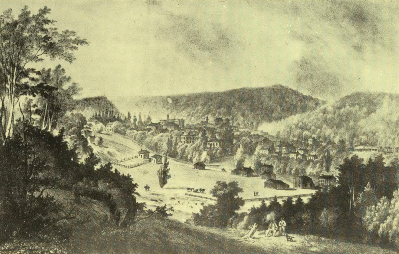
DUNDAS
As everyone knows, the early settlers had to do without, or to depend upon themselves for, numberless articles which we regard as necessaries, but perhaps it is from little concrete examples that we realise best what this general statement means. For instance, most present-day cooks would hardly like to have to make their own baking-soda from the “lye” of burnt corncobs, nor would our gay young girls or gallants, when dressing for some festive occasion, care to have to go to a neighbour’s before they could obtain a glimpse of themselves in a looking-glass. But an old settler of Wentworth County remembered as one of the chief glories of the ancient frame house where he lived as a boy “a wonderful mirror of large size”—by actual measurement 12 by 20 inches! This “very expensive article,” costing six or seven dollars, “had been imported with great care, wrapped between two pillows with the glass downwards. That mirror was the pride of the household and the delight of the neighbourhood. Girls living in the vicinity made frequent pilgrimages to its shrine, and the wild Indians entertained great veneration for our house in consequence of this wonderful talisman, helping them to see themselves as others saw them. Stoics though they were, their grimaces were extremely ludicrous.”
It has been already mentioned that wild beasts were plentiful in Wentworth County. To capture the larger animals, the settlers dug deep pits, which they concealed by a kind of trap-door contrived to spring back to its horizontal position after the creature stepping upon it had slipped into the hole below. A story is told of an unscrupulous fellow who, running off with a ham purloined from a neighbour, was caught in one of these traps. The fall did not greatly hurt him, but he was sorely troubled at the thought of being discovered in the morning with his stolen booty as evidence of his theft. He was destined to have something else to think of, however. Presently he was startled by a heavy thud, and a bear landed beside him at the bottom of the trap. Some time later a wolf came to share their captivity. After a while the man plucked up courage to offer them the ham in turn, partly to propitiate them, partly in the hope of getting rid of his plunder. In vain! The cowed animals had lost both appetite and spirit, and when morning dawned they had touched neither this discreditable “Daniel” nor the ham. At last a small boy peeped into the trap, and, seeing the bear, cried: “So you are caught at last, my fine fellow!” “Yes, I am,” replied the man, and the child ran home in terror to report that Bruin had answered him with a human voice. Immediately his father and brothers hurried to the trap, and, despatching the beasts, drew from his prison the now penitent thief.
Indirectly it was the War of 1812 that gave to the city of Hamilton its name, for when the conflict began a young Queenston man, George Hamilton, who had wedded a Miss Jarvis of York, determined to move, with his young wife and infant son, to somewhat less exposed quarters. The little family consequently migrated to the head of the lake, where, some years later, Hamilton laid out upon his property streets which he named after members of his family—John, James, Catharine, Hannah, Maria, and Augusta. He also presented to the town bearing his name Court-House Square, the Wood Market, and Gore Park.
But in the attempt to escape the troubles of the time by removal from the Niagara frontier Hamilton reckoned without his host, for the tide of war soon swept northward and westward, surging into Wentworth County during the second year of the struggle. In the spring the Americans, on their way to attack York, destroyed the “King’s Head Inn,” or “Government House” as it was sometimes called, at the southern end of Burlington Beach, whither the Indians came annually by hundreds to receive the presents promised to them for the lands they had relinquished. A few days later the settlers, whose log cabins near the bay faintly indicated the spot which within a century was to be covered by the homes of some 90,000 people, may have seen the smoke of the conflagration which destroyed the little capital of Upper Canada. Then flying rumours of disaster on the Niagara frontier heralded the march of General Vincent, with the remnants of the British garrisons of Forts George, Erie, and Chippewa, to make a stand upon Burlington Heights. His troops, consisting in part of men of the 49th Regiment, the Glengarry Fencibles, and some companies of the Royal Newfoundland Regiment, entrenched themselves on the ground where was to be built “Dundurn Castle.”
A few days afterwards, on the hot afternoon of June 5, an American force, led by Generals Chandler and Winder, arrived at Stony Creek. Thirsty, hungry, and tired, the troops “were ordered to sleep on their arms that night,” and cannon were placed in readiness to sweep the narrow, crooked road leading to the British camp on the Heights. Hearing of the approach of this force, which probably numbered from two to three thousand men, Vincent sent a party to reconnoitre, under Colonel John Harvey (later the Governor of several of the British Provinces in succession), and doubtless it was on this occasion that Lieutenant FitzGibbon (recently raised from the ranks and soon to share with Laura Secord the glory of the bloodless victory at Beaver Dams) penetrated into the enemy’s camp, disguised as a settler, with a basket of butter on his arm. He soon sold his stock-in-trade, but not before he had attained a good knowledge of the disposition of the American troops. Vincent was short of ammunition and seriously outnumbered, and an attack upon his camp might have ended disastrously for the whole upper country; but, reversing the old adage, the General evidently thought valour “the better part” of prudence. Promptly he fell in with the suggestion of a night attack, and in a few moments the sleeping officers and men were aroused from their couches on the grass, and the whole camp was alive with preparations for the march.
About 10.30 on a night when black darkness was varied by fitful flashes of lightning the little army, seven or eight hundred strong, noiselessly took its way down the lonely road eastward, to arrive a little before two o’clock the next morning in sight of the first American sentry, on guard near the old Methodist church of Stony Creek. The building was full of slumbering soldiers, but by some means, it is said, the British had obtained the American countersign. At any rate, they passed the sentries and got to the centre of the invaders’ camp before they were discovered. Then, breaking their long silence with wild yells, they burst with fixed bayonets upon the astonished enemy. The two American Generals, who had been spending the night at Gage’s farmhouse (which still stands), were made prisoners; so were a number of their men, but five hundred who had been posted in the lane “flew madly to the hill, leaving their blankets, knapsacks, and some of their arms behind.” Soon recovering from their confusion, however, the Americans fired a volley from the hill. At times the opposing forces were strangely mixed in the hand-to-hand fight, and prisoners were taken on both sides, but before daybreak the British leader, Harvey, fearful lest the enemy should discover the smallness of his force, drew off his men. After this check the Americans decided to make no further attempt on Vincent’s camp.
Several months later the broken remains of Proctor’s army, on its way to join Vincent’s force, straggled through Ancaster, to the great alarm of the villagers, who imagined that the victorious Americans were in hot pursuit; but after Stony Creek, Wentworth County was not destined to furnish another battleground for the opposing armies.
Occasionally during the War the settlers suffered a good deal from their friends; at least there are traditions of British officers “pressing” men and teams for military service and of Indians taking down the fence around some settler’s wheatfield to turn in their horses. In 1813, it is told, two thousand Indians gathered to a great feast on Dundas flats, for which they had prepared by killing the neighbouring farmers’ sheep and pigs.
It was soon after the return of peace, in 1816, that Wentworth became a separate county. Its first county buildings were a combined court-house and jail of logs. The walls of the lower storey, for the detention of criminals, were four logs thick; those of the second, the debtors’ prison, three logs thick; and those of the court-room above only two logs thick. This was superseded in 1828 by a stone building.
Did space permit much might be told of the social conditions of the early years. For instance, in that whisky-drinking period, it is surely worthy of record that in 1832 a Waterdown man, Griffin, succeeded (with the usual neighbourly help) in erecting a sawmill in half the ordinary time—without whisky! It was evidently an unpopular proceeding, however, for when he tried to arrange a barn-raising on the same conditions he had to send to the Indian mission on the Credit before he could obtain men. Later he started a kind of aristocratic temperance society, in which, while ardent spirits were tabooed, those who could afford might still indulge in wine, but in 1833 the pledge was broadened to include abstinence from all intoxicating liquors.
In 1832 Hamilton had a population of 800, which, despite the terrible ravages of cholera in that year and in 1834, had increased by 1837 to some 3500. But the Rebellion brought things to a standstill. Building almost ceased, the poor mechanics of the towns suffered sadly, and tradesmen became eager to obtain labourer’s work at 75 cents a day. A more pleasing event of the year was the opening of the Desjardins Canal, four miles in length; but not long after the construction of the railway between Toronto and Hamilton, the breaking of a bridge across the canal resulted in a shocking railway accident, which caused the death of seventy persons.
During the early decades of the nineteenth century many of the immigrants had to undergo experiences not less trying than those of their precursors, the Loyalists. In May, 1832, a party of Scottish emigrants set out for Hamilton. The ocean voyage to Quebec consumed seven and a half weeks, and it took three weeks more to complete the journey in a Durham boat, which made such slow progress that its passengers, strolling along the shore, could keep pace with it. The miseries of the journey were sorely increased by the fact that the little company had the dread cholera for a travelling companion. One of their number, John Glasgow, fifty-seven years later, told the story in one of the “Wentworth Historical Society” publications, and, strange to say, one of the great difficulties of the immigrants was to obtain water. They had been warned against drinking from the river, and the settlers on its banks chained the “swing-hoists” of their wells, lest cholera-infected immigrants should be tempted to linger in their neighbourhood.
Several of the voyagers died upon the way. Sometimes it was impossible to land the corpse for several hours; sometimes it was left nailed up in a rough coffin, in some outhouse on the shore, for the authorities to dispose of as they could. At last the weary travellers reached Hamilton, the first object in the town that struck their attention being the glittering spire of the old CourtHouse. But there was no welcome for them, and the first night they had to make their beds on the wharf. Within a few hours of their landing a young husband and wife both passed away, and the townsfolk dared not take them in. At last George Hamilton came to the rescue, proposing to build them a shelter at the edge of the woods. There they stayed till the cold weather came, ultimately moving out of the village to bush farms in East Flamboro’, where they erected their log houses about Christmas—some three miles from a road!
“Then upon the ground the warriors
Threw their cloaks and shirts of deer-skin,
Threw their weapons and their war-gear,
Leaped into the rushing river,
Washed the war-paint from their faces.”
Longfellow.
In the mother-isle red and white roses recall the memory of the rival Houses of Lancaster and York and of a long civil war. In Canada the same fair flowers were taken, on the occasion of a recent centenary, as symbols of the Indian and Canadian peoples, and wreaths of red and white roses were laid on the monument commemorating the great chief from whom the city of Brant—or Brant’s Ford—takes its appellation.
The name of Brant is with excellent reason written upon the map of our Province, for, none the less for his Indian blood, he was one of the most notable Loyalist pioneers of Upper Canada. Born on the banks of the Ohio in 1742, Joseph Brant, or Thayandanegea, received at thirteen years of age his “baptism of fire,” when his patron, Sir William Johnson, defeated the French, under Dieskau, on the shores of Lake George. After this first taste of warfare, Brant was sent by Johnson to a school for Indian boys in Connecticut. There he learned to speak, read, and write English so well that he acted later as interpreter to a missionary, and aided in the translation of the New Testament into his native tongue. But he soon returned to “the Mohawk Castles,” for school routine was not to his taste, and the best-loved business of his maturer life was warfare. Always on the side of the British, he fought against the French in 1759; against Pontiac’s braves in 1763; for the Loyalists throughout the Revolutionary War; and against the Americans in the Indian uprising, west of the Ohio, in 1791. As a warrior, he gained a name of terror, not all deserved, for there are many stories of his mercy to old acquaintances in the midst of fierce scenes of carnage; and the evening of his days was passed in peace.
Despite his Indian blood, Brant realised that it would be for the benefit of his race to learn many of the arts and ways of civilised life, and tried to interest his people both in agriculture and books. He, himself, according to a visitor, who, in 1792, stayed at his home on the Grand River, was “well acquainted with European manners,” receiving his guests “with much politeness and hospitality.... Tea was on the table when we came in, served in the handsomest china plate—our beds, sheets, and English blankets were fine and comfortable. Two slaves attended the table.” But “Mrs. Brant appeared superbly dressed in the Indian fashion. Her blanket was made up of silk and the finest English cloth, bordered with a narrow strip of embroidered lace.” Afterward Brant built the fine house, already referred to, at Wellington Square (now Burlington), and there, in 1807, he died, when his wife returned to the more congenial home amongst her own people on the Grand River. Brant’s last resting-place, moreover, is under the shadow of the little old “Mohawk Church” near Brantford, built by George III for the Indians. It is famous as the oldest Anglican church in Upper Canada, and possesses a communion service of beaten silver, given by Queen Anne to the Mohawk chiefs who visited her court. One of these, by the way, is said to have been the grandfather of Brant. Brant was succeeded as Chief of the Six Nations by his youngest son, John, a well-educated gentleman, who died at a comparatively early age.
The county named after the great Mohawk is rather small, comprising only six townships. It is of a curious tripartite shape, resembling a short, thick letter Y, laid upon the convolutions of the Grand River. South Dumfries, originally half of the larger township of Dumfries, of the settlement of which some account will be given in the “story” of Waterloo, forms the right arm of the Y; and Burford, once part of Oxford County, makes the left arm. The tiny triangular township of Oakland was successively known as the “Gore” of Townsend and of Burford before it took a more distinctive name.
The remaining three townships were borrowed from Wentworth when Brant County was organised in 1852. Onondaga is called after that nation of the Iroquois Confederacy known to this day as the “Fire-keepers,” who, in the formal councils of the tribes, hold a position resembling that of umpires. The township name, Tuscarora, comes from that of a tribe of North Carolina Indians who, early in the eighteenth century, joined the Iroquois League, which henceforth was known as the “Six” instead of the “Five” Nations. The whole of Tuscarora, as well as parts of Onondaga and Oneida (in Haldimand County), is included in the famous Indian Reserve; and these townships, with Brantford, South Dumfries, and others, were within the “tract of land six miles in depth on each side of the Grand River,” from its mouth to the Falls of Elora, given in 1784 to the Six Nations Loyalists. The boundaries of this grant followed the general direction, not the minor curves, of the river, and were drawn in straight lines, with angles here and there, to enclose a strip of country a hundred miles long by twelve in breadth. The Indians found this territory of 1200 square miles, or 768,000 acres, unnecessarily large, and from time to time it was reduced, by sales to private persons or concessions to Government, to its present relatively small dimensions of a little less than 44,000 acres. The plan of the original grant has left its traces in the township lines and the curious shape of Brant County.
In early days white men sometimes squatted on the Reserve, but sixty years ago the squatters were all obliged to remove. One of the pioneers of Onondaga unfortunately happened to pitch upon a place where the Indians had a “long house,” or meeting-place, and were accustomed to “burn their dog.” Holding the spot sacred, they pulled the intruder’s hut down about his ears, and at another time beat him into insensibility. Generally, however, they were friendly to the white settlers.
About 1853 the population of the Reserve was 2330 souls, a number now nearly doubled, two-thirds of the Indians on the Reserve belonging to the Mohawk and Cayuga tribes. To-day there are several churches and ten or eleven schools on the Reserve, besides the Mohawk Institute, where both boys and girls are trained in industrial pursuits. It is under the care of what is known as the “New England Company,” an ancient missionary society, which has worked amongst the Mohawks since 1649. The Indians on the Reserve are generally industrious and law-abiding. They live chiefly by farming and have long had a flourishing agricultural society among themselves.
Settlement began in a small way at Brantford about 1816—when there was a log hut by the river, used as a tavern—but it was not till April, 1830, that the Indians surrendered the town-plot to the Government. Its situation is in many respects advantageous. It was made a port in 1852. Now it has many flourishing industries and a population of over 28,000. In 1814 the American General, McArthur, marching from Detroit to relieve his countrymen besieged in Fort Erie, arrived at the spot to find the river high and a number of British troops (white and red) guarding the ford. A few shots were exchanged before McArthur turned aside to the township of Oakland to burn Malcolm’s Mills, where a few raw volunteers had gathered. The story goes that, on his approach, some of the would-be defenders of the soil fell into a panic and, seeking the most direct line of flight, splashed into the mill-pond, from which they were with difficulty rescued. However, McArthur, at any rate, went back to Detroit without accomplishing his purpose.
The town of Paris was founded in 1828 by Hiram Capron, an enterprising Vermonter, who bought a thousand acres of land at “the forks of the Grand River,” and built a mill, with “two run of stones,” for the double purpose of grinding wheat and plaster. This he sold to another good business man, named Elias Conklin. Other settlers soon came in, and in 1836 Capron called a public meeting to give a name to the village, suggesting it should be called Paris, “for shortness and because there was so much gypsum in the neighbourhood.” Locally, Hiram was known as “King” Capron, and, on one occasion, having an opportunity to buy a five-gallon keg of oysters—then a rare luxury—he invited every man, woman, and child in the village to an oyster supper.
“They are white men, we are Indians;
What a gulf their stares proclaim!
They are mounting; we are dying:
All our heritage they claim.”
W. D. Lighthall.
An excellent guide through the story of this county “in the days of Auld Lang Syne” is the Rev. R. B. Nelles, a Haldimand “Old Boy.”
Haldimand has no very large towns. In fact, Dunnville is its only town, and Cayuga, its picturesque county seat—on the Grand River—ranks as a village, but it is a thriving village, like several others in the county, within which there is now little wild land.
The Grand River flows through Haldimand, and the greater part of the county was included in the grant made by Governor Haldimand in 1784 to the Mohawk Loyalists. But Chief Brant had many friends in the Loyalist corps known as “Butler’s Rangers,” and he invited some of these men to settle on the banks of the Grand River, giving them lands on 999-year leases. The Loyalists, Nelles and Young, with their sons, thus obtained grants in Seneca Township. John Huff obtained lands in North, and John Dochstader in South, Cayuga. Captain Hugh Earl, who had wedded a sister of Brant’s, received 1000 acres in Dunn Township for himself and his three daughters. Nor was this all. After about ten years, Brant concluded that it would be advisable to sell part of the reservation to raise money for such necessaries as guns and powder and blankets, and, obtaining the consent of the Government to this step, was appointed agent for his tribe. In 1810 an American, Canby, agreed with Dochstader to purchase a block of nearly 20,000 acres for about as many dollars. The money was to be secured by mortgage, but as late as 1835 was still owing to Dochstader’s “Indian children.” A few years later the Indians parted with a great portion of Moulton Township—the estate was for a time in the possession of Lord Selkirk—but they received only a small amount of the sale price, and Mr. Nelles states that the mortgage executed to the trustees of the Indians still stands in the registry office against the land.
The little township of Sherbrooke was patented to William Dickson, on the extraordinary stipulation that it was to be paid for “in professional services” when required. Finally the Government stepped in and took from the Indians, for their own sakes, the power to sell or lease their lands. Shortly after 1830, however, the Government decided, with the consent of the chiefs, to sell the remainder of their lands in Haldimand County, excepting a small part of Oneida Township, which is still an Indian reserve, and to invest the proceeds for the benefit of the Indians. The result was that in 1832 the county generally was opened to white settlers. Many of the first actual settlers in Haldimand were Germans or of German descent.
As already mentioned, a few families had come in under the Indian régime. The nearest settlements of their own race were at Ancaster and Niagara, and in many respects they lived like their red neighbours, trusting for food chiefly to Indian corn and to the fish and game to be obtained from the streams and woods. The building of the first mill in the district was, of course, an event. The first erected in the county was at Canborough village, soon after the War of 1812. Men and women alike dressed much in homespun, coloured with indigo or butternut bark. Neighbours were too far apart to interchange visits frequently, except when winter’s snow had turned the forest tracks into fair roads.
To those who treated them well the Indians were not dangerous neighbours, but in the case of real or fancied wrongs they were ready to wreak vengeance with their own hands. Once a certain Captain Clinch of Niagara, on the way to visit John Dochstader, was carrying a keg of rum in his sleigh. This caught the attention of three Delawares, whom he met in the woods, and one seized the horses’ heads, another held the indignant officer himself, whilst the third filled an iron kettle with the liquor. Then each in turn took “a long pull” at the rum before releasing Clinch. In a rage he drove on “to John Huff’s,” borrowed a fowling-piece, loaded it with slugs, and drove back to where the three Indians sat carousing on a log. Firing his piece, he wounded one of the red-men severely, then turned and went on his way. But when Dochstader heard the story he sent a swift runner to beg Joseph Brant to give him aid, for he knew that the Delawares would not rest till they had taken vengeance on Clinch. Brant hurried to the rescue with two hundred braves; and he was not a moment too soon, for he found Dochstader’s house surrounded by the angry Delawares.
His force was strong enough to overawe them, and Clinch was escorted out of the Reserve by some of the Mohawks. But he had had his lesson, and never ventured to re-enter it.
As a pendant to this picture, it is only fair to give another one. It happened that Salmon Minor, one of the first white settlers in the county, who had promised to pay a rent in wheat for his lands, was for some years unable to raise the crops he had hoped for. At last he had a good yield, and went at once to the Indian Council to pay up the arrears. For a time the red-men sat silent; then the old chief rose and said, “You owe us no wheat. Indian never went to your house and came away hungry. Indian eat all the wheat in the house.” And when the tribe agreed to sell that part of their lands they stipulated that Minor’s farm should be secured to him.
In 1833 the Grand River Navigation Company, organised to improve navigation below Brantford, began to build dams and locks and short canals. Until one of these dams was constructed at Dunnville, Gifford’s Ferry, in South Cayuga, was the only place in the county where teams could cross the river. Opposite, on the North Cayuga side, stood Windecker’s Tavern, an old house (now swept away) with an immense fireplace, which seemed to give a cheery welcome to many a tired traveller. One of the stockholders in the navigation company, David Thompson, built grist-mills and sawmills and a distillery at Indiana, in Seneca Township. He did a large business in lumber also, but when he died his little village lost its short-lived importance. York, two and a half miles away, settled first by an Irish gentleman, Richard Martin, owed its origin to the water-power furnished by the company’s dam and to deposits of plaster in the neighbourhood.
Rainham and Walpole, originally part of Norfolk County, began to be settled early. About 1791 the Hoovers, a Swiss family from Pennsylvania, crossed the Niagara and Grand Rivers, “towing” their horses behind their boats, and settled beside Lake Erie, near where the village of Selkirk now stands. A few others came into these townships before the War of 1812, but some got discouraged and others deserted to the Americans. Still worse, in Walpole Township a band of men, sympathising with the invaders, made their headquarters near the Nanticoke River, and used to make raids on their Loyalist neighbours. They were responsible for the murder of a somewhat overbearing military settler, Captain Francis. At last a company of militia was sent to drive them off. All escaped save one, who was found hidden in a sap trough, and he and a squatter of disreputable character, after whom Peacock’s Point was named, were executed at Burlington.
On a December night in 1837 two men coming ashore from a skiff asked for shelter at the Hoovers’ house. In the morning they left for Buffalo, but the wind drove blocks of floating ice inshore, and off Dunn Township they were seen by a man named Overtrott, hopelessly entangled. He put out, seemingly, to their rescue, but he suspected that they were rebels trying to escape, and when he got them ashore he delivered them up to the authorities. One of the pair was Samuel Lount, upon whose head a large price had been set. Overtrott obtained this money, and with it the scorn of his neighbours; whilst Lount, snatched from his threatening grave in Lake Erie, died a few weeks later by the hangman’s hand.
Haldimand County (set apart for judicial and municipal purposes in 1850) was famous for the heat of its political contests and for the length and frequency of its election trials. John Brant, the first man elected to the Assembly in Haldimand, was unseated on a technicality growing out of his father’s long leases. In 1851 there was a three-cornered contest, in which George Brown was one of the defeated candidates, and William Lyon Mackenzie—the ex-rebel leader—was victorious. Twice afterwards he sat for the county, but resigned in 1860.
Haldimand men came of a stock who in politics or war could feel fierce joy in battle, and some families had a military record of many generations. The family to which the historian of Haldimand belongs is a remarkable instance of this. William Nelles, a Loyalist settler in the county, had fought in 1776; his son took up arms in 1812; his grandson fought against the rebels in 1837; his great-grandson marched against the Fenians in 1866; one of his great-great-grandsons saw service during the North-west Rebellion of 1885, and, lastly, another, Lieutenant W. H. Nelles of Strathcona’s Horse, laid down his life in South Africa in 1901.
“The sun is up and through the woods
His golden rays are streaming;
The dismal swamp and swale so damp
With faces bright are beaming.”
Alexander M‘Lachlan.
From a first visit, long ago, to the little old Trinity Church at Galt there remains with me an impression of a quaint tin-covered spire, and of a certain white tablet on one of the walls within, bearing in bold black letters the name, Absalom Shade! More recently, on taking up James Young’s Reminiscences of the Early History of Galt and the Settlement of Dumfries, I discovered again the same quaint name “writ large” across its pages. And this is how Mr. Young portrays its owner: “He was tall and wiry, straight as an arrow, with regular and sharp features—the whole face being lit up with the sharpest of bluish-grey eyes.” Shade’s connection with Waterloo County began in his early manhood, when he “looked, every inch of him, the typical ‘live’ Yankee, minus the dyspepsia, slang, and tobacco.” By birth a Pennsylvanian, by trade a carpenter and contractor, circumstances threw him into association with William Dickson, a Scotch gentleman, practising law at Niagara, who had just purchased the township of Dumfries.
Originally, this block of 94,305 acres had been part of the Indian grant on the Grand River, but Brant had sold it some eighteen years earlier. After that it had changed hands several times, but none of its owners before Mr. Dickson made any use of it. He, however, immediately after his purchase, in 1816, took steps towards settling the land.
At that date Dumfries was uninhabited save for a few hunters and trappers who had squatted along the river, but in the neighbouring township of Waterloo there were beginnings of settlement. Thither in the first years of the century had come a number of German families from Pennsylvania, travelling for weeks along the rude trails of the time, to what was then a wilderness, but is now a prosperous farming country, dotted with towns and villages. The covered wagons of these immigrants, serving at night instead of tents, were usually heavily laden and drawn by four or five horses each. One case is on record, however, of a wagon drawn by a yoke of oxen and a single horse hitched in front.
Of course these people suffered hardship at first, but they were thrifty and persevering. In the first years of scarcity they planted the parings of the potatoes they were obliged to eat. Not all were poor, however. There is a tradition that one company brought with them half a barrel of gold and silver to pay for the land they were taking up, and suffered in consequence “perils of robbers” on the journey. These immigrants were less ruthless than some of their contemporaries in the indiscriminate slaughter of forest trees, and within a generation the thickly-settled township of Waterloo had a picturesque, well-settled appearance, delightfully reminiscent of many a lovely country district in the old world. The “Pennsylvania Dutch,” as their neighbours called them, were followed in a few years by Mennonite immigrants from Europe; and half a century ago it was only the children in many a household in Waterloo who could speak English.
In 1805 the first settlers came to Berlin; but its population had not reached five hundred forty-five years later, and the not-far-distant village of Preston, with one thousand one hundred inhabitants, was a more important place. In the middle of the century, when the district of Wellington became the County of Waterloo—an enormous county, by the way, extending ninety miles from north to south and from twenty to forty from east to west—there was a lively struggle over the choice of a county town. Galt, then an incorporated village of two thousand souls, bid hard for the honour; Preston, too, made a fight for it; but it fell to Berlin, which, though small, was thriving. It had already entered into the manufacture of furniture, now one of its chief industries; and in the course of years it has outgrown its rivals for municipal honours, though Galt is a busy town, claiming to be “the Manchester of Canada.”
But when young Absalom Shade agreed to go “prospecting” with Mr. Dickson on his huge estate, all this was far in the future. About where Paris now stands they judged it advisable to hire an Indian guide. Under his leadership they soon came to a beautiful valley, surrounded by forest-clad hills and watered by the broad river, where years earlier a solitary settler had begun to build a mill, of which some dilapidated remains still stood. Tragical stories of Indian outrage floated about the ruin, but the truth seems to be that Alexander Miller, as the adventurous pioneer was called, had failed to obtain a title to the land and so had abandoned the enterprise.
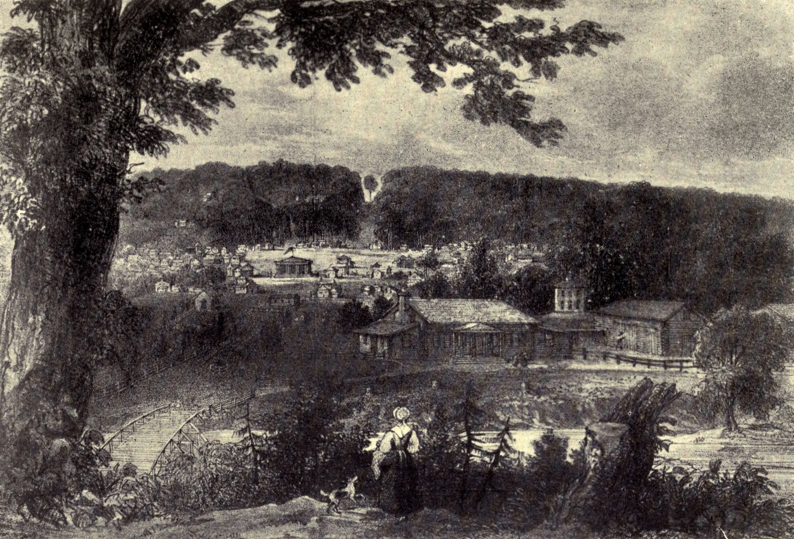
GUELPH
Shade fell in love at first sight with the valley, and, though he explored further, remained convinced that this was the best site for beginning the settlement. Mr. Dickson returned to Niagara, though afterwards he lived for some years at Galt, and one of his sons eventually made his home there. But Absalom Shade’s house and store were the first buildings erected, while he converted the old ruin into “a rough-and-ready grist-mill” to serve till a better one could be constructed. A smithy and a distillery were soon added, but for several years the place grew very slowly. About 1825 there was an improvement, Mr. Dickson having persuaded many Scottish settlers to come to Dumfries.
He offered a farm to the “Ettrick Shepherd,” but Hogg declined, saying, “The Yarrow couldna want him.” For another literary man, an old schoolfellow of his, Mr. Dickson showed his affection by naming after him his settlement when it first attained to the dignity of having a post-office, but the settlers clung to the familiar name of “Shade’s Mills” till, in 1827, John Galt visited the little hamlet, when his popularity brought the new name into favour.
Destined, like other districts, to suffer from “the railway fever” in the ’fifties, the opening of a new road was quite sufficient in 1839 to throw the district into wild rejoicings. Galt was cut off “from the head of navigation at Hamilton” by the dreaded Beverly swamp, which, with “its bottomless mud-holes,” soon became the scene of various appalling stories of the disappearance of benighted travellers by mire or murder. It was a terrible business to conduct a heavily-laden wagon through this “Slough of Despond,” and, to avoid the necessity, Absalom Shade, who took quantities of farm produce “in trade,” conceived the brilliant idea of building a fleet of great flat-bottomed boats—sixteen feet wide and eighty feet long—to sail down the Grand River to Lake Erie, and thence by the recently-opened Welland Canal to Lake Ontario. Each of these “arks” was of capacity to carry 400 barrels of flour, and there was vast excitement in Galt when they were loading. Owing to the difficulties of navigation they could be used only during the spring floods. For three years in succession Mr. Shade sailed with his fleet, but in the third year one of his seven well-laden “arks” ran on a rock. With difficulty its cargo of flour was saved and put on an island in the river; then Shade hurried back to Galt, worked almost night and day to complete a new “ark,” reloaded his flour, and “caught up to the first and only fleet which Galt ever possessed” about the middle of the Welland Canal. With such energy, it is not wonderful that Shade succeeded in making a fortune.
In 1832 Dr. Miller, Galt’s first permanent medical man to remain any length of time, settled in the village, though he regarded it as a “very discouraging” place. Conditions were rapidly improving, when in 1834 a terrible calamity occurred. Late in July the whole neighbourhood welcomed eagerly the coming of a “wild-beast show” to Galt, but the country folk had hardly left the village when it was whispered that one of the showmen was down with the cholera. That was Monday, and “within a week, and chiefly before Friday night, nearly a fifth of the villagers had fallen victims to the plague.” Not a few of the country visitors to the show were also stricken, but through the horror of the sudden agonising deaths and hasty burials, sometimes of several bodies in one grave, Dr. Miller, Dr. McQuarrie, and a young doctor, John Scott (who had just arrived from Scotland, and afterwards settled in Berlin), fought the disease inch by inch. They were aided bravely by a number of the villagers, and before long the plague was stayed.
It may give a false impression of the brave old pioneer days to close with this sombre picture; but there is not space to tell of the debating societies and amateur theatricals which enlivened the settlers’ busy lives, nor of the lengthy sermons and admirable lectures which improved their minds. For the same reason, the hot political contests of “the Rebellion” period, the excitement over the visits of such notables as William Lyon Mackenzie, Governor Arthur, and Lord Elgin, the odd happenings on “training day,” and other festive occasions, have all to be passed over (regretfully) in silence. But they leave one with the impression that life in the country—when the province was practically all country—was extraordinarily full and vigorous and interesting.
“When first I settled in the woods
There were no neighbours nigh,
And scarce a living thing, save wolves,
And Molly dear, and I.
We had our troubles, ne’er a doubt,
In those wild woods alone;
But then, sir, I was bound to have
A homestead of my own.”
Alexander M‘Lachlan.
The latest change in the boundaries of Wellington County, giving it its present size and shape, occurred in 1883, but the name of Wellington has been on the map since 1838, when the district containing the present county of that name and also Waterloo, Grey, and part of Dufferin County was set apart. At that time Galt and Fergus contested for the honour of being the county seat, but it fell to Guelph, the story of which begins somewhat unusually with a deliberately dramatic scene.
This was imagined and carried out by John Galt, the popular Scotch novelist, two of whose sons won distinction in Canadian public life. Mr. Galt at this period of a changeful and chequered career was acting as Commissioner of the Canada Company. Early in 1827 he visited the village on the Grand River, called by his name, and on April 23—a dismal, wet St. George’s Day—walked through the woods from Galt to the site of the future “Royal City.” In a straight line the distance is about thirteen miles, but Galt and his companion, Dr. Dunlop, lengthened it by losing their way. Men were waiting for them at the appointed place, and on their arriving at what was to be the centre, or “radiant point” of the new settlement, Galt, with solemnity, struck the first blow on a great maple. The doctor then produced a flask of whisky, and they “drank prosperity to the City of Guelph”—a name chosen in compliment to the Royal Family, because Galt “thought it auspicious in itself,” and because he “could not recollect that it had ever been used in all the King’s Dominions.” In after years the stump of the maple was nicely levelled, and upon it was placed a sun-dial which served as the town clock. This historic landmark, near the River Speed, was ultimately obliterated by the throwing up of the embankment for the Grand Trunk Railway.
Of course the first necessary business was to erect houses. Amongst these was a log building of an unusually imposing character, costing between £1000 and £2000. It not only served as a dwelling for the heads of the settlement, but one wing was used as a tavern and post-office. It overlooked the river, and in honour of Mr. Prior, one of Galt’s friends and assistants, was dubbed “The Priory.”
That year the King’s birthday fell on Sunday, but it was determined to celebrate it on the following day, August 13, and hold a kind of formal “opening” of Guelph. A frame market-house, 40 by 50 feet in dimensions, with open sides and a floor 18 inches above the street, was hastily finished for the occasion, and very early in the morning the traditional “whole ox” was set to roast before a huge bonfire. Unhappily the six hours allowed for cooking proved insufficient, and many of the five hundred guests at Guelph’s first civic banquet found the meat too “rare” for their taste. Fortunately, potatoes also had been cooked on a grand scale—in two potash kettles—and there was no lack of bread or of hemlock tea, whilst the supply of whisky was plentiful enough to be responsible for a few fights before the close of the day. A band from Toronto (“Little York” then) discoursed sweet music, and in the evening a grand ball was held for the aristocrats at the Priory. A special feature of the day was the laying of the foundation-stones of Guelph’s first stone buildings, a bank and a schoolhouse. (By the way, the provision made by Galt for education was one of the early attractions of the place to settlers.) In their rejoicings the pioneers showed their usual ingenuity, having prepared for the occasion a number of wooden cannon of hollowed-out beech and maple logs. They were bound with hoops of iron, but this did not prevent their adding to the excitement by bursting after the second firing or so.
Roads are always a pressing need of a newly-opened district, and Galt did his best to meet it; but when the way led through swamps the task of road-making was as unhealthy as it was difficult, and on one occasion the Commissioner was shocked by the return of forty men, who were the “colour of mummies,” from ague. He had tried to induce the company to engage a doctor, but as they neglected to do so, was obliged to meet the difficulty by taking on a surgeon as clerk and “making him compensation for his skill.”
In the Historical Atlas of Wellington County are scattered various interesting notes on its “first things” and events and of its representative personages. For instance, the first physician—Welsh by name—who settled in Guelph speedily earned by his eccentricities the title of “the mad doctor.” He built himself a log house without a door, having an aperture six feet from the ground, through which he climbed. Only two patients trusted themselves to his tender mercies, and both died. The first death in the settlement was that of a “beer peddler,” killed instantly by a tree being blown across his wagon. A house and lot was promised for the first baby born in Guelph, but the parents of little Letitia Brown, who was born in October 1827, never claimed it for her. Guelph’s first baker had, it is said, a sad experience when trying to bake in an oven of limestone. The heat crumbled down the oven, and people helped themselves to his loaves. The first horse in the district, while it was “the only one within a radius of fourteen miles,” was so much in request that it became “a wreck of skin and bones,” and was only saved from becoming an absolute “martyr to civilisation” by the arrival of a team of horses.
In 1834 the first political contest in Guelph resulted in the ruin of both candidates and the election (from lack of a sufficient number of votes) of neither. One of the rivals, Captain Poore, organised a company of loyal volunteers during the rebellion. The other, a young Englishman, Roland Wingfield, after acquiring in Puslinch Township an estate of 800 acres, which he stocked with imported Durham cattle, Southdown sheep, and Berkshire hogs, was forced by that luckless election to sell out. His successor, John Howitt, continued to improve his Durham herd, and at the first Provincial Exhibition, in 1845, his cattle took nearly all the prizes. This was a good showing for the district, which, some twenty years later, through the establishment of what is now the Ontario Agricultural College, was to become a centre of “light and leading” for Canadian farmers. Much more recently the Macdonald Institute and the consolidated schools near Guelph have begun to make their valuable contribution towards the solution of some of the country problems, especially touching women and children.
A decade before Guelph was founded with flourish of trumpets, the neighbouring township of Eramosa received its first settlers in the persons of three Irish brothers, Ramsay by name. They are credited with raising the first crop of potatoes, and the wife of one of them grew from pips the first apple-tree ever grown in the county. That was in days when wolves were alarmingly plentiful, and when the whole carcase of a deer was sometimes bought for a dollar, to salt down. During the Rebellion, seven farmers were arrested for having attended a meeting in an Eramosa schoolhouse to discuss public affairs, but all were acquitted.
Guelph Township was settled in part by Scots, who came to Canada after eighteen disappointing months in Venezuela, and Peel Township, during the days of “Abolitionist” activity, received many escaped slaves from the United States. The neighbouring Township of West Luther was once a kind of “dismal swamp.” It was said that it had only one dry spot, and that “if you ran thirty yards on that knoll and then took a long jump, you could feel the whole township shake and quiver beneath you.” But during the early ’seventies a dry summer with repeated fires burned off the mud and greatly simplified the work of clearing.
The picturesque village of Elora had, as its first pioneers, the Matthews family of father, mother, and nine children, who, arriving on the spot as night was falling, built a huge fire and lay down under a rude shelter of hemlock bows. In the night a great snowstorm came on. Their cattle wandered off, and the father, seeking them, lost his way, but was guided back by his son’s shouts. In due time Matthews and his boys cleared a little patch on which they grew grain. But in order to reach a market they had to hollow out a huge pine, and in this “dug-out,” 30 feet long, they took down sixteen bags of wheat to Galt and sold it to Absalom Shade, who gave them 50 cents per bushel cash. They sold the “dug-out” also for $2.50, and marched home cheerfully on foot.
“Cheerily on the axe of labour
Let the sunbeams dance,
Better than the flash of sabre
Or the gleam of lance.”
Whittier.
The first white settlers in Norfolk County on Lake Erie, as in Frontenac and Lennox, were Loyalists, and the story of their journeys to their new home in the great woods of noble beeches, maples, and white pines would easily fill a volume. One large family party of men and women and young children—the Mabees—wintered at Quebec; then the mothers and little ones were put on board open boats, whilst the men, happy enough to possess several horses and cows, drove the animals along the shore. For provisions they trusted largely to corn-meal and the milk of the cows.
The patriarchal leader of the cavalcade, Frederick Mabee, built the first log cabin of the new settlement at the foot of the hill overlooking Turkey Point, but within a year he died suddenly and was laid to rest in a coffin made painfully by the hollowing out of a great walnut log, and his grave was marked by a large boulder.
Another party of settlers from the south, bound for Townsend Township, slung baskets or panniers in pairs across the backs of their cows and tucked a little child comfortably in each basket.
Late in the summer of 1795, Governor Simcoe visited Norfolk County and chose a site, a little east of where Port Dover now stands, for its chief town, intending that a fort and Government building should be erected. He named it “Charlotte Villa,” in honour of the Queen, but the town was never built. In 1803, when Turkey Point (or Port Norfolk, as it was called for a time) became chief town of the London District, which was much larger than the present County of Norfolk, the settlers put up a log building, of which the upper storey served for a court-room and the lower for a jail. The latter was, however, so insecure that “any prisoner could release himself in half an hour unless guarded by a sentinel.” The juries, by the way, generally “held their consultations under the shade of a tree.”
During the War of 1812 three American schooners bore down on Port Norfolk to burn the Court-House. One of their officers was killed, and they retreated without carrying out their plan. Several of the mills were burned, however. In 1820 Vittoria became county town; afterwards the courts were held at London, and still later Simcoe, which now has a population of about 3200, became county town for Talbot District, as the country now comprised in Norfolk was called for a while. At the time of the rebellion Norfolk was represented in the Assembly by Dr. Rolph, and feeling ran high for and against the rebels.
But to go back to earlier times—Governor Simcoe was so much pleased with the district that when a Loyalist, Captain Samuel Ryerson (uncle of the great educationist, Rev. Egerton Ryerson), asked his advice as to where to settle, he recommended Long Point and promised large grants of land to him and his family. Ryerson had come to Niagara from New York, a difficult journey in those days, when there were no roads. Being obliged to come up the Hudson, then down the Mohawk to Lake Ontario, he had brought a boat as large as he dared, considering that it was necessary to make a portage between the two rivers. Besides its human freight it was heavily laden with farm implements, household utensils, and supplies of groceries to last two or three years; but at Queenston it had to be unloaded and carried round the Falls to Chippewa, a distance of twelve miles. By this time the summer was almost ended and the voyagers were eager to press on, to get some kind of shelter put up before winter; but they were twelve days making the final hundred miles, which seemed to carry them beyond the last outpost of civilisation.
Sailing along the shore of Lake Erie, the captain, liking the appearance of a small creek with high, sloping banks, ran his boat into it, landed and decided that at that spot he would make his home. There in due course, after many difficulties, he built not only a log house, but a flour mill and sawmill. Once he planned to try to make a town of it, but thought better of it, and to this day Port Ryerse—as, through a mistake, the place was called—is only a little hamlet. The Long Point settlement at this time (1795) boasted four householders in twenty miles, all settled along the shore. Between them and Niagara lay the Mohawk reserves along the Grand River, but the Indians were friendly and were by no means bad neighbours.
All kinds of wild creatures abounded in the woods and along the shores—from wild geese and ducks, pigeons and turkeys to bears and wolves. Years afterwards an old trapper declared that he had killed over a hundred bears and wild-cats innumerable, whilst musk-rats were so plentiful that in one year he had caught 1700. Captain Ryerson had a couple of deerhounds, and when he wanted meat he used “to go to the woods for his deer as a farmer would go to the fold for a sheep.” For fear of the wolves the cow was tied to the kitchen door every night, and during the day was taken by the men to the place where they were chopping and fed on “browse” from a maple tree cut down each morning for her especial benefit.
Of course the settlers got their sugar from the trees, and till the mill was built they made johnny-cake, instead of bread, of corn ground in a coffee-mill. Almost the greatest difficulty in the early days was to get clothes. The wolves, which, even after the country was partly settled, used to raid the folds, made it difficult to keep sheep, and “it was flax, the peddler’s pack, and buckskins that the early settlers had to depend upon for clothing.”
After the Loyalists other immigrants gradually came in, but the lack of markets was a great discouragement to farming. There was very little money in the country, and the people had to trade their goods as best they could. For many years lumbering was the chief industry of the county. In Walsingham Township thousands of forest giants were floated down Big Creek, near the mouth of which stands the little old village of Port Royal, and even in the last quarter of the nineteenth century the people in the back parts of the township were clearing the land and chopping and logging as the settlers on the lake had been doing eighty years earlier.
Besides its magnificent trees Norfolk County possesses other interesting natural features. In the township of Townsend are beds of limestone extraordinarily rich in fossils, whilst Houghton has strange high sandhills above the lake, from which the tops of dead trees stick out like the masts and spars of stranded ships. In Charlotteville deposits of bog iron-ore led to the building at Normandale in 1823 of a small blast-furnace. Last, though not least, amongst the notable features of the county is the island, jutting out thirty miles into the lake, from which the early settlement of Long Point was named. It supplied excellent cedar for posts and was the haunt of wild-fowl innumerable.
It has, moreover, a special human interest, for there, some fifty-eight years ago, lived Abigail Becker, a Canadian “Grace Darling,” who one bitter winter morning—the story is well known—saved from death the crew of a lake schooner. It had been driven by a fierce north-west gale on a sand bar, the waves every moment threatening the lives of the eight men who formed its crew.
“And it was cold—oh, it was cold!
The pinching cold was like a vice,
Spoondrift fell freezing—fold on fold—
It coated them with ice.”
For hours the sailors had clung despairingly to the rigging, but Abigail and her boys made a fire on the shore and then the strong, brave young woman signalled to the men to trust themselves to the raging surf and to her help. At last the captain ventured and was swept far down the beach, but Abigail dashed into the foaming water and dragged the half-frozen man to land. She did the same for six more. The cook, unable to swim, could not be induced to venture, but on the morrow they reached him with a raft. Before this Abigail had saved two other people from drowning, and it seemed especially sad that later she should lose a boy of her own in the waters of Port Rowan Bay.
“Shall we not thro’ good and ill
Cleave to one another still?
Britain’s myriad voices call:
‘Sons, be welded, one and all,
Into one imperial whole,
One with Britain, heart and soul!
One life, one flag, one fleet, one Throne!’
Britons, hold your own!”
Tennyson.
The early history of Elgin County is dominated by the striking personality of Colonel Talbot, founder of the Talbot Settlement.
Since Upper Canada became a province, this county has changed name and boundaries more than once. Its eastern townships of South Dorchester, Malahide, and Bayham were originally part of Norfolk County. The remaining four townships, three of which bear names borrowed from the English shire of Suffolk, were included in a county named Suffolk. When this disappeared from the map these townships became part of Middlesex, but some sixty years ago the new county of Elgin, with its present limits, was set apart and named after the staunch Governor-General of “Rebellion Losses Bill” fame.
In the township of Southwold, between the Talbot and Kettle Creeks, there are mounds, known as the “Old Fort,” from the neighbourhood of which Indian arrowheads, pottery, and charred maize have been unearthed, which are believed to indicate the site of an ancient stronghold of the Neutral Indians, and on old French maps the district was marked as the “Iroquois Beaver Ground.” Charlevoix, a French traveller, visited the country in 1721, and was enchanted with its beauty. He gave a glowing description of it as “the finest forest in the world,” whilst the clear sky, the charming climate, the waters, “bright as the finest fountain,” on which his boat was floating, made him think that, if such conditions could continue, he “would be tempted to travel all his life.” A later observer, the Government surveyor, Peter M‘Niff, was not so well pleased. He objected strongly to the high white and yellow sandbanks along the lakefront, and the townships were accordingly first laid out along the Thames River.
Charlevoix’s description is said to have greatly impressed young Thomas Talbot who, however, himself visited the country in his early manhood, when he was acting as private secretary to the energetic Governor Simcoe.
Born at Malahide, near Dublin, in 1771, he belonged to an ancient Norman family. Receiving a commission in the army as ensign before he was twelve years old, he was appointed at sixteen aide to his relative, the Lord-Lieutenant of Ireland. A fellow-aide was Arthur Wellesley, the future conqueror of Napoleon Bonaparte.
Talbot attained the rank of Colonel at the early age of twenty-five, and a brilliant career seemed to lie before him. He saw active service in Holland and at Gibraltar; but his thoughts turned back to the peaceful shores of blue Lake Erie, and, to the astonishment of his friends, he resolved, while scarcely past thirty, “to bury himself” in the Canadian wilderness. But indeed Talbot was very much alive and full of ambition, though he dreamed not of military glory, but of planting a strong colony in Canada under the flag he loved.
He desired first to settle in the township of Yarmouth; but the Canada Company and the Baby family had been before him, and a large grant was not there available. When, therefore, partly through the good offices of the royal Dukes of Kent and Cumberland, he obtained a grant of 5000 acres (an amount which had been given to many other officers) it was for lands in Dunwich Township. Afterwards he obtained additional grants.
It was on May 21, 1803, that he landed at a spot which has always since been called Port Talbot, though there is not even a village there. With his own hands he chopped down the first tree, and for years afterwards the anniversary was kept in the settlement as a holiday. From that date on, for half a century, till, as an old man over eighty, he was carried to his grave in the little village churchyard of Tyrconnell, he was one of the best-known men in Upper Canada. Sometimes he fell into conflict with the Provincial Government at York, but, having interest with the authorities at home and being ready at any time to make a voyage to England to set forth his case in person, he succeeded in maintaining a very independent position in his settlement; and, upon the whole, in spite of some eccentricities, he managed so well that, while the settlement of other districts was slow, colonists “flocked” to his lands.
For one thing, owing, perhaps, to his training as a military man, Colonel Talbot was impressed with the strategic value of roads. One of the conditions attached to the free grants of fifty acres which he offered to settlers, with the right to purchase an additional hundred and fifty at $3 an acre, was the opening within three years of half the road in front of each farm. The other conditions were the building of a small house and the clearing and sowing of ten acres of land. The result of the road-making provision was that the settlement became noted for its good roads, especially for that named the Talbot Road.
Talbot gave the choicest positions to actual settlers, relegating Crown and Clergy reserves to the rear; but he had a somewhat remarkable way of keeping a record of his land transactions. He had at Port Talbot a map on which he marked in pencil the names of the settlers. If they failed to fulfil the stipulated conditions within the allotted three years, he simply erased their names. When the conditions were fulfilled he gave the settler a certificate, which, on payment of certain fees at York, enabled him to obtain a patent from the Government. But, between lack of ready money and their absolute confidence in Talbot’s integrity, the settlers were often dilatory in completing the business, and at one time over 5000 deeds were waiting at York to be taken out by Talbot’s settlers. Having sometimes to deal with rough fellows, he conducted his business through a window with a sliding pane in it, and was attended by a faithful servant named Jeffrey Hunter. On one occasion he is said to have concluded an unsatisfactory interview with the curt command, “Jeffrey, set on the dogs!”
Talbot’s grist-mills and sawmills were burned, as were many others, during the War of 1812. He commanded the militia of the London and Western districts at that time.
In the early years of the settlement the nearest store was that at Long Point, sixty miles away, and in 1807 the price asked for broadcloth was $20 a yard; for printed cotton, $1; for brass buttons, a York shilling each; for a paper of pins, 50 cents; for tobacco, $1 a pound; for a single nutmeg, 25 cents, and for a bushel of salt, $12. In many instances the settlers had to carry home their purchases on their backs. During the War an enterprising peddler took a horse-load of salt into the Talbot Settlement, and sold it at the rate of $8 for fourteen pounds. In a few years, however, stores were opened at St. Thomas and elsewhere.
When Mrs. Jameson visited Talbot in 1837, the Colonel told her that he had settled some 50,000 people on 650,000 acres of land, of which 98,700 acres were cleared. Nowadays over eighty per cent. of the land in this good farming county (which, however, only represents a part of the Talbot Settlement) is cleared.
In the summer of 1846 an agitation began for the separation of the district from Middlesex, and on the morning of August 27 a band from St. Thomas (named, it is said, from Talbot’s Christian name) paraded the neighbouring villages with flags flying. At noon the band returned to St. Thomas, doubtless with some recruits for the public meeting, which passed resolutions in favour of separation. One of the townsmen, Benjamin Drake, offered sites for a court-house, a jail, and a marketplace, if St. Thomas should become a county town; but it was not till the autumn of 1853 that the separation was actually accomplished.
“In the country places,
Where the old plain men have rosy faces,
And the young, fair maidens
Quiet eyes!”
Robert Louis Stevenson.
Thirty years ago there lingered about Woodstock, in Oxford County, traditions of English gentlemen, “fine” and otherwise, who had “come out” with more or less money, and had attempted to transplant into the wilderness—tracked here and there with “blazed” paths—the luxurious habits and customs of their class. They were remembered as “holding their heads high,” thinking much of “family,” superciliously tolerant of “the lower orders,” keeping numerous servants, making rash experiments in farming, building roomy dwelling-places, devoting their time largely to sport and amusement, spending freely on wine, horses, and imported luxuries. Elderly ladies recalled with indulgent smiles the gay doings—the balls, the sleighing parties—of their girlhood, when the Imperial garrison at London furnished for a large area of country a supply of military gallants always ready to take part in any accessible diversion. Woodstock was in those days, it was said, “a very English place,” but even thirty years ago these early glories were but a memory. Scarlet-coated officers had long disappeared from the scene; the gay butterflies of family and fashion had given place to more sober, hard-working folks—in some instances, it was whispered with bated breath, to the men and women who had tended their horses and cooked their luxurious feasts. Some were ruined, some were dead; others, after playing for a few years at pioneering, had returned to more congenial surroundings, but meanwhile the rank and file of “less fortunate” settlers had plodded on, year after year, clearing the bush, gathering out the stones, making at once their own farms and the county, which is to-day notable for its prosperity and for its quiet beauty of low, rolling hills, well-cultivated fields, and gentle streams.
The county gained its name of Oxford in 1798, when the old township of Oxford on the Thames, with other municipalities formerly belonging to the then huge counties of Norfolk and York, was formed into a new county and made part of London district. The townships of Zorra and Nissouri were added in 1821, and sixteen years later steps were taken for the erection of a jail and court-house at Woodstock, where the first court was held for the new “District of Brock” in April, 1840. The survey of the first three concessions of Blenheim Township was ordered in 1793 for the benefit of an American, Watson, to whom Governor Simcoe, in reward for some services rendered during the Revolutionary War, had promised a township. This man’s nephew, Thomas Horner, built the first mill in the county, bringing the material from Albany, New York State, in two small boats by lakes and rivers and portages to Burlington Bay, from which he carried them inland to Blenheim on ox-sleds. The mill was built and fitted up by the end of 1795, but before a plank was sawn the dam burst and could not be repaired, for lack of workmen, till 1797. This accomplished, Horner claimed the township, but Simcoe had left the country, and the new Governor refused to honour his promise. Worse still, in the troublous times that succeeded doubts were cast upon Horner’s loyalty. Though Deputy-Lieutenant of the county, General Brock would not trust him with a command during the War of 1812. But, not to be deterred from taking part in the defence of the country, Horner, at his own expense, raised a corps of seventy-five Indian warriors, and afterwards served in the ranks as a volunteer.
When Oxford County became entitled to a representative for itself in the Assembly, Horner was its first member. He was also a Justice of the Peace, performing many marriages, under the rule that a magistrate might officiate where no Church of England clergyman lived within eighteen miles. A brother-magistrate is said to have married between four and five hundred persons.
A few years after Horner’s death in 1834 Francis Hincks (afterwards knighted) represented the county. Still later, George Brown, founder of “The Globe”, sat for Oxford. Several early elections for the constituency were held at “Martin’s Old Stand,” in the village of Beachville, whose importance has been long outstripped by its younger rivals, Woodstock and Ingersoll.
The former, long referred to ignominiously as the “Town Plot,” had indeed been marked out for a town by Simcoe, but as late as 1836 it was represented by “a paltry village”—or, rather, by “a few straggling houses at very unsocial intervals.” Even at that date it had its (now) venerable brick Church of St. Paul’s, one brick house among the wooden ones, a post-office, to which came three mails a week, and a subscription library, but it had no newspaper till 1840.
During the first half of the nineteenth century the population of Oxford County increased very rapidly, numbering over 32,500 by 1852. Of these nearly a third had been born in “the old country.” At that time immigrants usually arrived in Canada about August, a circumstance which must have added to the hardships of the first year.
In the township of Zorra there settled a notable colony of Scotch Highlanders. The pioneers of this colony, Angus and William MacKay, took up land in Zorra in 1820. After nine years Angus, as is told by Rev. W. A. MacKay, in his Pioneer Life in Zorra, went back to Scotland and brought out his aged mother and a shipload of Sutherlanders, who had been heartlessly driven by their landlords from their little holdings. Of course, much in their new life was quite outside their former experience, and, judging from the number of ghost stories told amongst them, the great woods must have had a powerful effect on their lively Celtic imaginations. In the first spring after their arrival, one party of immigrants was much alarmed one morning by some weird, unaccustomed sounds. On this occasion, however, they decided that the Indians, not ghosts, must be accountable for the noise, and the men armed hastily, only to be informed by older settlers that the disturbance was caused by nothing more dreadful than the bull-frogs celebrating the breaking of their icy prison.
In clearing the woods many accidents occurred through the inexperience of the choppers, and some piteous stories could be told of women and children left alone in the strange land to fight the battle of life. On the whole, however, the Highlanders were of the type speedily to “make good.” They were alike sturdy and God-fearing, helpful to each other, ready to sacrifice much for the education of their children, great readers of their Gaelic Bible, regular attendants at the little log churches. Once a year people used to gather from miles around for the great Communion in Zorra Church—the best building in the township—and on that occasion every householder in the neighbourhood showed that hospitality which caused Burns to declare:
“In Heaven itself I’ll ask no more
Than just a Highland welcome.”
Unhappily some amongst those fine people found a terrible enemy in “the black bottle.” One Scot, with grim irony, called his own whisky jug “Jeroboam,” because that king “had made Israel to sin,” and at elections, weddings, and funerals, at barn-raisings and logging bees “the black bottle” was responsible for much that was unlovely and not a little that was tragic in the simple life of the times. Perhaps it had also something to do with the ghost-seeing habit.
When a Highlander died in Zorra his corpse lay for several days in state, his neighbours keeping watch over it, and relieving the near relatives of the work of house and farm. The coffin was home-made and darkened with lampblack and white of egg. Covered by a “morte cloth” of black silk velvet, it was borne to the grave on men’s shoulders. Later, as the roads improved, lumber wagons were used, and the first spring wagon in a neighbourhood did duty as a hearse far and wide. As late as 1830, however, there were in the whole county only three carriages of the type described as pleasure wagons.
In the thirties Oxford County, as others, had its grievances concerning land grants and roads; but during the Rebellion two hundred stalwart men presented themselves at Embro to express their loyalty in a practical fashion by fighting the rebels, if need were. As there were not guns enough to go round, the men were put through their exercises with hop-poles. After a week there came news of an intended attack on Woodstock; so, armed with guns and clubs, the Highlanders marched to the defence of the town, inspired by the warlike strains of the pipes. It proved a false alarm. On their way home some of the volunteers were so much alarmed by the cracking reports from the trees that they fled helter-skelter; but apparently this little lapse did not destroy the confidence of the neighbourhood in the valour of its amateur soldiers, for during the “Fenian scare” an old Zorra lady is reported to have said: “They may tak’ Montreal, and they may tak’ Toronto, and they may tak’ Woodstock, but they’ll never tak’ Zorra.”
“Down by the river our log hut stands,
Where father and mother dwelt;
And the old door-latch that was worn by our hands,
And the church where in prayer we knelt.”
Old Song.
It has been quaintly said that the “dawn of civilisation” in Middlesex County first appeared in the township of Delaware, and here we also find a trace, but only a trace, of the pioneer Highlander of the county, Ronald M‘Donald, who in 1798 obtained a patent of the land on which Delaware village stands, but soon after sold out to Dr. Oliver Tiffany. It was, however, twenty years later that there began the great Highland immigration, lasting (save for a short break) for something like thirty years, and giving almost every township a greater or less number of immigrants from the northern counties and western isles of Scotland.
These settlers were of a notably fine order, tall, strong, and sturdy in physique, and possessing solid mental qualities, enlivened by the imaginative fire and poetry of the Celt. As to their moral qualities, honesty, earnestness, hospitality, and a strong sense of the unseen seem to belong to the type, and if, like other folk, they had their faults, these were often “the defects of their qualities.” It is somewhat strange that these immigrants—most of them poor—should have set an unusually high value on education; but it was so, and the little log schoolhouses were amongst the earliest buildings in the new settlements. Often the pupils could at first speak no language save Gaelic, but they speedily acquired English, and soon a surprisingly large number of teachers, ministers, and other professional men looked back to these little country schools as the scenes of their first triumphs in life and “book-learning.”
The majority of the Gaelic pioneers of Middlesex were Presbyterians, and often they met together for worship, to read “the Book” and sing their Gaelic versions of the Psalms, without waiting for the visit of missionary or minister. Until the Rebellion of 1837 and the gradual multiplication of newspapers, the Highlanders were slow to take an interest in politics.
Some notable men are connected with the early history of Middlesex. First and foremost must be mentioned Governor Simcoe, who, from careful study of maps and accounts of the country, had concluded that the forks of “La Tranche,” which he renamed the Thames, would be the best situation for the capital of Upper Canada.
In February, 1793, he undertook an arduous journey across the peninsula from Newark to Detroit to investigate the matter for himself. Taking five or six officers, a dozen soldiers, and twenty Indians as guides, the Governor travelled on foot most of the way, a journey of about 400 miles, but, as it was a “service of no danger” and likely to “afford him amusement,” his wife was “quite easy about it”; in fact, she thought the excursion would improve his health. On his departure “the Governor wore a fur cap, tippet and gloves and moccasins, but no greatcoat. His servant carried two blankets and linen. The other gentlemen carried their blankets in a pack on their backs.” The party was accompanied by a Newfoundland dog, Jack Sharp, which got into sad trouble with a porcupine, probably one of those which made a woodsman’s feast for the Governor and his suite, tasting “like pork.” At Detroit, “all his Majesty’s ships lying there” fired a salute on Simcoe’s departure. On a Sunday “his Excellency ordered prayers to be read in the woods ... and forty people attended.”
“The Governor rose early on the march and walked till five o’clock. A party of the Indians went on an hour before”—I quote from Mrs. Simcoe’s recently published Diary—“to cut down wood for a fire and make huts of trees, which they cover with bark so dexterously that no rain can penetrate, and this they do very expeditiously.” When the Governor came to the spot the Indians had fixed upon a spot to lodge for the night, and the provisions were cooked. “After supper the officers sang ‘God Save the King,’ and went to sleep with their feet close to an immense fire, which was kept up all night.” On the outward journey the party passed through the (future) townships of Delaware and Westminster, and, returning, spent a March day at the spot which Simcoe thought “eminently calculated for the metropolis of all Canada.” During the night it rained incessantly, and the travellers found that the hemlock boughs which served for beds had been wet when gathered, but such trifles did not chill the Governor’s enthusiasm for the situation.
He thought of naming the future city, in compliment to his Sovereign, “Georgina-on-the-Thames,” but ultimately pitched, instead, on the briefer, and already famous, name of London. Though circumstances forced him to make York his headquarters, he regarded the necessity as only temporary, but the Governor-General, Lord Dorchester, was of another mind, and Simcoe’s wishes were overruled. He had, however, had a town-site surveyed, and in consequence, while the land all around London was being taken up, the beautiful park-like spot where Simcoe had set apart for his city “remained in primeval beauty.” George Heriot, writing about 1807, mentioned that there were several “rich settlements” along the banks of the Thames, and that “new establishments” were “every week added to this as well as to other parts of the neighbouring country by the immigration of wealthy farmers from the United States.”
It is told also in some of the Ontario Historical Society papers that Governor Simcoe promised a grant of two thousand acres to a certain B. Allen, on condition that he should erect a grist-mill in Delaware. He began, accordingly, in 1797, to build a mill on Dingman’s Creek, but before it was finished “had to go to jail for counterfeiting.” About that time the post-office at Delaware was the only one between Newark and Detroit. Sir George Drummond established a military post at this village, and from it, on March 3, 1814, “a sortie of 240 men, under Captain Basden, was made against a United States post at Longwoods.” This was not captured, but soon afterwards the Americans retreated to Detroit.
About 1816 one John Applegarth began cultivating hemp on a ridge east of what is now Mount Pleasant Cemetery, but, being somewhat unsuccessful, soon went elsewhere, leaving his log cabin to squatters. There was as yet no bridge over the river, but a canoe ferry afforded some means of communication between the opposite banks. In 1817 Gourlay estimated that there were nearly 9000 settlers in the London district, of which the official centre was the inconsiderable hamlet of Vittoria. This was fifty miles, as the crow flies, from the forks of the Thames; and when the court-house there chanced to be burnt, the people of Middlesex began a vigorous agitation for the removal of “the headquarters of the district to a more convenient locality.”
The agitation was successful, and early in 1826 the Provincial Parliament authorised a second survey of London and appointed five commissioners to erect a court-house. Three of these were Hon. Thomas Talbot (founder of the Talbot Settlement), Mahlon Burwell, after whom Port Burwell was named, and Charles Ingersoll, who gave his name to the town in Oxford County. Talbot, particularly, had much to do with the settlement of London. The incoming people were required to pay the equivalent of $32 for the patent of each lot, and to erect some kind of a house, 24 feet by 18 feet in dimensions, upon it. A Scotch tailor, Peter MacGregor, built the first house in London, on King Street, where the Grand Central Hotel now stands. It was a mere shanty, but served as an hotel. When the courts were first held in London, MacGregor had to turn away many guests, who were obliged to go three miles further before they could obtain shelter.
The “first native-born Londoner,” Nathaniel Yerex, “saw the light of day in 1826.” By the following year thirty-three families, numbering, all told, 133 souls, had settled in the place. The first Court of Quarter Sessions was held on January 9, 1827, in a temporary building, afterwards used for a school; and one of the first trials was that of a murderer, who had slain a sheriff’s officer and, being found guilty, was hanged three days after sentence was pronounced. Thus, the beginnings of London, as it has been said, “centred in a tavern, a jail, and a post-office.” The latter was opened as soon as the work began of building the court-house, which was designed, on an imposing scale, in the Gothic style.
At first London grew slowly; and in 1845 a terrible fire destroyed no less than 150 of its buildings, causing a loss which, for so small a place, was enormous. Now the city covers some 4500 acres instead of its original 240 (of which, by the way, the estimated value is something like thirty million dollars), and the 133 people of its second year have now increased to over 46,000.
“Sleep well, Tecumseh, in thy unknown grave,
Thou mighty savage, resolute and brave!”
Charles Mair.
The county of Kent, now not a small one, was originally of enormous and indefinite extent. Its northern boundary was the Hudson Bay Territory, and, with the exception of Essex County, it included “all the territory to the westward and southward to the utmost extent of the country known by the name of Canada.” In a map made about 1798 it is indeed shown with something like its present limits; but when it was joined with Essex to form the western district, the Sheriff of the united counties used to serve his process as far north as Sault Ste. Marie and Lake Superior.
In 1792 it is said to have had six families, but Talbot’s colonising zeal did much for Kent as well as for Elgin, and his great road, “Talbot Street,” was continued through part of this county. It offered, indeed, just as good a field for his activities as the district to the eastward. The very character of the forest, abounding in mighty oaks, walnut trees, hickories, beeches, and maples, testified to the fertility of the soil, as do now the fine farms and prosperous little country towns which are so numerous here. The county is noted for its corn, tobacco, and sugar-beets; also for two products, which seem naturally associated in our minds, if not on our tables—pork and beans! The western townships yield also petroleum and natural gas.
In the year 1803, signalised at Port Talbot by the cutting down of the first tree, another notable coloniser appeared on the scene in Kent County. This was the Earl of Selkirk, afterwards so well known from his efforts to found a settlement on the Red River. As a very young man he had gone on a tour through the Scottish Highlands, and had been much impressed with the pitiable condition of the crofters, evicted from their little holdings by landlords who wished to turn their estates into pasture lands or game preserves. It seemed to him, then, that the only hope for the distressed peasants was emigration, and when, by the death of six elder brothers in succession, he succeeded to the earldom and estate, he made an earnest attempt to put his theories into practice. As a beginning he settled 800 crofters in Prince Edward Island, then turned his attention to Upper Canada, and, obtaining a grant of nearly 1000 acres on Big Bear Creek (now known as the Sydenham), he settled there 111 Highlanders, naming the place “Baldoon.” Like Talbot, he realised that one of the first necessities of a successful colony was good roads, and he offered to spend £20,000 in making a wagon road from Baldoon to York, on condition of a grant of wild lands along the route. In those days land grants were often made so recklessly that the progress of the country was seriously hampered by the huge blocks of lands held by speculators and absentees, but Selkirk’s offer met with no favour.
He was hardly fortunate in other respects. The situation of Baldoon proved to be so unhealthy that in the first year forty-two of the colonists died, and a great marsh between the settlement and the more populated part of the Province became almost impassable in bad weather. Later, Selkirk arranged to plant a settlement on the Grand River, but the war raging between France and England interfered with this project. He deserves all honour, however, for his untiring efforts to help the down-trodden, at great cost of ease and pleasure; and the city of Chatham has done well to commemorate him and his work in the names of two of its thoroughfares—Selkirk and Baldoon Streets.
The name Chatham was bestowed upon the county seat by Simcoe, though many years were to pass before it attained to that dignity. In fact, till about 1830, it was represented by a small shipyard, a blockhouse to protect it, and a single house, beside which an orchard was planted. When General Proctor evacuated Detroit, after the defeat of the British fleet on Lake Erie, the great Shawnee chief, Tecumseh, retreated with him up the Thames, though he urged Proctor to make a stand against the enemy. On the night of September 3, 1813, it is on record that Tecumseh crossed the bridge over the creek dividing the military reserve from the town-site of Chatham, and encamped with his weary braves on the ground which now appropriately bears the name of Tecumseh Park.
The great Indian’s name has been translated variously and picturesquely. Some say it signifies “the Shooting Star”; others, “the Crouching Panther.” Either suits well enough the stern, stately, tragic figure of the chief, who, after trying in vain to set back the hand of time and to rouse his countrymen to make a determined stand against “the pale-faces” and their customs, fell fighting desperately in the white men’s quarrel, with English George’s medal on his breast.
Proctor unfortunately neglected to destroy the bridges behind him, and his retreat before the American General Harrison was almost a flight. At last, near the Indian village of Moraviantown, just within the borders of Kent, he turned for a moment to bay. But the honours of that disastrous field belong to Tecumseh and his band, for, deserted by the leader, they fought on like lions, till their great chief fell dead. His faithful warriors bore his body from the field to bury it on St. Anne’s Island in Lake St. Clair; and for almost a century his people kept inviolate the secret of his last resting-place.
After the War, the great events in the story of the county are those which led to improvements in the condition of the settlers. For instance, in 1828 the first steamboat, the Argo by name, went up the Thames. In 1837 Kent’s first Agricultural Society was organised in the township of Howard, soon to be followed by one in Chatham. In 1841 the first newspaper, The Chatham Journal, was published. In the following year the first “fair” was held at Chatham. In 1853 the Great Western Railway began to run its cars through Chatham, which previously had depended for communication with other places on steamboats and stages and private travel on roads none too good.
In very early years Kent looked to Detroit as chief town of the district, then, as “junior county” in the union with Essex, to Sandwich; but in 1847 steps were taken to erect at Chatham the court-house and jail, which, in the case of counties, are the marks of graduation from the status of “juniors”; and in 1850 Kent was finally separated from Essex.
At an earlier date the counties had been separated for electoral purposes; and in a little book called Harrison Hall and Its Associations (published on the occasion of the opening of the said hall, erected by the county of Kent and the city of Chatham, for judicial, municipal, and other uses) an amusing description is given of an election in 1841.
After having suffered defeat by Sir Allan Macnab at Hamilton, an English lawyer, Harrison by name, appeared at Chatham. Already there were several other candidates in the field, but all save one, whose name was Woods, retired from the fight. In those days the constituency consisted of twenty townships, stretching from Tilbury West in Essex to Bosanquet in Lambton, a distance of 130 miles; and there was only one polling place, that at Chatham.
It was in the early spring, when the streams were in flood, and many a bridge had been swept away, whilst roads and woods were still half under ice, half in water; but at least one company of twenty-six voters were so determined to exercise their franchise that they came on horseback, a two-days’ ride from Sandwich, led by a guide and swimming their beasts across the icy streams. The election lasted from nine o’clock on Monday morning till midnight on Saturday night; indeed, excitement ran so high that the successful candidate, Mr. Woods, was not declared elected till two on Sunday morning, when his supporters indulged in great demonstrations of delight. Still undaunted by this second defeat, the valiant Mr. Harrison tried again and was finally elected for Kingston.
Harrison Hall at Chatham is called, not after this persevering candidate, though later he represented Kent in the Assembly, but after Hon. Robert Alexander Harrison, the Chief Justice of Ontario, who in 1877 was one of the three arbitrators appointed to fix the northern and western boundaries of the Province.
“Father of Nations! Help of the feeble hand!
Strength of the strong! to whom the nations kneel!
Stay and destroyer, at whose just command
Earth’s kingdoms tremble and her empires reel!
Who dost the low uplift, the small make great,
And dost abase the ignorantly proud:
Of our scant people mould a mighty State!”
Charles G. D. Roberts.
A very interesting county is Essex! It is one of Simcoe’s original nineteen counties, and its boundaries, fixed to a great extent by Nature, have seen comparatively little change. It is, in fact, a peninsula, more than three parts surrounded by the waters of Lake St. Clair, the Detroit River and Lake Erie, and, like many another district, it owes its historical importance to its geographical position. As is the case with Frontenac and Lincoln Counties, Essex already had a history before the district became a county of Upper Canada.
Early in the eighteenth century it was the scene of a Jesuit mission to the Hurons, and hundreds were baptized. Some twenty years later the French Governor of Canada decided on planting a colony along both banks of the Detroit River, and within the next half-dozen years many families were settled at this then far western outpost of civilisation. In 1752 was born the first white child in the future county, Jean Dufour by name.
Though over-level to appear picturesque in the eyes of the lovers of hills and heights, this fertile region is at least beautiful in its rich productiveness, and within a decade the industrious French settlers had turned a strip of the luxuriant wilderness into cultivated fields and fruitful orchards. Lieutenant-Colonel Hamilton, commanding at Detroit in 1761, was much impressed with the general air of prosperity. Every farmer, he said, had his yoke of oxen for ploughing, his calash for summer, and his cariole for winter, driving, whilst everywhere were to be seen blossoming shrubs and fine fruit-trees. In fact
“Many a thrifty Mission pear
Yet o’erlooks the blue St. Clair,
Like a veteran faithful warden;
On their branches gnarled and olden,
Still each year the blossoms dance,
Scent and bloom of sunny France.”
But Nature was not so subdued that she had nothing to bestow spontaneously. It was but a step from the trim farms to woods rich in game and berries; indeed, in a few hours a farmer “with gun or line” could “furnish food for several families.”
A hundred and fifty years ago a village of Ottawa Indians was situated a little above where Walkerville now stands, and when after the cession of Canada to England the red men rose in revolt, Pontiac assembled his forces at this village for an attack on Detroit. Peach Island, a little higher up the river and on the other side of the international boundary line, was the home of the great chief, but a few years later it was sold to an English officer for three rolls of tobacco, half a dozen pounds of vermilion and eight barrels of rum!
The town of Detroit, in 1763, contained about a hundred houses, surrounded by a palisade and defended by a small garrison. As a rule, Indians were chary of attacking a fortified place; but Pontiac, though in many respects a thorough savage, was a warrior of a different type from most of the dusky braves, and for months he struggled to gain possession of Detroit by stratagem, open assault, or siege. While other trading posts fell, Detroit held out till winter drove the Indians from the field; but in the spring of 1764, Pontiac again gathered his warriors to the attack. Again he was foiled, and three or four years afterwards he was murdered in a drunken quarrel.
In 1788 an English-speaking settlement in the district was begun by immigrants from Pennsylvania and others of the American States. Four years later it received its present designation; and names borrowed from the English “country of the East Saxons” were freely bestowed on townships and town-sites. Malden, Colchester, Sandwich, Gosfield, and Mersea are good old Essex names, but the appellation bestowed on the lonely township of Pélée Island recalls the fact that the French were first in possession of the county. Pointe Pélée, jutting sharply into the surges of Lake Erie, was so called by the early voyageurs because it seemed to have been denuded or “peeled” of trees. Once, when Charlevoix was journeying westward, he was detained for some hours on this point, and learned that bears were so numerous in the neighbourhood that during the previous winter “four hundred of them were killed upon Pointe Pélée alone.” This is a digression, however.
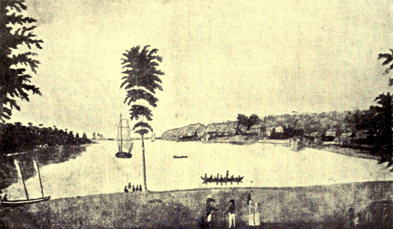
AMHERSTBURG, IN 1800
Not long after the coming of the first English-speaking people there was an election in Essex County, concerning which some amusing details were given by Miss Jean W. Barr in a recent number of The Globe. She had been fortunate enough to come across a letter written before the contest by the successful candidate, David William Smith, Surveyor-General of Upper Canada, and afterwards a baronet. Writing to a friend in Detroit, John Askin, who afterwards settled on the Essex side of the river, Smith begged his help in conveying voters to the hustings and in arranging for liberal supplies of beer and rum, without which nothing could be accomplished in those days. In the event of success, he planned to celebrate his triumph with a public dinner, a dance “for the ladies,” a generous distribution of strong drink and white ribbon favours, an enormous bonfire and the hoisting near it of a large red flag, emblazoned with the word “Essex” in big letters of blue tape.
Ten years after this Askin built a log-house overlooking the river, just above the site of Walkerville. That “brilliant and unfortunate foster-son of Essex,” Major John Richardson, author of The War of 1812, and of Wacousta, was one of his grandsons. Richardson fought in the war of which he wrote, was captured at Moraviantown in 1813, and his name is associated not only with Askin’s house, “Strabane,” but with Sandwich and Amherstburg.
Until 1796, when it was given up to the United States, Detroit was the chief town of the Western District of Upper Canada. When it passed under “the Stars and Stripes” many soldiers and settlers removed to Amherstburg or Sandwich, and the erection of Fort Amherstburg, or Malden, as it was afterwards called, was immediately begun.
In 1812 General Hull, with 2500 men, invaded Essex. The General established himself in “Colonel Baby’s big brick house” at Sandwich, from which he issued his bombastic proclamation to the people of Canada. But he had to deal with one whose motto was: “Deeds, not words.” Brock inspired the successful attack of the British on Mackinaw, and many another valiant deed of which I have no space to tell, but happily he was not Canada’s only hero in that perilous time.
Hull had designs on Amherstburg, but British regulars and Essex militiamen proved lions in the path, and ere Brock, with a small force, hastening in open bateaux along the surf-beaten shore of Lake Erie, arrived at Amherstburg (where he had a memorable interview with Tecumseh), Hull had recrossed the river to Detroit. In his turn, Brock made his headquarters in Charles Baby’s house; then he crossed the Detroit, with his little army of 750 regulars, militiamen and voyageurs, and his 600 Indian allies, to terrorise Hull, who had double the number of men behind his fortifications, into the surrender of himself, his army, his military stores, and the whole territory of Michigan.
A few months later Proctor brought to Sandwich an American General and 500 men, captured at the river Raisin, but Essex was to witness other scenes less flattering to our country’s pride. In September, 1813, Captain Barclay sailed from Amherstburg with a little armament to meet defeat at the hands of the American commander, Perry; and a few days later Proctor, who was certainly in a perilous position, abandoned Detroit and Amherstburg to the enemy, and retreated up the Thames, leaving an open way for Harrison and his Americans to follow.
The story of the battle of Moraviantown, where Tecumseh fell, belongs to another county and has been told already. For nearly two years the invaders occupied Amherstburg, rebuilding the fort which Proctor had demolished on his flight. Within a decade these new works had fallen into decay, and Fort Malden, the third stronghold on the site, was not begun till after 1837.
The year 1838 was an exciting one in Essex County, and the garrison of Fort Malden, assisted as occasion required by Essex militiamen, was kept busy repelling the attacks of marauders who gathered within the boundaries of the United States with the intention of overturning the Canadian Government. They called themselves “Patriots,” and amongst them were some honest enthusiasts for liberty, but a number of them were ruffians and desperadoes, hoping to profit by disturbing the peace of our country.
In January “General” Sutherland led a “Patriot Army” to attempt the capture of Amherstburg, but his mob of followers was defeated and their schooner, the Ann, was captured. Six weeks later another band of “Patriots” took possession of “Fighting Island” (as it has since been called) in the Detroit River half-way between Windsor and Amherstburg. But soldiers from the garrison were hurried to the scene in the night, and the next morning the invaders were dislodged. In March they landed on Pélée Island, and early in December made a final attempt on Windsor.
Led by one named Bierce, the intruders crossed from the end of Belle Isle in the steamer Champlain, and burnt a blockhouse. But on the site of the present City Hall of Windsor they were met by Colonel John Prince of Sandwich, with a loyal force, which, after a hot fight, defeated and dispersed the foe.
In any sketch of Essex County, Prince deserves more than a passing mention, for for some years he was credited with being “the most popular man in the Western District.” Having practised as a barrister at Gloucester, in England, he came out to Canada in 1834, attracted apparently by the hope of good sport and of a free, congenial life. He brought with him his wife, three sons, five servants, and “a box of golden guineas so heavy two men were required to lift it.” Prince set up two of his servants on a farm close to Sandwich, and when the pair tired of country life and opened an hotel in Sandwich, their master himself removed to the “Park Farm.” He enlarged the old house, which still stands and has recently been acquired for a clubhouse by the “new golf and country club” of Sandwich.
Prince spent his money freely in beautifying his grounds, bringing out pheasants, peacocks, and swans, and stocking his farm with thoroughbred cattle and his woods with deer and game. He was always ready, moreover, to lend to his more needy friends, and exercised hospitality in a most lavish fashion. He was a good speaker, and when elected to the Assembly acquitted himself so much to the satisfaction of his constituents that on his return to Sandwich the people on more than one occasion took the horses out of his carriage and dragged him home in triumph.
But the “Patriot” incursion brought a cloud over his popularity; for, as he himself reported (after stating that twenty-one “of the brigands and pirates” had been killed in the fight), four of their number were “brought in at the close of the argument, all of whom I ordered shot, and it was done accordingly.” For this high-handed proceeding of condemning men to death on his own responsibility, without even a form of trial, Prince was naturally much criticised. The affair was discussed in the Imperial Parliament, but the “Iron Duke” spoke in the Colonel’s favour, saying that an armed mob entering a country and marching against unprotected citizens deserved to be dealt with severely. Many of Prince’s former admirers turned against him, however, whilst his enemies in Detroit put on his head a price of a thousand dollars. Prince retorted by advertising in the Detroit newspapers that he had placed “man-traps and spring-guns” in the woods surrounding his house. The warning appears to have been effective. At any rate the redoubtable Colonel lived to a good old age, though, being appointed Judge of Algoma District, he left Essex years before his death.
During the Fenian alarms of 1866 Essex volunteers prepared to repel attack, but on that occasion their valour was not put to the proof. In fact, so far as this county is concerned, we have now done with warfare, but we have by no means exhausted the interesting associations connected with its old buildings and long-settled localities.
For instance, in the neighbourhood of Amherstburg, there is an Indian burying-ground about two hundred years old. The town is on the boundary-line between the townships of Malden and Anderdon, which latter was known as “The Indian Reserve” till about forty years since, though Sir Francis Head had induced the red men to resign two-thirds of their lands as long ago as 1837. Amherstburg itself has been said to be, in some respects, “very British; in others, very French.” Its narrow streets, however, bear English names.
“Strabane,” the “Park Farm,” and the Baby House at Sandwich have been referred to already; but there is one episode, so far unmentioned, in connection with the last-named dwelling, which it would be a shame to pass over in silence. In the year 1830 a runaway negro from the States contrived to cross the river and to fly for refuge to the historic house. His master was hot upon his track, and, following him to his asylum, demanded that the poor wretch should be given up. But he reckoned without his host. Charles Baby recognised no property right in human flesh and blood, and the Southerner was forced to retreat discomfited from British soil, leaving his former slave a free man at last.
In more recent years the oppressed negroes seeking liberty found many a helper in Kent and Essex counties. In fact, Windsor has a street which possesses the distinction of having been settled, for a mile, on both sides, by escaped slaves.
About 1830 people of three counties used to come to Sandwich to cast their votes for their representative in the Assembly, and in that year was published in the little town the first newspaper of Essex, called The Sandwich Emigrant. A quarter of a century later the county court-house was being built at Sandwich by Alexander Mackenzie, the master builder, who lived to become Premier of the Dominion, and whose statue on Parliament Hill at Ottawa is adorned with emblems of the craft by which in his younger days the statesman earned his bread. The distinction of being the chief town of Essex has, however, passed to Windsor, which was incorporated as a town in 1858, and now is a flourishing city of nearly 18,000 people. In early days it was known simply as “The Ferry,” from the fact that it was the point of departure for the big canoes which carried passengers backwards and forwards to Detroit for the modest charge of 25 cents the round trip. Later, the canoes were succeeded by a horse-boat, destined to give way in its turn to the great boats propelled by steam, which not only cross the river, but ply from port to port of the Great Lakes.
On the confines of Windsor there stands—or stood till very recently—an ancient Hudson Bay Company’s building, erected in the eighteenth century. It was called “Moy House” by its builder, Angus M‘Intosh, son of the “Lady of Moy,” who on one occasion harboured “Bonnie Prince Charlie,” and took the field in person for the luckless Stuart, riding at the head of 300 fighting men of the clan, with a man’s bonnet on her head and a brace of pistols at her saddle-bow. Angus, it is said, went into voluntary exile on account of the disinherited Prince; yet later was so good a liegeman to King George that he crossed from Detroit to Essex in 1796, and did valiant service, with his sons, in the War of 1812.
But Essex is not only interesting historically. To-day it is one of the most populous counties of Ontario. Corn and tobacco, grapes and peaches flourish remarkably in its mild climate and fertile soil. Nor is it surprising that such sun-loving crops come to rare perfection when one realises that Essex is several degrees nearer the equator than any part of Great Britain. Pélée Island, some miles to the south-west of Point Pélée, or rather its little neighbour, Middle Island, is the most southerly point in the Dominion; and “due east of the Pélée Island vineyards lie the famous old cities of Saragossa and Valladolid and the orange groves of Barcelona.”
“But here’s to the man who can laugh when the blast
Of adversity blows; he will conquer at last.
For the hardest man in the world to beat
Is the man who can laugh in the face of defeat.”
Emil Carl Aurin.
This fertile county, with its three or four towns, its many pleasant villages and numberless prosperous farms, with its long water-front washed by the waves of Lake Huron and the currents of the St. Clair River, bears a name which no Canadian should be willing to forget. John George Lambton, the Earl of Durham, had faults which gave his enemies a ready handle against him, but his brief sojourn in Canada (immediately after the Rebellion) was productive of great good to the whole of the Dominion. The county of Lambton, therefore, may be proud to bear the name of the much-maligned statesman, whose celebrated “Report” opened the eyes of the authorities at home to actual conditions in this country and led to the long-desired concession of responsible government and to the establishment of the present municipal system.
Curiously enough, several of the other names written upon the map of Lambton County recall incidents in the life of that stern soldier, Sir John Colborne, whose blunders, when Lieutenant-Governor of Upper Canada, had helped to raise the storm of insurrection. Plympton Township is called after a town in Devonshire, near which was Colborne’s—or Lord Seaton’s—beautiful mansion, “Beechwood,” and the not-far-distant township of Moore recalls the dead hero of the midnight burial at Corunna, who
“Lay like a warrior taking his rest,
With his martial cloak around him.”
Colborne was Sir John Moore’s military secretary, and almost with his last breath the General expressed a wish for his advancement. Lastly, there is a tradition that it was Sir John Colborne who gave the name of Sarnia to the county seat of Lambton and the township in which it is situated. In 1835 the Governor visited the place (then known as “The Rapids”), with some idea of erecting a fort at that point to defend the shores. He was feasted royally, and “an excursion (the first on record in Lambton) was planned for a trip up the rapids into Lake Huron,” but a stiff breeze forced the party to turn back. At the time a hot discussion was going on over the choice of a name for the village. It was decided to refer the matter to the Governor, and perhaps that experience of Huron’s boisterous seas reminded him of the little surf-beaten island of Guernsey, in the English Channel, where he had spent some years as Governor. At any rate, he bestowed upon the village the Roman name of the Isle of Guernsey—Sarnia.
Lambton County has now a population of about forty-five thousand to an area of something over a thousand square miles, but, as much of the land is suitable for growing fruits and vegetables, there is still room for multitudes more workers to till the soil and gather in the bountiful harvests. About half of the present population are dwellers in towns and villages, but the farmers of to-day have advantages which are rapidly giving a new character to rural life. There are schools, post-offices and churches within comparatively easy distance of almost every farm. Rural telephones are numerous, and a rural mail delivery has been tried with success. The county is crossed from east to west by the lines of three railway companies. The principal centres of population in the neighbourhood of the oil-fields of Lambton County and the farmers living along the pipe lines use natural gas, whilst other farmers have their own gas-wells, from which they obtain light and power for lessening their labours in many different directions.
By way of contrast to such conditions, it is worth while to give a backward glance to the state of things as described in Smith’s Canada, some sixty years ago. In Moore and Sombra there were then a few good farms, but in general the clearings were small and the buildings poor. In the former township lots in a Chippewa Indian Reserve were being offered for sale at from five to twelve shillings the acre; but the only white people as yet settled on it were half a dozen squatters. As at present, there were reserves in Sarnia and Bosanquet Townships and on Walpole Island, and at the latter place, in 1842, no less than 1140 Indians claimed presents. The Lambton County Indians are chiefly Chippewas or Ojibways, but in 1837 several bands of the wild, roving Pottawatamies, famous as hunters, settled on Walpole Island. A few of the red men attempted the culture of the soil on a small scale, but the largest amount of land cropped by an Indian was twelve acres, and their descendants do not take very kindly, as a rule, to farming their own land.
Though Bosanquet was in Lambton, it belonged to the Canada Company, and therefore was reckoned as part of the “Huron Tract.” Till after the middle of the last century settlers were few. A little over sixty years ago a road through the new township was a new luxury, the unfortunate settlers having previously had to content themselves as best they could with an Indian trail unfit for vehicles. But lack of roads was a common grievance. The Government had spent over twenty thousand pounds in making a road from Port Sarnia to London, but in a short time it was allowed to fall into such a bad condition that it was almost useless. The township of Plympton, where much potash was made, suffered seriously from want of good means of communication with Sarnia. A great grievance which Lambton shared with other counties was that immense quantities of land were held by absentees and speculators, and it was not to be expected that a settler, after making a road through his own lot, would “do it through five hundred or a thousand acres more.” In Warwick there were good clearings, though the farmers showed an inclination to exhaust the soil by sowing wheat repeatedly; but Enniskillen and Brooke were little settled, and much of the land was wet and marshy. In the strangely-named township of Dawn, a Virginian gentleman, King, had settled a little colony of slaves whom he had set free.
The county seat of Sarnia (now a prosperous town of nearly 10,000 inhabitants and a port “with two miles of water-front, at any point of which boats can dock safely”) was laid out about eighty years ago. It was, indeed, in the thirties that many of the first settlers of Lambton came in. One of the most notable pioneers of Sarnia itself was the valiant sea-captain of Huguenot descent, Richard Emeric Vidal. Having served thirty years in the Royal Navy and taken a hand in “the capture or destruction of thirty war vessels and sixty-eight merchant ships,” he came to Canada, and took up land within “the corporate limits” of the future chief town. Not prepared for the severity of the weather, he got so badly frozen that “a portion of each hand had to be amputated.” After returning for a short time to England, he settled in Sarnia in 1834, and became first collector of customs at the port. One of his seven children, Alexander, who had been educated at Christ’s Hospital, in London, and ultimately became a surveyor, took up land, at the age of eighteen, seven miles from Sarnia. On this farm he lived as a bachelor for five years. He had few neighbours but the wolves; and once when he was returning to his cabin with a round of beef that his mother had prepared for him, he was much alarmed by their howling close to him, as he was unarmed, save for a pocket-knife.
Another young fellow, James Houston, who, following his family to Canada, had had a long, adventurous journey from Greenock to Sarnia, set out to walk through the woods to his father’s homestead in Plympton, but was so terrified at the sight of some Indians that he ran back to the town again. Assured that they would not hurt him, he made a second venture and reached his journey’s end safely. Soon afterwards he took up land for himself, and lived for a while by making potash, which he sold in Sarnia. It was very cheap, however, while provisions were high; flour brought from Detroit costing $14 per barrel. Ultimately Houston prospered. In 1837 he enlisted on the Government side, and was stationed for some time at Sarnia.
Another Plympton pioneer was John Morrison, who came in with his father in 1827, as a child. The family drove from Hamilton, in an ox-wagon, containing all their worldly goods; and the mother had taken the wise precaution to fill every pot and pan with seed potatoes. These were experienced pioneers, and the father had sent on a grown-up son in advance to put up a log shanty. But when they reached the shanty it had neither doors nor windows. There were no neighbours within reach, no ditches in the swampy land, no grist-mill nearer than London; but they triumphed over all difficulties, and John Morrison became noted in the county for the fine stock he raised. He was a Liberal in politics, and was proud in his latter years to think that in 1851 he had helped George Brown, “one of the Fathers of Confederation,” to win his first seat in Parliament for the new constituency of Lambton-Kent.
“Rickety, shingleless, old and grey,
Scathed by the storms of many a day,
In a wayside spot where the wild weeds grow,
Stands the old cabin of long ago.”
Thomas Sparks, M.D.
This county was not set apart as a separate municipality till 1847, but to make intelligible the first chapter in its history it is necessary to go back a quarter of a century—to the year 1824—when the Canada Land Company was organised in London. It received its charter in 1826. One of its most eager promoters (already mentioned more than once) was the Scottish novelist John Galt, and he was amongst those who came out to this country to look after the interests and carry out the plans of the Company. It began its operations by buying up “vast tracts of the Clergy Reserves and Crown lands,” to sell at an advanced price in small lots. It was at first intended that, under certain conditions as to settlement and improvements, it should be permitted to buy at a low price all that remained ungranted of the Crown Reserves (about 1,300,000 acres), and half of the Clergy Reserves. It had not, however, been many years in business when another able Scot, Bishop Strachan, succeeded in persuading the Government that the Clergy Reserves should be controlled by the Church. The Canada Company was accordingly forced to accept, in exchange for the Clergy Reserves, what was known as the Huron Tract, of which the present county of Perth is an important part. This vast estate comprised about one million acres, and stretched almost from the head of Lake Ontario to the site of Goderich on Lake Huron. It has proved to be a rich and fertile country, but was then unknown. Only where the agents of the Company had entered from the east, near where the city of Stratford now stands, they had found a great swamp, which stretched away towards the north, through Elma and Ellice townships, and it seemed vain to hope that these dismal marshes could “ever be made available for agriculture.”
However, the Company, determined to make the best of what seemed to them a very bad business, set about making surveys and opening roads. The Huron road was cut from the east across the present counties of Perth and Huron from the site of Stratford (now a flourishing city of 13,000 inhabitants and the county seat of Perth) to Goderich on the shore of Lake Huron. On both sides of this road the wild lands were surveyed, concession by concession, as settlers came in. In the names of the townships then set apart there lingers a reminiscence of the first directors of the Company—Easthope, Ellice, and Downie; Blanshard, Fullarton, Hibbert, and Logan. The Company leased lands to the incoming settlers, giving them the right to purchase the farms they were improving, after five or ten years, but, as they charged increased prices as the country settled up, the people felt the Company’s hold upon them a hardship and an injustice; and some, it is said, ruined themselves by borrowing money at exorbitant rates of interest to pay for their farms. The pioneers felt that, though the Company had done some good work in opening roads, and so forth, that it was they who were really making the country, in putting up their rude log huts, clearing their patches of fields in the great woods, making their homes in the wilderness, marrying and giving in marriage, bringing up a new generation to possess the land after them, building their small schoolhouses at the cross-roads so that the little ones might have a chance to become good and useful citizens; and one cannot but feel that the pioneers were largely in the right.
Always, indeed, in these little excursions into the stories of the counties, the interest of the tale belongs to the people—the men, the women and the children, at their work and play. So we are proportionately grateful when a writer, like Mr. William Johnston, in his Pioneers of Blanshard, succeeds in gathering up some of the hitherto neglected crumbs of history, lingering in local tradition and the memories of the older inhabitants.
For instance, he tells—and the paragraph seems full of the “local” colour of the pioneer days—how the immigrant seeking a home was always anxious to locate himself near water. The first settlements of Perth were near the Thames or its tributary creeks. Later comers, sometimes far from a running stream, were forced often to content themselves with water drawn from a hole dug in a marshy spot. A “tasteful and methodical” pioneer might cut three or four feet from a hollow stump and sink it in the hole he had scooped out, to give the substitute for a well some appearance of cleanliness. More often no such precaution was taken; the frogs were permitted freely to enjoy themselves in the source of the family water-supply, and when, during the summer-time, the “wrigglers” became too uncomfortably numerous, the water was strained before using through a piece of calico.
The writer lingers in his passage through that picturesque period of sugar-making and spinning-wheels, of logging and “raising” and quilting “bees,” to describe the evolution of a farmer’s vehicle from the first “ox-sled” of the pioneer, made with axe and auger, and used both in summer and winter—through the more pretentious ox-cart and the larger ox-wagon, with its seats resting on poles—to the spring wagon, and that trim delight of the spruce young farmer, especially in his courting days, the top-buggy, which in turn may soon be superseded perhaps by the motor “runabout.”
The way in which the poor and struggling people helped each other was a pleasant feature of those bygone days, but a blot upon almost every large gathering for work or amusement was the amount of drinking. In fact, at “bees” and sales and “raisings” one of the most important functionaries was the “grog-boss,” armed with a jug of whisky. In consequence not a few social gatherings ended in free fights, nor was it uncommon that during the putting up of a new barn some poor wretch should be crushed to death by carelessly handled timbers.
But in those days there were fine opportunities for the steady and determined. A young Irishman in 1856 opened a humble little backwoods store on Fish Creek in the village of Kirkton (half in Perth and half in Huron County). Afterwards he carried on business in St. Mary’s, and later in Toronto, living to make widely famous for commercial success and integrity the name of Timothy Eaton.
By the way, the first building was not erected in St. Mary’s (or Little Falls) till 1841, and in the following summer an immigrant family tried in vain to obtain food and shelter in the little hamlet; but when, at the suggestion of the Canada Company, a grist-mill was erected, the village began to thrive. In 1845 when Commissioner Jones of the Canada Company visited the place his wife was invited to give it a new name. Her own name being Mary, she dubbed the settlement St. Mary’s, bestowing upon it the sum of ten pounds towards the erection of a stone schoolhouse. Two years later St. Mary’s was advanced to the dignity of having a post-office, the settlers previously having had to go to Embro or Beachville in Oxford County for their mail.
The high prices current during the Crimean War, when wheat reached the phenomenal figure of $2.25 the bushel, did something to set many a struggling farmer on his feet, and the conditions of life gradually improved. Nor were there wanting occasional holidays and merrymakings. In those days May 24th, the Queen’s Birthday, was also “training-day” for the militia, and every able-bodied man, from twenty-one years of age to sixty, was required to muster at an appointed place for a day’s drill. Mr. Johnston gives a lively account of “training day” at St. Mary’s in 1860, when he was one of the company of citizen-soldiers.
The weather was hot, and many of the men had walked seven or eight miles to take part in the exercises. Horses were scarce, but the commander, Colonel Sparling, was mounted on an ancient steed to give dignity to the occasion. Few of the officers had had any military training, and it was an anxious task to put the men, in their motley garb of blue cotton or black broadcloth, through the prescribed drill. On this occasion an Irishman, Cathcart, who had at least seen the drilling of regular soldiers in his native isle, took the lead, and for an hour or two the men marched and counter-marched, shouldered and grounded arms as best they could. At last came the order to “change front,” but, says Mr. Johnston, “soon it was painfully evident that we were not going to be successful.” To make matters worse some mischievous fellow had attached a bunch of grass to the brass buttons adorning the “claw-hammer” tails of a comrade’s coat, and at a crucial point in the manœuvres the Colonel’s steed reached out, seized upon the morsel and held on till the cloth of the tails gave way. The wearer of the garment expressed his wrath in no measured terms, and the absurd incident so upset the gravity of the already confused amateur soldiers that there was nothing for their officers to do but propose three cheers for the Queen and dismiss them.
“The lochs and lakes of other lands,
Like gems may grace a landscape painting, ...
But ours is deep, and broad, and wide,
With steamships thro’ its waves careering,
And far upon its ample tide
The bark its devious course is steering,
Whilst hoarse and loud the billows break
On islands in our own broad lake!”
Thomas M‘Queen.
The Huron County seal is dated 1841, but the emblems that it bears suggest pioneer days, as well as the easier periods after the woods had been laid low. Upon a shield of gold and blue is first a bare and brawny arm wielding an axe. Next is a plough, and finally a wheat-sheaf, while a laurel bough on the left and a spray of oak leaves on the right all but encircle the whole. In one respect, perhaps, the wheat-sheaf was an even more appropriate symbol for the county a decade ago than it is now, for it is said that at that time a thousand bushels of grain were marketed in Goderich for every hundred to-day. This only means that the farmers of Huron are becoming more alive to the advantages of mixed farming, are raising more stock than formerly, and are even beginning to make a serious business of apple-growing.
Long before 1841, what is now Huron County was included in the Huron Tract or District, the settlement of which began about 1827, when the town of Goderich was founded by Dr. Dunlop and John Galt, Commissioner of the Canada Company. It was a period when thousands of immigrants were arriving annually in Canada, and the lands of the Company, scattered through the more settled districts, were speedily taken up, but the settlement of the Huron Tract was slow, and the immigrants who did settle there were often disappointed and dissatisfied. The bridges, roads, and mills, liberally promised by the Company, often proved lacking altogether, or were very poor, and, chafing against such conditions, a party was soon formed amongst the settlers in the Huron Tract, in strong opposition to the Company and its representatives. John Galt did not long remain in its service, and Dr. Dunlop soon became the head of the anti-Company party.
Principal Grant (in his preface to Miss Robina and Miss Kathleen Lizars’ In the Days of the Canada Company, which is a veritable mine of information on the Huron pioneers and their times) says that Galt was too big a man for the Company, which distrusted him, and showed its distrust by sending out an accountant to be a sort of spy upon him. Galt was, perhaps, somewhat egotistical and self-sufficient, but at least he was “a man of ideas,” and he did good service to Canada in bringing out people “of the right stock.” In physique he was himself a magnificent specimen of humanity, being almost six feet four inches in height, and broad in proportion. In complexion he was fresh-coloured, and his hair was black and his eyes keen. He was convinced of the necessity of roads, and Principal Grant says that the road he cut, nearly a hundred miles in length, between Lakes Huron and Ontario, is “one of his best monuments.” For the making of this highway Galt was allowed only three thousand pounds, but by paying the settlers whom he employed partly in land he was able to accomplish the work. It was, however, but a narrow track, and after a storm was often obstructed by huge trees that had fallen across it.
The directors of the Company wished Galt to change the name of his little new town of Guelph to Goderich. To mollify them, the novelist bestowed the latter name on the infant port of Lake Huron. From the first it was chief town of the district, as it is now of the county. Perhaps Dunlop—“Tiger” Dunlop, he was nicknamed, from his exploits in hunting big game in India—ought to be counted founder of Goderich, for it was he who led a party through the woods, fixed on the site of the town, and had a log-house built on the rising ground above the River Maitland, so named in honour of Sir Peregrine Maitland, the Lieutenant-Governor of Upper Canada. A little later John Galt, sailing in the Government gunboat Bee, from Penetanguishene, doubling Cabot’s Head, which he called “the Cape of Good Hope of the Lakes,” and examining the coast with a telescope for possible harbours, saw “a small clearing in the forest, and on the brow of a rising ground a cottage delightfully situated.” While he was debating whether this could be the location of Dunlop, the vessel was met by a canoe, “having on board a strange combination of Indians, velveteens, and whiskers,” and Galt “discovered within roots of red hair the living features of the doctor.”
Except for the last brief period of his life, when acting as Superintendent of the Lachine Canal (an office said to have been given to get him out of Parliament, where his sharp tongue was an annoyance), the old “Tiger” identified himself with the Huron district. At the roomy log-house of “Gairbraid” he and his brother, the Captain, kept “bachelor’s hall.” About 1833 a Highland dairywoman, Louisa M‘Coll, came out to them from Scotland. She was something of a character, and when asked how she came to this country used to reply: “Oh, indeed, shuist by poaste!” She was devoted to “the deare gentlemen,” but (the story goes) gossip started, and, both being unwilling to let the girl go, the doctor told his brother that they would toss up to see which should marry her. The Captain won—which is not surprising, seeing that the doctor tossed a double-headed penny—so “Lou” became, by a marriage in which “Black Jimmy,” the butler, officiated, Mrs. Dunlop. It was of doubtful legality, so the bride wisely insisted on having the ceremony repeated in more regular form at a later date. She continued to serve and look after both brothers to the end, but failed to check their too convivial habits. The Captain died first, and was buried by the river, with a cairn to mark the spot. Some time later came the news that the doctor, then in charge at Lachine, was dangerously ill, and the faithful “Lou” journeyed to his bedside, nursed him till the end, and then in the Indian summer set out to bring back his body to his old home. At Hamilton it was given a temporary resting-place in Sir Allan M‘Nab’s plot, but when winter improved the roads, “Lou” continued her doleful journey with the heavy leaden coffin, and at last laid the doctor in the grave next to his brother’s beside the Maitland. Still the old “Tiger” lives in the pioneer legends, and his queer, energetic personality meets us at every turn in The Days of the Canada Company. It was the doctor who, when there was but a ferry over the Maitland, drove “an inoffensive cow” into the stream and crossed upon her back. It was he who took vengeance upon Galt’s bugbear, “the Cockney accountant,” by persuading a servant and Major Strickland (who, by the way, took service with the Canada Company in 1828) to howl like wolves while the innocent-seeming “Tiger” was guiding the wretched new-comer through the dense woods to Goderich. But Dunlop’s love of a practical joke was equal to his love of strong drink.
In the latter taste he was not singular, and, like other counties, Huron seems to have been fairly flooded in the early days with cheap whisky and more costly imported intoxicants. Almost at the beginning of things the thirty white men, then at Goderich, spent “a night of terror,” because five hundred Chippewas on the flats below were engaged in a great drinking bout.
The pioneers of all ranks were chiefly of a hardy, adventurous type, and many even of the gentlemen chose to affect in dress and behaviour the fashions depicted in such books as those of Fenimore Cooper. But, though red shirts and unconventionable manners were in vogue, “society” in the restricted sense was not lacking in the “backwoods” of Huron. “A fat, dark little Baron” from Belgium was amongst the early speculators in land, and was duly succeeded by a much handsomer heir, who caused a flutter by his good looks, his high play, and great flirtations. Then there was the “Colborne (Township) clique” of Scotch gentlemen, who made common cause against the Canada Company. And (to name but one more) there was Van Egmond (descendant, it is said, of the luckless Count who figured in the history of the Dutch Republic). He left the farm, where was grown the first wheat cut in Huron, to lead the rebels in 1837, but on the day of his funeral, his son, true to his adopted country, refused to allow a volley to be fired over the grave—because, as he said, his “father was Mackenzie’s general.”
“When the hill of toil was steepest,
When the forest-frown was deepest,
Poor, but young, you hastened here;—
* * * * * *
Toil had never cause to doubt you—
Progress’ path you helped to clear;
But to-day forgets about you,
And the world rides on without you—
Sleep, old pioneer!”
Will Carleton.
Long after the Loyalists had begun the building up of this province, Bruce County was peopled only by Indians, who belonged to the Ojibway race, made famous by Longfellow in his poem “Hiawatha.” In 1834 a Methodist missionary settled at the mouth of the Saugeen, turning many a red man to Christianity, and his son, born in 1835, was without doubt the first white child born in Bruce County.
A little earlier, Captain Alexander MacGregor had discovered that the neighbourhood of “Fishing Island” (Amabel Township) was teeming with fish, and he arranged with a Detroit company to buy from him all the fish he could catch, at a dollar a barrel, to be salted and packed. Near his camp he used to station a watchman in a tree to report the approach of a shoal, which looked like a silver cloud in the water. Then in hot haste a large rowboat, “its stern piled high with the seine,” was manned. Rowing round the shoal, the fishermen encircled it with the great net, then hauled ashore and sometimes thousands and thousands of fish were thus entrapped. To land them a man got into the net, in the midst of the struggling, glittering mass, and threw the fish ashore with a scoop. But sometimes, when the catch was very large, the landing was extended over three days to give the curers a chance to handle the fish, or, if the supply of salt or barrels ran low, some of the prey were allowed to escape. For a while MacGregor made large profits, then a Canadian company obtained the sole right of fishing on the islands, and MacGregor had to seek new fields for his operations.
In 1848 arrived the first permanent settler, according to Mr. Norman Robertson, to whose History of the County of Bruce I am much indebted; but Kincardine and Southampton both claim the honour of being the first settlement. At the latter place one of the pioneers was Captain Kennedy, “an educated half-breed,” who, four years later, headed a party sent out by Lady Franklin to search for her husband, the famous Arctic explorer.
One of the Huron Township pioneers, Abraham Holmes, is notable for his enterprise in sailing a huge dug-out canoe regularly between Goderich and Penetangore (Kincardine). It was propelled by oars or sails, was large enough to carry as many as five barrels of flour, and in it many a settler made part of his journey into the wilderness.
The subject of transportation in those early days, as now, when it is occupied largely with great railway enterprises, is a fascinating one, perhaps because so much depends upon it. In nothing did the pioneers display greater pluck and ingenuity than in their journeys. A jam of driftwood in the Saugeen River was made to do duty for a bridge, and a man, lacking a boat, once crossed the stream on the back of an ox. Others made great rafts to carry their families and effects downstream, and happy they might count themselves if they did not get their unwieldy crafts stranded in some rapid.
One Bruce County woman recalled, long years later, the perils of her journey in as a child. Starting from Goderich on a dark night in an open boat, the party was overtaken by a gale, and, dreading worse things, attempted to run ashore. So in black darkness their little vessel plunged to her doom on the beach, while her passengers were rescued with difficulty, to trudge dripping wet through the howling storm to seek shelter in an overcrowded shanty. But at last they reached Kincardine, “thankful to be done with travel either by land or water.”
Not less perilous was the plight of two young daughters of a settler in Saugeen Township, who on a December day in 1851 undertook to ferry two travellers across the river in a canoe. When they started there was ice and snow-slush in the water, and on their return this blocked their way when they were too far from land to be reached by rope or pole. Paddling incessantly, the girls kept themselves from freezing, but all the long day could make no headway, and it was dusk when someone felled a small tree into the river. At this they grasped in passing, and so were saved.
It was about the same time that an enterprising business man resolved to set up a steam saw-mill in Southampton, but as there was no road through the county, the problem of getting the huge iron boiler to its destination threatened to be insoluble. By some means the boiler was brought to Hanover, high up the Saugeen, and was there left on the river’s bank till some ingenious mortal proposed “to make an ironclad of it.” All openings having been plugged up, it was rolled into the water with a tremendous splash. It was so long in coming to the surface that the pessimistic declared that it was lost for ever, but a moment later its black bulk reappeared, and started on its way north without waiting for any one to take command. It was soon captured, and with a dry cedar log lashed to each side made “the strangest craft that ever navigated the Saugeen.” It was steered safely to Southampton, at the mouth of the river, however.
A somewhat similar story is told about a great potash kettle. In the early days a few of the pioneers made potash, though when there were no wharves it was a formidable task to land such a huge mass of iron from a small sailing vessel, but Captain Duncan, who later commanded the Ploughboy, the first steamboat of Bruce County, got over the difficulty in an original fashion. Placing the kettle gently in the water, he got into it himself and paddled it ashore. This was no doubt “the first instance of sailing in an iron vessel on Lake Huron.”
In matters small and great there was indeed endless opportunity for the ingenuity of the pioneers to display itself. In the shanties was often found a mysterious-sounding article of furniture called “a one-post bed,” the walls of the shanty being made to do duty as supports instead of the other three posts. The crossing of streams was a frequent difficulty, but when a foot-bridge over the Teeswater, where Paisley now stands, was carried away by a freshet, the two families living on opposite sides of the stream trained a dog to carry small articles across it. By the way, the first doctor who settled at Paisley was the father of one of Canada’s sweet singers, Isabella Valancy Crawford.
There was a great mixture of races in Bruce County, including a number of Pennsylvania Dutch Mennonites, and a colony of evicted Highlanders, who spoke only Gaelic, and being fishermen and shepherds, suffered great hardships before they could reap much profit from their bush farms.
For thirty years after the opening of the “Queen’s Bush” to settlement Bruce County made great progress, touching in 1881 its high-water mark in population with 65,000 souls, though the emigration of the young to the west and other districts had already begun. A few dates, taken almost at random, suggest the gradual improvement in the conditions of life. In 1851 and 1853 first schools were opened at Kincardine, Southampton, and Walkerton, but by 1856 twenty-eight or thirty schoolhouses had been erected. Already Bruce County had an agricultural society, and in 1856 its first public library was opened at Inverhuron. Five years afterwards the first newspaper was published at Walkerton, and 1862 was the last in which a bounty was paid for “wolf scalps.” In 1867 Bruce County (earlier united with Huron and Perth) began its existence as a separate municipality. A year or two later South Bruce had the honour of being represented in Parliament by a great man who has recently passed away, Edward Blake.
Open-handed hospitality, helpfulness to each other and great energy were characteristics of the Bruce pioneers, the latter quality sometimes displaying itself in hot contests over municipal matters. When in early days the townships of Bruce were to have been made an adjunct to two townships in Huron County, the pioneers refused to pay taxes. When Kincardine wished to pass a by-law taxing the county for the construction of a harbour a great procession started from Brant Township to protest, headed by Joseph Walker, riding the solitary horse of the settlement. Bad roads were long a drawback to the community, and in 1868 began an agitation for rival railways, one to have its terminus at Kincardine and the other at Southampton. The latter town was first to obtain railway connection in 1872. Finally, a battle royal raged for eight or nine years over the choice of a county town. In 1865 the matter was settled in favour of Walkerton, named after the energetic little Irishman mentioned above, who had built there a grist-mill and saw-mill. This town is situated on the Saugeen, in a valley so beautiful that a Scotchman who saw it in the spring of 1849, when white with the blossoms of wild plums and cherries, said to a comrade, “Eh, mon, if Eden was anything like this, what a fool Adam was to eat the apple.”
“Here’s to the Land of the axe and the hoe!
Here’s to the hearties that give them their glory!
With stroke upon stroke, and with blow upon blow,
The might of the forest has passed into story! ...”
William Wye Smith.
This county bears the name of the Liberal nobleman, Earl Grey, who was premier when the great Reform Bill of 1832 was passed by the Houses of Parliament. Grey is a huge county of sixteen townships, the western ones once forming part of Wellington and the others of Simcoe. It was set apart in 1852.
In 1840 it had no white inhabitants, except twenty families in St. Vincent and Collingwood Townships, but the following year saw the beginning of settlement in Derby and Sydenham (named after the first Governor of the United Canadas). In 1842 a man named Stephens arrived from Toronto at what is now the important lake port of Owen Sound, in the 15-ton schooner Fly, and established a general store, a potashery, a grist-mill and a saw-mill at Inglis Falls. Two years later, the steamer plying between Sarnia and Sturgeon Falls in Simcoe County began to call at Owen Sound, which was destined in a few years to become one of the most important ports and shipbuilding centres on the great lakes. In 1875 was organised the company which constructed the great dry dock at Owen Sound; but already, twenty years earlier, the town had received an impetus to its growth in becoming county seat. The county buildings were erected in 1853, but the jail was remarkable for its insecurity.
From very early days Grey was fortunate enough to have some attempt at great roads through the county. Charles Rankin made a survey for the “Garafraxa Road” in 1837; but the outbreak of the Rebellion prevented the completion of the work till 1840, when the surveyor of the Canada Company laid out “a tier of lots on each side of the line,” and immediately many of these were taken up as “free grants.” In 1848 the Durham Road was laid out, leading east and west from the village of Durham, which vigorously contested the claim of Owen Sound to be county seat. Another great highway was the Toronto and Sydenham Road, running diagonally across the county in a south-easterly direction; and a fourth was the Northern Road, leading from Collingwood Harbour to Owen Sound and thence to Saugeen in Bruce County. About 1861 these four roads, which reached every part of Grey, were gravelled at a cost of $300,000, and the people had a right to take pride (as they did) in the fact that there was not a toll-gate within the limits of the county.
From the roads, settlement gradually extended in every direction. Being “a hardwood county,” Grey had no lumber to export, and from the first the settlers depended on the cultivation of the soil; but the gravelling of the roads gave the farmers much easier access to their markets. With its long coast-line, its numerous waterfalls, and the “Blue Mountains” of its north-eastern townships, which rise to 1500 feet above sea-level and 900 feet above the lake, Grey has the attraction of picturesque and beautiful scenery, but to the pioneers of eighty years ago it must have seemed sadly “out of the world,” for the first comers reached it by travelling up Yonge Street to Lake Simcoe, thence they made their way to the Georgian Bay, to skirt its shores in bateaux or (later) in steamboats.
During the three decades after 1831, when there were practically no settlers in the county, the population of Grey rose gradually to over 37,000, who, in 1861, were chiefly Canadian-born, though both Scottish and Irish immigrants were numerous. In early days, speculators in land were very “persistent” and troublesome, pouncing on the townships as soon as surveyed and contriving somehow to evade “the actual settlement” clauses of the regulations. A great part of Collingwood Township was thus acquired, when first opened, by absentees; and when the town-plot of Sydenham (now Owen Sound) was laid out, its “park plots” were held so long unused by speculators, that the town seemed to be surrounded by woods; the more so, because its site was so large (5000 acres) that it held the farmers at arm’s length, as it were. Its great advantages of situation, on the beautiful sheltered inlet of Owen Sound (more accurately a “bay” than a “sound”) have, however, enabled the town to grow up to the large ideas of its promoters.
On the opposite side of the harbour was an Indian village, called Newash, after an old chief whose father and grandfather had lived there before him. It was inhabited by Ojibways and Pottawatamies, for whom, in 1842, Government cleared a few acres of land and put up sixteen log houses. It also gave the Indians a few oxen and cows, some of which were slaughtered for beef when winter came. In 1857 the Indians surrendered Newash and removed northwards to Cape Croker in Bruce County, where there is still a Reserve for their tribes.
When Collingwood Township was being surveyed an Indian chief interfered, and though the surveyor, Rankin, explained that the lands had been duly surrendered by the Indians, the old chief posted off to York to appeal to Government. But his faith in the officials must have received a rude shock, through the foolish jest of some clerk. In ten days he returned, and with all solemnity “served” Rankin with a paper, which proved to be actually only an advertisement of “Lands for Sale”! Happily when the old fellow found that his trouble had been of no avail, he took Rankin into his confidence, and explaining that he was hungry, was mollified with the gift of something to eat and drink.
This township, from its height, was first called “Alta,” whilst its neighbour was dubbed “Zero,” but they were re-christened—after two naval heroes—Collingwood and St. Vincent. Collingwood and Artemesia, in early days, had the distinction of possessing township libraries. That of the latter had nine branches, with seventy-five volumes, changed annually, in each division. In the last-mentioned township are situated the beautiful Eugenia Falls—seventy feet high—on the Beaver River. In a chasm near these falls, says Rev. William Wye Smith, once editor of the Owen Sound Times and author of an historical sketch of Grey (from which I have obtained much of the information embodied here), were found the antlers of an immense moose, which was supposed to have fallen in and been devoured by wolves.
About the year 1852 some of the settlers, according to Mr. Smith, imagined that they had made a much more valuable discovery—of nothing less, in fact, than gold, which could be chipped out of the rocks by the sackful! The find was made below the falls, and at first the secret was kept amongst half a dozen men, who “wrought like beavers to make their pile” before others found out. But rumours of gold, like murder, “will out.” One day, another prospecting party, from the commanding height of a precipice, perceived the gold-diggers hard at work below, and the latter, seeing that further concealment was impossible, stopped their work to discuss the situation.
The new-comers were doubtful whether it was “the real thing!” “ ‘Well,’ said an old man, wiping the sweat from his brow, and sitting down on a very respectable pile of the purest and most glittering ‘rocks’ he had been able to find, ‘Well, if it’s gold, I’ve got enough; and if it isn’t gold I’ve got enough!’ ” A wagon-maker of York, who chanced to be in the neighbourhood, rushed to the diggings with the rest, and carried home a “back-breaking load” of the glittering treasure, solacing himself during the toil of his three or four days’ journey on foot through the woods with plans for the future. He would buy a good farm, he determined, and on reaching home at once “kindled his forge fire to melt down a little of the precious stuff. The catastrophe was entirely unanticipated. The sulphurous fumes and horrible stench of the vile stuff choked him.... The harder he blew, the more horrible the stifling fumes, till in despair he pitched the whole lot into the street. He had carried home a backload of worthless iron pyrites,”—sometimes unkindly called “Fool’s gold!”
But, if Grey was not destined to prove itself a great gold region, many of its people, in its fisheries and its good farms, have found a surer, though perhaps a slower, road to prosperity than that by way of gold mines. It has lost one of its townships, Melancthon, to Dufferin County, but the population of Grey is now about 64,000.
“Weird monarchs of the forest! ye who keep
Your solemn watch betwixt the earth and sky,
I hear sad murmurs through your branches creep,
I hear the night wind’s soft and whispering sigh,
Warning you that the spoiler’s hand is nigh.”
Anon.
It is sometimes said that the name of this “Lake District” of Ontario is derived from that of an Indian chief, or medicine-man, which meant “Clear Sky.” Another suggestion is that the name comes from that of the valiant chief of the Chippewas—Misquuckkey—whose name, with that of two brother chiefs, appears on treaties signed in November 1815, by which, for the consideration of £4000, they resigned their claims on 250,000 acres between Lakes Simcoe and Huron. But for long years to come Muskoka and the surrounding districts continued to be Indian hunting-grounds, and “in the early fifties the region on the north of the Severn was to the inhabitant of the neighbouring county of Simcoe a wilderness of rocks and lakes, which never could be settled. ‘There is no land,’ the inquirer was told. ‘Nothing but rocks and lakes.’ ” A peculiarity, it is said, of Muskoka rocks, whether showing themselves from land or water, is that they rise up sharply and suddenly, so that there may be depths of good soil or fathoms of clear water close beside and around the miniature peaks. Flat rocks are rare, and so are land-stones.
Angus Morrison, a Scot, who had been brought to Canada by his parents at the age of twelve, and had become a barrister and a member of Parliament, did much for the opening of the Muskoka District. His name is deservedly recalled by that of the township of Morrison, which is the very gateway into the region now so widely famous as one of the great “playgrounds” of our country. Before any modern means of travel was introduced into the district, Morrison, with a party of friends and Indian guides, in canoes, penetrated into the beautiful wilderness, by way of the Severn River, Sparrow, Morrison, and Leg Lakes, to the spot where Gravenhurst now stands on Muskoka Bay. Soon afterwards, in 1858, the history of Muskoka as “a white man’s country” may be said to begin with the construction of the Government road from Washago to the South Falls on the Muskoka River. At that time Bracebridge did not exist, and the only bridge over the river was a great pine-tree. To cross this required a steady head, and on one occasion a man who had been drinking slipped off the log into the stream. He narrowly escaped drowning, but it chanced that he had, tied to him, a great “demijohn”—originally, no doubt, the occasion of his unsteadiness—which went down on the opposite side of the trunk from himself. Thus balanced, he hung beside the log till some witnesses of the accident could pull him out.
Before it was decided to open up the Muskoka and Parry Sound Districts to settlers, the idea was discussed of turning the whole region into a vast Indian reserve. This plan fell to the ground, and, in October 1859, the first party of settlers was met at Severn Bridge by the Government agent, Oliver, and received seventeen location tickets for free grants adjoining the road. By 1861, when there was but one house on Muskoka River, the townships of Morrison, Muskoka, Draper, and Macaulay were opened to settlers.
Then began a repetition of the same tale of pioneer hardships, adventures, fortitude, and resourcefulness as belonged to the earlier Loyalist days. Muskoka District, in 1861, had a population of 300 souls. By 1882 this had multiplied a hundredfold, but the first settlers in the roadless “bush” were terribly isolated. Some of them lost count of time, and one man, with little to mark the days, for many months kept Tuesday instead of Sunday as the “Lord’s Day.” Again it was the old story of long journeys on foot to the mill or the post-office. On one occasion some settlers, having walked forty miles to Orillia for flour, found the supply exhausted, so had to trudge on to Barrie, twenty miles farther, whence they carried home their hard-won flour sixty miles on their backs. Worse still, there were times when the poorer settlers could not obtain flour by any means, and so had to strip the birch trees of their buds, or dig up again the seed-potatoes they had planted in hope of more plentiful fare later in the year.
Of course, until the coming of the railways, the easiest means of communication in that country of lakes and rivers was by water. Birch canoes were the passenger vessels of early days, whilst heavier “dug-outs” were used for freight. Then were introduced sail-boats, and scows for lumber-men’s supplies, while the lumber rafts themselves, with their floating shanties, sometimes took a passenger or two. On Lake Muskoka a man named Holditch experimented with a large flat boat, worked by a horse, but it proved intolerably slow. Soon afterwards, Cockburn, an enterprising merchant, and reeve of Victoria County, put the steamer Wenonah on Lake Muskoka. She made her first trip in 1866, when there were only twenty people at the village, now Bracebridge. The first settler, by the way, going in there in a birch bark canoe had spent five days trying to find the mouth of the river, by which to go to “North Falls,” as it was then called. The Wenonah was a boon to the settlers, but at first proved a loss to her owner, who, however, after five years was able to put a second steamer on the lake. By that time stages were running weekly to Parry Sound, Huntsville, and Orillia, but goods were still brought in summer from the latter town in a “one-horse sled.”
The pioneers were of many nationalities, and many of them had no idea how best to meet the conditions of the new life. They were unused to the severities of the climate, and were not experts at chopping and clearing. A droll story is told of one unfortunate who, having cut his foot severely with his axe, endeavoured for some time afterwards to prevent a repetition of the disaster by standing in a wash-tub to chop his firewood!
Not the least to be pitied were the few gently-brought-up people who, burdened with habits and prejudices which made the rough life almost unendurable, attempted to redeem previous failures by taking up “free grants” in the bush. Such a one, according to her own account, was the writer of the “Sonnet to Muskoka Pines” quoted above. After living for years in France, and being driven from that country by the Franco-German War, this unfortunate lady settled in Muskoka, during the seventies, six miles from Utterson. She was a widow, but had a family of sons and daughters, some of them married, who also came to Muskoka.
From the first, the poor thing seemed to be the special butt of misfortune. In fact the children of this literary “Mrs. Gummidge” began to fear that her perpetual tears and lamentations would end in “softening of the brain.” Some of the family came to the country in advance of their mother, who arrived with one or two daughters at a season when bush fires “were raging,” a fact that added to the discomfort of their long ride in a wagon to the log-cabin which was to be their winter’s home. The road was full of stumps, and dust and smoke and heat from the smouldering embers where the fire had passed through added to their troubles. Too late to build a house of their own, the new-comers had to crowd for the winter into a daughter’s cabin, which was already overfull, and when at last the widow got into her own house the roof, put on by inexperienced hands, was so leaky that on a rainy night a big umbrella had to be fixed over the head of the bed. The family fared ill as to food, and there are records of Christmas festivities when the chief part of the feast was a single “scarecrow” chicken, with a pudding made mainly of flour, or a couple of herrings and a big vegetable marrow. In this case time only made matters worse, and at last the family gave up the hopeless struggle; but the widow wrote of neighbours, of a humbler class, who were kind, hard-working, contented, and full of hope.
By this time, at least in that part of the district so well known to summer visitors, the number of settlers was increasing fast, and the conditions of life were certainly improving. Here and there schoolhouses were springing up, and little churches, where occasional services were held by wandering missionaries of different denominations. New townships were being surveyed, and older ones were being organised, with reeves and councils. In 1872 the first election for a member of Parliament was held in Muskoka, and in 1874 the Governor-General, Lord Dufferin, arrived, on a July evening, at Bracebridge, to find the little village bedecked with no less than eight triumphal arches. Of course an address was presented and replied to with all possible ceremony, but the Governor talked freely to the settlers with whom he came in contact, and appeared particularly interested in a man from Iceland, perhaps because of happy reminiscences of his own sojourn in that island in “high latitudes.”
Bracebridge, incorporated in 1875, was surely remarkable for the number of its associations, ranging from a temperance society to a chess club, which used annually to play a rival club at Huntsville by telegraph. Towards the close of 1877 a teachers’ association for Muskoka was formed. In that same year Gravenhurst was thrown into excitement by the discovery, during the digging of a well, of some small nuggets of gold. But no expert was called in, and all the “delving and washing” that went on failed of the desired result, while the people who rushed in from outside were unkind enough to suggest that “the Muskoka folk were frauds.”
“Hurrah for the Rapid! that merrily, merrily
Gambols and leaps on its tortuous way;
Soon we will enter it, cheerily, cheerily,
Pleased with its freshness and wet with its spray.”
Charles Sangster.
This district gets its name from the town and harbour of Parry Sound—on the Georgian Bay—called after the famous Arctic explorer, Sir William Edward Parry. The Indians called the inlet “Shining Light,” but its present name was bestowed upon it by Captain Bayfield, who was employed surveying the Georgian Bay and Lake Huron from 1822 to 1825.
A little over two centuries earlier, Champlain, in his own less formal fashion, had also surveyed the coasts of Parry Sound and Muskoka Districts, when, in 1615, he made his way by the Ottawa River, Lake Nipissing, and French River and along the Georgian Bay to the country of the Hurons. By the same route, a few years later, those gallant soldiers of the Cross—Brébœuf and his brother-Jesuits—went to their work amongst the Hurons; and after the tragedy of the Iroquois invasion, which annihilated the flourishing missions for ever, several of the black-robed fathers who had escaped martyrdom led the broken remnants of their flock back by this way to seek safety nearer to the settlements of the French. It was on a June day in the year 1650 that the fleet of canoes—bearing a melancholy, half-starved company of three hundred Hurons, men, women, and children, all told, with a few French priests and laymen—took their way northwards through the countless islands which guard the land from the onslaught of the furious surges. At last they reached Champlain’s old water-way eastward, and so, skirting the region which is now Parry Sound District, passed to less lonely scenes. The Jesuit fathers knew the excellent harbour of Parry Sound, and a few years ago there was found there some ancient relic (of what description I do not know) bearing date, moulded in the metal, “1636.”
In 1837, this famous old canoe-route was surveyed by David Thompson, the great explorer and map-maker of the North-West, whose name has been bestowed on one of the swift rivers which hurry westward down the gorges of the British Columbian mountains. But though the old water-way which forms the boundary of Parry Sound District was so well known for generations, the land itself was left to the Indians, as a hunting-ground, for another quarter of a century. After 1861, however, a few settlers were sent in the winter from time to time into Parry Sound District from Bracebridge, and about 1865 the settlement of Parry Sound village began, when the steamer Waubuno was built to run between that harbour and Collingwood, and the lumbering firm of J. & W. Beatty established themselves there. The resident partner, belonging to the Methodist church, helped to establish a Sunday School, and soon the little village had no less than three churches, and was annually the scene of camp-meetings attended by hundreds of Indians and whites.
In 1870, when the Parry Sound region became a separate district, the village of Parry Sound became chief town, and a court-house, a jail, and a registry office were added to its few buildings. Now it has a population of about 3500, and, being the point of supply and departure for numerous tourists and sportsmen, is especially lively in summer. Its steamer connection extends not only to Collingwood but to Chicago, Duluth, Port Arthur, and other places, and it is served by no less than three railways.
The whole district is dotted with lakes—eight hundred, it is said, if all, small and large, are counted—and still it is a sportsman’s paradise, though probably it would be difficult now to rival the fish and game stories of the pioneers of thirty years ago. Then deer were extraordinarily abundant in M‘Murrich, one of the most southerly townships, now crossed by the Grand Trunk Railway—but they were being rapidly destroyed by the depredations of wolves and of “rapacious pot-hunters”! A settler, in 1879, saw a herd of deer at Whitestone Lake (so named from its good limestone) which he estimated at three thousand head. One winter, in the early seventies, a traveller came upon an Indian camp near this lake surrounded with deerskins hung on poles, whilst in the snow lay several deers’ heads at which the well-fed dogs “sniffed contemptuously,” and on the following day he saw a young, athletic-looking Indian yoked in a kind of harness attached to a load of deer meat. He had no sleigh, but the meat was packed in the skins of the slaughtered animals, with the hair so arranged as not to catch on the snow. The winter of 1874-5 was one of remarkably deep snow, and in some cases numbers of the deer, herded in “yards,” were wantonly destroyed, for mere inexcusable love of slaughter, though they were too lean to be good food, and their skins were not marketable.
But the chance to get wild meat was (and no doubt is) a great boon to the settlers, who at first often had a terrible struggle to make a livelihood. Pickerel used to be so plentiful in May that people caught them with their hands at the foot of rapids, and, in November 1877, one man in fourteen days caught 2200 lbs. of herrings in the narrows between the two arms of Whitestone Lake. Some of these weighed, it is said, no less than 2 lbs., whilst the largest of the pickerel weighed 20 lbs. Moose were plentiful in those days, and bears also. These latter animals, though usually inoffensive, and only anxious to get out of the way of human beings, occasionally behaved in a somewhat alarming fashion. In M‘Murrich Township an agent for a commercial house was “treed” by a bear; and, the story goes, so frightened Bruin by his wild shouting that the animal sought refuge in another tree. On another occasion two young men in Croft Township were going to look for their cows, accompanied by a small dog. This little creature started a bear and gave chase to it. The bear, instead of turning on the dog, chased the boys, who by means of a cedar “lodged in an ash tree” climbed into the latter. The bear, in unabated rage, came to the tree, and in spite of vigorous kicks tore the boots off the feet of the younger boy and severely wounded him. He got a branch, however, and with that managed to keep the angry brute at bay; but from eight in the morning till two in the afternoon the pair were held prisoners in the tree.
In September 1869, the village of Parry Sound held a gala day in honour of the visit of a number of officials of the Northern Railway, and its people were delighted, no doubt, at the promise of improved means of communication with the outside world. In 1874 Lord Dufferin, after visiting Bracebridge, arrived at Port Cockburn on Lake Joseph, and came on by land to Parry Sound. The same year saw a rush of settlers to the free lands of Parry Sound as well as to those of Muskoka, and as many as sixty farmers from Haldimand County came into Ryerson, which was the first township to send a consignment of wheat and oats to the outside world. North of Parry Sound village, Hagerman was the first township to send grain to market; and it also had the distinction of being represented in the Paris Exhibition by an English settler’s “Early Rose” potatoes.
Parry Sound District was the field for various experiments in colonisation. In 1874 M‘Murrich Township was selected for the establishment of a “Temperance Colony,” but after roads had been cut and mills built the township was thrown open to all comers. About the same time a plan of “ready-made farms” was tried in Ryerson Township long before the experiment was made in the west. It was known as the Donaldson Colonisation Scheme. The Government, after having five acres cleared and a small house built on certain farms, offered them for sale for $200 each, cash, the title to be given after the settler had cleared an additional ten acres. The money received was to be used in extending the scheme, but the “cash” stipulation was not insisted on and the plan failed. A colony of Swiss was settled by the Baroness von Koerber on the Magnetawan River, which the pioneers crossed by “a free-and-easy bridge of floating logs” that sank beneath the water under the weight of a team.
Foreigners were numerous in many townships, and often different nationalities were strangely mixed. Twenty years ago, for instance, a young man sent to teach a school in Mills Township found himself in a settlement where nearly all the men were Italians and the women Germans, for the former, working as navvies on a German railroad, had taken German helpmeets, and had afterwards emigrated to Canada. On the whole the speech of “the Fatherland” had triumphed over that of Italy, and, to all intents and purposes, it was “thirty smiling German ‘kinder’ ” who gathered in the primitive log schoolhouse to take their first lessons in “the three R’s.” These had to be given in the unfamiliar English language, but, before long, that also began to make some showing in the strife of tongues.
“And here a gorge, all reft and rent,
With rocks in wild confusion,
As they were by the wood-gods sent
To guard them from intrusion.”
Alexander M‘Lachlan.
Till a few months ago the districts of Nipissing and Sudbury included a region bordering on James Bay; now this northern territory has been divided from the southern portions and has become the new district of Timiskaming.
Nipissing is named from the lake, by which, almost three centuries ago, Champlain travelled to Lake Huron, and by a strange, roundabout course visited Lake Ontario. Closely following the direction of the ancient Indian canoe route of the River Mattawan, taken by the intrepid French explorer, the main line of the Canadian Pacific Railway between Ottawa and Winnipeg was traced a generation ago through this wild and broken country. To all intents and purposes it is still a wilderness, where sportsmen may find fish and game in plenty, though it is dotted sparsely with small farms and little hamlets, in which the sawmill is usually the most conspicuous building.
Moreover, at commercially strategic points in the wilds there is situated, here and there, some town of fair size and more impressive activity. Such a one is North Bay, on beautiful Lake Nipissing. It was made by the “C.P.R.,” and is becoming more and more of a railway centre. It now has a population of about 6000, a good proportion of whom are supported by industries connected with the mine and the forest. From North Bay the state-owned railway of Ontario, known as the Timiskaming and Northern Ontario Railway, strikes in a north-westerly direction, two hundred and fifty miles to Cochrane, giving ready access to the Cobalt silver district, the Porcupine gold fields, and the great “Clay Belt,” with all its rich agricultural possibilities. A large proportion of the passengers it carries are prospectors, miners, and sportsmen, but when it is pushed on to James Bay (as no doubt it will be in a few years’ time), it will surely stimulate, or create, a great salt-water fishing industry.
Twenty-four miles west of North Bay, still on the “C.P.R.,” is another growing town, Sturgeon Falls. The most important industry of this place is the manufacture of wood-pulp and paper, but it owes everything to the river, which not only brings to the huge mill the spruce that “feeds its ponderous grinders,” but also “supplies the power which makes the wheels revolve.”
Within the bounds of Nipissing District is Algonquin Park, the first of Ontario’s many “Forest Reserves.” As long ago as February 1892, a commission was appointed by the Provincial Government to consider the question of the creation of such a reserve. The commissioners reported favourably on the plan, on the grounds not only of the conservation of the forest itself (part of the territory, by the way, was already under license for the cutting of timber), but also for its beneficial effect on the water-supply of the surrounding country, six important rivers taking their rise within its limits. A third very important object was the protection of fur-bearing animals and game, which, unless special means were taken to prevent it, were in danger of extinction at the hands of careless and greedy hunters. It was also pointed out that the Park would serve as a delightful health resort and as a school of experiment in conservation methods. It was accordingly set apart and named after the ancient inhabitants of the land in 1893.
The Park is fifty-six miles long by forty-eight miles broad, comprising the whole or parts of thirty-one townships, and has an average elevation of 1500 feet above sea-level. It is under the charge of a superintendent and a staff of rangers, whose duty it is to guard the forest against fire, whether started by lightning or the carelessness of man, to see that the game-laws are duly observed, and as far as possible to protect the denizens of the woods and streams from the depredations of all enemies, human and otherwise.
Wolves give the rangers a good deal of trouble, having discovered that the Park affords them fine hunting. In one recent year the rangers killed about a hundred, but the protected animals are increasing, and Algonquin Park is an ideal field for the hunter with camera instead of gun. There, for instance, he may get pictures of Canada’s emblem, the beaver, busily building his dams and his domed mud-dwelling.
Many of the rangers are educated men, attracted to the life by love of the open air, or for the opportunity it offers of the study of the ways of beasts and birds and of the life of plants, and some of these men rarely leave the forest from year’s end to year’s end. Of course visitors go to the Park chiefly in summer; but there are people who find its enchantment greatest in the winter. Then it is very silent in the daytime, though at night it is vocal with the “yelps of the wolf-pack,” or “the shriller bark of the trailing fox.”
Part of another great “Forest Reserve,” Temagami, including the lake from which it takes its name, is in the Nipissing District. This lake is not set amidst heather-covered mountains, yet an enthusiastic and imaginative Scottish tourist felt that it would have made a fit setting for the appearance of Scott’s “Lady of the Lake,” in “her fairy shallop.” “But,” he added, “this first flash of a comparison between Loch Katrine and Lake Temagami must quickly give way to a feeling of awe. The islands of Temagami are numbered by at least a thousand, its shore lines by thousands of miles, and its area by hundreds of miles. Visitors to the Dominion are probably better acquainted with the thousand islands of the St. Lawrence just above the Montreal Rapids than with those of Temagami.”
But Ontario’s railway now gives easy access to this pleasant holiday-country; and visitors who wish to explore its maze of land and water can be “assured of reliable guides in the Indians, who reside in several of the islands, and know every nook and corner of the great lake. These Indians, by the way, are mostly half-breeds, and, coming from Hudson Bay, have a large dash of Scottish blood amongst them. The names of MacLeod and MacPherson and Campbell are quite common. Of this fact one of a party of British journalists who sailed for a long day on Temagami without seeing one tithe of the vastness of its territory had a significant experience. Having lost touch with his colleagues in a tramp over Bear Island, he timorously inquired his way of a dusky native, who, from his appearance, might have had a tomahawk concealed in his belt. But the reply was as reassuring as amusing. ‘Yer freens ha’e just got ayont the tap o’ the brae, and dinna forget that ye’ve been telt that by Sandy Macleod!’ ”
“Thence I ran my first rough survey—
* * * * * *
Plotted sites of future cities, traced the easy grades between ’em;
Watched unharnessed rapids wasting fifty thousand head an hour;
Counted leagues of water-frontage through the axe-ripe woods that
screen ’em—
Saw the plant to feed a people—up and waiting for the power!”
Rudyard Kipling.
The day of the romance of Northern Ontario is not yet over. It has, perhaps, taken on soberer tints than of yore, but it has its heroes still in the guise of Government surveyors, of railway-builders or miners, of the fire-fighters of the forest, or the modern pioneers of the settlement, whose courage is put sometimes, and often, to strange and unexpected tests. A recent writer, Mr. Talbot, speaking of the toils and dangers of the “scouts” who make the first rough surveys for the construction of a railway, declares that more is known about the land around the North Pole than of the northern stretches of Ontario and Quebec, excepting where some great river makes a highway into the back country.
To some men there is no joy like the joy of the wilderness; but here is another view of a land where reigns “a silence and loneliness that bludgeons the senses into inactivity.” “On every hand is the interminable forest, a verdant sea, except where here and there jagged splashes of black and brown betoken that the fire fiend has been busily at work.” And the forest covers unseen dangers. Even a slight exploration of its recesses is a perilous task, and often the line of march is crossed by pile on pile of jagged rocks, fallen trees massed in inextricable confusion; deep gulches, always being cut deeper by the raging torrents at the bottom. The dotted line of a “projected railway” across a map unmarked by towns or villages does not give a hint to most people of the wild work which must have been accomplished by the surveyors before even that broken line could be traced. Often three or four preliminary lines are gone over before the best is discovered.
But the railway “scouts” frequently discover more than a good route on which to lay the iron road. It was due to railway enterprise—to the building of the Canadian Pacific Railway, in fact—that the richest known nickel deposits on the globe were discovered in the district of Sudbury, and the story of the find and its utilisation is an interesting illustration of the close relations in our modern world between persons and events that till the dénouement of the drama often appear totally disconnected. All unconsciously, a number of men, each occupied with his own special end and aim, worked together during the ’eighties at the “making” of the Sudbury mining field, which was described in 1908 by a mining expert in the pages of The Canadian Magazine as the most productive and most profitable metal-mining enterprise in the British Empire.
First, as stated above, came the builders of the “C.P.R.,” cutting their way through the vast metalliferous deposits, just within the bounds of Sudbury District. The presence of copper in good quantity attracted attention. Then a group of American capitalists took a hand in the matter, and in Ohio was formed the Canadian Copper Company, a name which future events were to prove scarcely appropriate. In 1886 work was begun at the Copper Cliff mine, and the crude ore was shipped for treatment to New Jersey. There the experts in the smelting works detected the presence of nickel in the slag. In a short time a pound of nickel proved equal in value to two pounds of copper, but the copper company at first had great difficulty in separating the nickel “in pure metallic form from the associated metal,” and “also in the expansion of the market for its valuable product.”
Meanwhile a scientist, Dr. Ludwig Mond, unaware of the existence of the deposits at Sudbury, “was working at his carbon monoxide method of separating copper and nickel.” Later he formed a company and acquired properties in the new mining district, where he made a practical and commercially successful application of his method to the ores of the Victoria mines, twenty-two miles west of Sudbury.
It was in the year 1889 that Dr. Mond made the discovery, but there was no great demand for nickel until (in that same year) “an historic paper was read by Mr. James Riley before the English Iron and Steel Institute, and drew the attention of the world to this wonderful alloy.” Soon it was being used in the manufacture of armour-plate for the world’s navies, of heavy ordnance, of bicycles, and of many other kinds of machinery. So the annual value of Sudbury’s nickel output climbed up far into the millions (representing sixty per cent. of the world’s product of this metal), whilst at the mining centres huge heaps of debris and tall smokestacks—pouring forth thick clouds of ill-smelling gases and vapours from the tremendous cauldrons, kept ever on the boil by the modern wizards of invention and commerce—have for many a mile scarred and changed the face of the green wilderness.
As is well known, the actual building of the railways is done largely by foreigners of many nationalities—Russians, Austrians, Poles, Galicians, and others. There are thousands of these men, “most of them living in little shacks, and doing the work by contract. As a matter of fact,” says a member of “The Shanty Men’s Mission,” “the contractors will tell you that without the aid of these men it would be almost impossible to build railways; they will do work that no Canadian or English-speaking man would put his hand to. In the muskeg you can see them standing in water half-way up to their knees, shovelling the dirt into wheelbarrows to grade the road, and doing this work at a price that often does not bring them in $1 a day and board.”
Often they live under most deplorable conditions. For instance, the cellars of a number of houses near the “C.P.R.” station in Sudbury “are fitted up with two tiers of bunks, into which the men are packed, regardless of health considerations. The owners of these houses are themselves foreigners, and are getting wealthy at the expense of their less fortunate countrymen.”
Many of these sturdy fellows would make excellent settlers on the bush farms, and some have taken up such farms; but they are sorely handicapped by their little knowledge of English, and not a few ultimately return to their native lands.
There are still a few Indians in the district of Sudbury, and once a year, at the Hudson’s Bay Company’s station of Flying Post, and at Fort Metagami, a sum of $4 is paid as “treaty money” for each member of each Ojibway family—man, woman, or child.
The Indian agent goes to these wilderness posts in state with “a weather-beaten Union Jack, symbol of British might and good will,” flying from a spruce pole set up in the bow of his canoe; and his arrival “is the big event of the year” to the dwellers at the post, so no wonder that it is greeted with much firing of guns and other demonstrations of delight.
“And when we bring old fights to mind
We will not remember the sin—
If there be blood on his head of my kind,
Or blood on my head of his kin—...
“After us cometh a multitude—
Prosper the work of our hands,
That we may feed with our land’s food
The folk of all our lands!”
Rudyard Kipling.
Though the new district of Timiskaming (a name which has had many varieties of spelling) looks somewhat blank upon the map, it has a story which would lend itself admirably to representation in a great historic pageant like that enacted some years ago on the Plains of Abraham at Quebec. From the first scene to the last, the background is always the wilderness—sometimes forests of well-grown pine and spruce, sometimes acres upon acres of stunted poplar or small second-growth trees. But it is not unbroken forest, for here and there broad lakes reflect the blue of the sky. Here and there streams of all sizes, from considerable rivers to little creeks, loiter through level, swampy lands or hurry down from the hills in a succession of rapids and chutes. Here and there is a wide muskeg, haunt of water-fowl and amphibious four-footed things, or a dismal brulé, the scar of a fire started by some careless wanderer or by heaven’s lightning.
The opening of our pageant would show the red men fighting, hunting, trapping, fishing, building their bark tepees in the woods, feasting or starving, according to the season or chances of the chase, bewailing their dead, trying to propitiate the spirits of the earth, the air, and the beasts they had slaughtered.
Then come the white men on the stage, and we are plunged into the bewildering story of the struggles of French and English for the possession of the Hudson Bay country, a story rendered the more complicated and confusing by the “turn-coat” proceedings of the two French adventurers, Raddisson and Des Groseilliers. To put the matter briefly—in 1670 was formed that famous trading association, the Hudson’s Bay Company, which immediately sent out a vessel and built a little fort at the mouth of Rupert’s River on the shores of James Bay. Very shortly afterwards the energetic Talon, at Quebec, commissioned a Jesuit, Albanel, “to penetrate as far as the Mer du Nord”; and, accompanied by a young Frenchman and a few Indians, the valiant father struggled through the wilderness of Northern Quebec to his goal. A little later other French adventurers bade defiance to the English claim of sole sovereignty over the frozen north by erecting a little trading post at the mouth of Moose River, just within the boundaries of what is now Timiskaming District. The English protested, and presently the French lost their footing in this paradise of fur-traders, leaving their rivals in possession at Moose River and several other points.
In 1685, however, two Frenchmen travelling down the Abitibi river and lake, and thence by way of Lake Timiskaming and the Ottawa, pioneered a new route from the north. This suggested a daring scheme to a retired French officer, the Chevalier de Troyes, and on Christmas Eve 1685 he sought permission of the Governor, Denonville, to “drive the English utterly from the bay.” So comes in the second episode of our pageant.
Toiling through the wilderness, impeded by snow and ice, up-stream and down-stream, making many a portage through deep morass or tangled wood, goes a stout-hearted, ruthless band. Upon the march are thirty French soldiers, veterans of European wars; fourscore bush-rangers, wild in mien and in habiliments as the Indians themselves; a French priest in the black robe of the Jesuit; De Troyes himself, elderly, scholarly, frail of body, dauntless of spirit; last, but not least interesting to Canadians, three of the famous sons of Charles Le Moye—Sainte Hélène, De Maricourt, D’Iberville himself—the very type in hardihood, resourcefulness, utter indifference to bloodshed, of the young gallants bred in the castles “dangerous” of the St. Lawrence.
Such wild journeys wear down the strength of the hardest muscles, and reaching Abitibi the adventurers run up a little stockaded fort and take a brief rest before voyaging down the swift-flowing Abitibi River to surprise the English at Moose Factory. When they do strike, on a dark night, it seems to their prey that they have sprung full-armed from the very ground. The little fort is escaladed. The chief gunner, resisting single-handed, dies by D’Iberville’s blade. His comrades cry for quarter, and, fifteen in all, are captured. Then, with solemn ceremonial, De Troyes, in the name “of the Most Redoubtable Monarch, Louis XIV,” takes possession of Moose Fort and island, and cries of “Vive le Roi!” ring sharply out over the icy waters.
After capturing Moose Factory, taking two English ships, overpowering Fort Rupert, and making its garrison prisoners, De Troyes’ French force turned westward along the coast to seek out the third English factory on that part of James Bay. They did not know its situation exactly. Meanwhile two Indians had carried to Governor Sargeant of Fort Albany the appalling tidings of the doings of the French. But Sargeant determined to resist to the last. When, however, the French began to attack the fort by land and water most of its inmates (who were servants and traders, not soldiers) lost heart. The death of one man by the enemy’s shot brought them to the verge of mutiny, and they were terrified lest their powder magazine should be undermined and they should all be blown up together. Finally Sargeant—so the story is told in Mr. Beckles Willson’s Great Company—“desired to lower the flag above his own dwelling,” but the hail of bullets whistled so thick and fast that none dared to undertake the task until Dixon, the under-factor, offered to show himself and propitiate the French. He first thrust a white cloth through a window, waving a lighted torch before it; then he shouted with all his might. On this the firing ceased, and he went forth beyond the parapets, with a huge flagon of wine in each hand. The French officers came to meet him, and presently his comrades saw him by the light of the full moon sitting with some of the foe upon a mounted gun and drinking to the health of the Sovereigns of England and France. Next day Sargeant surrendered the fort, and on August 10 De Troyes set off on his return journey to Montreal, taking spoil in the shape of 50,000 beaver skins, many of which the unhappy English captives were forced to carry on the long march through the wilderness.
The French rechristened the fort Ste. Anne, and, in spite of some efforts of the English to dislodge them, succeeded in holding it for seven years, till 1693, when three English vessels, which had wintered at Fort Albany, appeared on the scene and landed forty men. These were met by a brisk fire from the fort, but it ceased very suddenly, and when the English entered cautiously, fearing a ruse, they found the place deserted, save for a wretched criminal, who lay loaded with chains in the cellar. Some sailors presently reported seeing three Frenchmen running away as fast as they could go, and it appeared that it was they who had fired the threatening salute to their opponents.
Some ten years later the French tried again to surprise the post, but on that occasion its Governor was not to be caught napping. He drove back the assailants from his gates in confusion, and from that day to this the flag of England has continued to wave over Fort Albany.
By the Treaty of Utrecht the English at last obtained undisputed possession of the Hudson Bay region, and the great fur-trading corporation began to reach out in every direction from the bay which had lent it a name. In 1755 (the eventful year of Braddock’s defeat and the expulsion of the Acadians) a Hudson’s Bay Company’s post was erected on a picturesque point of land jutting out into Lake Abitibi from its eastern end. This has been continuously occupied ever since, and until comparatively recently, when steamers began to ply on Lake Timiskaming, the post was supplied from Moose Factory, “whence the goods were laboriously conveyed up the river after the arrival of the annual vessel from England,” and the coming of these canoes, or the setting out for Timiskaming of the Abitibi brigade, which two years ago was described as “the last of the splendid fur brigades of the north,” would provide a most animated though peaceful scene in our pageant.
Now scenes crowd on us thick and fast. While the railway was building, two contractors, M‘Kinley and Darragh by name, struck with the appearance of a heavy, blackish substance on the shores of what was then known as Long Lake, sent away samples to be examined (which proved extraordinarily rich in silver), and staked a claim at the southern end of the lake. About a month later a French-Canadian blacksmith, La Rose, discovered a vein of silver at the other end of the lake, and staked his claim. The story goes that one day, when La Rose was busy at his temporary forge, he caught sight of an impudent-looking fox staring at him from a bush, and flung his hammer at the intruder. The fox decamped, and the man, going to pick up his hammer, found a bright metallic streak on the rock, where it had struck. The same summer two more veins were discovered, and the Provincial Bureau of Mines sent up experts to report on the district. One of these, Dr. W. G. Miller, fearing, it is said, that the coming town might be christened Long Lake, put up a board near the lake, inscribed “Cobalt Station, T. & N. O. Railway.”
Not quite at once was the public to be persuaded of the wealth of precious metals and other minerals that lay hidden beneath the soil of New Ontario; then suddenly the news seized on the imagination of the people, and Cobalt became a great mining camp. Shacks and houses were run up without a plan or order, and at first the methods of mining were as rough and ready as the place itself. Old hands at mining flocked thither from every quarter of the globe, but at first much of the work was done by inexperienced “lumber-jacks,” who needed expert supervision to make a success of their new trade. In its roughest days Cobalt (which was incorporated in December 1906) is said to have been an orderly place, as mining towns go.
But it is only one of Timiskaming’s mining centres. Elk Lake City and Gowganda have their famous silver mines. The year 1906 saw a stampede to Larder Lake, where it is told that a certain old Indian, Towmenie, used to obtain gold quartz, with which he paid for strong drink, and in 1910 the name of Porcupine began to be coupled with the magic monosyllable gold! In the fall of that year the district was “a moss-covered, gold-laden” swamp; by the following spring there were the beginnings of two or three little towns beside the lake. A few weeks later almost every human habitation was swept from the scene by the awful fires which for a generation to come will make 1911 a marked year in the annals of Timiskaming District. At Cochrane, far to the north, only six houses escaped the flames, but the story of the disaster is too recent to call for more than a mere reference here.
A discovery of importance perhaps as great as that of the precious metals, though of an altogether different character, was due to the scouts of the Grand Trunk Pacific Railway. Penetrating far north of the region once scornfully characterised as “a few acres of snow,” they came in Timiskaming and Algoma Districts on the immense stretch of fertile lands known as the great Clay Belt. And this is surely destined in not far distant days to be a fair and prosperous land of fine farms, richly cropped fields, and many people.
At present much of the population of Timiskaming is of Indian blood; and a story that well deserves telling is that of the missionaries, who for the love of God and of humanity have given their lives to the service of the folk of the wilderness. The name of one such “hero of the Cross,” John Horden, is indissolubly linked with that of Moose Factory, which for forty years was his headquarters as missionary and bishop. Horden was a Devonshire man—a printer’s son—and in the beautiful Cathedral of Exeter a memorial tablet hints at the noble story of his life. Arriving at Moose Factory in 1851, after the withdrawal of the Methodists, who had been labouring there, he found a small Christian congregation to begin with. His experiences were naturally varied in “a parish” extending “as far north as you please,” and including “the last house in the world,” as he described that lone outpost of civilisation, Fort Churchill.
“Our hearts are as free as the rivers that flow
To the seas where the north star shines,
Our lives are as free as the breezes that blow
Thro’ the crests of our native pines.”
Robert K. Kernighan.
The map of Algoma shows a vast territory, stretching some three hundred and sixty miles northwards from “the Soo” to the Albany River. Its southern portion is checkered with townships, already numerous enough to make several counties after the pattern of those of old Ontario, but bearing a small proportion to the huge blank spaces of the north, marked only with the names of the lakes and rivers that plentifully water that “Great Lone Land.” The lines of the townships run on the north into the larger oblong of the Mississauga Forest Reserve. Indirectly the Canadian Pacific Railway’s advertising agents had a hand in the setting apart of the vast reserve by calling the attention of “canoe travellers” to the Mississauga River. This flows through a large block of pine timber, and the authorities, fearing that the coming of tourists would cause increased danger of forest fires, decided to take measures to protect the valuable pine. Accordingly, on February 24, 1904, an Order in Council was passed, creating the Mississauga Forest Reserve, which comprised about 2900 square miles.
Dotted along Algoma’s two hundred miles or more of coast-line on Lakes Huron and Superior are a few villages and towns, the largest and most important of which is the historic Sault Ste. Marie. It was first visited, says Dr. Bain, “by the French traders, who named the Indians Saulteaux, from the falls in the St. Mary’s River.” Jesuit Fathers soon followed, and Père Marquette established a mission there in 1669. Two years later the Intendant Talon sent Daumont de St. Lusson, accompanied by the interpreter, Perrot, to seek for the copper mines, of which there were rumours, on Lake Superior. The expenses of the expedition were to be paid by trading in furs. St. Lusson wintered with the Indians, claiming in the name of his Sovereign the whole land as far as the western and southern and northern seas. As a visible token of these stupendous claims, a cross bearing the Royal Arms was planted at Sault Ste. Marie, and the Jesuit Allouez harangued the assembled Indians, representing several tribes, on the power of the King of France. But the red men, probably actuated by superstitious fears, pulled down the cross as soon as the backs of the French were turned.
The troublesome Iroquois caused the abandonment of the mission in 1689. Sixty-one years later, La Jonquière, then Governor of Canada, gave his nephew and the Chevalier de Repentigny a grant six leagues square at Sault Ste. Marie, so that—“at their own expense”—they might build a palisade fort to prevent the Indians trading with the English. “The palisade was 110 feet each way,” and enclosed three small houses and a “redoubt of oak 12 feet square.” A Canadian, Jean Baptiste Cadeau, or Cadot, was put in charge; and there, long after the French lilies “had ceased to float over the ramparts of Quebec,” this trader kept the old flag flying by St. Mary’s River, though ultimately he accepted the changed situation, and even fought gallantly for England. He had married an Indian woman “of great force of character, energy, and uprightness,” and in his house only Chippewa was spoken.
Alexander Henry visited Cadot in 1762, and this notable trader and explorer was much interested by the spectacle of the Indians—two in each canoe—scooping up whitefish with a long-handled net from the turbulent waters of the rapids. At times the fish (some of which weighed 15 lbs.) were so crowded together in the water that a skilful fisherman could catch five hundred in two hours, but some winters the usual supply of fish failed, and the traders and Indians had hard work to fight off starvation. Henry was at Michillimackinac, or Mackinaw, during Pontiac’s war, when the fort was taken by the Indians, but after many hair-breadth escapes he fell in with Madame Cadot, who was on a journey, and with her reached Sault Ste. Marie in safety. Two years later Henry took Cadot into partnership.
The story of the first success in the War of 1812 belongs, in a sense, to the district of Algoma. On St. Joseph’s Island there was at that time a blockhouse commanded by Captain Roberts, to whom Brock had sent orders that if war were declared he was immediately to attack the American fort at Mackinaw. Roberts had only forty-five regular soldiers available, but traders and voyageurs eagerly volunteered, and the North-west Company furnished the brig Caledonia as a transport. The surprise was so complete that there was no bloodshed, and Mackinaw remained in British hands till the end of the war.
Amongst the volunteers was John Johnston, a well-to-do Irish trader of Sault Ste. Marie, who had wedded a Chippewa. During his absence his house was raided and burnt by Americans, while his wife and children looked on from the woods. Later he took his wife and a daughter, a beautiful girl, home to England. The Duke and Duchess of Northumberland were so charmed with the latter that they wished to adopt her, but she preferred to return home, and ultimately became the wife of Henry Schoolcraft, the famous historian of the Indian tribes.
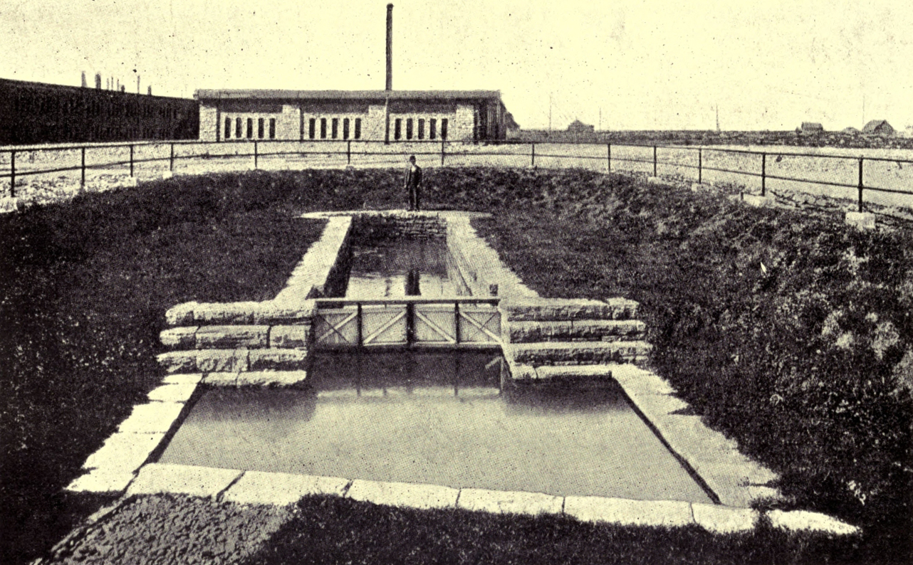
THE OLD LOCK AT SAULT STE. MARIE
Another pioneer who took part in Roberts’ expedition, and had also married an Indian woman, was Charles Ermatinger, a trader, of Swiss extraction. His post was on the south side of the river, and in 1822 the Americans took possession of it and made it into a fort, but afterwards gave compensation to its owner, who had removed to the British side.
In the days of trouble between the North-west Company and the X. Y. Company there was a hot dispute over the portage past the rapids. The latter company, says Dr. Bryce, “forced a road through the disputed river-frontage, while the North-west Company used a canal half a mile long on which was built a lock, and at the foot of the canal a good wharf and store.” Remains of the tiny old lock are still to be seen, near an old blockhouse lately used by the directors of the Algoma Steel Company for a lunch-room. The voyageurs in their little boats often had perilous voyages along the rugged coast of Lake Superior, to which clung many a legend of terror, and not a few bold fellows went down to death in its chill depths. Here and there along its grim shores were dotted little trading posts, that at Michipicoten, where Henry once tried unsuccessfully to grow potatoes, being within a few miles of what is now the western boundary of Algoma.
In 1870, when the Red River expedition was working its difficult way westward, there was no Canadian canal at Sault Ste. Marie by which vessels could pass the rapids, and the Americans would not at first permit the force to use their canal, built in 1855, so guns and stores had all to be “portaged” three miles and a half. After urgent remonstrances, however, the embargo was removed, and then the American officers at Fort Brady became very civil to the British officers. Of course, when the troops had embarked for Sault Ste. Marie, that stately name was often on the lips of the officers, and it was told that the old skipper of one of the steamboats grew obviously uncomfortable at its repetition, and at last protested: “Call it the Soo, sir—the Soo! ... We always calls it the Soo; it’s ever so much shorter, and everyone will understand ye!” And “the Soo” it most often is to this day, when its population has passed 11,000, and when millions of dollars are invested in its huge iron and steel works, its great paper factories, and other vast industrial enterprises, to say nothing of its world-famous canal.
To many people, indeed, the canals are the most interesting feature of “the Soo.” It was in 1888 that the Dominion Parliament passed a measure for the building of the canal which was to make Canada independent of the good-will of her neighbour for the passage of her vessels between Lake Huron and Lake Superior. Plans were at once prepared, but the engineer died before they could be carried into effect.
For the lock the final design was made in the autumn of 1892, and the contractors agreed to complete it by 1894. But in the summer of 1893 the United States Government ordered the collection of tolls on all vessels passing through the American lock. Upon this the Dominion Government offered the contractors a bonus of $90,000 to complete the work by the end of the year, and, except for a very small portion, the whole of the walls of the lock, from 20 to 25 feet in thickness, was built in five months, the last stone being put in place on November 16, 1893. The lock is 40 feet deep, 60 feet wide, and 900 feet long. Vessels go through as well by night as day, only fog, which sometimes makes it hard to find the narrow channel leading to the lock, stopping the procession. The canals on both sides of the international boundary are now free to the vessels of both nations. The larger vessels, however, often choose the Canadian canal, and the tonnage which annually passes through it is three times as great as that passing through the Suez Canal.
“Girdled by Huron’s throbbing and thunder;
Out of the drift and rift of its blue;
Walled by mists from the world asunder,
Far from hate and passion and wonder,
Lieth the isle of the Manitou.”
William Wilfred Campbell.
It is easy to guess from the name they bear that the Manitoulin Islands were supposed to be the haunt of the Indians’ Great Spirit, or “Manitou”; and very appropriately, the descendants of the former lords of lake and forest here hold their own a little more firmly than in most other districts of Ontario. There are nine or ten “Reserves” on the Manitoulin Islands; and out of a population of about 7000 the Indians (chiefly Ottawas and Ojibways), number between one and two thousand.
Great Manitoulin, said to be “the largest fresh-water island in the world,” is about as large as the Isle of Wight and the Channel Islands taken together. Its coast-line is extraordinarily indented, and its land-surface is further diminished by lakes galore, some of considerable size. One of these, Lake Wolseley, is separated from Campbell Bay by a mile of shallow reef, which is now “filled in” and “made into the Indian Point Bridge,” saving travellers a ten-mile trip round the head of the lake. Tobacco Lake, which has no visible outlet, lies amongst the hills, which, however, are of no great altitude, the highest point in Great Manitoulin being 350 feet above the level of Lake Huron. The largest sheet of water in the island is Lake Manitou, but the most beautiful, according to Mr. Arthur Seaton (writer of an interesting article in The Westminster), is Lake Mindemoya. Its waters, of opalescent tints of blue and green, are in part surrounded by shores of “white fretted limestone mounted with trees and flowers.” There are caves too in these white rocks, with arched roofs, that recall the groining of a cathedral, whilst Mother Nature, seemingly in whimsical mood, has decorated the lake with statuary, in the shape of “a high island, which at one side looks like an old woman sewing moccasins, hence the name ‘Mindemoya,’ ” meaning “Old Woman.”
Some seventy-five years ago, Mrs. Jameson, the famous writer and art critic, visited Manitoulin and wrote an account of an Indian Council held while she was there. She was, by the way, the daughter of an Irish artist, named Murphy, “Painter-in-ordinary to the Princess Charlotte,” and the wife of a barrister, Robert Jameson, who became Attorney-General and, later, Vice-Chancellor of Upper Canada. The marriage was not a happy one, and ultimately the pair agreed to separate, but, before that, Mrs. Jameson spent a few months in Canada with her husband, and afterwards published a book, which has its interest for Canadians of to-day, called, Winter Studies and Summer Rambles in Canada.
She states that the Government of Upper Canada at one time had an idea of forming “an Indian Settlement” on the Manitoulin Islands, but that some people objected that this would retard the civilisation of the red men, by making their religious instruction more difficult, and throwing them back on hunting and fishing. Some persons also asserted that the soil of the Manitoulin Islands was unsuited for agriculture, but Mrs. Jameson gave the Government credit for good intentions at any rate. 1837, when she was in Manitoulin, was the second year in which the annual distribution of presents to the Indians had taken place there. Those desiring presents were obliged to attend in person, so there was a great concourse of 3700 Indians, including many Chippewas, Ottawas, and Pottawatamies, some of whom had travelled five hundred miles for presents that to the Irish lady seemed very trifling. The chiefs got something in addition, but the present given to each man of the rank and file consisted of “¾ yard of blue cloth, 3 yards of linen, ½ oz. thread, 4 strong needles, 1 comb, 1 butcher’s knife, 3 lbs. tobacco, 9 lbs. shot, 4 lbs. powder, and 6 flints.” There were presents also, but less in value and variety, for the women and children. All of these things were given to the chiefs, who distributed them to their people with a fairness that seemed to give general satisfaction.
During the days they spent on the island, the Indians received rations of Indian corn and melted fat—“tallow,” Mrs. Jameson called it—which they made into porridge, reported by some white men to be quite palatable. In addition to this simple fare, the Indians were able to catch plenty of fish for themselves.
The Governor, Sir Francis Bond Head, was prevented attending the council by the death “of the Great Father on the other side of the Great Salt Lake and the accession of Queen Victoria,” but, in his stead, Mr. Jarvis, Superintendent of Indian affairs, addressed the Indians, through an interpreter, giving notice that after two years more the Government would cease to give presents to Indians resident in American territory, but inviting all who chose to come to live in any part of the British Empire they preferred, from Manitoulin Island to England itself! Finally a silk flag, bearing a representation of a lion, emblematic of the English, and of a beaver, emblematic of the Indians, was given into the custody of the Ottawas resident on the island, to be kept for all the tribes.
The Indian interpreter, Assikinack, or “the Black Bird,” an intelligent man, with a strangely high-pitched voice, was esteemed a great orator, and had the reputation of having once spoken from sunrise to sunset. In youth he had been a drunkard, but having been converted to Christianity, had learned to hate “fire-water.” On one occasion he was commissioned by Mr. Jarvis “to capture a cargo of rum on its way north from Detroit and throw it into the river.” His baptismal name was Jean Baptiste, and the signature, J. B. Assikinack, appears on more than one Indian treaty. In 1812 he had been present at the capture of Machillimackinac. He was then forty-four, but survived till 1866, almost living out his century. In 1840 his son Francis was sent by Mr. Jarvis to Upper Canada College, where he did excellently, taking several prizes. Ultimately he became a clerk and interpreter in the Indian Department. The name of “the Black Bird” survives in the township name of Assignack, in Manitoulin.
From the top of a steep hill near Lake Mindemoya are to be seen many well-cultivated farms, belonging both to white and red owners; but there is also a strange “circle on one of the hills,” to which the Indians, though no longer heathen, come once a year “to keep up the ancient practice of shooting the evil spirit with arrow or with musket.” Yet some of the Indians are very progressive, improving their lands and keeping the roads in repair, as do the better class of white settlers. The village of West Bay, for instance, with its white-washed log church and houses and its fishing-boats moored along the sands, is most picturesque and attractive. Mr. Seaton, who spent the night in one of the houses, found that his Indian hostess had taken “a domestic science course” at the Industrial School of Wikwemikong, in the “unceded” portion of Great Manitoulin, and the well-cooked and nicely-served meals she prepared for her guest witnessed to the excellence of her training.
The special interest of Manitoulin seems to lie largely with the Indians, but, as mentioned before, the white section of the population is immensely the larger. The Islands were opened in part to settlement in the sixties, but when, in 1870, the Red River Expedition was on its way westward, white settlers were very few. Amongst them, however, was one enterprising “Yankee,” engaged in making jam in large quantities, which he sent into the United States and to various parts of Canada. He lived on what was called “Raspberry Island.”
The white population is derived chiefly from older Ontario, the original settlers paying fifty cents an acre for their lands to a Government fund to be used for the benefit of the Indians. In places the land is stony; and great piles of “land-stones” in many of the fields tell a tale of struggle and endurance. The chief towns are Gore Bay (the district town), and Little Current.
It is said that the best way to see the “Great Manitoulin,” of the beauty of which its inhabitants are very proud, is to walk or drive inland, and to take a voyage in “the fish tug” which collects the catch of the fishermen from the hamlets along the shores. The difficulty of access to markets has been a long-standing grievance to Manitoulin farmers, who have hitherto been sorely at mercy of wind and weather in their communication with the mainland, but, at last, the long-agitated-for railroad connection is in sight. In fact, the Algoma Eastern Railroad Company has laid its rails to the yards on Goat Island, opposite Little Current, and the work on the huge bridge which is to carry the railroad into the island is being pressed forward.
“We fathers and our fathers saw, before the white man came,
Yon mighty giant heave in sleep and breathe the sulphurous flame;
Have seen him, roused in anger, lash these seas in furious wrath,
And all the torrents of his ire in lightning pouring forth; ...
But never saw through lifted clouds his rugged sides before
The white man came to drive away those lurid clouds of yore.”
H. R. A. Pocock.
The very name of Thunder Bay appeals to the imagination, and, even when travelling along the rugged coast of Lake Superior in the idle ease and the accompanying noise and crowding of a modern railway train, one understands a little how Indian legends of grim gods and sleeping giants—with the powers of tempest and death in their keeping—should have arisen here. The shifting mists, the dark waters, the towering crags of “Kitchi-gama”—the Ojibways’ “Big Sea Water”—even now force one to think of the sternest side of nature, and of the mysteries of pain and storm. Here and there along the margin of the lake man has made good his foothold, and, though in one sense his achievements of engineering skill and mechanical ingenuity are dwarfed by the grand scale of nature’s workings, this, from another point of view, but adds to his triumph. The forbidding rocks and long, long stretches of lonely wilderness hint at the magnitude of the powers against which the explorer, the trader, the maker of railways has pitted himself, sometimes to meet crushing disaster, often to come off conqueror.
At all times men have been few in the Thunder Bay District, but these few have been, for the most part, men of energy, who have dared largely, though not rarely, for ends that seem small enough, and so the story, as it is to be pieced out from the records kept under difficulties by explorers and traders, has fascinations which here can scarcely be hinted at. First it is Frenchmen who enchain our interest. The valiant pair, Radisson and Des Groseilliers, whose love of country suffered eclipse, perhaps, through their love of adventure, may have been the first of white men to reach the Kaministiquia (where the city of Fort William now stands), after which, turning northwards, they passed through the Lake Nipigon region. Some sixteen years later, in 1678, Greysolon Dulhut, “one of the most daring spirits in the service of France in Canada,” is supposed to have erected a trading-post at the mouth of the Kaministiquia. Afterwards he built a fort in the heart of the wilderness at Lake Nipigon, which vast sheet of water is now the centre of one of the largest of Ontario’s forest reserves. Here he probably stayed for several years, and no doubt succeeded in diverting some of the Indian trade from the English posts on Hudson Bay; but when the French finally resigned their claims to that region they only became the more eager in prosecuting the trade in the districts north and west of Lake Superior.
In 1728 La Vérendrye was in charge at Lake Nipigon, and whilst there heard from the Indians marvellous tales of the farther west, which impelled him to devote the remainder of his life to the hard task of the explorer. But such undertakings were costly, and to enable him to finance the work he obtained from the French Government a monopoly of the fur trade in the far west, as men then knew or imagined it. In 1731 he wintered where Fort William now is, before starting on his search for the western sea, but in the following summer this noble and courageous explorer, who was actuated not by love of gain, but by a passion for discovery, passed to a stage beyond the boundaries of Thunder Bay.
Some seventy years later, when the United States Government imposed a duty of from twenty to twenty-five per cent on all goods carried over the “Grand Portage” in Minnesota, which was the route used by the North-West Company, that great trading association removed its headquarters from the Portage to the mouth of the Kaministiquia, having previously sent out men to search for a new water route (entirely within British boundaries) from Lake Superior to Lake Winnipeg. A way had thus been discovered from Lake Nipigon to Portage de L’Isle, on the Winnipeg River, but it was not a convenient route. Then, in 1798, the old French route from the Kaministiquia, by Dog Lake, Dog River, Rainy Lake, and the Lake of the Woods, was rediscovered by Roderick Mackenzie, a cousin of the more famous Sir Alexander Mackenzie.
The buildings at the mouth of the Kaministiquia were begun about 1801, but the removal was not completed till 1804, and the new fort did not receive its present name till 1807, when it was named Fort William, in honour of William McGillivray, one of the partners of the North-West Company. From this time Fort William was the point from which the Montreal voyageurs or mangeurs de lard, turned back towards the east, and the trappers and hunters again set forth towards the regions of the setting sun. Alternately it was the scene of wild feasts and revels, of the strenuous labours of loading and unloading the trading canoes, and of fierce contentions amongst their rival crews. The fort was imposing in appearance, consisting of a large number of houses, stores, workshops, and other buildings, surrounded by a palisade fifteen feet in height. After 1813 its great banqueting-hall was adorned by a map completed in that year by David Thompson, whose later explorations were accomplished in the service of the North-West Company.
In 1816 Simon Fraser, who nine years earlier had made “the descent of the fearful cañon” down which the river bearing his name plunges towards the Pacific, was in charge at Fort William. It was the eventful year when Lord Selkirk, hearing on his way to the Red River of the murder of Governor Semple, turned aside to Fort William to demand of the North-West Company’s partners there an account of their treatment of his unhappy colonists. He was armed with the authority of a Magistrate of Upper Canada and the Indian Territories, and backed by a force of 250 men, of whom many were experienced soldiers. On August 12th he encamped his following on the south side of the Kaministiquia, in full view of Fort William; then he proceeded to arrest Fraser and other partners, ultimately sending them to York for trial, while he wintered at Fort William, and then went on to the Red River. The Nor’-Westers had powerful friends in the east, however, and soon the tables were turned. The Earl had to answer in the courts, and was fined two thousand pounds for having imprisoned the traders at Fort William. Selkirk did not long survive his harassing experiences in Canada, and in 1820, the year of his death, the rival trading companies united under the time-honoured name of the Hudson Bay Company.
Fifty years later, on a bright May morning in 1870, Colonel Wolseley, on his way to chastise Riel, passed “the clean, white buildings” of Fort William, and landed a little to the north, naming the spot Prince Arthur’s Landing (afterwards changed to Port Arthur) in honour of Queen Victoria’s third son (now our Governor-General). There the troops were disembarked, and as an old Indian stood watching the landing of a company of sappers and gunners he exclaimed: “What a lot of white people there must be in the world!” But the problems connected with the taking of all these men and the necessary stores through the wilderness to the Red River seemed at times to defy solution. Immediately after Confederation the cutting of what was called the Dawson Road had been begun, but as yet it extended only forty-four miles, and had been recently damaged by forest fires. Renewed fires, tempests, floods, plagues of flies, the inexperience of boatmen—all threatened the success of the expedition, but patience and cheerfulness won the day and accomplished the task.
But it is not to soldiers alone that the untracked wilderness turns a forbidding face. The surveyors of our first transcontinental railway—the C.P.R.—had no less hardships to endure, no fewer difficulties to surmount. In 1872 a surveyors’ party of seven, owing to a little carelessness in leaving alight the fire at which they had cooked breakfast, all lost their lives in a forest fire. Another party, exploring for the Nipigon and Port Arthur branch in the winter of 1879-80, were frozen in on a sudden drop of the temperature, whilst trying “to navigate Black Bay in the venerable tug Neff.” The tunnelling of the huge crags and the construction of the road-bed along the north shores of Lake Superior were scarcely less difficult than the crossing of the western mountains, but in both instances man’s ingenuity triumphed over nature’s “thus far and no further!”
The Canadian Pacific Railway gave a great impulse to the growth of Port Arthur, which by 1887 had a population of 4500. Then a serious difference of opinion between the authorities of the town and the railway was followed by the removal of the divisional headquarters of the latter to Fort William, which, of course, caused that old fur-traders’ station to develop rapidly. Meanwhile, Port Arthur languished, till, in 1902, it became the lake port of the Canadian Northern Railway, and now “the twin cities,” with their immense docks and elevators, flourish side by side.
But they do not live wholly by the activities of the transportation business. The stern country behind them is rich in mineral wealth. Ages ago some ancient people mined for copper on Isle Royale, just beyond the international boundary line, and the spot where Port Arthur stands was called by the Indians “Shuniah” or “Silver,” a name justified by some finds of the precious metal during the construction of the streets. The red men feared to awaken the wrath of “the Sleeping Giant” by pointing out his treasures, but the clue to the discovery of the Rabbit Mountain silver mine was given by an Indian. This is only one of many rich mines in the district, whilst the Atikokan Iron Company has a huge smelting plant at Port Arthur.
“Through tangled forests, and through dangerous ways;
Where beasts with man divided empire claim,
And the brown Indian marks with murderous aim.”
Goldsmith.
This district has a name which, though picturesque, appears to convey a reflection upon its climate. In reality, however, the name was not intended to do this, but was given by the French traders to the lake and stream, as “Lac” and “Rivière à la Pluié,” because they were connected by a perpendicular waterfall of such force that it raised a mist like rain. The voyageurs frequently seized upon such striking natural features to distinguish places in the wilderness, and it was they who dubbed the cataract itself the “Chaudière,” or “Caldron,” as the falls on the Ottawa were named earlier.
It is 225 years since a young Frenchman, Jacques de Noyon, wintered, it is supposed, at the mouth of the Rainy River, where he heard from the Indians of a nation of dwarfs, “three and a half or four feet tall and very stout,” and of cities to the west inhabited by white men with beards, and of ships that fired great guns. Probably De Noyon reached the Lake of the Woods, but he did not discover the Indians’ land of marvels. A few years later a French officer, La Noue, was sent to establish a trading-post on Rainy Lake, with a view of intercepting the furs carried to the English on Hudson Bay.
In 1731, La Vérendrye, beginning his western explorations, sent his nephew, La Jemeraye, to build a fort for him on Rainy Lake. After some difficulty in persuading men to go with him, not only on account of the long and difficult portages but also for fear, it is said, of the demons that were supposed to haunt the little-known western solitudes, the young man succeeded in building Fort St. Pierre, as he named the new post in honour of his uncle. After wintering there he returned with a rich harvest of furs, and, cheered by this good fortune, La Vérendrye and the rest of the party proceeded to the new fort, which was situated in a delightful meadow, surrounded by a grove of oaks. After a short rest, the leader pushed on to the Lake of the Woods, escorted by a flotilla of fifty Indian canoes. On a peninsula, running far into the lake from its western shore (now Manitoba), was built another post, Fort St. Charles, consisting of a quadruple oblong of posts, from twelve to fifteen feet high, which enclosed several log-cabins. It was an excellent spot for the fur trade, and for several years La Vérendrye, though he had by no means given up hope of pursuing his journey westward, made it his headquarters. Once he had to travel back to Montreal to persuade the merchants there to furnish him with additional supplies. Returning, he hastened forward in a light canoe, to find his people at Fort St. Charles approaching the starvation point. Then came his son Jean, from Lake Winnipeg, to report the death of La Jemeraye, and it was decided to send the young man with some of the most active of the voyageurs to meet and hasten the provision boats. A Jesuit, Father Aulneau, joined the party, which started from the fort very early one morning. But, a day or two later, the supply boats arrived, and their crews reported that they had seen nothing of Jean and his comrades. At once, the anxious father sent out a search-party, and horrible was the discovery that they made.
On a little island, off what is now known as Oak Point, guarding the entrance to the Rainy River, the headless bodies of the whole company were found lying in a circle on the beach, where it was supposed that they had stopped to breakfast, and had been attacked suddenly by a band of Sioux. Afterwards it leaked out that, during La Vérendrye’s absence, a party of Sioux visiting Fort St. Charles had been fired upon by some Crees who happened to be within. The French got the credit of this piece of treachery, and upon the French the Sioux took the first opportunity of wreaking vengeance. La Vérendrye’s Indian allies pressed him to make war on the murderous Sioux, and at first the gallant Frenchman was sorely tempted to take their advice; but he knew that, if he did so, it was “good-bye” to all his plans of exploration, so he finally laid aside any thought of retaliation.
About 1765, the Indians of Rainy Lake made themselves so obnoxious to the traders, by plundering them of their goods and demanding blackmail, that they earned the name of “the Pillagers.” Two notable traders of Montreal, Benjamin and James Frobisher, suffered much at the hands of these thievish Indians, on their first expedition; but afterwards, by “a show of force and co-operation” with other traders, they managed to get their goods safely through the dangerous county.
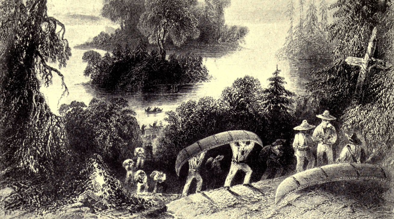
VOYAGEURS PORTAGING
The names of many remarkable men amongst the traders are connected with the Rainy River District. The elder and the younger Alexander Henry (uncle and nephew), David Thompson and Daniel Williams Harmon, all travelled by way of Rainy Lake and the Lake of the Woods westward. The last-mentioned traveller, when he reached Rainy River Fort on July 24th, in the year 1800, found many Chippewas encamped near by, living on the sturgeon and white fish they caught in the lake, and on wild rice, which though darker in colour than the “real rice,” was nearly as nourishing and palatable. About 1791, Peter Grant, then only in his twenties, but already a partner of the North-West Company, was in charge of the fort on Rainy Lake, and, at the request of that literary trader, Roderick Mackenzie, he wrote some interesting descriptions of the manners and customs of the Indians and the methods of the voyageurs.
It was Sir George Simpson, for forty years Governor of the Hudson Bay Company’s vast territories in North America, who named the Rainy River post Fort Frances, in honour of his wife, and in his account of his journey round the world he spoke of this district with less than the usual caution of the fur-trader when dealing with the resources of the country. “From the very brink of the river,” he says, “there rises a gentle slope of greenwood, crowned in many places with a plentiful growth of birch, poplar, beech, elm, and oak. Is it too much for the eye of philanthropy to discern, through the vista of futurity, this noble stream, connecting, as it does, the fertile shores of two spacious lakes, with crowded steamboats on its bosom and populous towns on its borders?”
In Captain Huyshe’s account of the “The Red River Expedition,” he tells with what delight the toil-worn, ragged troops bound for Manitoba reached Fort Frances, “the long-expected half-way house.” The fort itself, consisting of “a collection of one-storied block-houses,” surrounded by a palisade, stood just opposite to the lovely falls of the Rainy River, and its surroundings seemed like “a glimpse of the Promised Land,” especially as the party had been detained for days on an island in Rainy Lake by a north-westerly gale, solacing themselves as best they could during their captivity by eating and gathering into every available receptacle the delicious blue-berries that grew on the island.
Anxious lest the Chippewas might attempt to prevent the passage of the troops through the wilds, the Government at Ottawa had sent on agents in advance to inform the Indians that the soldiers were on the way, and to arrange that they should allow them to pass peaceably. A great council had been held at Fort Frances, and the Indians had lingered there for long, awaiting the arrival of the force, but the difficulties of the journey so delayed it that at last most of them grew impatient and left, and, when Colonel Wolseley arrived, only half a dozen lodges remained pitched beside the fort. But few as they were, the braves from these lodges did not permit the colonel and his officers to pass without a lengthy “pow-wow.” One Indian after another, with his hair plaited in long tails and his blanket draped about him like a Roman toga, inflicted his incomprehensible eloquence on the strangers; and the Englishmen, at first amused with the novelty of the scene, had more than enough of it before it was over. But the Chippewas gave no trouble; and Colonel Wolseley established at Fort Frances a depôt of supplies and a hospital, to guard which a company of the 1st Ontario Rifles was left behind in a camp on the grassy bank of the river. Since those days Fort Frances has become a busy little place of several thousand inhabitants, having easy connection by means of the Canadian Northern Railway and steamboats with the world at large.
Rainy River District was of course involved in the boundary dispute between Ontario and the Dominion Governments; but the story can be told more conveniently in connection with Kenora.
“Here Nature holds her Carnival of Isles,
Steeped in warm sunlight all the merry day,
Each nodding tree and floating greenwood smiles,
And moss-crowned monsters move in grim array.”
Charles Sangster.
In this district the interest of the story centres chiefly about the place that for considerably over a century was known as Rat Portage—so called, it is said, from the numbers of musk-rats seen crossing this way. Here the Lake of the Woods pours its waters into the Winnipeg River by three distinct cataracts—“Hebe’s Falls,” “The Witch’s Caldron,” and another.
By this route, in 1732, passed La Vérendrye’s son on his way to Lake Winnipeg, and many a later traveller followed in his steps, doubtless noting as he descended what one of them, Harmon, described as the “majestick and frightful waterfalls” of the Winnipeg River. In its course, says Captain Butler, in his Great Lone Land, there is a descent, “by terraces,” of 360 feet in 160 miles, and in ascending the river he had to make no less than twenty-seven portages, but words failed him in his attempt to do justice to its beauty. A quarter of a century earlier, Ballantyne, the author of many a stirring book for boys, who was at that time in the service of the Hudson’s Bay Company, crossed the Lake of the Woods in a great canoe paddled by eight sturdy boatmen, at a speed of seventy-two miles a day, and tells how the sight of the “sombre forest rivers of the American wilderness” had, upon him, “the same effect as sacred music.”
The Hudson Bay Company’s first fort at Rat Portage was on an island below the falls, and at times was difficult of access, but before 1852 it was removed to what was later the west side of the main street of Rat Portage town. In 1870 Captain Huyshe described the post as “a small affair,” consisting of three log houses, roofed with bark and enclosed by a high palisade. Of the thirteen men attached to the post, nine were employed at outlying places; and the well-educated Scotchman in charge had been “buried alive” here for thirteen years, receiving news of the outer world only once or twice a year. But he was “quite happy and contented” with his family and his little farm, “of a few acres of wheat, barley, and potatoes, some pigs and cows,” and a large number of “nasty-looking” dogs, of all sizes and colours, used in winter for drawing sledges.
There were three distinct “carrying-places” at Rat Portage, to match its three waterfalls. One of these, distant three miles from the Hudson’s Bay post, was used chiefly for big boats, as it was only 130 yards long, and a nearer one, though twice as long and very rough, was used for light craft. Behind the town stretches the magnificent lake with its maze of islands, on which the Indians used to grow their crops of corn. The Ojibways called it the “Lake of the Islands,” and in its northern half at least it emulates “the Thousand Isles,” as many a voyager, venturing without a guide amongst the perplexing labyrinth, has found to his cost. No less a person than Lord (then Colonel) Wolseley discovered that in such a case “most haste” may be “least speed.” Travelling in a light canoe, he had been storm-stayed on an island in the southern part of the lake, and desiring to press on while there was still “too much sea” for so frail a craft, he had changed into a “gig.” But he had neglected to make sure of a competent guide, and hour after hour was spent in rowing into one “cul de sac” after another, till the bewildered white men had the good fortune to fall in with an Indian, who, understanding their signals of distress, though not their language, guided them safely to Rat Portage. There they found that seventeen large boats, filled with men of the 60th Regiment, driven by a favouring breeze, had arrived before them, and preparations were being made to light a beacon on a conspicuous island to guide the lost commander to his destination. A few days earlier six Hudson’s Bay Company’s boats had been sent to Rat Portage by the loyal people of the Red River, with an urgent request that men and guns might be sent back in them without delay, as there was danger of an Indian rising. But there is no occasion to follow the expedition further, for the story of its bloodless victory and of Riel’s flight belongs to Manitoba.
About this time began a struggle, in which the weapons were pens and maps and dusty old books; and the prize contended for was the western portion of Thunder Bay and the whole of the districts of Rainy River and Kenora. It was one of the numerous boundary disputes which figure in Canadian history, but was strictly a family quarrel between the Dominion Government (later reinforced by that of Manitoba) against the Province of Ontario. In 1869, when the annexation of the Hudson’s Bay Company’s Territories to the Dominion was being arranged, it was suggested that Ontario’s northern and western boundaries ought to be defined. Upon this there arose a dispute, of which it is impossible here to give a detailed account, as to where these boundary lines ought to be drawn. Ontario claimed that her boundaries on the north and west coincided with those of old Canada under the Quebec Act, but the Dominion contended for the Height of Land between the basins of the rivers flowing to the Great Lakes and to Hudson Bay as the northern boundary, and a line drawn a little west of the 89th parallel of longitude (or about six and a half miles east of Port Arthur) as the western boundary. The question, which involved a vast amount of historical research, was by mutual agreement submitted to arbitration. The award, made in 1878, upheld Ontario’s claim, but the Dominion Government refused to ratify it, and in 1881 passed an act putting this “disputed territory” under the jurisdiction of Manitoba.
Upon that Manitoba appointed justices of the peace at several places in the district, incorporated Rat Portage as a Manitoba town, appointed a police magistrate there, and acquired a building to be used as a jail. But the magistrates of Ontario had been exercising jurisdiction in the territory since 1871, and already there was at Rat Portage in the pay of Ontario a stipendiary magistrate and a small police force. There was also a court-house and a jail which had been built by Ontario. On August 13, 1883, a public meeting held at Rat Portage asked that it might be incorporated as an Ontario town.
Under these circumstances there was necessarily some friction amongst the rival guardians of the peace, and there was also trouble over the timber licenses issued by the Dominion Government. A few arrests were made, but the actual disorder was never very great, though the confusion of authority made a perilous situation. For instance, September 28, 1883, saw the polling at Rat Portage for members for both the Provincial Legislatures of Ontario and Manitoba, and the latter province judged it necessary to order the Winnipeg Field Battery to assist to keep order, but the polling passed off peacefully. Soon afterwards the Manitoba authorities took action against the holders of Ontario liquor licenses; but when one of these, M‘Quarrie, was arrested by the Manitoba Chief of Police and three of his men, a stronger force of Ontario policemen liberated M‘Quarrie and arrested his captors.
Happily, at this pass the governments of the rival provinces determined to make a great effort to settle the dispute peaceably. Accordingly arrangements were made for the submission to the Imperial Privy Council of a Special Case. In the meantime all prisoners were released, and it was agreed that the affairs of the territory should be administered by the two governments jointly till a decision could be reached. In the following summer the Privy Council decided (as the arbitrators had done) in favour of Ontario, in which province the satisfactory settlement of the dispute was generally credited to Hon. Oliver Mowat, and upon his return from England in September, 1884, he received a welcome perhaps “unparalleled in the history of any Ontario public man.”
Rat Portage, now become, with one of its sister towns, Kenora (a name evolved ingeniously by adding together the first syllable of the three names Keewatin, Norman, and Rat Portage) has a population of over 6000. It is a great summer resort for Winnipeg people and a growing industrial centre. At the neighbouring town, Keewatin (still having an independent existence) are immense works to develop power from the Falls. It possesses also one of the largest flouring mills in the world, built of granite quarried in the neighbourhood. A few years ago sturgeon roe (for caviare) and berries used to be the chief exports of Rat Portage, and still there are sturgeon (and numerous other fish) in the Lake of the Woods.
The land in the district is easily cleared, as the timber is generally small, and about Kenora are many market gardens, which find a good sale for their produce in Winnipeg. To encourage farming and to test the capabilities of the region for the benefit of the incoming settlers, the Ontario Government, in 1894, established an experimental farm at Dryden, in the Wabigoon section.
“And now there came both mist and snow,
And it grew wondrous cold;
And ice mast-high came floating by,
As green as emerald....
The ice was here, the ice was there,
The ice was all around,
It cracked and growled, and roared and howled,
Like voices in a swound.”
S. T. Coleridge.
The story of the counties and districts of Ontario is now all but completed as it has been found possible to tell it in the very limited space available for each. There remains to be spoken of one district only—the last, but (very literally) “not the least”—for Patricia—so named in honour of the popular young princess then resident in Canada—was added to the Province by Act of the Dominion Parliament only in 1912. In extent it compares with all the rest of Ontario—Old and “New,” as we have been accustomed to call its northern portion—as 55 or 60 to 100. In fact the area of the new district is about one and one-fifth times the size of the British Isles, and being bounded on the east and north by James and Hudson Bays, it lengthens out Ontario’s salt-water shore to 600 miles in all.
It is true that many people regard the region as hopelessly frozen and inhospitable to man; but the reports of the explorers sent out in connection with the Geological Survey tell of indications of mineral wealth; of forests which, though the trees are rarely of very large size, and though some districts have evidently been burnt over more or less recently, may furnish large quantities of pulpwood and timber for other uses; of fish in lakes and rivers and in the vast salt-water bays; of fur-bearing animals, still numerous in spite of the depredations wrought by hunters and traders for nearly two and a half centuries; of great navigable rivers, of water-powers, chiefly inland; and of possibilities (proved by the cultivation of vegetables in the gardens of many generations of Hudson’s Bay Company’s factors) not small even in agriculture. It is not easy for most of us to realise that the new district is by no means Arctic in its latitudes; but its most northerly and most southerly points are (roughly) in about the same latitudes as the most northerly and southerly points of the British Isles. It has been well said, however, that the agricultural value of the land is “of less immediate interest,” whilst there still remain “such vast unsettled areas in other more readily accessible parts of northern Ontario.”
It may well be, indeed, that the question of comparative accessibility may have to be revised, when the long-discussed railways are built to Hudson Bay, and that ancient waterway from the heart of the West to Europe is restored to the importance it had in the palmy days of the fur trade. The consensus of opinion of sea-captains who have had experience of the navigation of the Bay seems to be that for three months of the year at least “Hudson Strait and Bay afford a safe commercial route to Europe.” It is stated, moreover, that “in the course of a century and three-quarters (to 1870) 750 vessels, ranging from 70-gun ships to 10-ton pinnaces, crossed the ocean, passed through the straits, and sailed the bay in the service of the (Hudson’s Bay) Company. And only two were lost. A marvellous record, when it is remembered that all the craft were sailers, and most of them small and of crude construction, and that the bay and strait afforded none of the modern accessories to navigation in the way of coast aids.”
But not all the navigators of the Bay were so fortunate as the Company’s servants. The very name reminds one of a tragedy in which indeed the treachery of man played part as well as the cruelty of the sea. Sailing in 1610 in his little Discovery to seek the elusive North-West Passage to the East, Henry Hudson entered the bay which bears his name and wintered on what was later called James Bay. Curiously enough, Hudson and the navigators who immediately followed him represented this smaller bay on their charts as cut in two by a great peninsula running up from the south. During the winter provisions ran very low, and Hudson had hardly set forth on his return voyage, when, according to the account of one of the mutineers, some of the crew conspired against “the master,” whom they bound and forced with eight other men into a shallop, to shift for themselves. One man alone, John King, the carpenter, elected to leave the ship, if he might take with him his chest of tools; and one fancies that in this he played the hero, for all the rest were sick or disabled. Fearing lest the doomed men should overtake the ship, as they seem to have tried to do, the mutineers crowded on all sail, and the last chapter in Hudson’s story was never known to mortal man.
About six months after the mutineers reached England (themselves having suffered terrible things), Hudson’s little Discovery sailed again with a larger consort, the Resolution, under command of Sir Thomas Button, who was commissioned to make another search for the “North-West Passage.” He was provided by King James with a letter to the Emperor of Japan, and was bitterly disappointed to find the western shores of the great bay utterly impenetrable. At Port Nelson, which he named after his sailing-master, Button and his company spent a wretched winter, somehow losing the Resolution, for it was in their smaller vessel that the survivors sailed for home. Two years later, “the good and luckie ship Discovery” carried Bylot and Baffin into Hudson Bay, and in 1619 a Danish navigator, Jens Munk, came with two ships to Port Churchill, but his crews suffered so terribly that, of sixty-four persons, only himself and two others survived the winter, and managed, in their smaller vessel, with great difficulty to reach Norway.
The stretch of coast recently added to Ontario was almost the last to be explored; but in 1631 two expeditions, commanded respectively by Luke Foxe, of Hull, and Thomas James, of Bristol, sailed from England within two days of each other in the Charles (a pinnace of something less than 150 tons, lent to Foxe by the King) and the Henrietta Maria (of 70 tons, fitted out by James’s fellow-citizens). The two vessels met at the mouth of the Winisk River off the coast of “Patricia,” and the captains dined together, on August 29, on James’s ship, whose guest and rival seems, however, to have treated him with scant politeness, holding him to be “no seaman.”
Both sailed on to Cape Henrietta Maria, so named by James; but from this point Foxe sailed northwards to the channel now bearing his name, and then home, while James sailed along the west coast of the bay called after him, to winter on Charlton Island, where in the spring the adventurers were sorely tormented by an “infinite abundance of bloud-thirsty Muskitoes.” Leaving his winter quarters on July 3, 1632, James sailed back to Cape Henrietta Maria and planted a cross, bearing the royal arms and those of the city of Bristol. It was he who discovered and named the new “Severne,” after the English river; and it is said that the account of his “strange and dangerous voyage” suggested to Coleridge his weird, beautiful poem of “The Ancient Mariner.”
Henceforth seekers for the “North-West Passage” came no more into Hudson Bay; but some thirty-five years later the ships of the Hudson’s Bay Company began to frequent it for the sake of the furs collected by the Indians scattered through the surrounding wilderness. It is still largely an Indian country, though the red men are probably much less numerous than they were two and a half centuries ago. There are other changes, wrought not only by the coming of the traders, but also by the self-denying labours of both Roman Catholic and Protestant missionaries. There are now few pagans amongst them, and, thanks to the wonderfully simple syllabic alphabet, invented by the Methodist missionary, Rev. James Evans, “practically all the Indians can read and write.” In fact, “every Indian camping-place and every point where canoe routes diverge become local post-offices, where letters written on birch-bark” are left for the information of persons coming after. A few of the Indians of Patricia have built, for use in winter, log-huts “with fireplaces and chimneys of wattles and mud,” but most still cling to the bark teepees. In the matter of clothing the present-day Indians are scarcely as well off as their forefathers, who dressed in the skins of the animals they hunted or trapped, for they sell everything marketable to the traders, and in place of furs garb themselves in manufactured cloth, not always of good quality. There is, however, no sale for rabbit-skins, and these, cut (spirally) into long strips and sewn together at the ends, are woven and fashioned into warm, rough blankets and coats.
By 1685 there were five trading posts on the bay, and in the following year it began to be the scene of the daring exploits of D’Iberville. In 1694, and again in 1697, he captured Fort Nelson, which then remained in his countrymen’s hands till the resignation of all French claims on the Hudson Bay territory by the Treaty of Utrecht in 1713. Afterwards, as York Factory, it was the headquarters on the bay of the Hudson’s Bay Company, and as such was the stage for many interesting scenes. But just now the people of Ontario are thinking rather of the future of this old port than of its past, for, though not properly within Patricia, it is to be connected therewith (for the building of a railway) by the “Five-mile Strip” through the territory of Manitoba. Nor is this all. At the mouth of the Nelson River an additional space of five miles by half a mile will bring Ontario’s water-frontage up to ten miles, so that the Province may construct a full equipment of docks, warehouses, and grain-elevators at this new “Archangel of the West.”
Abercrombie, 148
Abitibi, 271
— Lake, 273
Addington, 7
— Henry Viscount Sidmouth, 7
Adolphustown, 7, 8, 9, 10, 19, 122
Albanel, 270
Alexander, Henry, 294
Algonquin Park, 263
Allonez, 277
Allumette Islands, 152
Alnwick, 25
Alstine, Major von, 8
Amabel, 239
Amelia, Princess, 13
Amherstburg, 66, 217, 218, 219, 221
Amhurst, 49
Anderdon, 221
Anne, Queen, 110
Annwood, 20
Applegarth, John, 207
Arabella, 19
Arbroath, 41
Armstrong, Peter, 150
Artemesia, 248
Aulneau, Father, 293
Baffin, 305
Bain, Dr., 277
Baird, 45
Baldwin, 61
Balin, 182
Ballantyne, 297
Balsam, 47
Barcelona, 223
Barclay, Captain, 218
Barr, Dr., 83
— Jean W., 216
Basden, Captain, 207
Bathurst, 148
Bayfield, Captain, 256
Bayham, 194
Bear Island, 264
Beasley, Richard, 158
Beatty, J. and W., 257
Beaupoil, Countess de, 89
Beaver River, 248
Beaverton, 51
Becker, Abigail, 193
Beckwith, 148
Beikie, Sheriff, 56
Belle Isle, 219
Belleville, 13, 17, 18, 19, 38
Bennington, 128
Bertie, 98
Bethune, Alexander Neil, 104
— Rev. John, 104
Beverly, 181
Bexley, 44
Bierce, 219
Big Bear Creek (Sydenham), 210
Big Creek, 192
Blackheath, 110
Blake, E., 243
— Solicitor-General, 61
Blenheim, 200
Boerstler, Colonel, 96
Bond Head, Sir Francis, 20, 61, 155, 221
Bracebridge, 251, 252, 254, 255, 257, 259
Bradstreet, Colonel, 2
Brampton, 65
Brant, Catherine, 69
— Elizabeth, 69
Brant, Joseph, 69, 70, 85, 101, 161, 167, 168, 174, 178, 243
— Molly, 70
Brantford, 133, 134, 168-169, 170
Brébeuf, 76
Bremt, Chief, 172
Brighton, 25
Brock, Isaac, 58, 90, 92, 96, 135, 163, 200, 217
Bronte, 68
Brooke, 227
Brown, Colonel, 159
— Letitia, 186
Bruce, 65, 75, 239-244, 246, 247
Buck, Elijah, 23
Buffalo, 176
Bunyan, John, 33
Burford, 169
Burlington Bay, 200
Burritt, Adoniram, 128
— Mrs., 127
Butler, 85
— Captain, 297
Button, Sir Thomas, 304
Bylot, 305
Bytown, 153
Cabot’s Head, 236
Cadean, Jean Baptiste, 277
Cadot, Madame, 278
Caledon, 66
Caledonia, 120
Cameron, Lake, 47
Campbell Bay, 281
Campbellford, 25
Canborough, 173
Canby, 173
Caprow, Hiram, 171
Cartwright, Hon. R., 5
Cary, Monsieur, 133
Casey, Miss, Prefatory Note, vii
Castere River, 124
Cataract, 66
Cataraqui, 2
— River, 1
Cathcart, 233
Cayuga, 172
Cayuga, South, 175
Champlain, 75, 152, 256, 257, 261
Chandler, General, 162
Charlotteville, 192
Charlton Island, 305
Chicago, 258
Chief Brant, 18
Chinguacousy, 65
Chippewa Creek, 97
Christ Church Cathedral, 158
Chrysler’s Farm, 115
Clarence township, 122, 123, 124
Clarke, 39
Clinch, Captain, 174
Clinton, Sir Henry, 121
Cobalt, 274
Cobden, 156
Coburg (Amherst, Hamilton, Buckville), 20, 23, 25, 26, 29
Cockburn, 252
Cody, Philip, 67
Colborne, 24
— Governor, 45
— Sir John, or Lord Seaton, 224, 225
Colchester, 216
Collins, 54
Conat, Roger, 38
Conklin, Elias, 171
Cooksville, 65
Cooper, Fenimore, 238
Coots’ Paradise, 160
Cork, 39
Cornwall (New Johnstown), 102, 104, 109, 111, 114, 115, 118, 133
Cornwallis, 148
Corunna, 225
Coteau, 115
Cowan, 76
Crawford, Corporal, 51
Crawford, Isabella, 242
Credit Falls, 66
Crotter, Cape, 247
Cutter, George, 64
Daulac des Ormeaux, 116
Daumont de St. Lusson, 277
Dawn, 227
Dearborn, General, 58
Delaware River, 158, 204, 206, 207
Demorestville, 16
Denonville, 270
Depew, Charles, 158
Derby, 245
De Repentigny, Chevalier, 277
De Salaberry, 114
De Seronto, 21
Detroit, 44, 92, 171, 205, 207, 211, 218, 220, 222, 228, 239
— River, 219
De Troyes, Chevalier, 270, 271
De Vignan, 152
Devil’s Pulpit, 66
Dewson, Lieut.-Colonel, 79
D’Iberville, 306
Dickson, William, 173, 178-181
Dieskau, 167
Dingman’s Creek, 207
Dixon, 272
Dog Lake, 288
— River, 288
Dollier de Casson, 157
Dorchester, Lord, 54, 102, 116, 136, 206
Doughty, Dr., Prefatory Note, vii
Dow, Almira, 139
Drake, Benjamin, 198
Draper, 251
Drummond, 148
— Sir George, 207
Dryden, 301
Dufferin, 80, 81, 83, 184, 249
Dufour, Jean, 214
Duke of Cumberland, 196
Duluth, 258
Duncan, Captain, 242
Dundas, 102, 105, 107, 115, 122, 160
— Colonel, 130
“Dundurn Castle,” 162
Dunlop, Dr., 184, 234, 235, 237, 238
— Mrs., 237
Dunwich, 196
— Lord, 53
Earl, Captain Hugh, 172
East Flamboro’, 166
Eaton, Timothy, 232
Edwardsburg, 126
Egypt, 148
Elma, 230
Elmsley, Chief-Justice, 55
Elora, 188
— Falls of, 169
Embro, 232
Emperor of Japan, 304
Enniskillen, 227
— Lake, 79, 80, 91, 99, 171, 175, 176, 181, 189, 191, 195, 211, 214, 216, 218
Ermatinger, Charles, 279
Eugenia Falls, 248
Evans, Rev. James, 306
Faraday, 17
Fénelon, 44
— Abbé, 45
— Falls, 45
Fergus, 184
Fish Creek, 232
FitzGibbon, Lieutenant, 95, 96, 163
Fitzroy, 138
Flanders, 17
Fort Albany, 272
— Brady, 279
— Chippewa, 162
— Churchill, 275
— Coulonge, 152
— Erie, 162
— George, 162
— Malden, 218
— Nelson, 306
— Rupert, 271
— St. Pierre, 293
Foxe, Luke, 305
Francis, Captain, 176
Francis, W. J., 31
Frankford, 20
Franklin, Sir John, 33, 77, 143
Fraser, Simon, 289
Fredericksburg, 7
French River, 75
Frobisher, Benjamin, 294
— James, 294
Frontenac County, 1, 5, 6, 189, 214
Gallinée, 157
Galt, John, 57, 62, 70, 178, 180, 181, 182, 184, 185, 186, 188, 229, 234, 235, 236
Gananoque, 14, 21, 131, 132, 133, 134-135
Garden Island, 4
Gardiner, H. F., 13, 17, 32, 43, 81
— Lake, 167
Georgian Bay, 45, 75, 246, 256
Gibson, 25
Gifford’s Ferry, 175
Glasgow, John, 166
— St. Raphael’s, 103
Glenora, 16
Gloucester, 139
Goat Island, 285
Goderich, 230, 234, 236, 237, 238, 240, 241
Gore Bay, 285
— Governor, 19
Gosfield, 216
Graham, 65
Grant, 66
— Peter, 294
— Principal, 235
Grass, Captain Michael, 2
Grattan, 156
Great Lone Land, 276
Greece’s Point, 116
Green, 17
Greenock, 228
Grenville, 137
— canal, 122
Grey, Earl, 75, 83, 184, 245-249
Griffin, 165
Guelph, 184, 186, 187, 188, 236
Gull River, 34
Gwillimbury, West, 79
Hagerman, 259
Haldimand, 2, 22, 169, 172, 176, 259
— Governor, 172
Haliburton, Mrs., 35
Haliburton, Thomas, “Sam Slick,” 32, 33, 35, 36
Hall, 69
Hamilton, 22, 98, 155, 160, 165, 181, 212, 228, 237
— Lieutenant-Colonel, 215
Hampton, 114
Hanover, 241
Harris, Myndert, 37
Harrison, Hon. Robert Alexander, 213
— General, 211
Hart, 20
Harvey, Colonel John, 163, 164
Hastings, 17, 18, 20, 21, 22, 25
Havelock, 32
Hawick, 150
Hawkesbury, 116, 117, 118, 119, 120
“Hebe’s Falls,” 297
Henrietta Maria Cape, 305
Henry, Alexander, 278
Heriot, George, 206
Herschel, 17
Hincks, Sir Francis, 156
Hogg, 181
Holditch, 252
Holland Landing, 77
Holmes, 94
— Abraham, 240
Horden, John, 275
Horning, Isaac, 159
Horning’s Mills, 81
Houghton, 192
Hounston, 228
Howard, 212
Howe, 49
Howitt, John, 187
Hudson Bay, 152, 264, 292, 300, 302
— River, 111
Hudson, Henry, 304
Humber Bay, 58
Hungerford, 17
Hunter, General, 121
— Governor, 57
— A. F., 74
Huron Lake, 76, 80, 224, 225, 230, 235, 236, 242, 250, 256, 261
Indian Mutiny, 32
— Point Bridge, 281
Ingersoll, Charles, 64, 201, 208
— Thomas, 64
Inglis Falls, 245
Inverness, 103
Isleworth, 34
Jack’s Creek, 27
James Bay, 261, 262, 270, 271, 302, 304
— Thomas, 305
— Robert, 282
— Miss, 162
Jessup, Colonel, 129
— Major, 127
Jock River (Goodwood), 139, 140
Johnson, Eden, 117
— Eden, junior, 118
— Sir John, 102, 105, 111, 133
Johnston, Mr. William, 231, 233
— John, 278
Jones, Augustus, 24
— Commissioner, 232
— Rev. Peter, 138
— Peter, 24
Joseph Lake, 259
Kairns, Thomas, 117
Katrine, Loch, 264
Kawartha Lakes, 47
Keefer, George, 99
Keeler, James, 24
Keewatin, 301
Kempenfeldt Bay, 78
Kennedy, Captain, 240
Ketchum, Jesse, 60
Kettle Creek, 194
King, 227
Kingston, 2, 4, 5, 6, 9, 10, 11, 15, 21, 29, 56, 57, 91, 112, 114, 115, 118, 127, 130, 131, 143, 155, 213
Kinnel Lodge, 155
Kirkton, 232
Koerber, Baroness von, 260
Kuylu, 124
Lachine, 112
La Jemeraye, 292
La Jonquière, 277
La Noüe, 292
La Rose, 273
La Vérendrye, 287, 292, 293, 294
Lakefield, 30
Lake of Two Mountains, 154
Lake of the Woods, 288, 292, 293, 294, 297, 301
“Lake-on-the-Mountain,” 16
Langhorn, Rev. John, 11
Larder Lake, 274
Laroque, François, 118
Laud, Mrs., 159
Launceston, 34
Laurel, 80
Lawrence, 33
Lawson, 25
Le Caron, 75
Le Moye, De Maricourt, 271
— D’Iberville, 271
— Sainte Hélène, 271
Leg Lake, 251
Lewis, Lewis, 40
“Lift Lock,” 31
— county, 214
Little Current, 285
— York, 49
Livingstone, 33
London, 199, 200, 206, 207, 208, 226, 227, 229
— district, 190
Long Lake, 273
— — Rapids, 116
Longueuil, 116
Longwoods, 207
Lovekin, Richard, 39
Loyalists, 2, 3, 4, 6, 8, 14, 18, 20, 86, 104, 105, 124, 127, 165, 167, 168, 172, 175, 176, 190, 192, 239, 252
Lundy’s Lane, 118
Lutterworth, 32
Lynch, John, 65
Mabee, F., 189
McArthur, 171
Macaulay, 251
— Lord, 116
McAuley, Mr., 15
M‘Clintock, 33
McClure, 18
M‘Coll, Louisa, 236
Macdonald, Colonel Archibald, 14, 15
— Frances, 14
— Roland, 204
Macdonald’s Cove, 15
Macdonell, Alexander, 103
McDougall, Mrs., 153
McGillivray, 288
MacGregor, Captain Alexander, 239-240
— Peter, 208
M‘Intosh, Angus, 222
MacKay, Angus, 201
— Rev. W. A., 202
MacKenzie, Alexander, 222
— W. Lyon, 19, 41, 47, 52, 58-61, 71-73, 93, 97
M‘Keown, C. R., 83
M‘Kindly, 124
MacLeod, 264
M‘Niff, Peter, 195
MacPherson, 264
M‘Quarrie, 300
— Dr., 182
M‘Taggart, John, 123, 146-148, 150, 151
Madoc, 21
Magnetawan River, 260
Mahlon Burwell, 208
Maitland River, 236
Malahide, 194
Manitou Lake, 281
Manitoulin, 281
Manvers, 41
March, 138
Mariposa, 46
Markham, 57
Marmora, 21
Marquette, Père, 277
Martin, Richard, 175
Martintown, 104
Mary, Princess, 13
Marysburg, 14
Matchedash Bay, 76
Mattawan River, 261
Mer du Nord, 270
Merritt, William Hamilton, 99
Mersea, 216
Metagami, Fort, 268
“Meyers’ Creek,” 19
Michigan, 218
Michillimackinac, 77
Michipicoten, 279
Middle Island, 223
Miller, Alexander, 180
— Dr., 182
— Dr. W. G., 274
Mills, 260
Mimico River, 64
Mindemoza Lake, 284
Misquuckkey, 250
Mississippi, 157
Moira, Earl of (Lord Rawden, Marquis of Hastings), 17, 18
Moir, Miss, Prefatory Note, vii
Mond, Dr. Ludwig, 267
Monk, Mrs., 138
Montgomery, 117
Montreal, 56, 62, 75, 111, 112, 114, 116, 117, 119, 120, 133, 272, 293, 294
Moodie, Mr., 20
Moose River, 270
Morrisburg, 110
Morrison, Angus, 251
— Colonel, 115
— John, 228
— Lake, 251
— town, 251
Munk, Jens, 305
Murray, 24
Myers, Elgin, 84
Nanticoke River, 175
Napance, 7
Nassagawaya, 68
Navy Island, 97
— W. H., 177
— River, 307
Newark, 37, 38, 55, 86, 87, 205, 207
Newash, 247
New Brunswick, 159
New Haven, 132
Newmarket, 49
Newtonville, 41
Niagara, 6, 13, 67, 76, 85, 88-91, 94-95, 118-119, 159, 162, 173-174, 178, 180, 190-191, 200
— Fort, 86
Nightingale, Florence, 33
Nipigon, 290
— Lake, 75, 256, 261, 287, 288
Nookta, 147
Norman, 301
Normandale, 192
— Cayuga, 175
— Gower, 138
— Duke and Duchess of, 278
Nottawasaga, 78
Noyon, Jacques de, 292
Nursey, Mr., 91
Oak Point, 293
— Ridges, 57
O’Brien, Lucius, 79
Ogdensburg, 129
Old Windmill, 6
O’Neil, 98
Ontario, Prefatory Note, p. v, vi, vii, 2, 6, 26, 32, 43, 49, 52, 54, 56, 69, 80, 116, 222, 250, 262, 264, 265, 296, 299, 300, 301, 302, 303, 305, 307
— Lake, 12, 38, 45, 49, 53, 54, 57, 62, 63, 80, 91, 142, 157, 181, 190, 230, 235, 261
Osborne, Edward, 131
— Francis Godolphin, Duke of Leeds, 131
Osgoode, 137
Oshawa, 53
— Creek, 22
Otonabee, 30
Otonacha, 75
Ottawa (Bytown), Prefatory Note, vii, 131, 141-144, 152, 157, 215, 222, 261, 270, 292, 295
— River (Grand River), 69, 75, 116, 118, 122-123, 136, 139-141, 162-169, 171-172, 175, 178, 181, 184, 210, 256
Overtrott, 176
Oxford County, 169, 199, 200, 232
Paisley, 242
Paris, 171
Parkman, Francis, 75
Parry, Sir William Edward, 256
— Sound, 74, 75, 251, 253, 256-260
Patterson, Tibby, 150
Peach Island, 215
Peacock’s Point, 176
— 188
Pelée Island, 216, 219, 222, 225
Pennsylvania, 159, 175, 179, 213
Percy, 25
Perrot, 277
Perry, 218
Perth, 140, 149, 150, 229-234, 243
Peterboro’, 27, 29, 30, 31, 35, 43, 45, 46, 47
Petersfield, 121
Picton, 15
Pigeon Lake, 47
Pike, General, 58
Pinhey, Hamnet, 138
Plank, John, 52
Plantagenet, 119
Plattsburgh, 117
Polly Cow Islands, 27
Poore, Captain, 187
Portage de L’Isle, 288
Port Arthur, 258, 289, 290, 291, 300
— Burwell, 208
Port Churchill, 305
— Cockburn, 259
— Credit, 64
— Dover, 189
— Nelson, 304
— Norfolk, 190
— Rowan Bay, 193
— Royal, 192
— Ryern, 191
— Sarnia, 226
Porter, Jane, 88
Pottawatamies, 247
Prescott, 15, 115-120, 122, 123, 125, 126, 128, 129, 130
Preston, 180
Prevost, Sir George, 92
Prince, Colonel John, 219
— Edward County, 12, 13, 14, 16
— Edward Island, 210
Prinyer, Mr., 14
Prior, Mr., 185
Puisaye, Count de, 89
Puslinch, 187
Quebec, 2, 74, 85, 90, 111, 114, 117, 152, 155, 165, 189, 265, 269
Queenston, 91, 93, 95, 161, 191
Quetton, St. George, 76
Quinté, Bay of, 2, 14, 17, 18, 40
Rainham, 175
Rainy Lake, 288
Raisin River, 218
Rama, 53
Ramsay, 187
Raspberry Island, 285
Rat Portage, 297, 298, 299, 300, 301
Rawdon, 17
Red River, 56, 119, 210, 289, 290, 299
Richardson, John, 217
Rideau Canal, 131, 141, 142, 143, 146, 149
— River, 126, 128, 129, 137, 139
Ridgeway, 98
Riley, James, 267
Roberts, Captain, 278
Robertson, J. Ross, 4
— Mr. Norman, 240
Robinson, Sir John Beverley, 44
Rodgers, Major, 127
Rogers, R. B., 31
Rogue’s Harbour, 156
Rolph, Dr., 190
Ross, 155
Rouille, 54
Rubidge, Charles, 29
Rupert’s River, 270
Russell, Elizabeth, 121
Rye, Miss, 93
Ste. Anne, 272
St. Anne’s Island, 211
— River, 224
St. Joseph’s Island, 278
St. Lawrence River, 111, 113, 114, 118, 126, 127, 131, 132, 142, 264, 271
St. Peter’s Port, 90
Sagonaska River, 17
Sandwich, 212, 216, 217, 218, 219, 220, 221
— Township, 241
Saragossa, 223
Sargeant, Governor, 271
Sault Ste. Marie, 65, 76, 209, 277, 278
Scarborough, 66
Schoolcraft, Henry, 278
— John, 182
— Sir Walter, 100
— Township, 53
Secord, Laura, 96
— Settlement, 56
Semple, Governor, 289
Seton, Ernest Thompson, 48
Severn Bridge, 251
— River, 251
“Severne,” 305
Seymour, 25
Shade, Absalom, 178, 180, 181, 182, 188
Sharp, 53
Shaw, Sophia, 91
Sheaffe, Major-General, 58, 90
Shelburne, 83
Sherbrooke, 173
Sherwood, Sheriff, 127
Simcoe, 37, 38, 49, 74, 76, 77, 78, 79, 158, 190, 211, 214, 245
— Captain John, 74
— Colonel, 2, 3, 5, 9, 22, 86, 89, 121, 189, 190, 200, 201, 205, 206
— John Graves, 55
— John, 41
Smith, Father Peter, 140
— J. H., 157
— Peter, 37
— William, 216
— Rev. William Wye, 248
Smith’s Falls, 149
Sombra County, 226
Somerville, 45
Sophia, Princess, 13
Sophiasburgh, 15
South Dorchester, 194
— Dumfries, 169
Southwold, 194
Sparling, Colonel, 233
Sparrow Lake, 251
Speed River, 185
Spencerville, 126
Staten, Miss, Prefatory Note, vii
Steele, Margaret, 8
Stephens, 245
Stewart, Dr., 5
— Mr., 35
— George, 158
Stone, Colonel Joel, 131, 132, 133, 134, 135
Stouffville, 52
Strachan, Bishop, 5, 20, 104, 229
Stratford, 230
Strickland, Major, 30, 31, 237
— Lake, 46
Suffolk, 194
Susquehanna River, 38
Sutherland, “General,” 219
Sydenham, 245
Talbot, 190, 195, 197, 208, 209, 265
— Creek, 194
— Mr., 265
Talon, 270
Taylor, John, 18
Tay River, 149
Teeswater River, 242
Thames River, 195, 205, 207, 211, 212, 218, 231
Thomas, 117
Thompson, David, 175, 257, 288, 294
Thorold, 95
Thurlow (Nuitte Town), 18
Tiffany, Dr. Oliver, 204
Tilbury West, 212
Tobacco Lake, 281
Toronto, 22, 26, 47, 52, 55, 56, 58, 61, 65, 66, 67, 78, 80, 92, 98, 122, 160, 165, 186, 232, 245
Towmenie, 274
Treadwell, Charles, 117
Treaty of Utrecht, 273
Trenton, 20
Trent Valley Canal, 45
Trull, J., 38
Tuscarora, 169
Tyrconnell, 196
Upper Gap, 6
Utrecht, Treaty of, 307
Utterson, 253
Val di Demona, 68
Vallodolice, 223
Vancouver, 34
Van Dieman’s Land, 53
Van Egmond, 238
Vankleek Hill, 119
Vaughan, 57
Venezuela, 188
Victoria, 35, 36, 43, 45, 47, 48, 252
Vidal, Alexander, 227
— Richard Emeric, 227
Vincent, General, 162, 163, 164
Von Schultz, 130
Wabigoon, 301
Walker, Joseph, 243
Walkerton, 243
Walpole, 175
— Island, 226
Washago, 251
Walsingham, 192
Warwick, 227
Washington, 117
Watson, 200
Waupoos, 14
— Canal, 181
Weller, Asa, 24
— William, 24
Wellesley, Arthur, 195
Wellington, Duke of, 142
— Fort, 129
West Bay, 284
— Luther, 188
Westminster, 206
Weston, 42
Whitby, 53
White, Peter, 153
Wilberforce, 156
Wilkins, Robert, 24
William Lyon Mackenzie, 176
William Mackay, 201
William Nelles, 176
Willis, Justice, 57
— Lady Mary, 57
Winden, General, 162
Wingfield, Robert, 187
Winisk River, 305
— Lake, 293
— River, 297
— Lake, 281
Wright, Philemon, 123, 124, 139
Wycliffe, John, 32
Yarmouth, 195
Yeo, Sir James, 153
Yerex, 208
York, 6, 15, 22, 25, 49, 51, 52, 54, 55, 58, 59, 60, 61, 62, 63, 64, 66, 67, 69, 89, 160, 162, 172, 175, 197, 200, 206, 247, 249, 289
Young, Colonel Henry, 15
Printed by Ballantyne, Hanson & Co.
at Paul’s Work, Edinburgh
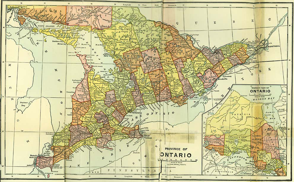
PROVINCE OF ONTARIO
Obvious printing errors have been corrected quietly with the exception of the following: “stem” to “stern” on page 112. Inconsistencies in hyphenation and spelling have been preserved.
Figures have been moved from their original locations in order to optimize the eBook layout.
We thank Our Roots (ourroots.ca) for providing the map of the Province of Ontario that follows the index. This map was not available from Internet Archive (archive.org), the primary source of the material in this eBook.
[The end of The Story of the Counties of Ontario by Emily P. Weaver]